Completing the Landvale Link – Broadway Terrace Mystery 1936

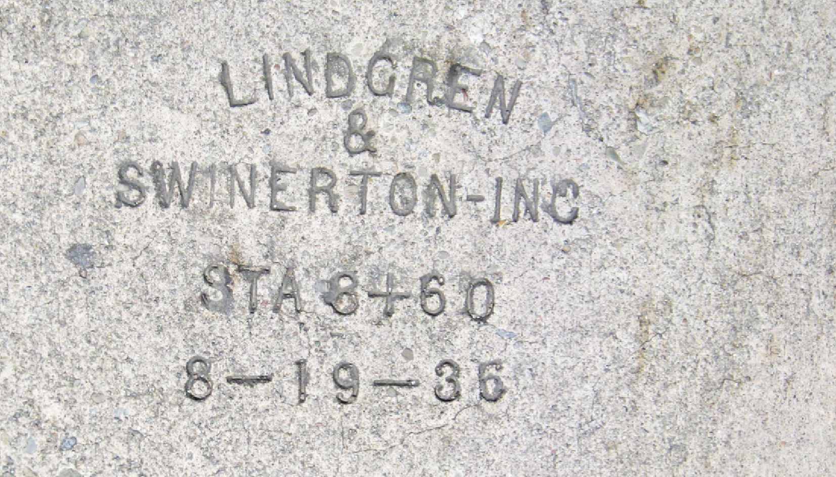
1936 was a big year for Broadway Terrace as the markings on the sheets of concrete forming the road surface confirm. By the way, Swinerton Incorporated was founded in 1888 by Charles Lindgren with Alfred Bingham Swinerton. Known for using steel-reinforced concrete, they also built the Fairmont Hotel, Ghiradelli Square, Levi’s Plaza and more.
L5-01-Stuart Swiedler Photo, (Image 1 of 13)

Concrete trestle supports along the west side of Highway 13 at Broadway Terrace were constructed prior to the freeway as an SN overpass to facilitate increased car traffic to the Broadway Low Level Tunnel via the Landvale Road. The south support, top, and the north support, below.
L5-02-Stuart Swiedler Photos, (Image 2 of 13)

This northeast view of SN 1006 at Broadway Terrace shows the existence of a grade crossing at that intersection. An aerial view from this time has not been identified. Note the Pacific Gas & Electric Company's Claremont Substation in the background.
L5-05-Cheney Photo D5966, Courtesy BAERA, Western Railway Museum Archives, 13334sn, (Image 3 of 13)

The official opening of the SN overpass was printed in the Oakland Tribune on Sept. 22, 1936 and was said to have a total cost of $150,000. This southeast view of Lake Temescal taken close to the time after underpass completion will be compared to an earlier image next ...
L5-10-Courtesy of East Bay Municipal Utility District, P-TR-36, (Image 4 of 13)

On top is a detail from Landmark L1-8, a southeast view, Nov. 29, 1924, below is a detail from L5-10. The intersection cannot be discerned in the top panel, but the lower panel shows a vegetation-free mound just north of the completed overpass, and a grade crossing to the south. Top, detail from Cheney Photo, W-644, P-TR-357
L5-15-Both Photos Courtesy of East Bay Municipal Utility District, (Image 5 of 13)

In an image dated 1936, this east view down Broadway Terrace shows the road being graded just west of the location of the SN grade crossing.
L5-20-Public Works Photo, Oakland Cultural Heritage Survey, Oakland City Planning Department, (Image 6 of 13)

Continuing east on the graded road, the temporary SN trestle comes into view, as does the grade crossing to the south. Is this temporary grade crossing the site of the original grade crossing? That is the mystery. East view, 1936.
L5-25-Public Works Photo, Oakland Cultural Heritage Survey, Oakland City Planning Department, (Image 7 of 13)

A detail of L5-25, east view, 1936, provides the order of key structures in this area. The concrete supports for the permanent steel overpass now come into view to the east of the temporary trestle, and further to the east is the adjoining shopping area with the Full Value Market.
L5-30-Public Works Photo, Oakland Cultural Heritage Survey, Oakland City Planning Department, (Image 8 of 13)

This image confirms the construction of the temporary wooden trestle to allow replacement of the grade crossing at Broadway Terrace with a steel overpass. Note the angle of SN 224, indicating the deviation from the former straight path along this section. Northwest view, circa 1935-36. Photo credited to the KV Bunker Collection based on notation on the back of the photo.
L5-32-Moreau Collection, Courtesy BAERA, Western Railway Museum Archives, 89859sn, (Image 9 of 13)

Eston Cheney documented the rerouting of the east side of Broadway Terrace around the Full Value Market in 1936, eliminating the original road, here with Key buses, and expanding the former Quercus Ct., the latter requiring the culverting of Temescal Creek. This west view solves the mystery showing the intact flag stop and original grade crossing prior to construction of the overprpass. Special thanks to John Bosko for this image.
L5-35-Eston Cheney Photo D-9120, Courtesy John Bosko, (Image 10 of 13)

L5-35 matched against Broadway Terrace, Jul. 23, 1941 lining up home on western hillside, black arrow. The Full Value Market would soon become Hamilton’s Market. Addition of the SN overpass at yellow arrow, and fence demarcating the paired-back, externalized creek highlight the 1941 image. Lower photo by Jenkins, courtesy of Oakland Cultural Heritage Survey.
L5-40-Eston Cheney Photo, Courtesy John Bosko and Public Works, Oakland City Planning, (Image 11 of 13)

Back to Broadway Terrace, the concrete supports for the new steel overpass are now set in place. Northwest view, 1936.
L5-45-Public Works Photo, Oakland Cultural Heritage Survey, Oakland City Planning Department, (Image 12 of 13)

SN 1005 leads SN 1020 and the parlor car Sacramento south to the Broadway Terrace overpass in this southeast view from May 19, 1938. The reconfigured berm is now covered with vegetation. An entrance to Lake Temescal, now part of the East Bay Regional Park District, sits just below. We will return later ....
L5-50-Charles Savage Photo, Courtesy BAERA, Western Railway Museum, 52319sn, (Image 13 of 13)