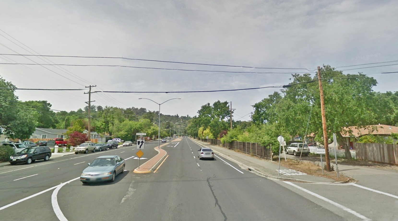
Newell Avenue Back Through Time II- Bridge Road to the Curve

The scene is the intersection of Bridge Rd. and Olympic Blvd., west view.
L65-05-Courtesy Google, (Image 1 of 12)

Turning back the clock fifty years, Apr. 4, 1963, a view from the same location shows the east-bound lanes as a smaller road, the original Newell Ave., and the west-bound lanes as the abandoned right-of-way of the SN.
L65-10-Courtesy Planning and Engineering Divisions, City of Walnut Creek, (Image 2 of 12)

Now a west view east of the intersection showing the block signal marking the Bridge Rd. grade crossing. July 5, 1935. Next to fill in the gaps of time.
L65-15-Dudley Thickens, Courtesy BAERA, Western Railway Museum Archives, 63824sn, (Image 3 of 12)

Southeast Saranap, before and after rapid population growth, 1940 and 1958, respectively. Willow Ave., red; Whyte Park Ave, purple; Lily St., turquoise; Bridge Rd., black, Park Av., green. Newell Ave. and the SN are in yellow, but the extension of Newell in the 1958 aerial veers to the south of the railway.
L65-20-Courtesy Contra Costa County Historical Society, 13560, right, 13562, left, (Image 4 of 12)

Dudley Thickens took this northwest panorama on Feb 2, 1947. Bridge Rd. is midway at the left margin, and the extension of Newell Av. highlights the center of the image. This extension provided those living east of Boulevard Way and south of Las Trampas Creek a route, albeit indirect, to Walnut Creek, seen in background.
L65-25-Dudley Thickens, Courtesy BAERA, Western Railway Museum Archives, 63821sn, (Image 5 of 12)

Now with an east view, also July 5, 1935, the homes on Newell Ave. between Willow Ave. and Bridge Rd. are seen. The mile 26 marker on the pole marked the location as Saranap, and both the block signal and crossbuck characterized the Bridge Rd. grade crossing.
L65-30-Dudley Thickens, Courtesy BAERA, Western Railway Museum Archives,, 63823sn, (Image 6 of 12)

SN 606 brings up the rear of a Walnut Creek-bound freight led by SN 653, completing its passage across the Bridge Rd. grade crossing, northeast view, Mar. 1949. The license plate on the car supports the date. Note the homes along the east flank of Bridge Rd. No idea of the identity of the young woman riding the bike ...
L65-35-Dudley Thickens Photo, Courtesy BAERA, Western Railway Museum Archives, 63808sn, (Image 7 of 12)

Two years earlier, SN 606 was at it again, this time just past the grade crossing, northeast view, spring, 1947. No stripes on this motor yet, and no WWII hood on its headlamp, both consistent with the date in question.
L65-40-Dudley Thickens Photo, Courtesy BAERA, Western Railway Museum Archives, 63801sn, (Image 8 of 12)

Just to the east of Crawford Ct. approximates where Newell Ave. was to be extended to the east in the mid-1940s. Here, in a west view from Apr. 29, 1963, shows the state of affairs just months prior to the removal of the right-of-way and the grading of Olympic Boulevard seen next.
L65-45-Courtesy Planning and Engineering Divisions, City of Walnut Creek, (Image 9 of 12)

Now Nov. 5, 1963, the same east view toward Crawford Ct. captures the progress of the conversion from rail bed to road.
L65-50-Courtesy Planning and Engineering Divisions, City of Walnut Creek, (Image 10 of 12)

Looking east, also Nov. 5, 1963, the new intersection with Olympic Blvd. will provide Newell Ave. with the look we know today, here during construction.
L65-55-Courtesy Planning and Engineering Divisions, City of Walnut Creek, (Image 11 of 12)

This northeast view of SN 605, SN 145 and tank cars have completed the turn to meet Newell Ave., spring, 1947. This will serve as a reminder to further explore the eastern-most section of Saranap.
L65-60-Dudley Thickens Photo, Courtesy BAERA, Western Railway Museum Archives,63799sn, (Image 12 of 12)