Introduction
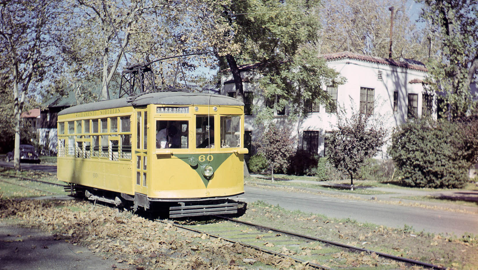
Although not appreciated by what is seen in 2020, Chico had an extensive local streetcar and interurban electric rail passenger and freight system in the early 20th century. Birney 60 on excursion at the Esplanade and Memorial Way, Nov. 9, 1947, North view.
L235-05-Al Thoman Photo, Courtesy Al Thoman, (Image 1 of 40)

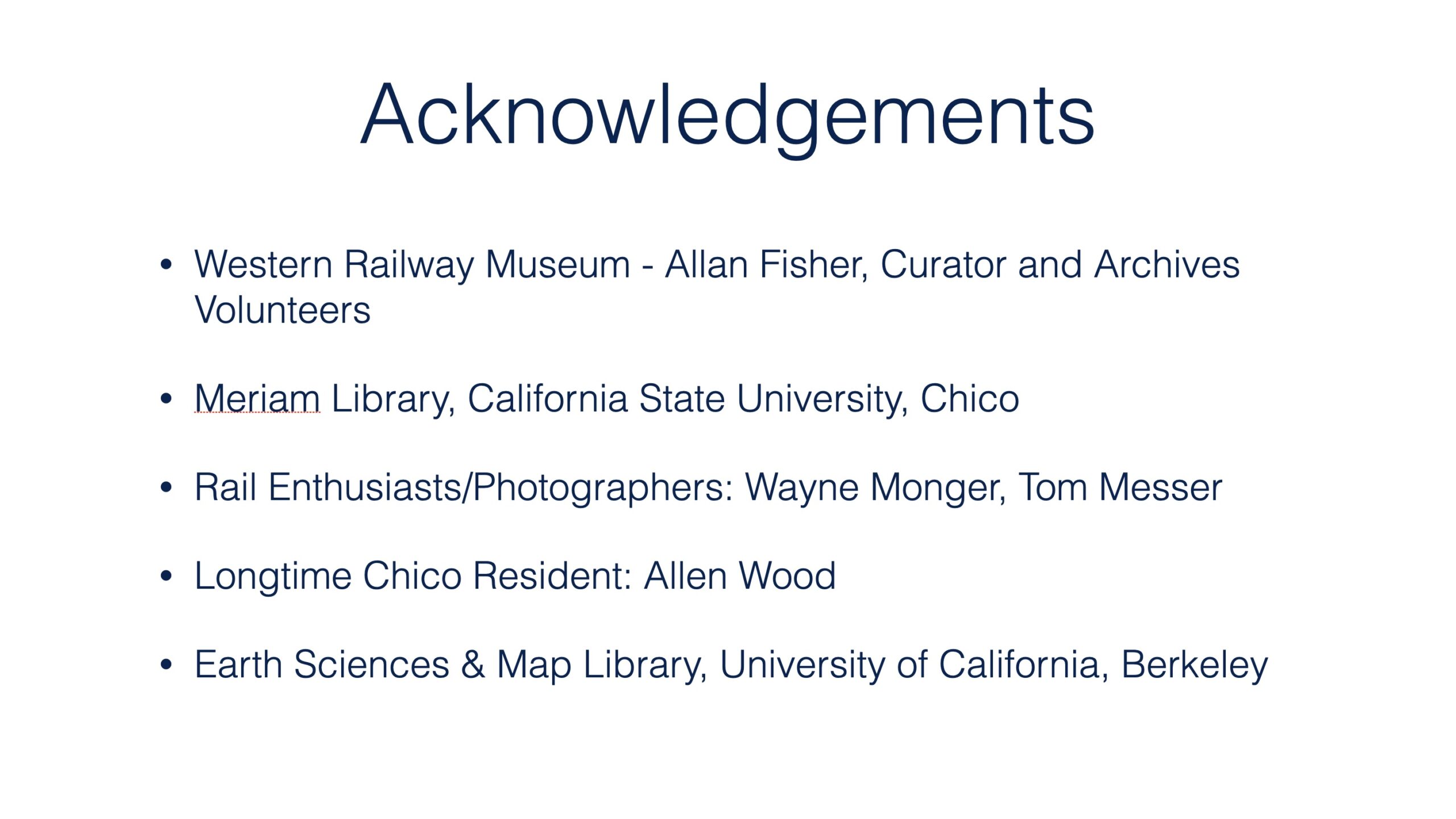
This set of presentations required the generous permission of these individuals to show images, review corporate documents, and tour what evolved and remains of the railway. Guiding this presentation is Kent Stephens’ “Chico’s Street Car Line: A Half Century of Service”, in the spring edition of the Butte County Historical Society publication Diggin’s, Vol. 15, no. 1, 1971, and Ira Swett’s “Sacramento Northern.”
L235-10-Ackowledgements, (Image 2 of 40)
In 2020, Chico’s population is approaching 100k, but in 1900 it was under 5000. Much of Chico’s appeal in 2020 depended heavily on activities that occurred during the railway's existence. While most of what will be covered in this series of presentations will focus up to 1951, comparative images up until 2020 will be used. The images to follow in this introduction provide background and address 1904-1914.
L235-15-Courtesy Earth Sciences and Map Library, University of California, Berkeley, (Image 3 of 40)
Rail service started as a local streetcar line that evolved over 25 years to be incorporated into one of the longest electric passenger-freight enterprises ever created in the US, the Sacramento Northern Railway or “SN”, a wholly-owned subsidiary of the Western Pacific Railroad. The history of establishing Chico as the northern terminus had its own twists and turns, to be revealed shortly.
L235-20-Diagram by Stuart Swiedler, Map Courtesy John Harder, (Image 4 of 40)
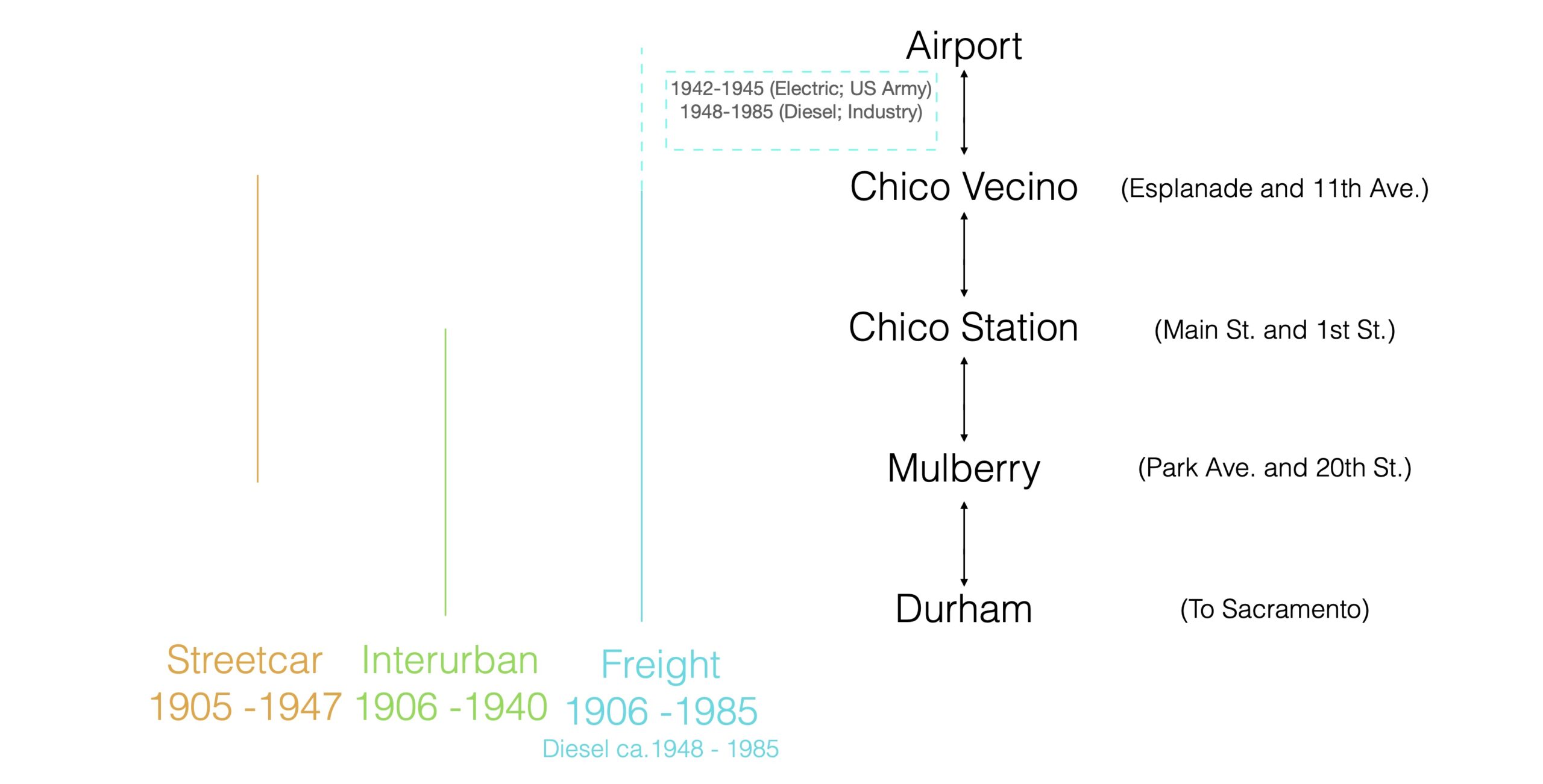
Electric rail transportation to and through Chico included three components as diagramed here. Durham represents everything to the south. The airport extension did not occur until 1942, details to follow. Combining images taken of the three components provide indirect documentation of life in Chico in the 20th century.
L235-26-Diagram by Stuart Swiedler, (Image 5 of 40)
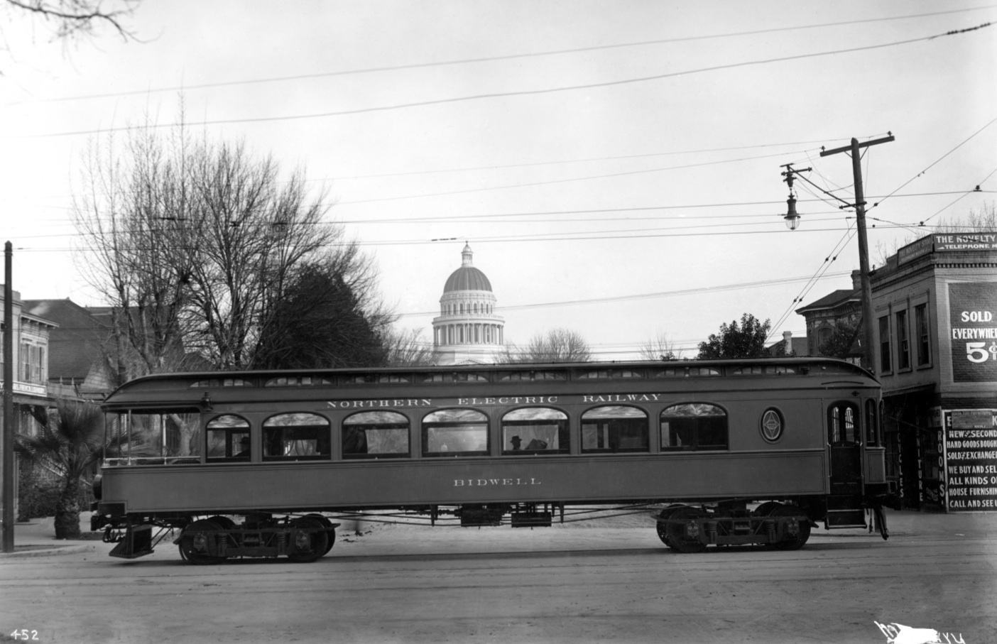
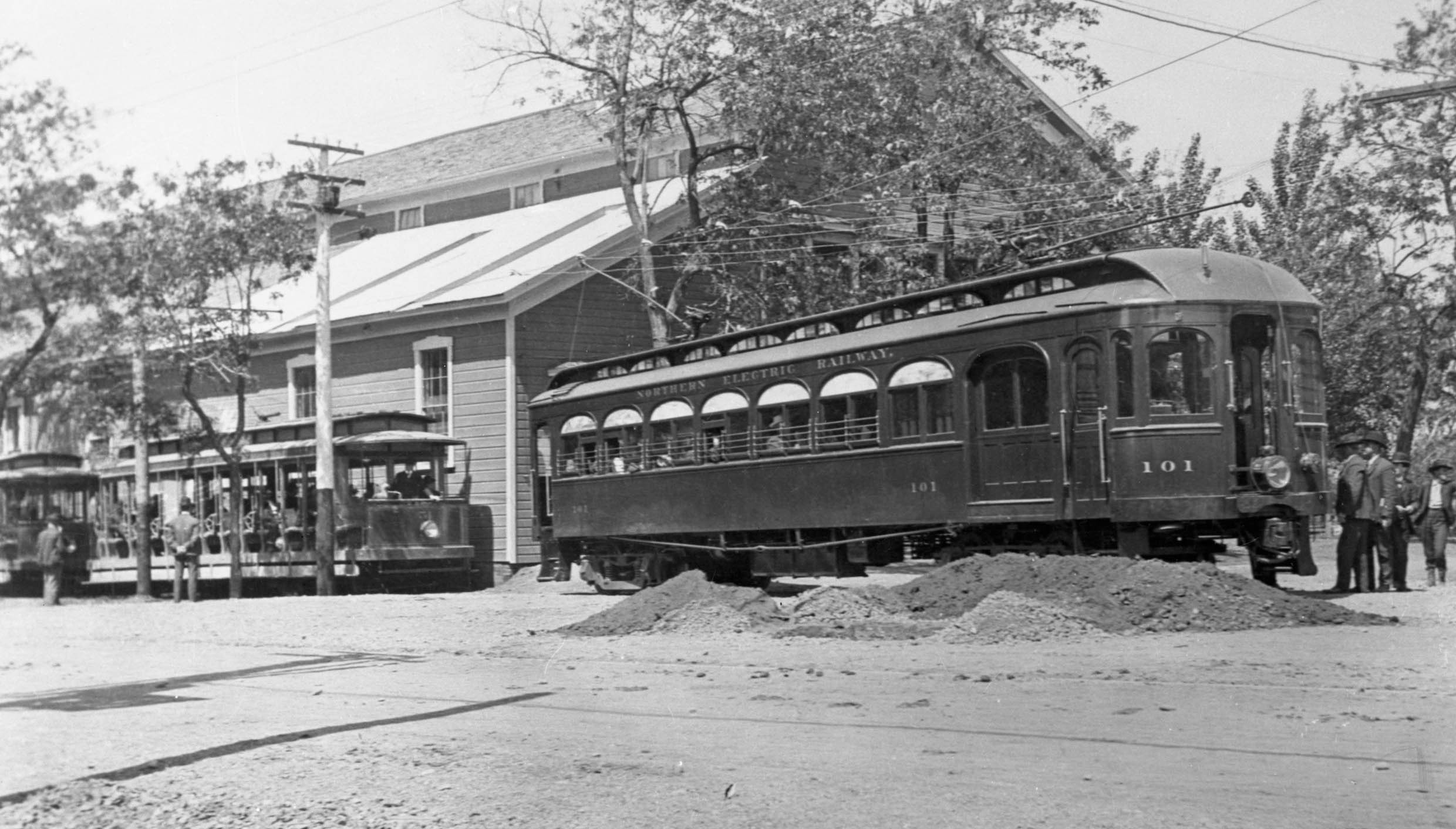
Chico’s development in the 20th century was influenced primarily by two entities, the first being John and Annie Bidwell. General John Bidwell founded the city in 1860, and laid out its grid. It became incorporated on Jan. 8, 1872. The Northern Electric Co. honored the Bidwell name by building this parlor car from a wrecked motor in 1914, seen here on Central California Traction track in Sacramento after that date.
L235-30-McCurry Photo, Sappers Collection, Courtesy Western Railway Museum Archives, 26789sn, (Image 6 of 40)
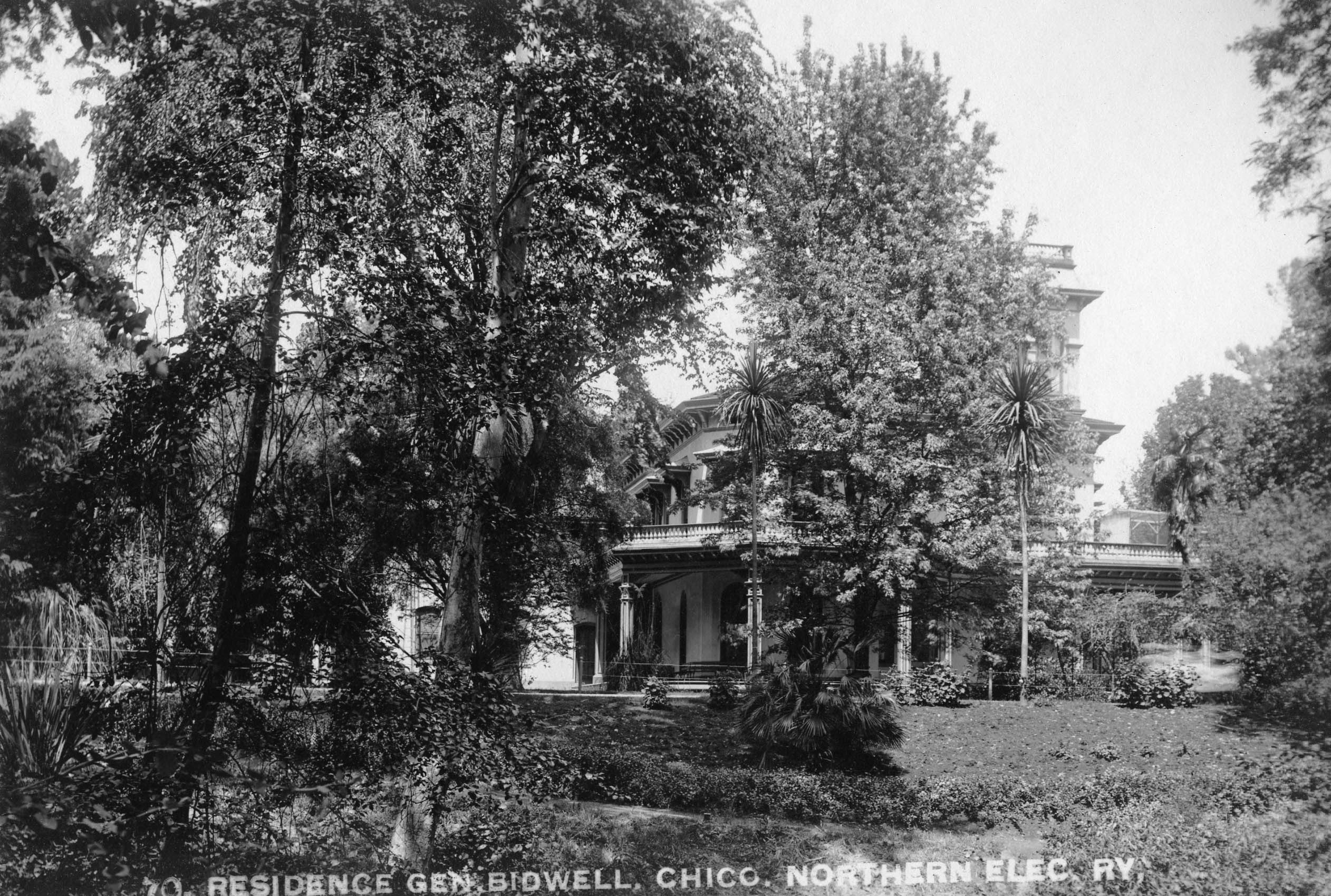
The Bidwells lived at 525 Esplanade, shown here circa 1910, from late 1868 until 1918. John died in 1900, leaving Annie with debt, forcing her to sell land that was eventually leased to the city. She added two more acres to Chico Normal School, the couple having given the eight acres to start the college in 1887, and Bidwell Park became part of the city when Annie passed in 1918. The house and grounds became a State Historic Park, a California Historical Landmark, and is listed on the National Register of Historic Places.
L235-35-Northern Electric Photo, Courtesy Western Railway Museum Archives, 109494sn, (Image 7 of 40)
The second influence was the arrival of match and lumber manufacturer Diamond Match Co. in 1903. They built a sawmill in Stirling City in 1905, connected it with a narrow gauge line, the Butte County Railroad, BCR, to their plant in two stages between 1903-1904 in the Barber neighborhood, the southwest section of town. They would quickly become the largest employer in the area.
L235-40-Courtesy BAERA, Western Railway Museum Archives, 120627sn, (Image 8 of 40)
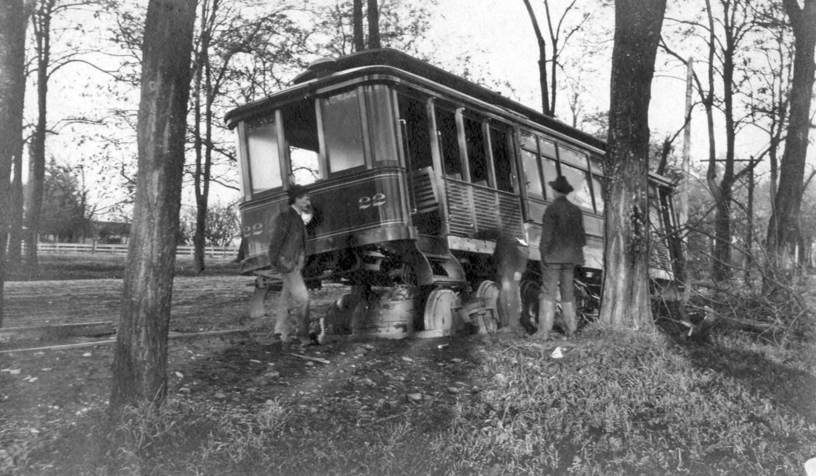
Diamond Match also wanted a streetcar line that would bring workers to the new plant, as well as to the downtown commercial center. Here, Chico Electric Railway, CER, car 22 is shown at Main St. near 2nd St. on opening day, Jan. 2, 1905. Note the Union Hotel, 3rd and Main St., and the steeple of Chico Presbyterian Church, 4th and Broadway, the latter founded by John and Annie Bidwell in 1868.
L235-45-Courtesy Meriam Library, California State University, Chico, sc28879, (Image 9 of 40)
The franchise was originally obtained by a Diamond Match employee, Fred Clough, and the company was involved in its construction through the BCR, but the incorporated entity was overseen by five San Franciscans involved in the formation of Pacific, Gas and Electric. An accident along the Esplanade on Jan 16, 1905, shown here, indicated the line needed more professional supervision.
L235-50-Courtesy Meriam Library, California State University, Chico, sc15489, (Image 10 of 40)
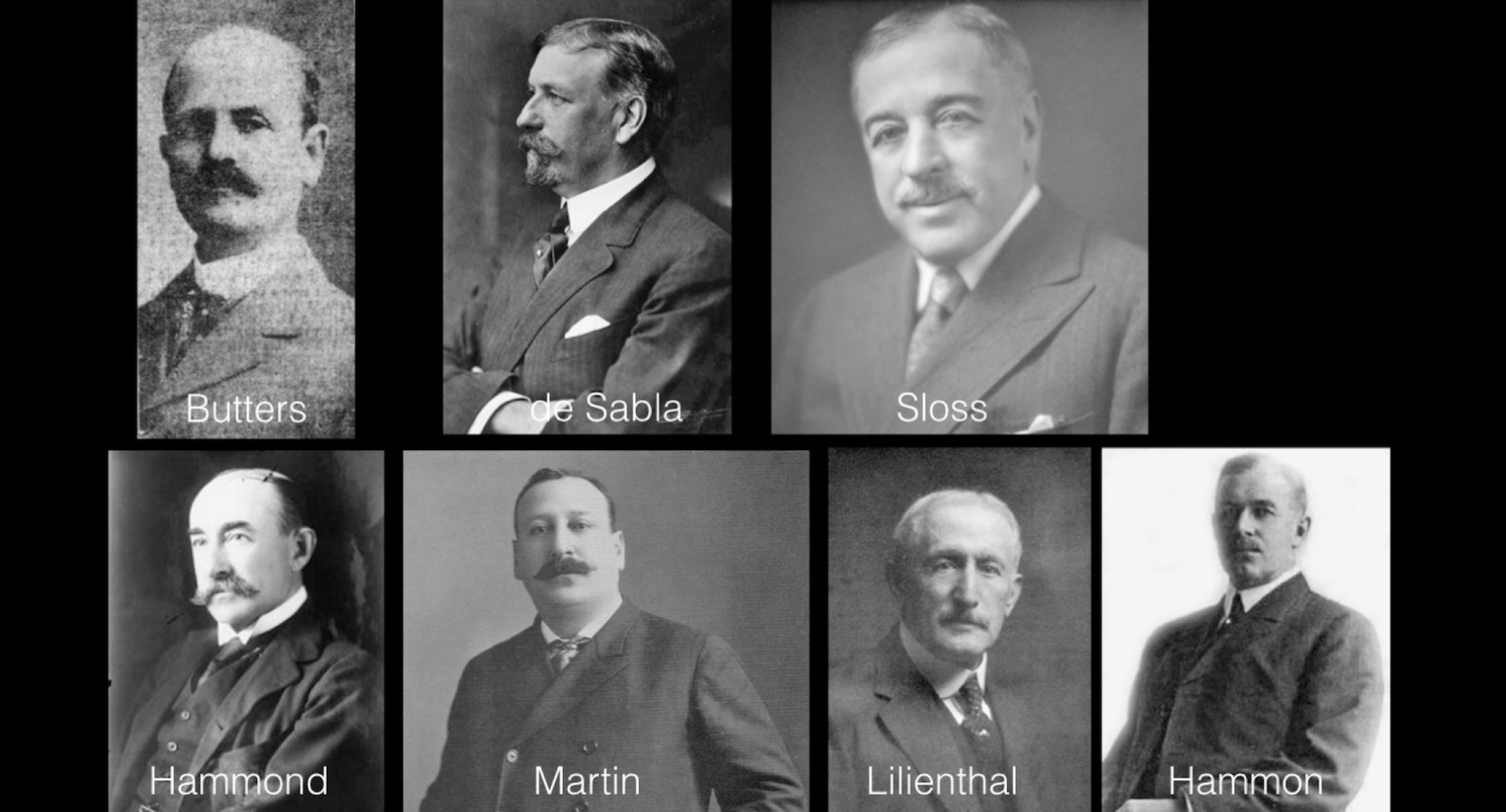
Sensing the opportunity, experienced railway and mining entrepreneur Henry Butters and four investor friends purchased the streetcar line on Aug. 1, 1905, having begun the construction of the Northern Electric Railway, NE, in Oroville that year. Electric railway pioneers and Pacific Gas and Electric founders John Martin and Eugene de Sabla, would join soon after, de Sabla’s brother Leon being one of the original incorporators of the CER.
L235-55-Courtesy BAERA, Western Railway Museum Archives, and Google Books, (Image 11 of 40)
By April 1906, the NE had begun interurban service between Oroville and Chico, erecting the first Chico Station at 1st St. and Main St., as shown here in a north view, offering local streetcar lines and interurban service to Oroville. The interurban line would be extended to Marysville by year’s end.
L235-60-Courtesy BAERA, Western Railway Museum Archives, 34245ne, (Image 12 of 40)
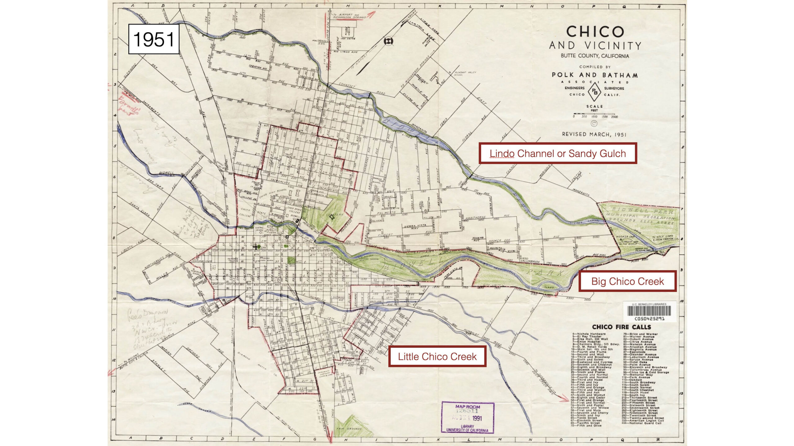
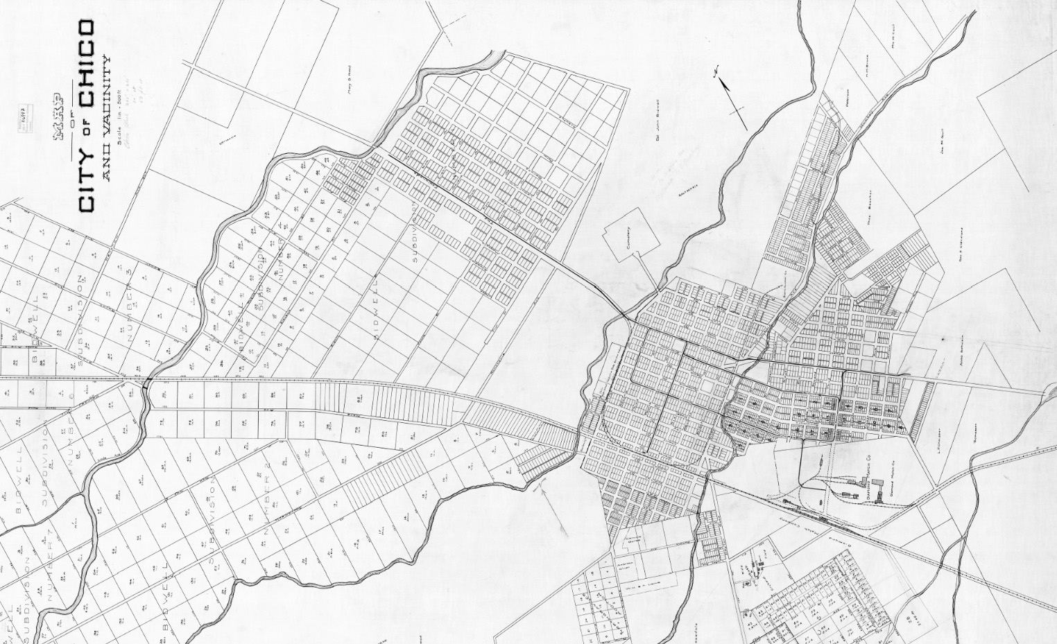
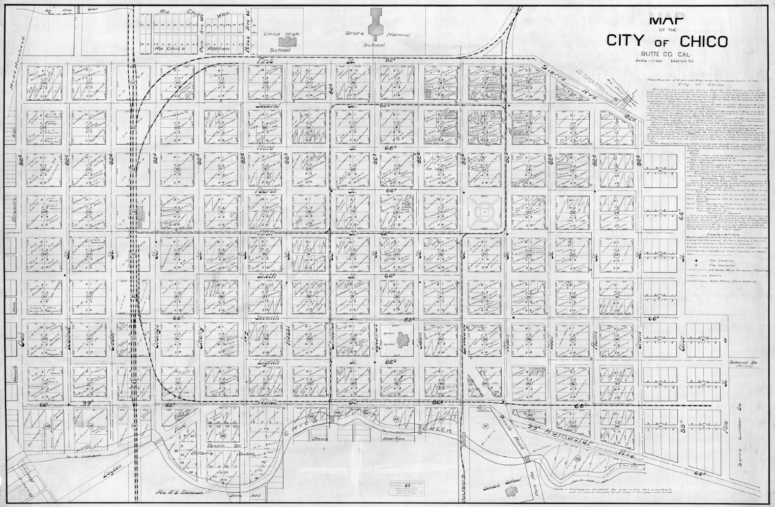
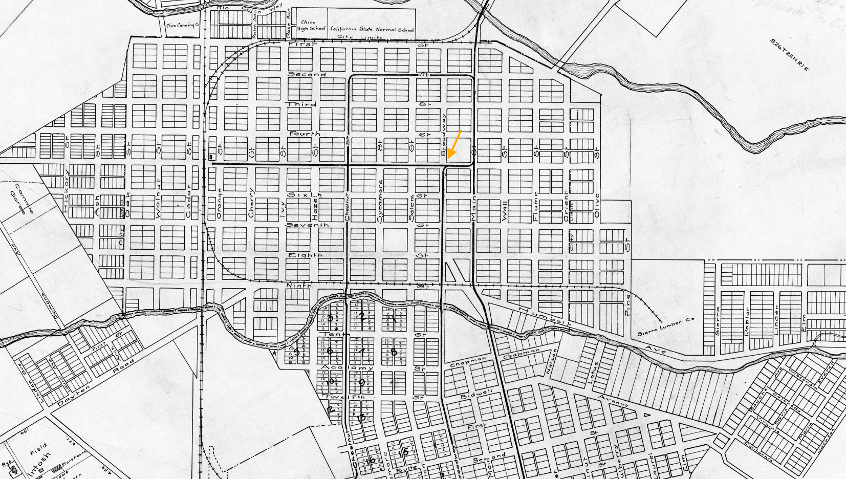
Reviewing the track layout the NE inherited from the CER line, and how they would modify the route, will be explored starting with this undated early 20th century map of Chico. The map has been turned 90 degrees here to show its entirety, but will be oriented 90 degrees clockwise in the panels to follow.
L235-65-Courtesy BAERA, Western Railway Museum Archives, 26997sn, (Image 13 of 40)
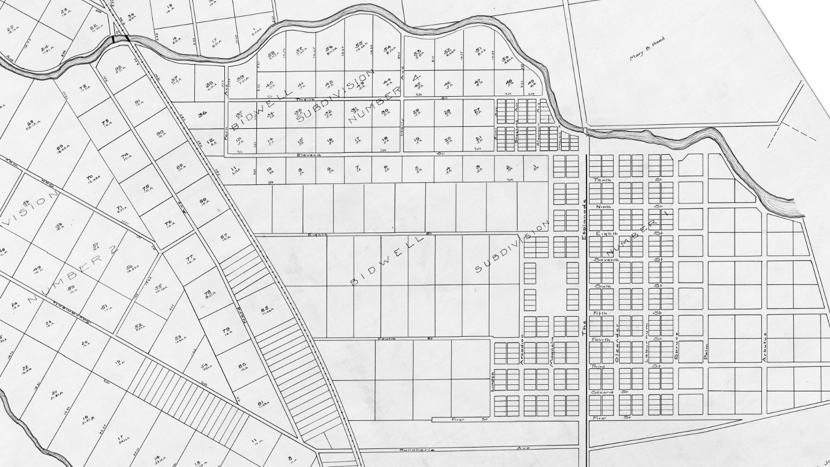
Starting in the north, the influence of the Bidwells can be appreciated in this view of Chico Vecino, at this time north of the city limits. This area would become known as the “The Avenues or The Aves” once the city administrators renamed the streets to distinguish them from two sets of numbered streets in the downtown area.
L235-70-Courtesy BAERA, Western Railway Museum Archives, 26997sn, Detail, (Image 14 of 40)
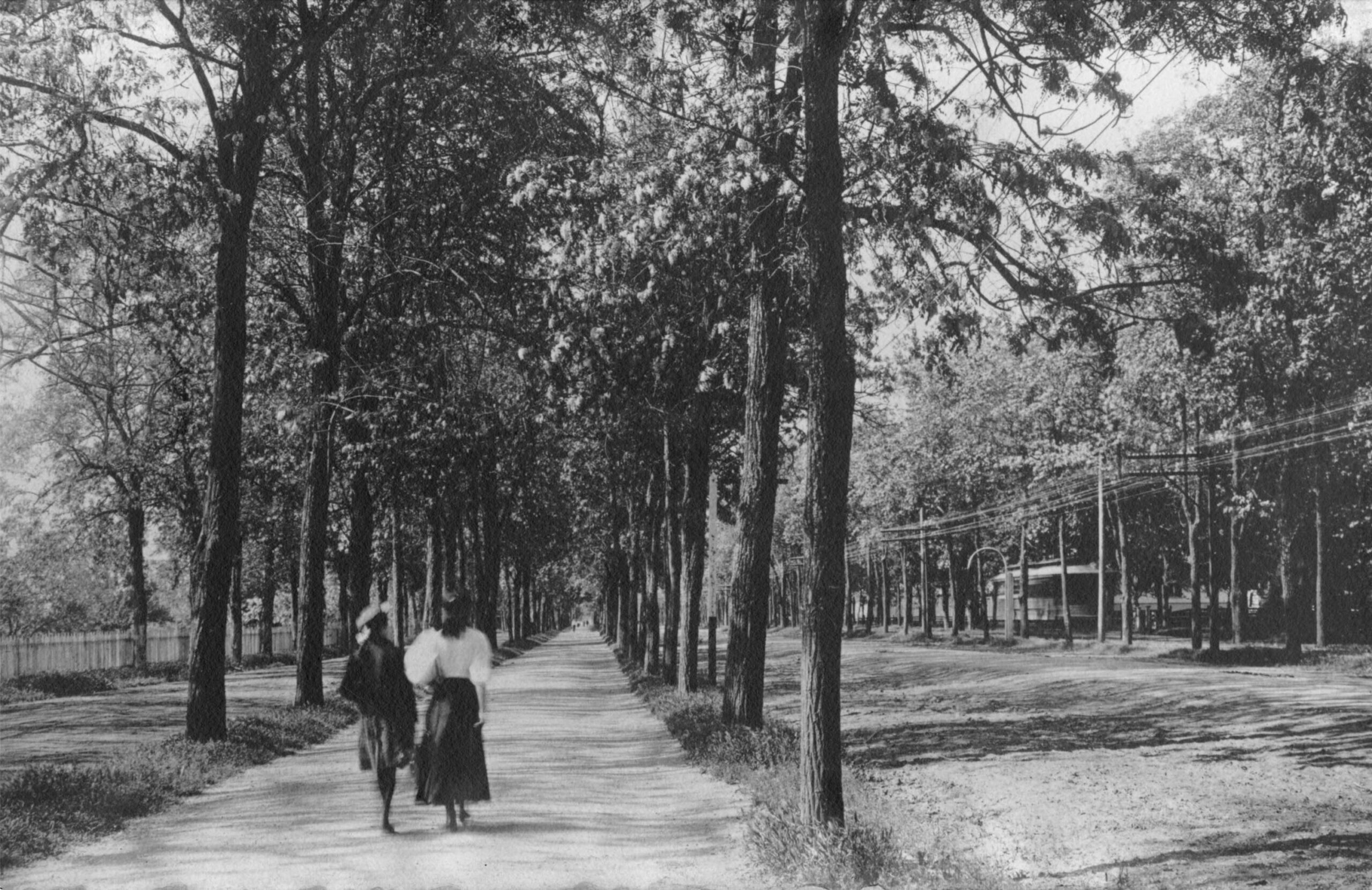
The NE did not modify the single track along the Esplanade that carried streetcars as far north as 11th Ave., although they would add two freight spurs shortly thereafter. This northwest view circa 1910 from the pedestrian west side of the boulevard shows the railway’s private right-of-way in the trees on the east side.
L235-75-Courtesy BAERA, Western Railway Museum Archives, 81482sn, (Image 15 of 40)
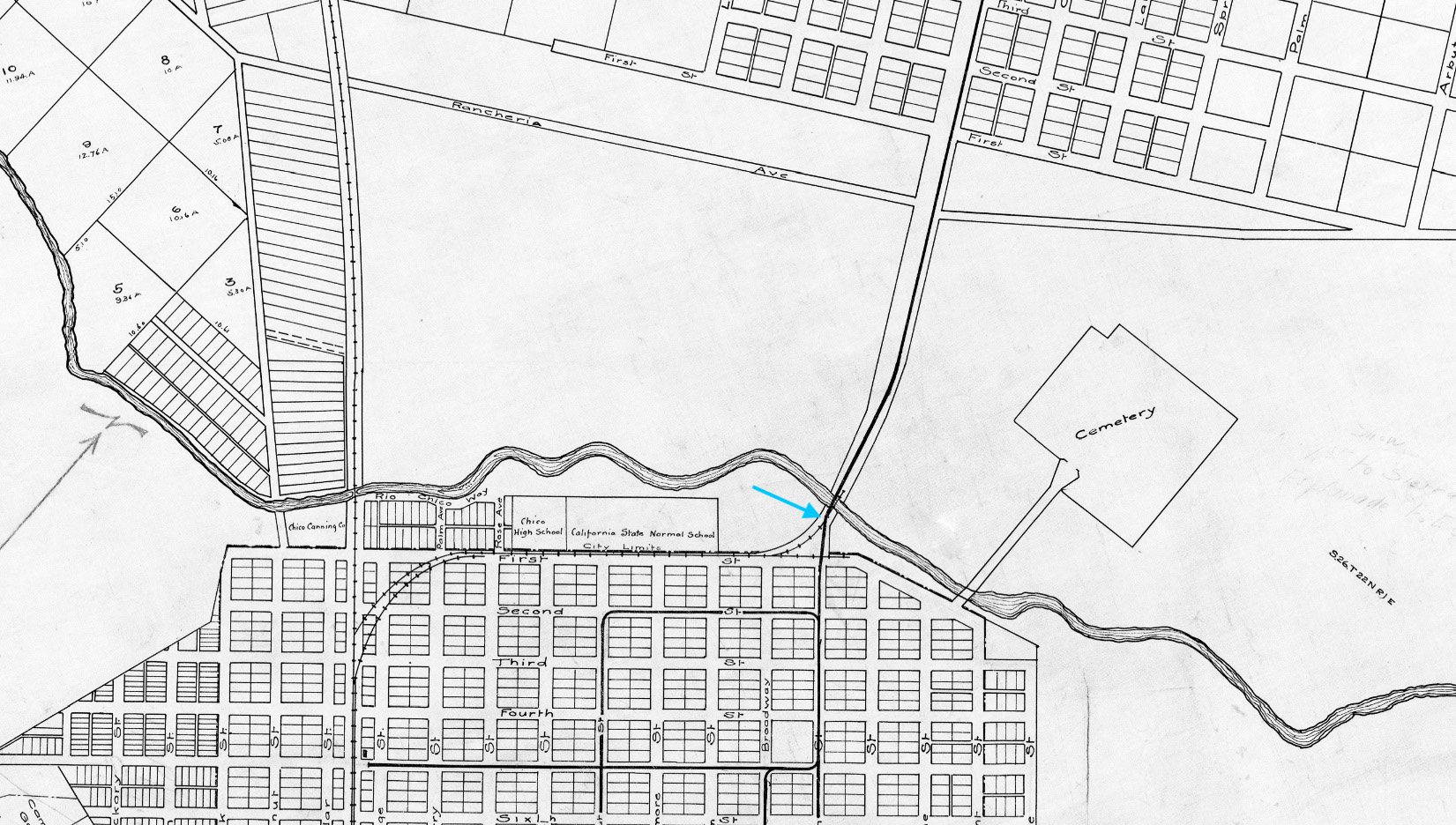
Upon reaching Big Chico Creek, the single track crossed a Southern Pacific, SP, spur, turquoise arrow, that came from the SP mainline down 1st St. This spur serviced the flour mills along the creek as well as any lumber-related transport. The large open area north of the creek and west of the NE track was the Bidwell land used to create the state park, and to expand the college campus, at this date hemmed in against the high school as shown.
L235-80-Courtesy BAERA, Western Railway Museum Archives, 26997sn, Detail, (Image 16 of 40)
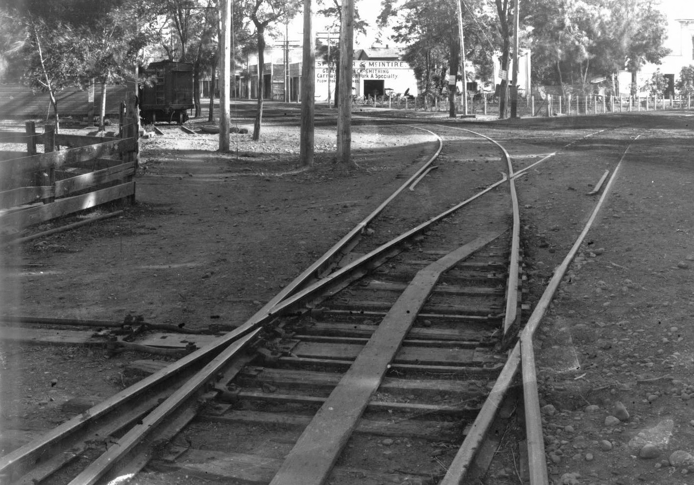
The combination diamond crossing-switch track just north of 1st St. and Main St. is seen here in a south view from 1905. The SP track was present when the BCR built the CER, and this new arrangement may have facilitated building the streetcar line. The boxcar seen in the background marks the edge of the NE Chico station.
L235-85-John Nopel Collection, Courtesy Meriam Library, California State University, Chico, sc50306, (Image 17 of 40)
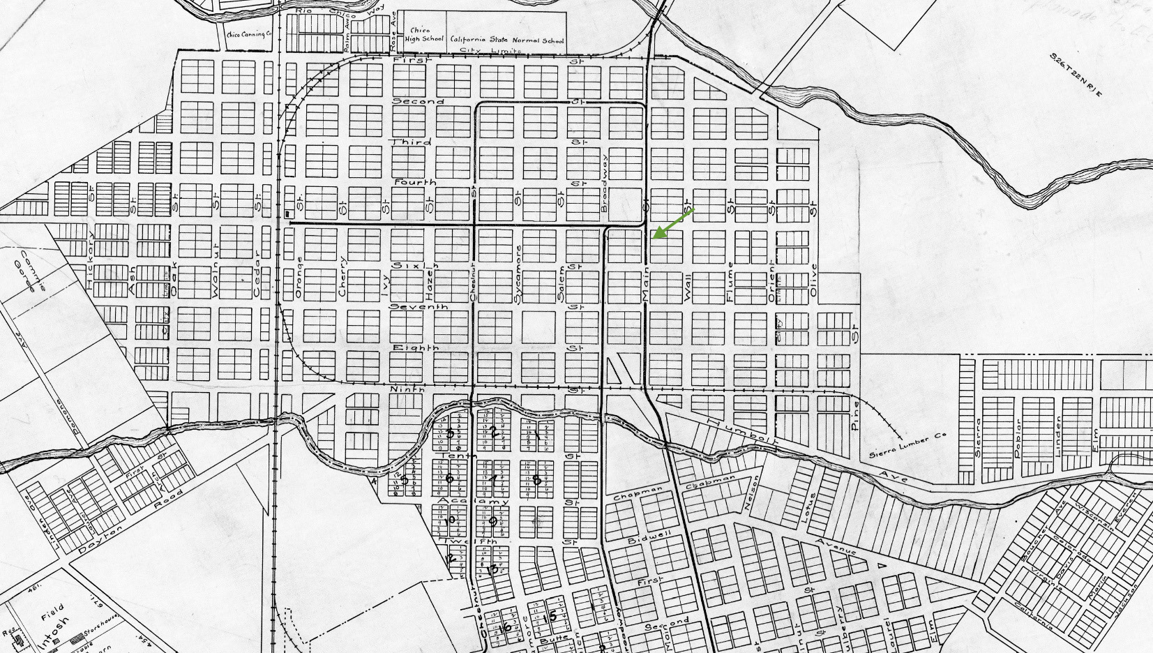
The area between Big and Little Chico Creeks contained a complex set of streetcar tracks that allowed the streetcars to take different routes around the central city. This map shows the initial streetcar line, and the first immediate and only major change the NE would make until 1910, extending the line down Main St. south of 5th St., green arrow, and along Park Ave. to create a route for interurbans from south of town.
L235-90-Courtesy Western Railway Museum Archives, 26997sn, Detail, (Image 18 of 40)
Although labeled March 1907, this map shows only the CER streetcar layout the NE inherited in 1905, and includes all the possible transfers at street intersections. The unprofitable track on Chestnut St. was the first to go in 1910, and that included cutting back the track on 2nd St. to Salem St. Service to Diamond Match was rerouted via Broadway St. to what is today W. 16th St., then called Del Norte, as will be diagramed later.
L235-95-Courtesy BAERA, Western Railway Museum Archives, 21sn, (Image 19 of 40)
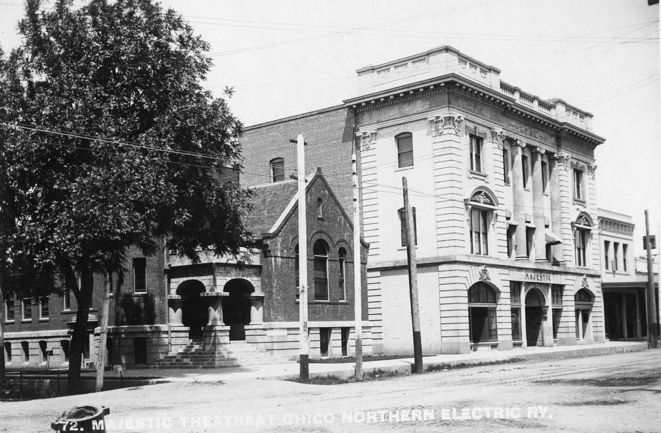
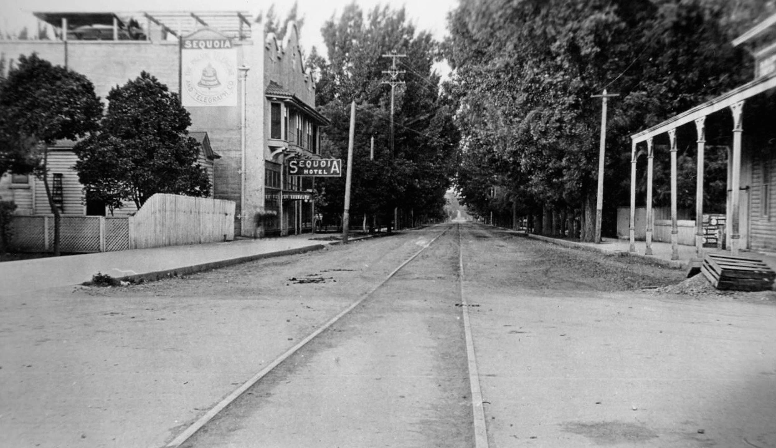
The 2nd St. track was initially spared between Broadway St. and Salem St. to serve the Majestic Theater, north view circa 1910. Opened in 1906 as Chico Elks Lodge 423, the theater used the lower floor. The building perseveres as the El Ray Theater, its rich history captured at https://elreychico.com/venue/
L235-100-Northern Electric Photo, Courtesy BAERA, Western Railway Museum Archives, 109495sn, (Image 20 of 40)
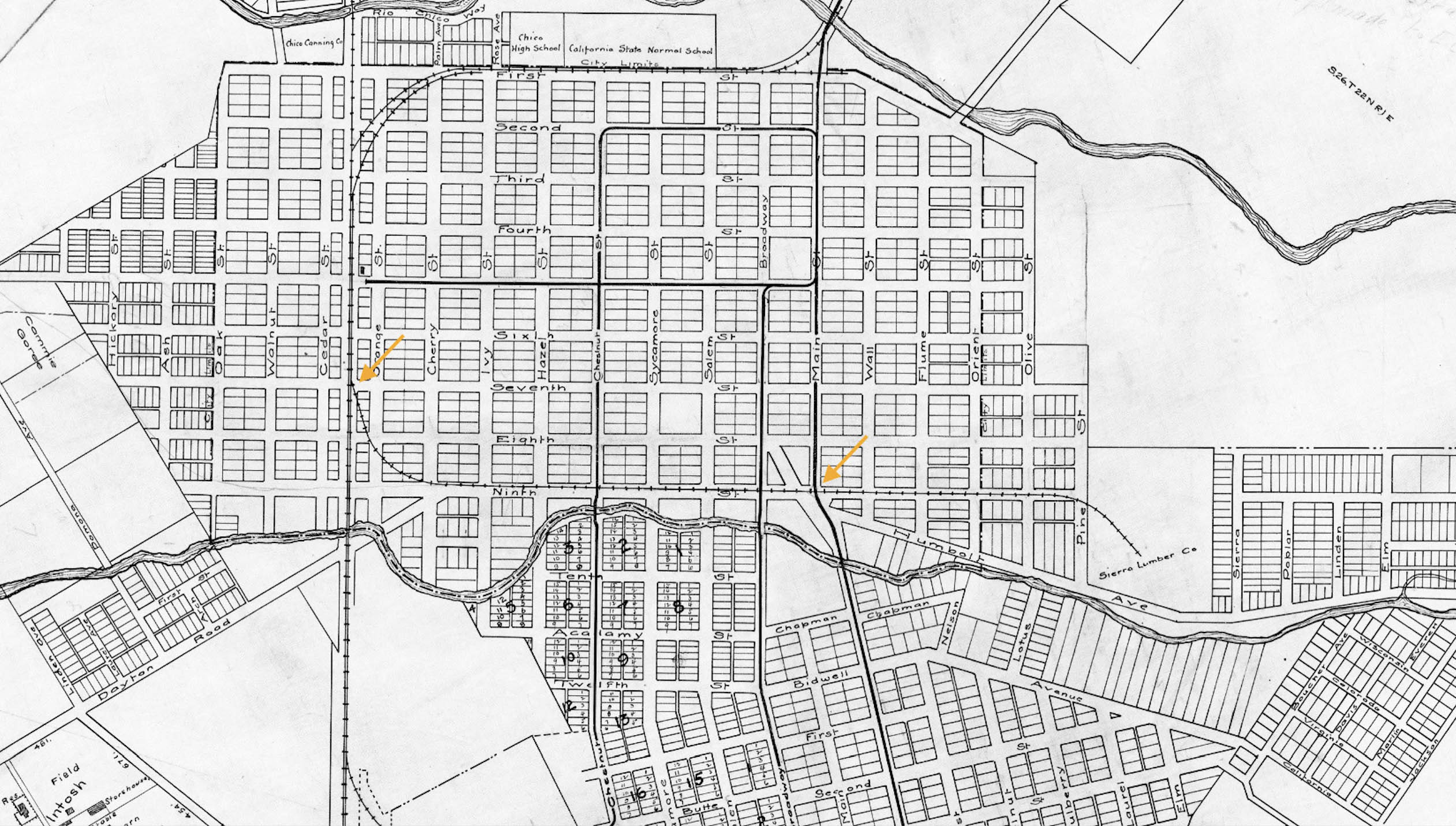
The two blocks of track on 2nd St. would be removed in August of 1911, the tracks being pulled up despite not having settled who would pay to repair the street. As streets were being paved independent of tracks during this time, property owners along the streets were covering the cost. Next to view the intersection of Broadway St. and 5th St., orange arrow.
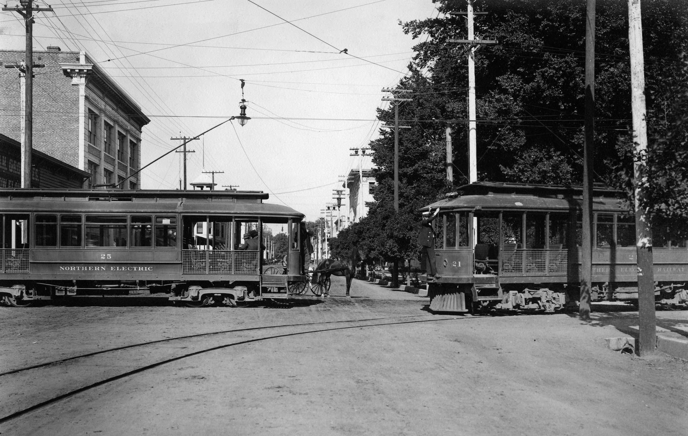
L235-105-Courtesy BAERA, Western Railway Museum Archives, 26997sn, Detail, (Image 21 of 40)
The scene is at 5th St. and and Broadway St. with “Huntington-type” cars 25 and 21. This northwest view confirms the presence of NE operation down Broadway between 1908-1910, as car 25 was built for the NE by the St. Louis Car Co. in 1908 according to Demoro’s “Sacramento Northern”. The NE would eliminate tracks on Broadway St. above 9th St. soon after, but south of this point would have to wait.
L235-110-Courtesy BAERA, Western Railway Museum Archives, 110733sn , (Image 22 of 40)
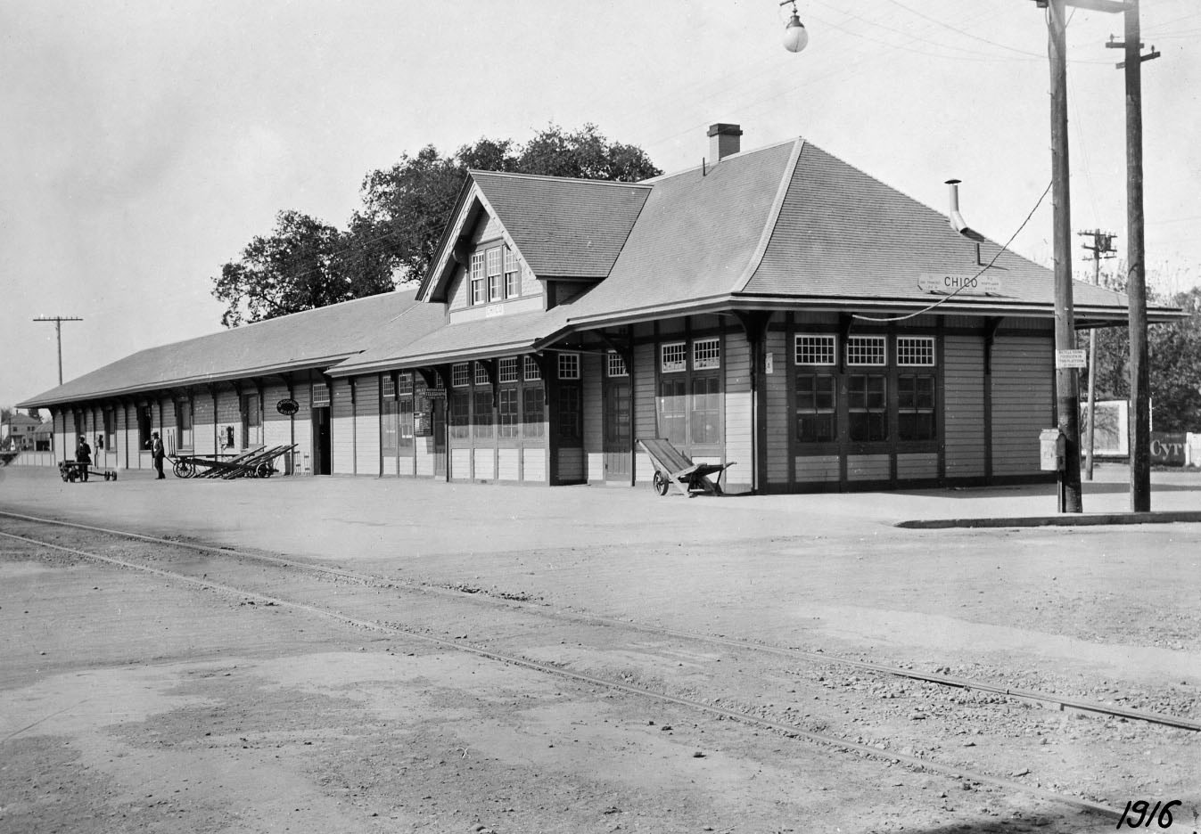
The CER line down 5th St. brought streetcars to the SP Station, seen here in a north view from 1916. This served little purpose for the NE given the infrequent SP trains stopping here, usually in the middle of the night, and the surroundings were not configured as an optimal freight switching point. But it would serve the NE in another way.
L235-115-Courtesy BAERA, Western Railway Museum Archives, 73147sp, (Image 23 of 40)
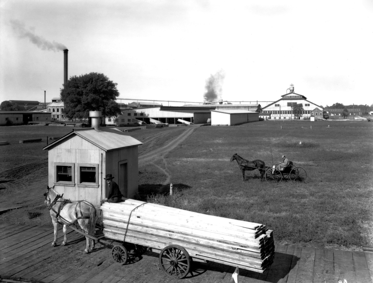
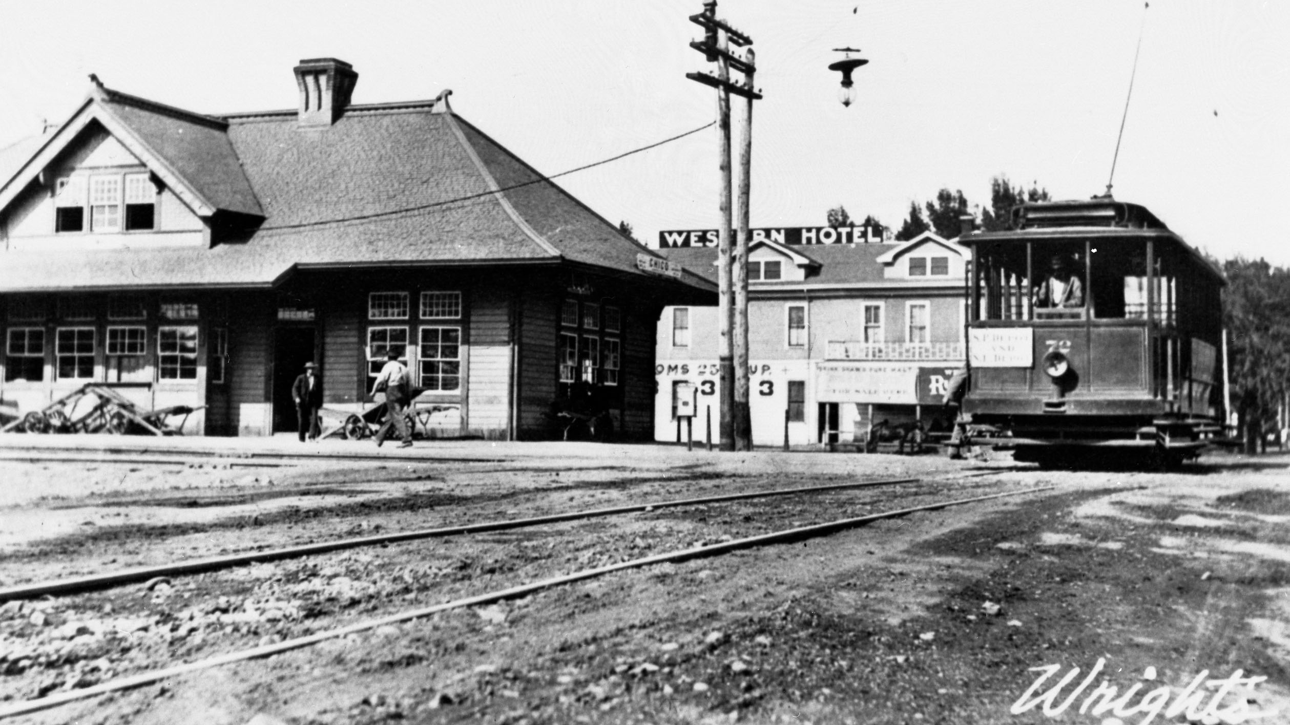
For freight use and a possible interurban opportunity, the NE extended the 5th St. track line past the station, as shown here in an east view ca. 1910, 11.37 miles into Glenn County to Hamilton City. This would serve hauling the beet crop to the Sacramento Valley Sugar Company plant, and potential vacationers to the Shot Over Inn resort section of town.
L235-120-Wright Studio Photo, Courtesy Western Railway Museum Archives, Moreau Collection, 110751sn, (Image 24 of 40)
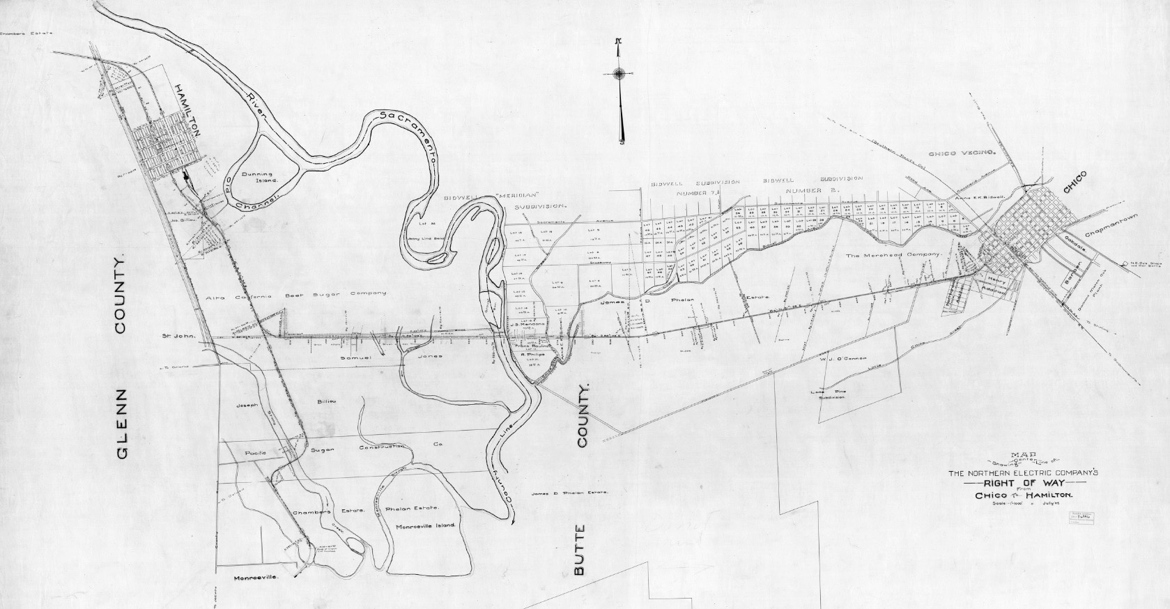
This map from July 1907 anticipated the soon to open extended line, that included a perilous crossing of the Sacramento River. The details will be presented in a separate presentation, but for this discussion, service from Chico ran from Sept. 1907 until the end of 1913, although service west of the Sacramento River continued at least until 1915, and abandonment was not granted until 1927.
L235-125-Courtesy BAERA, Western Railway Museum Archives, 26996sn, (Image 25 of 40)
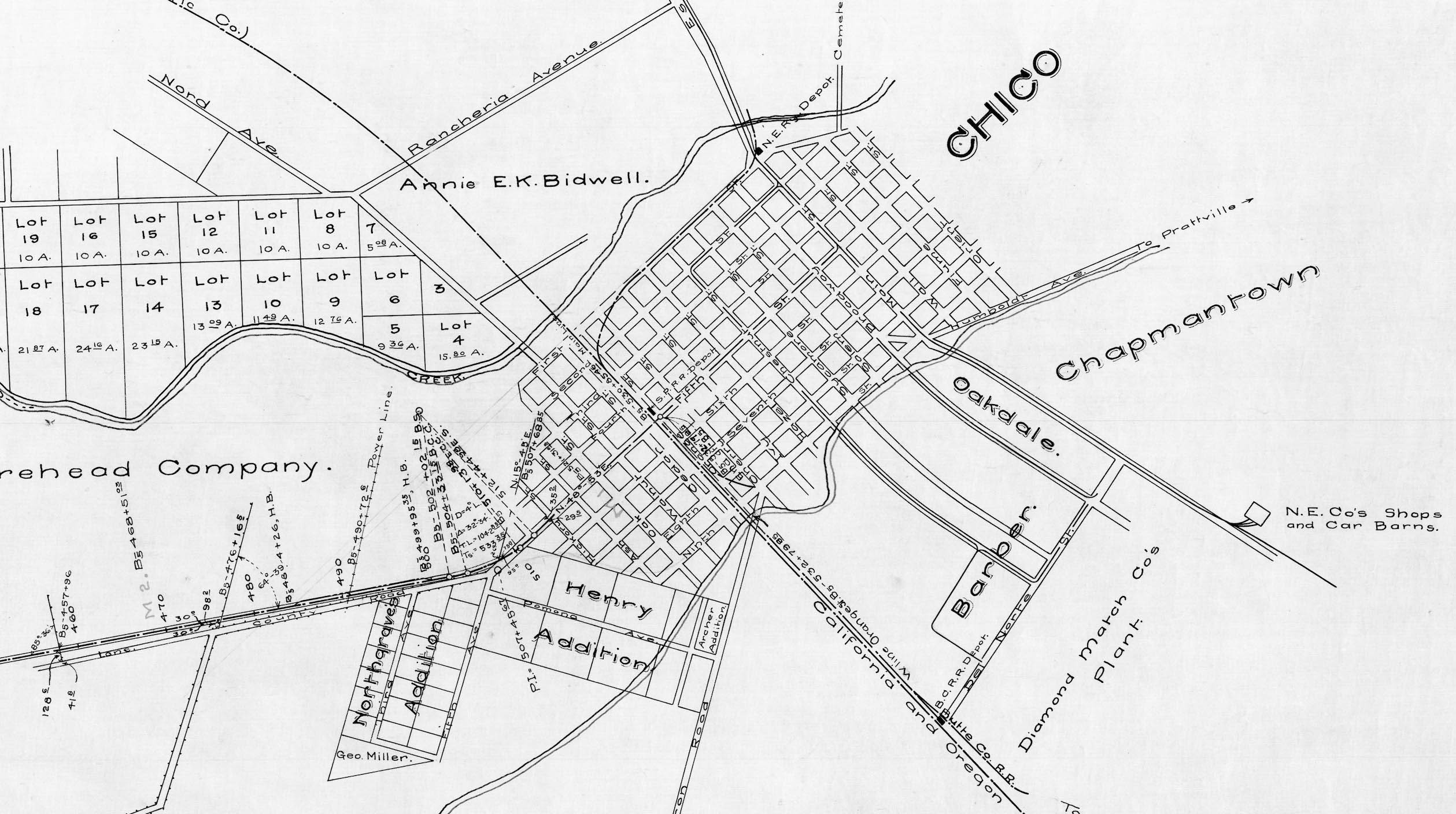
For completeness, a detail of the Chico portion of the previous 1907 map, showing the 5th St. line extended toward Hamilton City.
L235-130-Courtesy BAERA, Western Railway Museum Archives, 26996sn, Detail, (Image 26 of 40)
However, the NE’s franchise on 5th St. would expire in 1912. Shown here is a west view down an unpaved W. 5th St. just west of Broadway St. after the line was abandoned. Abandonment was possible when the city granted the NE a franchise on 9th St. Of course, residents were glad to be rid of freight trains on 5th St.
L235-135-John Nopel Collection, Courtesy Meriam Library, California State University, Chico, sc51295, (Image 27 of 40)
Diamond Match purchased the Sierra Lumber facility and track connecting the SP across 9th St. in 1907, and produced veneer there until 1910 when the plant closed. On July 18, 1911, the NE acquired the franchise to use these tracks, providing a freight connection between Main St. and the SP mainline, orange arrows.
L235-140-Courtesy Western Railway Museum Archives, 26997sn, Detail, (Image 28 of 40)
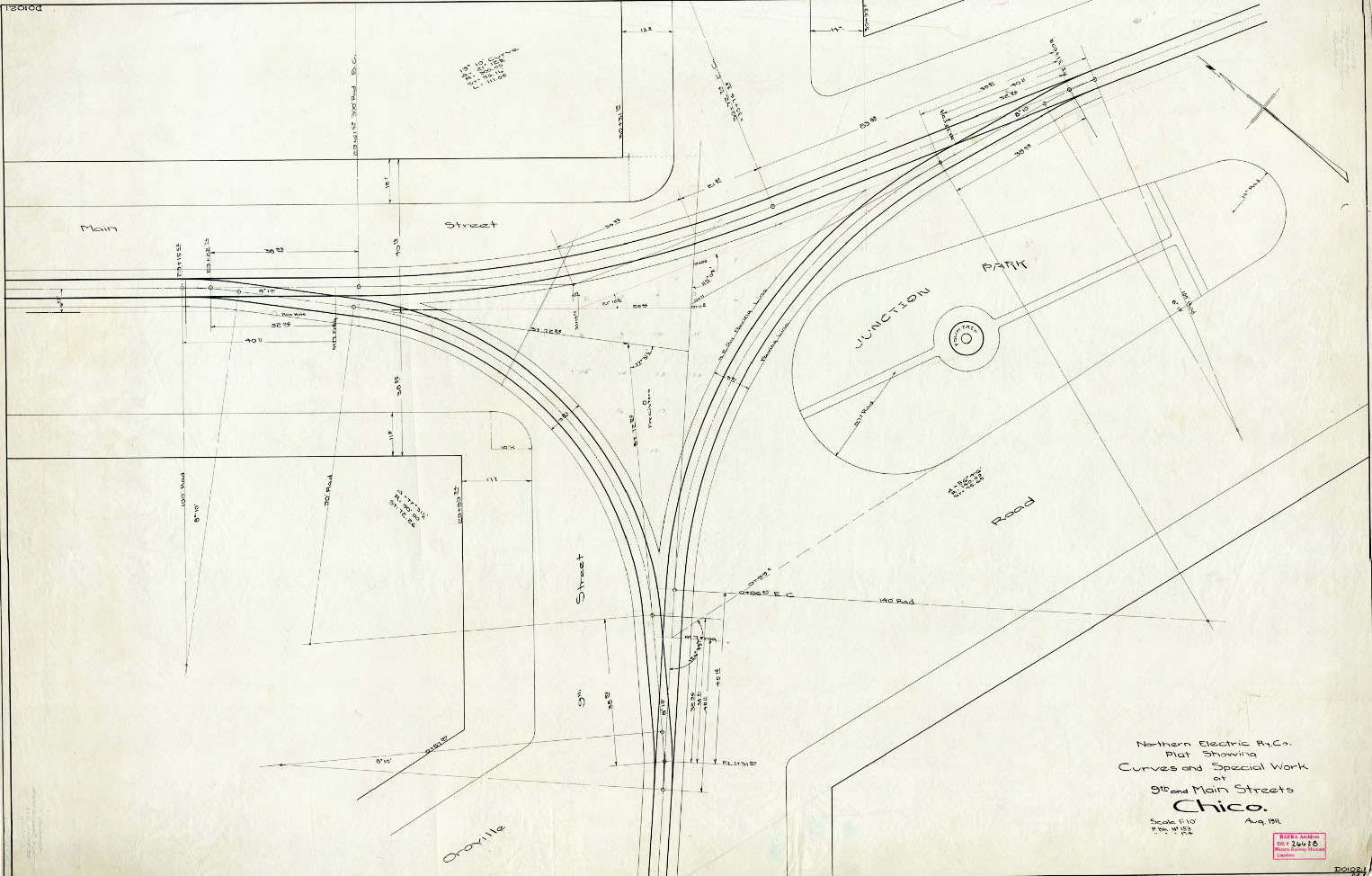
This map from Aug. 1911 shows the plans for a single track wye for the 9th St. spur connection at Main St. at Ashby Junction. The 9th St. line would also replace the 5th St. line to access Hamilton City.
L235-145-Courtesy BAERA, Western Railway Museum Archives, 26628sn, (Image 29 of 40)
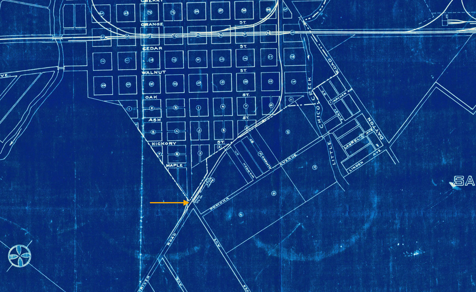
For the 9th St. option to work, the NE had to purchase in early 1912 a narrow, curved strip of land to lengthen the 9th St. spur past the SP connection directly to the Hamilton City line, where 5th St. joined River Rd., orange arrow, on this 1913 map. Once the Hamilton City line was eliminated, the track was cut back to this junction, allowing the railway to continue freight service to Union Oil, an important customer for the railway.
L235-150-Courtesy BAERA, Western Railway Museum Archives, 16184sn, (Image 30 of 40)
Further south, track was extended from Main St. via Del Norte, soon to be W. 16th St., to Chestnut St., to the gates of Diamond Match, to receive streetcar service after the Chestnut St. and Broadway St. lines were eliminated. The NE would later negotiate an extension into the plant for workers’ convenience, while also supplying the NE with freight access, and a second interchange with the SP.
L235-155-Courtesy BAERA, Western Railway Museum Archives, 26997sn, Detail, (Image 31 of 40)
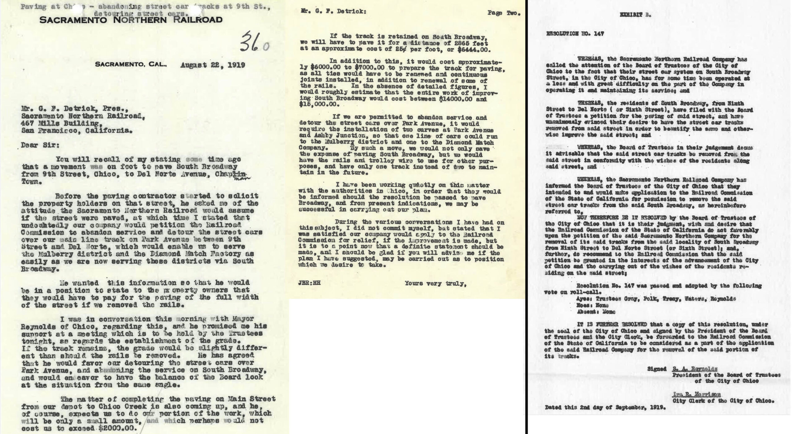
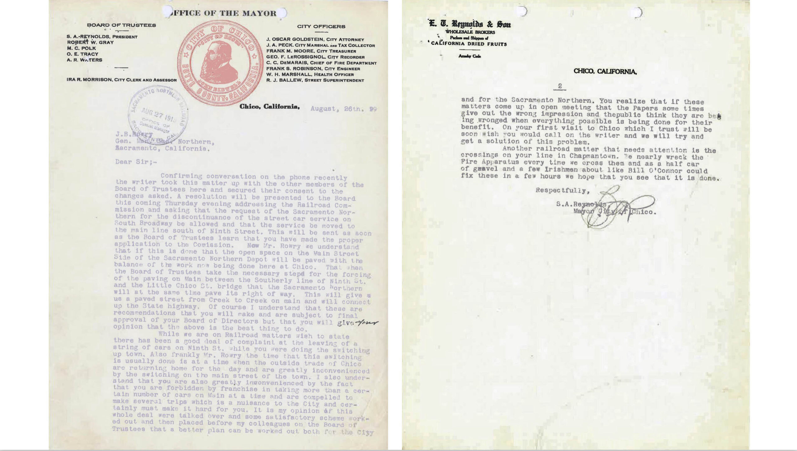
Many pre-1920 NE maps show no tracks on Broadway St. between 9th St. and Del Norte, but this is inaccurate. The letter on the left from J.B. Rowray, General Manager of the SN Railroad to his boss, G.F. Dertrick, outlines the issues involved. Rowray really meant the Barber neighborhood in the first paragraph. Chico Mayor S.A. Reynolds nicely outlines the situation in the agreement signed soon thereafter to remove the tracks, right.
L235-160-Courtesy BAERA, Western Railway Museum Archives, 39682sn, (Image 32 of 40)
This letter from Mayor Reynolds to Rowray in the interval between the two documents shown previously illustrates the backroom bargaining that took place, i.e., the financial contribution to pave Main St. allowed for the railway to abandon the Broadway St. line. And, if you read the letter to its completion, a mention of a line to Chapmantown, soon to be addressed.
L235-165-Courtesy BAERA, Western Railway Museum Archives, 39682sn, (Image 33 of 40)
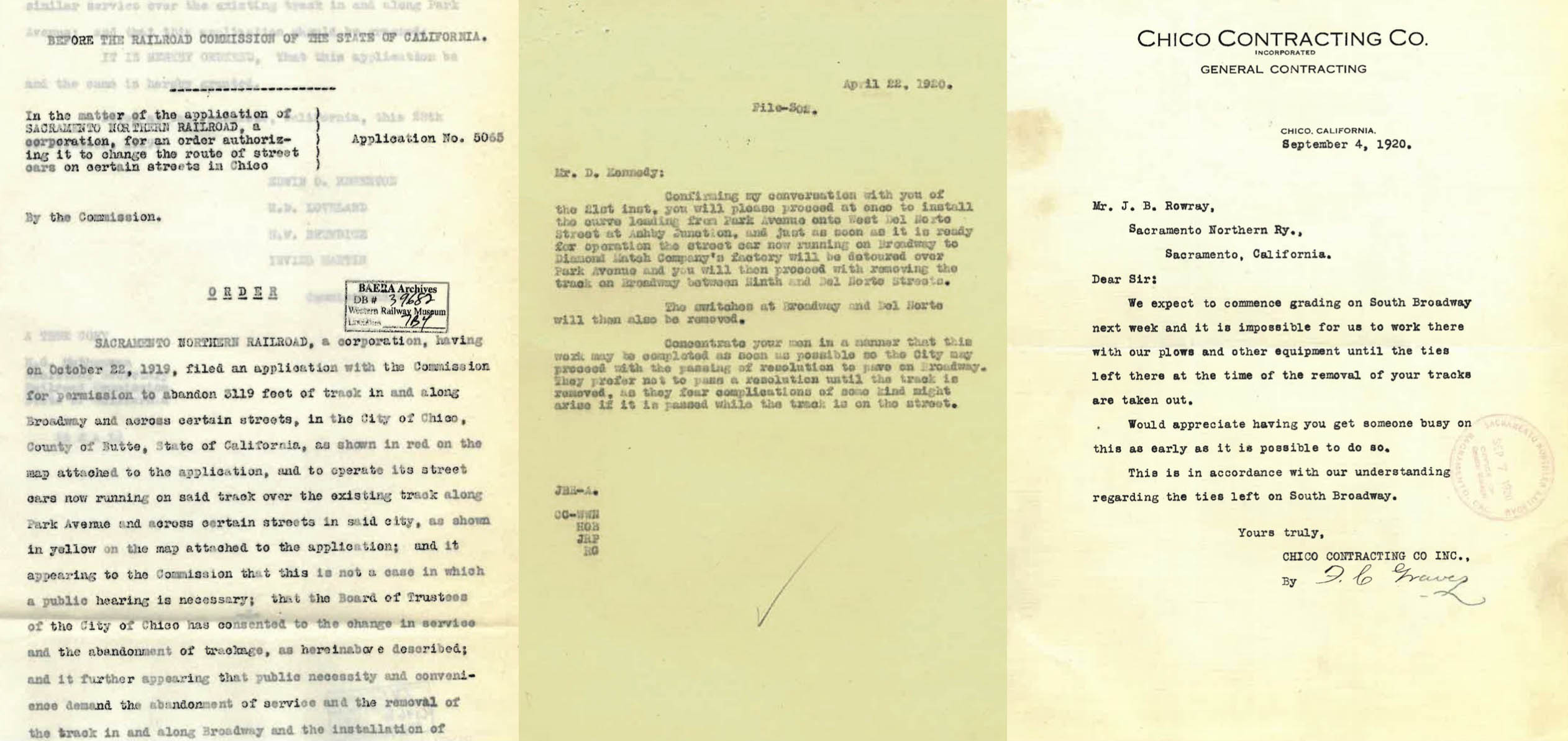
Three more documents to provide closure to the creation of the Park Ave. to Del Norte connection to replace the last remaining tracks on Broadway St. in 1920.
L235-170-Courtesy BAERA, Western Railway Museum Archives, 39682sn, (Image 34 of 40)
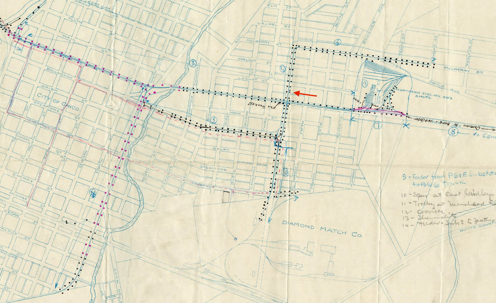
On the subject of Chapmantown, this neighborhood was northeast of Park Ave. Two maps were found related to 16th St. northeast of Park Ave. This 1911 map shows the extension of the Del Norte or 16th St. track to the east side of Park Ave., on what then called South 4th St., but would later be renamed E. 16th St. Incidentally, Chapmantown and Mulberry finally become incorporated into Chico on July 1, 2020.
L235-175-Courtesy BAERA, Western Railway Museum Archives, 16189sn, (Image 35 of 40)
No photographic or official document-based evidence of this route was found except for this 1911 map also showing the 16th St. extension on the northeast side of Park Ave. Appreciate that Kent Stephens refers to the “Chapmantown Line”, and Ira Sweet identified a line to Chapmantown as part of the CER, but neither provide any additional information. More research needed here.
L235-180-Courtesy BAERA, Western Railway Museum Archives, 108028sn, (Image 36 of 40)
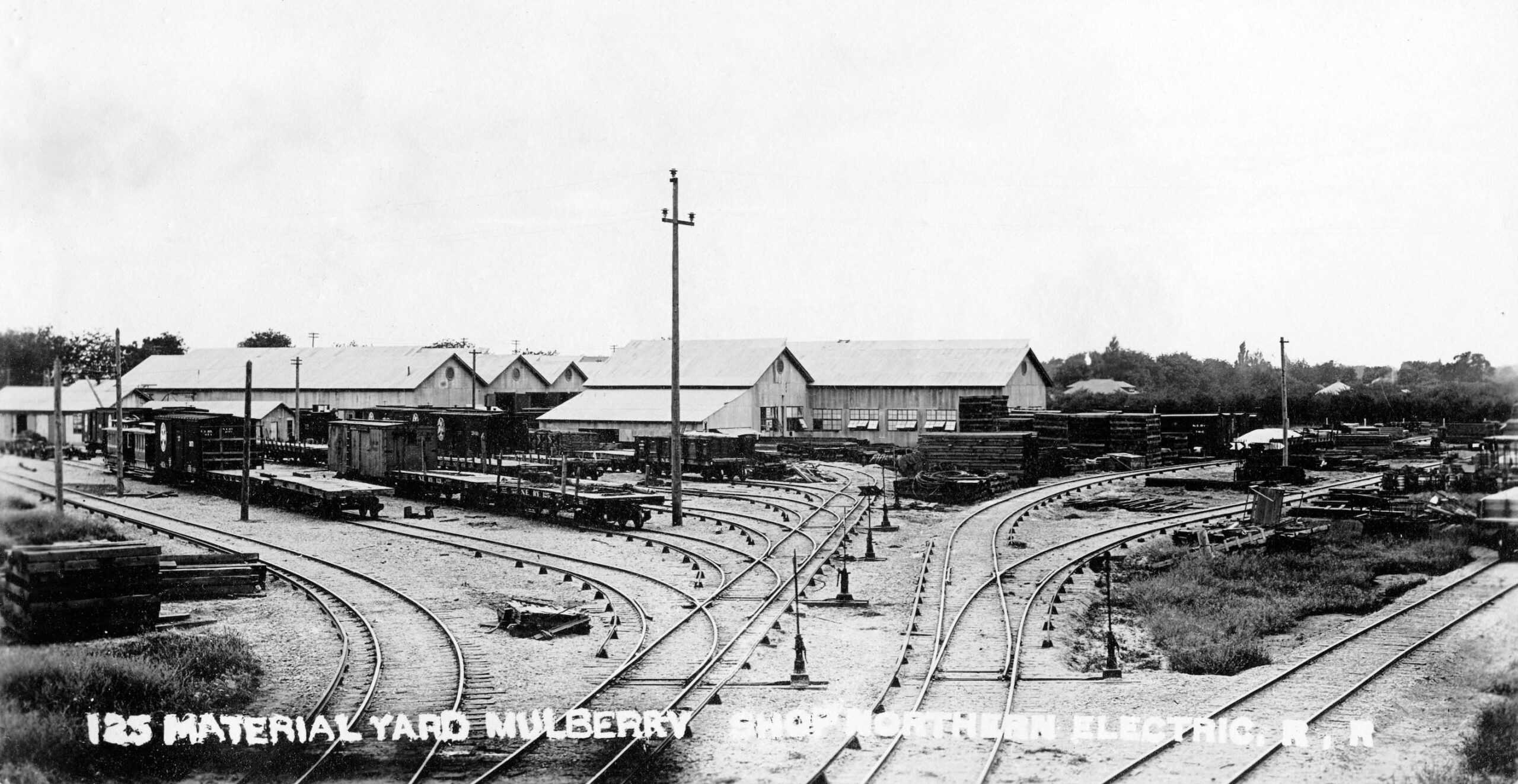
NE would create the Mulberry Shops and Yard to replace Diamond Match as a provider of power, shelter and an engineering facility to maintain the streetcars, freight and interurban services. North view, circa 1910.
L235-185-Northern Electric Photo, Courtesy BAERA, Western Railway Museum Archives, 26496sn, (Image 37 of 40)
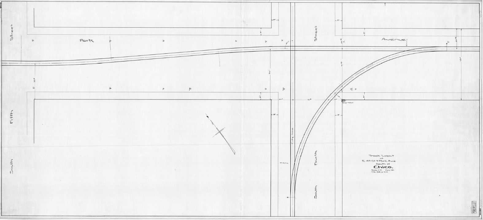
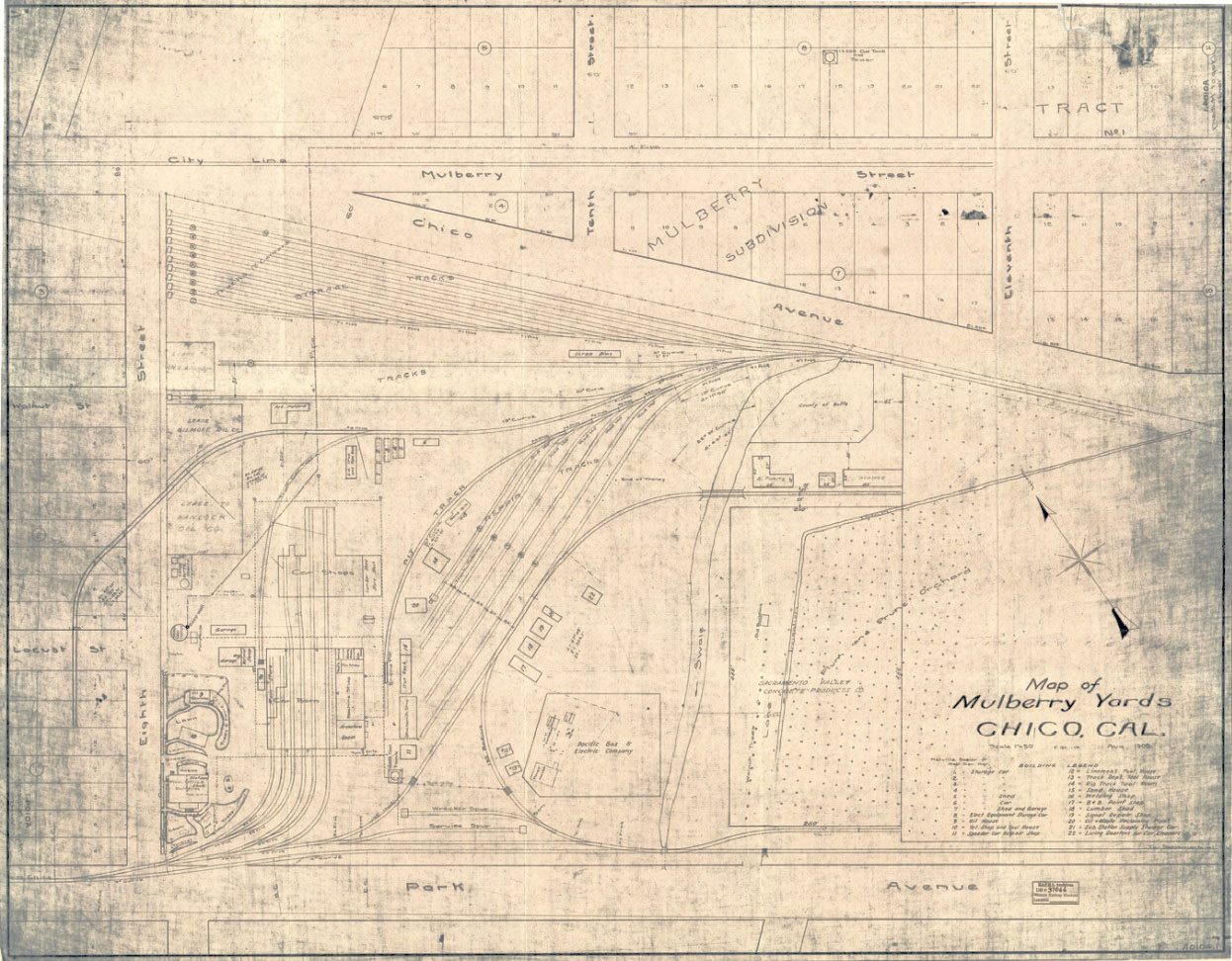
The facility entrance was located at Park Ave. and South 8th St., soon to be renamed E. 20th St., as seen in this map from Aug. 1909. The route from here south veered off the street onto a private right-of-way.
L235-190-Courtesy BAERA, Western Railway Museum Archives, 37066, (Image 38 of 40)
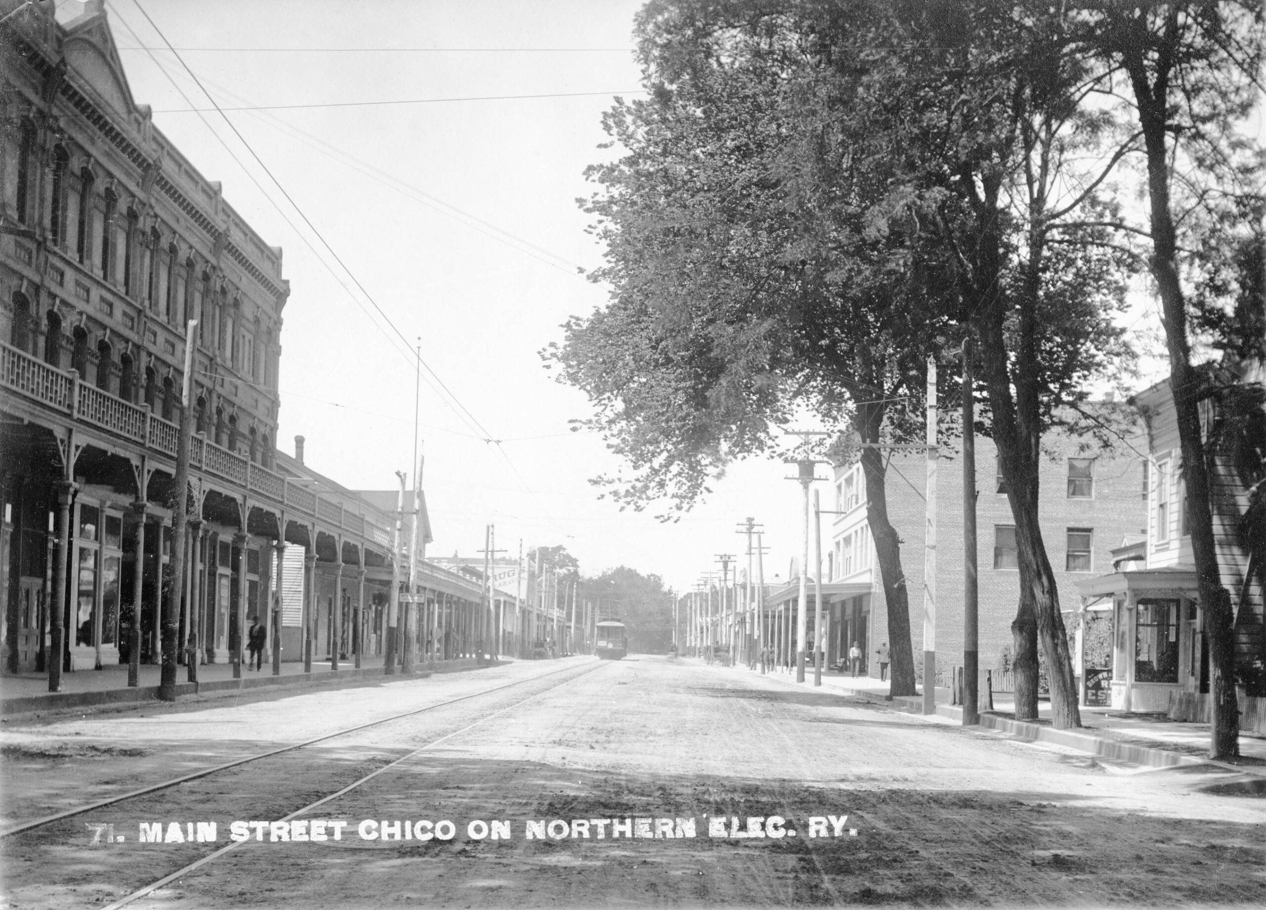
This northwest view from Main St. and 4th St. circa 1910 is a reminder that the original layout on Main St. was a single track. In mid-1911, the city granted the NE a franchise of 50 years to add a second track from Main St. and 1st St. to the southern city limit. Property owners along Park Ave. protested, so a second track was never added on the latter.
L235-195-Northern Electric Photo, Courtesy BAERA, Western Railway Museum Archives, 109486sn, (Image 39 of 40)
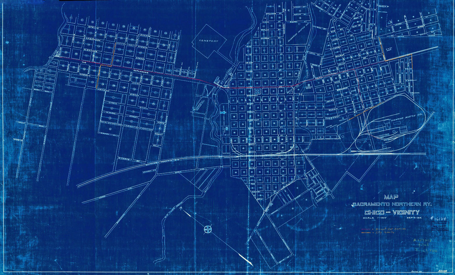
This map from 1913 completes the CER to NE to SN reconfiguration that would endure into the 1940s. These activities contributed, in part, to a large amount of debt, forcing the NE into receivership in Oct. 1914. Note this map anticipated the elimination of the Chico portion of the struggling Hamilton City line the following year. The increasing city limits relative to 1905 are indicated by the orange lines. Next time, a systematic ride through Chico begins.
L235-200-Courtesy BAERA, Western Railway Museum Archives, 16184sn, (Image 40 of 40)