West Lanes Finale and Passage Ways, August 1950
The last update featured the construction of the westbound lanes of the Frickstad Viaduct. In this follow-up, images of the nearly completed or completed road will be shown. Here, a southeast view showing the northern wall of the new structure on Aug. 26, 1950, with the headquarters of the Oakland Unified School District in the background, left, and the Oakland Civic Auditorium, right.
L332-05-Oakland Public Works Photos, Courtesy BAERA, Western Railway Museum Archives, 237069ov, (Image 1 of 29)

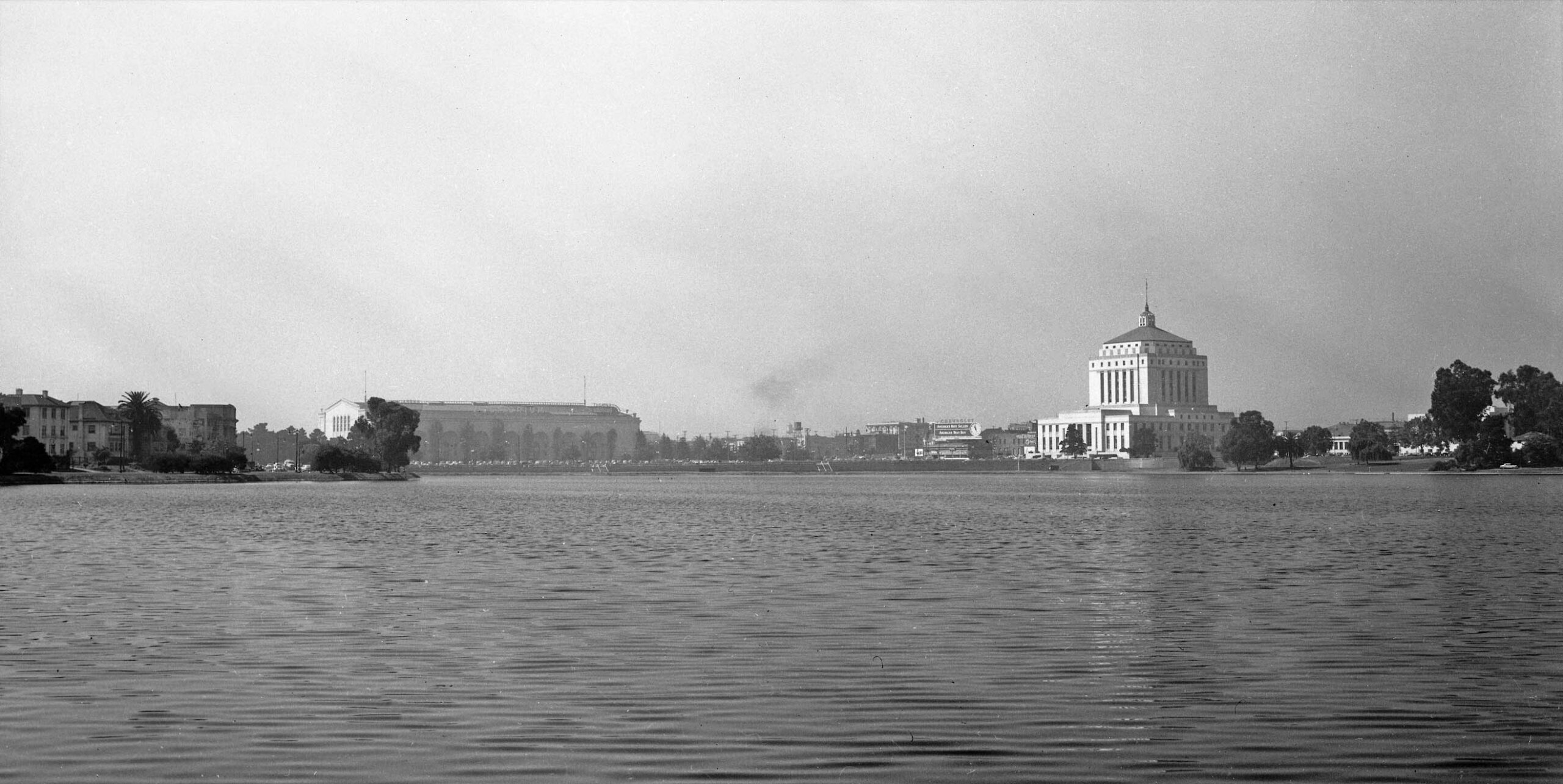
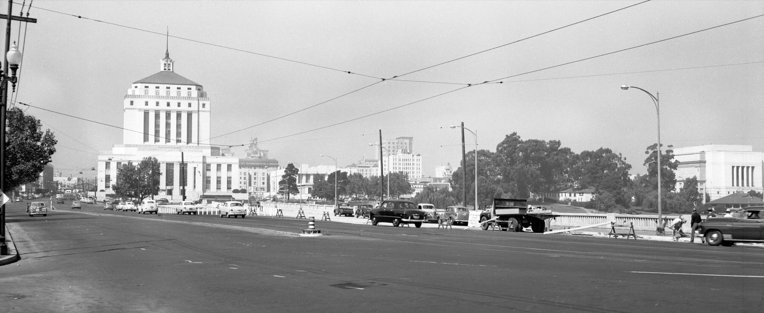
Shifting to the southwest, the Oakland Civic Auditorium is now to the left and the Alameda County Courthouse is included on the right on Aug. 26, 1950. A comprehensive set of images were taken on this August date with the opening not until early October. Whether a final set of the structure at its opening were taken is not known, but a few images of the finished product close to opening day have been added at the conclusion of this update.
L332-10-Oakland Public Works Photos, Courtesy BAERA, Western Railway Museum Archives, 237070ov, (Image 2 of 29)
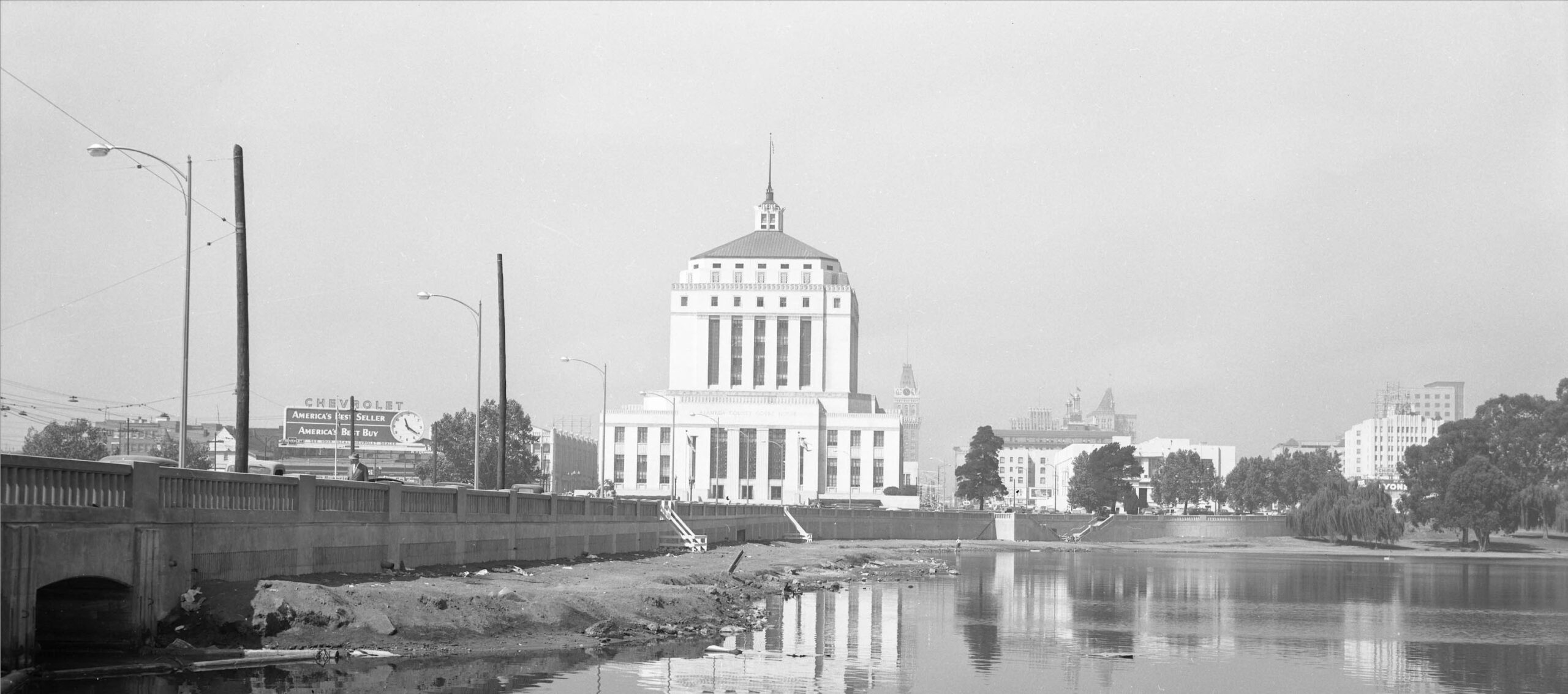
Finally to the west on Aug. 26, 1950, the dam occupies the left edge of the image. Framing the courthouse are the Art Deco Oak Building to the left, and The Oakland Tribune Tower and the two cupolas with flags of the Oakland Hotel on the right.
L332-15-Oakland Public Works Photos, Courtesy BAERA, Western Railway Museum Archives, 237072ov, (Image 3 of 29)
Items in this update are shown in an after-the-fact aerial from 1965 on the right. Relative to 1937, left, are the elevated structure of the new roadway separate from eastbound lanes, blue arrow, the addition of a traffic island at 14th St. and Oak St., yellow arrow, and the addition of an underpass to cross the road, red arrow, right. Note the configuration in 1937 had standard crossings at grade, red arrow, left. The area boxed in green, right, was not part of the initial building of the Viaduct, but an addition made for the new Oakland Museum of California under construction in 1965.
L332-20-Harrison Ryker Photo V5-142, Courtesy California Department of Transportation, l, cas-65-130_15-113, Courtesy of UCSB Library Geospatial Collection, r, (Image 4 of 29)
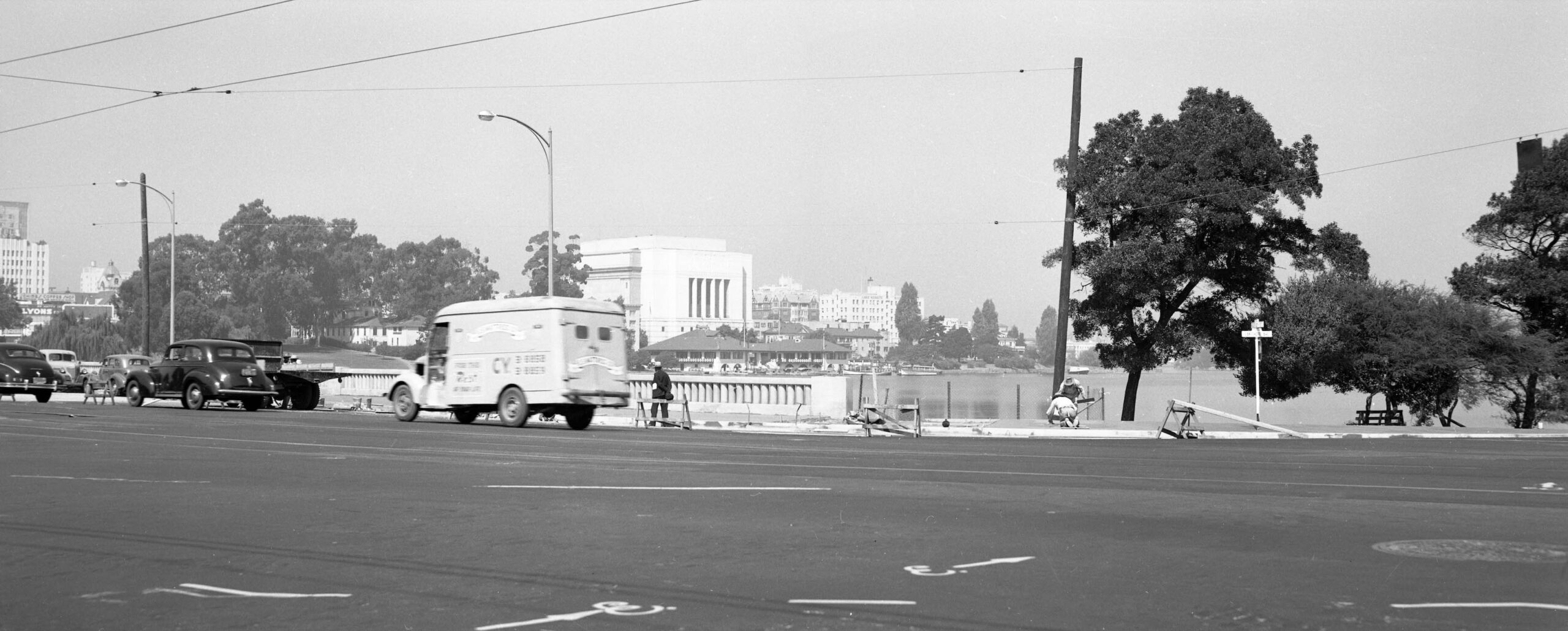
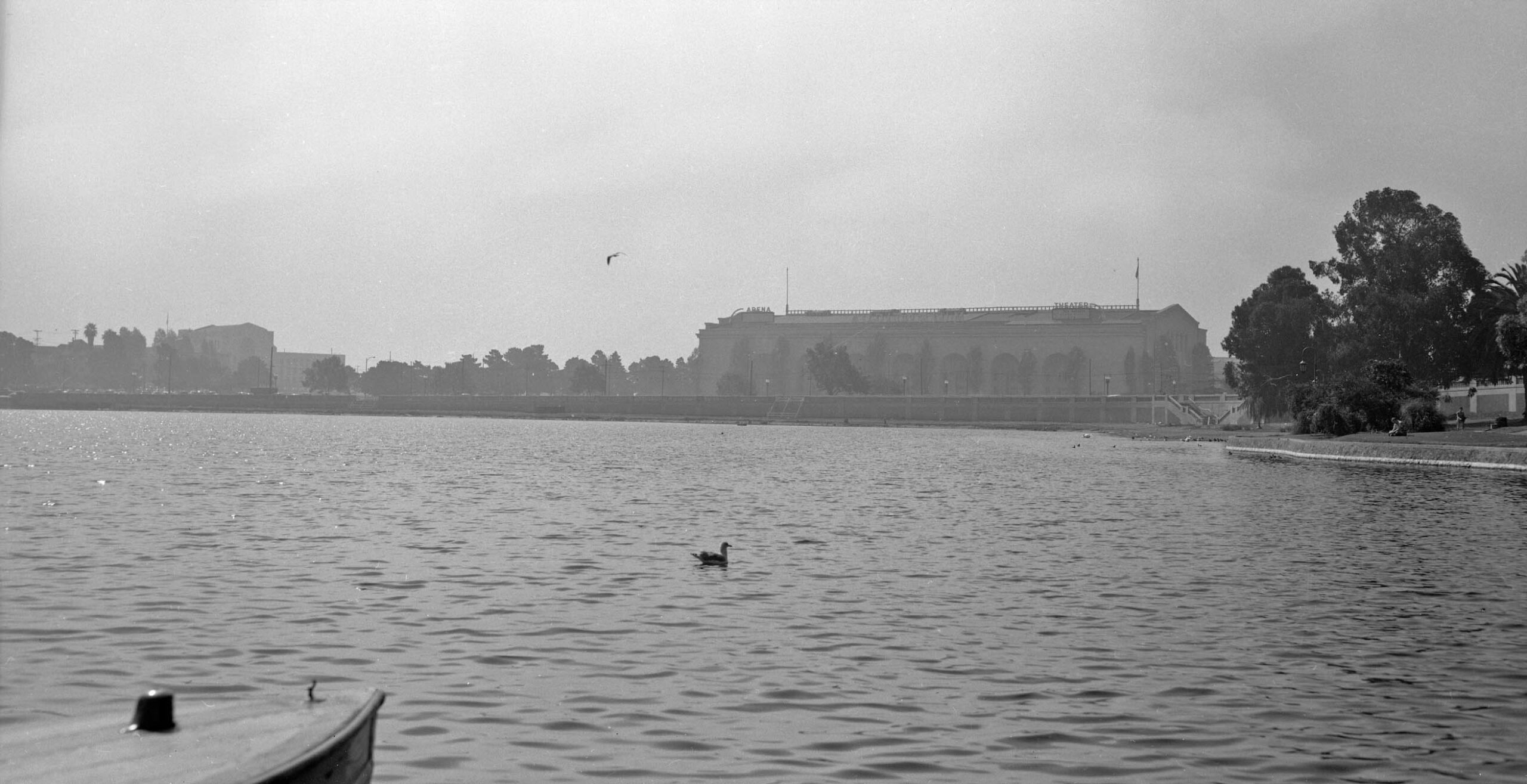
Now back the east end of the westbound lanes at Lakeshore Ave. with a northwest view from Aug. 26, 1950 across the lake with the boathouse-pumping station backed by the Scottish Rites Temple.
L332-25-Oakland Public Works Photos, Courtesy BAERA, Western Railway Museum Archives, 235159ov, (Image 5 of 29)
Moving along the westbound lanes to the west, this northeast view from Aug. 26, 1950 features Lakeshore Ave. and the Fourth Church of Christ, Scientist in the right portion of the image.
L332-30-Oakland Public Works Photos, Courtesy BAERA, Western Railway Museum Archives, 235163ov, (Image 6 of 29)
Now with the church on the right edge, this north-northeast view shows the Bellevue-Staten apartment building across the lake to the left.
L332-35-Oakland Public Works Photos, Courtesy BAERA, Western Railway Museum Archives, 235161ov, (Image 7 of 29)
A quick look back to the east at the two beer signs and the nearly finished roadway.
L332-40-Oakland Public Works Photos, Courtesy BAERA, Western Railway Museum Archives, 235155ov, (Image 8 of 29)
Next a west view from Aug. 26, 1950 showing that the original 12th St. and the Key tracks are unchanged at the moment, extending west past the courthouse. The buildings to the right have already been identified several times across the past few updates, but this image has a rare view of the extension added to the rear of the Camron-Stanford House while it served as the Oakland Public Museum. This can be appreciated just above the parked truck.
L332-45-Oakland Public Works Photos, Courtesy BAERA, Western Railway Museum Archives, 235158ov, (Image 9 of 29)
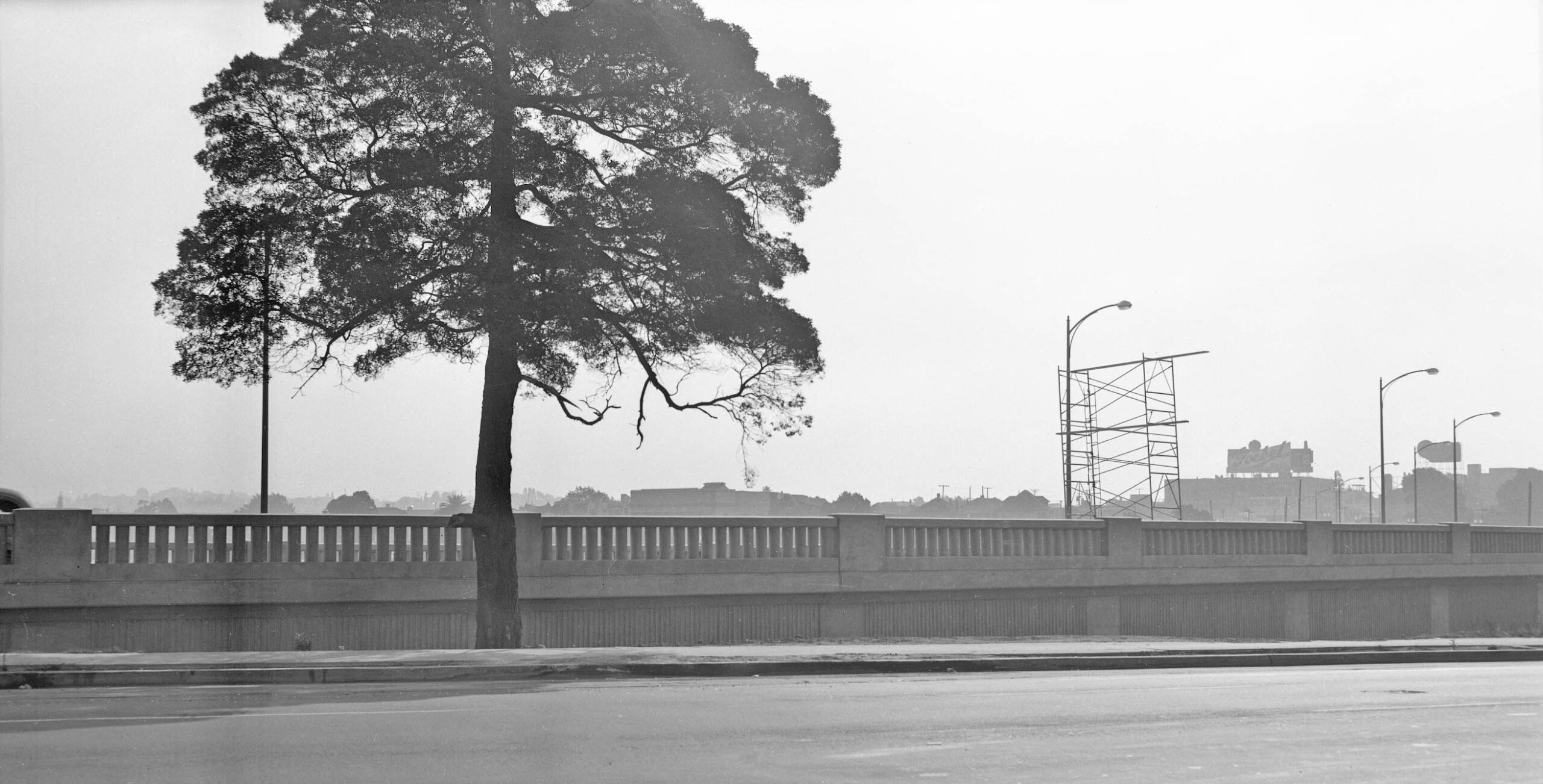
The new westbound lanes are seen rising above 12th St. as they make the turn to the northwest on Aug. 26, 1950.
L332-50-Oakland Public Works Photos, Courtesy BAERA, Western Railway Museum Archives, 235165ov, (Image 10 of 29)
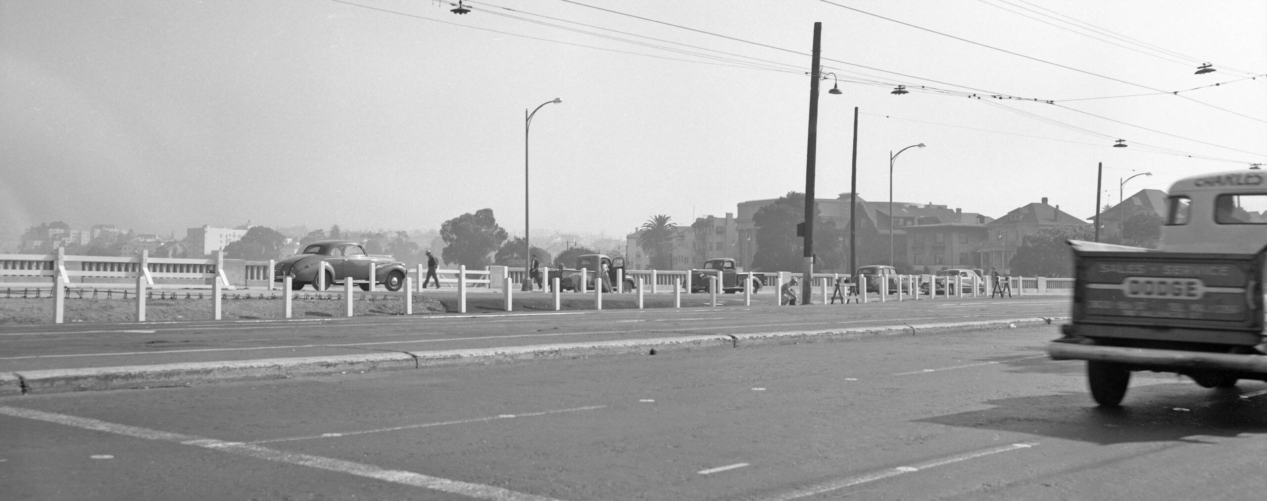
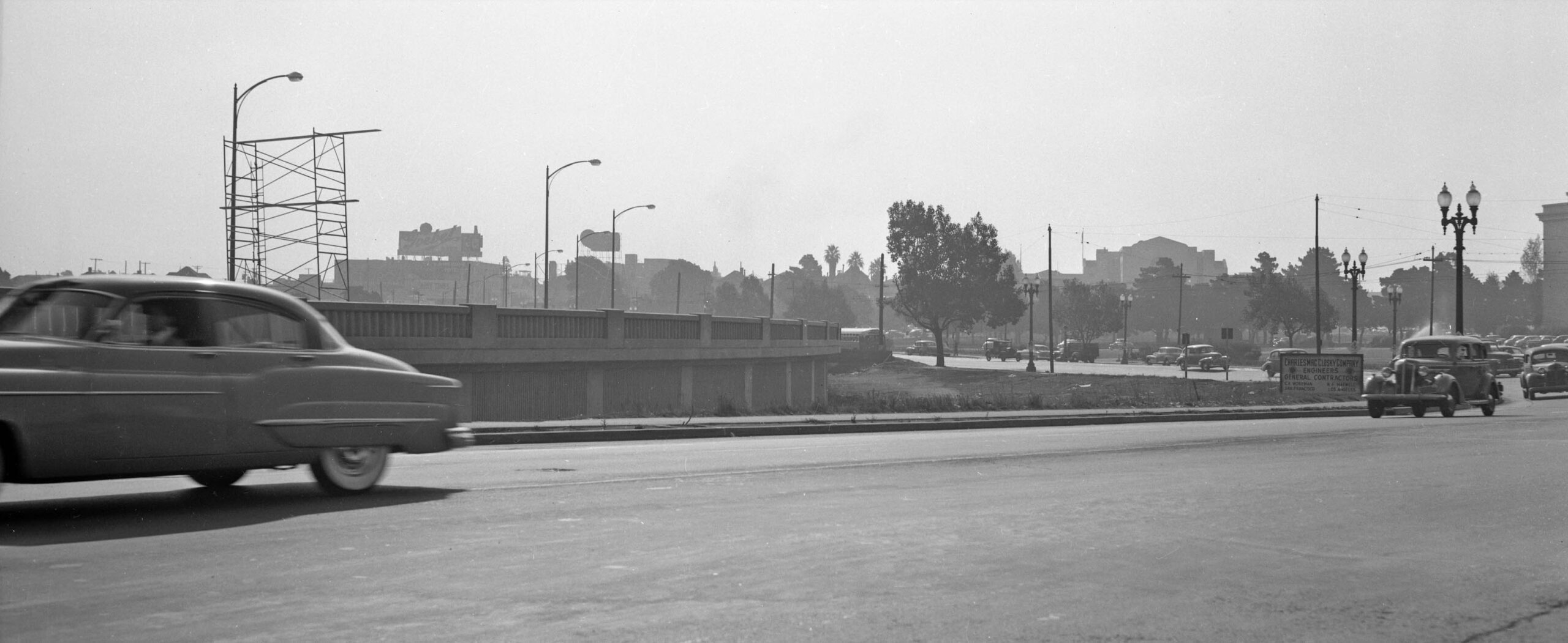
This southeast view of the curve of the westbound lanes from Aug. 26, 1950 also shows that Charles MacCloskey Co. supplied the engineers and general contractors for the project. MacCloskey had been awarded the contract providing a low bid of $291,648 as reported in the Aug. 24, 1949 Oakland Tribune. When the roadway opening was reported in the Oct. 3, 1950 Oakland Tribune, the final cost of that specific project was quoted as $300k.
L332-55-Oakland Public Works Photos, Courtesy BAERA, Western Railway Museum Archives, 235147ov, (Image 11 of 29)
As the westbound lanes begin the curve to the northwest, the roadway begins to level off with the adjacent original roadway as seen in this southeast view from Aug. 26, 1950.
L332-60-Oakland Public Works Photos, Courtesy BAERA, Western Railway Museum Archives, 235149ov, (Image 12 of 29)
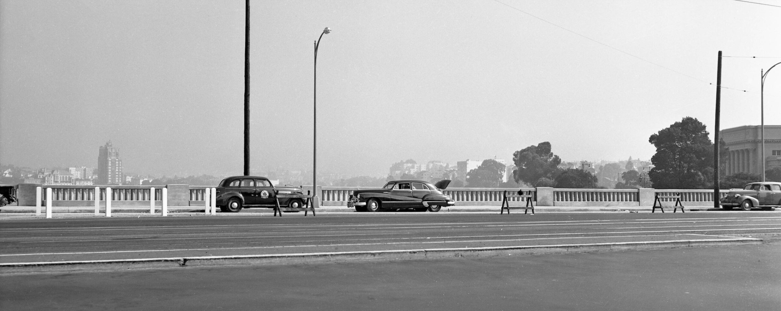
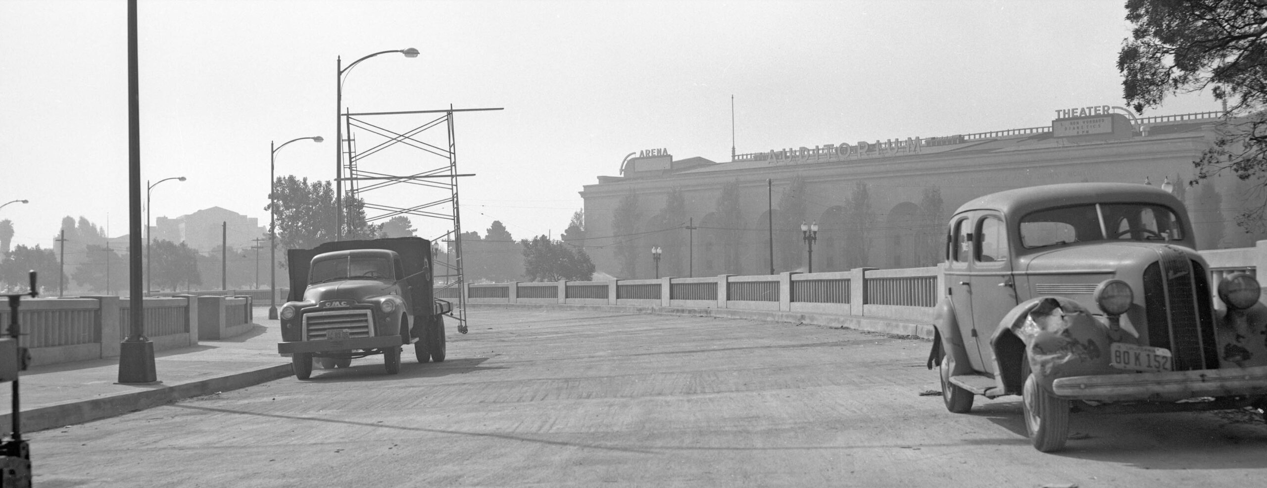
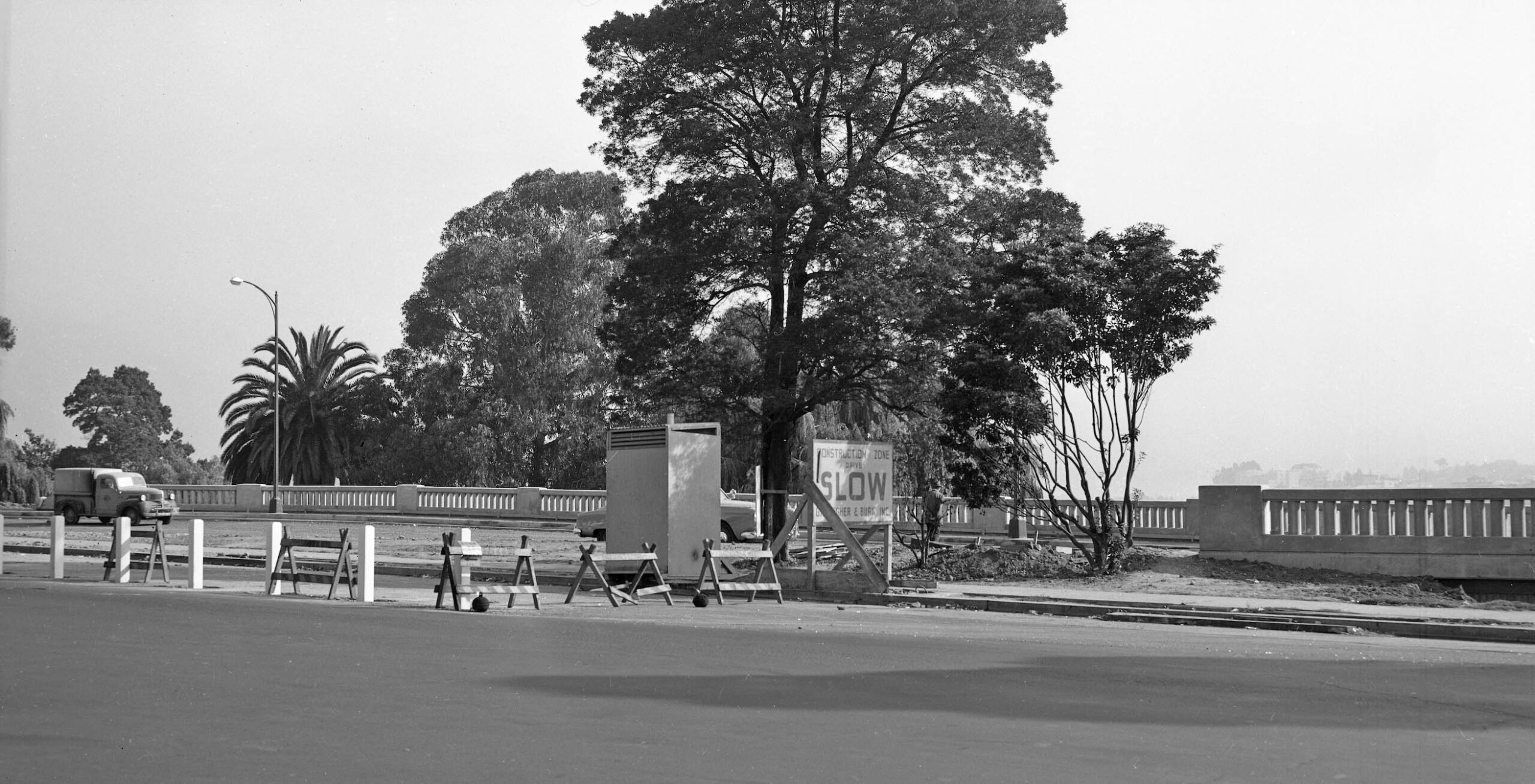
Another southeast view toward the Civic Auditorium of the nearly completed westbound lanes from Aug. 26, 1950. Completion of the lanes west of this point were still in progress as shown next …
L332-65-Oakland Public Works Photos, Courtesy BAERA, Western Railway Museum Archives, 235168ov, (Image 13 of 29)
… as advertised.
L332-70-Oakland Public Works Photos, Courtesy BAERA, Western Railway Museum Archives, 235166ov, (Image 14 of 29)
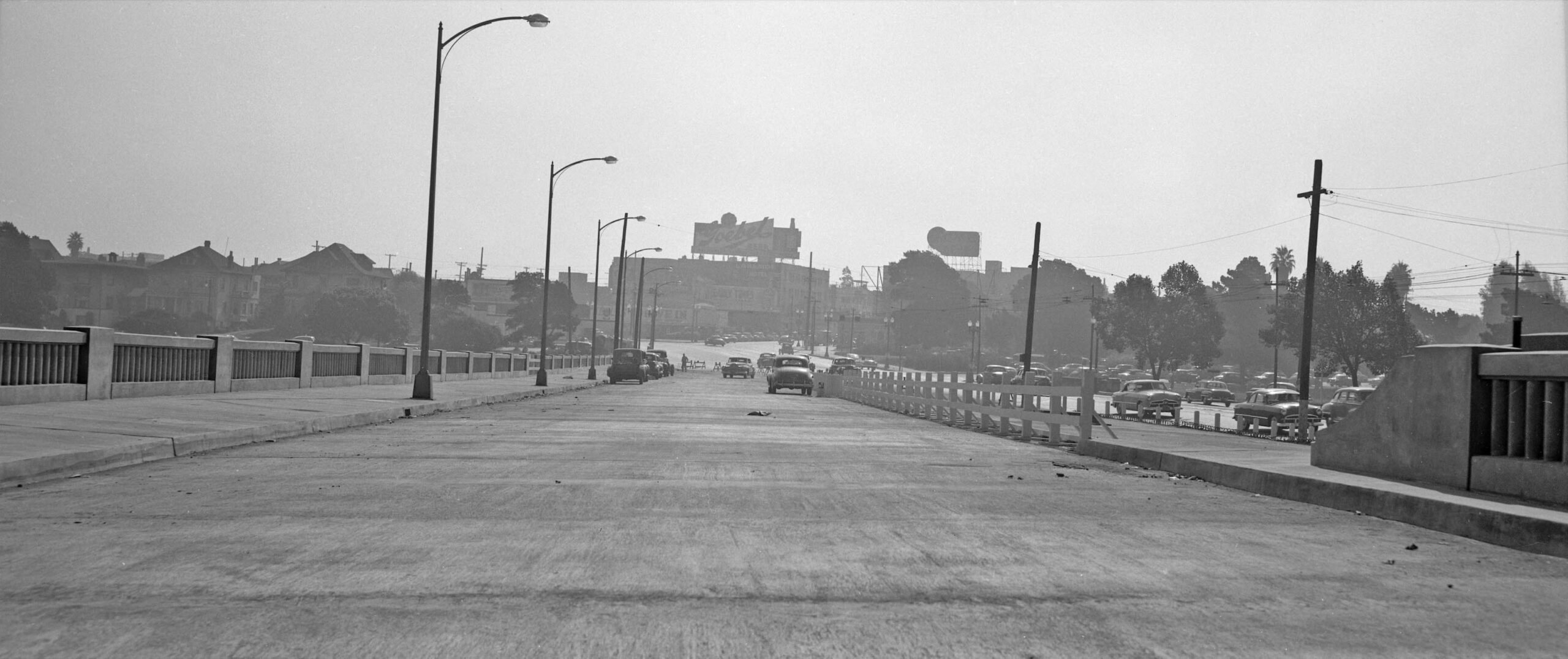
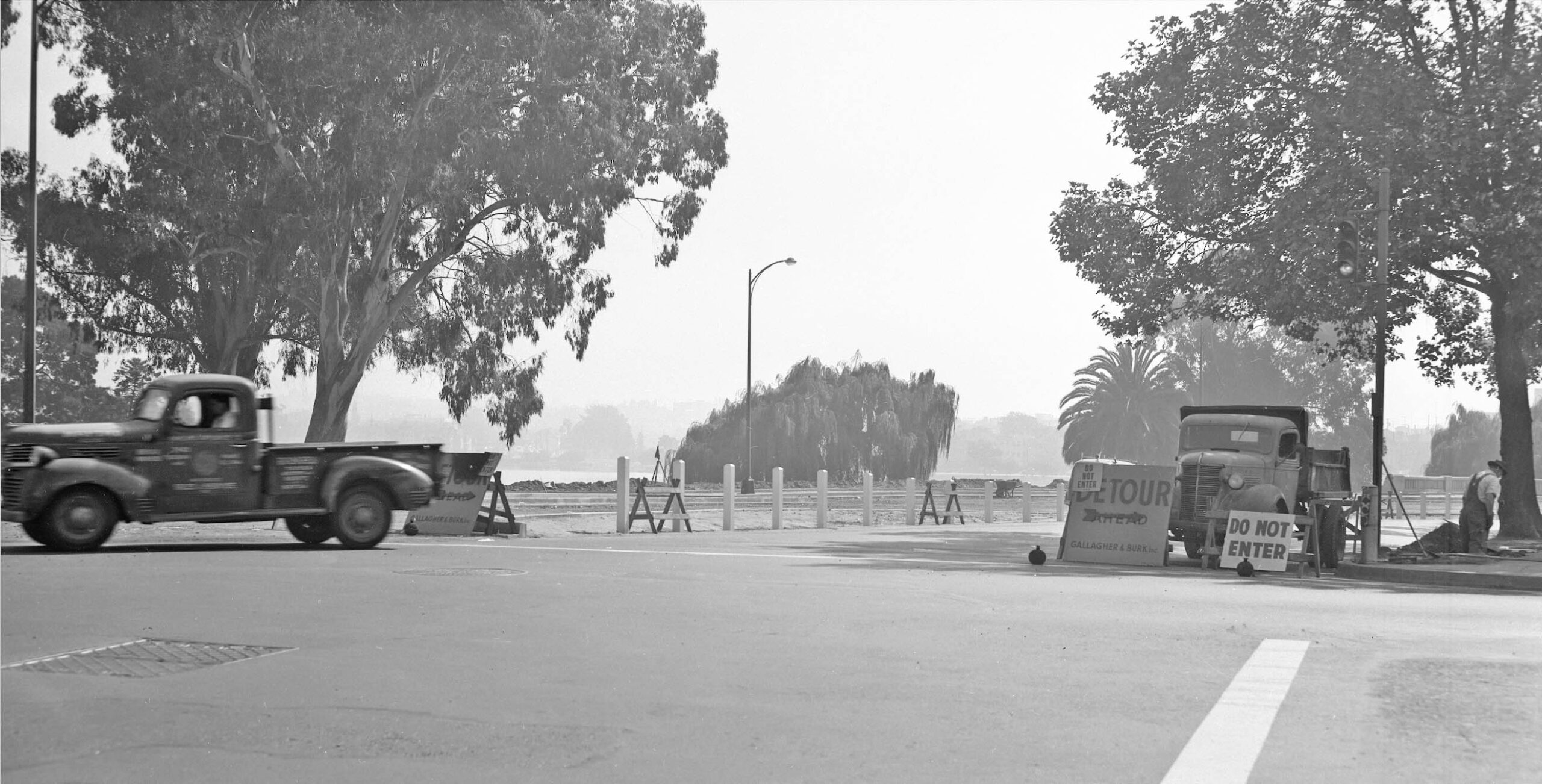
And turning to the northeast, more of the graded, but unfinished surface of the westbound lanes on Aug. 26, 1950.
L332-75-Oakland Public Works Photos, Courtesy BAERA, Western Railway Museum Archives, 238425ov, (Image 15 of 29)
Further west at 13th St., an east view of the graded, but incomplete roadway surface.
L332-80-Oakland Public Works Photos, Courtesy BAERA, Western Railway Museum Archives, 238426ov, (Image 16 of 29)
A northwest view at 14th St. shows that Oak St., in 2025 the south end of Lakeside Dr., off to the right was also involved in the resurfacing on Aug. 26, 1950.
L332-85-Oakland Public Works Photos, Courtesy BAERA, Western Railway Museum Archives, 238428ov, (Image 17 of 29)
A tiny bit further to the northwest from the previous image now shows both cupolas of the Islamic Cultural Center of Northern California.
L332-90-Oakland Public Works Photos, Courtesy BAERA, Western Railway Museum Archives, 238427ov, (Image 18 of 29)
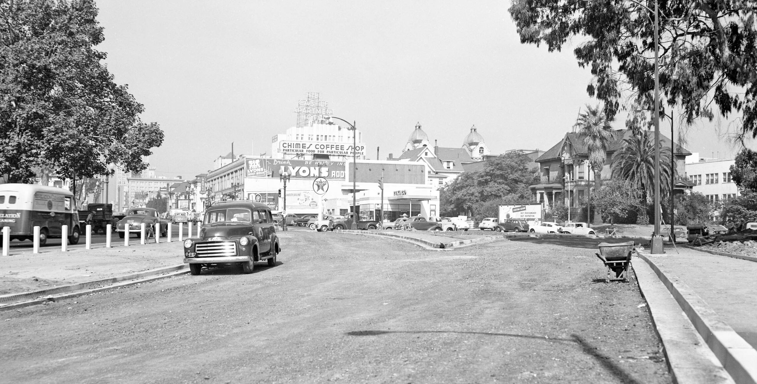
Finally, 14th St. is now in view as the image has shifted to the west with the Hill Castle Apartment Hotel now in view. The building was opened in 1930 with Chester Miller and Carl Warnecke as architects. The image shows how the original westbound lanes from the dam onto 14th St. were maintained as the new lanes were created. The house on the right, 1215 Oak St., is of interest and will be presented next.
L332-95-Oakland Public Works Photos, Courtesy BAERA, Western Railway Museum Archives, 238429ov, (Image 19 of 29)
This house was one of the earlier ones along Lake Merritt, and one of the last to be razed as shown shortly. The Oakland Wiki has an extended write up on the owners of the house, the Root family. Of note is that “the June 2, 1883 San Francisco Examiner reported that ex-mayor Samuel Merritt had sold the property at the corner of 14th and Oak to A.W. Root for $8,000.” For more, click here.
L332-100-Oakland Public Works Photos, Courtesy BAERA, Western Railway Museum Archives, 238429ov, Detail, (Image 20 of 29)
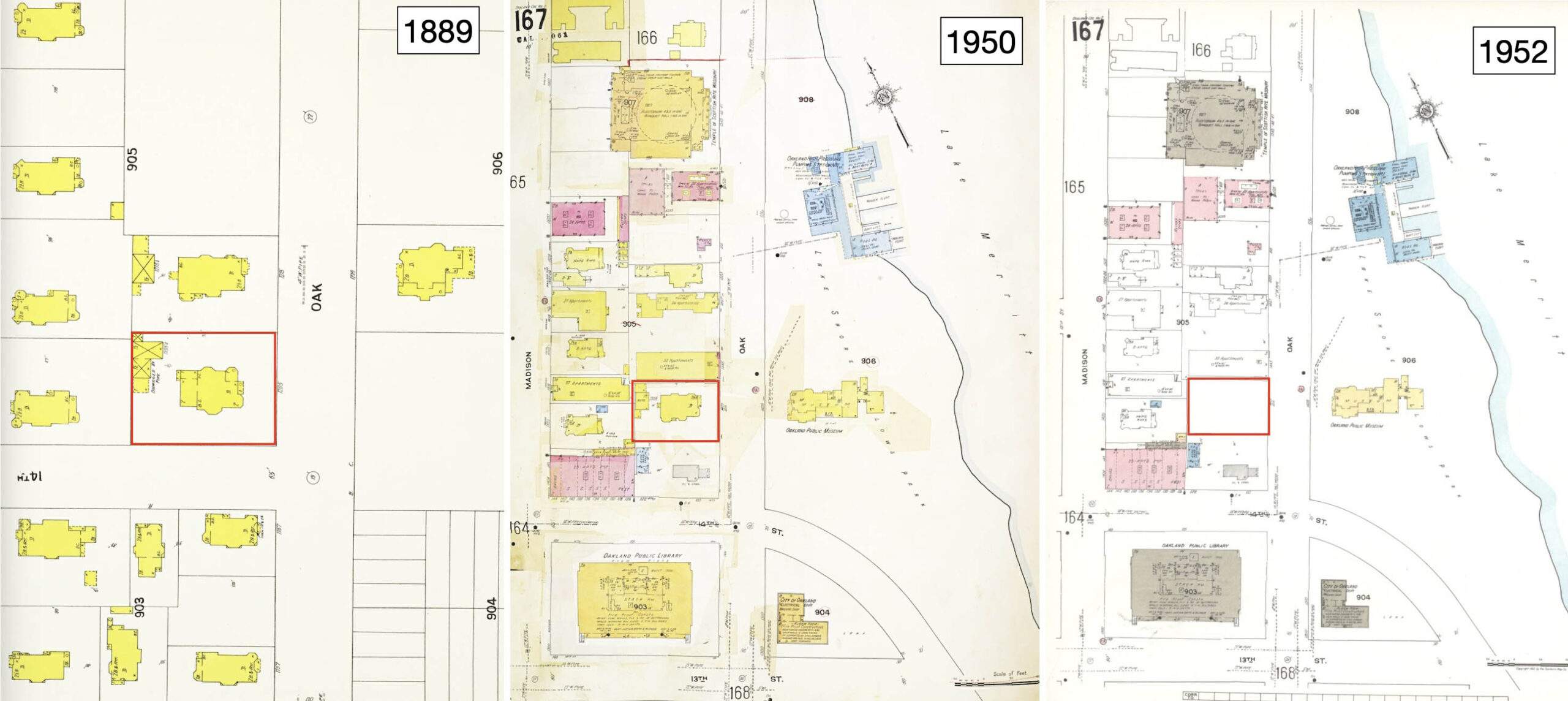
In addition to what is provided in the link and documentation of the house’s presence in 1950 in the previous image, these Sanborn maps show the house was there in 1889, left, and razed by 1952, right.
L332-105-Sanborn Map Company, 1889, Panel 155, l, 1911 - Nov 1950 Vol. 2_1950, Panel 167, c, 1911, Republished 1952 Vol.2, Panel 167, r, (Image 21 of 29)
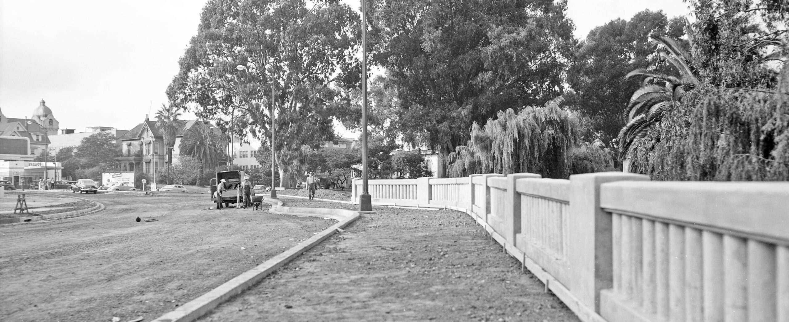
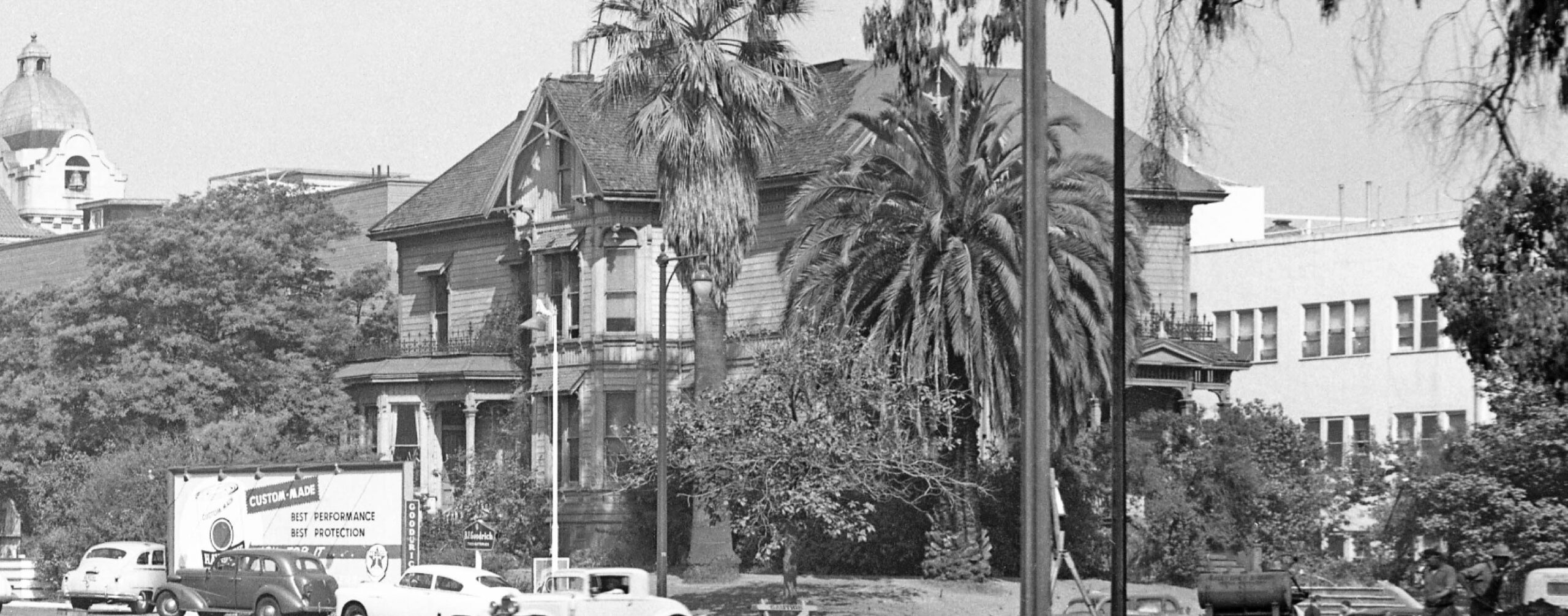
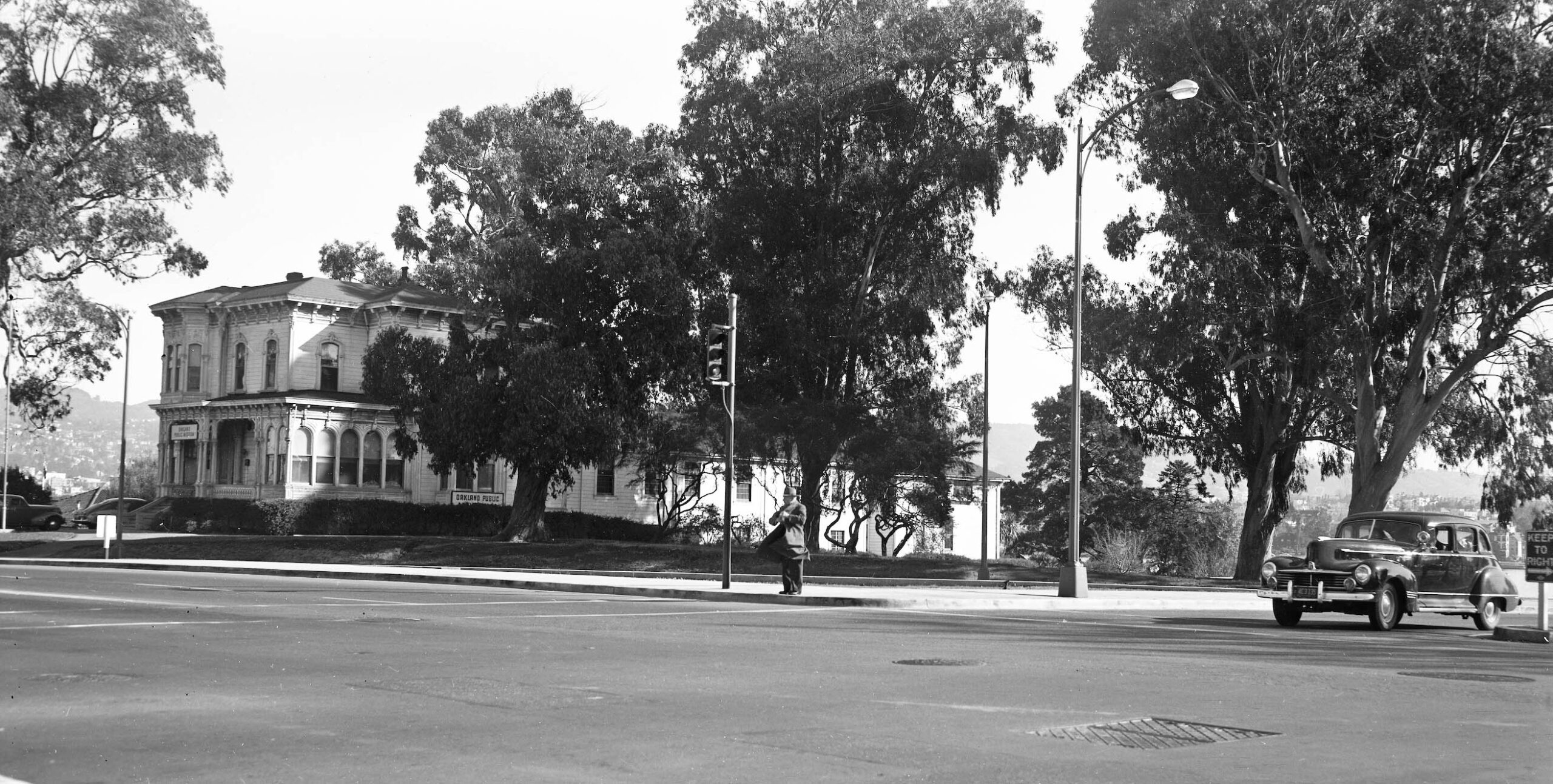
This northeast view shows the Stanford-Camron House identified as the Oakland Public Museum, then located on what was called Oak St. just north of 14th St. on Aug. 26, 1950. The workman appear to be constructing a new curb alignment alongside the new traffic island, easier to appreciate back on the aerials in L332-120.
L332-110-Oakland Public Works Photos, Courtesy BAERA, Western Railway Museum Archives, 238430ov, (Image 22 of 29)
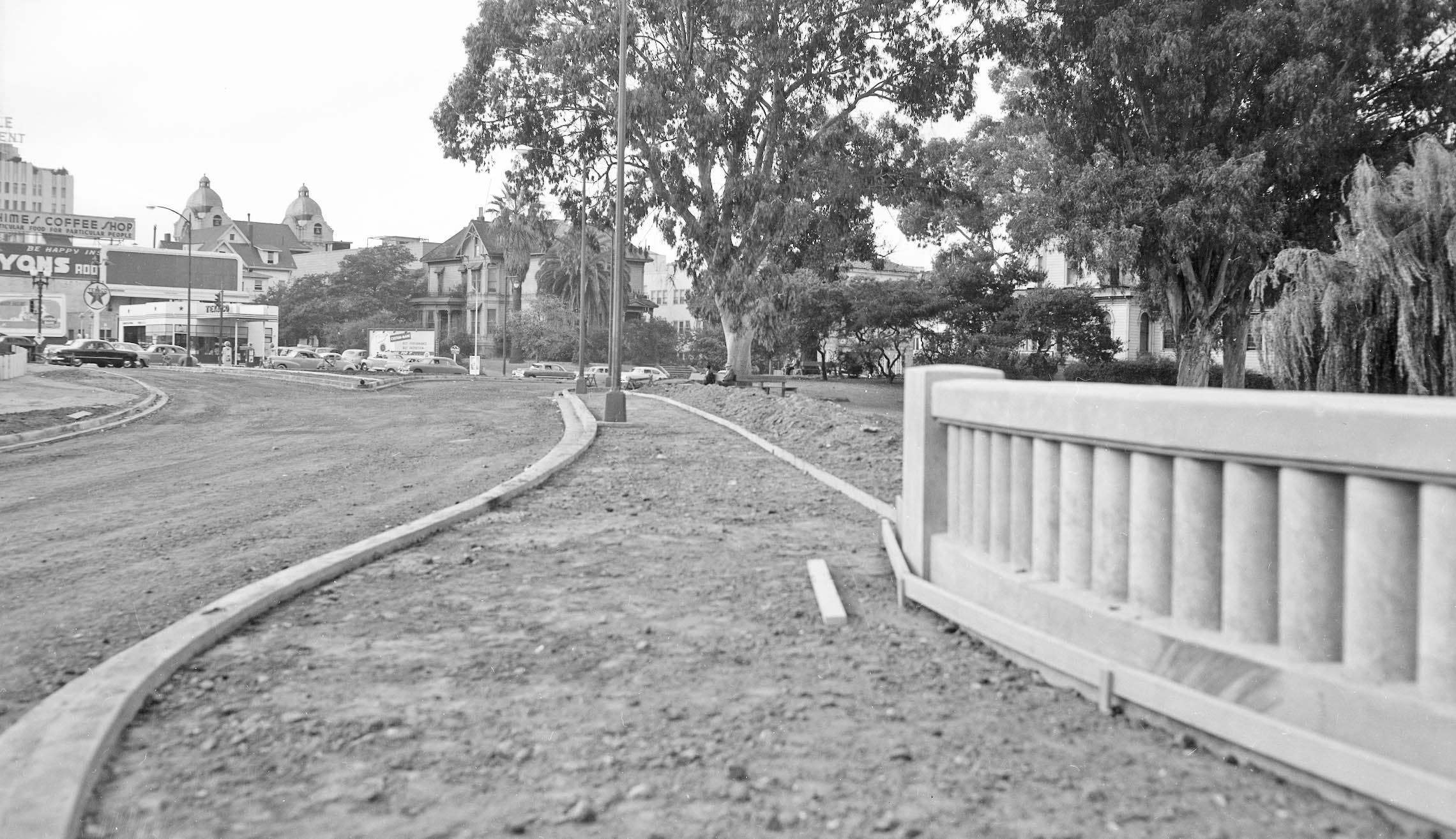
Now looking north up Oak St., the job appears to be almost completed in this undated view. The cars bare 1950 license plates.
L332-115-Oakland Public Works Photos, Courtesy BAERA, Western Railway Museum Archives, 238432ov, (Image 23 of 29)
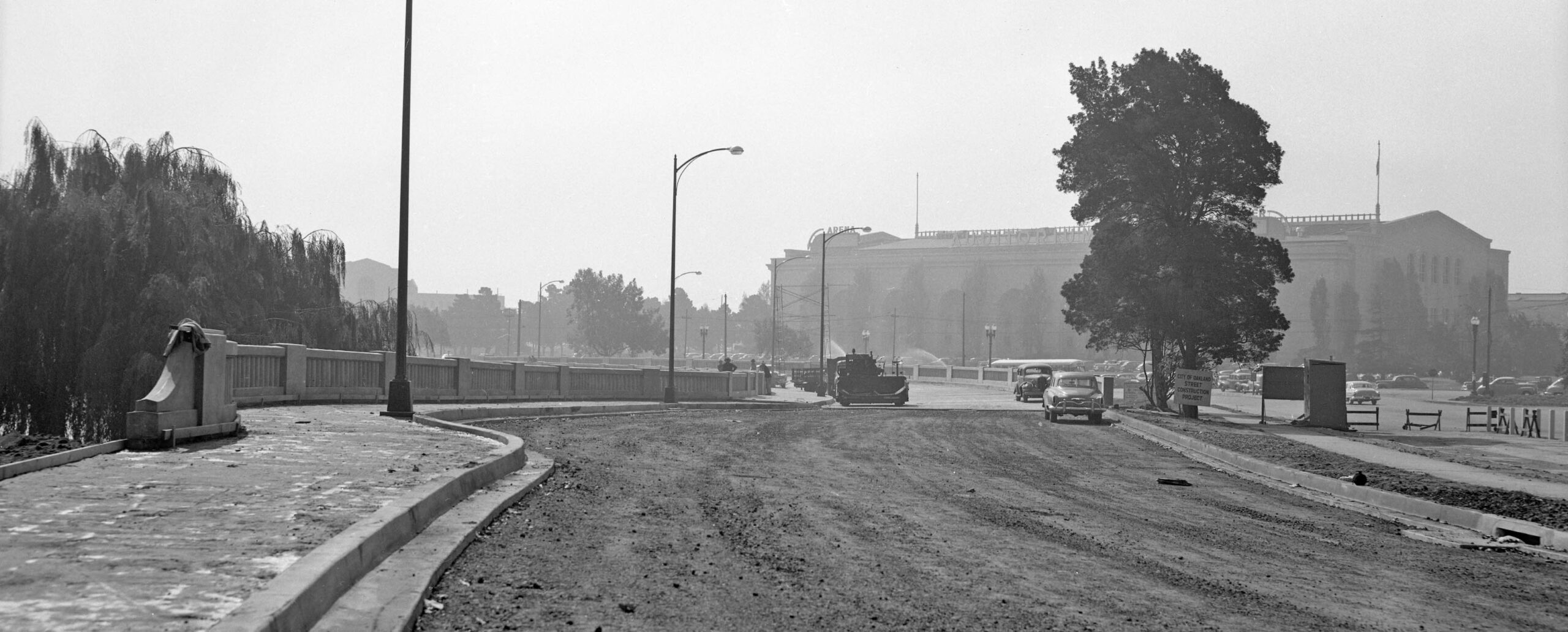
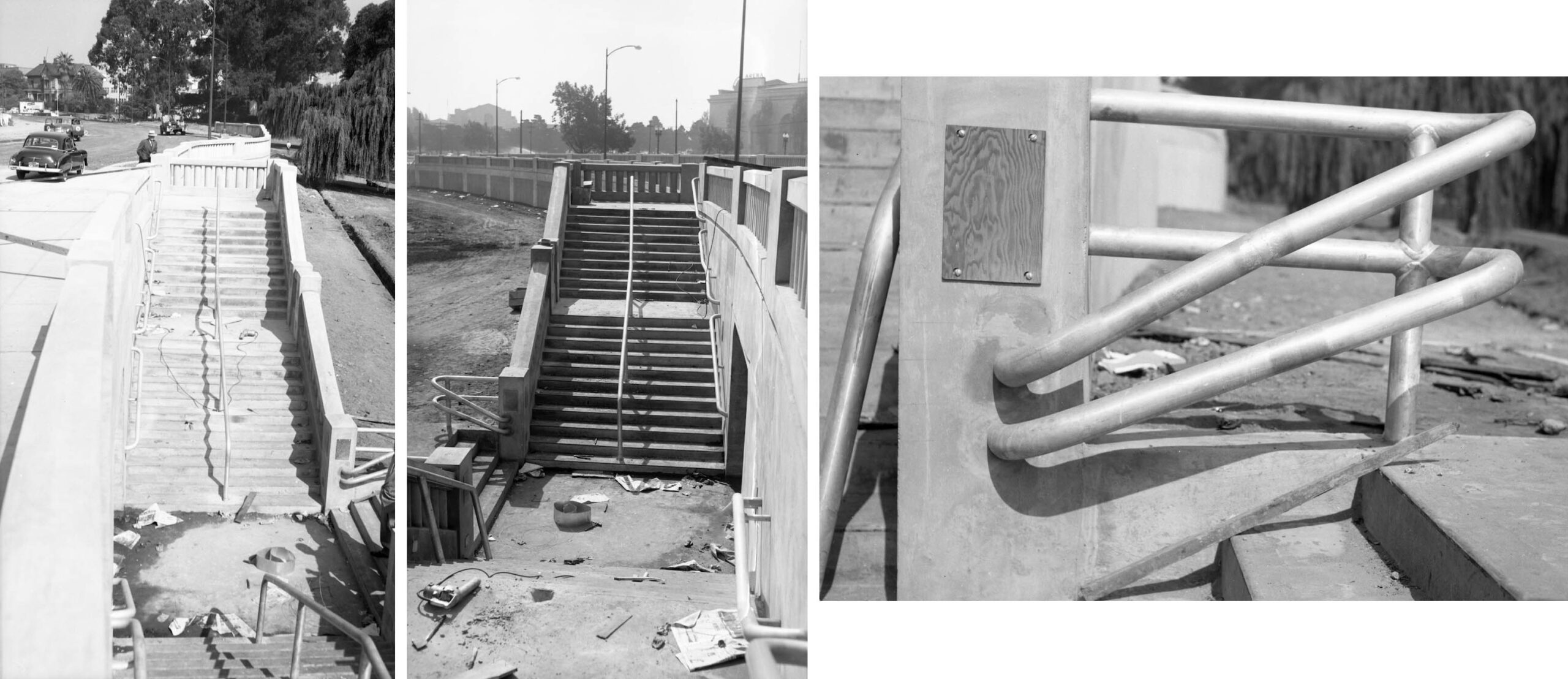
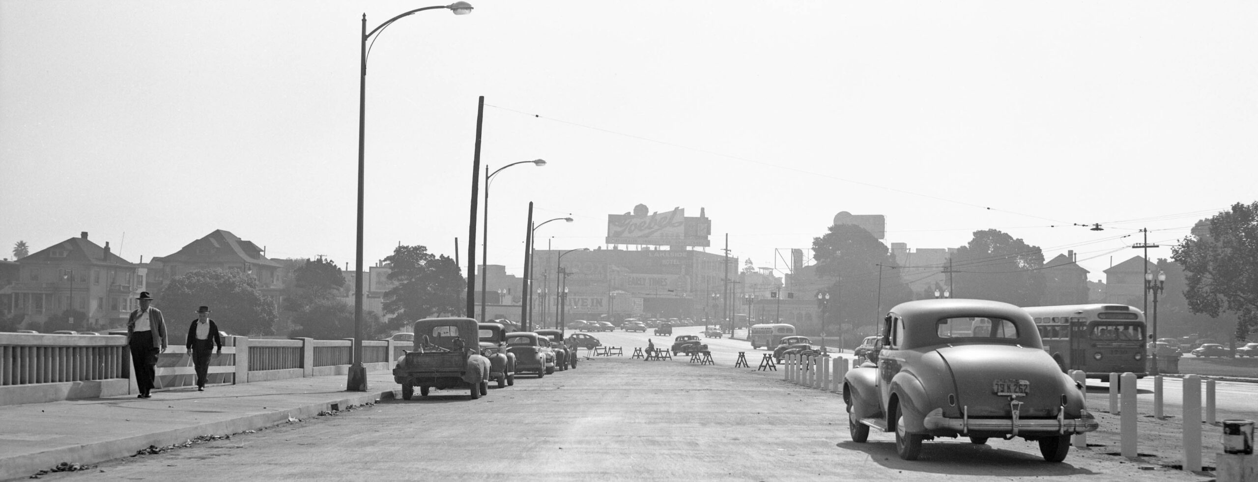
Soon after this review of progress on the westbound lanes was taken in August, the state of the new underpass walkways was documented on Sept. 21, 1950, still two weeks away from the opening of the roadway.
L332-120-Oakland Public Works Photos, Courtesy BAERA, Western Railway Museum Archives, 238414ov, l, 238419ov, c, 238415ov, r, (Image 24 of 29)
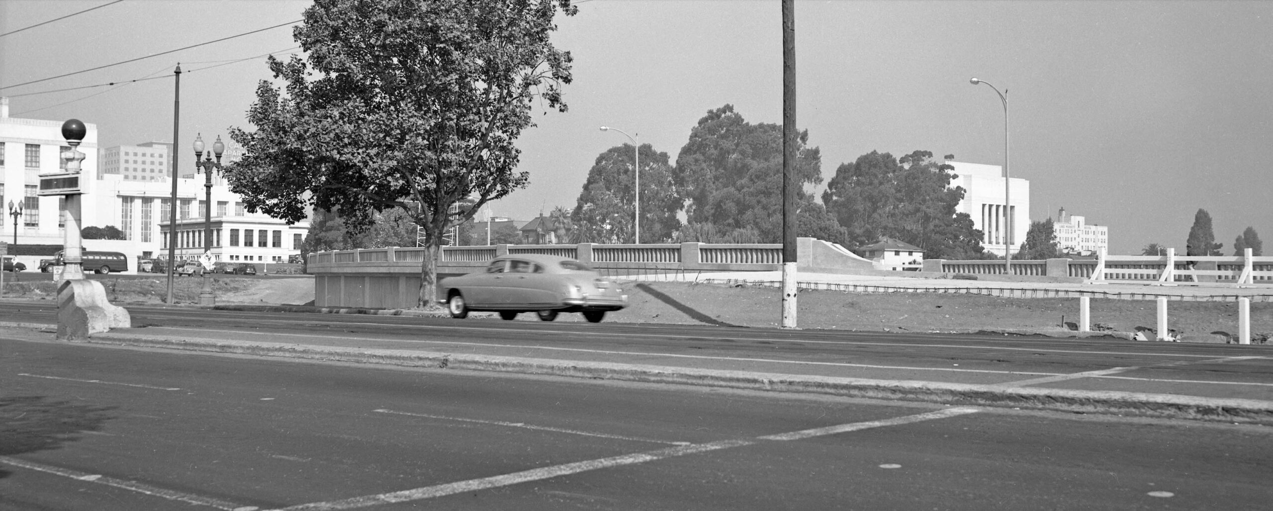
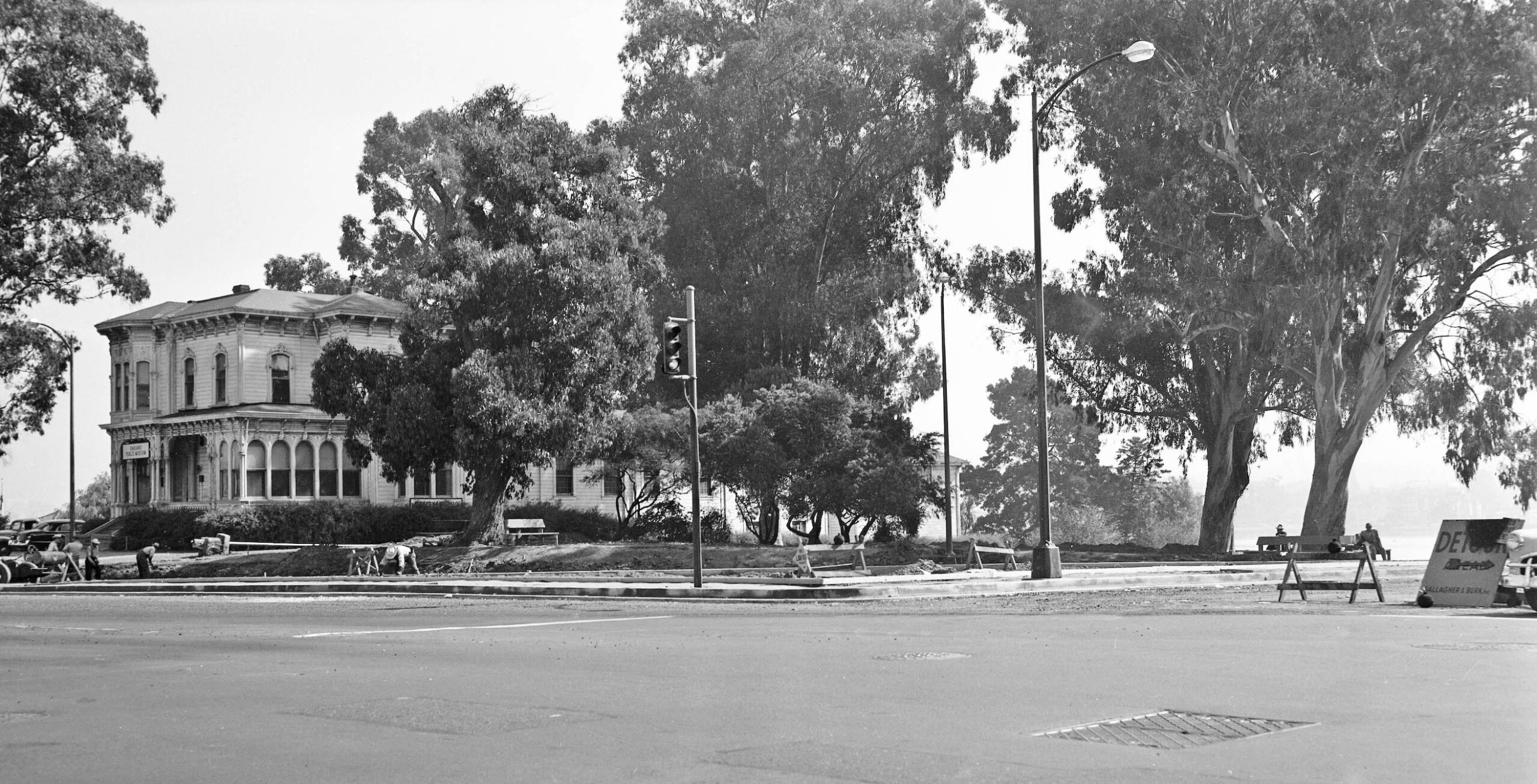
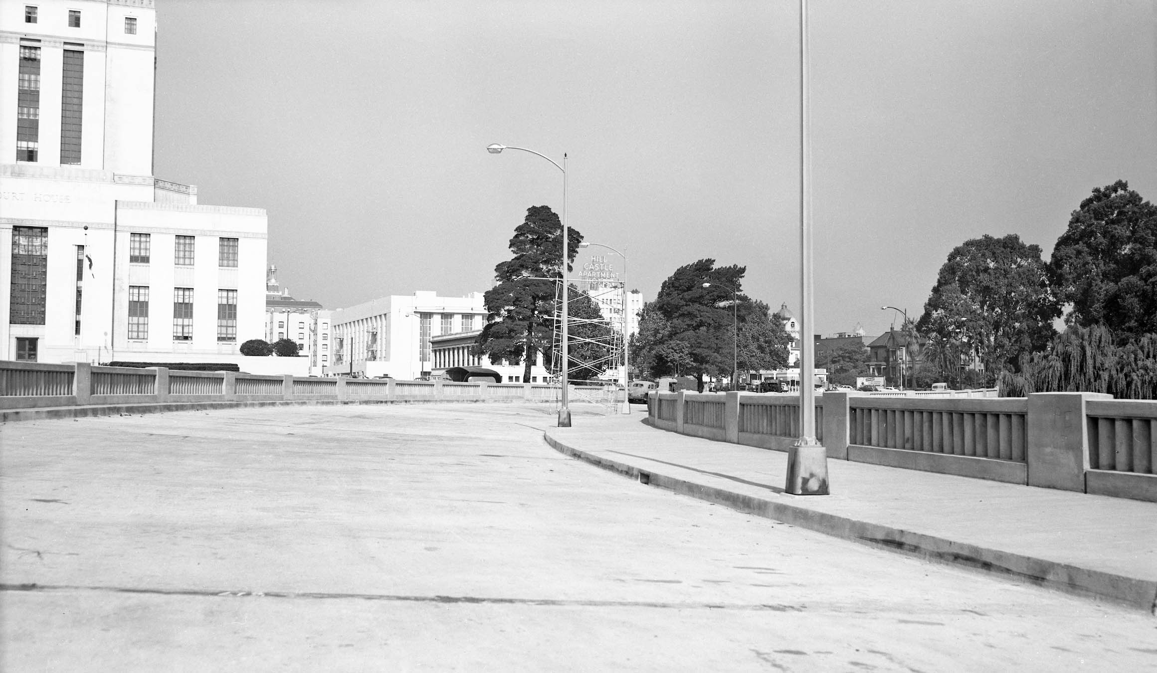
The western section did get completed as seen in this undated northwest view taken before the roadway opened of the final curve past the courthouse and Fire Alarm building toward 14th St.
L332-125-Oakland Public Works Photos, Courtesy BAERA, Western Railway Museum Archives, 235151ov, (Image 25 of 29)
Four images were found dated Dec 12, 1951, but evidence from the images suggest they were taken sometime earlier, closer to the roadway’s opening more than a year earlier. This northeast view shows the intersection of 13th St., the absence of any license plates leaving the precise date in limbo.
L332-130-Oakland Public Works Photos, Courtesy BAERA, Western Railway Museum Archives, 238435ov, (Image 26 of 29)
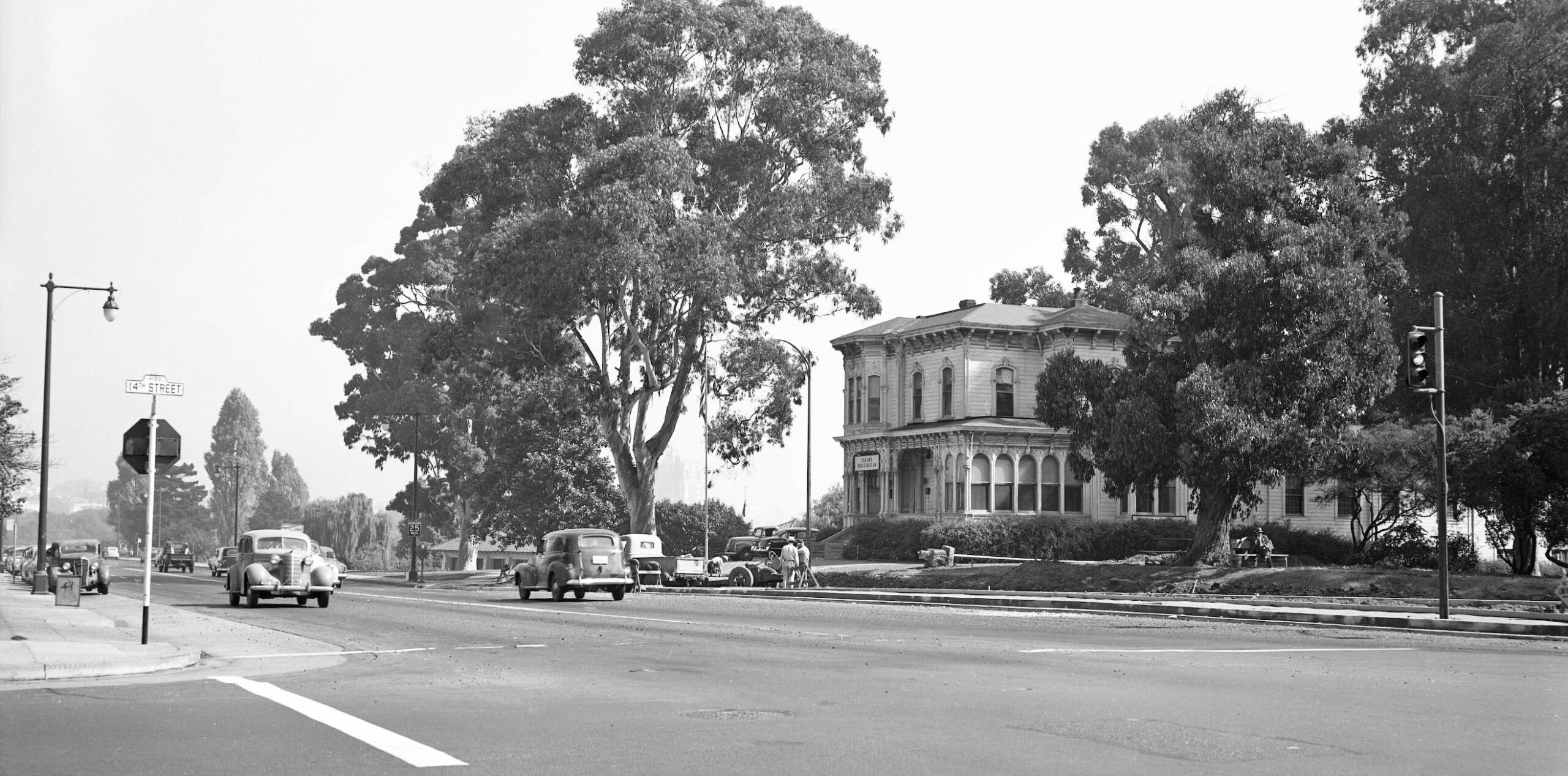
And here completed at the intersection with 14th St., this northeast view captures the Stanford-Camron House with signs as the Oakland Public Museum, and a car with a clearly displayed 1951 license plate.
L332-135-Oakland Public Works Photos, Courtesy BAERA, Western Railway Museum Archives, 238431ov, (Image 27 of 29)
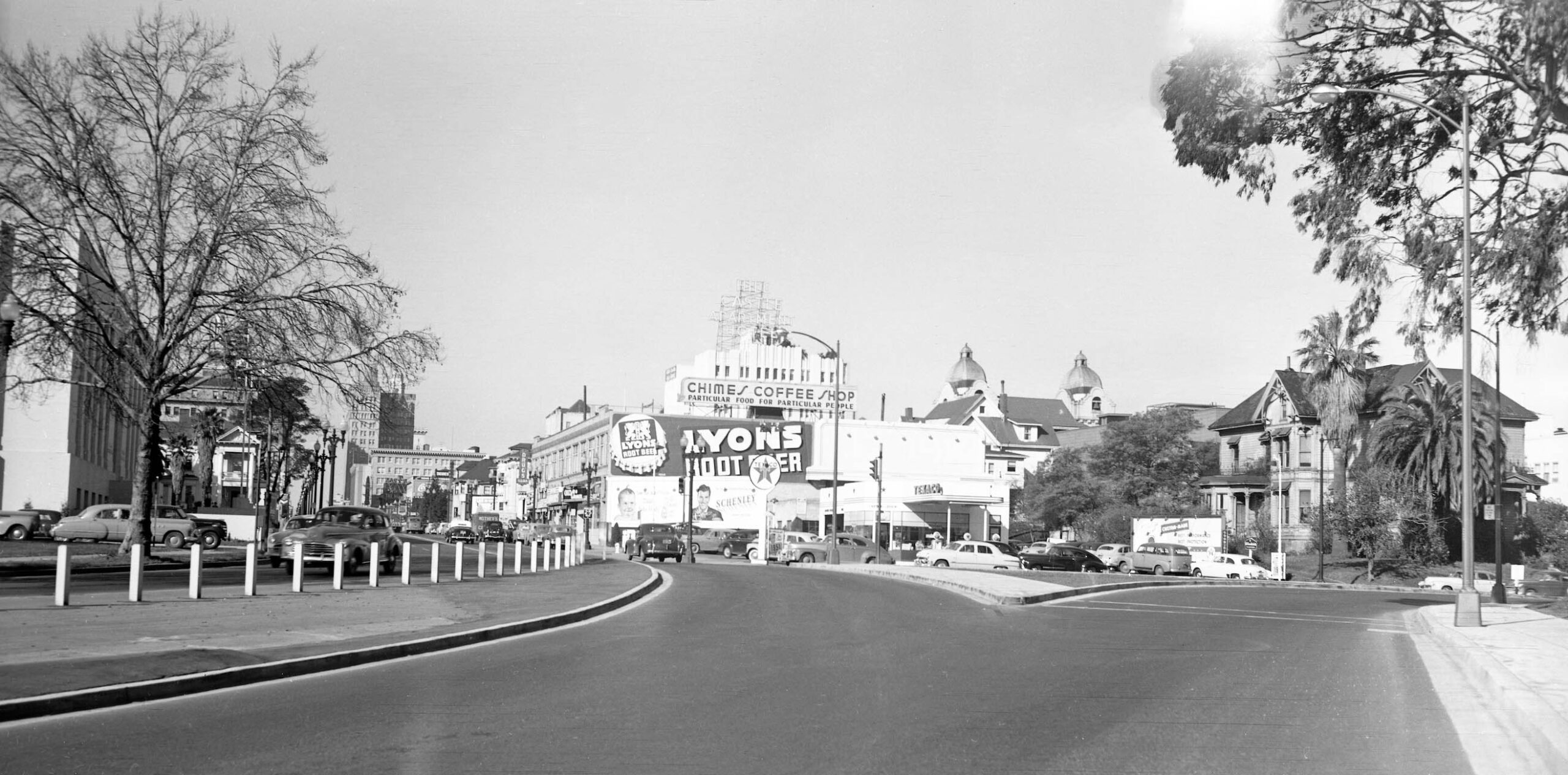
This northwest view closely matches the earlier version in L332-95, but here the roadway surface is finished, and the left edge includes the main branch of the Oakland Public Library. As for a date, the tree on the left has no leaves, the license plates are from 1950, but the sign on the ground below the round Texaco sign reads 1951.
L332-140-Oakland Public Works Photos, Courtesy BAERA, Western Railway Museum Archives, 238433ov, (Image 28 of 29)
Images collected from 1950 are now complete, and all the images of the westbound roadway found have been revealed. Back to Aug. 26, 1950, this east view points the discussion toward the east end of the next phase of the Frickstad Viaduct construction, to be tackled in the next update. Appreciation to Betty Marvin for the preservation and donation of the images.
L332-145-Oakland Public Works Photos, Courtesy BAERA, Western Railway Museum Archives, 235153ov, (Image 29 of 29)