E. 12th Street Cut, Hotel on the Move, and The Fate of the Frickstad Viaduct
A walk east on Lake Merritt Blvd. past the Lake Merritt inlet to where the road branches off to 1st Ave. and E. 12th St. is a cutout section to the south, left. On reaching 2nd Ave, diagonally across E. 12th St., is the handsomely bricked Lakemount Apartments, consisting of 66 units for independent living for seniors. Continuing on, across 2nd Ave. reveals a triangular empty space. These three items share one thing in common, that being the only traces of what existed during the Frickstad Viaduct era in Oakland.
L334-05-Stuart Swiedler Photos, (Image 1 of 29)

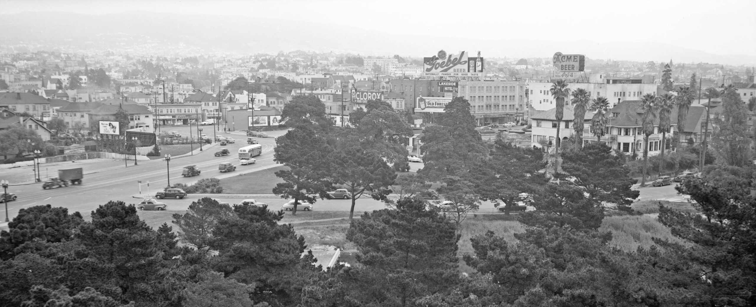
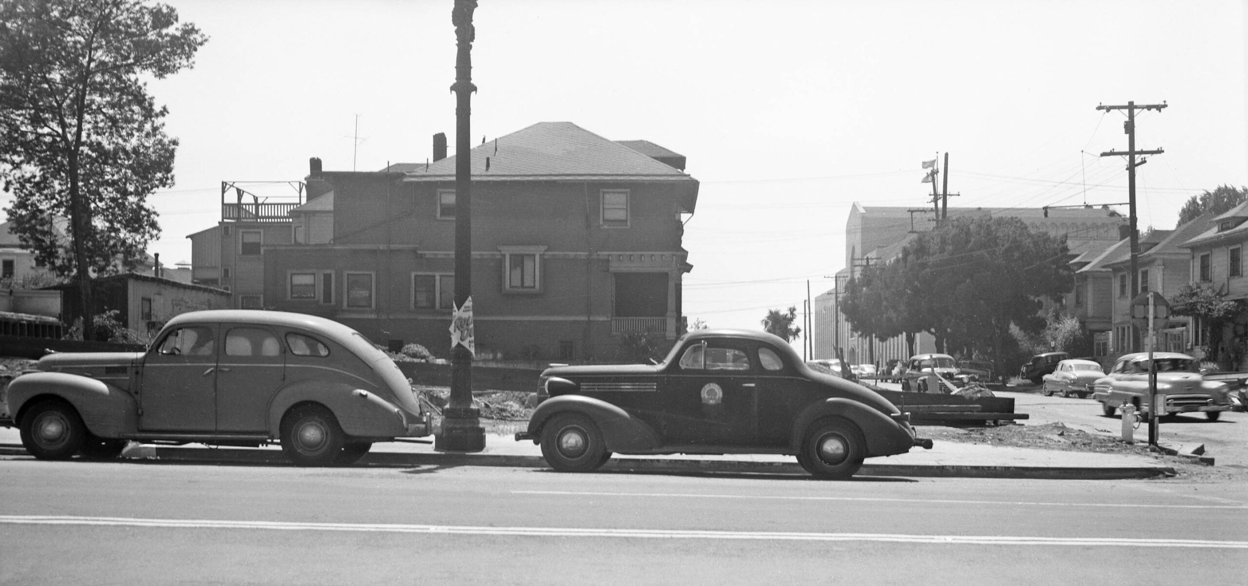
Back to the previous update and Apr. 17, 1951, an east view from the Oakland Civic Auditorium, the Henry J. Kaiser Center for the Arts in 2025, reveals two large signs for beer. On the north side of E. 12th St. is one for Goebel Beer on the Lakeside Hotel, and on the south side is one for Acme Beer on the Olympic Hotel. Note that by this date, the stucco has been removed from the lower section of the latter, and the adjacent lot has been cleared.
L334-10-Oakland Public Works Photos, Courtesy BAERA, Western Railway Museum Archives, 236022ov, (Image 2 of 29)
The last point is confirmed by this southeast view from E. 12th St. and 1st Ave. also taken on Apr. 17, 1951. This documents the formation of the cutout section mentioned initially. This image also confirms the building marked as the Lakeside Hotel, constructed in 1928, is the same brick structure that is the Lakemount Apartments in 2025.
L334-15-Oakland Public Works Photos, Courtesy BAERA, Western Railway Museum Archives, 235996ov, (Image 3 of 29)
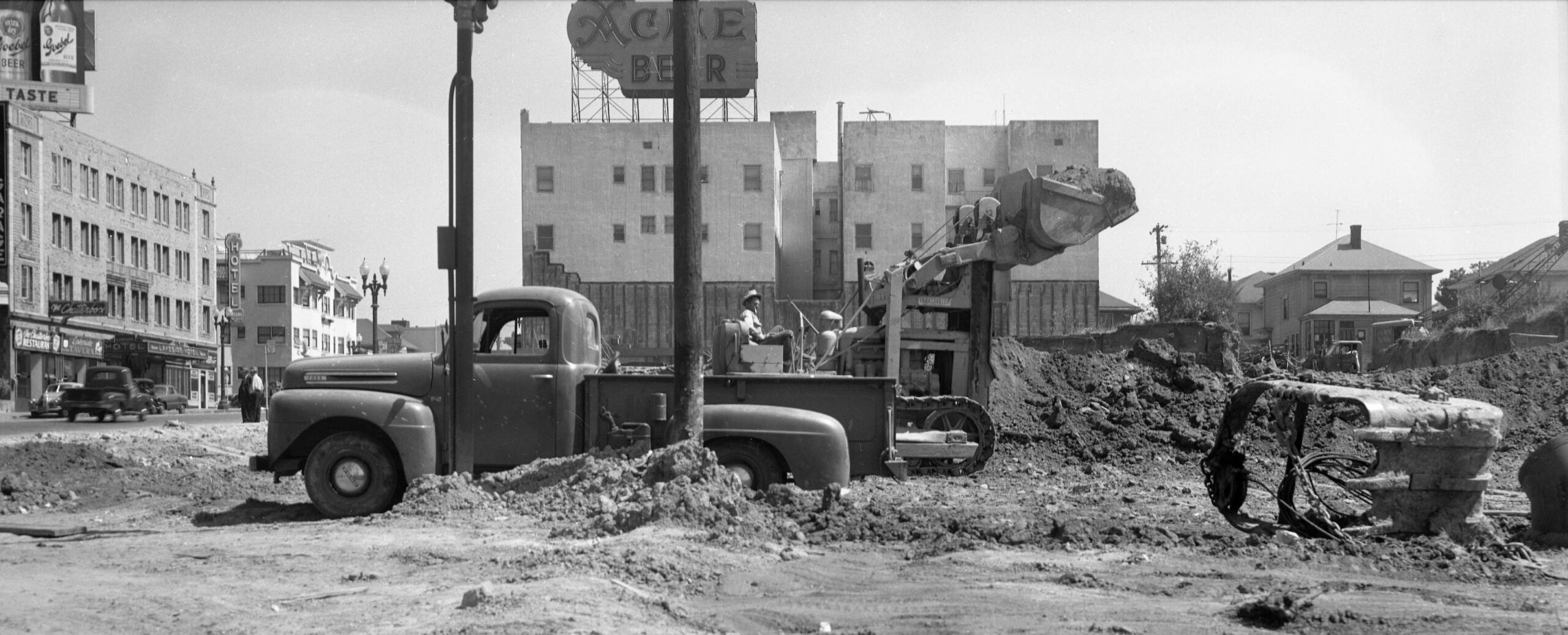
This northwest view of the the same two hotels on the same date from E. 12th St. at 2nd Ave. shows that the same beer signs have the names of the hotels on the reverse side.
L334-20-Oakland Public Works Photos, Courtesy BAERA, Western Railway Museum Archives, 235990ov, (Image 4 of 29)
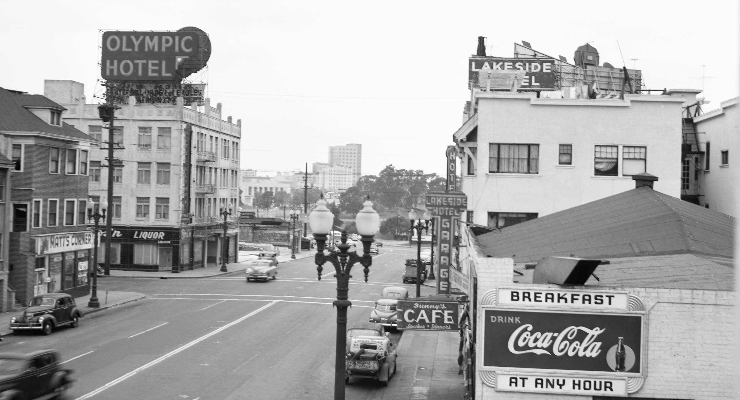
Across 2nd Ave. from the Olympic Hotel, this composite northwest view of two images shows the clearing of the third lot from the corner of E. 12th and 2nd Ave. The headquarters of the Oakland Unified School District on 2nd Ave. seen in the background, left, is a useful marker of the area. The building housing Matt’s Corner and the adjacent building on E. 12th St. will be history soon as well. Stay tuned.
L334-25-Oakland Public Works Photos, Courtesy BAERA, Western Railway Museum Archives, 235996ov, l, 235995ov, r, (Image 5 of 29)
This tripartite panel shows the relationship of E. 12th St. prior to the creation of the Viaduct, left, after its completion, center, and after the Viaducts removal, r. The central panel from 1965 accounts for how the road was widened by making the two cuts introduced in the opening panel of this presentation.
L334-30-Harrison Ryker Photo V5-142, Courtesy California Department of Transportation, l, cas-65-130_6-196, Courtesy of UCSB Library Geospatial Collection, c, and Google Maps, r, (Image 6 of 29)
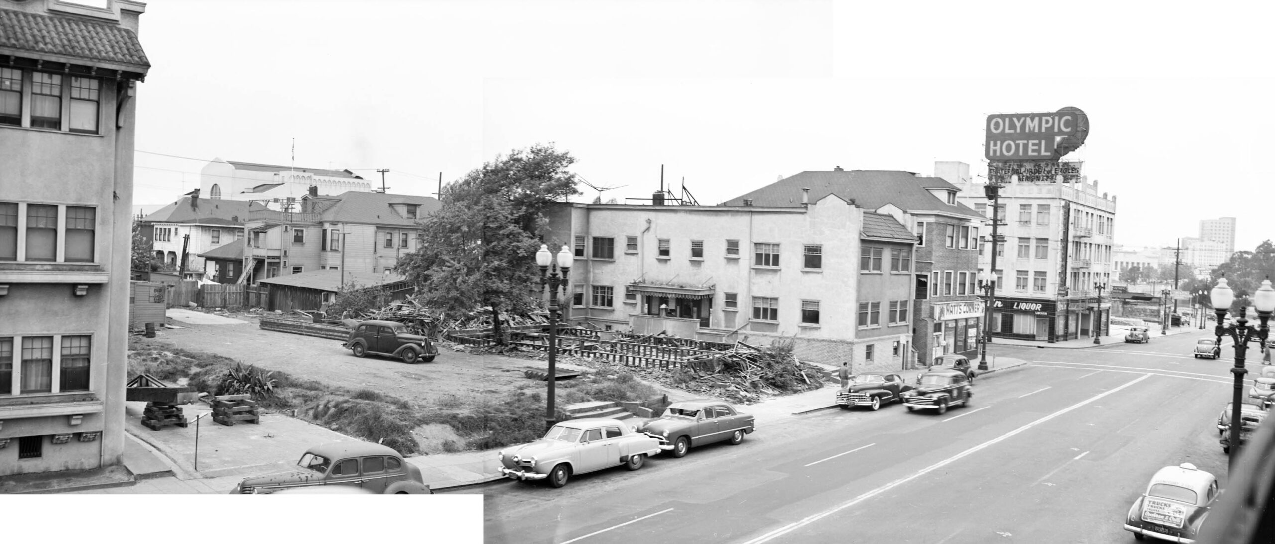
Ahead to Aug. 16, 1951, and as noted earlier, the building housing Matt’s Corner and the adjacent building on E. 12th St. are now gone, southwest view down 2nd Ave. with the headquarters of the Oakland Unified School District in the background.
L334-35-Oakland Public Works Photos, Courtesy BAERA, Western Railway Museum Archives, 237038ov, (Image 7 of 29)
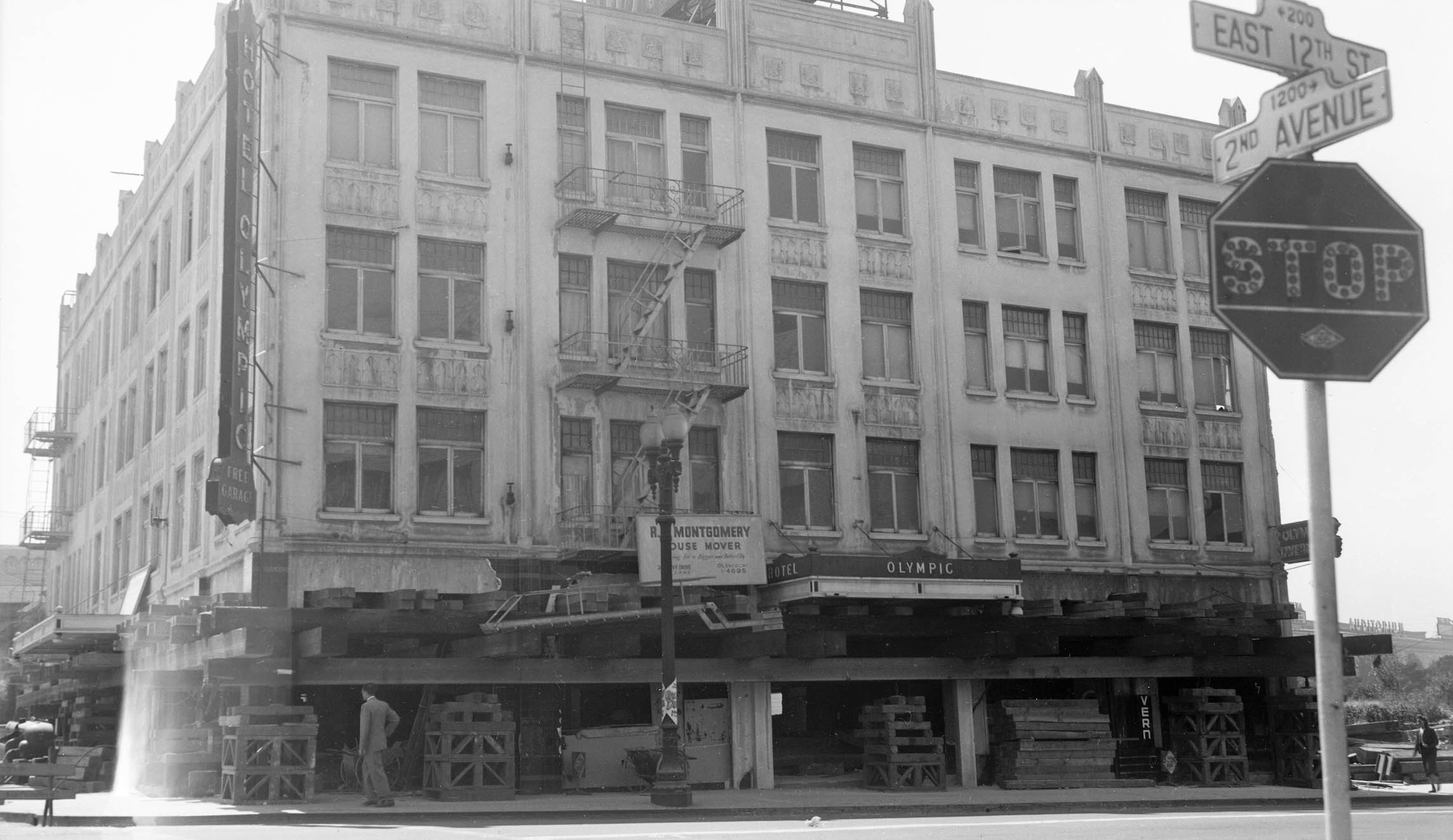
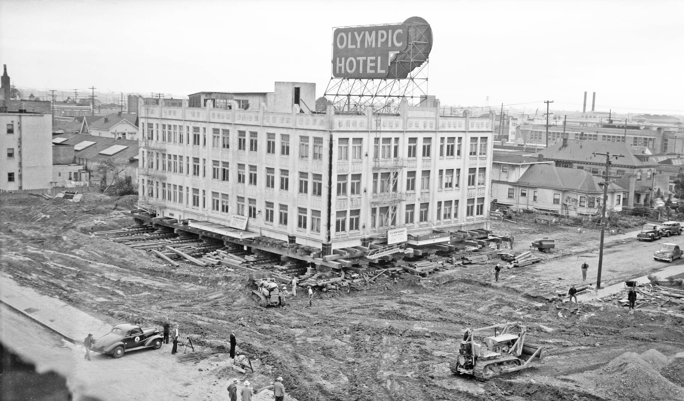
On the same date, this east view at the Olympic Hotel shows the structure has been lifted from its foundation. The posted sign indicates that R. B. Montgomery will be moving the structure. Recall the same mover relocated the house at nos. 1223-1225 1st Ave. featured in the previous update. A June 26, 1961 history of the hotel in the Oakland Tribune starts by stating “A perambulating hotel which inspired grandiose schemes may soon vanish from the face of Oakland.” By 1961 it was windowless and forlorn.
L334-40-Oakland Public Works Photos, Courtesy BAERA, Western Railway Museum Archives, 237037ov, (Image 8 of 29)
The hotel was built in 1928 with 72 rooms and four commercial spaces. In 1947, the City of Oakland purchased the property for $240k to allow widening of E. 12th St. R.B. Montgomery purchased the building in 1951 for $1000 with the idea to move it when the city ordered its removal. Two investors pledged $500k to fix up the structure.
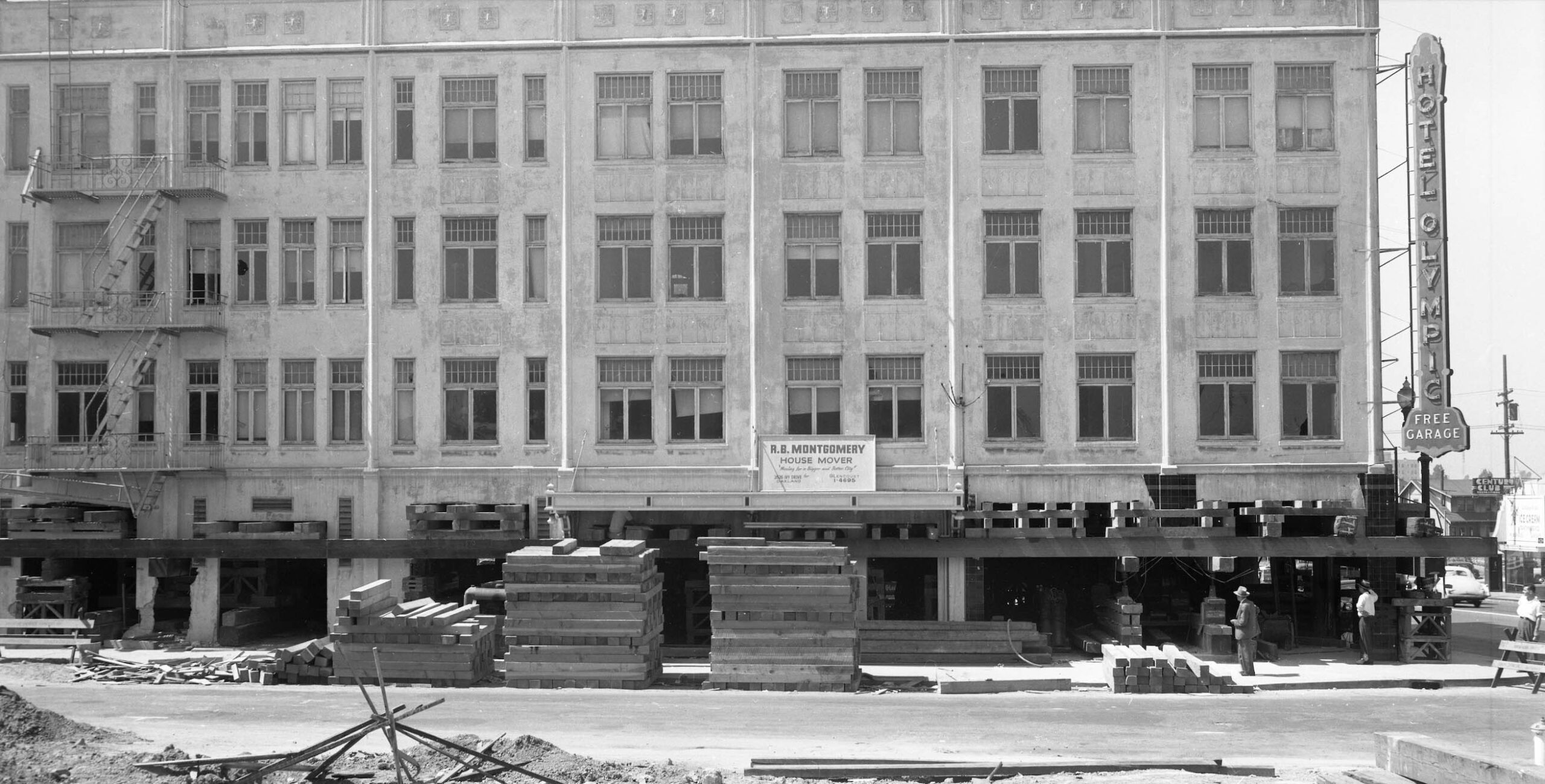
L334-45-Oakland Public Works Photos, Courtesy BAERA, Western Railway Museum Archives, 237040ov, (Image 9 of 29)
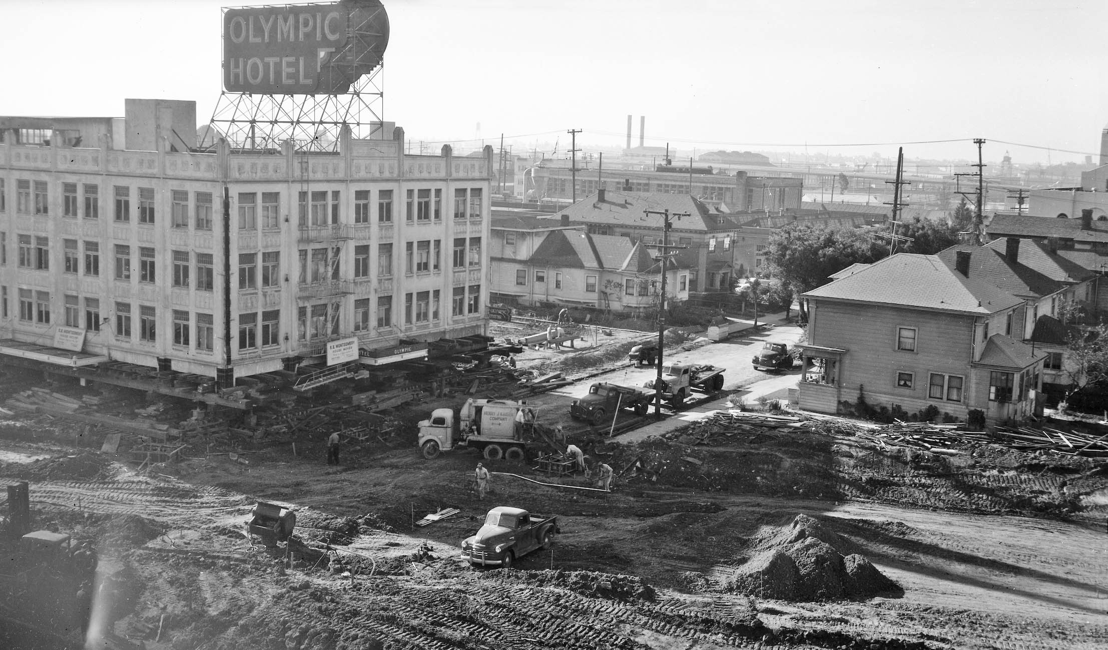
Montgomery cleared out the first floor and placed the structure on 600 seven-inch rollers and rotated it ninety degrees across 2nd Ave. as seen in this southeast view ca. 1952. The new position of the beer sign relative to E. 12th. Is the result of this event. The move cost Montgomery and two partners $50k, plus $51k for the land along 2nd Ave., and $75k for a new foundation. The house to the right and none of the structures across E. 12th St. on the left of this image survive in 2025, but all were untouched by the widening of the street.
L334-50-Oakland Public Works Photos, Courtesy BAERA, Western Railway Museum Archives, 237045ov, (Image 10 of 29)
Another view, this to the south, of the moved structure ca. 1952 is shown here. According to the Tribune article, the idea to refurbish the hotel disappeared quickly, as did several other possibilities, even as a county Municipal Court Building to be rented for $7500 per month after improvements would be made by the owners totaling $100k.
L334-55-Oakland Public Works Photos, Courtesy BAERA, Western Railway Museum Archives, 237047ov, (Image 11 of 29)
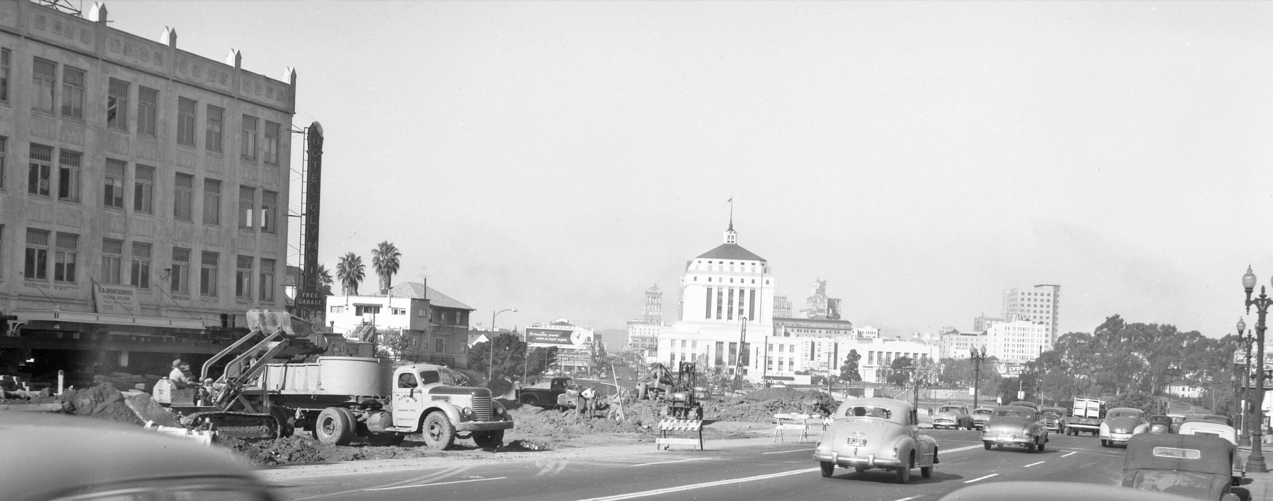
Another south view ca. 1952 where the triangular shape created for the widened E. 12th St. can be appreciated. In 1959, the vacant building was sold to Zellerbach and Associates of San Francisco, who would let the building stand idle. The firm requested that the property be rezoned from light industrial to general business to facilitate remodeling it into an apartment-office complex. None of this transpired, and the building was condemned by the city and razed in 1961. None of the houses seen in this image survive in 2025.
L334-60-Oakland Public Works Photos, Courtesy BAERA, Western Railway Museum Archives, 237046ov, (Image 12 of 29)
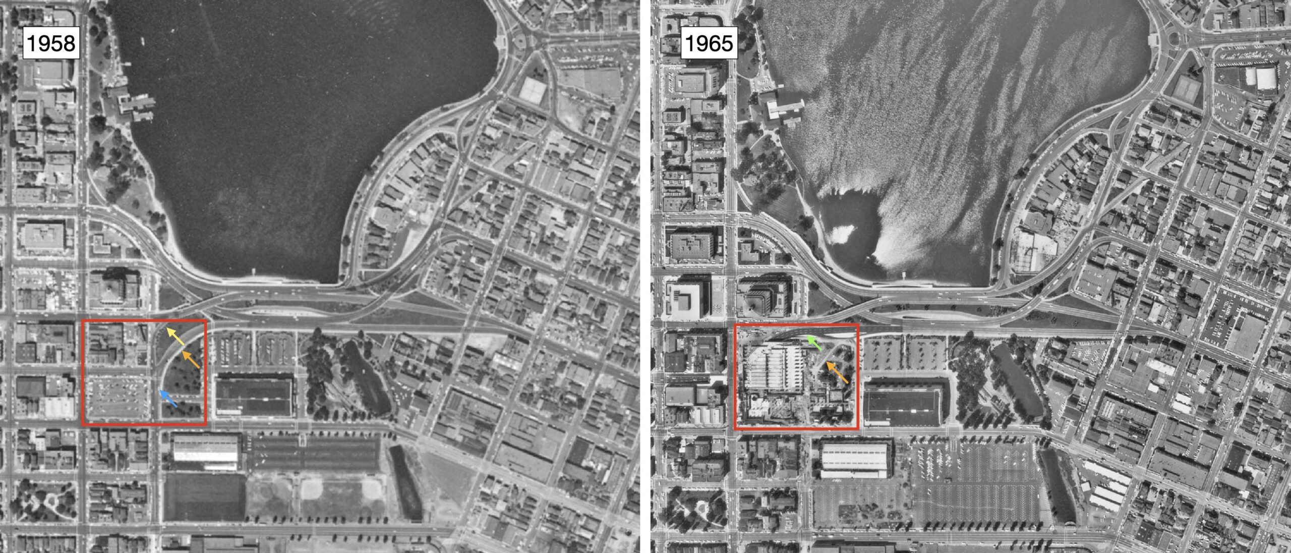
The legacy of that triangular portion of land created for the Viaduct seen in this ca. 1952 west view is that it will support two affordable apartment projects whose construction continues into 2025. The land had been classified a city owned “remainder parcel” said to be left over from Measure DD after completion of the road realignment in 2013, but this update shows it is actually a remnant of the Viaduct construction. For more about the new projects click here.
L334-65-Oakland Public Works Photos, Courtesy BAERA, Western Railway Museum Archives, 237048ov, (Image 13 of 29)
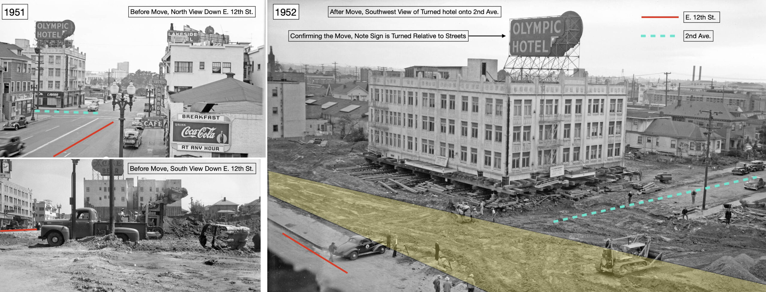
The move of the hotel is summarized in this composite panel.
L334-67-Oakland Public Works Photos, Courtesy BAERA, Western Railway Museum Archives, 235990ov, top l, 235996ov, bottom, l, 237047ov, r, (Image 14 of 29)
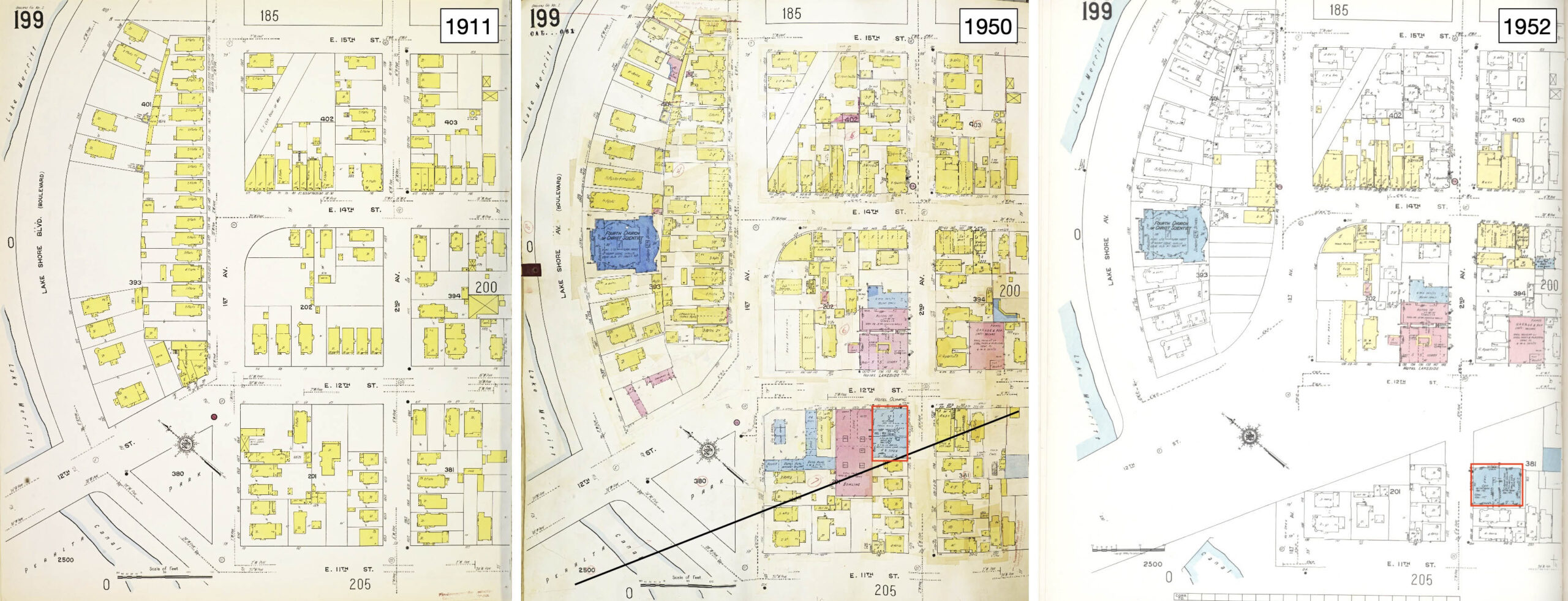
These Sanborn maps are provided to also document the creation of the tangential cut made to E. 12th St. between 1st. Ave. and 3rd Ave., with the loss in properties indicated by the black line in the middle panel from 1950, and the rotation of the hotel, red rectangles.
L334-70-Library of Congress, Geography and Map Division, Sanborn Maps Collection, Panel 199 from 1911 Vol. 2, l, 1911 - Nov 1950 Vol. 2 , c, 1911; Republished 1952 Vol.2, (Image 15 of 29)
Aerial views confirm the movement of the hotel, red rectangle, from its original position as seen in the aerial from 1937, left, after it was moved, as seen in the aerial from 1958, center, and the space filled by a new structure, as seen in the aerial from 1965, right. The latter building still stands as the Lakeview Towers Apartments, built in 1965 with 81 market-rate rentals open to all.
L334-75-Harrison Ryker Photo V5-142, Courtesy California Department of Transportation, l, but-1958_4v-78, c, cas-65-130_6-196, r, Courtesy of UCSB Library Geospatial Collection, (Image 16 of 29)
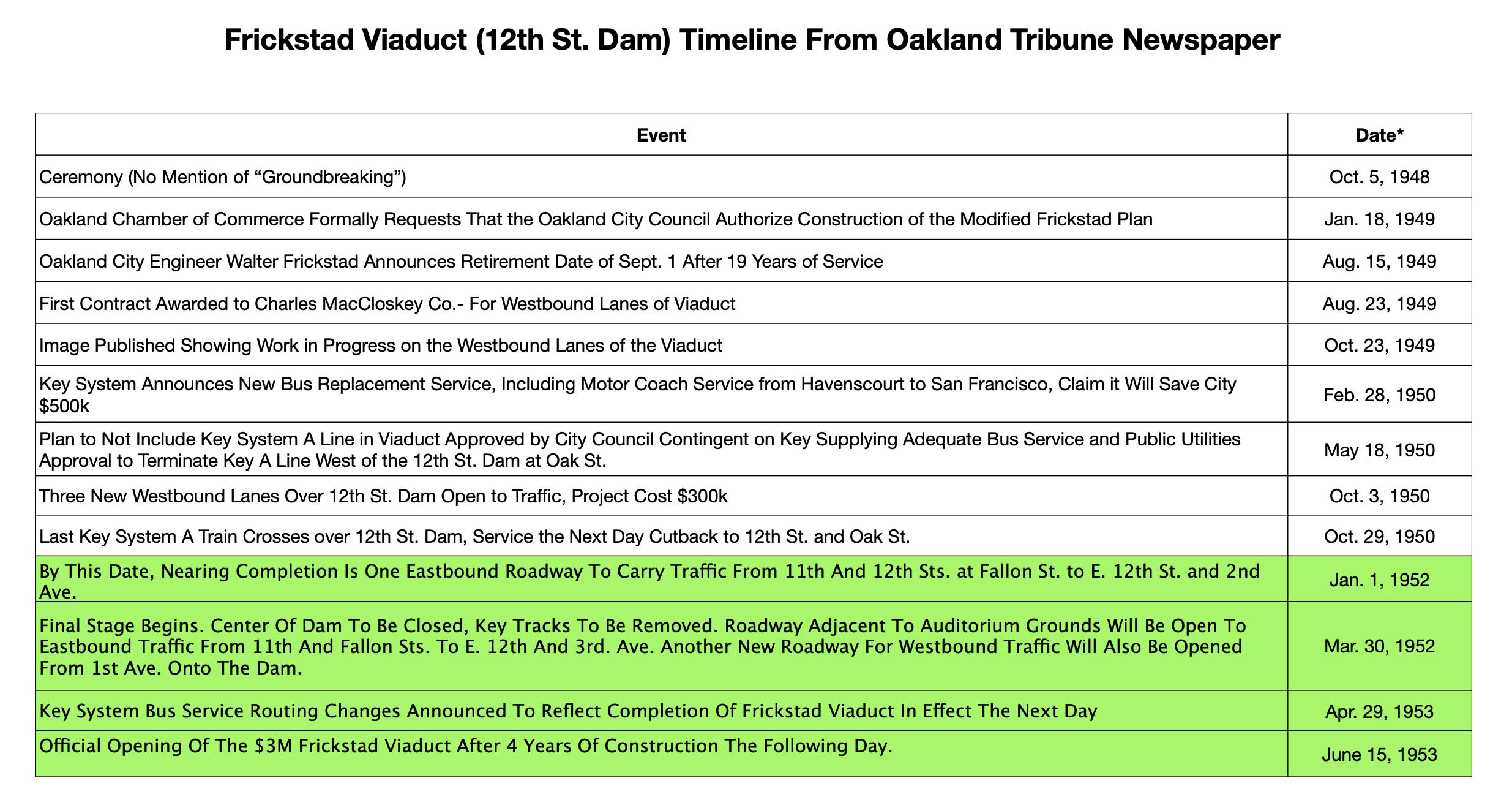
From the updates so far, aside from the new westbound lanes of the Frickstad Viaduct, the majority of the construction of the more complex elevated roads of the Viaduct were not begun until 1952 when the central portion of the road including the Key System tracks were cleared.
L334-80-Table Constructed by Stuart Swiedler, (Image 17 of 29)
Unfortunately, few images were recovered on this construction once 1952 began. The northwest image shown here taken from the roof of the Civic Auditorium from May 1952 is consistent to the benchmark listed in the last summary panel, “By This Date, Nearing Completion Is One Eastbound Roadway To Carry Traffic From 11th And 12th Sts. at Fallon St. to E. 12th St. and 2nd Ave.” Note work on the pedestrian underpass is still in progress.
L334-85-Oakland Public Works Photos, Courtesy BAERA, Western Railway Museum Archives, 237052ov, (Image 18 of 29)
This north undated view shows the completed pedestrian underpasses is now completed.
L334-90-Oakland Public Works Photos, Courtesy BAERA, Western Railway Museum Archives, 237061ov, (Image 19 of 29)
No ground images of the alterations made to the segment of Lakeshore Ave. between E. 12th St. and E. 15th St. could be found, but this three-part aerial survey shows how these corners have been altered with time. In 2025, the cul-de-sac created at the E. 12th St. side, green box, no longer allows through traffic on this segment.
L334-95-Harrison Ryker Photo V5-142, Courtesy California Department of Transportation, l, cas-65-130_15-113, Courtesy of UCSB Library Geospatial Collection, c, and Google Maps, r, (Image 20 of 29)
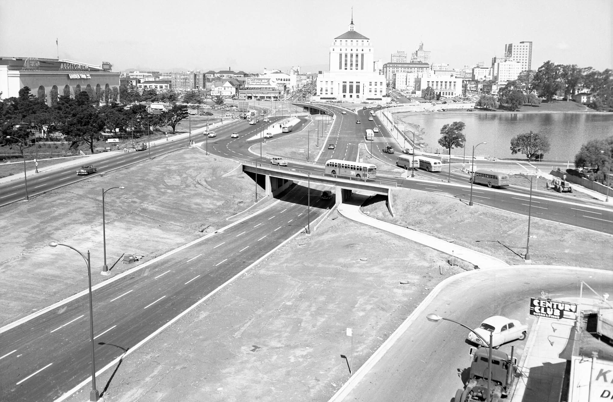
This west view shows the completed Frickstad Viaduct after it opening in mid-1953. At this point the islands of land between the road lack any landscaping or finishing elements. Whatever good it did to improve traffic flow, the road rearrangement was not pedestrian friendly and eliminated significant access to the lake.
L334-100-Oakland Public Works Photos, Courtesy BAERA, Western Railway Museum Archives, 237062ov, (Image 21 of 29)
The remainder of this presentation will summarize the major changes that occurred after the Viaduct was in place, a starting point depicted in the central aerial from 1958.
L334-105-Harrison Ryker Photo V5-142, Courtesy California Department of Transportation, l, but-1958_4v-78, Courtesy of UCSB Library Geospatial Collection, c, and Google Maps, r, (Image 22 of 29)
By April 24, 1954 when this southeast oblique aerial was taken, it was clear that auto and truck drivers would soon have an alternative to the Viaduct to get through Oakland using the under construction Highway 880. With the Key System Building at 11th and Broadway as a marker, red arrow, the highway still did not extend northwest of Broadway, green arrow.
L334-110-Copyright California Department of Transportation, 3800-3, (Image 23 of 29)
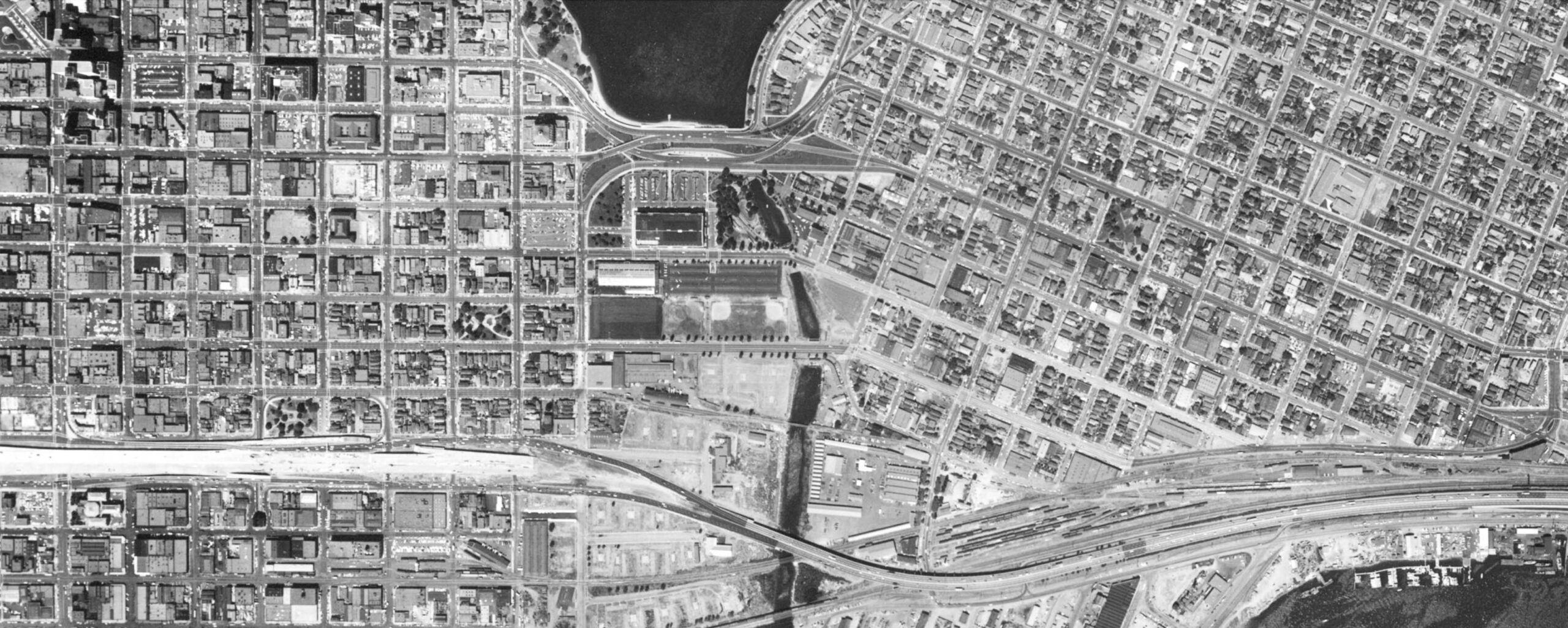
The aerial from 1958 shows the new Highway 880 is just about completed through downtown Oakland, and from this point on the new Viaduct did not stand a chance to compete.
L334-115-but-1958_4v-79, Courtesy of UCSB Library Geospatial Collection, (Image 24 of 29)
The utility of the new Viaduct took a second hit when Highway 580 was completed by Lake Merritt in the early 1960s. This southeast view from July 12, 1960 shows the beginnings of the new route taking shape by the lake. With traffic now able to bypass the Viaduct using Highways 580 and 880, it was just a matter of time before Oakland residents would want improved access and utilization of Lake Merritt reinstated and the Viaduct removed.
L334-120-Copyright California Department of Transportation, 7584-4, (Image 25 of 29)
Although it only had a minor impact, the construction of the Oakland Museum of California erased Fallon St. between 10th St. and 12th St., blue arrow, and the eastbound and westbound lanes feeding into the Viaduct, orange and yellow arrows, respectively, left. Replacement of the eastbound connection, orange arrow, right, was made by placing an underground route under the museum that connected with 12th St., green arrow, right, that remains in place in 2025.
L334-125-but-1958_4v-79, Courtesy of UCSB Library Geospatial Collection, (Image 26 of 29)
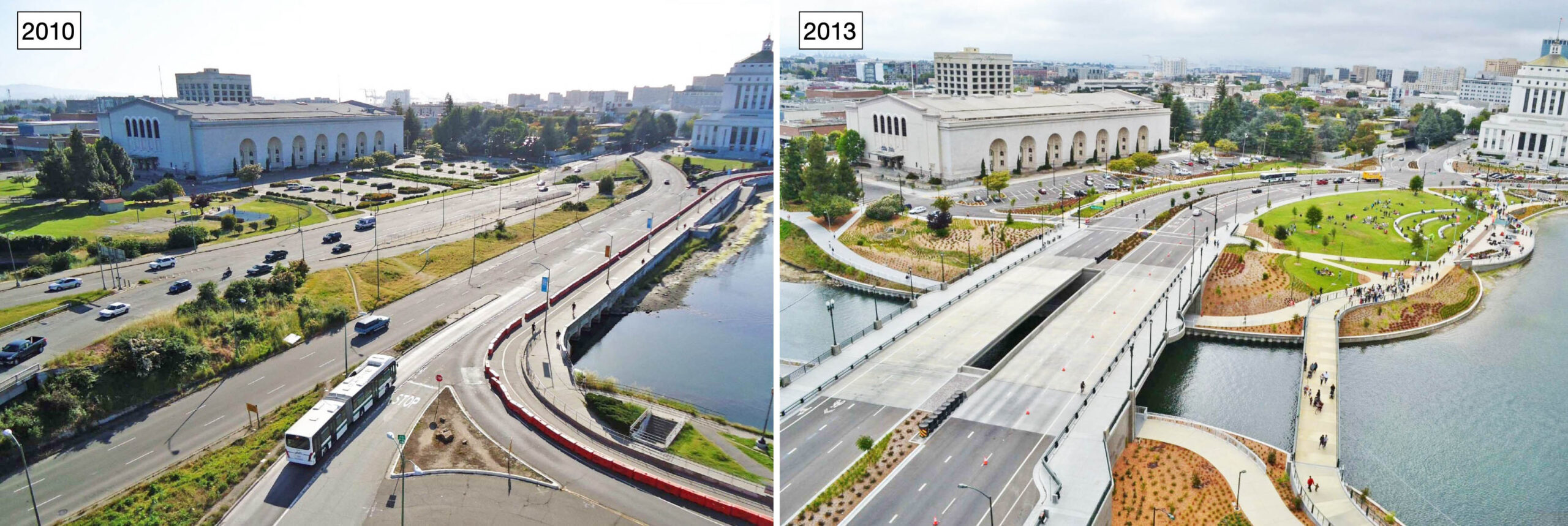
In 2002, Oakland voters passed Measure DD, authorizing $198,250,000 in bonds to create the Oakland Trust for Clean Water and Safe Parks. The Frickstad Viaduct was simplified along with the removal of the 12th Street Dam and culverts, construction of paths, and creation of the amphitheater. This construction was completed between 2010 and 2013. Erik Niemann’s before-and-after images from May 7, 2010, left, and 2013, right, shown here capture the transformation. Check out his blog for a lot of additional history, click here, and for his stunning time-lapse presentation of the entire reconstruction process, click here.
L334-130-Erik Niemann Photos, Courtesy Erik Niemann, (Image 27 of 29)
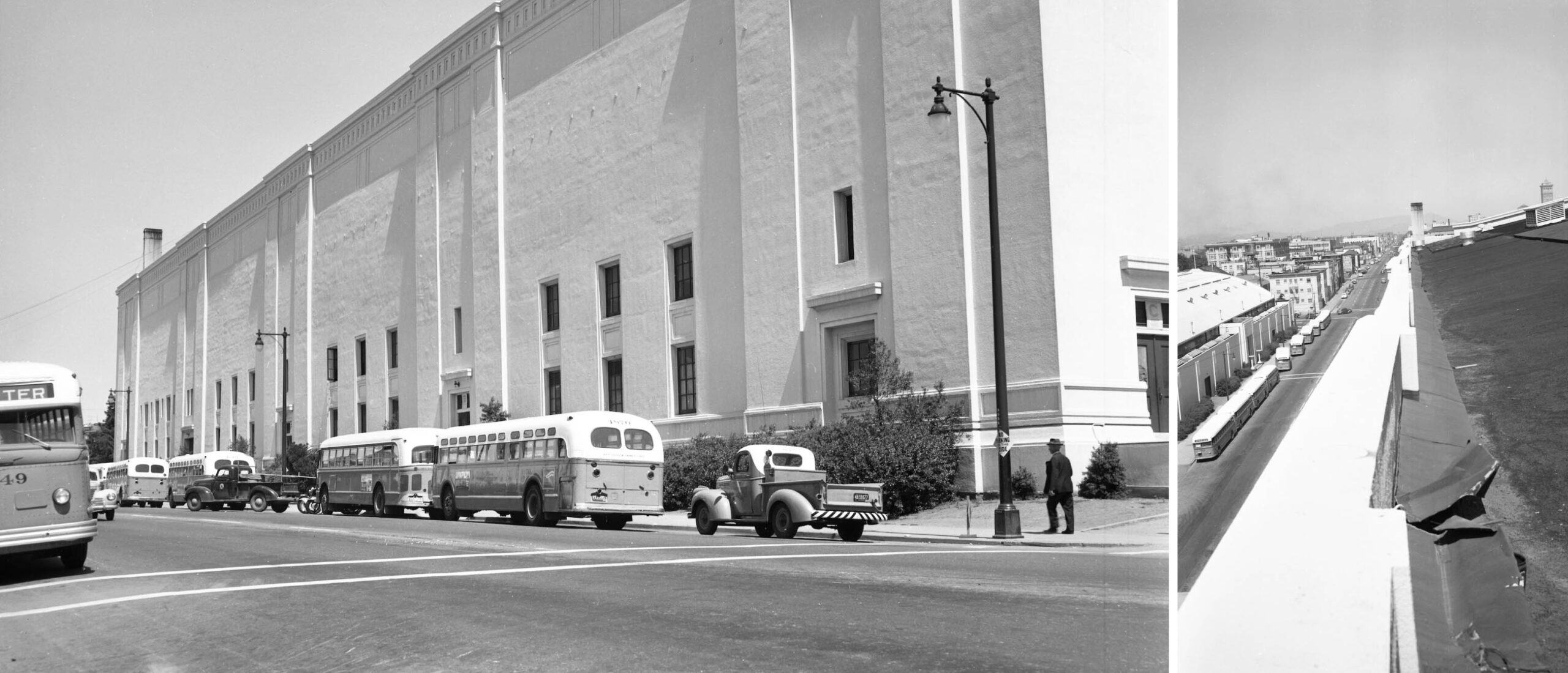
Some additional images found with those of the road construction from May 1952 are presented here for general interest. The south facing wall of the Oakland Civic Auditorium along 10th St. is featured on the left, and a west view down 10th St. from the Auditorium roof is shown on the right. The building partially visible on the left margin was the Oakland Exposition Building.
L334-135-Oakland Public Works Photos, Courtesy BAERA, Western Railway Museum Archives, 237055ov, l, 237053, r, (Image 28 of 29)
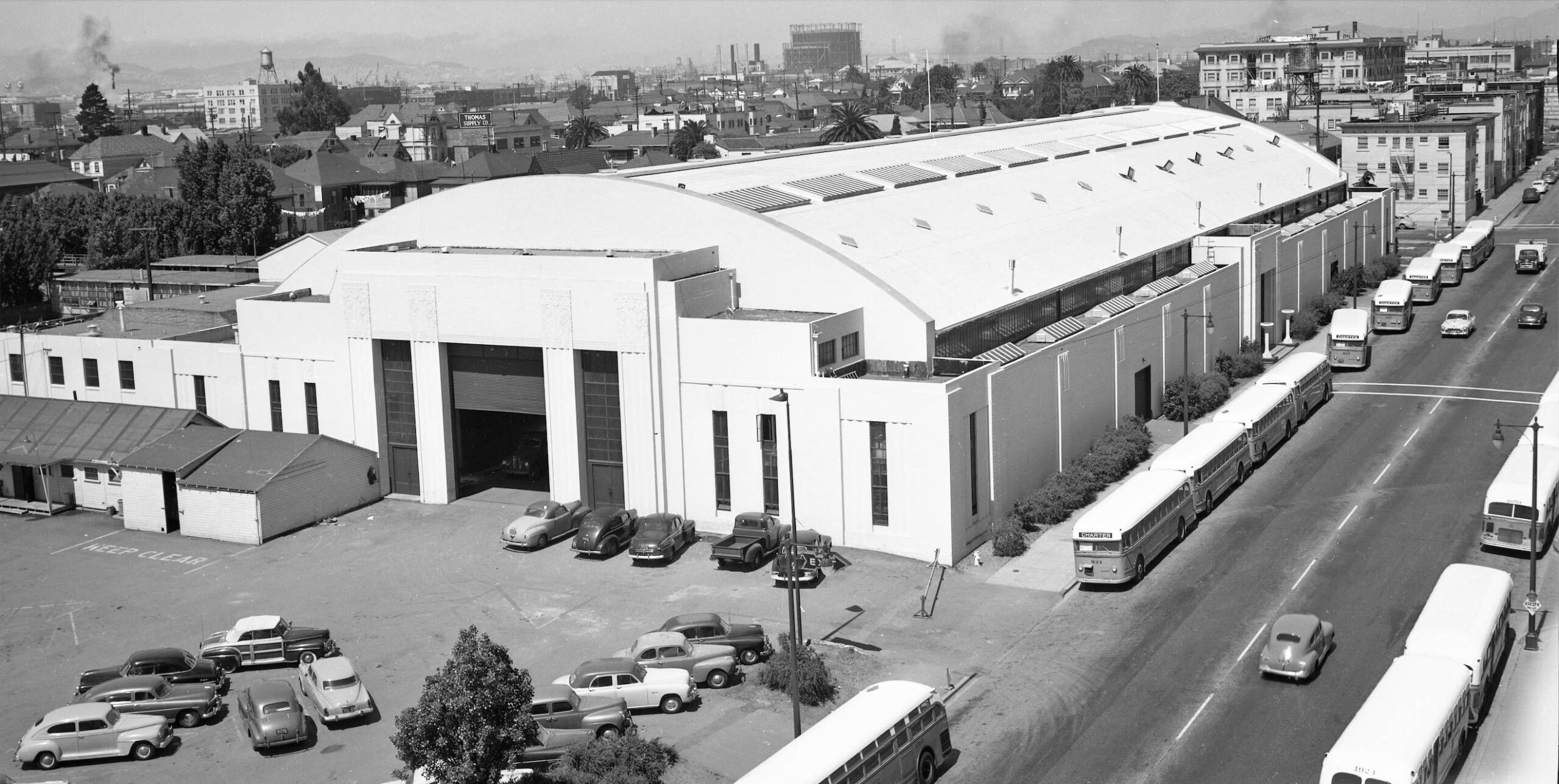
The presentation concludes with a southwest view of the Exposition Building. It was built in 1931 with Walter Reed and William Corlett as architects. Between that date and the late 1960s, it hosted a variety of shows, and Laney College eventually took over the land after the building was razed. For more information about the building, click here. Appreciation to Betty Marvin for the preservation and donation of the images, and to Erik Niemann for his images.
L334-140-Oakland Public Works Photos, Courtesy BAERA, Western Railway Museum Archives, 237056ov, (Image 29 of 29)