Constructing the Key Route to Northbrae and Westbrae
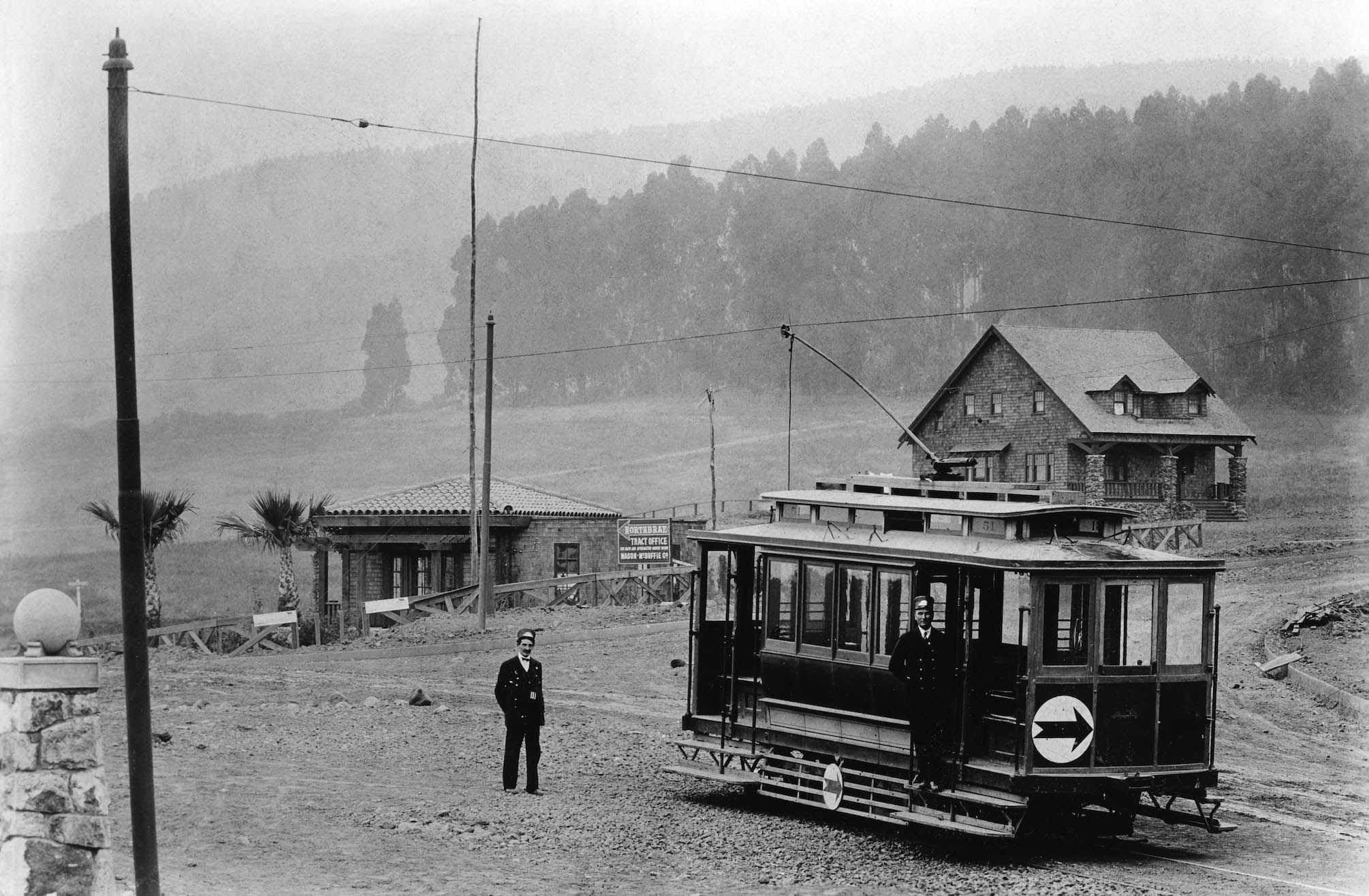
No better picture gets an update started about the incentive to bring electric rail travel to Northbrae and Westbrae than this northeast view of Oakland Traction car no. 51 owned by Borax Smith and Frank Havens’ Realty Syndicate stopped alongside the Mason-McDuffie Northbrae Tract office and the house at 1919 Marin Ave. Vernon Sappers “Key System Street Cars” Signature Press, 2007, dates this northeast view of the Oakland Traction Northbrae or Grove St. line streetcar at The Alameda and Monterey Ave. to ca. 1909.
L344-05-Vernon Sappers Collection, Courtesy BAERA, Western Railway Museum Archives, 256248ks, (Image 1 of 34)

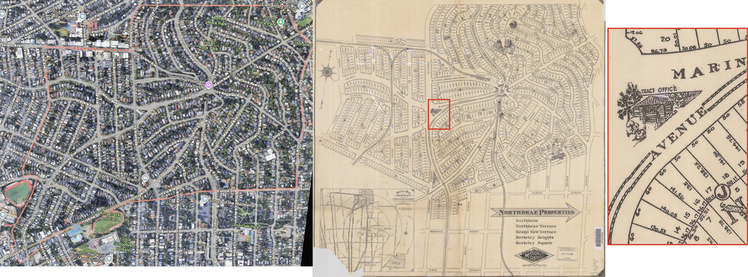
The 2026 Google Maps search for Northbrae provides the generally accepted neighborhood outline on the left, slightly larger than the tract being developed by Mason-McDuffie starting in 1907, center. The structure boxed in red in the triangular-shaped parcel at the intersection of The Alameda, Monterey Ave. and Marin Ave. is the Mason-McDuffie Northbrae Tract office shown previously. The pencil notation at the bottom right of the the map in the center dated 1909 should be 1912 to include the Southern Pacific, SP, Oakland, Alameda and Berkeley electric line and the Oakland Traction streetcar with two tracks on Arlington Ave.
L344-10-Courtesy Google Maps, l, and University of California, Berkeley Library Digital Collections, G4364_B5_G46_1909_M3, r, (Image 2 of 34)
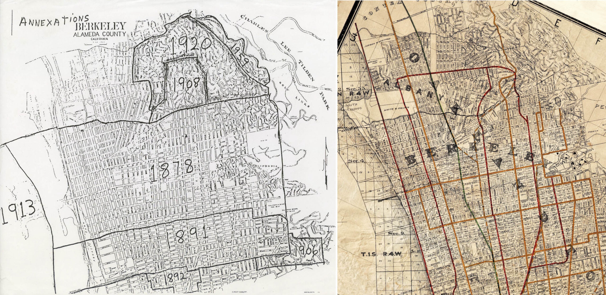
The planned Northbrae development got a boost as it was incorporated into Berkeley in 1908 as seen on the incorporation date map for the City of Berkeley on the left. No wonder the area became the focal point of three SP electric lines, red, an Oakland Traction Co. streetcar, solid orange line, and Key Route electric line, broken orange line by 1912-1913 based on the map on the right.
L344-15-Courtesy Daniella Thompson, l, Map Published By Realty-Bonds And Finance Co., Courtesy John Bosko, (Image 3 of 34)
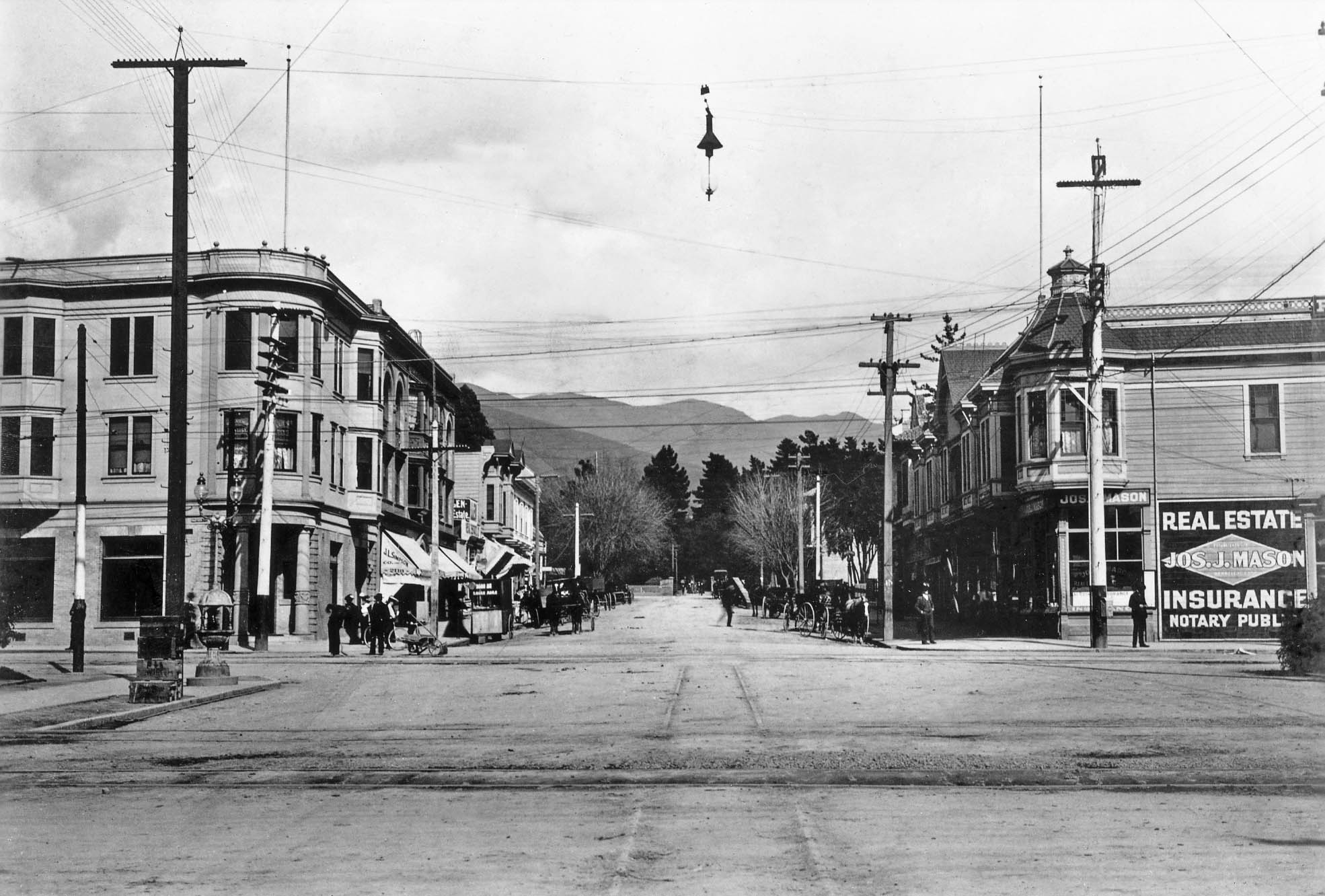
British-born Joseph J. Mason came to the US in in 1869, and in 1887 moved to Berkeley to start a real estate and insurance business. This east view ca. 1905 shows his office at 2161 Shattuck Ave. and Center St. In 1906, the building was replaced by the Wright Block, designated a City of Berkeley landmark in 2003. After some success, he hired Duncan McDuffie, six years out of UC Berkeley and working in a credit department, to join the firm, and the 1906 earthquake convinced two more to join from San Francisco, one being future Governor of California, C. C. Young. Thanks to Daniella Thompson for the building history.
L344-20-Herrington-Olson Colection 8-17231, Courtesy BAERA, Western Railway Museum Archives, 133257, (Image 4 of 34)
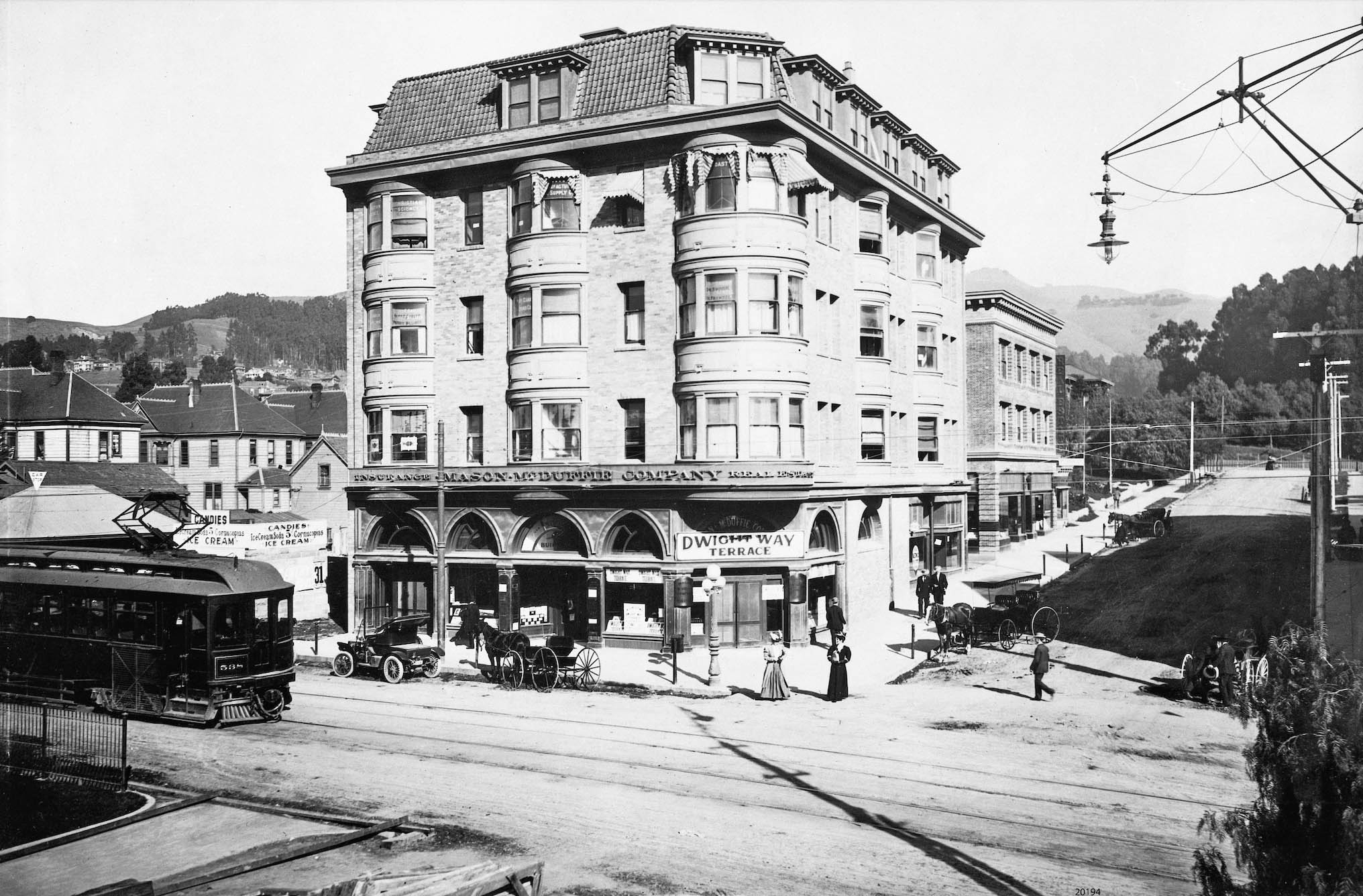
In 1906, the firm moved to the northeast corner of Shattuck Ave. and Addison St., shown here in a northeast view with Key Route Shattuck line car KS 538. The Studio Building was built in 1905 and is still around in 2026, its name preserved in the tiled floor entry. As Berkeley architectural historian Susan Corny has written, “The structure is distinctive because it is the only one with a tile mansard roof and rounded window bays. The first-floor storefront bays were built as a series of alternating rounded and pointed arches, some of which have since been covered.” For more building information from this author, click here.
L344-25-Sappers Collection, Courtesy BAERA, Western Railway Museum Archives, 20194ks, (Image 5 of 34)
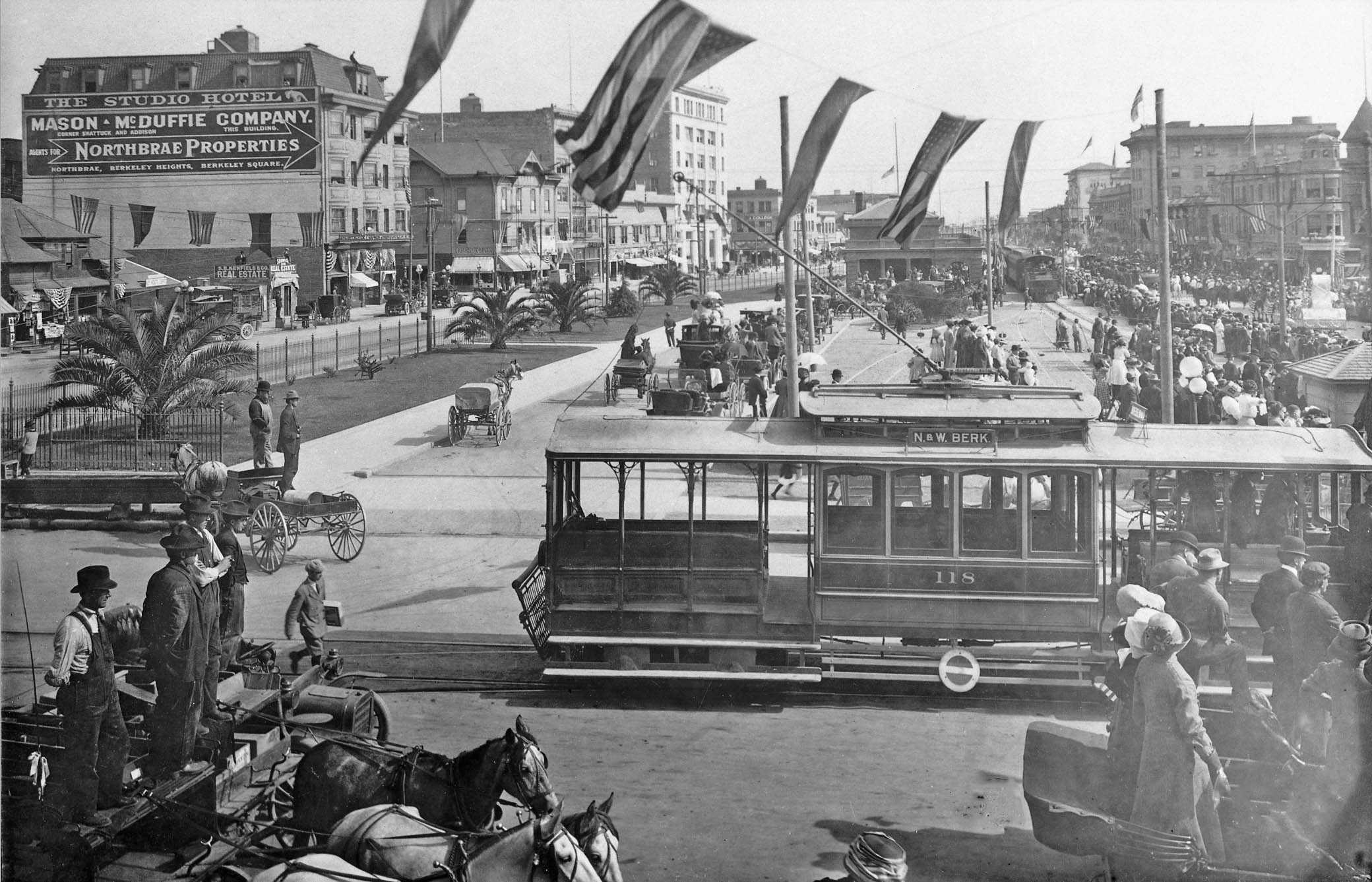
ason-McDuffie stayed in The Studio Building until 1928, by which time they had built the residential neighborhoods of Northbrae, Claremont and St. Francis Wood, all employing the best architects and landscape designers to blend the houses with the outdoors. This ca. 1910 south view of an unknown celebration at Shattuck Ave. and University Ave. shows the new SP station with steam train above Oakland Traction car 118. The modest Key Route depot is seen on the left, to the left of Kenfield and Co. Real Estate. The history of Mason-McDuffie was extracted from a concise description that may be accessed by clicking here.
L344-30-Robert L. Stein Collection, Courtesy BAERA, Western Railway Museum Archives,50239ks, (Image 6 of 34)
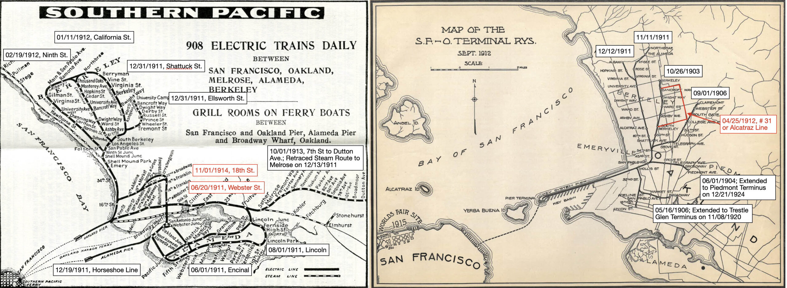
Next to turn to these electric railway 1912 maps with other important later extensions added for the SP, left and Key Route, right. The dates shown indicate when an individual line first ran to its terminal station on a regular basis according to Robert Ford’s “Red Trains in the East Bay” Interurbans Publications, 1977 for the SP, and Harry Demoro’s ”The Key Route”, Interurban Press, 1985 for the Key Route. In some cases streetcar shuttles were used for a time, or stations were added over time as in the case of the SP 7th St. line. The lines noted in red were streetcar lines deemed part of the rail lines systems used to link the main lines, the Key Route Alcatraz line highlighted with a red line.
L344-35-Courtesy BAERA, Western Railway Museum Archives, (Image 7 of 34)
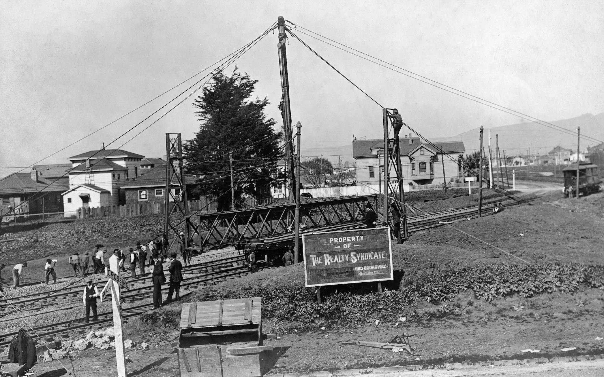
The rest of this presentation will focus on the construction and surrounding buildings for the Key Northbrae and Westbrae lines. The Key Berkeley lines were designed to leave Emeryville via a private right-of-way, PROW, along Linden St. shown here from 40th St. According to Demoro, interlocking Tower 3 was operational at the northeast corner of Yerba Buena Ave., then Spring St., and Adeline St. on May 11, 1910, left panel, to handle the Key Berkeley lines, and a future line to San Jose that never materialized.
L344-40-Key Official Photo, Sappers Collection, Courtesy BAERA, Western Railway Museum Archives, 262354ks, (Image 8 of 34)
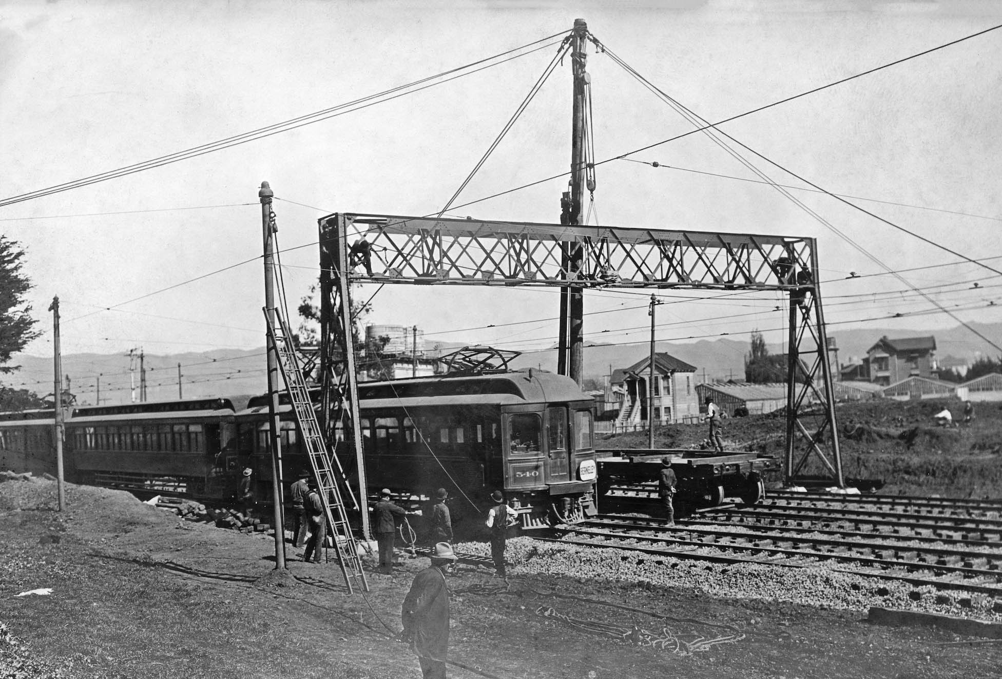
The date of the the last photo had to have been after Feb. 14, 1911, because the signal bridge above the tracks was added by that date. This north view on Linden St. captures the moments before adding the cross bridge structure over the PROW between 40th and 41st Sts. None of the houses in this image remain in 2026. The Realty Syndicate sign indicated who owned this railway. Back to Tower 3, by 1912 it would oversee up to 18 Key Berkeley trains per hour into the cut, 6 more per hour along Yerba Buena Ave. to Piedmont Ave., plus less frequent Sacramento Northern passenger trains and Oakland Terminal freights.
L344-45-Key Official Photo, Sappers Collection, Courtesy BAERA, Western Railway Museum Archives, 262255ks, (Image 9 of 34)
The new signal bridge is now in place in this northeast view on the PROW between 40th and 41st Sts. The structures seen behind the PROW have since been replaced, however note the green houses of Haselbacher’s Nursery that occupied most of 41st St. east of Linden St.
L344-50-Key Official Photo, Sappers Collection, Courtesy BAERA, Western Railway Museum Archives, 262258ks, (Image 10 of 34)
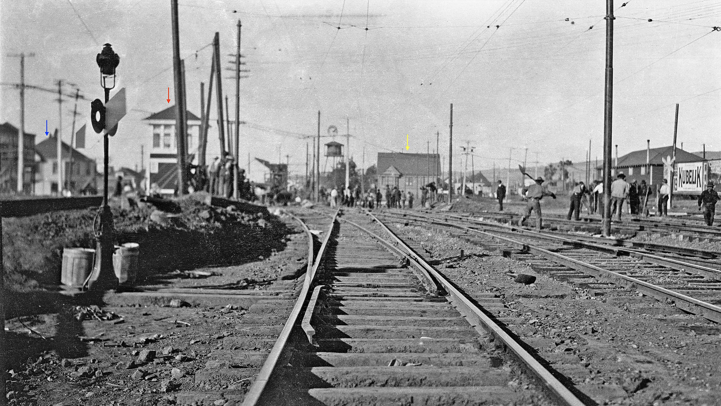
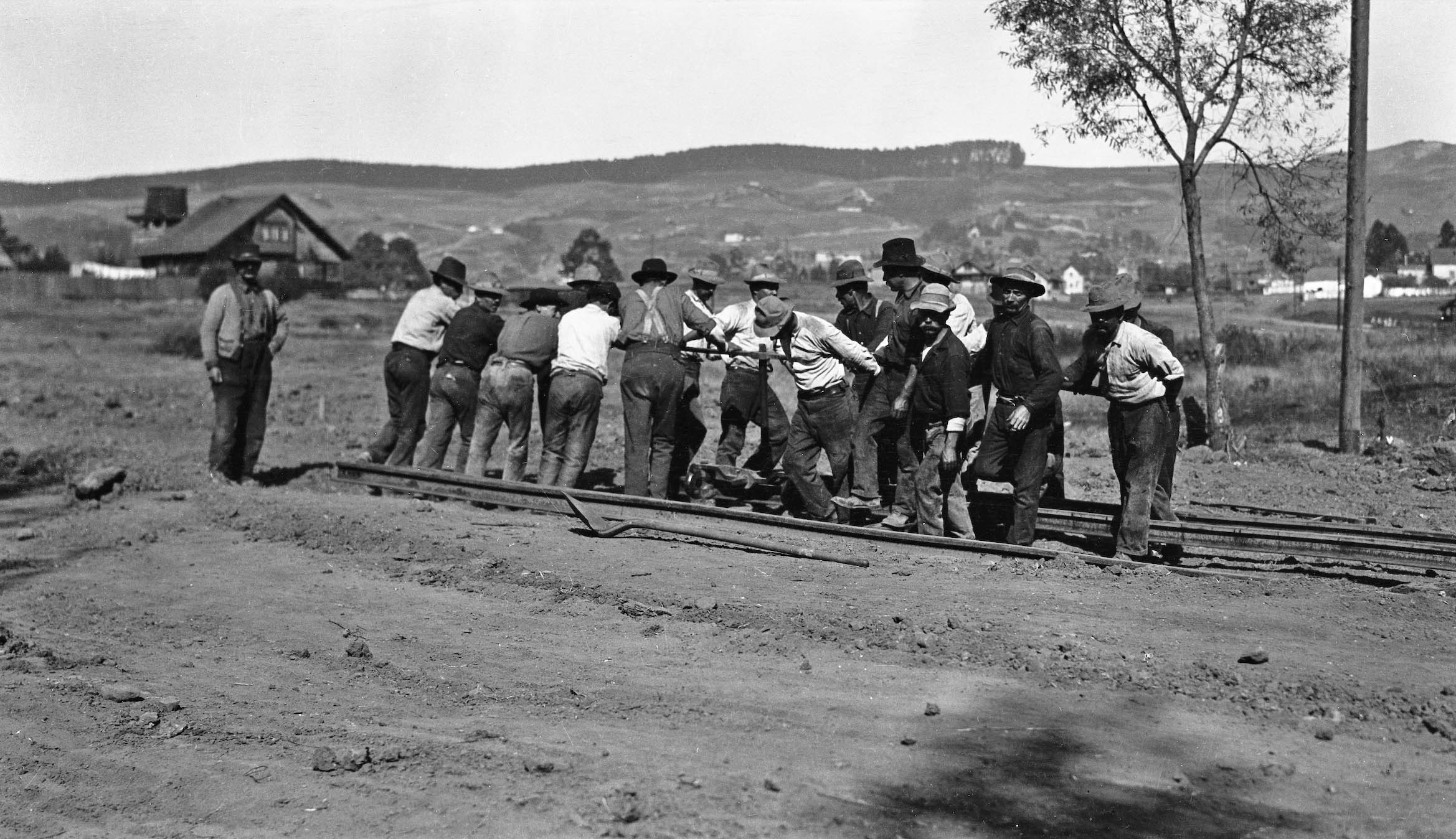
Now at 53rd St. and Adeline St., this north view from 1911 shows the crew working on the two tracks that will separate from the Shattuck line to head down Lowell St. Tower 4, red arrow, was added at this time to monitor the increased rail traffic. Two structures that remain in 2026 are no. 5301-5303 Lowell St., blue arrow, a market for many years that was converted to apartments, and no. 5403 Adeline St., yellow arrow, a residence that for most of the 20th century had storefronts along 54th St.
L344-55-Key VPO Photo, Sappers Collection, Courtesy BAERA, Western Railway Museum Archives, 55502ks, (Image 11 of 34)
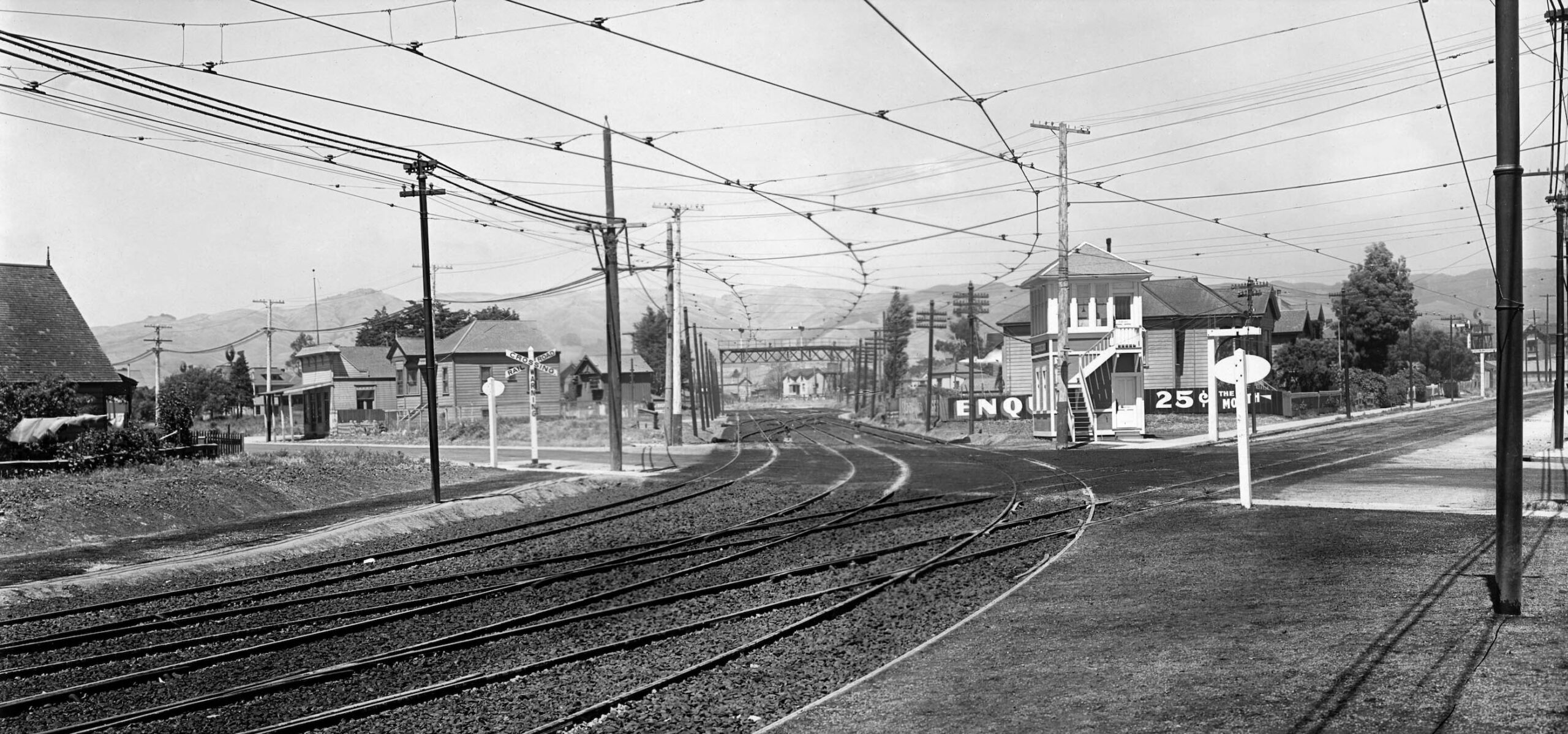
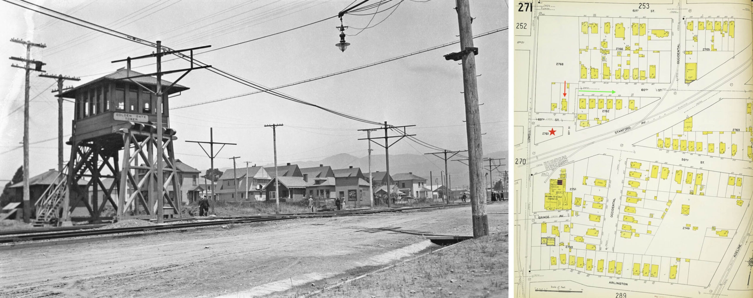
Now alongside the single track of the Atchison, Topeka and Santa Fe Railroad, SF, the northeast view at Stanford Ave., left, from Aug. 5, 1911 shows that the Key crossed the SP mainline to Shattuck Ave., at this point in early 1911 still a steam line. Note the poles for both the SP and Key are erected, but the overhead wires are not yet in place. Golden Gate Tower was manned by the SF, but at this point it was still not equipped to control the interlocking signals. The 1911 Sanborn map on the right points to houses still present in 2026; no. 944 60th St., red arrow, as well as four houses that still retain the High-Peaked Colonial Revival architectural style, green arrow.
L344-60-Louis L. Stein Collection, Courtesy BAERA, Western Railway Museum Archives, 29456ier, l, Library, (Image 12 of 34)
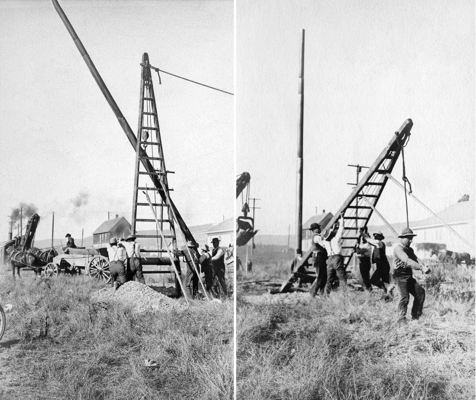
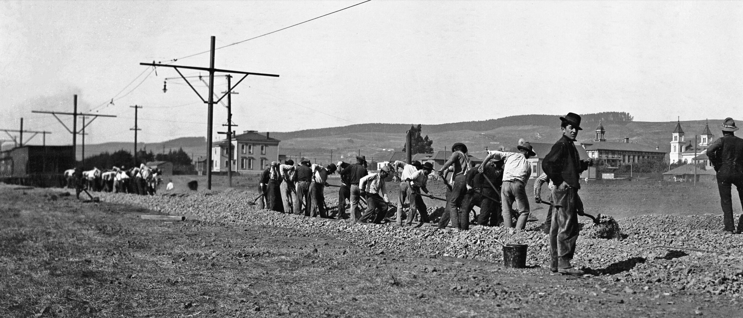
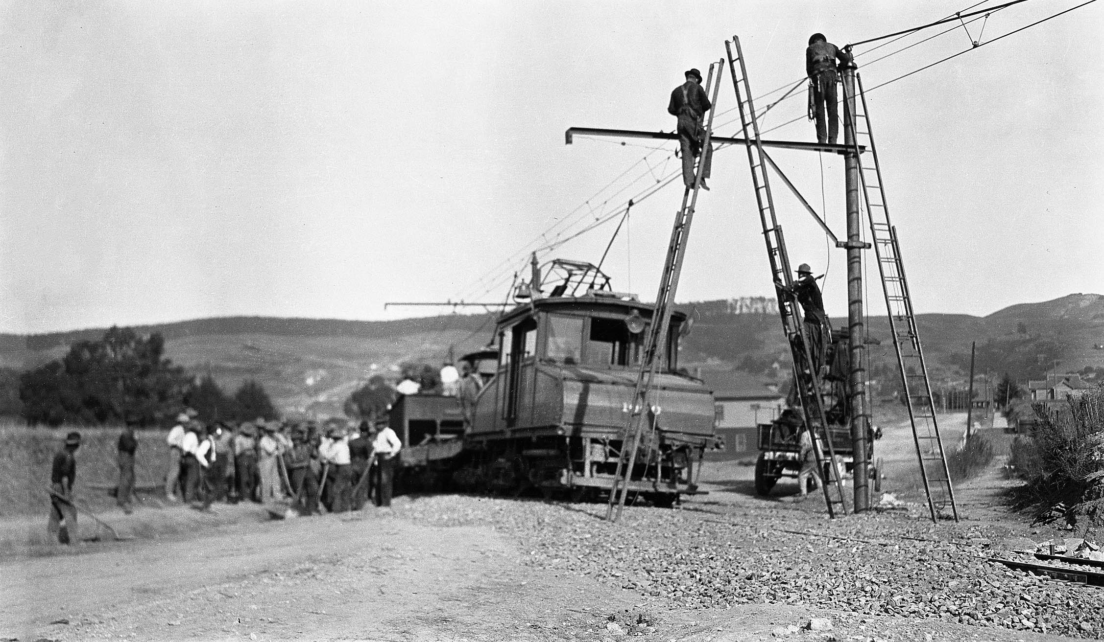
These northeast views further up the line in a place not identified are shown here just to appreciate the technique used to hoist the poles into place. Back to the Key Route, the mechanism by which the company secured a PROW on Lowell St. and Sacramento St. alongside the SF has not been determined. That is, did the Oakland and Berkeley see a benefit in having this configuration, or did the SF offer this as a payback to the Realty Syndicate for their previous efforts to obtain this former route of the California and Nevada Railroad, C&N, for them.
L344-65-Key Official Photos, Sappers Collection, Courtesy BAERA, Western Railway Museum Archives, 262251ks, l, 26252, r, (Image 13 of 34)
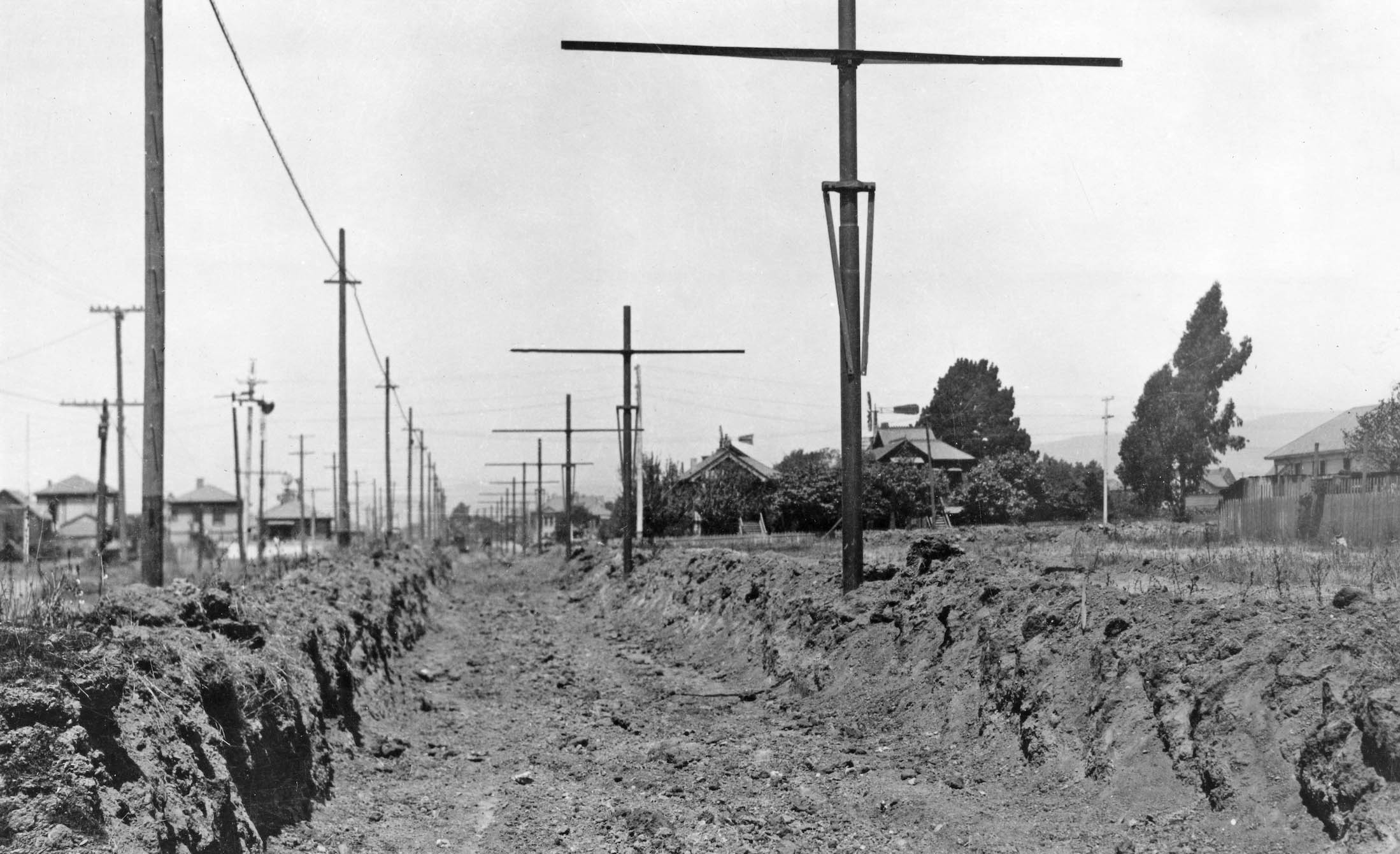
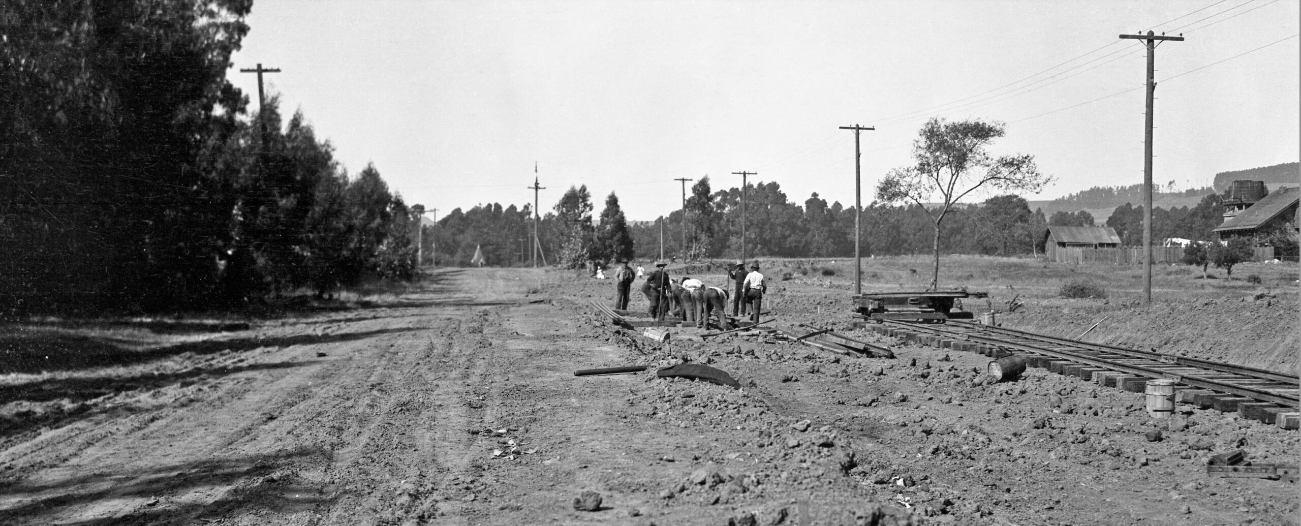
This north view from 1911 on Lowell St. appears to have been taken at around 61 St. It shows the depth of the trenches that would be filled with ballast along the PROW. The only clue that the SF track remains running alongside the route is the semaphore signal seen to the left of the trench. The poles between the SF and Key line would not be removed until the SF abandoned in 1979. None of these houses remain in 2026 as the area was primarily taken over by industrial buildings. The Sanborn map provided next shows the houses present in 1911-1912.
L344-70-Key Official Photo, Sappers Collection, Courtesy BAERA, Western Railway Museum Archives, 262254ks, (Image 14 of 34)
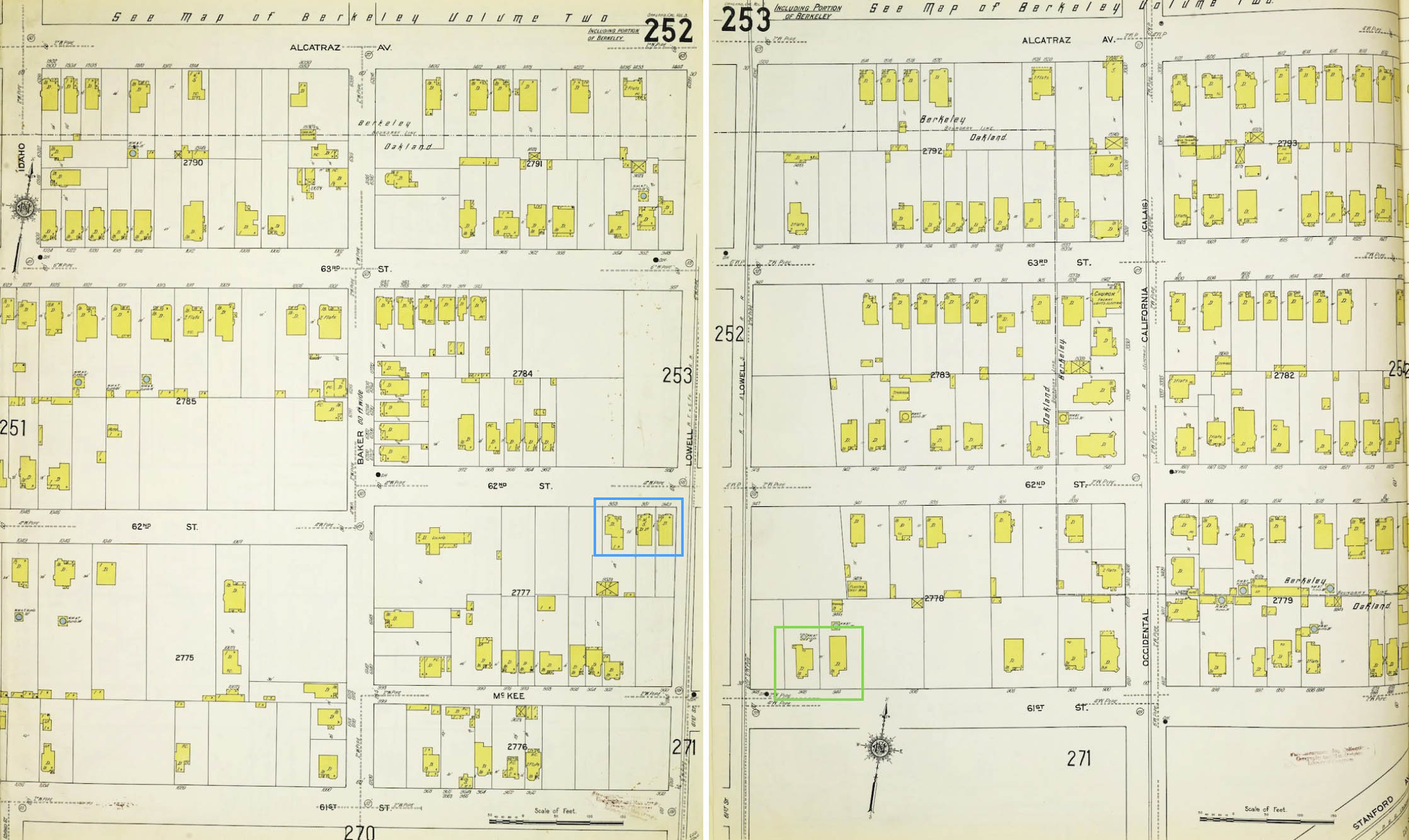
This Sanborn map from 1911-1912 is provided as the source of the house assignments in the previous image.
L344-73-Courtesy Library of Congress, Geography and Map Division, Sanborn Maps Collection, Sanborn Map Company, 1911 - 1912 Vol. 3, Panels 252 and 253, (Image 15 of 34)
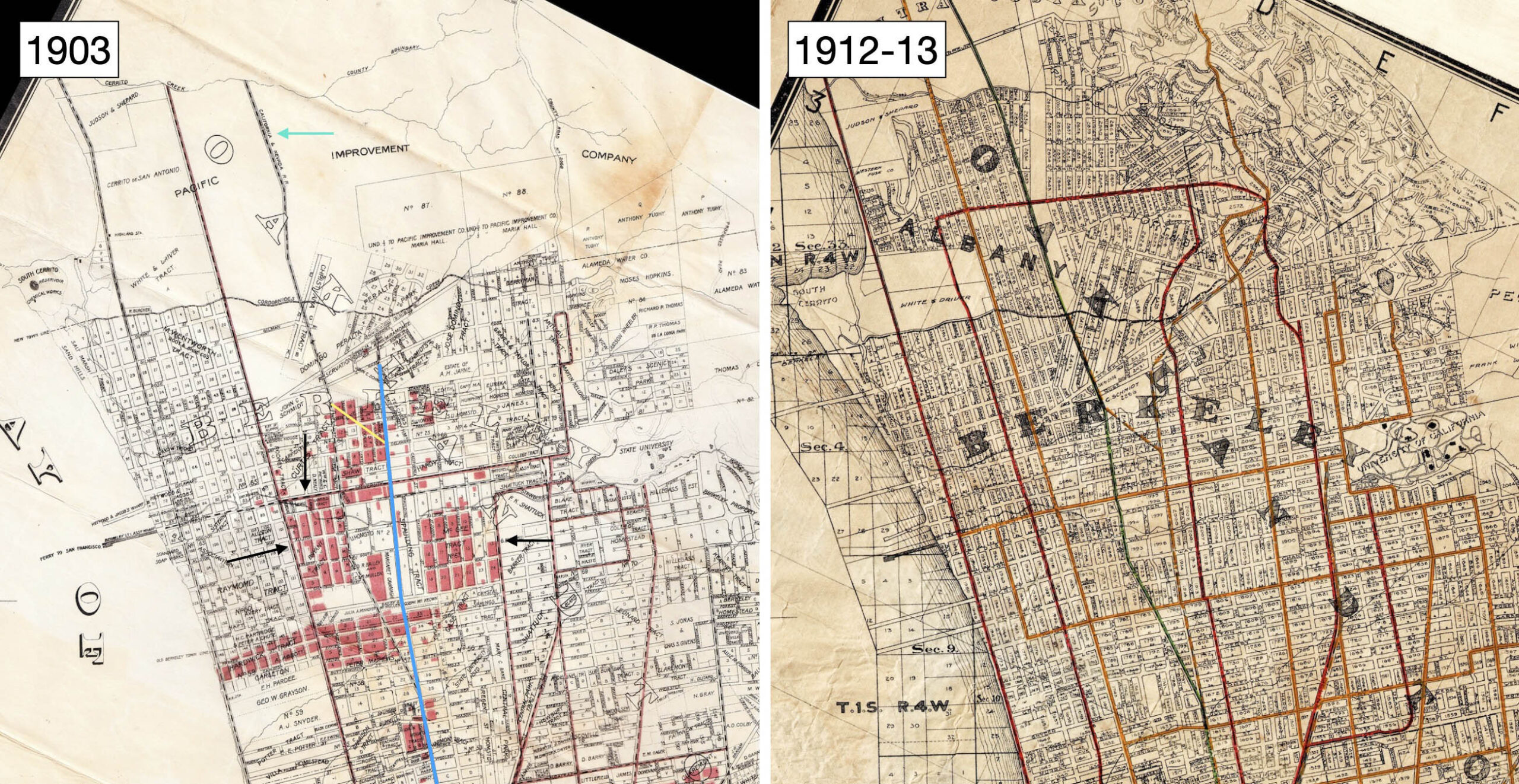
The previous update provided the 1903 map shown on the left to indicate properties owned by the Realty Syndicate highlighted in red in the Berkeley flats. The new railway construction was tailored to supply transportation to these properties, the blue line added here to indicate the path of the Northbrae line along Sacramento St., and the yellow line for the Westbrae line. Oakland Traction streetcar lines marked by the black arrows expanded transportation options to the area. However, Sappers notes that the SF’s nearby presence, turquoise arrow, as a steam railroad with a freight component discouraged buyers from the Syndicate’s properties. The 1912-13 map on the right is included for comparative purposes.
L344-75-Map of Oakland and Vicinity, Published by Woodson, Watson and Co., l, Map Published By Realty-Bonds And Finance Co., r, Courtesy John Bosko, (Image 16 of 34)
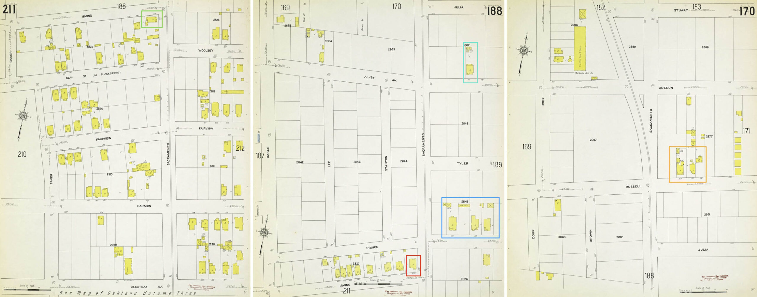
This north view from Aug. 6, 1911 is the first in Berkeley, at Sacramento St. and Prince St., the Key poles up alongside the SF track on an unimproved road. From left to right, the two houses at Irving St. (67th St. in 2026) to the west or left of the SF track no longer exist. In the right foreground, three houses on Prince St. are shown. Properties with similar Victorian features remain in 2026, but are different from the ones shown here. Behind these houses to the left is a partial edge of a property on Ashby Ave., and in the far distance are nos. 1507 and 1511 Russell St., a High-Peaked Colonial Revival and Victorian, respectively, virtually unchanged in 2026.
L344-80-Robert L. Stein Collection, Courtesy BAERA, Western Railway Museum Archives, 175213ks, (Image 17 of 34)
This Sanborn map from 1911 is provided as the source of the house assignments in the previous image. No. 1446 Irving St. (67th St. in 2026,) green box, no. 1499 Irving St., red box, nos. 1507, 1515, and one unnumbered house on Prince St., blue box, nos. 1509 and 1515 Ashby, turquoise box, nos. 1507 and 1511 Russell St., orange box. Note that the map on the right shows that the SF route deviated from the Key Northbrae line beginning at Russell St.
L344-85-Courtesy Library of Congress, Geography and Map Division, Sanborn Maps Collection, 1911, Vol. 2, Panels 170, 188, and 211., (Image 18 of 34)
As a construction crew applies ballast to a section of Northbrae line track, this northeast view also shows the St. Joseph’s Church complex at 1640 Addison St, as well as a two-story structure closer to the Key line, with some smaller structures seen in the distance sometime in 1911. See the Sanborn map that follows for more detail.
L344-90-Key VPO Photo, Sappers Collection, Courtesy BAERA, Western Railway Museum Archives,5489ks, (Image 19 of 34)
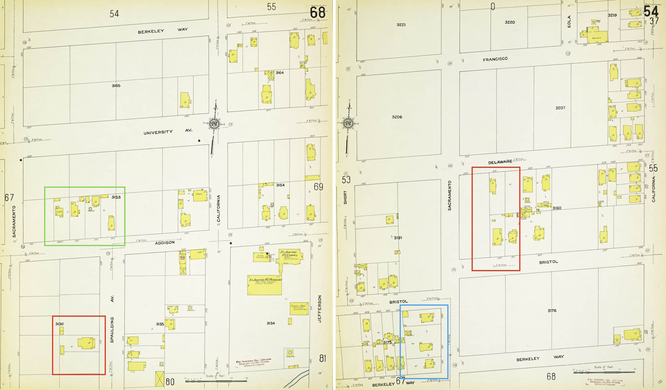
The Sanborn map from 1911 on the left is provided as the source of the house assignments in the previous image. The church property is in the right corner, and note no. 2116 Spaulding Ave., red box, nos. 1509-1523 Addison St., green box. The land where the house on Spaulding St. sat is occupied by a two-story apartment in 2026. The map on the right shows nos. 1912, 1910, 1900 Sacramento St. between Berkeley Way and Bristol St. (in 2026 Hearst Ave.), blue box, that remain intact in 2026, and will be seen as they appeared in 1911 next, and nos. 1509 and 1511 Bristol St., and the rear of 1516 Delaware that will be addressed after that.
L344-95-Courtesy Library of Congress, Geography and Map Division, Sanborn Maps Collection, 1911, Vol. 1, Panels 64 and 58, (Image 20 of 34)
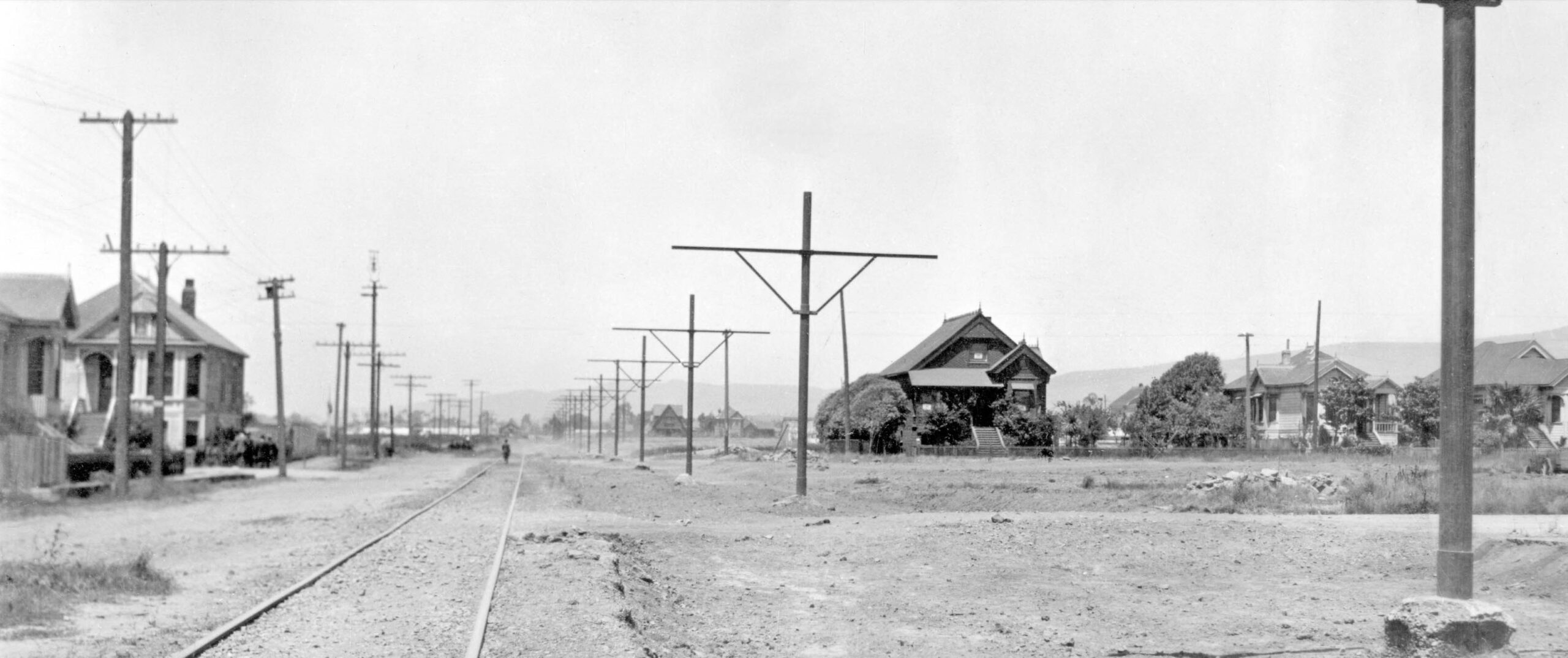
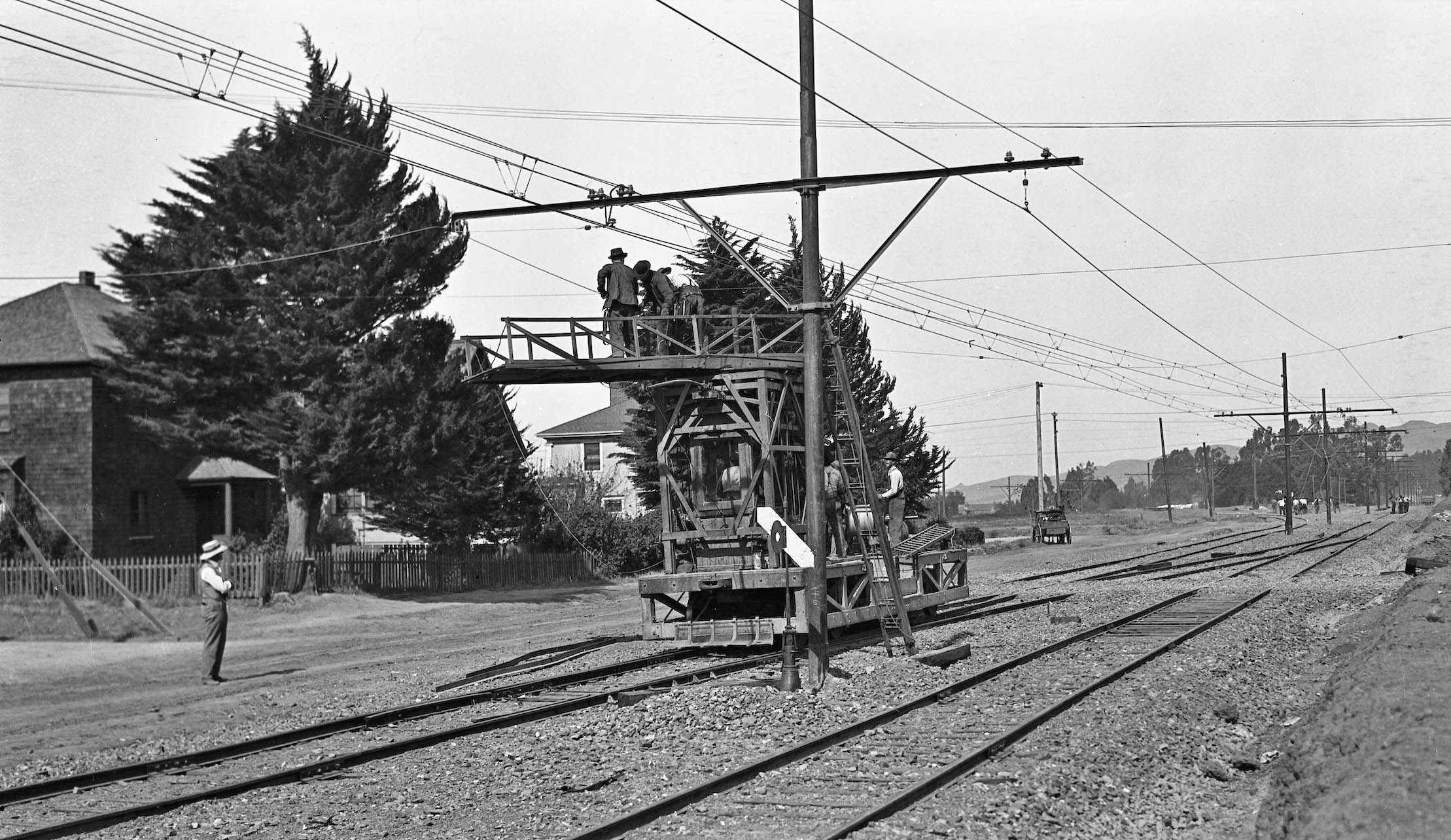
This northeast view from October 16, 1911 shows the three houses on Sacramento St. between Berkeley Way and Bristol St., albeit the middle one is almost completely obscured. A flat motor with crew is seen working on the overhead wire. Past the workers, this image shows how the Westbrae line separated from the Northbrae line, to the left and straight ahead, respectively. Also documented is that after the line separation, both lines would continue as single tracks to their final destinations.
L344-100-Key VPO Photo, Sappers Collection, Courtesy BAERA, Western Railway Museum Archives, 55494ks, (Image 21 of 34)
This image relates to the three houses enclosed by the red box in L344-95. This northeast view at Sacramento St. and Bristol St. shows a crew with a steam shovel creating a trench for the PROW, with onlookers in horse-drawn wagons and one auto. The three houses shown are nos. 1509 and 1511 Bristol St., and behind those the rear of 1516 Delaware St. The properties on Bristol St. have been replaced. The property on Delaware St. is now part of the Ohlone Greenway that was created for BART’s approach to the North Berkeley station.
L344-101-Key Official Photo, Sappers Collection, Courtesy BAERA, Western Railway Museum Archives,85250ks, (Image 22 of 34)
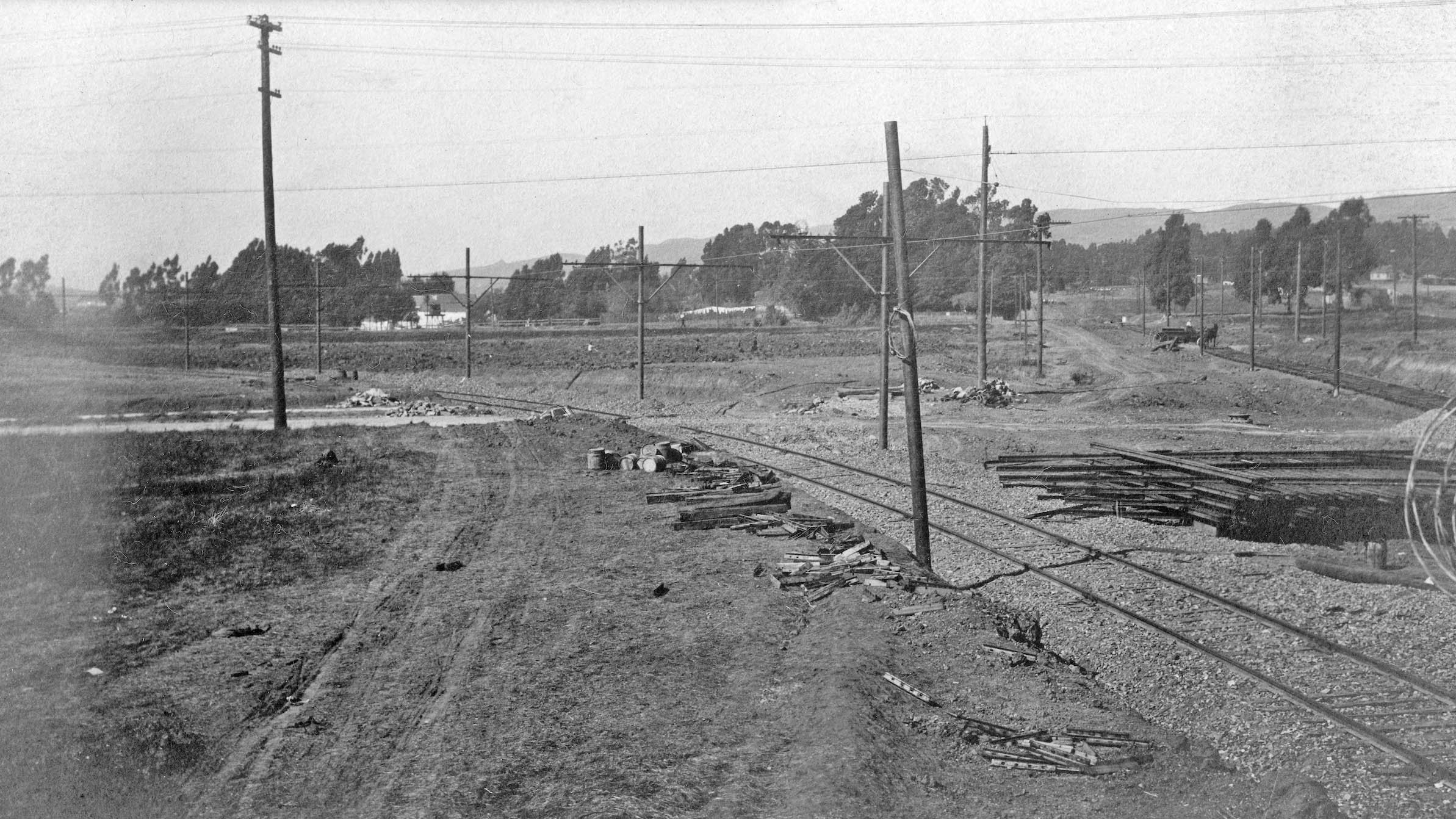
This north view west of Sacramento St. toward Delaware St. shows the Westbrae line construction sometime in 1911. The Northbrae line construction appears to have progressed through to Virginia St. to the right or east. The lots between Delaware St. and Virginia St. west of Sacramento St. were owned by the Realty Syndicate. In 2026, this area contains the North Berkeley BART station. More on this subject later.
L344-102-Key Official Photo, Sappers Collection, Courtesy BAERA, Western Railway Museum Archives, 262248ks, (Image 23 of 34)
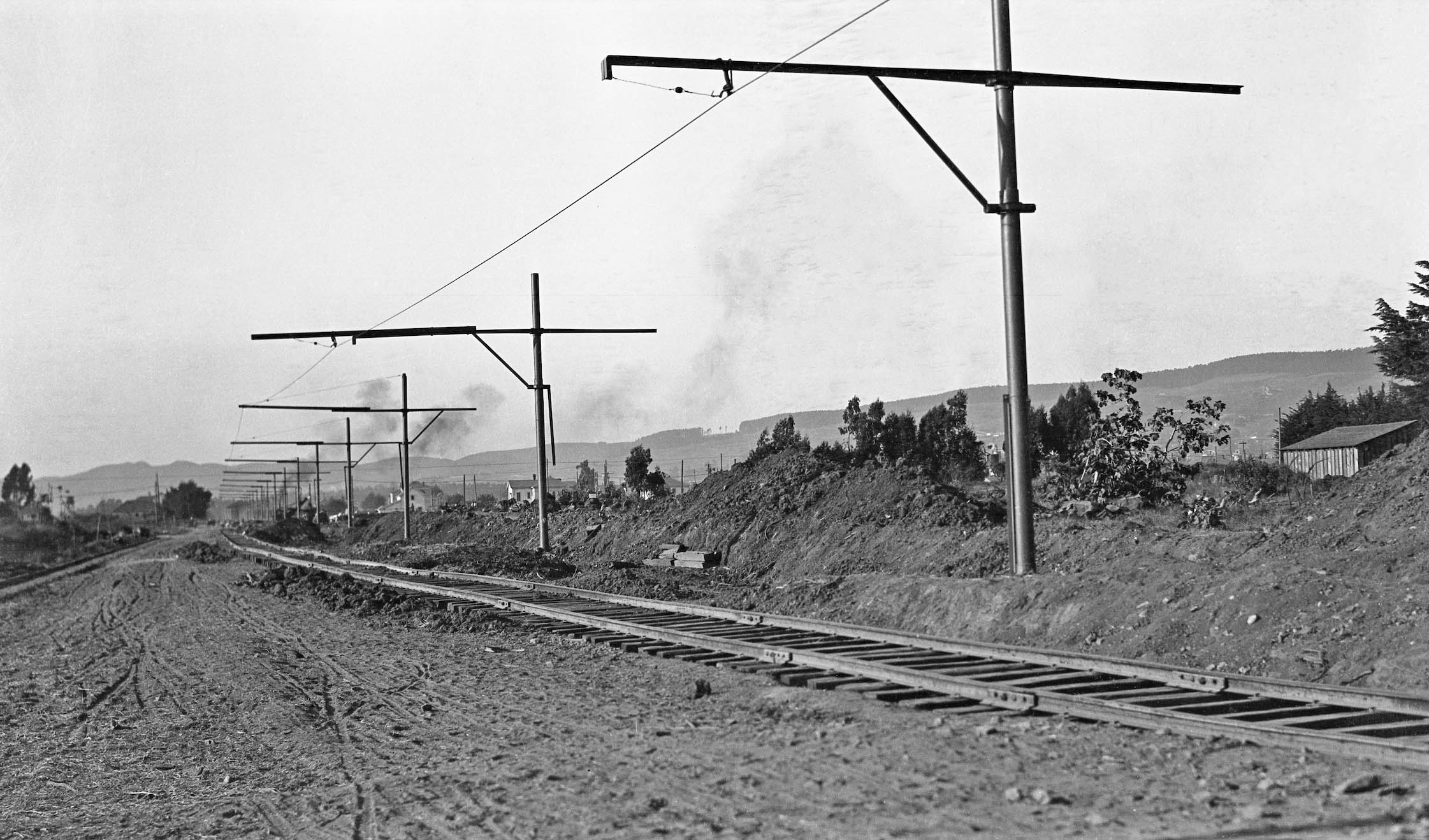
Following along the Westbrae line in 1911, the near completed line is shown where it settled alongside the SF tracks seen along the left margin at where Cedar St. will be, here looking toward Rose St. As with the Northbrae line, exactly how the Key managed to gain this PROW has not been determined.
L344-105-Key Official Photo, Sappers Collection, Courtesy BAERA, Western Railway Museum Archives, 85244ks, (Image 24 of 34)
Back to where the Northbrae line construction was seen two images ago up to Virginia St., here is a north view at that intersection with Sacramento St. in 1911. The only structure evident in this image is the top of a house with a water tank seen in the distance just east of the PROW.
L344-110-Key Official Photo, Key Official Photo, Sappers Collection, Courtesy BAERA, Western Railway Museum Archives, 85232ks, (Image 25 of 34)
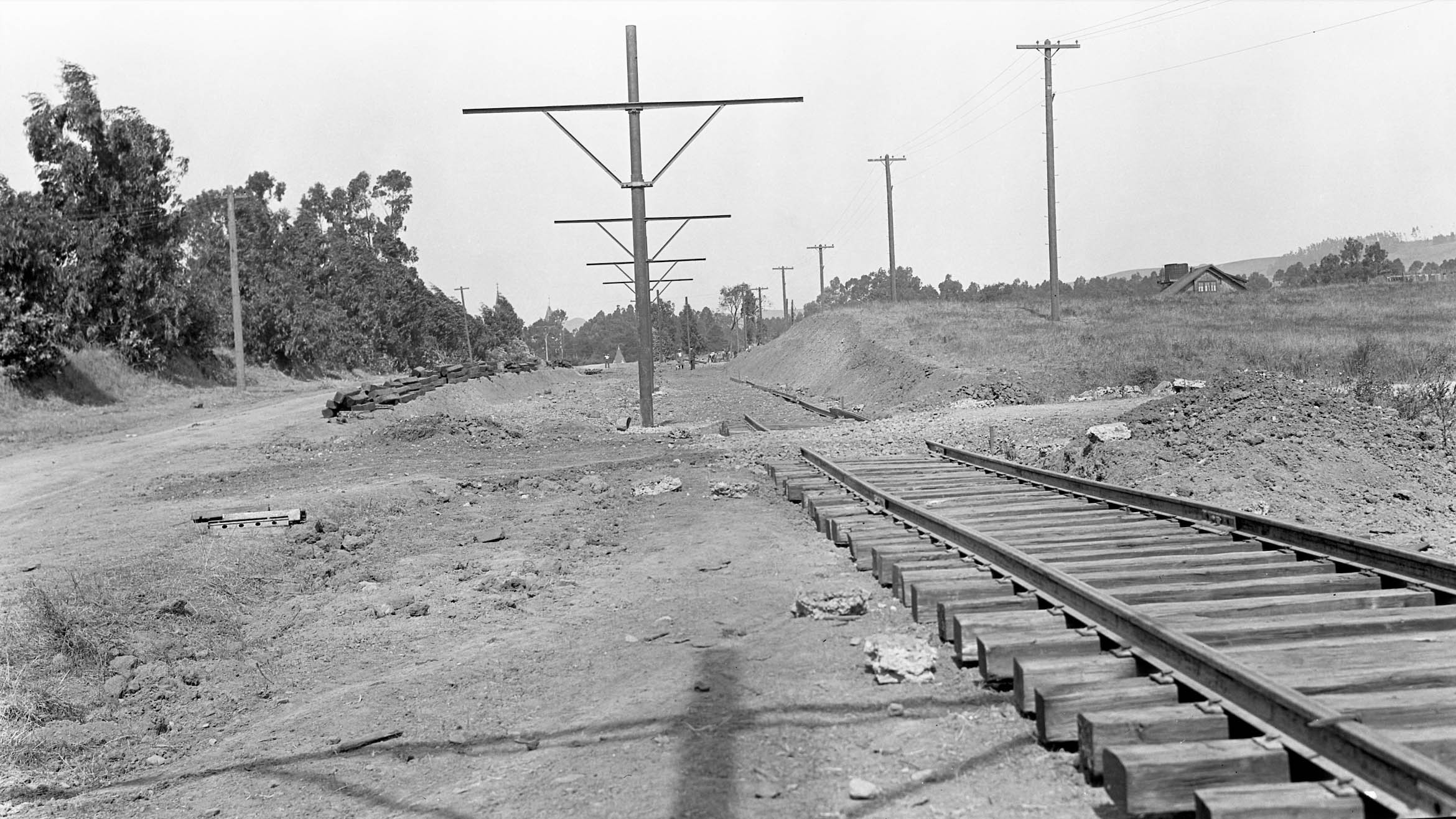
The track gang has pushed north in this northeast view to Sacramento St. and Cedar St. taken on Sept. 30, 1911. A full view of the house seen in the last image is present to the east of Sacramento St. without any intervening street. The lack of any streets in the past few images might explain why the Sanborn Map of 1911, Vol. 1, did not cover the area between the SF PROW and California St., and Virginia St. to Hopkins St. The origins and exact location of the house in this image remains to be determined.
L344-115-Key VPO Photo, Sappers Collection, Courtesy BAERA, Western Railway Museum Archives, 55497ks, (Image 26 of 34)
Looking to the north from the previous spot, also on Sept. 30, 1911, the mound of dirt curving to the east or right would place the initial curve at the future site of Rose St. The house of interest is located south of Rose St. and west of California St. This would mean Holly St., and although the water tank is long gone, the house remains as no. 1410 in 2026. Berkeley architectural historian Daniella Thompson found that the house was first assessed in 1909. Owner Elias Olan James, then a teacher at the High School, was later at UC before becoming a professor of English at Mills College, where he remained for the rest of his career.
L344-120-Key Official Photo, Sappers Collection, Courtesy BAERA, Western Railway Museum Archives, 85246ks, (Image 27 of 34)
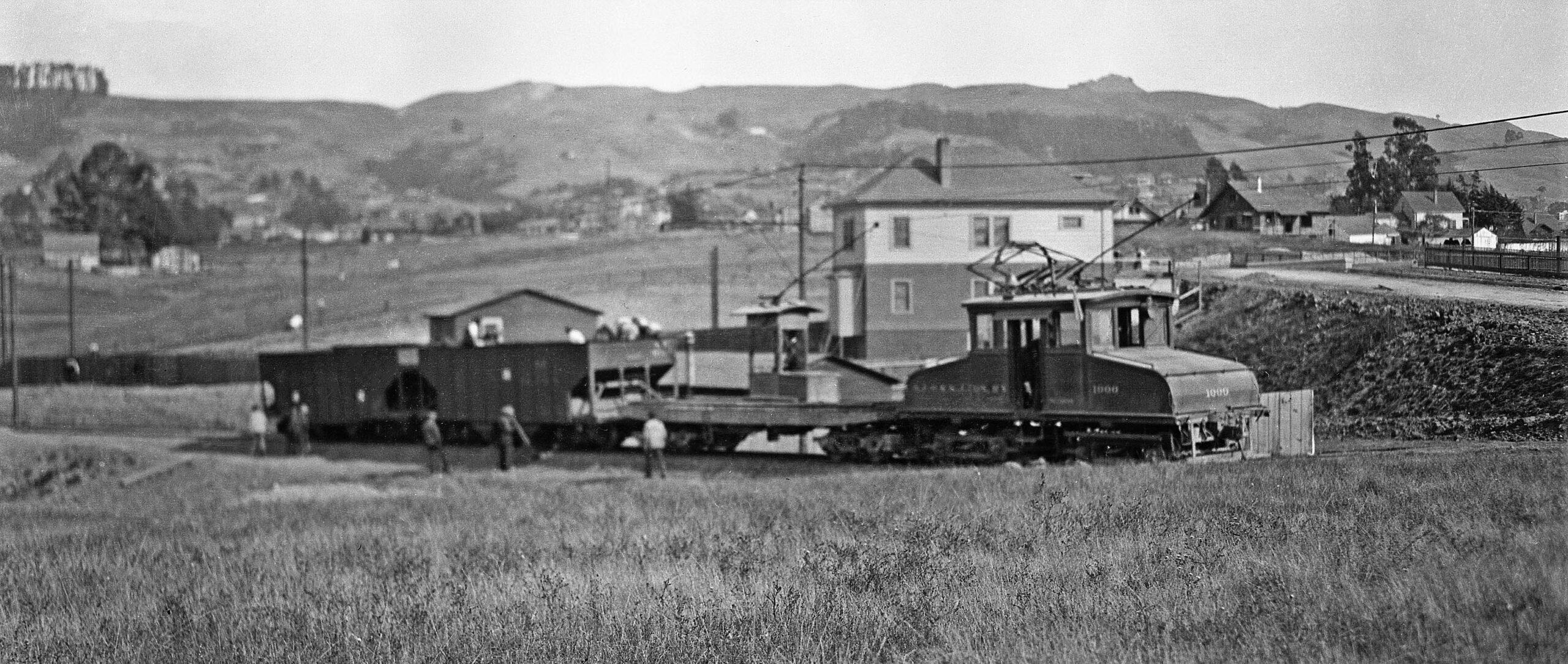
Finally at Sacramento St. and Rose St., sometime later than the previous images, but still 1911, Key Electric Motor 1000 with flat motor and two hopper car is lined by workers, with some on ladders putting up the overhead wire. This east view looks right down an unimproved Rose St. with the house at no. 1577 in view, a house west of California St. that remains virtually unchanged in 2026.
L344-125-Key VPO Photo, Sappers Collection, Courtesy BAERA, Western Railway Museum Archives, 55501ks, (Image 28 of 34)
Same railcars as previous image, but now an east view on the steep decline toward Hopkins St. To the right of no. 1577 Rose St. is the fence above the cut containing the SP California St. line. To the left of the house, note beyond it are the poles with overhead wire affixed for the SP line. At this point, California St. ends at Rose St., the SP railway moving to where the street exists today north of Ada St. It should be obvious that the Key Northbrae line had to cross the SP California St. line at the southwest corner where Ada St. and California St. intersect in 2026. More about this crossing next time.
L344-130-Key VPO Photo, Sappers Collection, Courtesy BAERA, Western Railway Museum Archives, 55493ks, (Image 29 of 34)
Getting close to opening day, after crossing the SP tracks, the Key Northbrae line curved toward Hopkins St., reaching it just before McGee Ave. as seen in his northeast view from Nov. 6, 1911. If you go to the opening just west of Vanguard Properties at 1600 Hopkins St. at McGee Ave. in 2026, you will note the sharp cut where the tracks entered the unimproved street. All the houses shown here are gone in 2026 with the exception of the Victorian toward the right edge, the 1890s built no. 1675 Hopkins St., just east of Carlotta Ave.
L344-135-Key Official Photo, Sappers Collection, Courtesy BAERA, Western Railway Museum Archives, 25708ks, (Image 30 of 34)
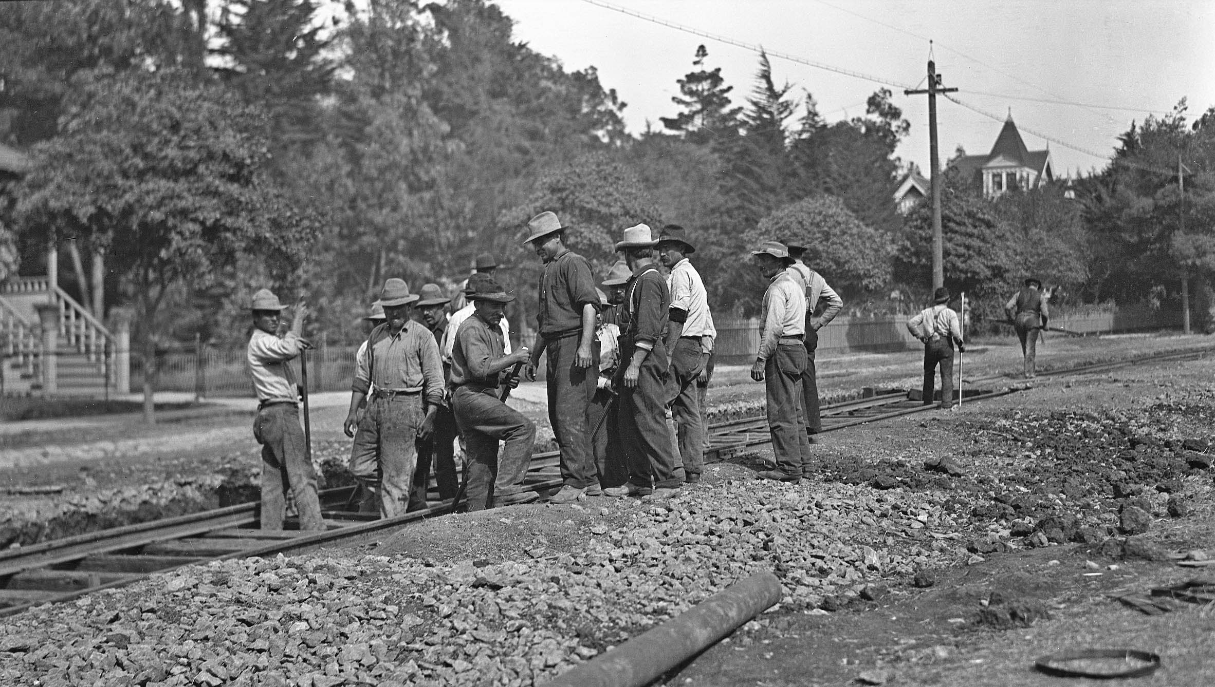
Further down Hopkins St. to the east, a crew is still busy at work on Nov. 6, 1911 between McGee Ave. and Carlotta Ave. making a repair near the track on the unimproved road.
L344-140-Key VPO Photo, Sappers Collection, Courtesy BAERA, Western Railway Museum Archives, 55500ks, (Image 31 of 34)
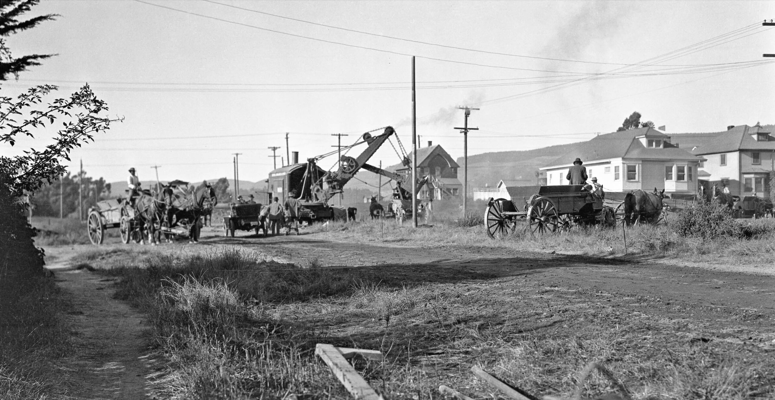
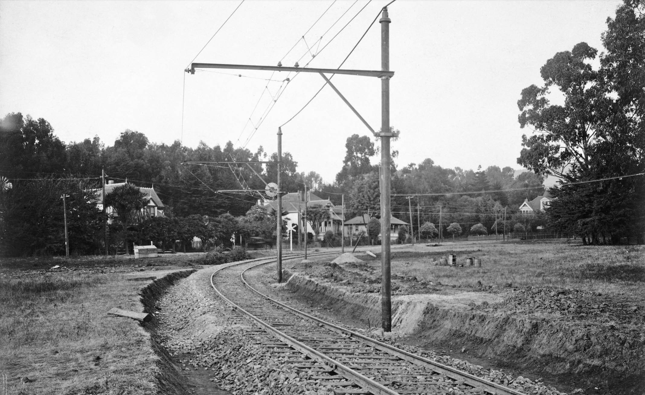
The crossing at The Alameda allowed for a transfer to the Syndicate-owned Oakland Traction streetcar line seen here that continued north on The Alameda and to Monterey Ave. In 1912, the line was extended up Marin Ave. to the Circle and Arlington Ave., more on this in two updates. The streetcar shown in the first image of this presentation took this path, and the SP would never have an answer about getting their passengers directly to the upscale portion of Northbrae. Note here in this east view from 1911, the new tracks shown for the Northbrae line are those between The Alameda and the terminus, Sutter St. Construction of the actual crossing is still to come.
L344-145-Robert L. Stein Collection, Courtesy BAERA, Western Railway Museum Archives, 22121ks, (Image 32 of 34)
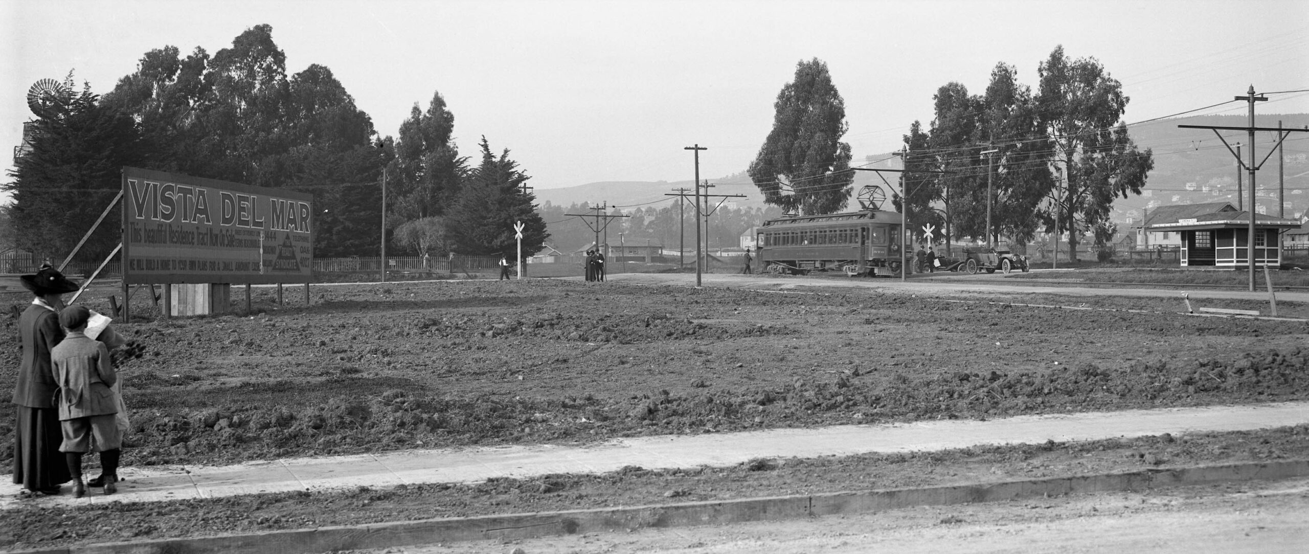
What better way to end a presentation than with an image combining electric trains and real estate as done for the first image in this presentation. The date is Nov. 11, 1911, and opening day for the Key Northbrae electric line, here a car seen approaching the Virginia St. station in a northeast view. The Realty Syndicate sign advertises the Vista Del Mar tract, soon to add that it is alongside both the Key Northbrae and Westbrae line. Unlike the legacy of Mason-McDuffie, this area never achieved more than bungalow status, and the houses here would be cleared for the BART station. Appreciation to Daniella Thompson for house identification and for the incorporation map. Next time, constructing the SP lines.
L344-150-Eston Cheney Photo, Sappers Collection, Courtesy BAERA, Western Railway Museum Archives, 17739ks, (Image 33 of 34)
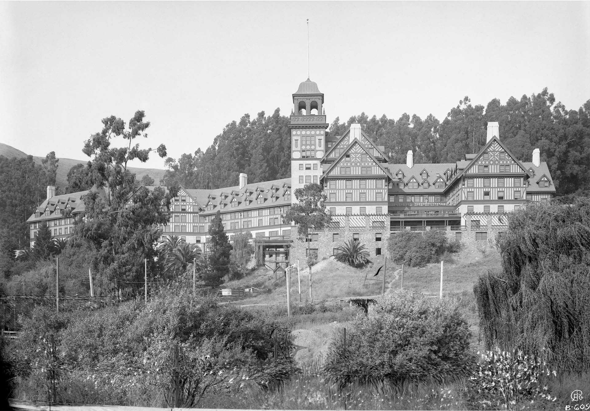
One added note. There is no mention of the Key Route to the Claremont section in Berkeley in this update since there was no battle with the SP to this part of Berkeley. The SP avoided this area completely. This northeast view of the Claremont Hotel was taken around 1910 before the hotel was finished, and before the Berkeley Tennis Club moved here in 1917. However, the overhead wire for the trains is up and in service among the weeds. A closer look at Claremont Ave. and surroundings will be presented separately.
L344-155-Eston Cheney Photo B-609, Sappers Collection, Courtesy BAERA, Western Railway Museum Archives, 115038ks, (Image 34 of 34)