Unsustainability – 1920-1933 – George Russell’s Flight and Rose St. Tower
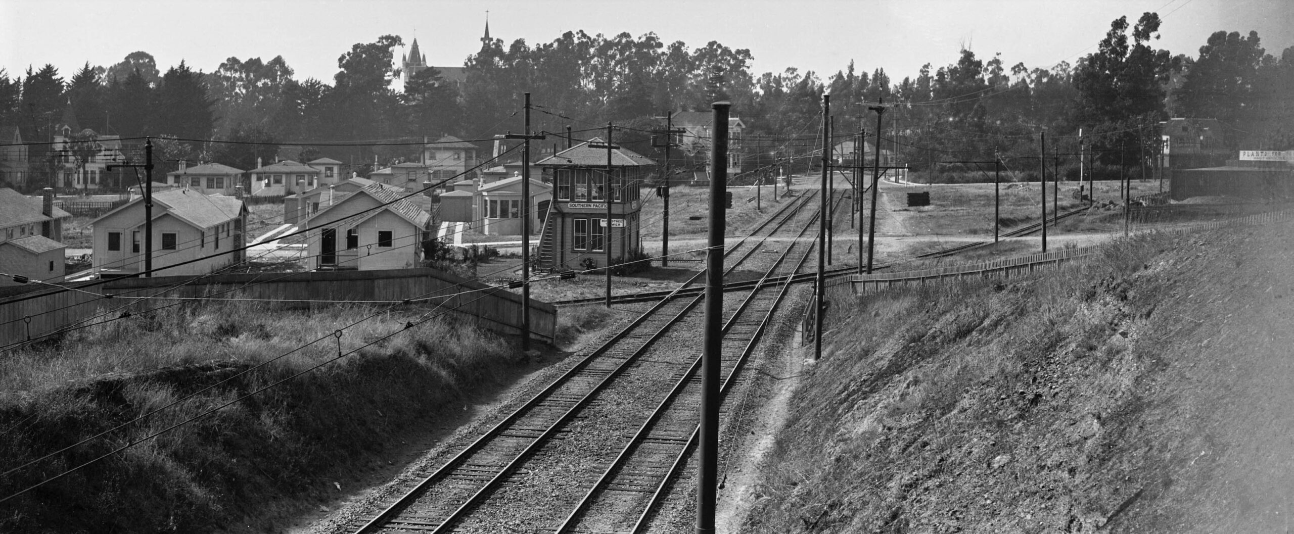
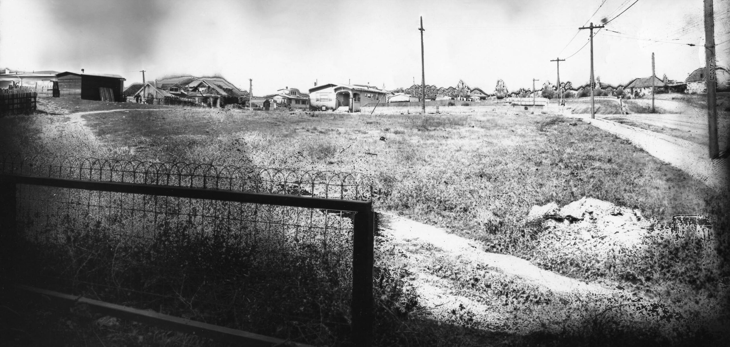
This north view taken from the Rose St. overpass of the Southern Pacific, SP, California St. line ca. 1925 shows the SP Rose St. tower, and the Key Northbrae line crossing the SP tracks. In the distance to the left is the former Peralta Park Hotel, housing St. Joseph’s Academy Grammar School since 1903, soon to be taken over by St. Mary’s College High School in 1927, and razed in 1959. As another time indicator, Berkeley Horticulture Nursery seen on the far right margin began operation in 1922. For more on the latter, click here.
L349-05-Vernon Sappers Collection, Courtesy BAERA, Western Railway Museum Archives, 25355ier, (Image 1 of 32)

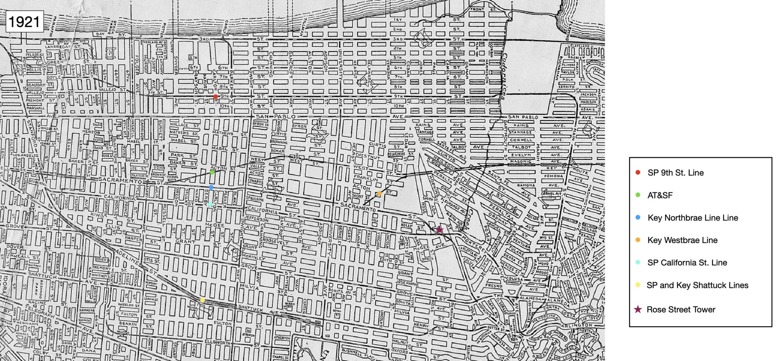
The last update focused on the SP and Key Shattuck lines, yellow dot on the map from 1921. In the era from 1920-1933, it became more evident that maintaining competition between the two companies in a defined geographic area was unsustainable. This update will cover the competing lines to the west, the SP California St. line, turquoise dot, and Key Northbrae line, blue dot.
L349-10-Central National Bank Map, Courtesy BAERA, Western Railway Museum Archives, 83537, (Image 2 of 32)
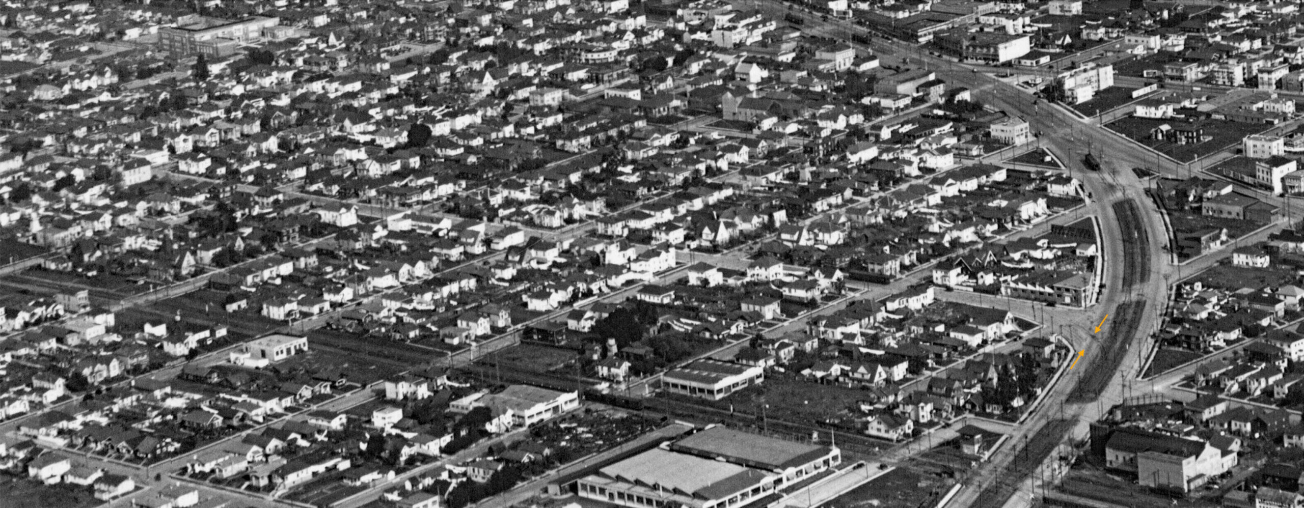
First to start with the SP California St. line. Although images of the California Street line are rare, knowledge of its track alignment is complete as shown in this track map covering 1910-1929. The red arrows with street names below indicate where cross-over tracks were present. The green arrow shows the only siding at Dwight Way. The yellow arrow shows the configuration of the double-track with connector “wye” structure that existed at its terminus at Colusa Ave. and Solano Ave. to complete the loop with the Shattuck and Ninth St. lines.
L349-12-SP Track Map, Courtesy BAERA, Western Railway Museum Archives, 56071, (Image 3 of 32)
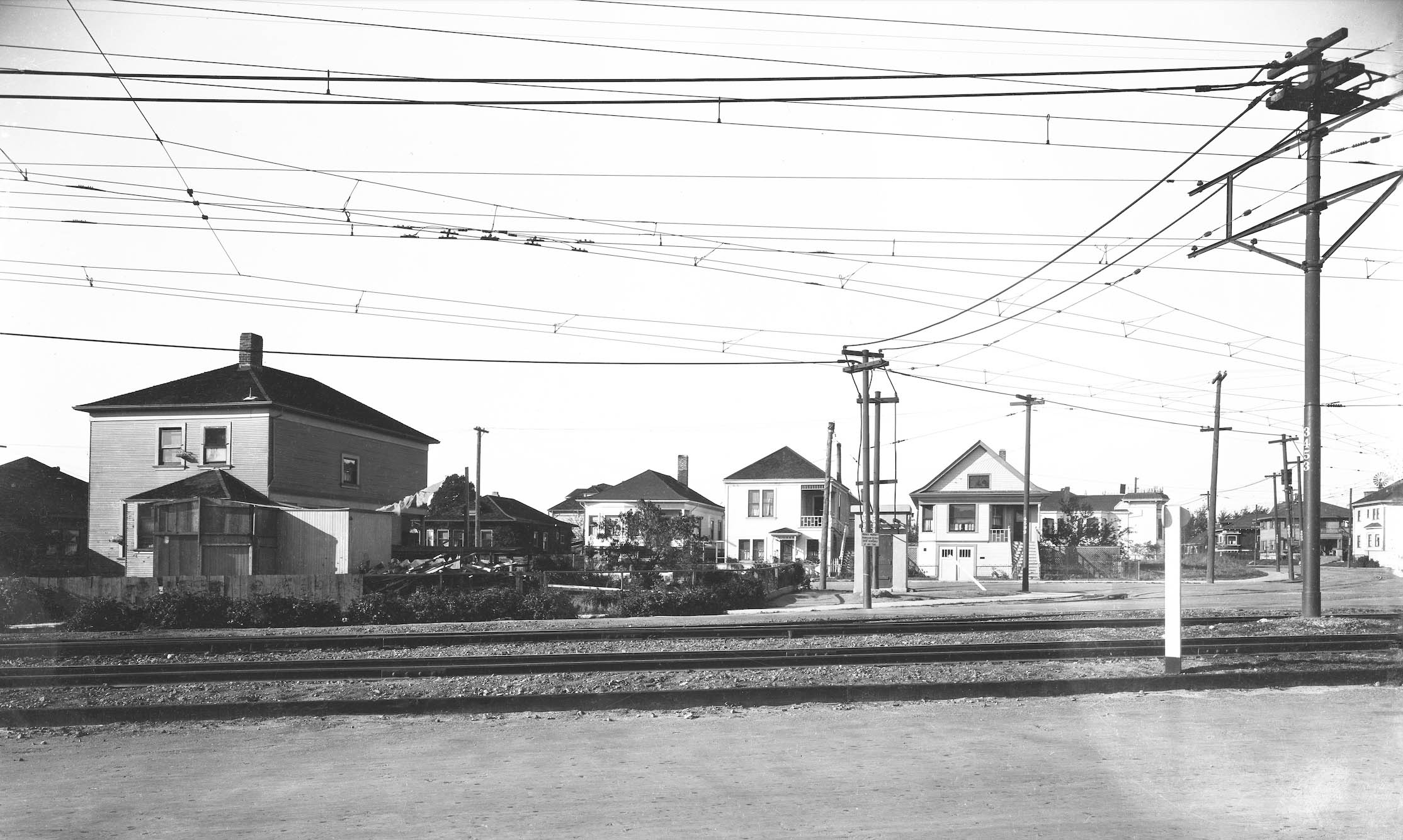
This northeast view by George Russell in the mid-1920s shows the two tracks of the SP California line, orange arrows, separating from the SP mainline on Stanford Ave. that supplied SP electric trains to Berkeley near the Oakland-Berkeley border.
L349-15-George Russell Photo, Courtesy California State Lands Commission, SLC_644_NoDate_23, Detail, (Image 4 of 32)
This north view from the ground also shows the California St. line tracks heading north on California St. from the mainline. This street intersection was later modified such that the intersection was moved to Market St. The two initial blocks the are in Oakland are now called Occidental St.
L349-20-SP Valuation Photo P-222, Vernon Sappers Collection, Courtesy BAERA, Western Railway Museum Archives, 76039oa&b, (Image 5 of 32)
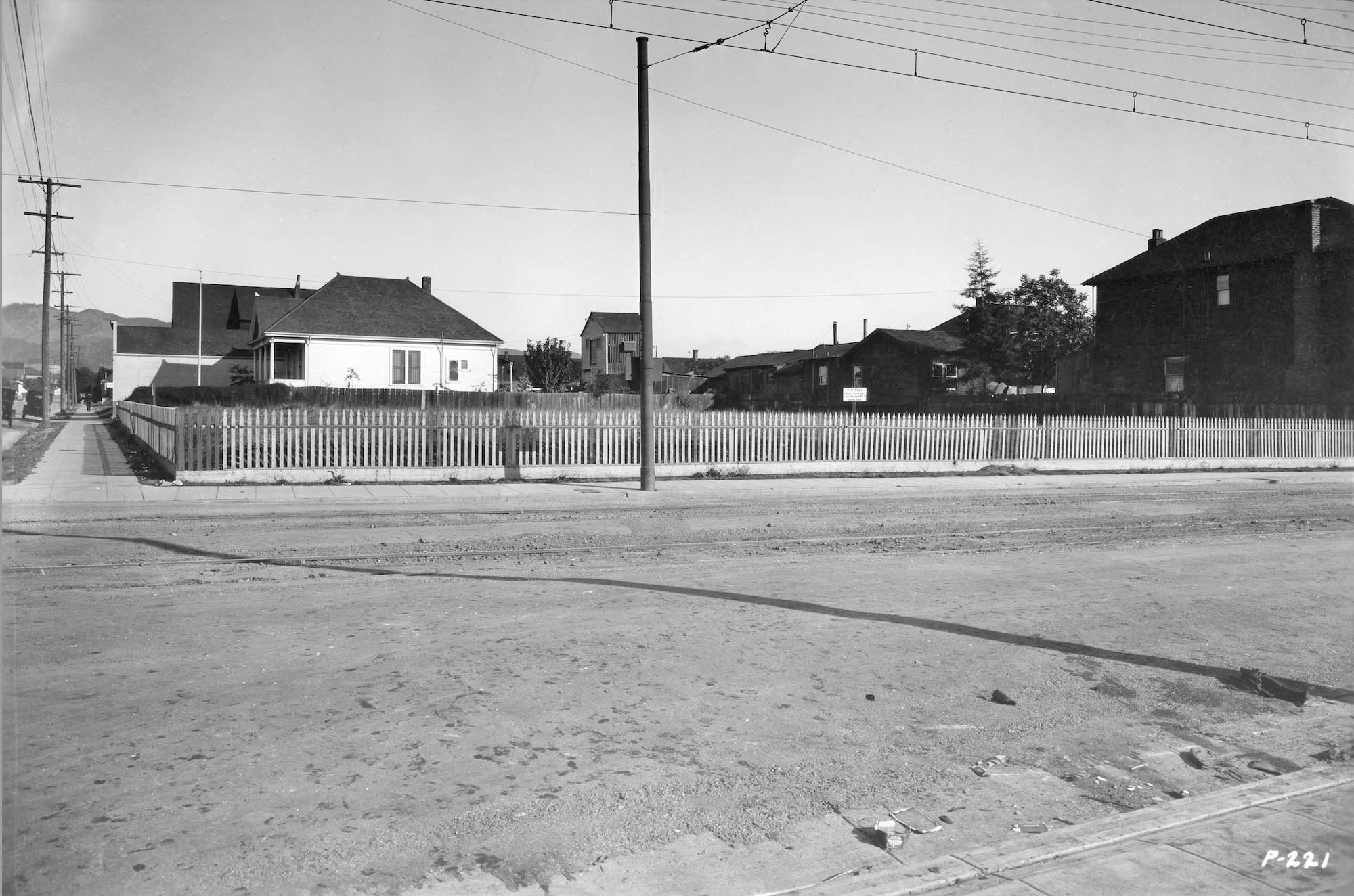
Further north on the line, this east view ca. 1923 at the intersection of Russell St. and California St. shows the SP tracks, and the house at no. 2911 California St. along the right margin, and no. 1614 Russell St., the most western structure on the south side of Russell St., both structures intact in 2026. The South Berkeley Branch of the Berkeley YMCA occupies the empty lot shown here in 2026.
L349-25-SP Valuation Photo P-221, Sappers Collection, Courtesy BAERA, Western Railway Museum Archives, Sappers Collection, 76042oa&b, (Image 6 of 32)
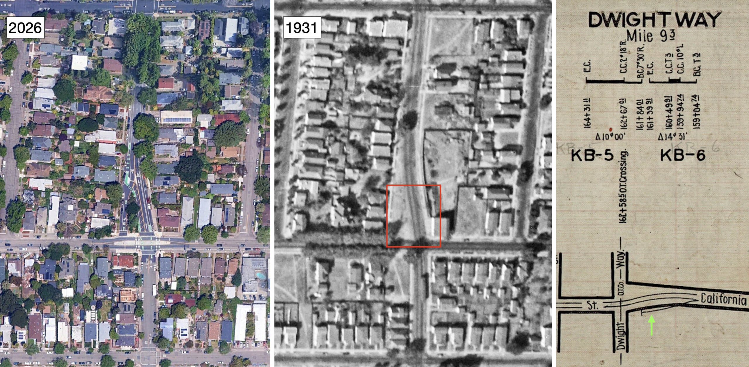
The northern intersection of California St. and Dwight Way as seen on the 2026 aerial on the left has an unusual extra right turn lane on Dwight to the west, and a small median. In the corresponding aerial from 1931, center, the two train tracks complete a curve alongside that space, red box, but the function of the space has not been uncovered. Recall from the previously shown SP track map, the siding for the train line was on the east side of the tracks. This is reproduced on the far right.
L349-30-Courtesy Google Earth, l, c-1820_56, Courtesy of UC Santa Barbara Library Geospatial Collection, c, Courtesy BAERA, Western Railway Museum Archives, 56071, r, (Image 7 of 32)
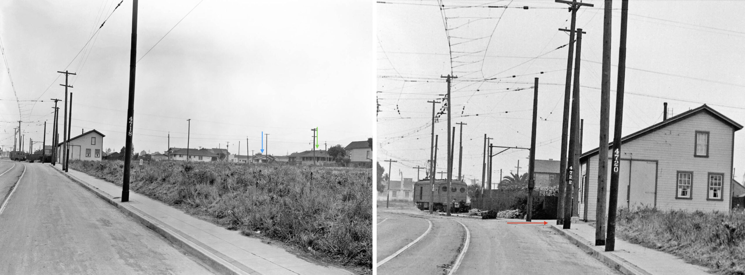
This north view toward Dwight Way taken ca. 1920, left, confirms the position of the SP siding as follows. The increasing pole numbers and the still standing houses at no. 1621 Dwight Way, green arrow, at corner of Jefferson Ave., and no. 2437 California St., blue arrow, confirm a north view, meaning the siding resided east of the tracks. The detail on the right shows the rail car on the siding cut off by the large structure on the northeast corner, the red arrow denoting the path of Dwight Way. That building was the SP linesmen headquarters at the northeast corner of Dwight Way. The building is prominent in the 1931 aerial shown previously.
L349-35-Sappers Collection, Courtesy BAERA, Western Railway Museum Archives, 22393oa&b, (Image 8 of 32)
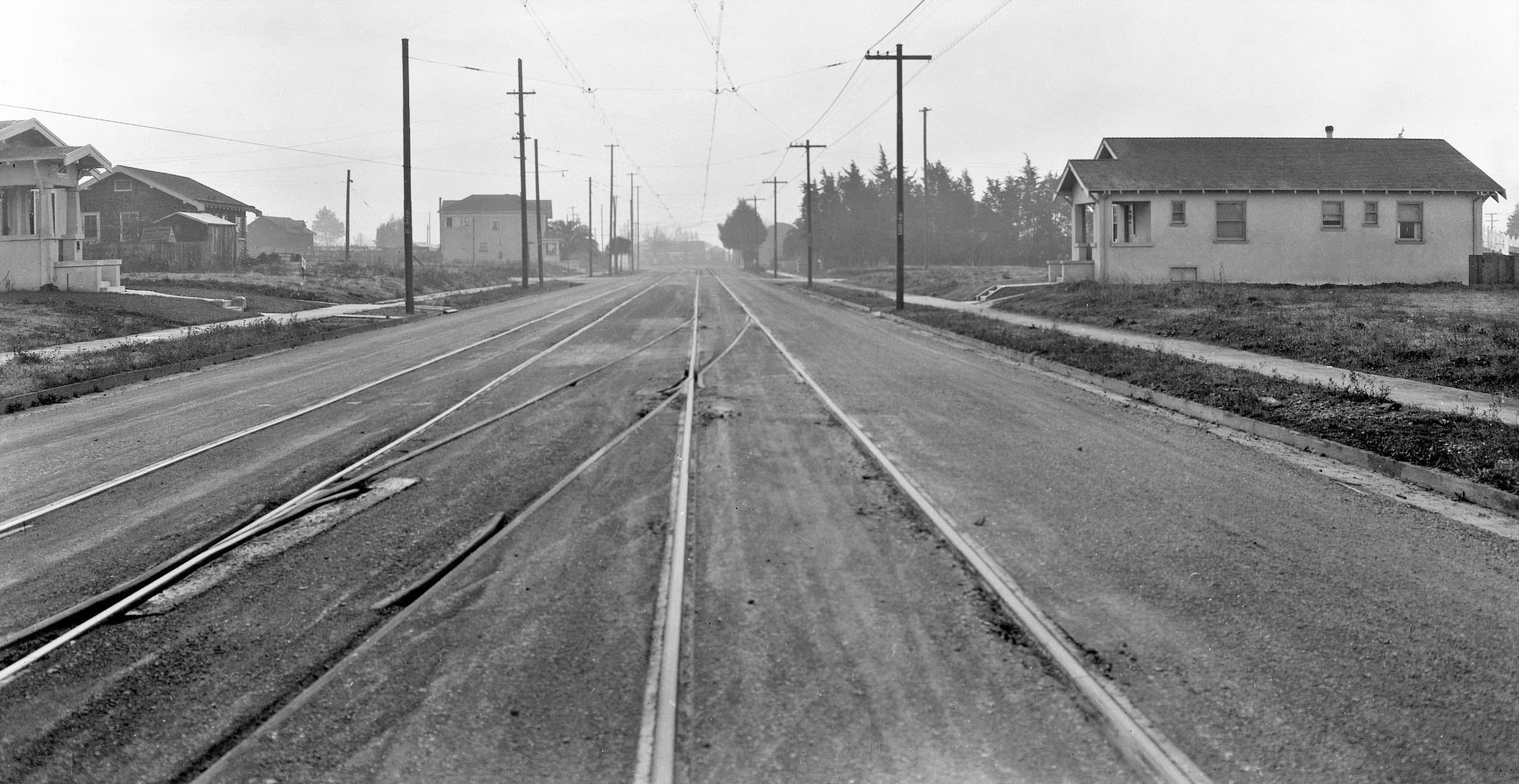
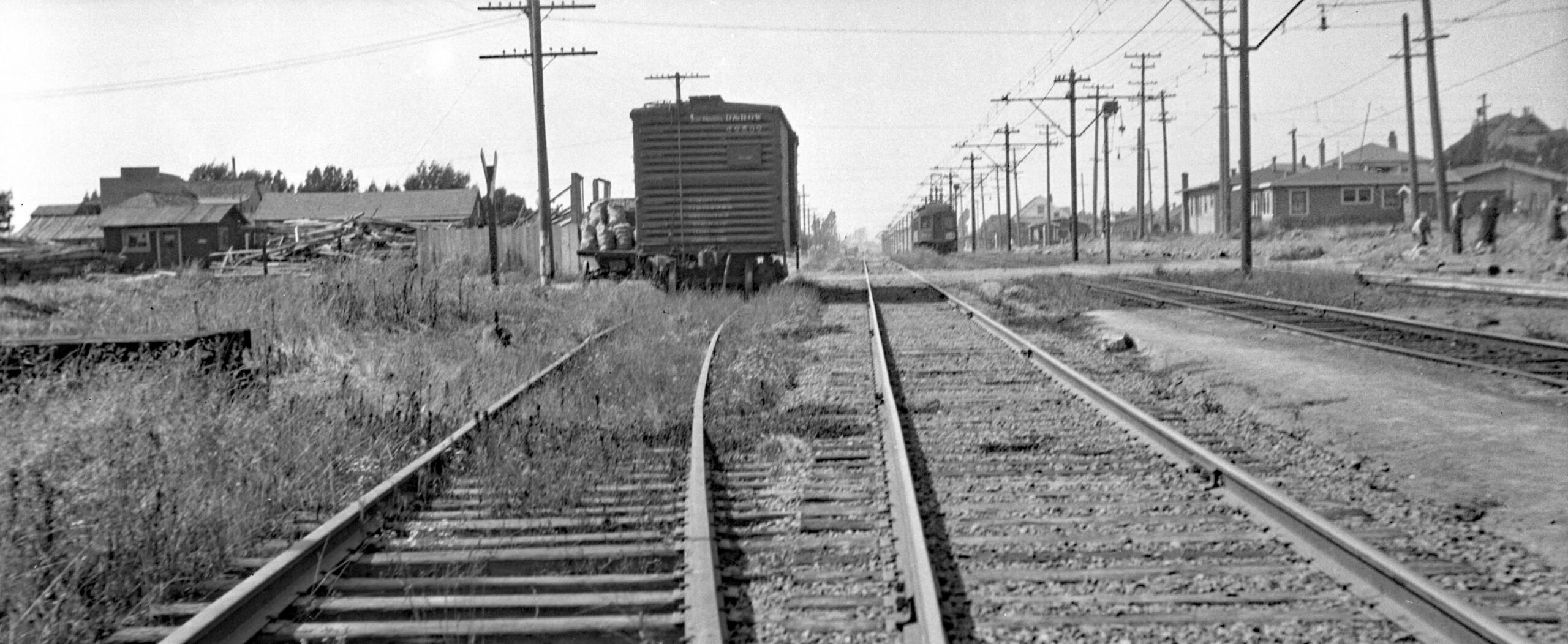
This south view between Bancroft Way and Channing Way ca. 1920 features the crossover track noted earlier. The house on the right is no. 2332, and the first house on left is no. 2335, both still there in 2026. Way in the distance, the SP linesmen headquarter building at Dwight Way can be seen, partially obscured by trees.
L349-40-Sappers Collection, Courtesy BAERA, Western Railway Museum Archives, 4658oa&b, (Image 9 of 32)
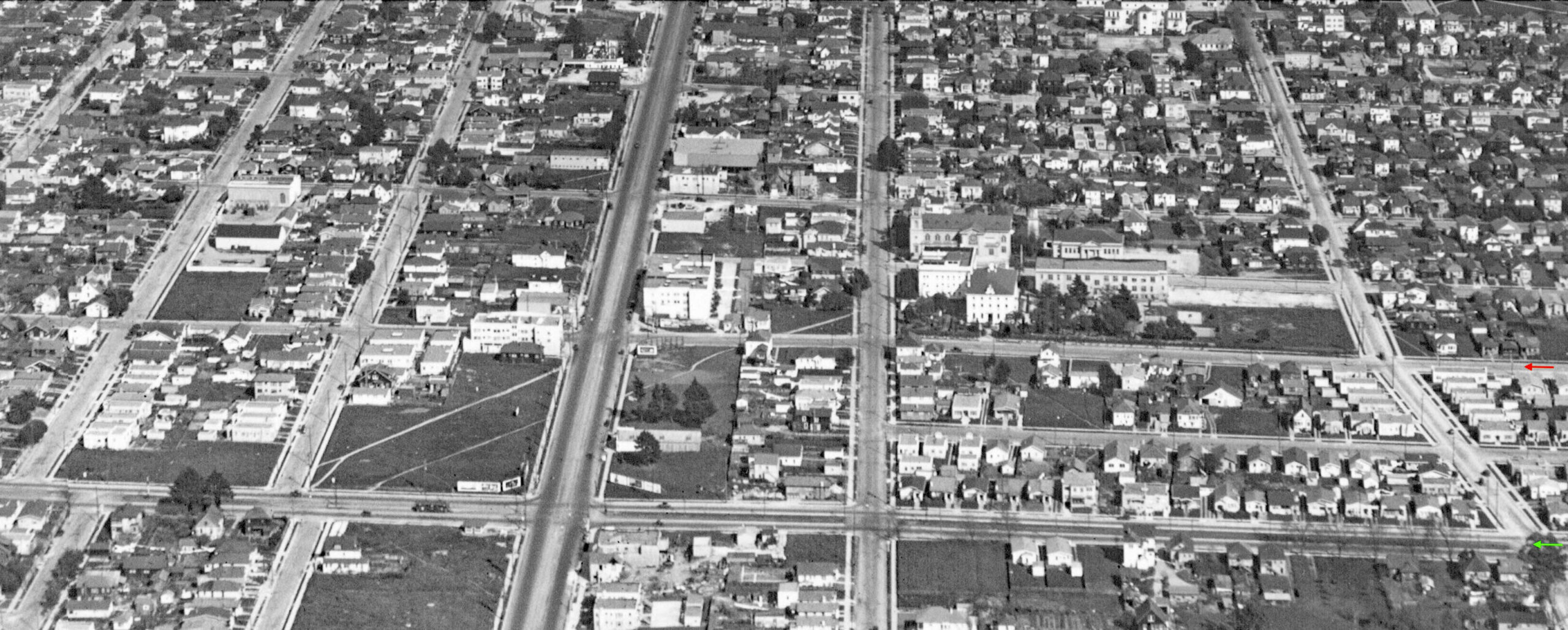
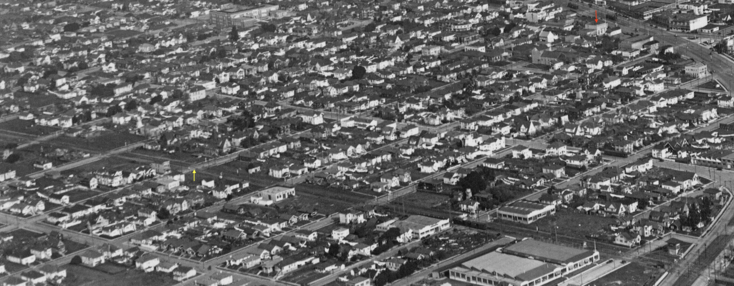
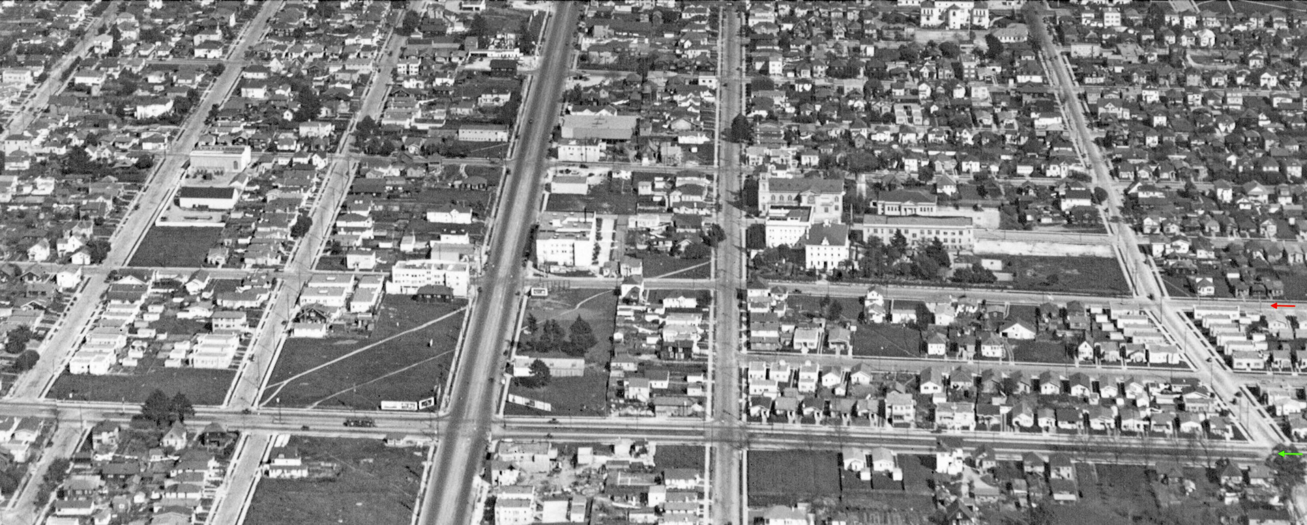
This east aerial oblique ca. late 1920s shows streets between Alston Way to Hearst Ave. The St. Joseph’s Church complex ran along the right-of-way of the California St., red arrow. The route of the Key Northbrae line is also prominent, green arrow.
L349-45-George Russell Photo, Courtesy California State Lands Commission, SLC_644_NoDate_32, detail, (Image 10 of 32)
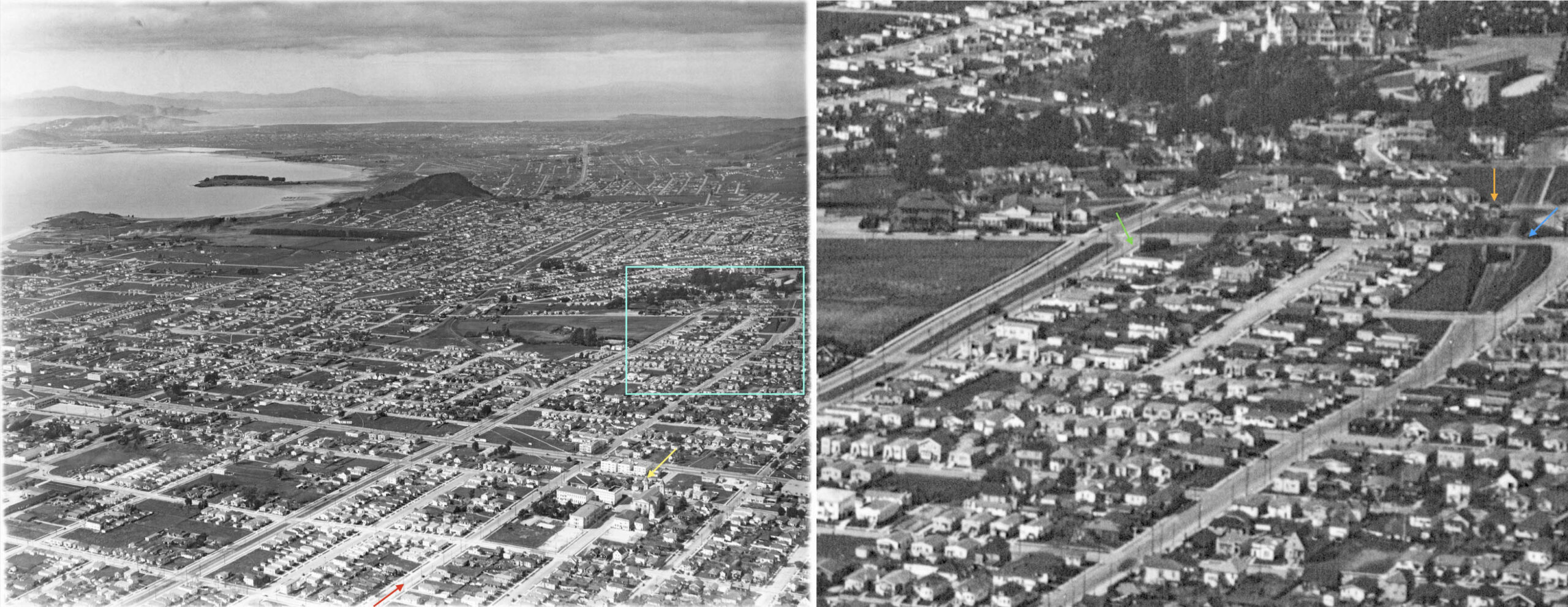
On the left, this northwest aerial view ca. late 1920s marks the St. Joseph’s Church complex, yellow arrow, and the SP California St. line all the way from Bancroft Way, red arrow, into North Berkeley, turquoise box. The contents of the boxed area is shown on the right, containing the Rose St. overpass, blue arrow, the Rose St. tower, orange arrow, and where the Key Northbrae line curved off Sacramento St. to cross Rose St., green arrow.
L349-50-George Russell Photo, Courtesy California State Lands Commission, SLC_644_NoDate_4, (Image 11 of 32)
Next to California St., looking north from about Buena Ave. toward the Rose St. overpass of the SP California St. line ca. 1922. None of the houses along Rose St. remain in 2026.
L349-55-SP Valuation Photo P-220, Vernon Sappers Collection, Courtesy BAERA, Western Railway Museum Archives, 76041sp, (Image 12 of 32)
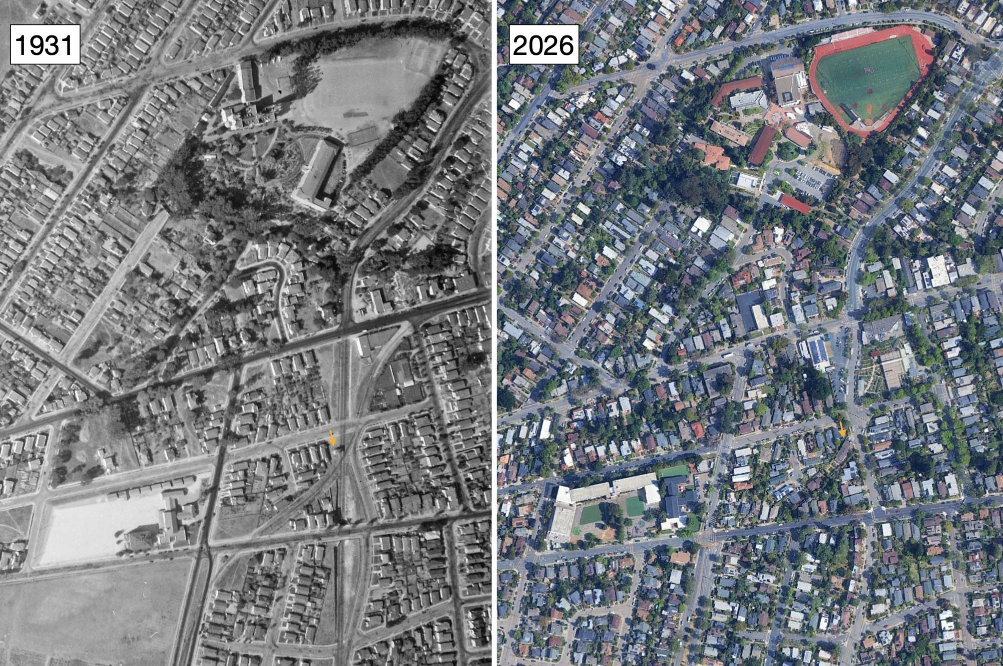
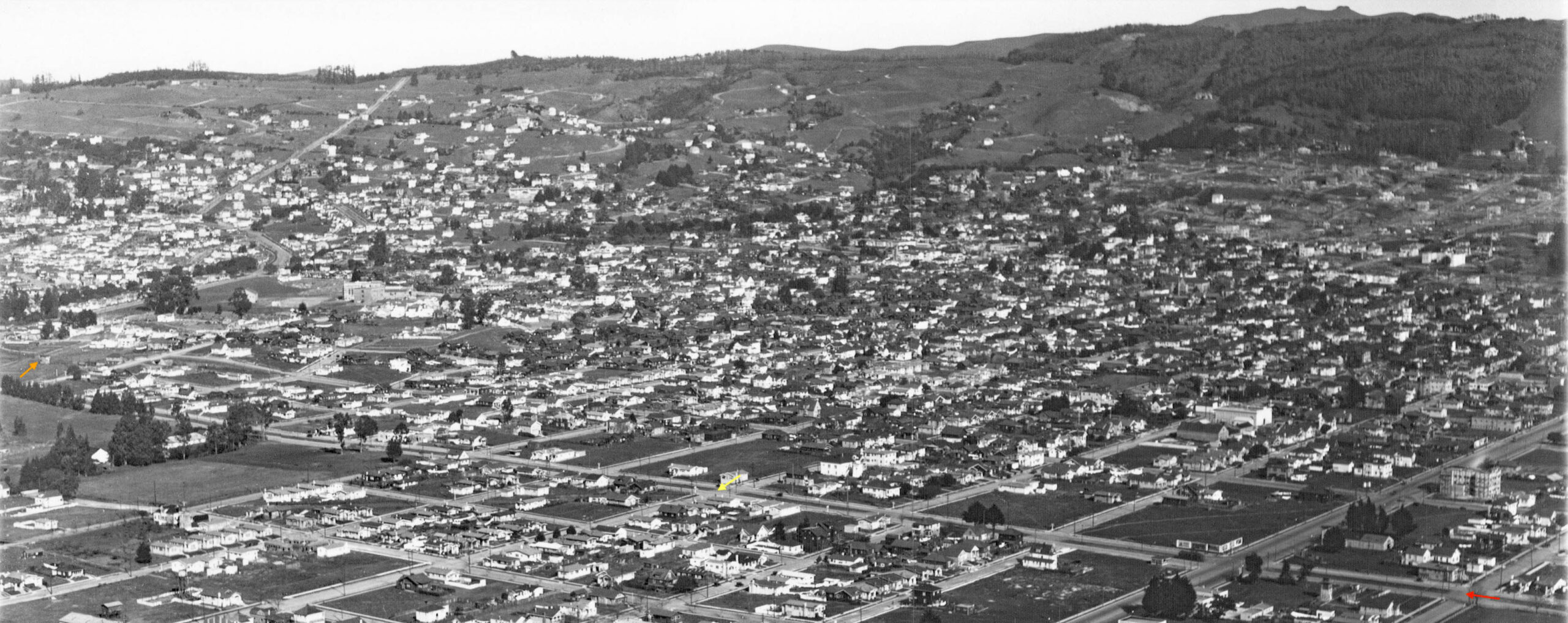
Next, north-oriented, comparative aerial views from 1931 and 2026 of the Key-SP crossing and Rose St. tower. The orange arrow on left points to the tower, and the arrow on the right the corresponding position in 2026 where a house resides.
L349-60-c-1820_61, Courtesy of UC Santa Barbara Library Geospatial Collection, l, Google Earth, r, (Image 13 of 32)
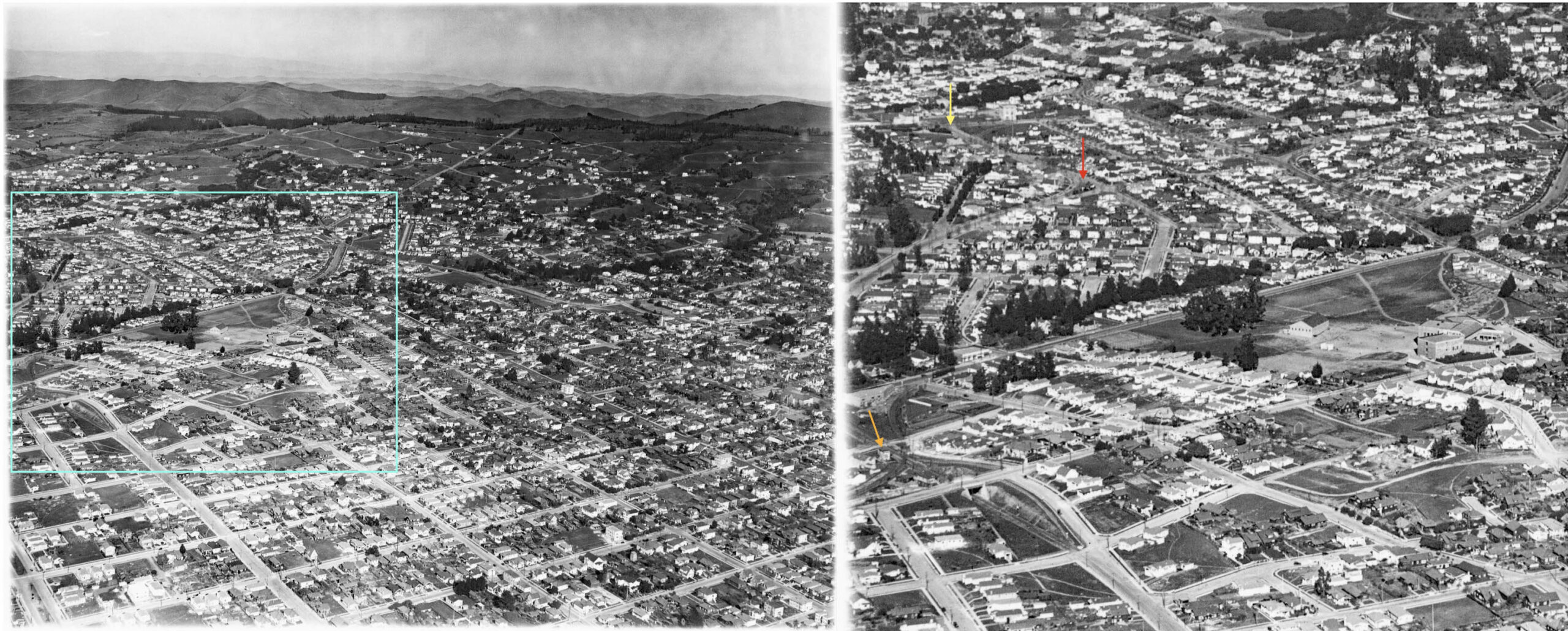
The northeast aerial view of North Berkeley on the left provides an overview of the approach of the Key and SP electric routes to Northbrae and Thousand Oaks. Outlined in turquoise is the detail shown on the right. The Rose St. tower is marked by the orange arrow. As for the SP California St. line, the red arrow marks where trains segued from Monterey Ave. to Colusa Ave. The yellow arrow marks the northern terminus at Solano Ave. and Colusa Ave., named for the neighborhood north of Solano Ave., Thousand Oaks.
L349-65-George Russell Photo, Courtesy California State Lands Commission, SLC_644_NoDate_52, (Image 14 of 32)
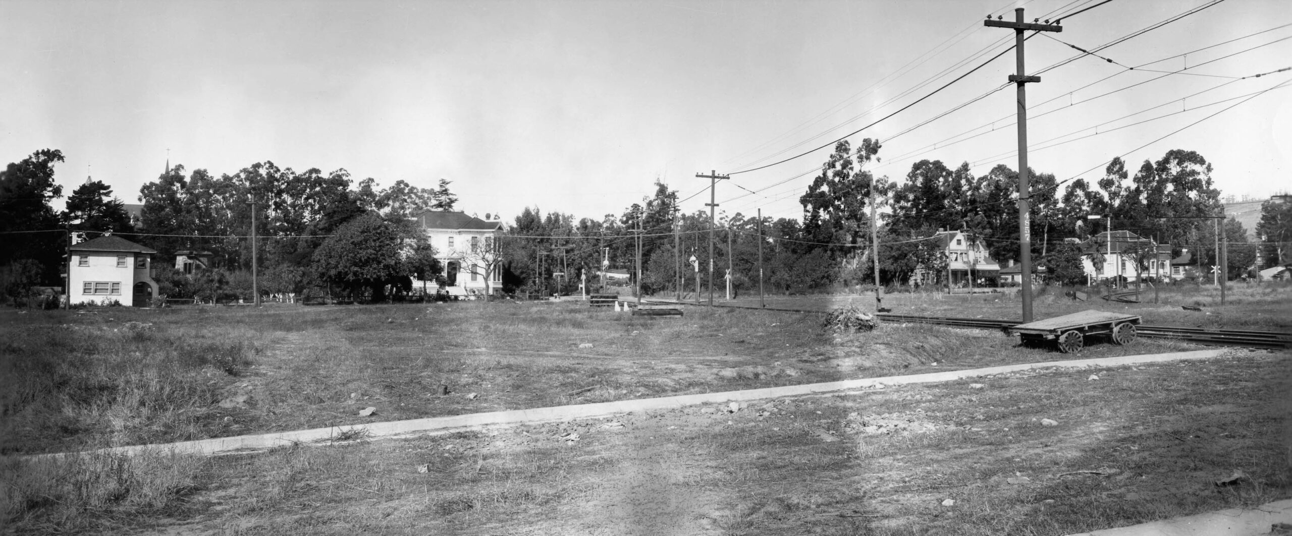
This north view ca. 1922 from Ada St. shows the SP California St. line on what was then a private right-of-way, up to the intersection with Hopkins St. This will become California St. as it is configured in 2026. No houses seen in this view have survived to 2026, and the empty lot to the left would eventually become the spot where the Monterey Market opened four decades later.
L349-70-SP Valuation Photo P-219, Sappers Collection, Courtesy BAERA, Western Railway Museum Archives, 76040sp, (Image 15 of 32)
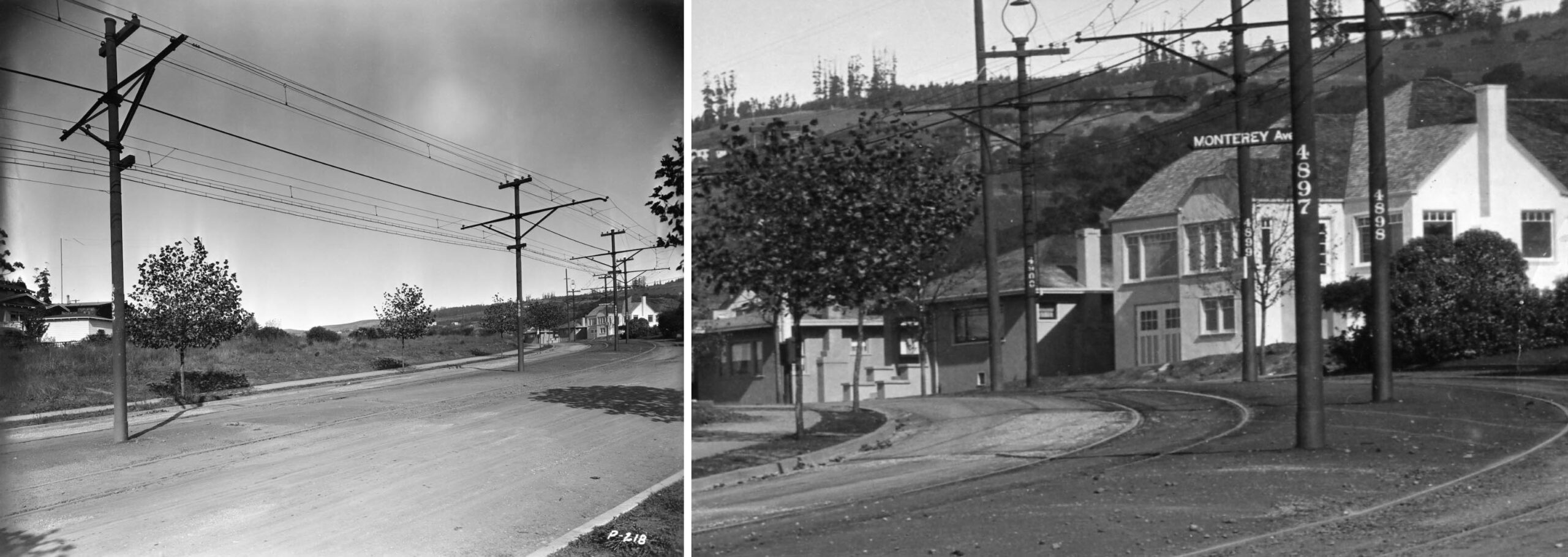
The northeast view on the left ca. 1923 captures the approach and transition of the SP tracks from Monterey Ave. to Colusa Ave. In the detail on the right, the large white house on the right is no. 1037 Colusa Ave., still there in 2026. The Colusa station shelter area would be off the frame to the right.
L349-75-SP Valuation Photo P-218, Sappers Collection, Courtesy BAERA, Western Railway Museum Archives, 116241sp, (Image 16 of 32)
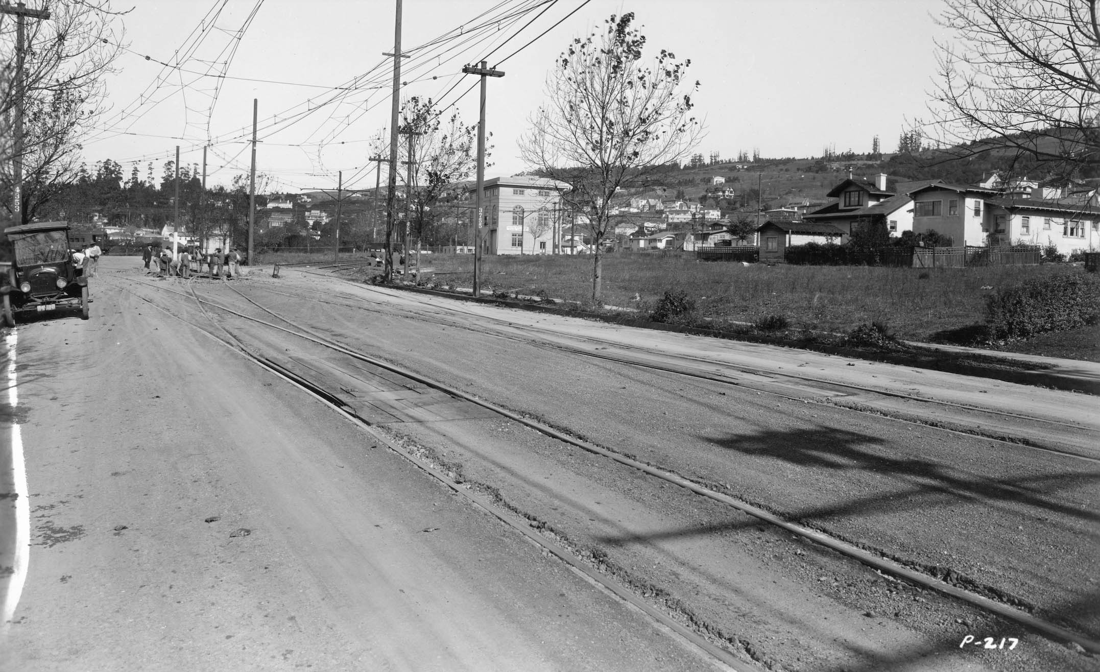
Finally at Colusa Ave. and Solano Ave., this northeast view from 1922 shows men at work on the double-track wye structure. The license plate of the car is unequivocally from 1922. The SP substation on the north side of Solano Ave. is visible. No views of the Thousand Oaks station area were found from this time period. Next, moving on to the Key Northbrae line.
L349-80-SP Valuation Photo P-217, Sappers Collection, Courtesy BAERA, Western Railway Museum Archives, 68508sp, (Image 17 of 32)
This northeast view from the late 1920s begins at Stanford Ave. and Lowell St. in Oakland, right edge, the Santa Fe Golden Gate tower in view. The Key Northbrae line crossed its first street northbound into Berkeley when it reached Alcatraz Ave., yellow arrow, as the undeveloped Lowell St. got a new name, Sacramento St. The red arrow marks the former bank building marking Alcatraz Ave. and Adeline St. for reference. The train along the Key right-of-way is a Santa Fe steam-powered freight blowing smoke along the Key’s west flank.
L349-85-George Russell Photo, Courtesy California State Lands Commission, SLC_644_NoDate_23, Detail, (Image 18 of 32)
This north view at Sacramento St. and Fairview St. during 1928 shows a Key Northbrae train approaching. A boxcar is on a siding at left originating from the Santa Fe Oakland branch mainline.
L349-90-Jeff Moreau Collection, Courtesy BAERA, Western Railway Museum Archives, 82630ks, (Image 19 of 32)
This east view was shown previously in L349-45 to highlight the SP California St. line, red arrow, between between Alston Way to Hearst Ave., versus the Key Northbrae line, green arrow. The single passenger car on the Key line is most likely a Key Westbrae train based on images ca. 1940. University Ave. was the southern terminus of the Key Westbrae line, and these trains waited here for Key Northbrae trains to transfer passengers.
L349-95-George Russell Photo, Courtesy California State Lands Commission, SLC_644_NoDate_32, Detail, (Image 20 of 32)
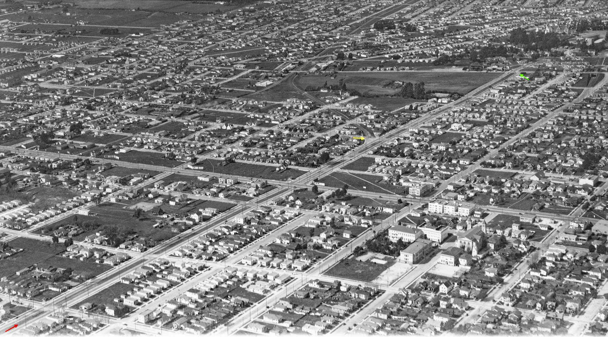
An overview of the Key Northbrae line between Bancroft Way along the left bottom edge, red arrow, through its turn from Sacramento St. at Rose St., green arrow, is presented in this northwest aerial view from the late 1920s. The yellow arrow marks the takeoff point of the Key Westbrae line to be reviewed in the next presentation.
L349-100-George Russell Photo, Courtesy California State Lands Commission, SLC_644_NoDate_4, Detail, (Image 21 of 32)
Covering almost the same amount of area starting at Addison St., this northeast view shows the Key Northbrae extending down Sacramento St. just short of the turnoff at Rose St. Note the presence of the Rose St. tower, orange arrow. The yellow arrow marks the takeoff point of the Key Westbrae line that, at this angle, is difficult to follow, but note the crossbucks marking where that line crossed streets.
L349-105-George Russell Photo, Courtesy California State Lands Commission, SLC_644_NoDate_53, Detail, (Image 22 of 32)
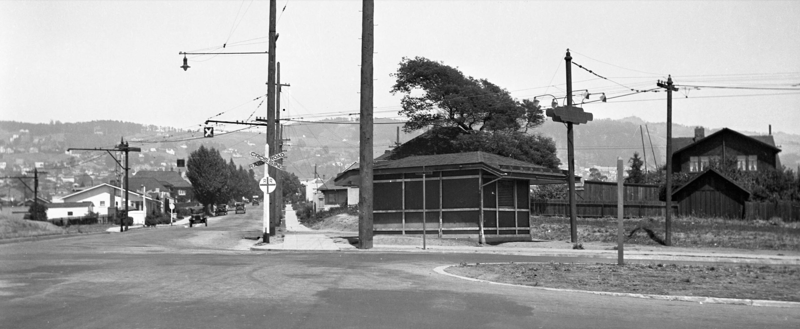
This east view down Rose St. ca. 1925 shows the shelter for the Key Northbrae line and the tracks passing behind or east of it. The image nicely documents that the line cut across the sidewalk prior to Rose St. before actually crossing it, as opposed to turning onto it.
L349-110-William Gardnier Photo, Moreau Collection, Courtesy BAERA, Western Railway Museum Archives, 82633ks, (Image 23 of 32)
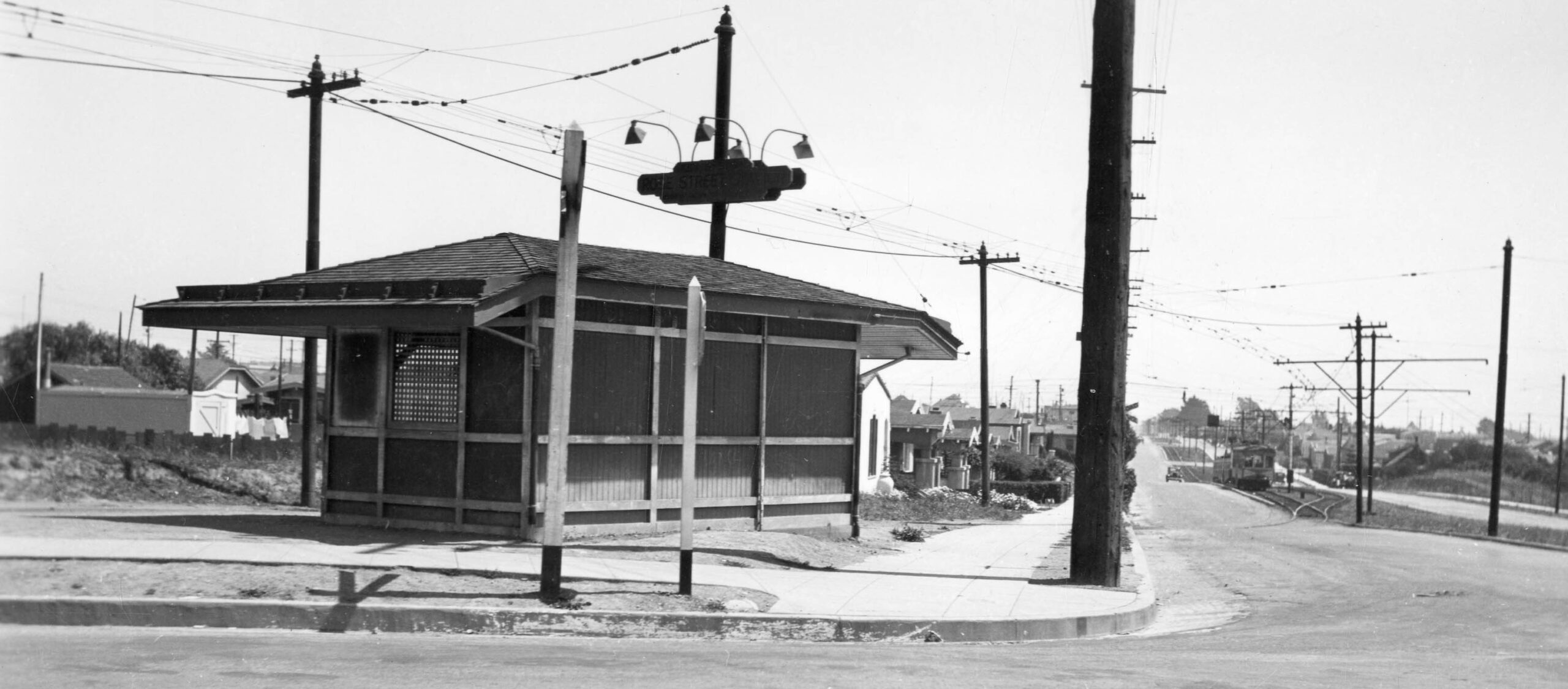
This south view at Sacramento St. at Rose St. in 1932 also shows the station shelter, but indicates that a passing track had been added to the single track that had previously approached the shelter at least prior to 1920. A northbound 600 series Key “dinkey” waits as a southbound 650 series car has passed it and is now behind it on the mainline. The orientation of the switch track supports the above interpretation.
L349-115-Warren Miller Collection, Courtesy BAERA, Western Railway Museum Archives, 149445ks, (Image 24 of 32)
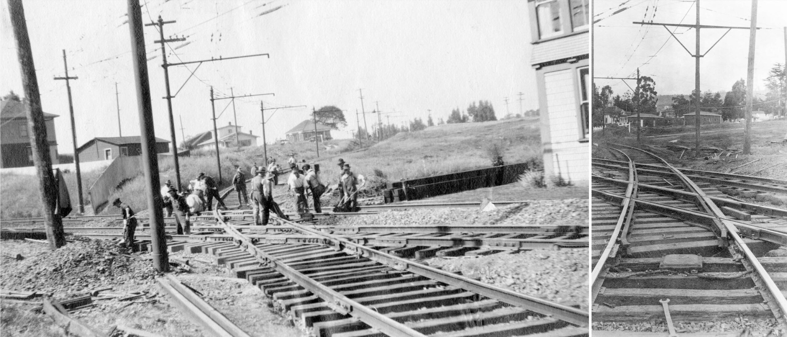
The descent of the Key Northbrae line from Rose St. to its crossing of the SP California St. line just south of Rose St. tower, left, and its continuation to Hopkins St., right, are illustrated here in this southwest view, left, and northeast view, right, respectively, ca. 1923. On the right, the two original buildings of the Berkeley Horticulture Nursery can be seen.
L349-117-Key Official, Key VPO print 770, l, 824, r, Sappers Collection, Courtesy BAERA, Western Railway Museum Archives, 78756ks, l, 78768ks r, (Image 25 of 32)
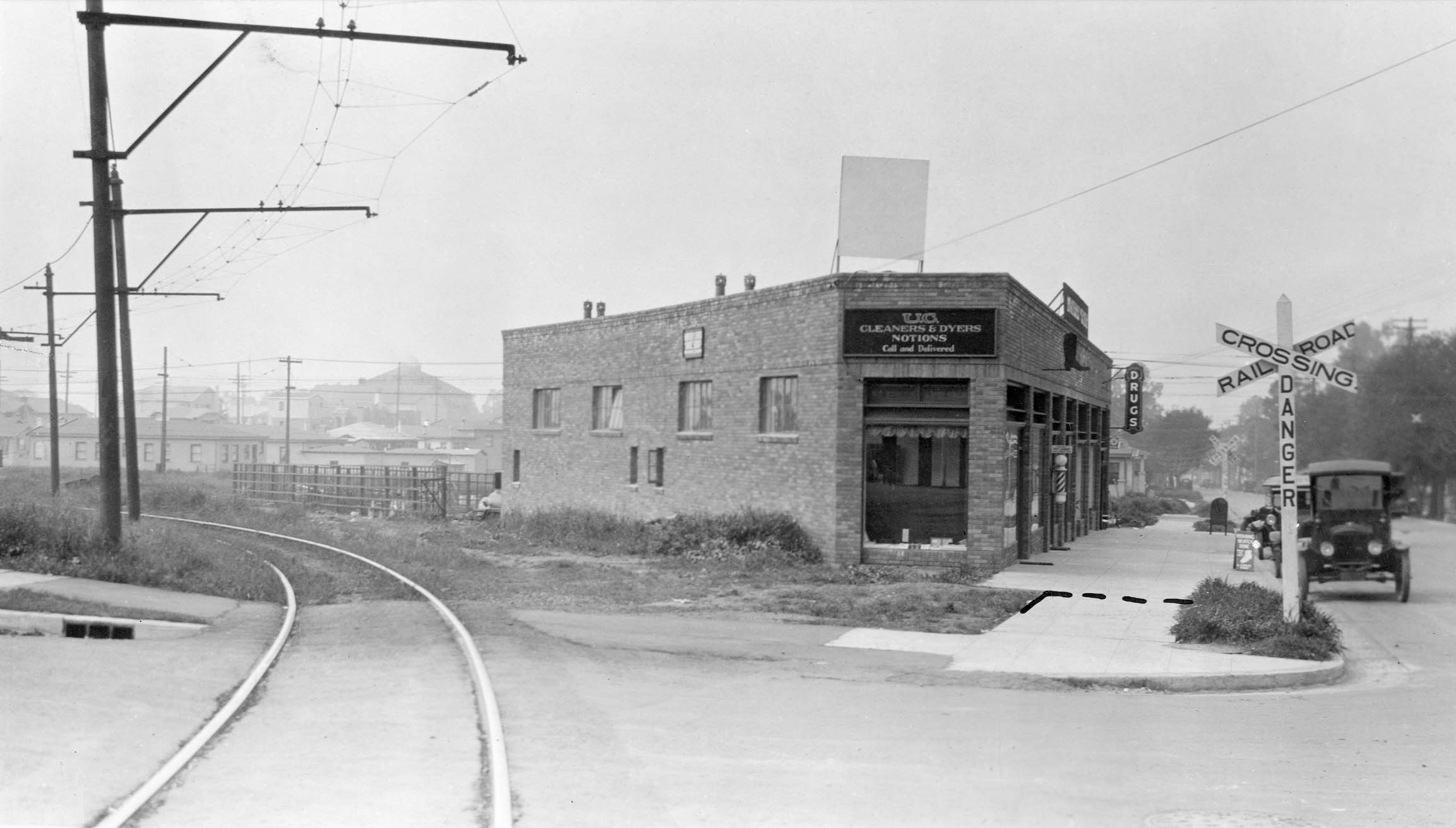
This southwest view across McGee Ave. at Hopkins St. shows the path taken by the Northbrae line onto the asphalt on Apr. 13, 1925. Vanguard Properties at no. 1600 Hopkins St. sits on the former right-of-way in 2026.
L349-120-Key Official Photo, Sappers Collection, Courtesy BAERA, Western Railway Museum Archives, 203395ks, (Image 26 of 32)
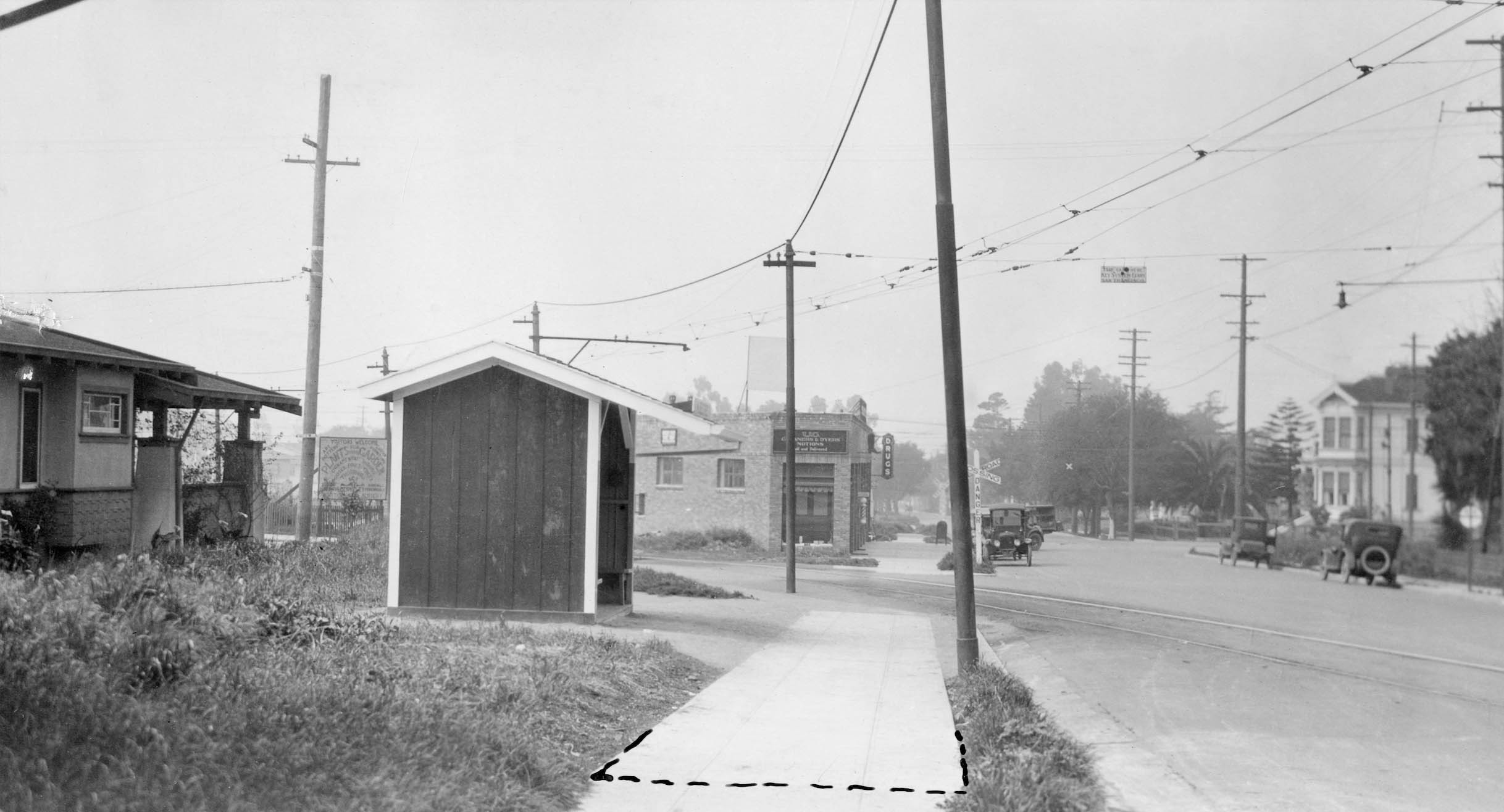
Same day, same view, but further east on Hopkins St. shows the shelter at the station located here. The dotted line suggests cutting the pavement at this spot.
L349-125-Key Official Photo, Sappers Collection, Courtesy BAERA, Western Railway Museum Archives, 203396ks, (Image 27 of 32)
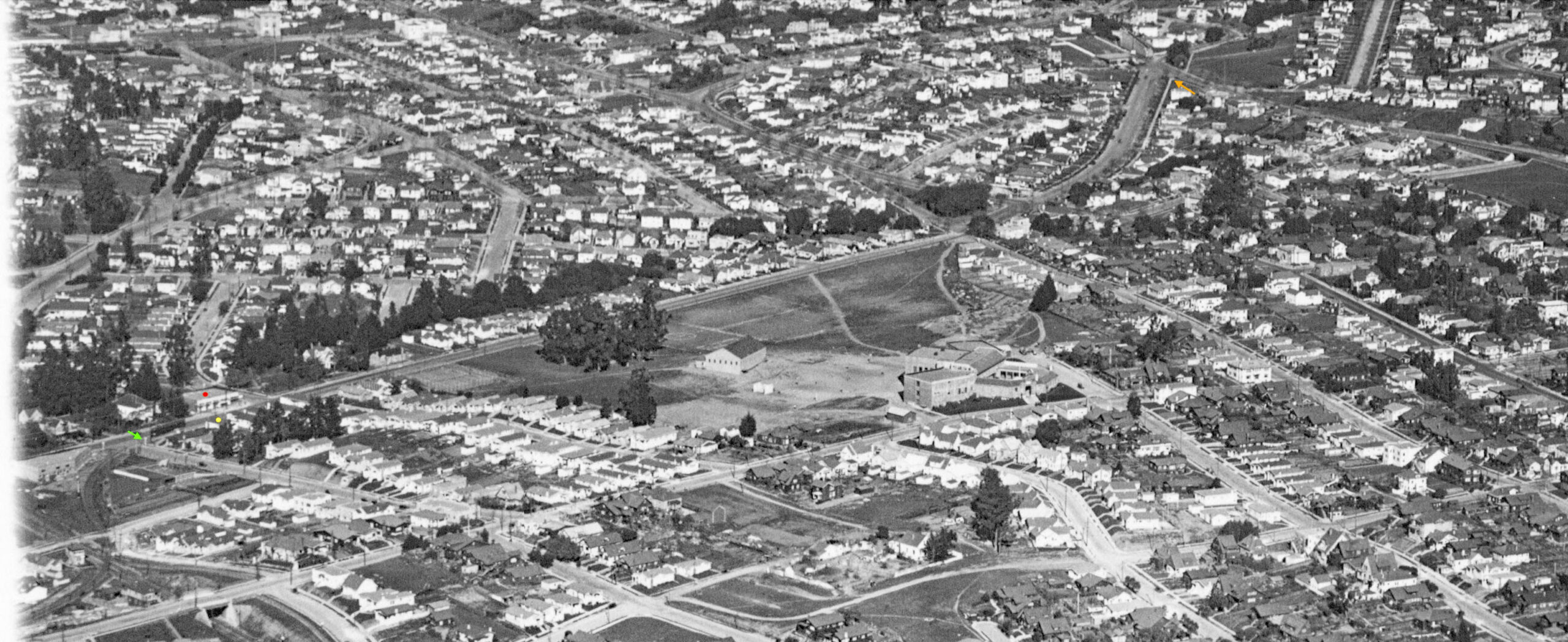
Another northeast view from a late 1920s aerial shown previously, here featuring a Northbrae single car passenger train seen east of McGee Ave. The buildings marked by the red dot and the house marked by the yellow dot are still present in 2026. The green arrow marks a crossbuck whose position indicates that the east corner of McGee Ave. with Hopkins St. is still squared off as seen in the previous two images. Note this image shows all of Hopkins St. to its terminus at Sutter St., orange arrow.
L349-130-George Russell Photo, Courtesy California State Lands Commission, SLC_644_NoDate_52, Detail, (Image 28 of 32)
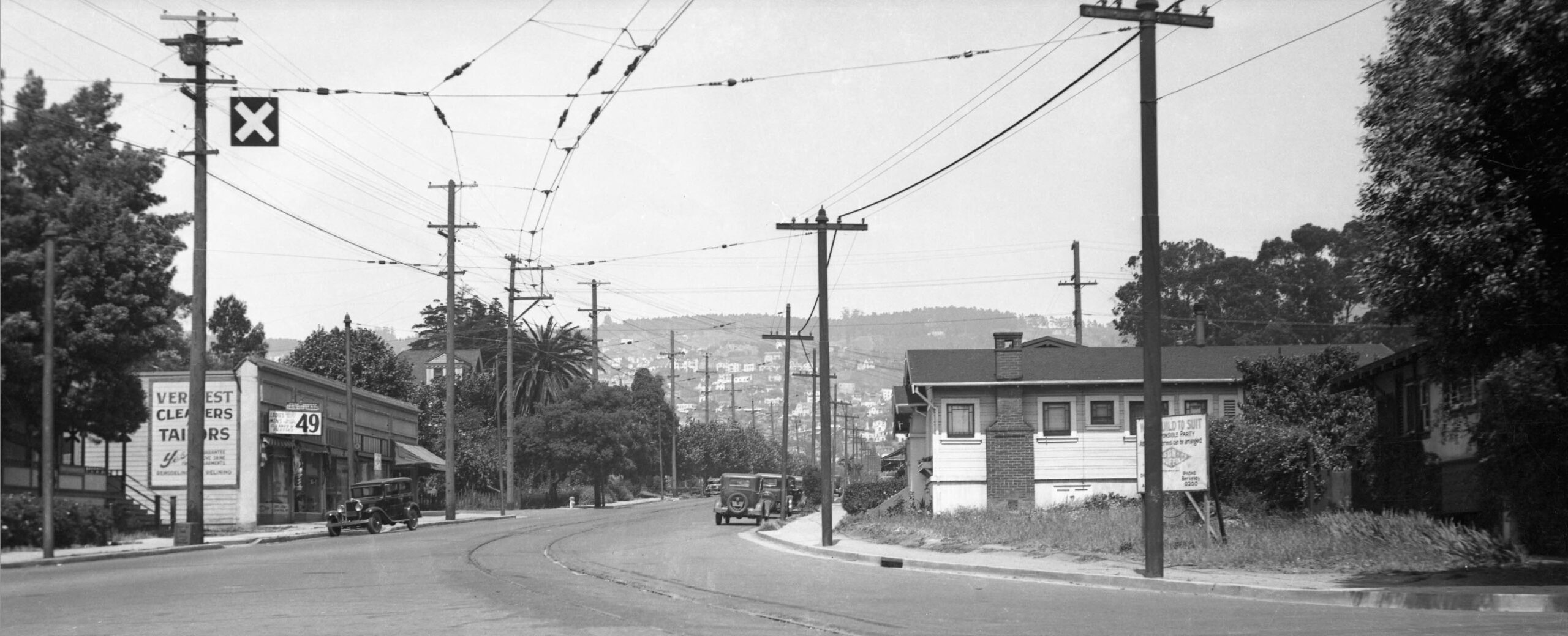
This northeast view down Hopkins St. was taken at a later date than the previous three images. The sidewalk has been cutback on the east side of McGee Ave. to follow the curve of the track. The house at the eastern side of McGee Ave. is no. 1616 Hopkins St., marked by the yellow dot in the previous aerial. It is still present in 2026, but is no longer the corner house. The shelter is also gone. The aerial comparison between 1931 and 2026 in L349-60 shows the curve in the sidewalk was removed after the track was abandoned in 1941, returning it to the original configuration a seen in 1925.
L349-135-Moreau Collection, Courtesy BAERA, Western Railway Museum Archives, 82632ks, (Image 29 of 32)
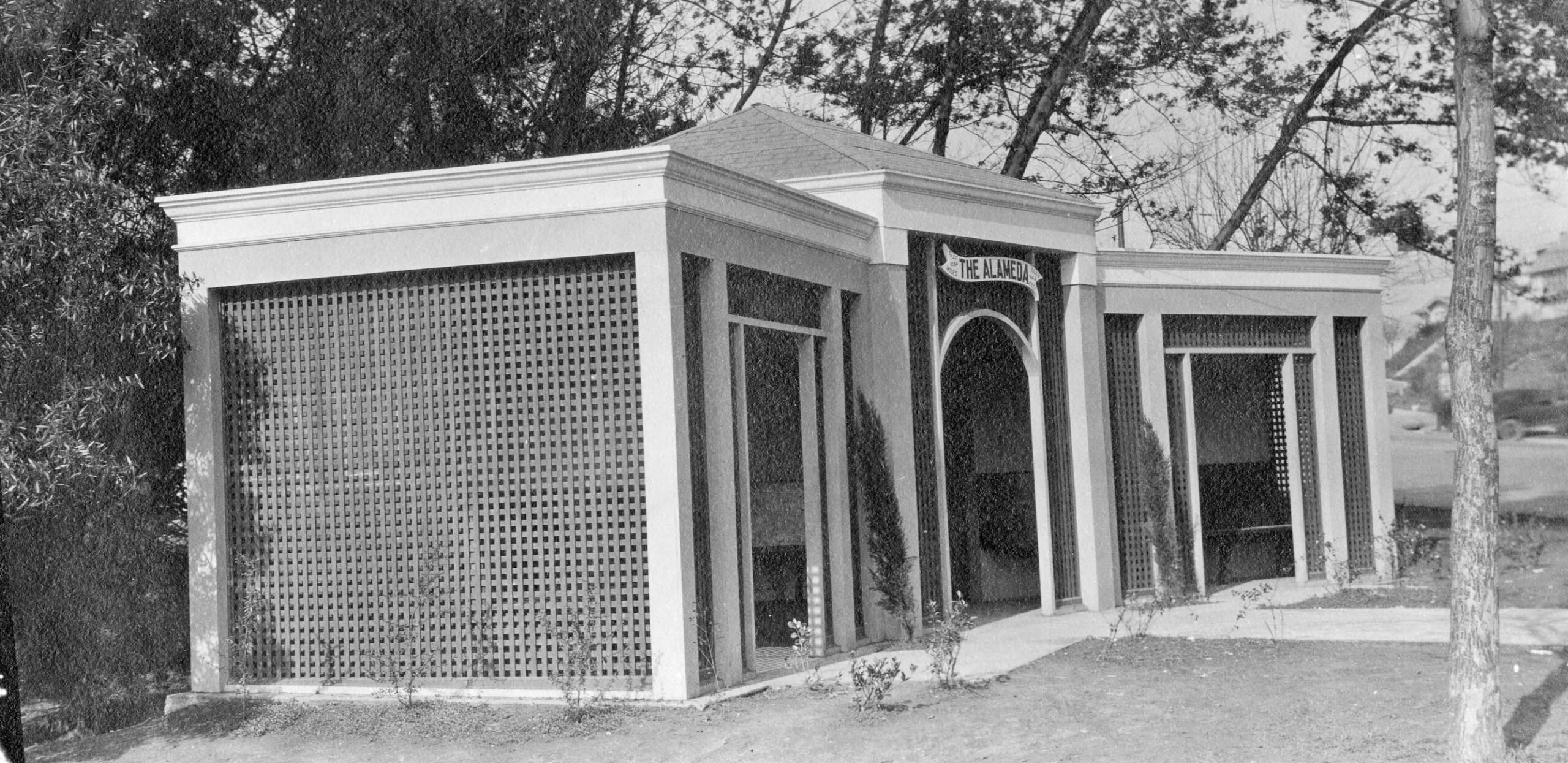
Ahead to Hopkins St. and The Alameda. On Feb. 11, 1924, the shelter that served the Northbrae line and Key Arlington streetcar sits on what is in 2026 the corner at the site of the North Berkeley library.
L349-140-Key Official Photo, Sappers Collection, Courtesy BAERA, Western Railway Museum Archives, 203321ks, (Image 30 of 32)
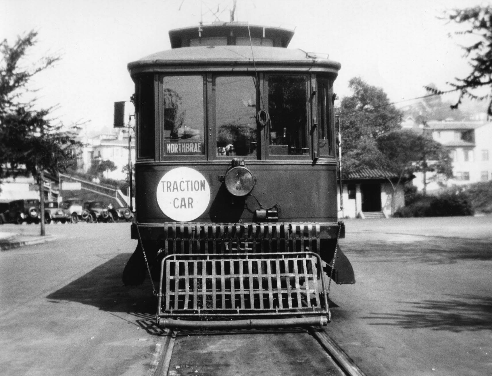
Finally at the terminus at Sutter St., a north view of a passenger car from 1925.
L349-145-Alan Atkins Photo, Courtesy BAERA, Western Railway Museum Archives, 22122ks, (Image 31 of 32)
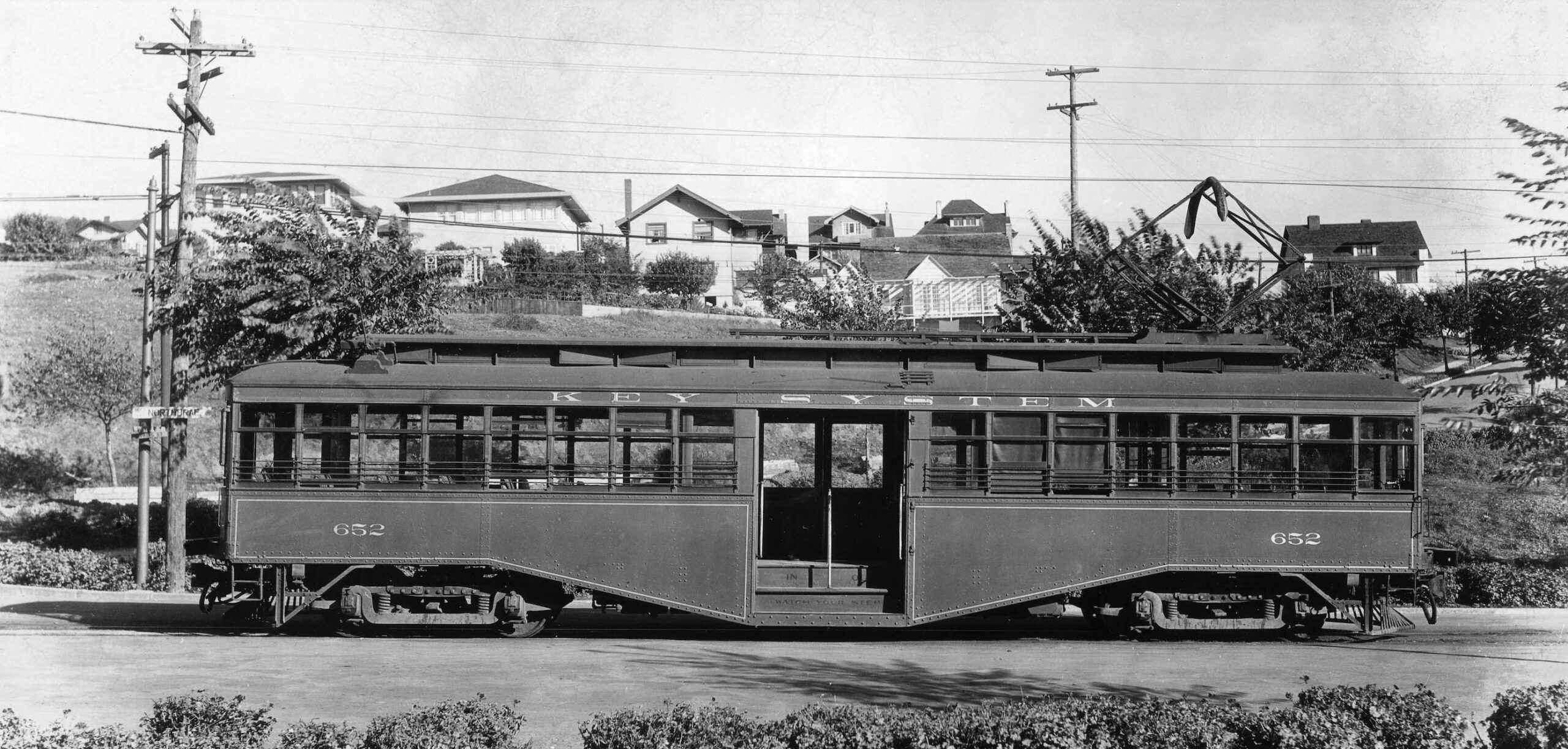
And from a different angle, an east view of Key 652 from Sept. 27, 1921.
L349-150-William Gardnier Photo, Courtesy BAERA, Western Railway Museum Archives, 22124ks, (Image 32 of 32)