Unsustainability -1920-1933 – George Russell’s Flight and Tracks Through the Weeds
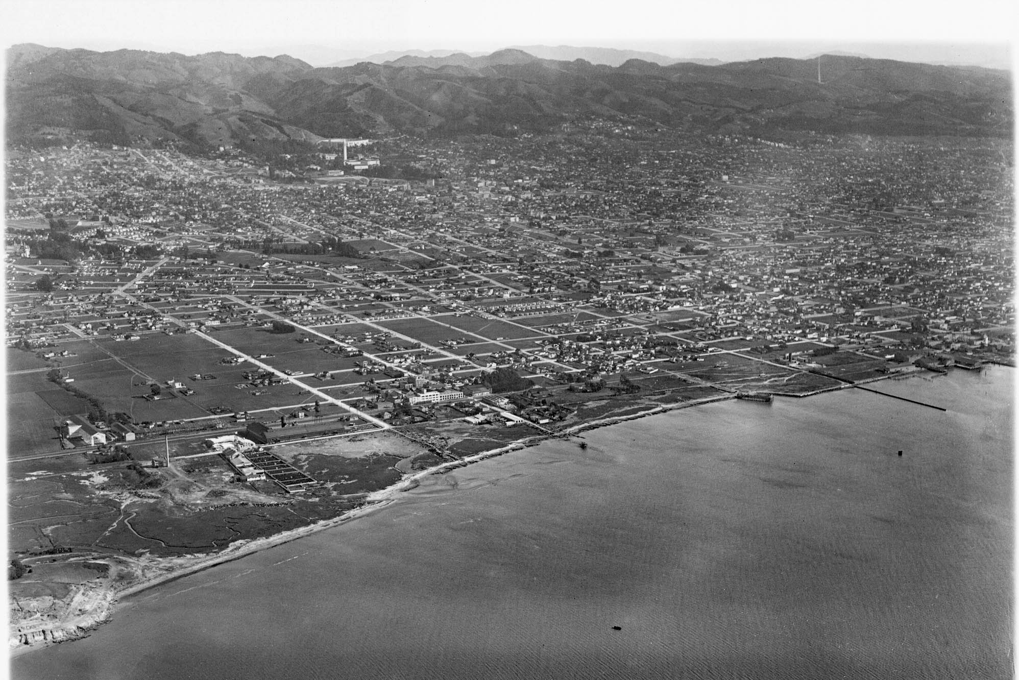
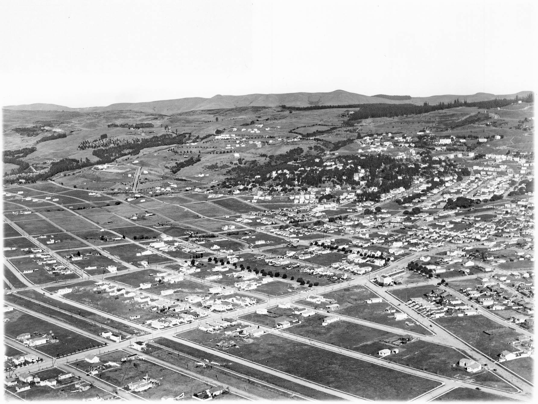
George Russell’s southeast aerial introduces this final update from the era 1920-1933 where it became more evident that maintaining competition between the Southern Pacific, SP, Oakland, Alameda and Berkeley suburban electric railway and the Key System interurban lines in a defined geographic area was unsustainable. The railways of West Berkeley and Albany, Key Westbrae and SP Ninth St. lines, will be covered with an added bonus of including the Atchison, Topeka and Santa Fe, Santa Fe, steam Oakland branch.
L350-05-George Russell Photo, Courtesy California State Lands Commission, SLC_644_NoDate_7, (Image 1 of 42)

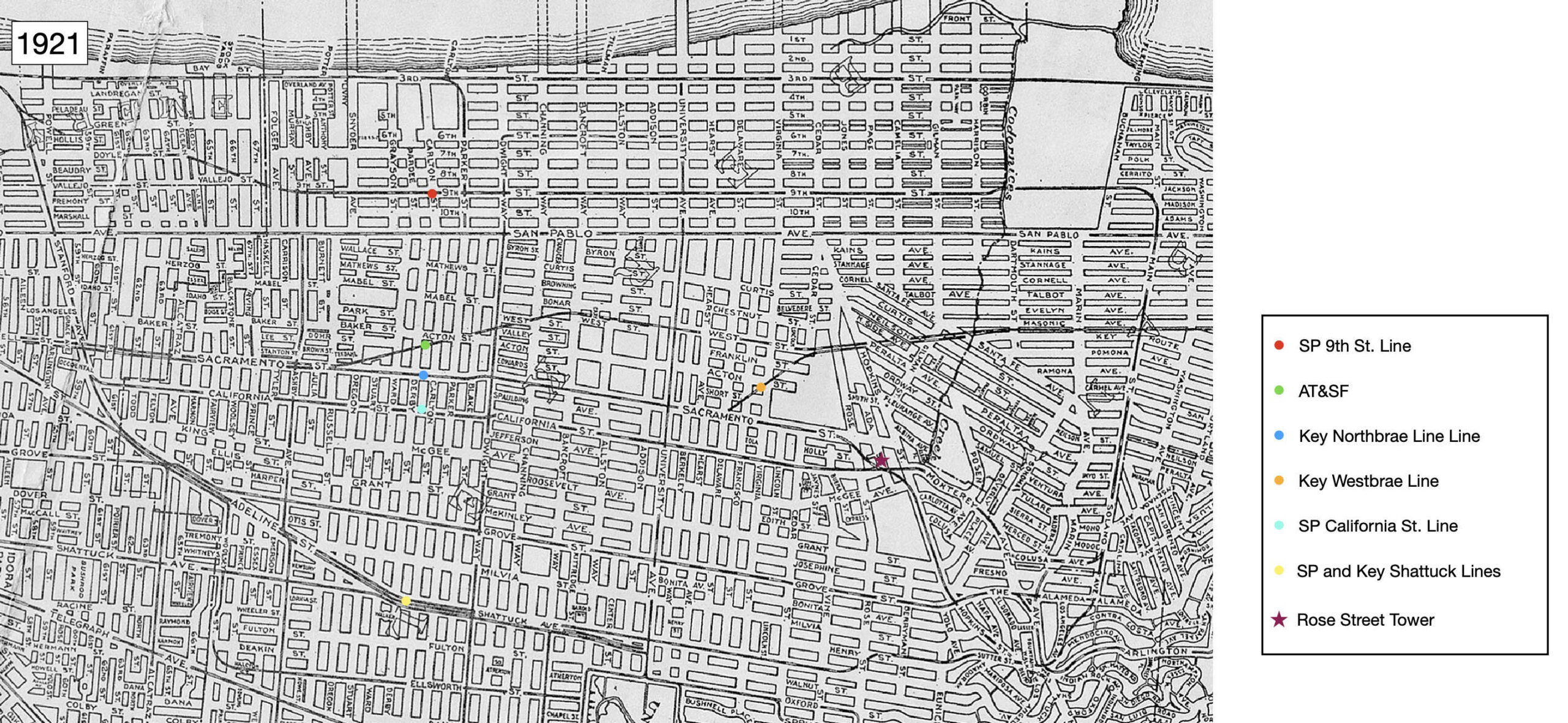
The Key Westbrae and SP Ninth St. are indicated on this map from 1921 with an orange and red dot, respectively. The Santa Fe is marked by a green dot. The close association of the latter with the Key Northbrae and Westbrae lines was no accident. Borax Smith would ship borate via his narrow-gauge Borate & Daggart Railroad, reloading it to the Santa Fe at Daggart, CA. He also helped the Santa Fe gain access into Oakland starting in 1902 by selling his acquired property of the bankrupt California and Nevada Railroad, but leaving some room to grow the Key Westbrae line all the way to Sacramento, a plan that was not fulfilled.
L350-10-Central National Bank Map, Courtesy BAERA, Western Railway Museum Archives, 83537, (Image 2 of 42)
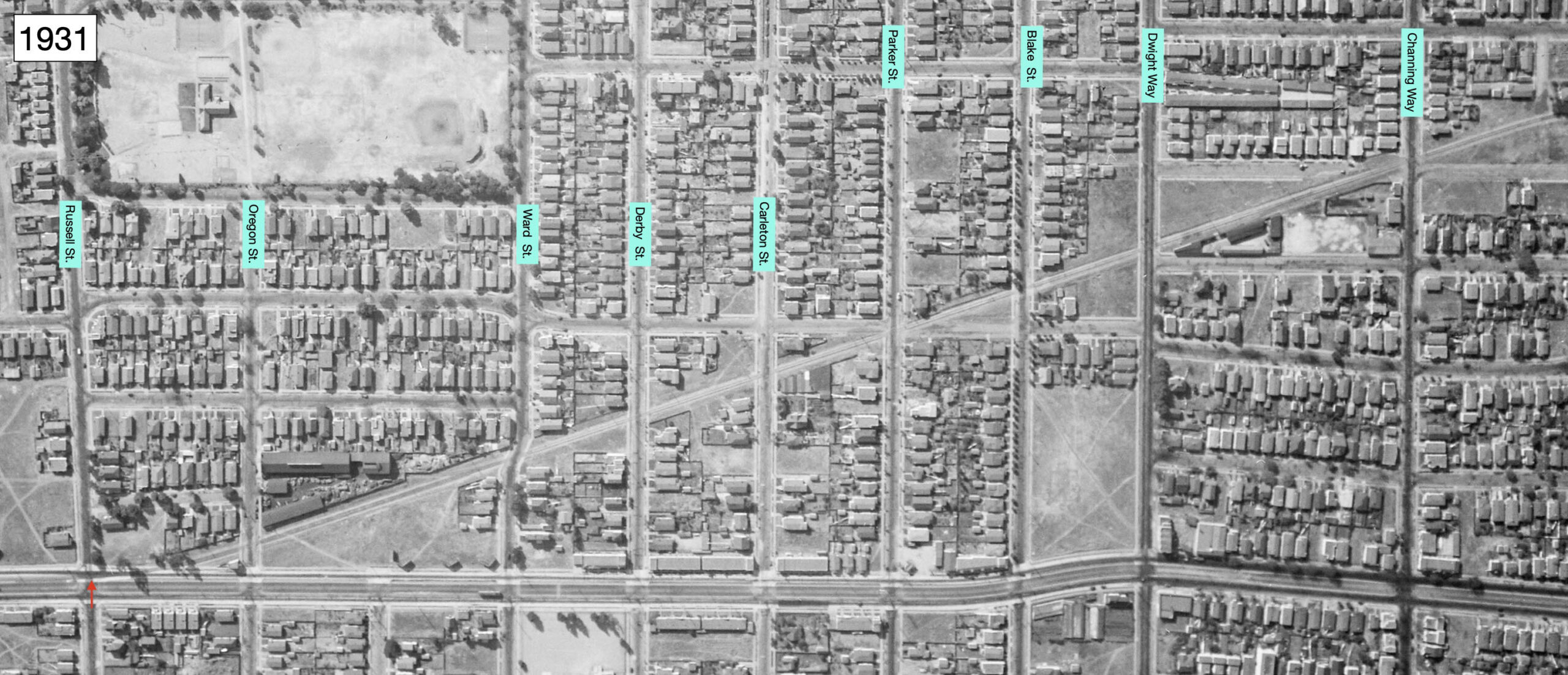
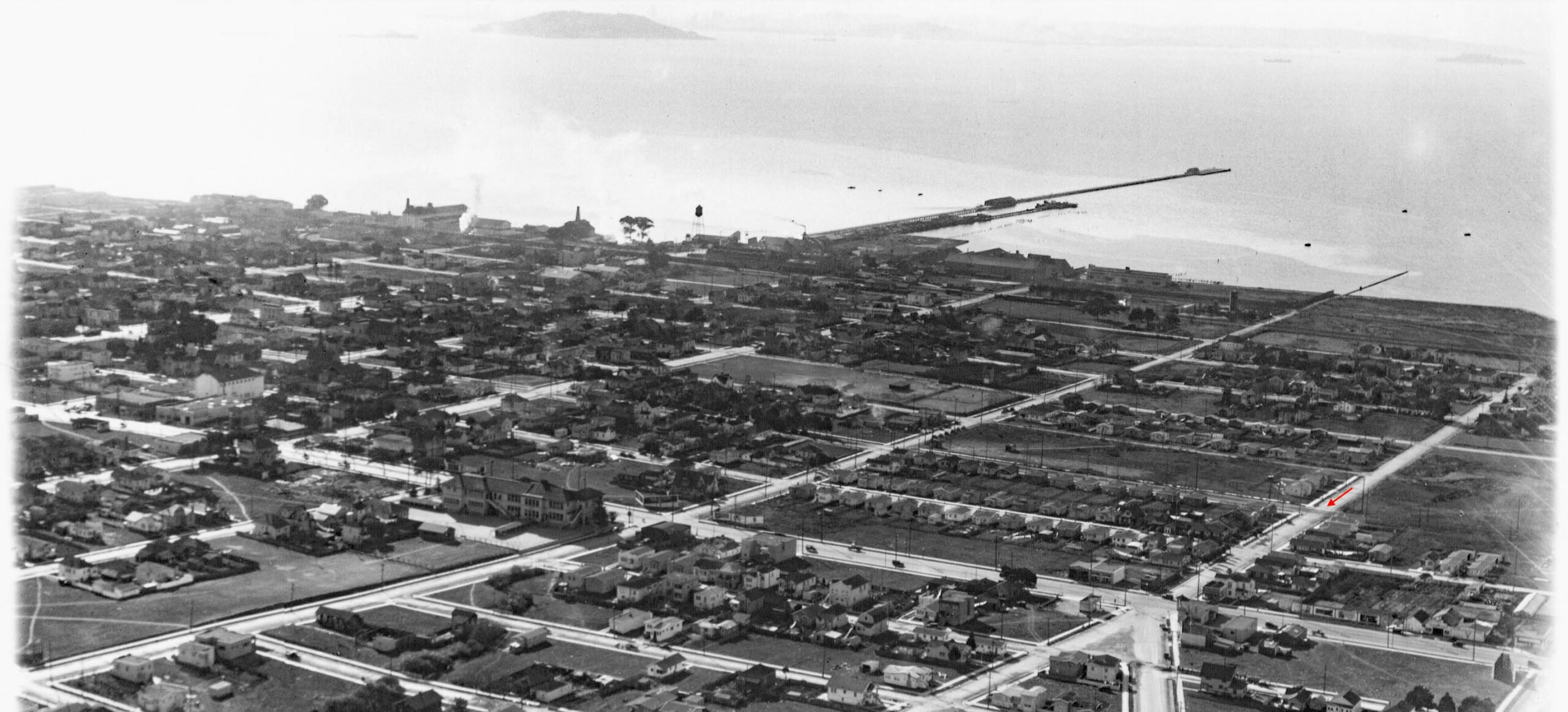
This vertical aerial oriented with west to the top shows the single track right-of-way of the Santa Fe separating from the Key Northbrae line between Russell St. and Oregon St., red arrow. By Channing Way, the line had settled along what was then West St., to the east of Bonar St.
L350-15-c-1820_58, Courtesy of UC Santa Barbara Library Geospatial Collection, l, Google Earth, r, (Image 3 of 42)
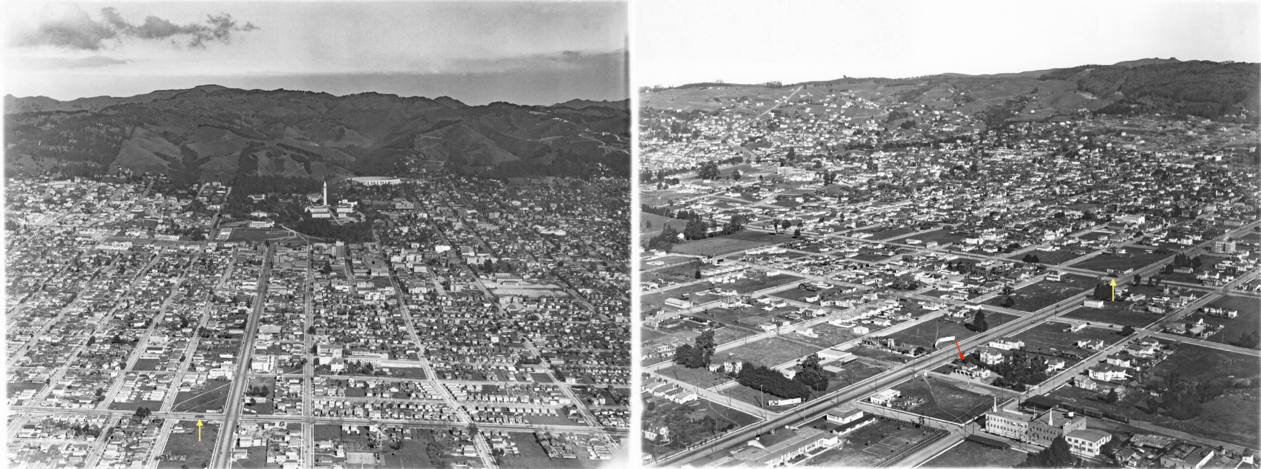
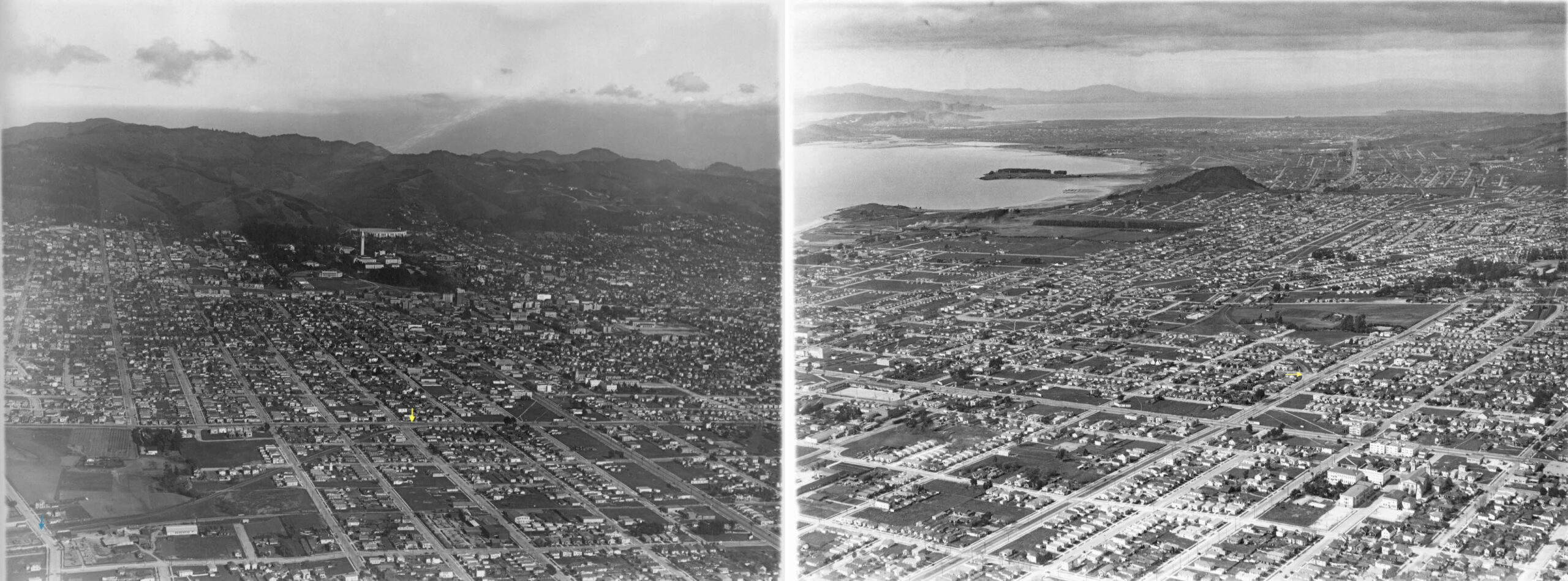
The next two aerials are from the mid-1920s, an east view on the left, and a northeast view on the right. The yellow arrows point to a single car Key Westbrae train waiting at their southern terminus at University Ave. for new passengers, or to transfer passengers with a Key Northbrae line train. The red arrow marks the Mission Revival-style Santa Fe passenger depot at University Ave., red arrow, designed by Charles Whittlesey and opened in 1904. To follow, details from both aerials.
L350-20-George Russell Photos, Courtesy California State Lands Commission, SLC_644_NoDate_53, l, _32, r, (Image 4 of 42)
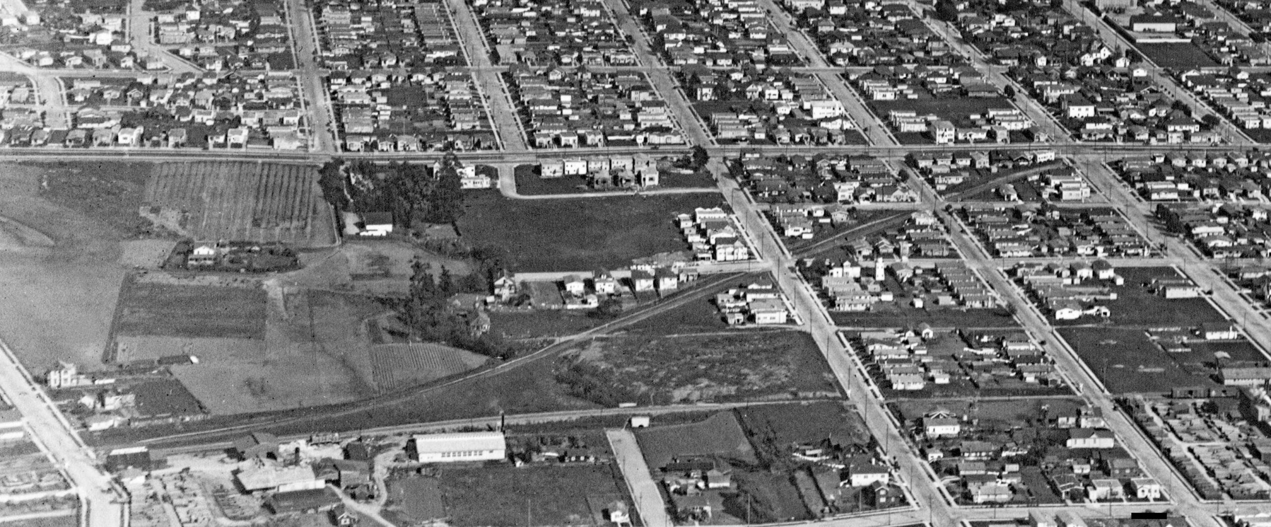
First, this detailed view from the previous aerial on the left highlights the terminus of the Key Westbrae line toward the right margin at University Ave. with the takeoff from the mainline at Delaware St. at the left margin.
L350-25-George Russell Photo, Courtesy California State Lands Commission, SLC_644_NoDate_32, Detail, (Image 5 of 42)
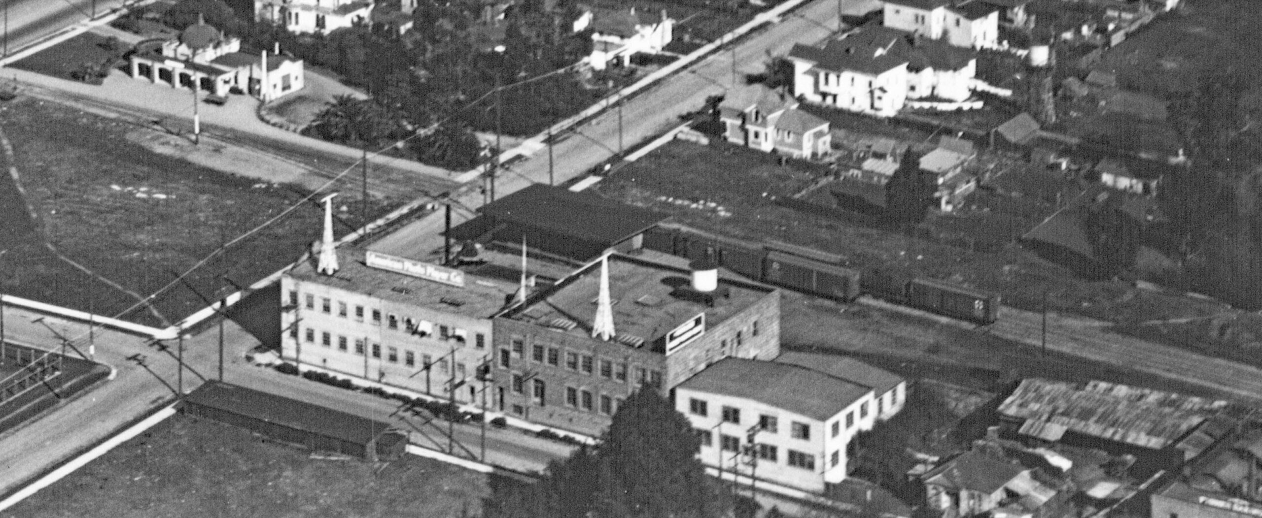
Second, a detailed view of the Santa Fe depot area with passenger station and freight shed at University Ave. from the previous aerial on the right. American Photo Player Company’s manufacturing facility can be seen on the southeast corner of Addison and Bonar Sts. It produced the music-making Fotoplayer apparatus that was used to accompany silent films. For a very detailed history of the company and building, and a demonstration of one being played, click here.
L350-30-George Russell Photo, Courtesy California State Lands Commission, SLC_644_NoDate_53, (Image 6 of 42)
Two more aerials from the 1920s, a southeast view on the left, a northwest view on the right. The yellow arrows point to the takeoff of the Key Westbrae line from the Key Northbrae line at Delaware St. Details from each follow.
L350-35-George Russell Photos, Courtesy California State Lands Commission, SLC_644_NoDate_30, l, _4, r, (Image 7 of 42)
A detail from the previous east aerial on the left shows the takeoff point of the Westbrae line at Delaware St. and Sacramento St. toward the right margin, and its private right-of-way to Rose St., left margin, now alongside the Santa Fe. The stop after University Ave. on schedules was listed as Virginia St. An image of a shelter at that location could not be found. The land between Delaware St. and Virginia St. was transformed into the North Berkeley BART station in the early 1970s.
L350-40-George Russell Photo, Courtesy California State Lands Commission, SLC_644_NoDate_30, (Image 8 of 42)
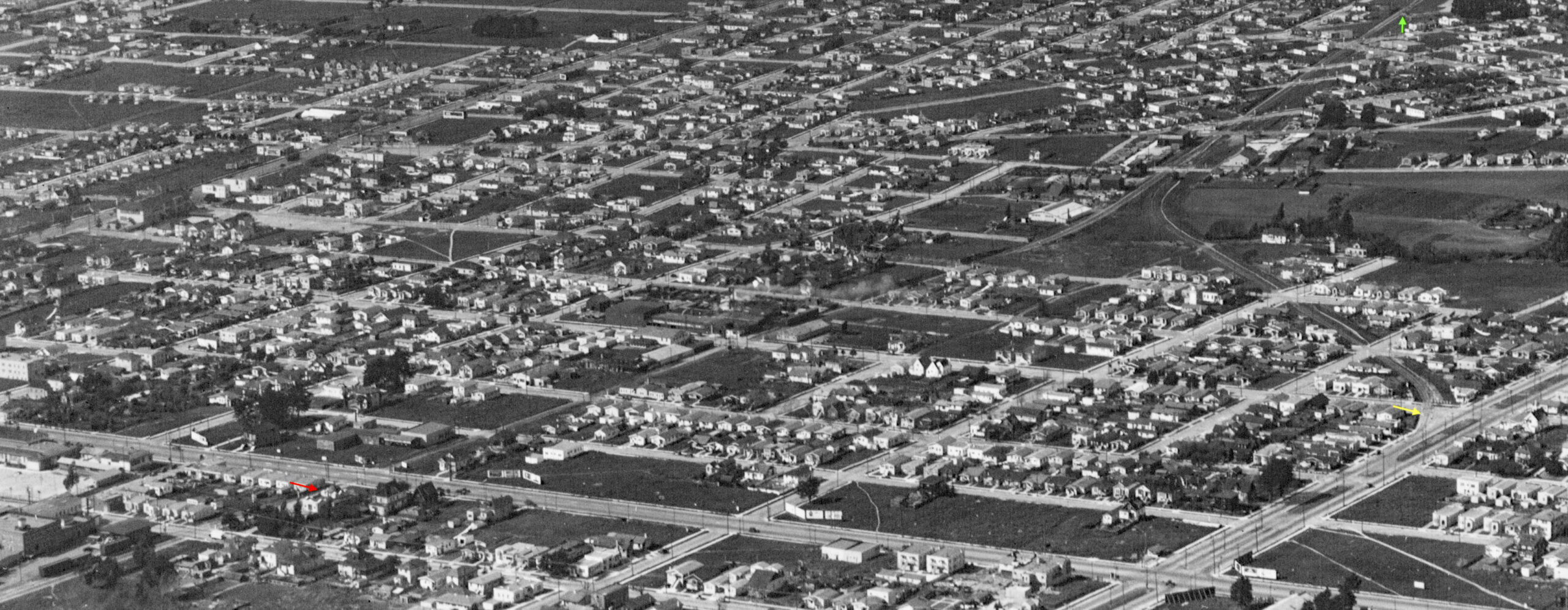
This detail of the previous aerial on the right shows the takeoff point of the Westbrae line at Delaware St. and Sacramento St., yellow arrow, and follows the line all the way to its Westbrae terminus at Santa Fe Ave., green arrow. The Santa Fe right-of-way is also seen in the north Berkeley area, but can be traced back all the way to the University Ave. passenger station, red arrow.
L350-45-George Russell Photo, Courtesy California State Lands Commission, SLC_644_NoDate_4, (Image 9 of 42)
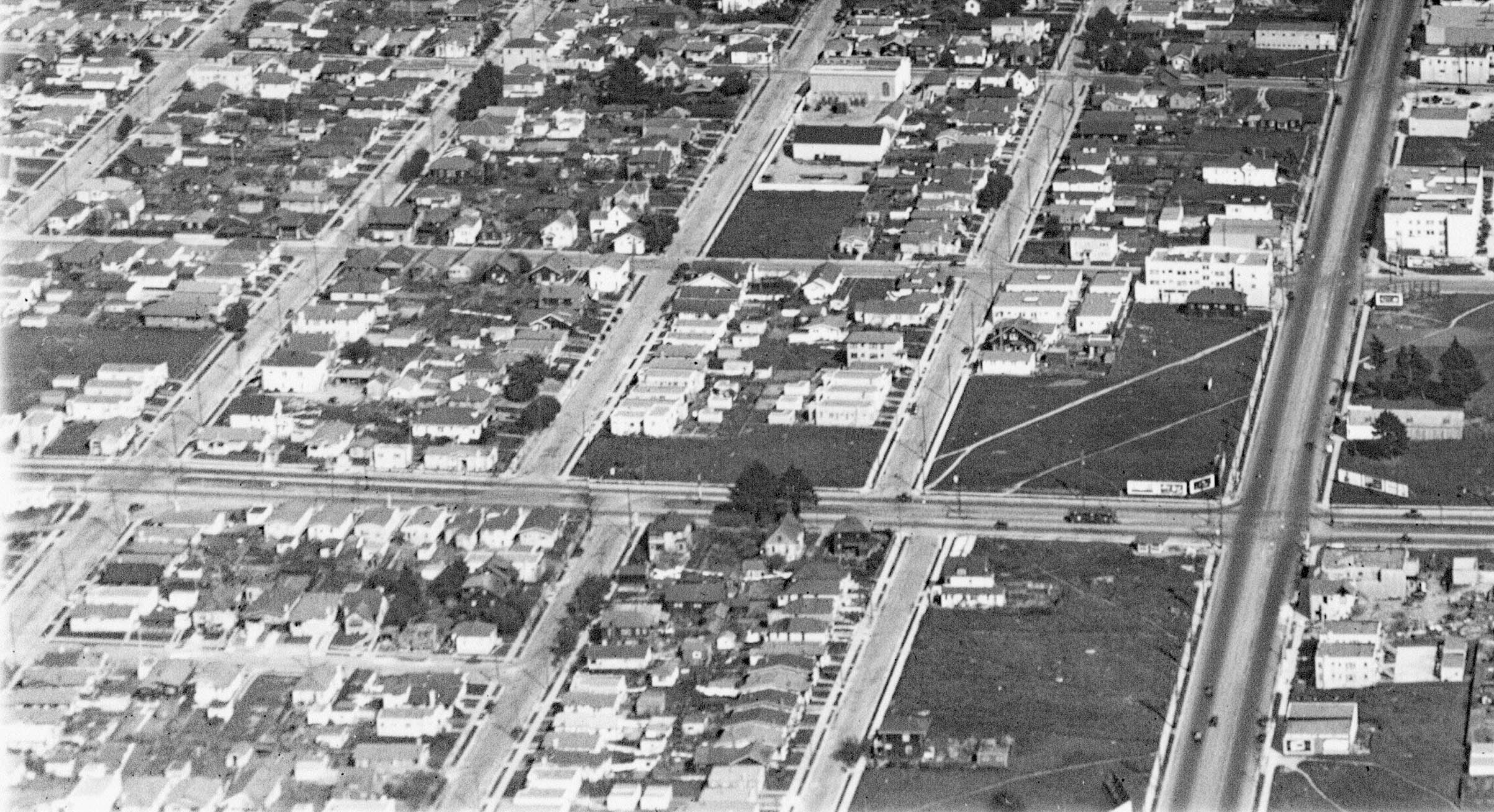
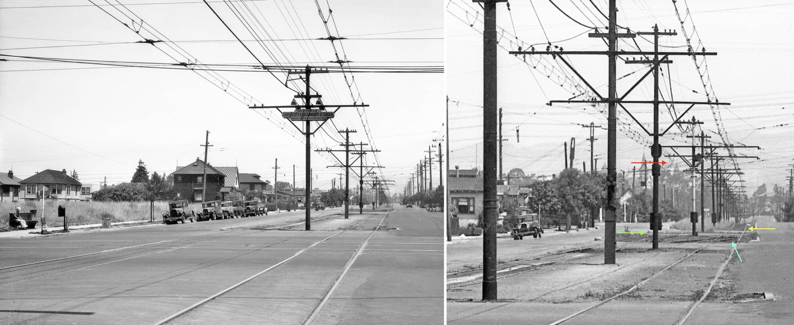
Ground views from 1934 contain the same general information as 1933, and will be used next. On the left is a north view from just south of University Ave. and its Key streetcar tracks at the terminus of the Westbrae trains. The dark colored house at Berkeley Way and the one beyond remain in 2026. The detail, right, shows all Northbrae train tracks from the south have two tracks, but short of Delaware St. there is a switch track, turquoise arrow, forcing this line to a single track, yellow arrow. The Westbrae trains sat where the green arrow is placed, the dedicated track heading north to turn off the mainline as indicated by the red arrow pointing to the overhead wire. This set up allowed Northbrae trains to go around the Westbrae trains.
L350-47-Key Official Photo, Courtesy BAERA, Sappers Collection, 171263ks, (Image 10 of 42)
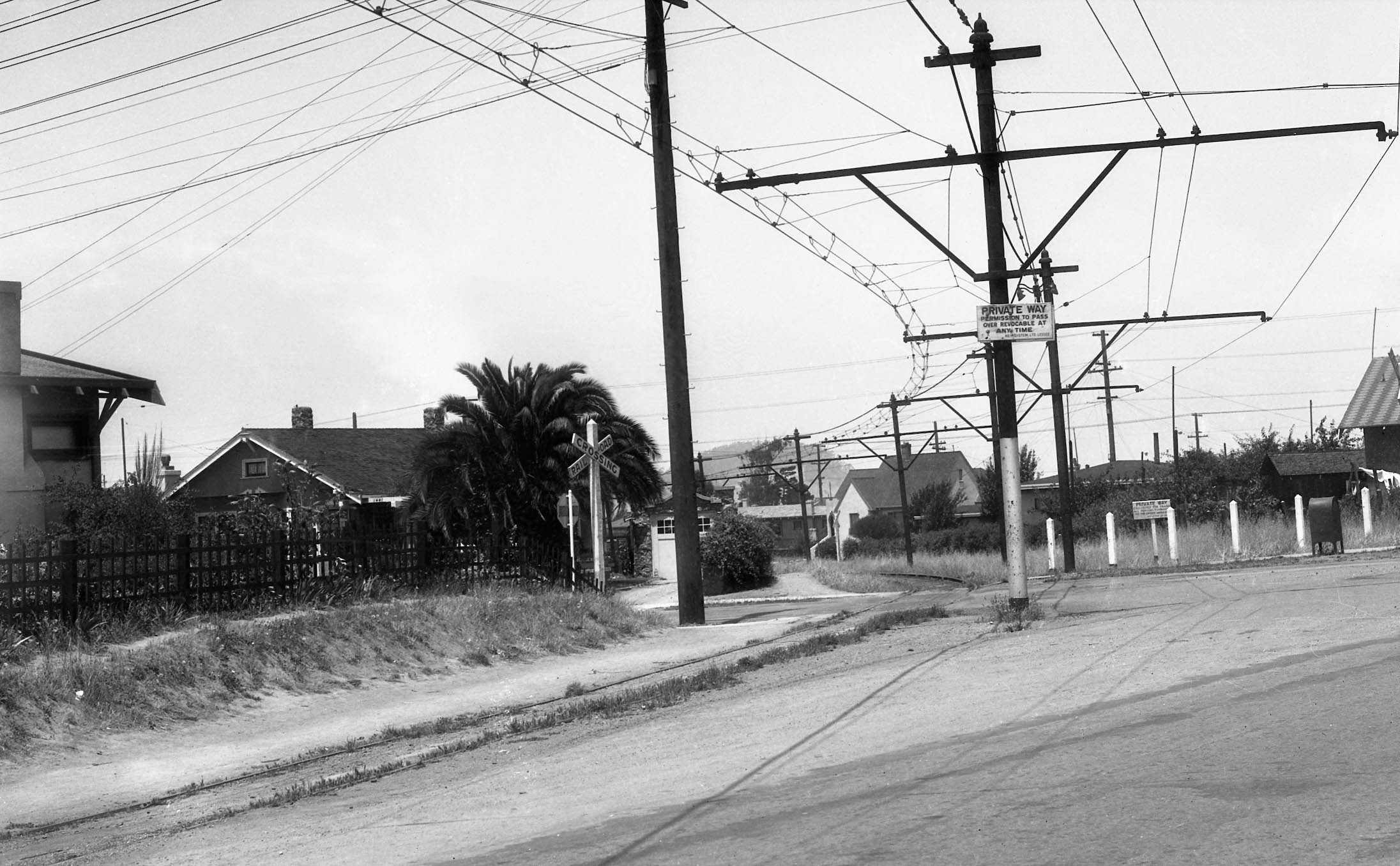
This northwest view shows the right-of-way curving across Delaware St. as the line turned off Sacramento St. at a forty-five degree angle. Every house in this image north of Delaware St. has been replaced by BART, and the corner house on the left edge no. 1442 Delaware St. is no longer a corner house; a newer structure sits on the abandoned rail path, the former cut across the side walk now squared off with Sacramento St.
L350-50-Key Official Photo, Courtesy BAERA, Sappers Collection, 171277ks, (Image 11 of 42)
In sequence, a northwest view at Francisco St. and Short Street. This spot is now occupied by the BART North Berkeley station building.
L350-52-Key Official Photo, Courtesy BAERA, Sappers Collection, 171276ks, (Image 12 of 42)
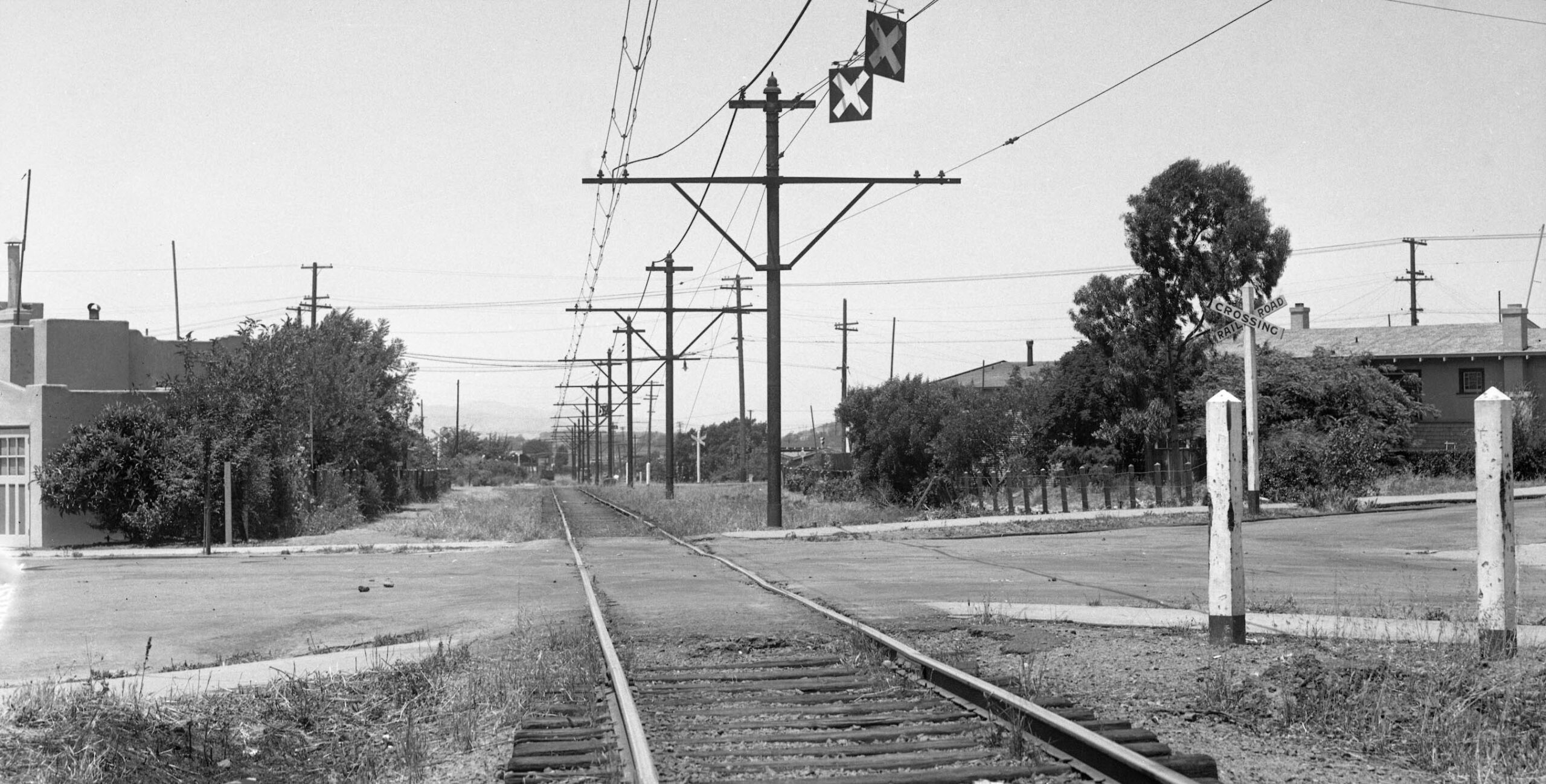
Continuing along the Key Westbrae line to the northwest, this image shows the grade crossing at Virginia St. and Acton St. and weeds along the track. Having left the future BART station area once across the intersection, the path in 2026 is the start of the Ohlone Greenway. BART follows this route underground. The house along the left margin is gone, the land now part of a parking lot for the several parks in the area.
L350-55-Key Official Photo, Courtesy BAERA, Sappers Collection, 171272ks, (Image 13 of 42)
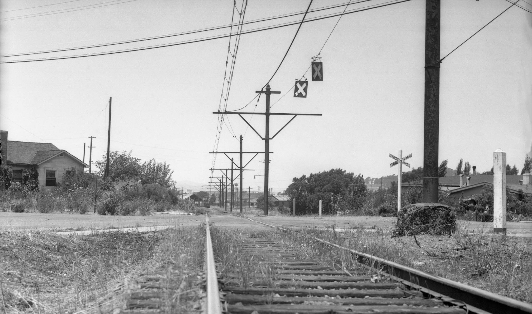
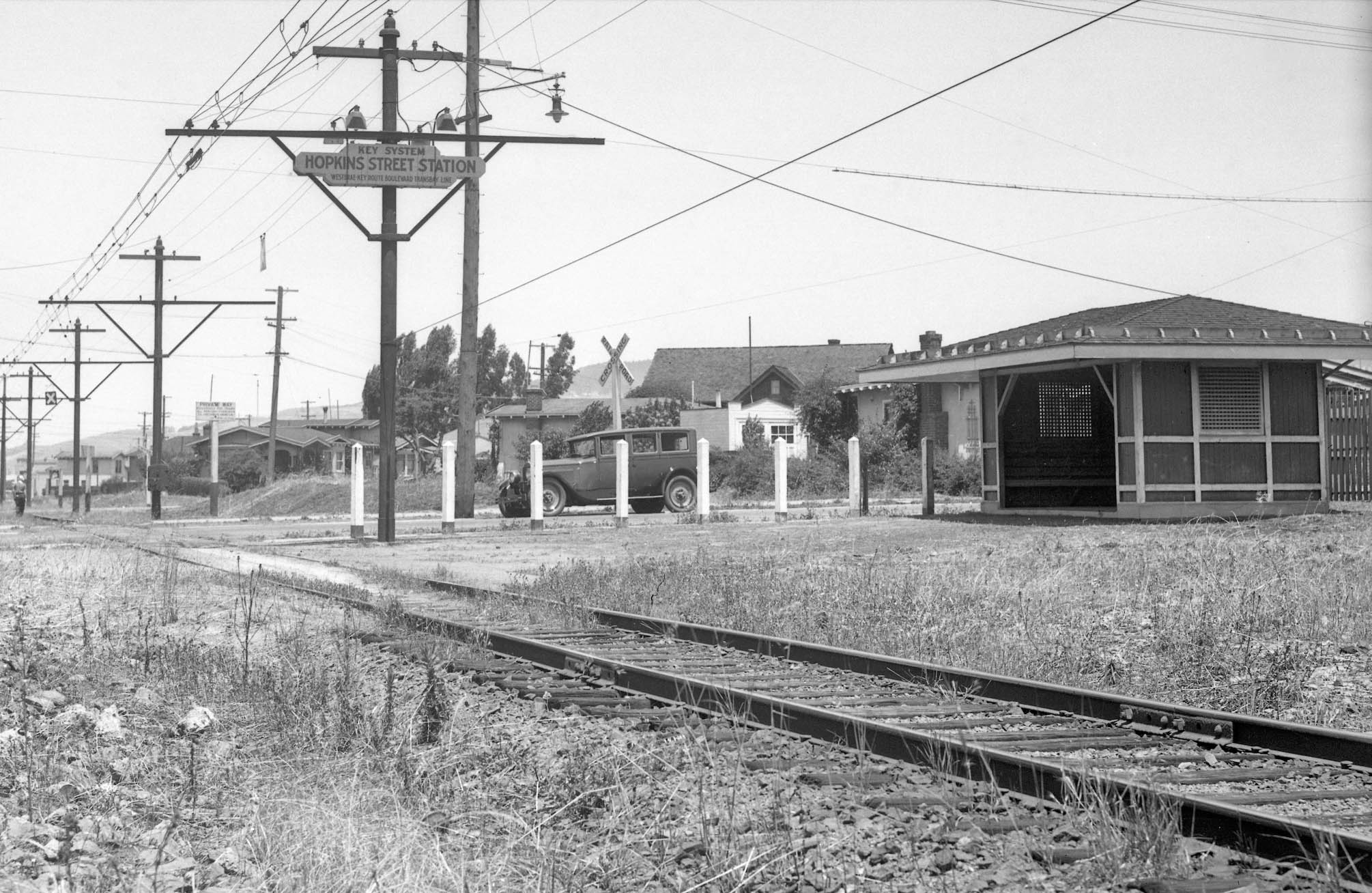
The Hopkins St. stop with shelter on the right, north view, was the next image found from 1934. The overhead X marks the grade crossing of Peralta St. You can see why authors would talk about the train heading through fields of weeds. This view in 2026 would capture the Cedar Rose Park Pickleball Courts. Note from the station sign, the term “Westbrae” came to the line in 1934 according to Sappers “Key System Streetcars”, Signature Press, 2007. When debuting in 1911 it was to be the “Sacramento Short Line”, then the “Richmond Line” and on early maps the “Albany Line”, falling one block short of that city as well.
L350-60-Key Official Photo, Courtesy BAERA, Sappers Collection, 171273ks, (Image 14 of 42)
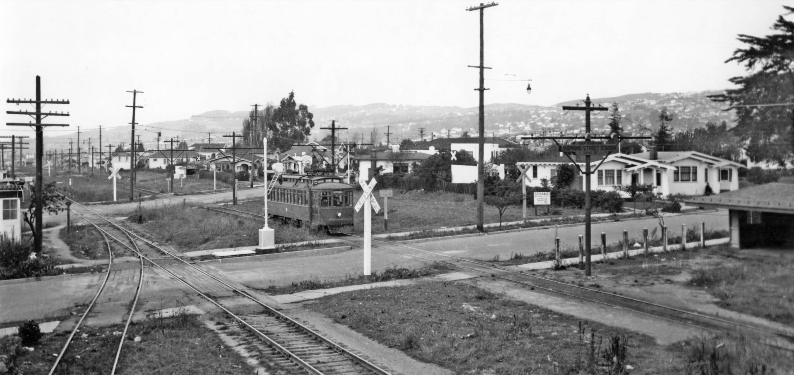
The next ground view is also at Hopkins St., and it shows a KS 271 lettered as “G” plus the Santa Fe track and a spur takeoff. According to Sappers, the letter came to the line after a swap with the Key Alcatraz K line, also in 1934. The two houses to the right, nos. 1315 and 1317 Hopkins St., left to right, remain in 2026, but now two houses sit to the west plus the EcoHouse Garden Center alongside the Karla Linn Community Garden. The BART line surfaces from its tunnel on the north side of Peralta St., the Ohlone Greenway reappearing there to its east.
L350-65-Railway Negative Exchange Photo, Courtesy BAERA, Western Railway Museum Archives, 22159ks, (Image 15 of 42)
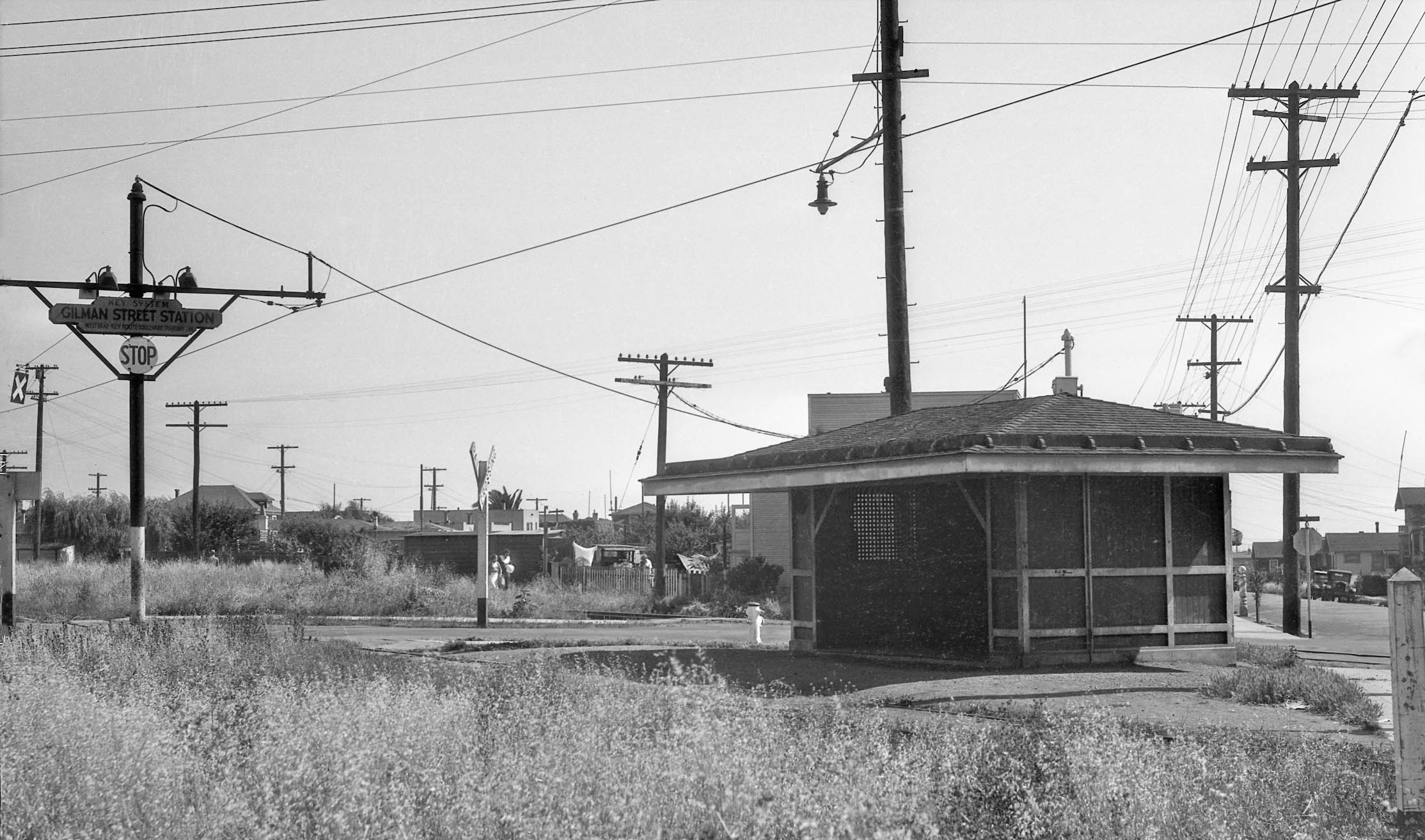
Finally from 1934, this southwest view at the Gilman St. stop with shelter. The shelter is to the west of the track, the Santa Fe track is behind it or west. Curtis St. formed part of the intersection, on the right.
L350-70-Key Official Photo, Courtesy BAERA, Sappers Collection, 171275ks, (Image 16 of 42)
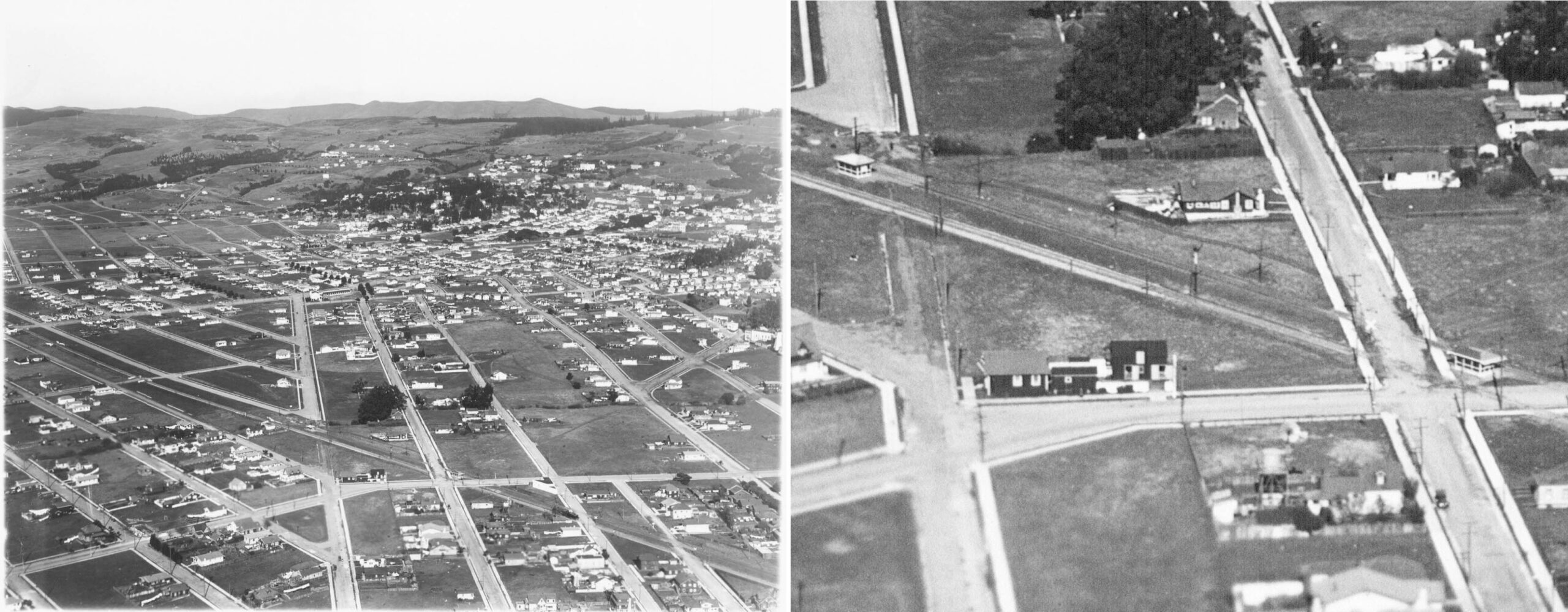
The northeast aerial from the late 1920s, left, shows the Gilman and Westbrae stations. The train in view is a Santa Fe steam locomotive and tender. The detail on the right show the Gilman St. shelter at Curtis St. intersection on the right, and the Westbrae shelter on the left, both along the west side of the private right-of-way. Key Route Blvd. continues north along the route, the unfulfilled plan of Borax Smith to continue the line to Albany, Richmond, and possibly even Sacramento.
L350-75-George Russell Photo, Courtesy California State Lands Commission, SLC_644_NoDate_58, (Image 17 of 42)
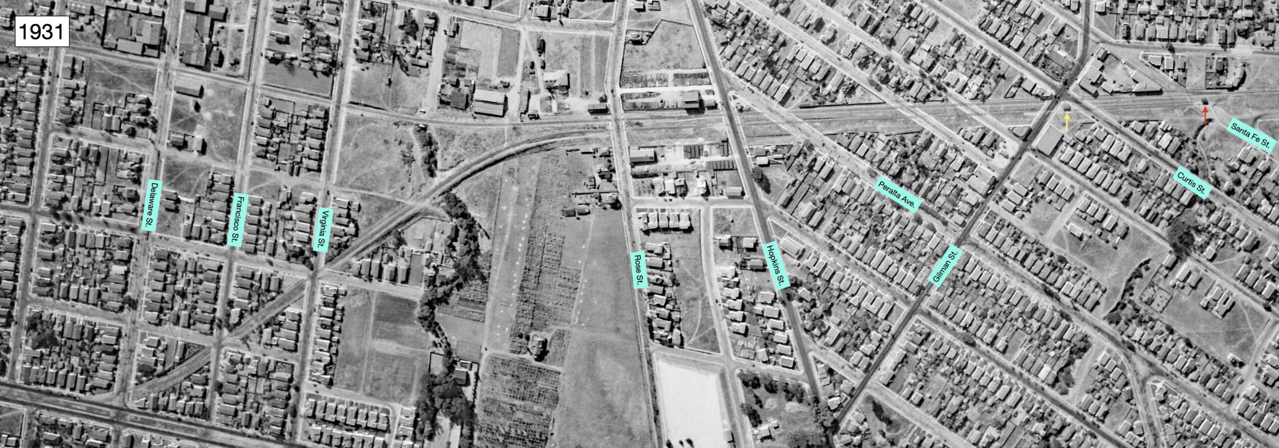
Given the gap in the presentation so far between the Hopkins St. and Gilman St. shelters, this aerial from 1931 aerial provides that information. The Westbrae line from its Delaware St. takeoff, left, until the terminus at Santa Fe Ave., right. Finished with the Key line, next to examine the SP Ninth St. line in Berkeley in detail.
L350-80-c-1820_61, Courtesy of UC Santa Barbara Library Geospatial Collection, (Image 18 of 42)
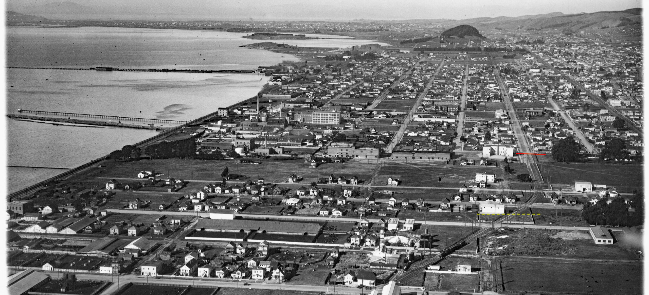
The SP Ninth line has been covered extensively in the “Rails to Trails” section from its separation from the mainline on Stanford Ave. until Heinz Ave. in Berkeley from 1912 until the freight operation ceased in the early 2000s. For this update, images covering 1920-1933 will be reviewed from Heinz Ave. to Solano Ave. This north view from the 1920s shows where the SP Ninth St. line crossed into Berkeley north of 67th St., broken yellow line, and Heinz Ave., red line. For the “Rails to Trails” updates, and the identity of many of the buildings in this image, click here.
L350-85-George Russell Photo, Courtesy California State Lands Commission, SLC_642_NoDate_11, (Image 19 of 42)
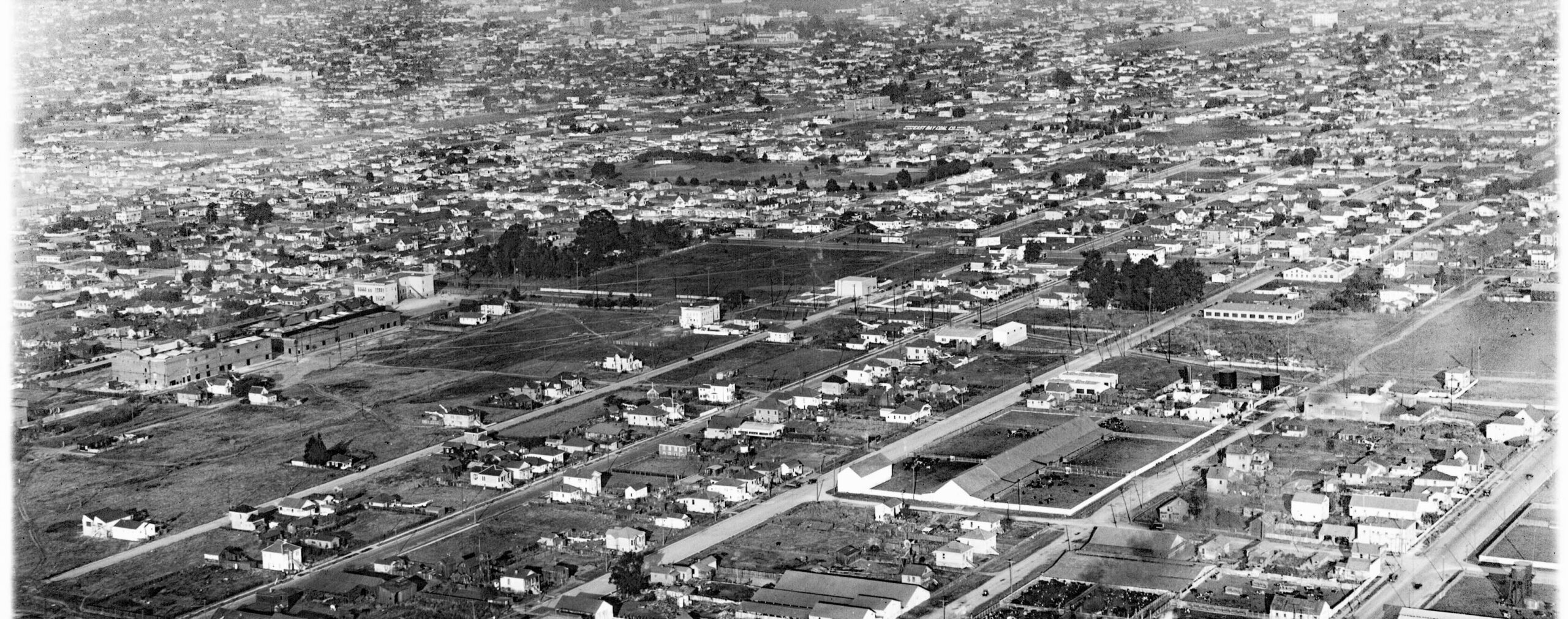
Another view of the southern Berkeley border where the Ninth St. passed through, this a northeast view from the mid-1920s. The large empty lot in the center would be purchased by the Heinz Co. They built a small building there in 1926 (after this image was taken,) and the building that is still there at Ashby Ave. and San Pablo Ave. in 2026, was constructed in three phases, between 1927 and 1928.
L350-90-George Russell Photo, Courtesy California State Lands Commission, SLC_644_NoDate_24, (Image 20 of 42)
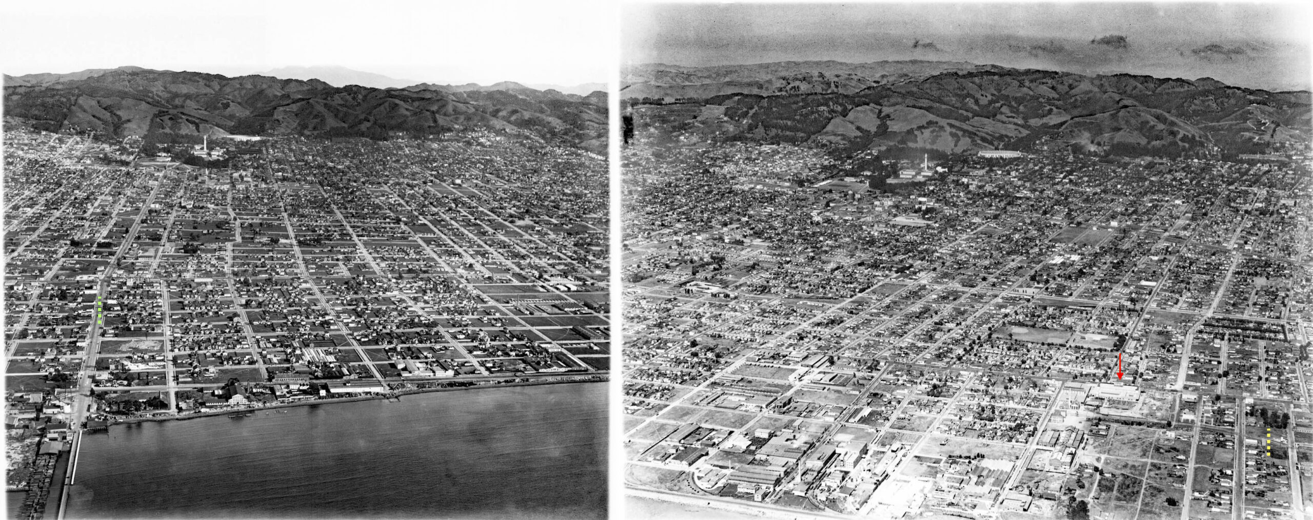
These two aerials from the late 1920s on the left, and 1929-1930 on the right, are juxtaposed such that where the SP Ninth St. line crossed the southern border of Berkeley is on the far right of the right image, broken yellow line, and where it crossed University Ave. is on the far left of the left image, green broken line. The red arrow points to the Heinz facility serviced by SP freights. SP freights did not operate north of Heinz St. using the Ninth St. passenger train tracks, but shortly it will be shown that they did parallel the tracks coming from the north to Camelia St.
L350-95-George Russell Photos, Courtesy California State Lands Commission, SLC_644_NoDate_25, l, 22, r, (Image 21 of 42)
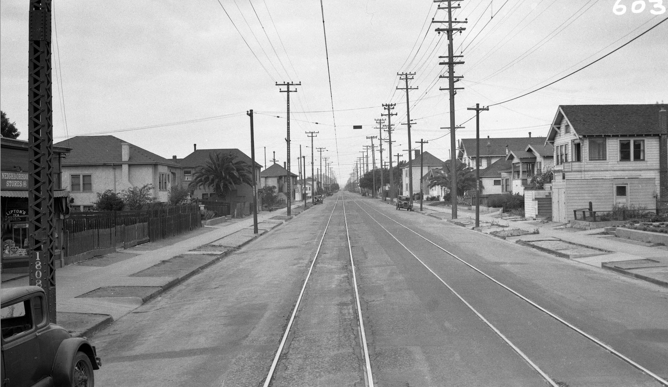
Two sets of images will be used to survey the SP Ninth St. line. One set was from the back of a passenger train heading south in 1933, the photographer not known. The second set is from 1934, taken by the SP from the center of the street. Starting on the ground from Heinz St. a north from the back of a passenger train heading south in 1933. The private right-of-way also serving freight service ended at Heinz Ave. and the two passenger tracks were now on asphalt. On the right or east, the houses after the first two to the end of the block appear intact in 2026.
L350-100-Courtesy BAERA, Western Railway Museum Archives, 233125oa&b, (Image 22 of 42)
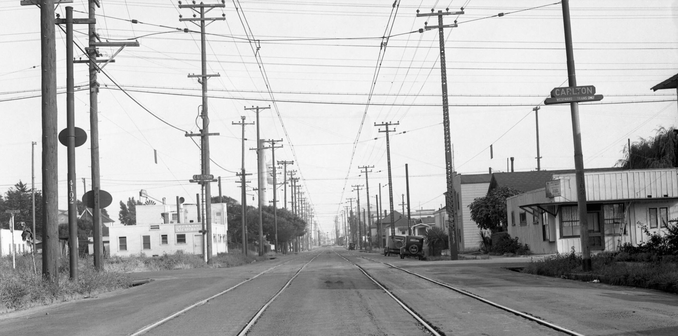
Next, from the 1934 series, a south view from the Carlton St. stop. An “E” would be added later to spell “Carleton” later. The smoke stack and water tower from the Heinz facility can be appreciated in the background toward the left edge. The houses in the foreground are all gone in 2026.
L350-101-SP Official Photo, Courtesy BAERA, Western Railway Museum Archives, Sappers Collection, 170929oa&b, (Image 23 of 42)
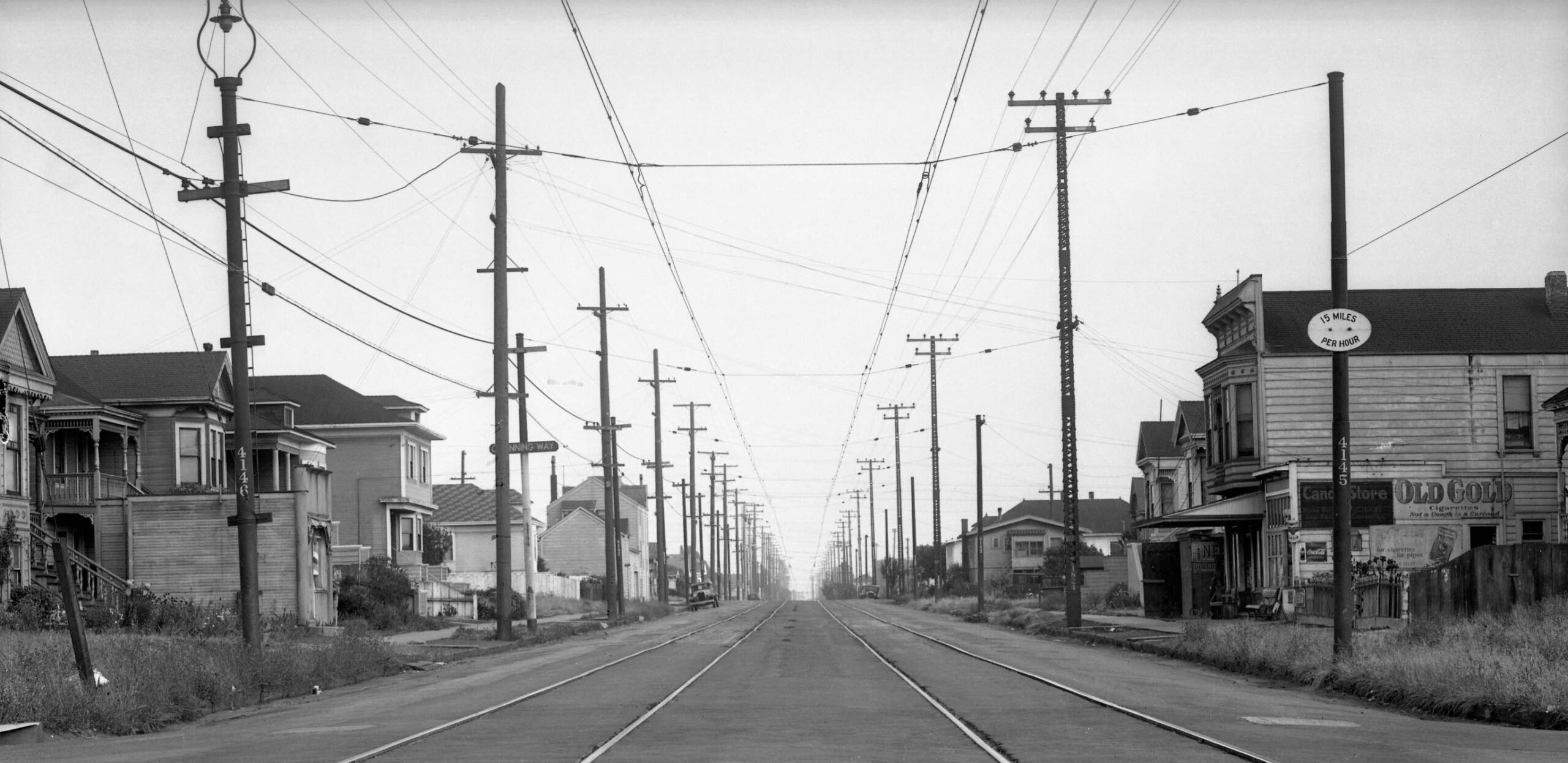
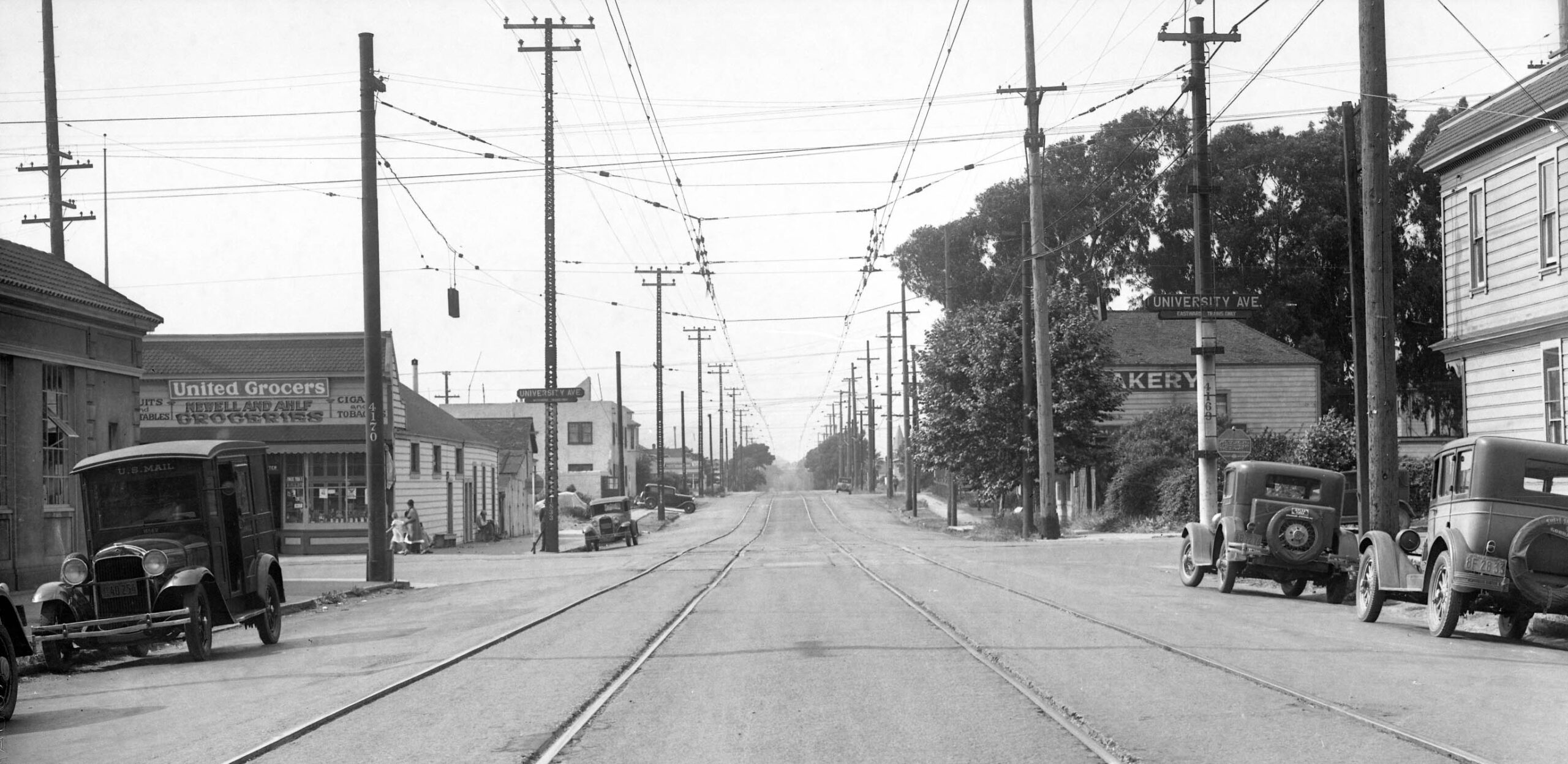
Also from the 1934 Series, a south view of the Channing Way stop. It appears to have been between Channing Way and Bancroft Way, but closer to the latter. The small structure with the Old Gold sign and the building to the south of it appear to be nos. 2316 and 2310 Ninth St. The fronts have been drastically changed as to what is seen in 2026. Note the poles numbered 4145 and 4146 and go to the next image.
L350-104-SP Official Photo, Courtesy BAERA, Western Railway Museum Archives, Sappers Collection, 170931oa&b, (Image 24 of 42)
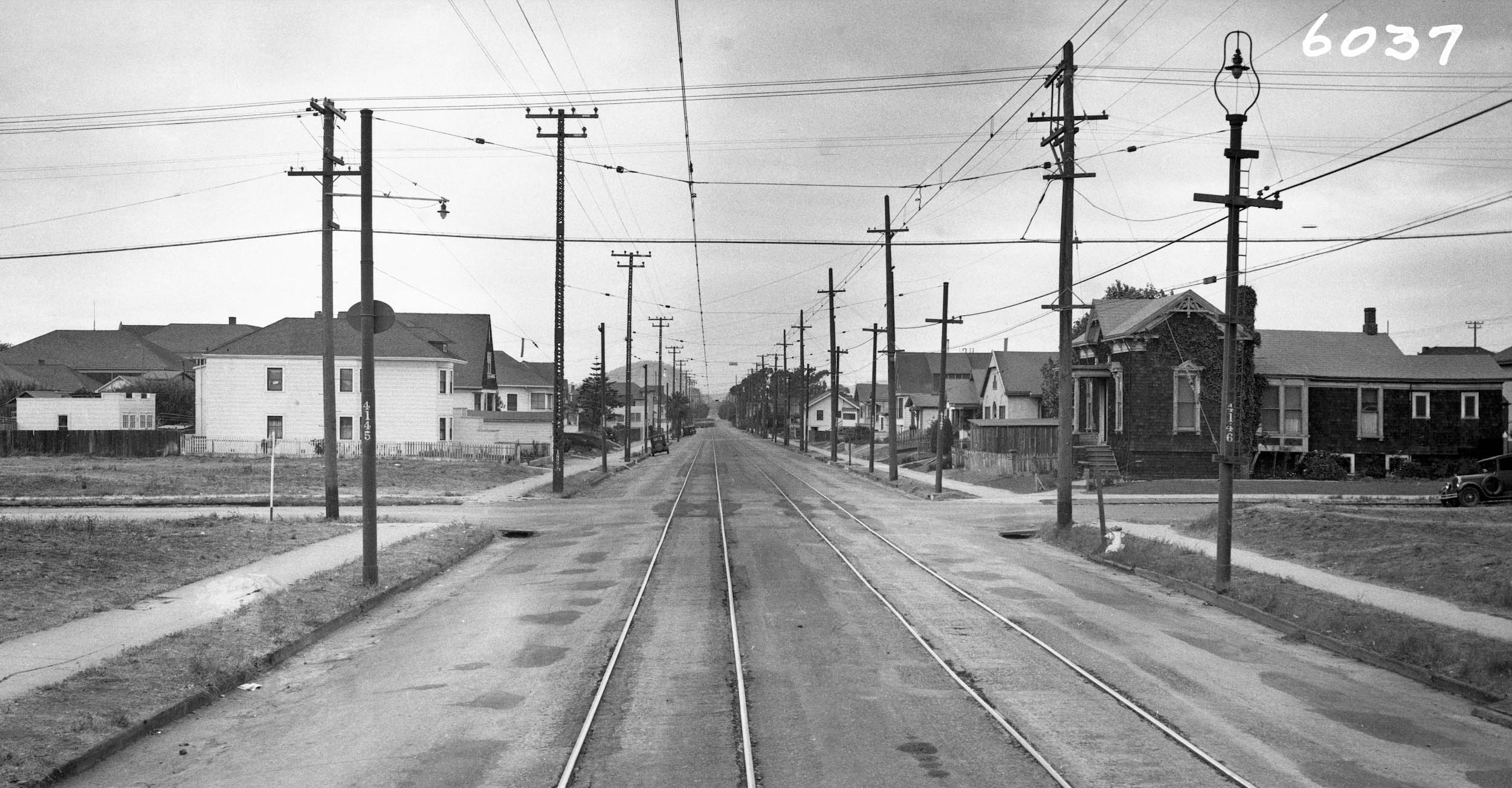
The next north view from the back of a passenger train in 1933 was taken just south of Bancroft Way. The reversed position of poles 4145 and 4146 mean the image just overlaps what was seen in the last image. The first house across the intersection on the right is no. 2247 Ninth St., still there in 2026, but significantly modified.
L350-105-Courtesy BAERA, Western Railway Museum Archives, 233126oa&b, (Image 25 of 42)
A north view just south of the University Ave. stop is next from the 1934 series. The slice of the building seen on the left edge is still there in 2026 as Milan Indian Groceries, but the windows on the Ninth St. side have been filled in and now feature advertisements for the store.
L350-109-SP Official Photo, Courtesy BAERA, Western Railway Museum Archives, Sappers Collection, 170930oa&b, (Image 26 of 42)
Back with George Russell in the air north of University Ave., identified by the continuation into the Bay as the City Wharf,. This southwest view was taken above Cedar St. in the late 1920s. The red arrow marks the SP Ninth St. line grade crossing of Cedar St. By this point, Ninth St. appears to be unpaved, and the west flank of the tracks starting one block earlier at Virginia St. is almost devoid of any buildings.
L350-110-George Russell Photo, Courtesy California State Lands Commission, SLC_644_NoDate_10, (Image 27 of 42)
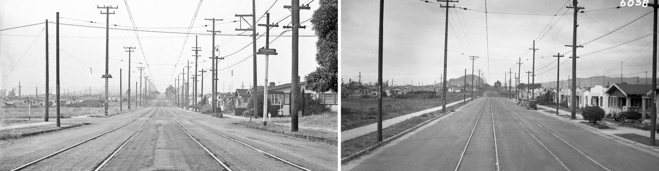
These two north views from either side of Virginia St., the view on the left from 1934 showing the station sign and the houses along the east side of the street toward Cedar St. that are pretty much preserved as is in 2026. The image on the right from from the back of a passenger train in 1933 shows houses further down the street to complement the image on the left, and documenting that by 1933, Ninth St. was now paved north up to the Cedar St.
L350-115-SP Official Photo, Courtesy BAERA, Western Railway Museum Archives, Sappers Collection, 170932oa&b, l, 233127oa&b, r, (Image 28 of 42)
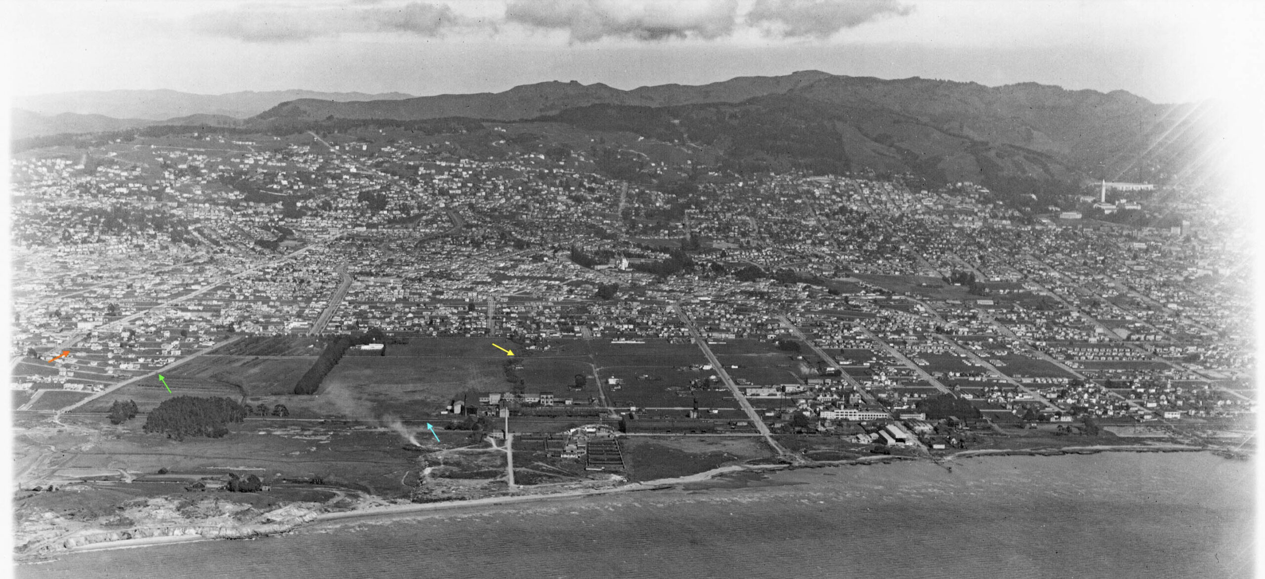
This northwest aerial view from the late 1920s shows the beginning of unimproved surface on Cedar St., red arrow, the crossing of Codornices Creek into the City of Albany, yellow arrow, and through the stand of trees toward its approach to Main St., the name then for the street in Albany that changed to Solano Ave. in Berkeley, today united as Solano Ave.
L350-120-George Russell Photo, Courtesy California State Lands Commission, SLC_644_NoDate_5, (Image 29 of 42)
The next north view from the back of a passenger train in 1933 was taken at the Gilman St. grade. The extra track to the right or east of the passenger tracks is a freight track that was derived from the mainline SP line along the Bay. Its origins will be shown shortly, but it traveled south and ended at Camelia St. The image from 1934, not shown since it adds little else, indicates the station sign for Gilman St. was on the south of the intersection, out of view here.
L350-125-Courtesy BAERA, Western Railway Museum Archives, 233128oa&b, (Image 30 of 42)
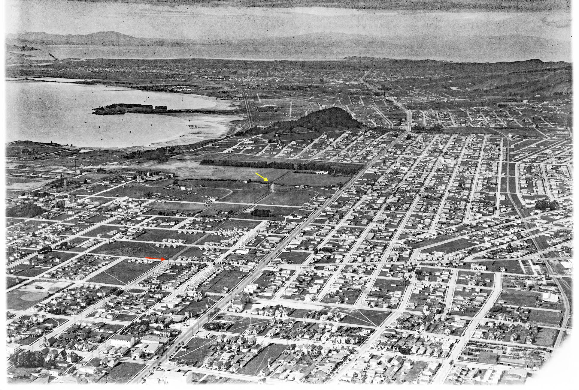
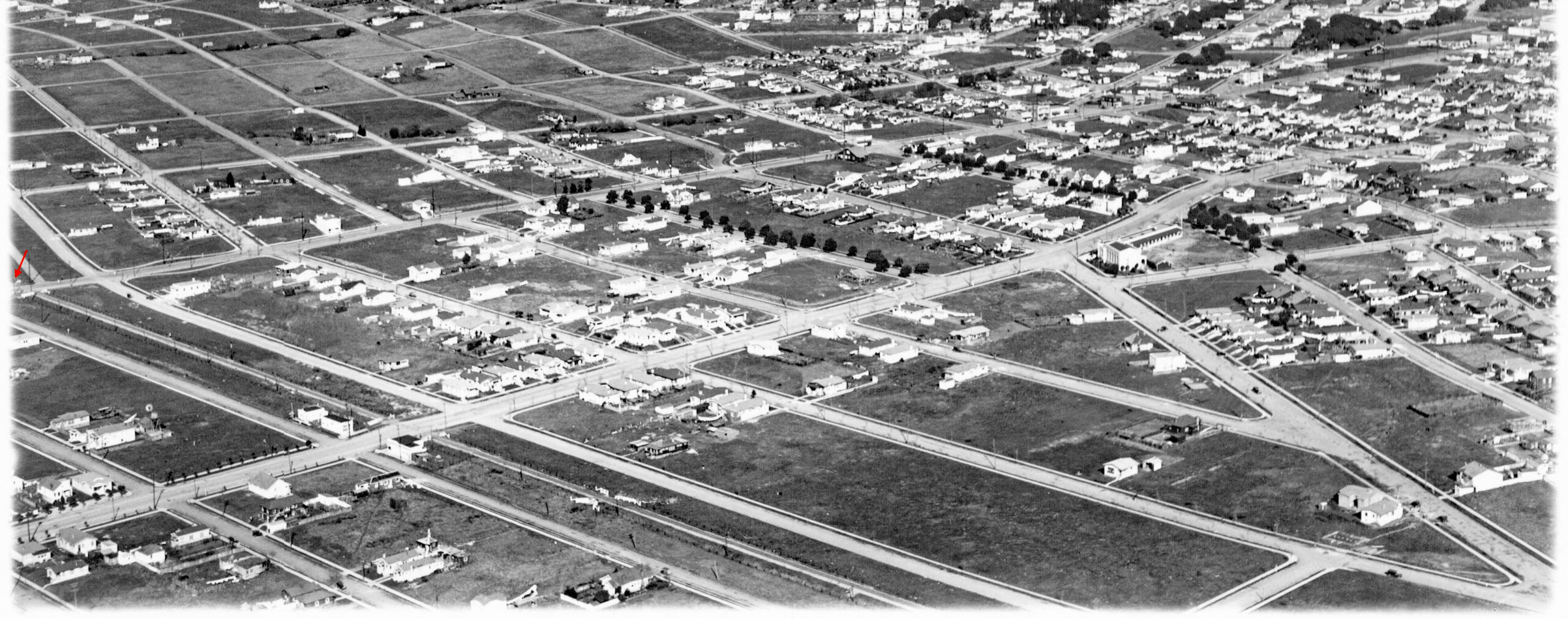
This east view from the late 1920s shows the crossing of the SP Ninth St. line at Codornices Creek, yellow arrow. The turning of the two tracks onto Main St. is marked with an orange arrow. Seen too is the original Gill Tract bounded on the west by the SP mainline along the Bay, turquoise arrow, to the north by Buchanan St., not yet connected to Marin Ave., green arrow, San Pablo Ave. to the east, and to the south by Codornices Creek. In 1928, the regents of The U. of California purchased the land from the Gil Nursey, the business that occupied the tract.
L350-130-George Russell Photo, Courtesy California State Lands Commission, SLC_644_NoDate_2 copy, (Image 31 of 42)
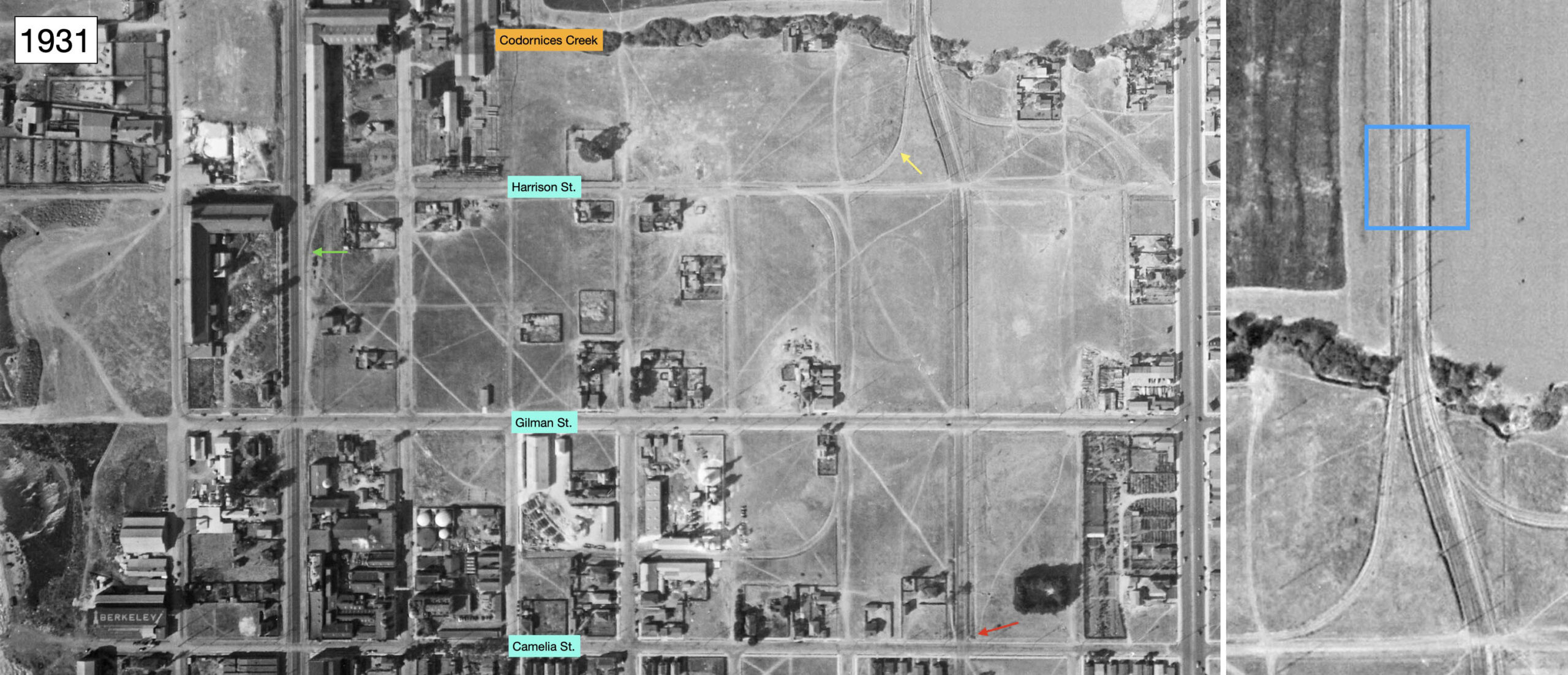
The north-oriented aerial from 1931, left, shows a spur derived from the SP mainline along the Bay, green arrow, and a derivative, yellow arrow, that connected to the SP Ninth St. mainline. The red arrow shows that the spur ended at Camelia St. On the right, the place where the spur from the SP Bay mainline connected with the SP Ninth St. line is contained within the blue box. Once on the north-bound track of the electric line, freights would then reverse south to access their own track to Camelia St. There was no business to service there at this time, but that would change ca. 1940.
L350-135-c-1820_62, Courtesy of UC Santa Barbara Library Geospatial Collection, (Image 32 of 42)
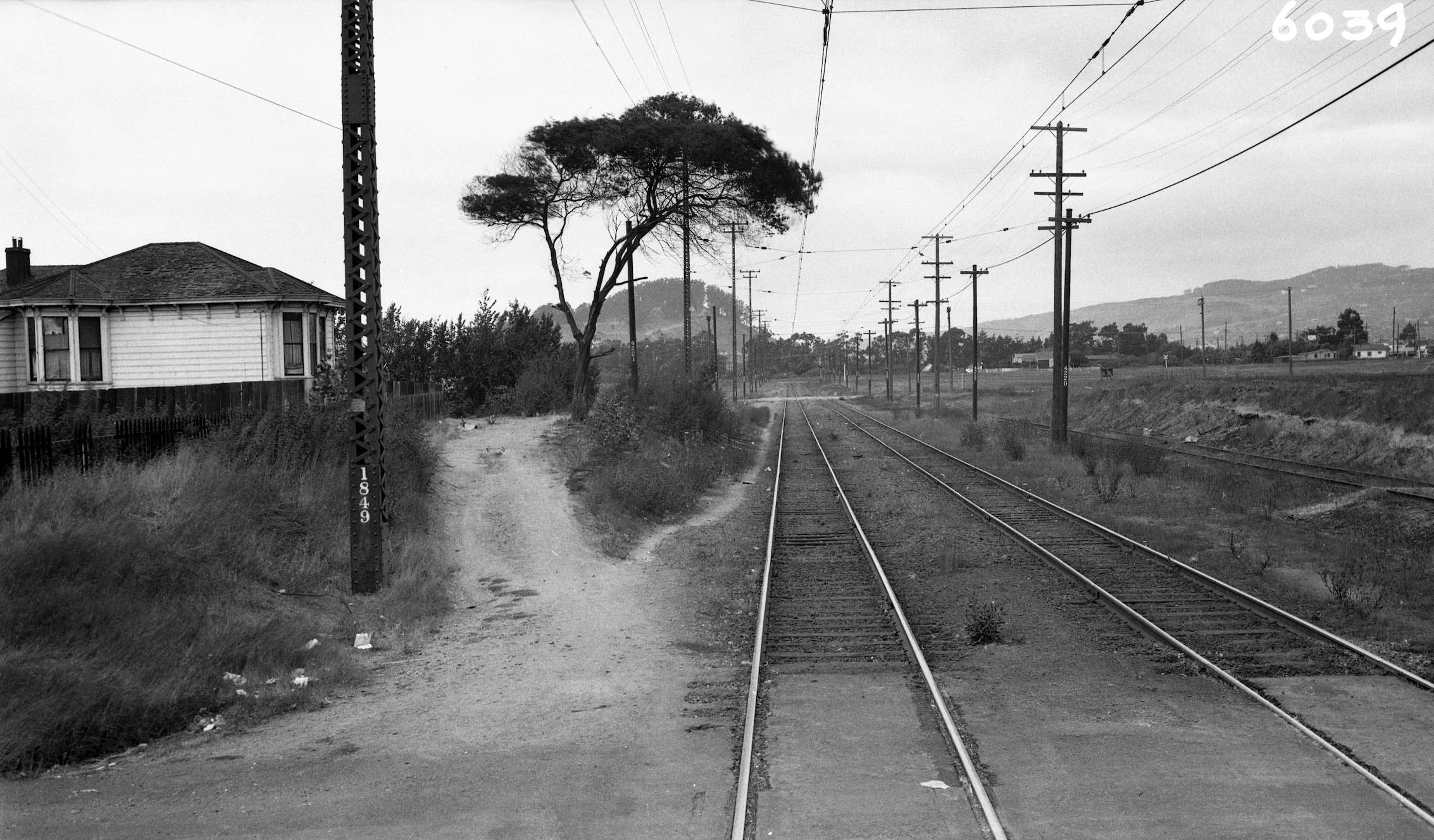
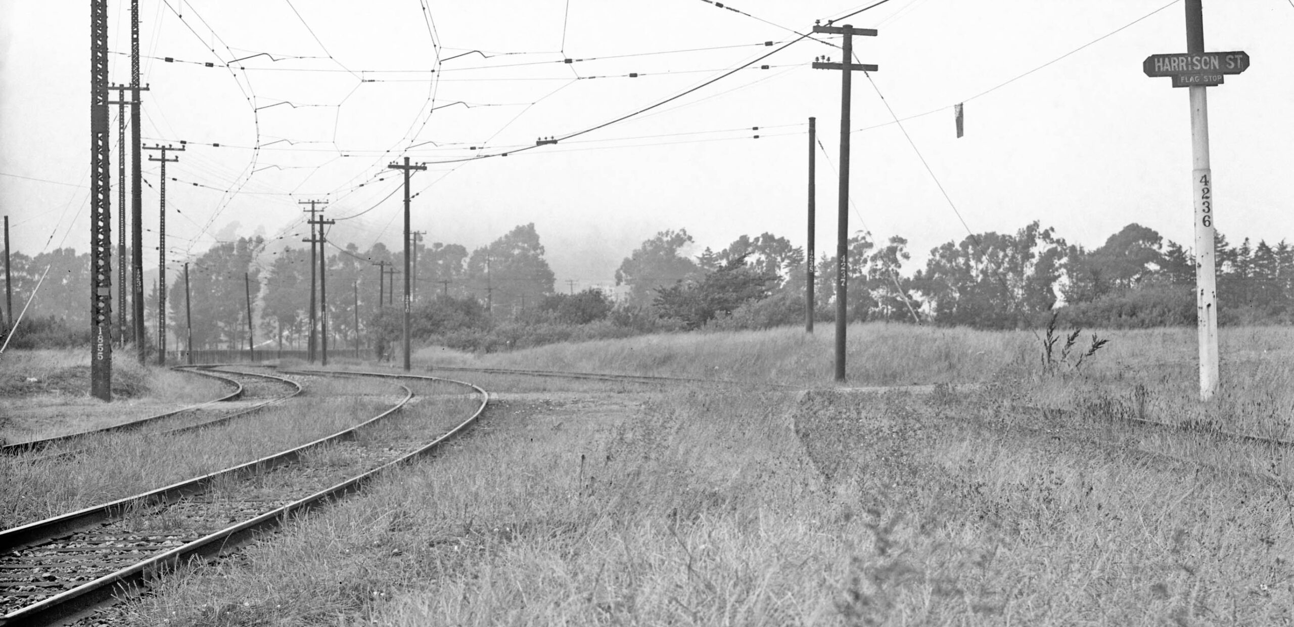
At Harrison St., the grade crossing of which is shown in this north view from 1934, the tracks swung to the west before crossing Codornices Creek, the presence of which is marked by the line of shrubs in the distance. The track carrying steam-powered freights to the east noted in the previous aerial is also seen to the right sans overhead wire. And, yes, lots more weeds.
L350-136-SP Official Photo, Courtesy BAERA, Western Railway Museum Archives, Sappers Collection, 170934oa&b, (Image 33 of 42)
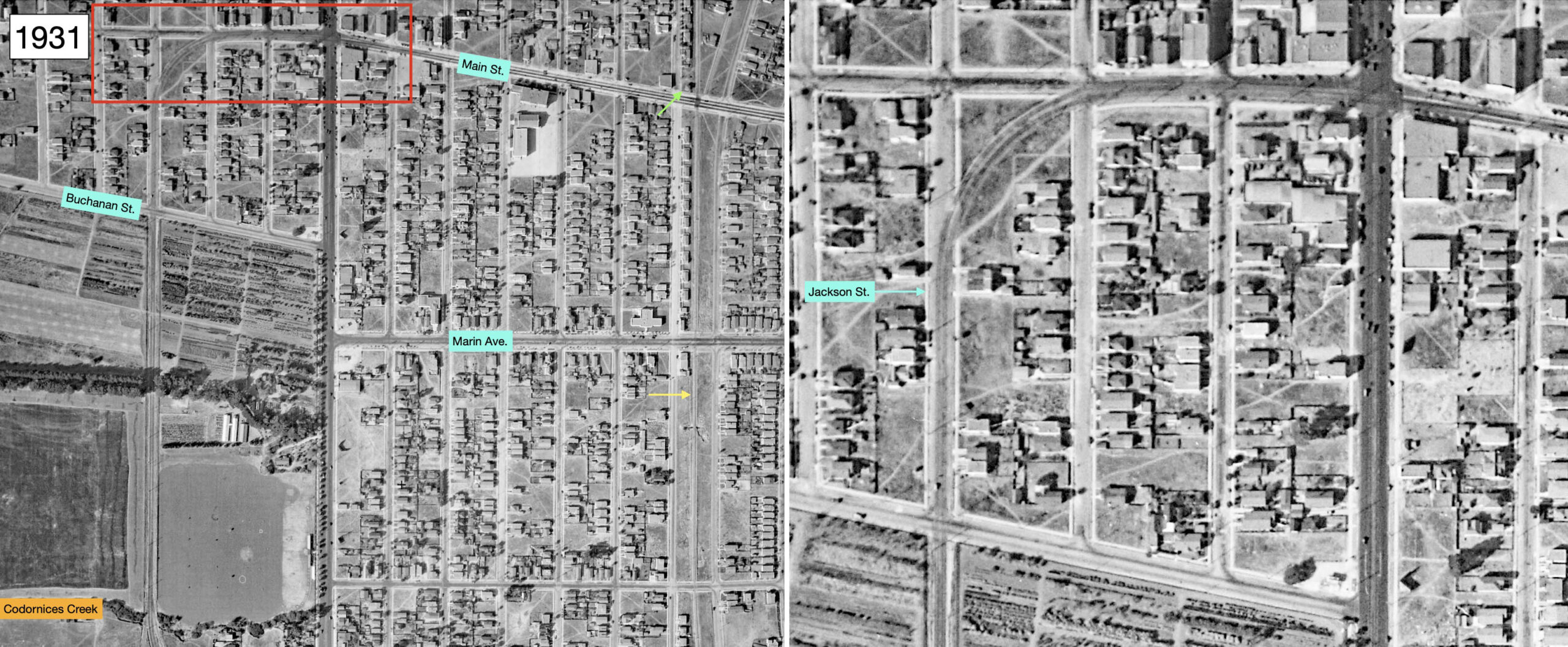
On the left, a continuation north of Codornices Creek into Albany from the same north-oriented aerial from 1931 shows the SP Ninth St. line within the Gil Tract up to Buchanan St. The yellow arrow marks the Santa Fe line, the green arrow Masonic Tower. Then to the area boxed in red, magnified as the detail on the right, the street is now Jackson St. where the tracks turned onto Main St. One clarification on the Gil Tract. Many references listed it as occupying both Albany and Berkeley, but the borders are only within Albany. Berkeley architectural sleuth Daniella Thompson offers an explanation for the confusion. When the Gill Nursery was in operation, its stated address was West Berkeley.
L350-140-c-1820_62, Courtesy of UC Santa Barbara Library Geospatial Collection, (Image 34 of 42)
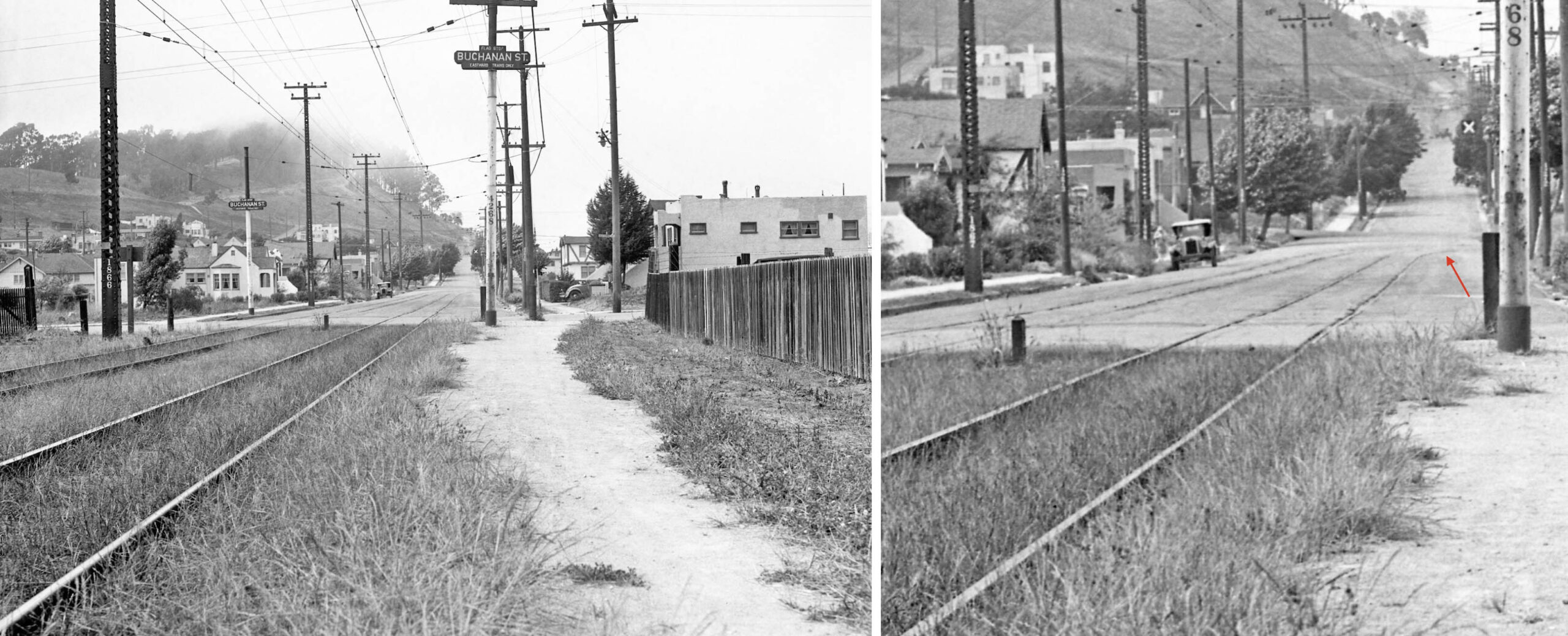
This north view from 1934 shows a view up Jackson St. on the left, and a detail of the tracks turning off the street on the right, marked by the red arrow. The tracks would encounter more weeds on the final left turn.
L350-141-SP Official Photo, Courtesy BAERA, Western Railway Museum Archives, Sappers Collection, 170935oa&b, (Image 35 of 42)
The final late 1920s aerial is a northwest view of Main St.-Solano Ave. and the highlighting the mostly undeveloped land to the north. This image falls short of the Thousands Oaks terminus. A detail is shown next.
L350-145-George Russell Photo, Courtesy California State Lands Commission, SLC_644_NoDate_59, (Image 36 of 42)
In this detail from the previous aerial, the red arrow marks the land just to the east of the Santa Fe mainline at Solano Ave., the image not including the Masonic Ave. tower. The other large street running across the image from the left lower margin to the right upper corner is Marin Ave.
L350-150-George Russell Photo, Courtesy California State Lands Commission, SLC_644_NoDate_59, Detail, (Image 37 of 42)
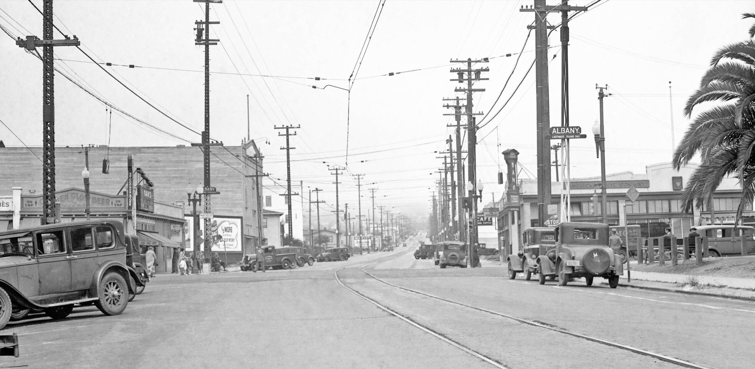
Next, a trip heading east on Main St. from the 1934 images. The Albany stop shown here was at the intersection of Main St. with San Pablo Ave. The large building one block east at Kains Ave. on the left at the northwest corner seen here was the meeting hall-dance hall that was converted into the Albany Theater in 1935. Te theater ended operations in 2023. Note the rail line here is now only single track here.
L350-155-SP Official Photo, Courtesy BAERA, Western Railway Museum Archives, Sappers Collection, 170936oa&b, (Image 38 of 42)
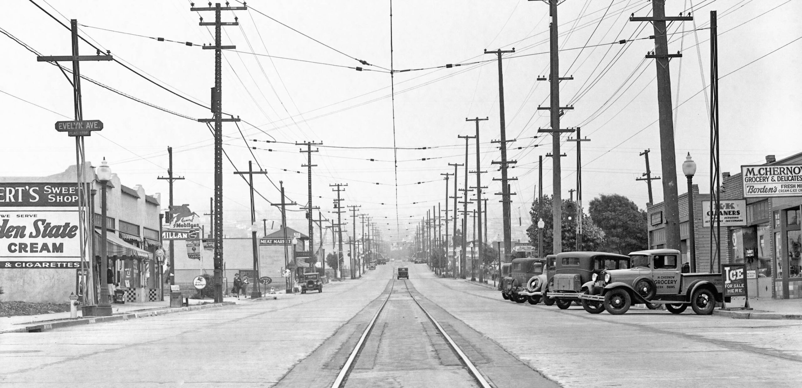
Next from 1934 was the Evelyn Ave. stop viewed east. The roof of the SP Masonic Tower can be seen on the left, just above the meat market sign. In the distance beyond the car, the line appears to divide into two tracks.
L350-160-SP Official Photo, Courtesy BAERA, Western Railway Museum Archives, Sappers Collection, 170937oa&b, (Image 39 of 42)
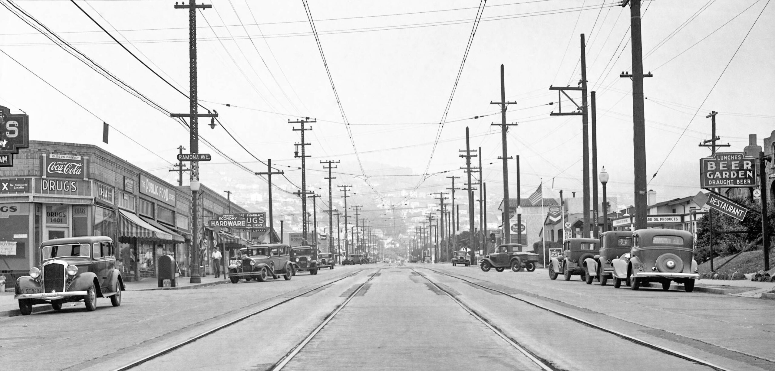
Beyond the tower, the next stop was Ramona Ave., again an east view from 1934. The street to the left is actually Carmel Ave. The stores east of that intersection on the north side have been modified over the last couple of years, but if you go back to Google maps to at least 2022, those images confirm the street location. A match could not be made with buildings on the south side of the street. The double track seen here that served to allow trains heading in the two directions to pass one another. One block up the track returns to being single.
L350-165-SP Official Photo, Courtesy BAERA, Western Railway Museum Archives, Sappers Collection, 170938oa&b, (Image 40 of 42)
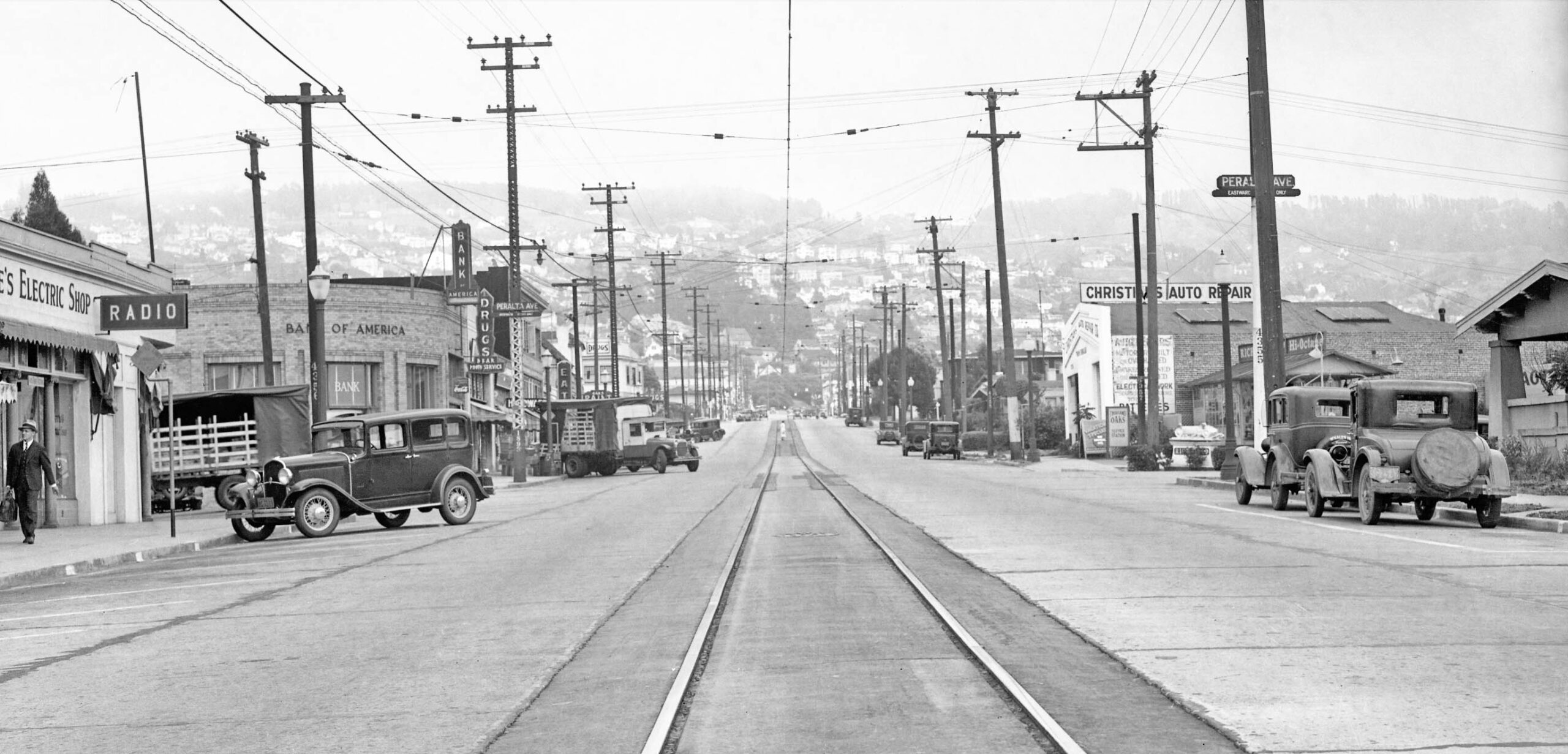
At Peralta Ave., the north side of the street, left, is in Berkeley, the south side is in Albany. The east view from 1934 shows a Bank of America office on the northeast corner. That building, as well as the next three up to and including the two-story structure, remain in 2026. The south side no longer has any of the buildings seen here in 2026.
L350-170-SP Official Photo, Courtesy BAERA, Western Railway Museum Archives, Sappers Collection, 170939oa&b, (Image 41 of 42)
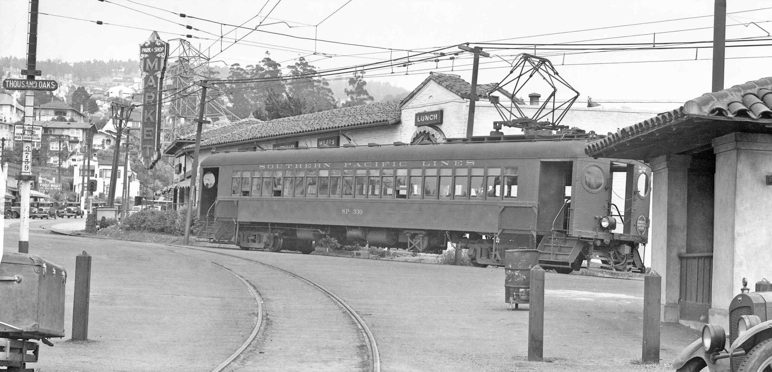
The tour from 1934 ends with an east view at the Thousand Oaks station and shelter, the latter partially seen on the right. A Shattuck train, SP 330, waits for passengers. The track in the foreground is the connector to the two double wyes at Colusa Ave. This update completes a detailed look at the Key Westbrae and SP Ninth St. Lines. Until their abandonment in 1941, not much happened to these two lines, but to the east big changes were coming. That will be the topic for the next update. Appreciation to Daniella Thompson for her contribution to this update.
L350-175-SP Official Photo, Courtesy BAERA, Western Railway Museum Archives, Sappers Collection, 170940oa&b, (Image 42 of 42)