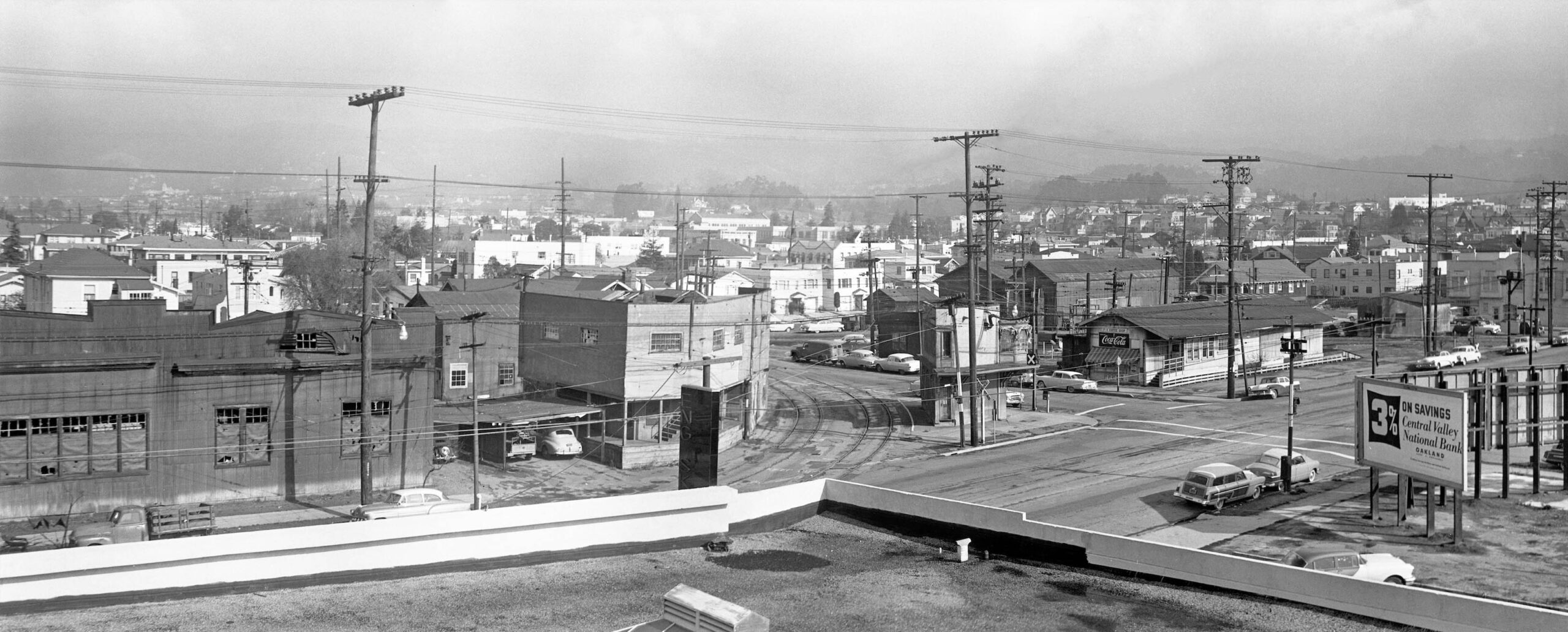
40th and Shafter, 1957
Sitting between 40th and 41st Sts., Webster and Opal Sts., was the Sacramento Northern, SN, south end facility as seen in the northeast aerial view from Apr. 8, 1953. Station, operational administration, storage yard, maintenance works, freight transfer with Oakland Terminal Railway and Key System interchange, this was where important SN business transpired, and was referred to by the general public as “40th and Shafter.”
L295-02-Copyright California Department of Transportation, 3301-9, (Image 1 of 37)

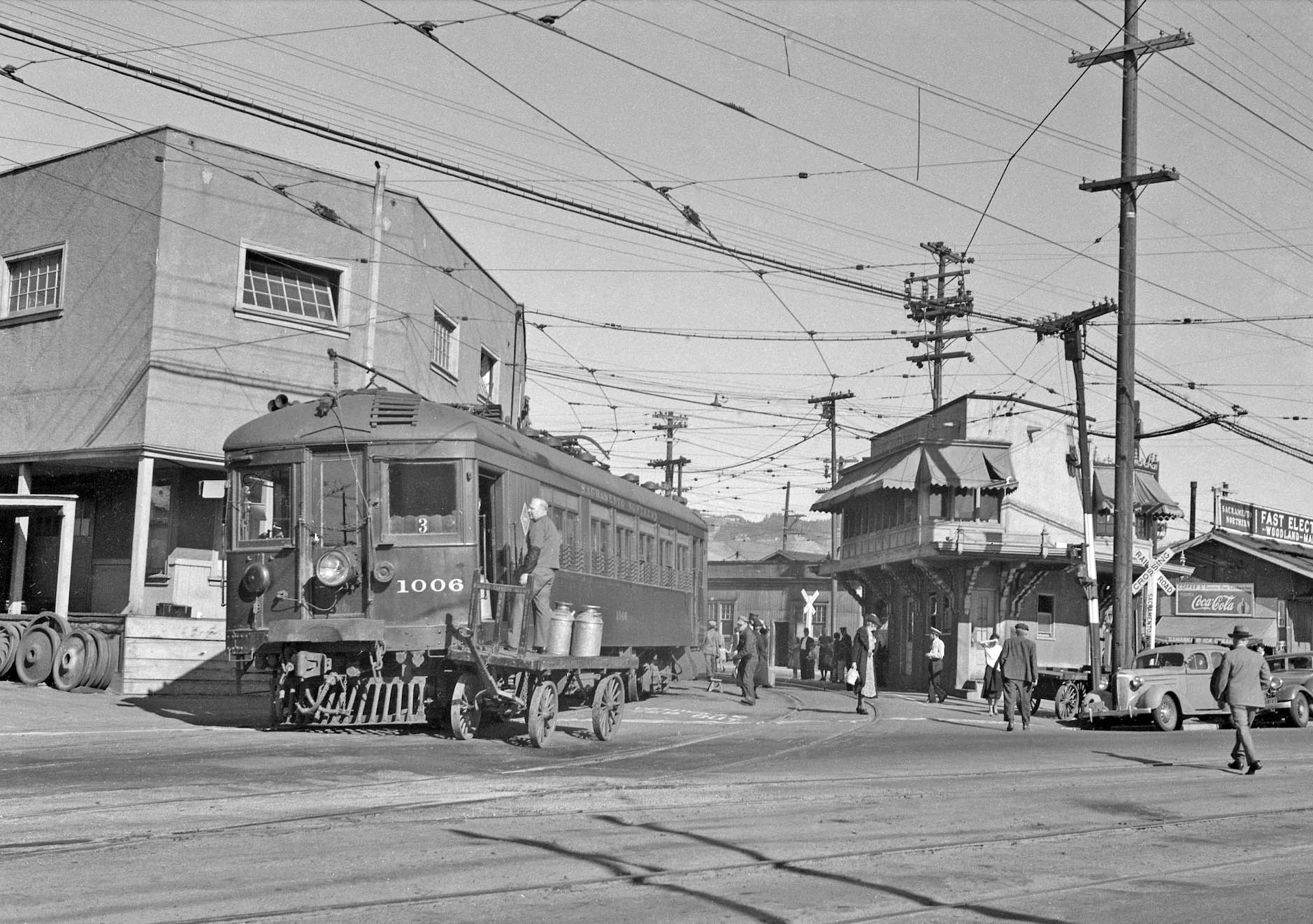
A place where passenger trains were primary photo subjects prior to WWII, here in a ca. 1940 northeast view from 40th St. with SN 1006 delivering Contra Costa County-produced milk to Oakland …
L295-05-Waldemar Sievers Photo, John Harder Collection, Courtesy John Harder, (Image 2 of 37)
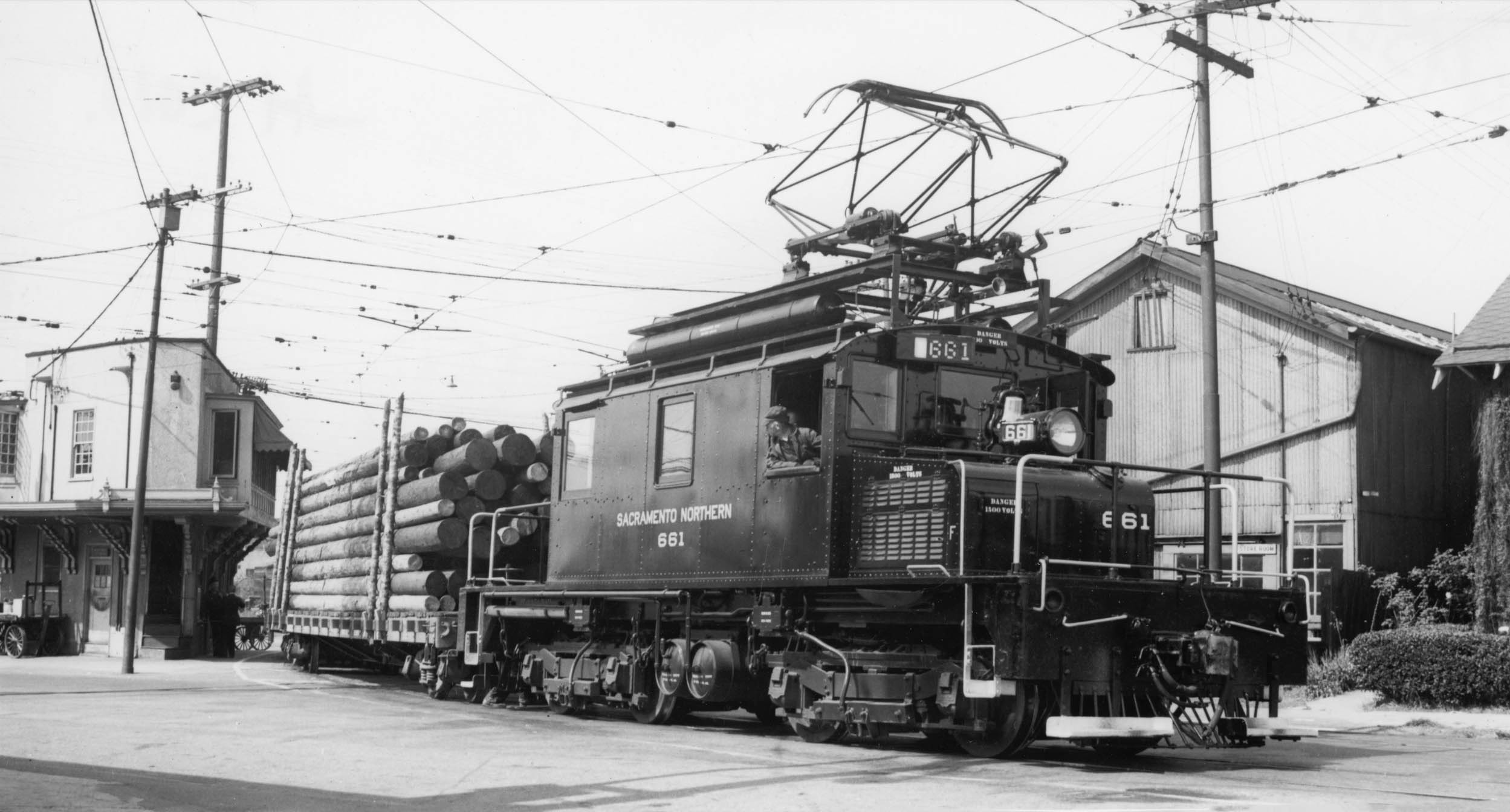
.. and post-WWII where freights with munitions and building materials dominated the conversation, here SN 661 and logs from Apr. 12, 1949 in a southwest view from Shafter Ave.
L295-10-Wilbur C. Whittaker Collection, Harrison Collection, Courtesy BAERA, Western Railway Museum Archives, 204241sn, (Image 3 of 37)
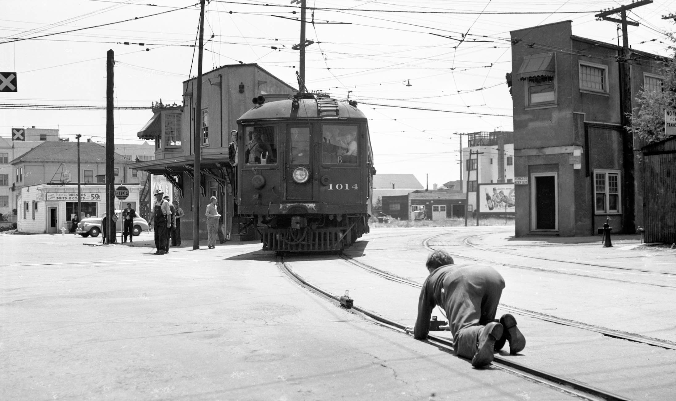
Where special excursion rides and celebrations took place, such as the last passenger train shown here, an insurance run with SN 1014 on July 12, 1941. Southwest view from Shafter Ave.
L295-15- Richard Jenevein Photo, Robert P Townley Coll., Courtesy BAERA, Western Railway Museum Archives, 201899sn, (Image 4 of 37)
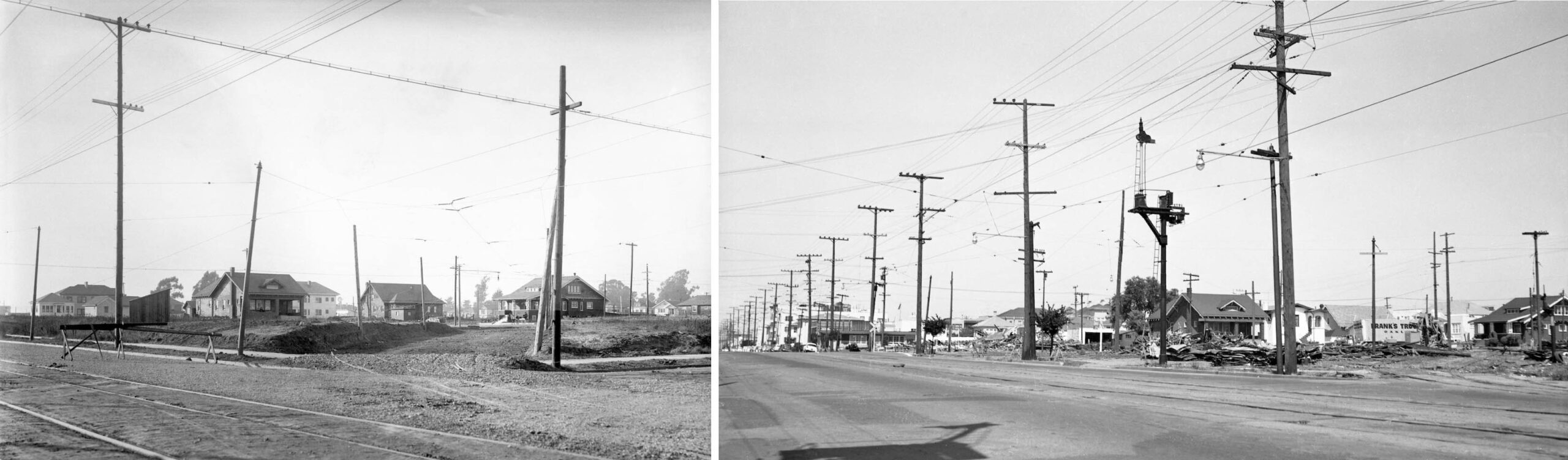
The facility was under construction ca. 1911, left, and was cleared by mid-1957, right, both northwest views toward Shafter Ave. from 40th St. just west of the Opal St. intersection. This update will review the facility in its final year of operation, 1957.
L295-20-Courtesy BAERA, Western Railway Museum Archives, Sappers Collection 24114oa&e, l, Addison Laflin Photo, 179610sn, r, (Image 5 of 37)
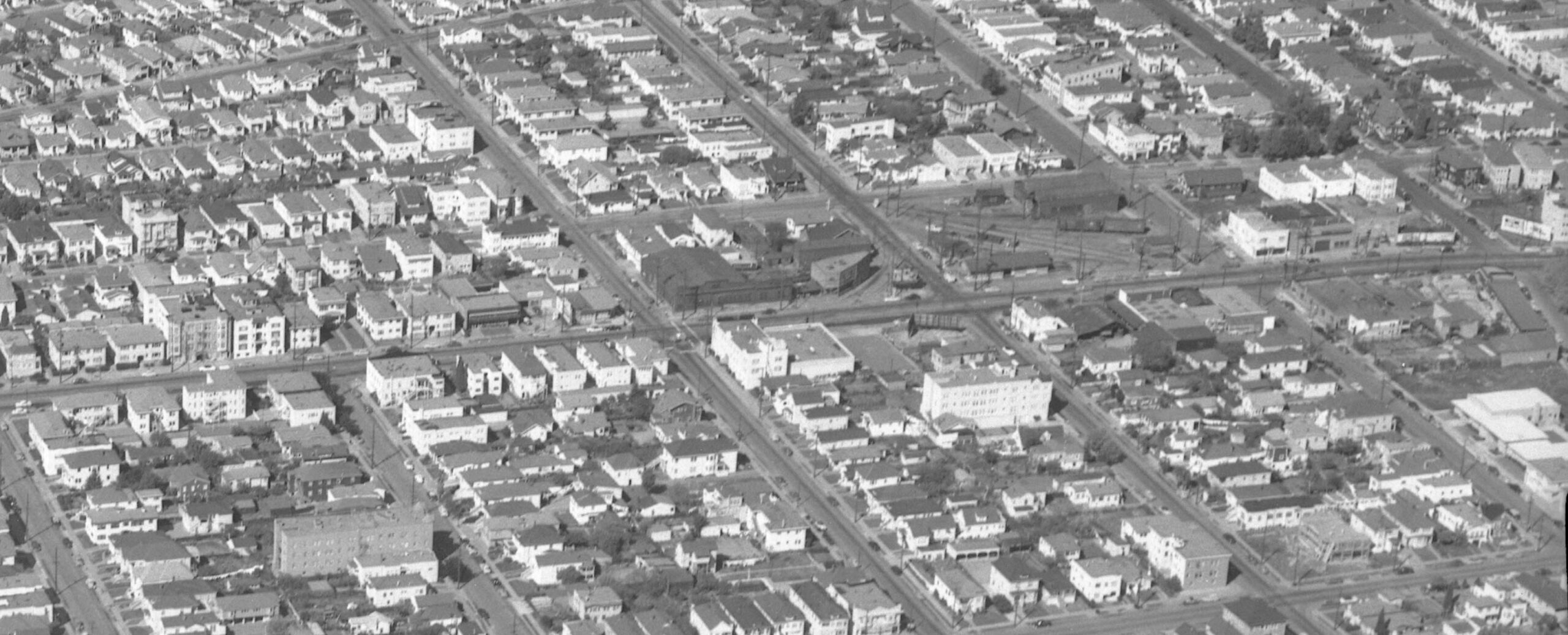
First, an aerial view from July 10, 1951 as an introduction to the array of structures and track network in the facility.
L295-25-Copyright California Department of Transportation, 2218-9 7:10:51 HW 580 273, (Image 6 of 37)
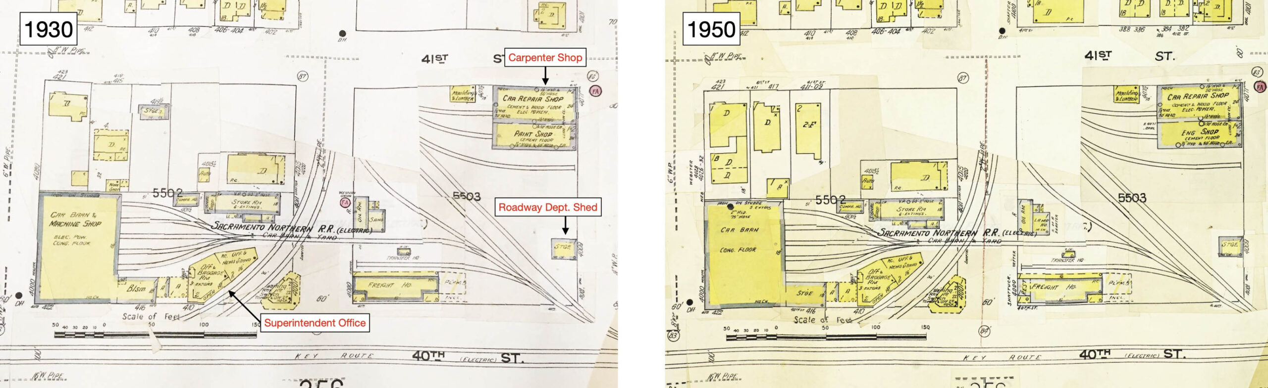
Similar depictions of the facility in 1930 versus 1950 are presented from Sanborn maps. Harry Demoro in his book “Sacramento Northern” had a few of the smaller structures labeled differently as indicated in red. Ref: Both: Sanborn Maps Collection, Sanborn Fire Insurance Map from Oakland, Alameda County, California. Left: 1911 – Oct 1930 Vol. 3. Panel 348; Right: 1911 – Oct 1950 Vol. 3. Panel 348
L295-30-Oakland History Room, Oakland Pubic Library; l; Library of Congress, Geography and Map Division, r, (Image 7 of 37)
Railfan Bob Townley took several northeast bird’s-eye views from the south side of 40th St. in Jan. 1957, the image depicted here a panoramic combination of two separate photographs. With this information in hand, Bob went through the rest of the facility to document its condition.
L295-35- Robert P. Townley Photos, Courtesy BAERA, Western Railway Museum Archives, 196278sn and 196277sn, (Image 8 of 37)
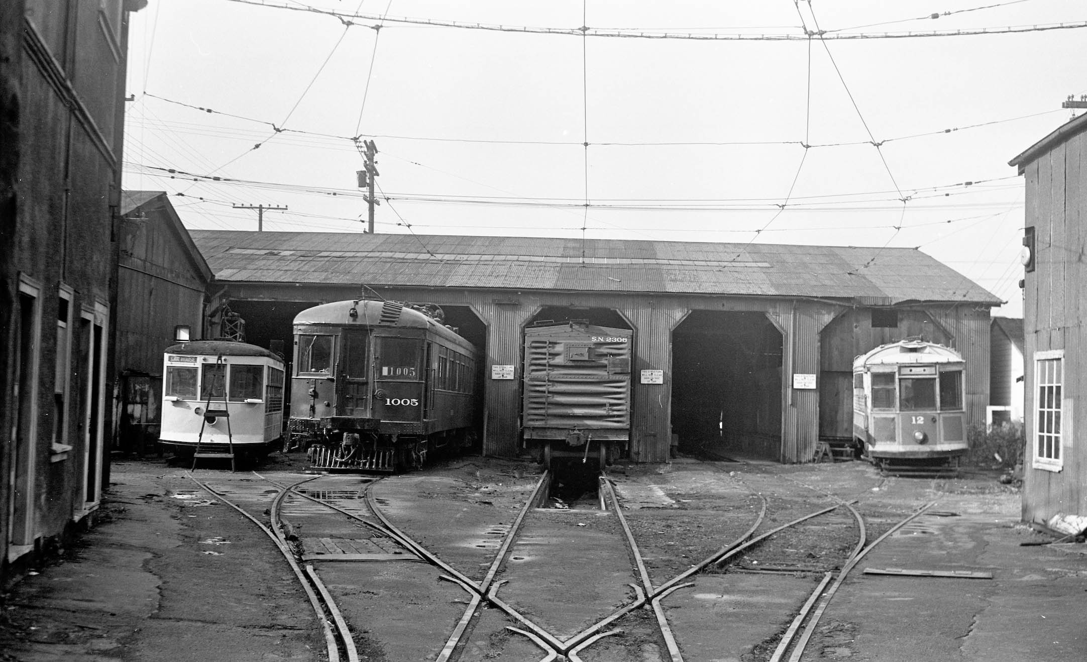
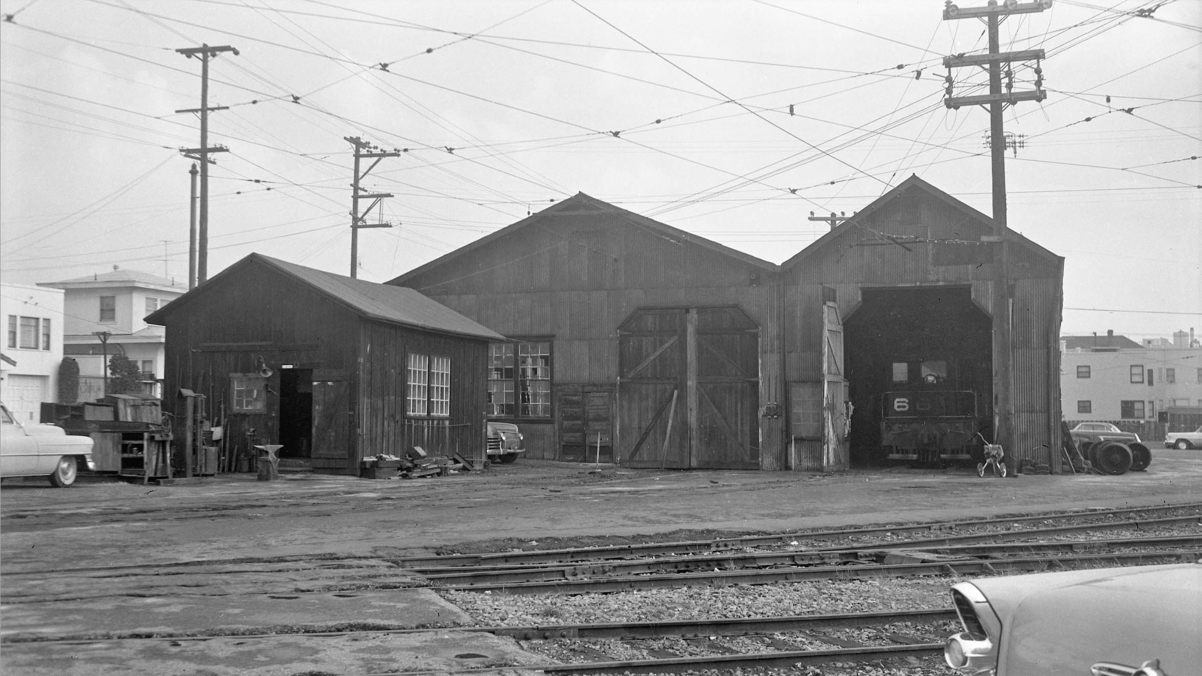
First, in the western yard, the car repair shop with Birney 62, SN 1005, Boxcar 2306, and Saskatoon Car 12, a west view taken from Shafter Ave., Jan. 1957.
L295-40-Robert P. Townley Photo, Courtesy BAERA, Western Railway Museum Archives, 197702sn, (Image 9 of 37)
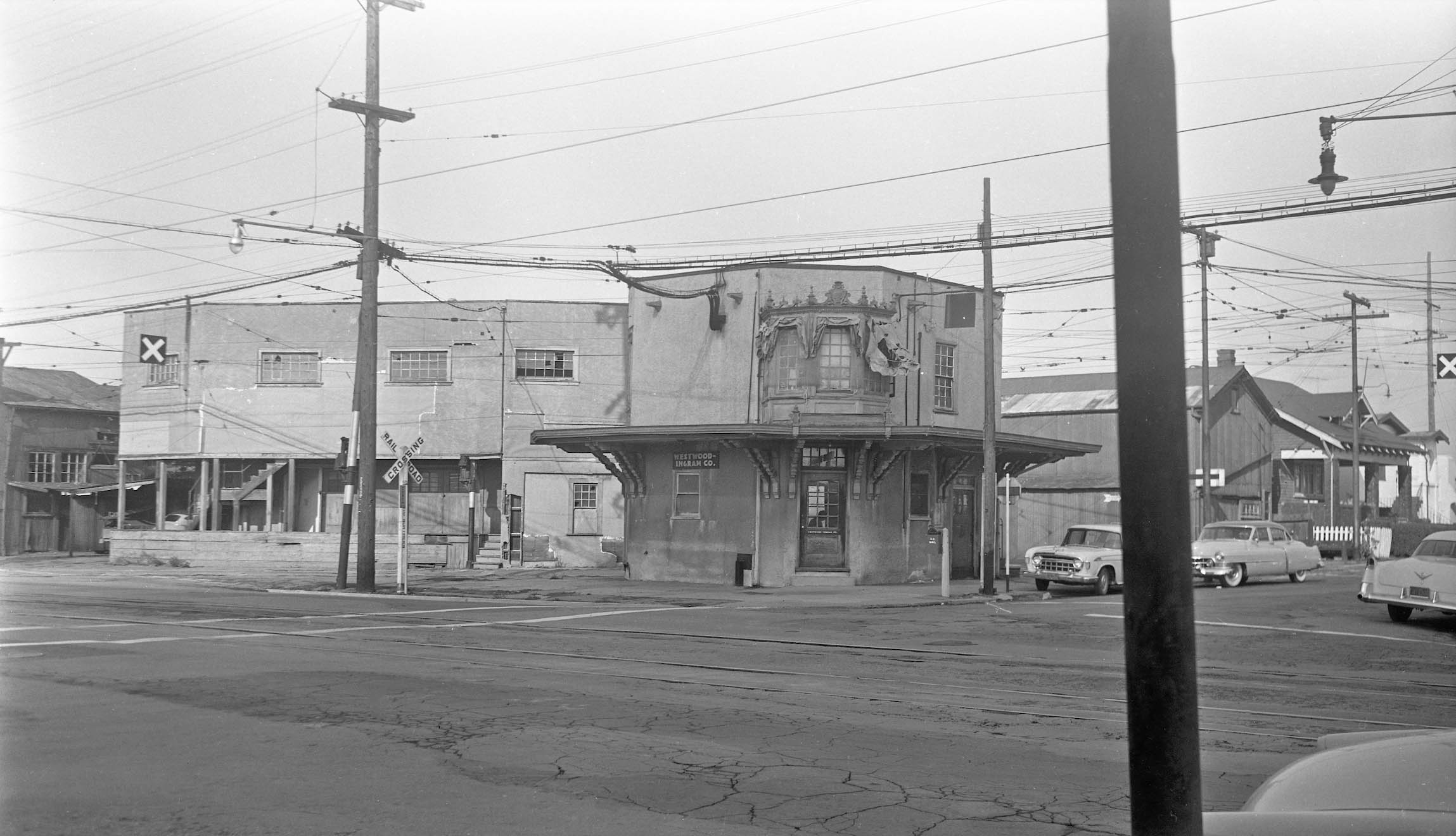
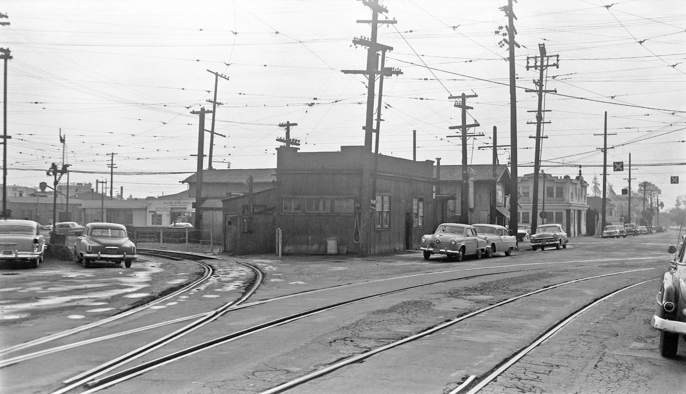
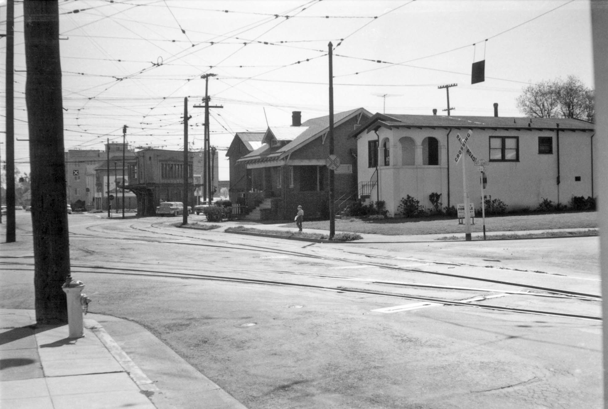
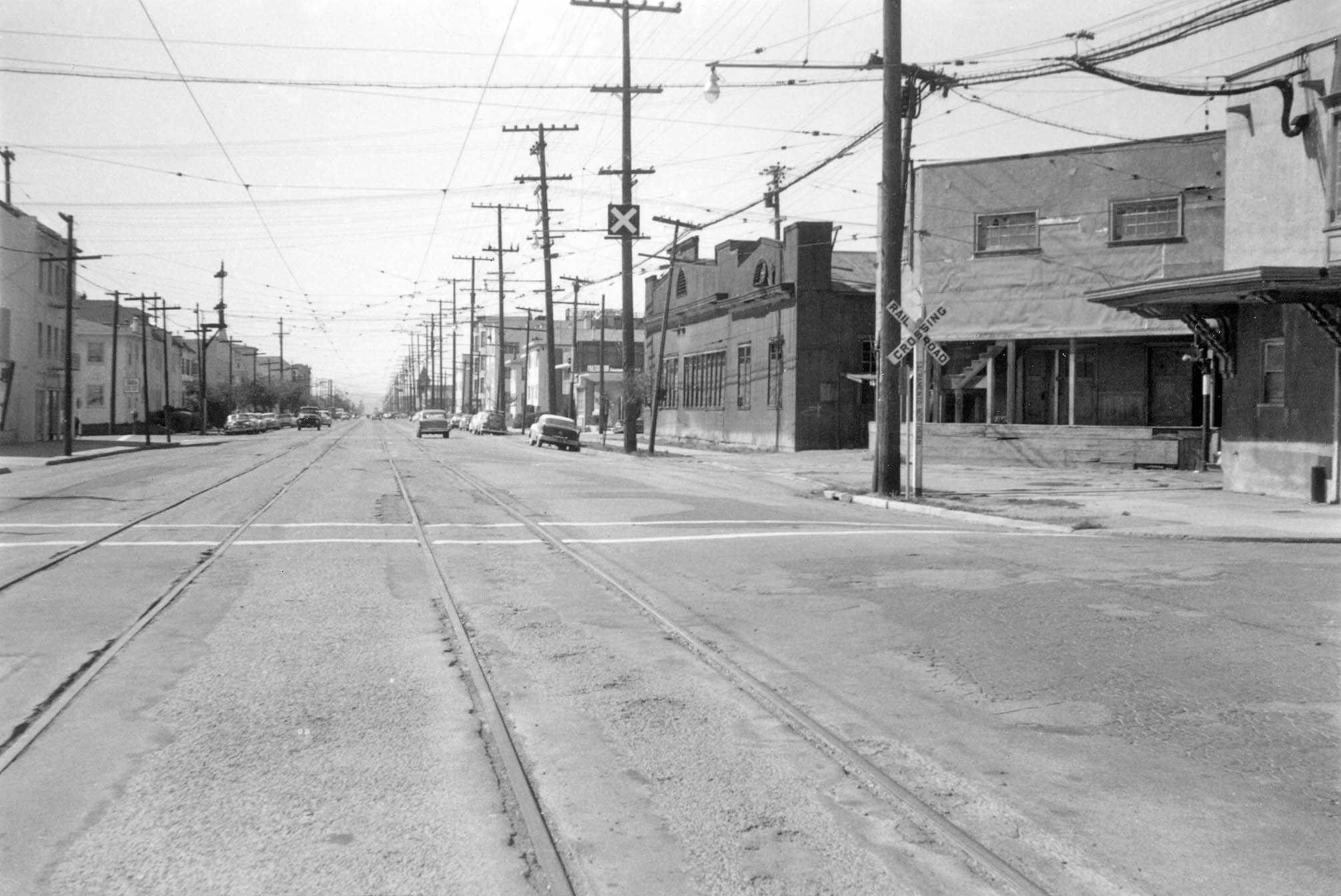
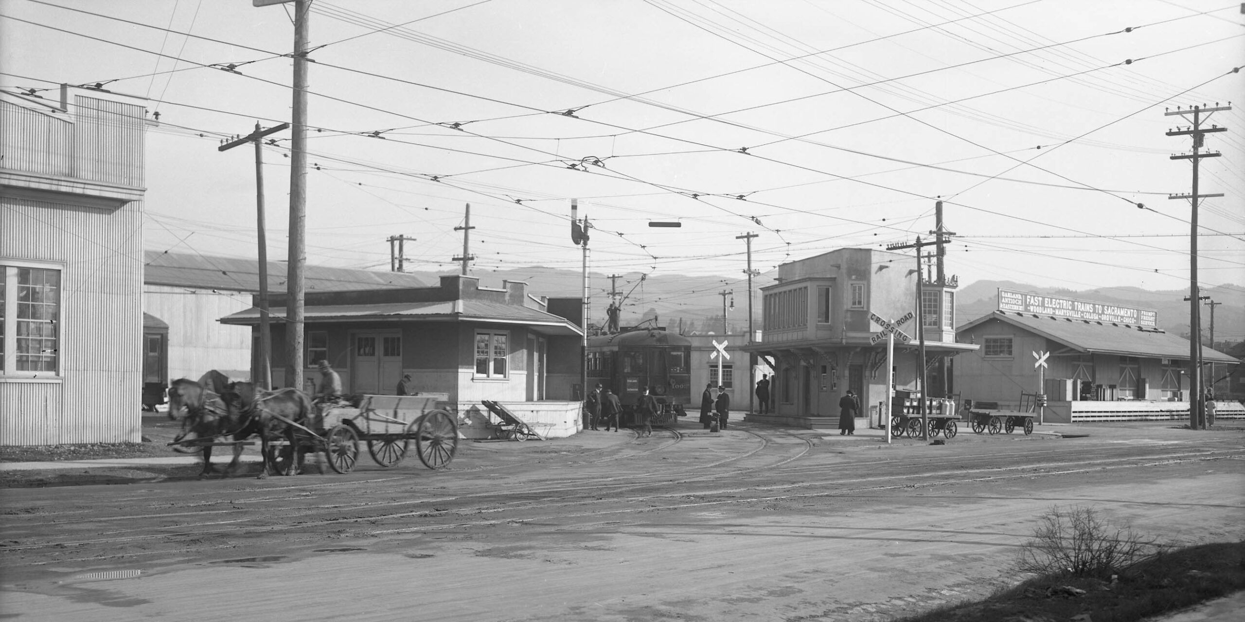
This northwest view from the southeast corner of 40th St. and Shafter Ave. shows the depot where passengers could wait for a train, and to its west or left, the Superintendent’s Office, Jan. 1957.
L295-45-Robert P. Townley Photo, Courtesy BAERA, Western Railway Museum Archives, 200050sn, (Image 10 of 37)
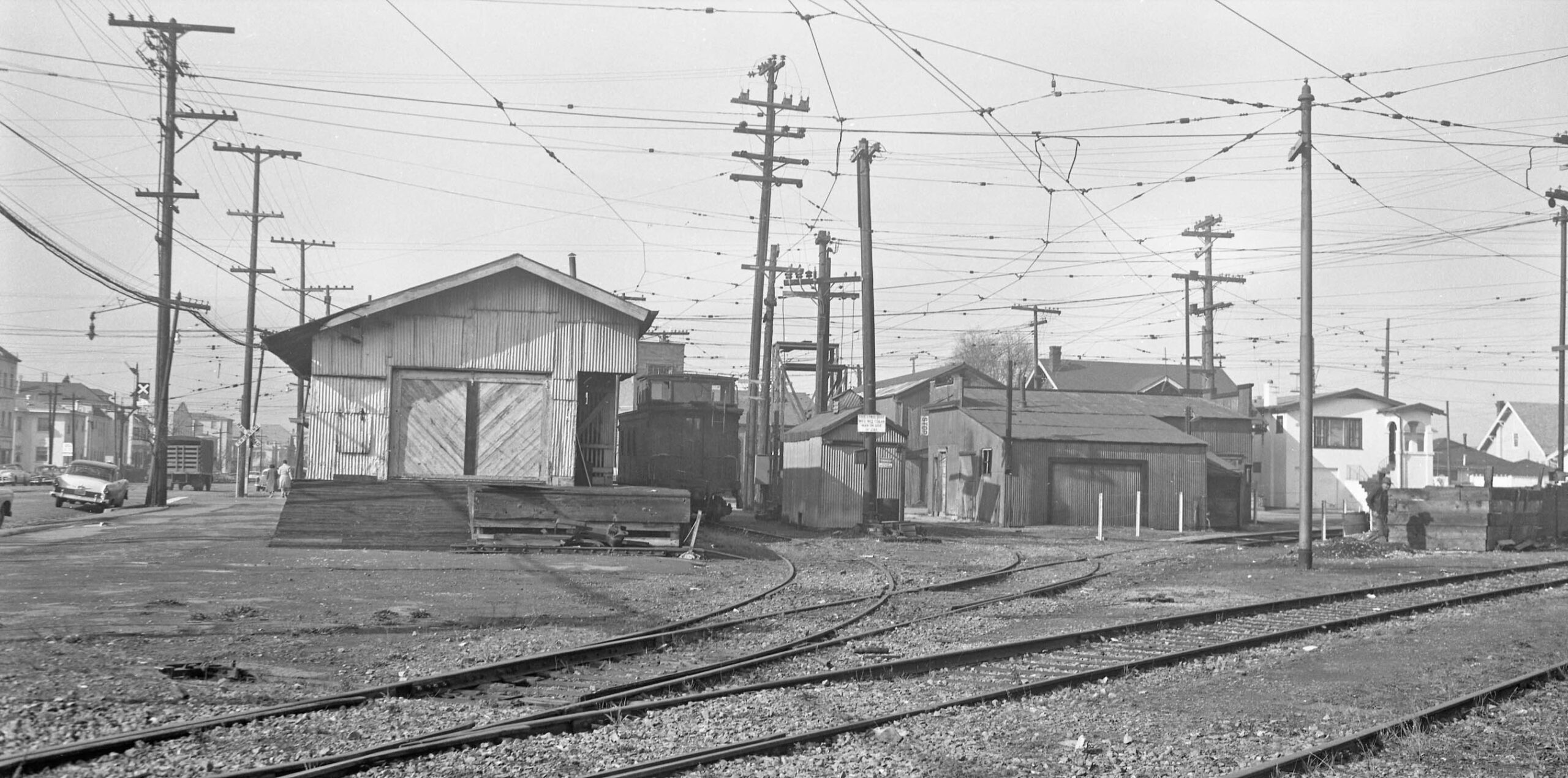
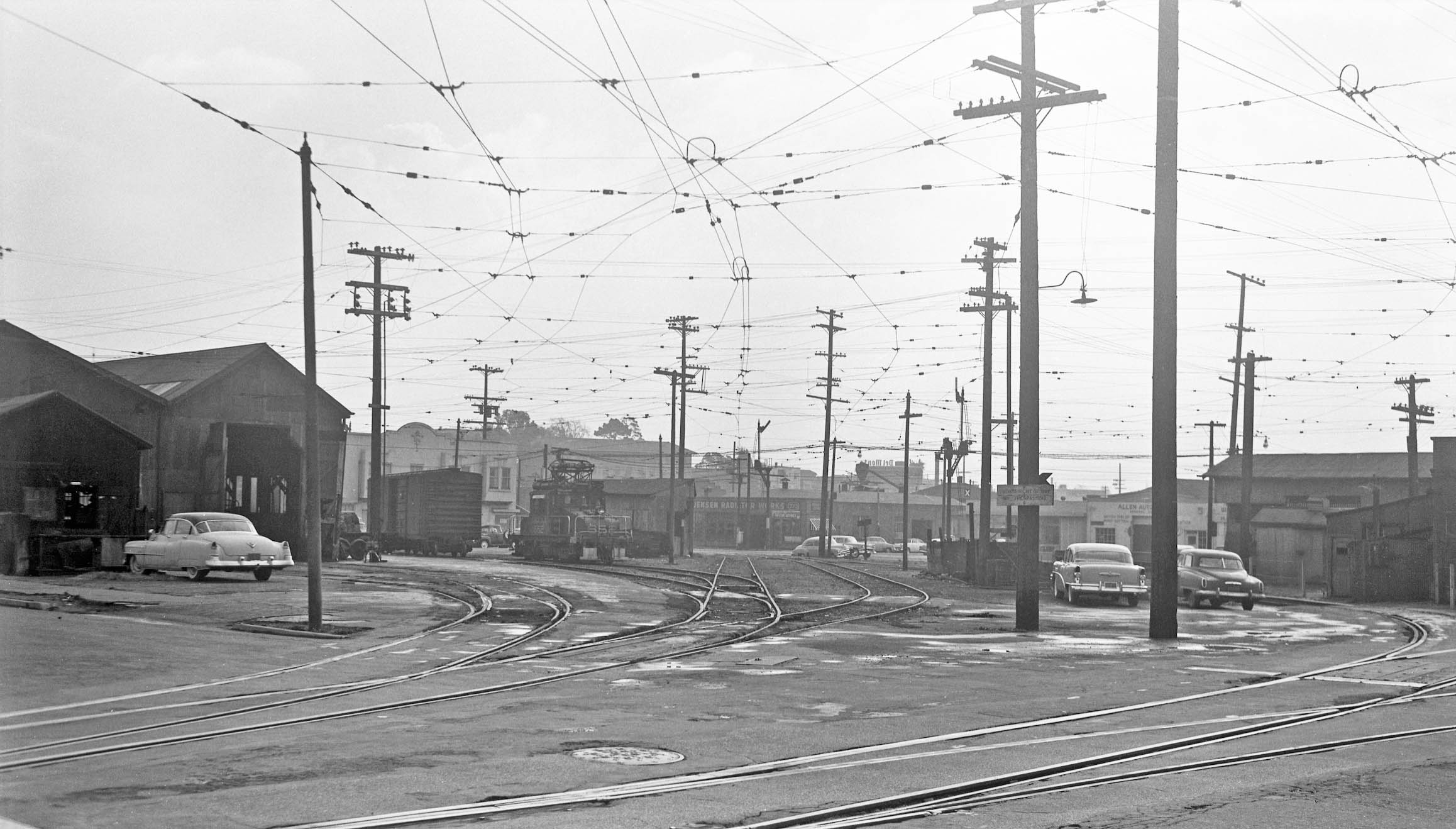
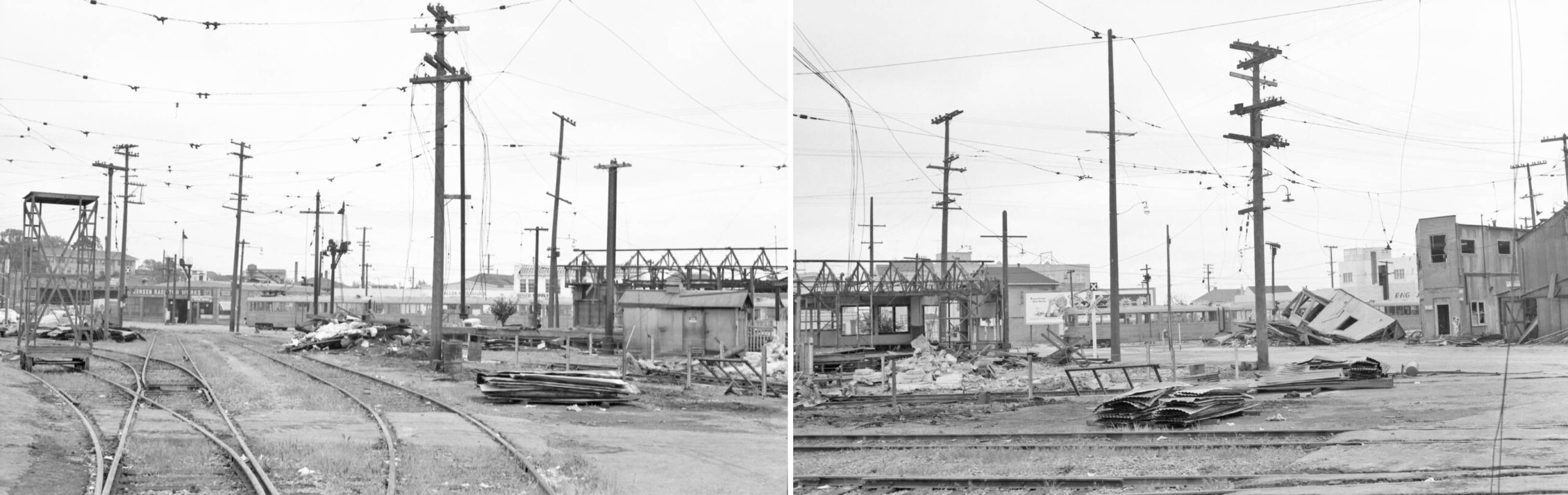
Then to the eastern yard, the freight shed, transfer house, and sand house-oil room seen left to right in this west view from Opal St., Jan. 1957.
L295-50-Robert P. Townley Photo, Courtesy BAERA, Western Railway Museum Archives, 200051sn, (Image 11 of 37)
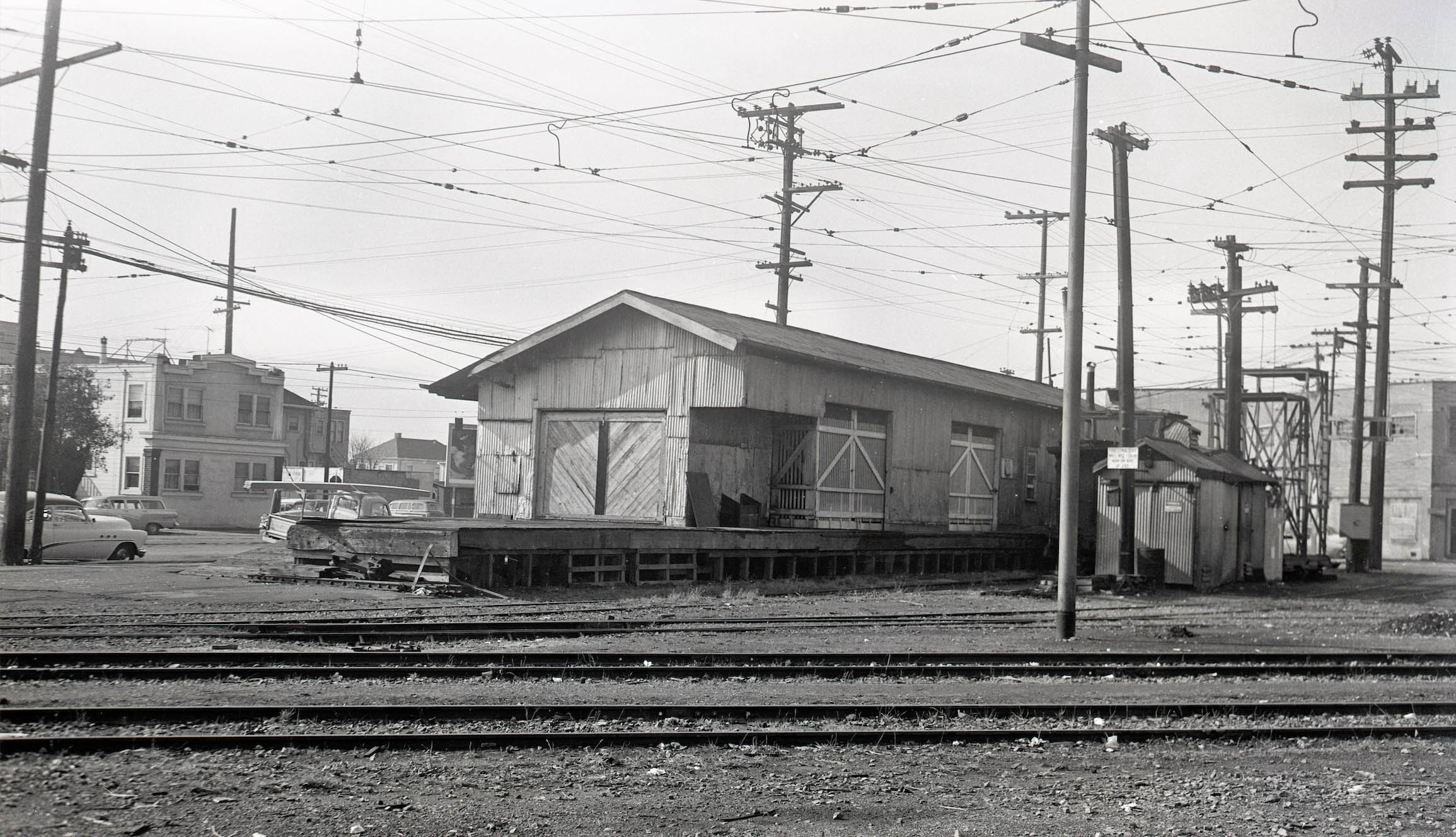
Presented here is a northwest view of the rear of the freight house and transfer house from Opal St. toward 40th St. with no. 3946 Shafter Ave. seen in distance near the left border in Jan. 1957.
L295-55-Robert P. Townley Photo, Courtesy BAERA, Western Railway Museum Archives, 197708sn, (Image 12 of 37)
Next, a northeast panoramic view from the north side of 40th St. toward Opal St. of the Roadway Department Shed, Jan. 1957.
L295-60-Robert P. Townley Photo, Courtesy BAERA, Western Railway Museum Archives, 200049sn, (Image 13 of 37)
Continuing to the east, the Opal St. side of the Roadway Department shed, the paint shop, and carpenter-car repair shop are shown here in a northwest view toward 41st. St. and Shafter Ave., Jan. 1957.
L295-65-Robert P. Townley Photo, Courtesy BAERA, Western Railway Museum Archives, 197709sn, (Image 14 of 37)
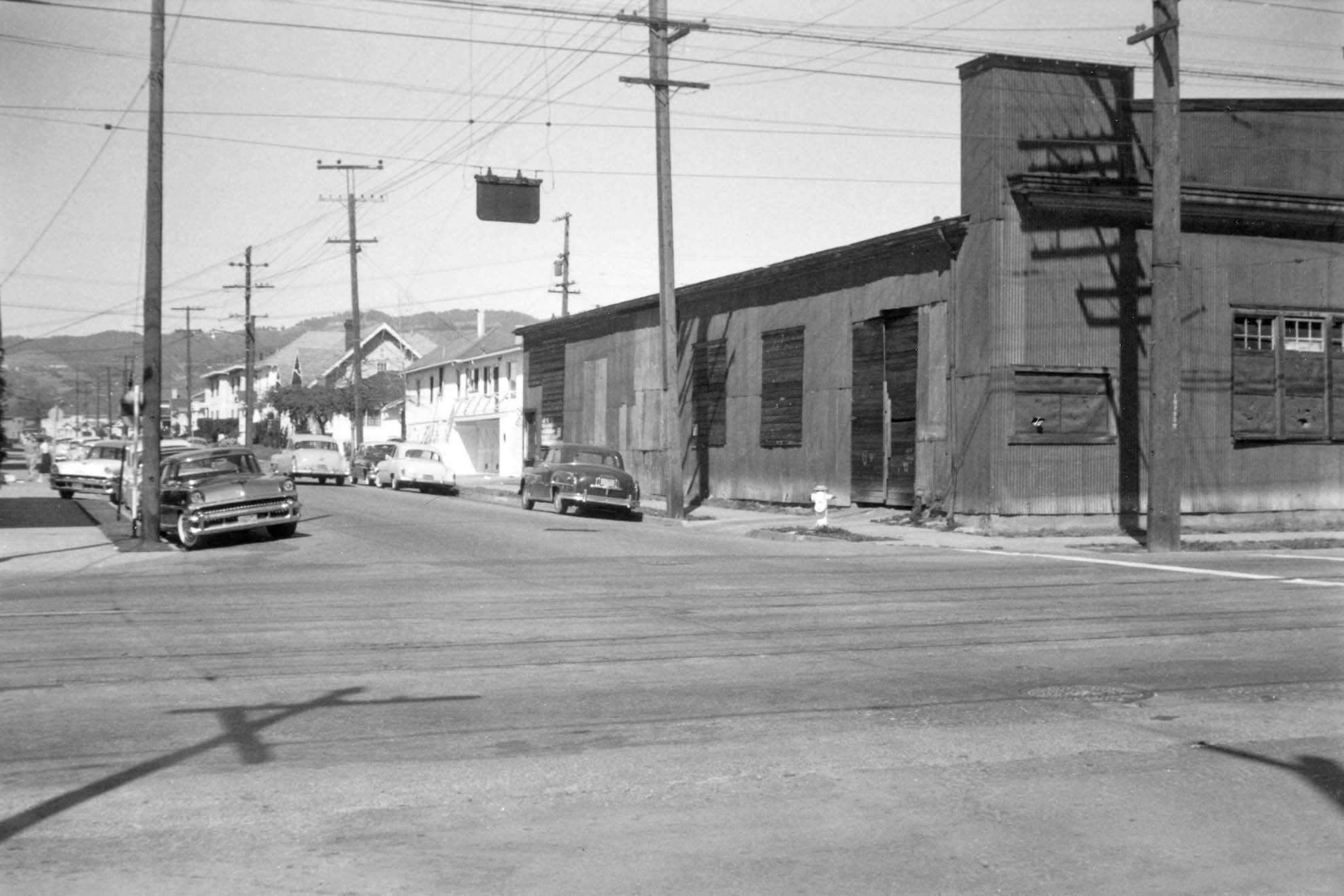
Then to Shafter Ave., an east view of the wood scrap bin, carpenter-car repair shop, and paint shop, left to right, with SN 661 in the latter needing its numerals enhanced, Jan. 1957.
L295-70-Robert P. Townley Photo, Courtesy BAERA, Western Railway Museum Archives, 200052sn, (Image 15 of 37)
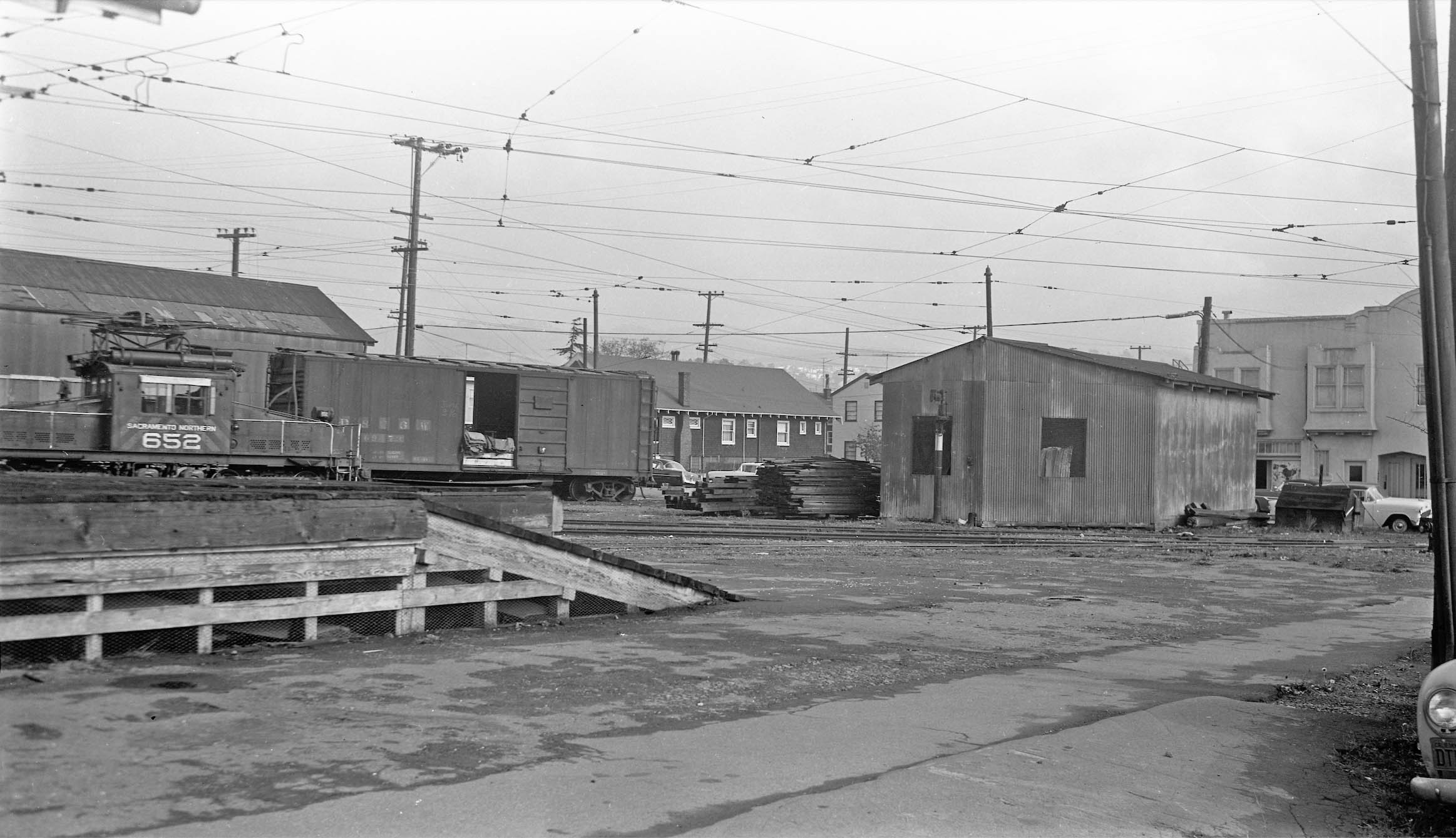
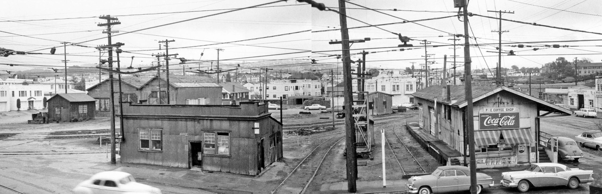
Bob Townley took this southeasterly panoramic view from Shafter Ave. toward the Opal St.-40th St. intersection with SN 652 in the east yard, Jan. 1957. A photograph of this yard during operation without a single railcar present has not been found. Activity occurred 365 days a year.
L295-75-Robert P. Townley Photo, Courtesy BAERA, Western Railway Museum Archives, 200053sn, (Image 16 of 37)
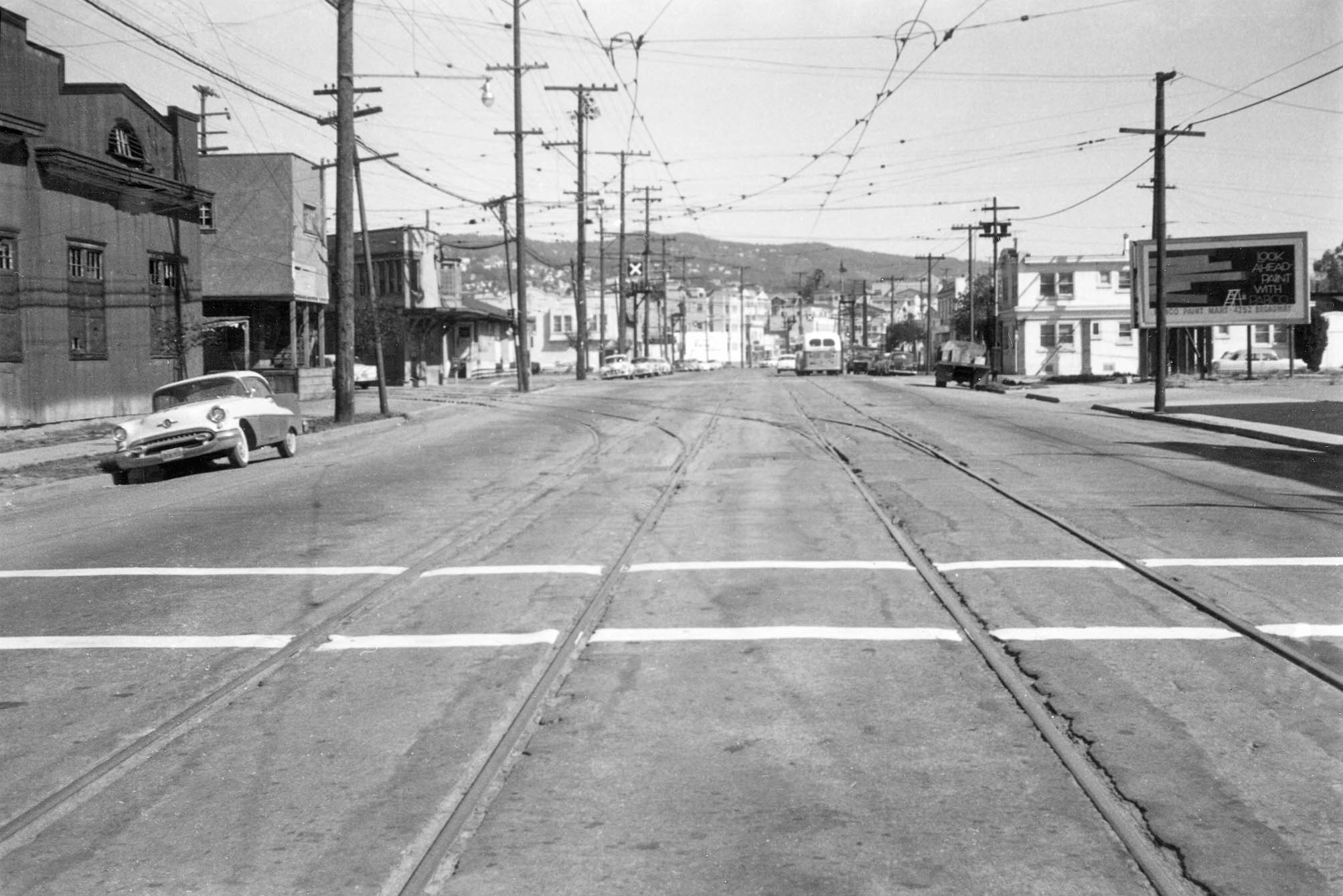
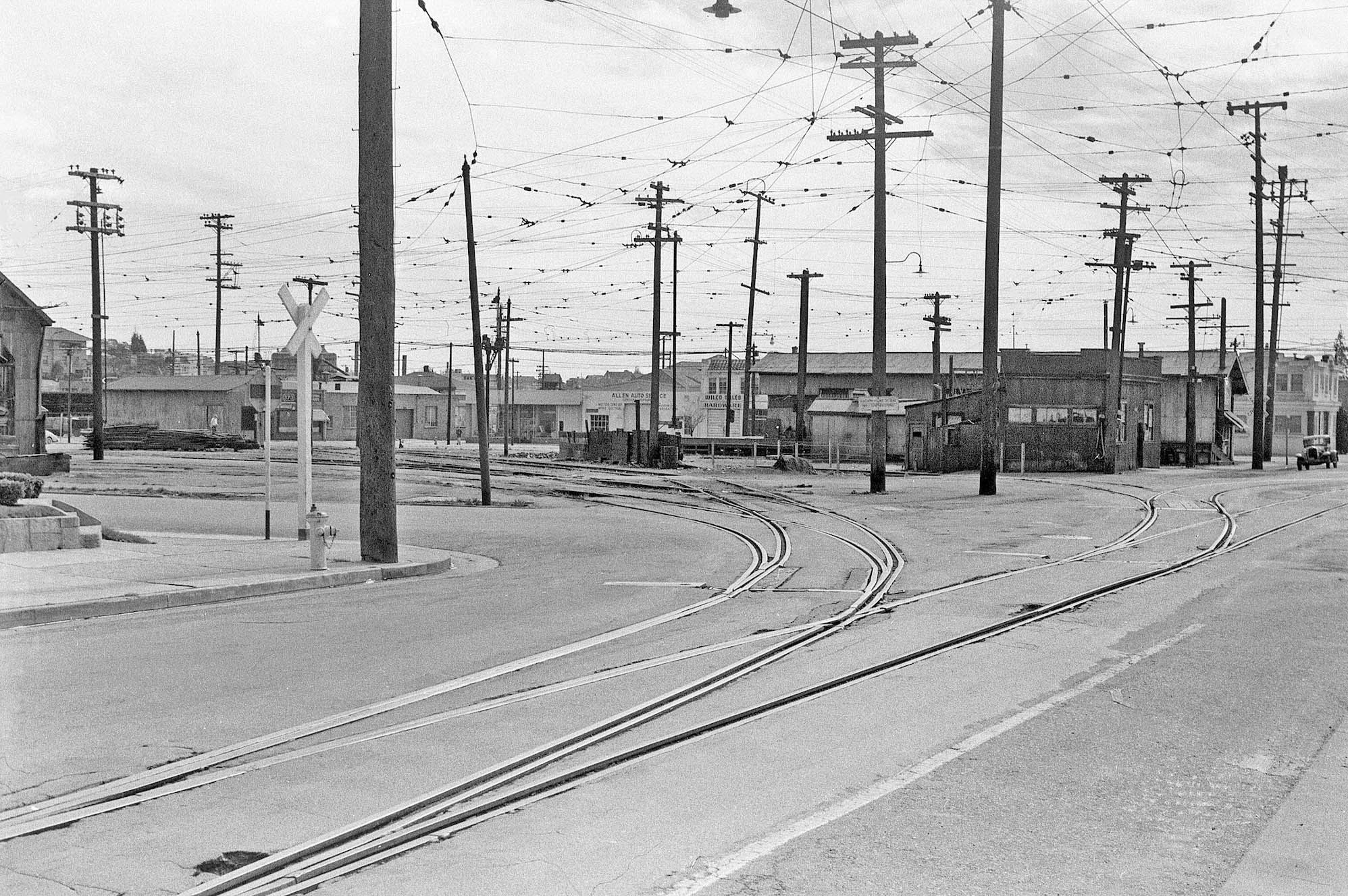
Turning further to the west and looking south down Shafter Ave., the tour of the east yard ends with a view of the sand house-oil room, Jan 1957. Now the stage has been set to describe how and when the facility was altered once abandonment was reached on Mar. 1, 1957.
L295-80-Robert P. Townley Photo, Courtesy BAERA, Western Railway Museum Archives, 200047sn, (Image 17 of 37)
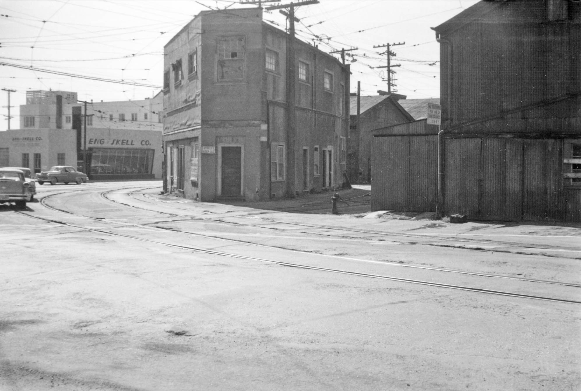
The Oakland Cultural Heritage Survey had secured photos of unknown origin that appear to follow an inspector of sorts around the western section of the facility once the March date had been reached. Except for his car, the scenes to the north, left, and northeast, right, are noteworthy for the absence of any activity.
L295-85-Public Works Photo, Oakland Cultural Heritage Survey, Oakland City Planning Department, (Image 18 of 37)
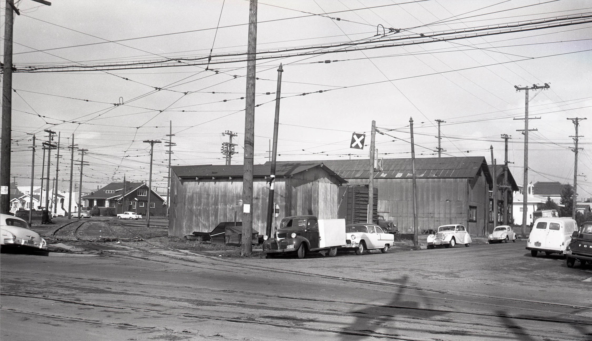
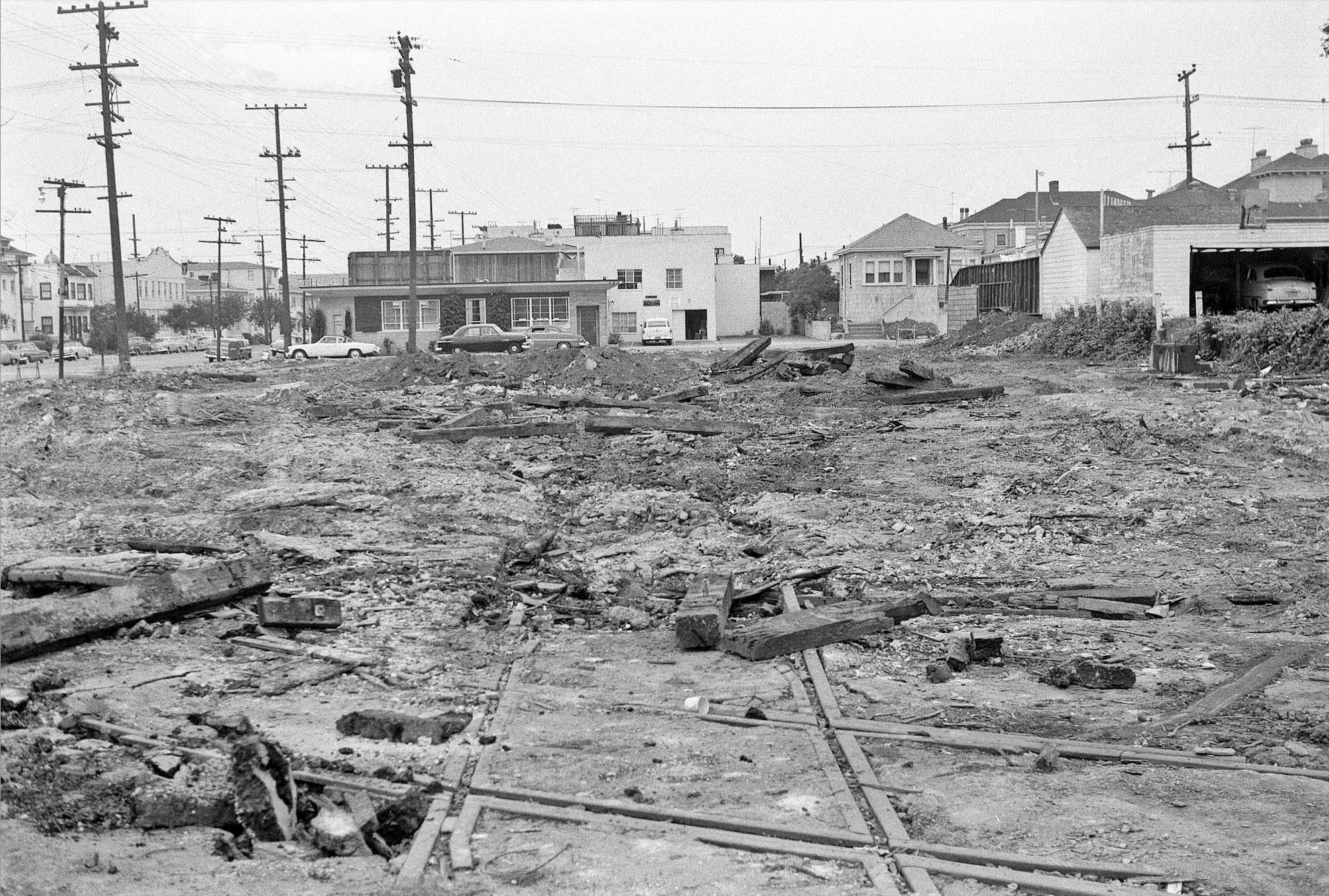
The post abandonment tour starts at 41st. St. and Shafter Ave., southwest view, none of the SN structures or private houses seen in this image survive in 2023.
L295-90-Public Works Photo, Oakland Cultural Heritage Survey, Oakland City Planning Department, (Image 19 of 37)
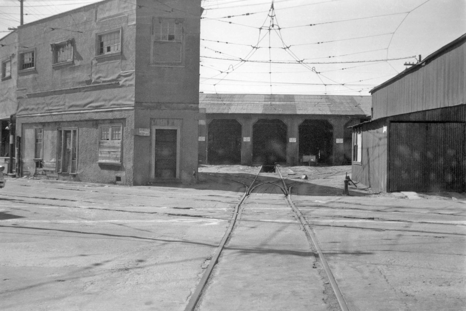
Following the curve of the mainline track, the crossing track between the east and west yards is in view just short of the Superintendent’s Office …
L295-95-Public Works Photo, Oakland Cultural Heritage Survey, Oakland City Planning Department, (Image 20 of 37)
… to the carbarn, now devoid of any rolling stock in need of maintenance, west view. Note the broken windows in the Superintendent’s Office.
L295-100-Public Works Photo, Oakland Cultural Heritage Survey, Oakland City Planning Department, (Image 21 of 37)
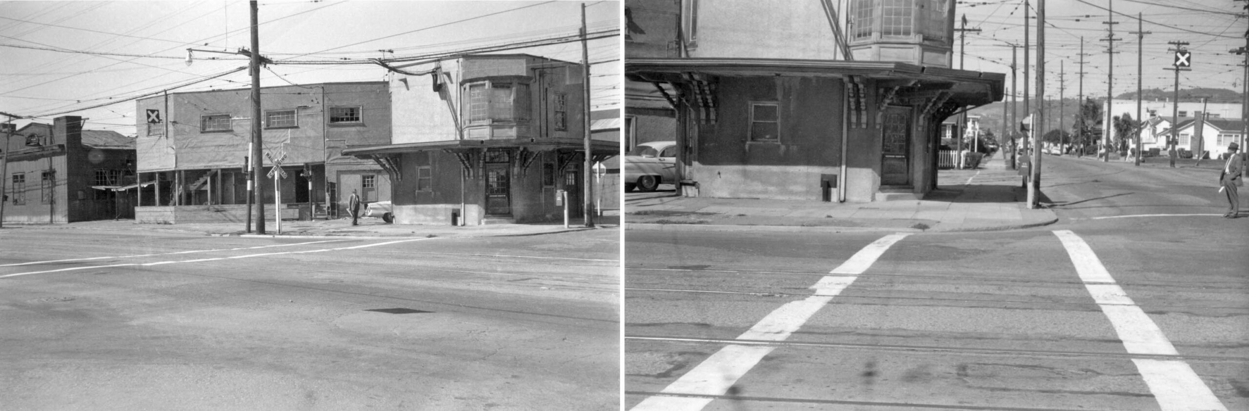
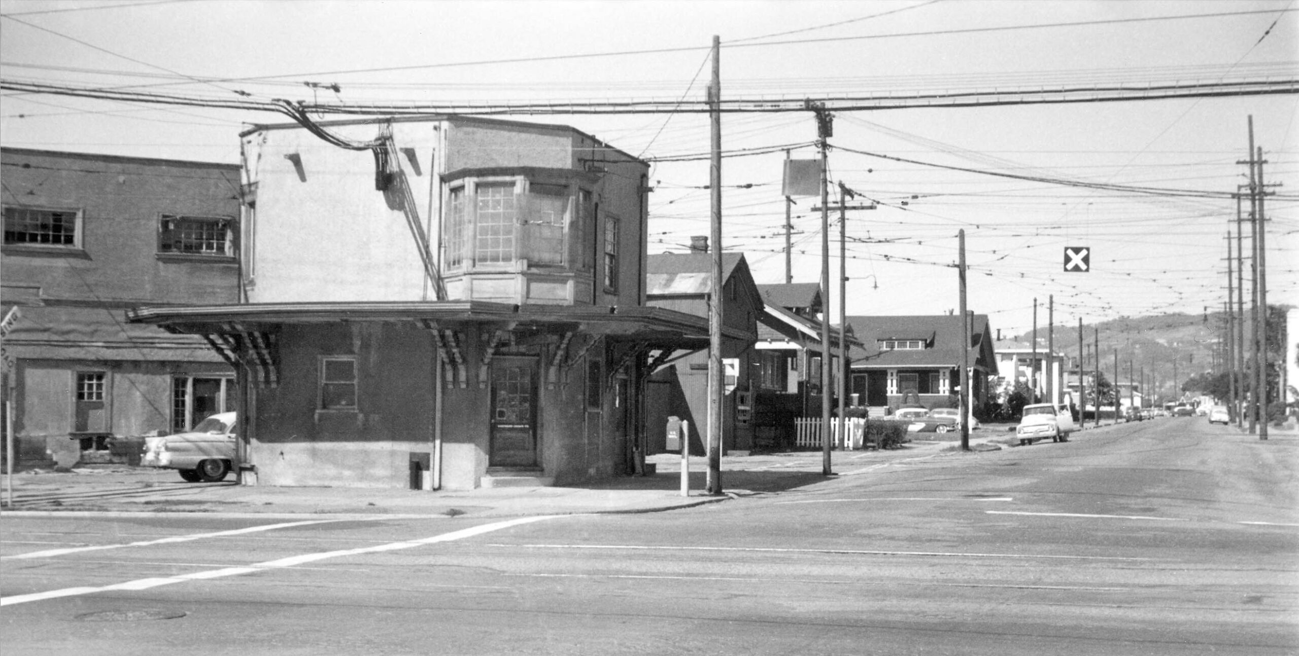
The forlorn depot at least has its windows, but evidence for the canopy over the second story windows is no more.
L295-105-Public Works Photo, Oakland Cultural Heritage Survey, Oakland City Planning Department, (Image 22 of 37)
A west view down 40th St. and the equally deteriorating Key tracks will remain for at least one more year.
L295-110-Public Works Photo, Oakland Cultural Heritage Survey, Oakland City Planning Department, (Image 23 of 37)
Same situation for the Key tracks running to Broadway, but those switch tracks facilitating Oakland Terminal Railway transfers would not survive much longer.
L295-115-Public Works Photo, Oakland Cultural Heritage Survey, Oakland City Planning Department, (Image 24 of 37)
Turning the corner at Webster St., houses had been added post-WWII that abut the car barn.
L295-120-Public Works Photo, Oakland Cultural Heritage Survey, Oakland City Planning Department, (Image 25 of 37)
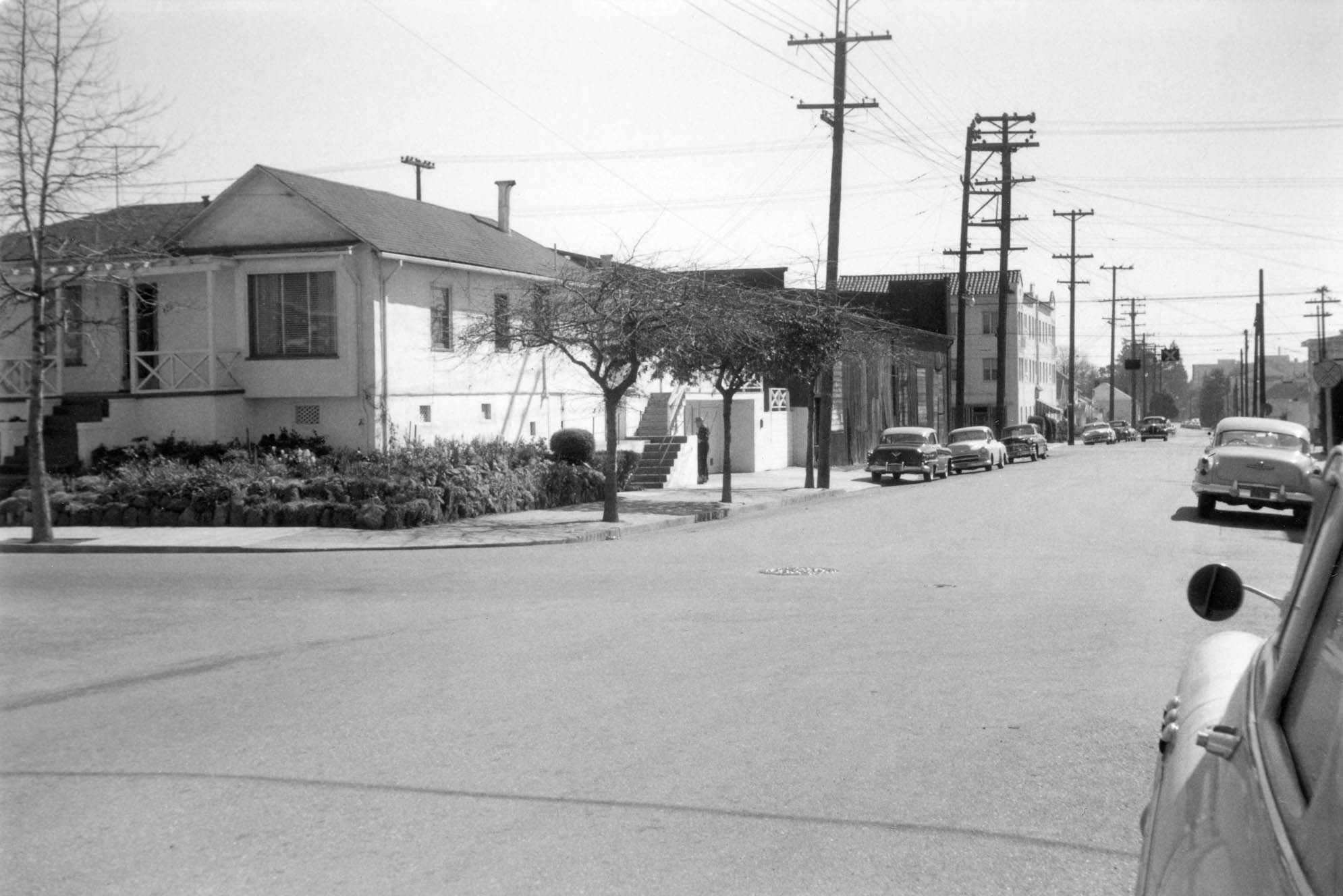
One final view southwest up Webster St. to 40th St., the corner house shown here remains in 2023.
L295-125-Public Works Photo, Oakland Cultural Heritage Survey, Oakland City Planning Department, (Image 26 of 37)
To complete the full evaluation of the SN facility, juxtaposition of two northeast views taken from the second story of the passenger depot at the time of abandonment documents the still intact east yard.
L295-127-Courtesy BAERA, Western Railway Museum Archives, 213899sn, r, 213901sn, l, (Image 27 of 37)
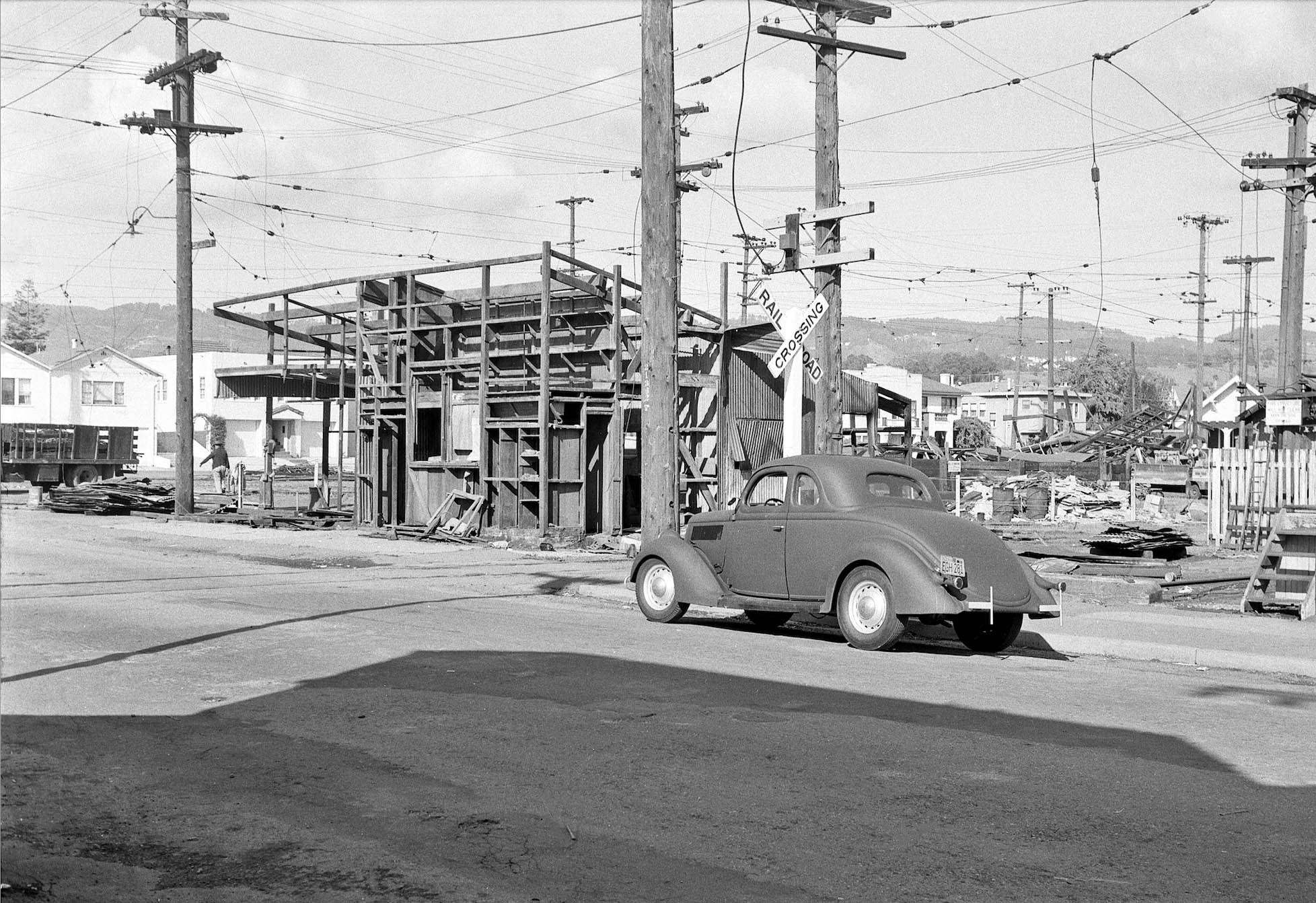
The set of images just reviewed didn’t include the east yard, but in their first visit in Mar. 1957, John Harder and Harry Demoro documented the intact buildings, and the yard devoid of any equipment. Don’t be distracted by the the Model A at the corner of Shafter Ave. and 40th St. As explained by John Harder, it was Demoro’s vehicle in the late 1950s.
L295-130-John Harder Photo, Courtesy John Harder, (Image 28 of 37)
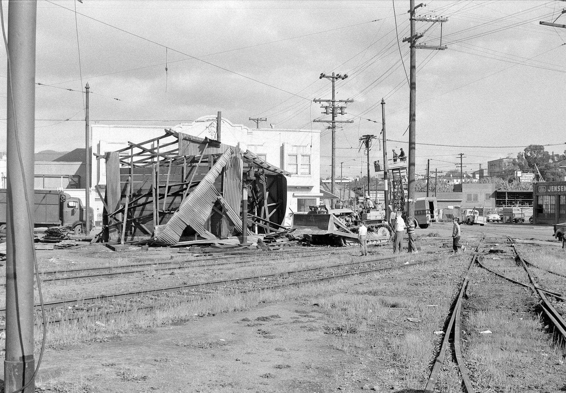
The date the destruction of the facility began was not found, but John and Harry returned later in March. By then the carbarn was completely gone as seen in this west view toward Webster St.
L295-135-John Harder Photo, Courtesy John Harder, (Image 29 of 37)
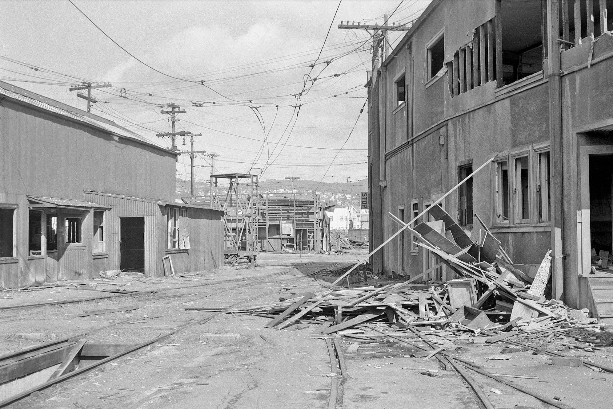
Turning 180 degrees to the east, the railway inspection pit that had been within the carbarn is seen on the left, the other buildings showing the early stages of dismantling.
L295-140-John Harder Photo, Courtesy John Harder, (Image 30 of 37)
Continuing to the east yard, the sand house-oil room is seen partially dismantled in an orderly fashion in this northeast view.
L295-145-John Harder Photo, Courtesy John Harder, (Image 31 of 37)
Turning toward the intersection of Opal St. and 40th St. to the southeast, the Roadway Department shed has met a more destructive end.
L295-150-John Harder Photo, Courtesy John Harder, (Image 32 of 37)
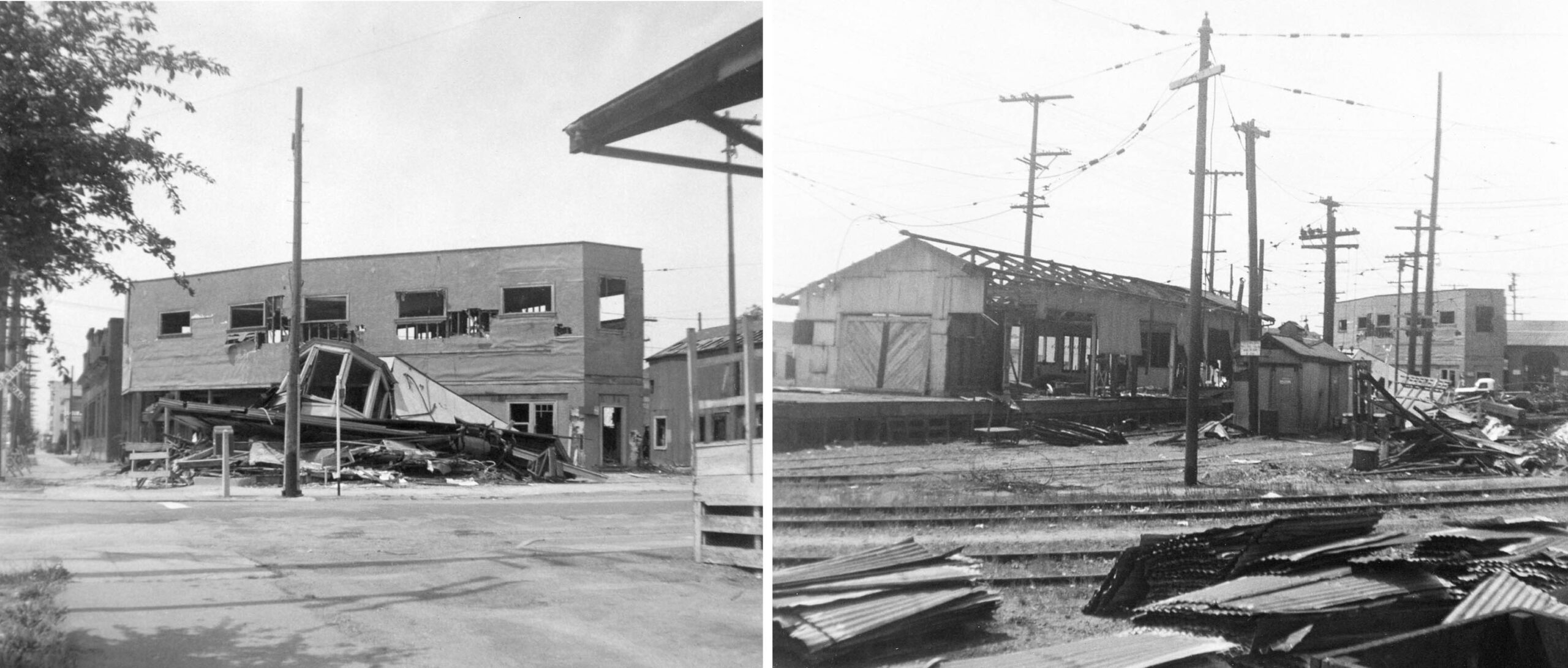
Next, two images that were dated and accurately annotated from Apr. 21, 1957. On the left, the passenger depot has been flattened as seen in this west view. On the right, the freight depot is being carefully dismantled in this southwest view.
L295-155-Courtesy BAERA, Western Railway Museum Archives, 213906sn, r, 213902sn, l, (Image 33 of 37)
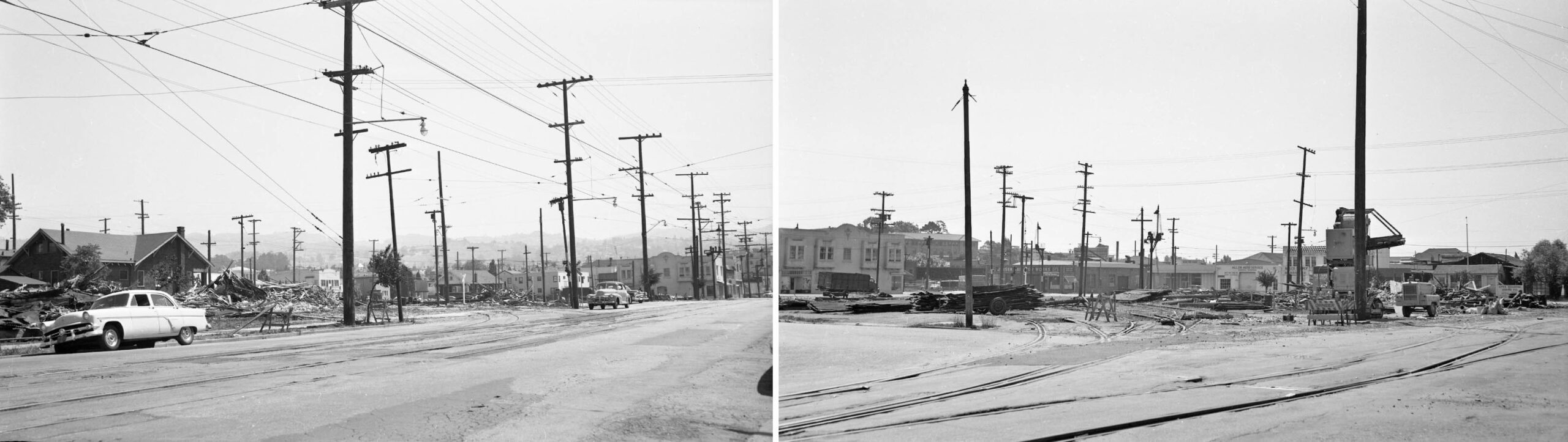
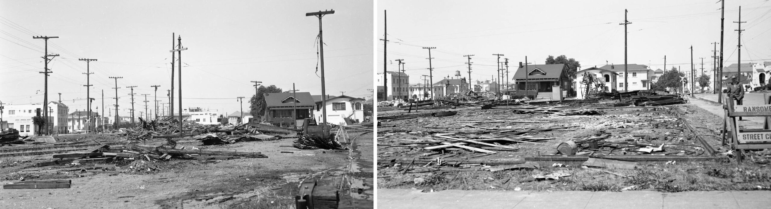
Determining when the destruction was complete rests on images from Addison Laflin taken on May 5, 1957. These two images, a northeast view from 40th St. between Shafter Ave. and Webster St., toward Opal St., left, and a southeast view from Shafter Ave. and 41st St. toward Opal St. and 40th St., right, show the absence of the depot and any structures in the east yard.
L295-160-Addison Laflin Photo, Courtesy BAERA, Western Railway Museum Archives, 171708sn, l, 171709sn, r, (Image 34 of 37)
Likewise, these two west views of the west yard from Shafter Ave. between 40th-41st Sts. toward Webster St. by Laflin show no remaining structures as of May 5, 1957.
L295-165-Addison Laflin Photo, Courtesy BAERA, Western Railway Museum Archives, 171710sn, l, 171711sn, r, (Image 35 of 37)
These two images by Fred Matthews were not dated, but the loss of the depot in the southwest image in the right panel, and the untouched sand house-oil room in the left panel means Matthews visited the site in March before Harder and Demoro returned for a second time that month. The images confirm that the Key C line ran uninterrupted during the destruction of the SN terminal.
L295-170-Fred Matthews Photo, Moreau Collection, Courtesy BAERA, Western Railway Museum Archives, 102557sn, l, 102558sn, r, (Image 36 of 37)
Leaving on a positive note, Eston Cheney’s northeast view of 40th St. and Shafter Ave. when it was fully operational in 1913. Unfortunately this glass plate had the Cheney number obliterated, so that portion was cut off. Thanks to John Harder for his personal images and recollection of his experiences at the facility in 1957, and to Betty Marvin and Gail Lombardi of the Oakland Cultural Heritage Survey in Oakland City Planning for images.
L295-175-Eston Cheney Photo, Courtesy BAERA, Western Railway Museum Archives, 24113oa&e, (Image 37 of 37)