A Day at the Lake
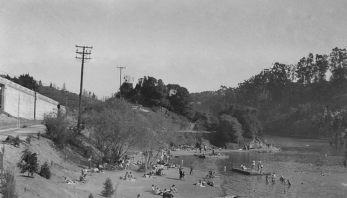
In this section, images of Lake Temescal from the end of the SN passenger era, 1938-1941, will be highlighted. This undated north view reveals the popularity of the location. The vintage of the cars in the lot, left upper corner, and along Broadway, top margin, are consistent with the time period of interest.
L42-05-Courtesy East Bay Regional Park District, (Image 1 of 11)

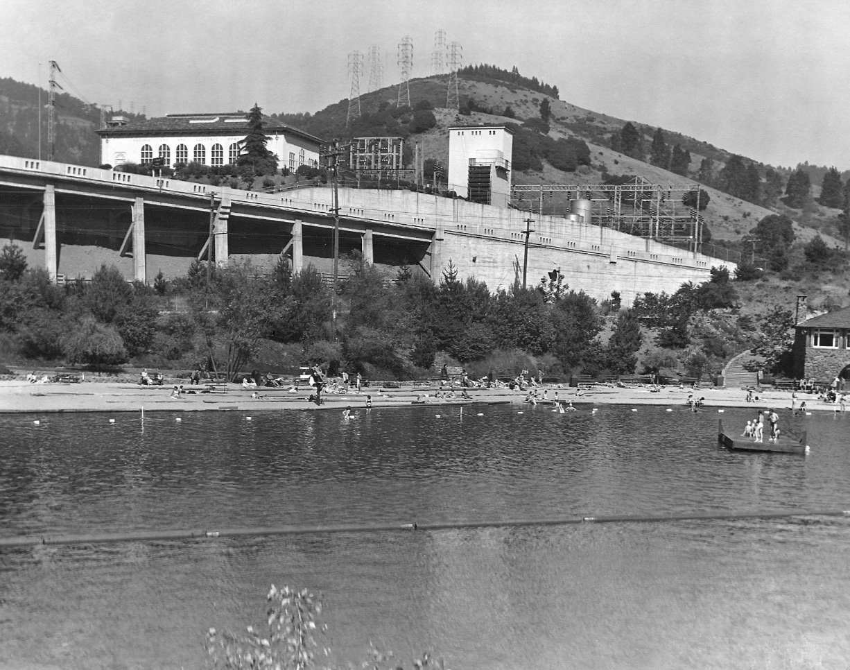
Key events for Lake Temescal include creation of the East Bay Municipal Utility District in 1923, designation of park status by the East Bay Regional Park District in 1936, and completion of the Broadway Low Level Tunnel in 1937. The east view up Broadway or Route 75 from Oakland in Oct. 1946 highlights the north entry to the lake, access from Contra Costa County, and the Landvale Road Overpass from Berkeley.
L42-10-Copyright California Department of Transportation, Detail 1175-2, (Image 2 of 11)
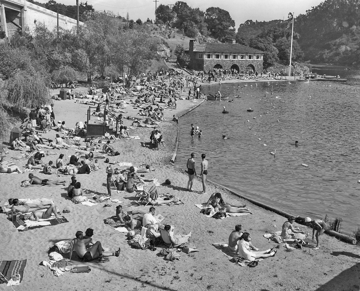
This east view from Mar. 30, 1949 provides a general overview of the beach area of the lake and the relative positions of the Landvale Road and the PG&E Claremont Substation to the east. The stone beach house was constructed in 1940 by the Works Progress Administration and provides a marker to date images of the area.
L42-15-Courtesy Pacific Gas and Electric Company, 3065, (Image 3 of 11)
Another east view showing more details of the major landmarks in the area from an earlier period relative to L42-15 based on the height of the trees to the east of the beach. The catenary poles from the SN mark the course of the right-of-way along the eastern border of the park. The PG&E Claremont substation dates back to 1922.
L42-20-Courtesy East Bay Regional Park District, (Image 4 of 11)
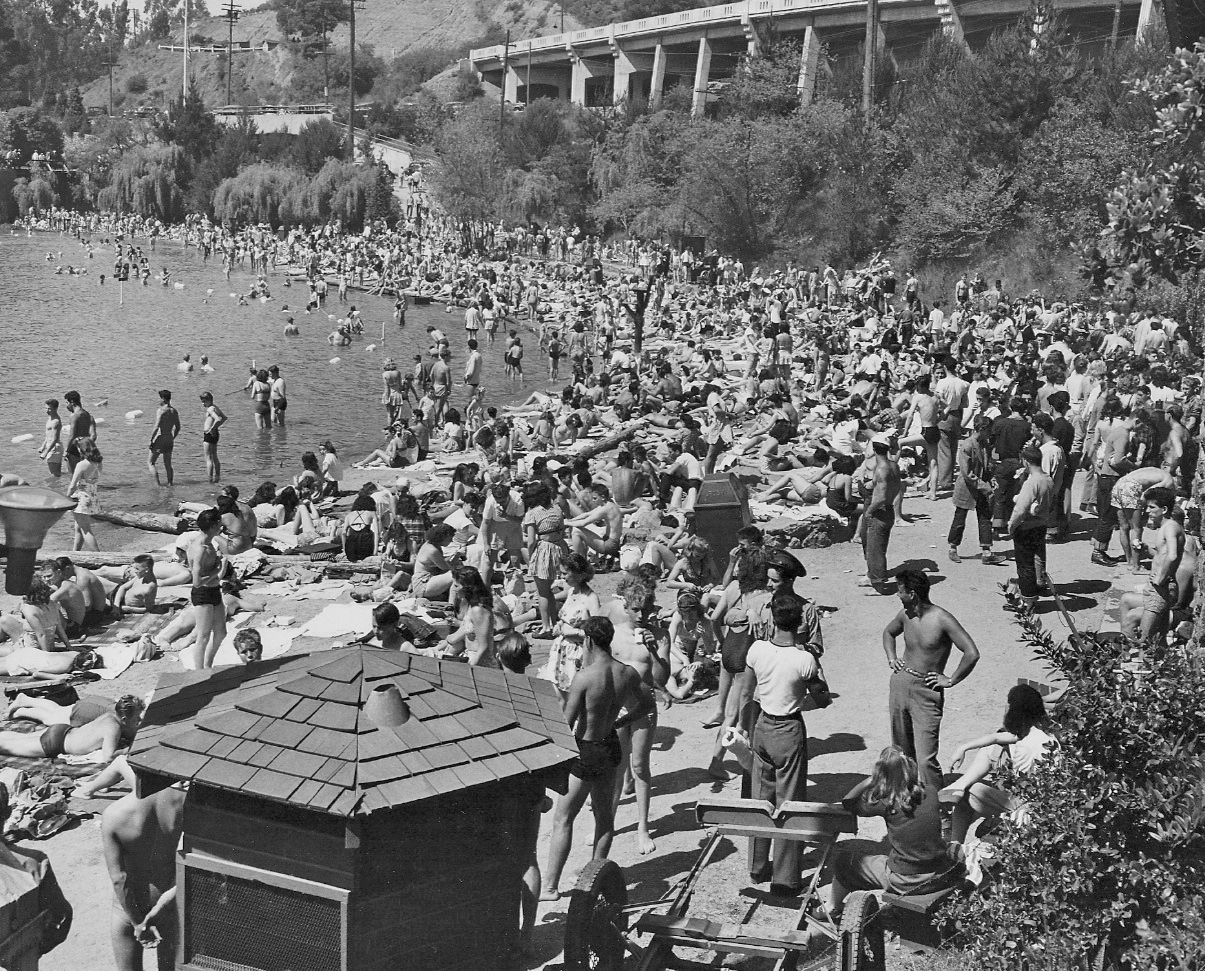
A more direct north view relative to L42-05 of a crowded beach scene from the 1940s also highlights the roads, but from this angle, the trees obscure the path by foot to the lake from Chabot Road and the SN right-of-way. Ref: Mr. Young’s address given as 1112 Clarendon Crest, Oakland, CA.
L42-25-Elmer E. Young Photo, Courtesy East Bay Regional Park District, EBRPD.P67.1, (Image 5 of 11)
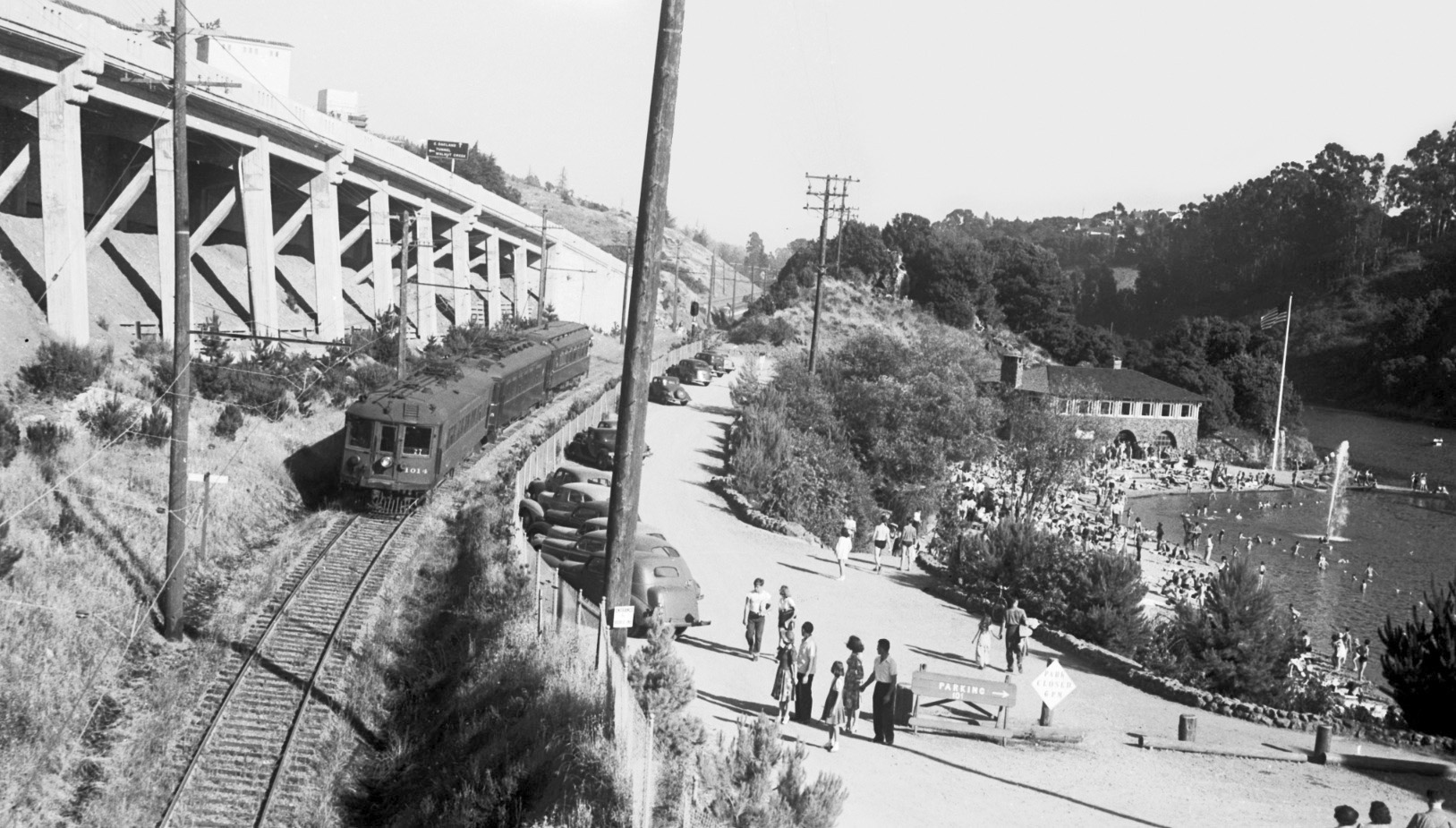
A circa 1940 north view of the north entrance to the lake with the portals from Chabot Road and for the train, here SN 1014 as the eastbound school train, number 12.
L42-30-Courtesy BAERA, Western Railway Museum Archives, 52061sn , (Image 6 of 11)
It would be hard to imagine a more dramatic view documenting the juxtaposition of the SN right-of-way and the lake than this south view by Peter Kyhn taken from Broadway, circa 1940. Here SN 1014 takes the designation of train 27, the westbound school train.
L42-35-Peter Kyhn Photo, Courtesy Tom Gray , (Image 7 of 11)
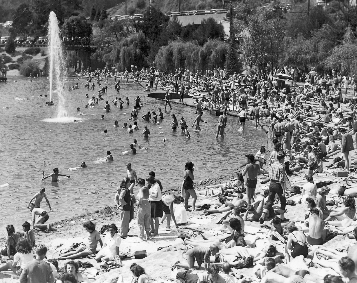
Another undated south view from no earlier than 1940 showing a crowd at the beach.
L42-40-Courtesy East Bay Regional Park District, (Image 8 of 11)
Same south view as L42-40, but prior to the building of the beach house, May 3, 1938.
L42-45-Courtesy East Bay Regional Park District, EBRPD.P3.8 , (Image 9 of 11)
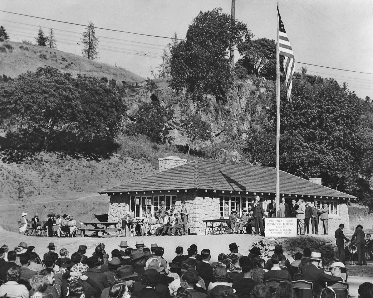
Hidden among the trees, west of the SN right-of-way and south of the beach house is the Recreation Building, here shown at the dedication after being built by the North Oakland Kiwanis Club in 1939. Southeast view.
L42-50-Courtesy East Bay Regional Park District, (Image 10 of 11)
A three-car SN train catches the attention of a family paddling south, just as the train crosses the landfill where the SN had previously had a steel trestle to cross the eastern-most bud of the lake. This section of the lake was eliminated to allow extending the Landvale Road in the mid-1930s. East view, 1939.
L42-55-Charles Savage Photo, Courtesy BAERA, Western Railway Museum Archives, 10135sn, (Image 11 of 11)