At Home in Nichols
Heading east along the North Coast, the next SN stop after Bay Point-Port Chicago was the town of Nichols. This update will focus on images of the homes in this town that were served by the SN up until mid-1941, and some additional images into the 21st century.
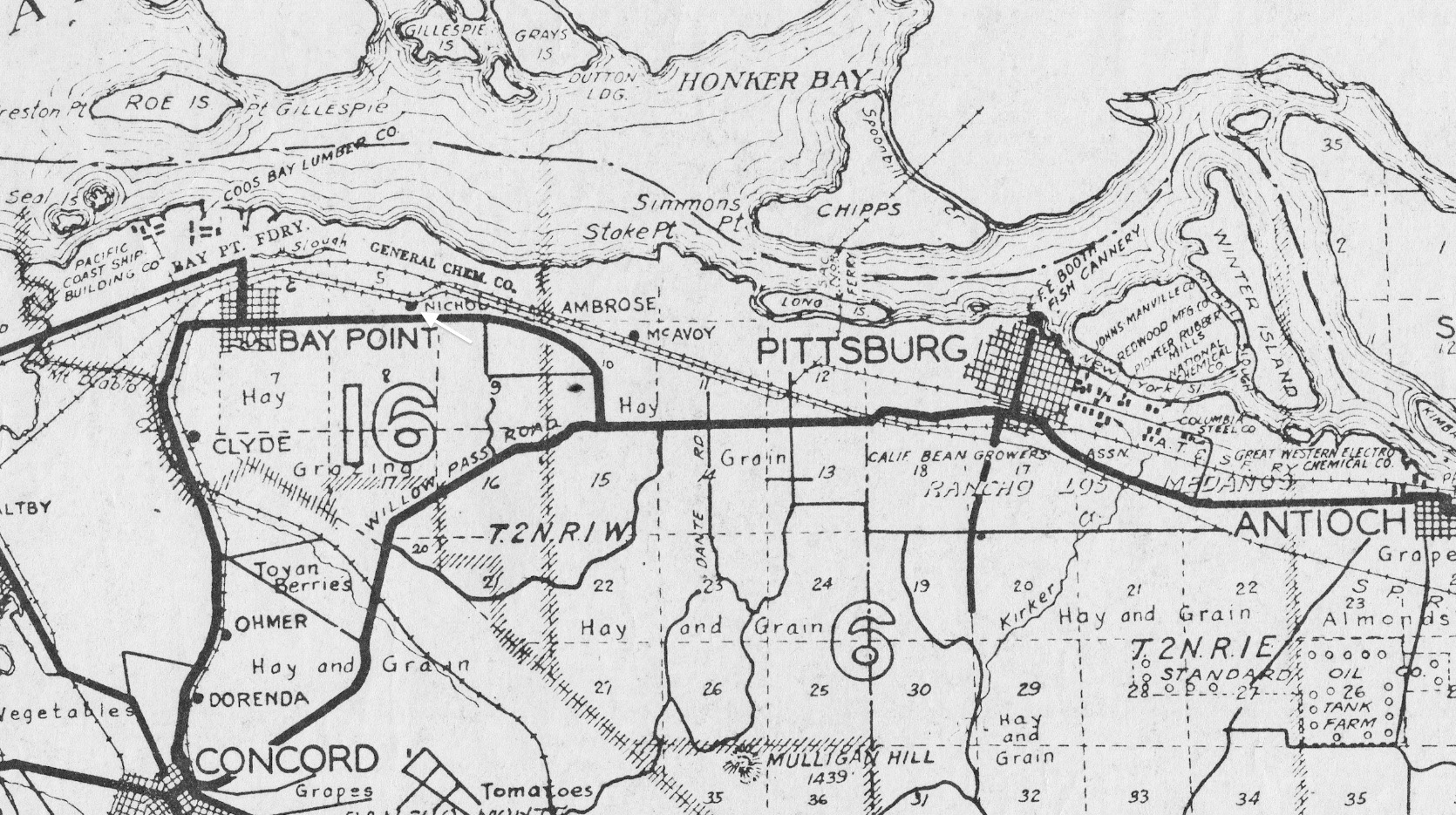
L171-05-Courtesy Earth Sciences and Map Library, University California, Berkeley, (Image 1 of 25)

Key elements of the history of Nichols, the General Chemical Company and the Santa Fe-Southern Pacific crossover have all been covered in the history section under “Industry of the North Coast VI - General Chemical and Turning a Blind Eye at Nichols”.
L171-10-Stuart Swiedler Photo, (Image 2 of 25)
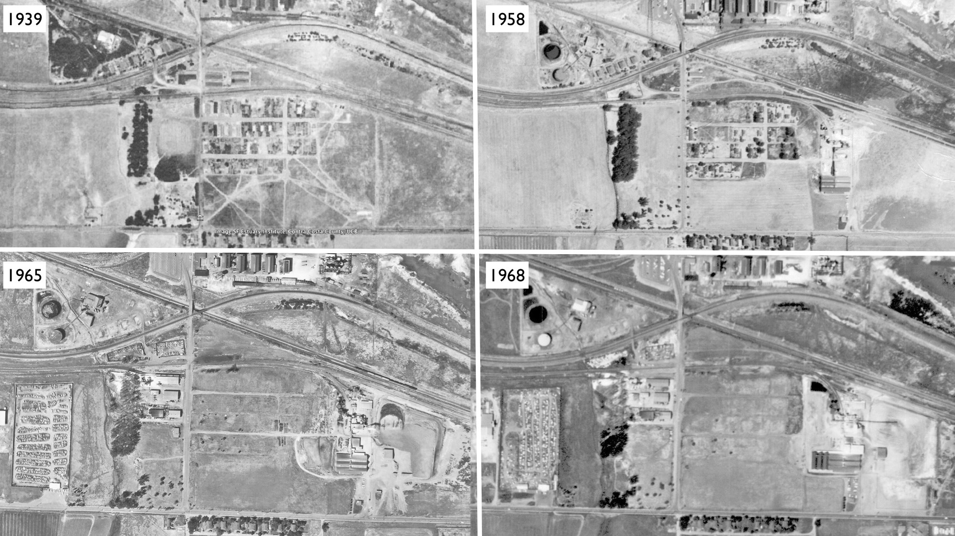
The homes that the SN served in 1939 were evacuated by the mid-1960s as the Navy took over Port Chicago and created the two-mile safety zone. As the Navy continued to build up armaments in this area, General Chemical flourished as did new industries along the SN’s right-of-way. Sources of USDA aerials: 1939, Google Earth; 1958, BUU-6V-41, 8/13/58, Contra Costa County Historical Society; 1965, the National Archives of San Francisco, RG 77 NRHS Acc Number 077-99-01 Box 9, Folder 6; 1968, 3-214 GS-VBZJ, 4/22/68, Contra Costa County Historical Society
L171-15-US Dept. of Agricuture, AAA Western Division Aerials, (Image 3 of 25)
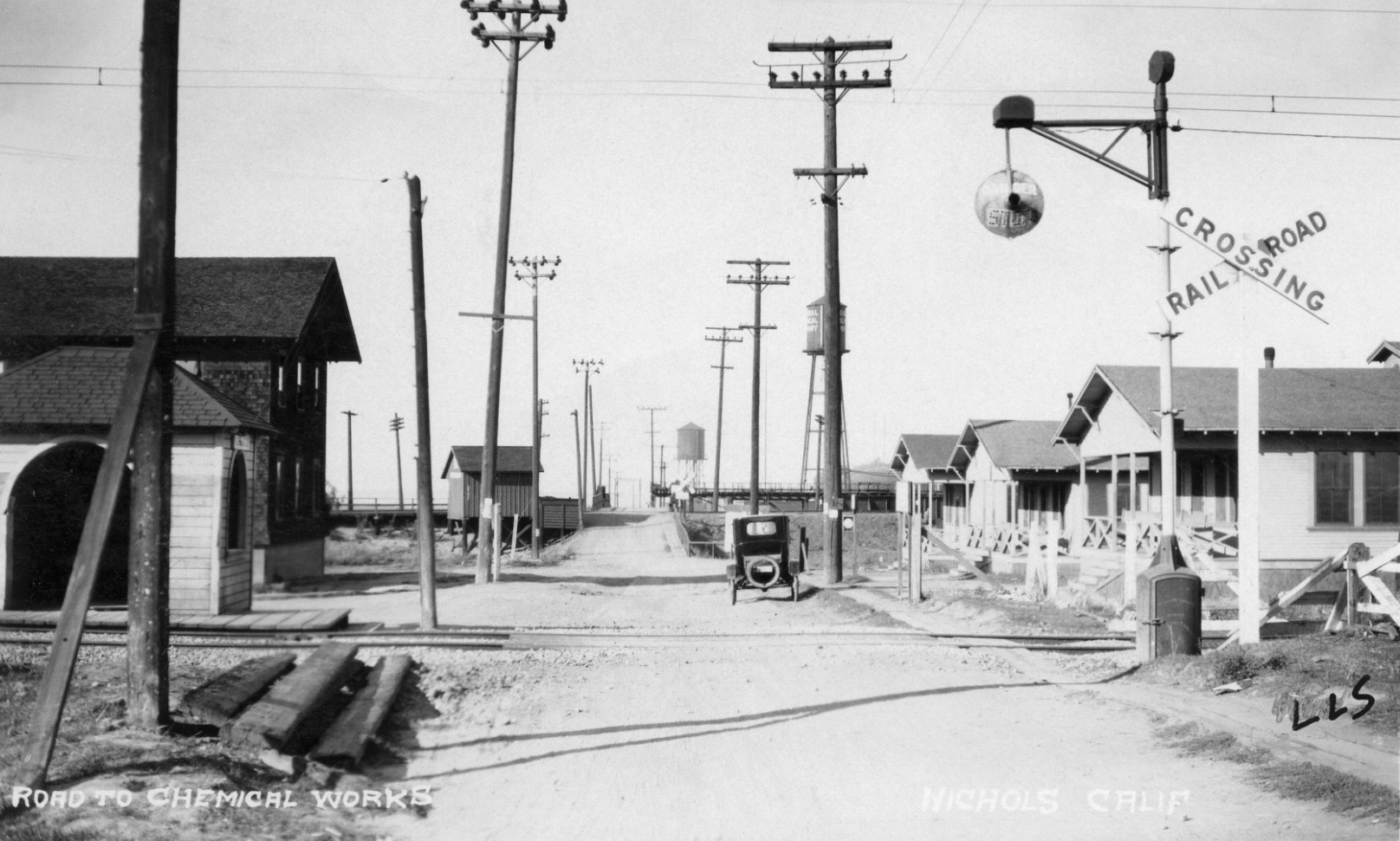
Starting in 1909, General Chemical built its first West Coast plant, and around it grew a town with 50 homes, 10 bunk houses and 600 or so residents. They even had their own school, and three railroad stations. This circa 1920 north view shows the SN shelter in the foreground to the left of Nichols Rd., with the Santa Fe shelter in the background. The Southern Pacific or SP shelter could not be seen from this view.
L171-20-Louis L. Stein Collection, Courtesy BAERA, Western Railway Museum Archives, 97702sn, (Image 4 of 25)
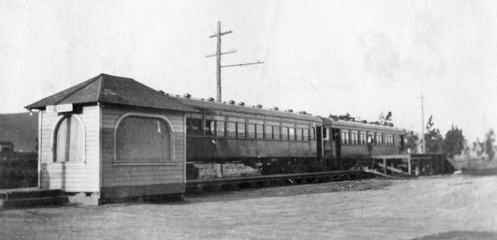
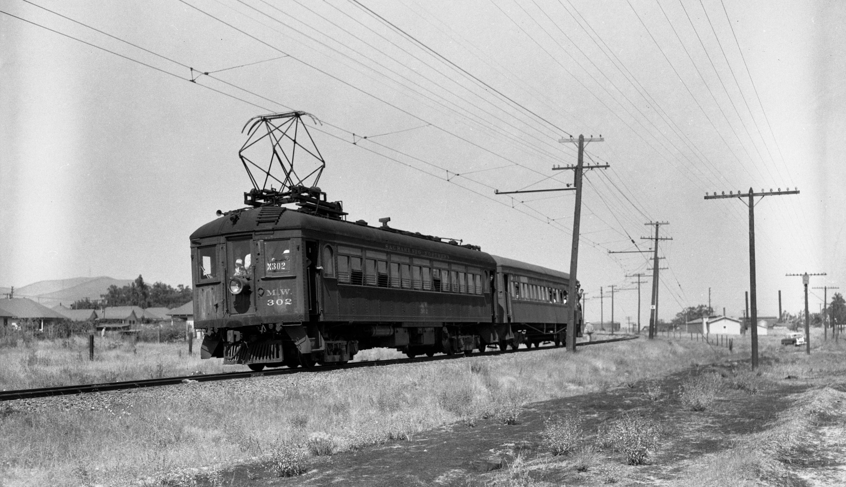
This southwest view from Apr. 1921 shows the first morning train to San Francisco, the 6:53 AM, with SN 1005 leading the two-car train. Note the shelter appears to be boarded up by this time.
L171-25-Courtesy Martinez Historical Society, (Image 5 of 25)
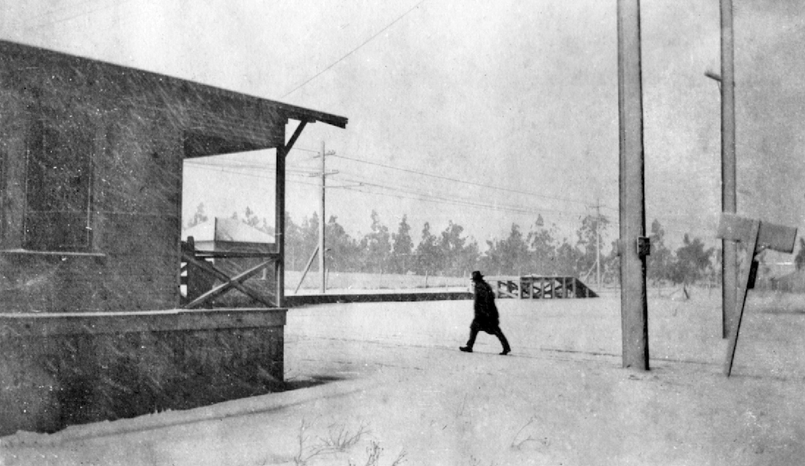
A similar southwest view, but the snow is coming down on Jan. 29, 1922, with dormitory no. 48 in the foreground and the trees serving as a windbreak in the background.
L171-30-Courtesy Martinez Historical Society, (Image 6 of 25)
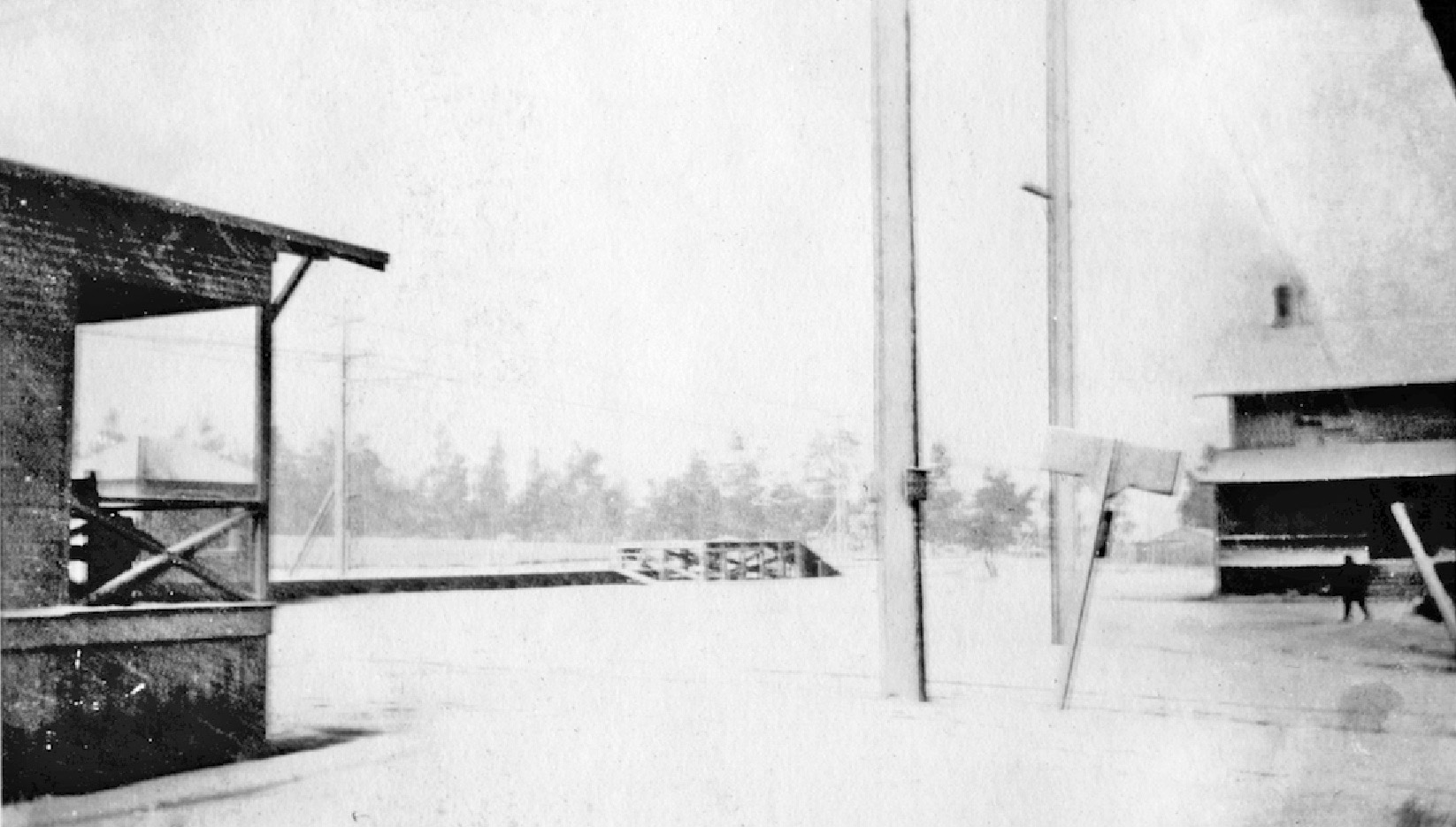
Again in the snowstorm of Jan. 29, 1922, but this southwest image also includes the hotel at the right edge.
L171-35-Courtesy Martinez Historical Society, (Image 7 of 25)
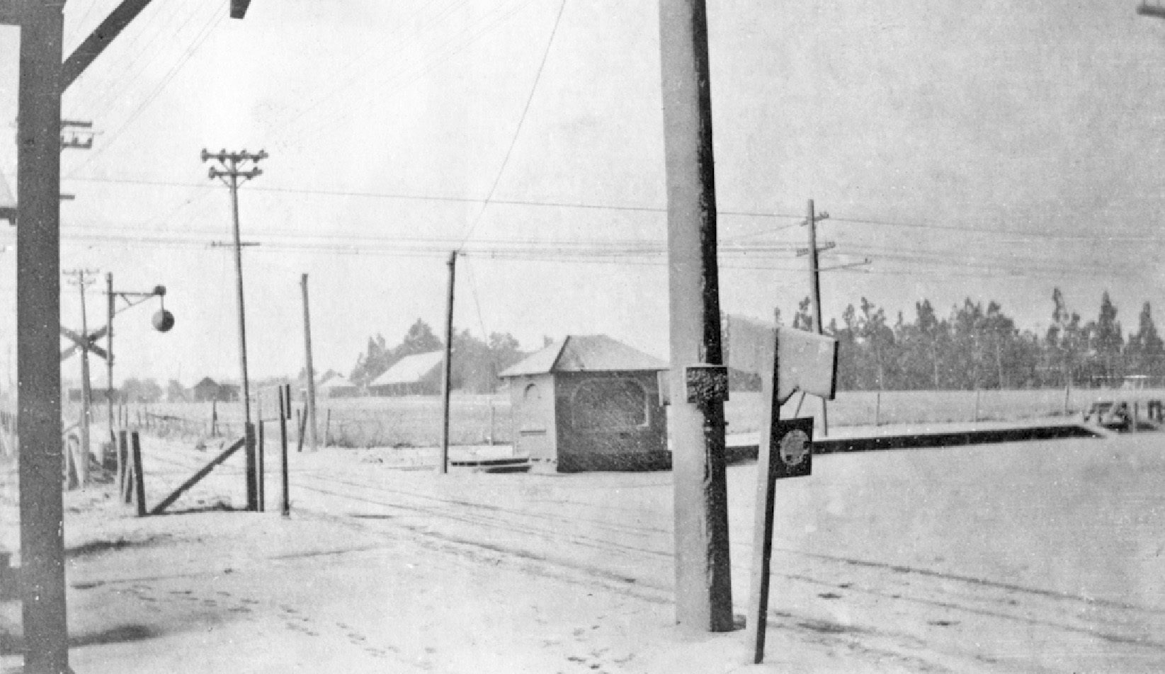
One final southwest image from Jan. 29, 1922 with the homes to the east of the windbreak. The imprint of car tires on Nichols Rd. gives the appearance of a perpendicular set of tracks to those of the SN.
L171-40-Courtesy Martinez Historical Society, (Image 8 of 25)
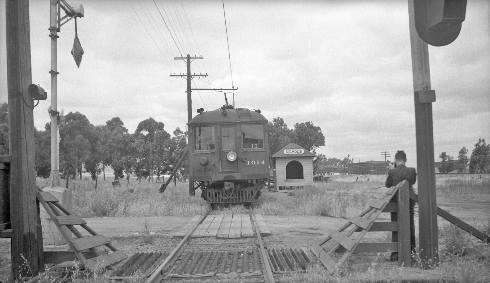
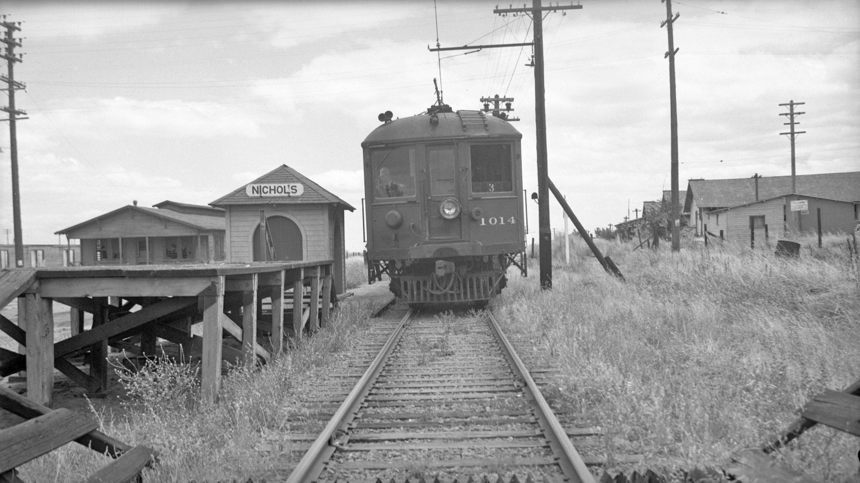
Based upon images identified, Nichols did not receive much further attention until the end of SN passenger service approached. Dudley Thickens took this west view of SN 1014 on June 22, 1941 …
L171-45-Dudley Thickens Photo, Courtesy BAERA, Western Railway Museum Archives, 94736sn, (Image 9 of 25)
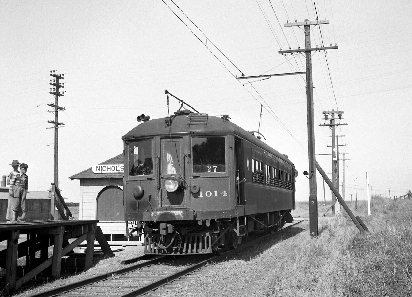
… and this east view of SN 1014 on June 22, 1941. This image, in particular, shows the relative disrepair of the housing adjacent to the station shelter.
L171-50-Dudley Thickens Photo, Courtesy BAERA, Western Railway Museum Archives, 60288sn, (Image 10 of 25)
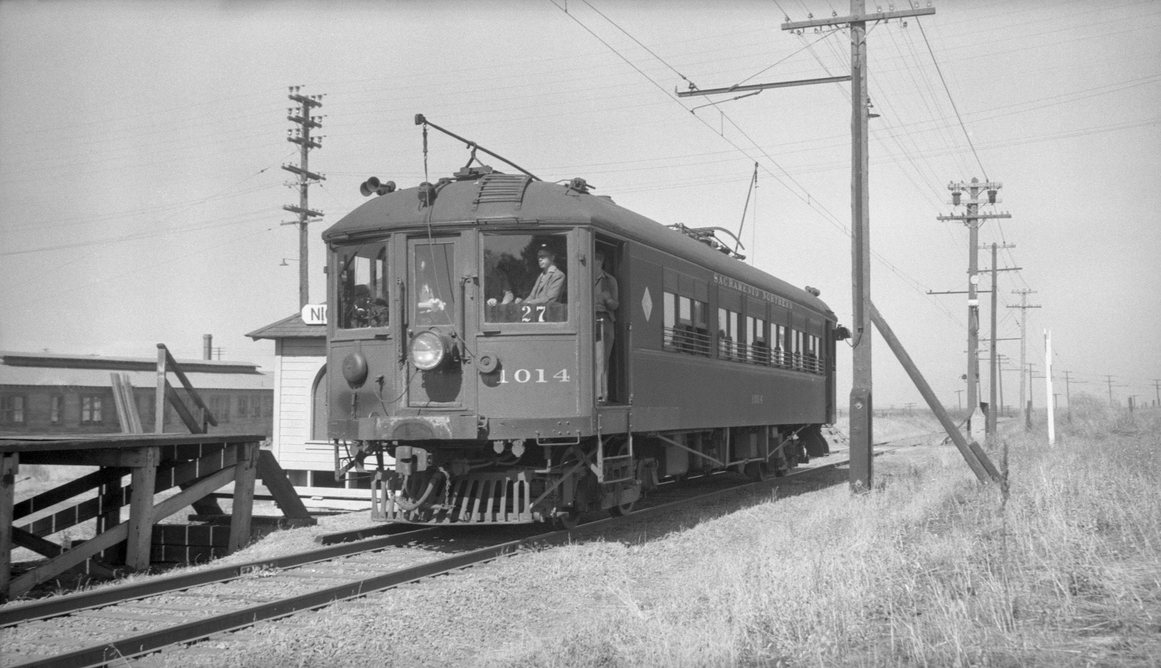
Several east-northeast views of SN 1014 were taken during the last passenger run of July 12, 1941. Each one shows something different, starting with this one showing two kids on the freight platform with one building in the background.
L171-55-JG Graham Photo, Courtesy BAERA, Western Railway Museum Archives, 4362sn, (Image 11 of 25)
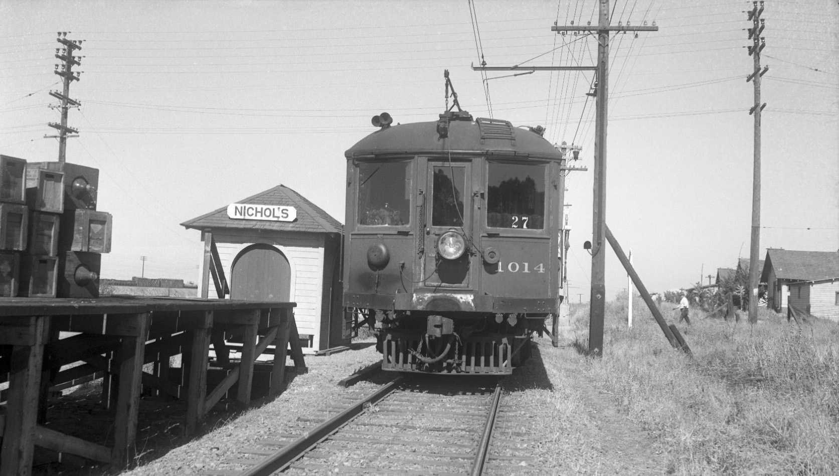
More of the building to the north is seen in this east view from July 12, 1941.
L171-60-Dudley Thickens Photo, Courtesy BAERA, Western Railway Museum Archives, (Image 12 of 25)
Finally, and more to the direct east, this view again showing the homes to the southeast of the track.
L171-65-Tom Gray Collection, Courtesy Tom Gray, (Image 13 of 25)
This southwest view from a July 4, 1950 BAERA-sponsored excursion provides a different angle to add what little can be gleaned from the housing in this area. With all evidence for the existence of these homes gone, and so few pictures preserved, little else remains but the memories of the folks that lived here more than fifty years ago.
L171-70-Jim Holmes Collection, Courtesy BAERA, Western Railway Museum Archives, 103016sn, (Image 14 of 25)
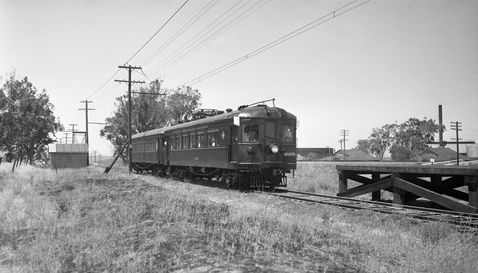
Excursions provided other details of the area in the 1956-1957 timeline, such as the small hut to the south of the SN track, and the buildings to the north of the Santa Fe berm that would soon be history. Here, a northwest image west of the freight platform and SN 1005 and Salt Lake and Utah 751 on excursion.
L171-75-Tom Gray Photo, Courtesy Tom Gray, (Image 15 of 25)
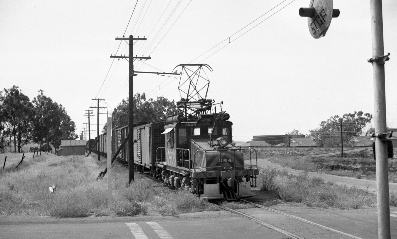
Additional details of the structures along the north side of the Santa Fe berm and the wig-wag signal at Nichols Rd. can be appreciated in this 1950s sweeping northwest view with SN 654 and freight.
L171-80-Robert P. Townley Photo, Courtesy Robert P. Townley, (Image 16 of 25)
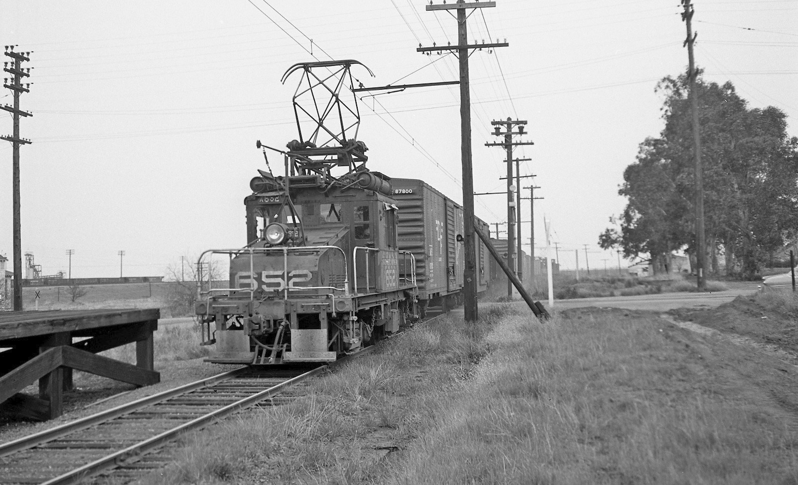
As the electric era came to an end, SN 652 is seen making one of its final runs on Feb. 25, 1957, east view.
L171-85-EK Muller Photo, Courtesy BAERA, Western Railway Museum Archives, 79009sn, (Image 17 of 25)
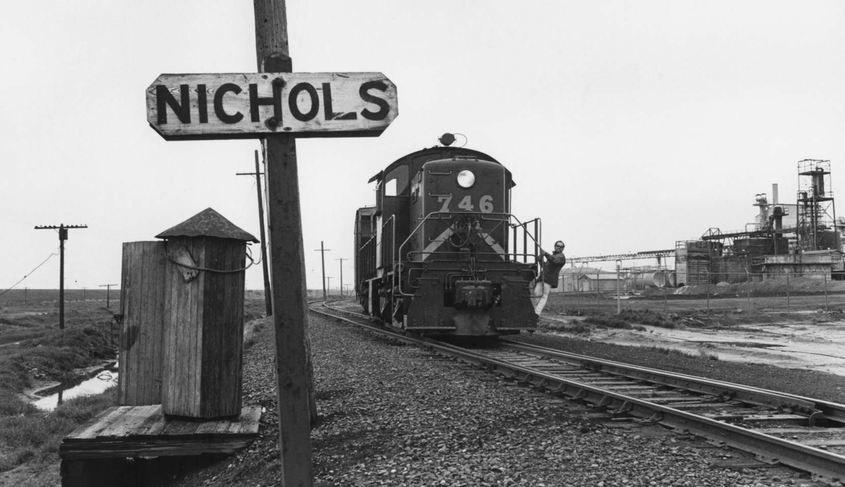
And finally, a diesel-era SN image of Tidewater Southern no. 746 on the Pittsburg Road Switcher at Nichols, Feb. 1973, east view, east of the Nichols Rd. intersection.
L171-90-Ted Benson Photo, Courtesy Ted Benson, (Image 18 of 25)
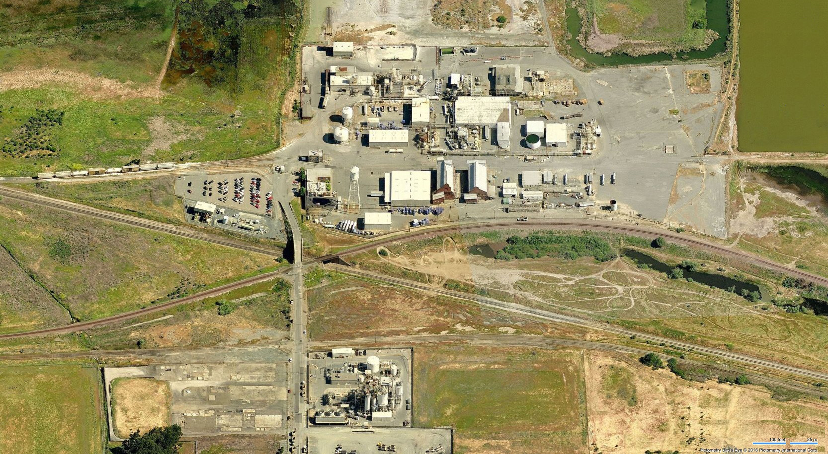
This north-oriented aerial from 2016 shows the Nichols area just prior to the removal of the last heavy industry to the south of the SN right-of-way, replaced by the Jass Boys Trucking.
L171-95-Courtesy Bing Maps, (Image 19 of 25)
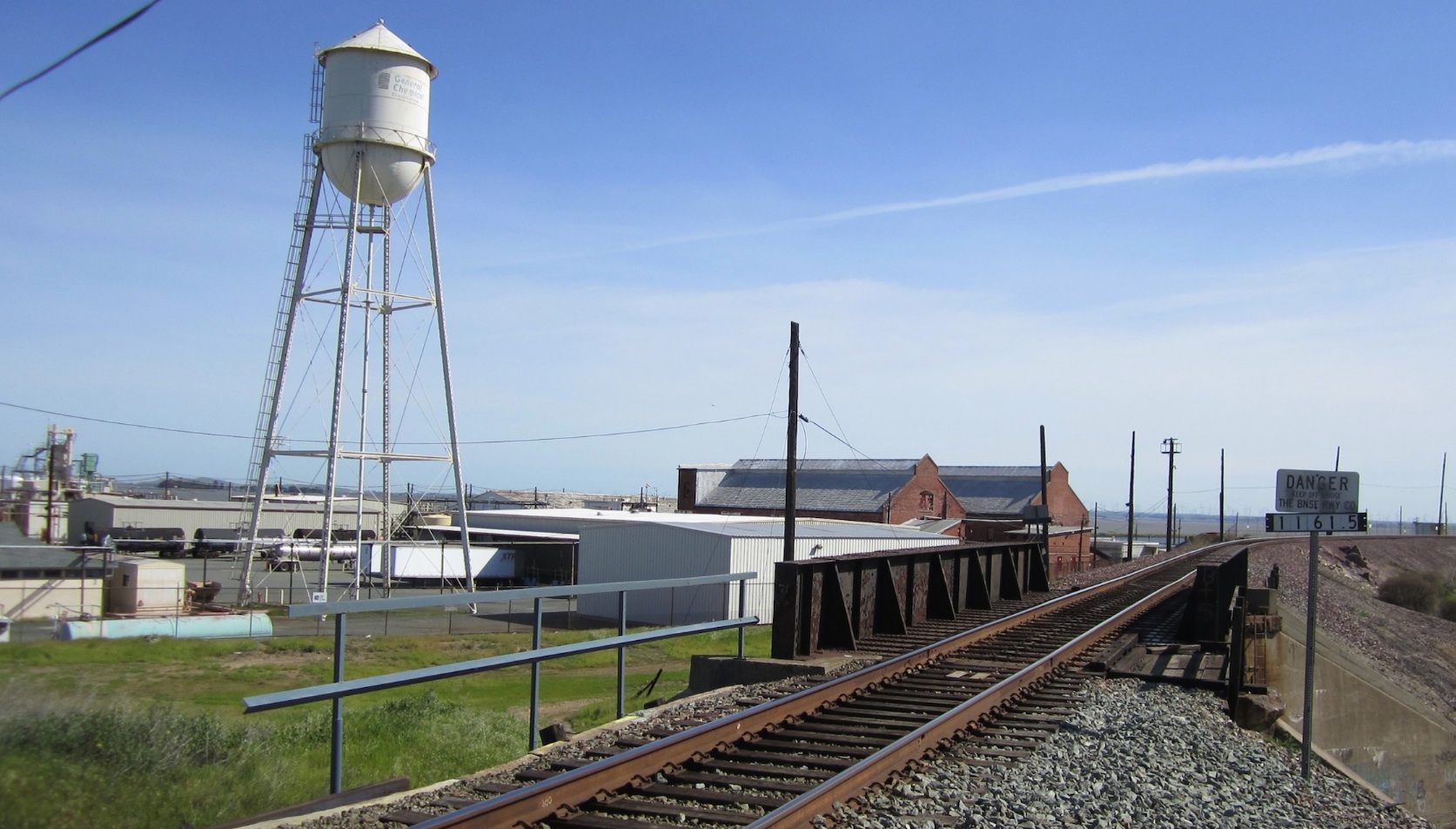
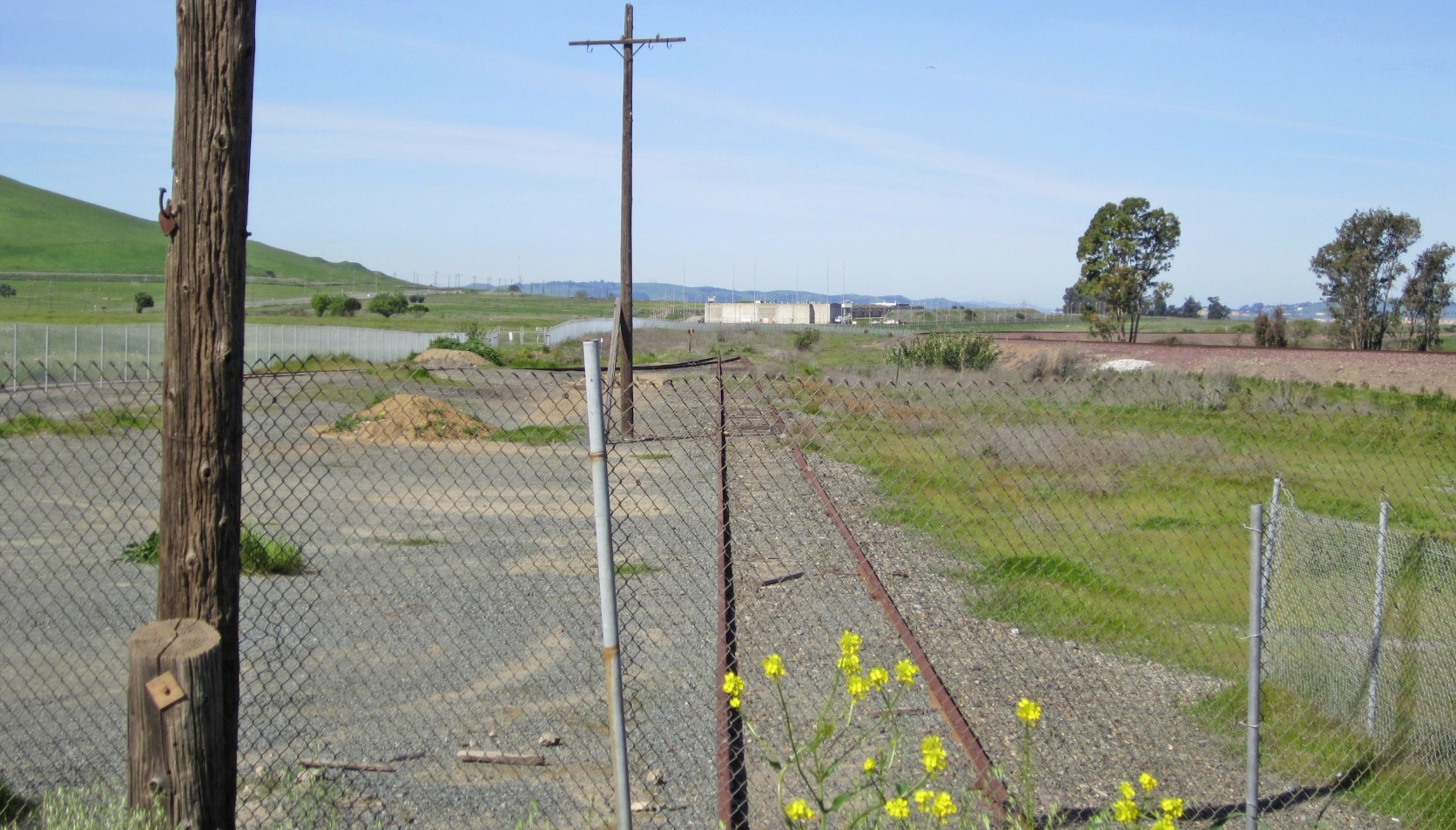
A west view from 2017 of the SN mainline at Nichols Rd. includes a fence that separates what is today the Army base from the present day, census designated place of Bay Point, formerly West Pittsburg. The spur to the former chemical entities to the south can be seen.
L171-100-Stuart Swiedler Photo, (Image 20 of 25)
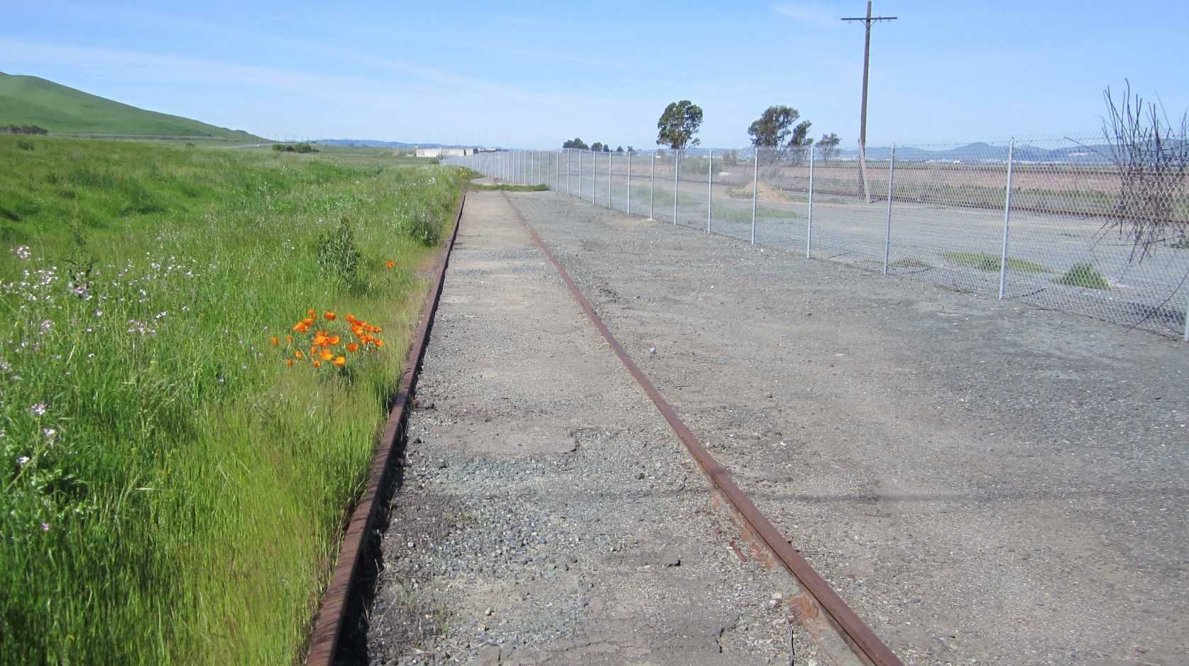
Next, a west view from 2017 down the spur track, here with poppies.
L171-105-Stuart Swiedler Photo, (Image 21 of 25)
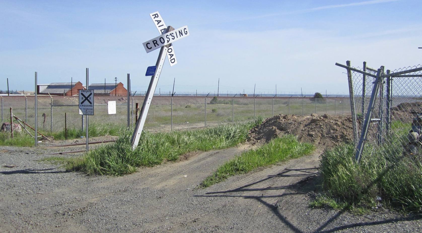
Turning to the northeast, the crossbuck at Nichols Rd. is seen with a backdrop of the Burlington Northern Santa Fe berm and two of the original buildings from General Chemical.
L171-110-Stuart Swiedler Photo, (Image 22 of 25)
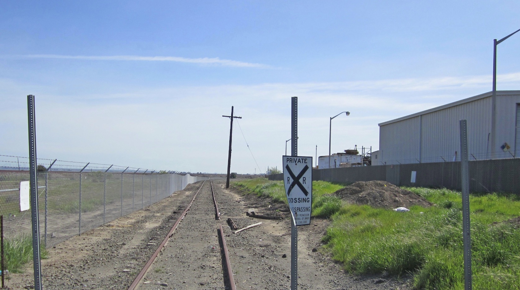
A direct east view down the SN mainline needs no further comment.
L171-115-Stuart Swiedler Photo, (Image 23 of 25)
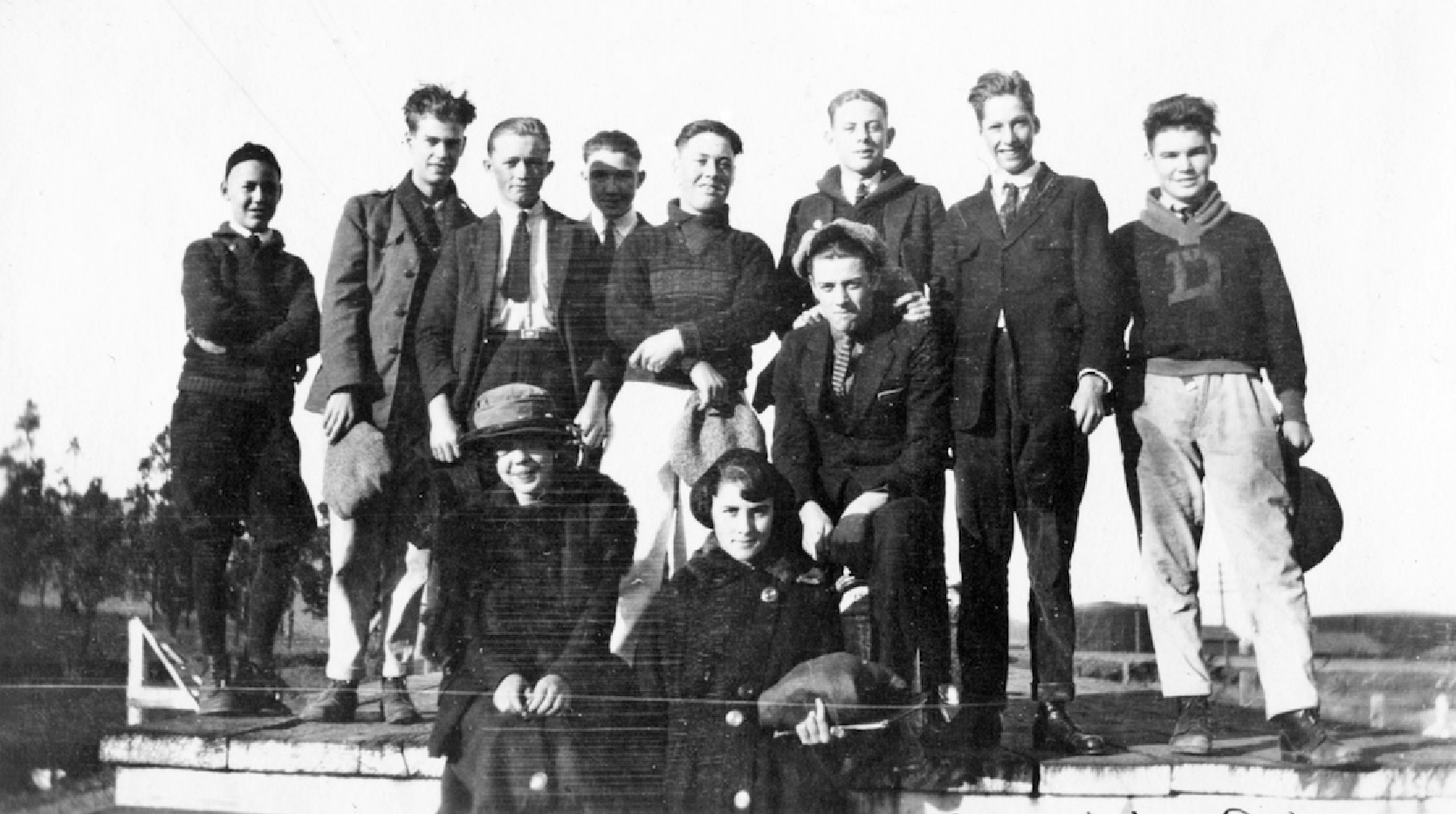
The smiles on these Mt. Diablo High School students awaiting the school train on the SN freight platform in a south view sometime one hundred years ago signals the mood was different at Nichols during its heyday.
L171-120-Courtesy Martinez Historical Society, (Image 24 of 25)
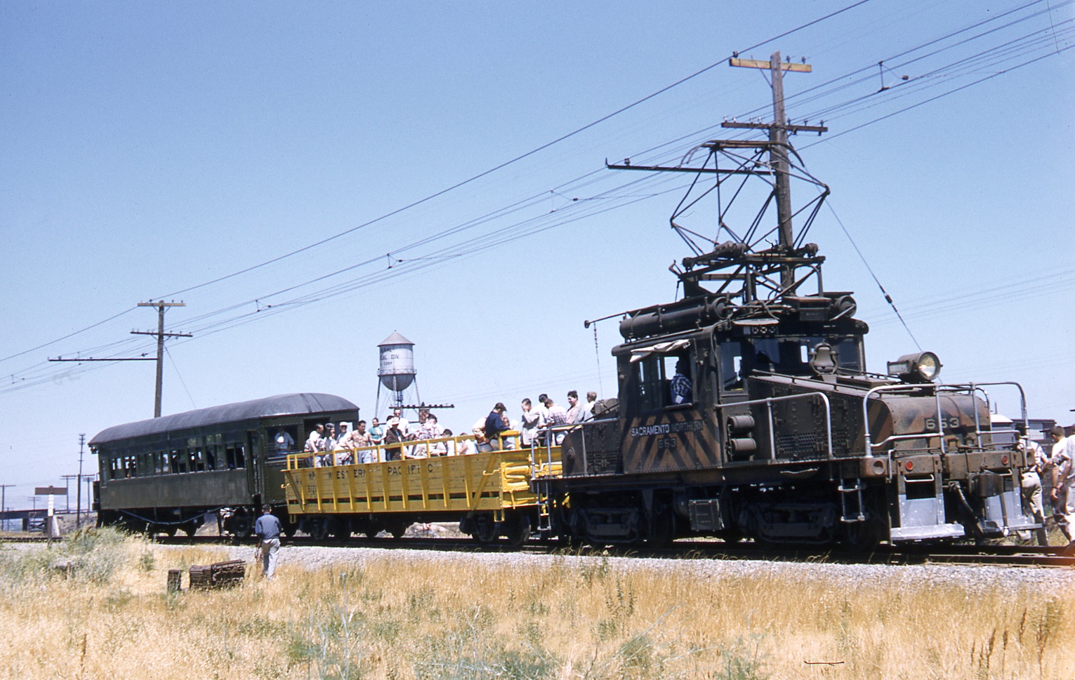
With the Santa Fe-Southern Pacific overpass and water tower of General Chemical in view to the northwest, an excursion train consisting of SN 653, WP open car, and Salt Lake and Utah 751 prepare to head east to MacAvoy in 1956. All aboard. Special thanks to David Mackesey and Seth Adams for alerting me to the images of Nichols that were most generously provided by the Martinez Historical Society.
L171-125-Dave Gumz Photo, Courtesy BAERA, Western Railway Museum Archives, 121401sn, (Image 25 of 25)