Banning’s Baffling Buildings
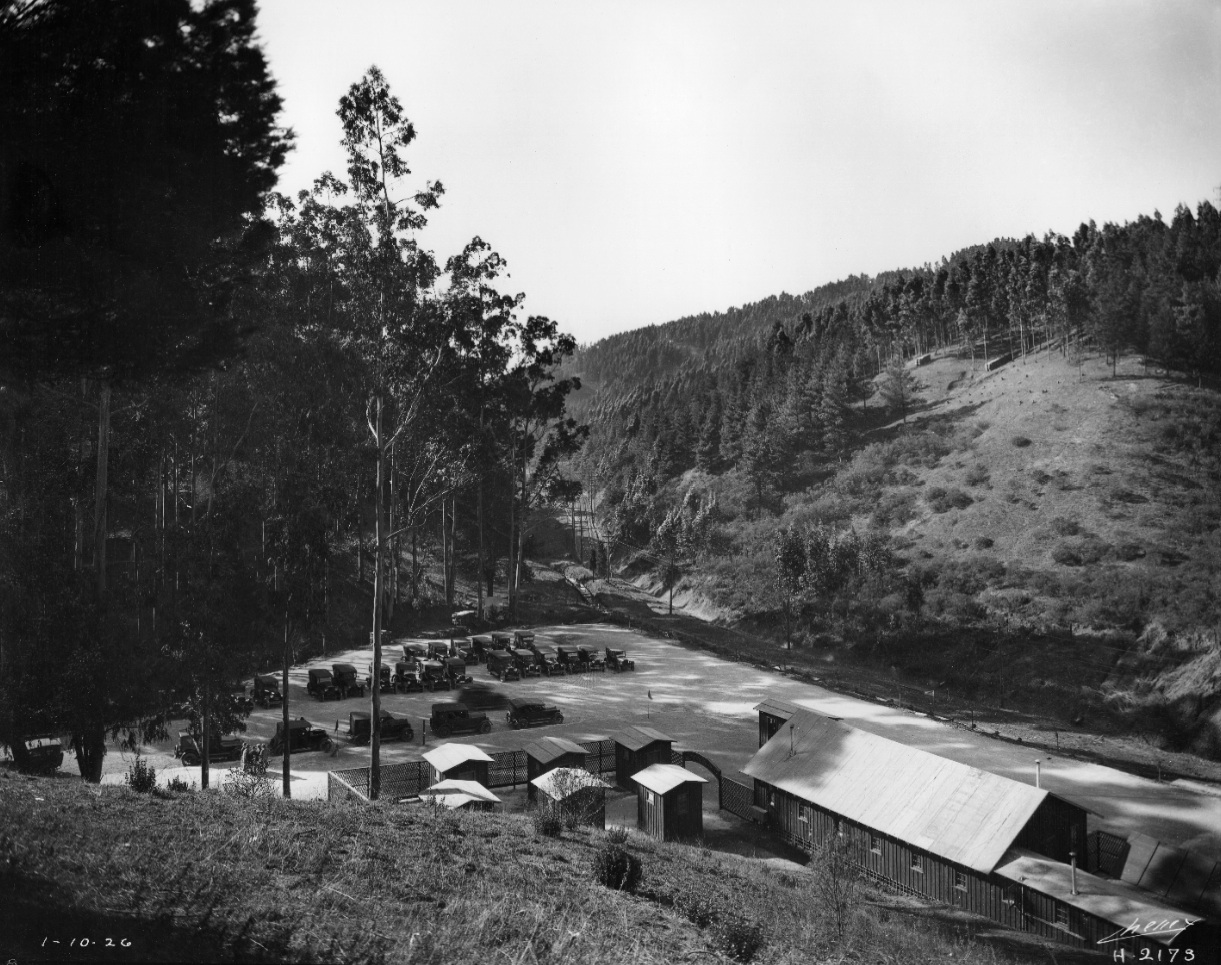
This section covers the SN approach to the tunnel northeast of Havens, top, to a position at Banning Dr. relative to the current roads. Southwest view on Jan. 10, 1926 when the railway was called the San Francisco-Sacramento Railroad or Shortline.
L96-05-Eston Cheney Photo H-2173, Courtesy John Bosko, Detail, (Image 1 of 20)

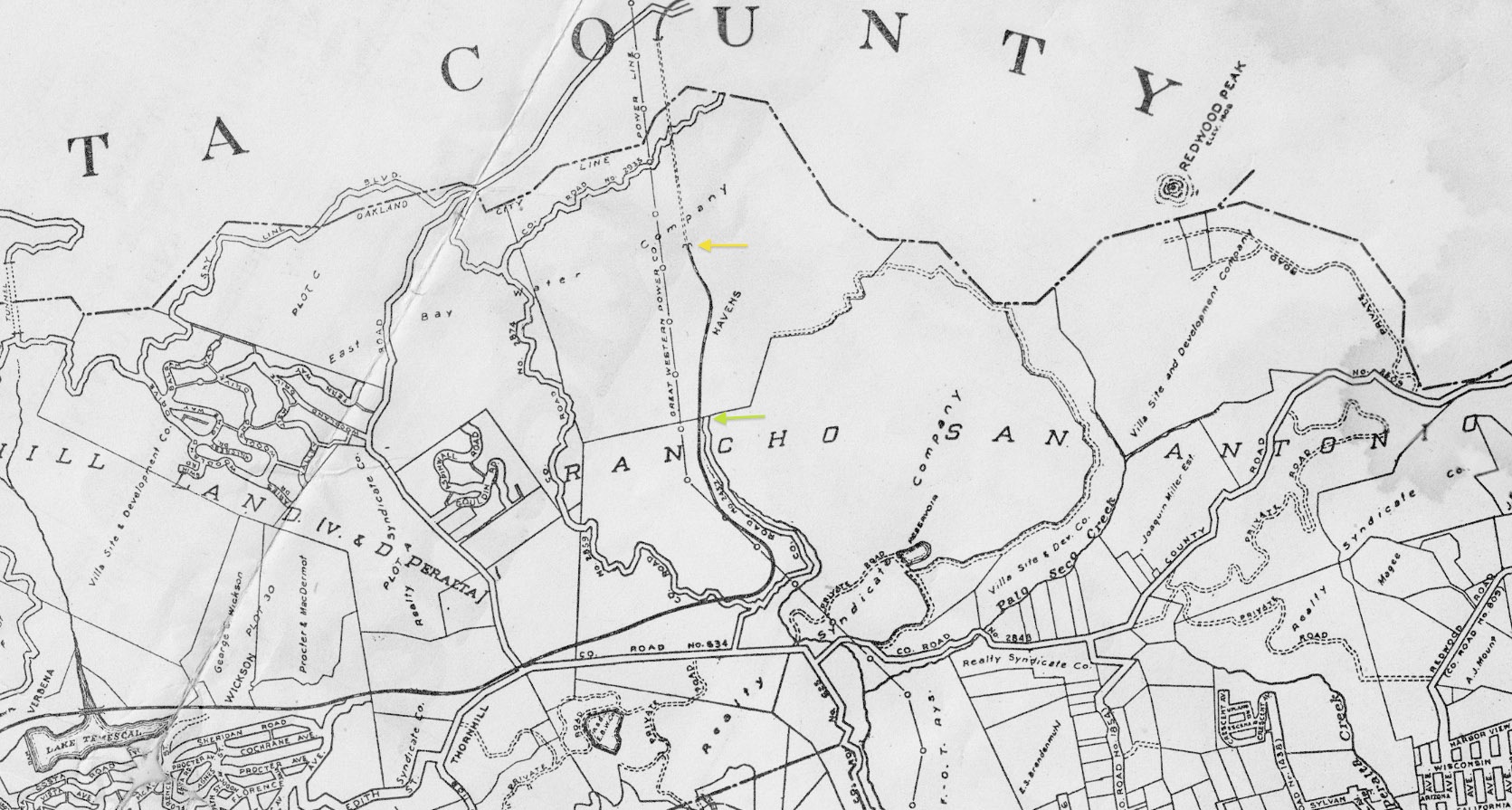
By 1921, the road that became Park Blvd. and later Shepherd Canyon Rd. extended only as far as the East Bay Water Co. land, green arrow, way short of the railway tunnel portal at today’s Saroni Dr., yellow arrow. Ref: Central National and Central Savings Banks, 1921.
L96-10-Courtesy BAERA, Western Railway Museum Archives, 83537a, Detail , (Image 2 of 20)
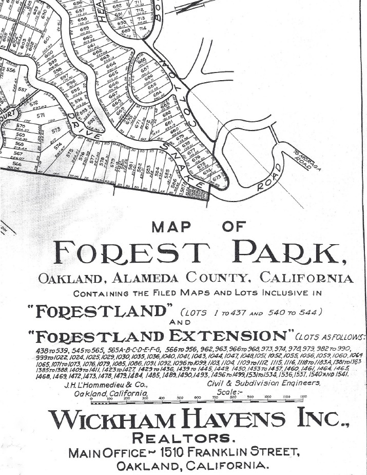
As introduced in “Forest Park and Wickham Havens”, the latter had already extended his initial hills holdings as part of Forestland Extension, 1925 with Louis Saroni, Forestland Heights, 1926, and Forestland Manor, 1927, all related to East Bay Water Co. land, some of which was called Forestland by 1924. Special thanks to Craig Sundstrom and Gail Lombardi for map and information.
L96-15-Courtesy Oakland History Room, Oakland Public Library , (Image 3 of 20)
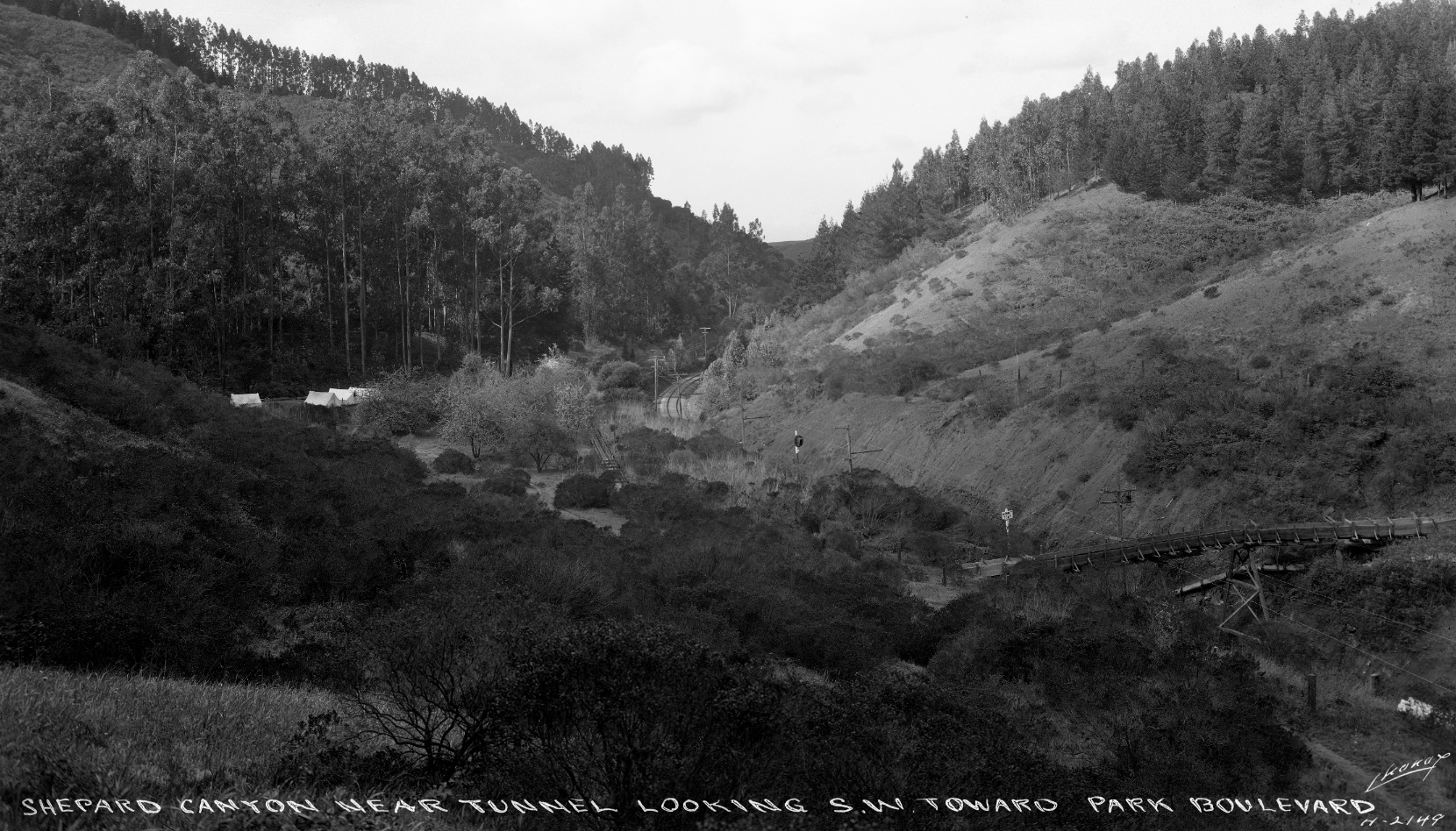
Starting with Cheney image 2148 of Shepherd Canyon, northeast view circa 1925, no homes in sight. All that can be seen along with rail were the towers of the Great Western Power Company.
L96-20-Eston Cheney Photo, H-2148, Courtesy BAERA, Western Railway Museum Archives, 26709sn, (Image 4 of 20)
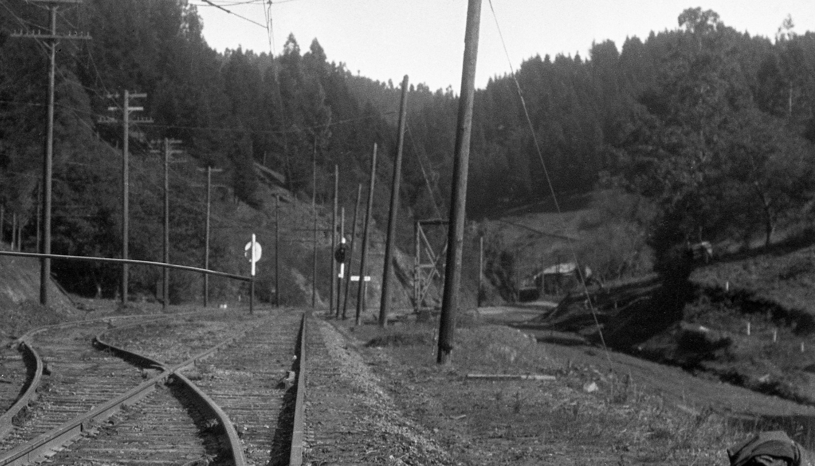
A detailed view of L96-20, northeast view circa 1925, shows the block signals marking the approach to Havens flag stop.
L96-25-Eston Cheney Photo, H-2148, Courtesy BAERA, Western Railway Museum Archives, 26709sn Detail, (Image 5 of 20)
A detail from a 1925 image provides a northeast view of Havens, no more than a sign marker and possessing a manual catenary wire maintenance car. Deeper into the canyon, however, is a building so mysterious that John Bosko, a key contributor to this section, aptly coined Banning’s Baffling Buildings.
L96-30-Harry A Mitchell Photo, Sappers Collection, Courtesy BAERA, WRM Archives, 57469sn , (Image 6 of 20)
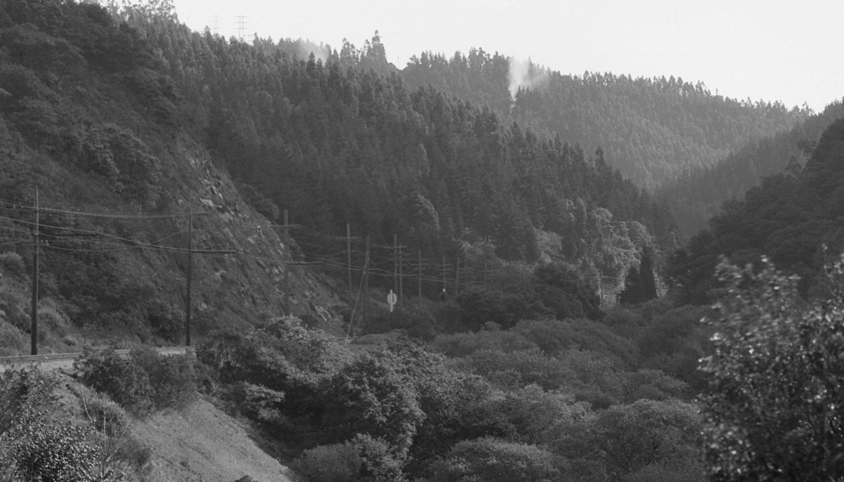
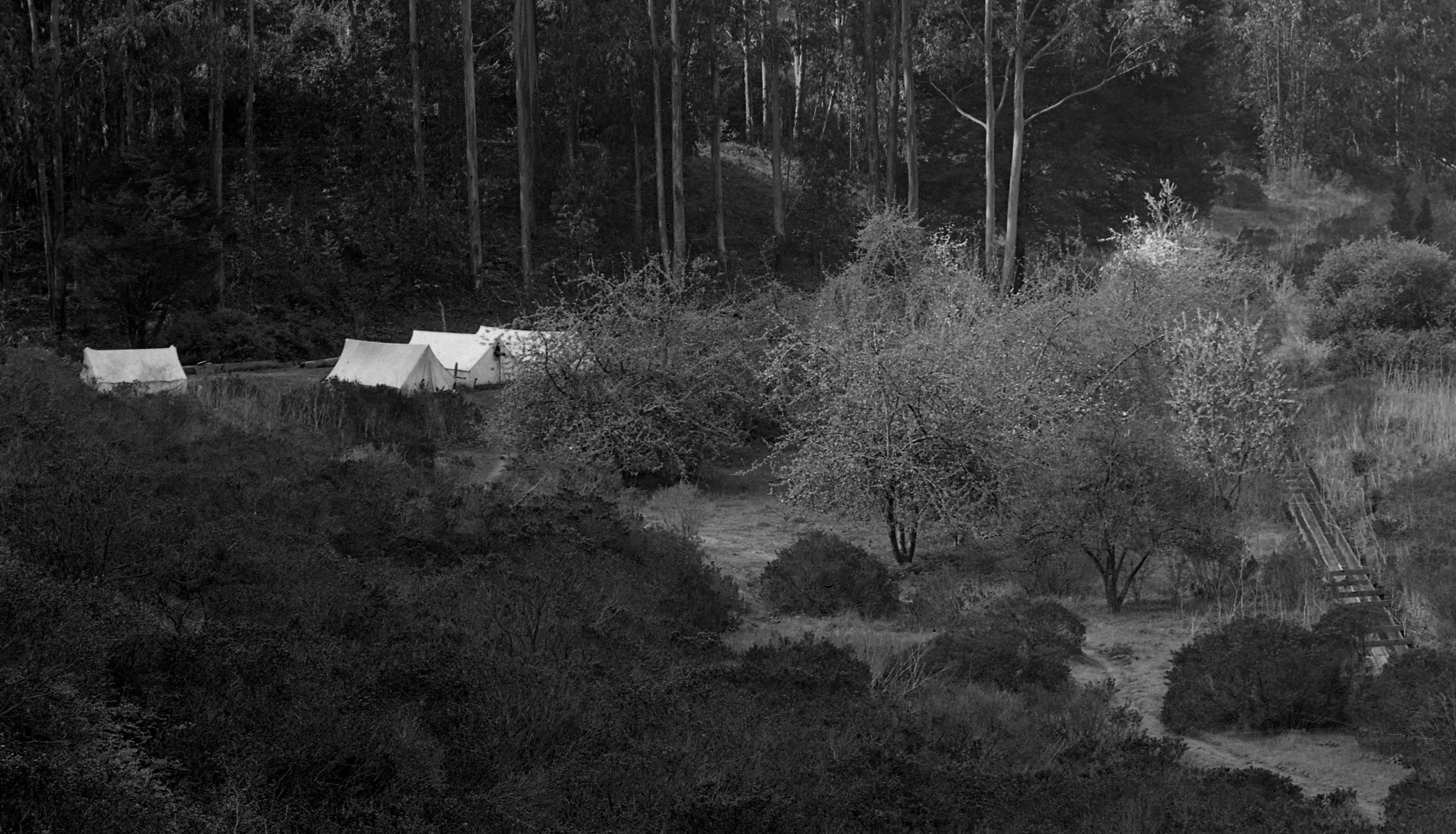
Following Cheney’s image L96-20, circa 1925, he went deep into the canyon and turned to the southwest to capture this view, showing Shepherd Creek diverted by a flume across and then along the right-of-way, some tents to the south, and no sign of a completed road.
L96-35-Cheney Photo H2149, Oakland Cultural Heritage Survey, Oakland City Planning Department, (Image 7 of 20)
Greater detail from L96-35, southwest view circa 1925.
L96-40-Cheney Photo H2149, Oakland Cultural Heritage Survey, Oakland City Planning Department , (Image 8 of 20)
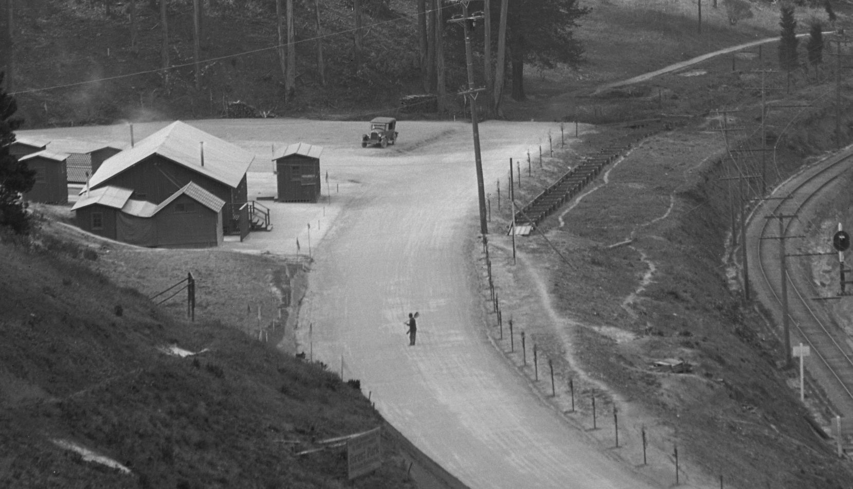
Now back to the entire image from which L96-05 was derived, the area that today marks Banning Dr., seen here to consist of several buildings, and to the southwest a large lot filled with cars on Jan. 10, 1926.
L96-45-Eston Cheney Photo H-2173, Courtesy John Bosko , (Image 9 of 20)
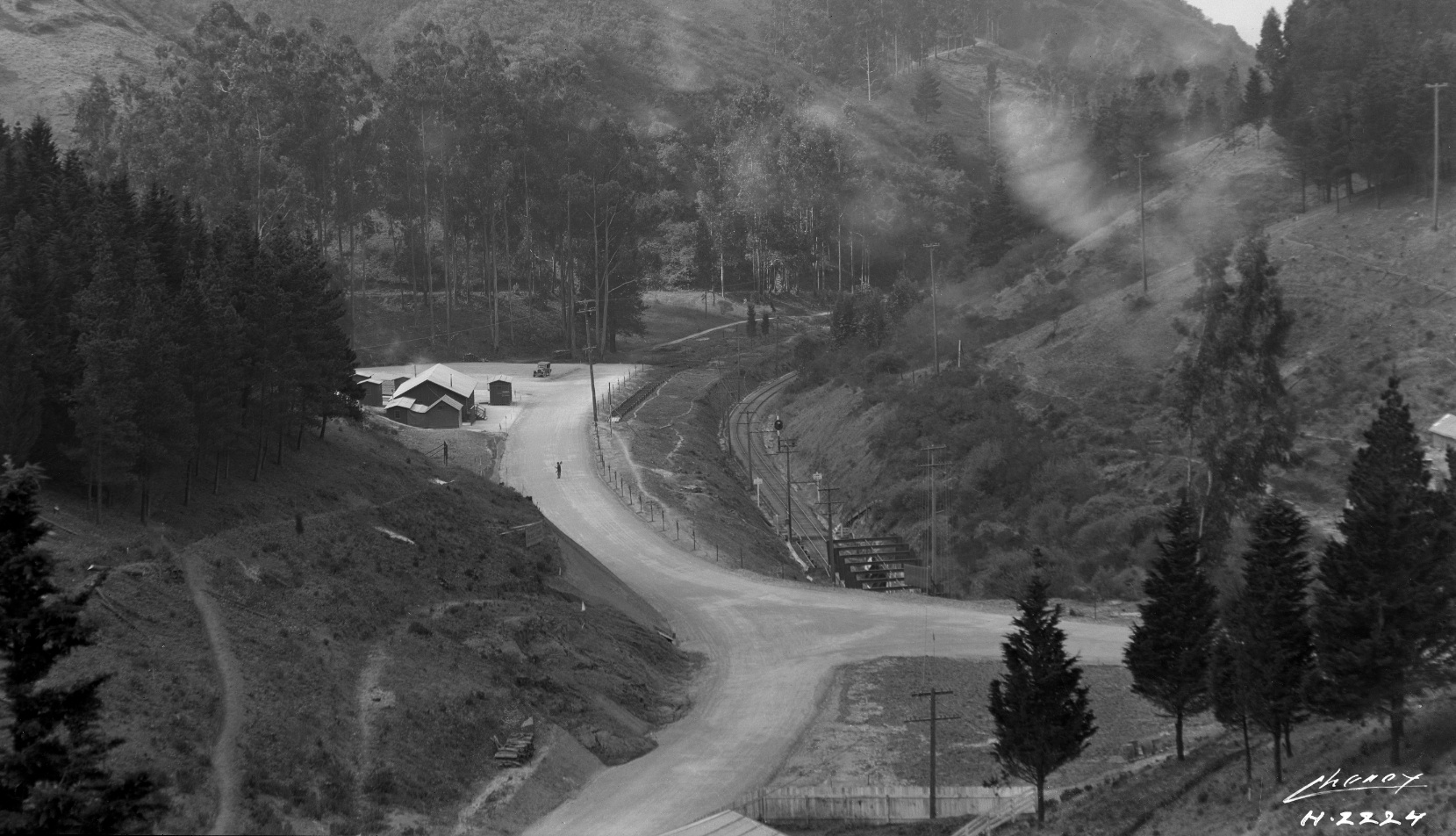
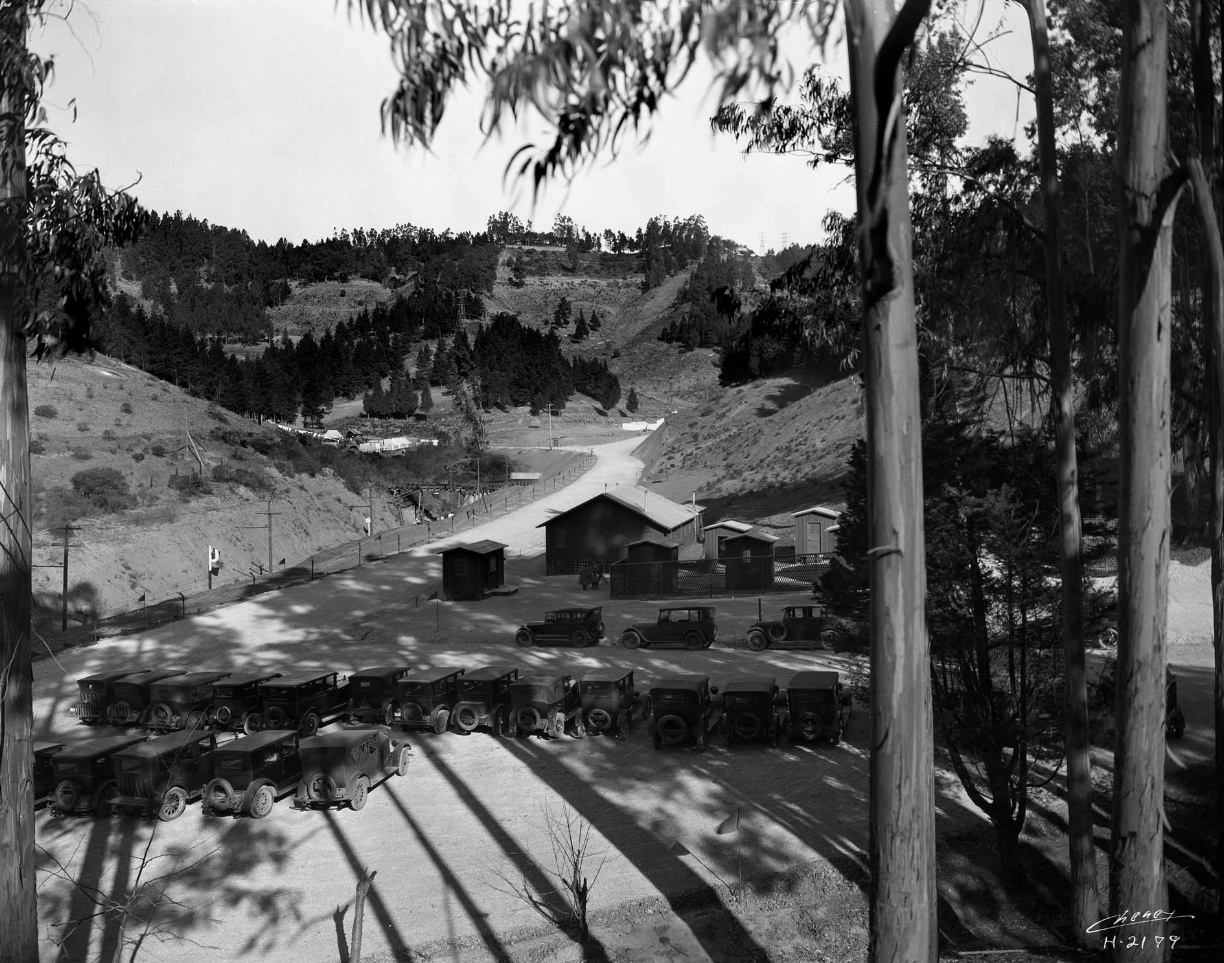
Now jumping from the previous Cheney image, 2173 to 2224, a southwest view now shows the eastern section of Park Blvd. and Saroni Dr. meeting at the railway tunnel portal, and further west, only a dirt path.
L96-50-Eston Cheney Photo H-2224, Courtesy BAERA, Western Railway Museum Archives, 26081sn, (Image 10 of 20)
A detail of the unmarked buildings and the diverted creek also show a sign advertising the Forest Park housing development.
L96-55-Eston Cheney Photo H-2224, Courtesy BAERA, Western Railway Museum Archives, 26081sn, Detail, (Image 11 of 20)
Now back in time to Cheney image 2179, other structures on Saroni Dr., left, or up Park Blvd., right, can be seen in this northeast view, from early 1926.
L96-60-Eston Cheney Photo H-2179, Courtesy John Bosko, (Image 12 of 20)
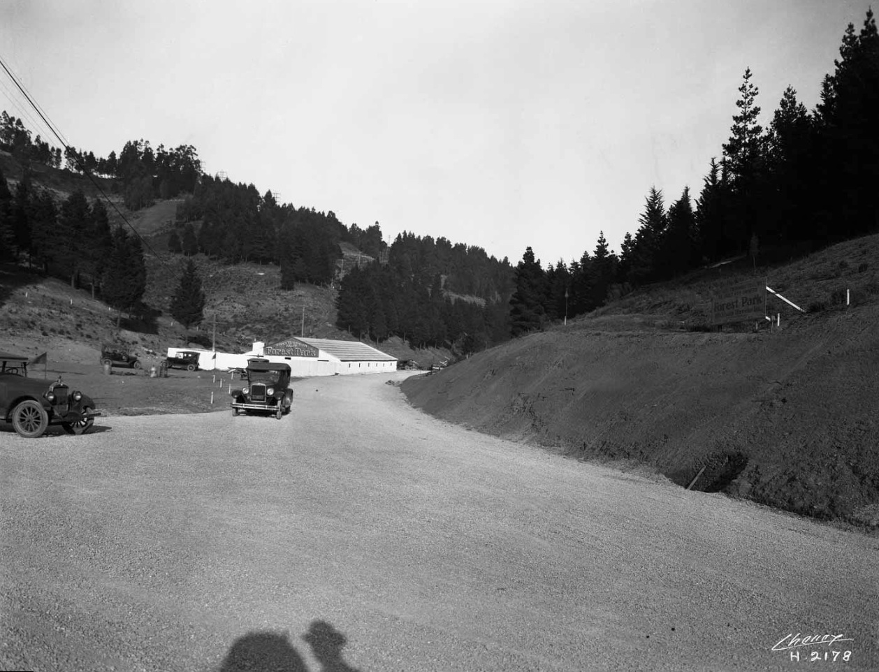
Image 2178, a northeast view at the Saroni Dr. divide, also reveals Forest Park ads as well as Forest Park Construction Camp in the distance. The shadow of a figure in the image, by the way, is probably that of Eston Cheney, for which no photographic image of him has been found.
L96-65-Eston Cheney Photo H-2178, Courtesy John Bosko, (Image 13 of 20)
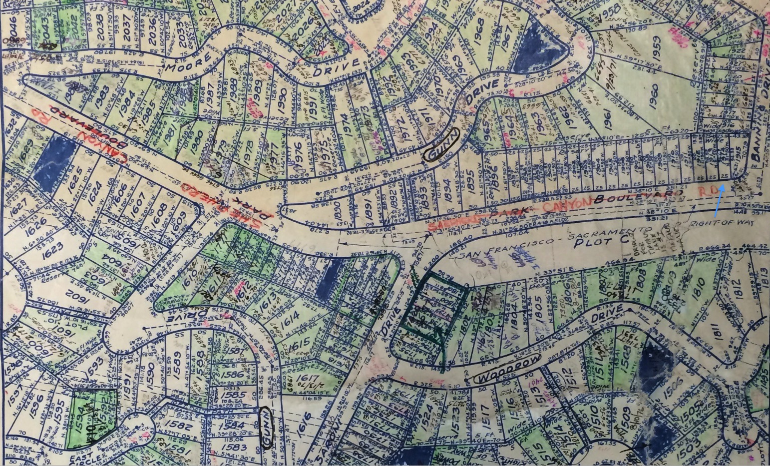
Who built the structures at Banning Dr. and are they related to Havens’ developments, the East Bay Water Company, or some unrelated project? The 1926 plan for Forestland Heights produced by JH L’Hommedieu and Co. shows the area of Banning Dr., blue arrow, projected to be divided as small lots.
L96-70-Courtesy Oakland Cultural Heritage Survey, Oakland City Planning Department , (Image 14 of 20)
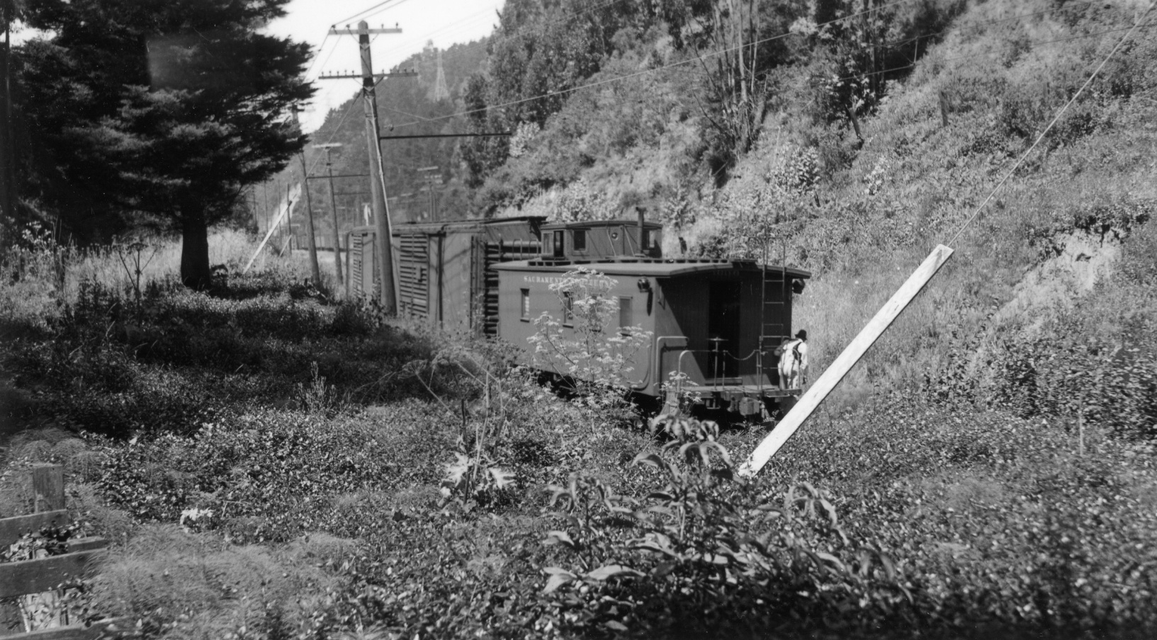
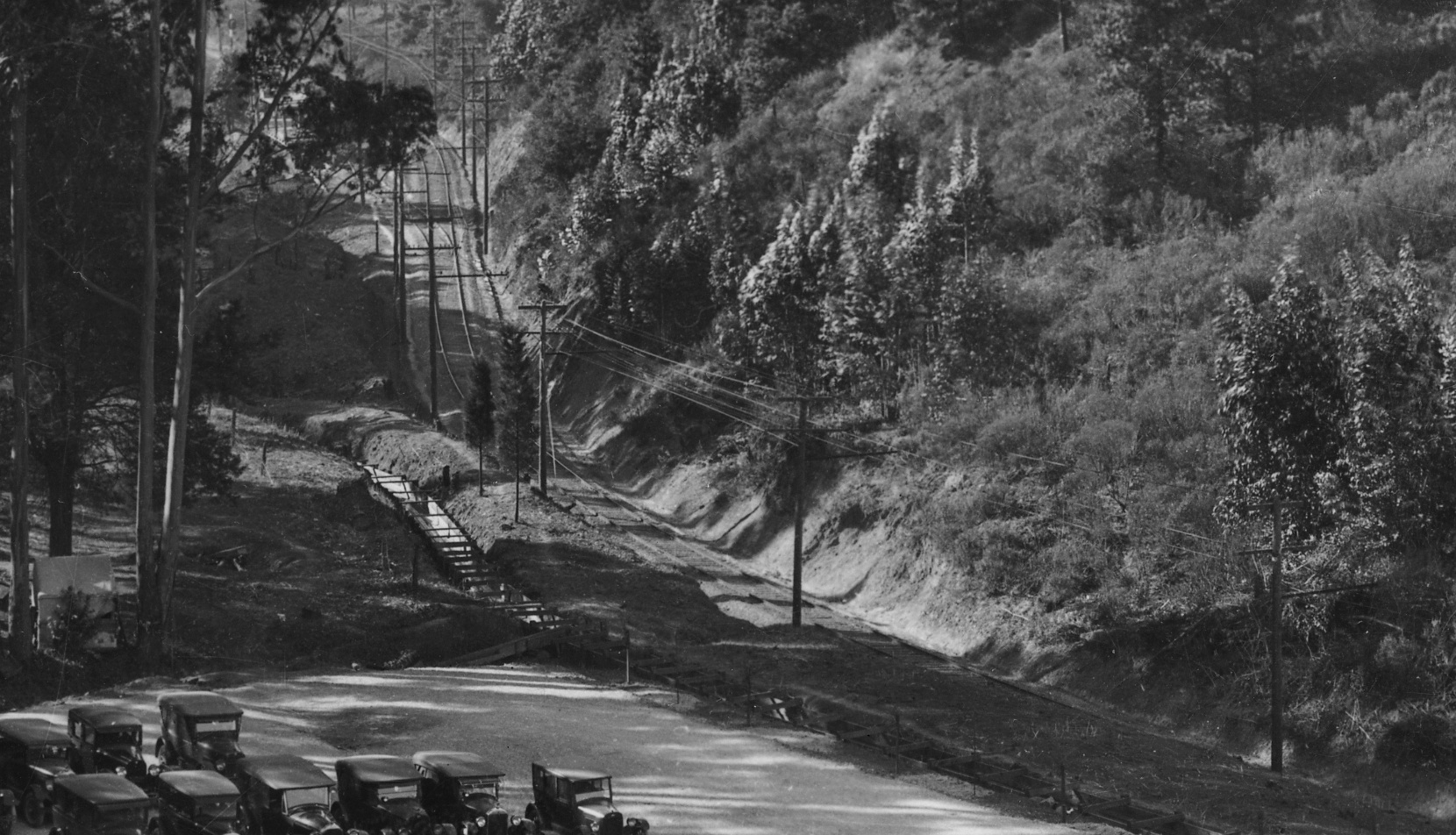
The mystery surrounding the buildings continued to 1940 as views along the right-of-way from a position east of Havens marked by the end of this long freight will soon reveal. Note the portion of the diverted creek in the bottom left corner of the image. Southwest view.
L96-75-Paul Smith Photo, Courtesy BAERA, Western Railway Museum Archives, 67520sn, (Image 15 of 20)
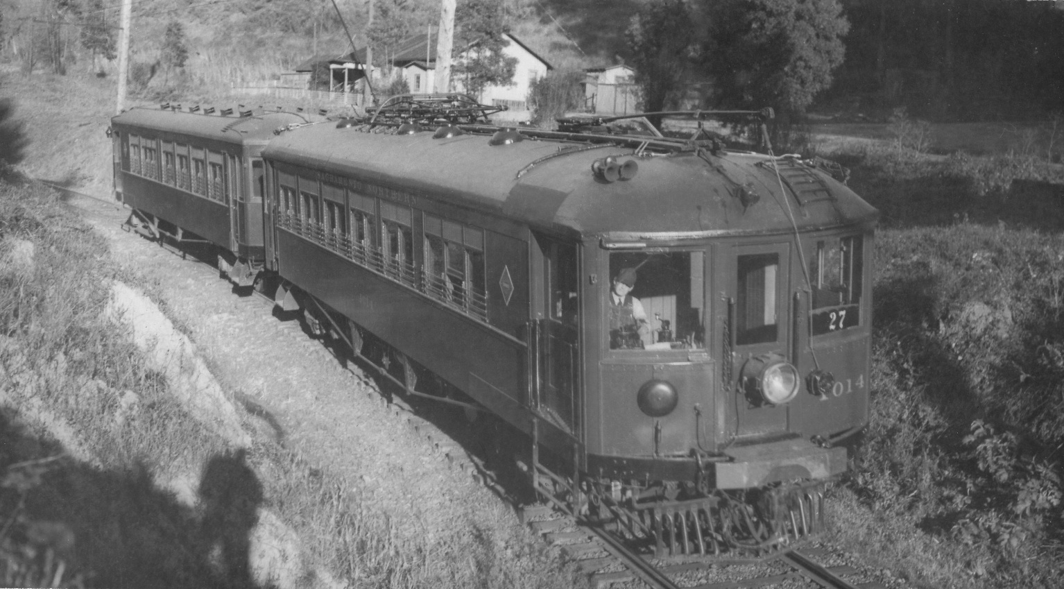
The unmarked buildings and probably Wil Whittaker’s shadow are extras for this Feb. 22, 1939 image of SN 1014 and trailer as train 27 heading to 40th and Shafter.
L96-80-Courtesy Arnold Menke and Garth Groff, (Image 16 of 20)
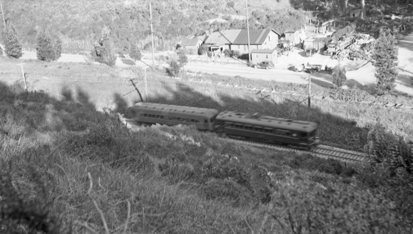
An even later view to the south, Mar. 23, 1941 shows the unmarked buildings as another two-car train heads toward 40th and Shafter.
L96-85-Louis Bradas, Jr. Photo, Courtesy BAERA, Western Railway Museum Archives, 67924sn, (Image 17 of 20)
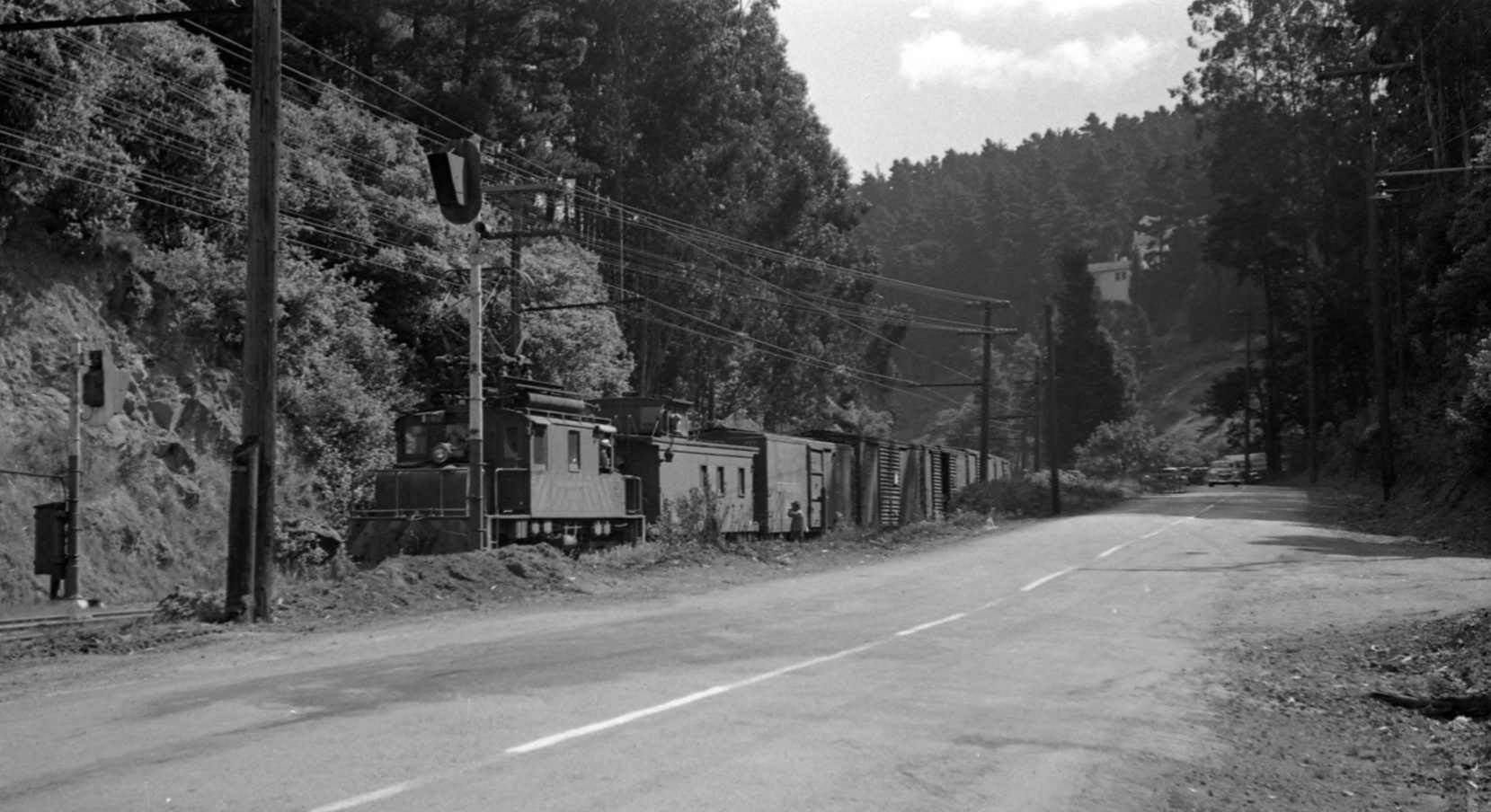
Based on rail fan images such as this northeast view, the unmarked buildings at Banning lasted until at least the late 1940s, the date supported by the stripes on this motor at the rear of a freight heading for the tunnel portal.
L96-90-Norman Smith Photo, Courtesy BAERA, Western Railway Museum Archives, 55578.4sn , (Image 18 of 20)
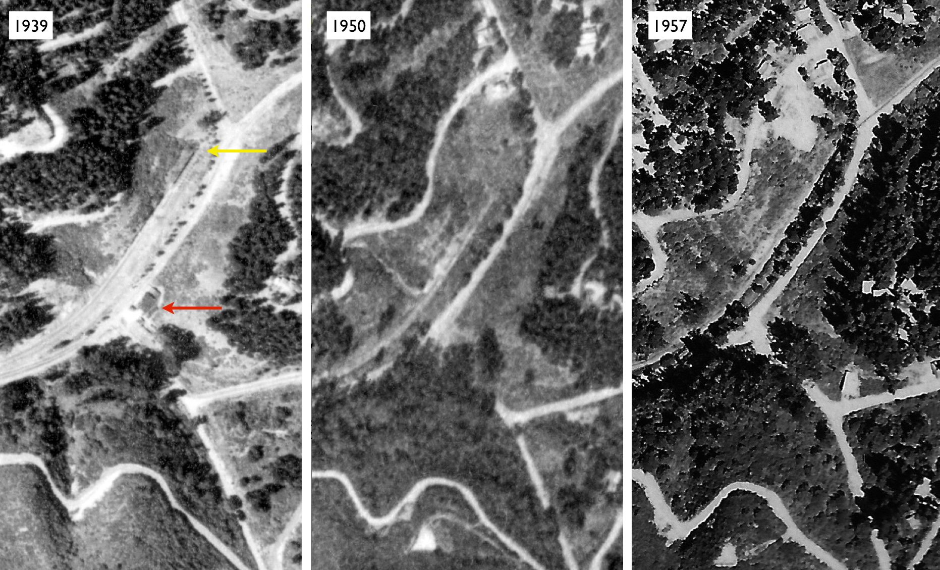
A comparison of the buildings at Banning Dr., red arrow, and SN west tunnel portal, yellow arrow, show the buildings did not survive into the 1950s. Historicaerials.com shows structures in 1946, but not in 1958. Left, BUT BUU-289-44 Aug. 2, 1939, courtesy the East Bay Municipal Utility District; center, BUT-8G-83 Mar. 30, 1950 Courtesy the East Bay Regional Park District; right, AV 253 11-23, HJW, 1-12000, May 4, 1957, courtesy Contra Costa County Public Works Department.
L96-95-USDA AAA Western Division and HJW Geospatial Inc, Pacific Aerial Surveys, Oakland CA, (Image 19 of 20)
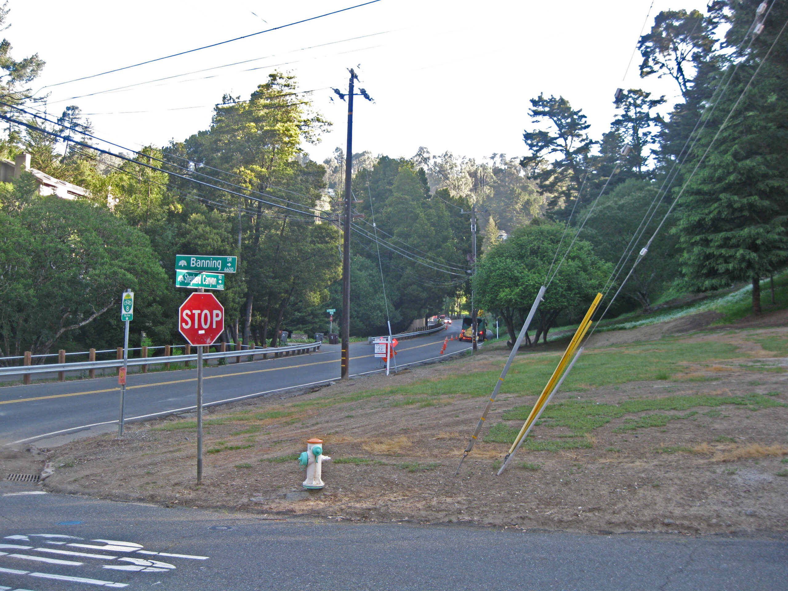
This northeast view shows the lot at the intersection of Banning Dr. and Shepherd Canyon Rd. up for sale in 2014. The origin, function and inhabitants of the buildings that occupied this site as Wickham Havens and other developers unsuccessfully populated the canyon floor in the mid-1920s remains a baffling mystery.
L96-100-Stuart Swiedler Photo, (Image 20 of 20)