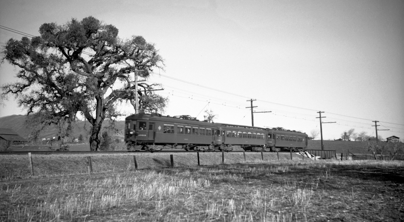
By the Old Oak Tree
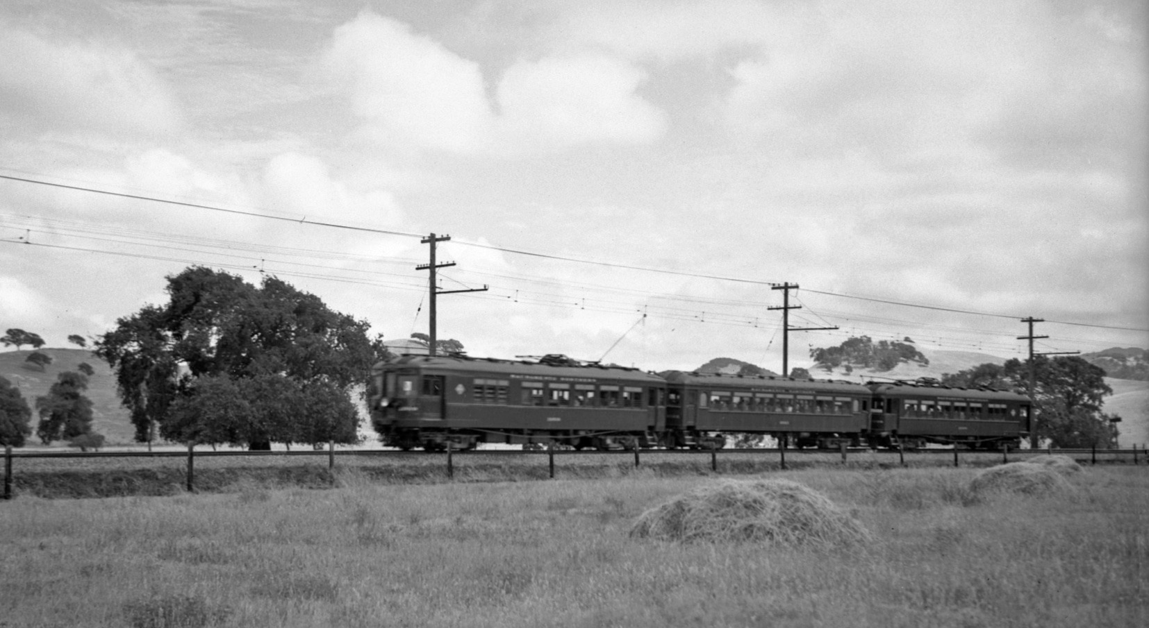
East Saranap is graced by MW 302 on an excursion from Sept. 12, 1948 in this northeast view. A steel overpass, the tops of homes to the right, or east, and this large oak tree, the main attraction between the turn-off from Newell Ave. and the Las Trampas Creek crossing.
L75-05-Arthur Lloyd Photo, Courtesy Arthur Lloyd, (Image 1 of 23)

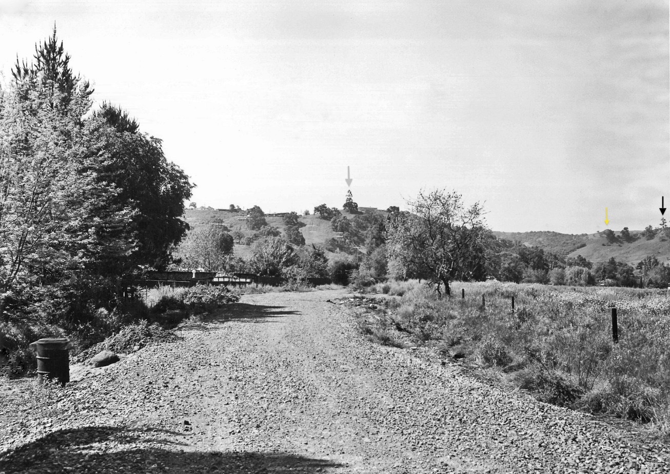
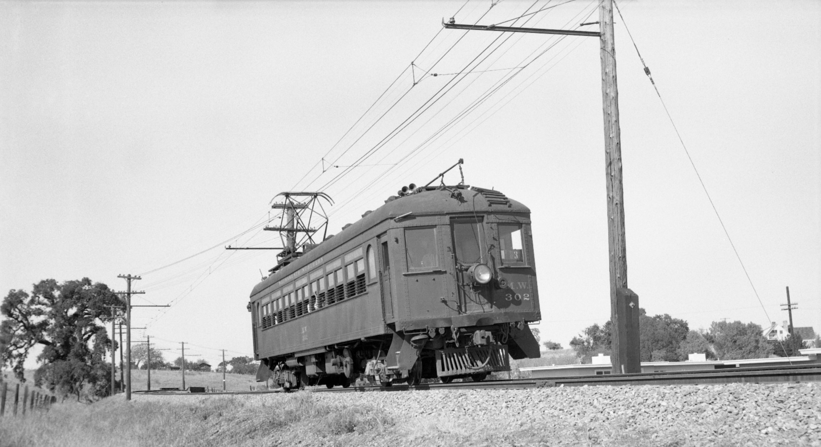
Just one and one-half years earlier, February 1947, this north view shows the northerly curve from east Saranap to the Las Trampas Creek crossing. Unlike L75-05, there are no homes to the right or south and east of the right-of-way, the corresponding oak tree is marked to allow the comparison to be made. Note the other prominent oak trees as well.
L75-10-Dudley Thickens Photo, Courtesy BAERA, Western Railway Museum Archives, 63821sn, (Image 2 of 23)
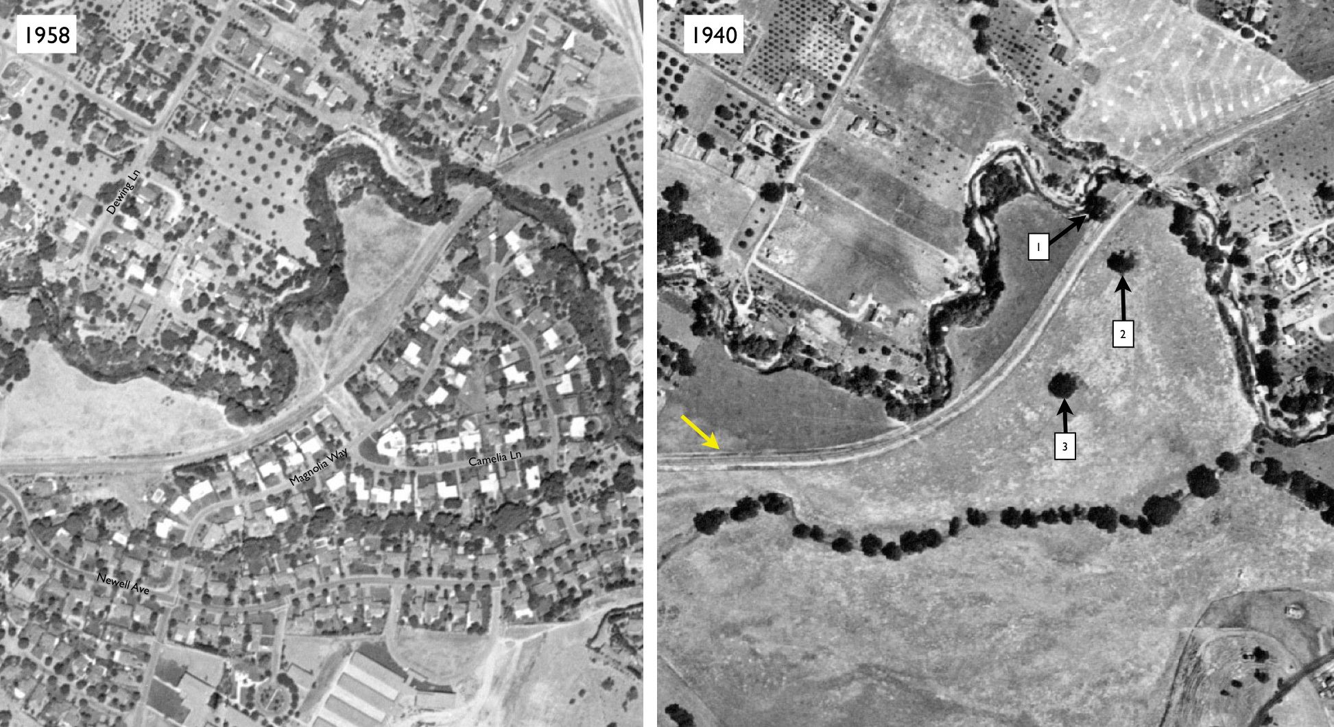
The complete development of the empty field below or to the south-southeast of the right-of-way, yellow arrow, in 1940 to suburban neighborhood by 1958. Oaks 1, 2 and 3, as marked, survived, and the strip between the right-of-way and Las Trampas Creek, above or to the north-northwest of the right-of-way, remained orchards.
L75-15-Courtesy Contra Costa County Historical Society, 13560, right, 13562, left, Details, (Image 3 of 23)
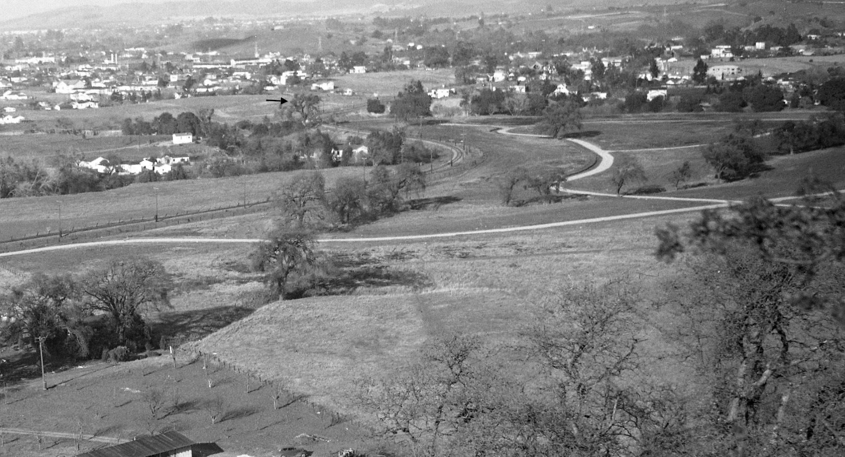
This south view aerial from Feb. 13, 1958 complements what is seen in the 1958 portion of L75-15. Parkmead Elementary School to the south of the new housing, and the first signs of I-680 construction are evident. Las Trampas Creek overpass, black arrow; oak tree 1, yellow arrow; and the turn of Newell Ave. to the south, red arrow.
L75-20-Copyright California Department of Transportation, 5845-7, (Image 4 of 23)
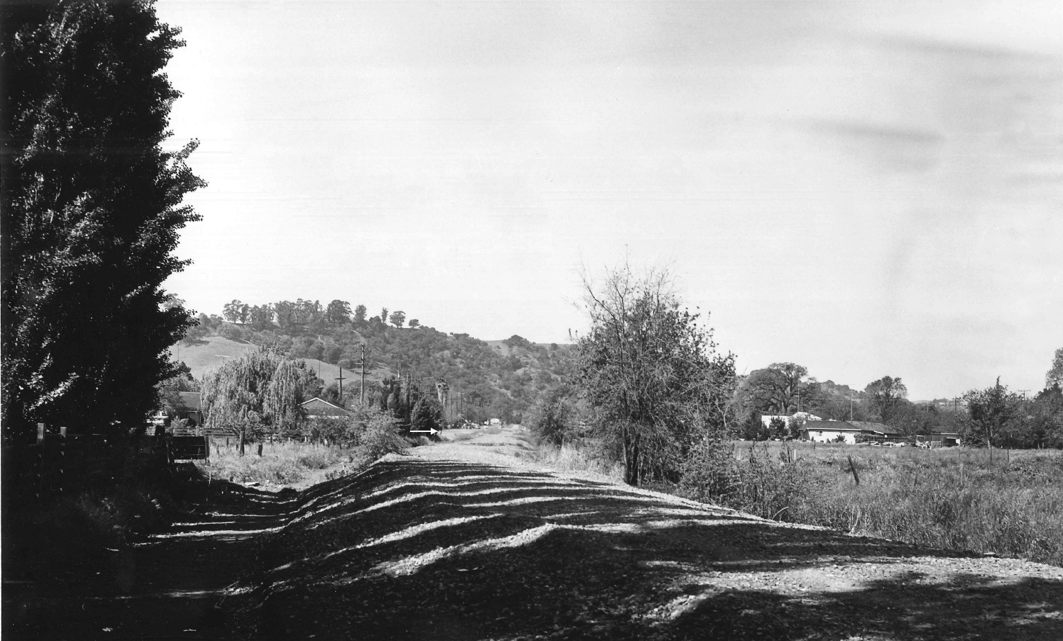
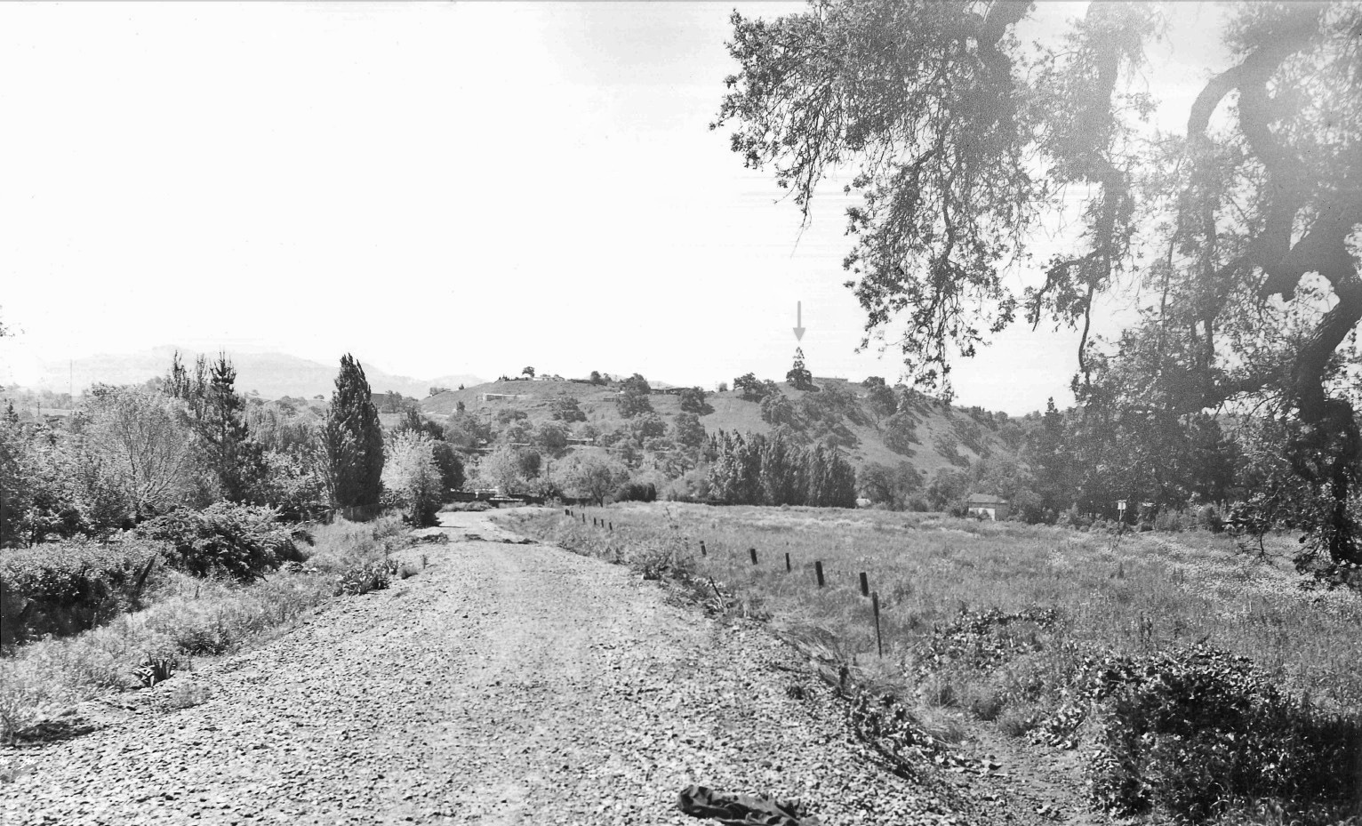
What follows compares west view images from 1939-1940 versus 1963, starting here, Apr. 29, 1963, west view down the right-of-way minus track, west of the present intersection of Olympic Blvd. and S. Villa Way. The white arrow marks where Newell Ave. diverges to the south. Note the pattern of the tree line.
L75-25-Courtesy Planning and Engineering Divisions, City of Walnut Creek , (Image 5 of 23)
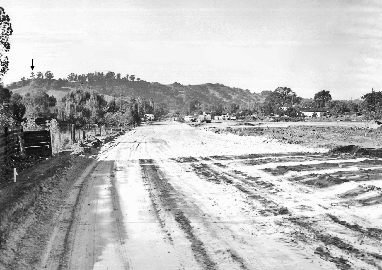
Any evidence of the former right-of-way is now gone, and Olympic Boulevard is taking shape just west of S. Villa Way in this west view, Nov. 5, 1963. The tree line matches the previous image, L75-25, but more to the east is visible. A prominent tree is marked by the black arrow to line up the next image ...
L75-30-Courtesy Planning and Engineering Divisions, City of Walnut Creek, (Image 6 of 23)
Proceeding east on the empty right-of-way as it curves to the north, Apr. 29, 1963, the view is more to the southwest based on the position of the tree marked by the black arrow. A gray arrow is added to another more southeasterly tree that will line this image up with L75-45, the yellow arrow to line up with L75-40.
L75-35-Courtesy Planning and Engineering Divisions, City of Walnut Creek , (Image 7 of 23)
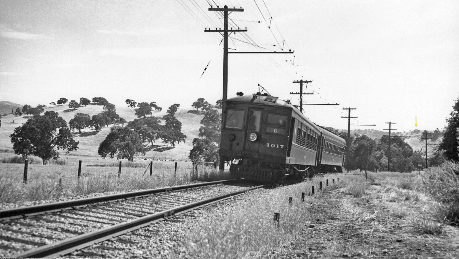
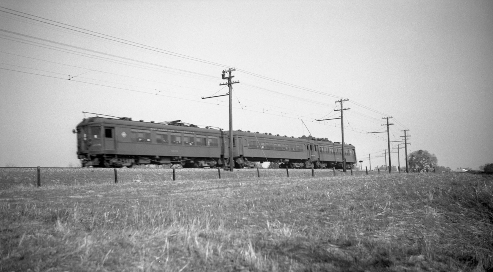
Now on the northerly curve with SN 1017 and a trailer, southwest view from Jul. 14, 1940. This image may be lined up with L75-35 using the yellow arrow in each image. The writing on sign to the right or north of the track could not be resolved.
L75-40-Wilbur C Whittaker Photo, Courtesy Arnold Menke and Garth Groff, (Image 8 of 23)
Traveling more easterly on the graded road bed, also Apr. 29, 1963, oak tree 1 from L75-15 is to the right, and the gray arrow allows alignment with L75-35 in this southwest view.
L75-45-Courtesy Planning and Engineering Divisions, City of Walnut Creek , (Image 9 of 23)
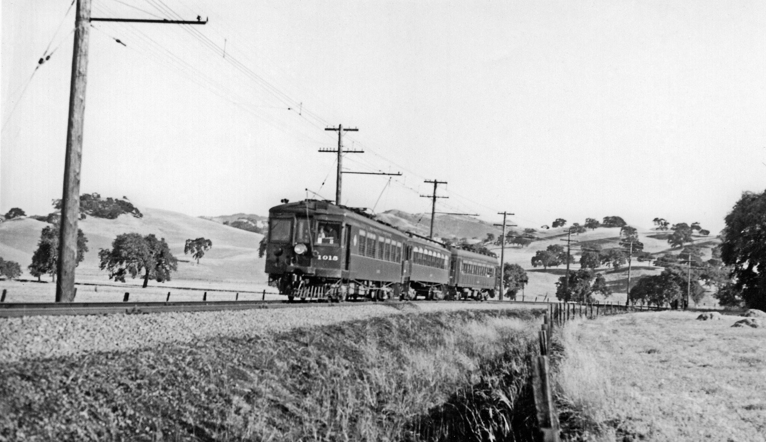
SN 1015 moves the scene more to the east in this southwest view from June 18, 1939. The trees on the right of this image match perfectly with those on the left of L75-40 as would be expected. The angle makes it difficult to align with the later image in L75-45. The back of a second sign to the left or southeast of the track will be seen from the front in L75-90 and 95.
L75-50-Wilbur C Whittaker Photo, Courtesy Tom Gray, (Image 10 of 23)
This three-car training heading east on Jul. 4, 1939, in more of a south view relative to L75-50. The back of the sign is present, and the collection of trees on the right side matches those on the left side of L75-50. In addition, oak tree 3 as designated in L75-15 is seen to the left.
L75-55-Dudley Thickens Photo, Courtesy BAERA, Western Railway Museum Archives, 71482sn , (Image 11 of 23)
Now back tracking toward Oakland to the west, to the northerly curve for a series of images looking to the north and east to Walnut Creek, all from the late 1930s and 1940s. The first late 1930s northeast view provides a three-car train, the back of the unreadable sign along the track as in L75-40, and oak tree 3 as designated in L75-15 off to the right.
L75-60-Dudley Thickens Photo, Courtesy BAERA, Western Railway Museum Archives, 71481sn, (Image 12 of 23)
Heading east to view a west-bound, three-car train in this east view July 4, 1939. Aside from the background, note the unique wiring on the catenary pole furthest to the right, the pole in the ground seen in front of and between the first two cars of the train, and that the catenary poles are all to the same side of the track.
L75-65-Dudley Thickens Photo, Courtesy BAERA, Western Railway Museum Archives, 71474sn, (Image 13 of 23)
This east view of a west-bound train with the SN Moraga parlor car at the rear from Feb. 14, 1937 has the unique wiring on the catenary pole furthest to the right as in L75-65, but the train in this image is further east. The different background also includes oak tree 2 behind the Moraga, and the left edge includes a catenary pole positioned on the other or north side of the track.
L75-70-Dudley Thickens Photo, Courtesy BAERA, Western Railway Museum Archives, 71478sn, (Image 14 of 23)
This western facing aerial from Apr. 9, 1953 shows the position where the catenary poles switch over relative to the track, creating four poles to the north on the western side of the Las Trampas Creek overpass.
L75-75-Copyright California Department of Transportation, 3299-3 Detail, (Image 15 of 23)
This south view shows the portion of the SN in this review from Feb, 13, 1958 to allow additional comparisons of the homes surrounding the right-of-way in the next set of images. A portion of Parkmead Elementary School is along the top edge of the image.
L75-80-Copyright California Department of Transportation, 5845-5 Detail , (Image 16 of 23)
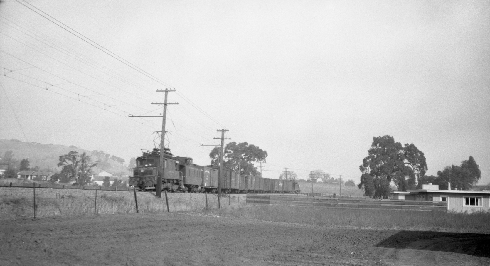
SN 660 pushes on the rear of a freight approaching the Las Trampas Creek overpass in this northeast view circa 1950. Oak tree 2 is to the right, oak tree 1 to the left as homes start to fill the open field to the east of the right-of-way.
L75-85-Dudley Thickens Photo, Courtesy BAERA, Western Railway Museum Archives, 4307sn, (Image 17 of 23)
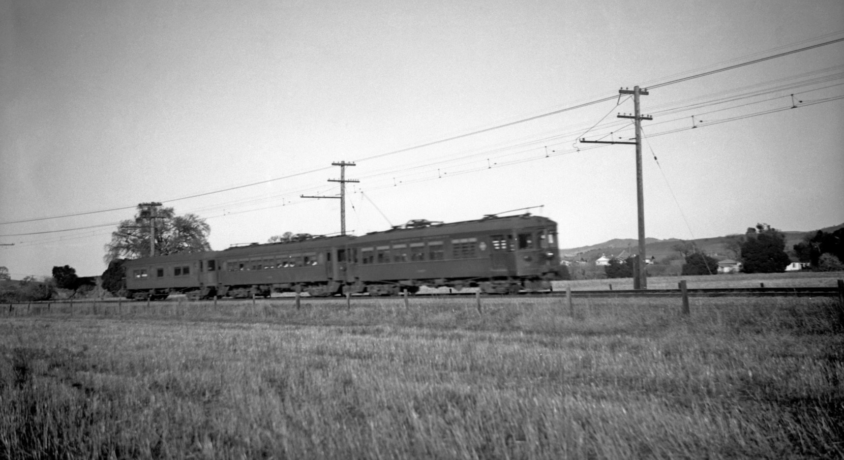
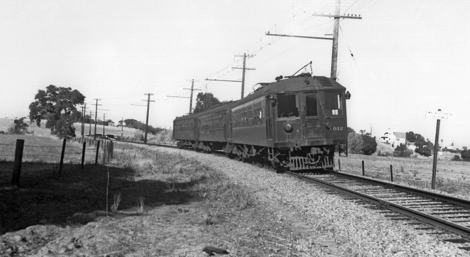
This northeast view shows SN 1012 leading a three-car train toward Oakland on October 29, 1939. The sign whose back was seen in L75-50 and 55 is now visible alerting trains of the distance to the Walnut Creek City limit at Mt Diablo Blvd.
L75-90-Wilbur C Whittaker Photo, Courtesy Tom Gray and Garth Groff, (Image 18 of 23)
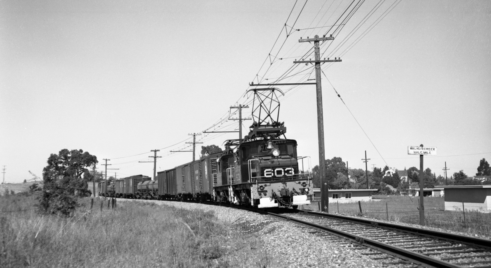
Contrast L75-90 to this northeast view of SN 603 and 604 in Sept. 1949, where homes now approach the right-of-way and the vegetation to established homes in the background has increased significantly.
L75-95-Dudley Thickens Photo, Courtesy BAERA, Western Railway Museum Archives, 71486sn, (Image 19 of 23)
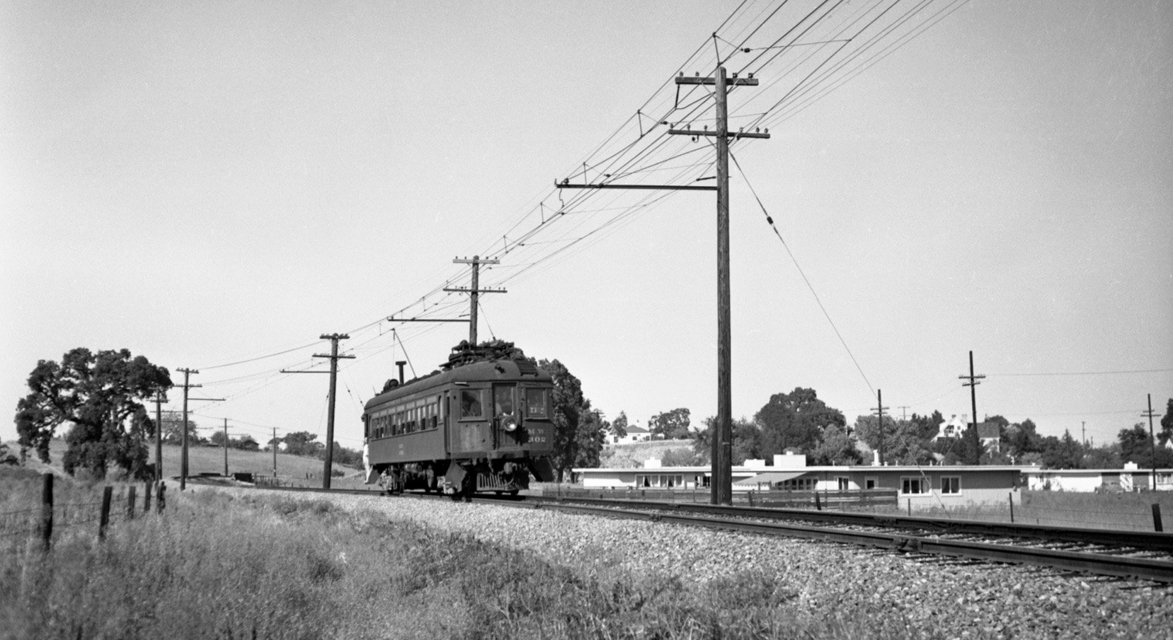
A similar northeast view shows MW 302 heading west on a Northern California Railroad Club excursion, Sep. 18, 1949 during a round-trip, Oakland to Pittsburg. The shorter train provides more detail to the new housing to the south.
L75-100-Dudley Thickens Photo, Courtesy BAERA, Western Railway Museum Archives, 71484sn, (Image 20 of 23)
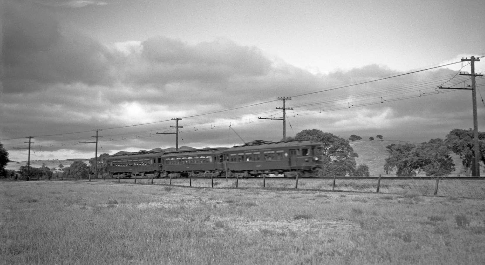
Finally, by the the old oak tree and the Las Trampas Creek crossing, one of many Dudley Thickens images of this site with a three-car train at full speed. Northeast View, Feb. 14, 1937. The crossing and more about the buildings in the background of this image soon.
L75-105-Dudley Thickens Photo, Courtesy BAERA, Western Railway Museum Archives, 71494sn, (Image 21 of 23)
For those interested in the period in between the late 1940s and 1958, two aerial views from Mar. 3, 1952 are presented dividing the section of interest in half, east to west. This one showing the section from Newell Ave. north to half way to the creek crossing with the west direction along the bottom edge ...
L75-110-Copyright California Department of Transportation, 2481-2, Detail , (Image 22 of 23)
...and this one completing the path to the Las Trampas Creek crossing, Mar. 3, 1952, again with the west direction along the bottom edge.
L75-115-Copyright California Department of Transportation, 2481-2, Detail , (Image 23 of 23)