Cannery Row
This panoramic northwest view from about Cole Ave. circa 1940 with SN 1019 and two-trailers sets the stage for what follows.
L67-02-Moreau Collection, Courtesy Western Railway Museum Archives, 163736sn , (Image 1 of 20)

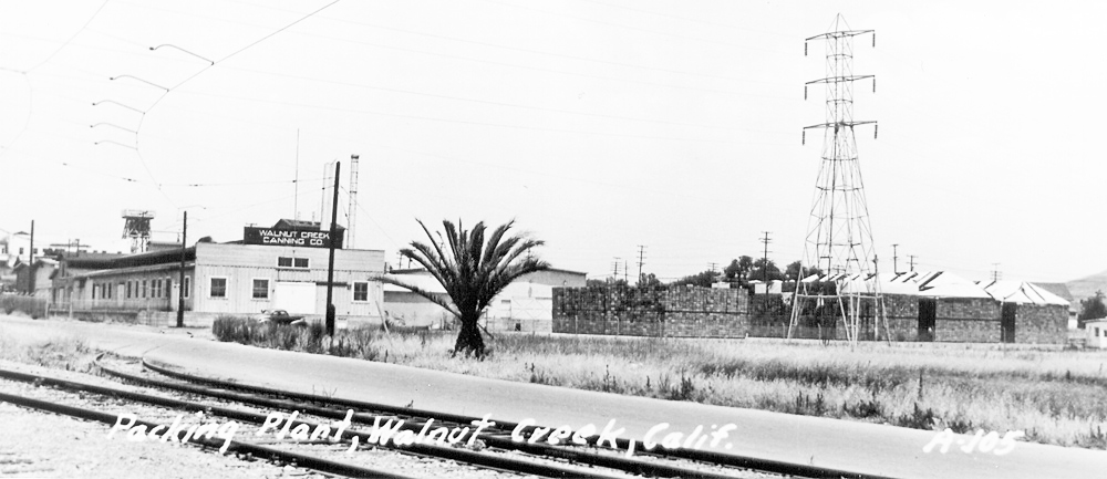
In addition to the Walnut Growers Association complex, the Walnut Creek Canning Company or “Cannery” was a key industrial operation along the SN route through central Walnut Creek. North view, 1930s. Much appreciation for extensive contributions to this presentation by Andy Smith, Planning Division of Walnut Creek.
L67-05-Courtesy Planning Division, City of Walnut Creek , (Image 2 of 20)
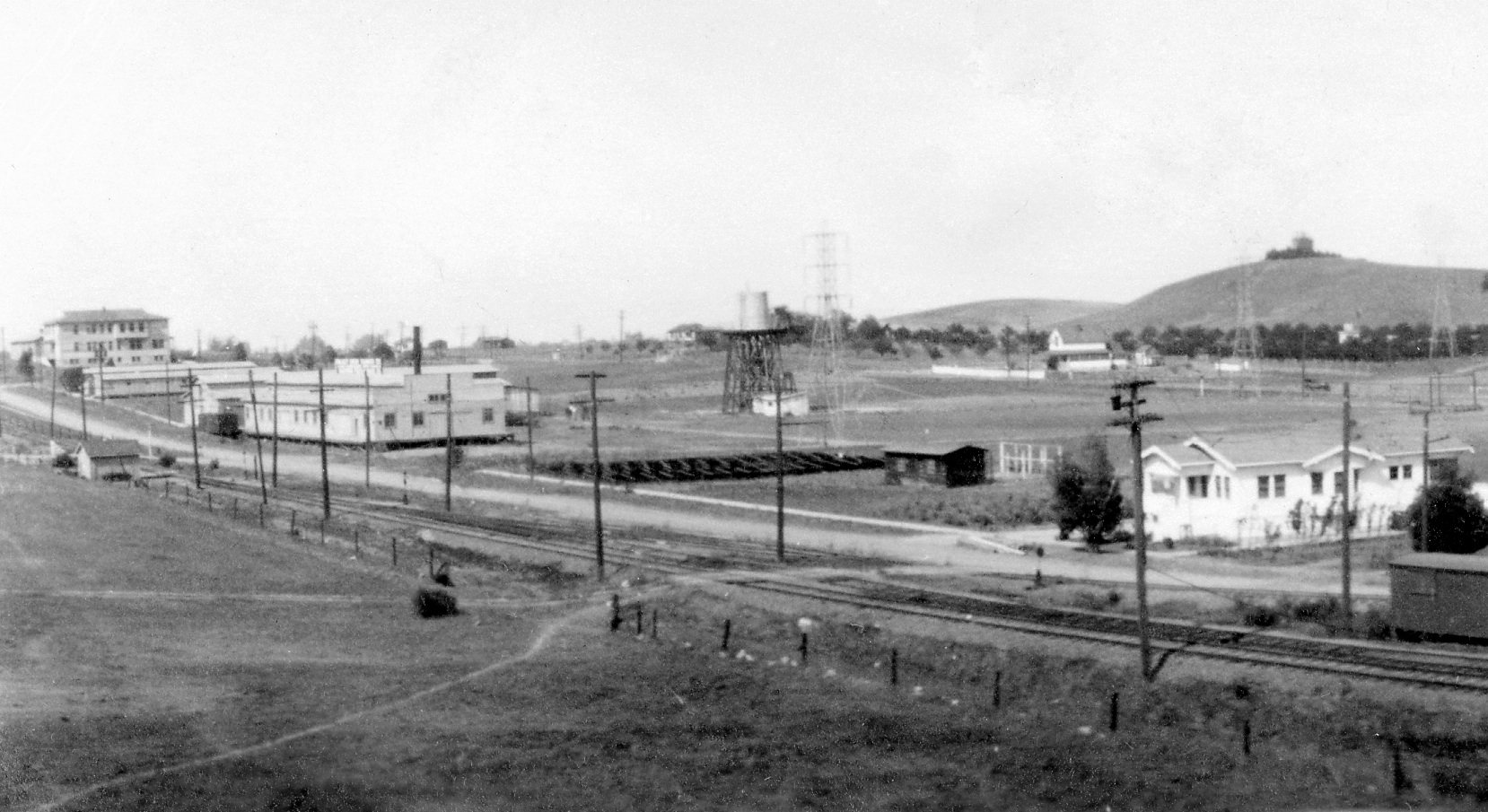
The Cannery is seen to the left, middle portion of this detail from a northeast view from 1924. Records from the Board of Trustees of Walnut Creek indicate the railway had received permission to build a spur to the site of the facility in 1920. The boxcar adjacent to the plant would support this.
L67-10-Vernon Sappers Collection, Courtesy BAERA, Western Railway Museum Archives, 35797sn, (Image 3 of 20)
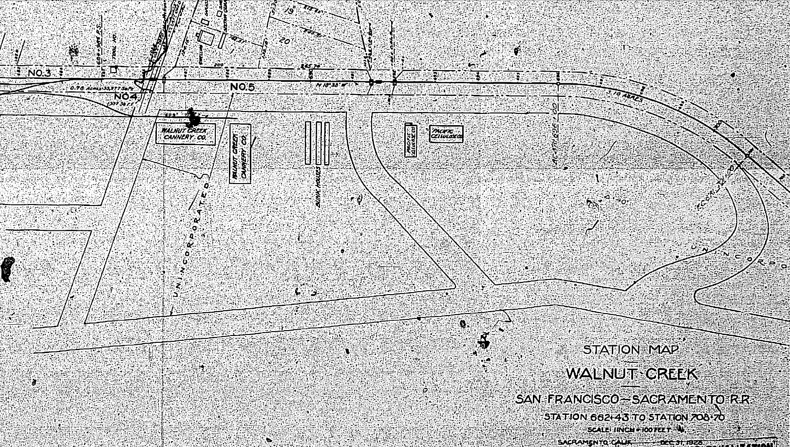
This map from 1928 show the presence of the Cannery as well as the Pacific Cellulose Company, the site of a mysterious murder in 1925. The latter building served as a glove factory previous to this time, and the 1943 Sanborn map labels it as R.C. Franke and Helman Estate, and the 1953 version as Williamsons Locker Service.
L67-15-Courtesy California Board of Equalization, 862-7-3D, (Image 4 of 20)
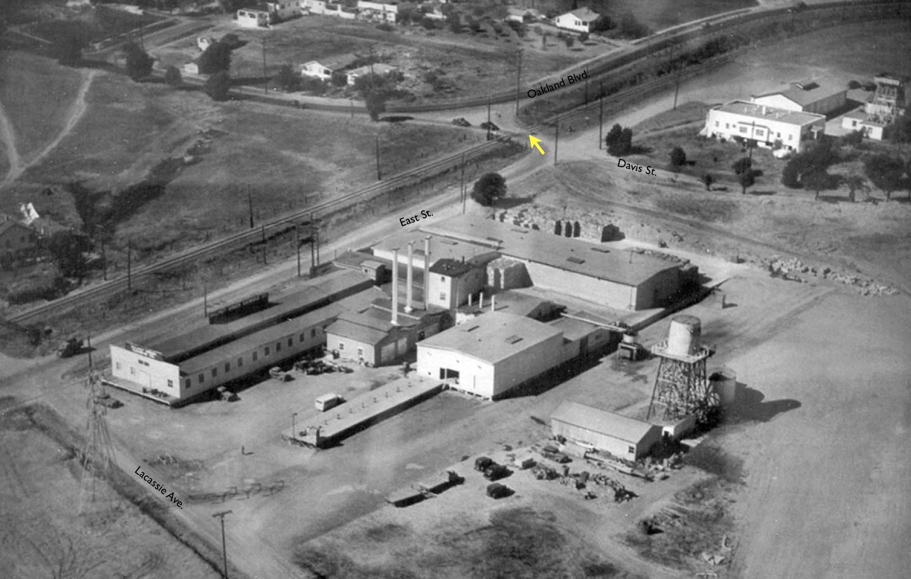
An annotated version of L67-05 shows the main streets in the 1930s up to the late 1950s. The yellow arrow at the SN grade crossing marks the current location of the Ygnacio Valley Rd- N. California Boulevard intersection, completed in the late 1950s. Conversion of the SN right-of-way and East Street to N. California Boulevard occurred in the late 1960s.
L67-20-Courtesy Planning Division, City of Walnut Creek, (Image 5 of 20)
This undated north view highlights the SN spur, as well as the transmission tower at Lacassie Ave. and the palm tree along East St.
L67-25-Courtesy Planning Division, City of Walnut Creek , (Image 6 of 20)
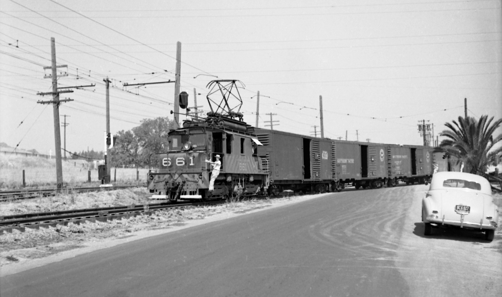
Its 1951 based on the license plate in this north image, and the signature palm tree stands by as SN 661 and freight swing out of the Cannery onto the main line.
L67-27-Norman Smith Photo, Courtesy BAERA, Western Railway Museum Archives, 89610.1sn , (Image 7 of 20)
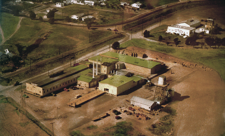
Ahead to Apr. 9, 1953, an aerial northwest view showing the post WWII increase in land development along the SN corridor east to Main St. City records indicate that “Cannery Island’, bound today by N. California Blvd., N. Main St., and Lacassie Ave., although part of Walnut Creek when incorporated in 1914, was detached from the City in 1920, and re-annexed back in 1947.
L67-30-Copyright California Department of Transportation, 3299-2 Detail, (Image 8 of 20)
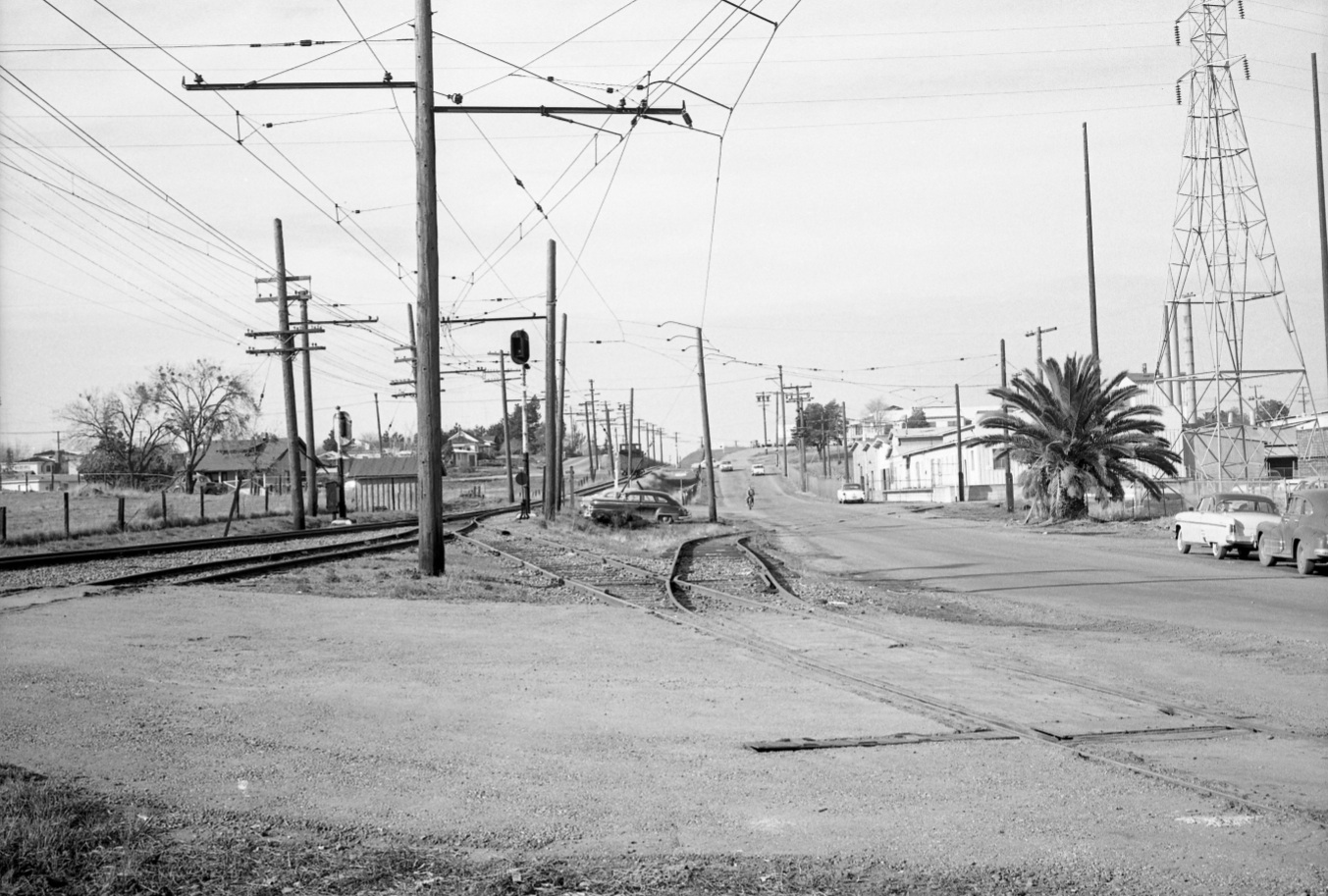
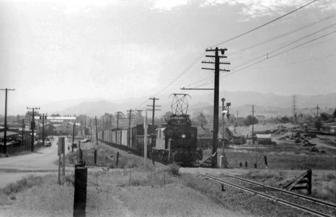
After the Oakland-Lafayette section of the SN was abandoned on Mar. 1, 1957, EK Muller documented much of the SN in the East Bay prior to the de-electrification of the system. Here, a north view from Cole Avenue shows the arrangement used by the SN to maintain the catenary supplying the spur, and the grade heading north.
L67-35-Enrique K Muller Photo, Courtesy BAERA, Western Railway Museum Archives, 68471sn, (Image 9 of 20)
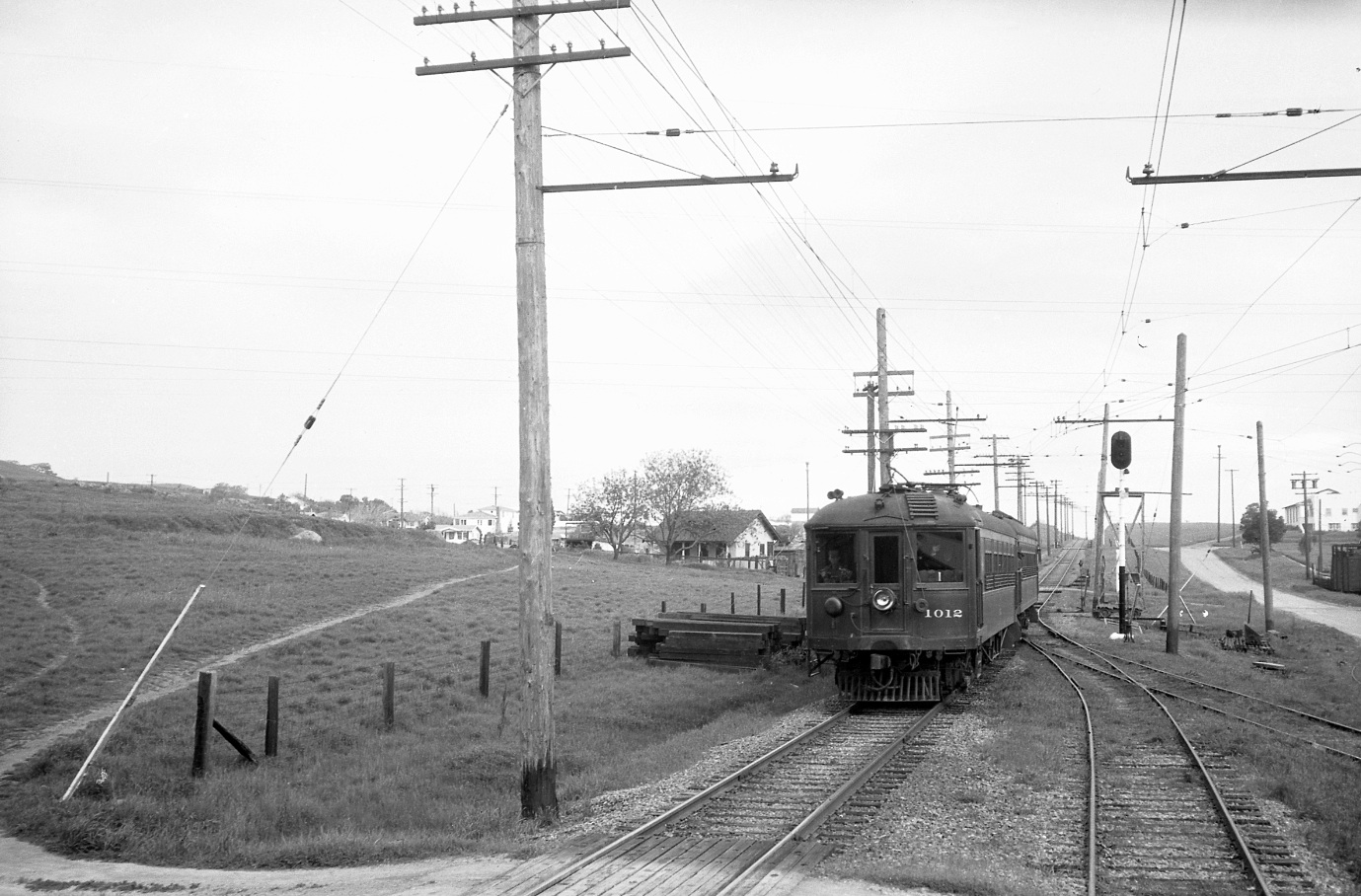
A similar north view from 1940 of a three-car train led by SN 1012 taken at the Cole Ave. intersection begins an evaluation of the area both in time and space through to the present Ygnacio Valley Rd. intersection.
L67-40- John G Graham Photo, Courtesy BAERA, Western Railway Museum Archives, 4363sn, (Image 10 of 20)
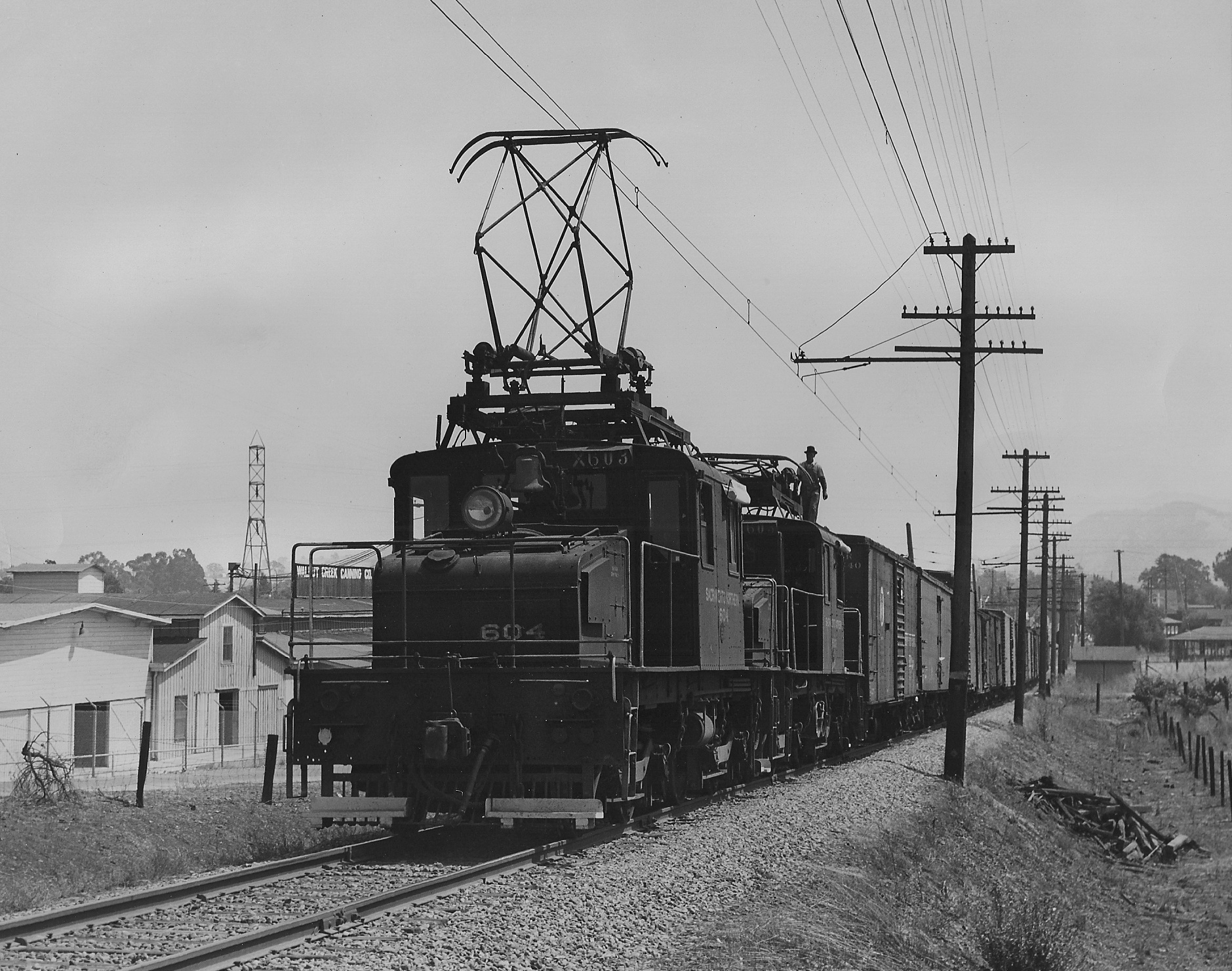
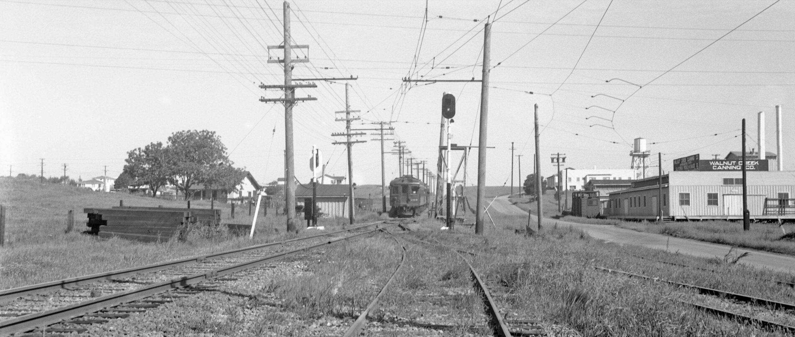
A southeast view from 1948 of motors SN 604 and SN 603 along side the Cannery as part of a long freight that has progressed in part past the Lacassie Ave. grade crossing. Note the Walnut Creek Canning Company sign to the left of the motor.
L67-45-Roger Heller Photo, from the collection of the Moraga Historical Society, Moraga, CA, NN-54, (Image 11 of 20)
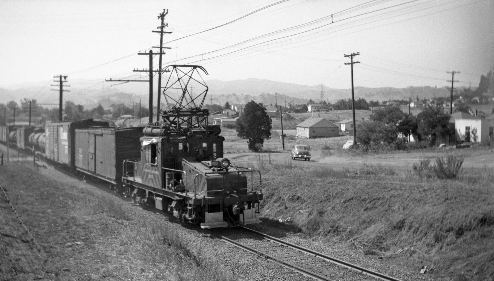
Next to a south view of a circa 1950 SN motor and freight approaching the Oakland Blvd.-Davis St. grade crossing, by decade’s end to be widened and renamed Ygnacio Valley Rd. Note the line of freight cars adjacent to the Cannery, left edge, center, confirming the railway’s active business relationship.
L67-50-Dave Gumz Photo, Courtesy BAERA, Western Railway Museum Archives, 68474sn, (Image 12 of 20)
SN 653 has progressed past the Oakland Blvd.-Davis St. grade crossing circa 1950. The car in the background navigates the curve on Oakland Blvd, soon to be a past memory.
L67-55-Dave Gumz Photo, Courtesy BAERA, Western Railway Museum Archives, 68473sn, (Image 13 of 20)
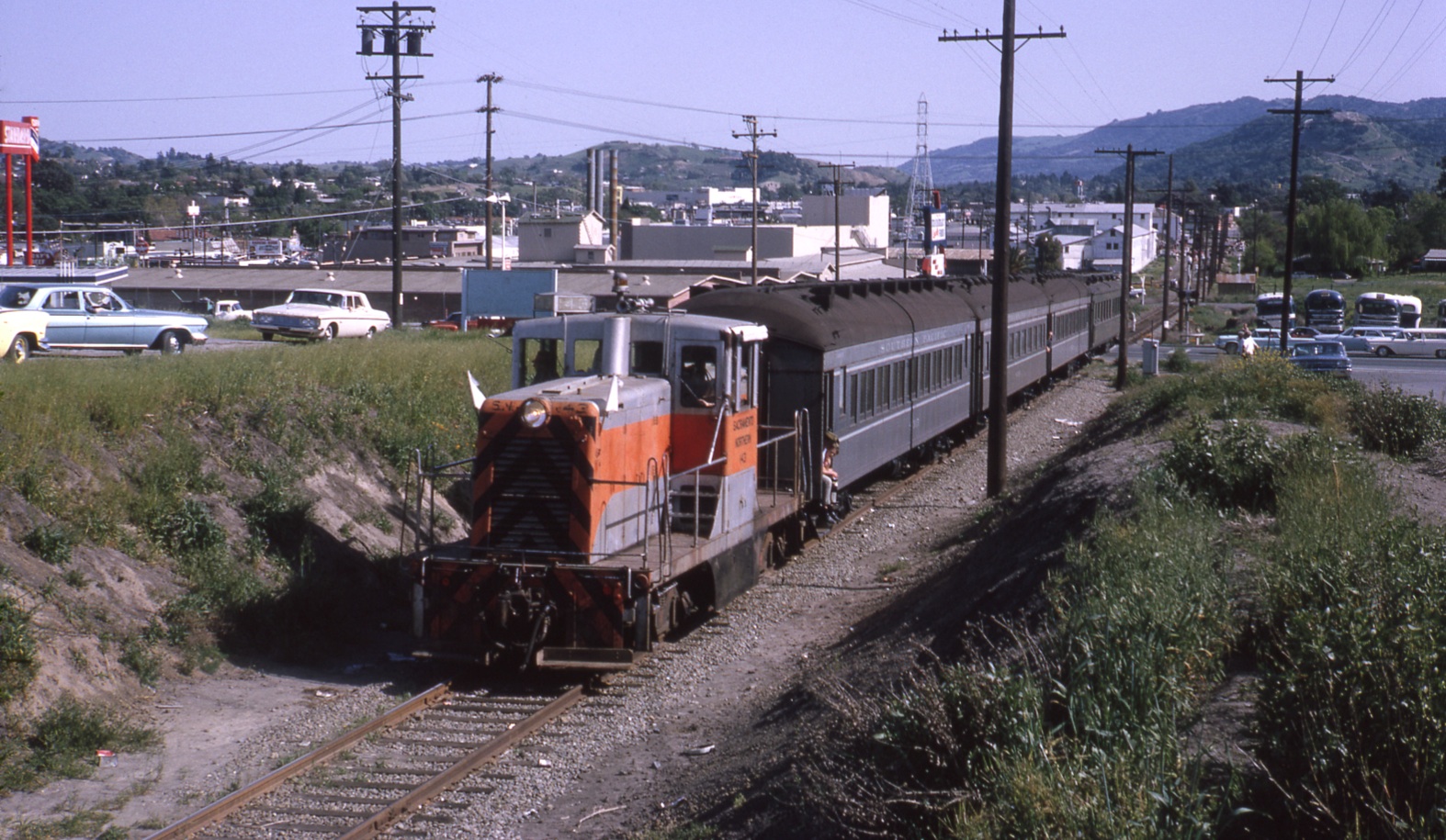
Some of the best material showing the new Ygnacio Valley Rd. grade crossing come from the Apr, 12, 1964 “End of an Era” rides marking the transfer of the SN right-of-way to BART. Southeast view of SN 143 and Southern Pacific passenger car fleet.
L67-60-Courtesy Charles Smiley , (Image 14 of 20)
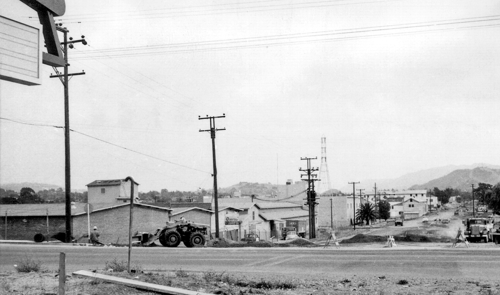
Construction of the final segment of N. California Blvd. began in 1965. This undated southeast view shows how the road was widened from the original East St.-SN -right-of-way by removing homes and unoccupied residential space to the west, preserving the commercial interests to the east. The presence of the Walnut Growers facilities in the background dates the photo to before 1967.
L67-66-Courtesy Planning Division, City of Walnut Creek , (Image 15 of 20)
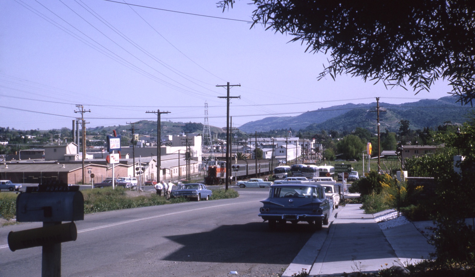
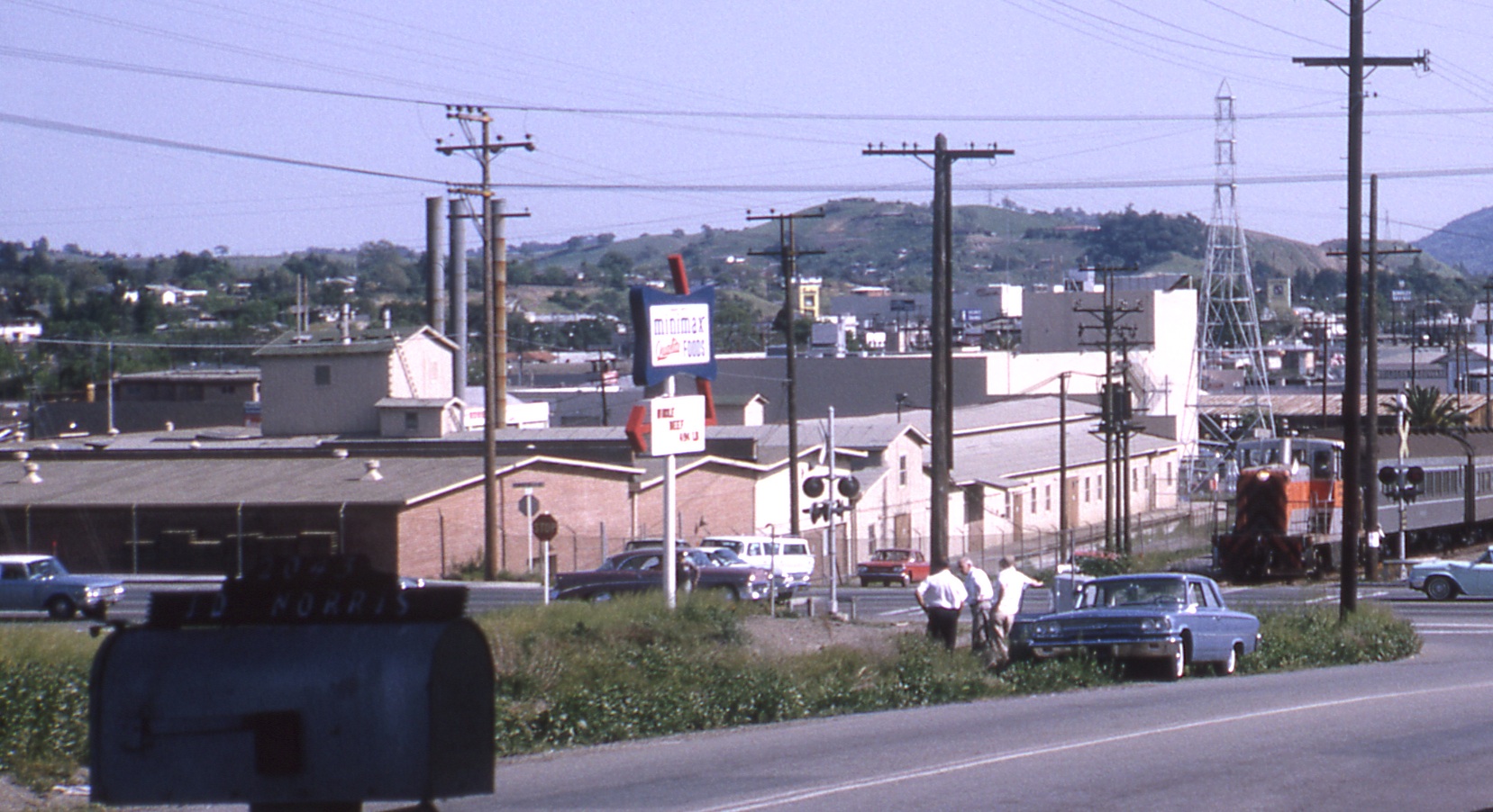
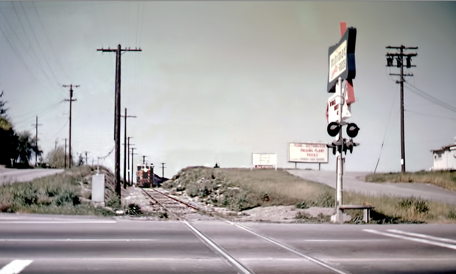
This detail from L67-60, southeast view, Apr. 12, 1964, provides the details of the sign at Ygnacio Valley Rd. indicating the presence of Minimax Foods to the north.
L67-70-Courtesy Charles Smiley, Detail , (Image 16 of 20)
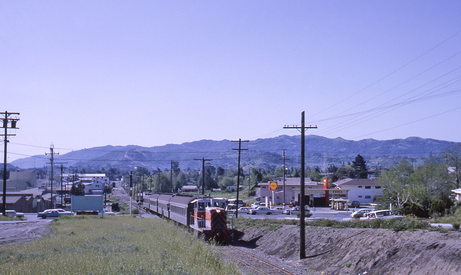
SN 143 steadily climbs the grade in this southwest view from Apr. 12, 1964, showing that the Oakland Blvd. curve has been swapped out with the squared off intersection of Ygnacio Valley Rd.
L67-75-LL Stein Photo, Courtesy BAERA, Western Railway Museum Archives, 68477sn, (Image 17 of 20)
Now a south view, Apr. 12, 1964, with views of Main Street on the left, and the Greyhound buses in the lot to the right.
L67-80-Courtesy Charles Smiley, (Image 18 of 20)
An undated north view showing an SN diesel approaching the grade crossing from the north.
L67-85-Courtesy BAERA, Western Railway Museum Archives, 68479sn, (Image 19 of 20)
In case this gets you motivated to get out and search the area of the Cannery, take note that the only thing remaining from all the images presented in this update is the transmission tower at Lacassie Ave.
L67-90-Stuart Swiedler Photo, (Image 20 of 20)