Colusa Junction to Colusa
A west view above Colusa Jct. in 2026 reveals the scars of the former wye track arrangement of the Sacramento Northern Railway, SN, that sent the mainline north and the Colusa Branch line to the west. This update will attempt to recreate a ride as a passenger between Colusa Jct. to Colusa in 1940. Details of a ride from Arbee through the town of Colusa in 1940 is covered elsewhere and can be accessed by clicking here.
L341-05-Courtesy Google Maps, (Image 1 of 44)

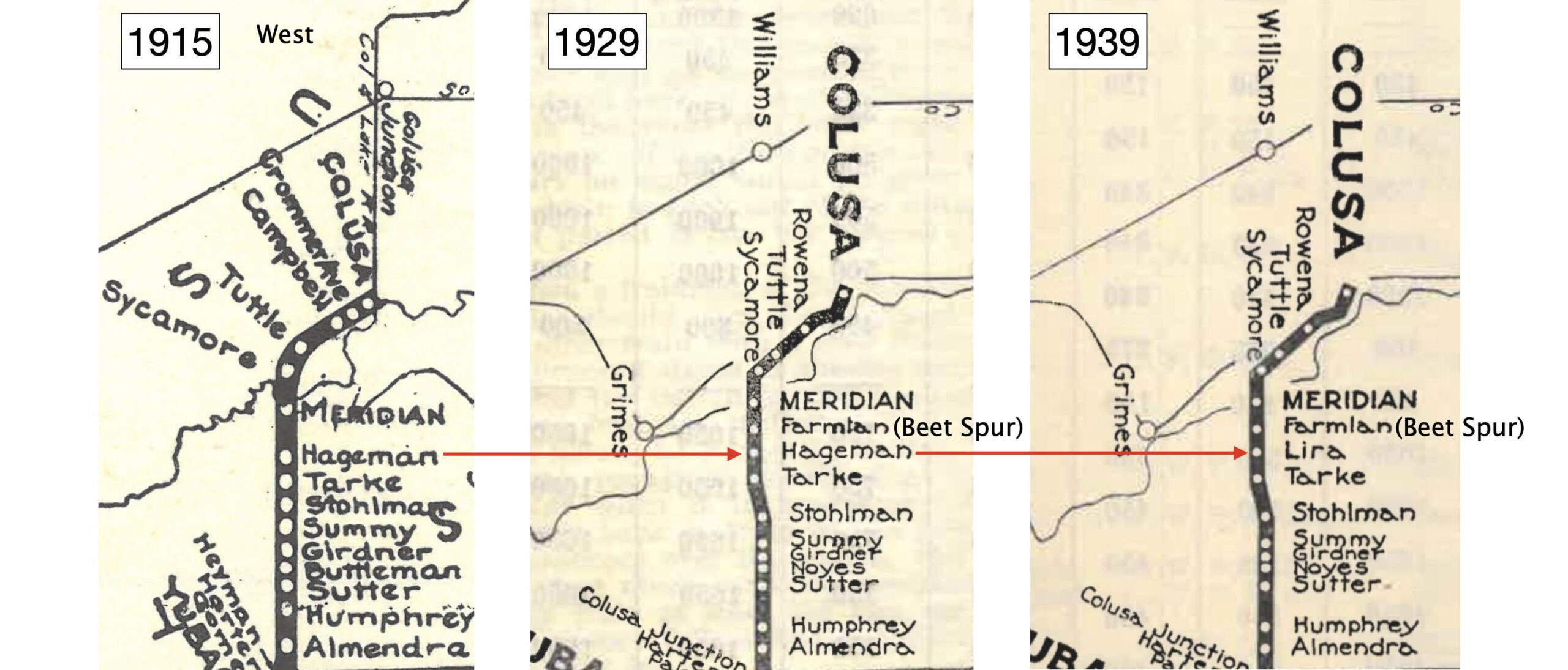
First some terminology. With the exception of Sutter and Meridian, the places in between in 1940 were sparsely populated, and in most cases, there were very few physical landmarks to pinpoint a specific place. The names changed or were reduced in number with time, a single place was given multiple names as shown here.
L341-10-Courtesy BAERA, Western Railway Museum Archives, 89129, l, 13460, c, 13474, r, (Image 2 of 44)
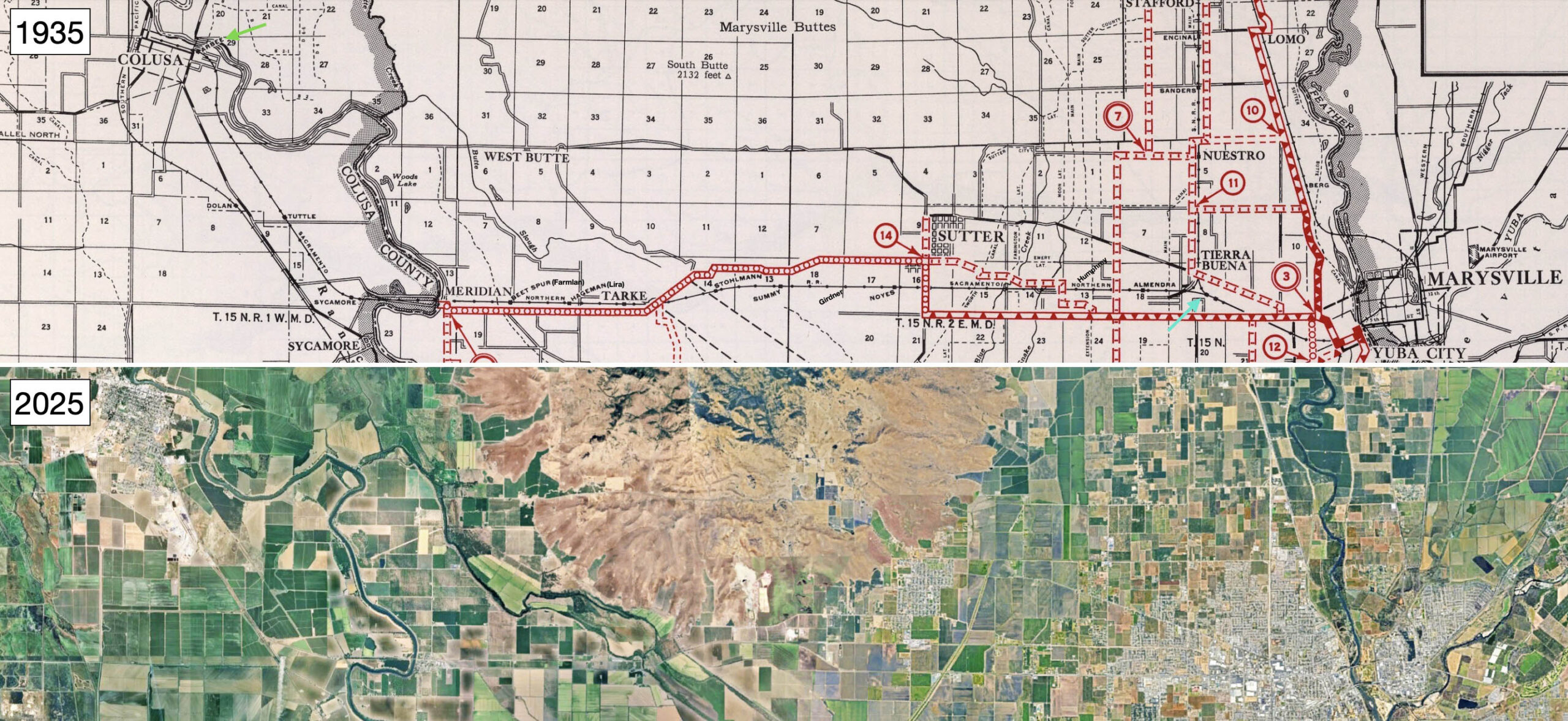
The map for 1935 shown above the one from 2025 shows the starting point at Colusa Jct., turquoise arrow, until reaching Arbee, green arrow, near the Colusa city limit. After leaving the wye at Colusa Jct., the right-of-way made only two curves before reaching Meridian, the curve to the south leading to a large overpass of the Butte Slough-Sutter Bypass, followed by a curve to the north to Tarke. From that point, a straight section with a view of the Meridian Bridge that could be seen for miles. The big curves were reserved for the last portion in Colusa County.
L341-15-David Rumsey Map Collection, David Rumsey Map Center, Stanford Libraries, top, Google Maps, bottom, (Image 3 of 44)
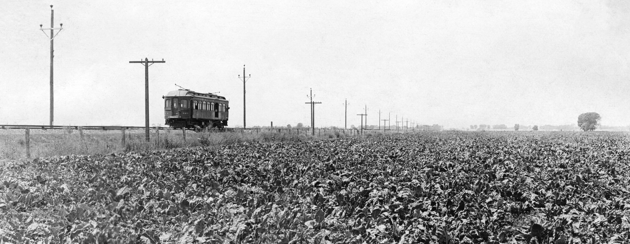
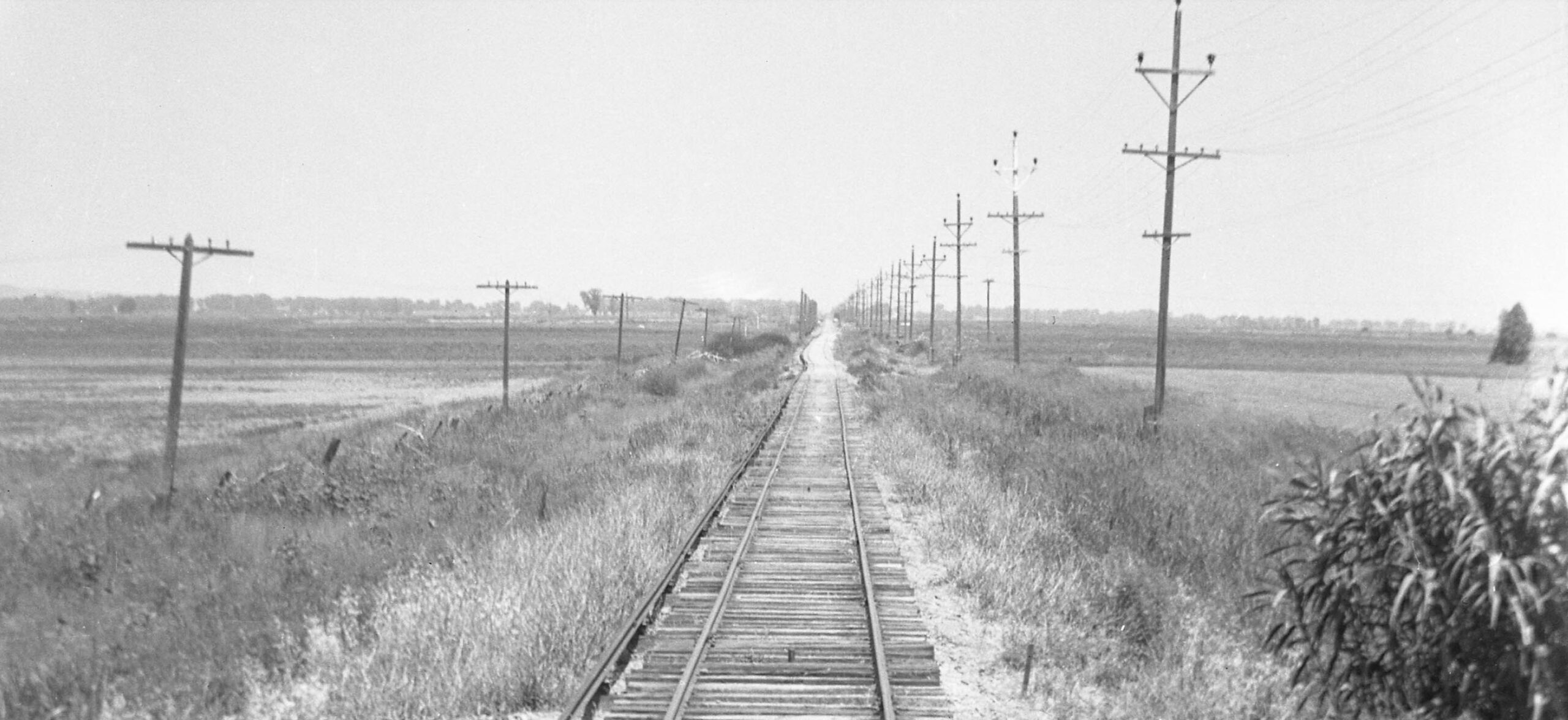
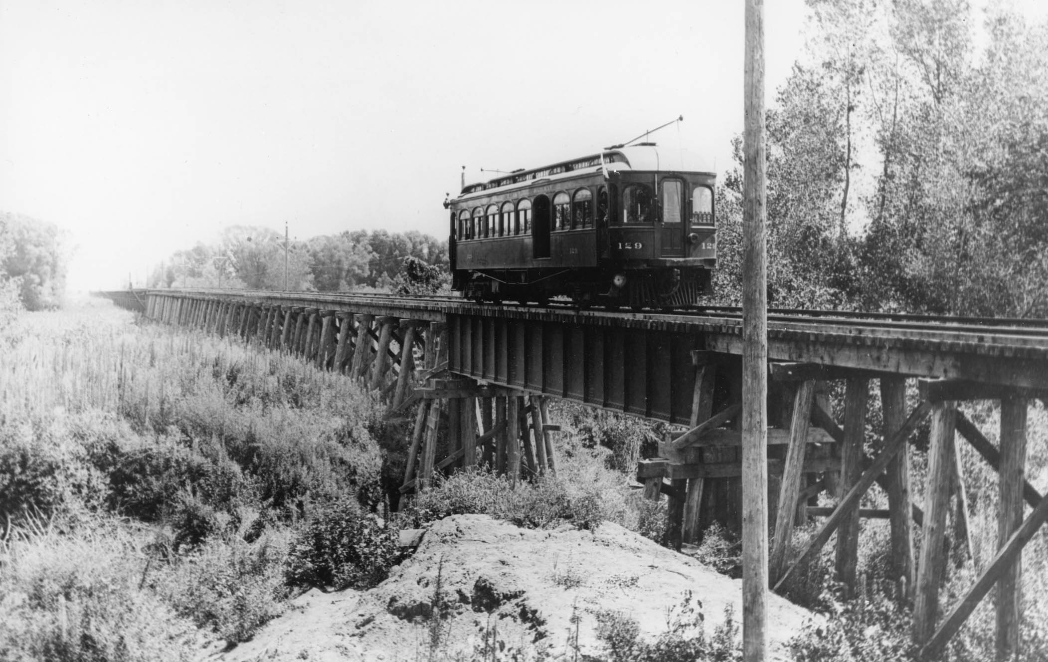
The area to be covered was 21.74 miles from Colusa Jct. to Colusa according to employee timetables. The Sacramento River divided the Sutter County and Colusa County sections, both entirely agricultural with beets, as seen here, rice and beans. But no matter how little landmarks surrounded the tracks, knowing you were on the branch line and the direction you were heading in Sutter County were simple to determine. The exact location of this early image with SN 129 can only be estimated, but it can only be from the branch line in Sutter County with a view to the west. Read on to find out why.
L341-17-Robert L. Stein Collection, Courtesy BAERA, Western Railway Museum, 259535sn, (Image 4 of 44)
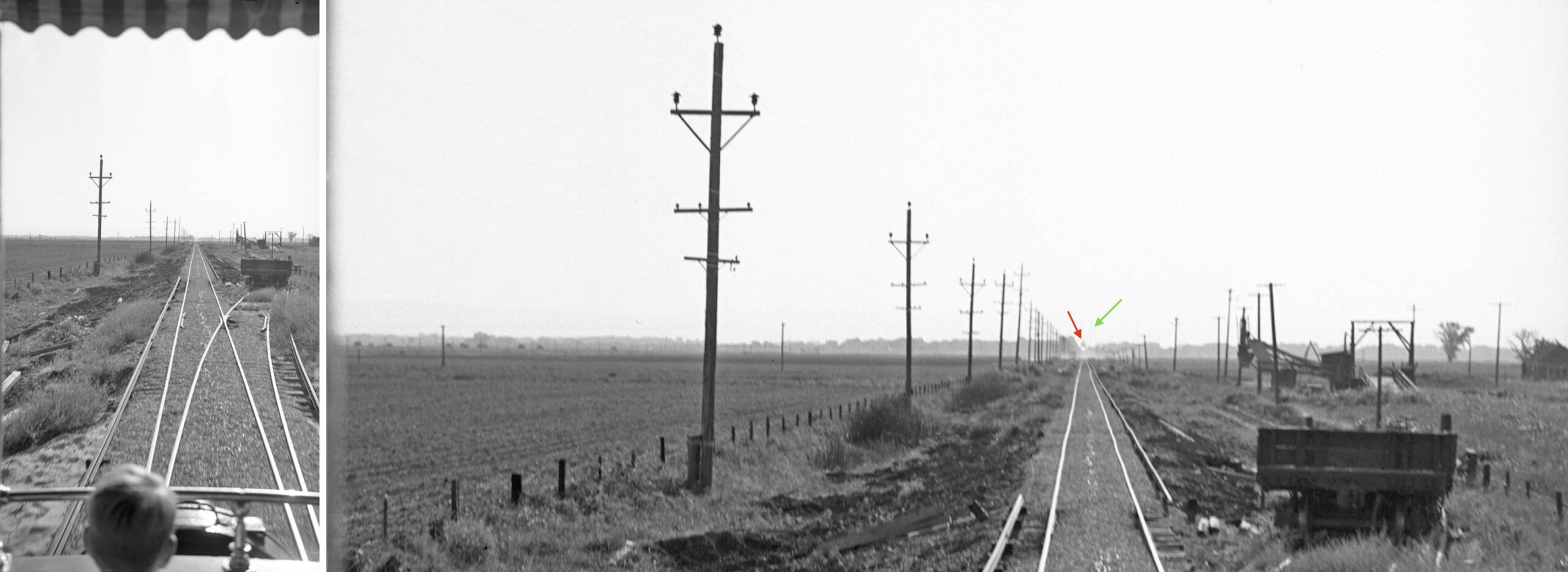
On the left is a view Dudley Thickens took from parlor car Sacramento on the excursion of June 6, 1940. On the right, a detail showing the Meridian Bridge, red arrow, and adjacent electrical power tower, green arrow, indicating the view is to the west. For the Colusa Branch in Sutter County, the electrical poles were always to the south of the rail after leaving the wye area, the third rail always to the north, except for a short distance where a spur or siding came off to the north. Rare landmarks, the agricultural equipment and spur position mark this place as Lira.
L341-20-Dudley Thickens Photo, Courtesy BAERA, Western Railway Museum Archives, 60203sn, (Image 5 of 44)
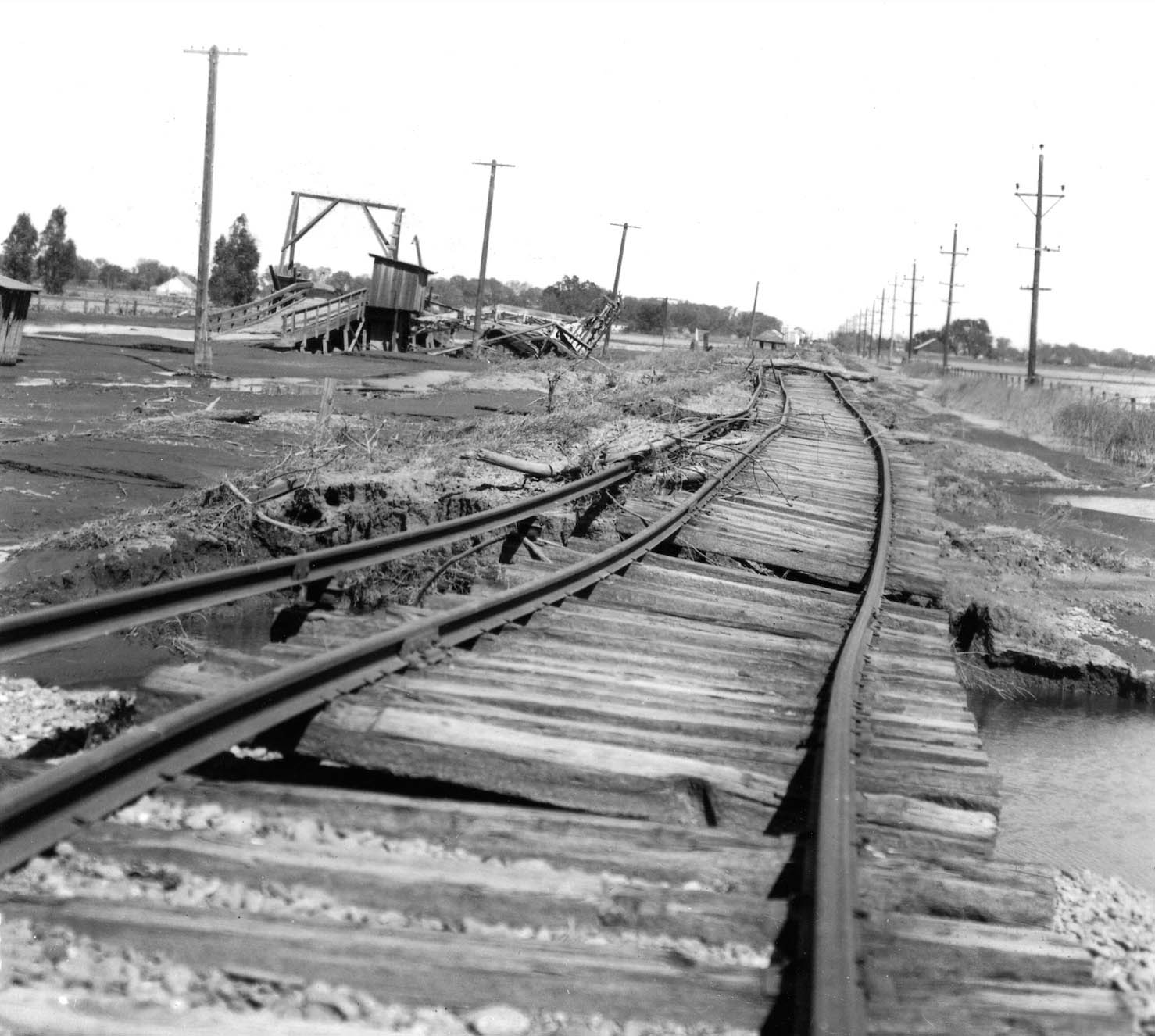
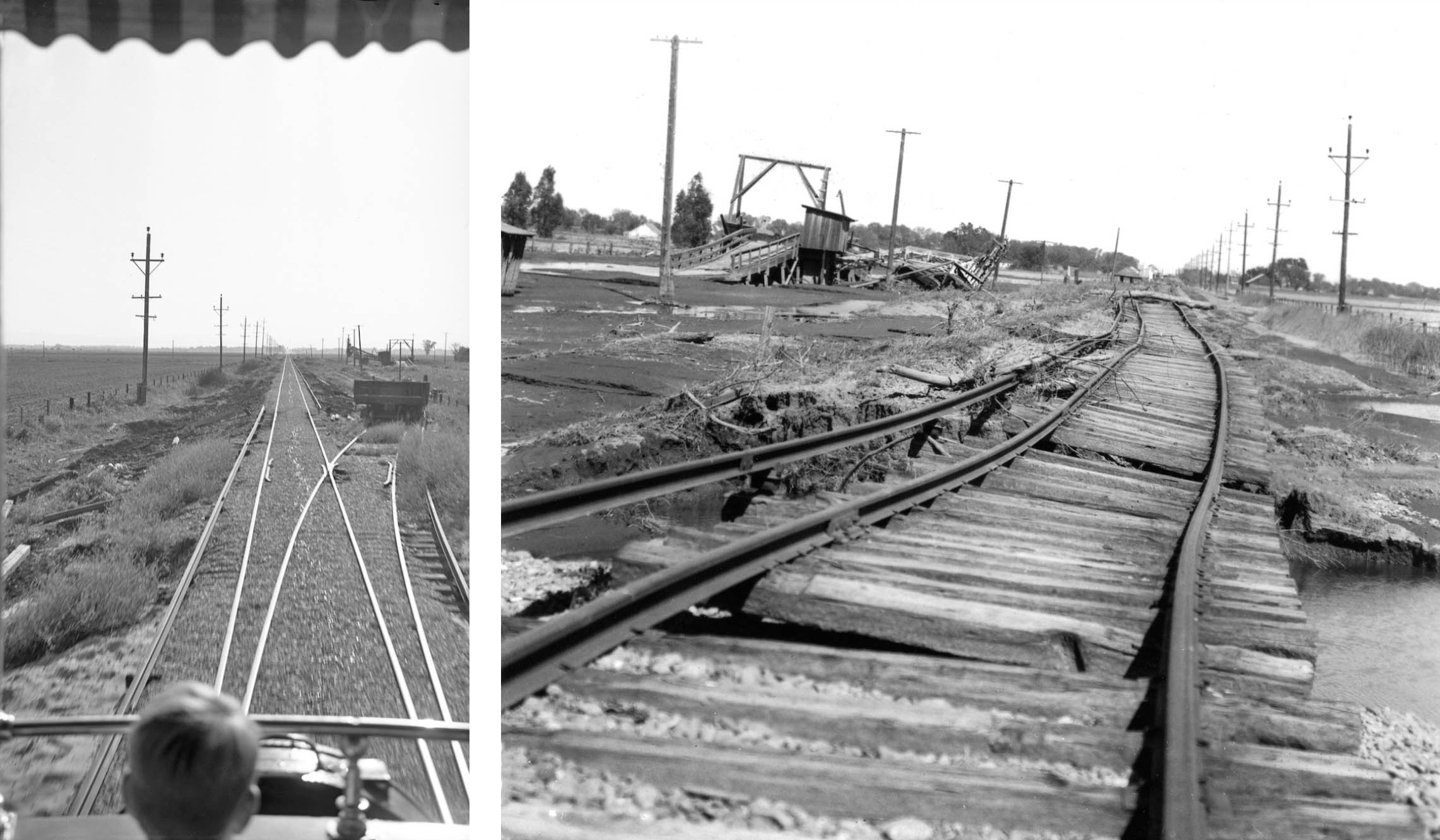
Another scene at Lira shown from Apr. 20, 1940, but now an east view documenting the damage imparted by the flood of that year. In the distance, the only sheds remaining between Meridian and the Butte Trestle were at Tarke. The small structure by the tracks between Lira and Tarke with the two open doors has not been identified. The “Forgotten Flood” of 1940 devastated 780 square miles of Sutter, Butte, Tehama, Glenn and Colusa counties. Click here for an article with a picture of the Tarke Warehouse partially under water.
L341-25-Courtesy BAERA, Western Railway Museum Archives, 227236sn, (Image 6 of 44)
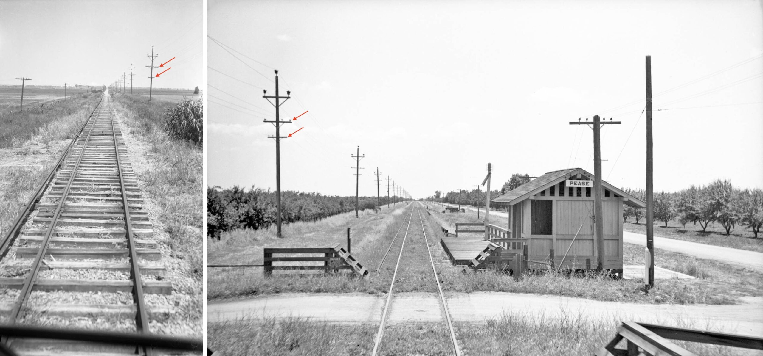
In contrast to the Colusa Branch, left, tracks in Sutter County from the Ardmore substation to south of Saunders on the mainline had electrical poles alongside the third rail to the east of the track, the example here at Pease, right, a south view from June 2, 1940. The tripartite structure at the top of the poles was also used north of Del Paso in Sacramento County, and in the first part of southern-most Yuba County, but those poles lacked the secondary wire holders, red arrows. A cluster of poles like the ones in Sutter County were also found by the SN at Shippe in Butte County.
L341-30-Paul Smith Photo, l, Howard T. Wolfe Photo, r, Courtesy BAERA, Western Railway Museum, 104271sn, l, 238461sn, r, (Image 7 of 44)
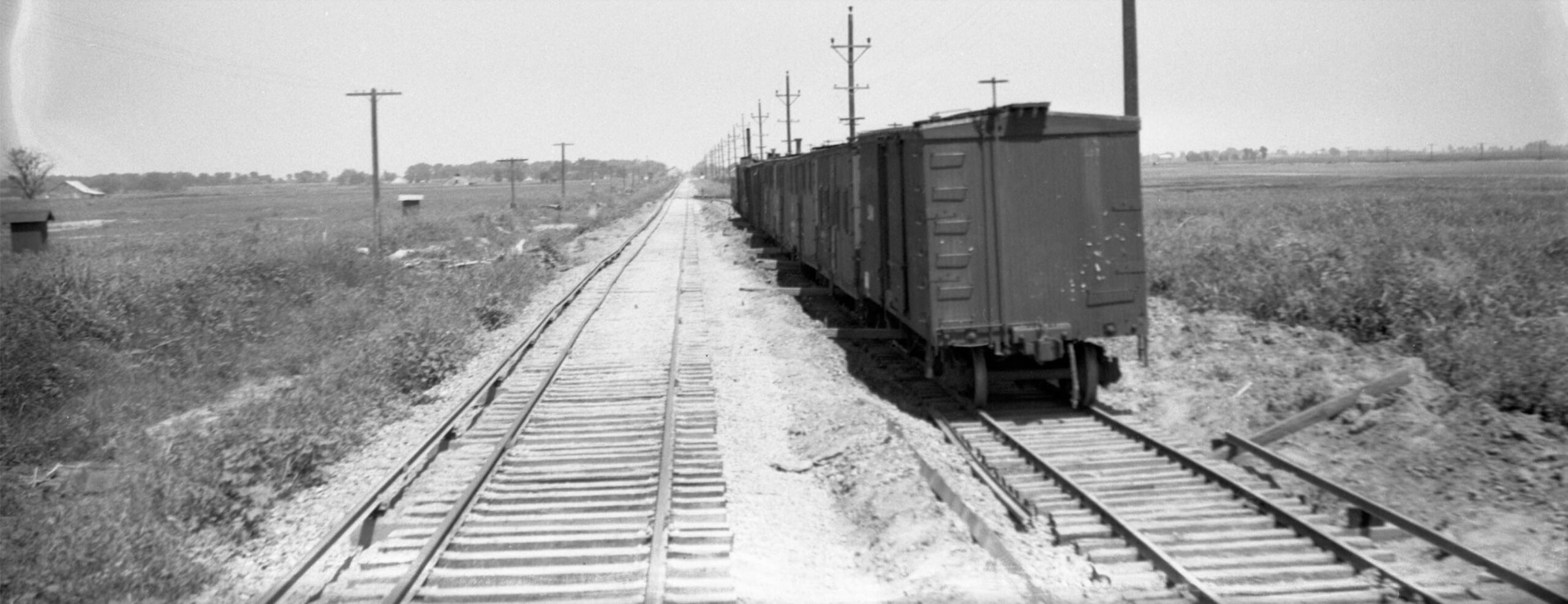
Not to overlook the previous image on the left, this detail from the branch line was taken between Meridian and Farmlan or Beet Spur, a line of boxcars on its southerly siding seen as a pinpoint in the distance. The pole and third rail positions indicate an east view. It also has to be 1940. The flood occurred earlier that year and passenger service ended at the end of Oct., so the presence of new ballast added to repair the track is the clue as to the date. The function of the row of poles seen in the distance has not been determined.
L341-35-Paul Smith Photo, Courtesy BAERA, Western Railway Museum, 104271sn, Detail, (Image 8 of 44)
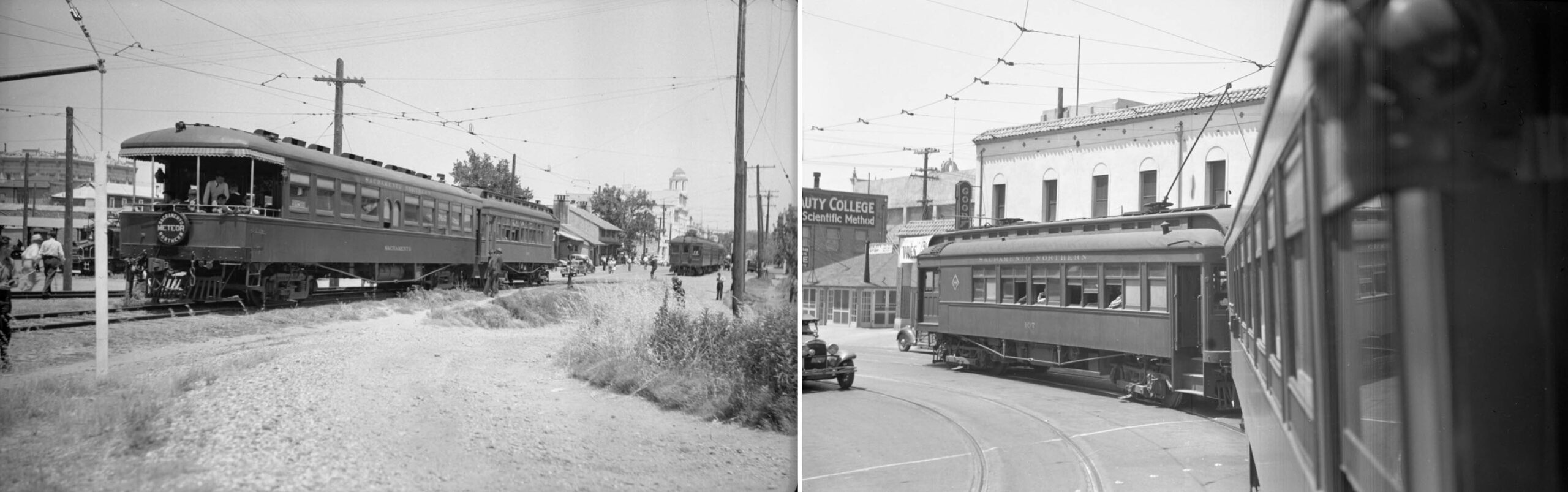
Time to get ready for the ride. Luckily, Howard Wolfe was on that June 16, 1940 excursion, seen in a northeast view setting up SN 107 and parlor car Sacramento at Maryville just west of the freight depot, left, and later turning from D. St. onto 5th St., right, northwest view. He took most of the images to be shown next. Although passengers Dudley Thickens and Paul Smith did take one image a piece, Wolfe took overlapping views from Tarke to Meridian.
L341-40-Howard T. Wolfe Photos, Courtesy BAERA, Western Railway Museum Archives, 246446sn, l, 246455sn, r,, (Image 9 of 44)
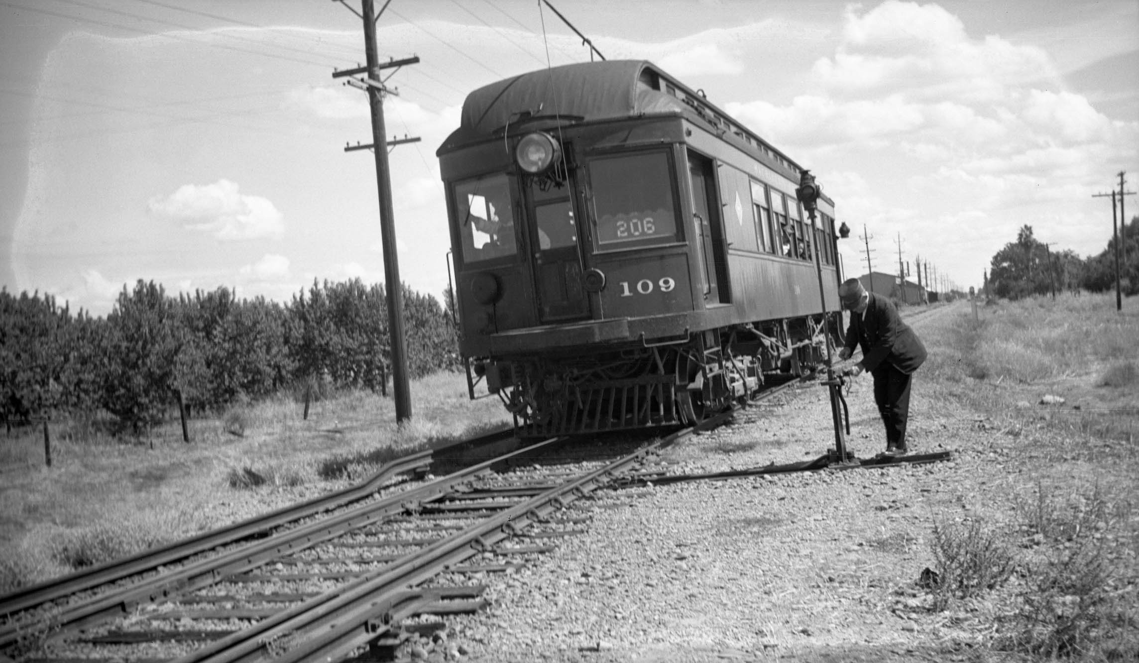
Although Colusa Local SN 109 as Train 206 may not have been the place pictures of the branch line were taken from, it did show up in several images and did transport photographers to get those images. Here the conductor sets the switch east of Colusa Jct. to access the branch line in 1940, east view.
L341-45-Vernon Sappers Collection, Courtesy BAERA, Western Railway Museum Archives, 136908sn, (Image 10 of 44)
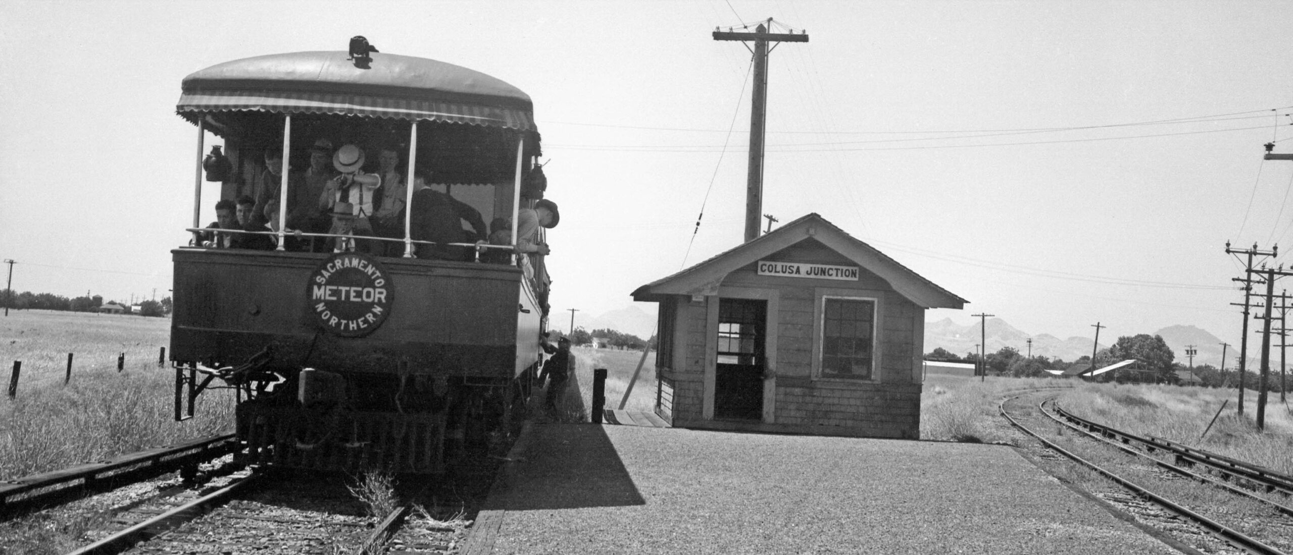
The excursion train of June 16, 1940 has just arrived at Colusa Jct. as seen in this west view.
L341-50-Wilbur C. Whittaker Photo, Vielbaum Collection, Courtesy BAERA, Western Railway Museum Archives, 132829sn, (Image 11 of 44)
A view of the Sutter Buttes faintly hangs as a backdrop as the train begins the trip to the west. Yes, the third rail and “Sutter-type” electrical poles are on the same side of the track, but only until the train leaves the track wye configuration.
L341-55-Courtesy BAERA, Western Railway Museum Archives, 257796sn, (Image 12 of 44)
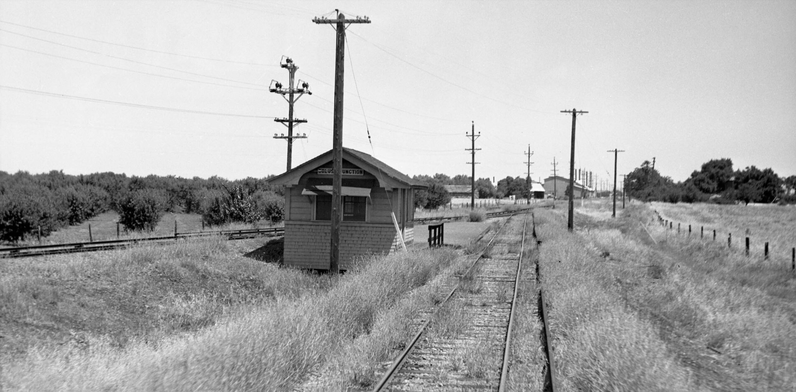
One last look at the shelter at Colusa Jct., east view. The photos taken by Howard Wolfe with two exceptions were all taken from the rear of the parlor car looking east as the train traveled west.
L341-60-Howard T. Wolfe Photo, Courtesy BAERA, Western Railway Museum Archives, 246456sn, (Image 13 of 44)
The first possible stop on the branch line is Almendra, the train passing by at full speed in this east view from the parlor car Sacramento on June 16. 1940.
L341-65-Howard T. Wolfe Photo, Courtesy BAERA, Western Railway Museum Archives, 246458sn, (Image 14 of 44)
The same place ca. 1913, an east view at Almendra. The series of the American Photo Co. images shown in this presentation were all ca. 1913, and the ones of Sutter County show the “Sutter-type” electrical poles to be in place.
L341-70-American Photo Co. Photo, Robert L. Stein Collection, Courtesy BAERA, Western Railway Museum Archives, 259538sn, (Image 15 of 44)
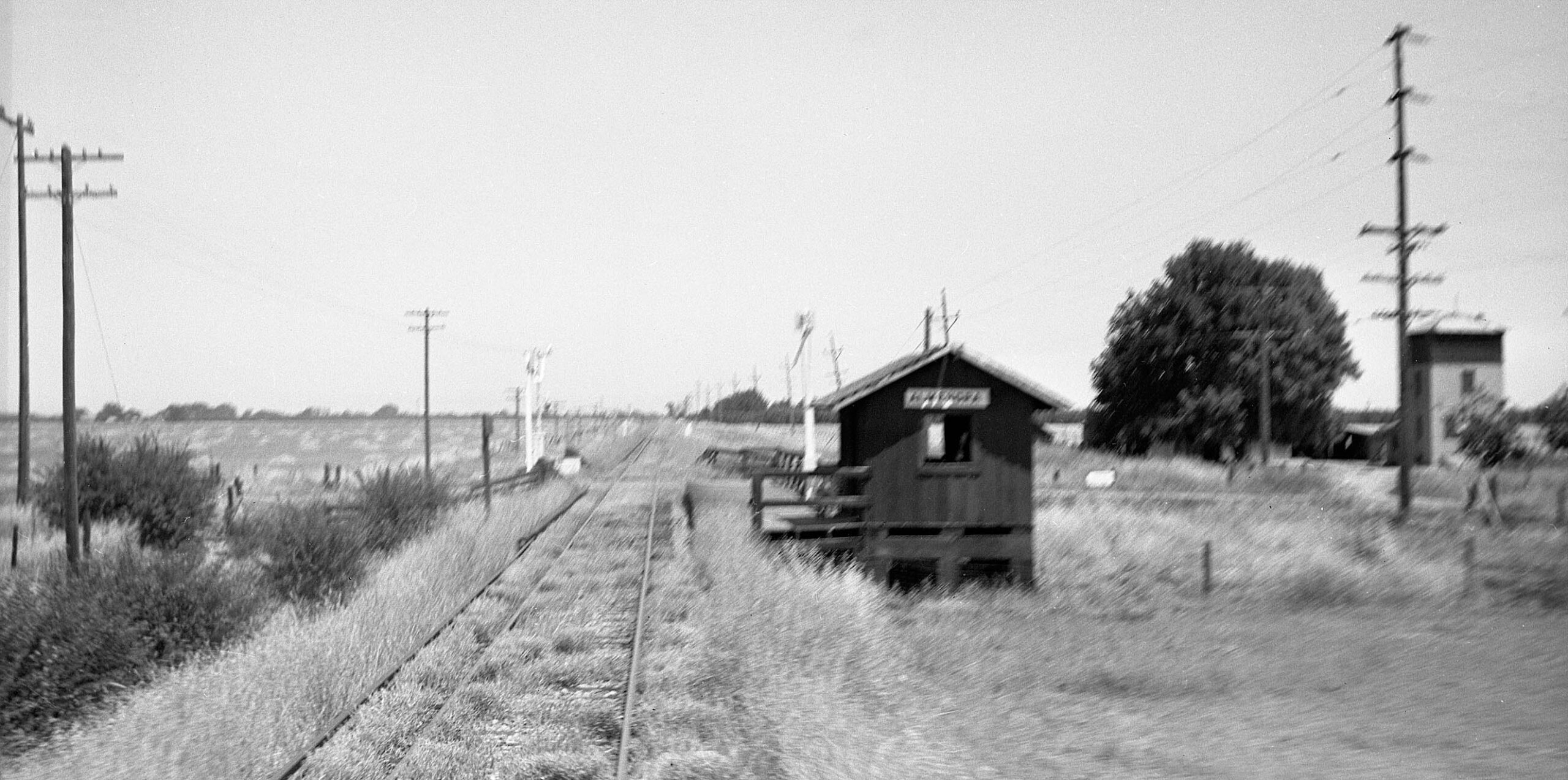
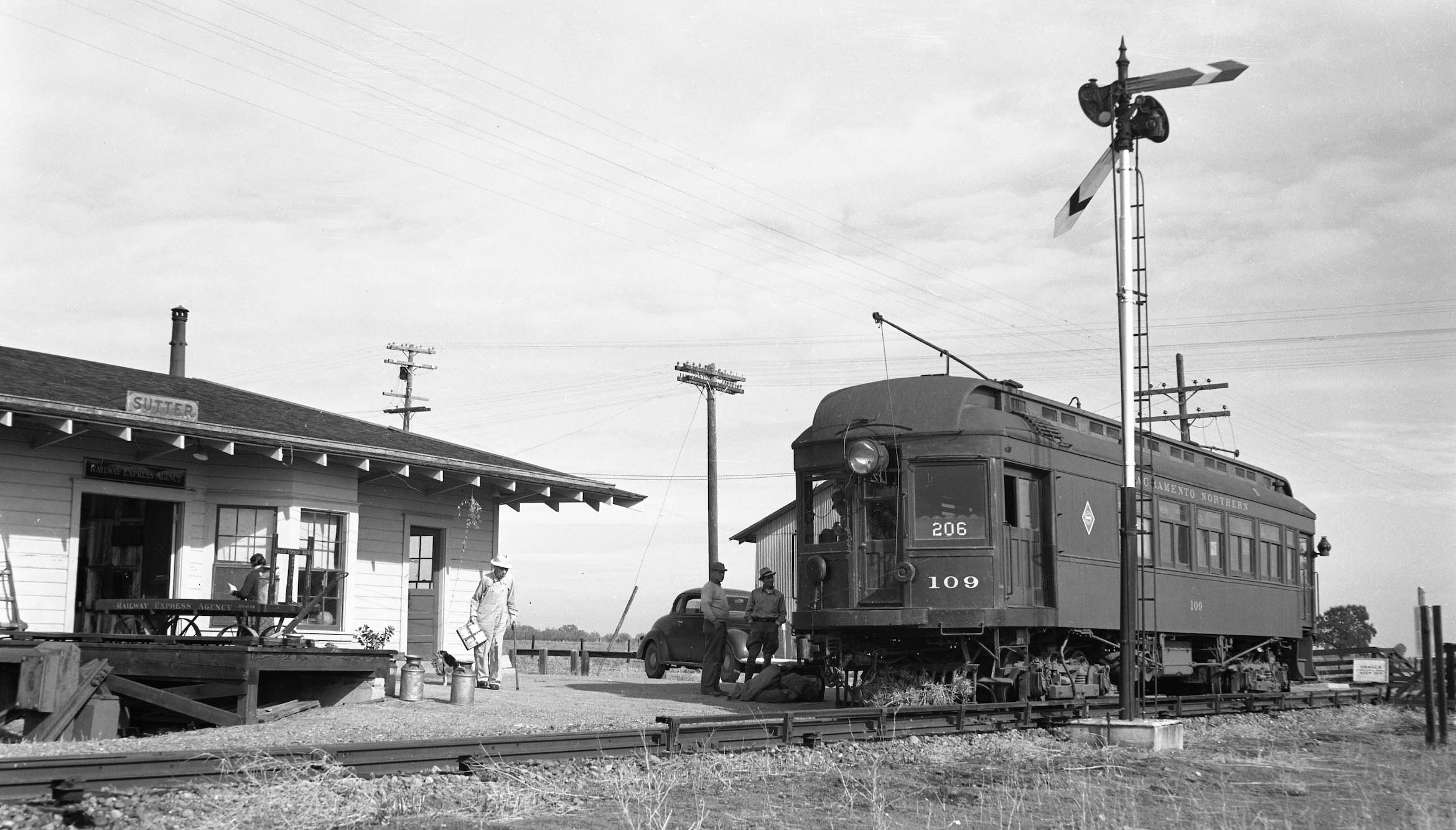
Nothing from the Humphrey flagstop in 1940, so on to Sutter, where Train 206 has arrived at the depot.
L341-75-Ted Wurm Photo, Moreau Collection, Courtesy BAERA, Western Railway Museum Archives 162092sn, (Image 16 of 44)
This ca. 1913 west view was labeled as “Lumber Yard and Substation”, the former assumed to be Union Lumber Co., the oldest continuously operating hardware store west of the Mississippi since 1852 based on several sources. The substation may have been a seasonal addition, as the branch line had two primary substations at Colusa and Stohlman.
L341-80-American Photo Co. Photo, Louis L Stein Collection, Courtesy BAERA, Western Railway Museum Archives, 259513s, (Image 17 of 44)
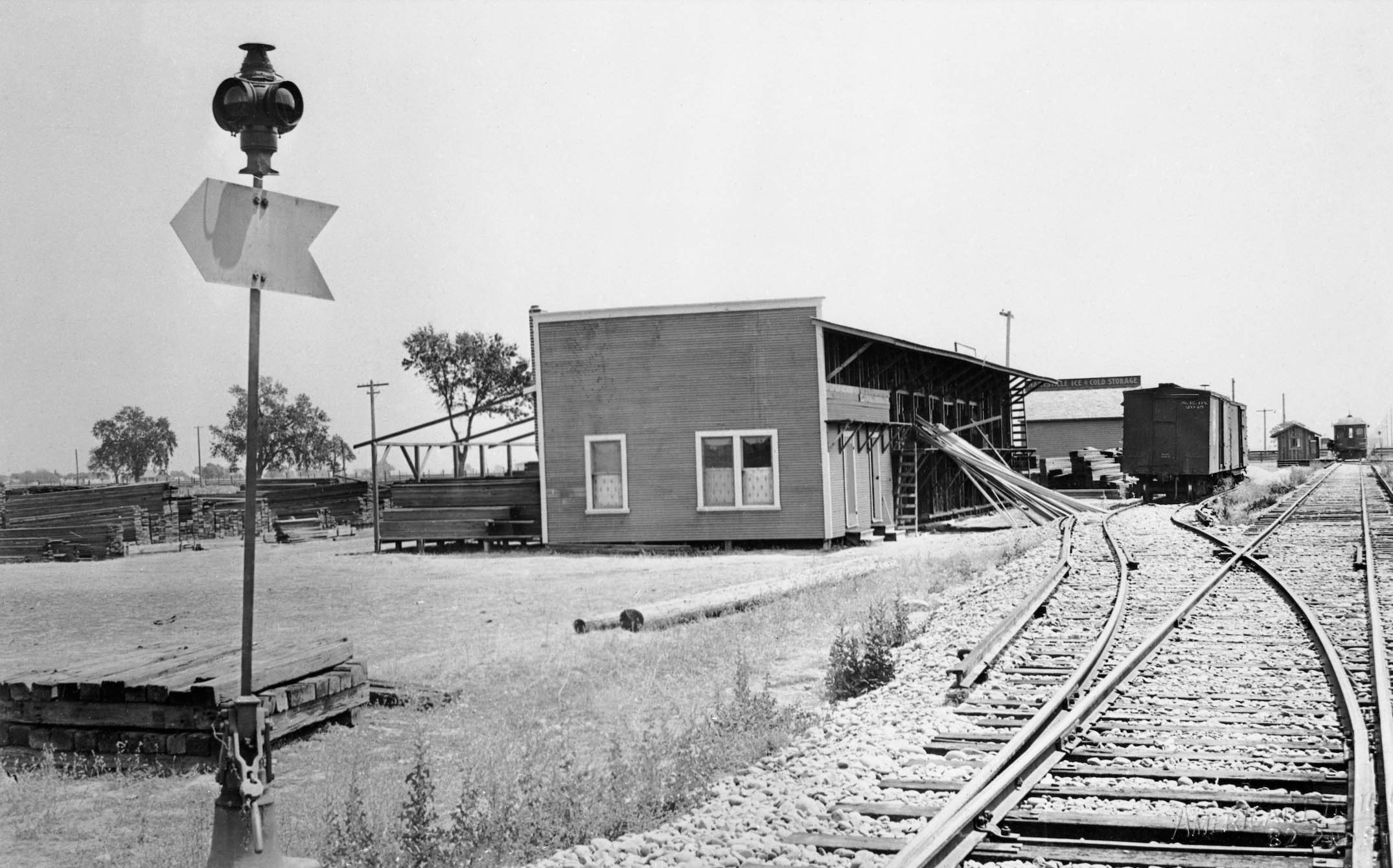
Another ca. 1913 view, this time to the east, shows the lumber yard and Marysville Ice and Cold Storage. Note the smaller passenger shelter in the distance with a passenger train alongside it. The date it was replaced by the larger depot was not found.
L341-85-American Photo Co. Photo, Louis L. Stein Collection, Courtesy BAERA, Western Railway Museum Archives, 64630sn, (Image 18 of 44)
The excursion train of June 16, 1940 departs, this east view showing the depot and Union Lumber, sometimes the former looking like the latter based on the amount of lumber in the area.
L341-90-Howard T. Wolfe Photo, Courtesy BAERA, Western Railway Museum Archives, 246457sn, (Image 19 of 44)
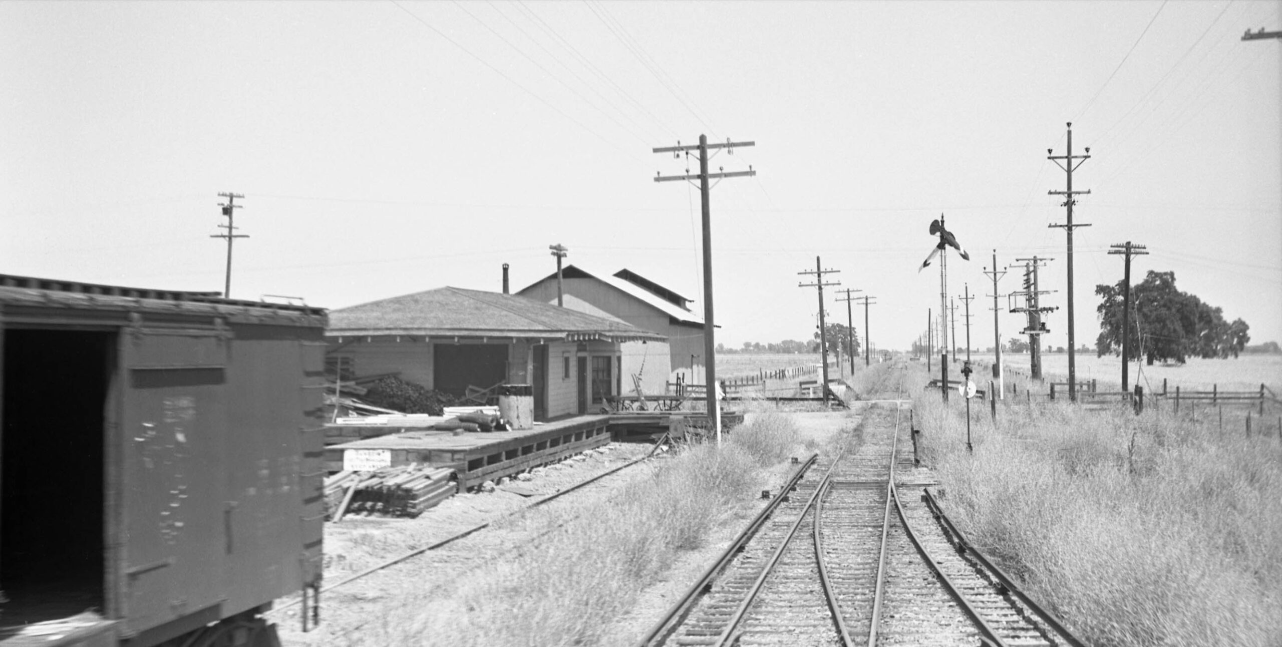
This was the only image found between Sutter and the Butte Slough-Sutter Bypass Overpass. The position of Highway 20 hugging the south border of the track, the curve of the right-of-way indicated by the poles in the distance, and the apparent presence of a small trestle seen as an dark irregularity in the right-of-way in the distance are consistent with an east view by the Stohlman sign. Trying to decipher these blurred signs is nothing less than treacherous based on several examples. It is not clear why Wolfe did not wait to photograph the substation. See the next image.
L341-95-Howard T. Wolfe Photo, Courtesy BAERA, Western Railway Museum Archives, 246454sn, (Image 20 of 44)
Here is an east view of the substation at Stohlman with a passenger train ca. 1913. Jeff Asay’s book “The Iron Feather”, Lockridge Press, 2018, page 429 notes that the Colusa Branch third rail and overhead wires in Colusa were inactivated on Dec. 26, 1946 except for third rail from Stohlman’s substation to Meridian Bridge to allow opening of the bridge. This arrangement persisted until a gasoline powered generator was substituted in Jan. 1948.
L341-100-American Photo Co. Photo, Robert Stein Collection, Courtesy BAERA, Western Railway Museum Archives, 259514sn, (Image 21 of 44)
The excursion train of June 16, 1940 is over the west tributary of Butte Slough with an east view of the wooden trestle portion of the Butte Slough-Sutter Bypass Overpass, herein the slough overpass. The section north of the overpass is generally referred to as Butte Slough, while the section to the south the more engineered Sutter Bypass set up to handle flooding from the Sacramento River. At the Butte Slough Outfall gates near Colusa, Butte Creek flow can be either directed into the Sacramento River, regulated to accommodate agricultural demands, or continued to wildlife areas supplied by the Sutter Bypass. Minus floods, the flow enters the Sacramento River near the mouth of the Feather River at Verona. Click here for more.
L341-105-Howard T. Wolfe Photo, Courtesy BAERA, Western Railway Museum Archives, 246451sn, (Image 22 of 44)
Although the previous view showed a different type of electrical transmission line tower in the slough in 1940, this ca. 1913 east view taken from a similar position shows the standard “Sutter-type” poles. They were replaced sometime between Oct. 1938 and 1939, this to be supported by images shown in a separate update that will include the construction of the overpass. One other bit of trivia is the slough overpass was often referred to as Stohlman’s Trestle as the Stohlman house was located at the east end of the trestle.
L341-110-American Photo Co. Photo, Robert L. Stein Coll., Courtesy BAERA, Western Railway Museum Archives, 259536sn, (Image 23 of 44)
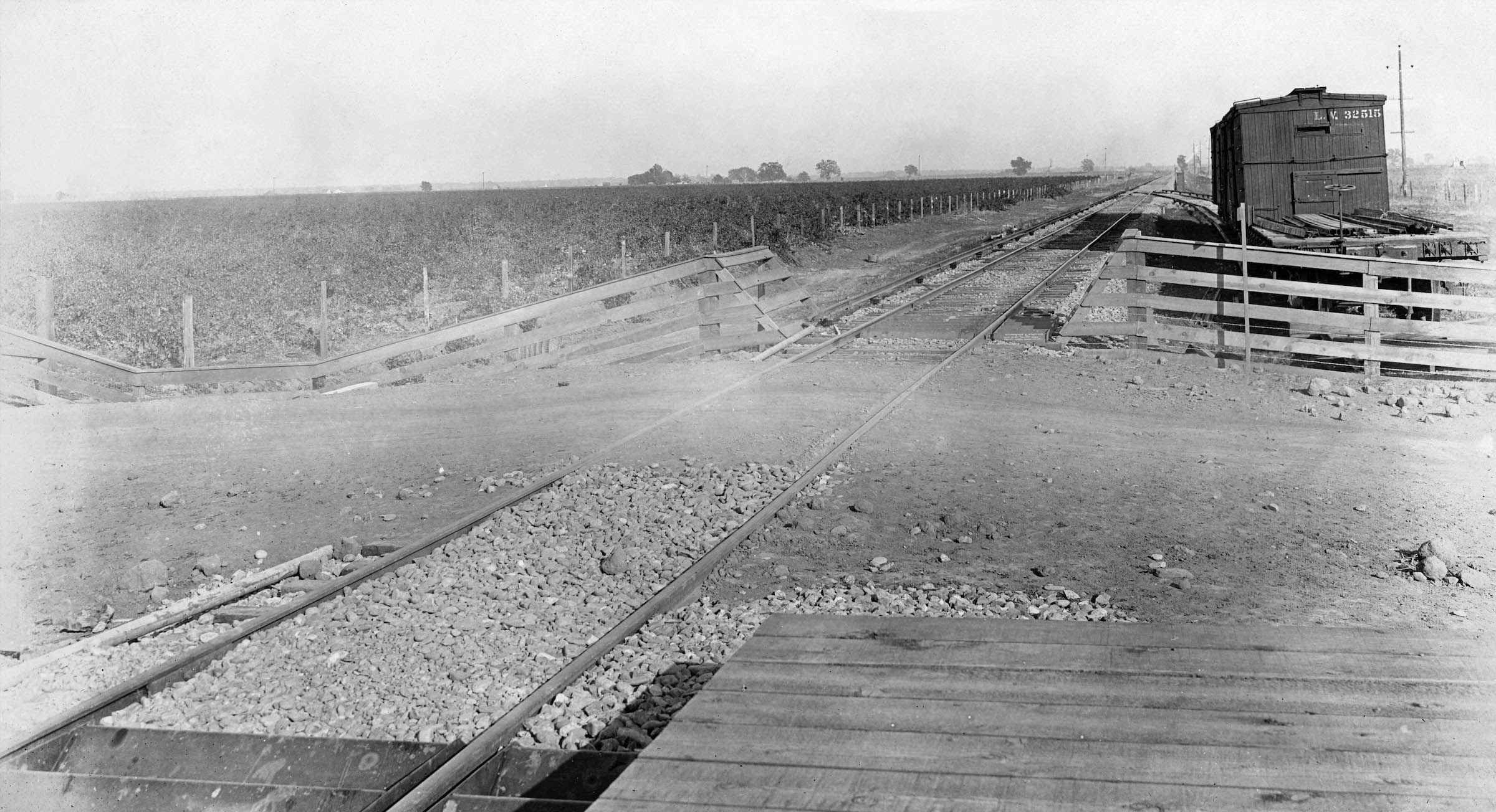
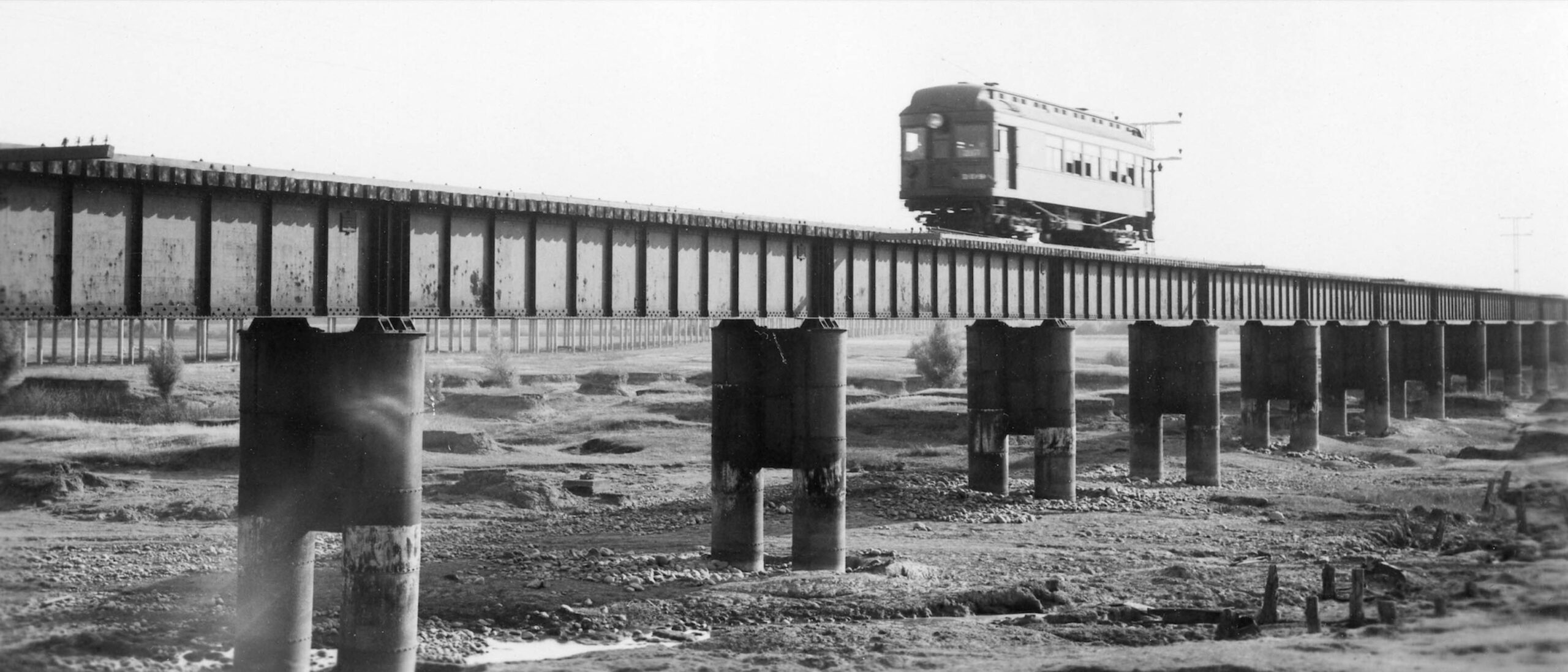
Train SN 109 passes over the eastern portion of the overpass, constructed of steel and cement. The electrical tower position relative to the track marks this as a southwest view. In the background is the recently completed extension of Highway 20 over the slough to replace the Long Bridge, that structure residing to the north of the train overpass. Early photos sometimes called this portion Butte Slough Bridge.
L341-115-Courtesy BAERA, Western Railway Museum Archives, 209047sn, (Image 24 of 44)
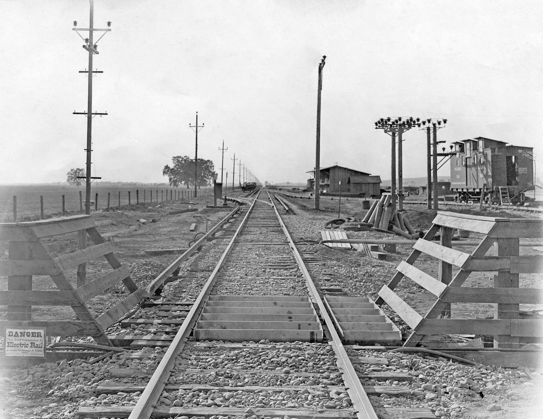
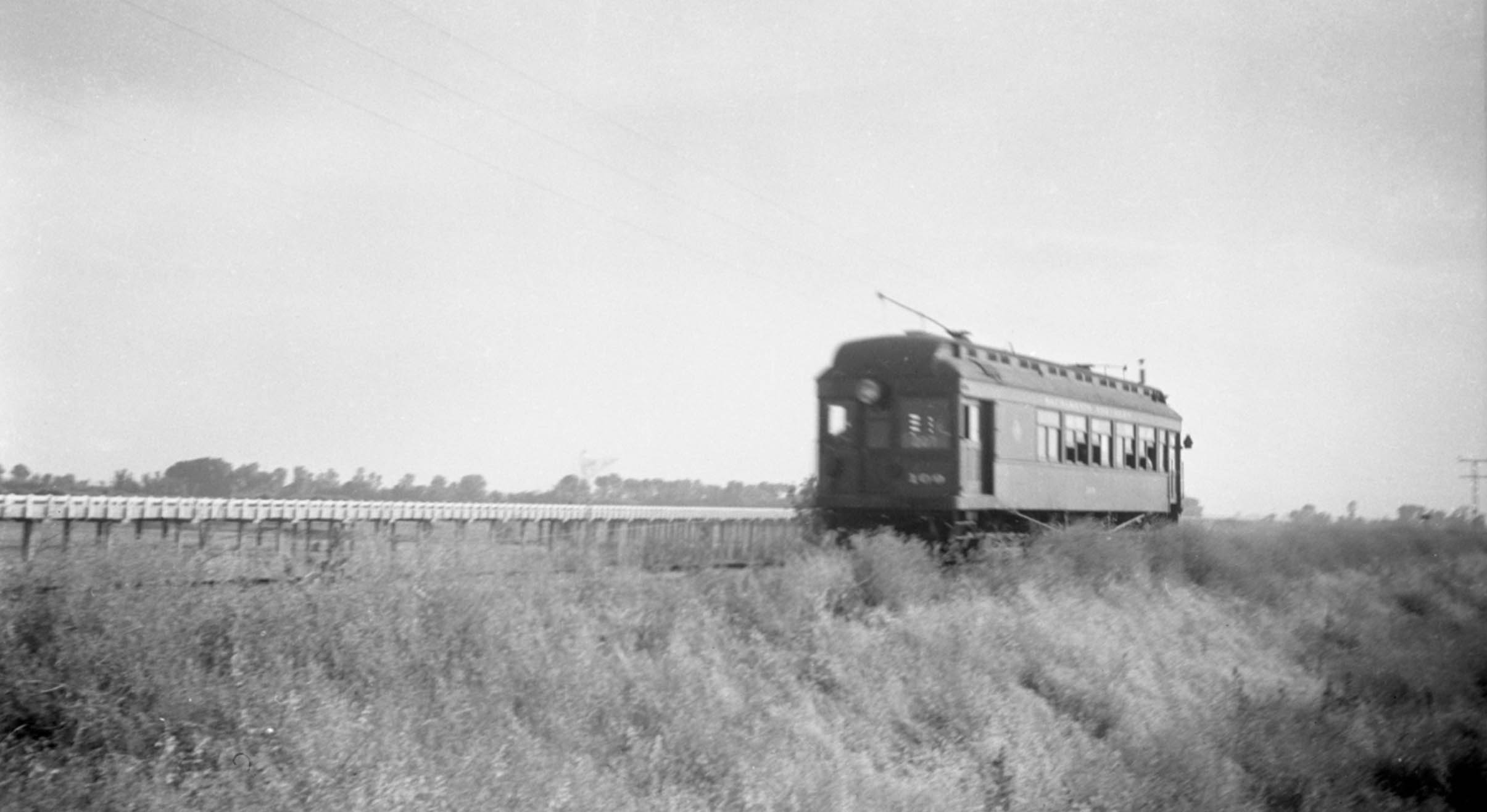
The western part of the overpass was made of wood for the most part. Here SN 109 is captured at top speed heading east in this southwest view from 1939 with the new Highway 20 crossing in the background. It has not been determined why the overpass was built with two materials, but a good guess was cost. This would prove to be a mistake as it was for the similar combination overpass between Alicia and Oliver, when part of this trestle was swept away in 1942. More about this in another update.
L341-120-Vernon Sappers Collection, Courtesy BAERA, Western Railway Museum Archives, 136871sn, (Image 25 of 44)
The wooden trestle had two steel-reinforced overpasses inserted over the two waterways of Butte Slough. NE 129, east view, ca. 1913.
L341-125-Western Pacific Photo, Harrison Coll., Courtesy BAERA, Western Railway Museum Archives, 204923sn, (Image 26 of 44)
This east view on the west side of the slough from the excursion train of June 16, 1940 is at Tarke prior to reaching the Tarke Bean warehouses at this section. The placard in the distance is impossible to decipher. The curve in the track and the presence of South Butte Rd. on the north side or left of the track confirm the location. Note the very tall electrical pole in the background-center. The folks who work at Tarke Bean in 2026 say the warehouse opened in 1925, and was purchased by the Rhodes Stockton Bean Co-op in 2013, but still called Tarke Bean at this location.
L341-130-Howard T. Wolfe Photo, Courtesy BAERA, Western Railway Museum Archives, 246452sn, (Image 27 of 44)
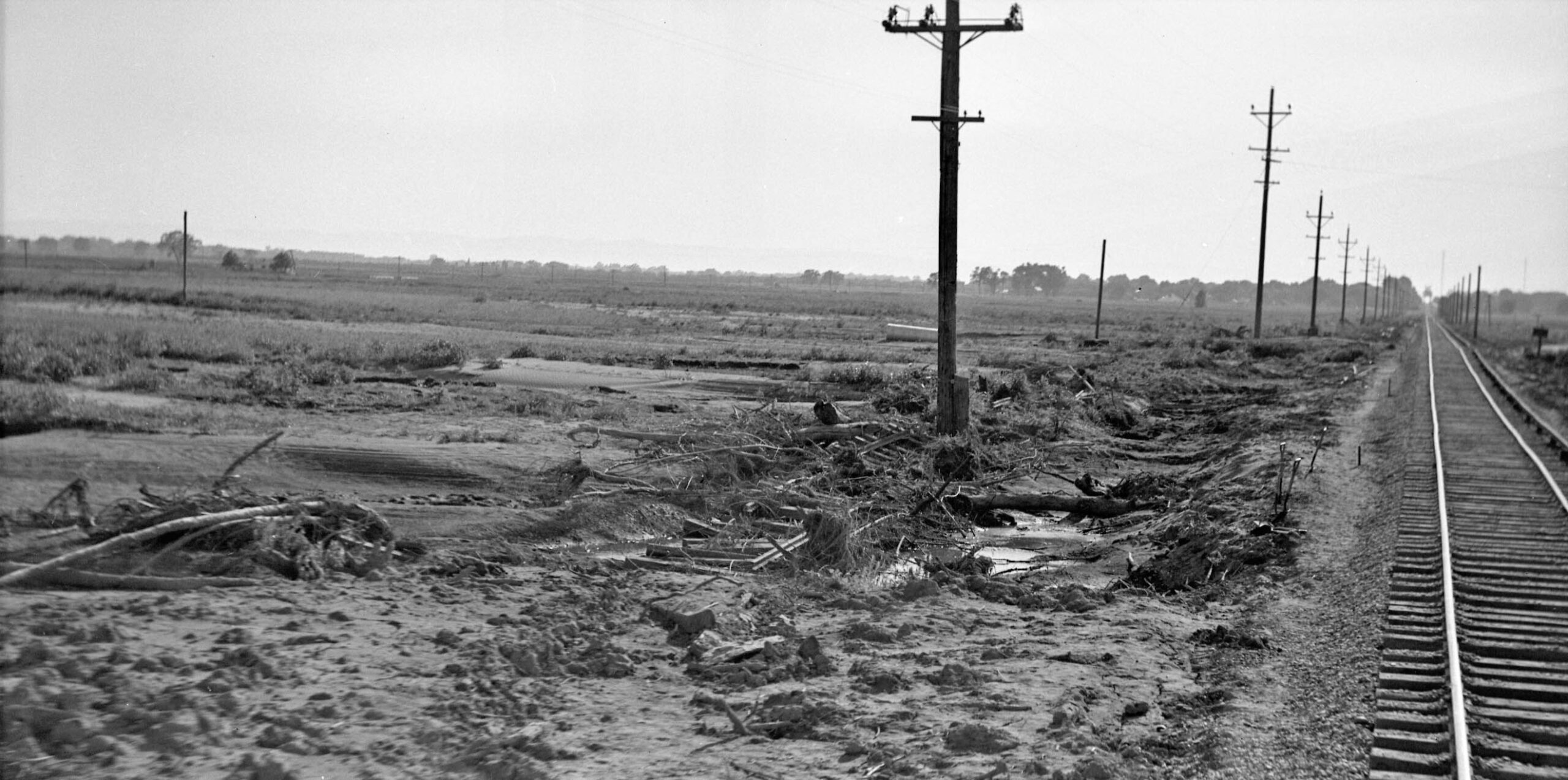
Howard Wolfe proceeded to construct overlapping east views for the entire line from Tarke all the way to Sycamore during the June 16, 1940 excursion. This first east view is east of Lira looking toward Tarke. The red arrow points to the very tall electrical pole seen in the last image. The fresh ballast in the foreground documents the repair work due to the flood of 1940 that wiped out Lira and Farmlan.
L341-135-Howard T. Wolfe Photo, Courtesy BAERA, Western Railway Museum Archives, 246453sn, (Image 28 of 44)
Further west with the Tarke warehouses still in view, this east view has gone past Lira, the red arrow marking the agricultural equipment seen in images shown earlier. In case you have forgotten those, go to the next panel with two views from Lira.
L341-140-Howard T. Wolfe Photo, Courtesy BAERA, Western Railway Museum Archives, 246459sn, (Image 29 of 44)
repeat of a west view from June 16, 1940 showing the Lira spur, the agricultural equipment, and the new ballast, left, and the aftermath of the flood 1940, right, an east view from Apr. 20, 1940, with Tarke in the distance.
L341-145-Dudley Thickens Photo, l, Unkown Author, r, Courtesy BAERA, Western Railway Museum Archives, 60203sn, l, 227236sn, r, (Image 30 of 44)
Further west, an east view from June 16, 1940 of the Farmlan or Beet Spur siding with boxcars along the south side of the track is seen. Note the continued presence of new ballast.
L341-150-Howard T. Wolfe Photo, Courtesy BAERA, Western Railway Museum Archives, 246460sn, (Image 31 of 44)
Further west, another east view from June 16, 1940 showing signs of the flood earlier that year, with the the Farmlan or Beet Spur in the distance marked by the boxcars along its length.
L341-155-Howard T. Wolfe Photo, Courtesy BAERA, Western Railway Museum Archives, 246461sn, (Image 32 of 44)
Howard Wolfe turned his camera around to get this west view still in the Farmlan-Beet Spur area showing more fresh ballast, a series of bare poles along the north side of the track, and the Meridian Bridge and electrical towers coming into view. The function of the poles is not known, and their timing is not known relative to the flood repair. A series of poles like this were in position across from the East Gridley substation. To see that arrangement, click here, and go to image 26 of the update.
L341-160-Howard T. Wolfe Photo, Courtesy BAERA, Western Railway Museum Archives, 246472sn, (Image 33 of 44)
On the subject of those bare poles, Wolfe did get a shot while passing through, again an east view from June 16, 1940. The repaired right-of-way here looks more like from a roller coaster ride than a interurban electric railway track
L341-165-Howard T. Wolfe Photo, Courtesy BAERA, Western Railway Museum Archives, 246462sn, (Image 34 of 44)
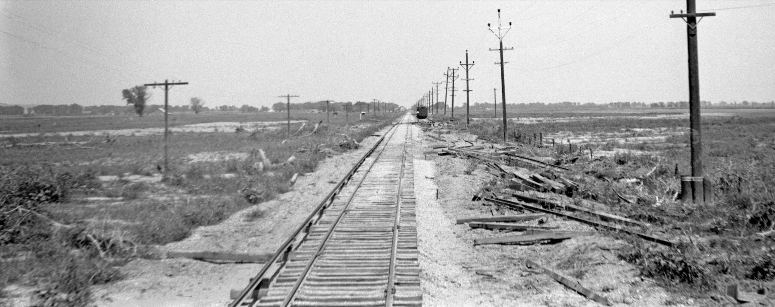
Further west and getting close to Meridian, another east view from June 16, 1940, now showing the poles in the distance. The placement of new ballast may be appreciated in the distance, a place where a small kink was placed in the right-of-way, function or timing relative to the flood repair unknown.
L341-170-Howard T. Wolfe Photo, Courtesy BAERA, Western Railway Museum Archives, 246463sn, (Image 35 of 44)
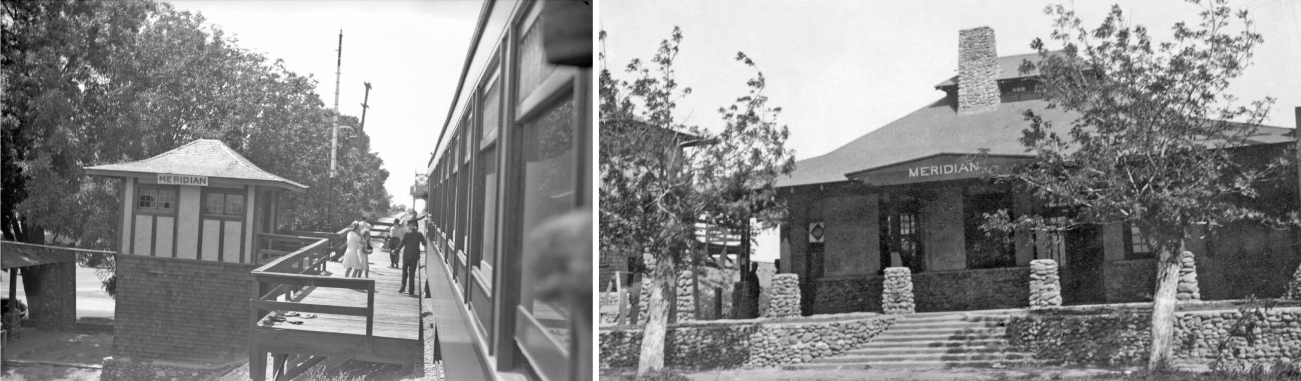
Approaching the Meridian station platform on June 16, 1940, left, the design of the elevator tower follows Northern Electric general manager A. D. Schindler’s rock pylon Craftsman design of the depot building seen in 1940, right. The broken windows in the tower reflect its neglect and placement out of service in 1936. The depot building was based on Schindler’s design of the Pacific Electric Railway’s Glendale, CA station. The building in Meridian is the only one of four built that survives into 2026. Meridian is covered in depth in another update, click here.
L341-175-Howard Wolfe Photo, l, Robert L. Stein Collection, r, Courtesy BAERA, Western Railway Museum, 246464sn, l, 103396sn, r, (Image 36 of 44)
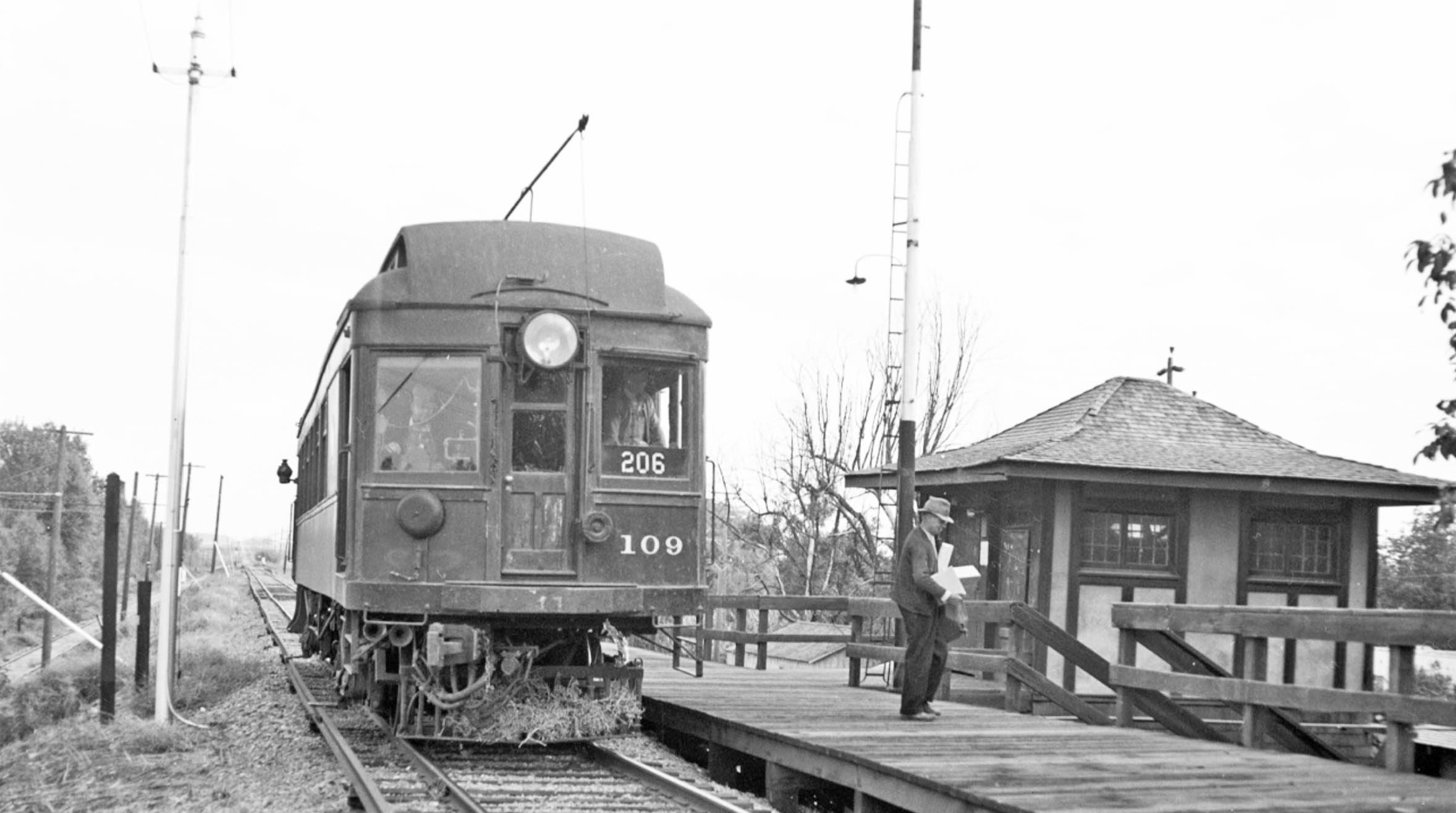
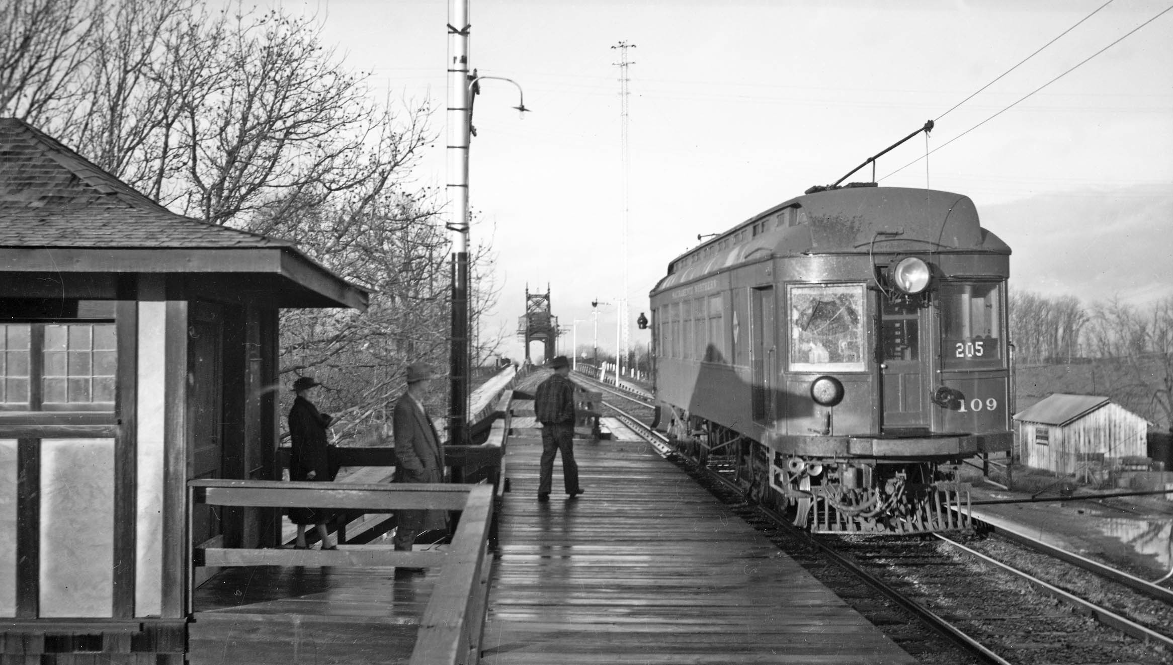
Meanwhile, SN 109 waits at the passenger platform in this east view from 1940 having discharged one passenger who is heading for the open-air stairway to the right or west of the tower.
L341-180-Silleman Bros. Photo, Courtesy BAERA, Western Railway Museum, 138457sn, (Image 37 of 44)
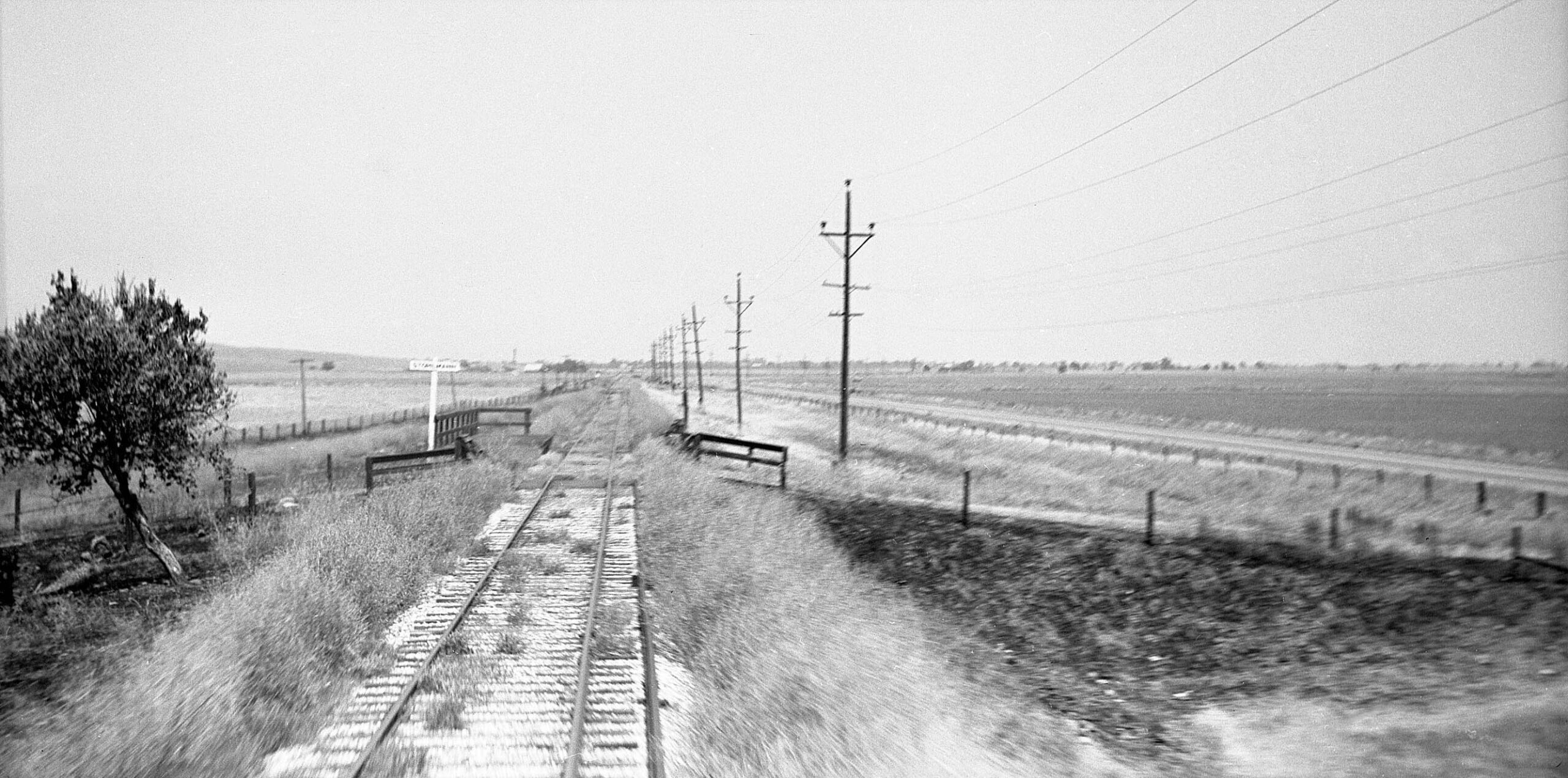
In this this west view taken on Jan. 2, 1940 on the passenger platform, SN 109 awaits three passengers to board. The Meridan Bridge is just ahead to bring this ride across the Sacramento River and into Colusa County. The bridge was completed before the 1913 opening of the branch line, a collaboration of the NE, Colusa and Sutter Counties. For more on the workings of the bridge, click here.
L341-185-George Henderson Photo, Wurm Coll., Courtesy BAERA, Western Railway Museum Archives, 240510sn, (Image 38 of 44)
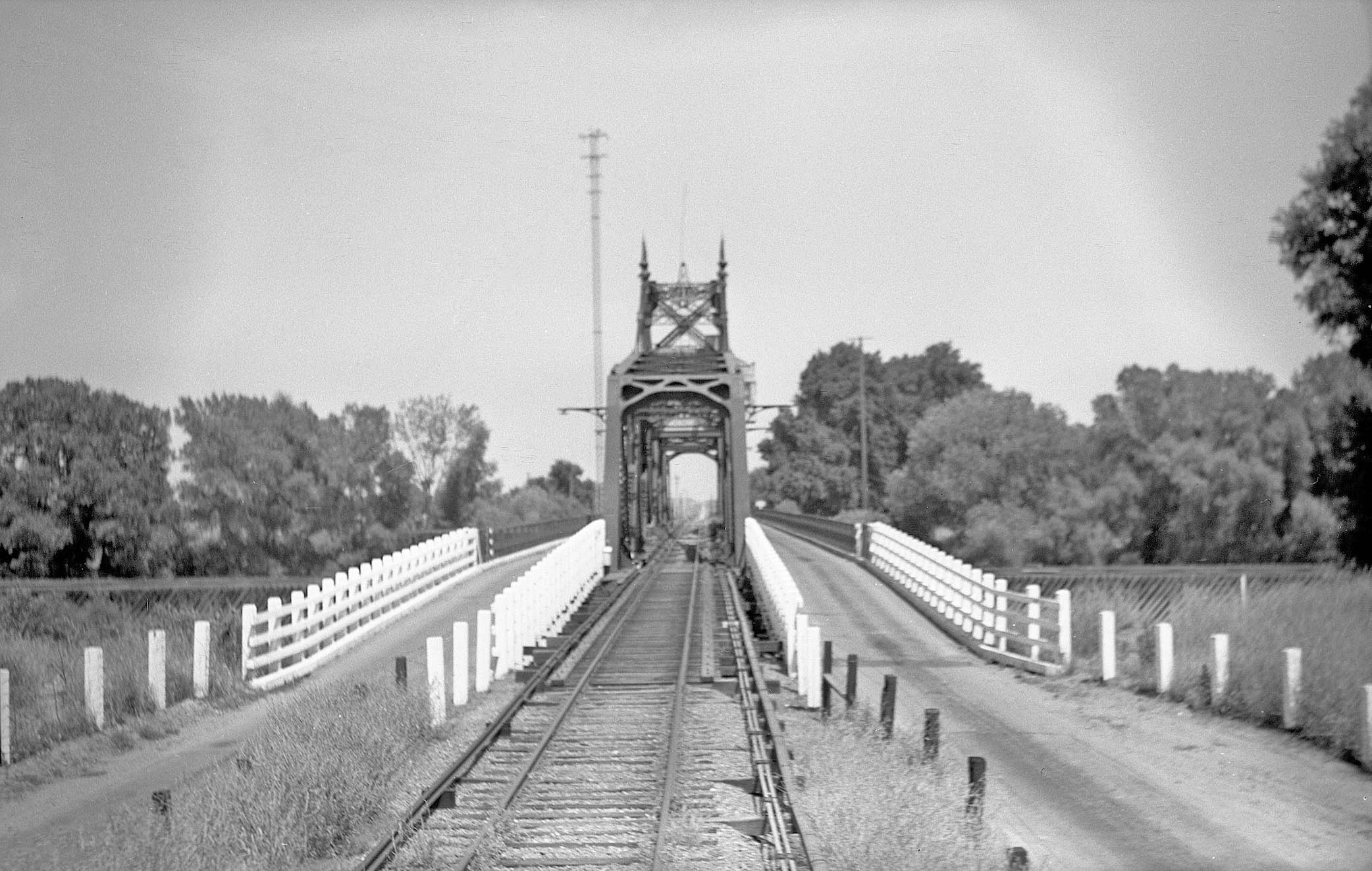
The excursion train of 1940 has made it across the bridge allowing for this east view of the bridge and the tall electrical tower sitting to the north on the Meridian side.
L341-190-Howard T. Wolfe Photo, Courtesy BAERA, Western Railway Museum Archives, 246465sn, (Image 39 of 44)
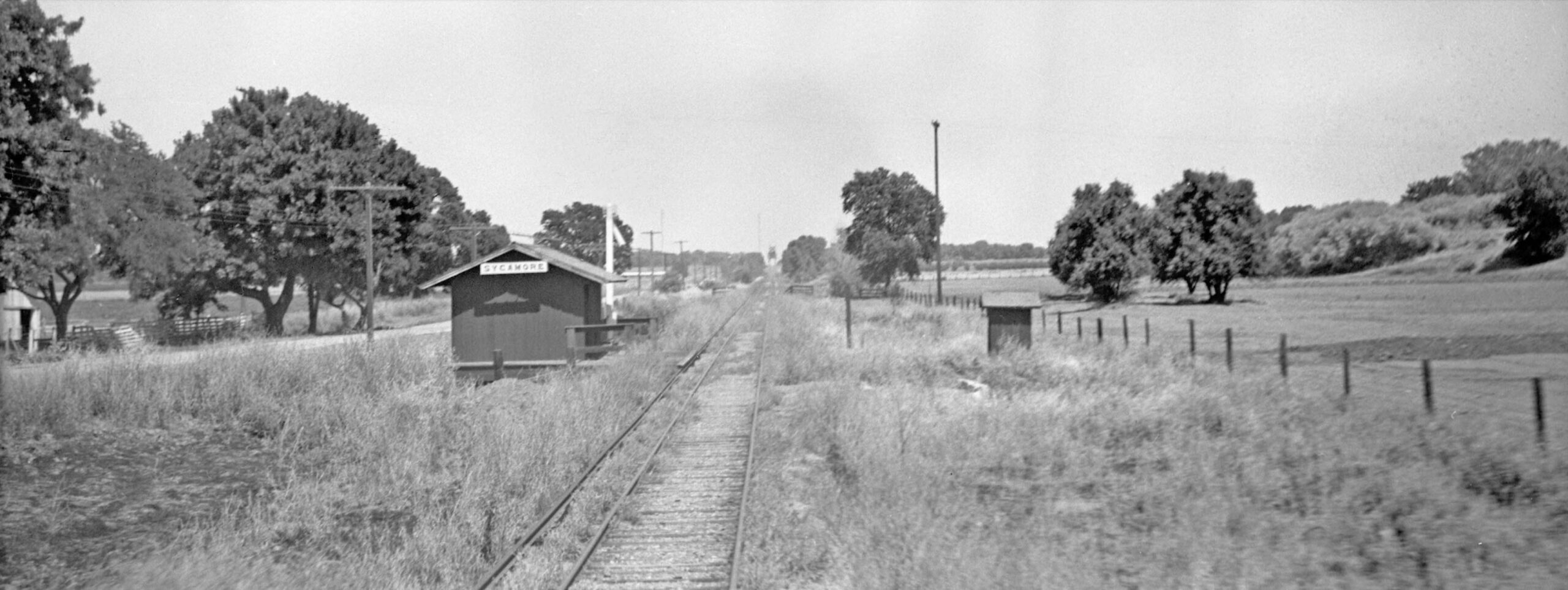
Possibly the most important photo taken by Howard Wolfe on the 1940 excursion was this east view of the station shelter at Sycamore. This is the only image found between the Meridian Bridge and the Colusa city limit. In addition, “Sutter-type” electrical transmission poles are no where to be seen, but the view of the bridge and the shelter define the area. This eliminates a way to identify any other possible images of the SN in Colusa County east of the City of Colusa once the railway turned north to eliminate the view of the bridge. Wolfe did not take any other overlapping images on his trip to Colusa.
L341-195-Howard T. Wolfe Photo, Courtesy BAERA, Western Railway Museum Archives, 246465sn, (Image 40 of 44)
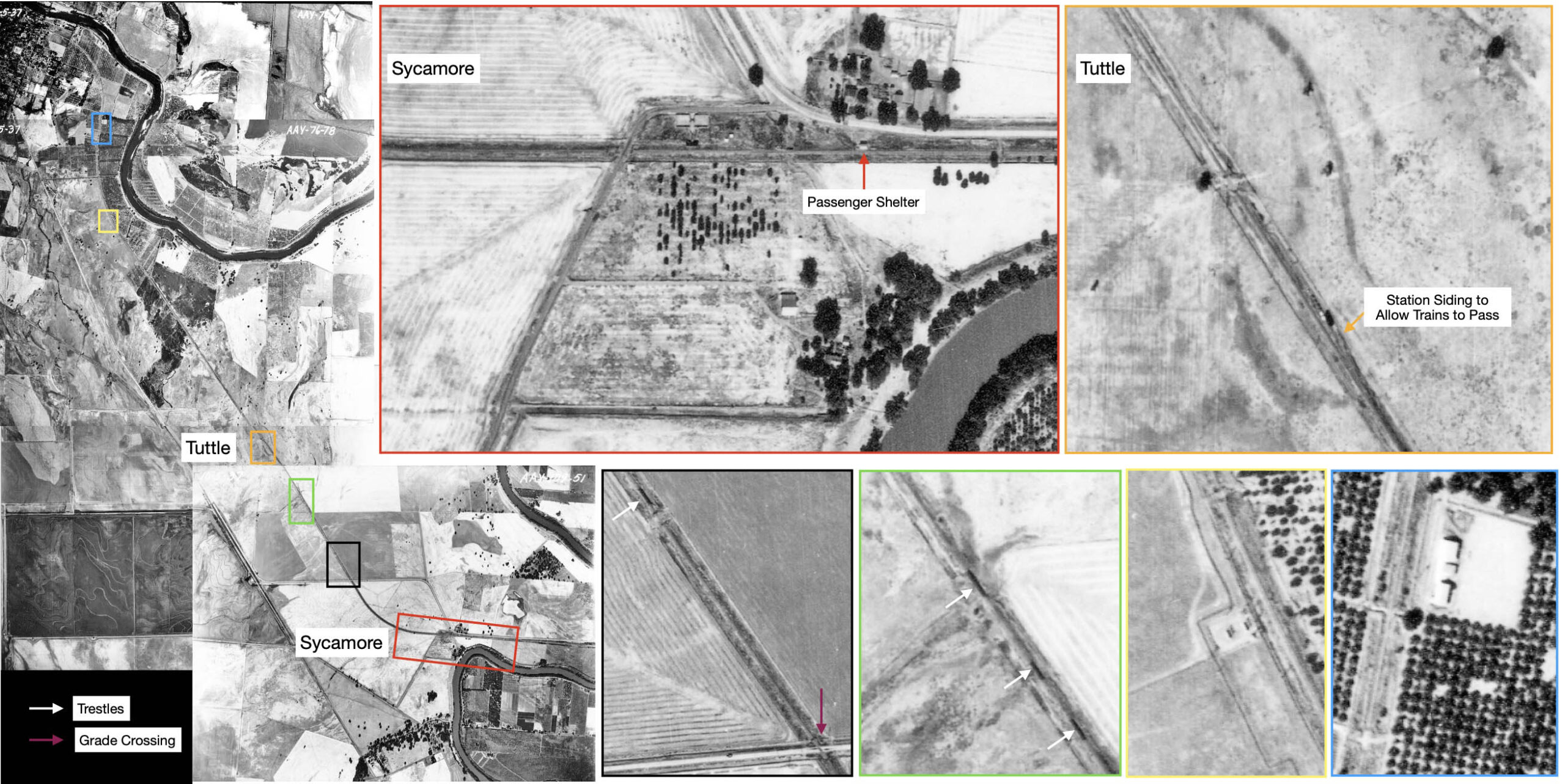
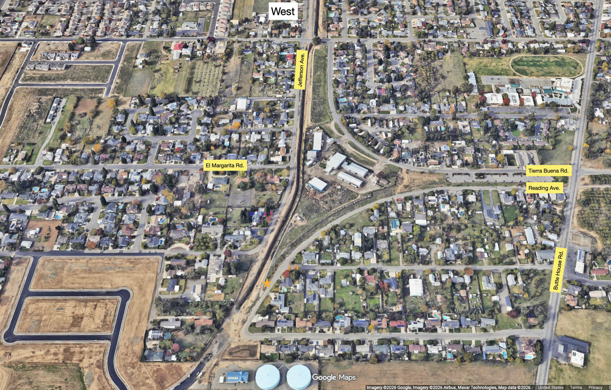
To help locate images from ca. 1940 in Colusa County, this collage of aerials from 1937 on the left was constructed to show the entire branch line from the Sycamore area, red box, to Colusa. Structural features are color coordinated to allow identification. The single grade crossing, purple arrow, would be Steidlmayer Rd. in 2026. A possible siding at Tuttle had been designated as the place for trains heading in opposite directions to pass twice a day when ten trains a day ran in 1929, but unnecessary when only six trains a day ran in 1939. The placement of a siding for Sycamore was not obvious.
L341-200-USDA Aerial AAY-109-50, -51, and AAY-76-76, -78, -79, Courtesy Map Collection, Shields Library, University of California, Davis, G4363 C5A4 1937 U6, (Image 41 of 44)
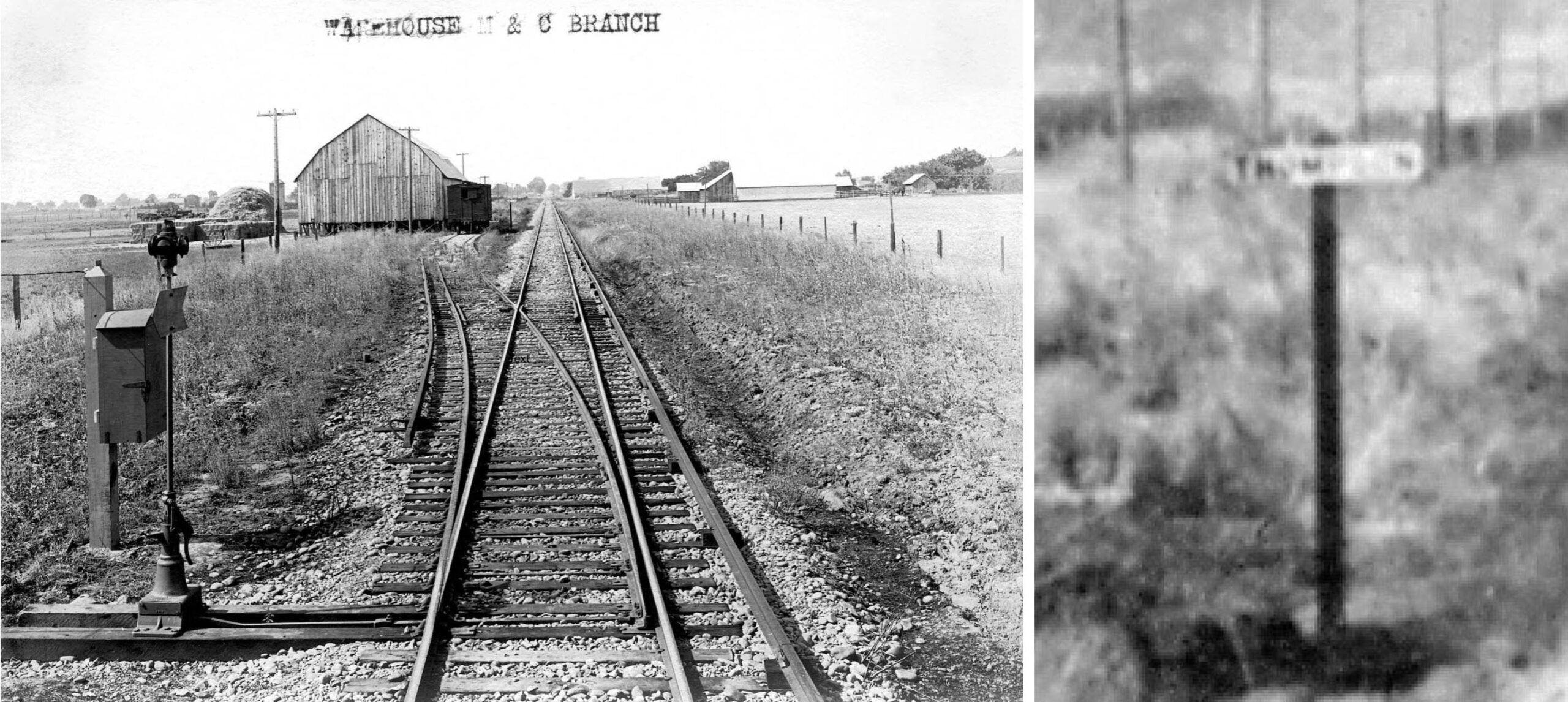
The ca. 1913 image on the left was found from the set from American Photo Co. survey of the Marysville and Colusa Railway. It shows a short siding to a warehouse with the name “Thompson” on the placard, magnified on the right. There are no “Sutter-type” electrical poles, so it must be Colusa County based on the finding that all images from this photographer of Sutter County had those poles. The density of structures does match anything in the 1937 aerial collage of Colusa County.
L341-205-American Photo Co. Photo, Courtesy BAERA, Western Railway Museum Archives, 259537sn, (Image 42 of 44)
The 1914 employee timetable only shows two spurs between Meridian and Colusa. There is no record found as yet of a passenger or freight stop called Thompson. The placard may refer to viticulturist William Thompson, who introduced the Sultana grape in the US ca. 1875, since popularized as the Thompson Seedless Grape. California State Parks has placed a historic landmark in Sutter County just west of Sutter at 9001 Colusa Hwy, State Hwy 20 (P.M. 7.7), 8 mi W. of Yuba City. For more, click here. More research needed here to connect this history with the previous image.
L341-210-Courtesy BAERA, Western Railway Museum Archives, (Image 43 of 44)
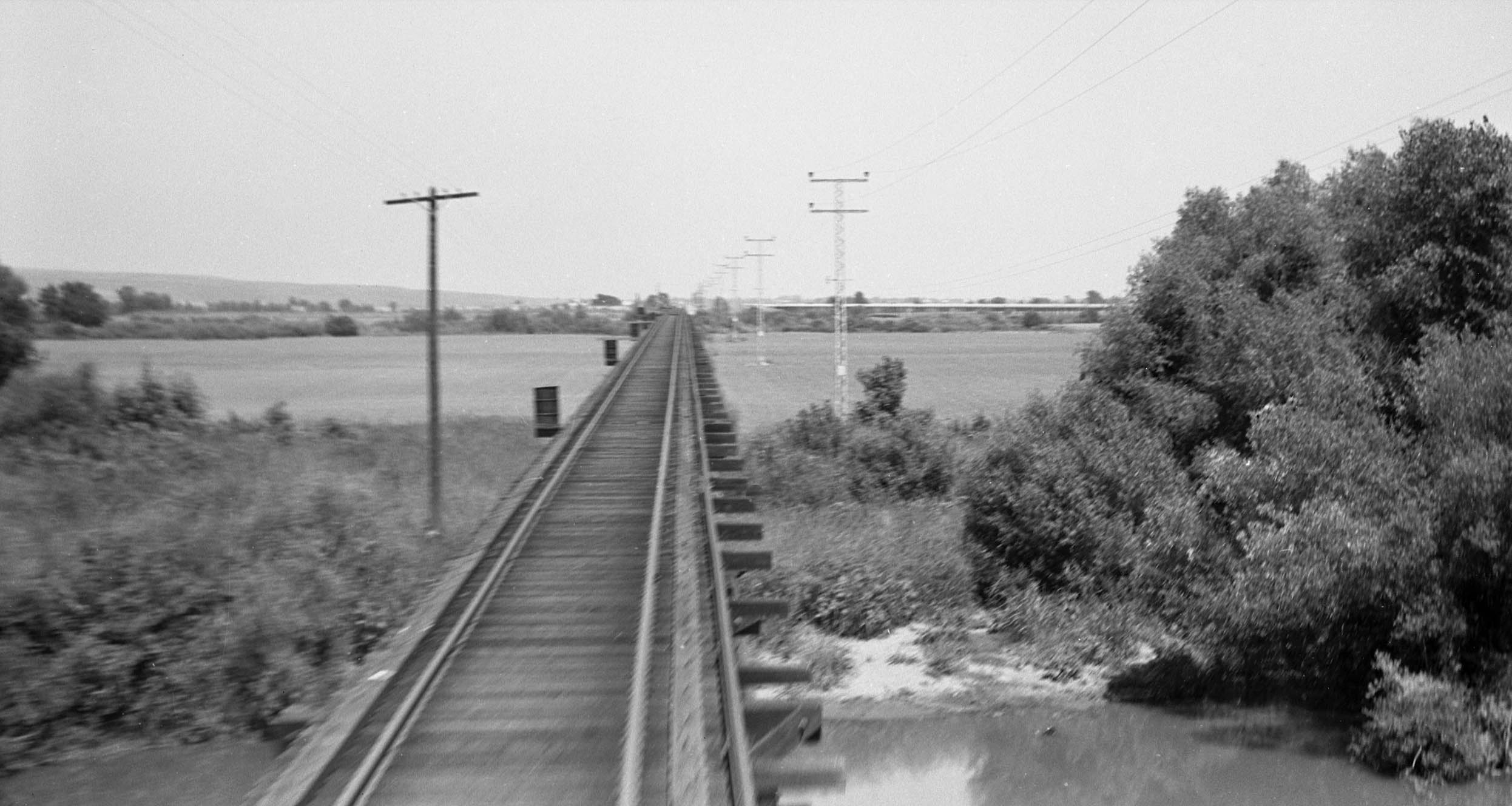
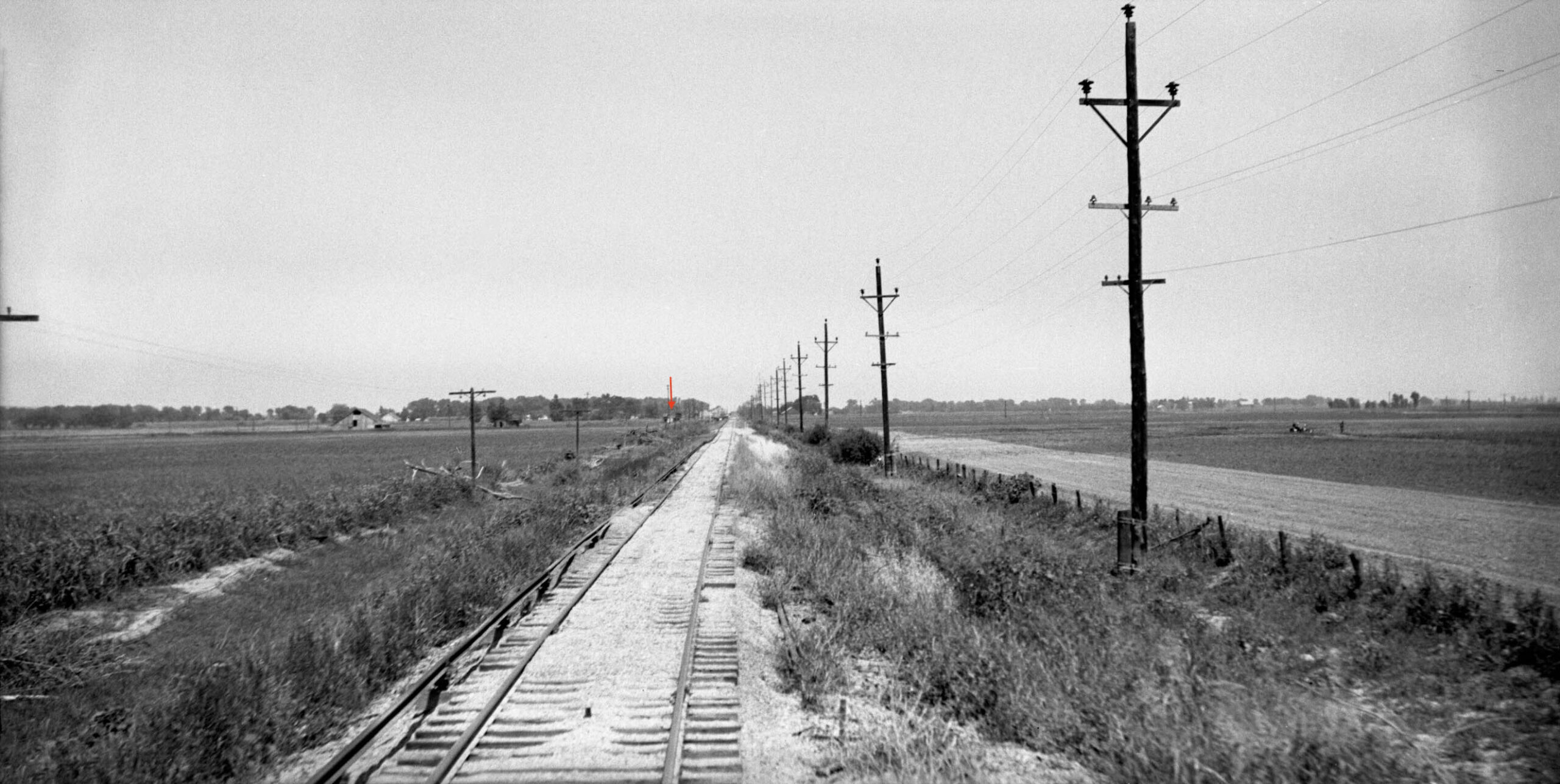
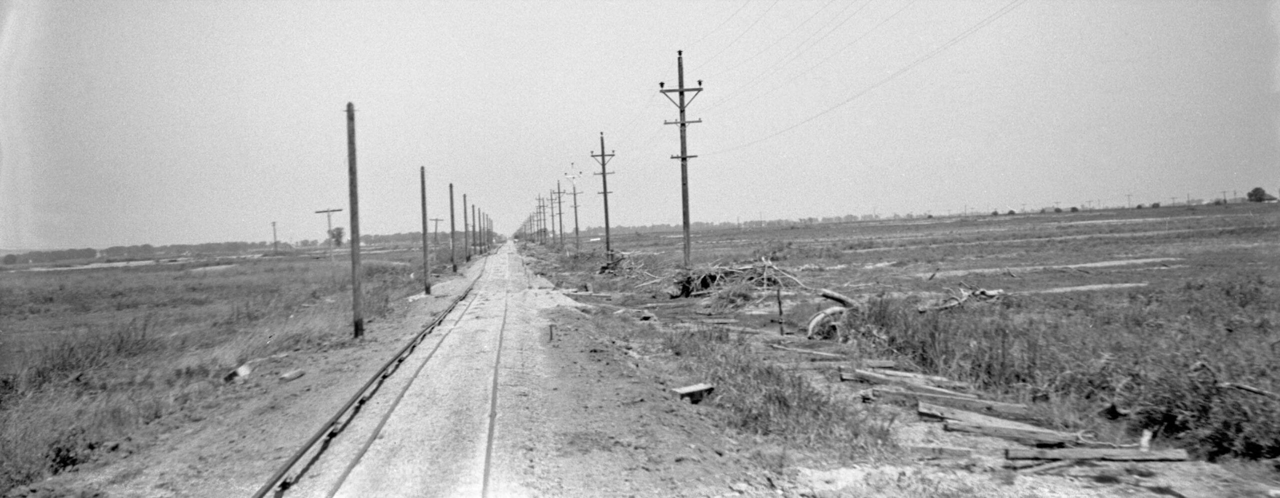
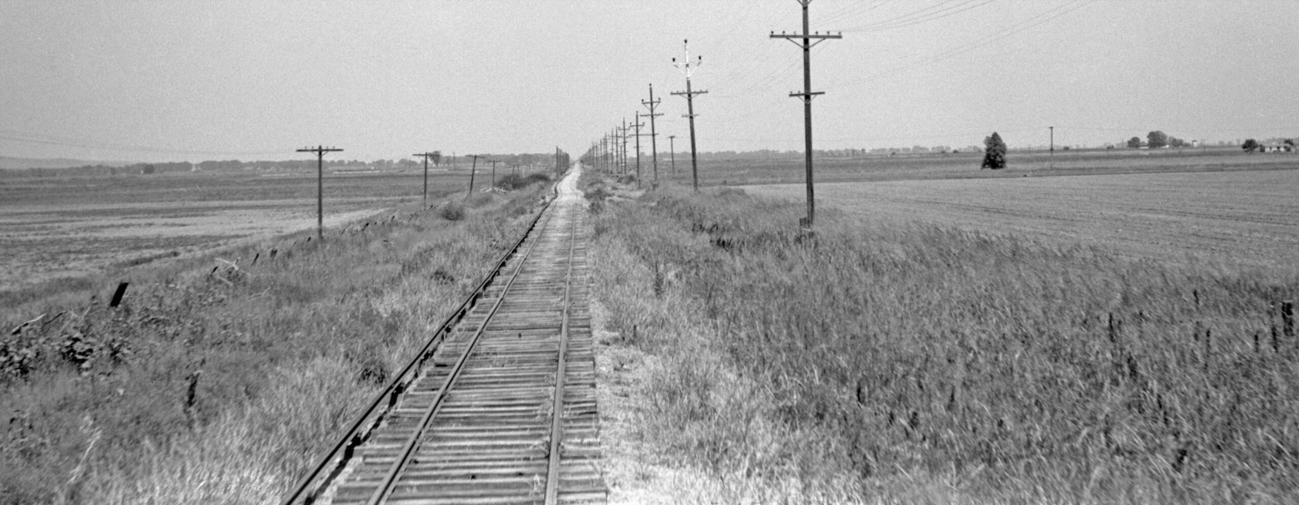
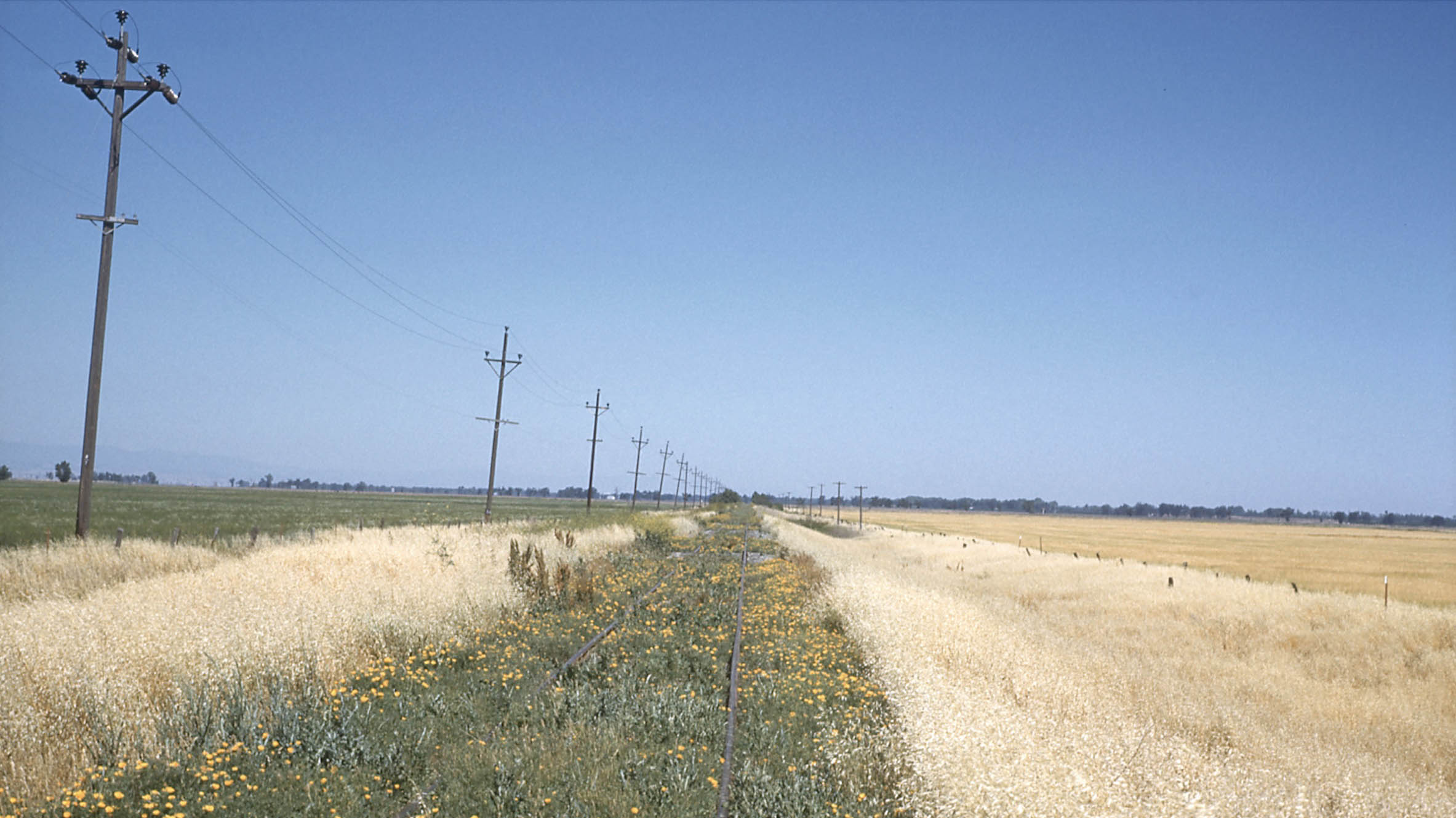
This update ends with an overgrown, but technically still freight-active Colusa Branch line somewhere west of Tarke taken on May 21, 1959. At least one excursion train would plow through this vegetation in Mar. 1960. There are a lot of other interesting things about this branch that make it a fun and learning experience if you are willing to walk the line. And beautiful views of the Sutter Buttes. That is up for next time.
L341-215-Ernest Haase Photo, Moreau Coll., Courtesy BAERA, Western Railway Museum Archives, 210172sn, (Image 44 of 44)