Constructing the West Lanes of the Frickstad Viaduct, 1950
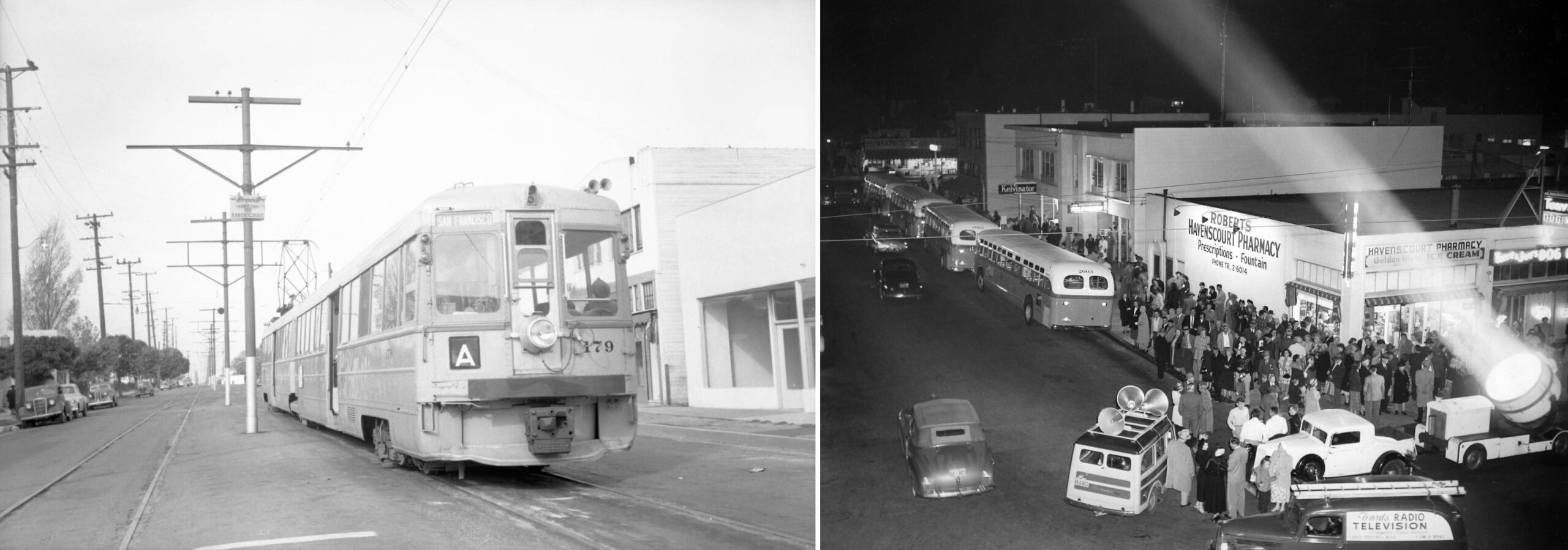
Key System articulated unit 179 sits at Beck St. west of Havenscourt Blvd. at the terminus of the interurban A line on Oct. 28, 1950, left. The view looks west at the rear of the train headed toward San Francisco via the 12th St. dam on the last day of operation to this location. The following day, the trains will terminate west of Oak St. on 12th St. allowing the next phase of the construction of the Frickstad Viaduct to continue. On the right, the next day in the wee hours of the night, the replacement K line bus replacements line up to take over.
L331-05-Fred Matthews Photo, Moreau Collection, Courtesy BAERA, WEstern Railway Museum Archives, 91894ks, l, AC Transit Photo, Courtesy John Harder, (Image 1 of 30)

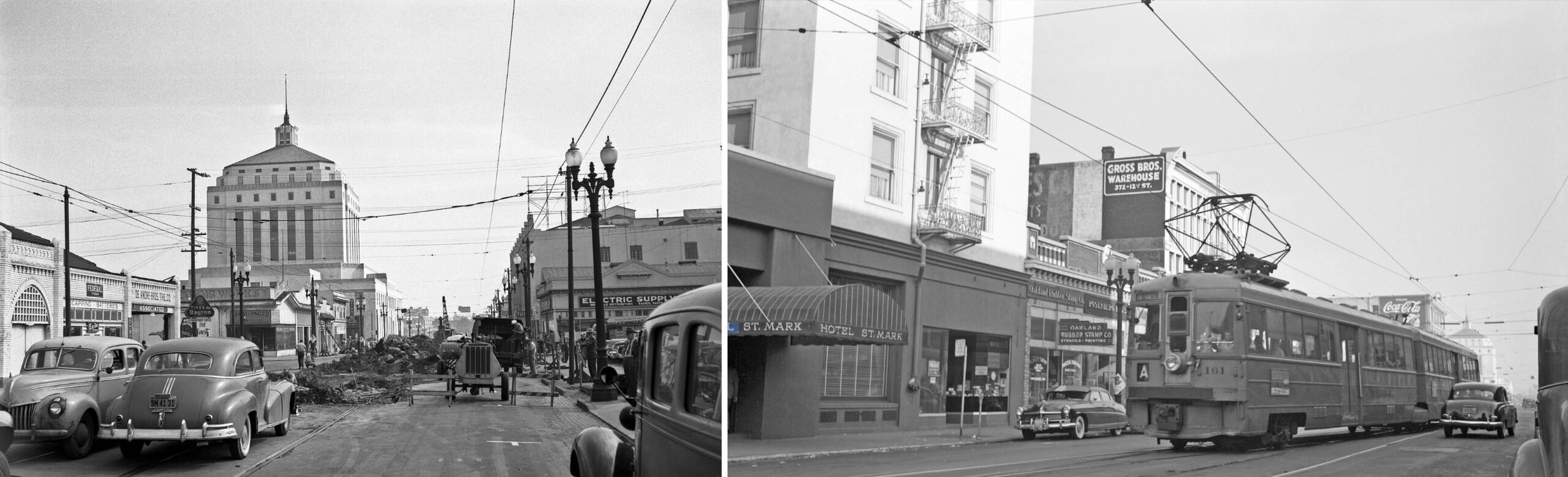
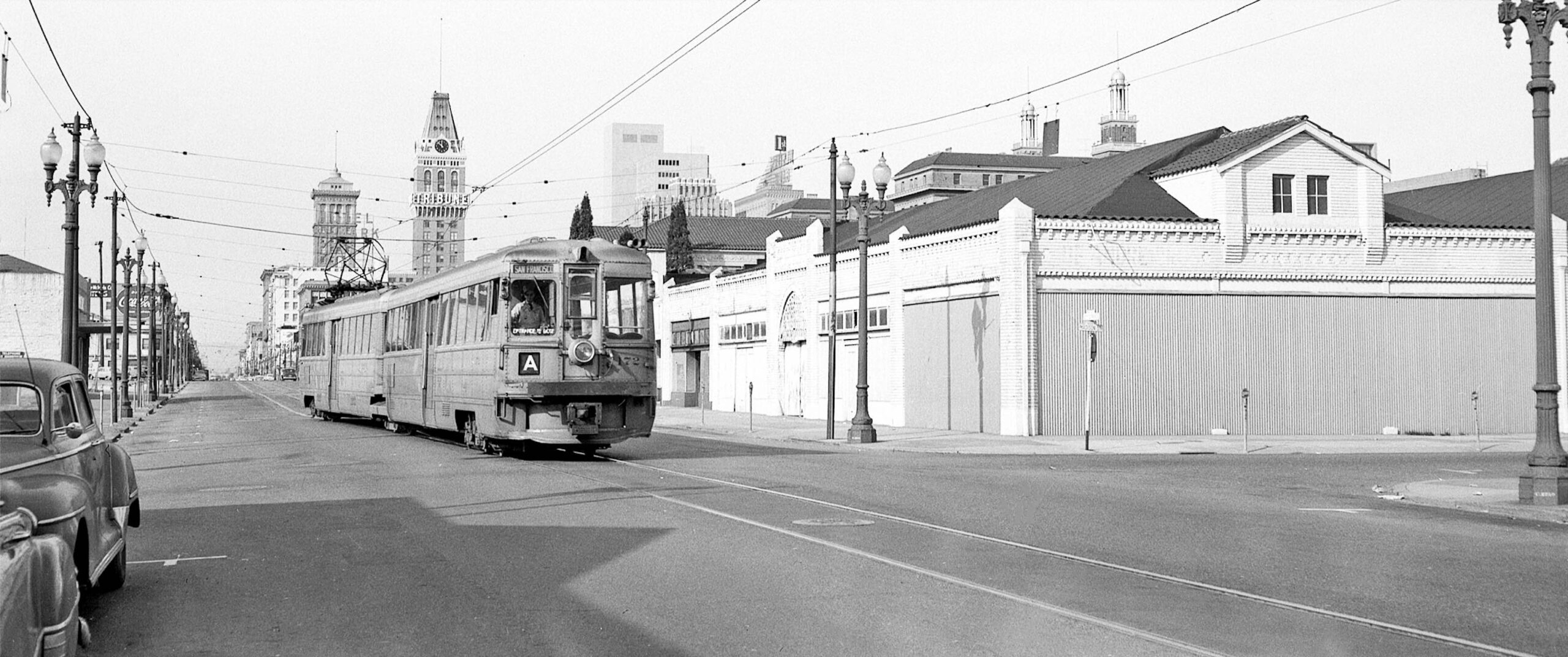
Key A line train 161 sits by Hotel St. Mark at 12th St. and Franklin St. sometime later in 1950, right, while the tracks are being ripped out just west of Madison St. to create the new terminus at 12th St. just west of Oak St., left. The 1907 hotel is now an apartment building, and has an interesting history, click here. On the left, the 12th and Oak Building at 125 12th St., the three-story building, right edge, built in 1924, is noted in Sanborn maps to have fireproof construction. Except for these two buildings and the courthouse, nothing is left in 2025.
L331-10-John Harder Photos, Courtesy John Harder, (Image 2 of 30)
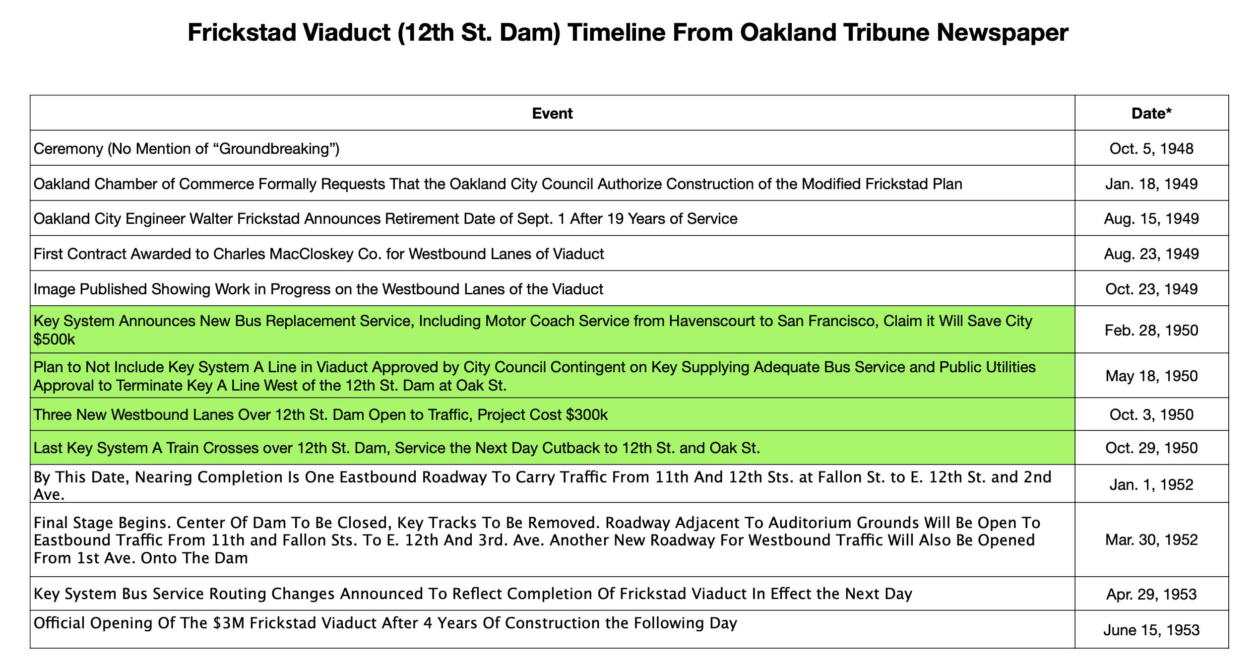
This update will review the construction of the westbound lanes of the Frickstad Viaduct in 1950 prior to the truncation of the Key A line.
L331-15-Table Constructed by Stuart Swiedler, (Image 3 of 30)
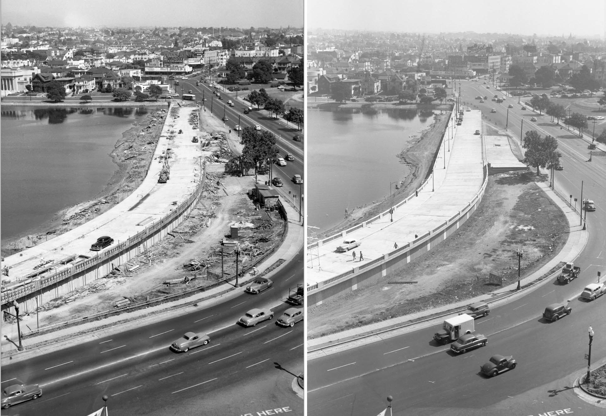
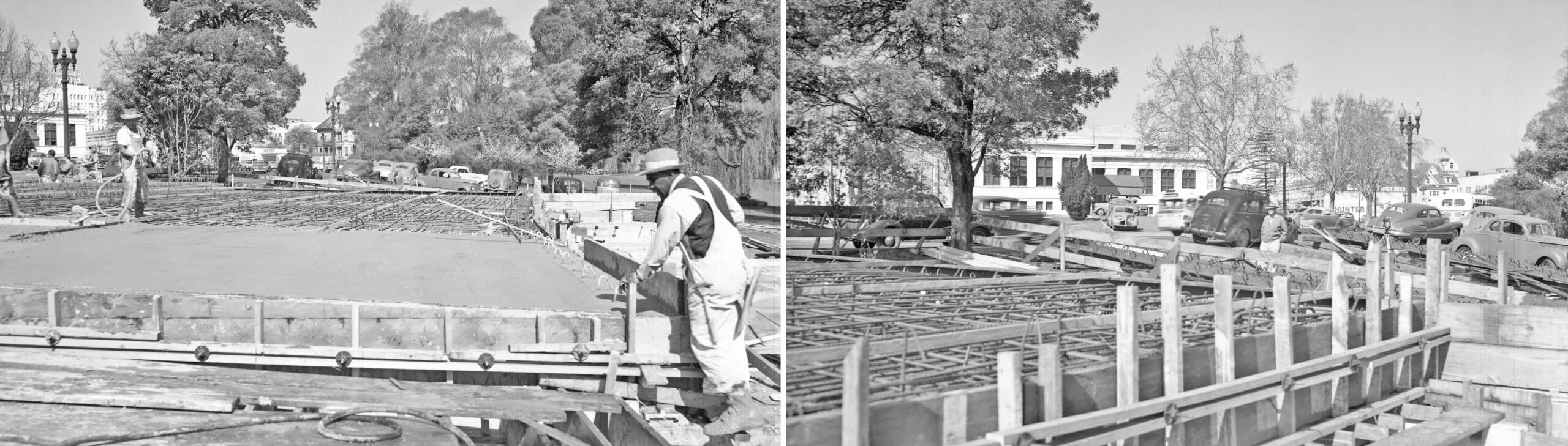
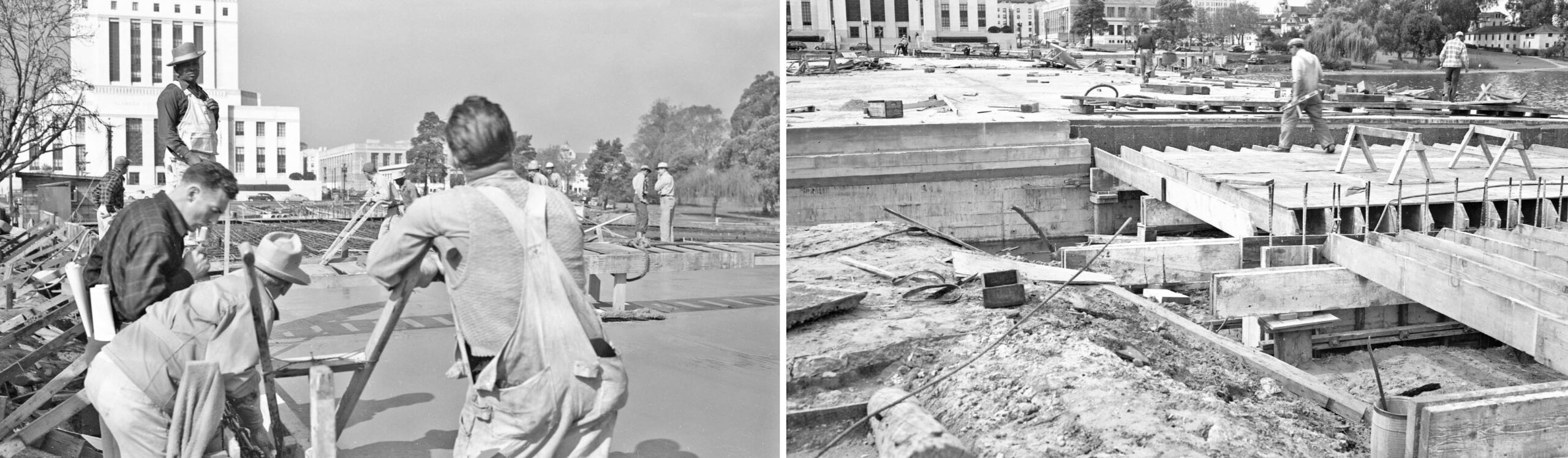
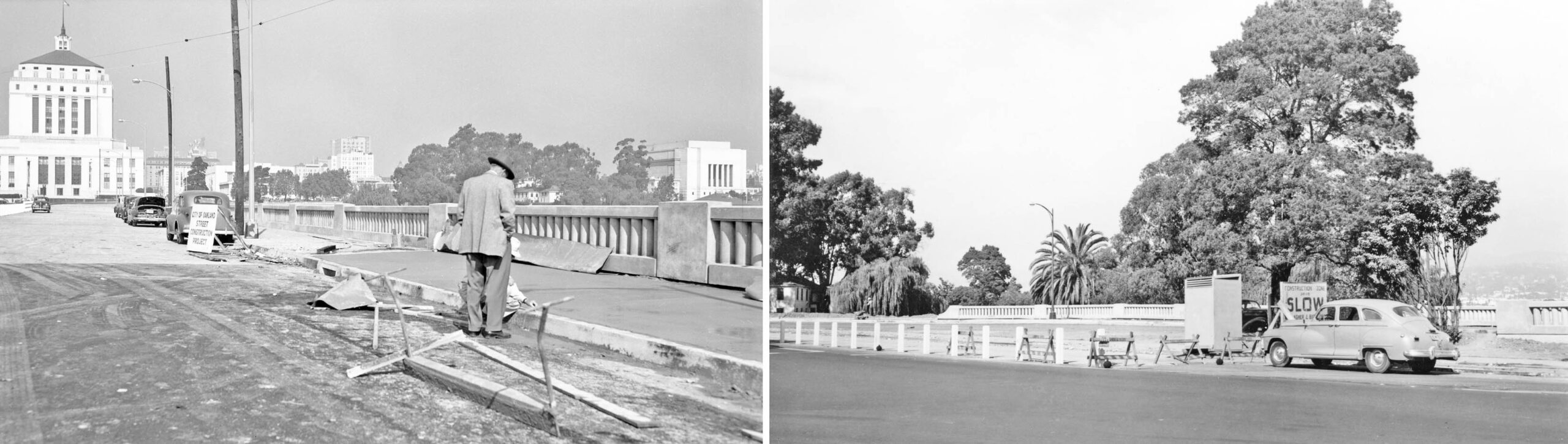
Two east views from the 8th floor of the Alameda County Courthouse of the westbound lanes nearing completion, left, and at completion, right. Note the gain in elevation as the structure reaches the curve at the western end.
L331-20-Oakland Public Works Photos, Courtesy BAERA, Western Railway Museum Archives, 235173ov, l, 235174ov, r, (Image 4 of 30)
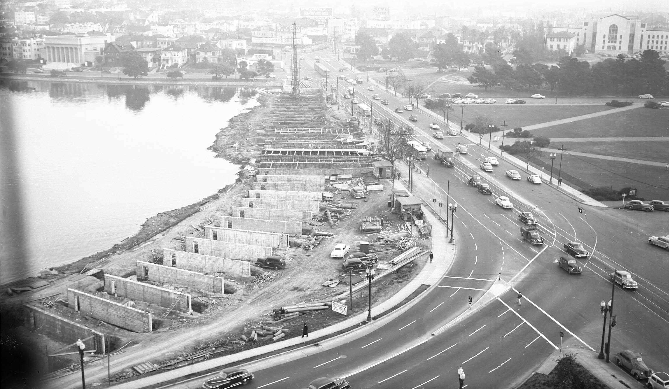
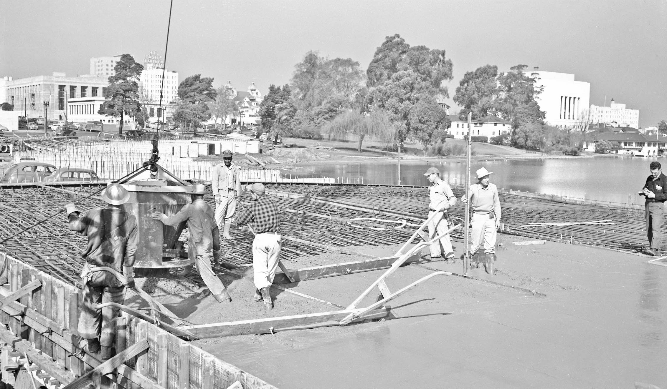
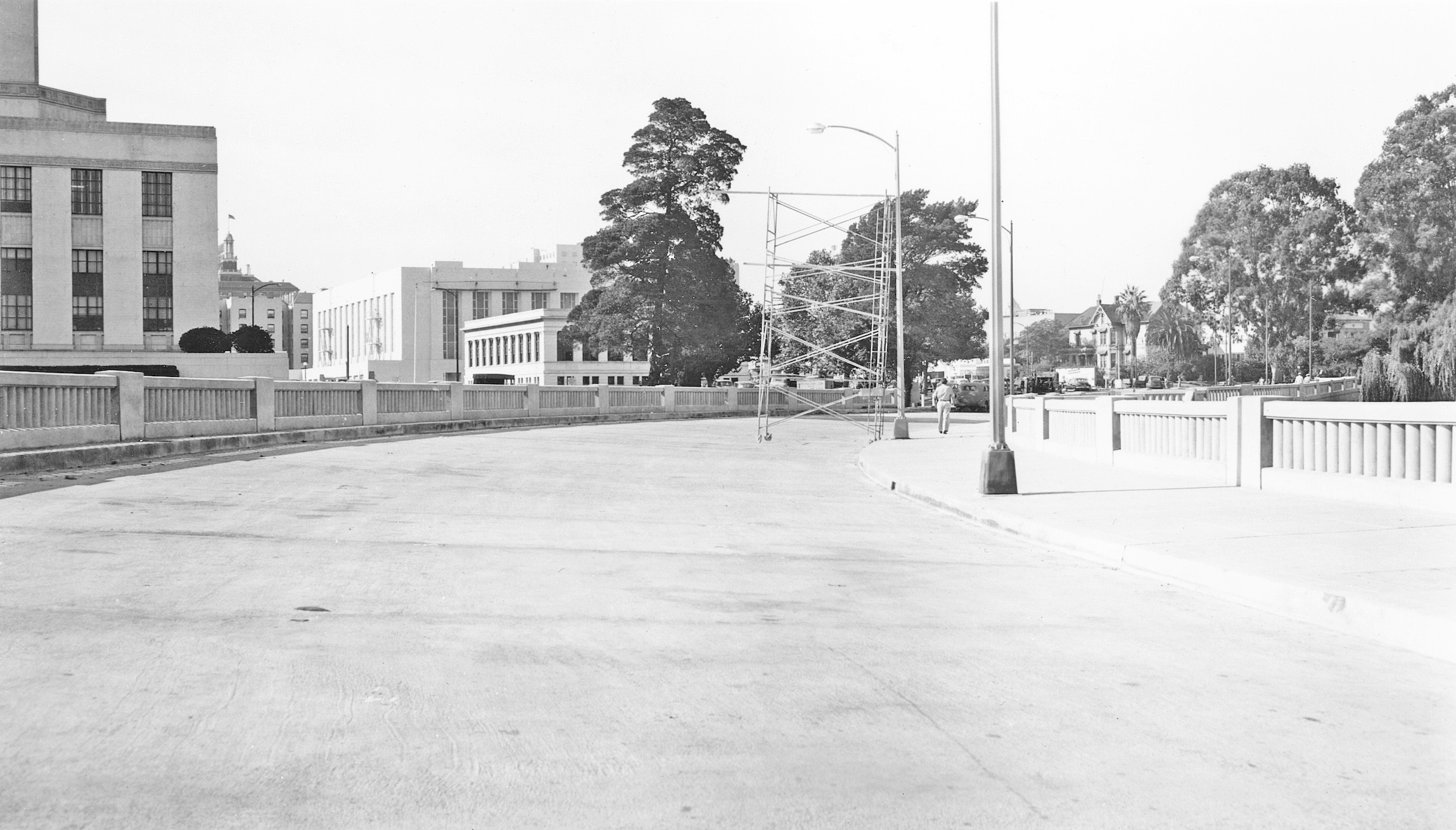
A similar east from the courthouse taken on Dec. 13, 1949 showing different stages of the framing and of the first set of supports for the new roadway.
L331-25-Oakland Public Works Photo, Courtesy BAERA, Western Railway Museum Archives, 235170ov, (Image 5 of 30)
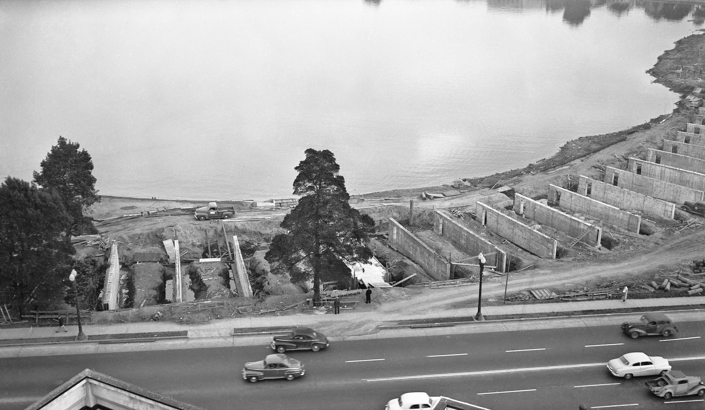
A north view also from Dec. 13, 1949 showing additional detail at the western end of the structure.
L331-30-Oakland Public Works Photos, Courtesy BAERA, Western Railway Museum Archives, 235171ov, (Image 6 of 30)
The remaining images in this update were taken either on Feb. 7, 1950, Mar. 30, 1950 or Apr. 27, 1950 based on the packet the negatives were placed. There is no way to be absolutely sure which date is the right one for each image. Here is shown the framing of the elevated curve toward the west end of the road viewed toward the east.
L331-35-Oakland Public Works Photo, Courtesy BAERA, Western Railway Museum Archives, 238397ov, (Image 7 of 30)
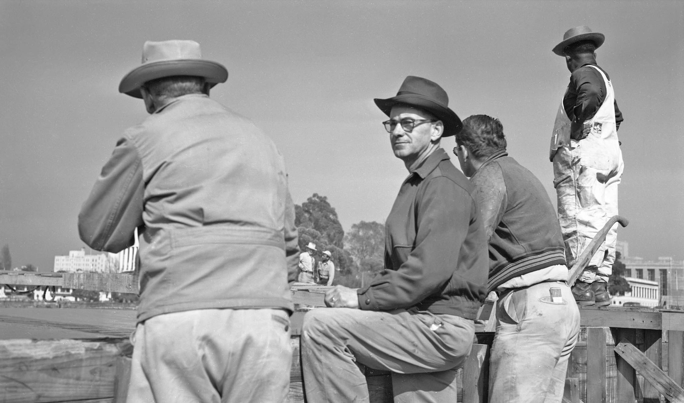
The photos taken also showed the workers involved in the process. It was quickly appreciated that these images could be arranged making a complete circumnavigation of the area showing details of the surrounding buildings as opposed to showing the sequential steps of construction.
L331-40-Oakland Public Works Photo, Courtesy BAERA, Western Railway Museum Archives, 238382ov, (Image 8 of 30)
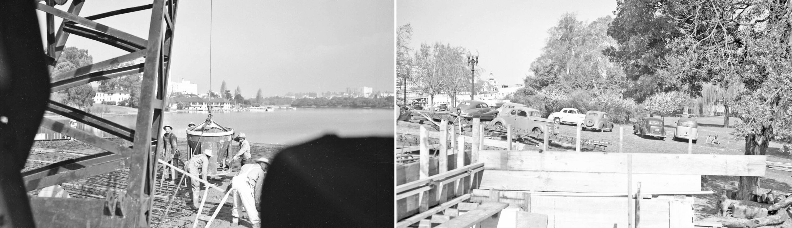
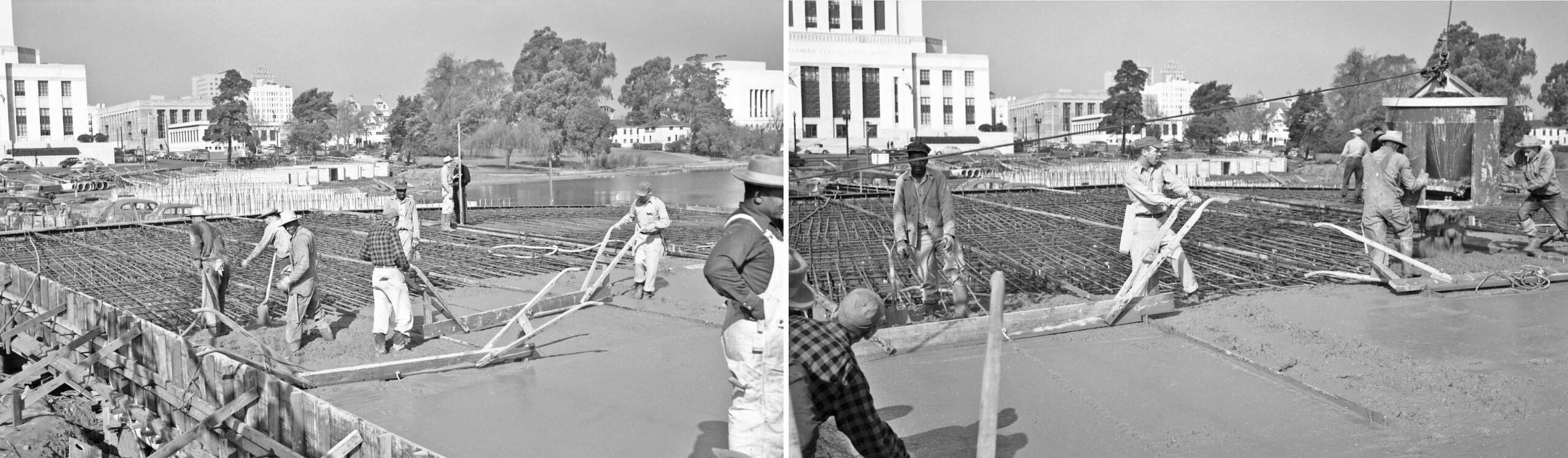
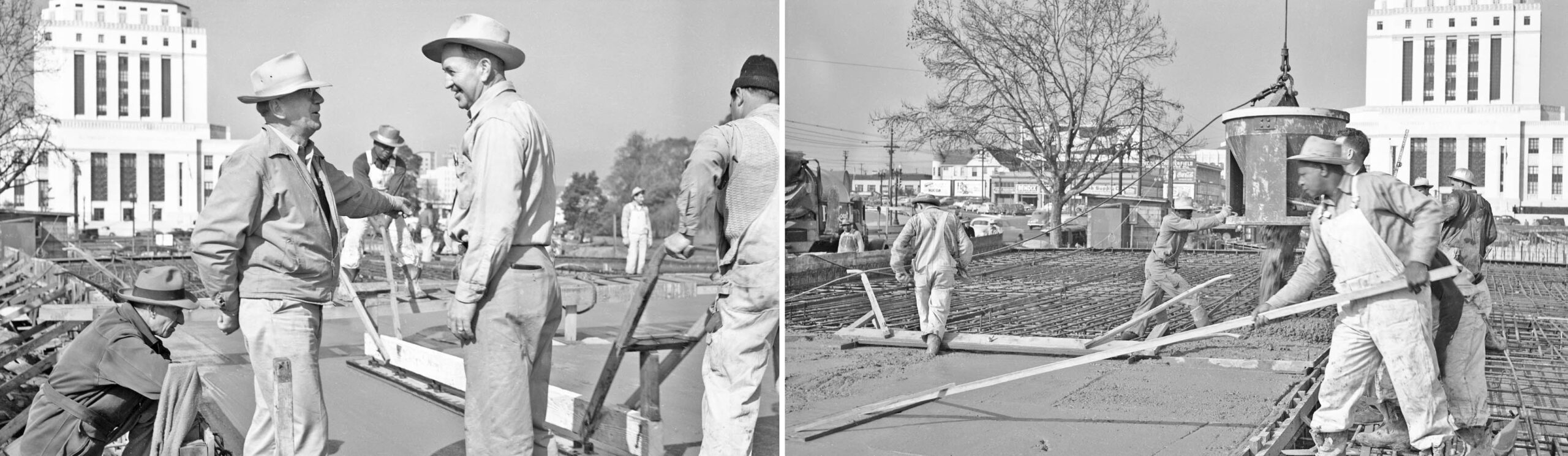
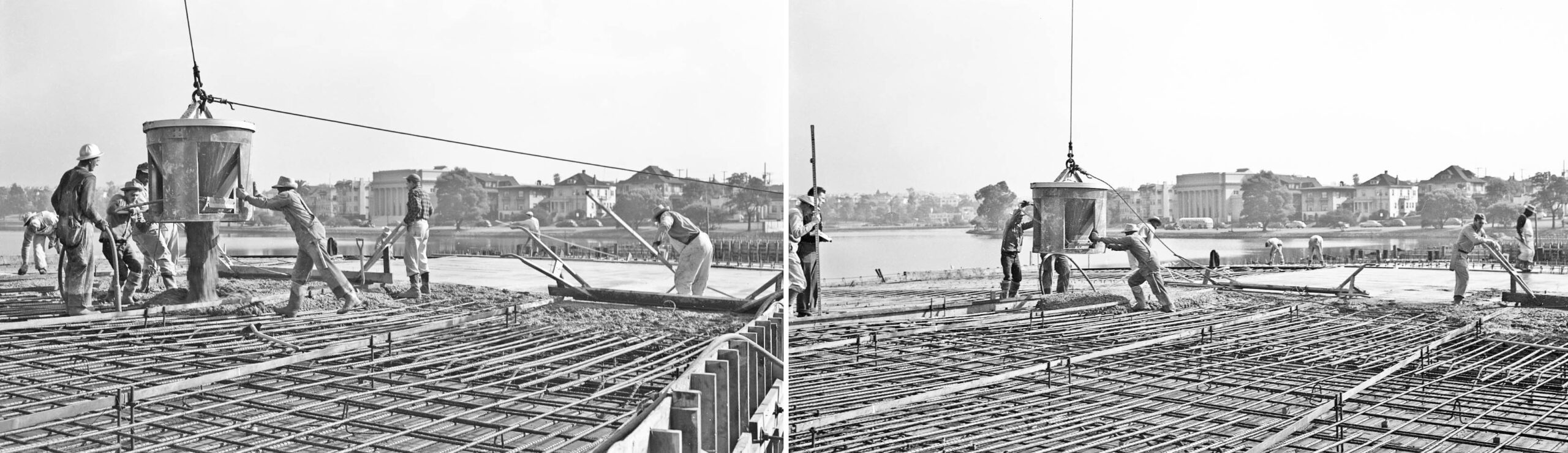
On the left, workers are in the process of adding concrete to the steel-reinforced surface of the roadway. In the background is the lake and the boathouse-pumping station and the rear of the Oakland Public Museum-Camron-Stanford Mansion going right to left toward the left edge, left. The same buildings are seen partially in the right panel, this scene showing an earlier stage as the framing is established.
L331-45-Oakland Public Works Photos, Courtesy BAERA, Western Railway Museum Archives, 238380ov, r, 238376ov, l, (Image 9 of 30)
Slightly turned more to the west, this scene of adding concrete to the steel-reinforced surface of the roadway provides better views of the boathouse-pumping station and rear of the Oakland Public Museum-Camron-Stanford Mansion, left. Turning more to the west, 14th St. comes into view, right.
L331-50-Oakland Public Works Photos, Courtesy BAERA, Western Railway Museum Archives, 238379ov, l, 238409ov, r, (Image 10 of 30)
Another scene of adding concrete to the steel-reinforced surface of the roadway, this northwest view also shows, starting at the left edge, the Oakland Public Library Main Branch, the Fire Alarm Building, the Hill Castle Apartments, the cupolas of the Islamic Cultural Center of Northern California, and the Scottish Rites Temple.
L331-55-Oakland Public Works Photo, Courtesy BAERA, Western Railway Museum Archives, 238393ov, (Image 11 of 30)
Two more northeast views of the reinforced base of the roadway, right, and after completing a section with concrete, left, with the Fire Alarm Building in view in both images.
L331-60-Oakland Public Works Photos, Courtesy BAERA, Western Railway Museum Archives, 238407ov, l, 238406, r, (Image 12 of 30)
More to the west, these views show more scenes of applying the concrete for the roadway surface, now the courthouse appears on the left edge.
L331-65-Oakland Public Works Photos, Courtesy BAERA, Western Railway Museum Archives, 238405ov, l, 238377ov, (Image 13 of 30)
More of the same as the views turn more to the west, the right panel shows a section prior to adding the rebar, the roadway with the wood framing in place.
L331-70-Oakland Public Works Photos, Courtesy BAERA, Western Railway Museum Archives, 238394ov, l, 238378ov, r, (Image 14 of 30)
As the camera swings further west, left to right, the site of the future Oakland Museum of California appears in the right panel behind the tree to the left of the courthouse.
L331-75-Oakland Public Works Photos, Courtesy BAERA, Western Railway Museum Archives, 238386ov, l, 238387ov, (Image 15 of 30)
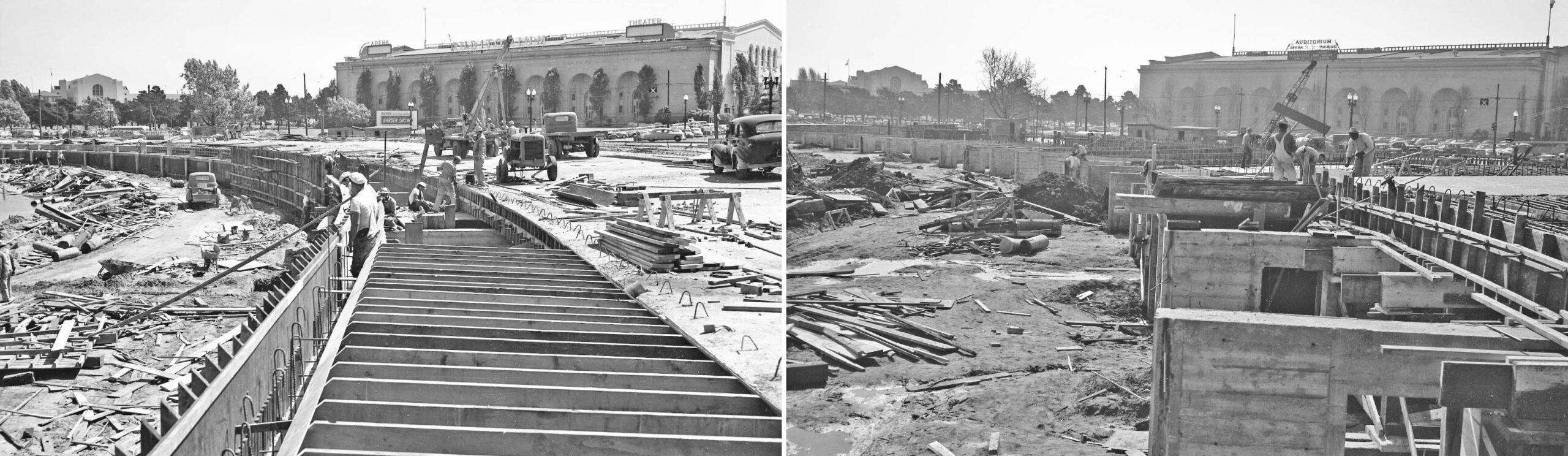
Two scenes at an earlier, right, and later, left, phase of creating the curved section of the westbound lanes. These southeast views also feature the Oakland Civic Auditorium, and closer to the left edges in the distance, the headquarters for the Oakland Unified School District.
L331-80-Oakland Public Works Photos, Courtesy BAERA, Western Railway Museum Archives, 238391ov, l, 235169ov, r, (Image 16 of 30)
South, left, and southeast, right, views of the auditorium with more mid-construction details at the curve.
L331-85-Oakland Public Works Photos, Courtesy BAERA, Western Railway Museum Archives, 238398ov, l, 238388ov, r, (Image 17 of 30)
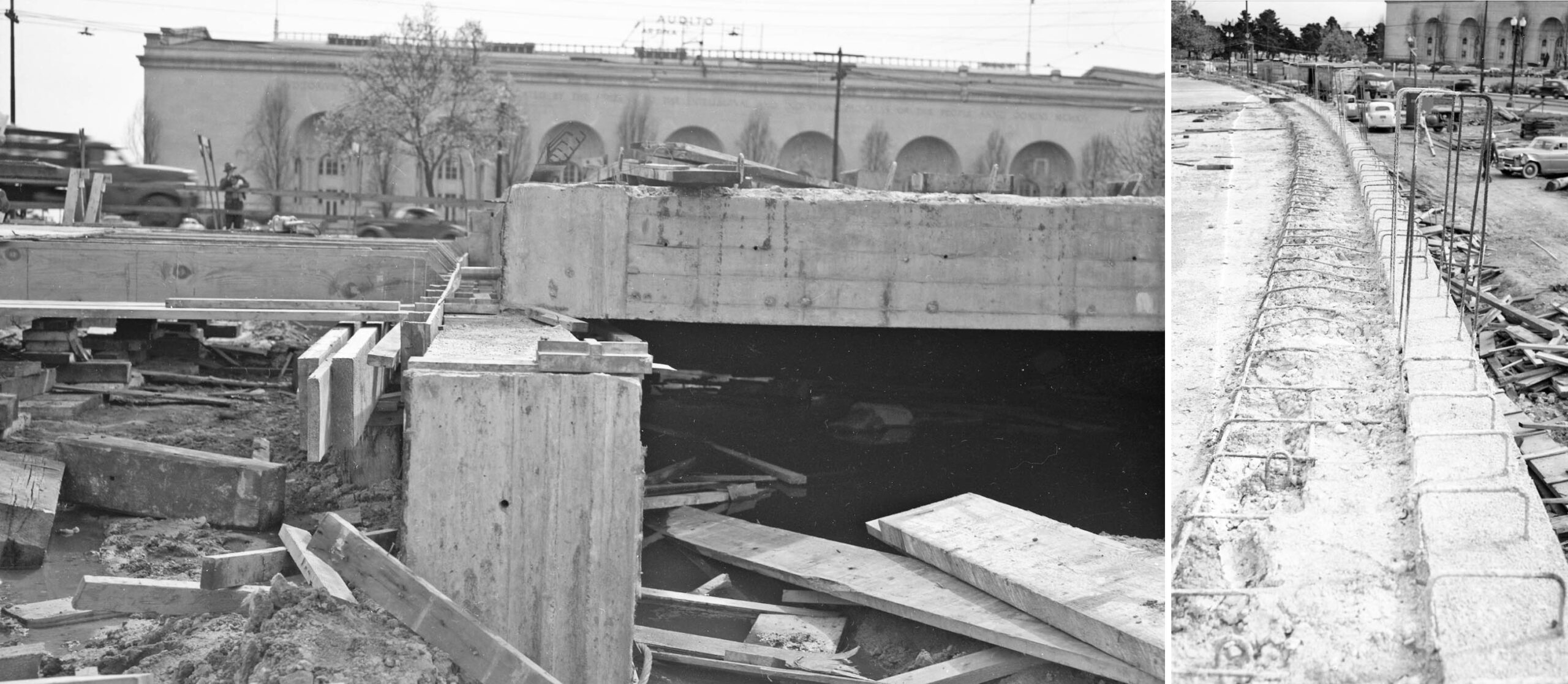
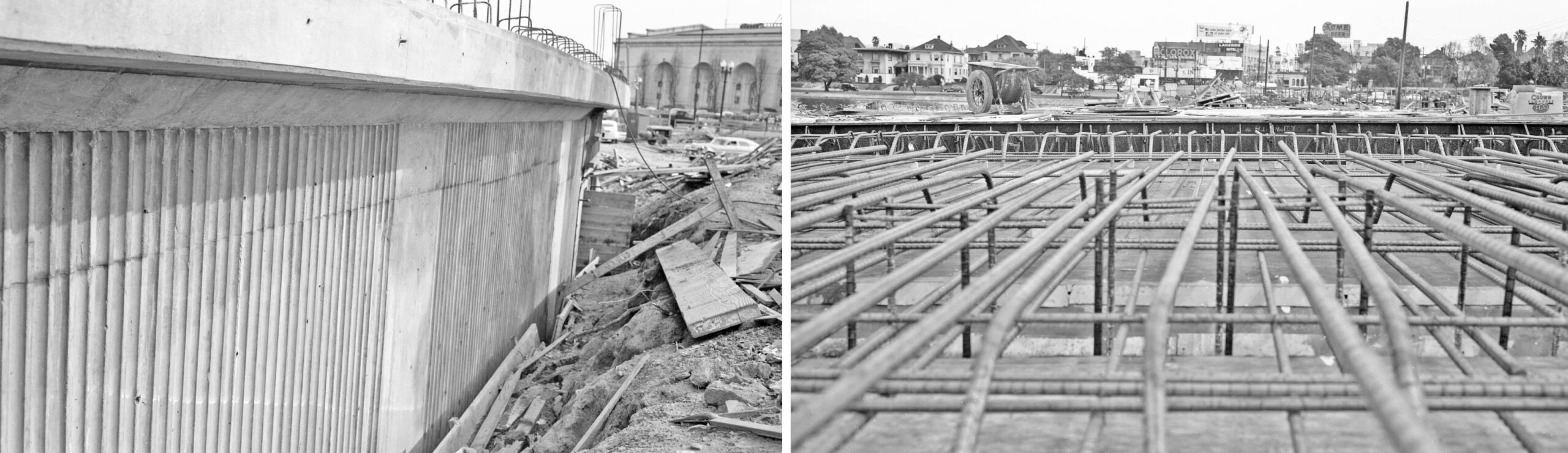
The left panel shows the finished exterior curve of the westbound roadway in a southeast view, while the right shows the reinforced framework with an east view in the distance centered on 12th St. where it meets Lakeshore Ave. and 2nd Ave., the Chlorox and Acme Beer signs prominently displayed.
L331-90-Oakland Public Works Photos, Courtesy BAERA, Western Railway Museum Archives, 238400ov, l, 238404ov, r, (Image 18 of 30)
The process of applying the concrete to the reinforced roadway is featured in these two northeast views of Lakeside Ave. and the Fourth Church of Christ, Scientist.
L331-95-Oakland Public Works Photos, Courtesy BAERA, Western Railway Museum Archives, 238401ov, l, 238384ov, r, (Image 19 of 30)
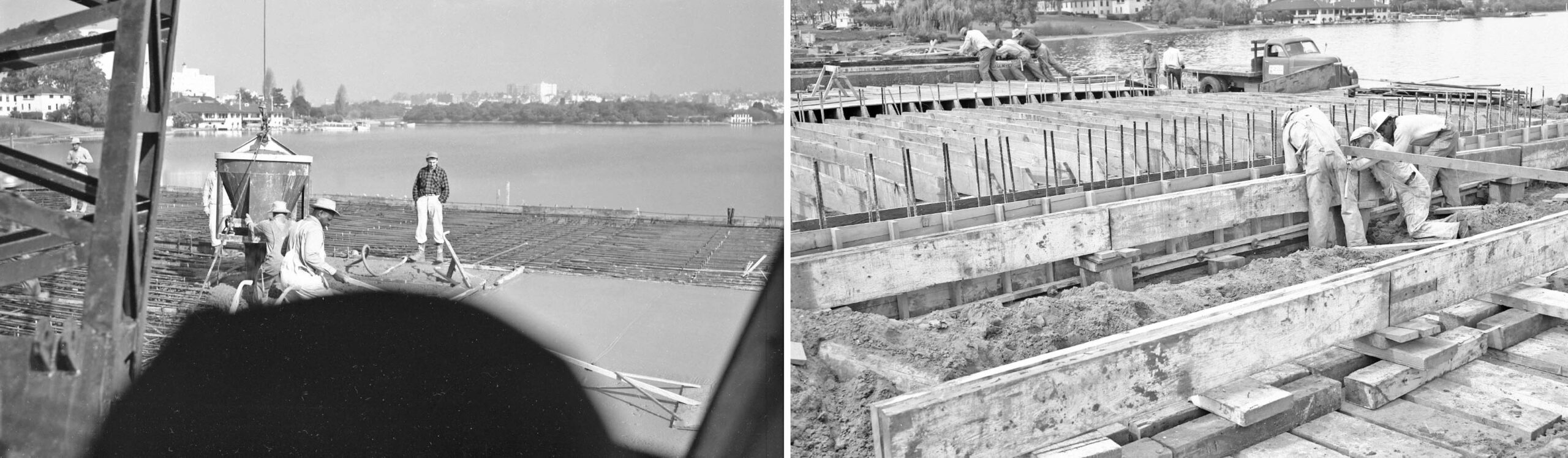
The camera swings to the north with two panoramic views of the lake as the workers set the steel rebar in the frame of the roadway.
L331-100-Oakland Public Works Photos, Courtesy BAERA, Western Railway Museum Archives, 238403ov, l, 237057ov, r, (Image 20 of 30)
The Bellevue-Staten residential apartment building is seen across Lake Merritt in these two north views. Another successful concrete pour on the left. The right image shows that the construction project did not impact the west shore of the lake.
L331-105-Oakland Public Works Photos, Courtesy BAERA, Western Railway Museum Archives, 238385, l 238408ov, r, (Image 21 of 30)
The west view on the left toward the courthouse and the north view as the road turns to toward becoming 14th St., right, reveal nearly completed westbound lanes.
L331-110-Oakland Public Works Photos, Courtesy BAERA, Western Railway Museum Archives, 238381ov, (Image 22 of 30)
This northwest view shows the completed westbound lanes of the Viaduct where they turn away from 12th St. toward their final destination as 14th St. on Sept. 25, 1950, just prior to opening day. The flag atop the one of the cupolas of the Oakland Hotel built in 1912 may be seen in the distance.
L331-115-Oakland Public Works Photo, Courtesy BAERA, Western Railway Museum Archives, 237066ov, (Image 23 of 30)
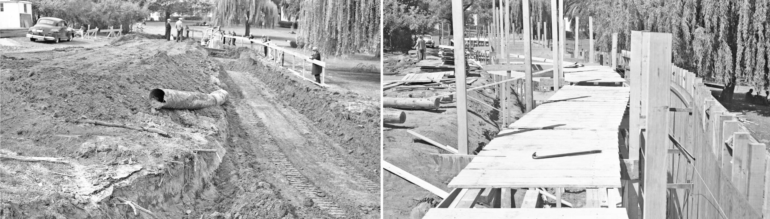
Next for a series of more detailed images of the construction without the background of buildings showing. Two northeast views are shown of the trench, left, and framing, right, of the outer retaining wall as the westbound lanes approaching 14th St.
L331-120-Oakland Public Works Photos, Courtesy BAERA, Western Railway Museum Archives, 238412ov, l, 238411ov, r, (Image 24 of 30)
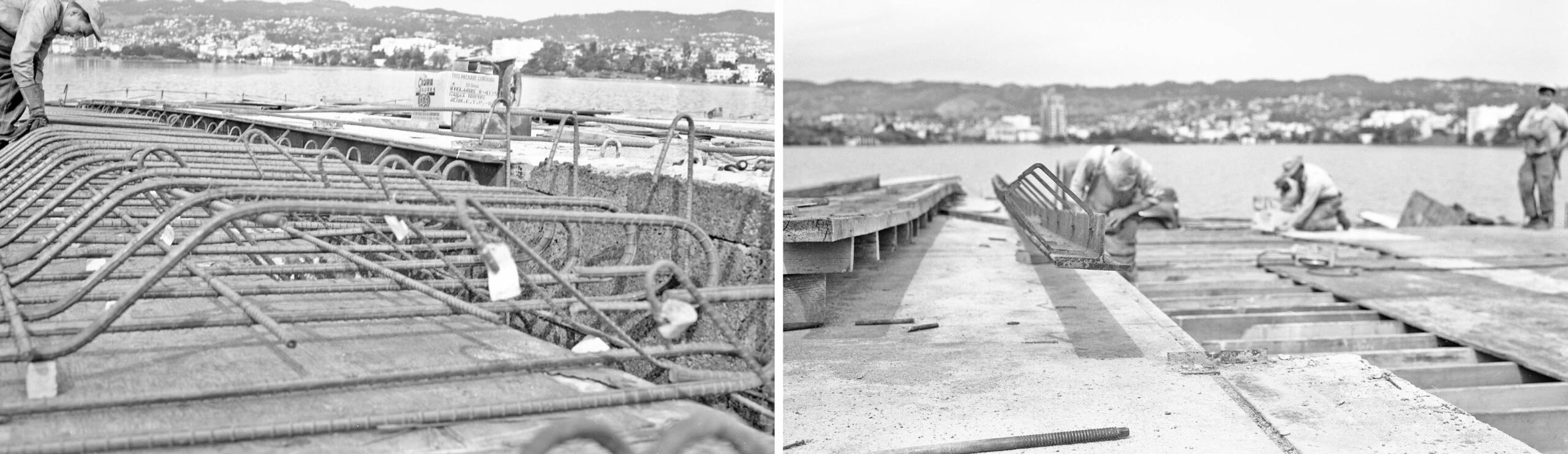
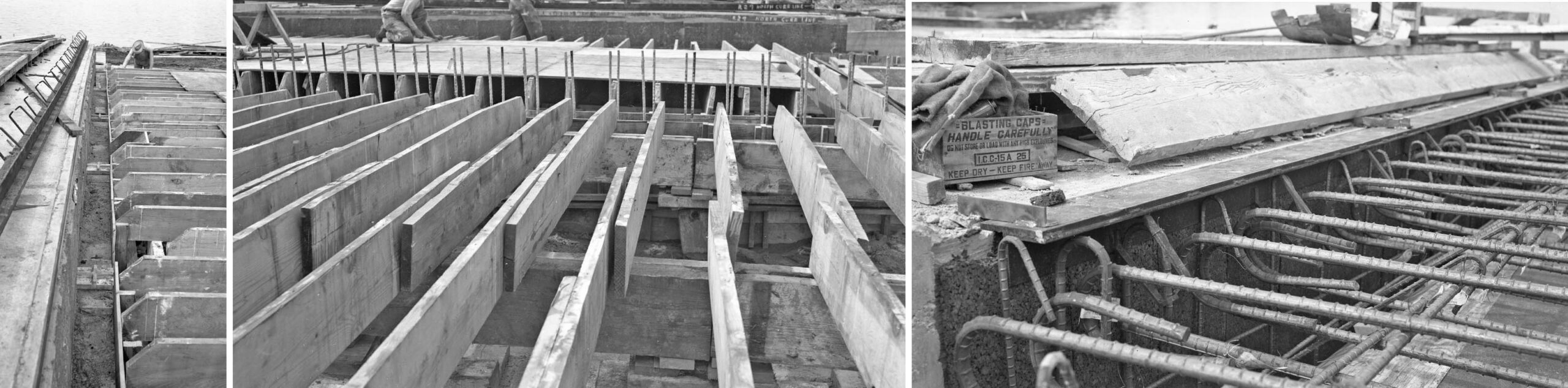
More scenes of setting up the framing for the placement of the rebar to be part of the road surface.
L331-125-Oakland Public Works Photos, Courtesy BAERA, Western Railway Museum Archives, 237059ov, l, 237060ov, c, 238389ov, r, (Image 25 of 30)
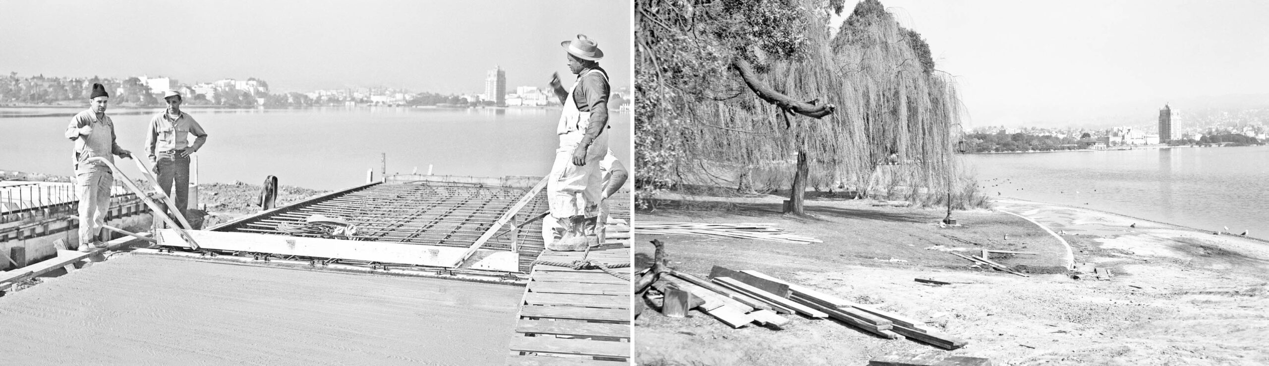
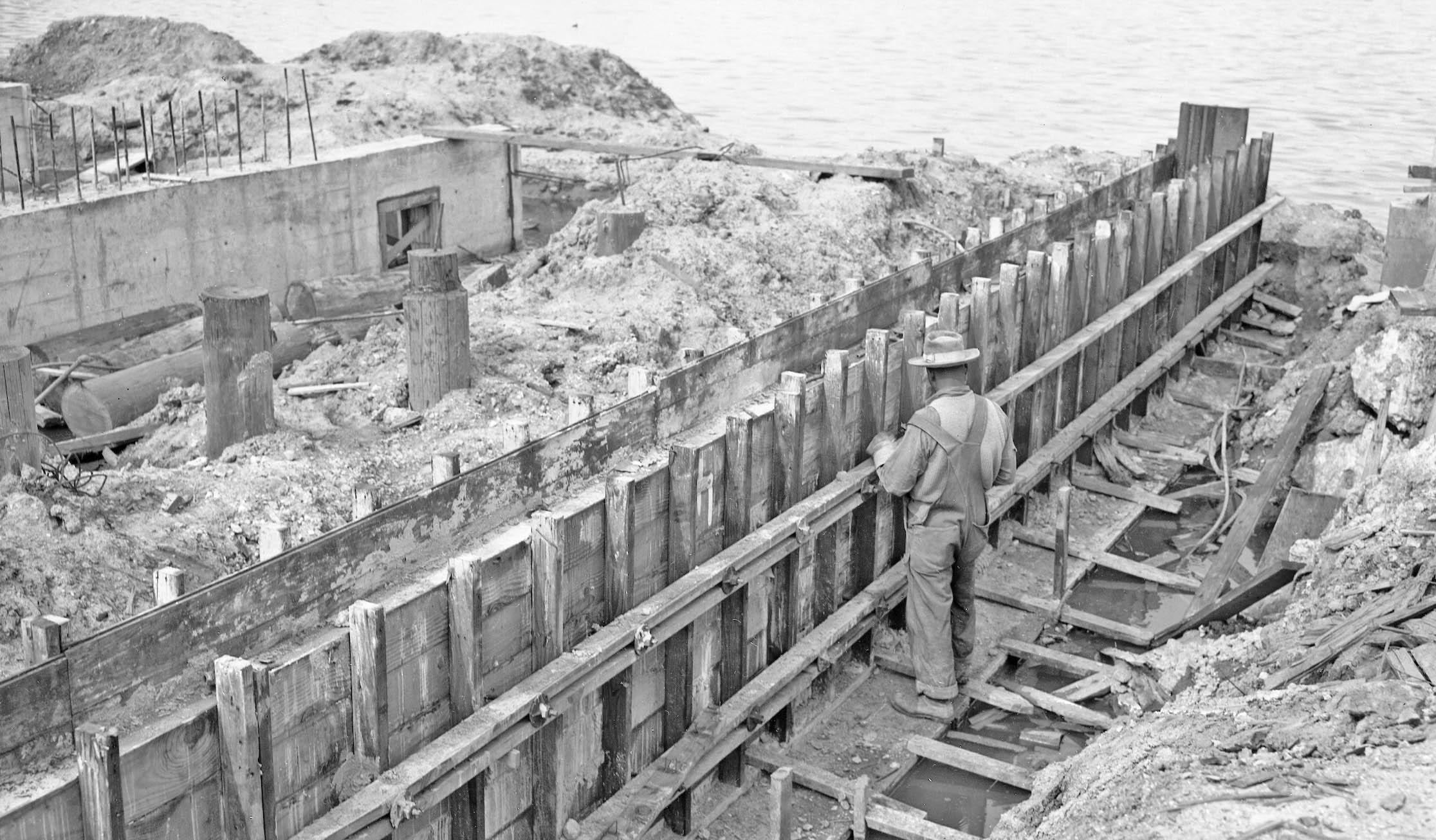
The worker stands on one of the supports of the roadway as it hugs the lake shoreline.
L331-130-Oakland Public Works Photo, Courtesy BAERA, Western Railway Museum Archives, 238402ov, (Image 26 of 30)
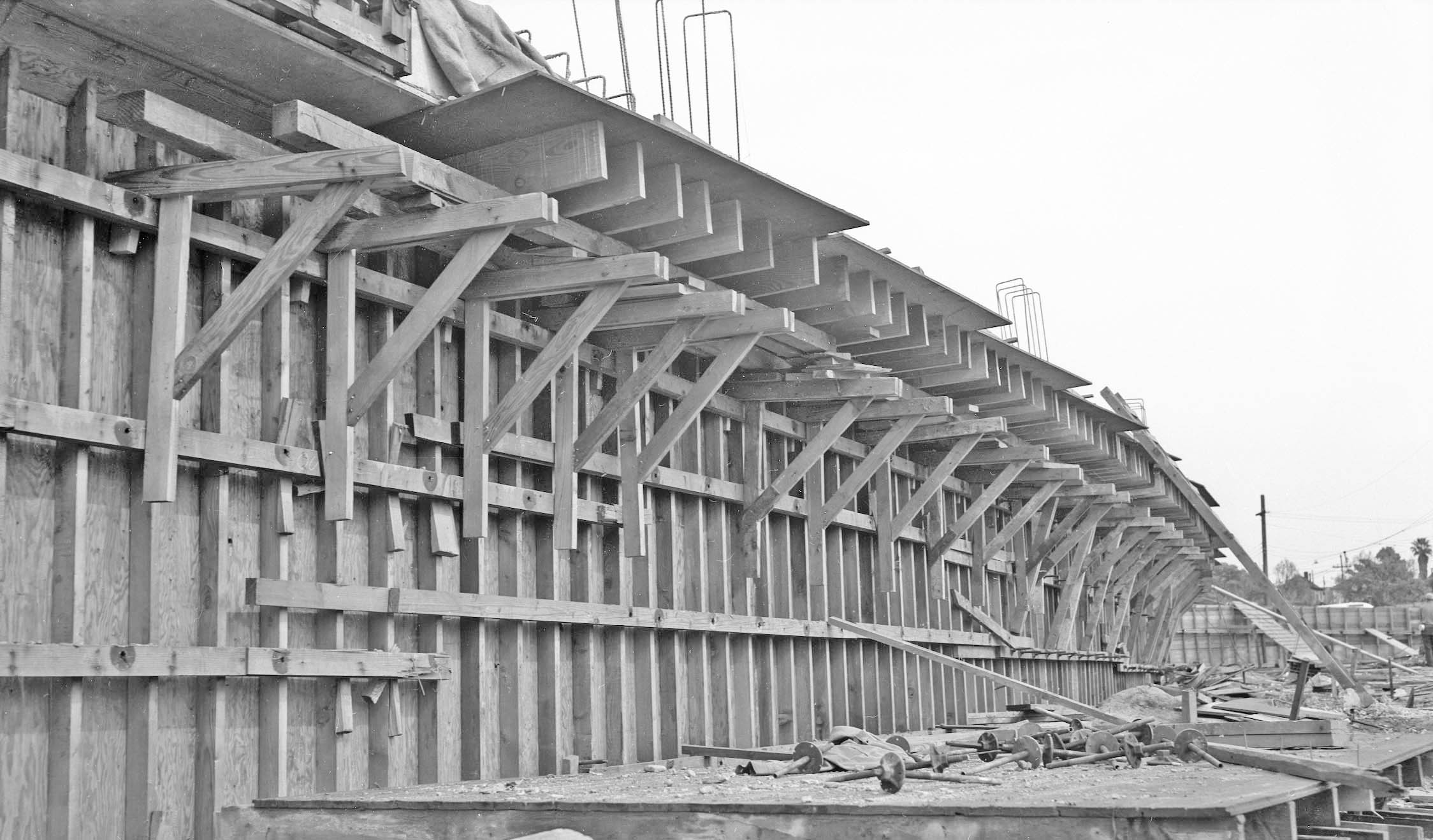
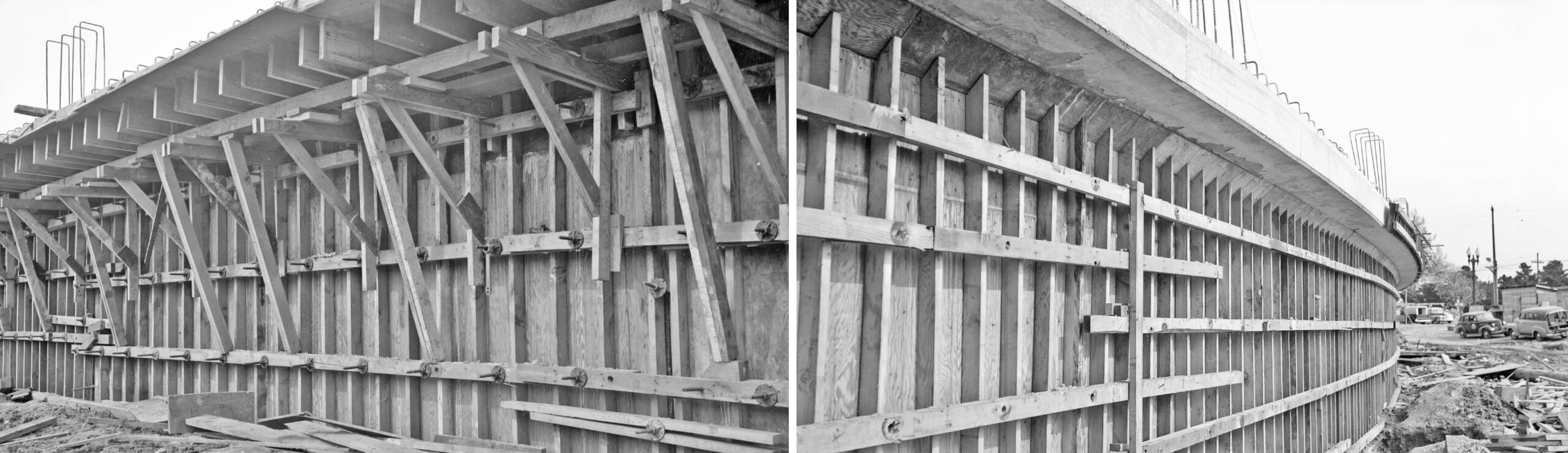
Two views of the framing of the retaining wall of the westbound lanes are shown here.
L331-135-Oakland Public Works Photos, Courtesy BAERA, Western Railway Museum Archives, 237058ov, l, 238399ov, r, (Image 27 of 30)
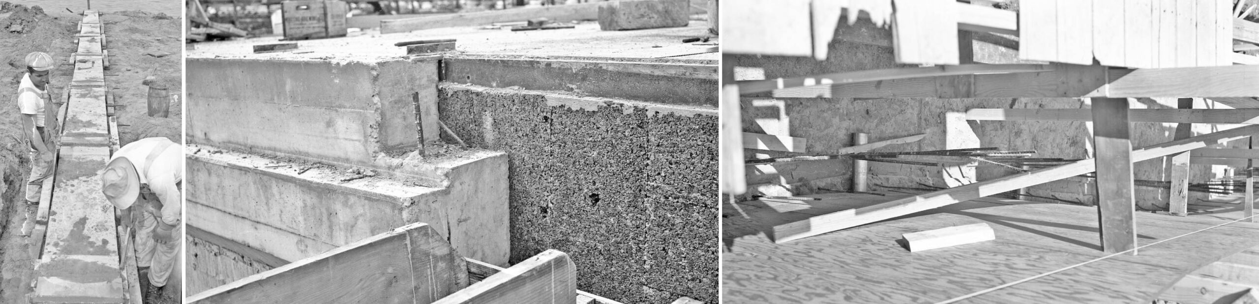
Several views of more framing.
L331-140-Oakland Public Works Photos, Courtesy BAERA, Western Railway Museum Archives, 238383ov, l, 238392ov, c, 238410ov, r, (Image 28 of 30)
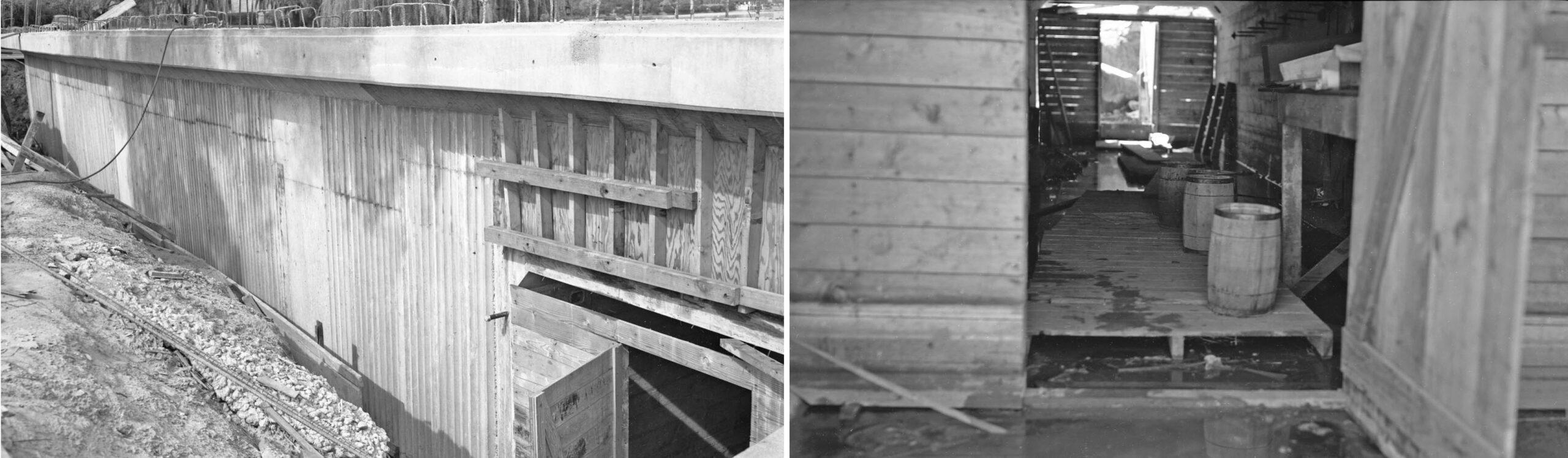
Two final shots of the nearly competed retaining wall of the Viaduct, left, and temporary storage under the structure.
L331-145-Oakland Public Works Photos, Courtesy BAERA, Western Railway Museum Archives, 238395ov, l, 238396ov, r, (Image 29 of 30)
A west view unit of Key unit 172 pulls across Madison St. at its new terminus just west of Oak St. The year is 1957, and although the truncation of the line in 1950 appeared like a death sentence, the A interurbans stuck around until the end of the system in April 1958. Appreciation to Betty Marvin for the preservation and donation of the images. Next time, completing the westbound lanes in August 1950.
L331-150-John Harder Photo, Courtesy John Harder, (Image 30 of 30)