Concord
Bill Larkins introduces the City of Concord in an east view over Concord from Jul. 2, 1950. The city would grow from a population of just under 7000 to over 36,000 in the 1950s. Great changes were in store, including for the SN, seen here running along the top of the image with its Concord depot at the mid-point.
K5-Wiiliam T Larkins Photo, Courtesy Contra Costa County Historical Society, 5007, (Image 1 of 19)

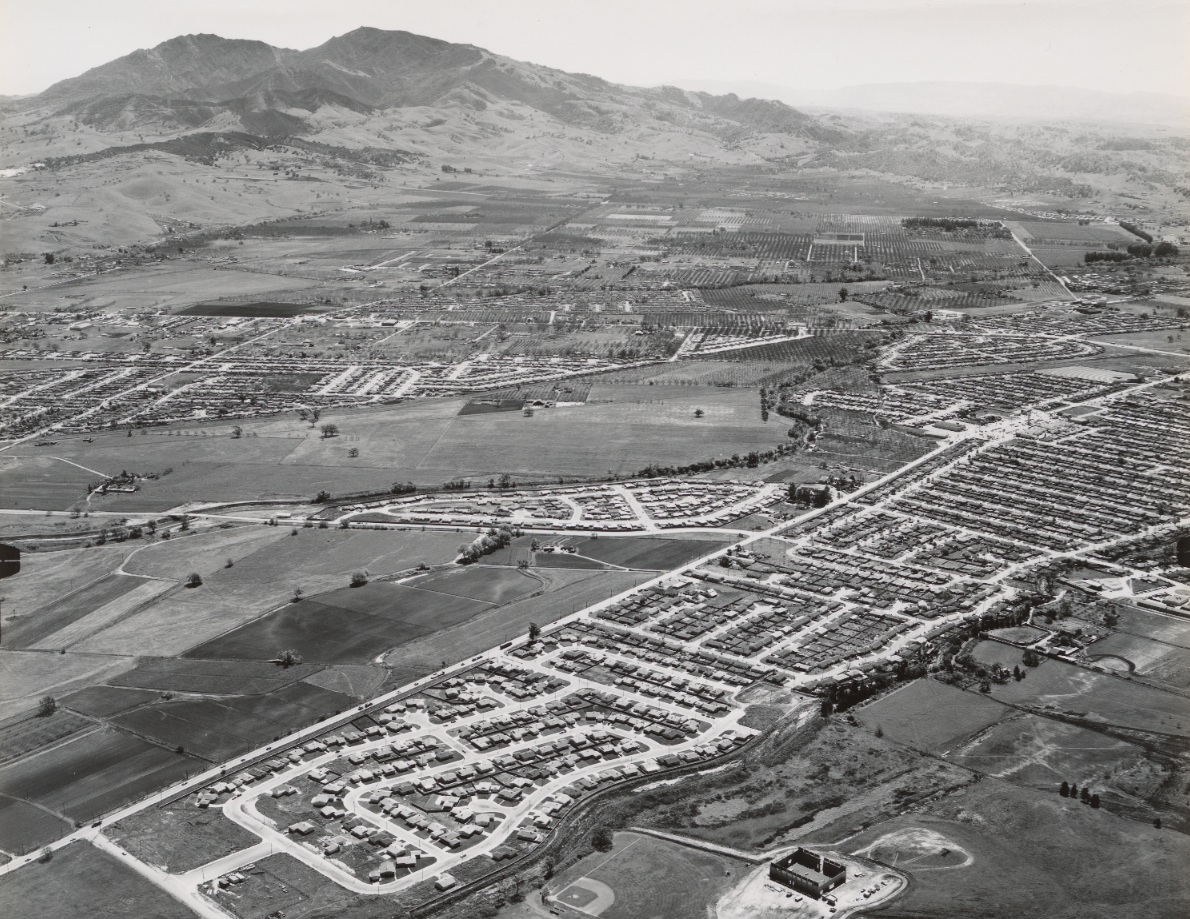
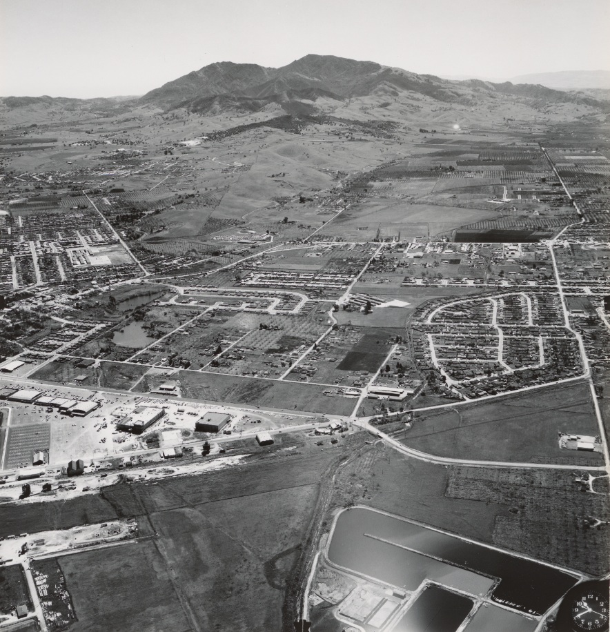
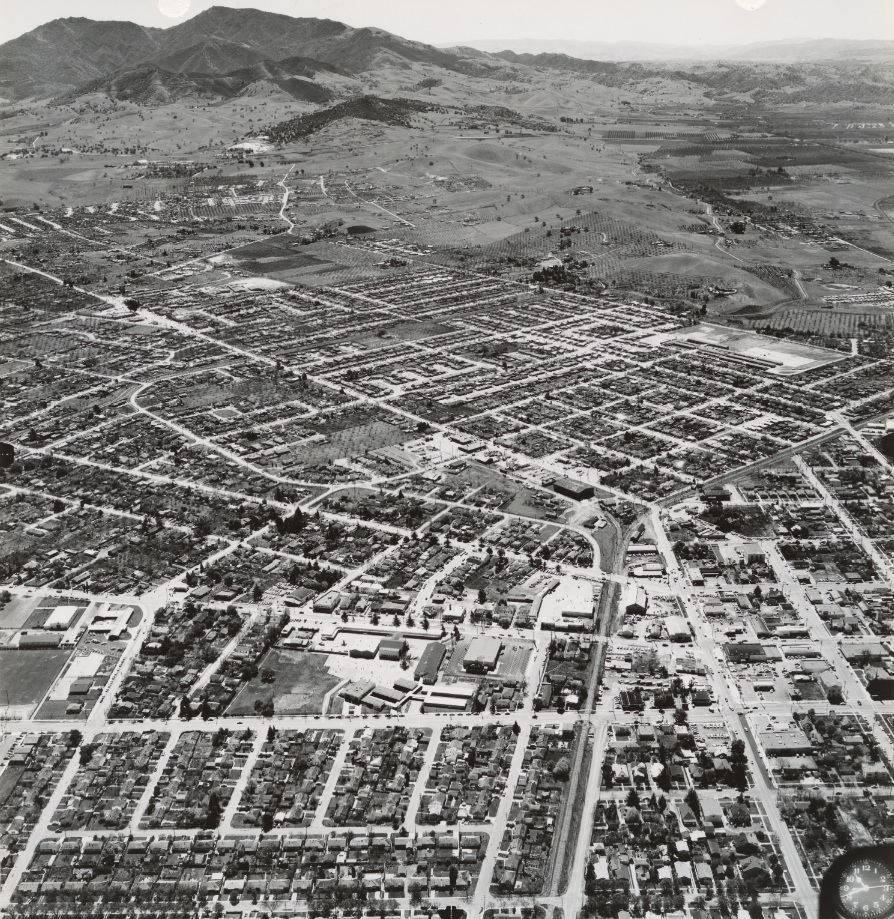
A southeast view from circa 1956 just south of Buchanan Field shows Grayson Creek, State Road 21 (Contra Costa Blvd.), the Walnut Creek and Market St., right to left. No I-680 or Sun Valley Shopping Center as yet. Ref: brk00017186_24a
K10-Clyde Sunderland Photo, Courtesy of The Bancroft Library, University of California, Berkeley, De, (Image 2 of 19)
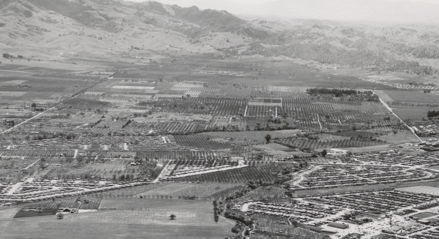
A detail of the background of K10, southeast view from circa 1956, highlighting the Ygnacio Valley. Annotated version to follow. Ref: brk00017186_24a
K15-Clyde Sunderland Photo, Courtesy of The Bancroft Library, University of California, Berkeley, De, (Image 3 of 19)
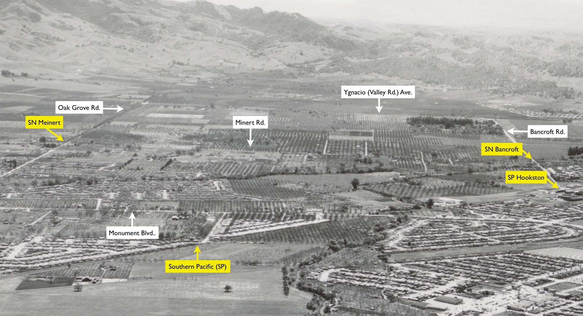
Annotated version of K15, detail of K10, southeast view, circa 1956. The major roads and two railroads are detailed. The arrows at Bancroft and Meinert (flag stop name) for the SN point to the grade crossings, but there were many structures related to storage of agricultural products that are visible.
K17-Clyde Sunderland Photo, Courtesy of The Bancroft Library, University of California, Berkeley, De, (Image 4 of 19)
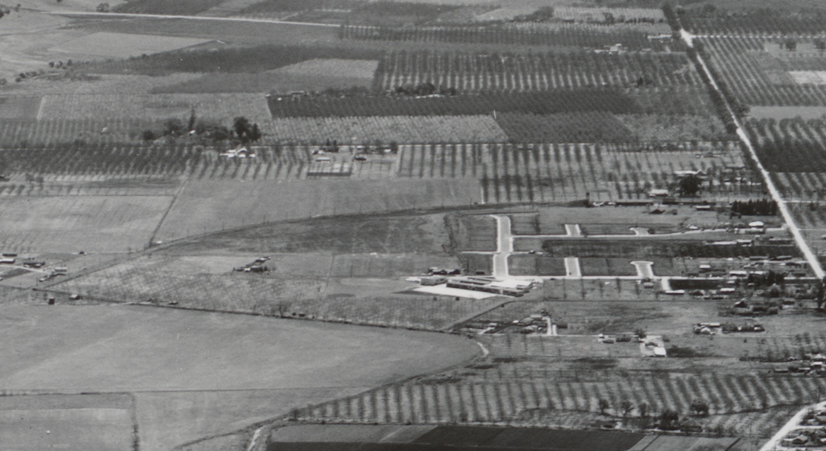
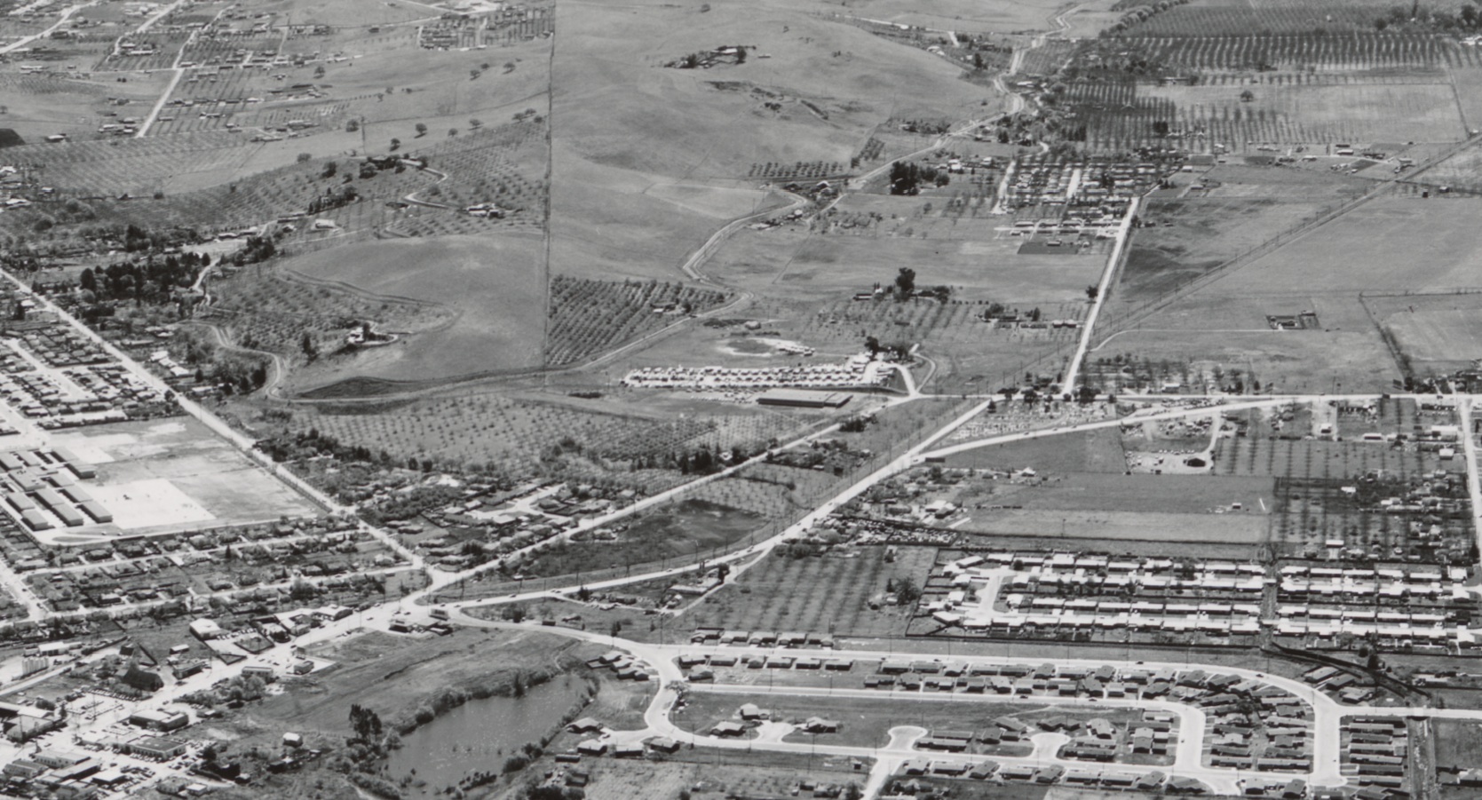
Again to the southeast, the curve at Meinert, starting from Oak Grove Rd., right border, and proceeding to Pine Creek or Road no. 2, left border. The storage facilities at Meinert will be a subject in itself in the Landmarks, as will Pine Creek at Kilgore. Who was Kilgore? More to follow. Ref: brk00017178_24a
K20-Clyde Sunderland Photo, Courtesy of The Bancroft Library, University of California, Berkeley, De, (Image 5 of 19)
A southeast view, circa 1956, with Oak Grove Rd. Along the right, west, margin as it passes Monument (Blvd.) Rd., becomes Meadow Ln., and then splits with Market St. toward the northeast. Willow Pass Rd. can be seen crossing Market St. just to the east where Pine Creek flows under both roads. The next image may help. Ref: brk00017178_24a
K25-Clyde Sunderland Photo, Courtesy of The Bancroft Library, University of California, Berkeley , (Image 6 of 19)
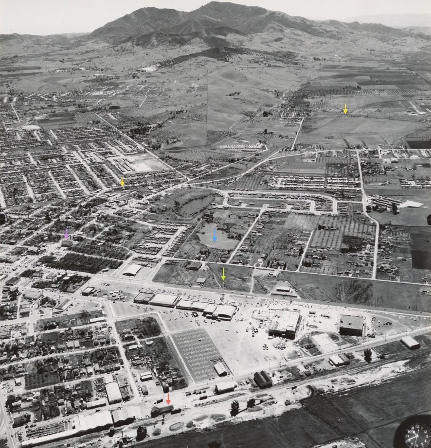
A slightly more eastern view circa 1956 relative to K25, the orange arrow points to the Southern Pacific Concord depot, with Market St. running along its length to the east. The green arrow denotes the large tower indicating the Park and Shop Shopping Center along Willow Pass Rd. The blue arrow, Ellis Lake Park, the purple arrow, the Masonic Hall, and the yellow arrows the portion of the SN shown next. Ref: brk00017179_24a
K30-Clyde Sunderland Photo, Courtesy of The Bancroft Library, University of California, Berkeley , (Image 7 of 19)
The catenary poles are very obvious in this circa 1956 southeast view of the SN from Pine Creek or road no. 2, right margin or west, then across a field until it crosses San Miguel Rd. From here the SN followed Monument (Blvd.) Rd. and then curved just past Ynez (Cowell) Rd. and then along Mesa St. heading for the SN depot. Great view of the Contra Costa Canal as it snakes across to the east of the railway. Ref: brk00017179_24a
K35-Clyde Sunderland Photo, Courtesy of The Bancroft Library, University of California, Berkeley, De, (Image 8 of 19)
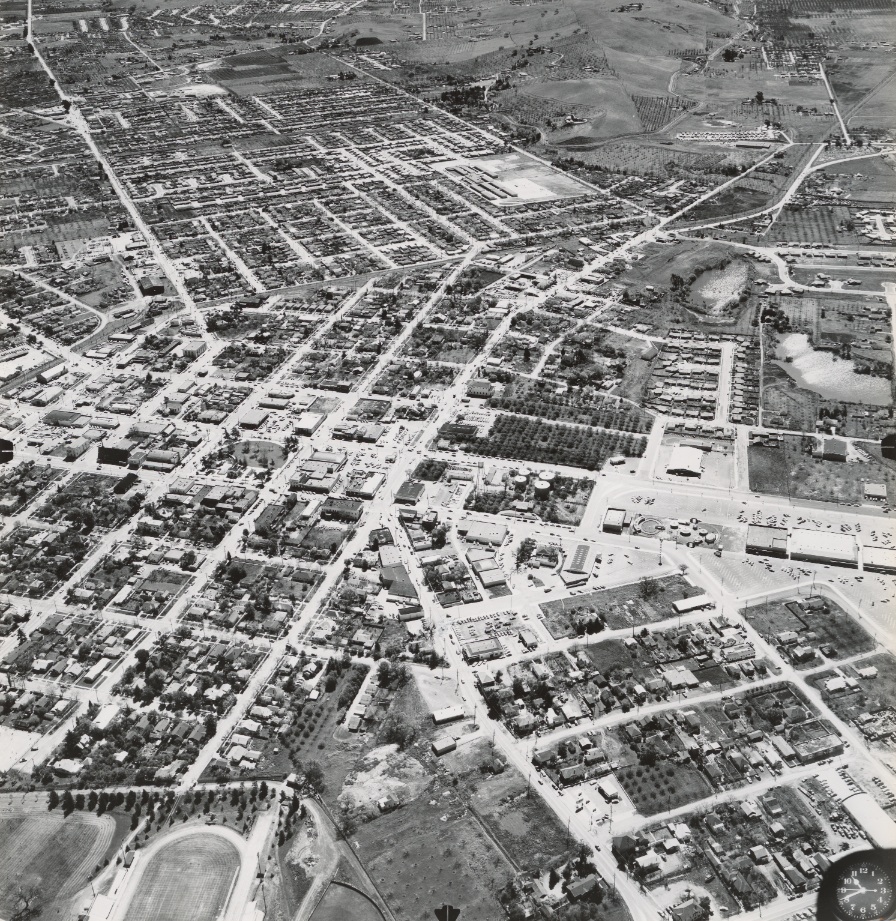
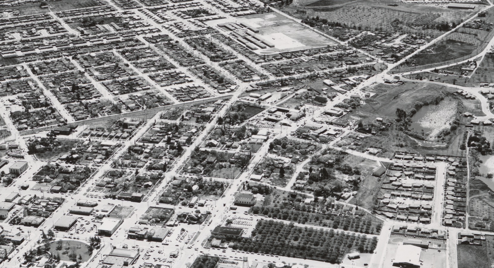
Moving more toward the center of Concord, circa 1956, with Concord Ave. entering from the bottom margin of the image, north, and forming the curve to become Galindo St. So much in this image, but for now concentrate on where the SN left of in K35, now with the intersection with Clayton Rd. and the abrupt turn to the depot in view. Ref: brk00017177_24a
K40-Clyde Sunderland Photo, Courtesy of The Bancroft Library, University of California, Berkeley , (Image 9 of 19)
One step at a time, the path of the SN along Mesa St. on the left portion, east, of the image. Note the residential nature to the right-of-way to the east, while more commercial along the rails to the west. Southeast view, circa 1956. Ref: brk00017177_24a
K45-Clyde Sunderland Photo, Courtesy of The Bancroft Library, University of California, Berkeley, De, (Image 10 of 19)
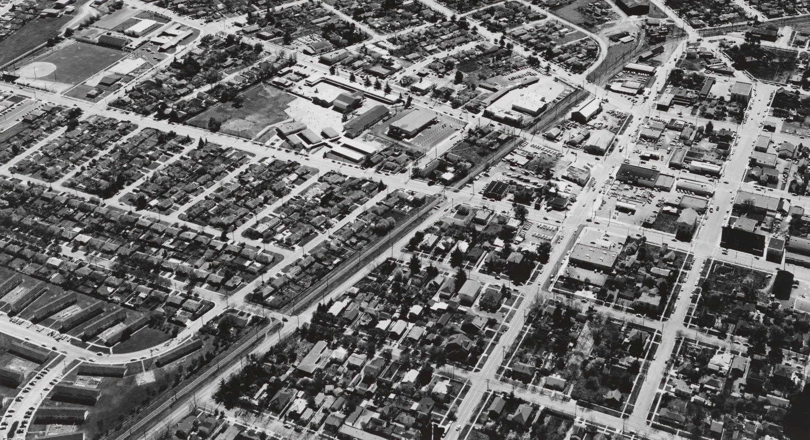
Next, the depot area in this southeast view, circa 1956. The SN right-of-way is shown making the curve after its intersection with Clayton Rd. and continues north to Salvio St. where it will set its path along the Port Chicago Highway. A more detailed look next. Ref: brk00017181_24a
K50-Clyde Sunderland Photo, Courtesy of The Bancroft Library, University of California, Berkeley , (Image 11 of 19)
This details the SN route from its intersection with Clayton Rd., top, or south, and Salvio St., bottom or north. Description of SN-related structures will be covered in depth later. The image also highlights the Concord Grammer School complex on Willow Pass Rd., dating back to 1892 and closed in 1974. Southeast view, circa 1956. Ref: brk00017181_24a
K55-Clyde Sunderland Photo, Courtesy of The Bancroft Library, University of California, Berkeley, De, (Image 12 of 19)
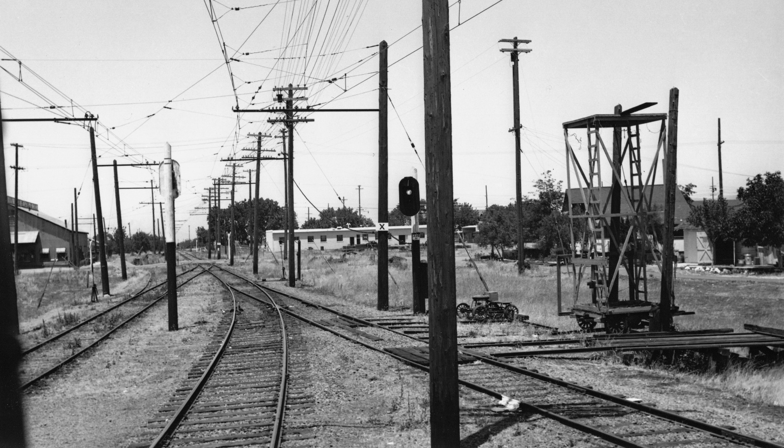
A 1950s north view of the industrial area where the tracks converged north of the depot. Next, north to Salvio St. to meet the Port Chicago Highway.
K60-Railroad Negative Exchange, Courtesy Charles Smiley, (Image 13 of 19)
This southeast image, circa 1956, highlights the east part of central Concord, the Port Chicago Highway seen following the SN along a more residential setting from Salvio St. to Almond Ave., north or bottom left. Ref: brk00017180_24a
K65-Clyde Sunderland Photo, Courtesy of The Bancroft Library, University of California, Berkeley, De, (Image 14 of 19)
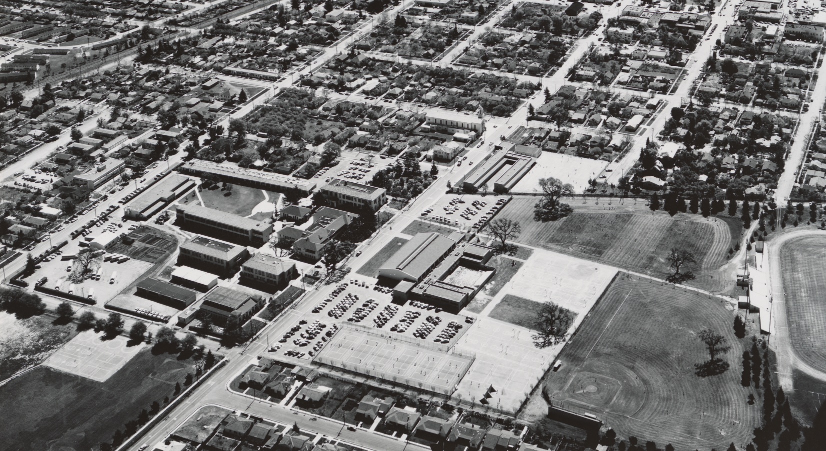
Now a southwest view through central Concord circa 1956 that brings in more from the north. In the right foreground, the Naval housing development, Eniwetok Village, off Bonifacio St., and along the middle right edge, athletic fields adjacent to Mt. Diablo High School. Much more later on each. Ref: brk00017182_24a
K70-Clyde Sunderland Photo, Courtesy of The Bancroft Library, University of California, Berkeley , (Image 15 of 19)
With the SN tucked off to the upper left corner, this southeast image circa 1956 details Mt. Diablo High School, and to the east, the rapidly evolving site of Concord Hospital. Stay tuned for more on these entities. Ref: brk00017184_24a
K75-Clyde Sunderland Photo, Courtesy of The Bancroft Library, University of California, Berkeley, De, (Image 16 of 19)
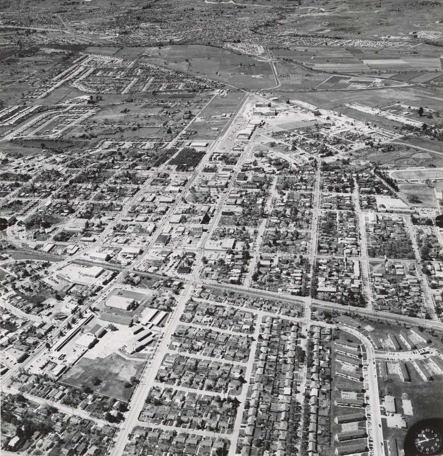
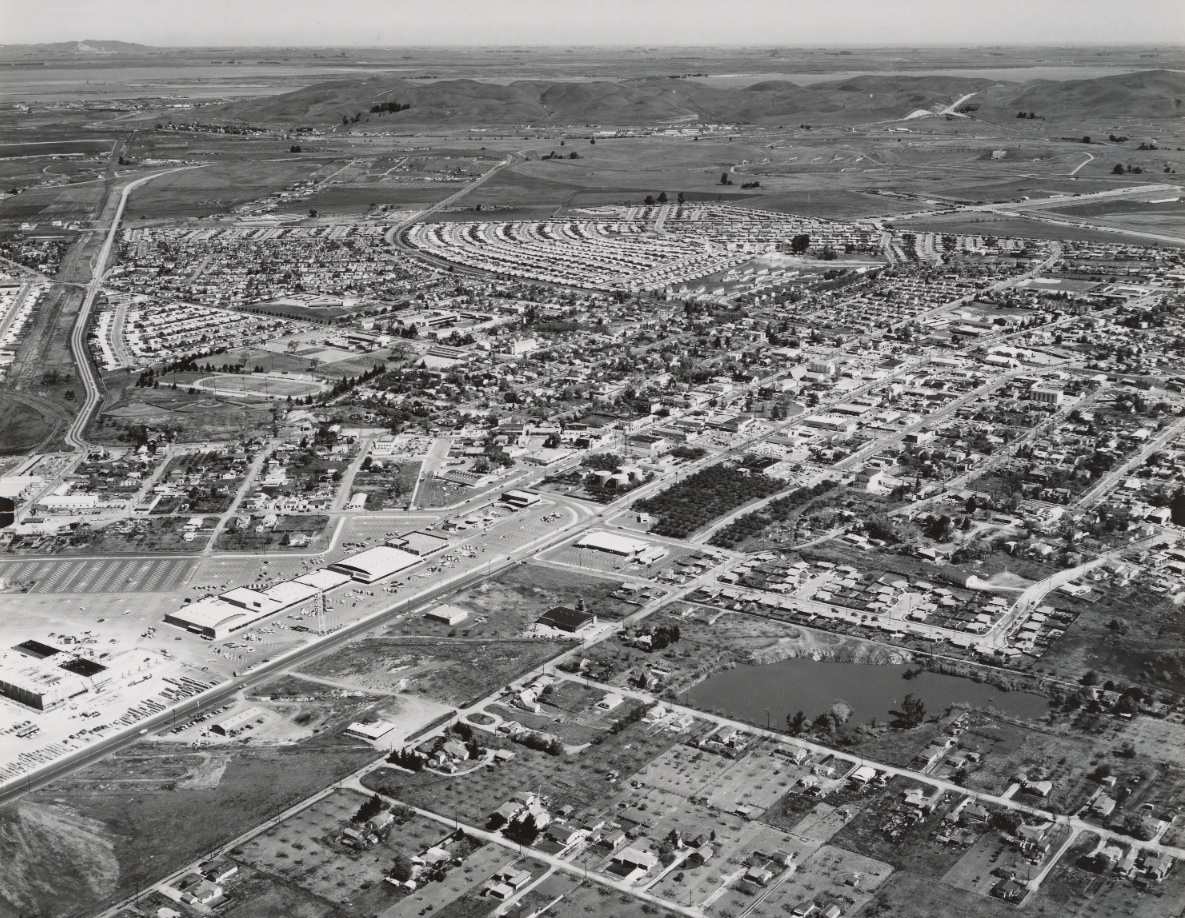
In addition to previously noted Ellis Lake Park and Park and Shop Shopping Center in the foreground, this north image circa 1956 highlights the continuation of Market St. as Highway 24 along the left, west, edge of he image, and the fan-like pattern of housing bordered by the curve of the SN and the Port Chicago Highway. Ref: brk00017183_24a
K80-Clyde Sunderland Photo, Courtesy of The Bancroft Library, University of California, Berkeley, De, (Image 17 of 19)
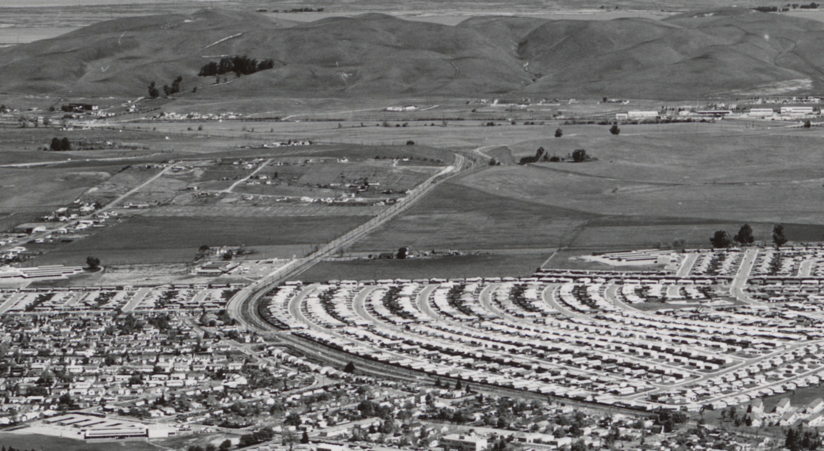
A detail of K80 shows that once the dense, new housing section stops, the SN right-of-way straightens out an crosses Olivera Road. Beyond that, it is still open country to the north, as the SN negotiates Ohmer Hill along the Naval Weapons Station to the east, and then to Clyde, seen at the top left portion of the image. Ref: brk00017183_24a
K85-Clyde Sunderland Photo, Courtesy of The Bancroft Library, University of California, Berkeley, De, (Image 18 of 19)
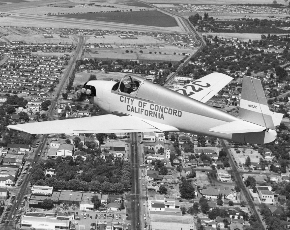
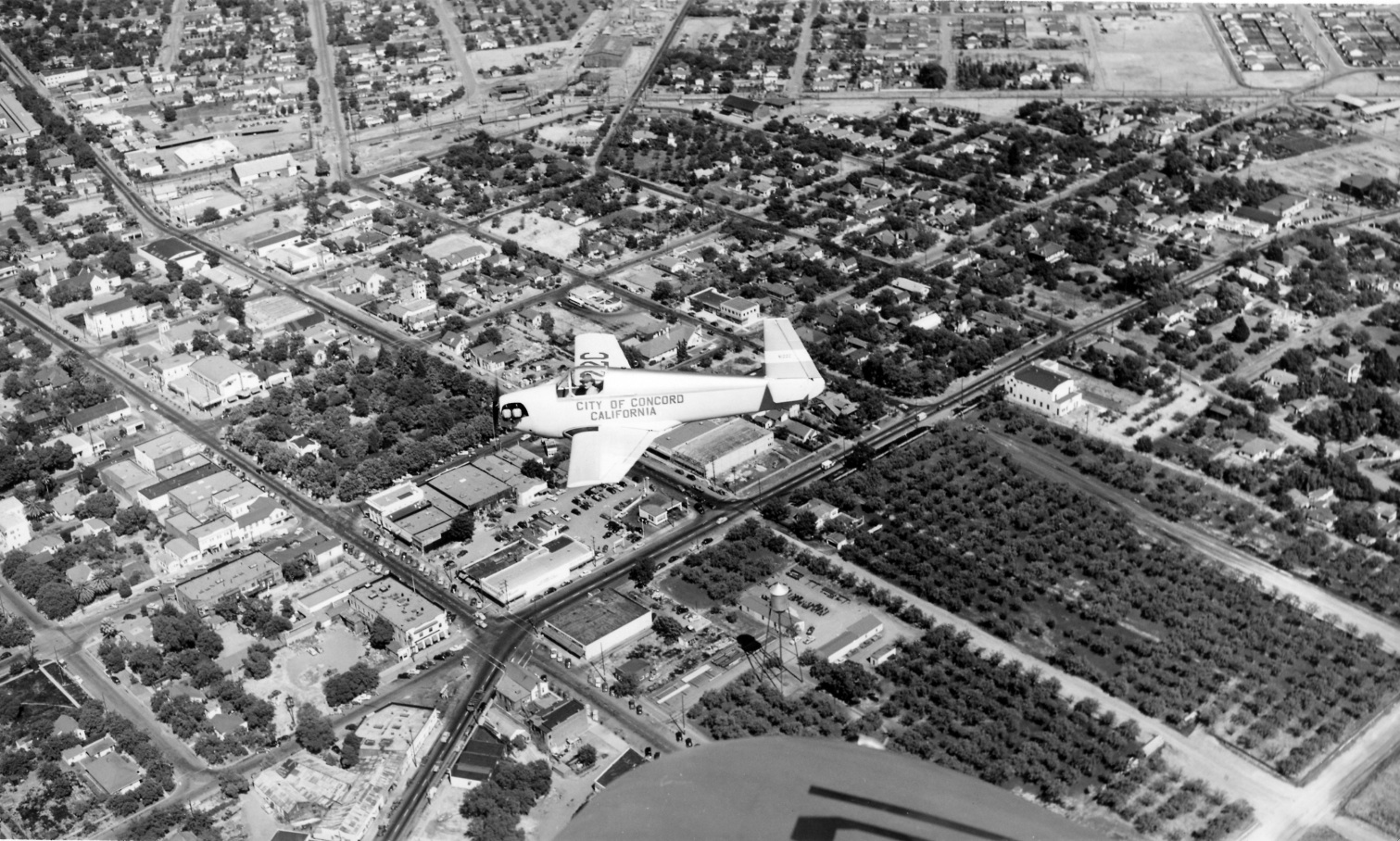
By the way, that is Gladys Davis in her Mooney M-18C Mite on the way to the start of the Powder Puff Derby, June 2, 1950. She came in 5th in this women’s cross-country race, from California to South Carolina. Gladys and her husband Tom operated a flight school and aircraft rental business at Buchanan Field in the early years.
K90-William T Larkins Photo, Courtesy William T Larkins, (Image 19 of 19)