Crossing the Freeway I – Construction Sequence

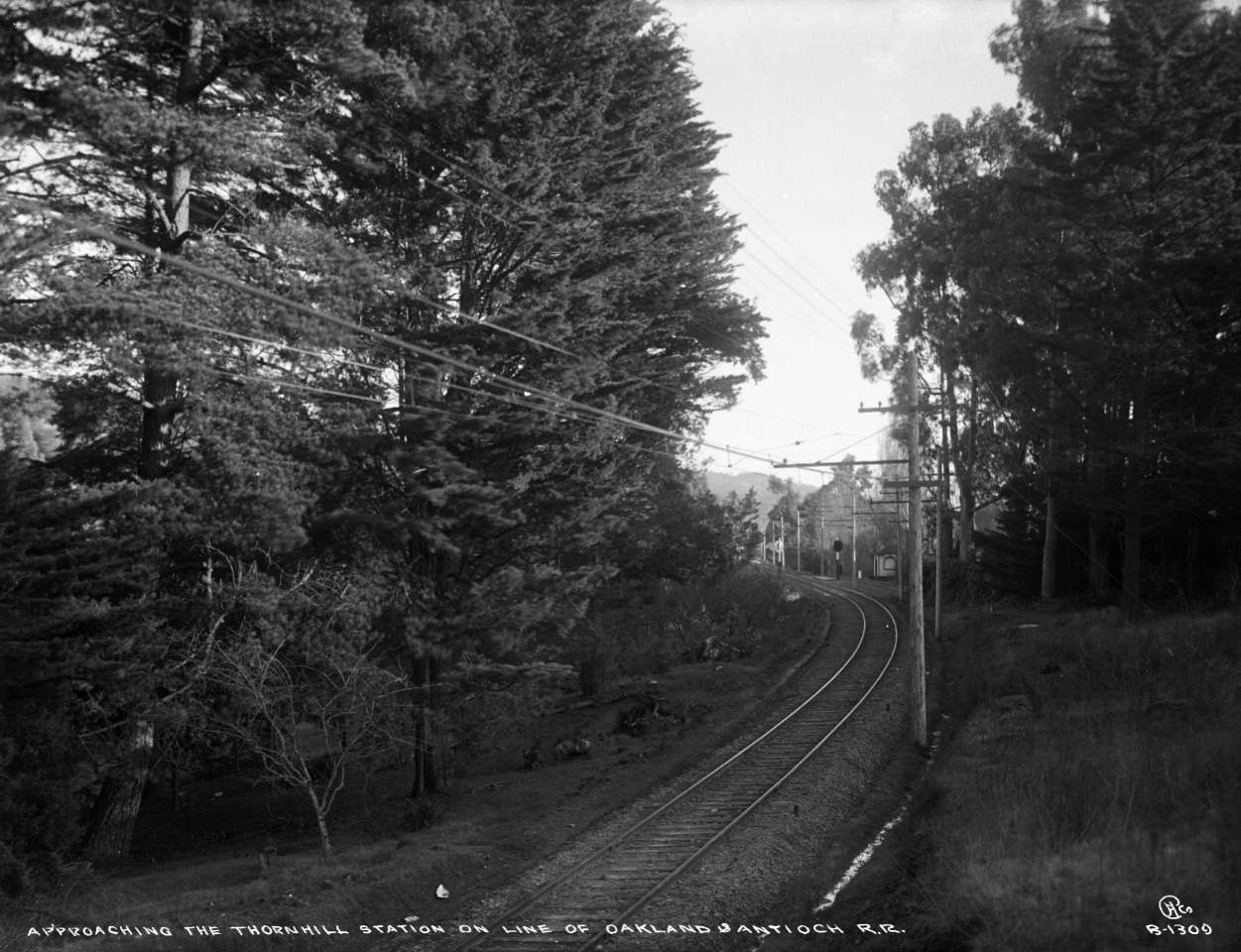
A south view from the 1910s of the future SN grade crossing of the Mountain Boulevard Freeway. Note the tiny spur in front of the Thornhill shelter, the latter right off Moraga Avenue. If unfamiliar, a review of the previous Landmark, “Where was the Thornhill Station Located?” would provide more background.
L44-05-Eston Cheney Photo B-1309, Sappers Collection, Courtesy BAERA, WRM Archive, 24134sn, (Image 1 of 13)

This north view was taken sometime before the Sept 14, 1950 groundbreaking for Mountain Boulevard Unit One, “Unit One” or, officially ALA 227. The home in the upper left of the image is one of several on the east side of Estates Drive that serve as landmarks for this view.
L44-10-Public Works Photos, Oakland Cultural Heritage Survey, Oakland City Planning Department, (Image 2 of 13)

This north image was taken just prior to the Jan. 1952 opening of the 1.6 miles of freeway from Broadway Terrace to Moraga Avenue. This review will document the sequence of constructing the grade crossing as part of a sequence of presentations on the evolution of this important junction.
L44-15-Public Works Photos, Oakland Cultural Heritage Survey, Oakland City Planning Department, (Image 3 of 13)

An aerial view from the passenger era, left, and just after SN abandonment, right, of the area of the SN freeway grade crossing. The next image is the same panels with annotations. Refs. left, BUT BUU-289-44 Aug. 2, 1939, courtesy the East Bay Municipal Utility District; right, AV 253 11-23, HJW, 1-12000, May 4, 1957, courtesy Contra Costa County Public Works Department.
L44-20-USDA AAA Western Division and HJW Geospatial Inc, Pacific Aerial Surveys, Oakland CA, (Image 4 of 13)

Annotated version of L44-20. Key roads are labelled. Yellow arrows, SN right-of-way; Orange arrows, Thornhill trestle, just east of Thornhill Drive-Moraga Avenue intersection; White arrow, Thornhill SN shelter in 1939. The date of the removal of the shelter is not known, but evidence for its existence after 1941 has not been found.
L44-25-USDA AAA Western Division and HJW Geospatial Inc, Pacific Aerial Surveys, Oakland CA, (Image 5 of 13)

From Broadway Terrace until it met Moraga Avenue, the SN right-of-way resided on a ridge carved out of the western wall of the rift valley of the Hayward Fault. This east image provides some idea of the downslope to the floor of the valley on the east side of the tracks.
L44-30-Public Works Photos, Oakland Cultural Heritage Survey, Oakland City Planning Department, (Image 6 of 13)

A complement to L44-30, this west view east of the tracks shows a two-car train led by SN 1014 in the vicinity of the north end of the future grade crossing and the downslope to the east. Undated image, circa 1940.
L44-35-Paul Smith Photo, Courtesy BAERA, Western Railway Museum Archives, 61349sn, (Image 7 of 13)

The next series of images captures progression of the construction of the grade crossing starting with this circa 1950 north view down the right of way.
L44-40-Public Works Photos, Oakland Cultural Heritage Survey, Oakland City Planning Department, (Image 8 of 13)

This north view from 1951 shows the valley after cleared of trees and other vegetation. The large eucolyptus tree in the center of the image still stands today. It is a marker for the trestle adjacent to the intersection of Florence Avenue with the right-of-way, the most eastern portion of the right-of-way between Broadway Terrace and the grade crossing.
L44-45-Public Works Photos, Oakland Cultural Heritage Survey, Oakland City Planning Department, (Image 9 of 13)

Grading of the new freeway has progressed in this north view as a SN 660-led freight greets workers on a break. There is no evidence that the right of way was ever altered during this process. The 1951 license plate on the car provides the year.
L44-50-Public Works Photos, Oakland Cultural Heritage Survey, Oakland City Planning Department , (Image 10 of 13)

The freight in L44-50 has almost passed, revealing SN 670 on the rear to aid the climb out of Oakland. Note the homes in the background, center, now visible on the east side of Glenwood Glade. Removal of the homes on the west side of this street will be addressed in another update.
L44-55-Public Works Photos, Oakland Cultural Heritage Survey, Oakland City Planning Department, (Image 11 of 13)

Edging closer to completion, this undated north view shows the elevation gain as Unit One proceeded south from Broadway Terrace to the grade crossing.
L44-60-Public Works Photos, Oakland Cultural Heritage Survey, Oakland City Planning Department, (Image 12 of 13)

This south view of the grade crossing is just prior to paving and completion. Refer back to L44-15. The track bed appears undisturbed relative to its appearance prior to construction. Written documentation for this type of detail has not been found. Compare this image to L44-05 to locate the corresponding spot of the Thornhill shelter.
L44-65-Public Works Photos, Oakland Cultural Heritage Survey, Oakland City Planning Department, (Image 13 of 13)