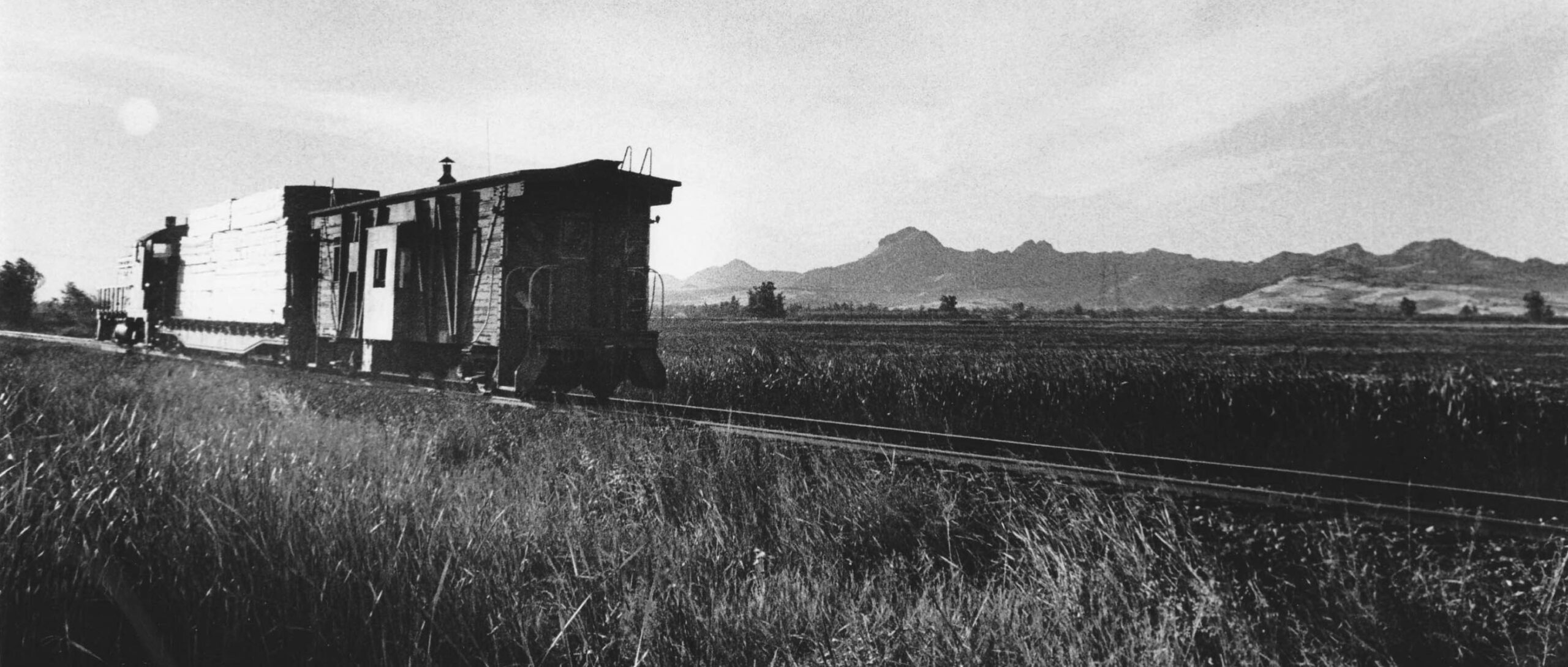
Dick Dorn Remembers Colusa Junction to Tarke on the Colusa Branch

The date is Oct. 10th, 1973. Dick Dorn, an elementary school teacher in Yuba City, was in the process of cultivating his interests in photography and railroad history. Dick got the idea to capture scenes of small freights of the Sacramento Northern Railway, SN, heading toward Tarke on the SN Colusa Branch drawing the neighboring Sutter Buttes into the image using a telephoto lens. Here diesel SN 402, a Union Pacific, UP, hopper, and caboose SN 1641 are seen in a north view between Sutter and the Butte Slough-Sutter Bypass crossing.
L342-05-Dick Dorn Photo, Courtesy Dick Dorn, (Image 1 of 53)

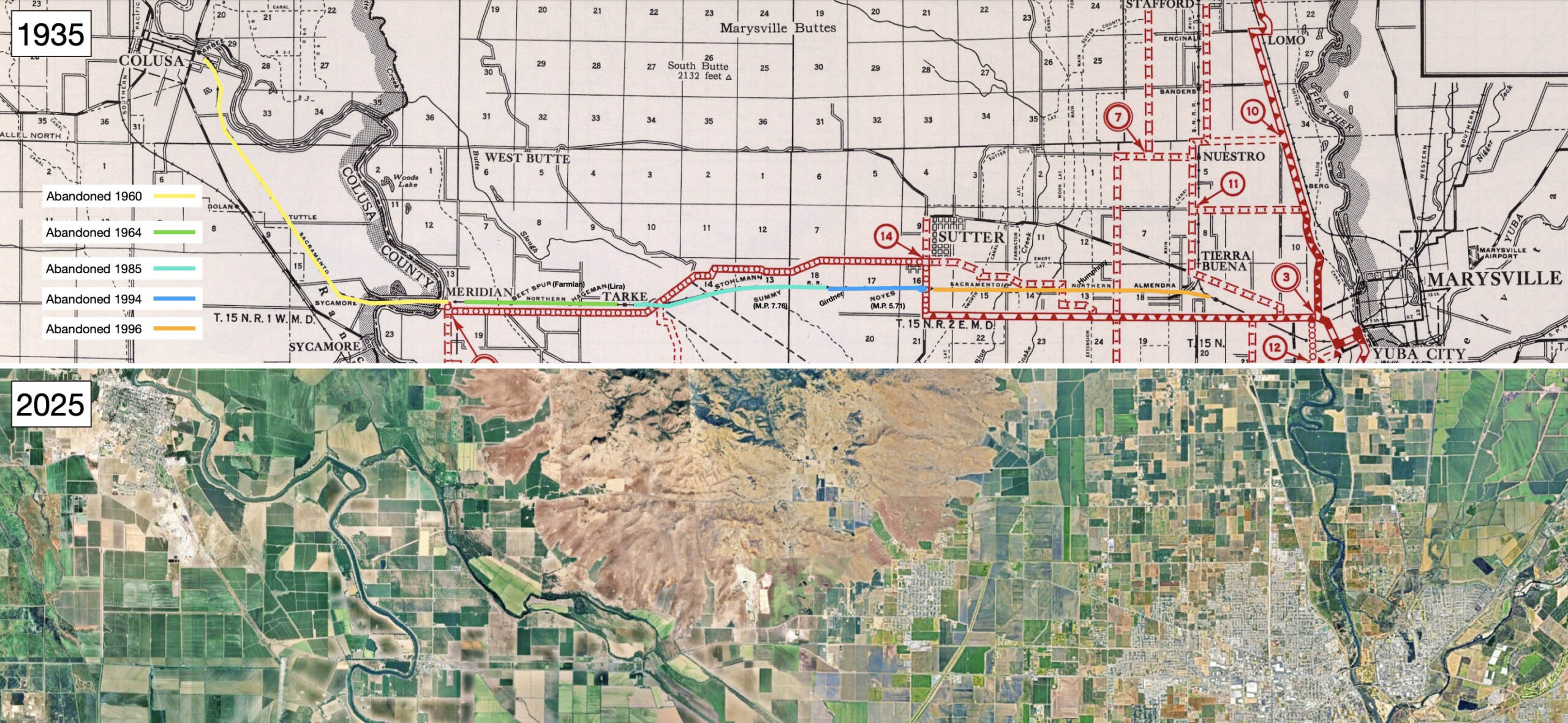
This update will incorporate Dick Dorn’s images and memories to facilitate documenting the final year of the SN Colusa Branch From Tarke to Colusa Jct. As indicated on the map from 1935, the dates indicate when portions of the Colusa Branch right-of-way were officially abandoned, but not necessarily the dates actual freight service ceased or track was removed. That is where Dick Dorn played an important role. When Dick Dorn went out to photograph in 1973, these dates would suggest that this was a time of relative stability for the line.
L342-10-David Rumsey Map Collection, David Rumsey Map Center, Stanford Libraries, top, Google Maps, bottom, (Image 2 of 53)
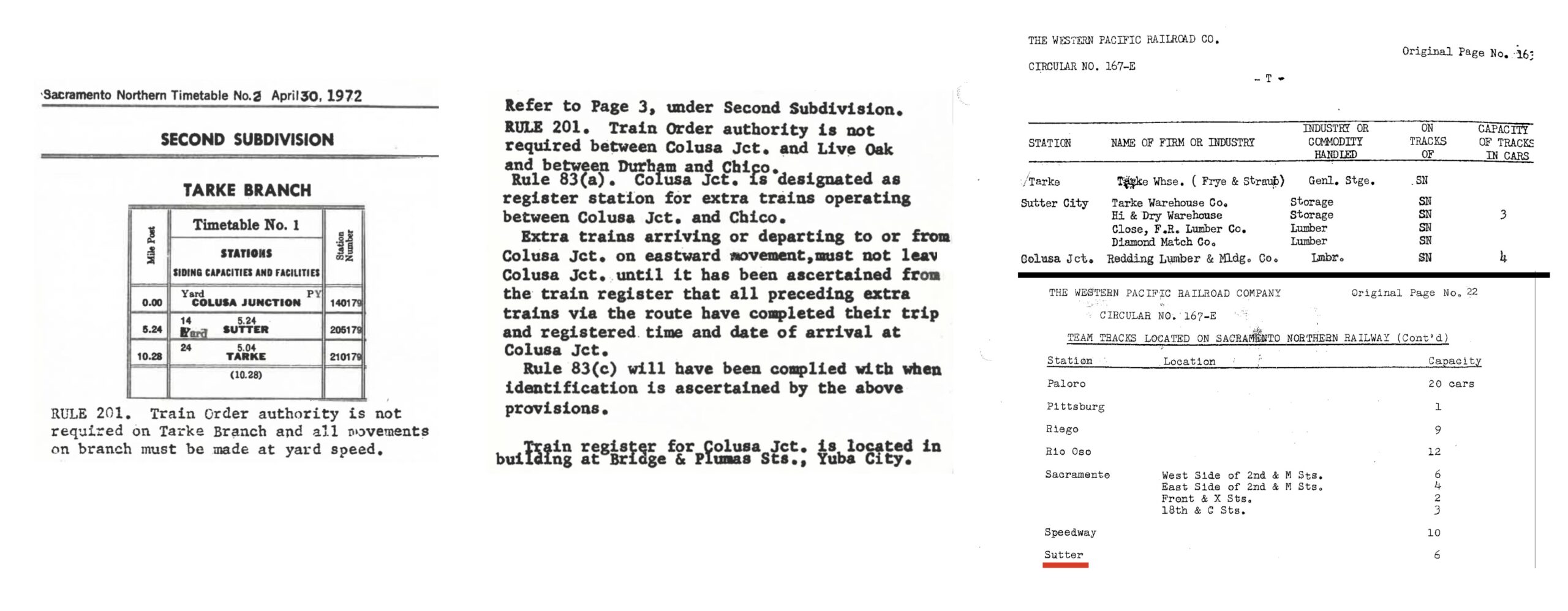
On the left, by 1972 the Colusa Branch was serving only three places. On the left center, weekly freight traffic through Colusa Jct. consisted of three runs of the Chico Local, and, at best, one run to Sutter on the Colusa Branch. Trains crawled through the area at 10 miles per hour, so the registration procedure at Colusa Jct. by telephone was no longer in use. On the right and right center, there was only one customer at Tarke, Tarke Bean Warehouse, started in 1925 and limited to Sept.-Oct. service only by 1973. After the flood at Tarke in 1940, the Frye Bros. built the second warehouse at Sutter along the branch line. For more about the Frye family and Cecil Straub, click here.
L342-12-Courtesy BAERA, Western Railway Museum Archives, 13492, l and c, Courtesy Bruce Eldridge, r, (Image 3 of 53)
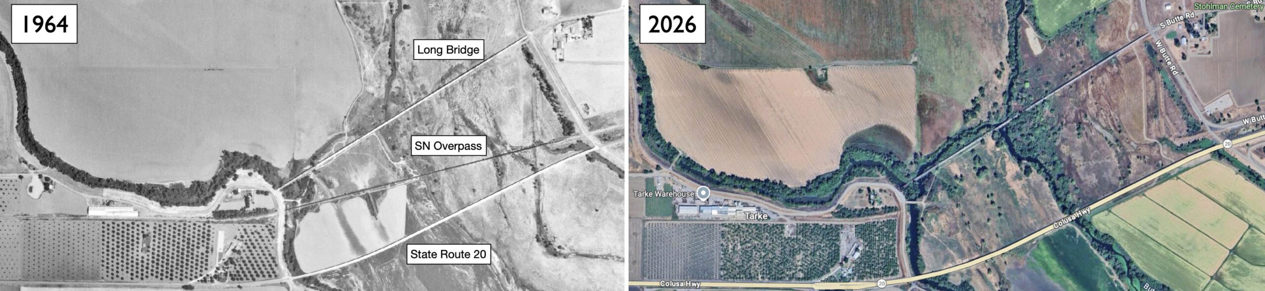
The complication with the branch line by the 1970s was the SN overpass of the Butte Slough-Sutter Bypass, henceforth to be referred to as the slough overpass. The vehicular crossing to the north, the Long Bridge was supplanted by the construction of State Highway 20 from just west of Sutter to the south of the slough overpass in 1938. Almost all of the abandoned and shuttered Long Bridge survives in 2026.
L342-15-USDA Aerial Sut 2-98, Courtesy Map Collection, Shields Library, University of California, Davis, G4363.S9A4 1964. S8, l, Google Maps, r, (Image 4 of 53)
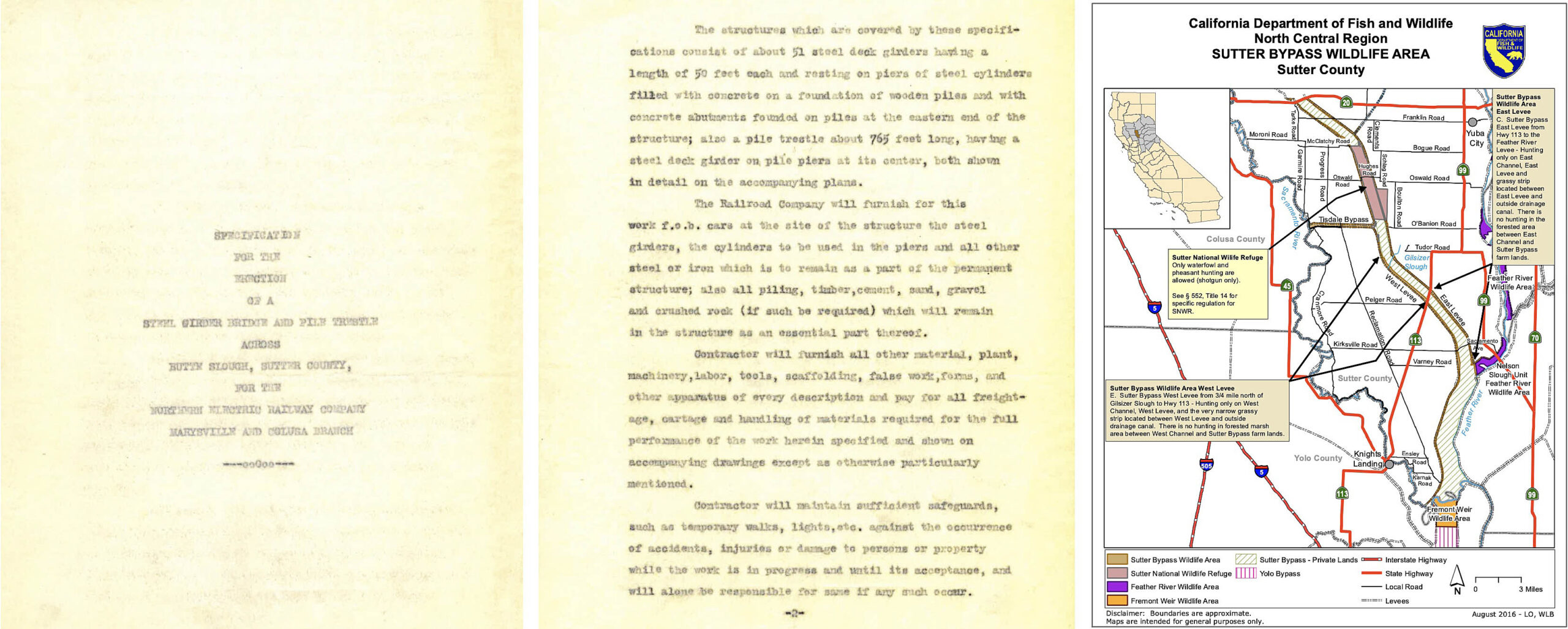
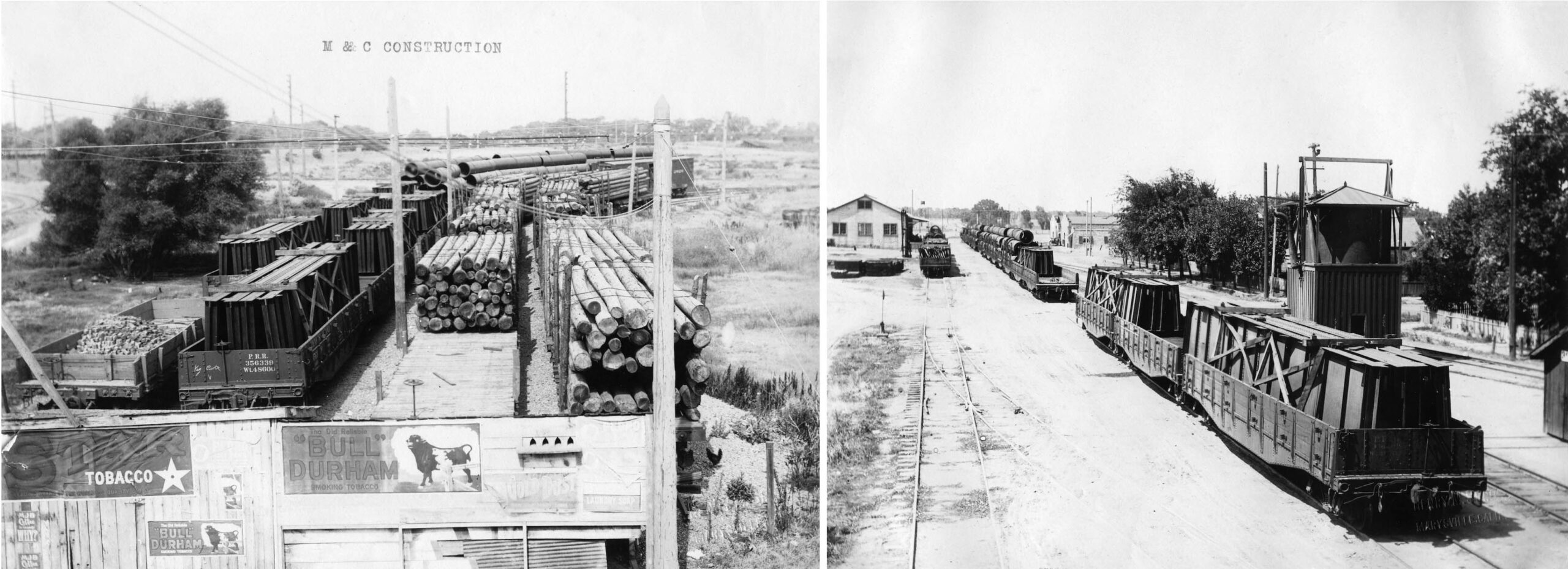
Next for details about the construction of the slough overpass ca. 1911-1913. The second page of this proposal on the right outlines the Northern Electric Railway, NE, specifications for the slough overpass. Fifty-one steel girders, each fifty feet in length, accounted for the eastern “bridge” portion of 2550 feet, the western portion a 765-foot long pile trestle. The reason for this hybrid design as a function of cost, water flow patterns, or the pending construction of the Sutter Bypass, right, has not been found. This map confirms that Highway 20 is the official northern border of the Sutter Bypass, however, delineating it from Butte Slough is often inconsistent in older documents.
L342-20-Courtesy BAERA, Western Railway Museum Archives, 29800sn, , l and c, Courtesy California Dept. of Fish and Wildlife, r, (Image 5 of 53)
Along with the grading of the path of the slough overpass, a temporary railroad was constructed to bring the timbers and steel plates to the positions they would assume in the structure. The locations of the images shown were not provided and could not be determined for sure, although the track configuration on the left appears to be that of a multi-track wye.
L342-25-Henry M. Seron Photos, Courtesy BAERA, Western Railway Museum Archives, 259519sn, l, 259519sn, r, (Image 6 of 53)
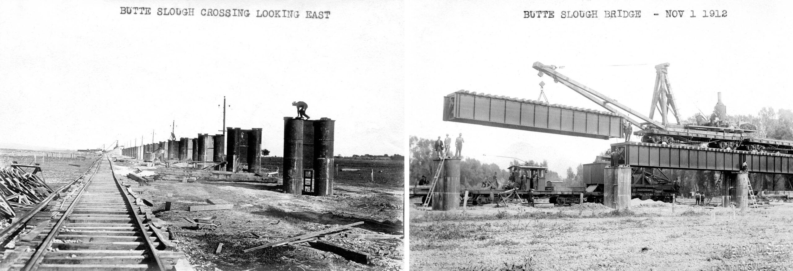
The steel cylinders were set and filled with concrete to create the piers, left, then starting from the east side, the steel girders were lowered into position by advancing the final rail line over each pair of piers one-by-one, right, northeast view.
L342-30-Henry M. Seron Photo, r, Courtesy BAERA, Western Railway Museum Archives, 259524sn, l, 259529sn, r, (Image 7 of 53)
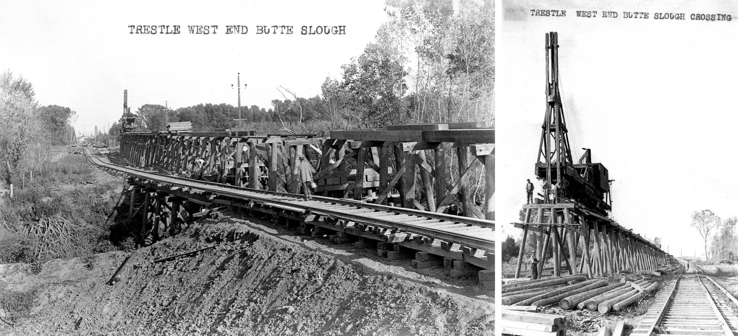
From the west end, a pole driver started to assemble the wooden trestle, left, east view, a close up west view on the right, as the process of laying the rail followed the progress of the driver.
L342-35-Courtesy BAERA, Western Railway Museum Archives, 259520sn, l, 259521, r, (Image 8 of 53)
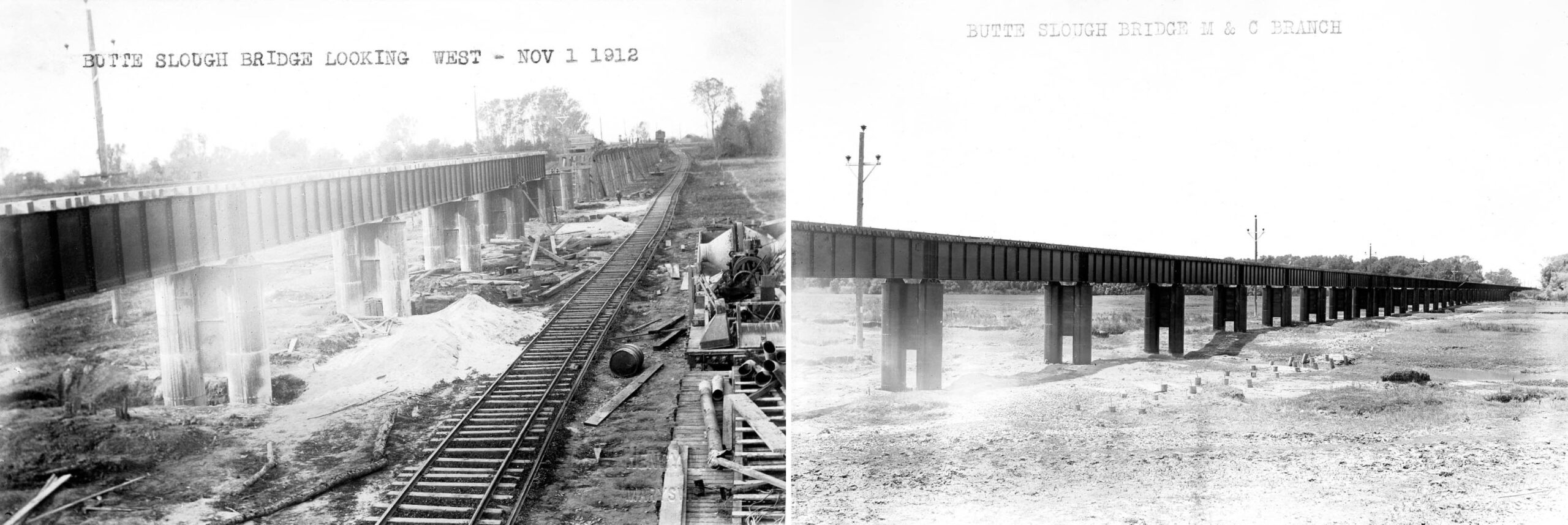
Finally, the point where the trestle and bridge came together is shown in a west view, left, and the completed structure sometime ca. 1913, right.
L342-40-Henry M. Seron Photo, l, American Photo Co. Photo, r, Courtesy BAERA, Western Railway Museum Archives, 259528sn, l, 259531sn, r, (Image 9 of 53)
Moving ahead to 1938, prior to the extension of State Highway 20 over the slough, vehicles heading from Tarke to Sutter had to cross over the SN right-of-way on the west side of the slough via what in 2026 is S. Tarke Rd. to access the Long Bridge as seen in this north view from Sept. 29, 1938, left. The scene looks similar in 2017, right view, as the road is still passable, but the track is gone and access to the Long Bridge is not an option. S. Tarke Rd. now heads south to Highway 20.
L342-45-Copyright California Department of Transportation, 541-3, l, Stuart Swiedler Photo, r, (Image 10 of 53)
By the time this west view was taken on Sept. 29, 1938, State Highway 20 had been extended from west of Sutter, left, to across the slough in an east view, right.
L342-50-Copyright California Department of Transportation, 541-0, l, 541-1, r, (Image 11 of 53)
Finally, this northeast view taken on Sept. 29, 1938 shows the three slough crossings; Highway 20, the SN overpass, and the abandoned Long Bridge, forefront to background. As Highway 20 headed west, it separated a greater distance from the SN overpass. This is mentioned only in that no images prior to Dick Dorn’s work in 1973 show a train on the trestle taken from a remote location, Highway 20 being a logical vantage point. Photos of the trestle were typically taken from the spot it landed on its western end.
L342-55-Copyright California Department of Transportation., 541-2, (Image 12 of 53)
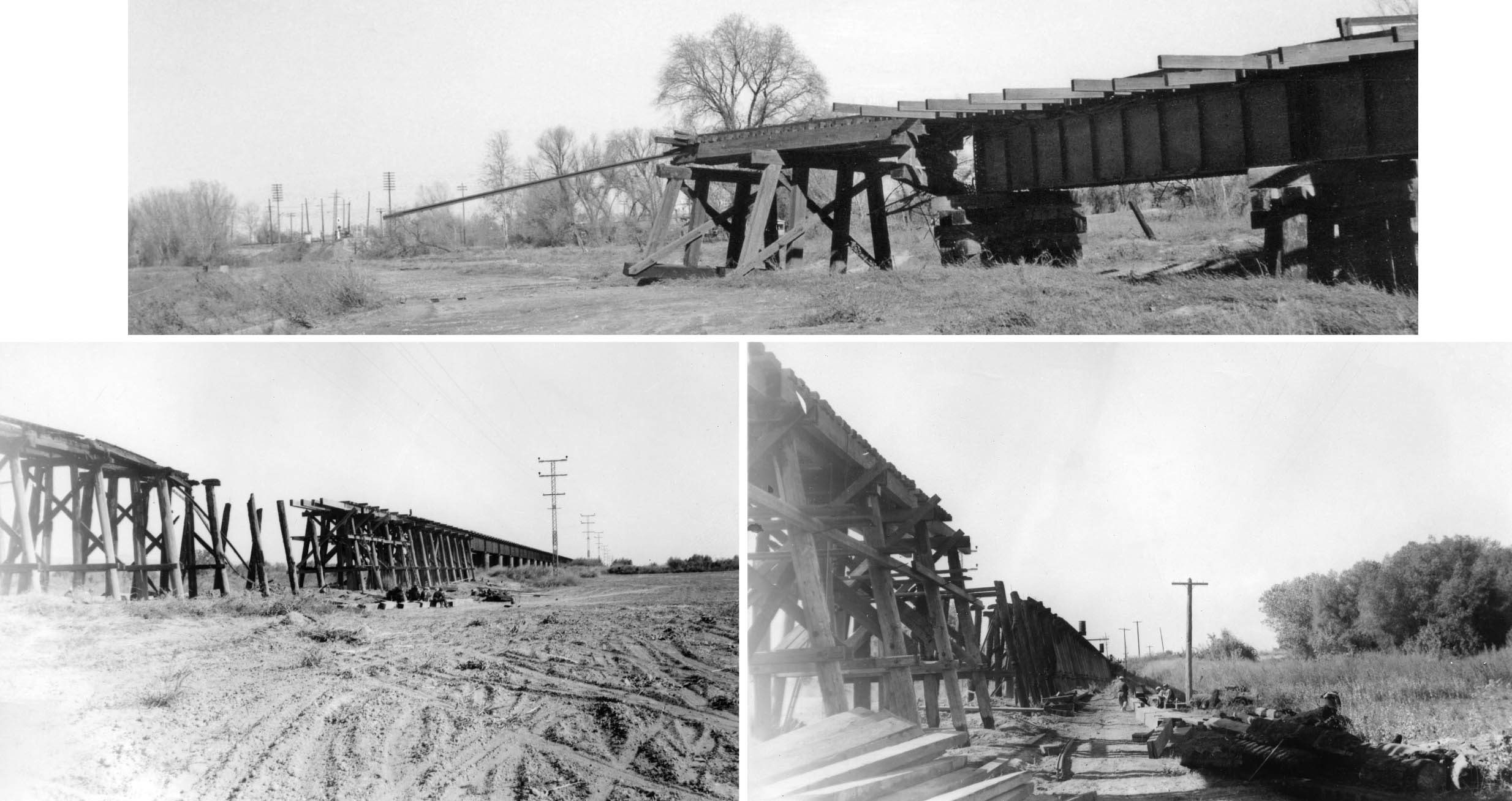
The wooden portion of another hybrid steel-wooden overpass the NE created between Alicia and Oliver ca. 1907 did not do well in the Christmas Flood of 1955, top, and so too the slough overpass was severed within the wooden portion during a flood in 1942, the east view from the south side, left, the north side looking west, right, both from Oct 16, 1942.
L342-60-Courtesy BAERA, Western Railway Museum Archives, 225586sn, top, 259541, bl, 259539, br, (Image 13 of 53)
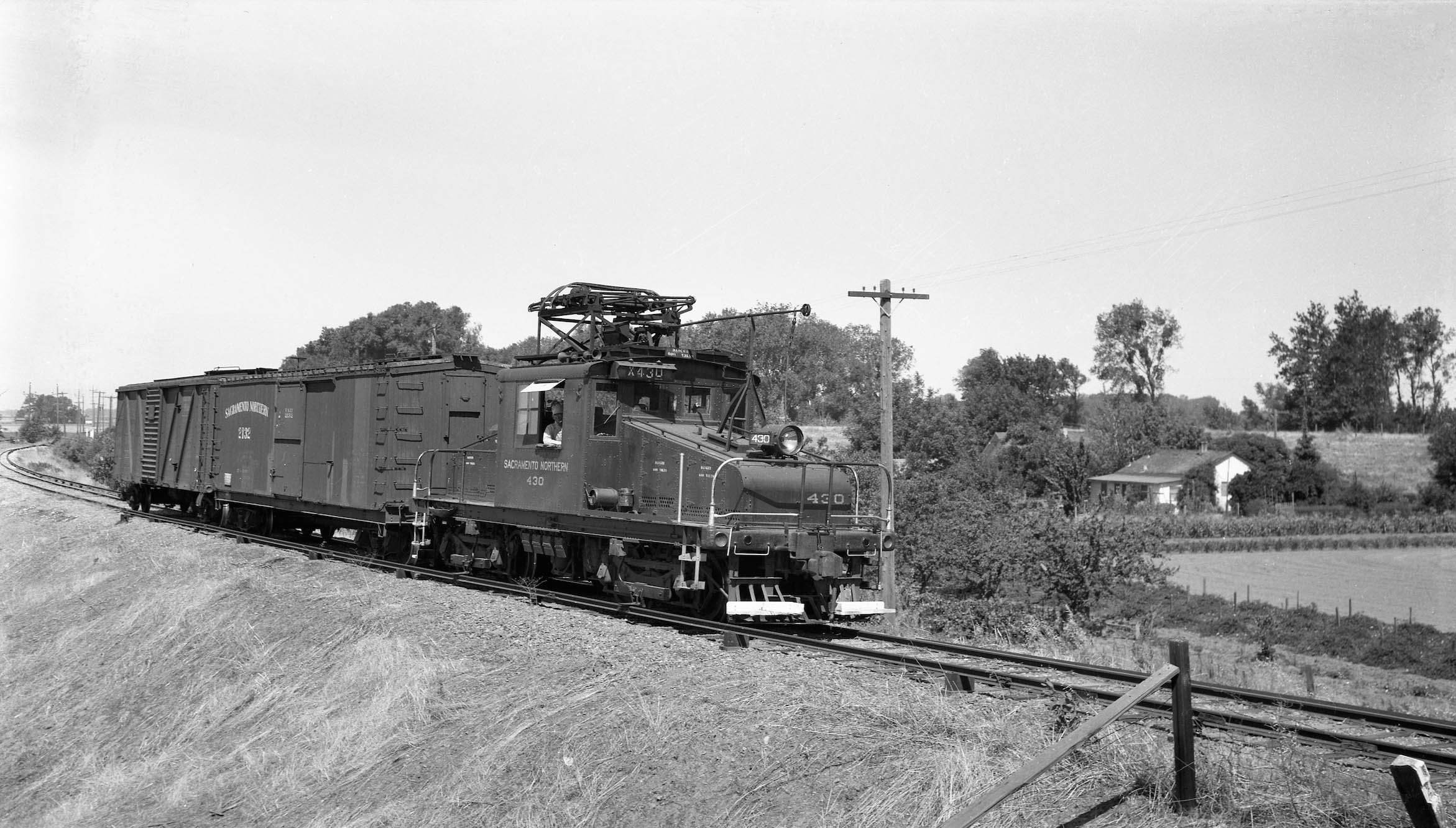
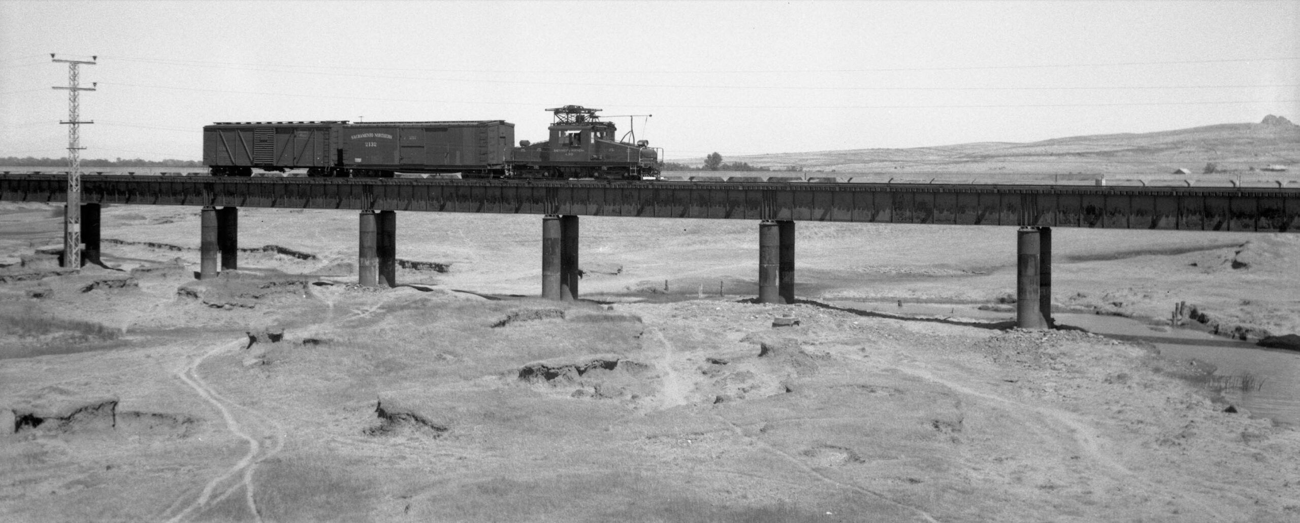
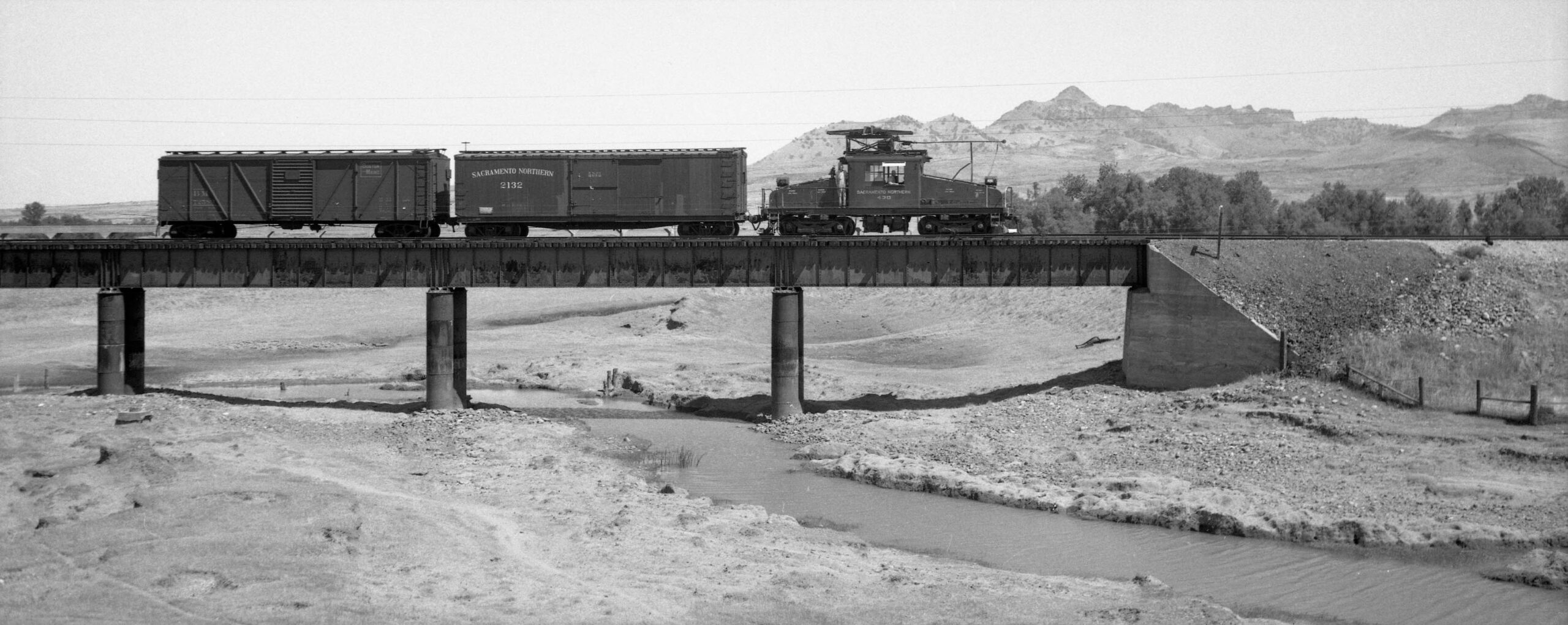
On June 27, 1945, Bay Area railfan photographer Arthur Lloyd went to the SN North End to take pictures of electric freights. He took one photo at Live Oak, and took a series of images of a small freight crossing the slough. The first view is to the northwest, motor SN 403, SN boxcar 2132 and a Boston Maine boxcar passing the residence just to the east of the Tarke Warehouse.
L342-65-Arthur Lloyd Photo, Courtesy BAERA, Western Railway Museum Archives, 126041sn, (Image 14 of 53)
Set up on the eastern portion of the Highway 20 overpass, Lloyd next captured the there-car freight nearing the east end of the structure on June 27, 1945, northwest view. The wooden trestle portion can barely be appreciated toward the left edge. No images were found of the train on the wooden trestle.
L342-70-Arthur Lloyd Photo, Courtesy BAERA, Western Railway Museum Archives, 126043sn, (Image 15 of 53)
As SN 403 and the two boxcars progressed more to the east, the view now more toward the north reveals the Long Bridge in the distance.
L342-75-Arthur Lloyd Photo, Courtesy BAERA, Western Railway Museum Archives, 126044sn, (Image 16 of 53)
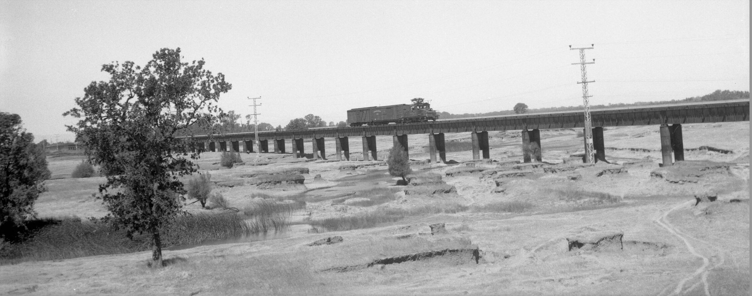
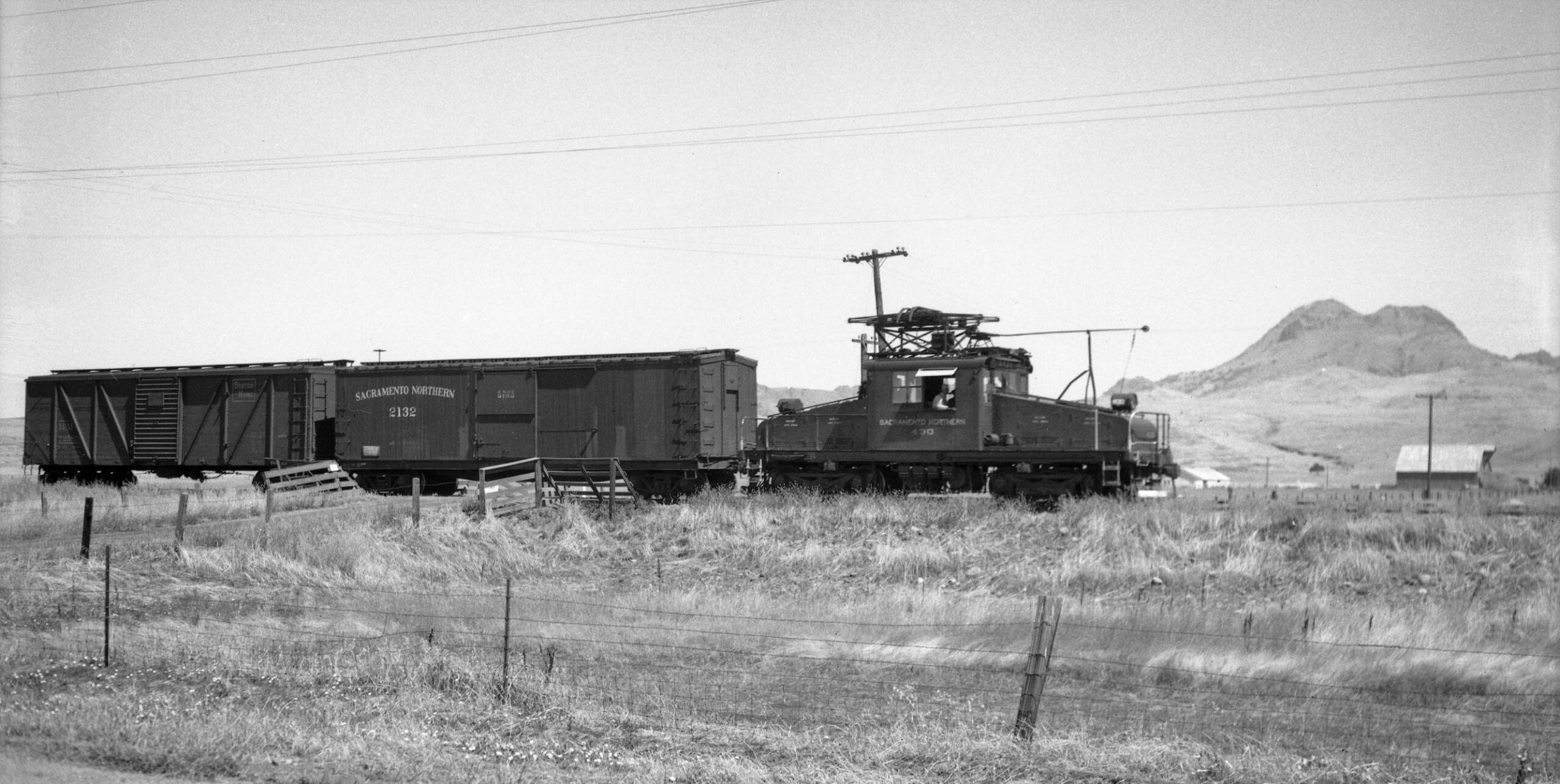
Now at the end of the overpass about to cross the east support, the Sutter Buttes come into view in the background in this north view.
L342-80-Arthur Lloyd Photo, Courtesy BAERA, Western Railway Museum Archives, 126042sn, (Image 17 of 53)
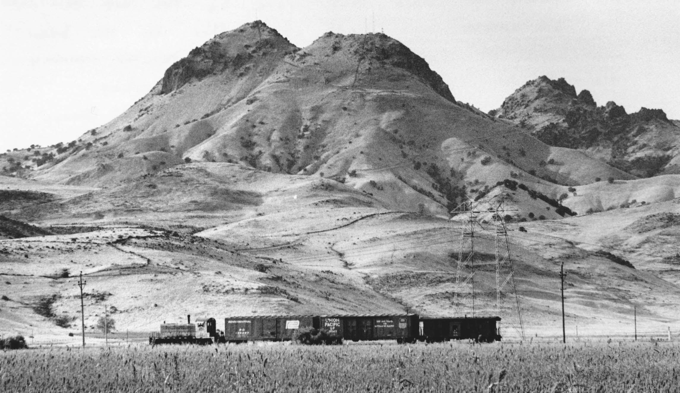
To top it off, on the way to Sutter, the train is positioned in front of the summit of South Butte, at 2,122 ft. the highest point in Sutter County.
L342-85-Arthur Lloyd Photo, Courtesy BAERA, Western Railway Museum Archives, 129829sn, (Image 18 of 53)
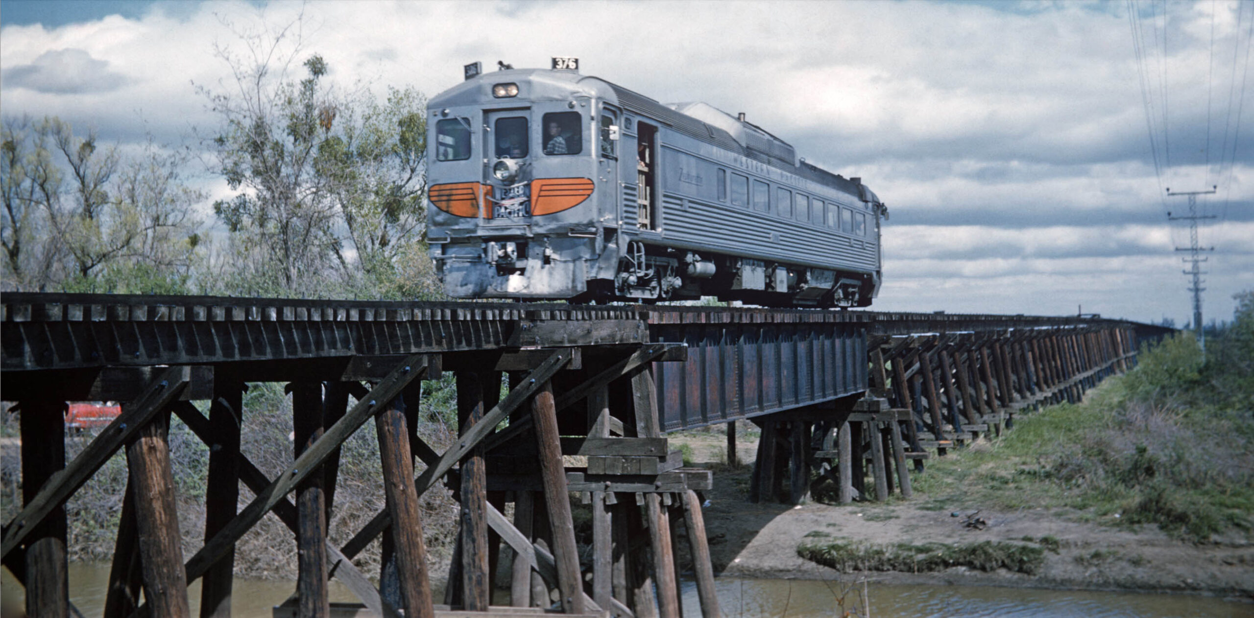
Lloyd also participated in the Bay Area Electric Railroad Association, BAERA, excursion to Colusa on Mar. 26, 1960 with Western Pacific Rail Diesel Car, WP RDC, no. 376. He finally got a shot at the trestle that he didn’t get before. Note the single steel girder over the Butts Slough tributary. Even so, it is difficult to resolve the steel reinforced eastern portion of the overpass in the distance. After this event, no images of the Colusa Branch west of Sutter were found until Dick Dorn began taking photos there in the fall of 1973.
L342-90-Arthur Lloyd Photo, Courtesy BAERA, Western Railway Museum Archives, 130184wp, (Image 19 of 53)
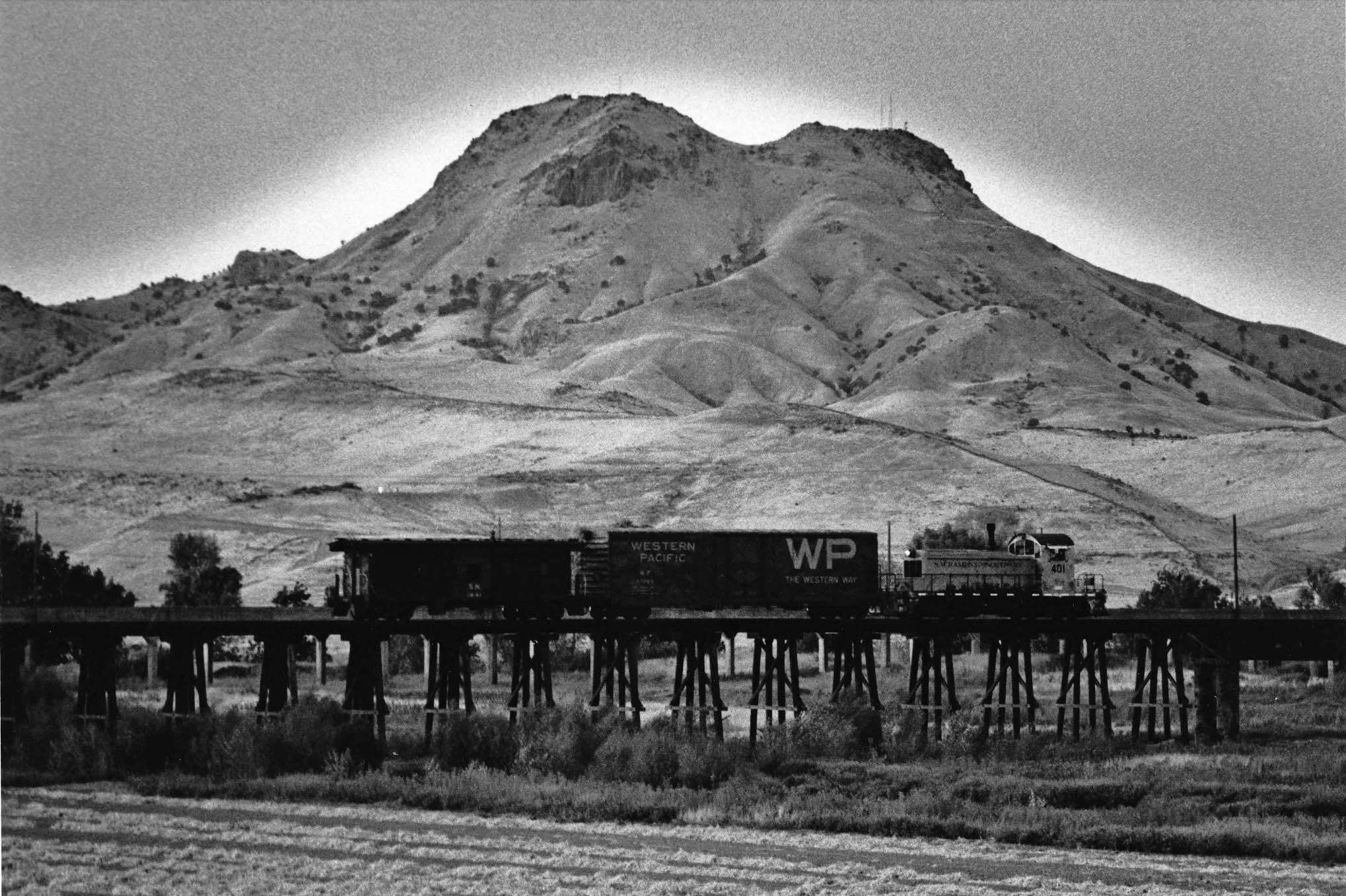
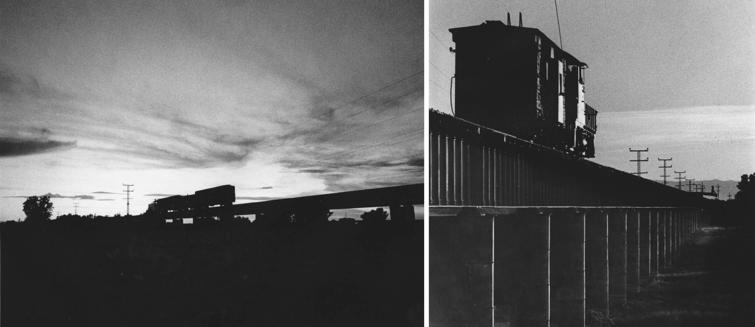
The photos Dick took in 1973 of the slough overpass and track to Tarke are important for two reasons. First, it would be the last opportunity to document freight activity on this section of the SN. His comments from 2026 indicate that he didn’t have any knowledge of this being the case. Second, his choice of lens allowed him to compress the entire overpass from the single western end steel girder overpass seen in the last image to the east end concrete abutment as seen on the left in the east view of SN 201, boxcar and caboose on Sept. 25, 1973.
L342-95-Dick Dorn Photo, Courtesy Dick Dorn, (Image 20 of 53)
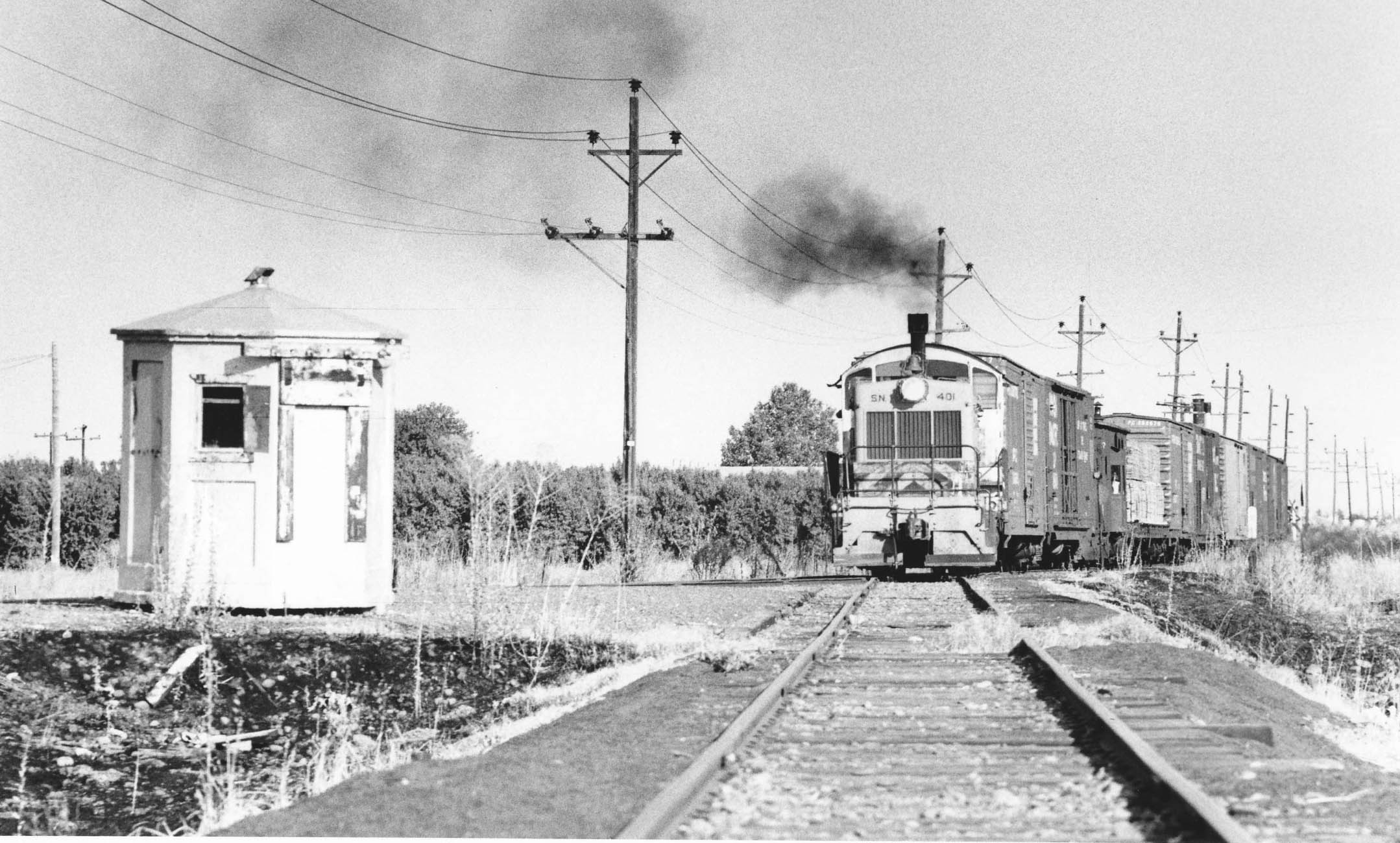
Dick was present during the Sept. 2, 1973 first run out to Tarke that last year, Seen here are SN 401 with two boxcars and caboose destined for Tarke, and the lumber and trailing boxcars to be dropped off at Sutter to be switched on the return trip. As shown previously with the 1972 employee timetable, the dilapidated cement phone booth was no longer needed by the crew to register this run, and the train would crawl at yard speed to its destinations.
L342-100-Dick Dorn Photo, Courtesy Dick Dorn, (Image 21 of 53)
After depositing the tail end of the freight, the remainder headed for Tarke. Dick waited with his telephoto lens on Highway 20 between Wyncoop Rd. and Southridge Blvd. to document the scene, north view, Sept. 2, 1973. In addition to the position of the summit of South Butte, the position of the electrical transmission tower in the picture is a clue as to the location of the passing train.
L342-105-Dick Dorn Photo, Courtesy Dick Dorn, (Image 22 of 53)
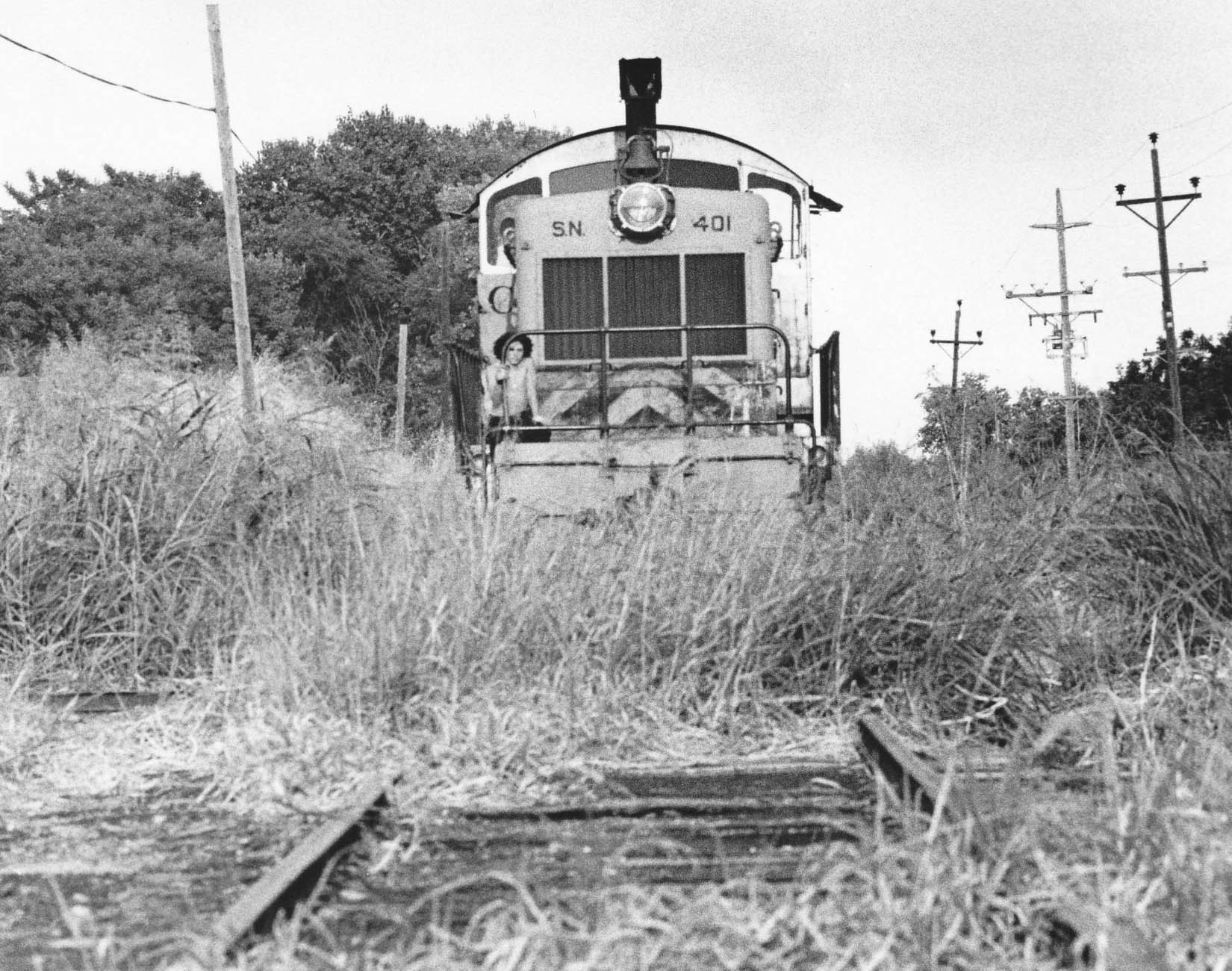
If there was any doubt this was the first run of the year past Sutter, and that the train stayed at yard speed, this east view from Sept. 2, 1973 is more than enough proof short of a video replay. Dick continues, “in looking at the early names of the Colusa Branch station names: Stolhman, Tarke, Noyes, and Humphrey are all names of some of the first families to establish around the south and west sides of The Buttes.”
L342-110-Dick Dorn Photo, Courtesy Dick Dorn, (Image 23 of 53)
Next a photo of SN 401 with boxcar and caboose on the Stohlmans Trestle on Sept. 25, 1973, north view. Dick noted “that the SN was very aware of the limitations on it. Only the 401 and 402 were allowed to take trains over it. Plus, they used the smallest capacity covered hoppers for bulk loading. I remember discussions about this when they were running out there in 73. The Stohlman’s were one of the original families settling in the area, their house was located at the east end of the trestle. There is a small cemetery next to the house bearing their name.”
L342-115-Dick Dorn Photo, Courtesy Dick Dorn, (Image 24 of 53)
Two more views from Oct. 10, 1973 while traversing the steel supported eastern portion of the overpass while the sun was setting. Dick continues, “there use to be a little town out there called Noyesburg. The old wood schoolhouse was still standing out there into the early 80’s. The Stohlman family has a grave site with original members out at the Noyesberg Cemetery on the west side of the Buttes. The Tarke family also has original family members out there as well.”
L342-120-Dick Dorn Photos, Courtesy Dick Dorn, (Image 25 of 53)
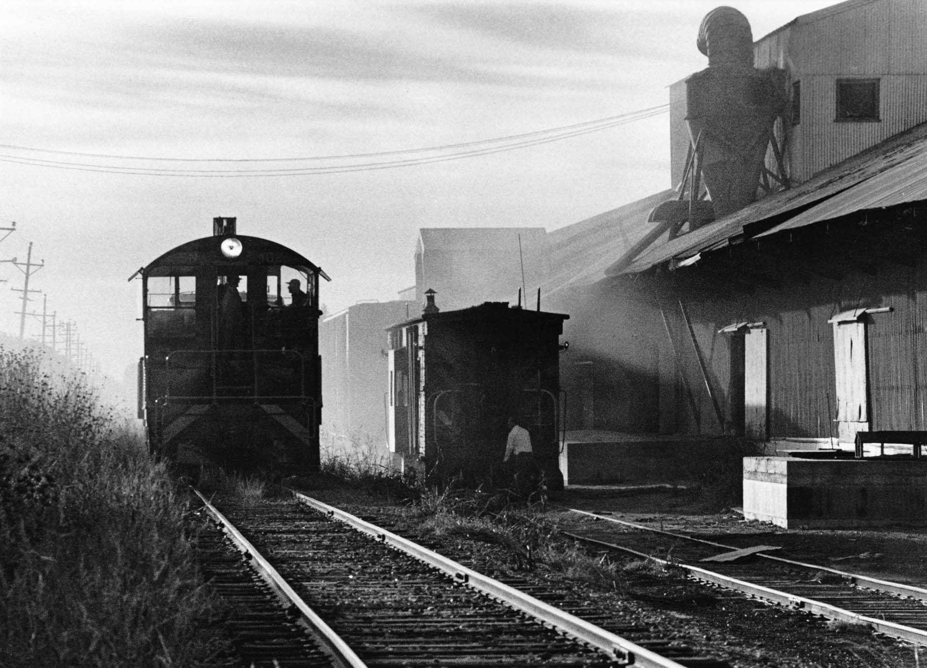
Finally a documentation of switching at Tarke Warehouse on Oct. 10, 1973, the only picture found of this operation that had been ongoing since 1925. The image captures the dust in the air at the warehouse. Dick noted “that once at Tarke, they loaded bulk beans in covered hoppers and bagged beans in box cars.” Tarke Bean was purchased in 2013 Rhodes-Stockton Bean CO-OP, but is still listed in 2026 as Tarke Barn LLC.
L342-125-Dick Dorn Photo, Courtesy Dick Dorn, (Image 26 of 53)
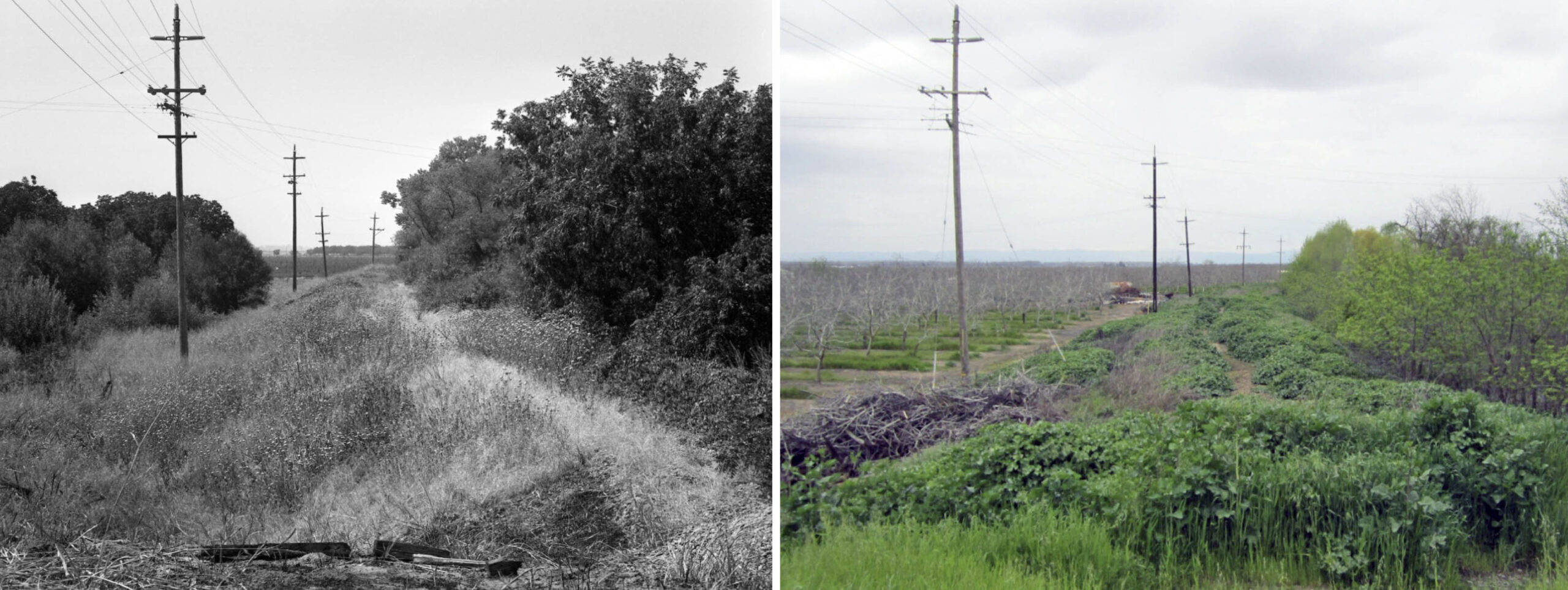
A few comparative images of the area by Harry Demoro from Sept. 15, 1988, left versus ones from 2017, right, respectively. First, two north views of the severed truss bridge section at the western end of the Long Bridge. Jeff Asay’s book “The Iron Feather”, Lockridge Press, 2018 contains some insights that you will not find anywhere else regarding the WP’s view of the Colusa Branch. First, from page 463, although the WP liked having the business at Tarke, the slough overpass could only handle underweight car loads, and the cost of maintaining the crossing annually was $5000. The WP favored abandonment west of Sutter in mid-1972.
L342-130-Harre Demoro Photo, Courtesy John Harder, l, Stuart Swiedler Photo, r, (Image 27 of 53)
Another set of comparative west views from what is in 2026 S. Tarke Rd. are shown here. More from Jeff Asay, p. 463, the WP filed to abandon the section west of Sutter in January 1973, but protests from Tarke Bean and others kept the line open.
L342-135-Harre Demoro Photo, Courtesy John Harder, l, Stuart Swiedler Photo, r, (Image 28 of 53)
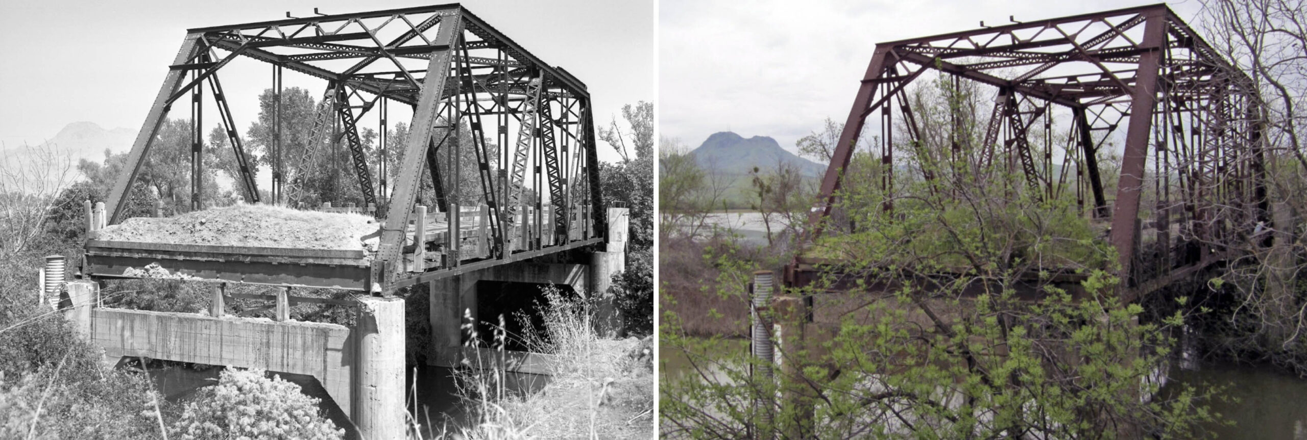
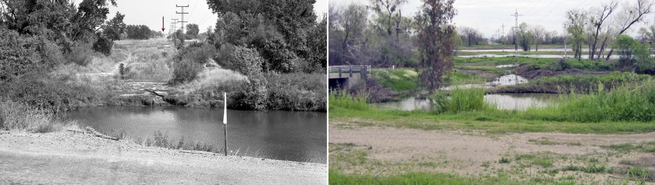
Another set of comparative east views taken from what is in 2026 S. Tarke Rd. at the western end of the trestle are shown here, the red arrow the site of the eastern concrete abutment, present in 1988, one year after the removal of the overpass. Dick Dorn had already mentioned the timber portion of the slough crossing did not pass the FRA inspection, and Harry Demoro notes in “Sacramento Northern”, Signature Press, 1991, that the bridge was condemned soon after.
L342-140-Harre Demoro Photo, Courtesy John Harder, l, Stuart Swiedler Photo, r, (Image 29 of 53)
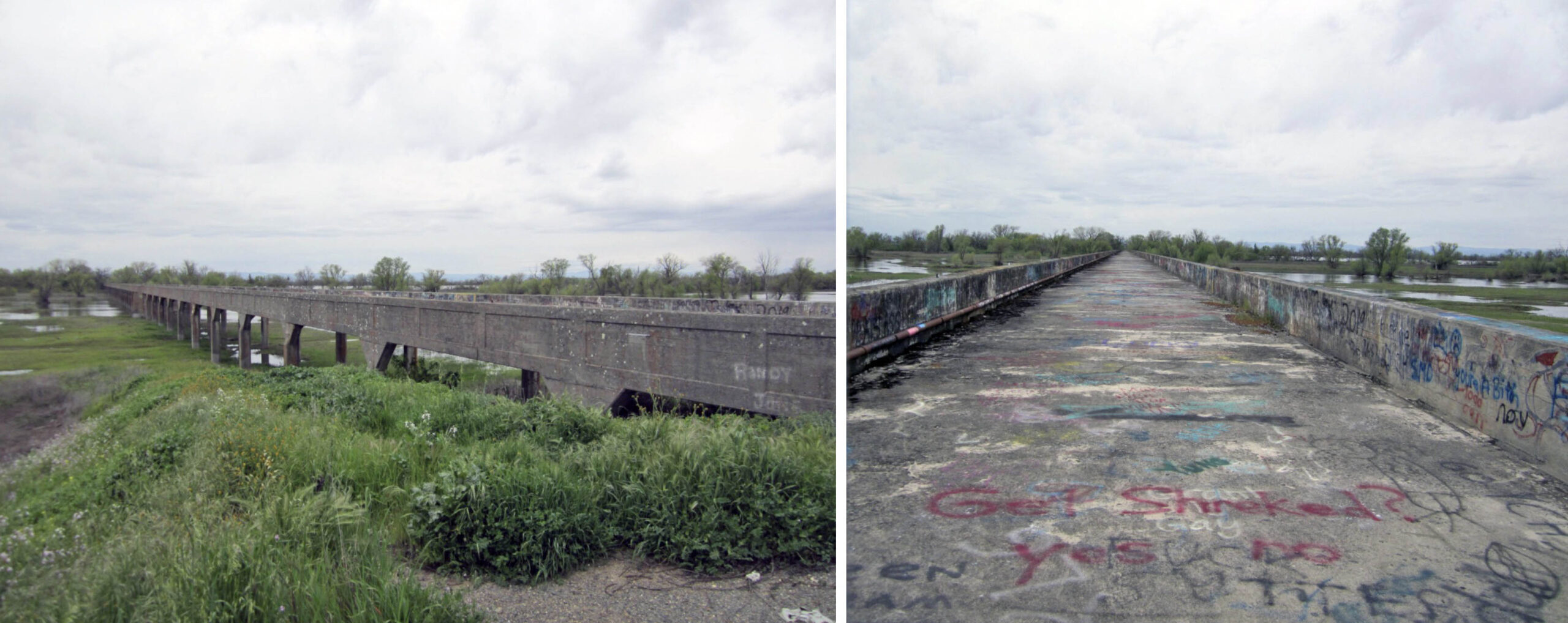
Two west views of the Long Bridge from the east end in 2017. After the fall of 1973, no trains came over the slough overpass to Tarke. Jeff Asay notes on page 502, the WP set up an economically favorable agreement with Tarke Bean where beans were transported by truck to the SN Yuba City team track to be loaded onto trains. Technically, the line from Sutter to Tarke remained open, as abandoning the line would have required the WP to pay for removing the overpass. It would not be until 1985 that the section west of Sutter at milepost 7.11 to Tarke was abandoned and removal the slough overpass occurred at the beginning of 1987.
L342-145-Harre Demoro Photo, Courtesy John Harder, l, Stuart Swiedler Photo, r, (Image 30 of 53)
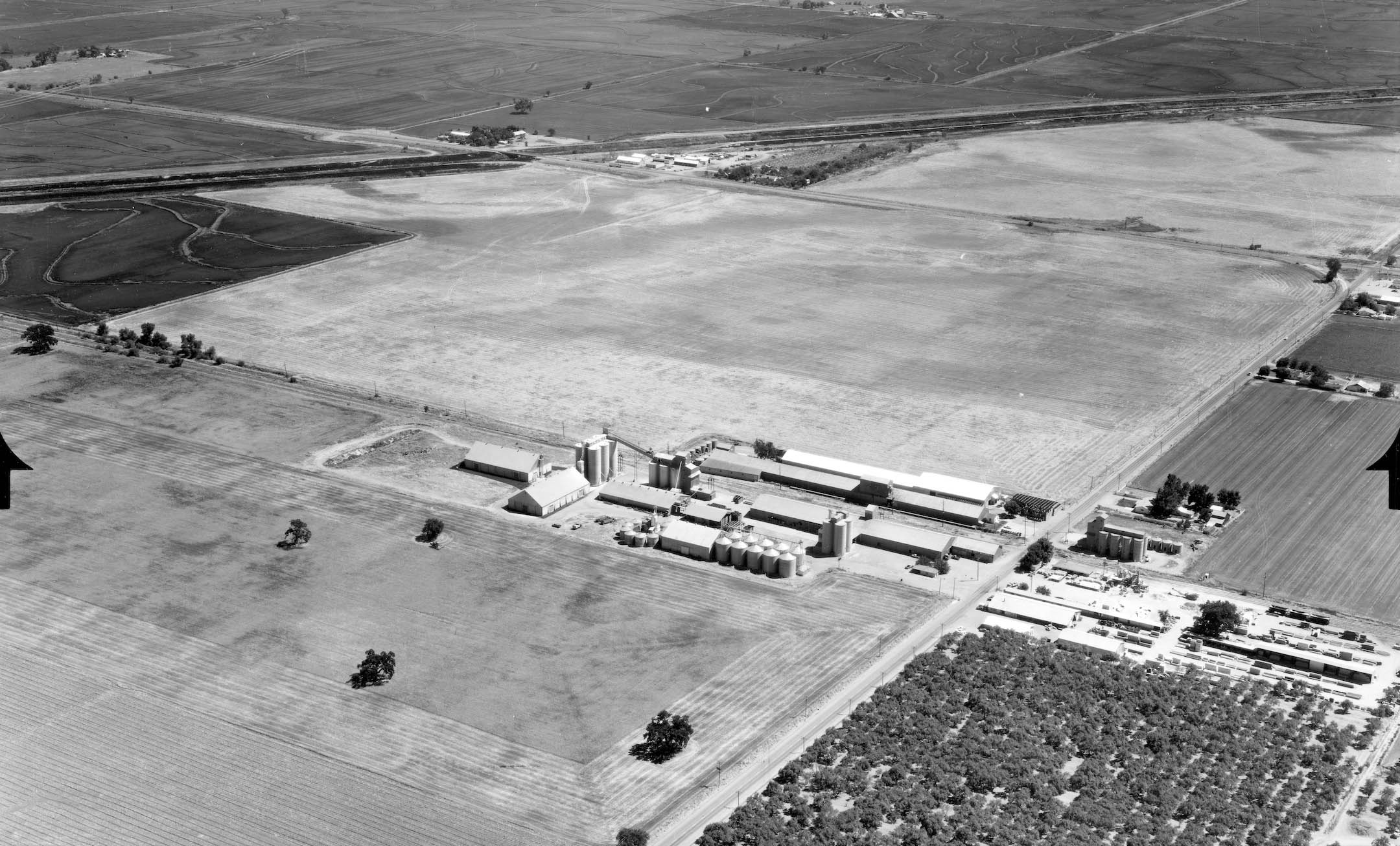
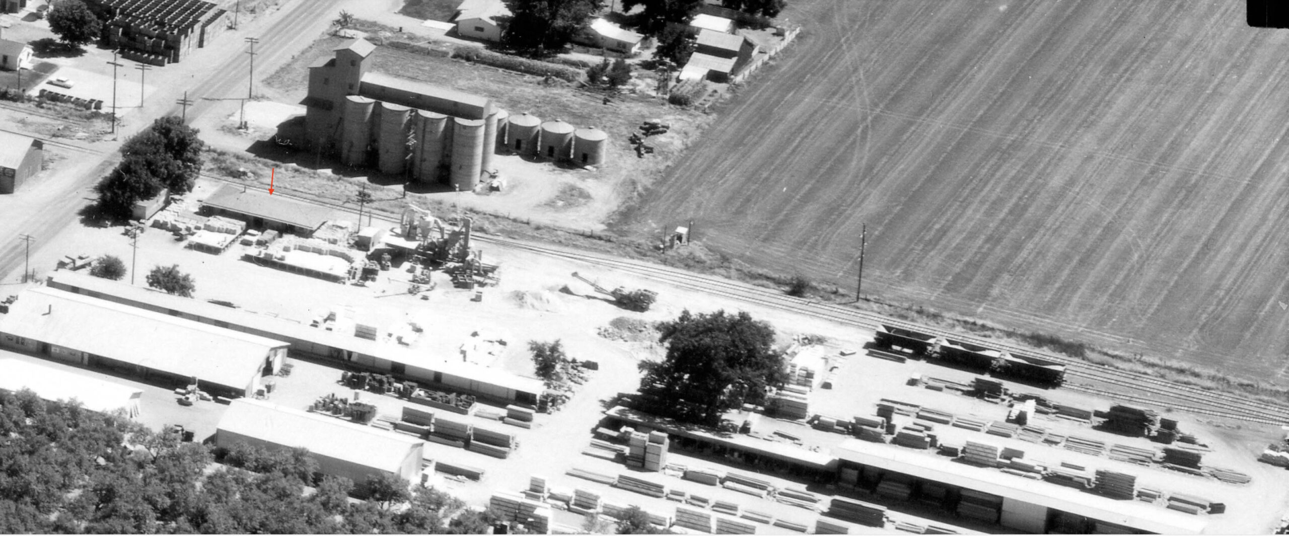
After 1973, there was still active shipments coming to Sutter, this southeast view from Aug. 14, 1967. The previously shown WP Circular ca. 1967 showed customers Hi & Dry Warehouse, Close F.R. Lumber Co., Tarke Warehouse Co., and Diamond Match. Diamond Match was gone by 1973, unsure about this location for Tarke Warehouse. As an aside from the previous link, when the Frye Bros. built the warehouse at Sutter after the flood of 1940 damaged the 40k lbs. of barley at Tarke, the operation was able to supply the entire world with Lima Beans during WWII.
L342-150-Ed Brady Aero Portraits Aerial Photography, Courtesy BAERA, Western Railway Museum Archives, 261465sn, (Image 31 of 53)
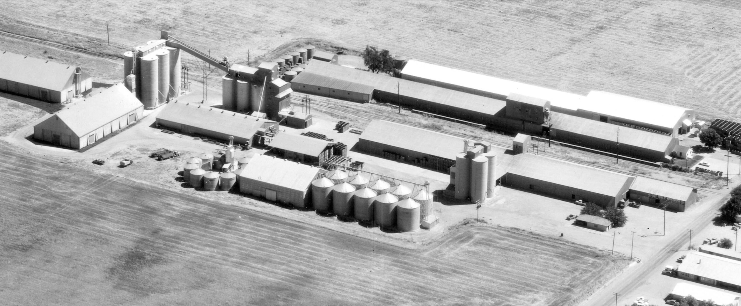
A detail of the portion east of Acacia Ave. from the 1967 aerial shows what was and is still Hi & Dry in 2026. It was begun in 1949, confirmed by its absence in images from 1940, and was purchased in 2012 by Farmers’ Rice Cooperative. Sutter Rice Co. is also at this location in 2026.
L342-155-Ed Brady Aero Portraits Aerial Photography, Courtesy BAERA, Western Railway Museum Archives, 261465sn, Detail, (Image 32 of 53)
A detail of the portion west of Acacia Ave. from the 1967 aerial shows at least the Close F.R. Lumber Co. The red arrow marks the SN Sutter depot engulfed with lumber as it had been from at least 1940.
L342-160-Ed Brady Aero Portraits Aerial Photography, Courtesy BAERA, Western Railway Museum Archives, 261465sn, Detail, (Image 33 of 53)
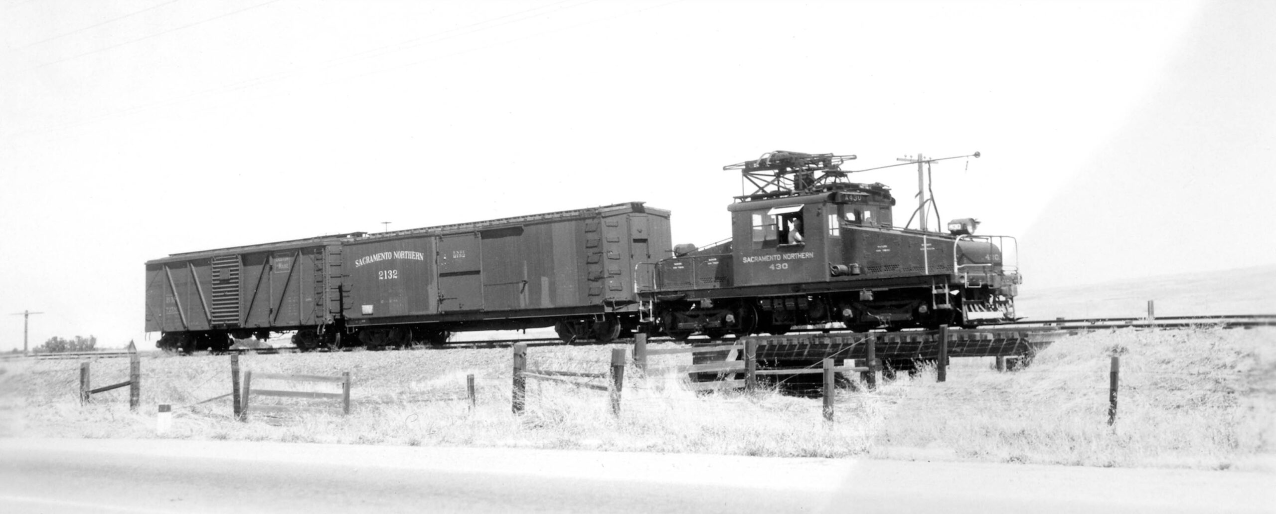
Back to 1945, this images is dated to May 28, 1945 of SN 430 and freight over one of three small trestles that were between the slough overpass and Sutter. It is exactly the same set of rail cars as the trio seen in Arthur Lloyd’s sequence, and Ken Kidder, the presumed photographer of this image, was a friend of the former.
L342-165-Ken Kidder Photo, Moreau Collection via Ira Swett, Courtesy BAERA, Western Railway Museum Archives, 156572sn, (Image 34 of 53)
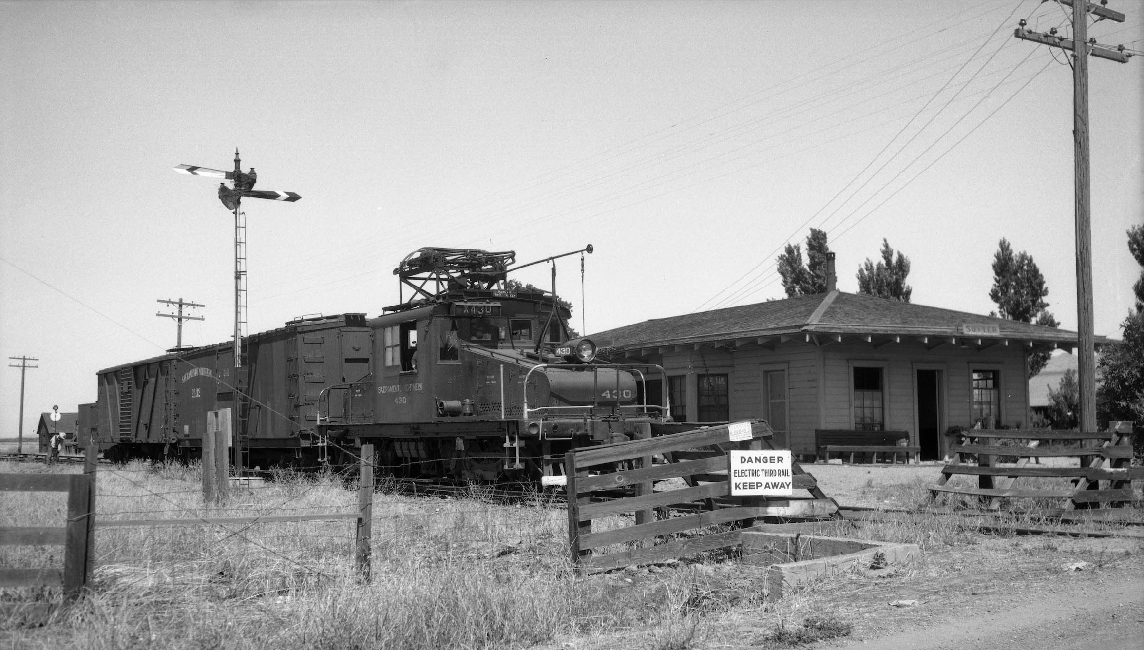
Arthur Lloyd definitely made it to Sutter, this northwest view from June 27, 1945 at the Sutter depot. Note the train order board or train order mast. It was used to tell the engineer if he needed to pick up orders or if he could proceed. When in the stop position with arms straight out they needed to stop and pick up orders. The worker behind the train at the switch with a railcar on the track next to him to the north is a nice segue to the next image.
L342-170-Arthur Lloyd Photo, Courtesy BAERA, Western Railway Museum Archives, 129827sn, (Image 35 of 53)
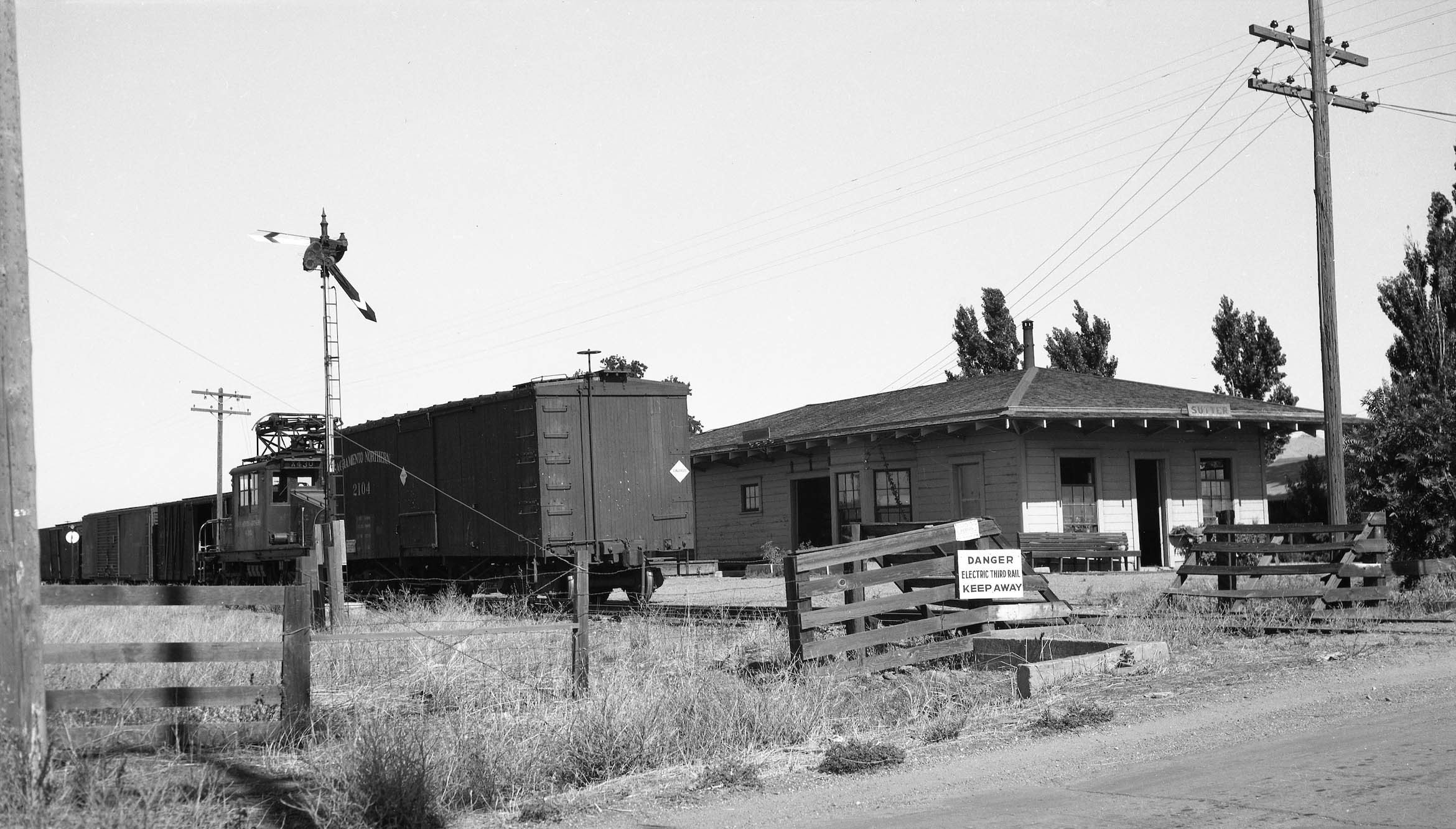
This northwest view from 1945 shows a different boxcar, SN 2104, and the train is in the process of switching. No images from this period were found facing east, so the presence or absence of Hi & Dry Warehouse cannot be ascertained.
L342-175-Sappers Collection, Courtesy BAERA, Western Railway Museum Archives, 136909sn, (Image 36 of 53)
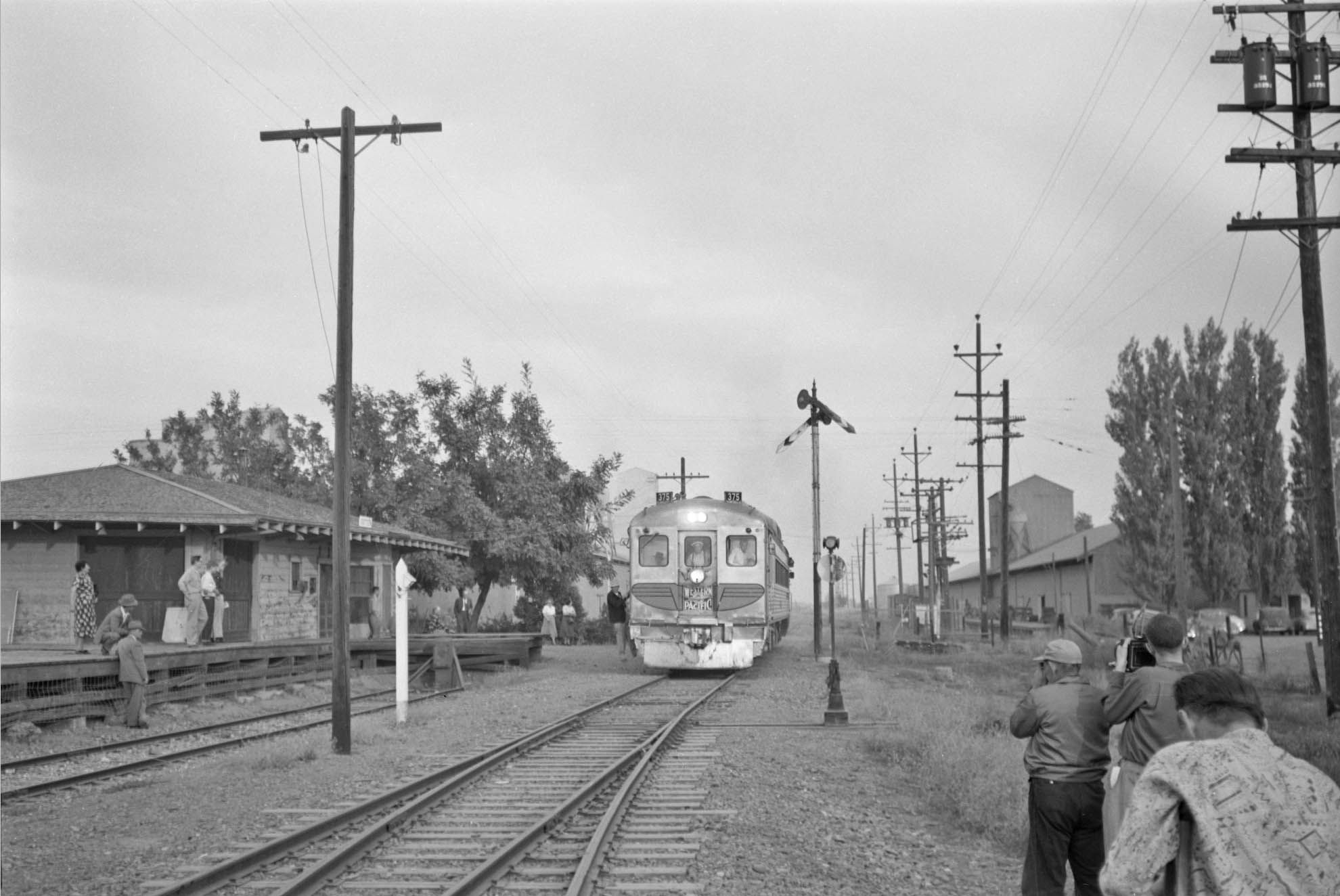
Ahead to Oct. 31, 1953, WP RDC no. 375 is approaching the Sutter station area slowly in this east view. Note Hi & Dry facilities are now present, and the switch track sending off a siding to the south has come into view. The Sutter depot is in need of a new coat of paint, but it is no longer engulfed in wood products.
L342-180-Rigney Collection, Courtesy BAERA, Western Railway Museum Archives, 133328sn, (Image 37 of 53)
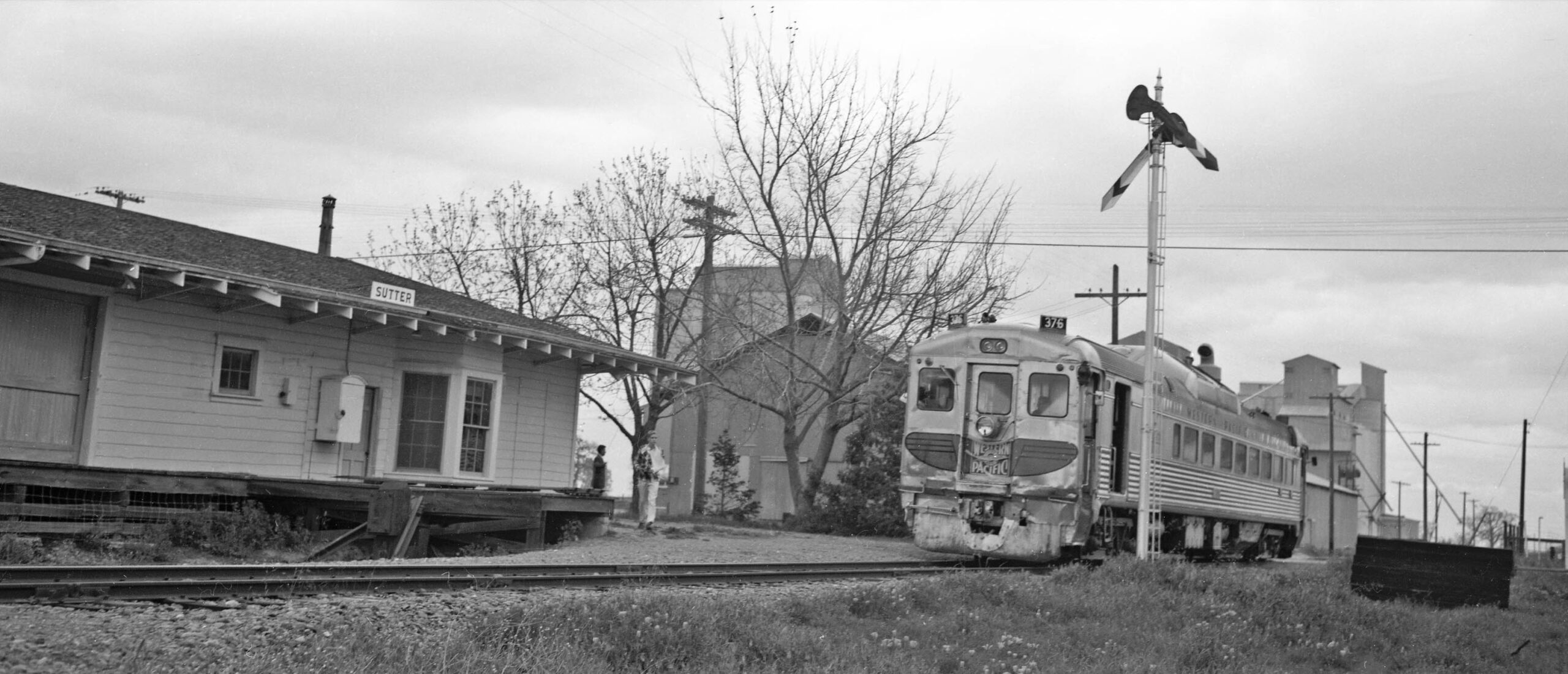
Same scene and conditions, but it is now the excursion to Colusa on Mar. 26, 1960 with WP RDC no. 376. The depot is looking much better as the train slowly pulls forward. Jeff Asay notes on page 494 of his book that the SN closed the depot and removed the agent there in 1962, the track continuing to be used for decades.
L342-185-Addison Laflin Photo, Courtesy BAERA, Western Railway Museum Archives, 172970sn, (Image 38 of 53)
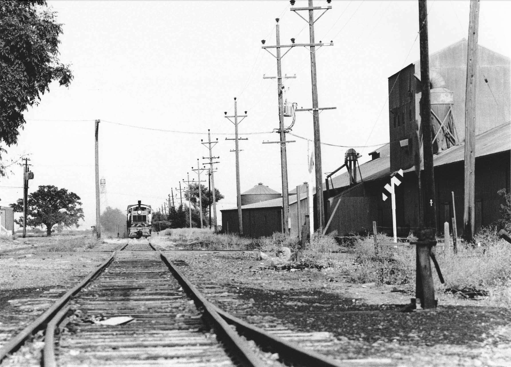
Nothing more at Sutter until Dick Dorn took two east views of SN 401 on Sept. 9, 1973. Here is the first one with the south side of Hi & Dry visible …
L342-190-Dick Dorn Photo, Courtesy Dick Dorn, (Image 39 of 53)
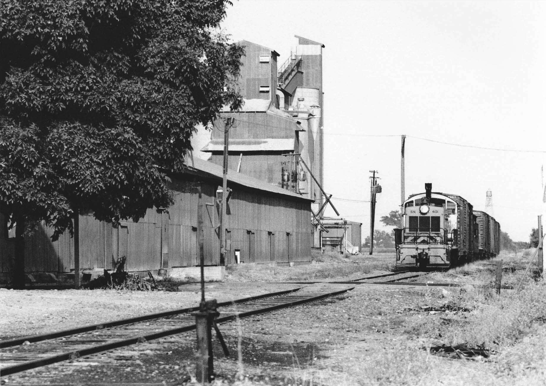
.. and the north side of Hi & Dry with SN 401 on Sept. 9, 1973. The boxcars behind the caboose will be left here until the return trip from Tarke.
L342-195-Dick Dorn Photo, Courtesy Dick Dorn, (Image 40 of 53)
A northwest view near Almendre on Sept. 18, 1973 with the rising moon and Buttes.
L342-200-Dick Dorn Photo, Courtesy Dick Dorn, (Image 41 of 53)
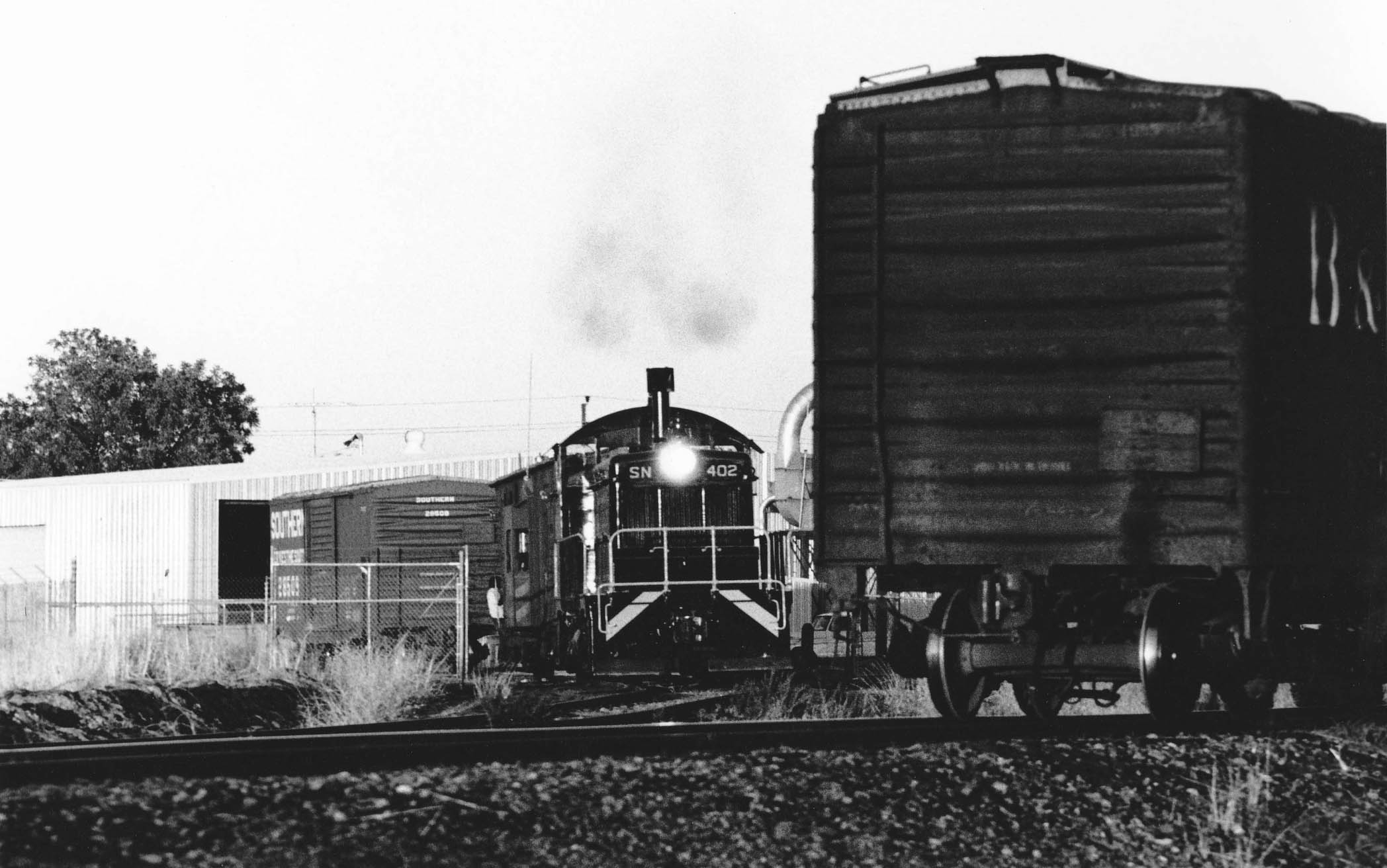
At Colusa Jct., the branch line switched out Redding Lumber and Moulding Co. Dick’s image of SN 402 in action on Sept. 18, 1973 is another one-of-a-kind photo from this location. So in summary Dick Dorn appears to have been the last person to systematically capture the whole line between Colusa Jct. and Tarke, using telephoto photography to bring the Sutter Buttes into the images and document extended parts of the branch line such as the overpass that required compression to fit in a single frame.
L342-205-Dick Dorn Photo, Courtesy Dick Dorn, (Image 42 of 53)
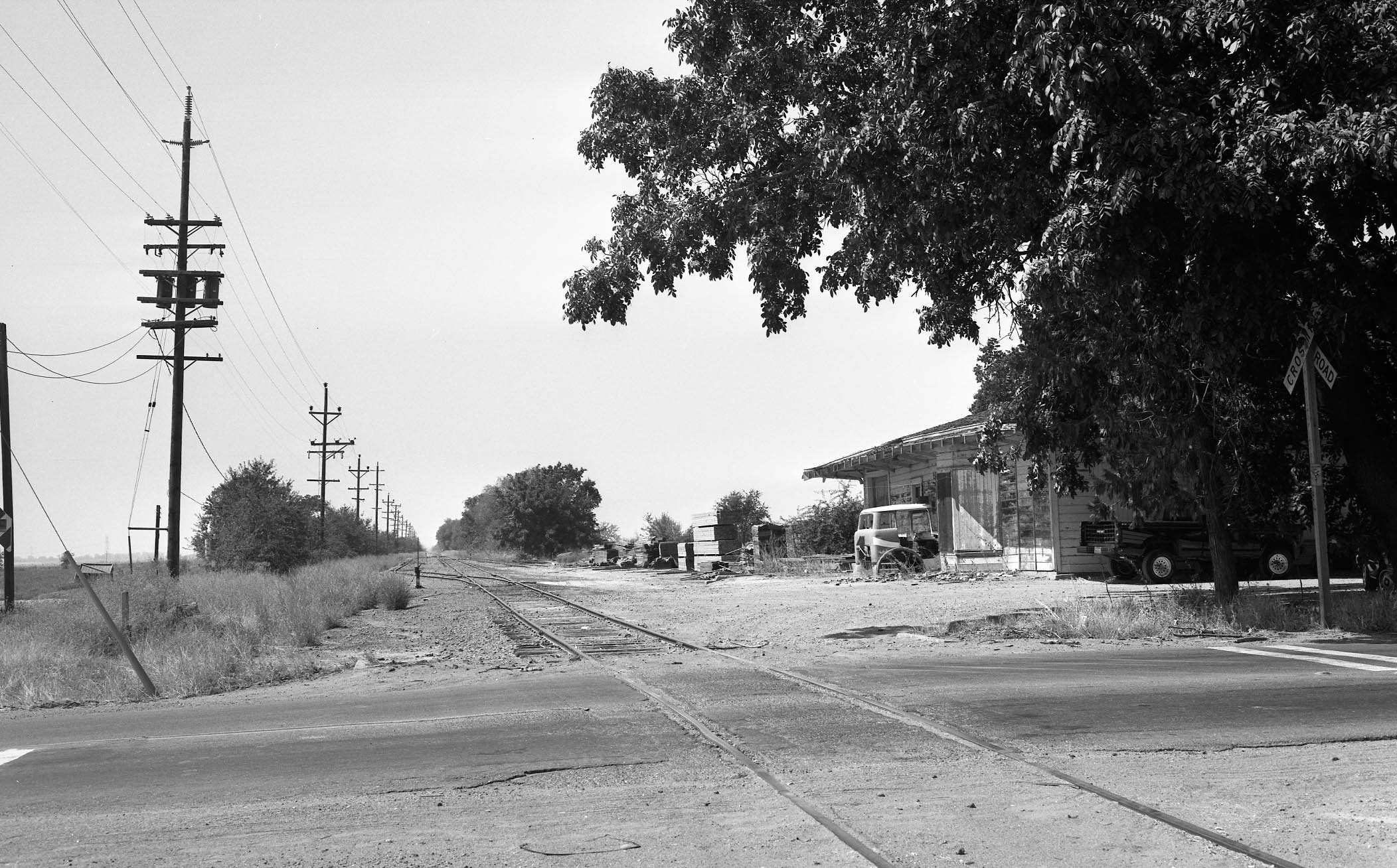
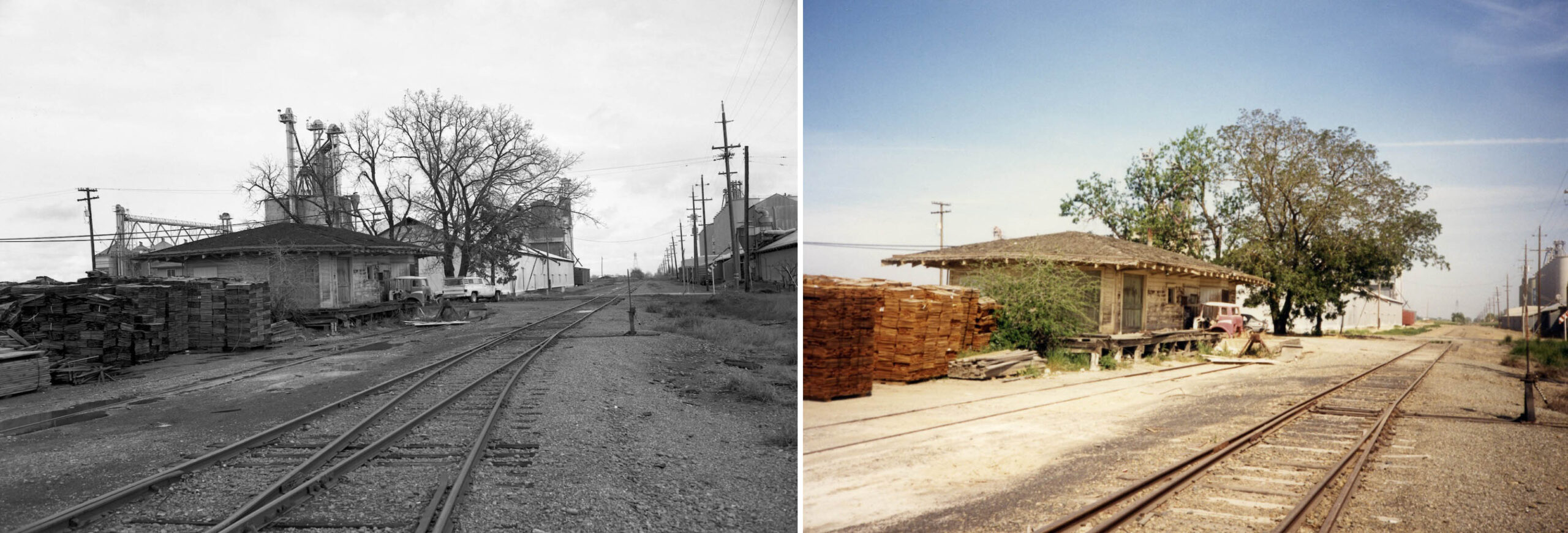
Next, a series of post abandonment images as well as the rest of the history as extracted from Jeff Asay’s book, pgs. 502-503. This west view from Acacia Ave. at Sutter shows the double-track segment and the dilapidated depot building on Sept. 15, 1988. The depot would be leased, at this point most likely to Close Lumber.
L342-210-Harre Demoro Photo, Courtesy John Harder, (Image 43 of 53)
A similar west view from July 7, 1989 shows the north siding serving Close Lumber.
L342-215-Jack Shekell Photo, Courtesy BAERA, Western Railway Museum Archives, 133977sn, (Image 44 of 53)
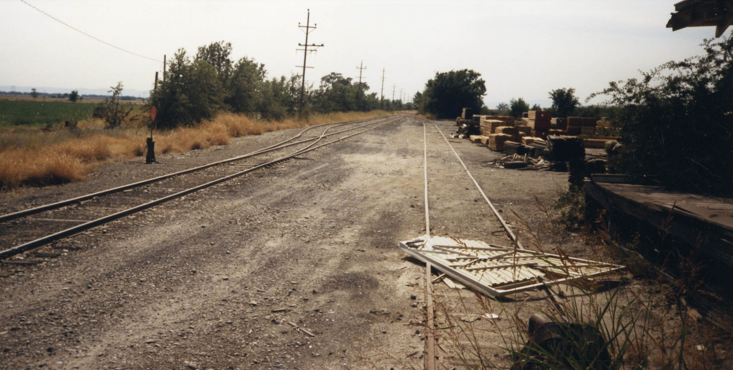
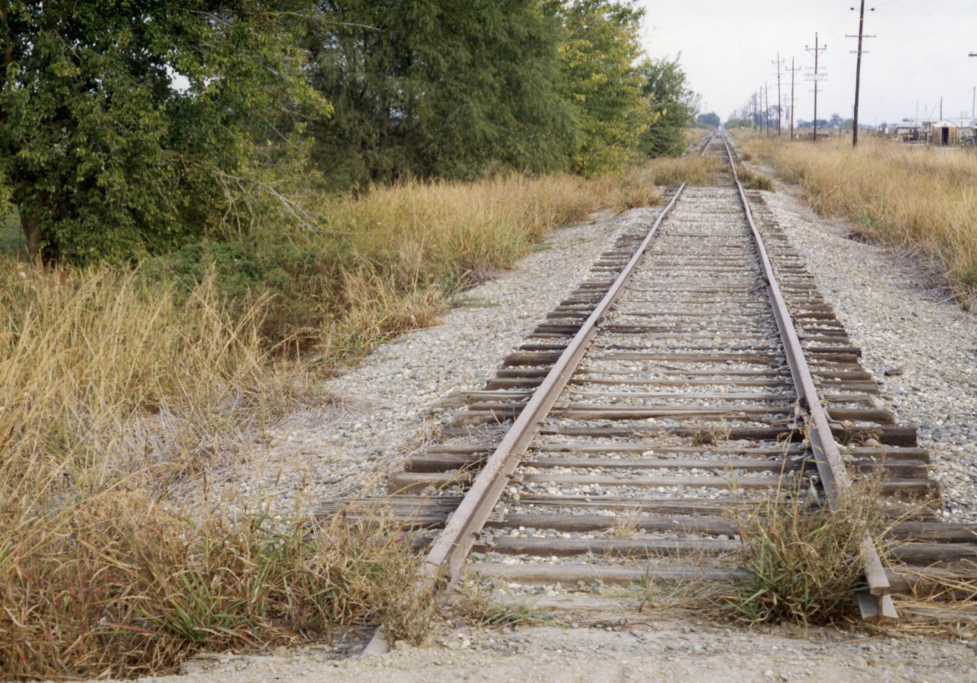
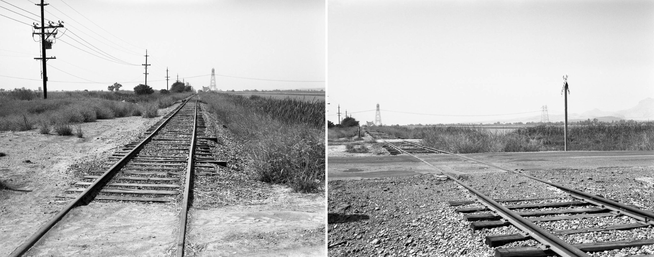
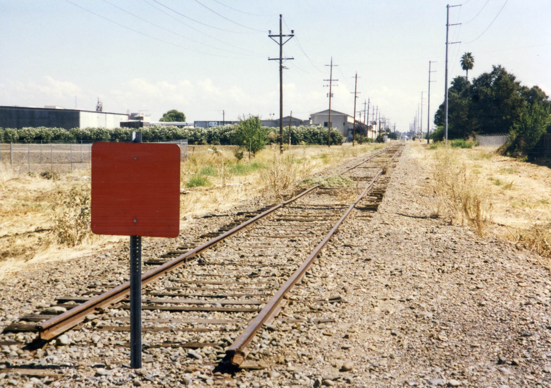
The east view shown here is of the truncated track at milepost 7.11 in Oct. 1993. After service to Tarke ended in late 1973, the track shown here was said to be used to store extra cars. One month later, Nov. 1993, the UP applied to the Interstate Commerce Commission, ICC, to abandon the entire Colusa Branch, that is from the milepost shown here to east of the Colusa wye at Colusa Jct. The UP only received approval in Sept. 1994 to abandon the portion west of Sutter, milepost 5.24.
L342-220-Dave Hamilton Photo, Jack Shekell Collection, Courtesy BAERA, Western Railway Museum Archives, 133961sn, (Image 45 of 53)
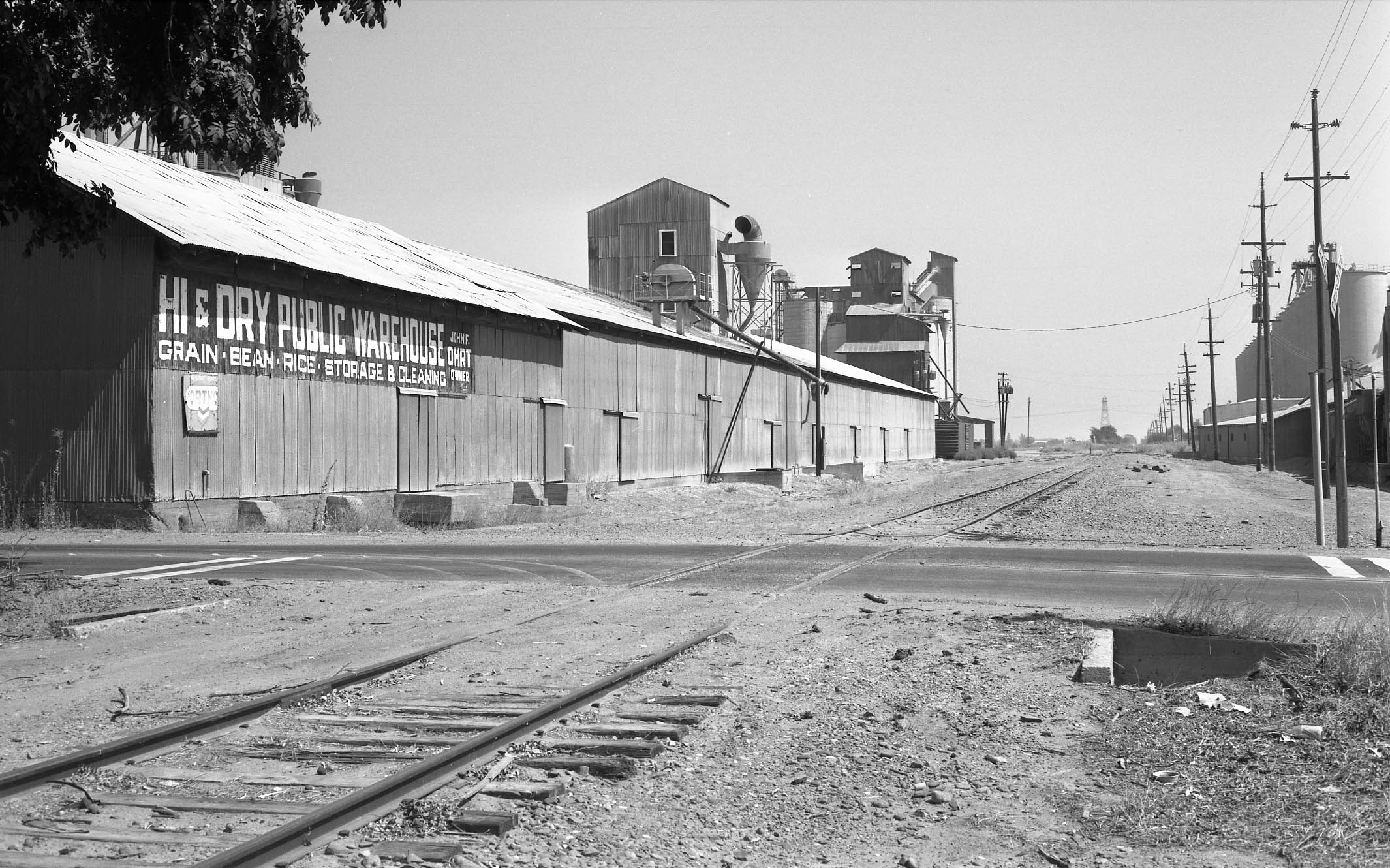
An east view from Acacia Ave. on Sept. 15, 1988 shows Hi & Dry. Jeff Asay in his book, page 503, recorded that the UP obtained approval to abandon the remaining portion of the branch line between Sutter and Colusa Jct. effective Apr. 29, 1996. Although business had tailed off to the entities at Sutter, they remain in business in 2026. In 2026, the abandoned right-of-way serves as a bike trail to Hopper Rd., just west of Colusa Jct.
L342-225-Harre Demoro Photo, Courtesy John Harder, (Image 46 of 53)
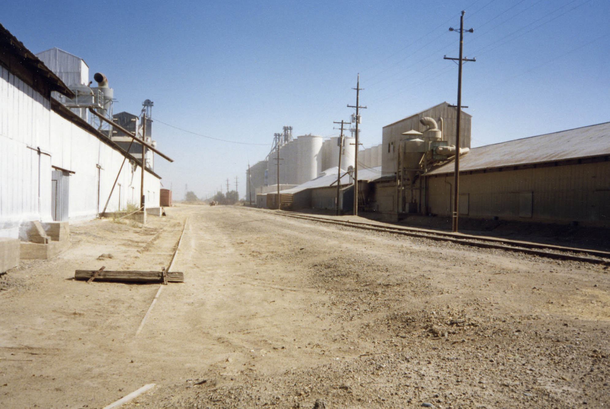
A similar east view from Oct. 1993 provides a better view of the siding to the north side of the mainline as well as the boxcars indicating business as usual.
L342-230-Dave Hamilton Photo, Jack Shekell Collection, Courtesy BAERA, Western Railway Museum Archives, 132087sn, (Image 47 of 53)
The east view on the left from Feb. 17, 1990 shows a few boxcars along the buildings, and the electrical transmissions tower seen in the distance just east of the Wadsworth Canal, still present in 2026 where the wires cross the former right-of-way. The same view on the right from Apr. 9, 1990 serves to add some color to the discussion. The ex-depot looks in bad shape, see the details next.
L342-235-Harre Demoro Photo, Courtesy John Harder, l, Jack Shekell Photo, Courtesy BAERA, Western Railway Museum Archives, 133971sn, r, (Image 48 of 53)
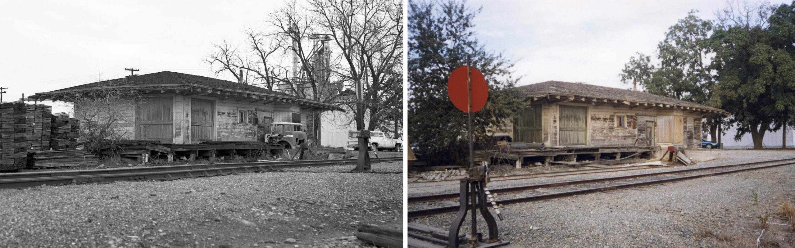
Despite being used for the Close Lumber business, the former Sutter depot had experienced a second downturn in maintenance as seen in this northeast view from Feb. 17, 1990, left, and Oct. 1993, right.
L342-240-Harre Demoro Photo, Courtesy John Harder, l, Jack Shekell Photo, Courtesy BAERA, Western Railway Museum Archives, 133965sn, r, (Image 49 of 53)
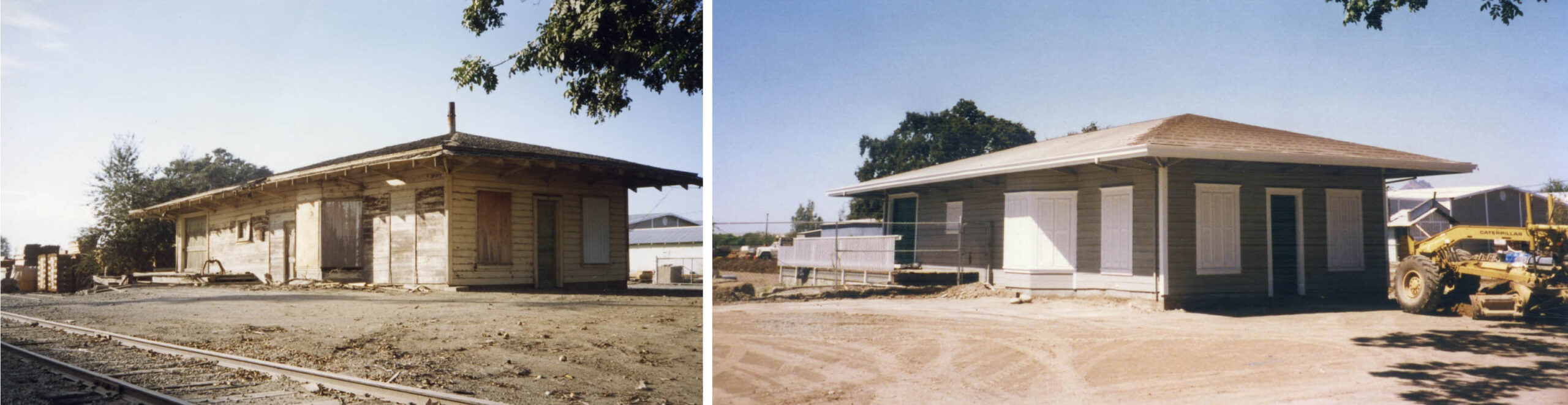
The ex-depot would receive a second reprieve as seen on the right on Sept. 3, 1997 relative to the poor state in Oct. 1993, left. If you were to go by in 2026 you will find that the structure could use at least a new coat of paint.
L342-245-Dave Hamilton Photo, Jack Shekell Collection, l, Jack Shekell Photo, r, Courtesy BAERA, Western Railway Museum Archives, 133970sn, l, 133974sn, r, (Image 50 of 53)
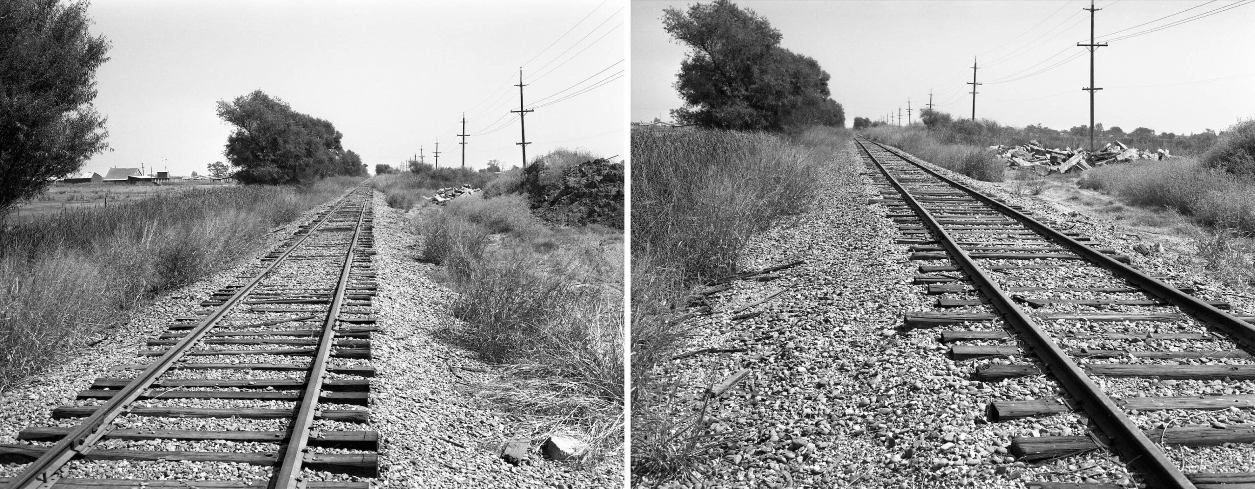
Together, these two west views toward Sutter from Sept. 15, 1988 at the Humphrey Rd. grade crossing provide a panoramic view of the area. It is hard to imagine this spot as a former flagstop in the early 20th century in terms of passenger numbers.
L342-250-Harre Demoro Photos, Courtesy John Harder, (Image 51 of 53)
Of course, having a panorama east view from Sept. 15, 1988 at the same spot might give a different impression, but not based on these images.
L342-255-Harre Demoro Photos, Courtesy John Harder, (Image 52 of 53)
As he did twenty-five years earlier to document what was left at Colusa, Jack Shekell returned to the branch line one year after it was abandoned, the date here Sept. 3, 1997. The track is cut east of Colusa Jct., this east view toward Harter puts this subject to rest. Much appreciation and acknowledgement to Dick Dorn for providing his memories and unique images that captured the history of railroading on the Colusa Branch line in 1973, and views of the majestic Buttes, to John Harder for providing post-abandonment images taken by Harry Demoro, and Jeff Asay for editorial comments.
L342-260-Jack Shekell Photo, Courtesy BAERA, Western Railway Museum Archives, 132198sn, (Image 53 of 53)