Distinguishing Sparkle from Las Juntas
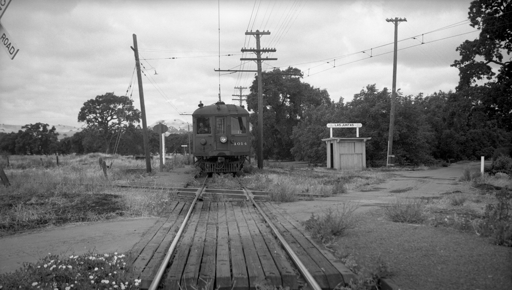
This southwest view from June 22, 1941 has all the elements to help distinguish Sparkle from Las Juntas. Now for more background to understand the difference.
L112-05-Dudley Thickens Photo, Courtesy BAERA, Western Railway Museum Archives, 60301sn, (Image 1 of 17)

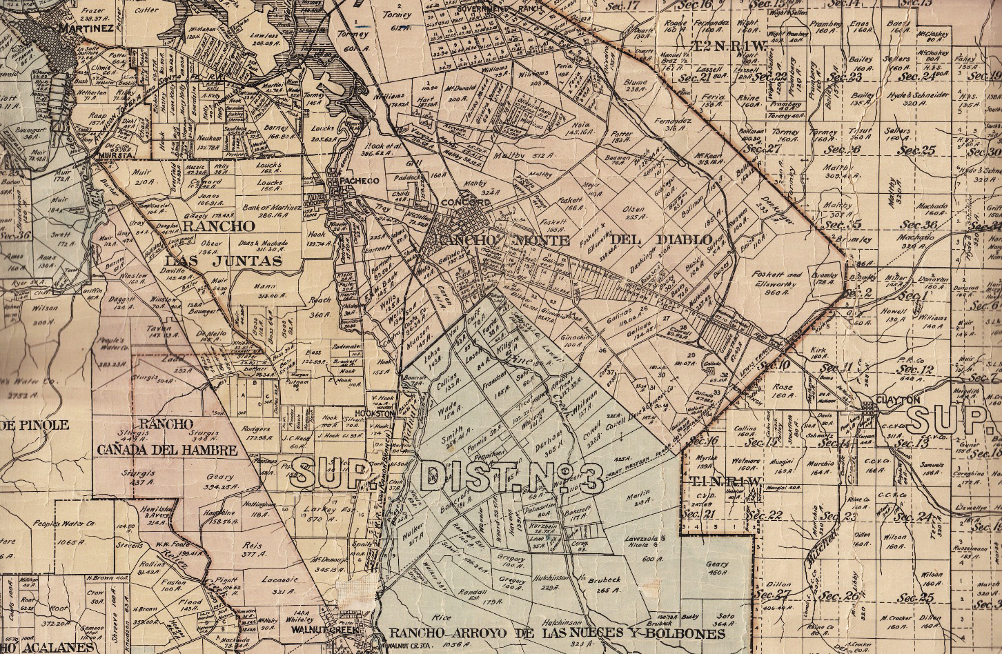
Las Juntas, meaning the “junction, crossroads or meetings”, here referring to streams, was 13,000 plus acres granted to William Welch in 1844. In contrast, there are no historical references to Sparkle. https://en.wikipedia.org/wiki/Rancho_Las_Juntas and/or http://contracostahistory.blogspot.com/2009/05/william-welch-and-rancho-las-juntas.html. Ref: Official Map of CCC Map G4363.C6 1908.M3
L112-10-Courtesy Earth Sciences and Map Library, University of California, Berkeley, (Image 2 of 17)
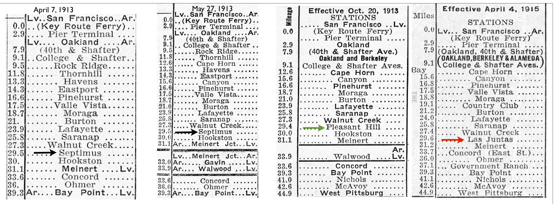
Very appropriately, the Oakland, Antioch and Eastern Railway and Southern Pacific San Ramon Branch did use Las Juntas to refer to where the two lines crossed in the southeast end of the former rancho. Sparkle was only found in one timetable in Ira Swett’s “Sacramento Northern” on page 174, 0.1 miles west of Las Juntas, and is not otherwise mentioned in any obvious source.
L112-15-Courtesy BAERA, Western Railway Museum Archives, (Image 3 of 17)
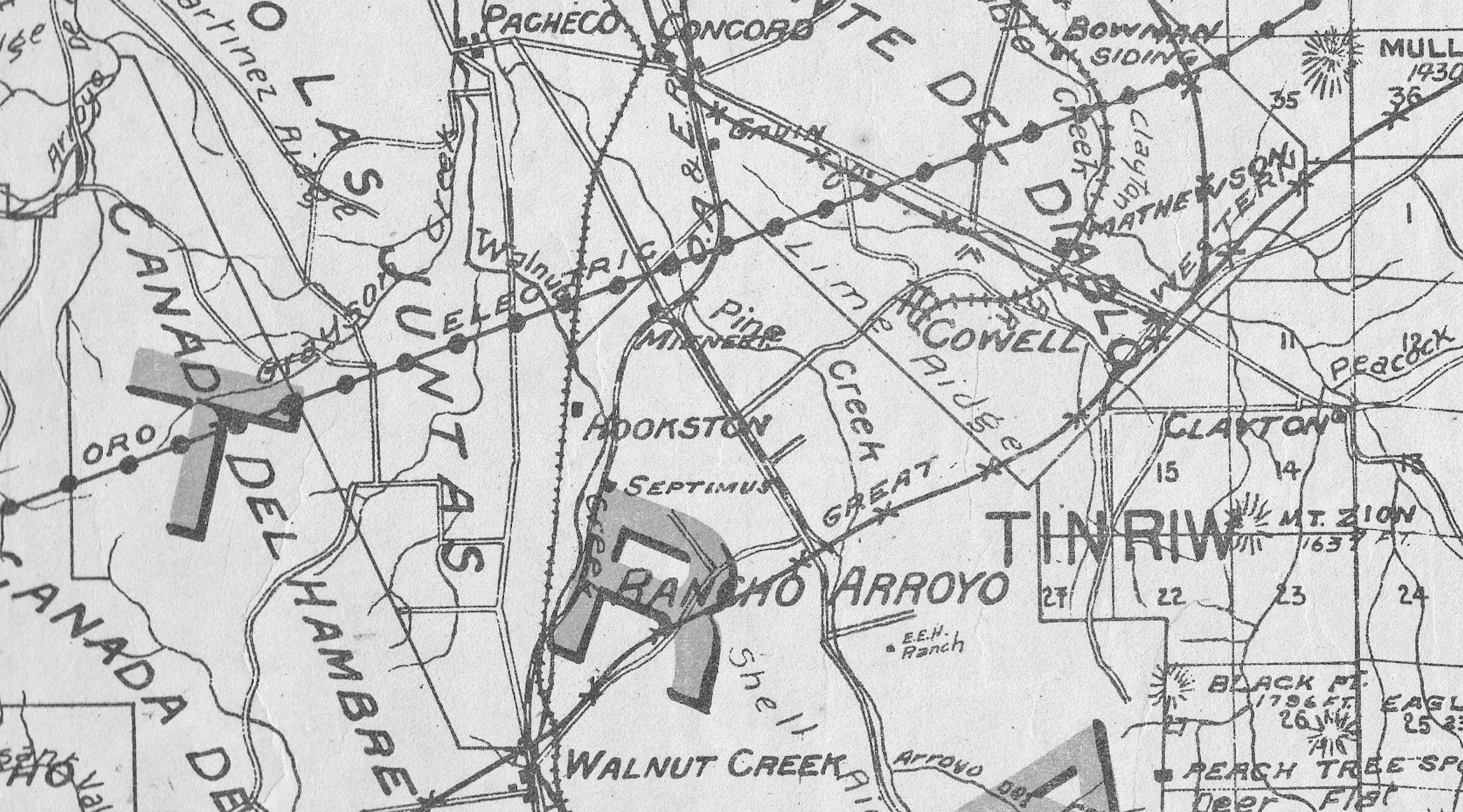
Irma Dotson’s book, “San Ramon Branch Line of the SP”, notes on page 91 that the crossing was first called Septimus, derivation unknown, but was changed for the SP to Las Juntas in May, 1914. This map from 1914 applies Septimus to a stop on the Oakland, Antioch and Eastern only, inaccurately placed east of the two lines’ crossing and east of the Walnut Creek. Ref: CCC 1914 Weber's Map G4363.C6 1914.W4
L112-20-Courtesy Earth Sciences and Map Library, University of California, Berkeley, (Image 4 of 17)
The inaccuracy of maps is illustrated in this mid-1950s version that places the SN Las Juntas shelter in the right location, but incorrectly places Sparkle on the SP line. Sparkle was no more than a sign post and spur track. In any event, Contra Costa County did not recognize Las Juntas or Sparkle as formal land designations where these train stops were located.
L112-25-Courtesy Contra Costa County Library, (Image 5 of 17)
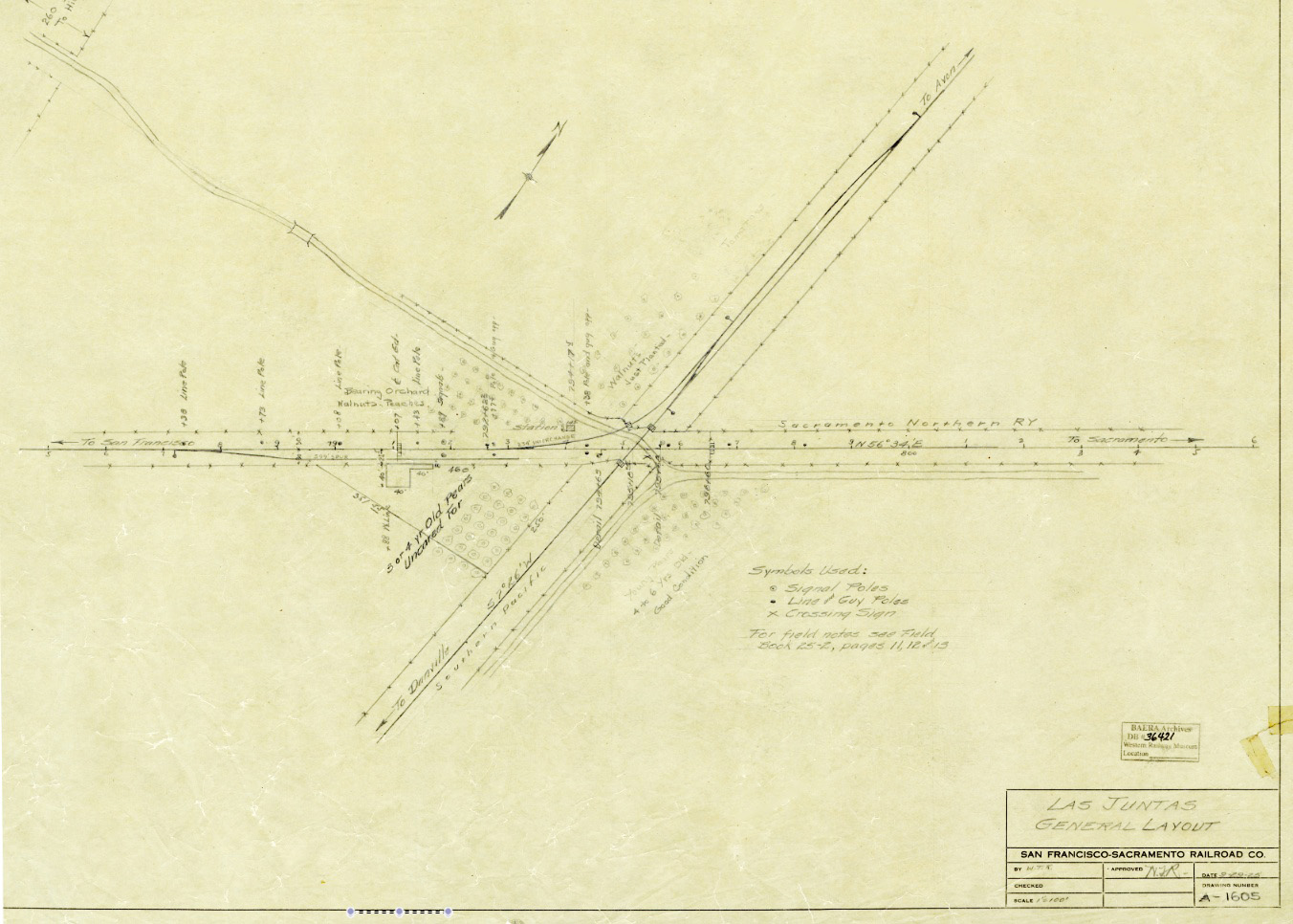
The exact location of Sparkle and Las Juntas relative to the San Francisco-Sacramento Railroad and SP are shown in this track diagram with the spur at Sparkle, and the position of the railway shelter just to the west of the SN-SP crossing as Las Juntas. The pencil additions had to have been added later, based primarily on the use of “Sacramento Northern Ry”.
L112-30-Courtesy BAERA, Western Railway Museum Archives, 36421sn, (Image 6 of 17)
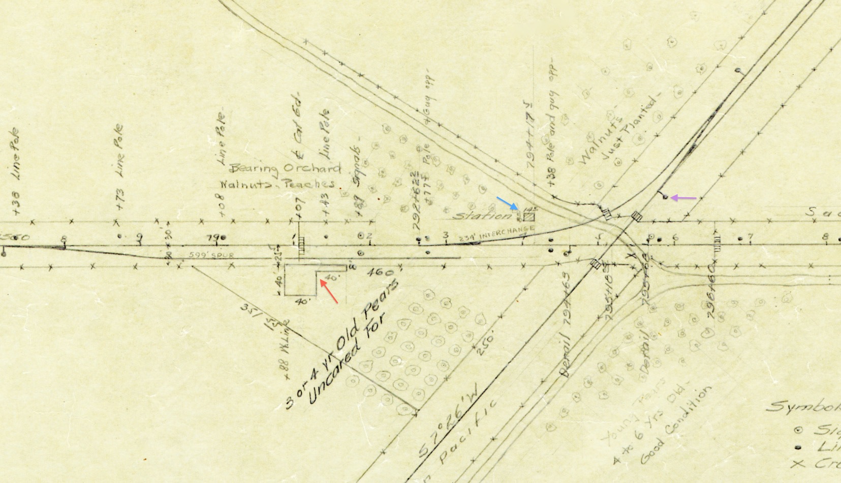
Here in this enlarged version of L112-30, the red arrow denotes a mythical loading platform serving the spur or team track at Sparkle, and the passenger shelter for Las Juntas, blue arrow. The position for a sign post on the SP line, to be discussed in the future, is shown with the purple arrow.
L112-35-Courtesy BAERA, Western Railway Museum Archives, 36421sn Detail, (Image 7 of 17)
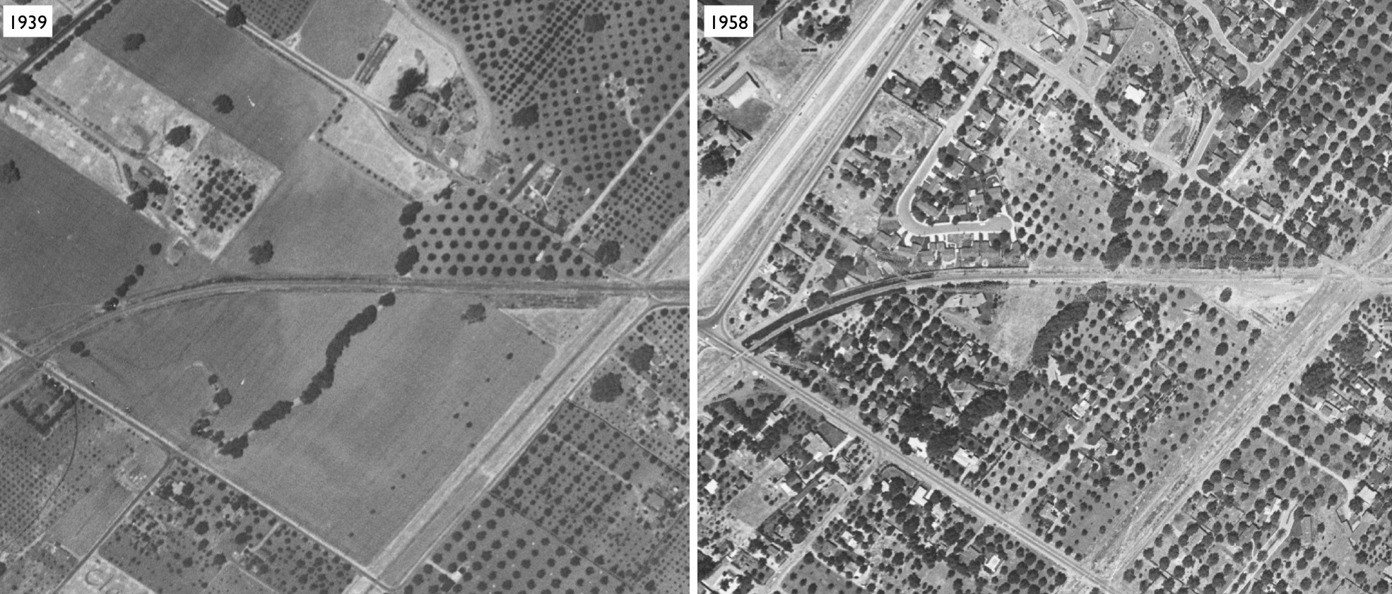
For completeness, corresponding northerly positioned aerials from 1939 and 1958 allow positioning of the information in the track diagrams to actual parcels of land. Ref.: USDA AAA Western Division, BUU 280-64 from Jul 25, 1939; The 1958 aerial was originally from CCC Planning Department.
L112-40-Courtesy Contra Costa County Historical Society, (Image 8 of 17)
Now to Mar. 10, 1957, this southeast view of Mt. Diablo over the new Route 75 or I-680 Oak Park Blvd. and Rd. eastern ramp reveals both Sparkle and Las Juntas. A closer view follows ...
L112-45-Copyright California Department of Transportation, 5397-4 , (Image 9 of 17)
A detail from L112-45 from Mar. 10, 1957, a southeast view with many key labels added. The image was taken after Geary Rd. was extended east to connect to Treat Ln. to form Treat Blvd. east of the freeway overpass.
L112-50-Copyright California Department of Transportation, 5397-4 Detail, (Image 10 of 17)
Reviewing a similar southeast from Mar. 3, 1969 marks the end of the agriculture era in Walnut Creek and the addition to the BART test track instead of the SN.
L112-55-Copyright California Department of Transportation, 15606-26 , (Image 11 of 17)
A closer look at L112-55, southeast from Mar. 3, 1969, to compare to the 1957 counterpart in L112-50.
L112-60-Copyright California Department of Transportation 15606-26 Detail , (Image 12 of 17)
A north view aerial from Mar. 10, 1957, provides another angle to the Sparkle-Las Juntas axis.
L112-65-Copyright California Department of Transportation, 5397-3 , (Image 13 of 17)
A close-up of L112-65, a north view aerial from Mar. 10, 1957. The SN crosses Treat Blvd., lower left, and eventually forms the spur at Sparkle to the south of the mainline. Further east, the transfer track to the SP joins the latter to the north, here in the upper right corner. If you followed all this so far, you should be able to spot the Sparkle flag stop sign along the south side of the spur.
L112-70-Copyright California Department of Transportation, 5397-3 Detail, (Image 14 of 17)
For those who were told that BART was merely built over the SN right-of-way, look closely at this northeast-directed aerial from Mar. 3, 1969 as it shows how much the new path deviated from the original SN one. The curvature of the SN was said to make sparks fly from the catenary wire, thus the purported origin of the name of this spot.
L112-75-Copyright California Department of Transportation, 15606-28 Detail, (Image 15 of 17)
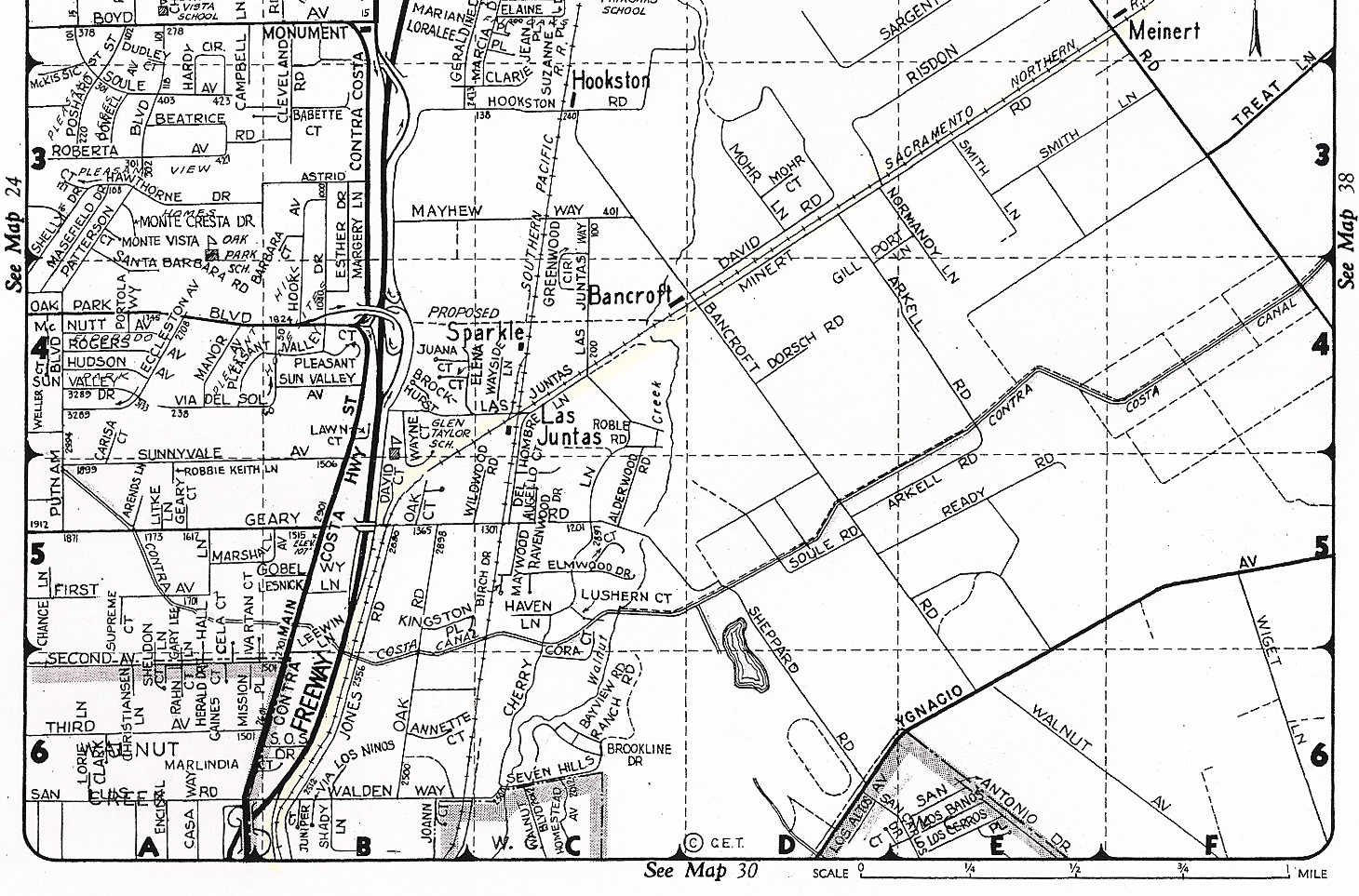
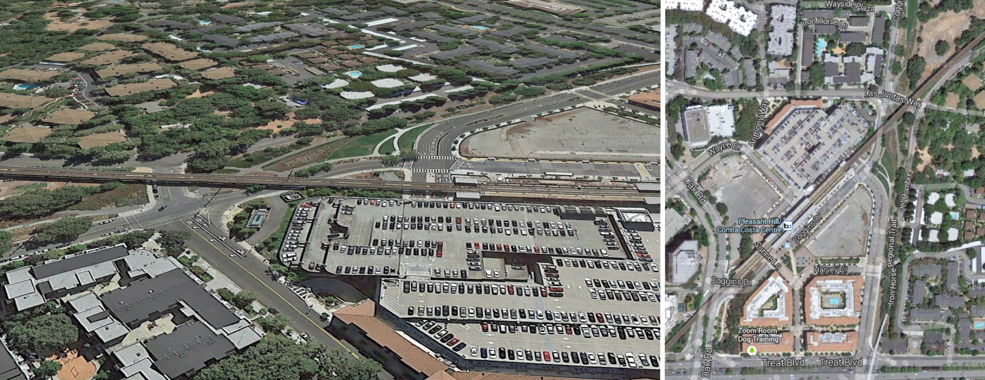
It is of interest that the area corresponding to Sparkle and Las Juntas remains as unincorporated land.
L112-80-Courtesy Contra Costa County Public Works, (Image 16 of 17)
The area does serve the purpose as the Pleasant Hill/Contra Costa Centre, with BART and the Iron Horse trail replacing the SN and SP, respectively. Far from the days of sparks flying from the catenary on the curve and the switching of freight cars at Las Juntas. Next time, other surprises about Sparkle ...
L112-85-Courtesy Google Earth, (Image 17 of 17)