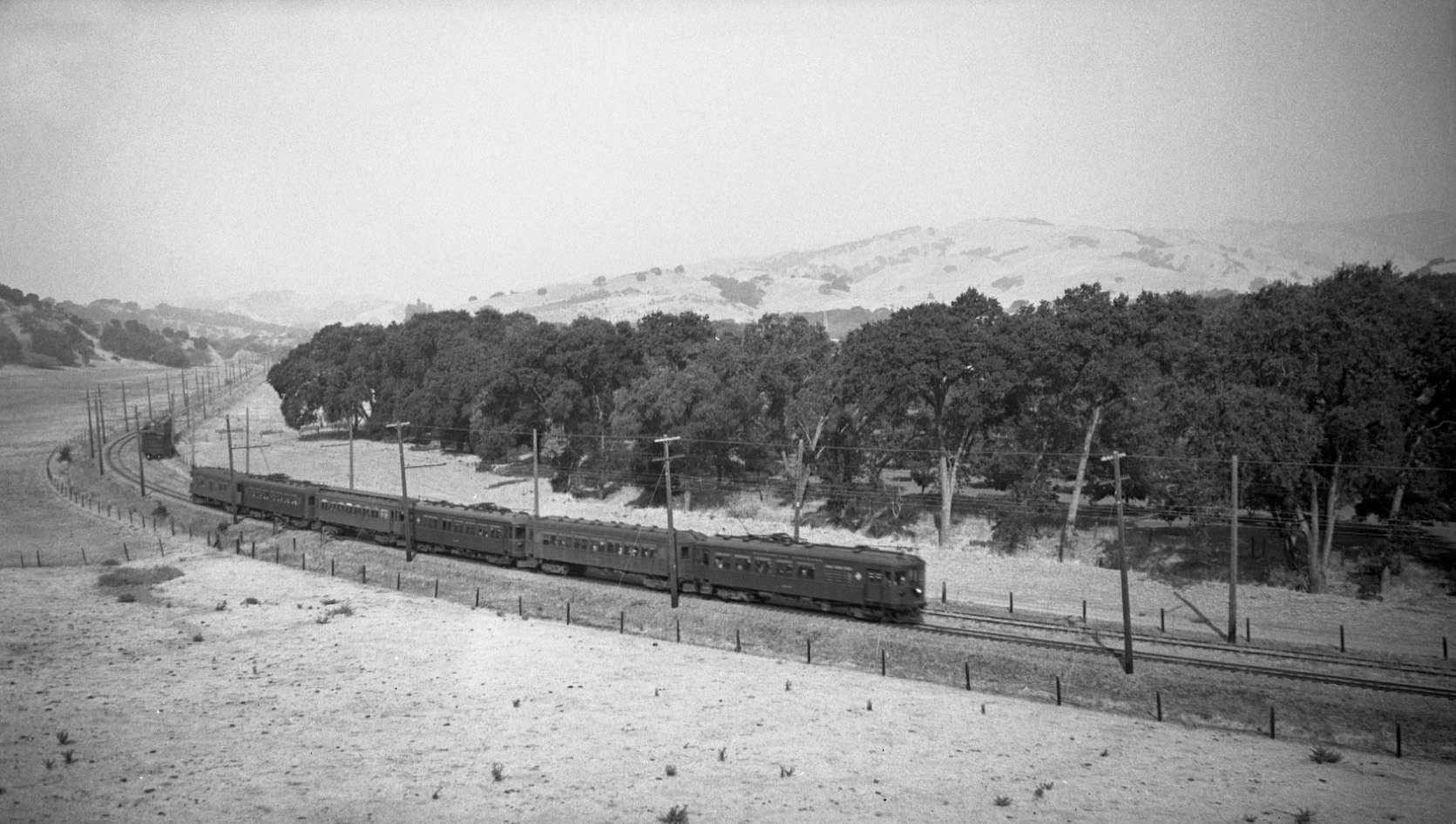
Double Track Curve – Views to the West

A distinctive feature of the SN was a double track section along the curve approaching Saranap station from the west. Dudley Thickens’ west image from Sept. 27, 1936 documents the absence of roads in this section prior to WWII past the Lafayette border to the cut at the present Pleasant Hill Road-Olympic Boulevard intersection.
L32-05-Dudley Thickens Photo, Courtesy BAERA, Western Railway Museum Archives, 58323sn , (Image 1 of 13)

Why place a double section of track on a curve? Possibly to accommodate the increased rail traffic during 1914-24 when the Danville branch was a strategic direct passage south through the Tice Valley to Danville and Mount Diablo.
L32-10-Eston Cheney Photo B-2047, Sappers Collection, BAERA, Western Railway Museum Archives, 24240s, (Image 2 of 13)

This detail of L32-10 shows that the western portion of the wye is incomplete, as one rail ends abruptly. Second, the sign in the background advertises for “Dewing Park”, consistent with the sale of lots by this family key to the early development of Saranap (see Ligda’s “Saranap Then and Now” for details.) Finally, the sign in the right corner has been digitally darkened to reveal “Block Clearance”, possibly related to a railroad block signal.
L32-11-Eston Cheney Photo B-2047, Sappers Collection, BAERA, Western Railway Museum Archives, 24240s, (Image 3 of 13)

An Oakland-bound, three-car Meteor with the Sacramento observation car in the rear zips around the curve in this west view from Feb. 14, 1937. The bare trees reveal orchards to the north and no sign of roads at the curve. By 1937, the passing track was used primarily as a siding as evidenced by the isolated box car.
L32-15-Dudley Thickens Photo, Courtesy BAERA, Western Railway Museum Archives, 58329sn, (Image 4 of 13)

Southwest view, 1938, with SN 1014 reveals a split or “derail” in the northerly rail of the siding track. Along with the white object wrapped against the southerly rail, this prevented a train from rolling toward the main line by derailing it off to the side. The derail was closed by flipping the switch between the tracks. Credit to Cliff Baumer.
L32-20-Courtesy BAERA, Western Railway Museum Archives, 58167sn, (Image 5 of 13)

The double track section continued east past the station and the Tice Valley Boulevard-Boulevard Road, now “Way”, grade crossing. As in its west point of origin, the switch track to the east also was placed on a straight section of right-of-way. Southwest view, SN 1014, circa 1940.
L32-25-Ted Wurm Photo, Courtesy John Harder, (Image 6 of 13)

A new passenger shelter was added in 1940 as seen in this image of students awaiting the train on Apr. 19, 1940. Providing a new shelter at this time may indicate that cessation of passenger service in 1941 was not yet planned. These students were likely headed directly to Mount Diablo High School in Concord, or would transfer to a bus at Walnut Creek for San Ramon Valley High School.
L32-30-Dudley Thickens Photo, Courtesy BAERA, Western Railway Museum, 60870sn., (Image 7 of 13)

Ahead to 1950, and a southwest view revealing Newell Avenue to the south, left, with new housing, and additional structures to the north, possibly off the end of Freeman Drive. A freight with SN 604 and 603 sits just beside the derail switch.
L32-35-Dudley Thickens Photo, Courtesy BAERA, Western Railway Museum Archives, 58136sn, (Image 8 of 13)

Moments later, inching closer, SN 604 and 603 lead the freight past the derail section. Slightly different views of the adjacent structures are seen, plus political posts of the day.
L32-40-Dudley Thickens Photo, Courtesy BAERA, Western Railway Museum Archives, 58135sn , (Image 9 of 13)

Spring, 1957, southwest view. John Harder’s image captures the fact that although still technically in operation, closure of the south end of the SN as far east as Lafayette has reduced operations at Saranap to a trickle. By mid-August of 1958, this scene would be lost to history, shortly to be converted to Olympic Boulevard.
L32-45-John Harder Photo, Courtesy John Harder, (Image 10 of 13)

Abandonment of the Lafayette to Walnut Creek section simplified the construction of I-680 and the creation of Olympic Boulevard, the latter pictured in its infancy in a southwest view at the Tice Valley Boulevard-Boulevard Way intersection, Apr. 29, 1963. This view also reveals the two gas stations on the corners of Tice Valley Boulevard that were added after abandonment of the right-of-way.
L32-50-Courtesy Planning and Engineering Divisions, City of Walnut Creek, (Image 11 of 13)

This undated southwest view of the Tice Valley Boulevard-Boulevard Way intersection shows the actual grading of the road that occurred after L32-50. The yellow arrow points to the removal of the overgrown base of the SN, the blue arrow to grading Newell Avenue to incorporate as part of Olympic Boulevard, and the orange arrow shows the Slo Sam’s sign, the latter to be explained later.
L32-55-Courtesy Contra Costa County Historical Society, 4424, (Image 12 of 13)

SN 654 sweeps along the curve, west view, circa 1950.
L32-60-Robert P. Townley Photo, Courtesy Robert P. Townley, (Image 13 of 13)