George Russell XI – The Industrialization of Emeryville North of Stanford Avenue and the Iconic Water Tower
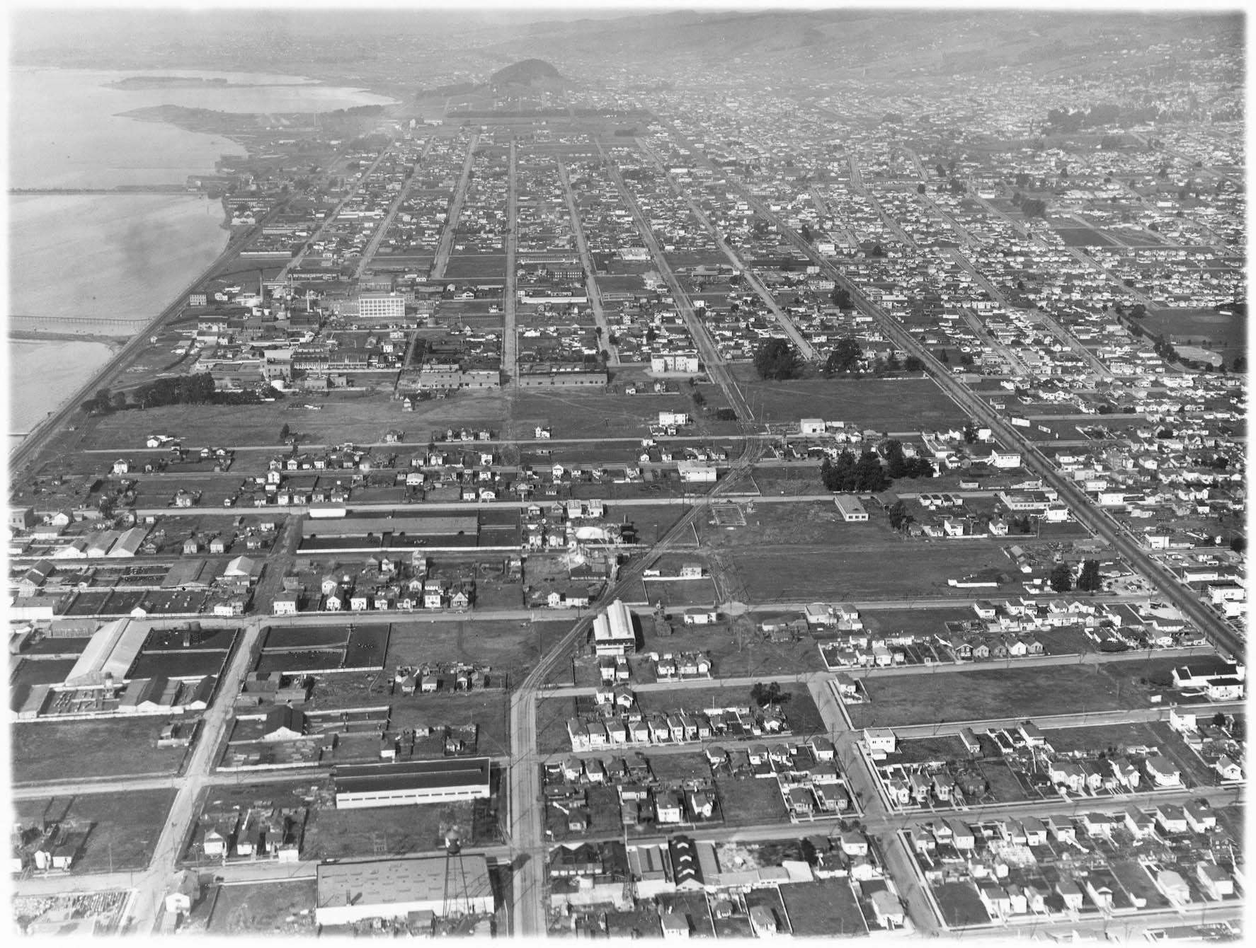
For this update, George Russell and his aircraft explore the northern half of Emeryville, right panel detail from overview in left panel, starting at the Southern Pacific, SP, Stanford Ave. line, turquoise arrow, to the Berkeley border, toward the left edge, or north.
L278-05-George Russell Photo, Courtesy the California State Lands Commission, SLC 642 No Date 1, (Image 1 of 25)

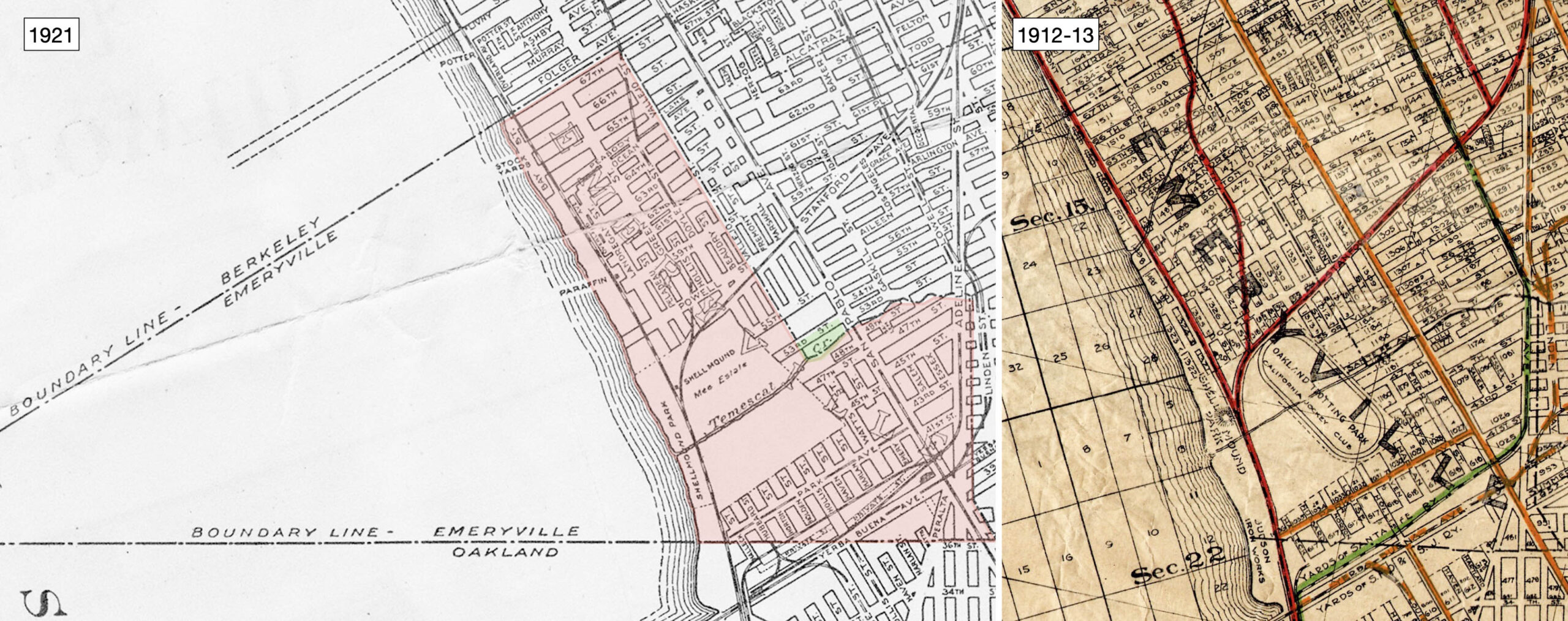
The original boundaries of incorporated Emeryville, red shading, established on Dec. 2, 1896 by a vote of 150 to 28 have been maintained in 2022 save for strategic building into the bay, and annexing land in the early 1970s from Oakland at its Temescal Creek border, green shading. The 1921 map indicates that Paraffine Companies., and the stock yards or “Butchertown” hug the SP mainline, while the SP Ninth St. line cuts diagonally to the Berkeley border. Ref: Central National Bank Map, l; Realty Bonds and Finance Co., r
L278-10-Courtesy BAERA, Western Railway Museum Archives, 83537, l, Courtesy John Bosko, r, (Image 2 of 25)
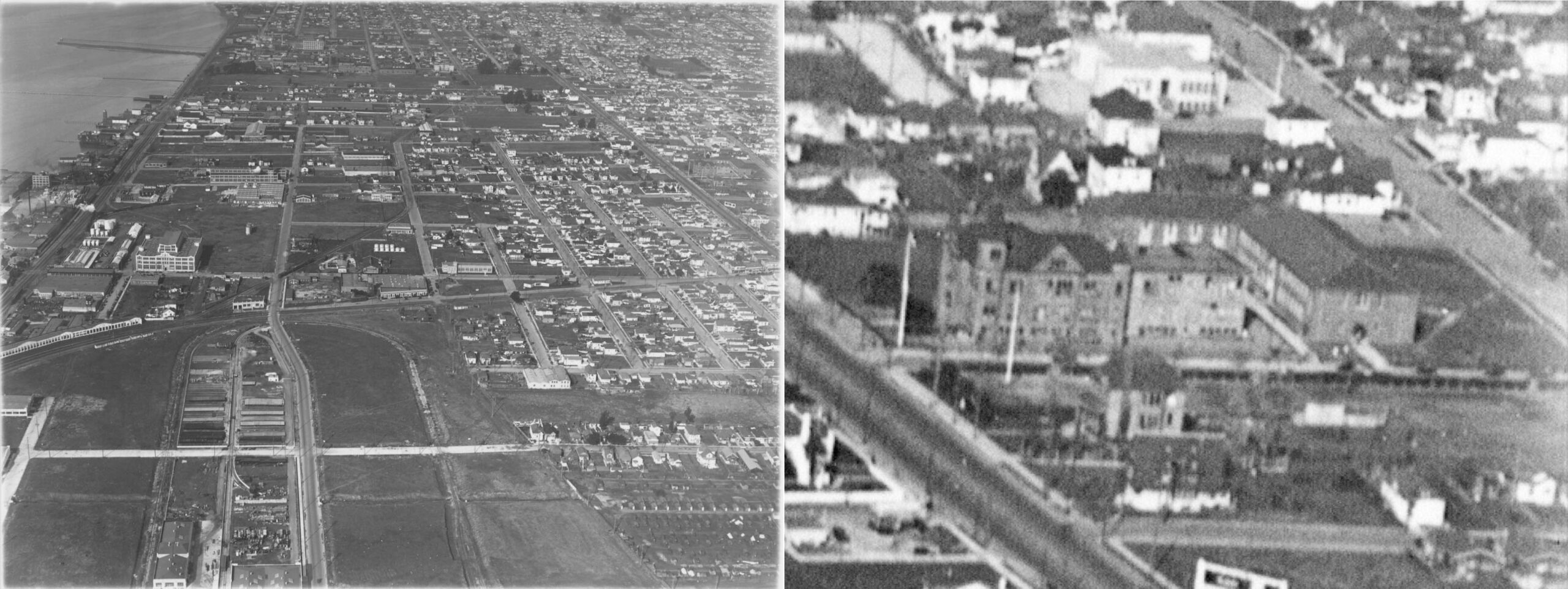
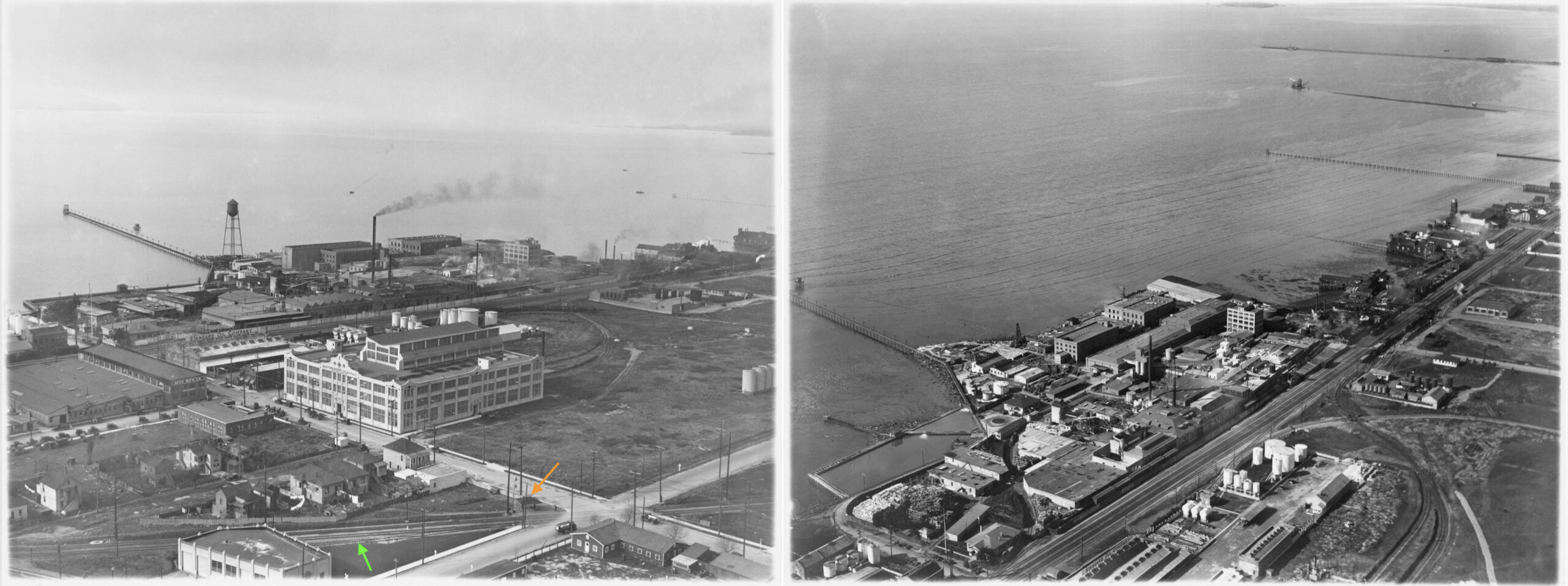
The first north facing aerial by Russell shown here, left panel, taken above the already reviewed industrial area south of the SP Stanford Ave. was taken during the 1925-1927 era. In addition to what has been reviewed, the detail on the right shows the Bay School building from 1892, to be replaced by 1928 with the Golden Gate Jr. H.S. still in use in 2022 by Berkley Maynard Academy. See https://abitofhistory.site/2019/11/25/then-now-oakland-schools-part-10/
L278-15-George Russell Photo, Courtesy the California State Lands Commission, SLC 642 No Date 12, (Image 3 of 25)
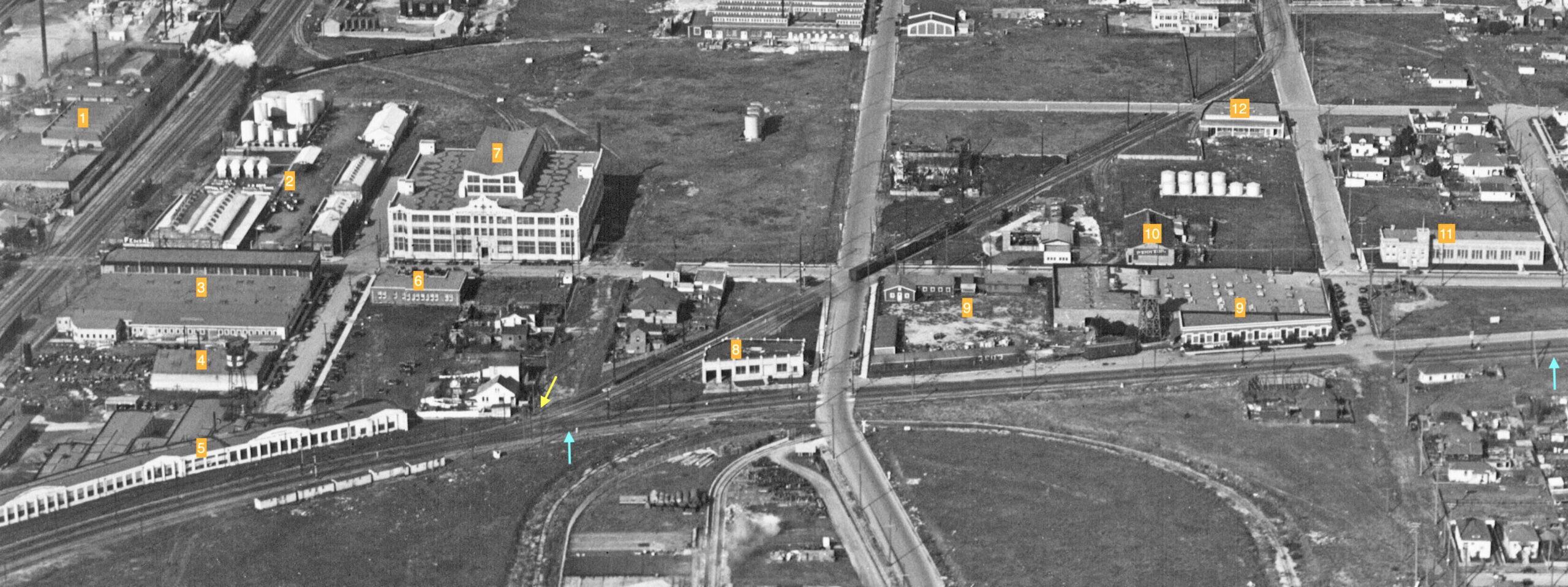
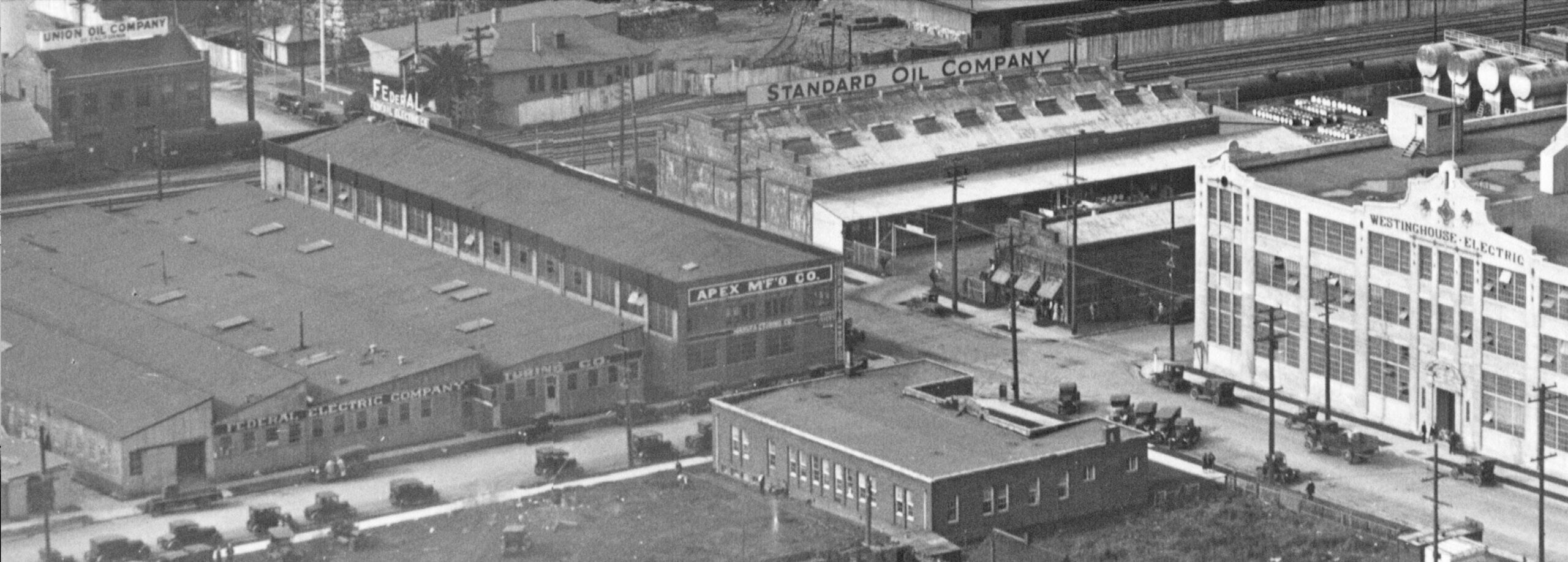
1, the Paraffine Companies, Inc., 1883; 2, Standard Oil, Foot of Powell St., ca. 1914; 3, Federal Electric Co., 1925-1928, and Apex Manufacturing, Powell and Landregan; 4, Edwards Ice Machine Co., 1928-1930, 5749 Landregan; 5, Marchant Calculating Machine Co. plant, 1913; 6, Marchant Calculating Machine Co. offices; 7, Western Electric and Manufacturing Co., 1921, moved to Powell and Peladeau St. ca. 1924; 8, National Biscuit Co. warehouse, 5701 Green St., now Hollis St., 1928; 9, Pacific Manifolding Book Co., Stanford Ave. corner of Doyle, ca. 1908 after move from Oakland; 10, Pennzoil, 1326 Powell St., 1925; 11, Great Western Meter Co., 1290 Powell, 1925. The take-off of the SP Ninth St. line is marked by the yellow arrow, the three lines to Berkeley by the turquoise arrow. The occupant of the building marked no. 12 in the 1920s is not known, but will be discussed next. The facade of no. 9 is still present in 2022, and No. 11 is virtually intact.
L278-20-George Russell Photo, Courtesy the California State Lands Commission, SLC 642 No Date 12, (Image 4 of 25)
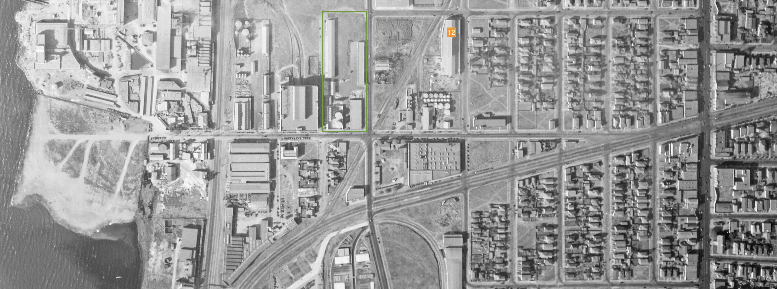
The building in the previous image marked as no. 12 was located at 1301 59th St. It is shown in an expanded form in this detail from a vertical aerial dated Oct. 31, 1931. Sanborn Map Vol 3., 1911 Updated to 1930, Panel 267 marks the front part of this structure as Industrial Steel Products, Ltd. Ground views of the area in 1934 show it to be Liberty Iron Works, Inc., and by directory in 1938, another steel company, A.M. Castle Co. The structure still stands in 2025. The area marked boxed in green and not present in the previous aerial was a new distribution plant occupied by Union Oil Co. of Calif., a machine shop to the west, and a garage to the east.
L278-25-c-1820 47, Courtesy of UCSB Library Geospatial Collection, (Image 5 of 25)
Two northwest views taken at different times of the area to the west of the SP Ninth St. line are shown here. Westinghouse Electric Co. expanded from San Francisco to Emeryville in 1921 setting out on 12 acres where they produced high voltage porcelain insulators. This building served as assembling plant, warehouse and service department. Note the small shelter for the SP Ninth St. line Powell St. stop, orange arrow, and the spur to the National Biscuit Co. warehouse along the bottom edge, green arrow. Based on ground views, the small shelter would be moved to the other side of Powell St. by 1934. The right panel shows the Paraffine Companies, Inc., to be reviewed very shortly.
L278-30-George Russell Photo, Courtesy the California State Lands Commission, SLC 642 NoDate 16, (Image 6 of 25)
This detail from the previous left panel provides the names of companies already identified. It also identifies Union Oil’s smaller operation to the west of the SP mainline at the foot of Powell St. According to directories, Federal Electric Co. was on its way out of the facility seen here by 1928, with Frigidaire Warehouse and Service Shops taking space initially in 1928, and expanding into no. 5755 Landregan by 1930.
L278-35-George Russell Photo, Courtesy the California State Lands Commission, SLC 642 NoDate 15, (Image 7 of 25)
Next, a northeast view ca. 1925-1927 of the Paraffine Companies, Inc., originally the Paraffine Paint Co. in 1883.
L278-40-George Russell Photo, Courtesy the California State Lands Commission, SLC 642 NoDate 4, (Image 8 of 25)
As described in “Emeryville” by the Emeryville Historical Society, the company went on to produce 6000 products in 11 plants encompassing 155 buildings on the 38 acres of landfill by 1938. This Sanborn map revised about that time reflects the diversity and scale of the operation.
L278-45-Courtesy Oakland History Room, Oakland Public Library, (Image 9 of 25)
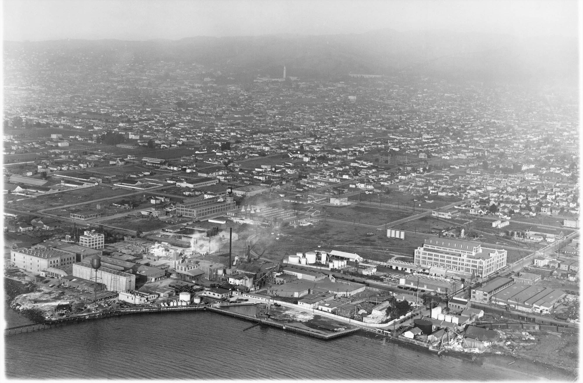
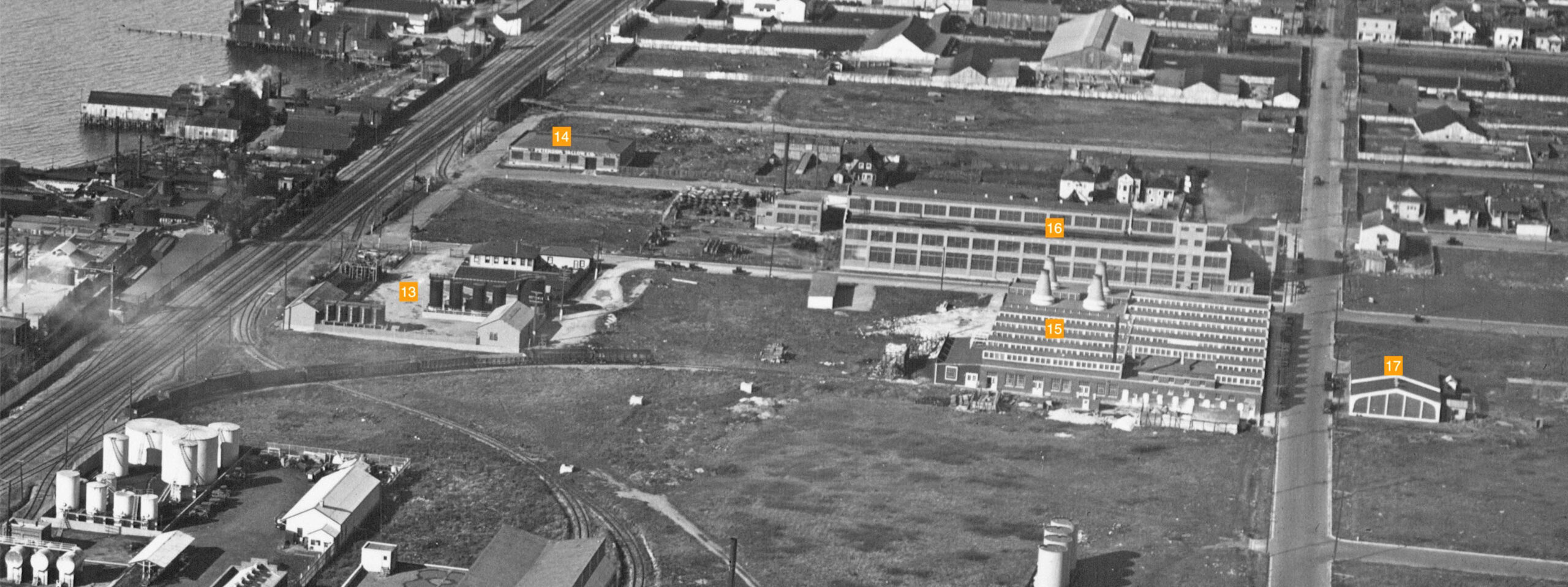
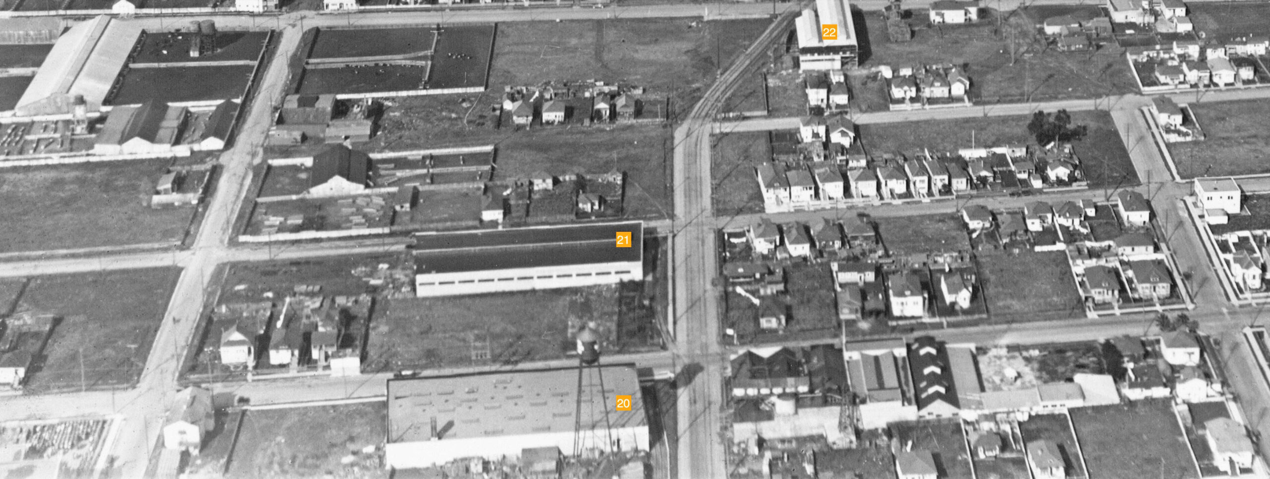
Russell proceeded northward along the coast circa 1925-1927 and produced this aerial view highlighting the transition from oil concerns to stock yard-related businesses.
L278-50-George Russell Photo, Courtesy the California State Lands Commission, SLC 642 NoDate 13, (Image 10 of 25)
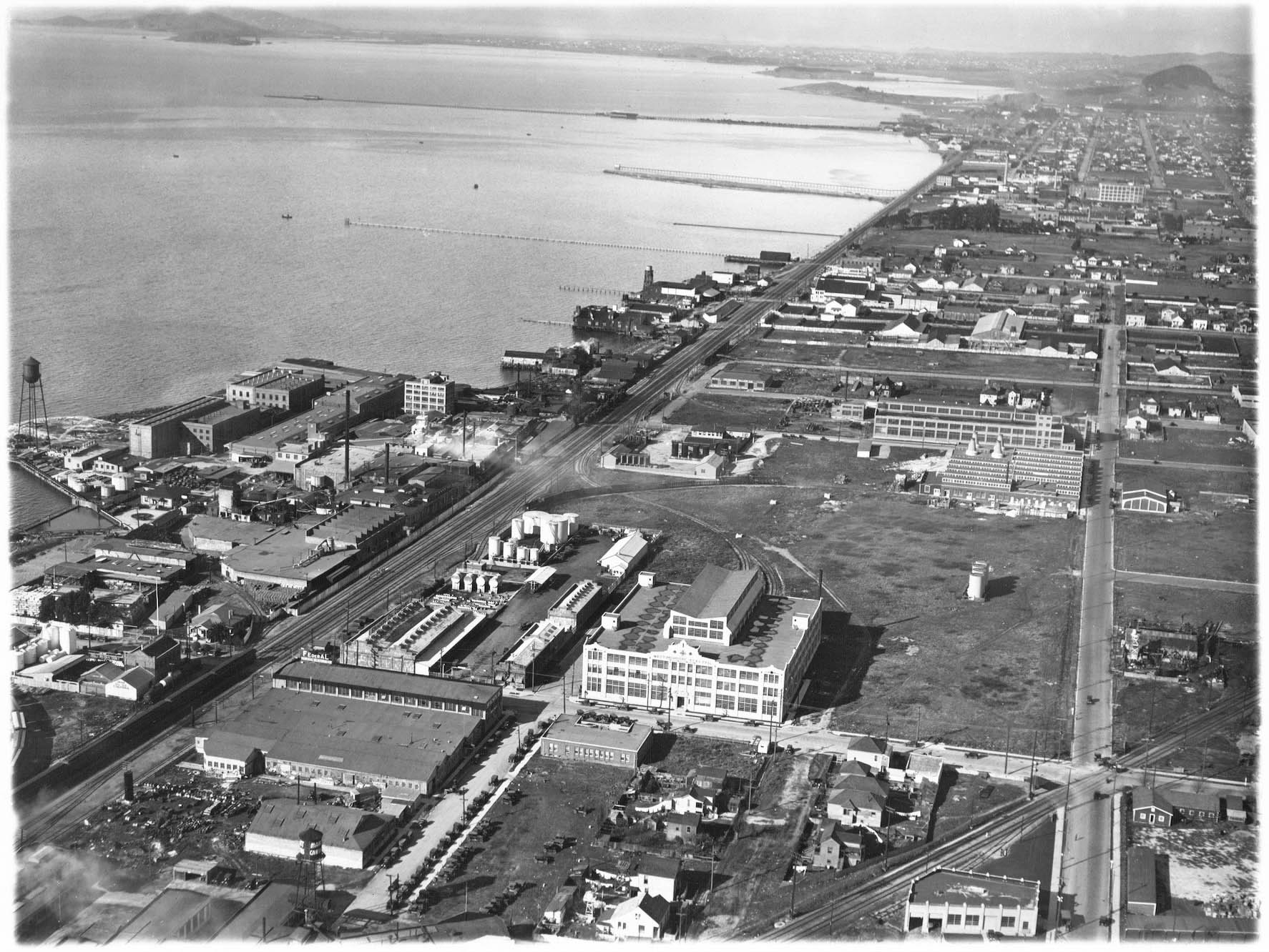
A detail from the previous north view provides the next layer of industrial concerns. 13, Shell Company of Calif., foot of 61st St., ca. 1918; 14, Peterson Tallow Co., foot of 65th St., ca. 1918; 15, Westinghouse High Voltage Insulater Co., 6121 Green St, now Hollis, ca. 1921; 16, Standard Underground Cable Co., 62nd St. corner with Green St. To the north The occupant of the building marked no. 17 at that time is not known, but will be discussed next.
L278-55-George Russell Photo, Courtesy the California State Lands Commission, SLC 642 NoDate 13, (Image 11 of 25)
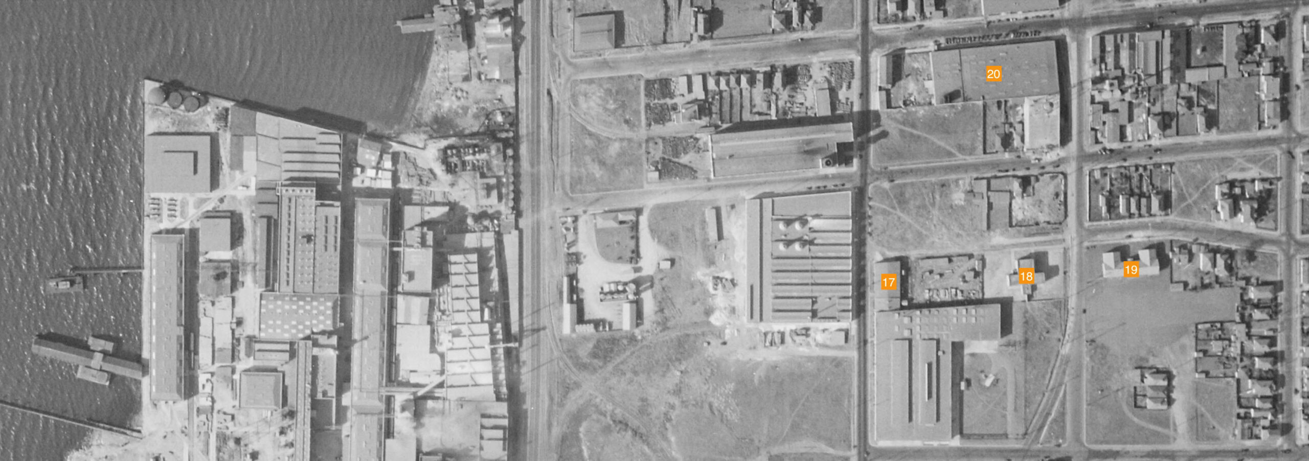
This detail to 63rd St. from a vertical aerial dated Oct. 31, 1931 shows the expansion to the south of building no. 17. In the 1930s, this enlarged structure would be occupied by Associated Oil Co.’s automotive department. For dating purposes, structure no. 18 is the North Emeryville School built in 1910 at 61st St. and Doyle St., no. 19 is the school building that replaced it in 1929, and no. 20 is Western Waxed Paper Co. at 1311 63rd St. corner of Doyle St., first appearing in the 1924 directory listings.
L278-60-c-1820 47, Courtesy of UCSB Library Geospatial Collection, (Image 12 of 25)
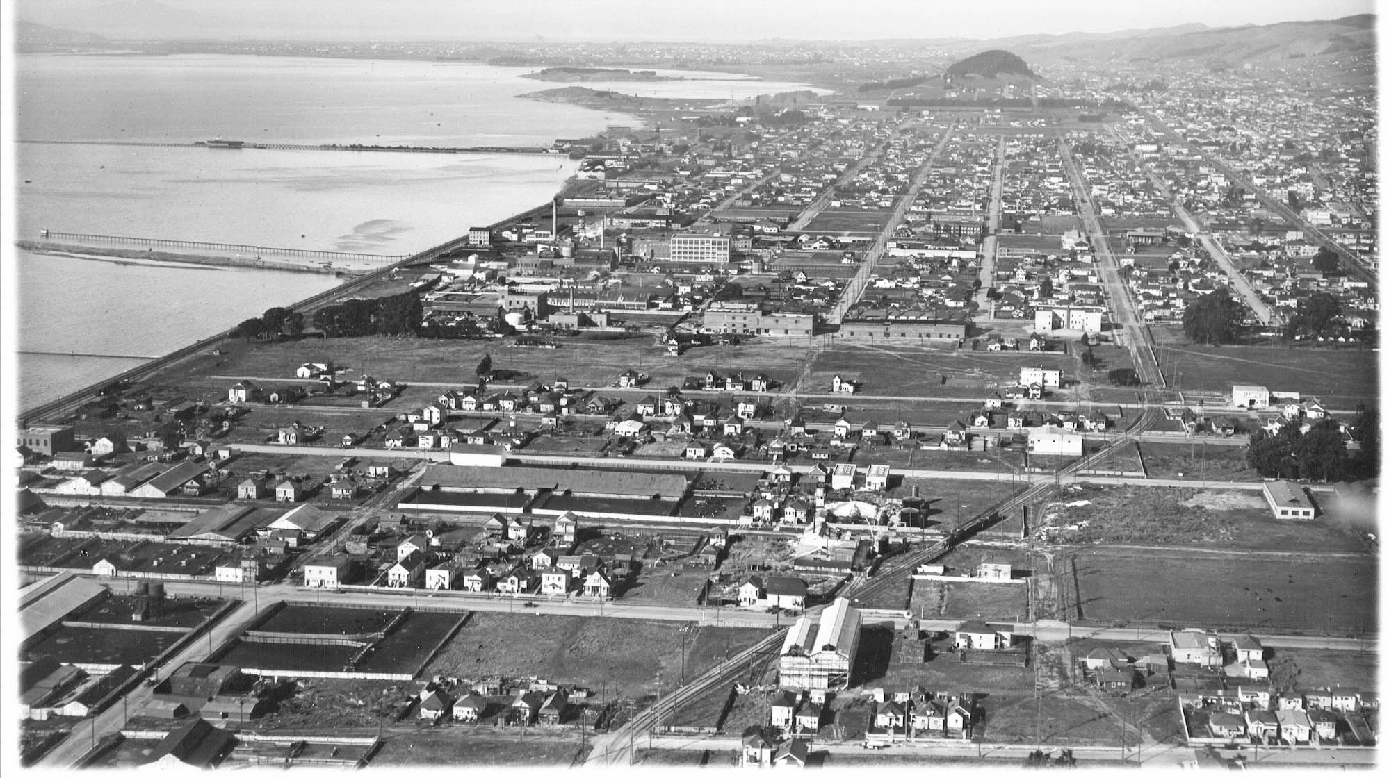
Further north, George Russell has approached the Emeryville border with Berkeley and swings his aircraft to the east to capture structures in Butchertown, circa 1925-1927.
L278-65-George Russell Photo, Courtesy the California State Lands Commission, SLC 644 NoDate 24, (Image 13 of 25)
This northeast detail from the previous aerial highlights T.W. Corder, Inc. and Oakland Meats and Packing Co. Corder first appeared in the 1924 directory as a wool and sheep skin dealer at the foot of 67th St., the northern limit of Emeryville. Oakland Meats, as it was known in the 19th century, is seen here at the foot of 65th St., with stockyards flanking its east side. Note the SP’s Stock Yards depot building at the foot of 65th St. along the lower right edge.
L278-70-George Russell Photo, Courtesy the California State Lands Commission, SLC 644 NoDate 24, (Image 14 of 25)
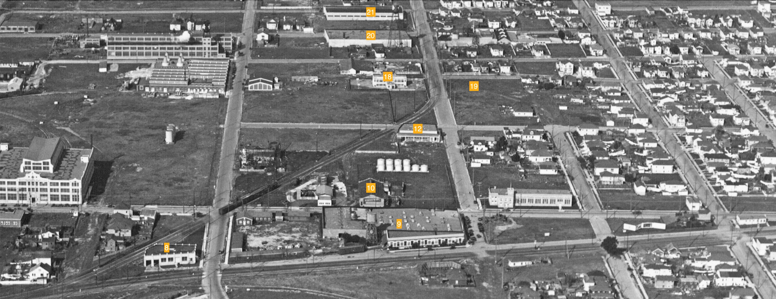
Several industries lined the path of the SP Berkeley line on Stanford Ave. and the Ninth St. line to the northern border. The presence of a boxcar on the siding of no. 9, Pacific Manifold Book Co., is seen in this north view. Spurs-sidings on the Ninth St. line were as follows: no. 8, National Biscuit Co. warehouse; no. 10, Pennzoil; no. 12, the building soon to be occupied by Industrial Steel Products Ltd.; no. 20, Western Waxed Paper Co.; and no. 21, Detroit Steel Products Co., who added a window plant for Fenestra brand windows at 1309 64th St. in 1923. No. 18, North Emeryville School, and no. 19, the empty lot for its replacement in 1929, did not have sidings, but help date the image.
L278-75-George Russell Photo, Courtesy the California State Lands Commission, SLC 642 NoDate 12 , (Image 15 of 25)
Further north as the train tracks began to curve east at Doyle St. and Ocean Ave., the Berkeley line is within sight. This north view catches 62nd St. just east of Vallejo St. at the Emeryville-Oakland line along the lower right edge. As the Ninth St. line returns to a straight northern trajectory in Berkeley, the future location of Heinz Co. is an empty grassy lot to the east of the tracks, consistent with the image haven been taken sometime between 1925 and 1927.
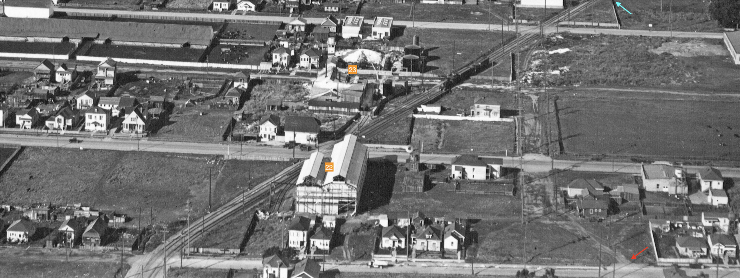
L278-80-George Russell Photo, Courtesy the California State Lands Commission, SLC 644 NoDate 12, (Image 16 of 25)
A detail from the previous north view shows an SP siding to no. 20, Western Waxed Paper Co., no. 21, Detroit Steel Products Co., and no. 22 at no. 1265 65th St. Built originally for Janson Iron Works, this building also housed mining companies including the most recent Baker Metals, Yuba Mining Co. in the 1957 list of SP customers, and the Alloys Co. zinc manufacturing plant in the 1950 Sanborn map. All three of these buildings are still standing in 2022.
L278-85-George Russell Photo, Courtesy the California State Lands Commission, SLC 644 NoDate 12, (Image 17 of 25)
This north view just at the level of Ocean Ave. along the lower edge is a slightly earlier version of the previous image as no. 22 at 1265 65th St. still has scaffolding around it and in need of several sections of the external structure.
L278-90-George Russell Photo, Courtesy the California State Lands Commission, SLC 642 NoDate 11, (Image 18 of 25)
In the detail from the previous image, a freight train is crossing 66th St., with no. 23, Emeryville Chemical Co., manufacturers of silicate of soda, spanning the same street with tanks containing the product, and a siding from the railroad between 65th. and 66th St. By 1950 the company name had changed to Diamond Alkali Co. of California, and from circa 1962 onward would be the SP’s last customer here, California Syrup and Extract, known locally as Liquid Sugar. Note that Vallejo St. is not complete north of 64th St., red arrow, and the only spot where Emeryville, Berkeley and Oakland meet is along the top, turquoise arrow.
L278-95-George Russell Photo, Courtesy the California State Lands Commission, SLC 642 NoDate 11, (Image 19 of 25)
This detail to the Emeryville-Berkeley-Oakland border just north of 67th St., turquoise arrow from a vertical aerial dated Oct. 31, 1931 shows the buildings from the 1925-1927 period, nos. 22-23, and two other buildings of note, no. 24, Tile Vitamin Concentrate Manufacturing Co., and no. 25, the auto chassis company, F.A.B. Manufacturing Co., based on the revised Sanborn maps of the 1930s. Building no. 24 would later be replaced by Oliver Tire and Rubber Co. from 1946 until the last day of 2000.
L278-100-c-1820 47, Courtesy of UCSB Library Geospatial Collection, (Image 20 of 25)
Between circa 1925-1927, left and circa 2000, right, the industrial section of Emeryville north of Stanford Ave. reached its zenith. In 2001, Liquid Sugar closed their plant, and the SP freight service was abandoned. Three buildings from the 1920s still standing in 2022 are nos. 20-22. The turquoise and yellow arrows point to two homes that allow for further alignment of the two images. Ref: l, George Russell Photo, Courtesy the California State Lands Commission, SLC_642_12; r, City of Emeryville
L278-105-G. Russell Photo, Calif. State Lands Commission, SLC 642 NoDate 12, l, City of Emeryville, , (Image 21 of 25)
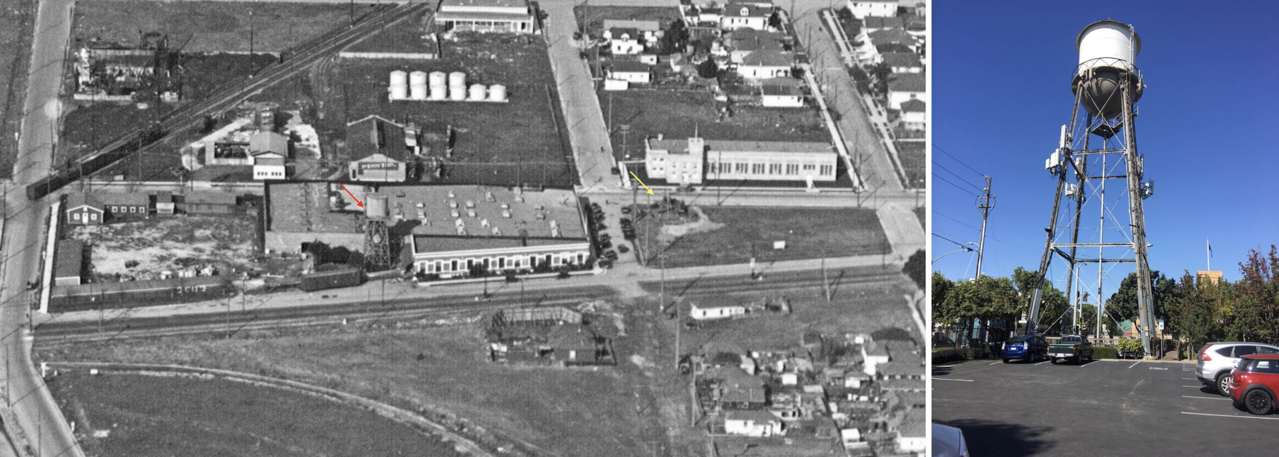
Finally there is the question of the water tower that sits at the southeast corner of Doyle St. and Powell St. in 2022, right panel. George Russell’s circa 1925-1927 of Pacific Manifolding Book Co. shows the earlier version of the companies water tower, red arrow, that looks nothing like the one mentioned above. The yellow arrow marks the position of the present tower.
L278-110-G. Russell Photo, Calif. State Lands Commission, SLC 642 NoDate 12 l, S. Swiedler Photo, r, (Image 22 of 25)
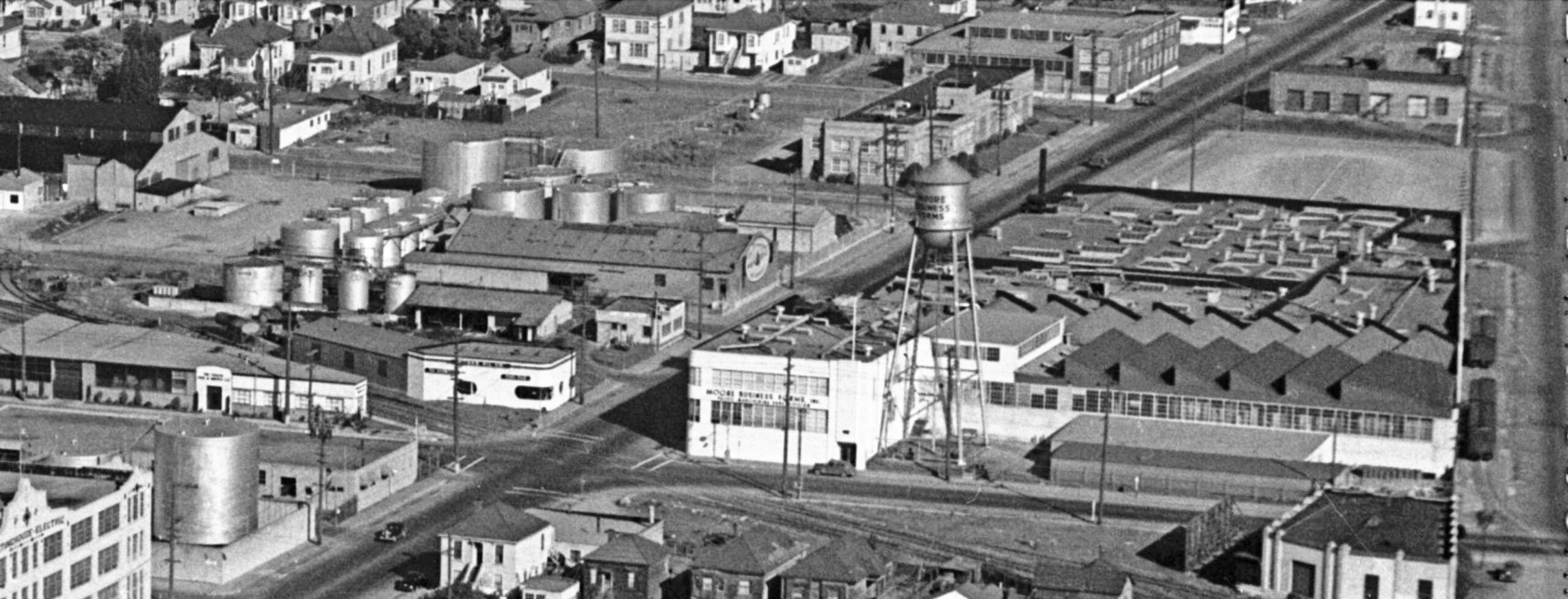
Next to this northeast view of Powell St., and buildings that should be all too familiar at this point, sometime after 1945. The photographer has not been identified.
L278-115-Courtesy BAERA, Western Railway Museum Archives, 66782, (Image 23 of 25)
The detail from the previous aerial shows a different water tower at a different position, and the company is now named Moore Business Forms, Inc. This occurred in 1945 capping a large corporate reorganization, and note that there is no longer electric wire above the SP Ninth St. line., removed in 1941.
L278-120-Courtesy BAERA, Western Railway Museum Archives, 66782, Detail, (Image 24 of 25)
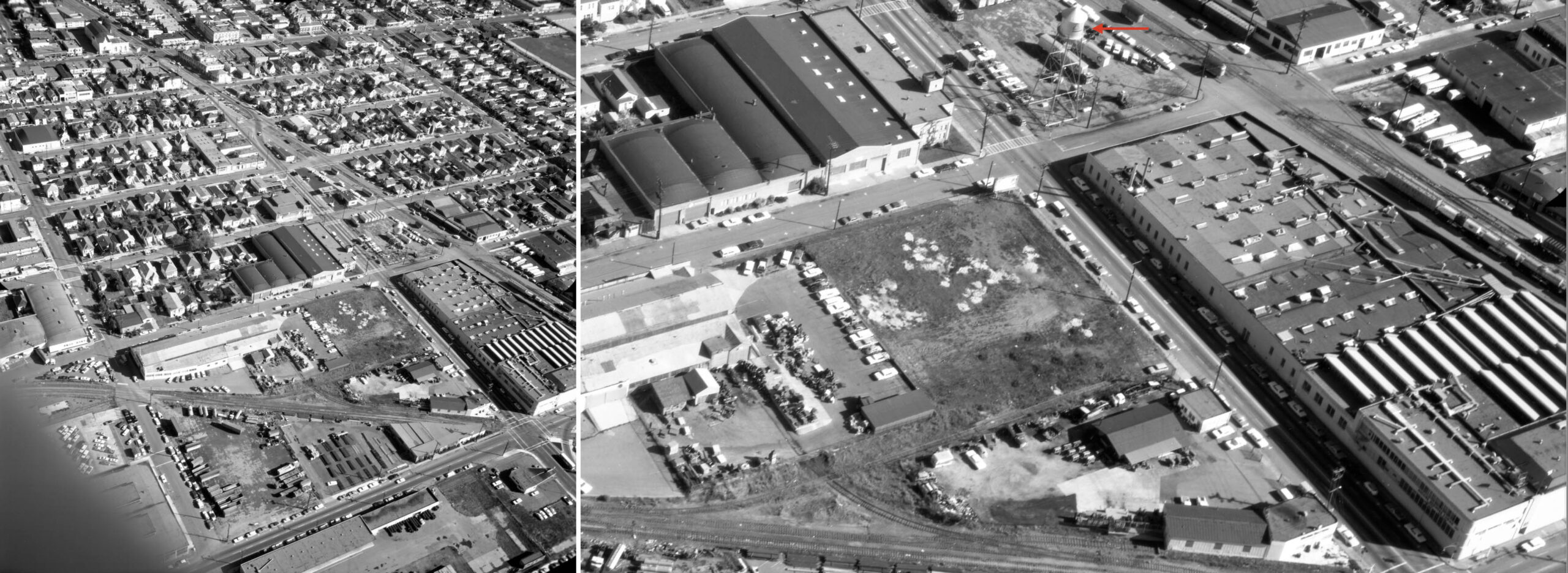
Ahead to this east view from Nov. 12, 1968, left, the detail on the right shows the water tower has been moved to its current location, red arrow, and the space it left behind filled with another building. The tower had been moved by 1951 based on the Sanborn map. Appreciation to The Oakland History Room, City of Emeryville and historian Daniella Thompson and Berkeley Architectural Heritage Association for providing the essential Sanborn maps. In addition, acknowledgement of the many on-line telephone directories and the ground-level images in “Emeryville” by the Emeryville Historical Society that contributed to this presentation.
L278-125-Ed Brady-Aero Portraits Aerial Photo, Courtesy BAERA, W. Railway Museum Archives, 184137ev, (Image 25 of 25)