Getting Started on the Frickstad Viaduct, 1949
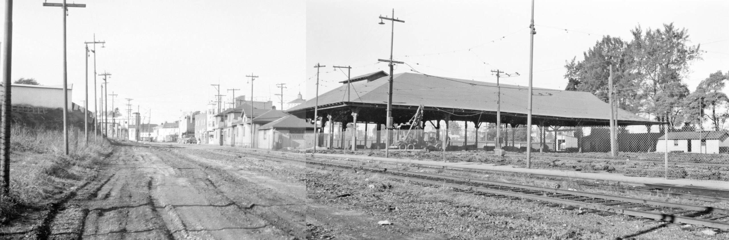
The date is Jan. 2, 1949, and Key System employee Peter Kyhn took two images of the Central Car House to create a panorama documenting the abandonment by the Key System of all streetcar service and this facility as well in Nov. 1948. This meant the only undecided item in the way for planning the new Frickstad Viaduct over the 12th St. dam was whether or not the Key interurban A line connecting Havenscourt with San Francisco would be included.
L330-05-Peter Kyhn Photos, Courtesy BAERA, Western Railway Museum Archives, Fusion of 134412ks, l, 134411ks, r, (Image 1 of 16)

Based on multiple Oakland Tribune articles, the City of Oakland wanted no part of the Key A line being included in the new viaduct construction. The new design’s overlapping roadways had no room for the tracks, and the city was unwilling to pay to have them installed. After many back-and-forth discussions, the Key System agreed to cut back A line service to west of the 12th St. dam and replace it with bus service. For this update, the focus will be to show images of the early preparatory phase for the west lanes of the new viaduct during 1949.
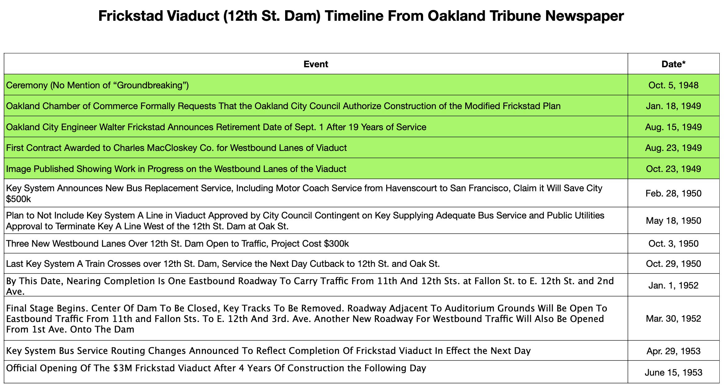
L330-10-Table Constructed by Stuart Swiedler, (Image 2 of 16)
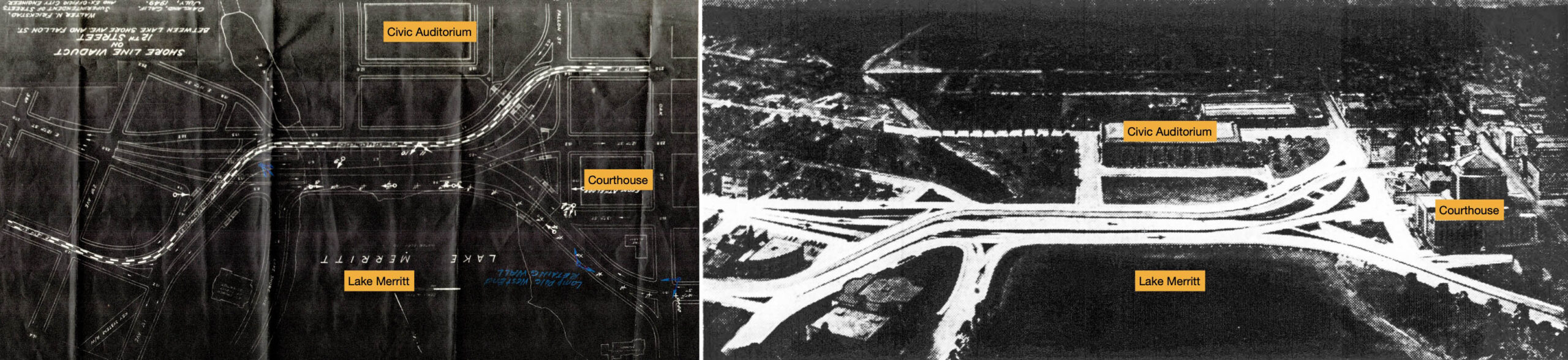
On the left is a diagram of the new viaduct from July 1949 flipped 180 degrees to match a diagram on the right from the Oakland Tribune, Volume 144, Number 106, April 16, 1946 when the plans for the configuration of the roadway was made public. The plans are fairly similar except for the section just east or left of the Courthouse. In agreement, the previous panel noted that the modified plan on the left was approved in Jan. of 1949.
L330-15-Oakland Public Works Drawing, Courtesy BAERA, Western Railway Museum Archives, 240504ov, (Image 3 of 16)
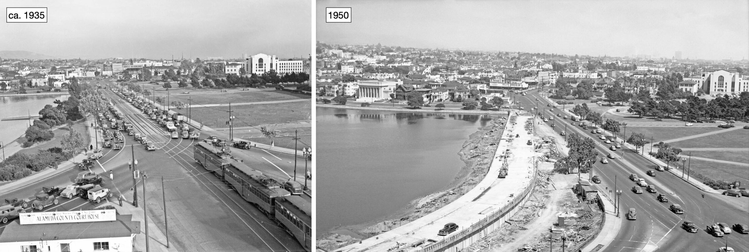
Viaduct construction followed two phases. The first would be to add western lanes to the existing configuration shown in the left panel, an east view from the newly constructed Alameda County Courthouse ca. 1935. The panel on the right is included to show the new western lanes nearing completion in the late summer of 1950. The actual buildout of those lanes will be the subject of the update to follow.
L330-20-Vernon Sappers Collection, Courtesy BAERA, Western Railway Museum Archives, 24709ks, l, Oakland Public Works Photo, Courtesy BAERA, Western Railway Museum Archives, 235172ov, r, (Image 4 of 16)
An east-to-west review of the preparatory phase of the viaduct construction begins with a west view from E. 12th St. and 1st. Ave. taken on Dec. 8, 1949. By this date, heavy machinery can be seen in the distance on the land along the lake cleared for the planned western lanes.
L330-25-Oakland Public Works Photo, Courtesy BAERA, Western Railway Museum Archives, 233754ov, (Image 5 of 16)
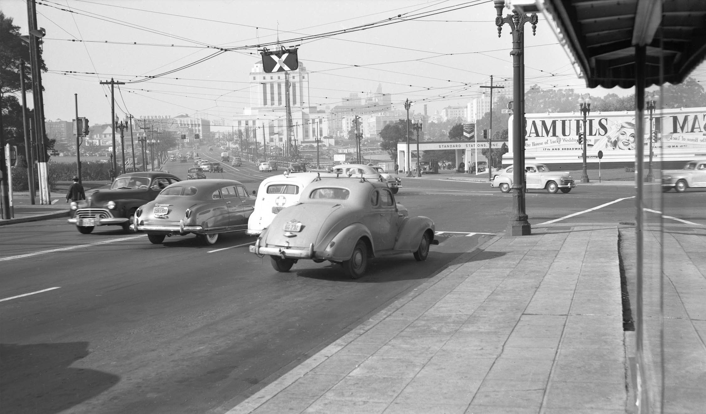
The remainder of the images to be shown were all taken earlier on Aug. 18, 1949. This east view was taken as the photographer just crossed the western end of the dam, marked by the concrete wall on the right edge.
L330-30-Oakland Public Works Photo, Courtesy BAERA, Western Railway Museum Archives, 235157ov, (Image 6 of 16)
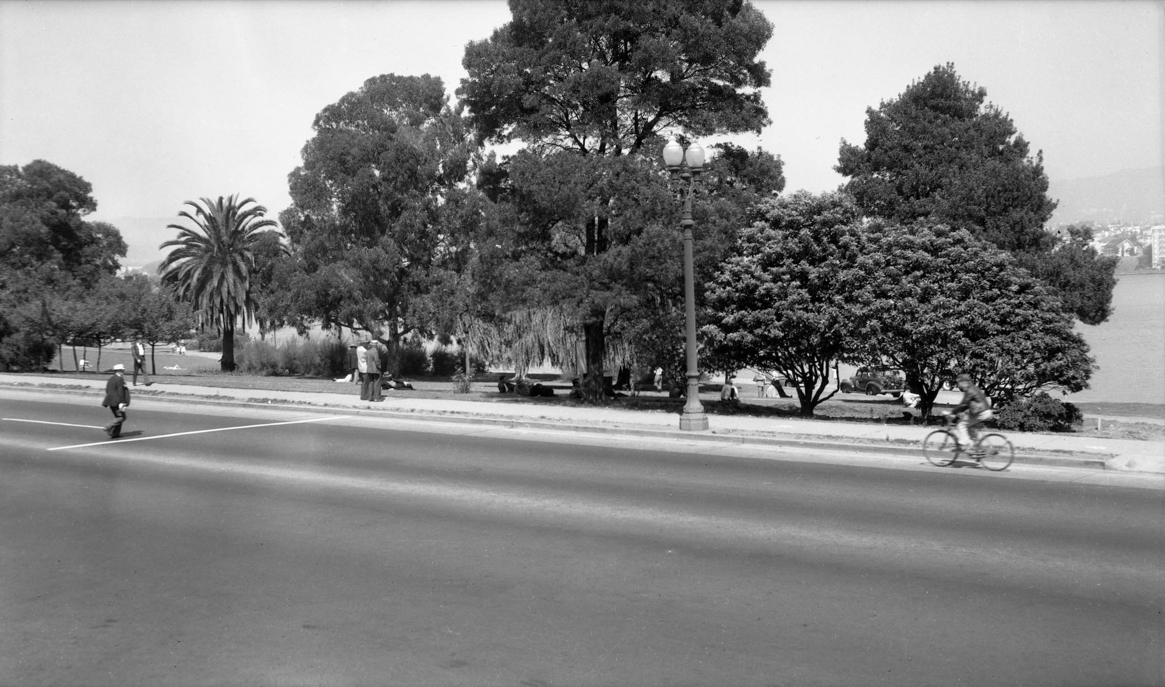
Next a north view toward Lake Merritt and the hills. Seen below the tree on the north side of the lake are the Bellevue-Staten condominiums built in 1929 as a residential apartment building. Listed in the National Register of Historic Places since 1991, the Art Deco and Spanish Colonial architectural style structure was designed by architect Herman Carl Baumann. Note the Key System tracks, and the Fourth Church of Christ Scientist, the latter seen close to the right margin. It was discussed at length in the previous update.
L330-35-Oakland Public Works Photo, Courtesy BAERA, Western Railway Museum Archives, 235160ov, (Image 7 of 16)
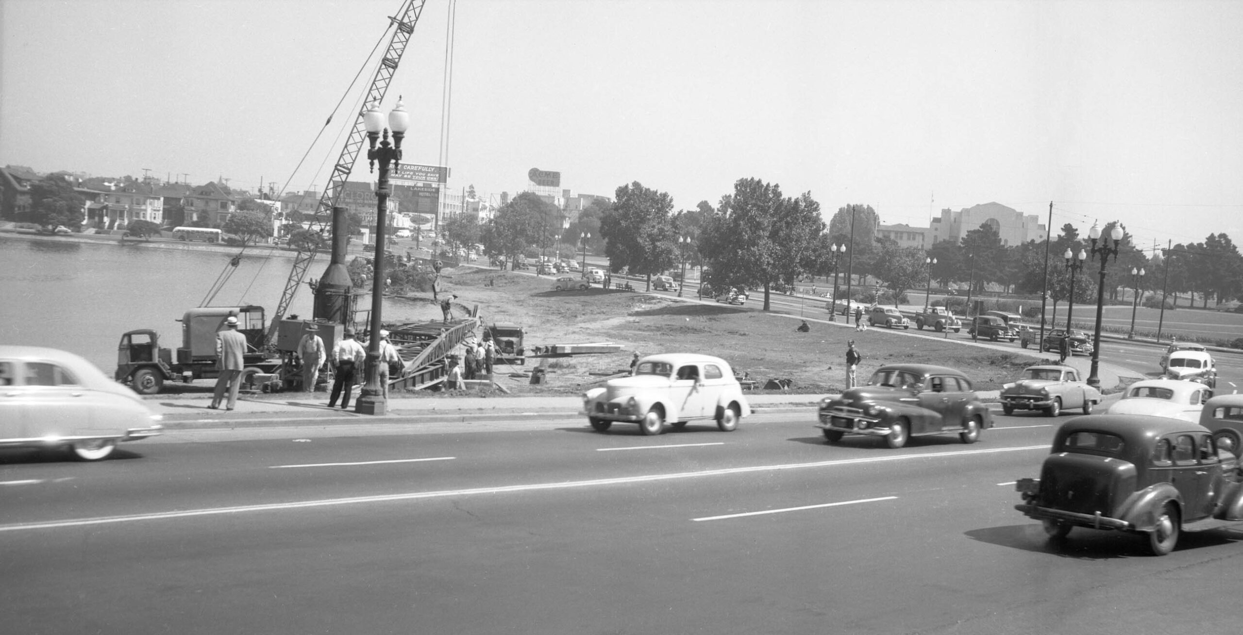
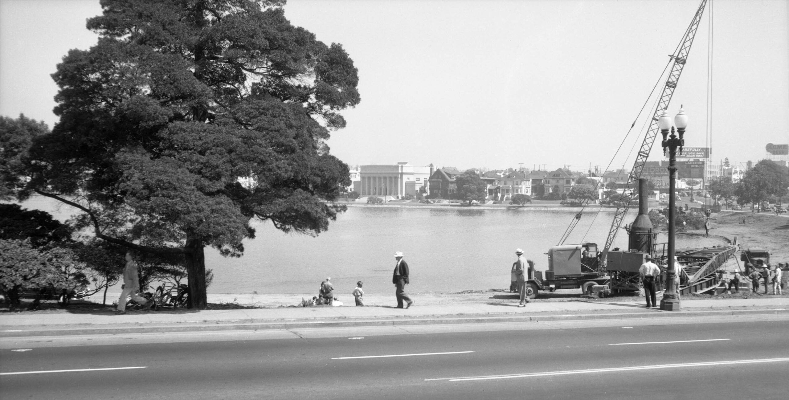
Staying close to the lake edge, this east view from Aug. 18, 1949 shows the dam, and to the east of it the intersection where Lakeshore Ave., E. 12th St. and 1st. Ave. meet.
L330-40-Oakland Public Works Photo, Courtesy BAERA, Western Railway Museum Archives, 235156ov, (Image 8 of 16)
A few steps west reveals the same east view as in the last panel. In this view, the clearing of the land adjacent to the lake and removal of trees is evident.
L330-45-Oakland Public Works Photo, Courtesy BAERA, Western Railway Museum Archives, 235154ov, (Image 9 of 16)
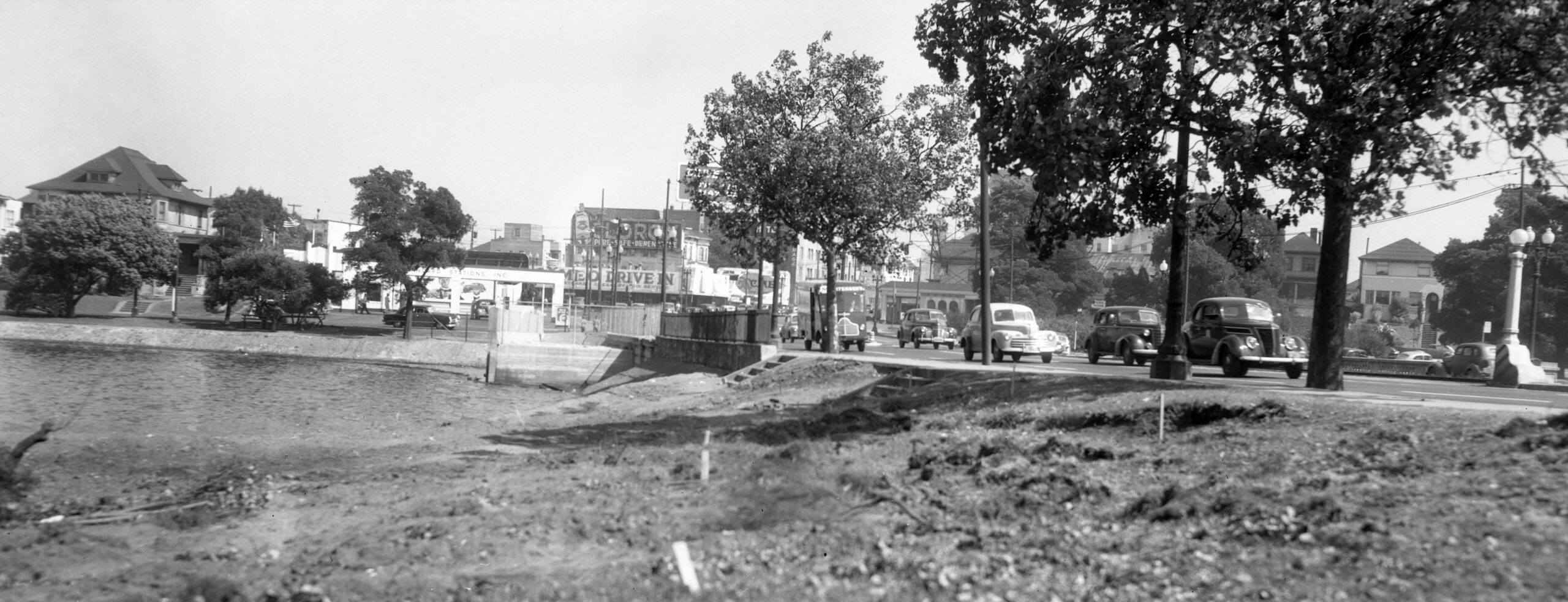
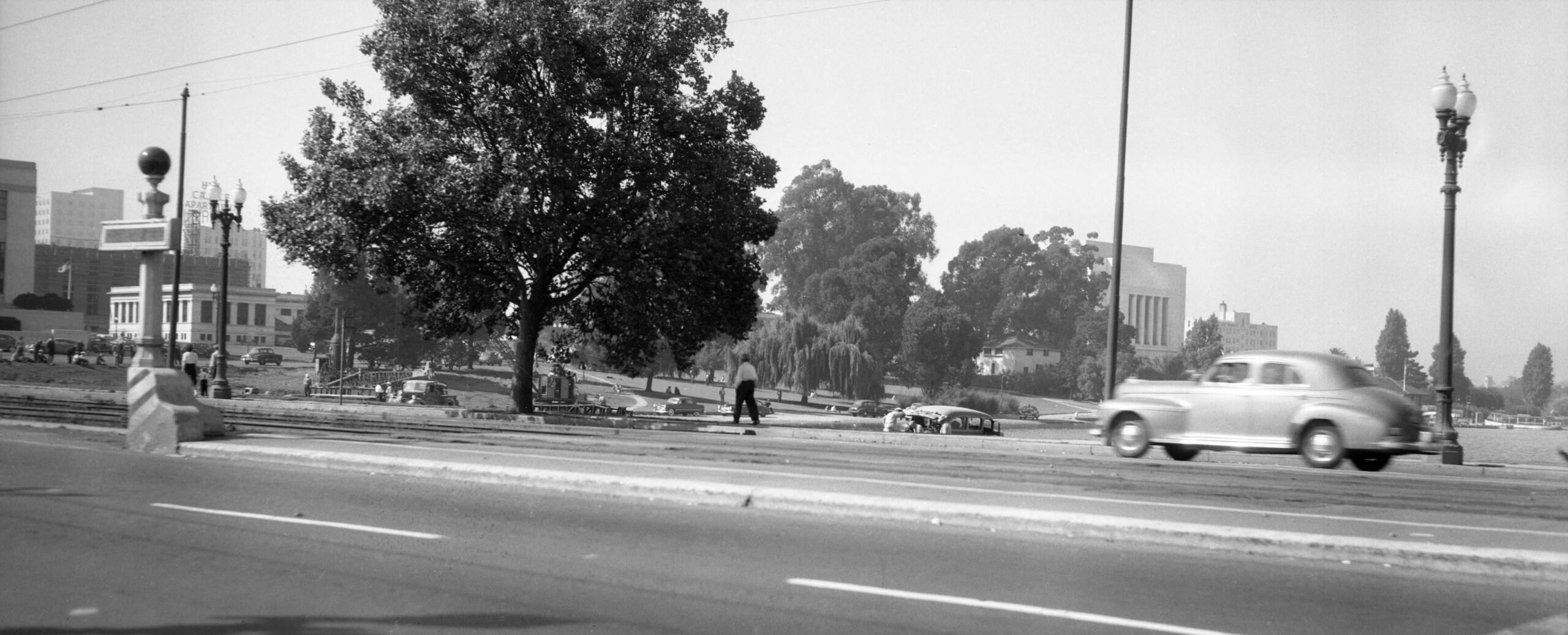
Back to the south side of 12th St., a northeast view along the Lakeshore Ave. side of the lake is featured.
L330-50-Oakland Public Works Photo, Courtesy BAERA, Western Railway Museum Archives, 235162ov, (Image 10 of 16)
The camera is turned from the view on 12th St. in the previous panel to the northwest where it shows the lake along the right edge. Panning the image for major structures right to left in order are the Temple of Scottish Rites Masonry, the Camron-Stanford House serving as the Oakland Public Museum, the Fire Alarm Building, and the northeast side of the Courthouse, all reviewed in the last update.
L330-55-Oakland Public Works Photo, Courtesy BAERA, Western Railway Museum Archives, 235164ov, (Image 11 of 16)
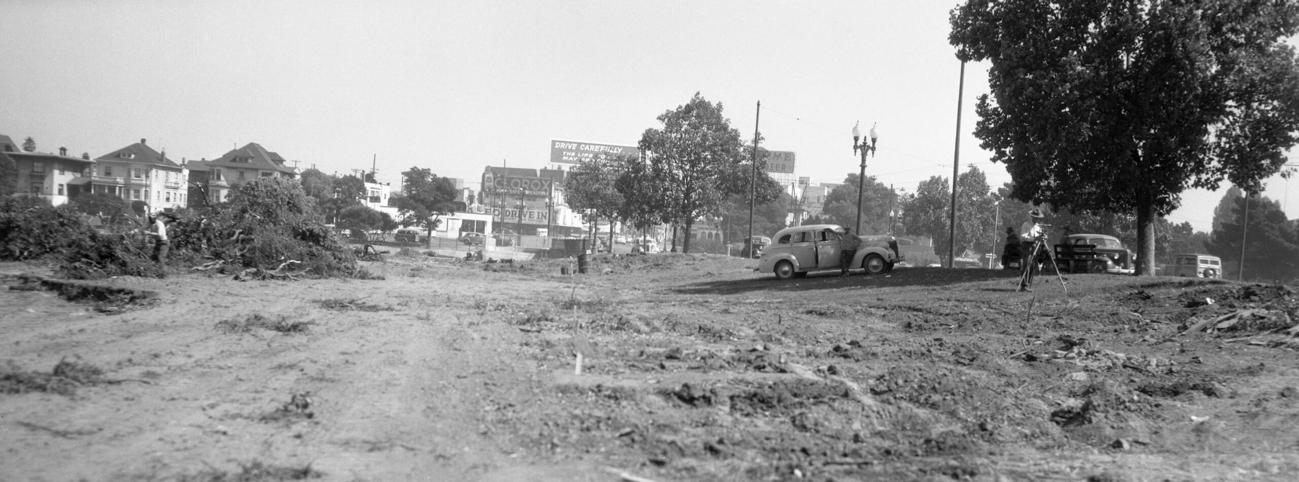
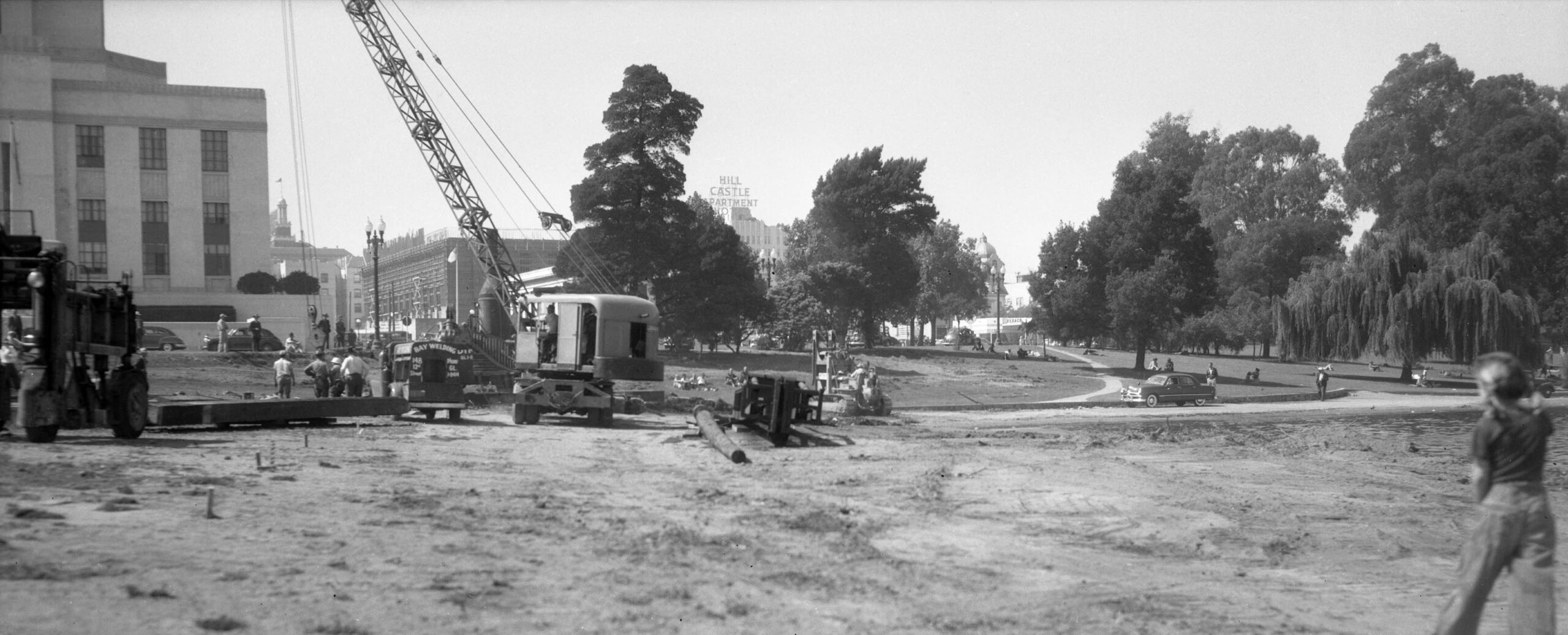
Making the turn toward 14th St., this southeast view shows heavy machinery at work along the lake. The Oakland Unified School District headquarters is featured toward the center right edge.
L330-60-Oakland Public Works Photo, Courtesy BAERA, Western Railway Museum Archives, 235148ov, (Image 12 of 16)
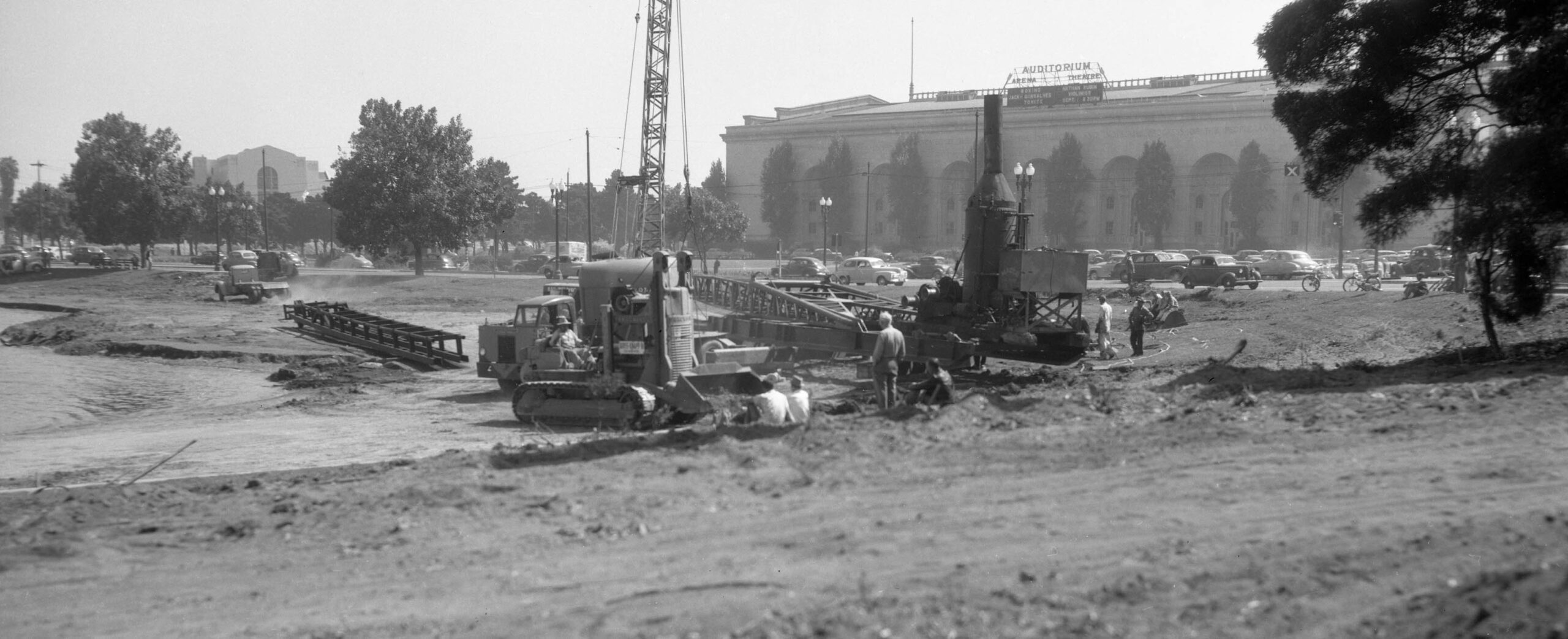
Turning more to the south, the Oakland Civic Auditorium comes to view in the background of this early construction scene.
L330-65-Oakland Public Works Photo, Courtesy BAERA, Western Railway Museum Archives, 235167ov, (Image 13 of 16)
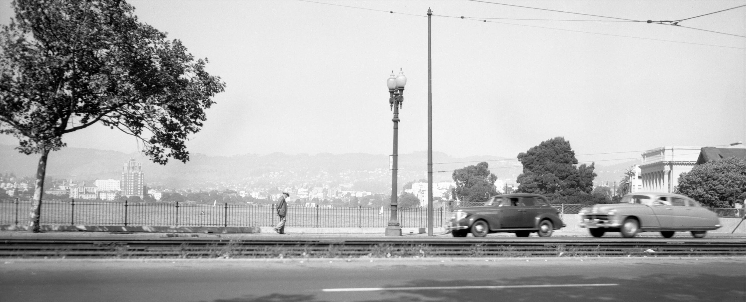
A few steps further west provides an east view across the lake toward the private homes and church along Lakeshore Ave.
L330-70-Oakland Public Works Photo, Courtesy BAERA, Western Railway Museum Archives, 235150ov, (Image 14 of 16)
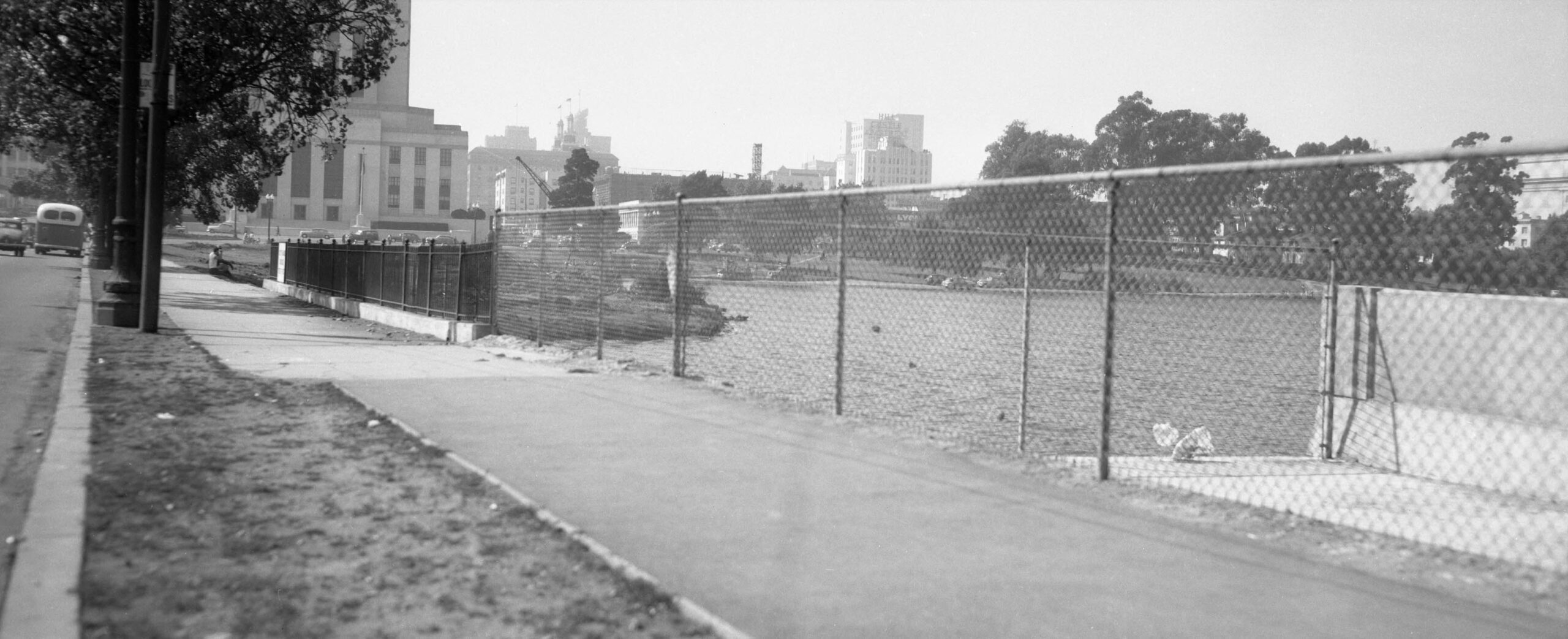
The precise location of the heavy equipment can be established having the 13th St. side of the Courthouse as a marker in this northwest view.
L330-75-Oakland Public Works Photo, Courtesy BAERA, Western Railway Museum Archives, 235152ov, (Image 15 of 16)
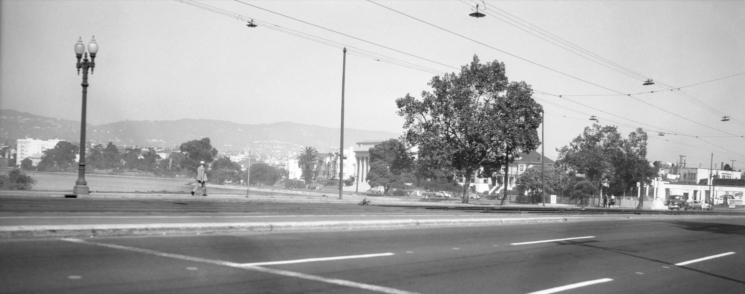
The fellow crossing the road to the left appears to be at 13th St. as the road swings back to the west to become 14th St., north view. The survey of the early preparatory work for clearing of the land for the western lanes of the viaduct is now complete. Appreciation to Betty Marvin for the preservation and donation of the images. Next time, 1950 and the actual road construction.
L330-80-Oakland Public Works Photo, Courtesy BAERA, Western Railway Museum Archives, 235146ov, (Image 16 of 16)