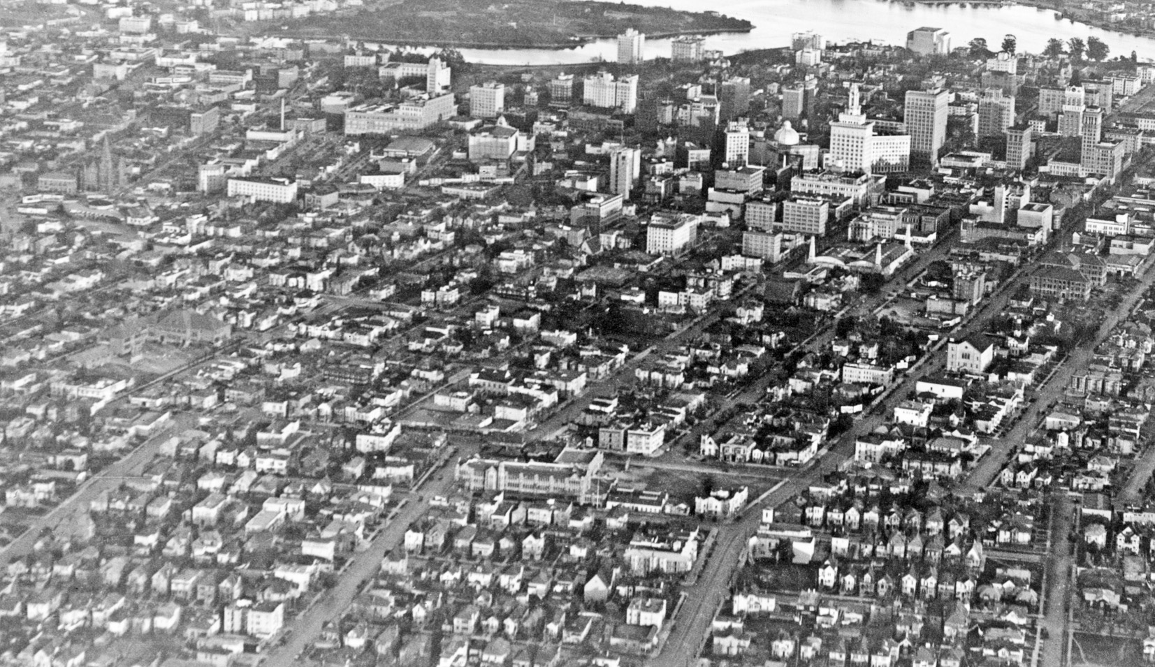
More Alameda County
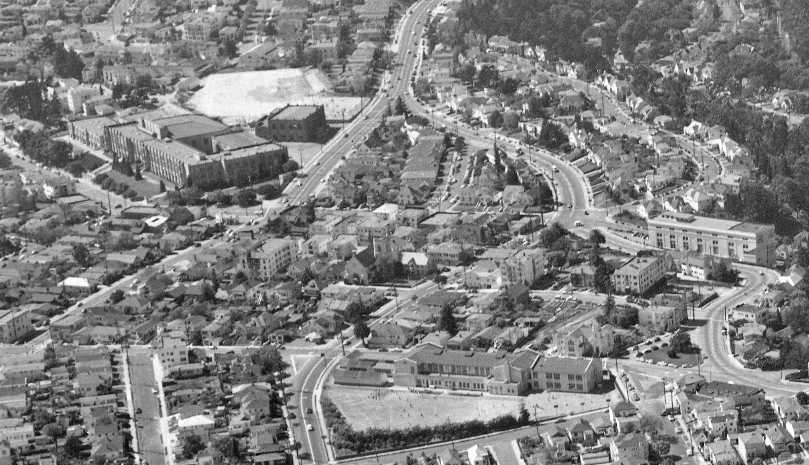
An aerial view facing west on Apr. 8, 1953 reveals the third iteration of Oakland High School, far left, flanking McChesney Junior High, built in 1913, renamed Edna Brewer Middle School in 1989, foreground center, and the Pacific, Gas and Electric substation, right. Oakland High moved from 12th St. and Jefferson downtown after Mary Smith’s Home Club was razed circa 1926. This structure was torn down in 1980 to create a more earthquake-safe structure.
L215-05-Copyright California Department of Transportation, 3300-30, (Image 1 of 36)

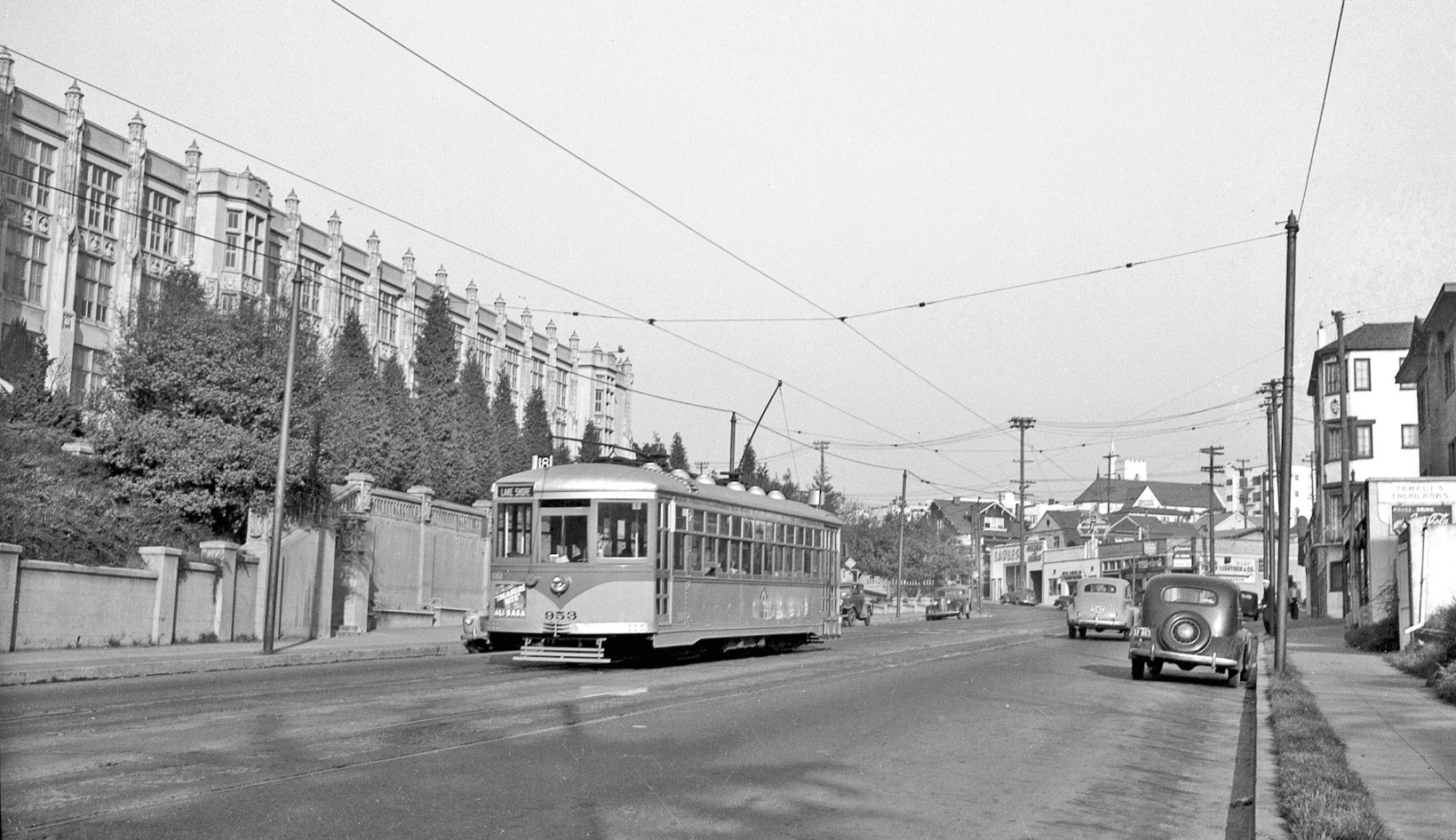
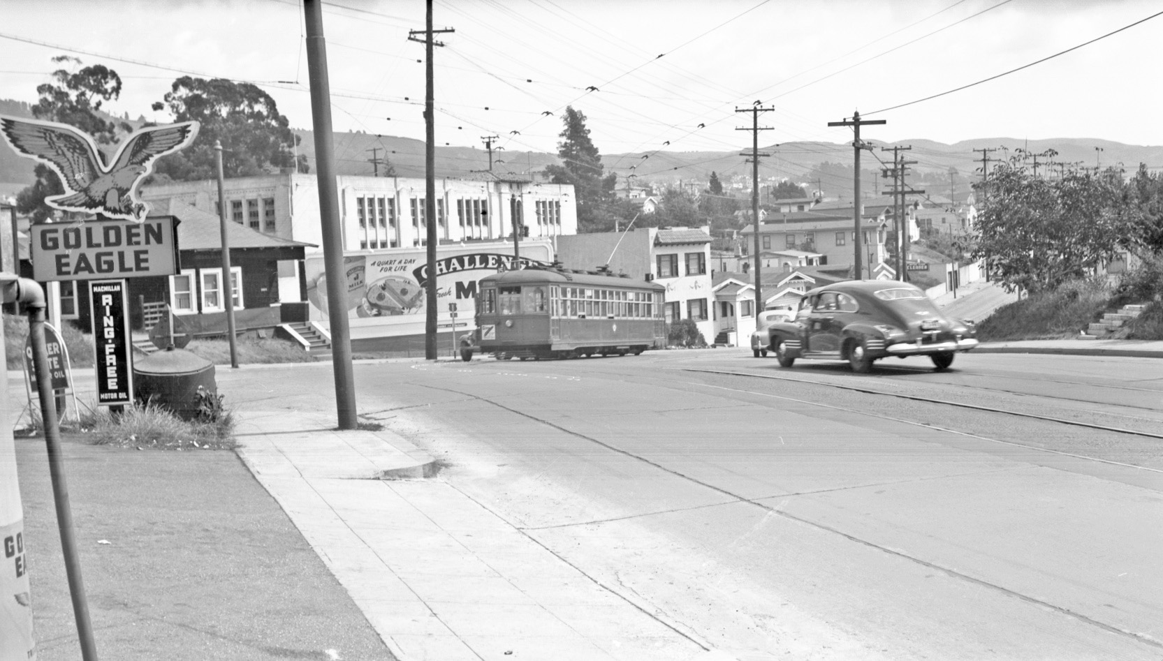
Key System, KS, 953 is shown heading downtown as a No.18 Line, Park Blvd. and Lakeshore, streetcar at Park Blvd. at 30th St. in 1947, east view.
L215-10-Waldemeir Sievers Photo, Courtesy John Harder , (Image 2 of 36)
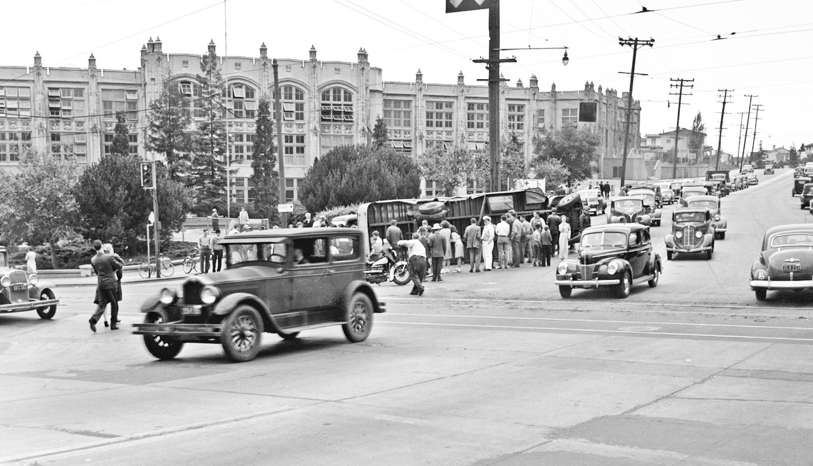
An overturned bus at Park Blvd. and Hopkins St., soon to be MacArthur Blvd., is the attraction in this 1940 northeast view. The lesson to be learned is ...
L215-15-Ralph Demoro Photo, Courtesy John Harder, (Image 3 of 36)
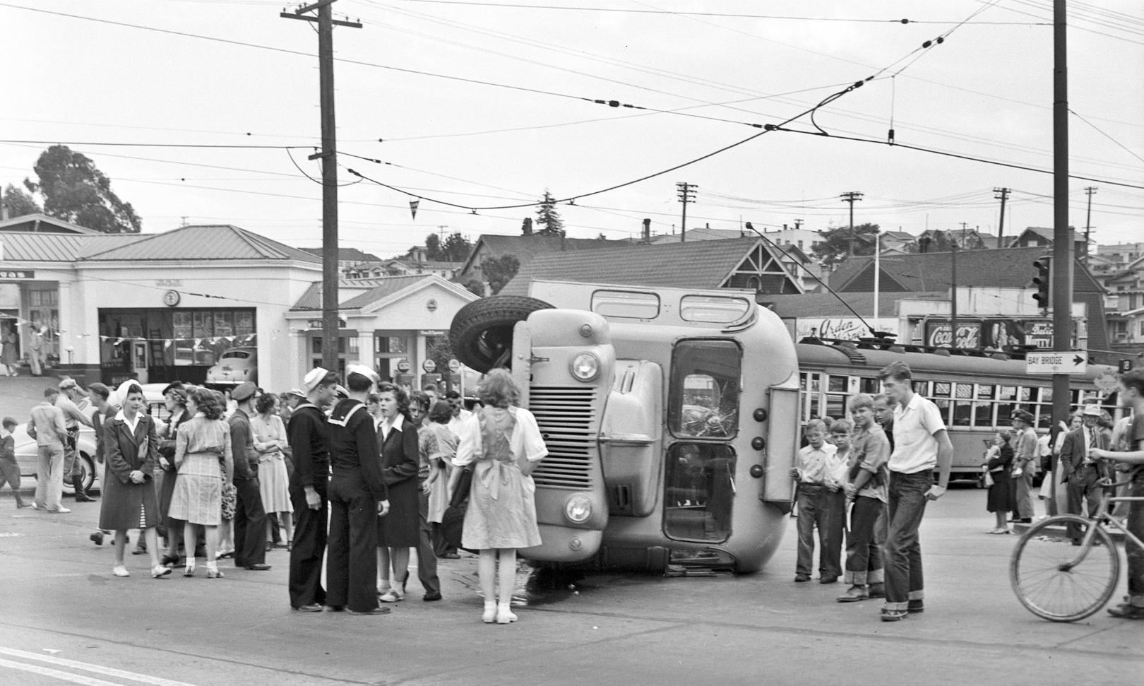
... never cross a Key System streetcar. South view, 1940.
L215-20-Ralph Demoro Photo, Courtesy John Harder, (Image 4 of 36)
On to Lakeview Elementary School, sitting across from the Grand Lake Theater in this west view from Apr., 8, 1953. Opened in 1913, it was closed as a standard elementary school circa 2013, and has been used for administrative offices, and then leased to a charter school.
L215-25-Copyright California Department of Transportation, 3300-22, (Image 5 of 36)
KS 936, as a no. 18 line streetcar eastbound on Lake Park Ave., approaches Lakeshore Ave. in 1948, west view. Note Lakeview Elementary School in the distance, and the Serenador restaurant at right.
L215-30-Tom Gray Photo, Courtesy BAERA, Western Railway Museum Archives, 80458ks , (Image 6 of 36)
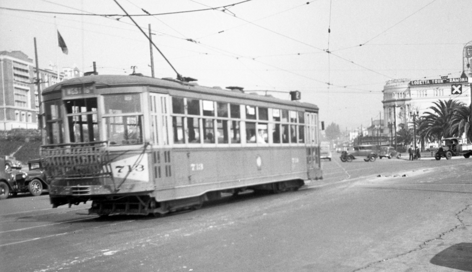
KS 918 is shown eastbound in a north view at Grand Ave. and Perry St. on the no. 12 line, Grand Ave. and Hollis St. The streetcar is approaching the switch that separated the no. 12 line from the no. 18 line. The original brick exterior of Lakeview Elementary School can be appreciated on the left. The Grand Lake Theater is showing Loretta Young in Ramona, verifying the date marked on the image as Sept. 1936.
L215-35-FT Hill Photo, Courtesy BAERA, Western Railway Museum Archives, 54680ks, (Image 7 of 36)
This east view over west Oakland from the early 1930s shows gothic-inspired Lowell Middle School in the foreground center. Ref: API 653_18_BOX 94
L215-40-George Russell Photo, Courtesy California State Lands Commission, (Image 8 of 36)
KS 918 is heading to downtown Oakland on the no. 12 line as it turns from Market onto 14th St. This building was razed in 2006, and has been rebuilt as West Oakland Middle School.
L215-45-Robert L. Stein Photo, Courtesy BAERA, Western Railway Museum Archives, 46080ks, (Image 9 of 36)
Now flying high over East Oakland, this mid-1930s north view shows Bret Harte Middle School. The prominent curved road, Hopkins St., would soon be incorporated as part of MacArthur Blvd.
L215-50-Courtesy East Bay Regional Park District , (Image 10 of 36)
KS 320 as a no. 15 line, 38th Ave., streetcar, is shown in a north view at MacArthur Blvd. and Hopkins Pl. passing Bret Harte Middle School.
L215-55-Peter Kyhn Photo, Courtesy BAERA, Western Railway Museum Archives, 58431ks, (Image 11 of 36)
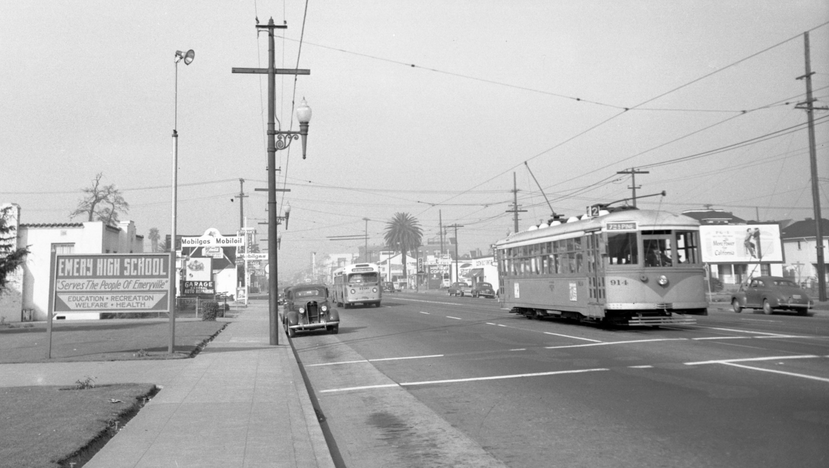
An east view circa 1930 above Emeryville sets Emery High School, foreground center, into view. The schools in the background will be discussed soon. Ref: API 642_2_BOX 92
L215-60-George Russell Photo, Courtesy California State Lands Commission, (Image 12 of 36)
This image of KS 914 as a line no. 2, Richmond, West Berkeley, San Pablo Ave., heading to downtown Oakland on San Pablo at 47th Street is as much as can be found for that HS in this genre. The date of this north view, Nov. 13, 1948, is two weeks away from the elimination of East Bay streetcars, as the approaching bus can attest.
L215-65-Vic DuBrutz Photo, Courtesy BAERA, Western Railway Museum Archives, 70888ks, (Image 13 of 36)
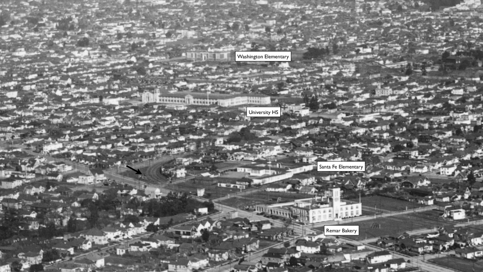
This panoramic northeast view above Emeryville from the early 1930s is a school shot extraordinaire by placing Oaks Park, a place where ball players were “schooled”, in the foreground. See the annotated detail next. Ref: API 651_16_BOX 94
L215-70-George Russell Photo, Courtesy California State Lands Commission, (Image 14 of 36)
The Remar Bakery in Emeryville at 4700 Adeline operated from 1919-1988, and is now Bakery Lofts. This version of Santa Fe School at 915 54th St. existed from 1914 until the present structure opened in 1960, used as a temporary school since 2011. The black arrow points to the separation of the Key E line from the other Berkeley lines. More on the other marked schools coming up.
L215-71-George Russell Photo, Courtesy California State Lands Commission, (Image 15 of 36)
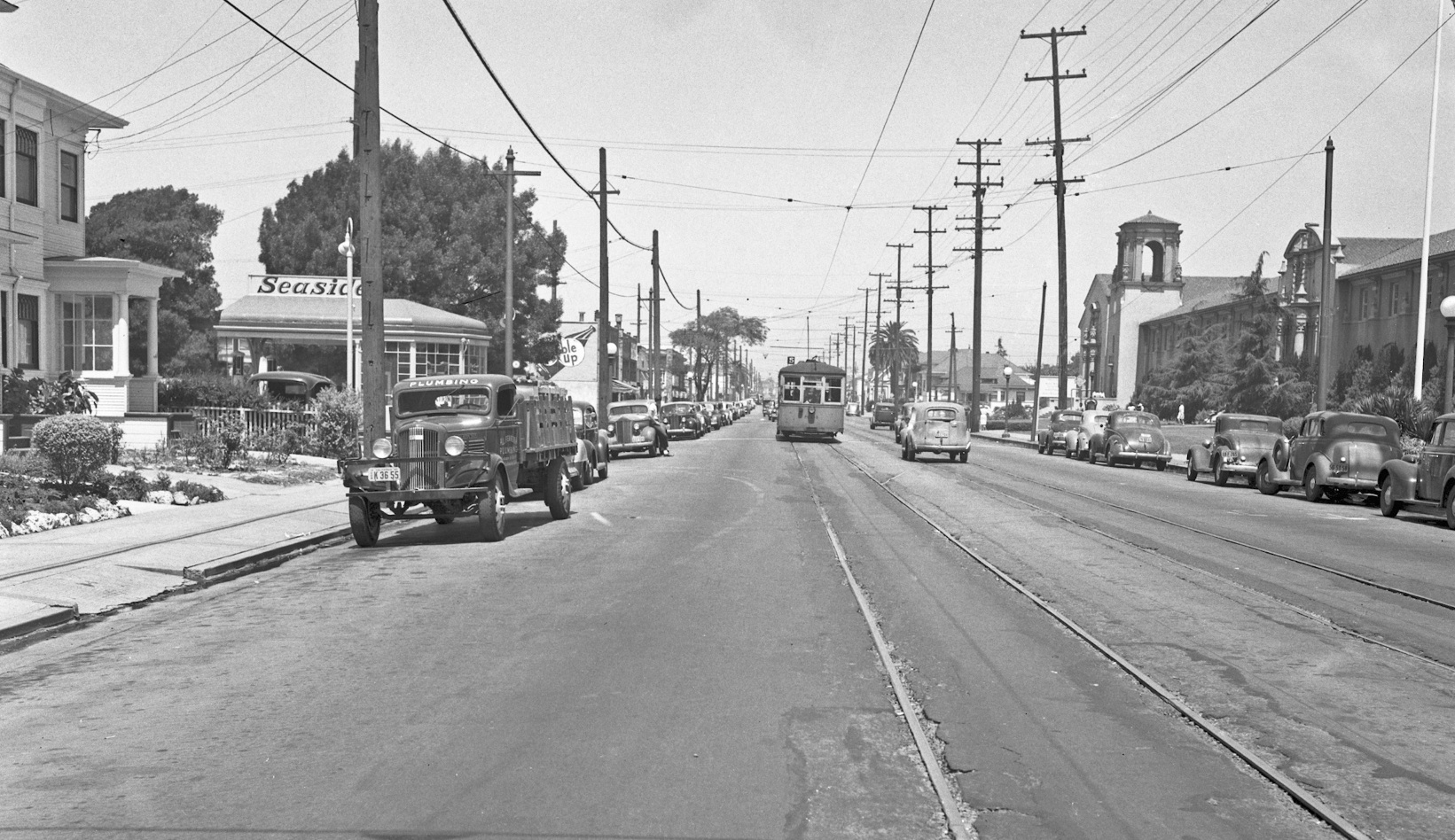
KS streetcar 814 is shown with a posted no. 5, Telegraph Ave., on Grove St., now MLK Way, circa 1946. The building to the right opened in 1923 as University High School for the children of faculty of the University of California in Berkeley. It has been used for several purposes as a high school and college, and in 2020 is now shared between the Children's Hospital Oakland Research Institute and the North Oakland Senior Center. This site was added to the National Register of Historic Places in 1992. See Oakland Wiki for more details.
L215-75-Waldemar Sievers Photo, Courtesy John Harder , (Image 16 of 36)
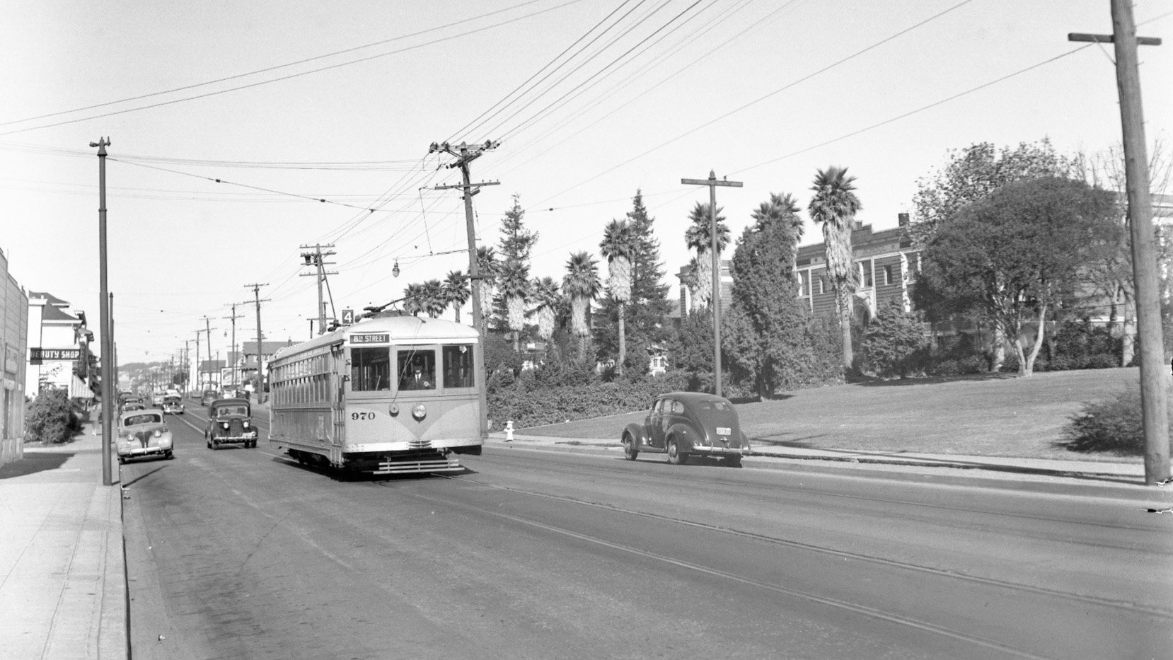
KS 970 as a line 4, Shattuck Ave., streetcar heads to downtown Oakland in this north view from Nov. 18, 1948. Washington Elementary at Shattuck and 61st St. survived the 1906 earthquake albeit with repairs, but was replaced in 1952. It was most recently Sankofa Academy.
L215-80-Vic DuBrutz Photo, Courtesy BAERA, Western Railway Museum Archives, 63653ks, (Image 17 of 36)
Next, flying north over Piedmont Ave. reveals Piedmont Ave. Elementary. This school was opened in 1941 after the original 19th century structure burned in a fire in 1938. This photo also contains a C-line, 2-car bridge unit heading to Oakland Ave.
L215-85-Copyright California Department of Transportation.,3300-36 , (Image 18 of 36)
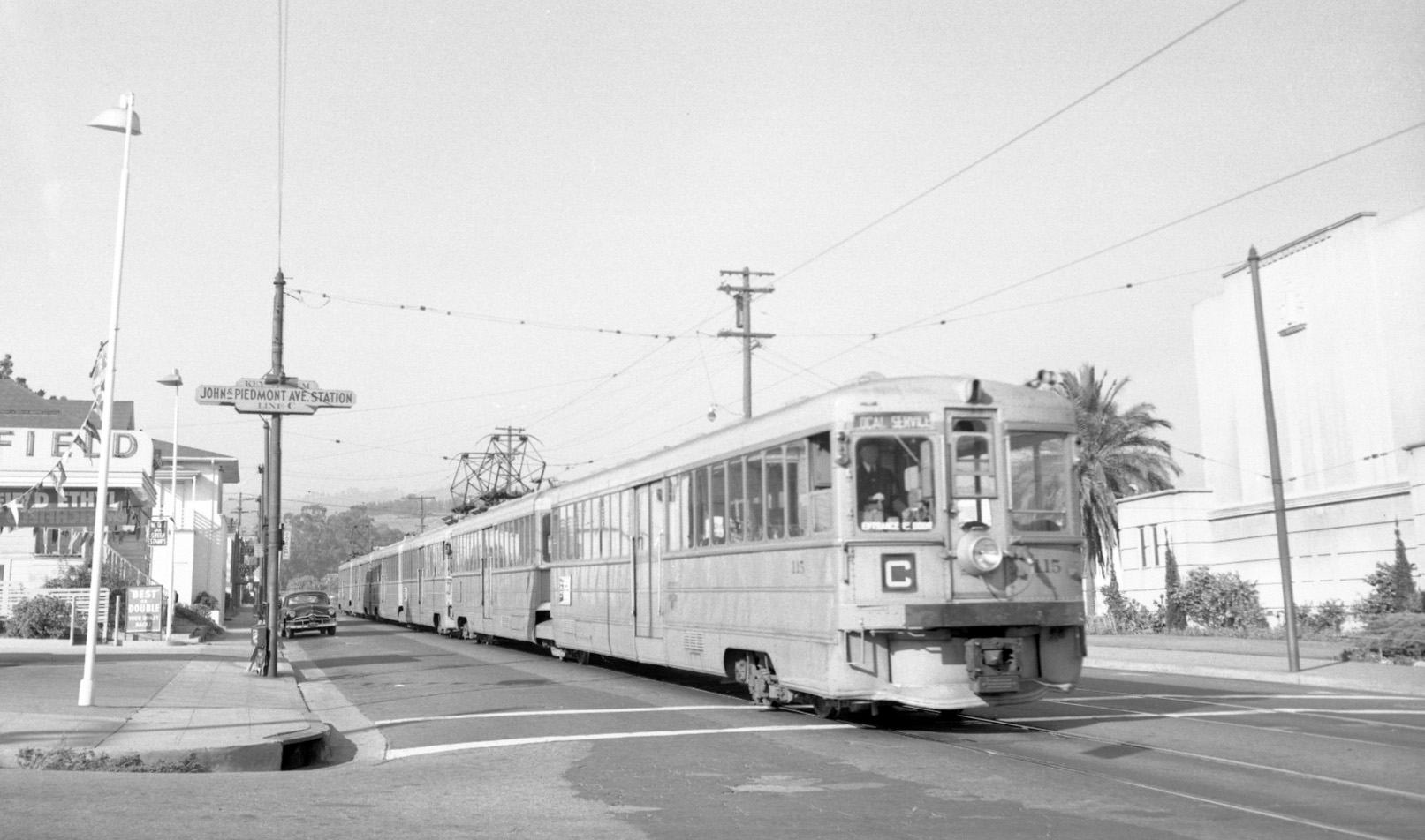
KS Unit 115 heads three bridge units westbound as a C-line train on Piedmont Ave at the John Street stop. Northeast view, May 14, 1954.
L215-90-Vic DuBrutz Photo, Courtesy BAERA, Western Railway Museum Archives, 70929ks, (Image 19 of 36)
This northeast view from Apr. 23, 1958 highlights Beach Elementary School in Piedmont, this second edition built in 1936, with an auditorium added in 1940. The original school, built in 1913, was razed in 1934 due to inadequate fire safety.
L215-95-Copyright California Department of Transportation, 5982-5 , (Image 20 of 36)
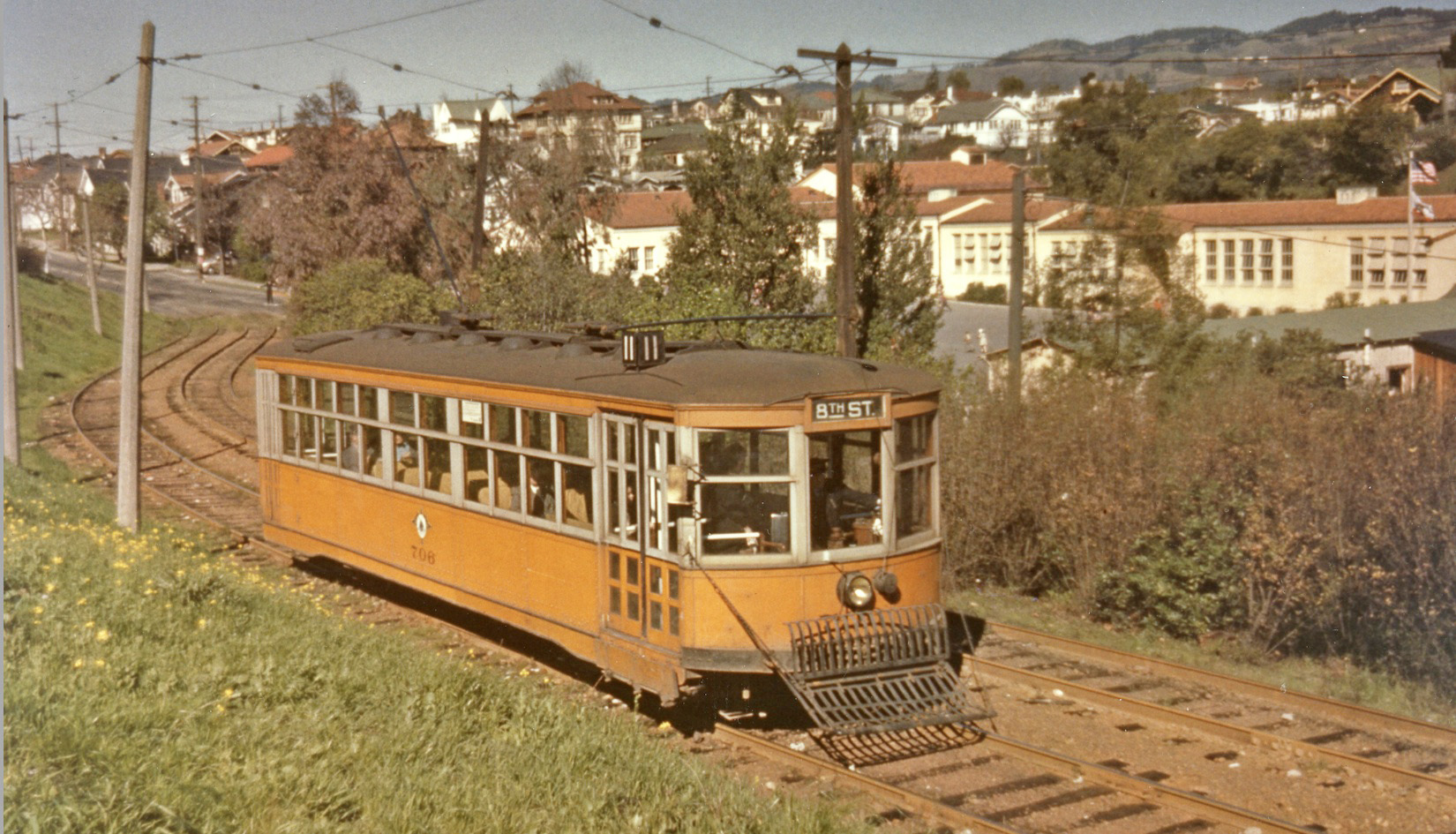
KS 706, line 11, Oakland and 38th Aves., sets along its private right-of-way between Linda and Oakland Aves. in 1944, northeast view.
L215-100-Wilbur C. Whittaker Photo, Courtesy BAERA, Western Railway Museum Archives, 161835sn, (Image 21 of 36)
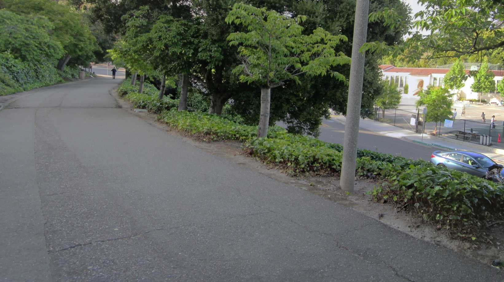
The “after” image from 2017 of the previous northeast view of Beach Elementary School. A good shortcut to Oakland Ave.
L215-105-Stuart Swiedler Photo, (Image 22 of 36)
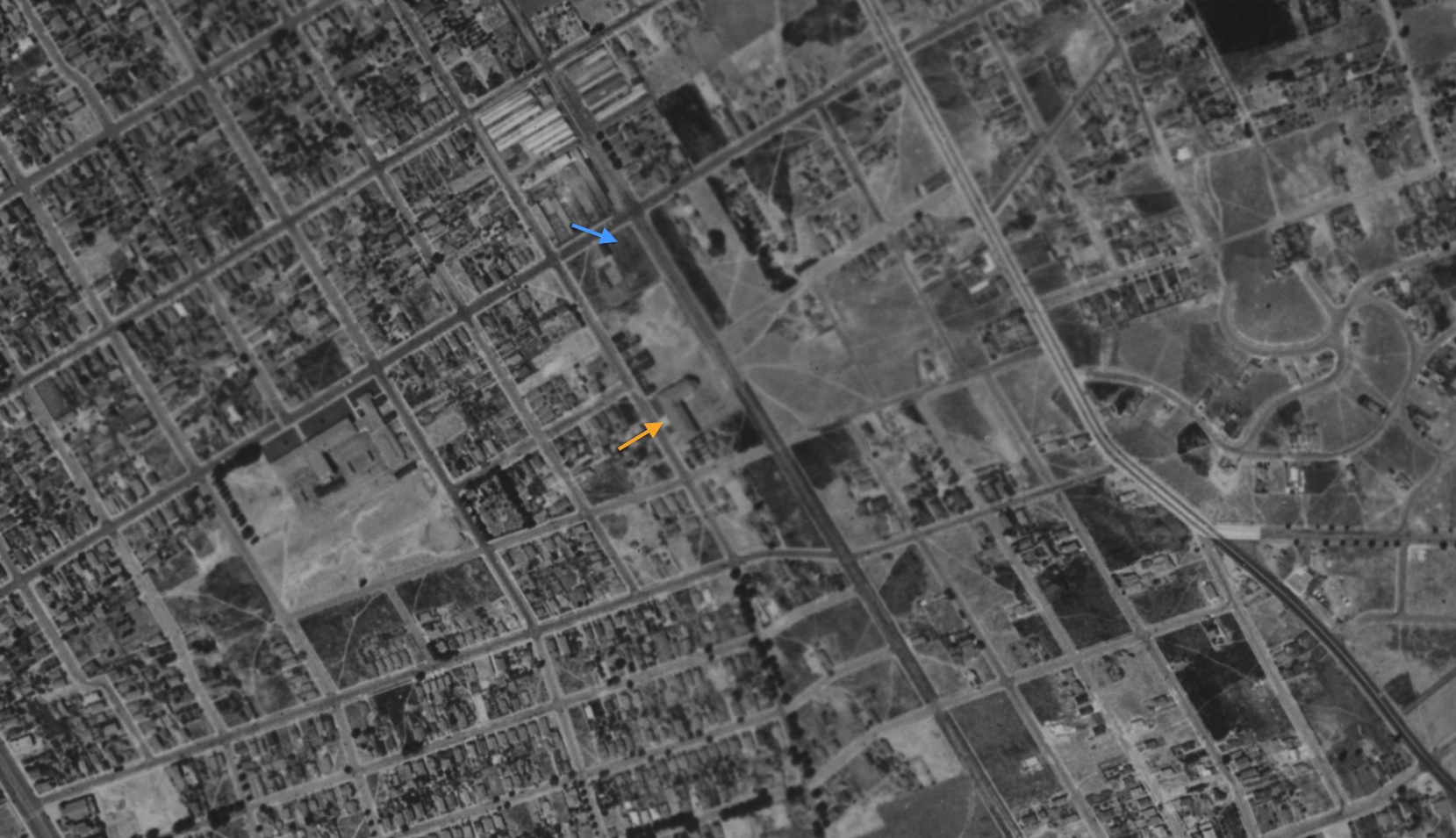
An oblique view of E. Morris Cox School could not be found, so this vertical north-oriented aerial from July 30, 1939 will be used to show the school building, orange arrow, and the small SP yard, blue arrow. Ref: Ref: BUT-283-86, 7/30/39, UCSB Ref: c-5750_283-86
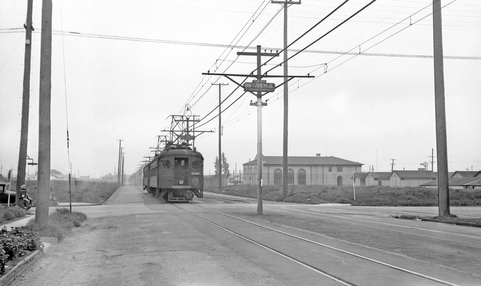
L215-110-USDA AAA Western Division, Courtesy UCSB Library, Special Research Collections , (Image 23 of 36)
Southern Pacific’s Interurban Electric Railway 381 sits on the no. 2 line at 98th Ave. on its private right-of-way, later converted to Bancroft Ave. East view, circa 1940. Cox School opened in 1926, and is today used by Reach Academy Elementary. The switch track accessing the SP yard can be appreciated to the right of the train.
L215-115- J. G. Graham Photo, Courtesy BAERA, Western Railway Museum Archives, 17835sp, (Image 24 of 36)
Emerson School between 45th and 49th St, and Shafter and Lawton Aves., was built in 1913 during the school construction renaissance of Mayor Frank Mott’s reign in Oakland. Most of the schools of that vintage were designed by architect John J. Donavan, City Hall architect, who wrote “School Architecture: Principles and Practices”. This project with an assist by UC Berkeley architect John Galen Howard. The school was razed in 1978 due to seismic concerns.
L215-120-Copyright California Department of Transportation, 3301-14, Detail , (Image 25 of 36)
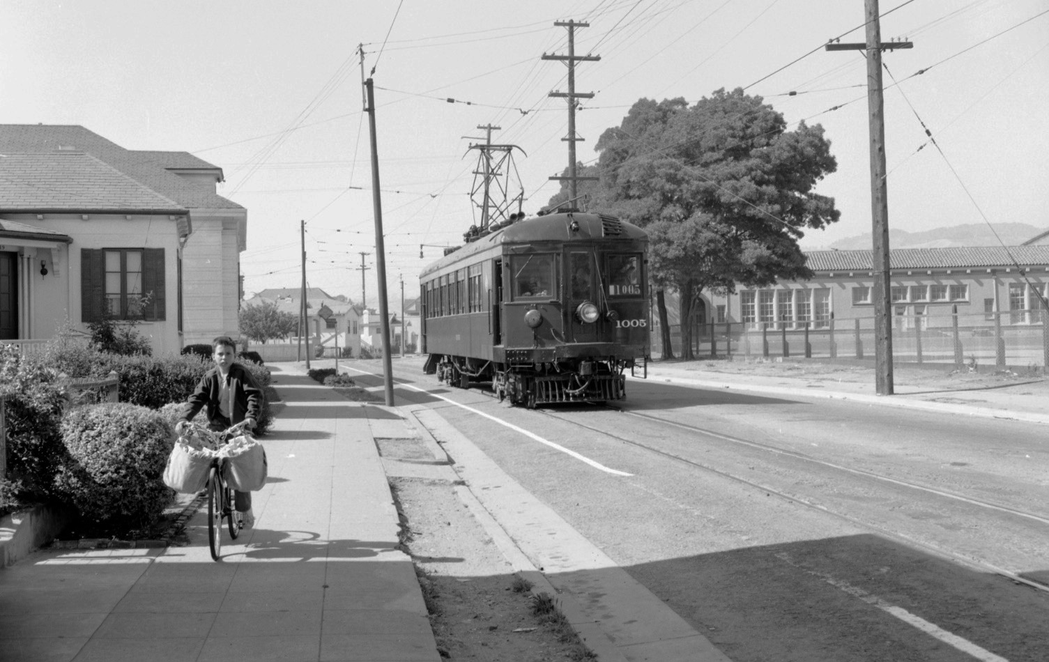
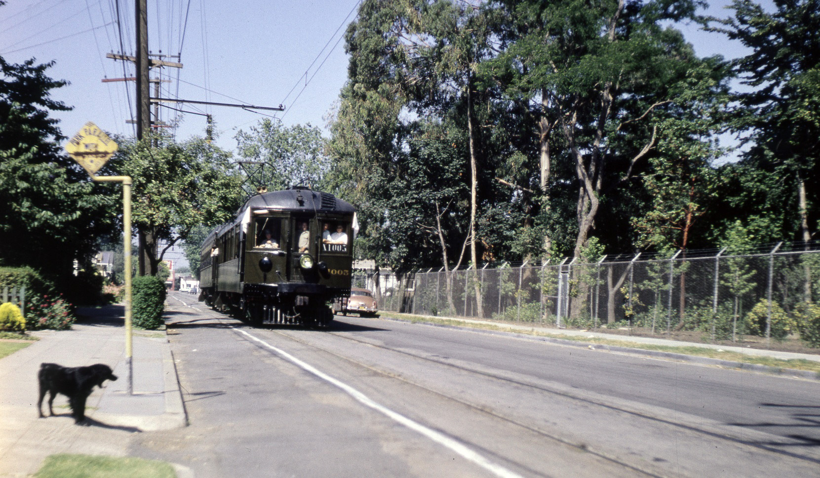
The newspaper boy is transfixed by the camera as SN 1005 leads an Aug. 10, 1952 excursion on Shafter Ave. by the school after being refurbished from Key System duty. North view.
L215-125-Ted G. Wurm Photo, Courtesy BAERA, Western Railway Museum Archives, 59606sn, (Image 26 of 36)
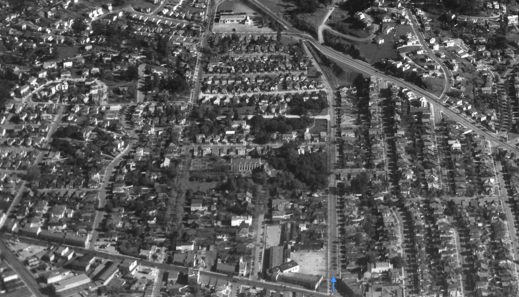
This detail of an east view from College Ave. captures three schools in the Rockridge area. Follow Shafter Ave., blue arrow, to identify Claremont Middle School, foreground center, St. Albert’s College and Priory, center, and Chabot Elementary School, background center.
L215-130-HJW Geospatial Inc, Pacific Aerial Surveys, Oakland CA, Courtesy East Bay Regional Park Dis, (Image 27 of 36)
Compare the previous image with this similar east view from June 21, 1967 to appreciate the additions to these institutions in the mid-20th century.
L215-135-Copyright California Department of Transportation, 13947-3, Detail , (Image 28 of 36)
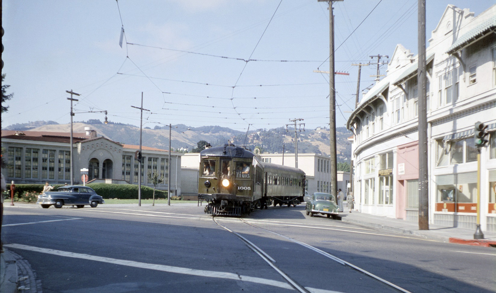
A northeast view in Rockridge at Shafter and College Ave. shows SN 1005 and Salt Lake and Utah 751 during a mid-1956 excursion. In Claremont Middle School’s design, John J. Donovan was joined by Oakland skyscraper architect Walter D. Reed. It served all early grades until Chabot Elementary opened in 1927, when it became a JHS. This structure was demolished in 1976.
L215-140-Courtesy BAERA, Western Railway Museum Archives, 54983sn, (Image 29 of 36)
SN 1005 and MW 302 pass the grounds of College of St. Albert's in this southwest view from a July 8, 1956 excursion. St. Albert's Priory is a monastic community in Rockridge. The priory was founded in 1932, and additions were made and completed by 1951.
L215-145-Courtesy BAERA, Western Railway Museum Archives, 54985sn , (Image 30 of 36)
Those attending Chabot Elementary School by SN would get off at the sign post and pass over Temescal Creek. When dedicated on Apr. 21, 1927, it served as the Claremont JHS Annex. Northeast view, 1949.
L215-150-Vernon Sappers Collection, Courtesy BAERA, Western Railway Museum Archives, 68143sn, (Image 31 of 36)
A better appreciation of the previous scene is shown in this northeast image from Apr. 8, 1953.
L215-155-Copyright California Department of Transportation, 3301-15, (Image 32 of 36)
A two-car train on the berm passes the school in May, 1941, north view.
L215-160-Vernon Sappers Collection, Courtesy BAERA, Western Railway Museum Archives, 70083sn, (Image 33 of 36)
Two views, left, looking northwest on Sept. 23, 1953, and right, southeast on Feb. 1, 1956 of the Montclair Elementary School. The main building replaced the original 1925 structure in 1947, and additional structures placed on the railway berm in 2013. Ref: left, Public Works Photo, Courtesy Oakland Cultural Heritage Survey, Oakland city Planning Department; right, Copyright California Department of Transportation, 4809-7, Detail
L215-165-Oakland City Planning, left, and Copyright CALTRANS, right, (Image 34 of 36)
A northwest view of the school taken from a SN motor in the early 1950s.
L215-170-Reginald McGovern Photo, Courtesy Reginald McGovern, (Image 35 of 36)
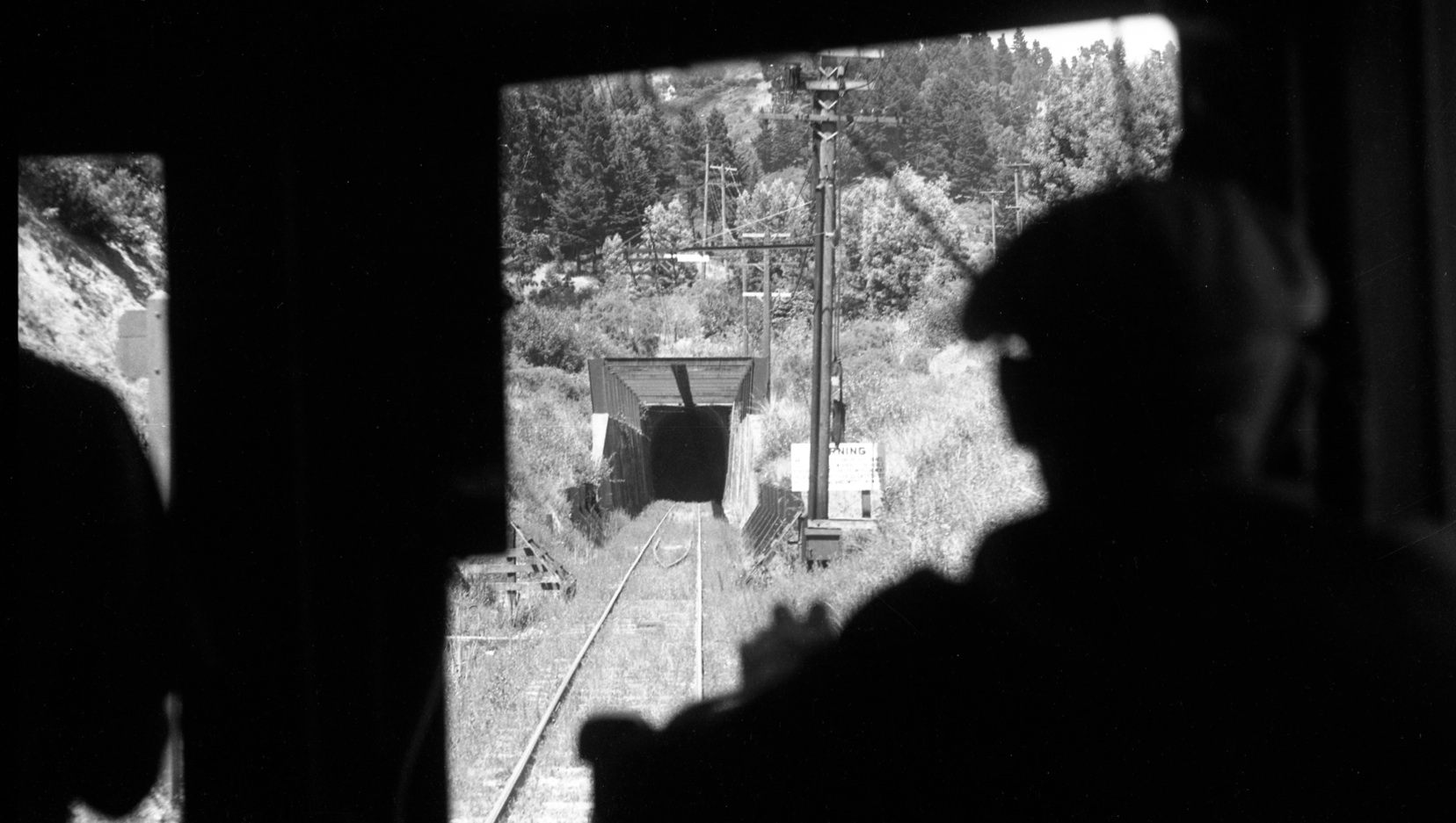
All aboard Train no. 28 in Shepherd Canyon at the west portal on July 5, 1941, to continue the school tour into Contra Costa County. If you want to learn more detail of Oakland schools, explore Dorothy “Littledots” Londagin’s the “Then and Now - Oakland Schools” series on the internet. Start at https://abitofhistory.website and then look for school presentations.
L215-175-Courtesy BAERA, Western Railway Museum Archives, Art Alter Photo, Moreau Collection, 82382s, (Image 36 of 36)