Glenwood Glade’s Dark Secret

This north view shows the Mountain Boulevard Freeway Unit 1, herein referred to as “the freeway”, on Feb. 1, 1956 as an introduction to Glenwood Glade, the SN right-of-way and alterations to the area made as a result of construction of the freeway in the early 1950s.
L104-05-Copyright California Department of Transportation 4809-1 , (Image 1 of 33)

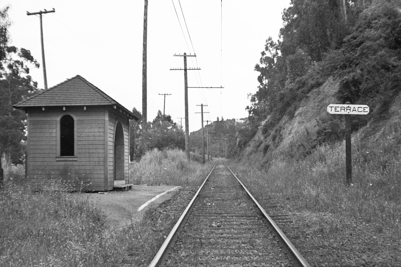
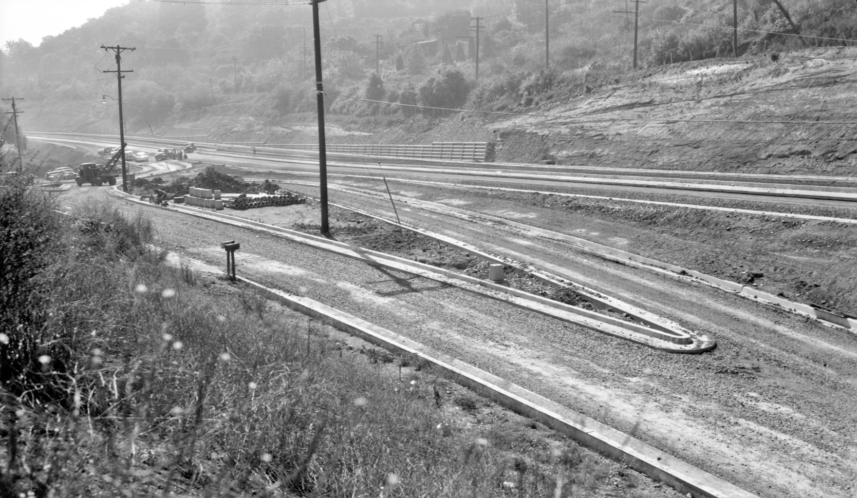
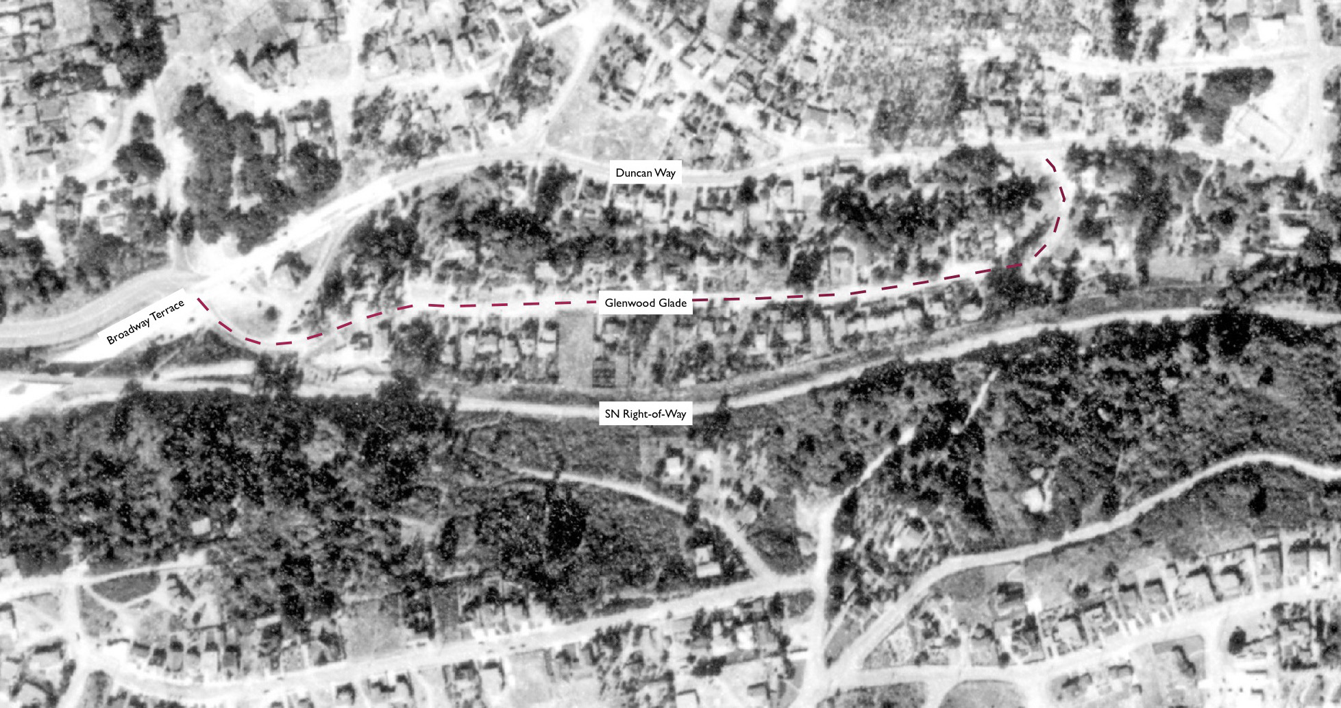
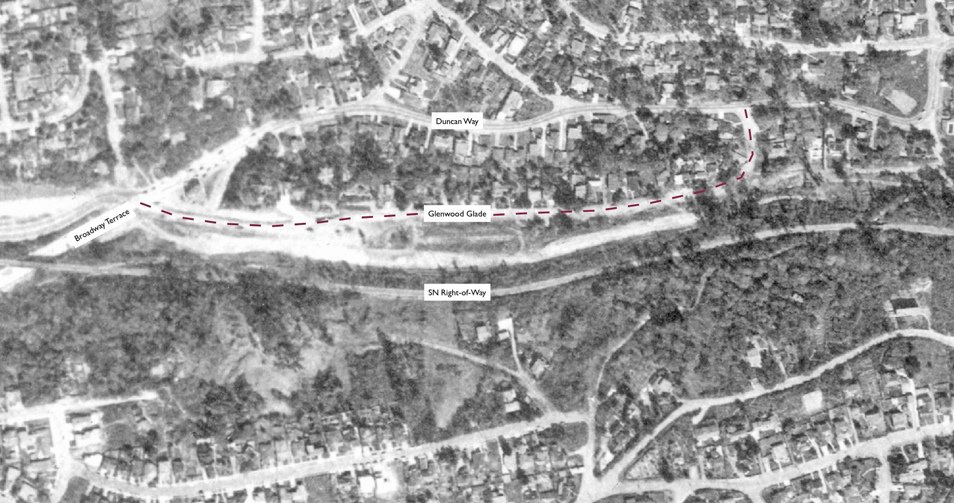
This detail from L104-05 of a north view of the freeway shows the southern-most origin of Glenwood Glade from Duncan Way, right corner, and further to the north, the east-side off-ramp to Broadway Terrace on Feb. 1, 1956. Glenwood Glade was developed as part of the Glenwood tract in 1920 by the Villa Site & Development Co. Note the position of the catenary poles along the SN right-of-way.
L104-10-Copyright California Department of Transportation 4809-1, Detail, (Image 2 of 33)
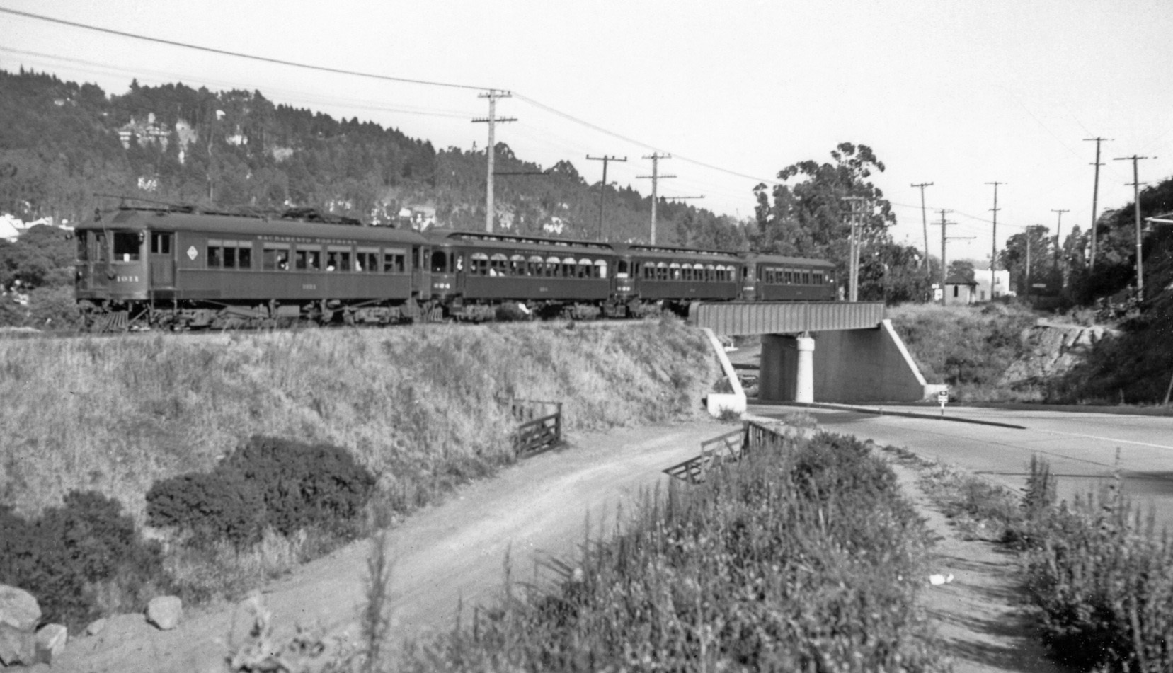
Knowledge of the changing position of the catenary poles relative to the track is extremely useful information for placing photos of the surrounding area. This ca. 1940 southeast view from just south of the Broadway Terrace overpass shows several poles to the east of the track, switching to the west further south at the left curve.
L104-15-Norman Smith Photo, Courtesy BAERA, Western Railway Museum Archives, 56022sn , (Image 3 of 33)
This southeast view from Aug. 25, 1949 was taken further south with the poles to the west to accommodate the left curve. The house about 20 feet to the west or right of the track was number no. 264 Sheridan Rd., sometimes numbered 274, Oakland building permit no. A73188 dated June 27, 1938. Firestorm records do not list this home as a casualty, but the home at this spot in 2019 is a newer house with no further building permit records found.
L104-17-Sappers Colection, Courtesy BAERA, Western Railway Museum Archives, 93737sn, (Image 4 of 33)
The catenary poles on the west eventually switched back to the east to accommodate the right curve in the distance as shown in this 1957 post-abandonment, southeast view.
L104-20-EK Muller Photo, Courtesy BAERA, Western Railway Museum Archives, 85911sn, (Image 5 of 33)
This southeast directed aerial of Broadway Terrace, bottom, to Moraga Ave., top, from July 9, 1956 provides all the details seen in the previous three images and those to come.
L104-22-Copyright California Department of Transportation 4975-1, Detail , (Image 6 of 33)
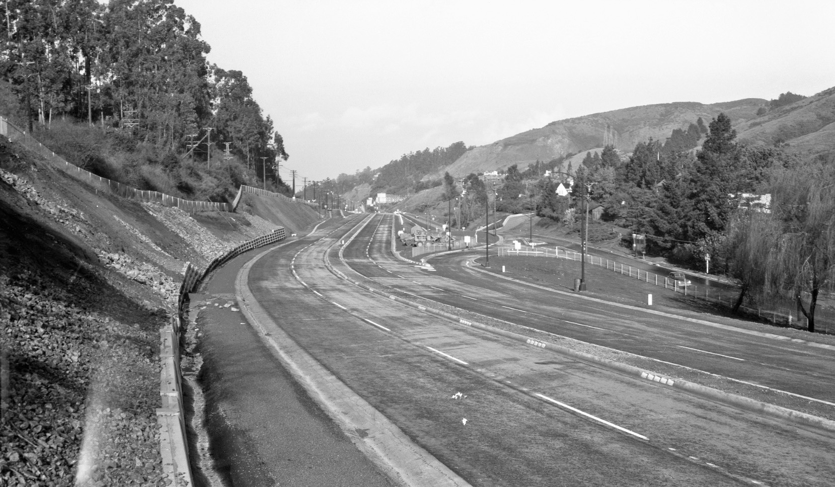
It is early 1952, and the freeway is complete. In this northwest view, the sign for the Broadway Terrace is in view, as is the SN right-of-way along the left side of the image, all catenary poles to the west of the track.
L104-25-Public Works Photo, Oakland Cultural Heritage Survey, Oakland City Planning Department , (Image 7 of 33)
Traveling further north on the freeway, the new Broadway Terrace exit onto Glenwood Glade can be seen in this northwest view form early 1952.
L104-30-Public Works Photo, Oakland Cultural Heritage Survey, Oakland City Planning Department , (Image 8 of 33)
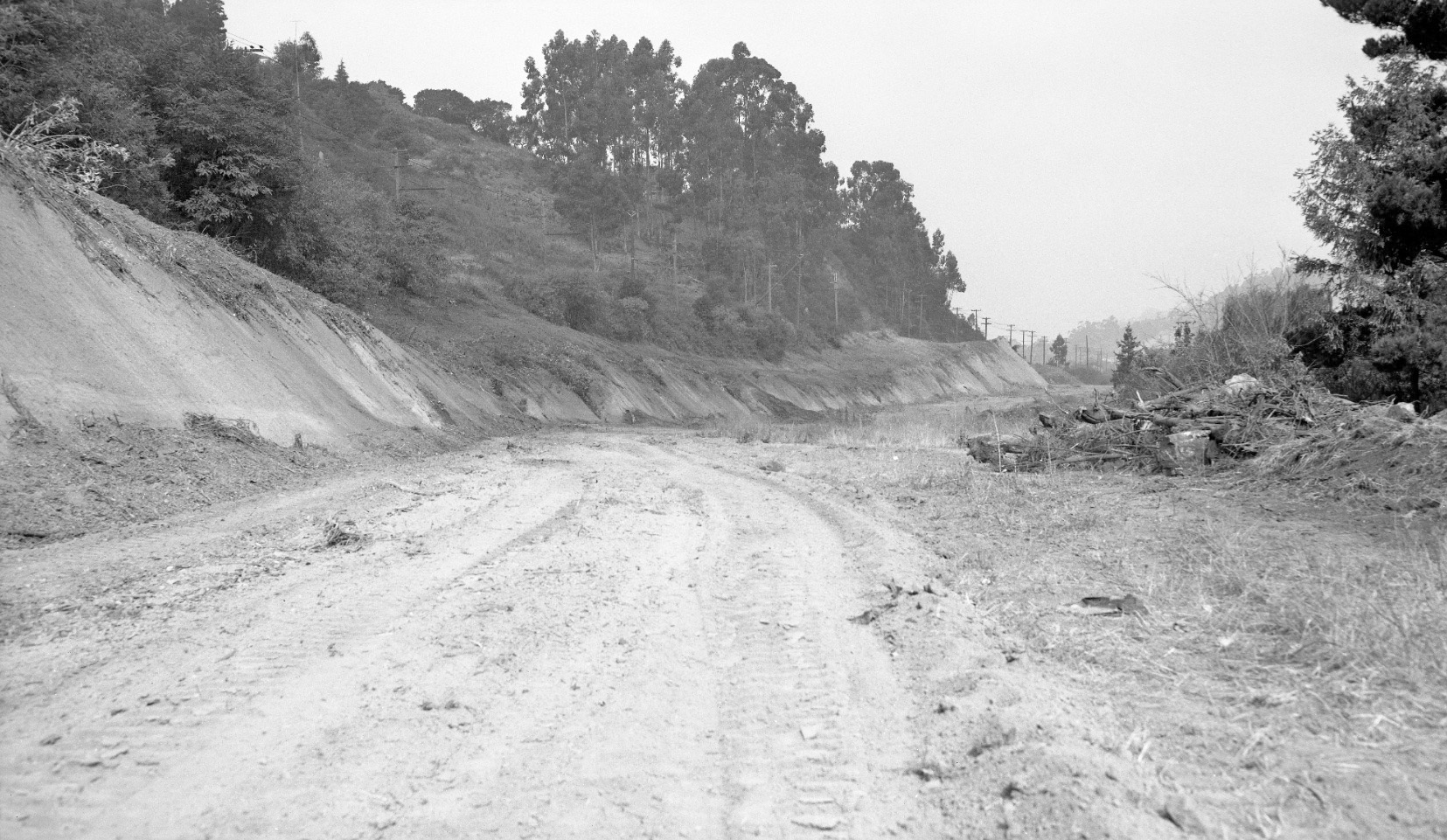
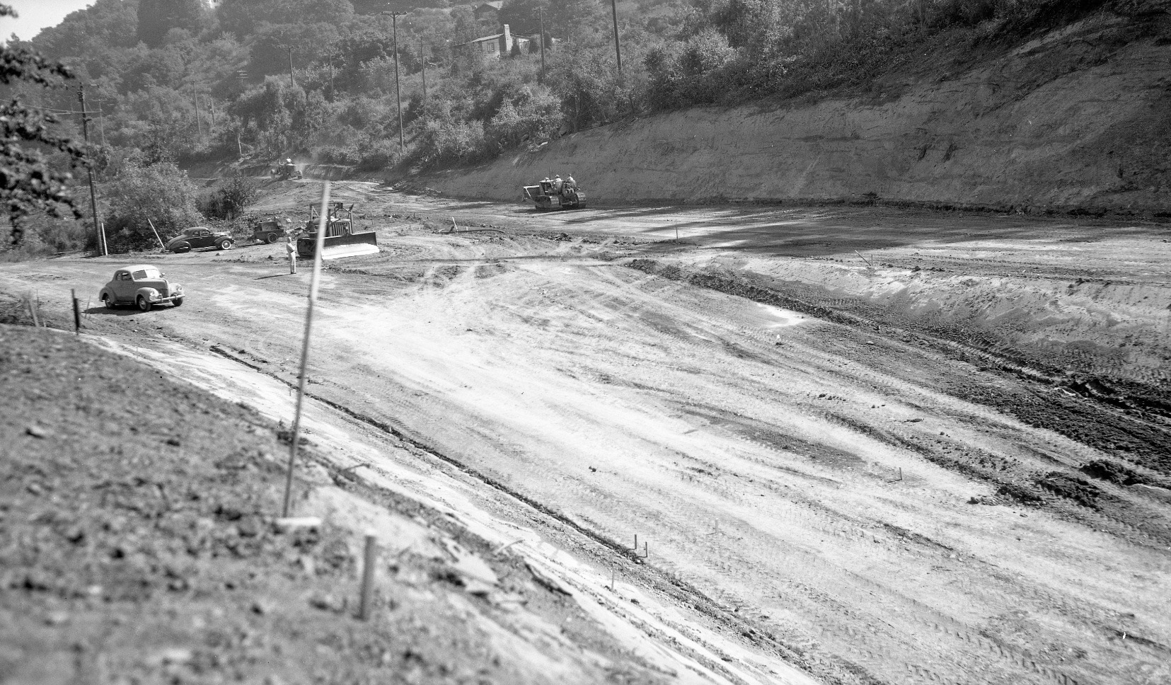
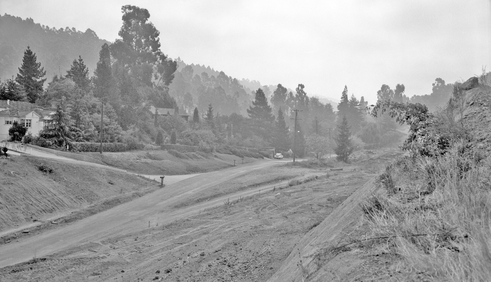
A very different scene at approximately the same location as L104-45, a northwest view circa late 1949 of the dug out canyon floor. An earlier pre-construction image from this vantage point has not been found.
L104-35-Public Works Photo, Oakland Cultural Heritage Survey, Oakland City Planning Department , (Image 9 of 33)
Alignment of L104-30 and L104-35.
L104-36-Public Works Photo, Oakland Cultural Heritage Survey, Oakland City Planning Department , (Image 10 of 33)
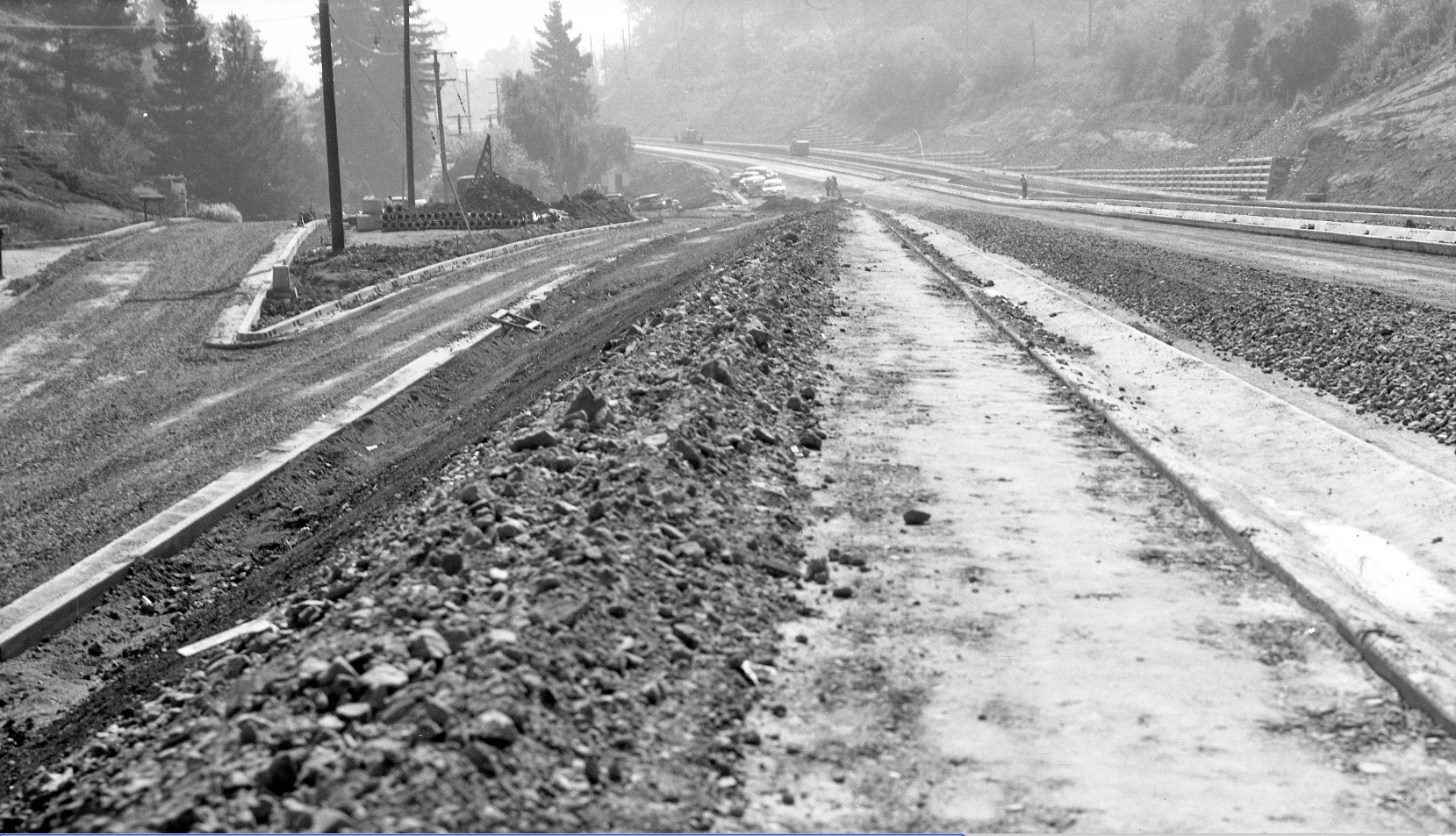
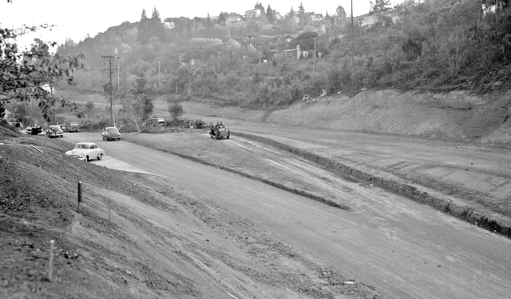
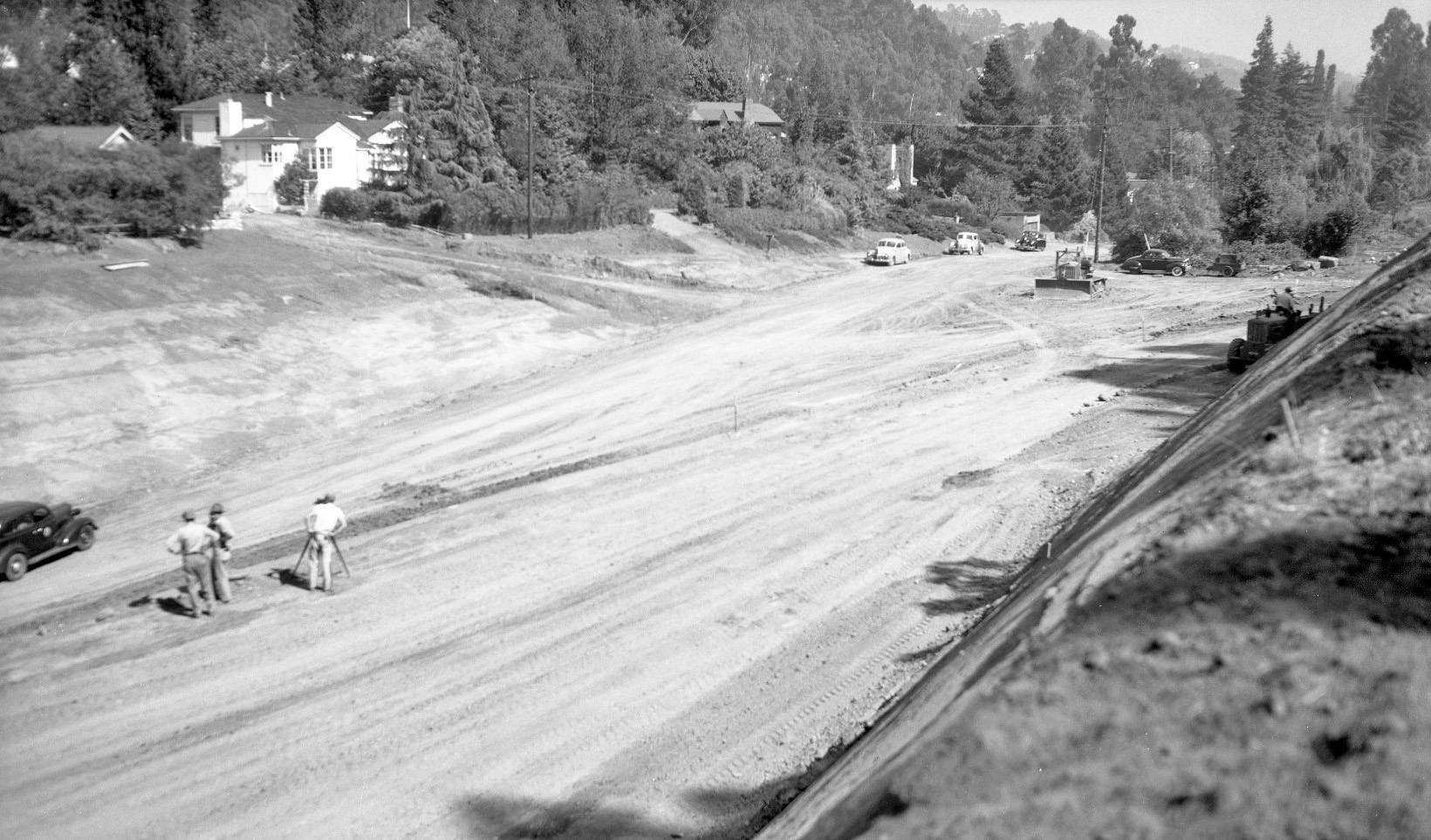
Now to late 1951, the split in the two directions of Glenwood Glade just north of the freeway exit being readied for final surfacing is shown in this southeast view.
L104-40-Public Works Photo, Oakland Cultural Heritage Survey, Oakland City Planning Department , (Image 11 of 33)
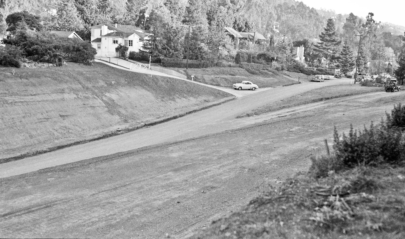
Next a four panel sequence of south views of the freeway exit at Glenwood Glade going back in time starting with this image from late 1951 of the roadway prior to addition of a final surface.
L104-45-Public Works Photo, Oakland Cultural Heritage Survey, Oakland City Planning Department , (Image 12 of 33)
A little earlier than L104-60, the exit at Glenwood Glade taking shape, south view ...
L104-50-Public Works Photo, Oakland Cultural Heritage Survey, Oakland City Planning Department , (Image 13 of 33)
... and yet an earlier view than L104-65 with grading in progress, south view ...
L104-55-Public Works Photo, Oakland Cultural Heritage Survey, Oakland City Planning Department , (Image 14 of 33)
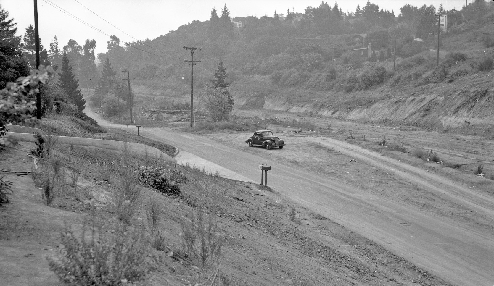
... and finally the earliest image recovered of the freeway exit construction, south view. Note the paired mailboxes in the center of the image and the telephone pole on the left side of the image on private property.
L104-60-Public Works Photo, Oakland Cultural Heritage Survey, Oakland City Planning Department , (Image 15 of 33)
Three southeast views of the east side of Glenwood Glade at the freeway exit starting with this undated one shows the same paired mailboxes and telephone pole in L104-60.
L104-65-Public Works Photo, Oakland Cultural Heritage Survey, Oakland City Planning Department, (Image 16 of 33)
This southeast view of the east side of Glenwood Glade on Aug. 11, 1949 shows more of the freeway path to the west. The paired mailboxes are absent.
L104-70-Public Works Photo, Oakland Cultural Heritage Survey, Oakland City Planning Department , (Image 17 of 33)
This final southeast view of the east side of Glenwood Glade was taken sometime between Aug 11, 1949 and Dec. 12, 1949. As to the house number in these three images, note the position of the driveway exit relative to the split in the road, and that the driveway is shared by at least two homes and the detached garage.
L104-75-Public Works Photo, Oakland Cultural Heritage Survey, Oakland City Planning Department , (Image 18 of 33)
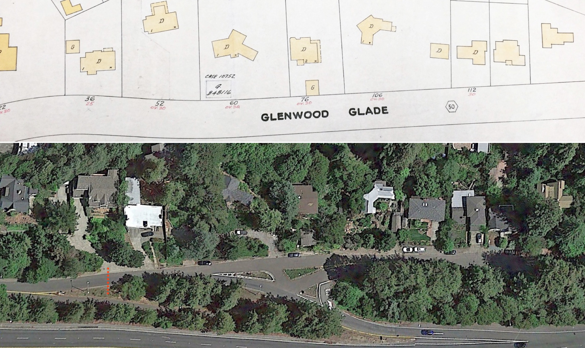
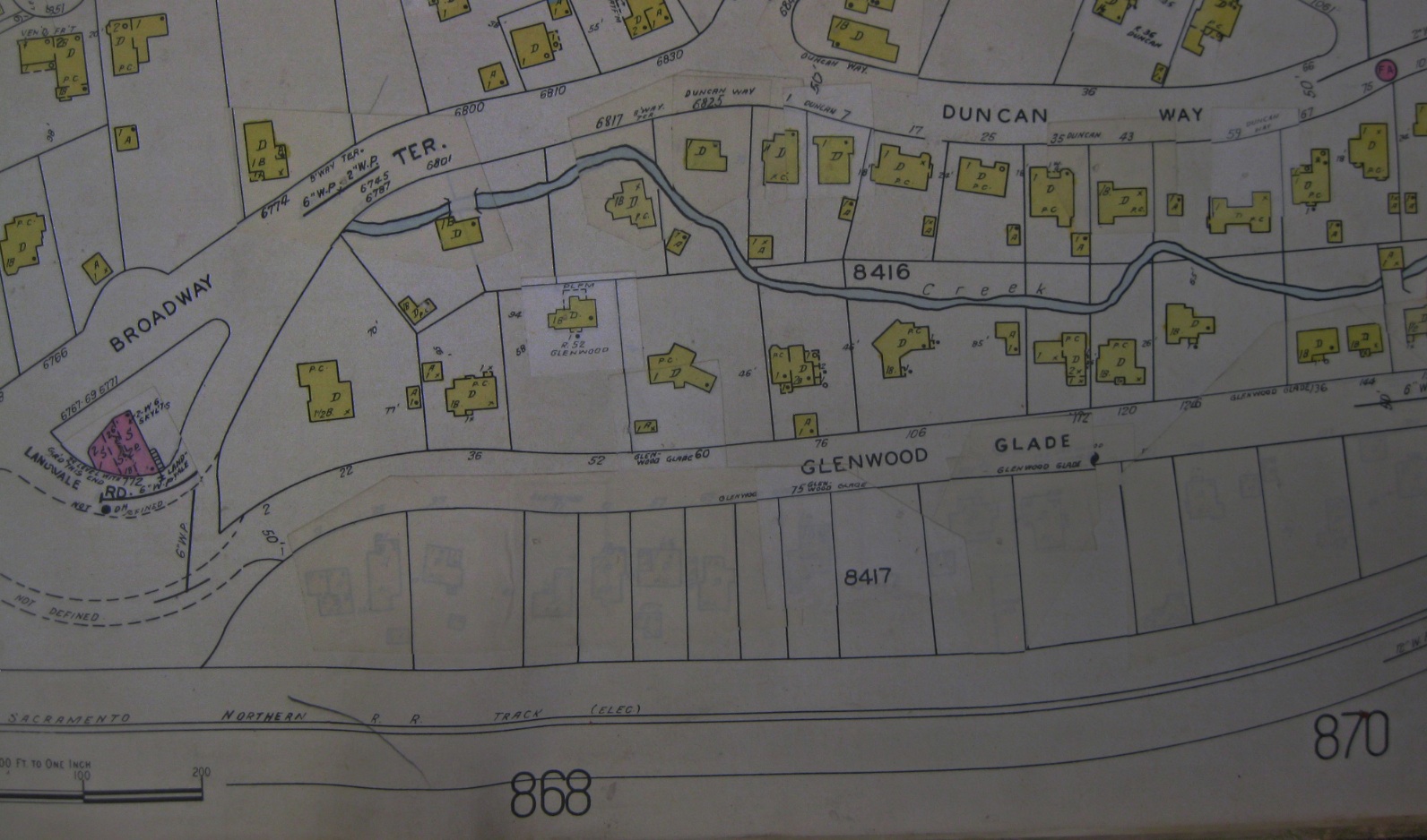
Absent unequivocal images or aerials, this panel compares a post-freeway Sanborn map with a 2014 aerial of the east side of Glenwood Glade to make the assignment of 36 Glenwood Glade. City records indicate a 1994 remodel which accounts for the enlarged size and inclusion of the formerly detached garage. The red dotted line, the position of driveway entrance to the island lane divider, is consistent with previous images.
L104-80-Public Works Photo, Oakland Cultural Heritage Survey, and Google Earth, (Image 19 of 33)
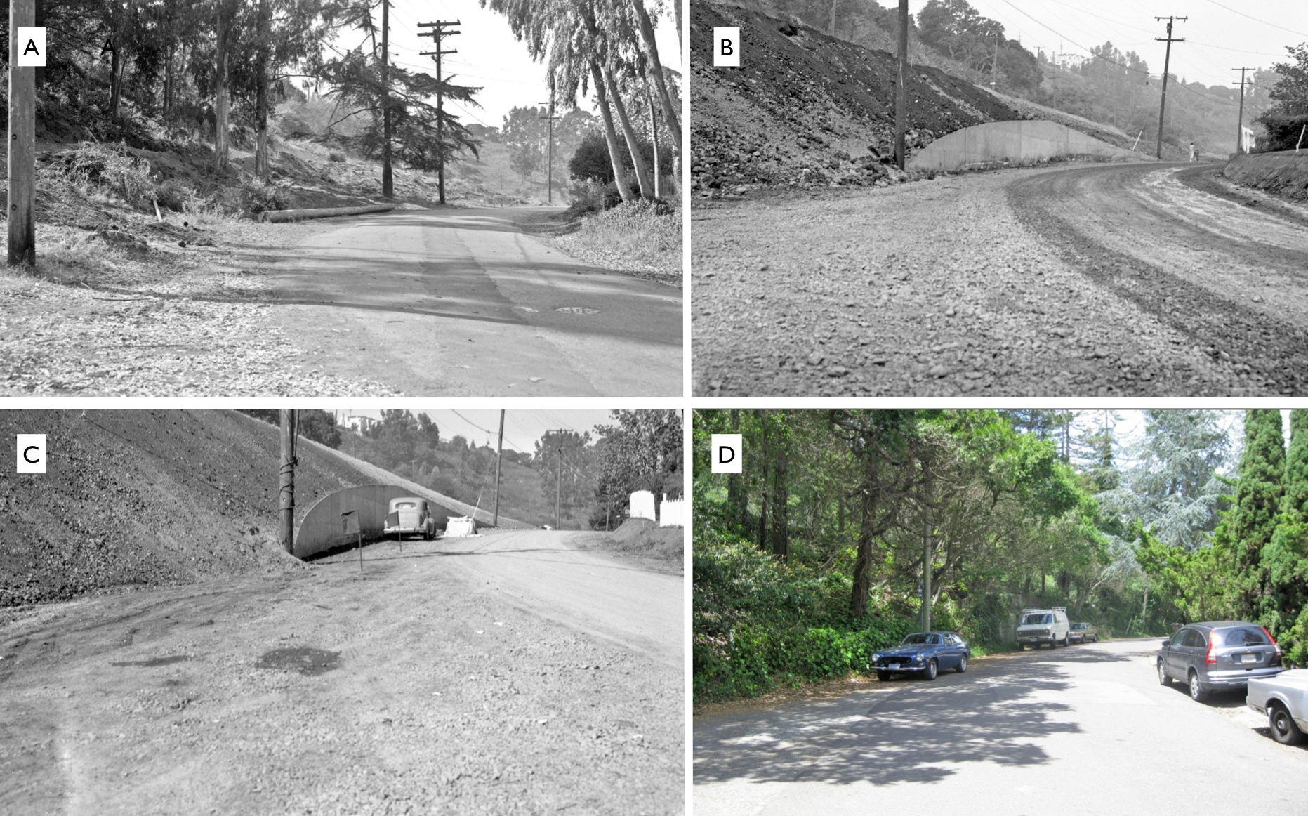
For completeness relative to freeway construction, a retaining wall on the south end of Glenwood Glade near its origin with Duncan Way was constructed against the adjacent freeway. Here is shown the change from pre-construction, panel A, to mid-construction, panels B and C, to the view in 2015, panel D. Panel D courtesy Stuart Swiedler.
L104-85-Public Works Photo, Oakland Cultural Heritage Survey, Oakland City Planning Department , (Image 20 of 33)
Glenwood Glade’s Dark Secret is revealed in this revised 1929 Sanborn Insurance Map. By using low light, home outlines covered by white paper appear on the west side of the street. In short, to prepare for freeway construction, the homes on the west side of the street were moved or razed. More on this later ...
L104-90-Sanborn Map, Courtesy Oakland Public Library, Oakland History Room , (Image 21 of 33)
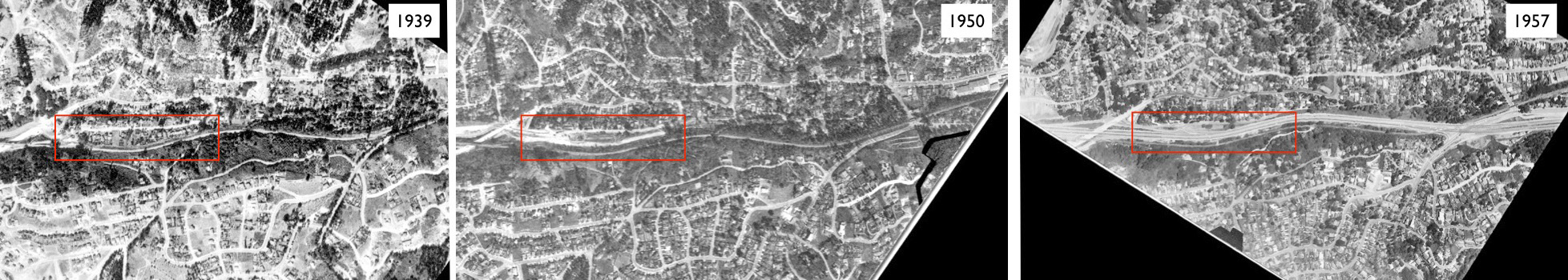
Comparative north-to-south, left-to-right, aerial views of the freeway: from 1939, prior to freeway construction; 1950, at the start of freeway construction; and 1957, after freeway construction. The red box marks Glenwood Glade and accompanying SN right-of-way. Refs: left, USDA AAA Western Division BUT-BUU-289-66, Aug. 2, 1939; middle, USDA AAA Western Division BUT-8G-123, Mar. 30, 1950; right, AV 253 11-23, Hamman, Jensen, Wallen, AV 253 11-23, May 4, 1957.
L104-95-Multiple Contributors, See Legend, (Image 22 of 33)
A north-to-south, left-to-right, aerial view prior to freeway construction in 1939. See the next image for annotated version. Ref: BUT-BUU-289-66, Aug. 2, 1939
L104-100-USDA AAA Western Division Aerial, Courtesy East Bay Municipal Utility District, (Image 23 of 33)
A north-to-south, left-to-right, aerial view prior to freeway construction in 1939. Note the presence of homes on the west side of Glenwood Glade, below red line. Ref: BUT-BUU-289-66, Aug. 2, 1939
L104-101-USDA AAA Western Division Aerial, Courtesy East Bay Municipal Utility District, (Image 24 of 33)
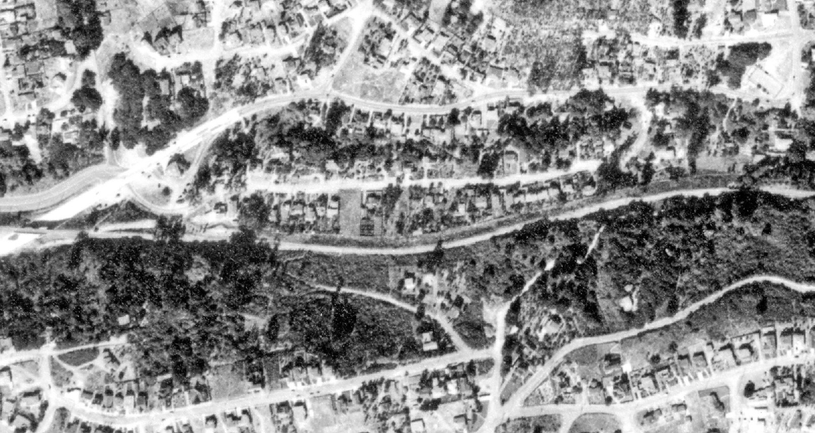
A north-to-south, left-to-right, aerial view of the freeway at the start of construction from 1950. See next image for annotated version. Ref: BUT-8G-123, Mar., 30, 1950
L104-105-USDA AAA Western Division Aerial, Courtesy East Bay Regional Park District, (Image 25 of 33)
A north-to-south, left-to-right, aerial view prior to freeway construction from 1950. Note all the homes on the west side of Glenwood Glade, belowred line, are now gone. The north section of Glenwood Glade near Broadway Terrace has also been relatively straightened relative to 1939. Ref: BUT-8G-123, Mar., 30, 1950
L104-106-USDA AAA Western Division Aerial, Courtesy East Bay Regional Park District, (Image 26 of 33)
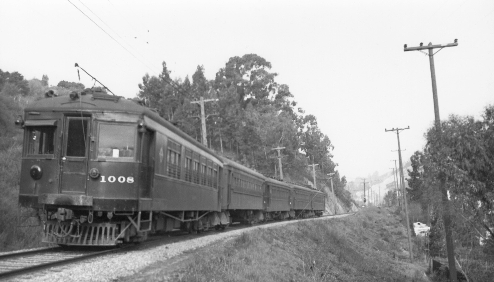
So what of the homes or structures removed from the west side of Glenwood Glade? Images of the SN during the end of the passenger era appear all that survive, starting with this southeast image at Broadway Terrace of a four car train on May 30 1939. Note the white multi-story building to the right of the Terrace shelter at the right of the image.
L104-110-Wilbur C Whittaker Photo, Courtesy Arnold Menke, (Image 27 of 33)
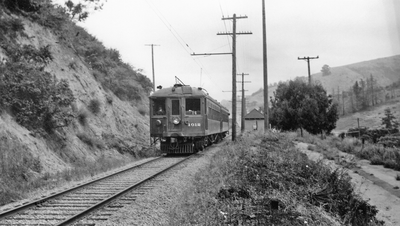
This northwest image from June 16, 1940 of a two-car train composed of SN 1012 and 1026 shows no structures to the north of the white building seen in L104-100. The roadway to the east of the track is the abandoned portion of Broadway Terrace or its precursor McAdam St. when the road had to climb the berm prior to construction of the railway overpass in 1936.
L104-115-Courtesy BAERA, Western Railway Museum Archives, 51858sn, (Image 28 of 33)
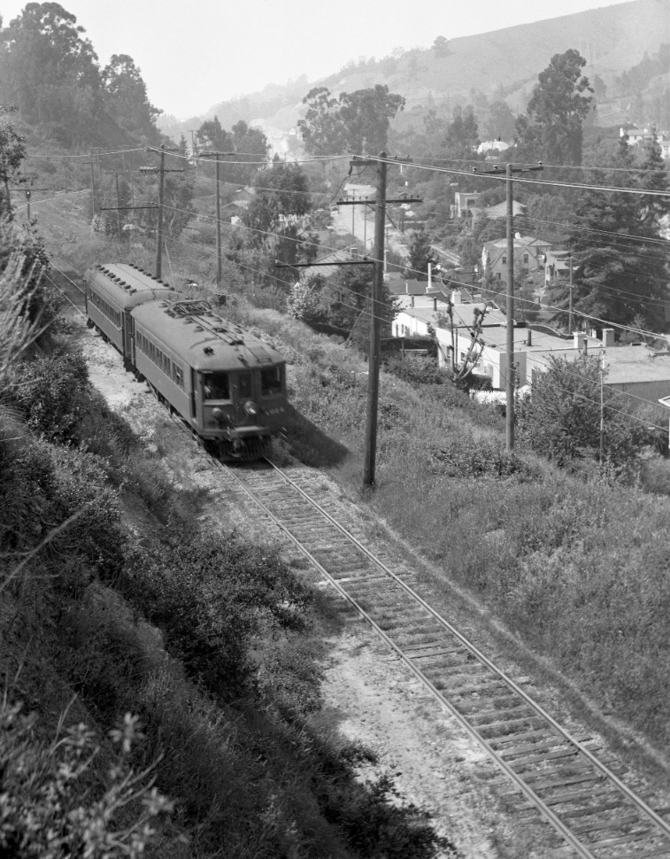
Now further south of L104-105, the rear of a rare five-car train is shown just completing the curve on Feb. 19, 1939 passing some structures at the property limits to the east of the berm.
L104-120-Courtesy Arnold Menke and Garth Groff , (Image 29 of 33)
SN 1014 and trailer have completed the first curve heading south providing a unique look at the west side of Glenwood Glade from Apr. 27, 1941. Note the switch of the last two catenary poles to the east of the track. More confirmatory information next ...
L104-125-Vernon Sappers Collection, Courtesy BAERA, Western Railway Museum Archives 52125sn, (Image 30 of 33)
Matching up homes from 1941, left, with 1956, right: green line, number 76, since remodeled; red line, number 106; yellow line, number 112; orange line, number 126. The white arrow marks the large rock separating numbers 126 and 136, the latter created when one of the last three white homes seen here along the west side was moved on Mar. 11, 1942.
L104-130-Courtesy BAERA, Western Railway Museum Archives and CALTRANS, (Image 31 of 33)
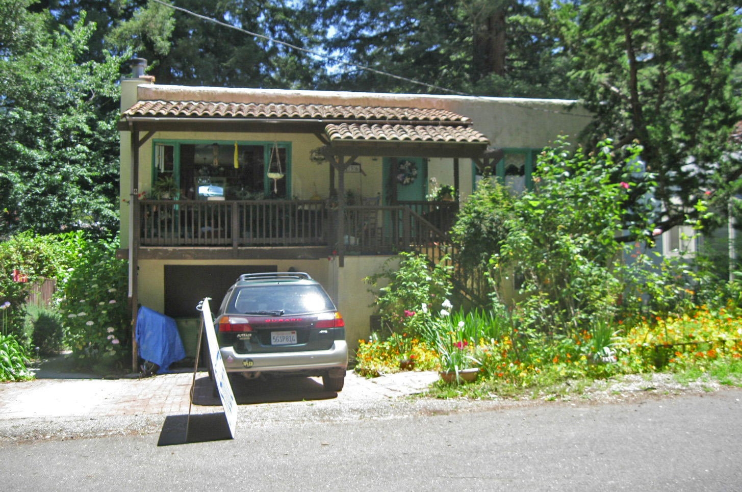
Artist Janey Gibson Jordan acquired 136 Glenwood Glade and added a Spanish motif to the “white box” that had been relocated from the west side of the street. Although city records provide some addresses that may have been moved, there is no further examples beyond number 136 as to their final resting place. More work needed on this topic.
L104-135-Stuart Swiedler Photo, (Image 32 of 33)
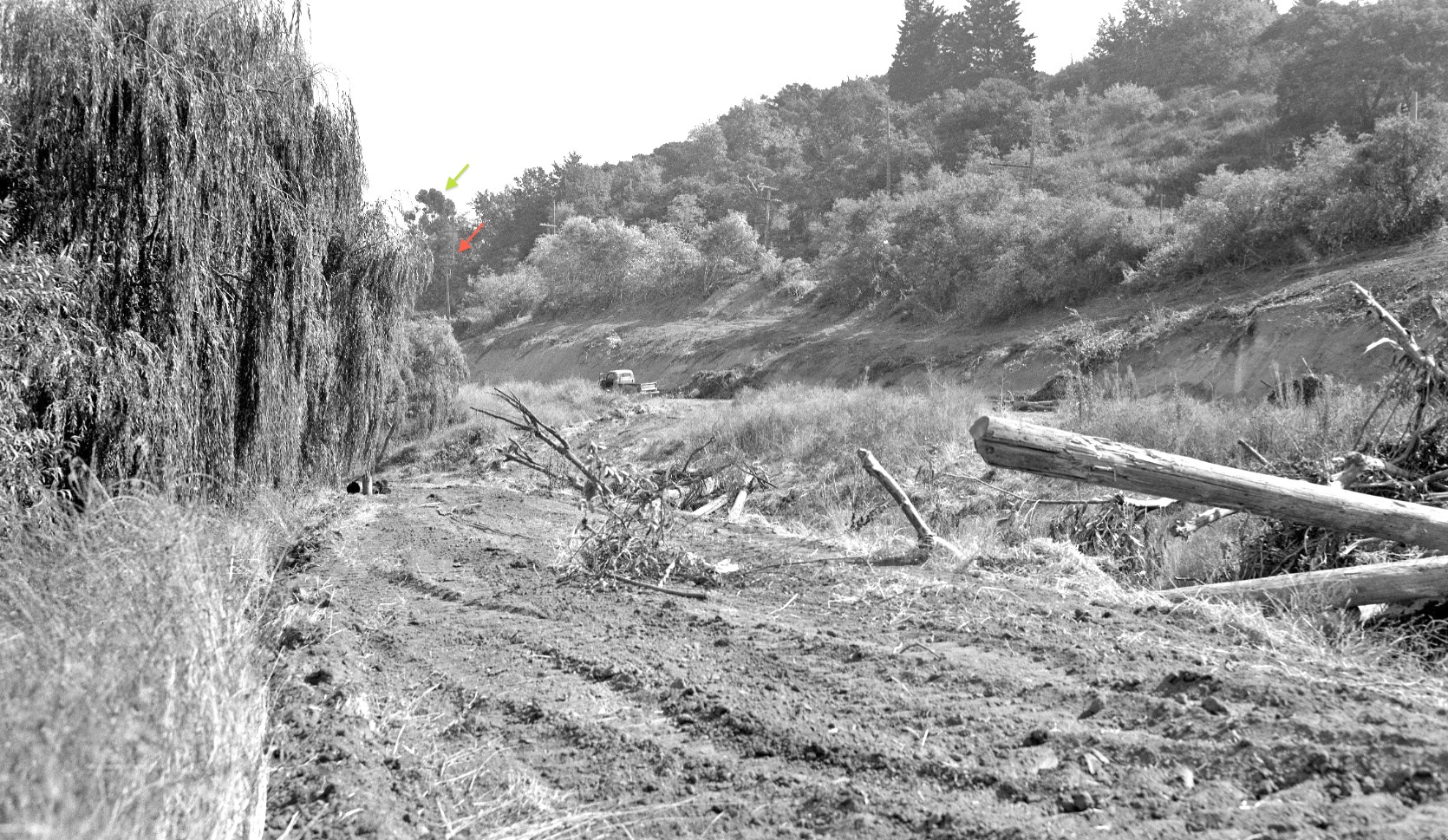
The switch of the catenary pole to the east side of the tracks, red arrow, reminds us that this south view from 1949 of the cleared canyon prior to freeway construction is at the level of Glenwood Glade. The large eucalyptus tree, green arrow, marks the intersection of Florence Avenue with the right-of-way, the next stop on this journey. Thanks to Gail Lombardi and Betty Marvin of the Oakland Cultural Heritage Survey for research and innumerable contributions to this update.
L104-140- Public Works Photo, Oakland Cultural Heritage Survey, Oakland City Planning Department , (Image 33 of 33)