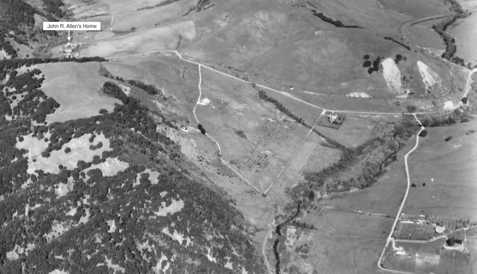
Half Mile to Pinehurst and John R. Allen’s Home
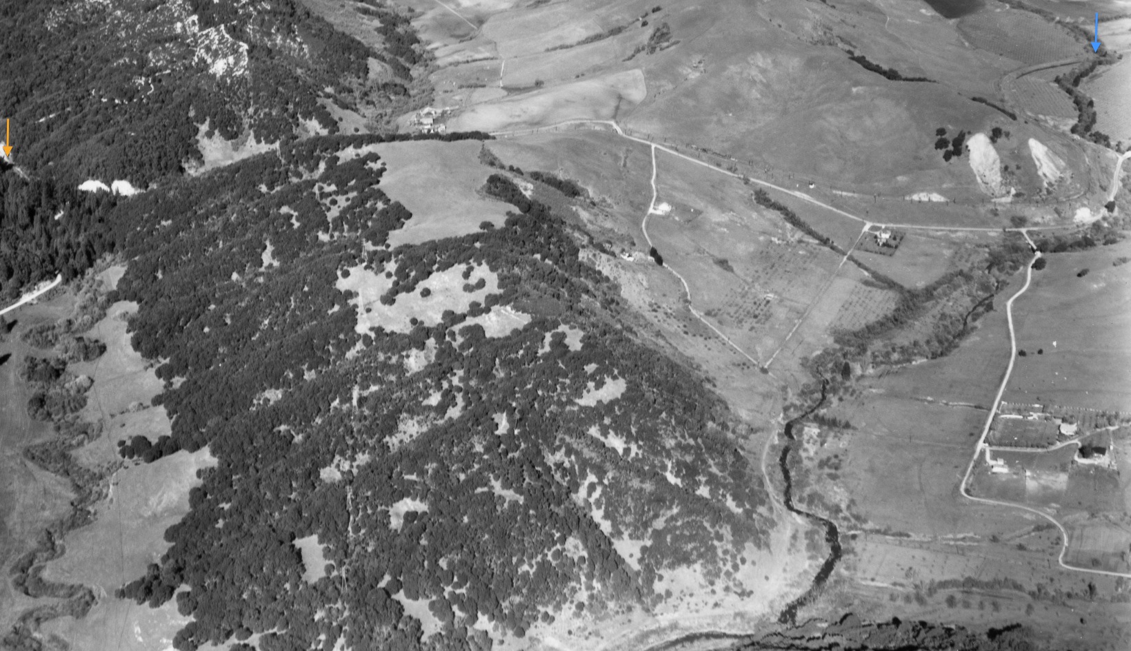
North view, 1935, of the SN right-of-way at Pinehurst, orange arrow, to the point it crosses Moraga Creek, blue arrow. This update will begin a detailed view of Valle Vista, first heading in to pass John R. Allen’s home. See annotated, more detailed version next.
L83-05-Pacific Aerial Surveys, Courtesy East Bay Regional Park District, USNPS-11-D, (Image 1 of 14)

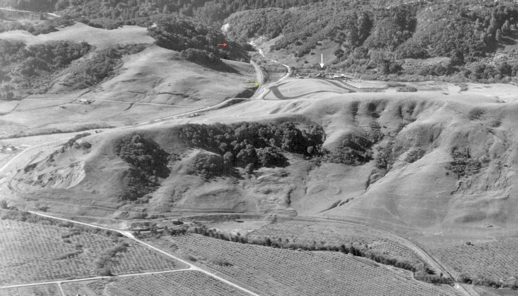
Valle Vista will be considered just to the east, or right, of John R. Allen’s home up to the Moraga Creek SN crossing seen at the top right corner. Today, everything east of Indian Creek and north of Canyon Rd. is part of Moraga, but back during the SN, there were no incorporated boundaries.
L83-06-Pacific Aerial Surveys, Courtesy East Bay Regional Park District, USNPS-11-D, (Image 2 of 14)
Again, 1935, but here a west view, with the focus on everything between the arrows, the green one just southwest to the SN cut prior to the Canyon Rd. overpass. Structures remain today at the site of John R. Allen’s home, white arrow, but details beyond that are lacking.
L83-10-Pacific Aerial Surveys, Courtesy East Bay Regional Park District, USNPS-11-E, (Image 3 of 14)
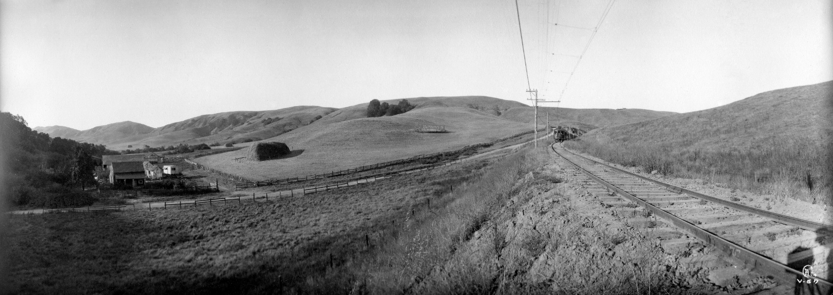
Based on the photo number, a very early Eston Cheney northeast view, this image was dated Jan. 23, 1913, three weeks prior to the first test run through the new tunnel of the Oakland, Antioch and Eastern according to Swett’s “SN”.
L83-15-Eston Cheney Photo V-56, Sappers Collection, Courtesy BAERA, WRM Archives, 27165sn , (Image 4 of 14)
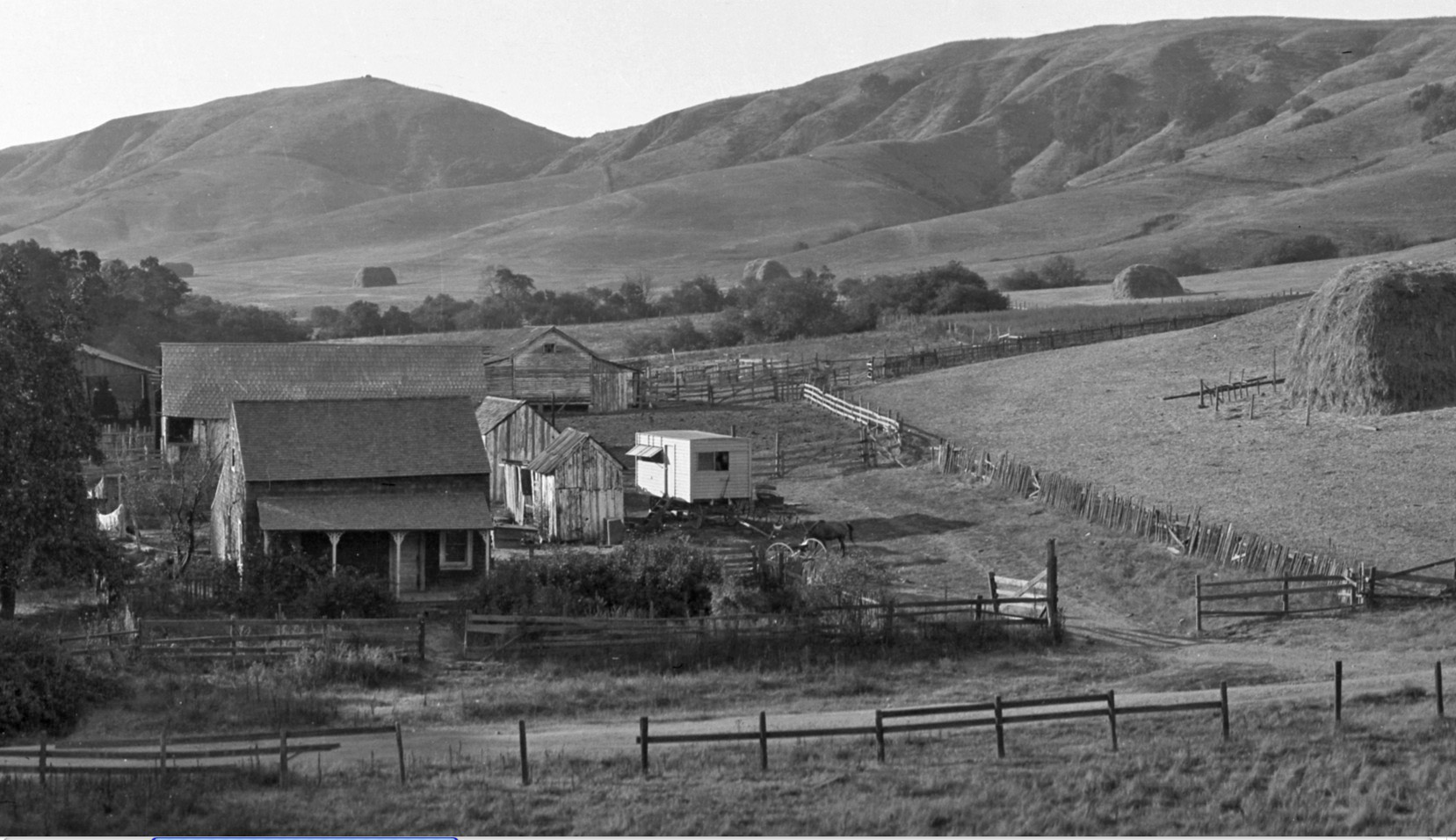
The next Cheney image, also dated Jan. 23, 1913, is a northeast view further east to the opening of the valley with John R. Allen’s home to the left.
L83-20-Eston Cheney Photo V-57, Sappers Collection, Courtesy BAERA, WRM Archives, 27166sn, (Image 5 of 14)
A detail of L83-20, John R. Allen’s home, northeast view, dated Jan. 23, 1913.
L83-25-Eston Cheney Photo V-57, Sappers Collection, Courtesy BAERA, WRM Archives, 27166sn, Detail, (Image 6 of 14)
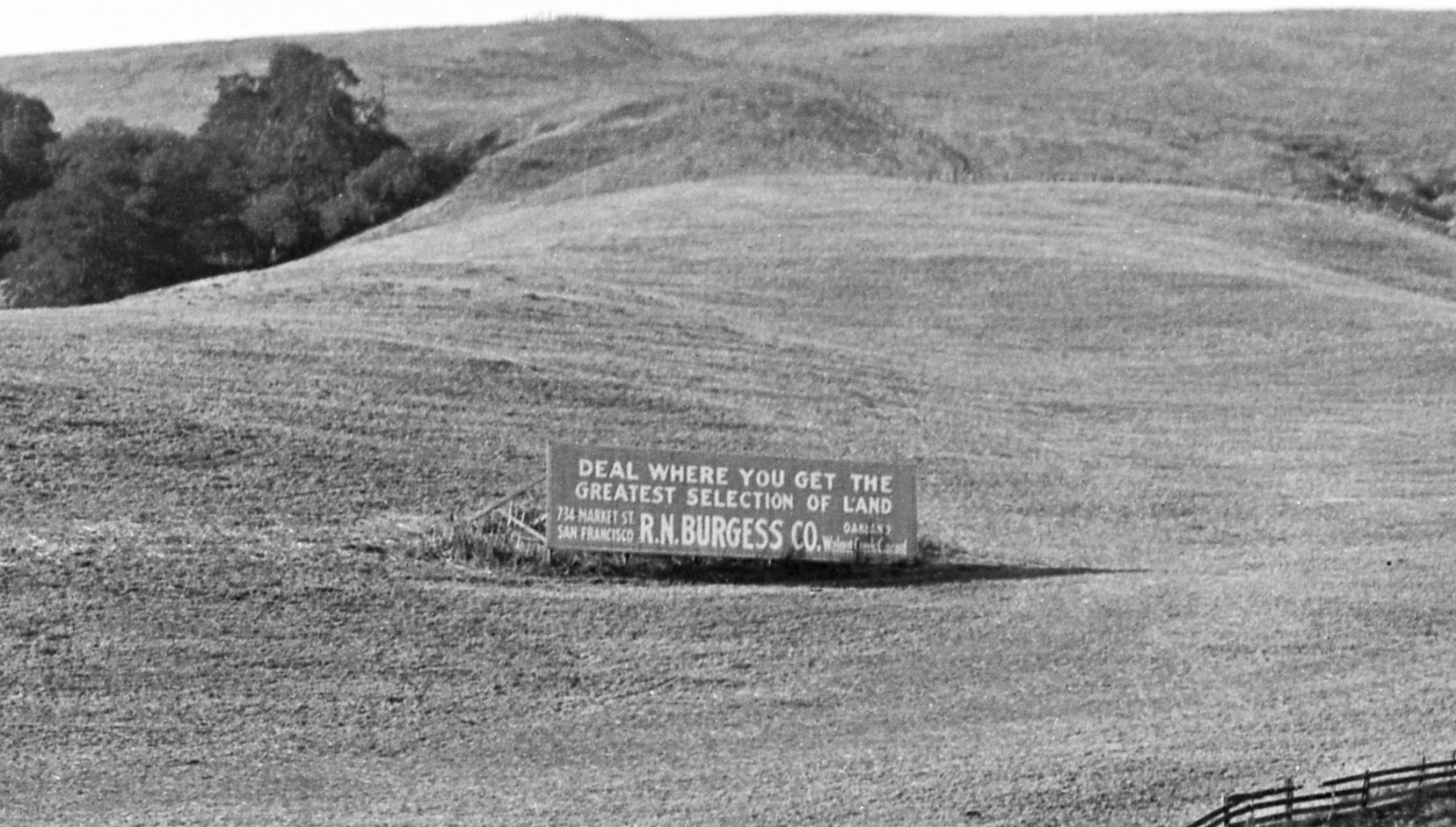
Second detail from L83-20, northeast view, ad for land from Robert N. Burgess Co. Burgess, a developer, was peripherally involved in the railway through several housing development schemes in Diablo, Walnut Creek, Concord and Clyde in addition to the Moraga Company in Moraga.
L83-30-Eston Cheney Photo V-57, Sappers Collection, Courtesy BAERA, WRM Archives, 27166sn, Detail, (Image 7 of 14)
Second detail from L83-20, northeast view, ad for land from Robert N. Burgess Co. Burgess, a developer, was peripherally involved in the railway through several housing development schemes in Diablo, Walnut Creek, Concord and Clyde in addition to the Moraga Company in Moraga.
L83-30-Eston Cheney Photo V-57, Sappers Collection, Courtesy BAERA, WRM Archives, 27166sn, Detail, (Image 8 of 14)
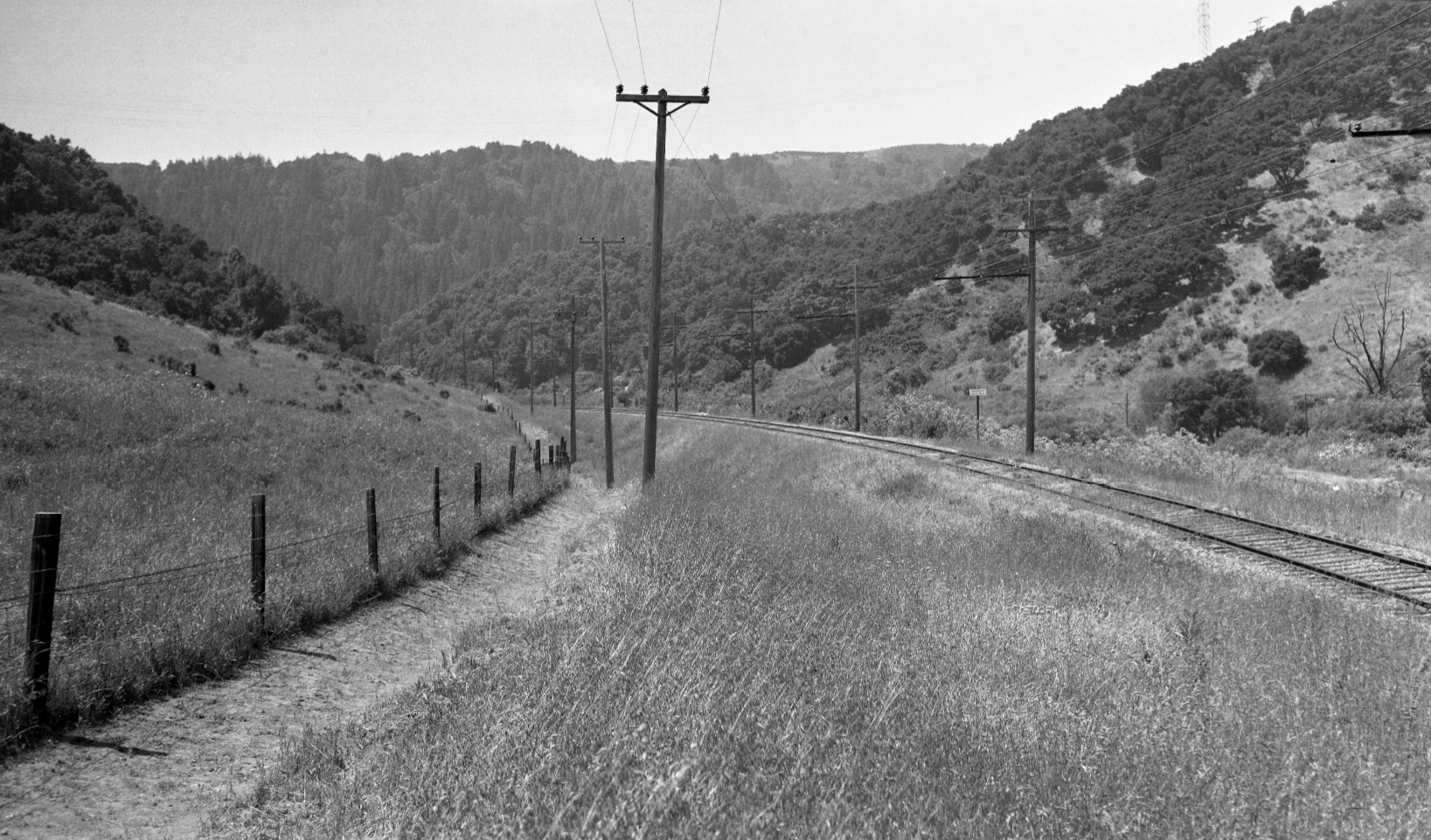
Charles Savage and Wilbur Whittaker must have been out at Valle Vista on May 26, 1940, both taking southwest views of the southwestern limit. Savage provided the overview ...
L83-35-Charles Savage Photo, Courtesy BAERA, Western Railway Museum Archives, 77354sn, (Image 9 of 14)
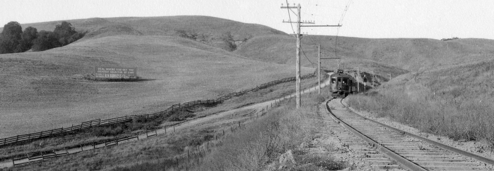
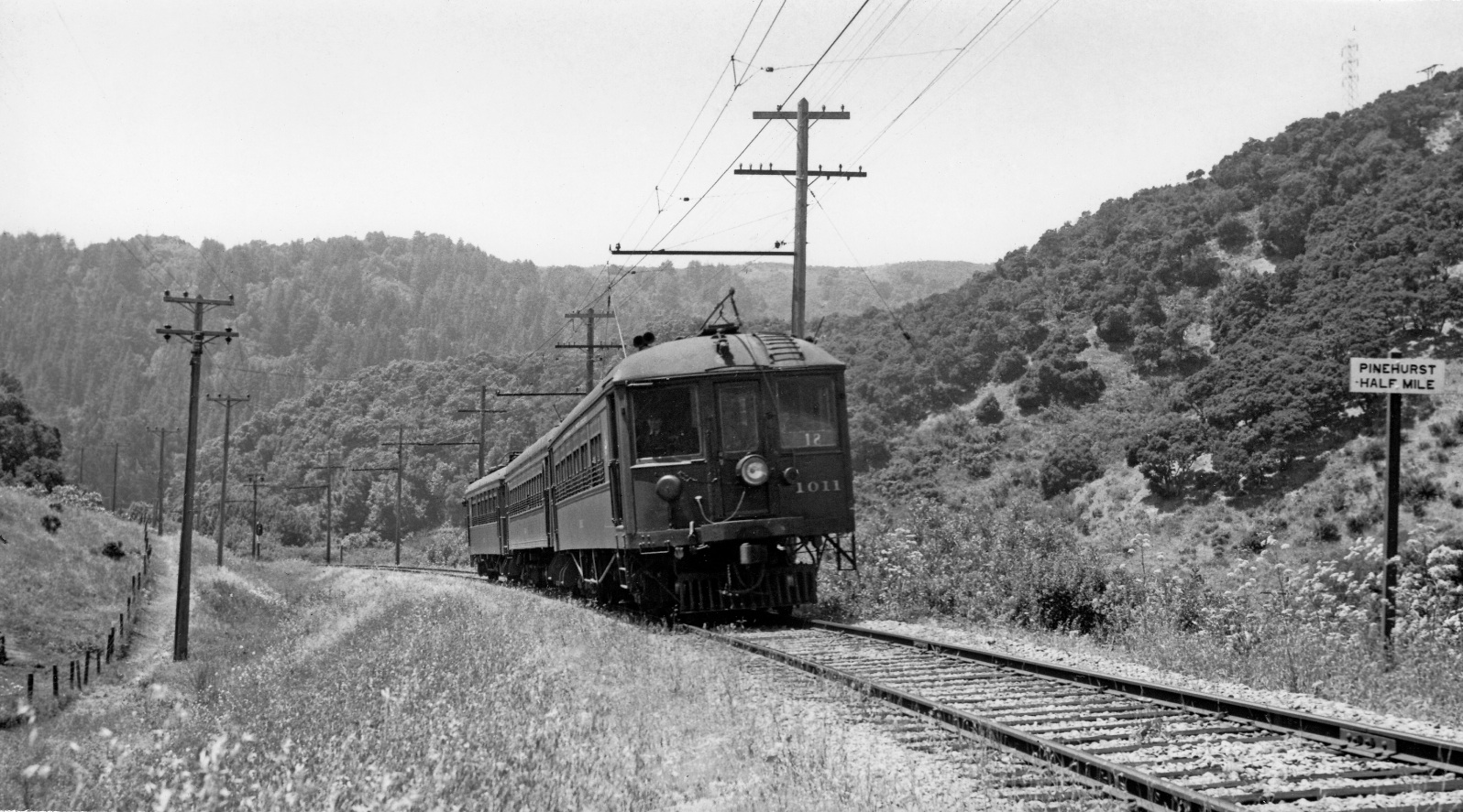
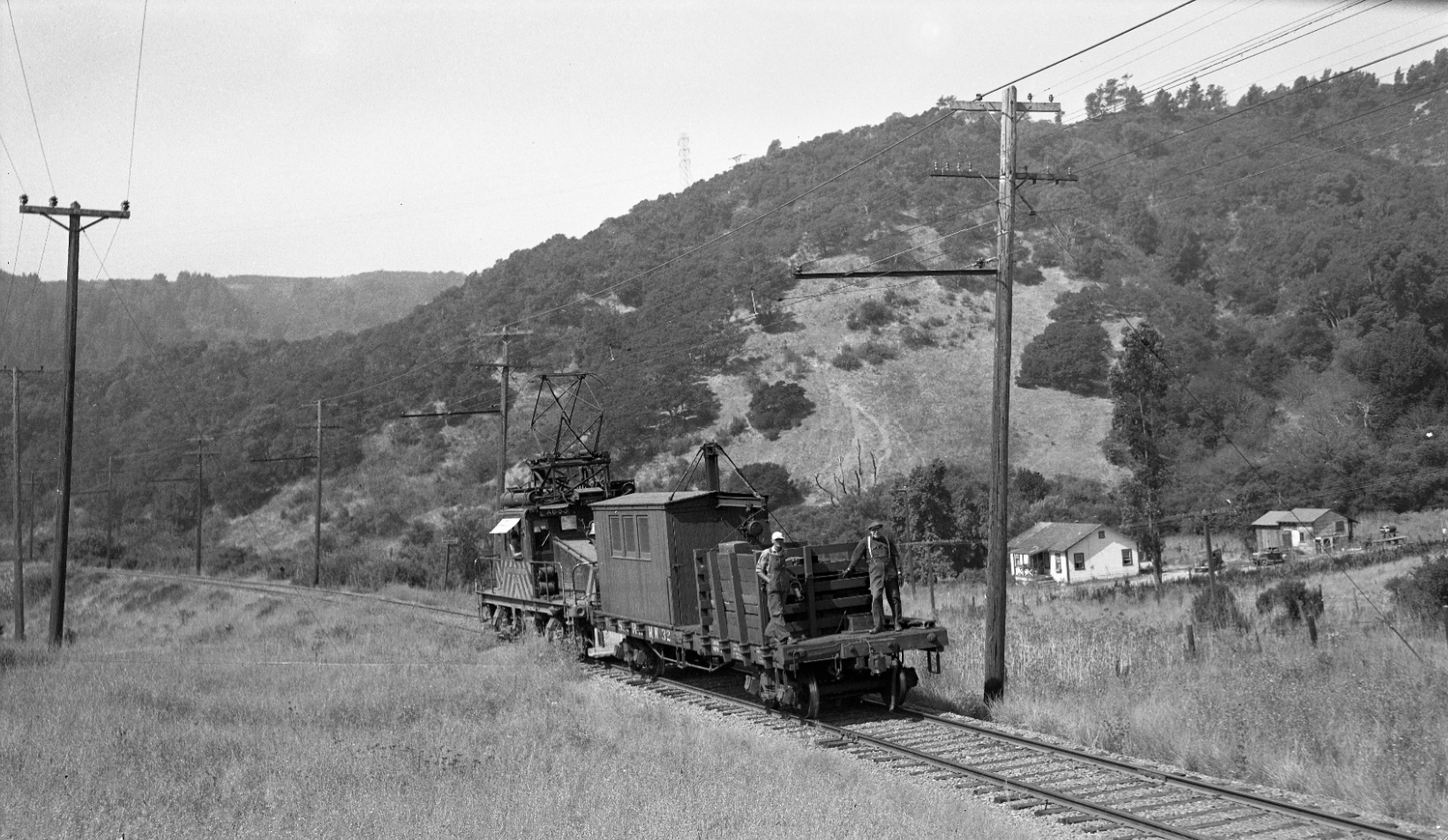
... and Whittaker provided the three-car train with SN 1011 and the “Pinehurst Half Mile” writing on the sign. The question is whether this referred to the SN shelter at Pinehurst, or the perceived border. Southwest view, May 26, 1940.
L83-40-Wilbur C Whittaker, Courtesy Arnold Menke and Garth Groff , (Image 10 of 14)
Bringing us further northeast, here with a southwest view of an SN 653 with a wrecker, the sign and John R. Allen’s home, 1951.
L83-45-Vernon Sappers Collection, Western Railway Museum Archives, 75177sn, (Image 11 of 14)
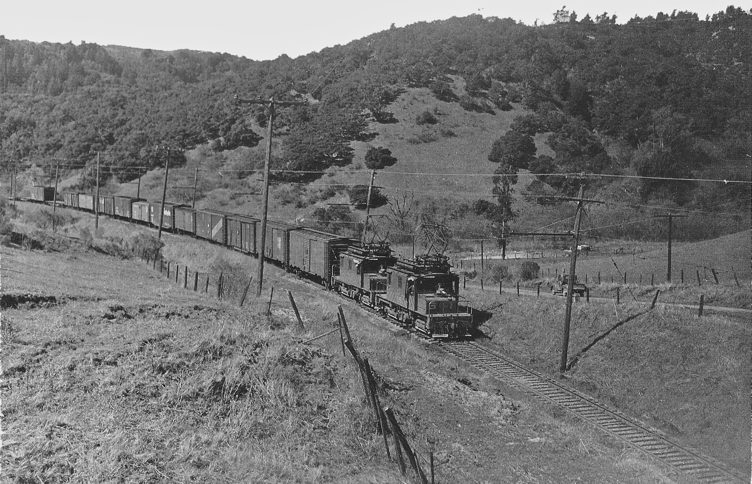
Now even further northeast circa 1952, the rise in Canyon Rd. signals the beginning of the railway cut and the Canyon Rd. overpass for this SN 661-led freight. The motor’s pentograph appears to obscure John R. Allen’s home, or have the structures been removed prior to rebuilding? Still a mystery.
L83-50-Reginald McGovern Photo, Courtesy Reginald McGovern, (Image 12 of 14)
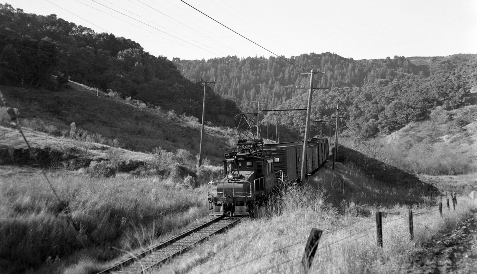
The initial rise in Canyon Rd. relative to the tracks is appreciated in this southwest view of SN 653 leading a freight in Jan. 1957, foreshadowing the approach to the road overpass of the track.
L83-55-Fred Matthews Photo, Courtesy Anonymous Donor, (Image 13 of 14)
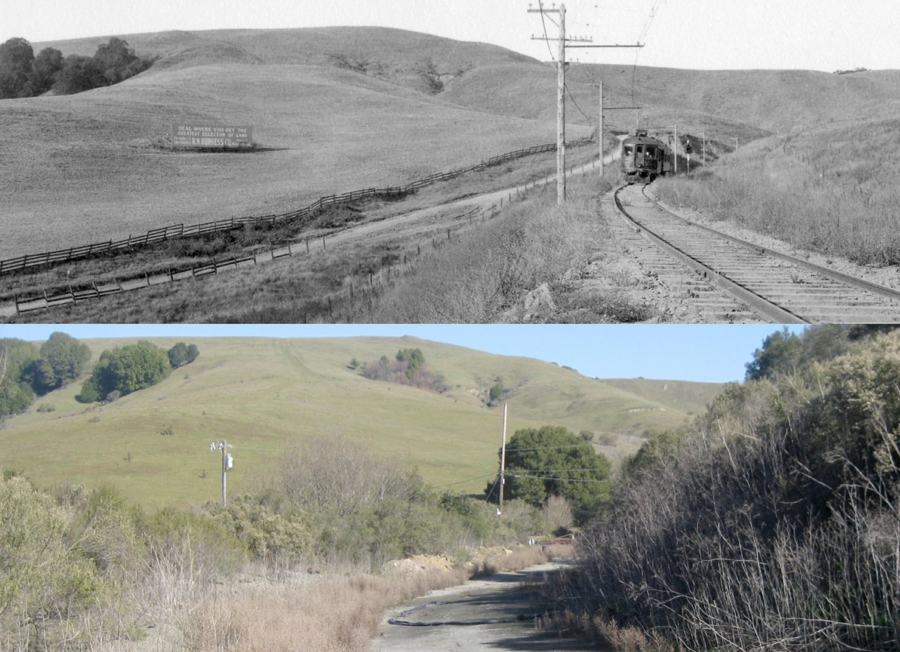
A comparison of northeast views from 1913 versus one hundred years later. This will set the stage for a thorough examination of the Canyon Road Overpass and the regrading of Canyon Rd. to be presented in the future. Full reference of top image: Eston Cheney Photo V-57, Sappers Collection, Courtesy BAERA, WRM Archives, 27166sn, Detail.
L83-60-Courtesy BAERA, Western Railway Museum Archives and Stuart Swiedler, (Image 14 of 14)