In and Out of Canyon Station
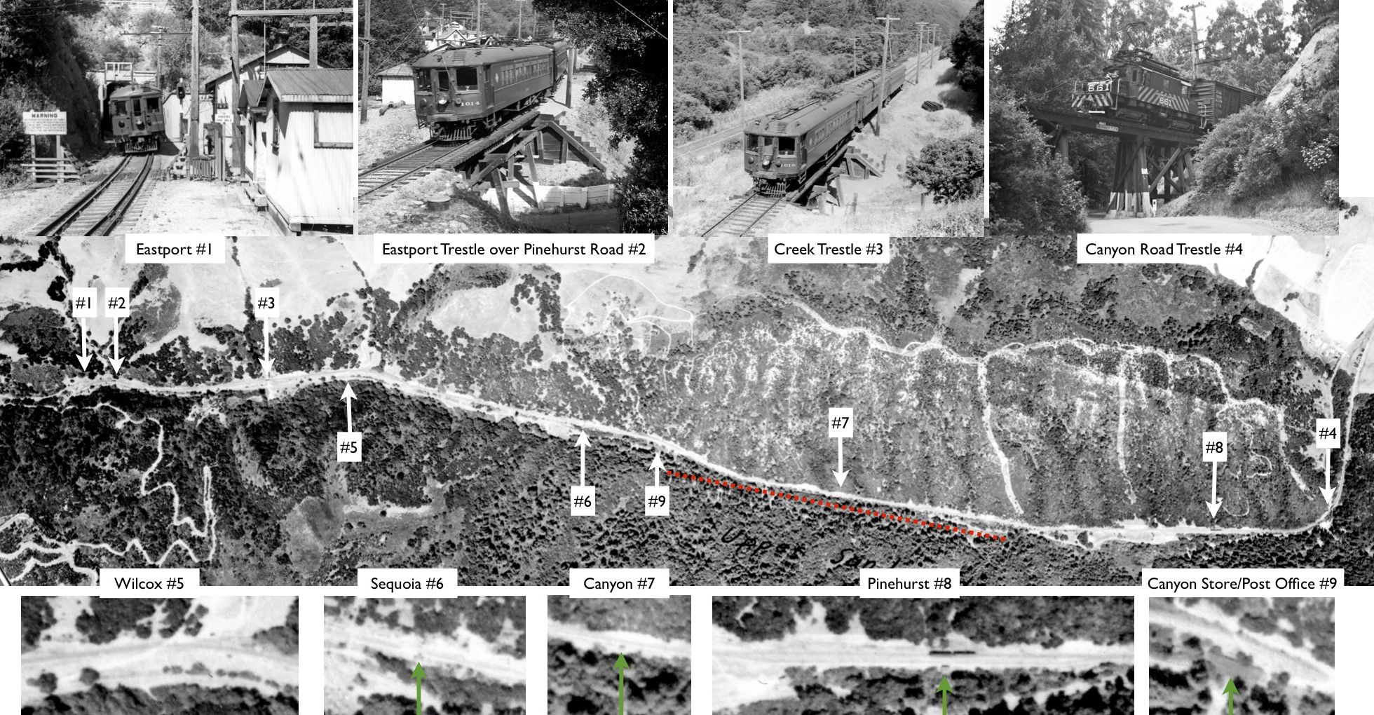
Now featuring Canyon “Station” or SN shelter, from the wigwag signal southeast of the Canyon Store and post office, out to the section approaching Pinehurst as indicated by the orange dotted line. First starting at the station. Composite image contributed by several organizations and individuals.
L59-05-USDA, AAA, Western Division Laboratories, BUT BUU-283-80, Panel 79, Courtesy EBMUD and others, (Image 1 of 14)

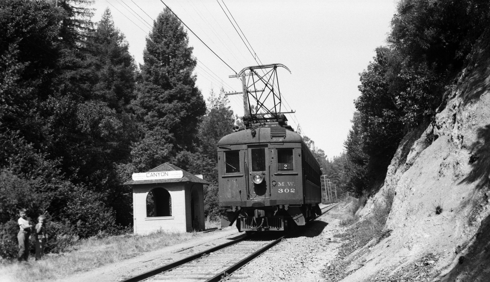
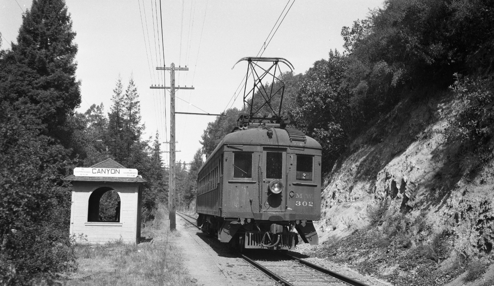
A favorite image from the first BAERA excursion on the SN, Sept. 9, 1948, was this north view of MW 302 at the Canyon SN shelter, a structure inexplicably left over from the passenger era. An image of the shelter from the other direction was not found from this excursion.
L59-10-Arthur Lloyd Photo, Courtesy Arthur Lloyd , (Image 2 of 14)
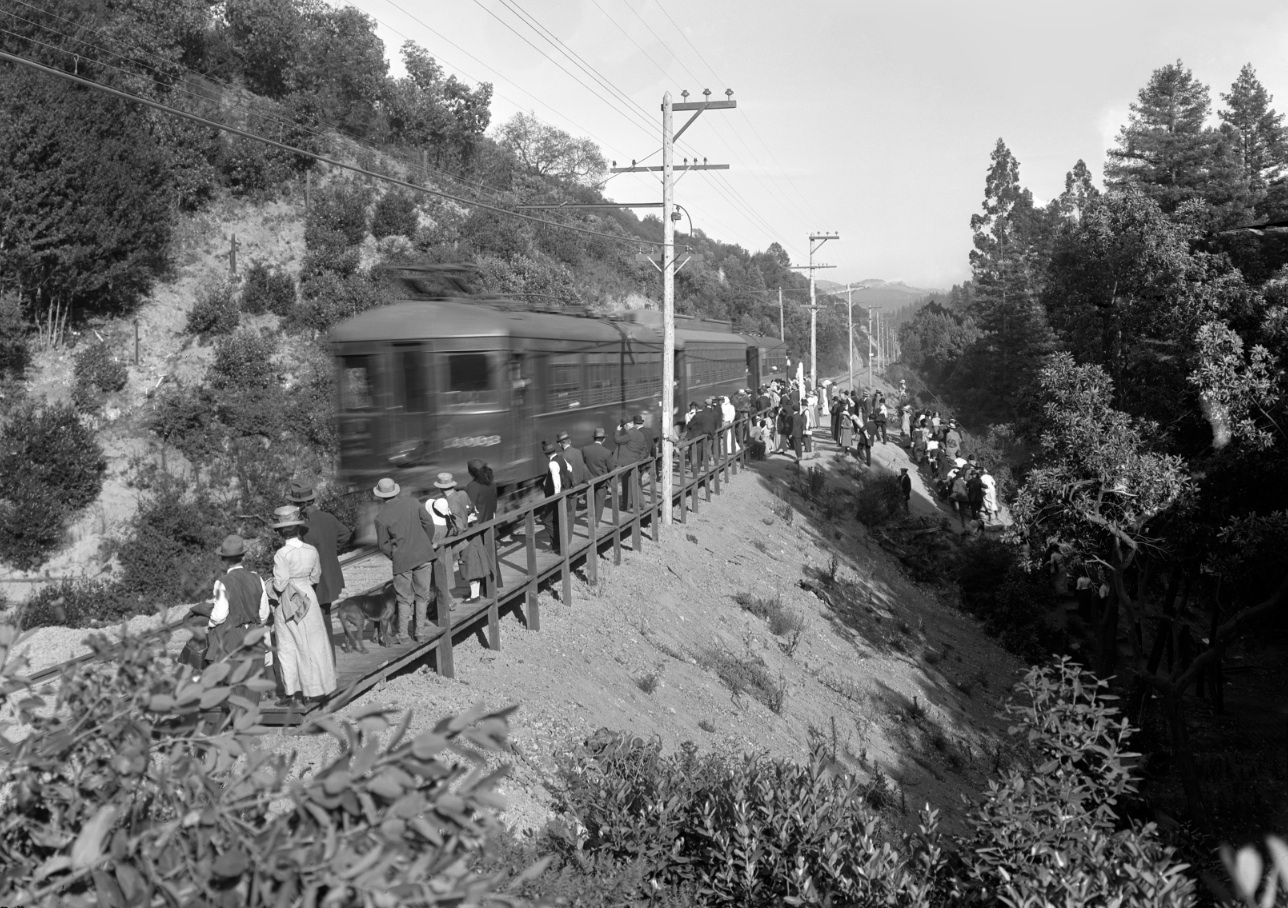
In addition to providing visual markers, this OA&E-era south view with SN 1003 substantiates the reports of crowds coming to this locale to enjoy the park, although not known if it was Sequoia or Madrone. A bill for $3.90 dated Sept 6, 1918 for the merry-go-round summer electric charges called the location “Canyon Station” (LL Stein Slide Collection, WRM Archives.)
L59-15-Vernon Sappers Collection, BAERA, Western Railway Museum Archives, 24196oae, (Image 3 of 14)
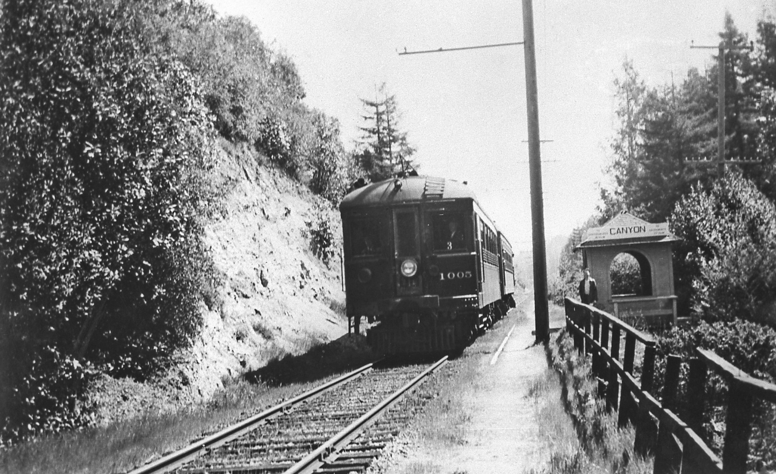
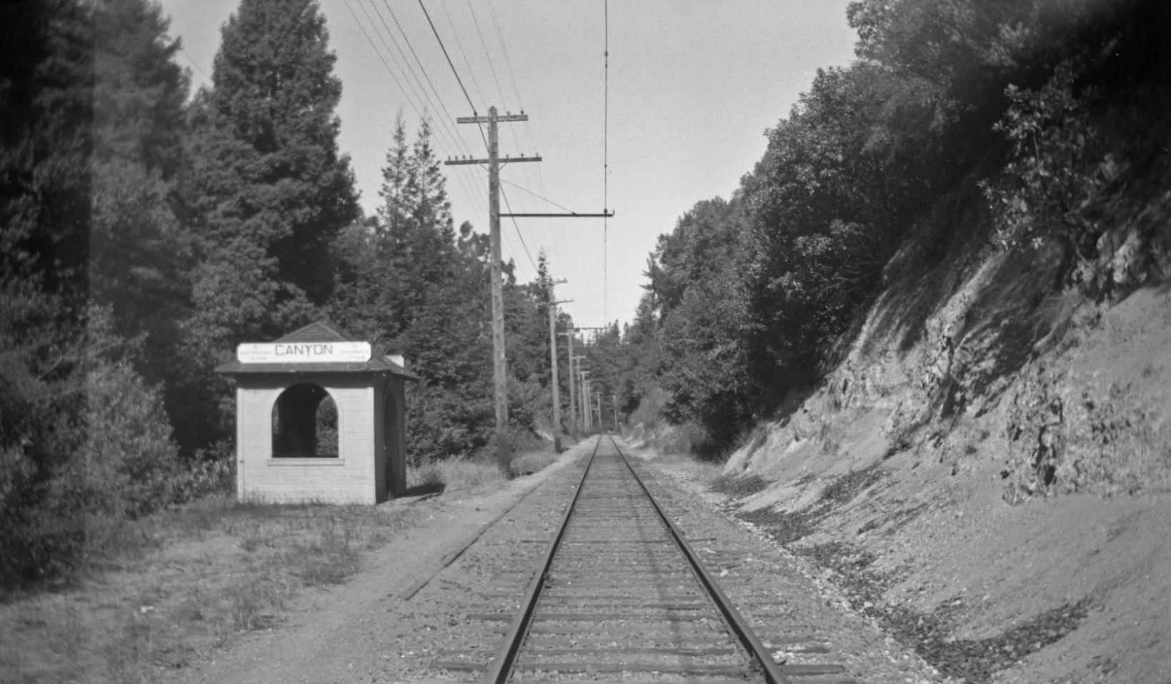
This later south image of SN 1005 shows the same westward fence that would persist throughout the passenger era. The position of the catenary poles to the west along a single track marked the location for this shelter.
L59-20-LL Stein Collection, Courtesy BAERA, Western Railway Museum Archives, 65032sn, (Image 4 of 14)
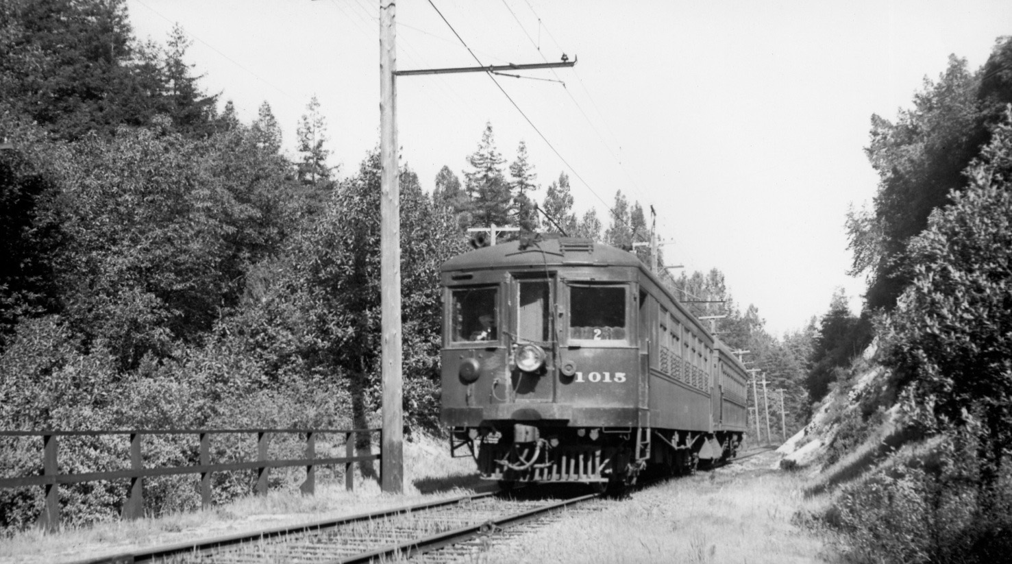
Now facing north, the presence of the fence and catenary pole position place this two-car train led by SN 1015 just south of the Canyon SN shelter, Apr. 12, 1940. As with the south side, the poles remain to the west side of the track in a straight line, this time to the north.
L59-26-Wilbur C Whittaker Photo, Courtesy Arnold Menke and Garth Groff, (Image 5 of 14)
Although this view of the right-of-way might of been taken while on foot, Dave Gumz probably clicked his camera while riding the rear motor of an east-bound freight as he did based on other photos circa 1947.
L59-30-Dave Gumz Photo, Courtesy BAERA, Western Railway Museum Archives, 59265sn, (Image 6 of 14)
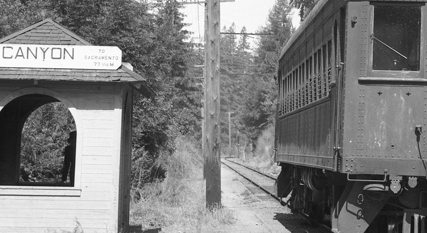
More details to the area to the north of the SN shelter was obtained in Tom Gray’s version of MW 302 at the BAERA excursion of Sept. 9, 1948. Note the number of electrical lines as well as the generous level of black coloration at the bottom portion of the catenary poles.
L59-35-Tom Gray Photo, Courtesy Tom Gray , (Image 7 of 14)
A detail of L59-35 shows a block signal to the east side of the track at the end of the straight-away. No images at this location to ask if a similar signal on the opposite side of the track existed, but there was a signal on that side to the south of the Sequoia SN shelter.
L59-40-Tom Gray Photo, Courtesy Tom Gray, Detail, (Image 8 of 14)
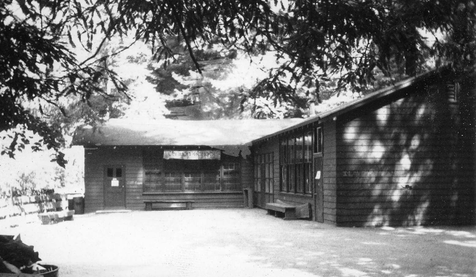
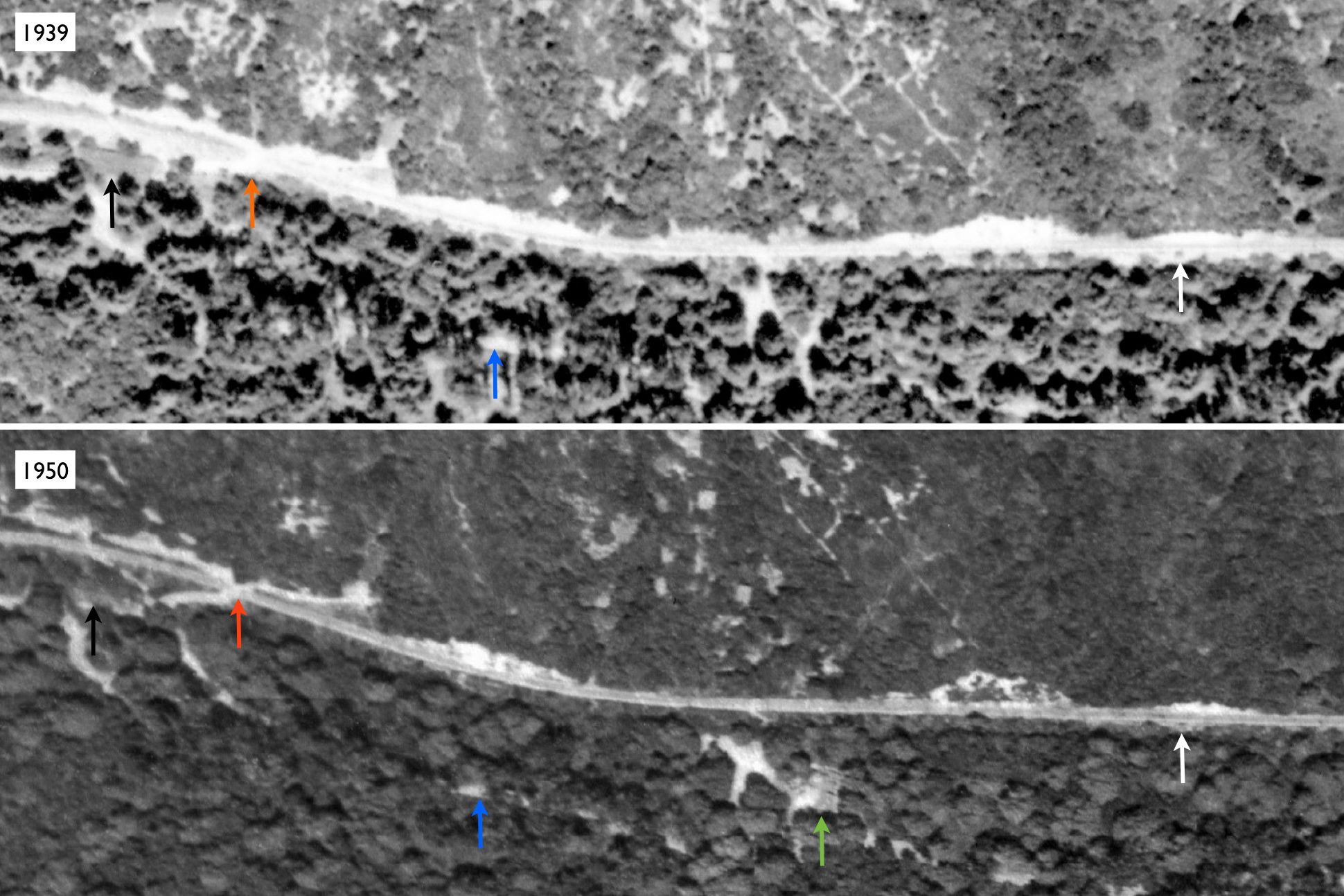
Confirming additional details in either direction from the shelter is somewhat more problematic and will be illustrated with the next examples. Locating Canyon School, here from 1973, along this straight section of right-of-way relative to the Canyon SN shelter required aerial images.
L59-45-Courtesy Charles Smiley, (Image 9 of 14)
Although absent or equivocal in this 1939 aerial, top, the school location is identifiable in a 1950 version, bottom, green arrow. Canyon Store and post office, black arrow; position of wigwag signal, orange arrow; Pinehurst (Redwood Canyon) Road, blue arrow; Canyon SN shelter, white arrow. Top, BUT BUU-283-80, July 30, 1939; Bottom, BUU-12G-20, May 10, 1950.
L59-50-USDA, AAA, Western Division Laboratories, Courtesy EBMUD and East Bay Regional Park District, (Image 10 of 14)
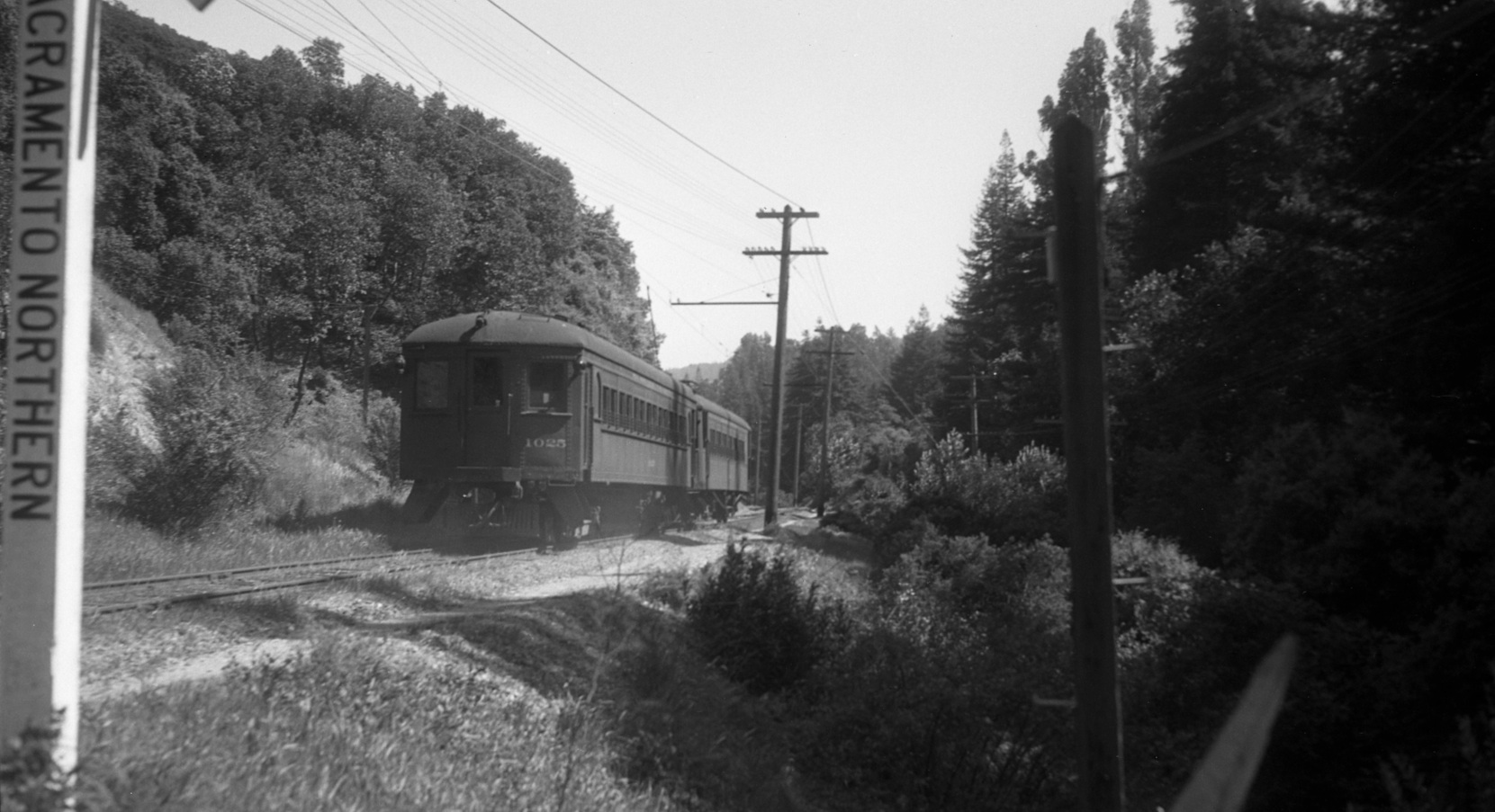
No images from a north view of the curve, north of the block signal in L59-40 has been found. Here is a south image of a two-car train with SN 1025 from the south side of the curve, just south of the grade crossing south of the Canyon Store and post office.
L59-55-Vernon Sappers Collection, Courtesy BAERA, Western Railway Museum Archives, 64870sn , (Image 11 of 14)
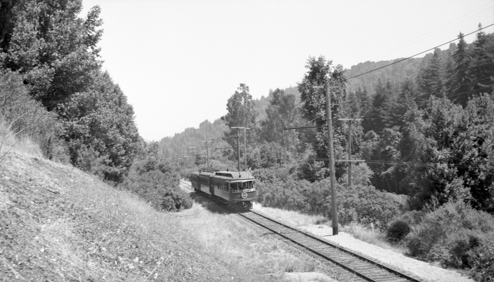
It would be difficult to prove whether this southwest image of a three-car train with the Bidwell parlor car, circa 1941, was taken north or south of the Canyon SN shelter, although the south seems more likely. The clearing on the hillside and the large trees to the west fit both areas along this straight section of track.
L59-60-Arthur Lloyd Photo, Courtesy Arthur Lloyd, (Image 12 of 14)
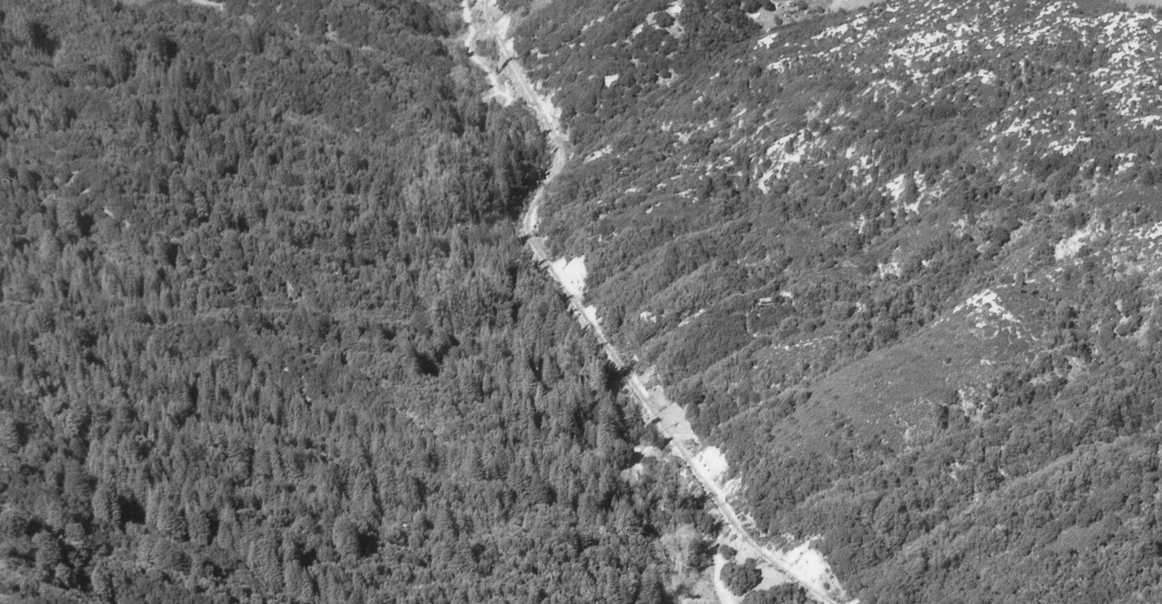
This detail from a 1935 southwest view aerial shows, in the center of the image, the curve between the Sequoia SN shelter and the Canyon SN shelter that lies just south of the Canyon Store and post office, and illustrates the similarities of the hillside markings and trees along the straight-away to the south that continues through to Pinehurst.
L59-65-HJW Geospatial Inc, Pacific Aerial Surveys, Oakland CA, Courtesy East Bay Regional Park Distr, (Image 13 of 14)
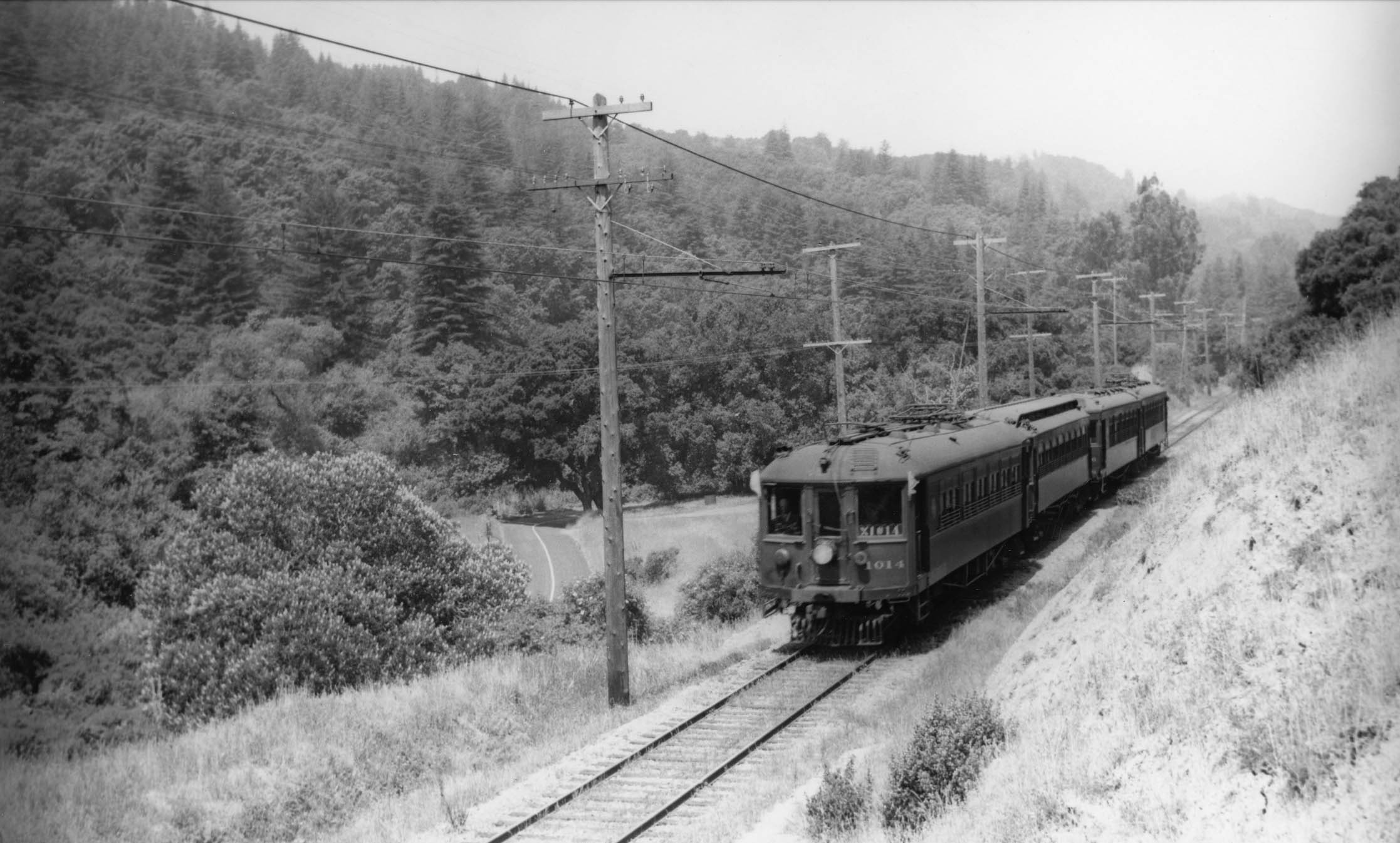
As newly paved Pinehurst Rd. makes a left curve southward toward the right-of-way, SN 1014 and three trailers make the final approach to Pinehurst in this panoramic northwest view from 1941 showing the western tree-line profile for this junction. To be proven more conclusively next time.
L59-70-Courtesy BAERA, Western Railway Museum Archives, 177704sn, (Image 14 of 14)