Lake Temescal & Terrace
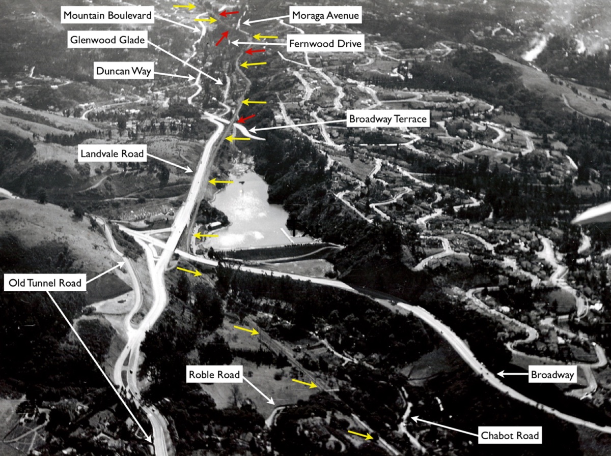
Construction of a freeway connecting Chabot Canyon to Hayward, the Mountain Boulevard Freeway, later renamed the Warren Freeway and Highway 13 was to be built in the 1940s. Preconstruction south view, 1939. An annotated version follows.
C5-Courtesy Oakland History Room, Oakland Public Library, 267 or F-1200, (Image 1 of 19)

This annotated version of C5 indicates the SN right-of-way with yellow arrows and trestles in red arrows. Images of the three trestles between Broadway and Thornhill Drive will be covered in this section.
C6-Courtesy Oakland History Room, Oakland Public Library, 267 or F-1200 , (Image 2 of 19)
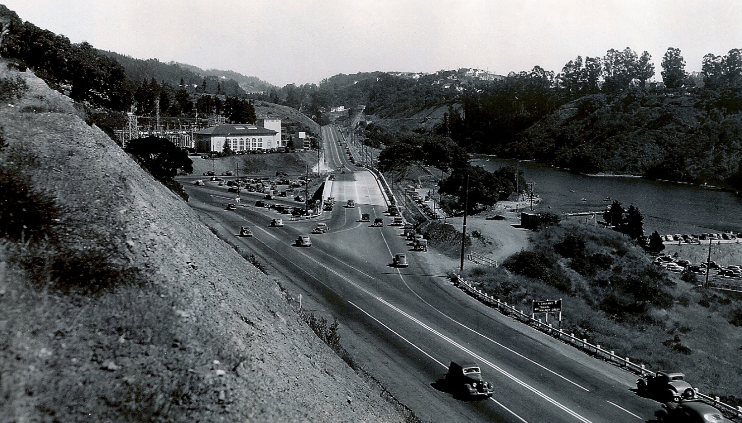
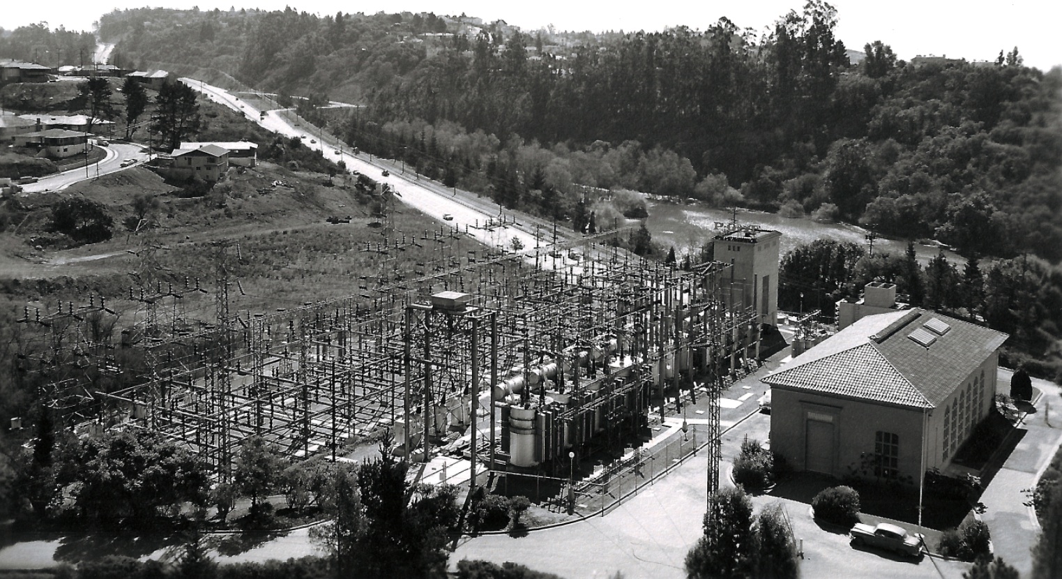
This late 1930s south view shows the Landvale Road, its ramps to and bridge over Broadway, and the Pacific, Gas and Electric Company Claremont Substation to the east, and Lake Temescal to the west.
C10-Courtesy Oakland History Room, Oakland Public Library, 068D, (Image 3 of 19)
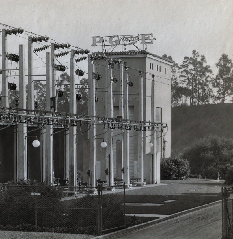
The Claremont Substation was built in 1922 and still plays an important role in supplying electric power to the local area.
C15-Courtesy Pacific Gas and Electric Company, 5045, (Image 4 of 19)
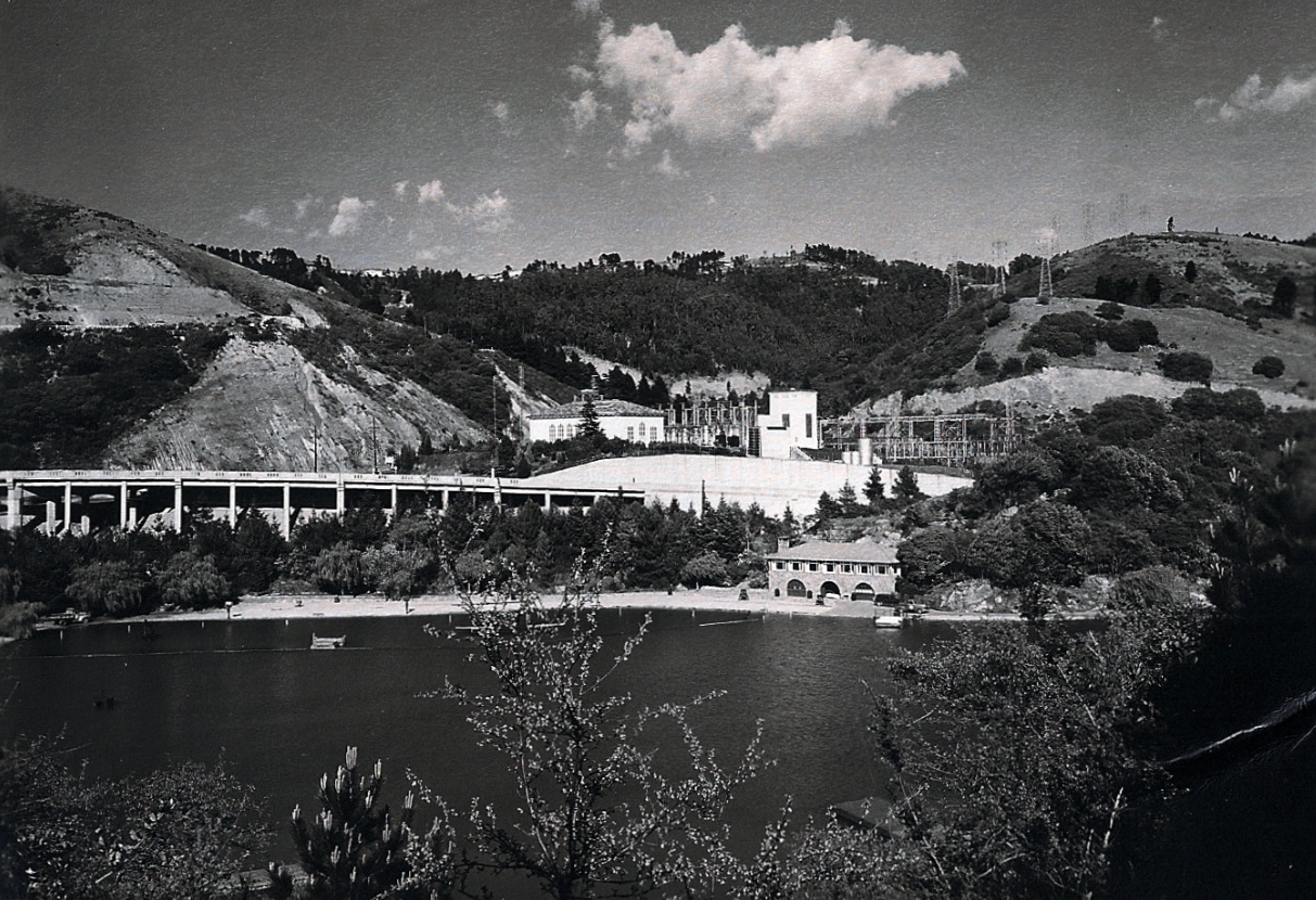
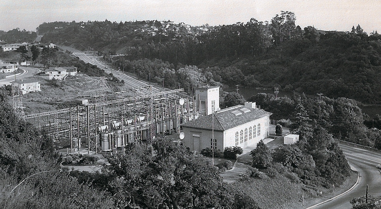
Lake Temescal played an important role as a water supply prior to the opening of the Pardee Dam in 1929 by the East Bay Municipal Utility District, and as a park when acquired by the East Bay Regional Park District in 1936. Much more about its history later....
C20-Courtesy Pacific Gas and Electric Company, 3065, (Image 5 of 19)
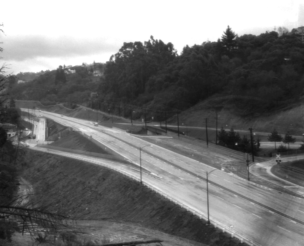
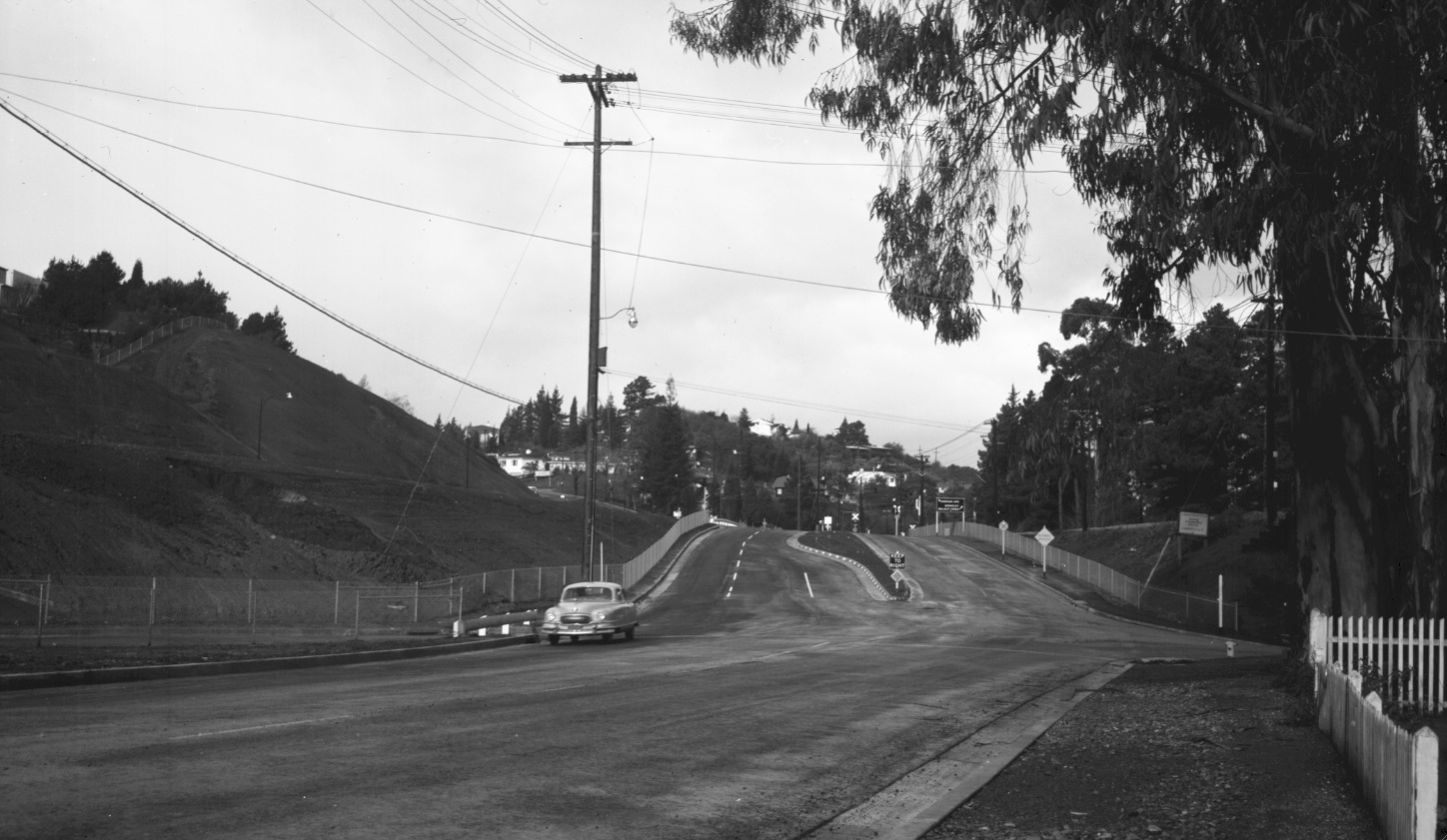
For many reasons, the freeway construction never officially got started until 1950. The section of Landvale Road needed to be moved over and then back to its original path, although this southwest view of Landvale Road from Mar. 12, 1956 would suggest little evidence of change.
C25-Courtesy Pacific Gas and Electric Company, 8087, (Image 6 of 19)
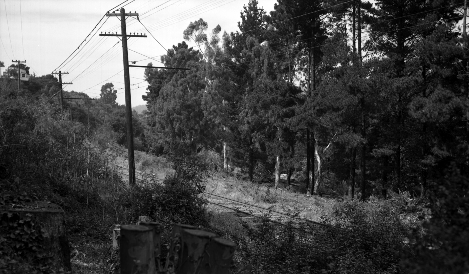
A similar view as in C25 south view from May 17, 1957 showing the presence of SN track and catenary wire pole supports three months after abandonment.
C30-Courtesy Pacific Gas and Electric Company, 10438, (Image 7 of 19)
In contrast, tremendous change occurred at Broadway Terrace in two stages, first in the mid-1930s and then 1949-52. This southwest view on a rainy day circa 1952 documents the final configuration between the freeway ramps and the SN right-of-way.
C35-Public Works Photo, Oakland Cultural Heritage Survey, Oakland City Planning Department , (Image 8 of 19)
This Feb. 1, 1956 north view of Broadway Terrace and the reconfigured Landvale Road allowed for the 1.6 mile extension of the freeway south to Moraga Avenue; this portion, completed in 1952, was referred to as Mountain Boulevard Unit One, “Unit One” or, officially ALA 227.
C40-Copyright California Department of Transportation, Detail 4809-1, (Image 9 of 19)
Taking a north view from a point further south, the mid-portion of Unit One is seen from the Feb., 1, 1956. The next image will take a closer look...
C45-Copyright California Department of Transportation, 4809-1, (Image 10 of 19)
Constructing this portion of the freeway and ramps seen from this north view from Feb., 1, 1956 was only possible after eliminating the houses on the west side of Glenwood Glade, the remaining east side housing seen here straddling the east, or right, side of the freeway.
C50-Copyright California Department of Transportation, Detail 4809-1, (Image 11 of 19)
To complete the trip south down Unit One, this Feb., 1, 1956 south view continues at the point where Florence Terrace and Fernwood Drive meet Duncan Way on the east, or left lower, side of the image.
C55-Copyright California Department of Transportation, 4809-7, (Image 12 of 19)
Detail from C55 reveals the freeway to its end at the crossing of Moraga Avenue where the SN crossed as well. Construction of the east, or left side of this section of freeway required the removal of the west side houses of Fernwood Drive.
C60-Copyright California Department of Transportation, Detail 4809-7, (Image 13 of 19)
Detail from C55 also shows a long forgotten SN trestle that crossed a long forgotten path across the Hayward Fault Valley. More on this later ...
C65-Copyright California Department of Transportation, Detail 4809-7, (Image 14 of 19)
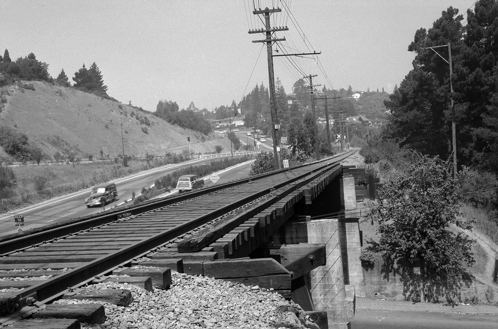
Continuing south on Feb., 1, 1956, the site of the railroad crossing of the freeway is captured, as is the crossing of Moraga Avenue and the railing that marked the temporary end of the freeway until the opening of Unit Two later that year. Note the SN Thornhill Drive trestle in the upper left.
C70-Copyright California Department of Transportation, 4809-6, (Image 15 of 19)
Again turning to a north view on Feb., 1, 1956, the railroad and Moraga Avenue crossings from the opposite view just north of Thornhill Drive.
C75-Copyright California Department of Transportation, Detail 4809-2, (Image 16 of 19)
It is hard to believe that this northeast view from circa 1949-50 would be looking into the traffic of a freeway two years later. Much more on all phases of the construction of Mountain Boulevard Freeway Unit One later ....
C80-Public Works Photo, Oakland Cultural Heritage Survey, Oakland City Planning Department , (Image 17 of 19)
A north view of the unfinished freeway, middle left, and Moraga Avenue, with traffic, from a point just south of Thornhill Drive and its trestle from 1955. The Thornhill Station had once been about one-tenth of a mile north of mile marker 12. More later ...
C85- Harre Demoro Photo, Courtesy John Harder, (Image 18 of 19)
A final north view at Moraga Avenue and Thornhill Drive at the conclusion of the Unit One construction, circa 1952.
C90-Public Works Photo, Oakland Cultural Heritage Survey, Oakland City Planning Department , (Image 19 of 19)