Lake Temescal, the East Bay Municipal Utility District, and the Roaring Twenties

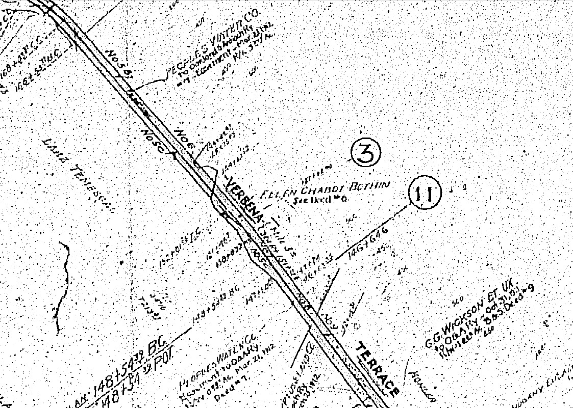
This Board of Equalization map from circa 1920 introduces the Lake Temescal Region as it was once known, Verbena, and includes many names of historical importance, property ownership, the railroad track configurations, and a wealth of historical information.
L1-1-Courtesy California Board of Equalization, 862-1-1D, (Image 1 of 15)

The Oakland, Antioch and Eastern Railroad began in 1913, and one of its biggest challenges was to build a trestle over the eastern finger of Lake Temescal. The top right corner of this pre-1920 northern view shows the raised edge of the trestle and the cut through the rock formation in the background.
L1-2-Cheney Photo, B-1324, Courtesy Ray Raineri Collection, (Image 2 of 15)

An undated northeast view of the trestle. The trestle would eventually be removed when the eastern finger was filled in during the early 1930s to accommodate the construction of the Landvale Road. Many other features from this image will be presented next.
L1-3-Courtesy Pacific Gas and Electric Company, Photo 3489, (Image 3 of 15)

Another undated northeast view of the trestle.
L1-4-Courtesy Pacific Gas and Electric Company, Photo 3490, (Image 4 of 15)

The Claremont Substation of Pacific, Gas and Electric Company featured in this July 17, 1931 northwest view was built on a shoulder at the northeastern corner of the lake. Still in use today, the substation provides another good marker for the location of the trestle and the eastern extension of the lake.
L1-5-Courtesy Pacific Gas and Electric Company, Photo 7794, (Image 5 of 15)

This northeast view begins a series of images of Lake Temescal from Nov. 29, 1924. The East Bay Municipal Water District was formed in 1923. For a timeline of major events related to East Bay water supply history, see http://www.ebmud.com/about-ebmud/our-story/district-history
L1-6-Cheney Photo, W-655, Courtesy of East Bay Municipal Utility District, P-TR-1353, (Image 6 of 15)

Lake Temescal, southeast view, Nov. 29, 1924.
L1-7-Cheney Photo, W-645, Courtesy of East Bay Municipal Utility District, P-TR-1354, (Image 7 of 15)

Lake Temescal, another southeast view with southern shore, Nov. 29, 1924.
L1-8-Cheney Photo, W-644, Courtesy of East Bay Municipal Utility District, P-TR-357, (Image 8 of 15)

Lake Temescal, northwest view with dam, Nov. 29, 1924.
L1-9-Cheney Photo, W-648, Courtesy of East Bay Municipal Utility District, P-TR-361, (Image 9 of 15)

Lake Temescal, northwest view with western shore, Nov. 29, 1924.
L1-10- Cheney Photo, W-647, Courtesy of East Bay Municipal Utility District, P-TR-1355 , (Image 10 of 15)

Lake Temescal, west view with dam and spillway, Nov. 29, 1924.
L1-11-Cheney Photo, W-642, Courtesy of East Bay Municipal Utility District, P-TR-35, (Image 11 of 15)

Lake Temescal, east view with dam, Nov. 29, 1924. Note Old Tunnel Road in the background.
L1-12-Cheney Photo, W-649, Courtesy of East Bay Municipal Utility District, P-TR-359 , (Image 12 of 15)

Closer image from LM-01-12, east view with dam, Nov. 29, 1924.
L1-13-Cheney Photo, W-649, Courtesy of East Bay Municipal Utility District, P-TR-359 , (Image 13 of 15)

This image from 1924 shows a work crew setting tile drain downhill from the lake.
L1-14-Courtesy of East Bay Municipal Utility District, P-TR-38, (Image 14 of 15)

This west view of the northeast corner of Lake Temescal looking down Chabot Canyon will serve as an introduction to the next Landmark presentation documenting the building of access roads to the lake.
L1-15-Courtesy of East Bay Municipal Utility District, P-TR-37 , (Image 15 of 15)