Lowell St., Golden Gate Tower, and the Market St. Solution, Part 1, 1911-1941
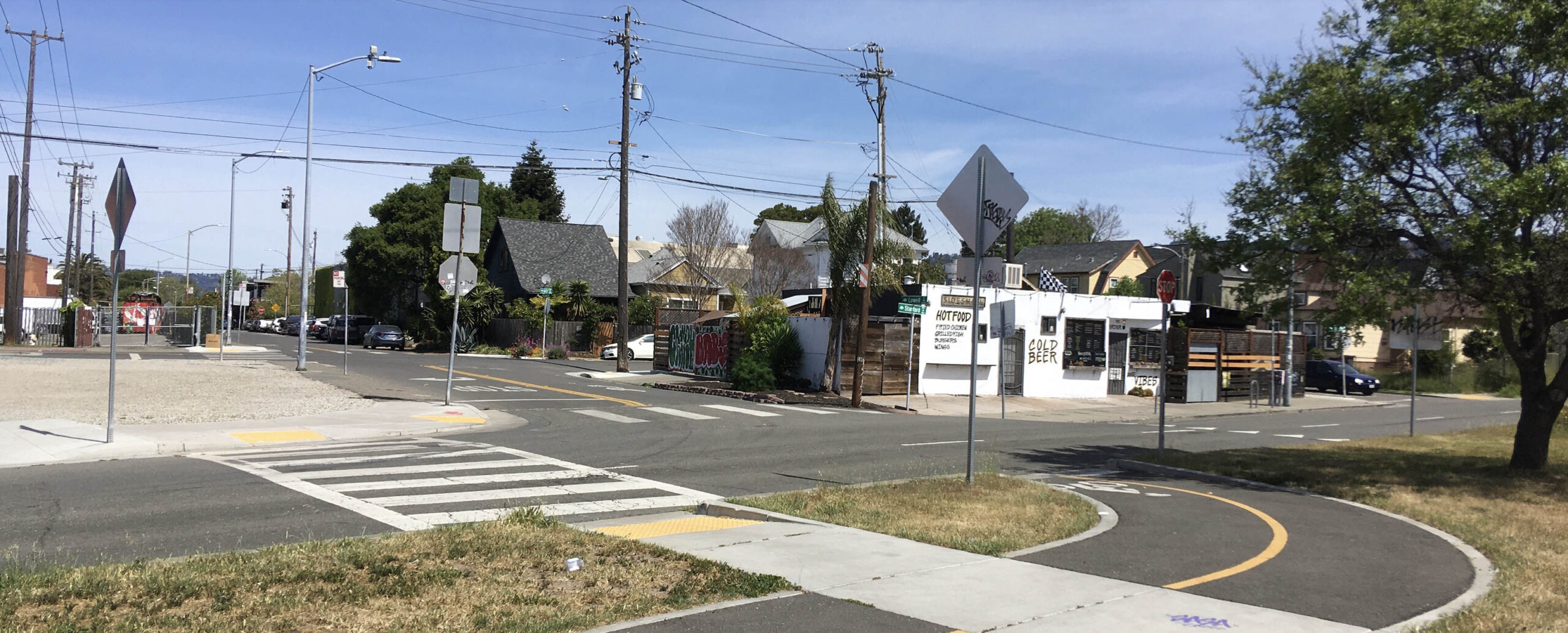
A north view from Lowell St. and Stanford Ave. in 2023 belies the former presence of several train lines whose movements were coordinated from a tower in the first half of the 20th century. This update will bring this scene back to that time period and provide a full account of this crossing, where much of the competition was centered between the Key System, Key, and Southern Pacific, SP, electric interurban lines for the Oakland-Berkeley border from Dec. 1911 until July 26, 1941.
L293-05-Stuart Swiedler Photo, (Image 1 of 35)

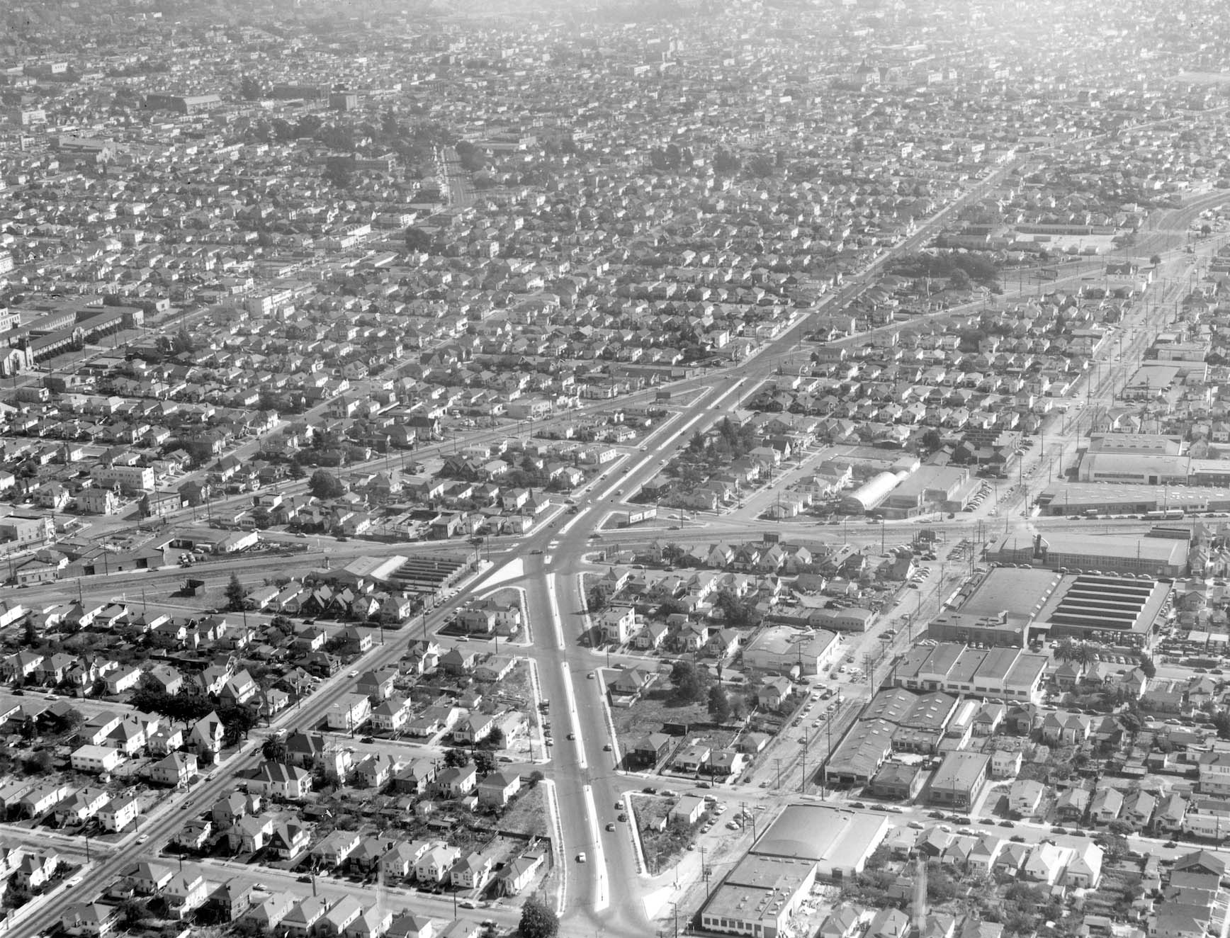
This southeast view of the Lowell St. was taken on Sept. 23, 1953. The image captures the solution to the increase in auto traffic that had been building as the electric train era came to an end in the East Bay. This will be the subject of the update to follow.
L293-10-Public Works Photo, Oakland Cultural Heritage Survey, Oakland City Planning Department, (Image 2 of 35)
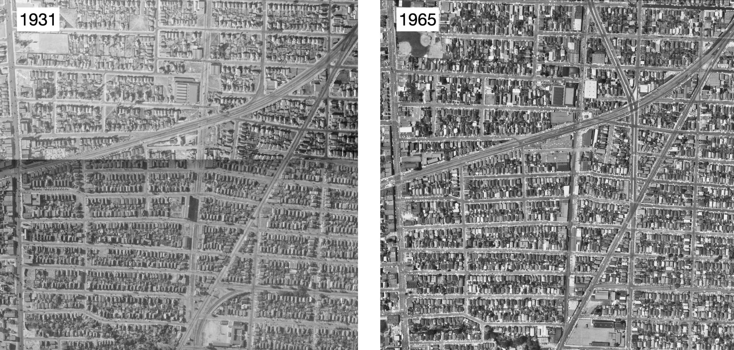
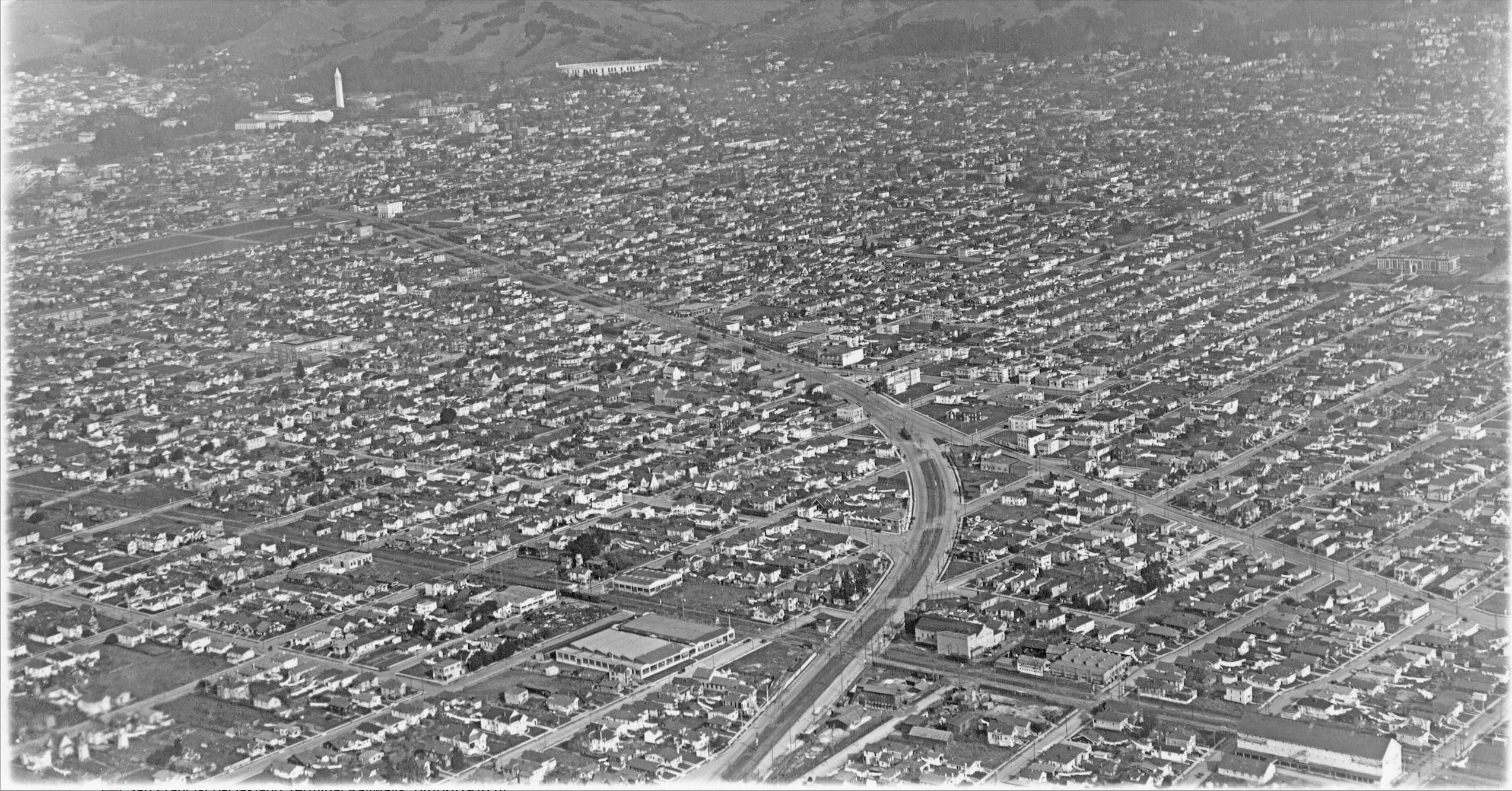
Aerial views from 1931 versus 1965 contrast the electric railway era on the left versus the automobile era on the right. Ref: The left panel is a fusion of Flight c-1600, Frame 24 from 1931 with Flight c-1600, Frame 57 from 1931. The right panel is Flight cas-65-130, Frame 15 from 1965
L293-15-Courtesy of UC Santa Barbara Library Geospatial Collection (see legend), (Image 3 of 35)
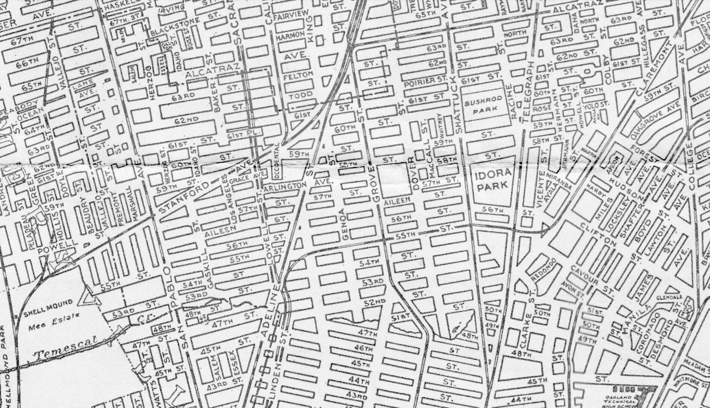
This map from 1921 introduces the proliferation of electric traction serving the Oakland-Berkeley border. Next to begin to detail how these routes were dispersed as they entered Berkeley.
L293-20-Central National Bank Map, Courtesy BAERA, Western Railway Museum Archives, 83537b, (Image 4 of 35)
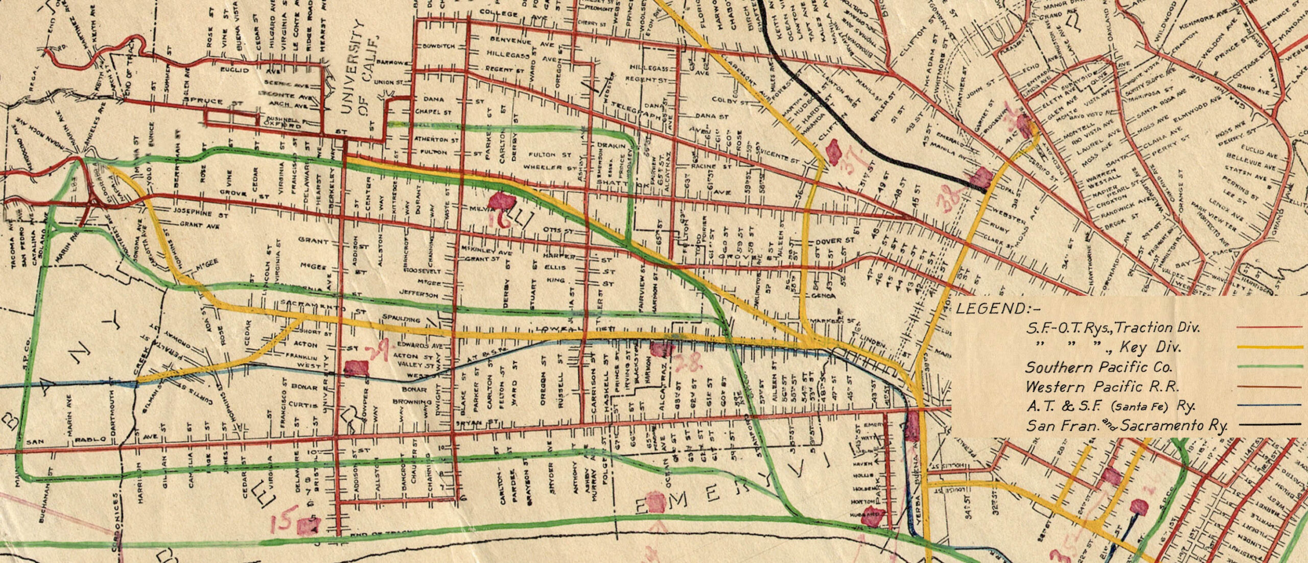
The Key and SP came to the East Bay from different entry points. The Key interurbans used their pier in the Bay, while the SP used the Oakland Pier on the Oakland shoreline. The Atchison, Topeka and Santa Fe, Santa Fe, entry of their steam line was from Richmond. Overlaying this were Key streetcars for delivering local traffic. The Key no. 88 Market St. bus was the only bus that served the Oakland-Berkeley border between Sacramento St. and Telegraph Ave.
L293-25-San Francisco-Oakland Terminal Railways System Map, Courtesy Port of Oakland, (Image 5 of 35)
The SP electrics heading into Berkeley came off the mainline at the Shellmound Tower, green arrow. The Ninth St. line was spun off soon thereafter, red arrow. After passing into Oakland at Vallejo St., the tracks crossed San Pablo Ave. and the Bank of Italy, yellow arrow, the bank’s name confirming that this northeast view was taken before Nov. 1, 1930. It continued on past the Golden Gate Tower, turquoise arrow, to be covered soon.
L293-30-George Russell Photo, Courtesy the California State Lands Commission, SLC_642_NoDate_2, (Image 6 of 35)
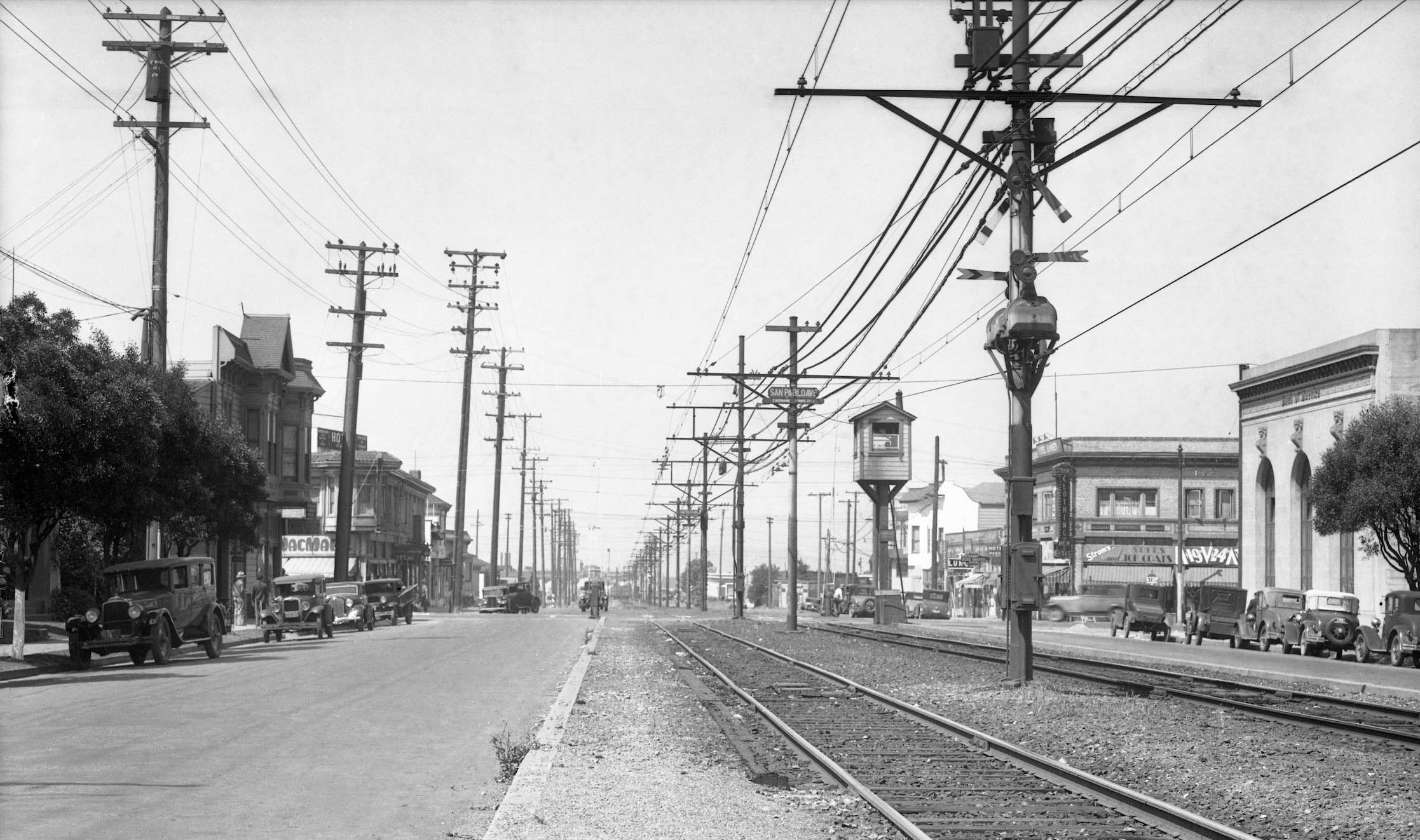
At San Pablo Ave., the Key tower kept streetcars from crossing until one of a possible three SP interurban lines had cleared the intersection between 1911-1933. By the time this southwest view was taken in 1934, the SP California St. and Ellsworth St. lines had been discontinued since Mar. 26, 1933. Note the former Bank of Italy at the northeast corner has been renamed the Bank of America.
L293-35-S.P. Official Photo, Sappers Coll., Courtesy BAERA, Western Railway Museum Archives, 170904oa&b, (Image 7 of 35)
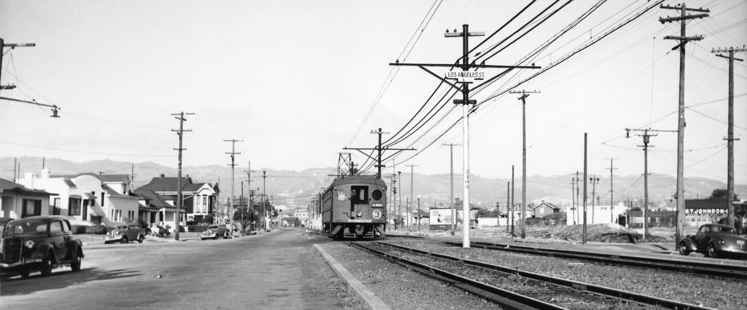
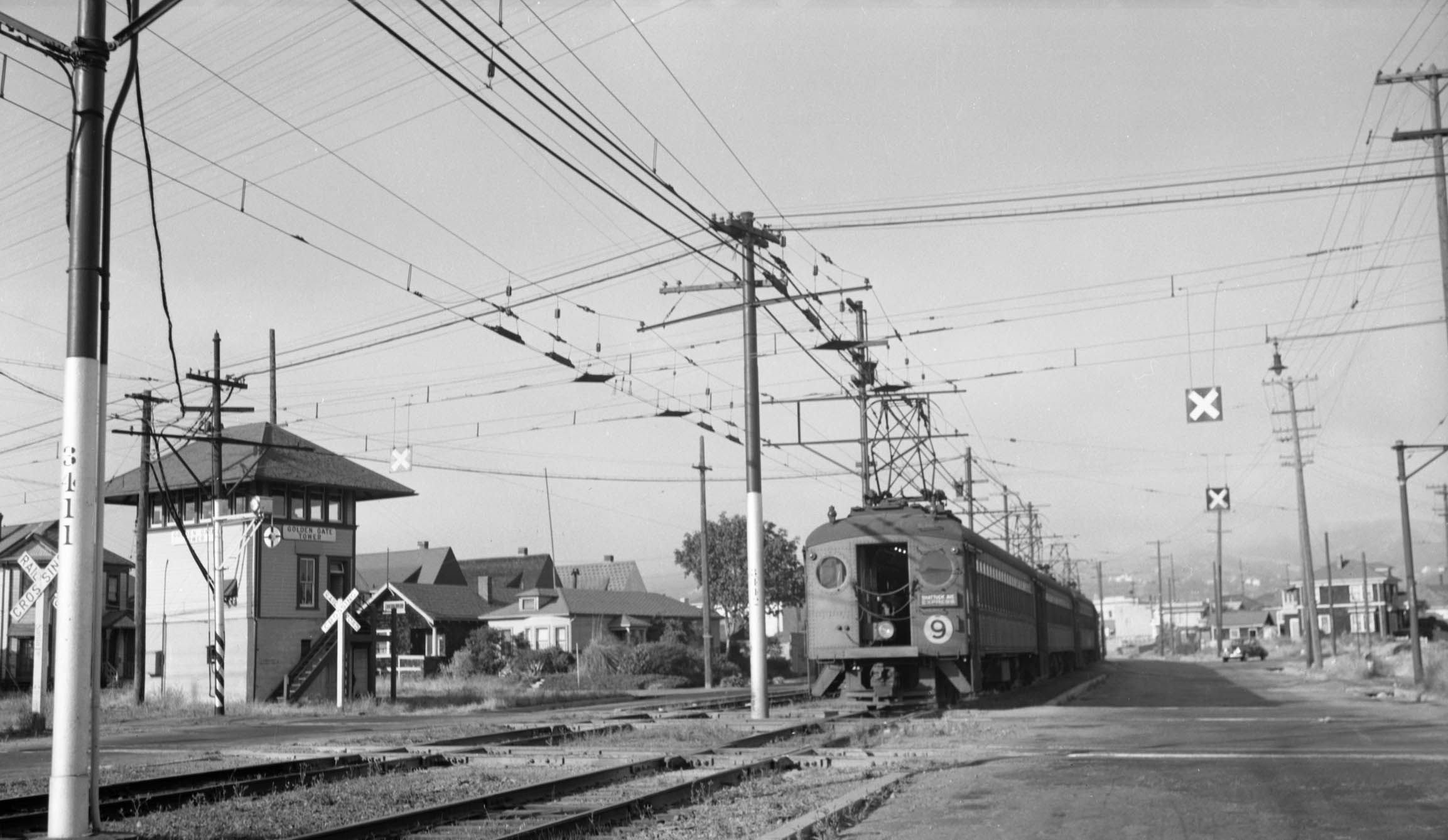
After San Pablo Ave., the SP red cars stopped at Los Angels St., seen here in a northeast view with a local Shattuck Ave. train from 1939. By 1939, the SP line was being operated by the Interurban Electric Railroad or I.E.R., the SP’s subsidiary that was created to separate the losses and liability of the electric railway from the parent company. The Golden Gate Tower came next, hidden by trees in this view, but near the wig-wag signal on the north intersection with Lowell St.
L293-40-Courtesy BAERA, Western Railway Museum Archives, 209048ier, (Image 8 of 35)
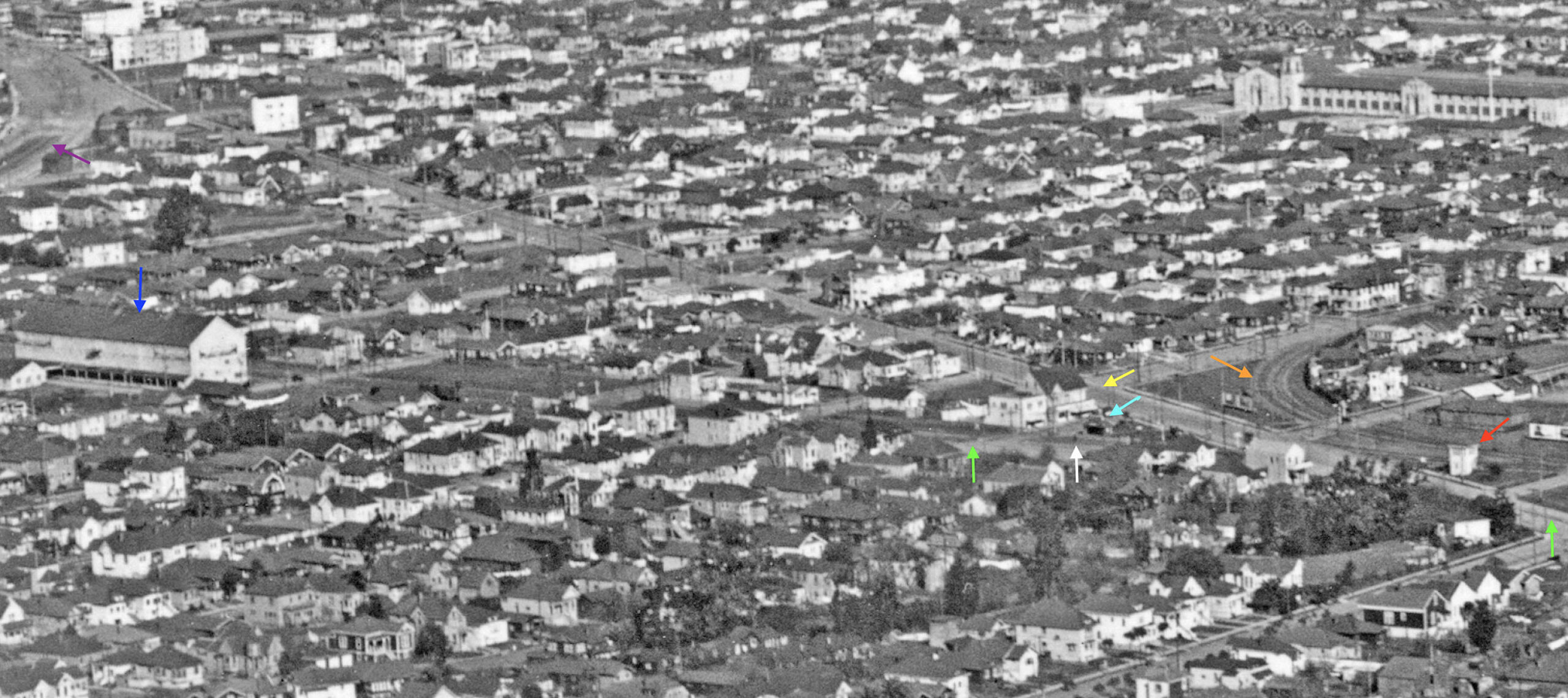
Next for the Key entry onto Lowell St. This northeast view of the eastern border of Emeryville with Oakland was taken sometime ca. 1924-1925, based on the presence University High School, later City or Merritt College, that opened in 1923, and the absence of the Aluminum Cooking Utensil Co. building that opened in 1926 south of the Remar Bakery. The three lines shared the corridor along Linden St. to approach the point of dispersal at Key Tower 4 toward Berkeley. An annotated detail continuing from this last landmark follows.
L293-45-George Russell Photo, Courtesy the California State Lands Commission, API 651 16 Box 94, (Image 9 of 35)
An annotated detail of the southern end Lowell St. corridor from the previous aerial view ca. 1924-1925 with arrows as follows: Key Tower 4, red; Santa Fe track, green, on Adeline St. and Lowell St; Key Claremont, later E line, orange; Key Shattuck, later F line, yellow, on Adeline St; Key Northbrae, later H line, white; Key 54th St. shelter for Northbrae-H line, turquoise; SP Shattuck and Ellsworth lines, purple, on Stanford Ave.; Redwood Manufacturers Co., Sash, Doors and Mill Work, 950 Aileen St, blue, as per the 1925 directory, referred to as REMCO in Pittsburg, CA.
L293-50-George Russell Photo, Courtesy the California State Lands Commission, API 651 16 Box 94, Detail, (Image 10 of 35)
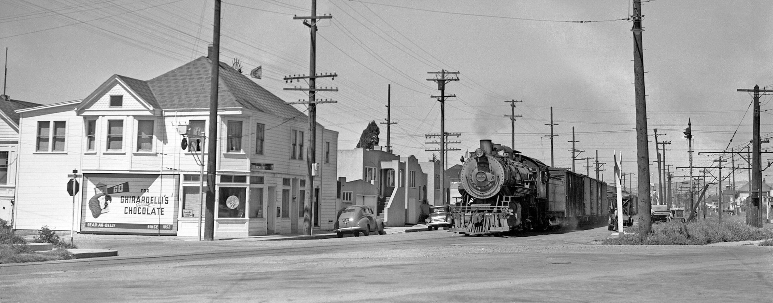
The review of Lowell St. starting from the south during the electric era begins where Lowell St. originates from Adeline St. with this photo of Santa Fe steam engine no.1963 In 1941. The Santa Fe began passenger and freight operations in 1904 along the right-of-way of the California and Nevada Railroad of 1880. The building on the corner was one of the few on Lowell St. in the 1903 Sanborn map, marked as no. 950 53rd St. Note the windmill on top of a water tank behind it. In 2023, it serves as an apartment, now addressed as no. 5303 Lowell St., and still retains the fishscale gable.
L293-55-Ralph Demoro Photo, Courtesy John Harder, (Image 11 of 35)
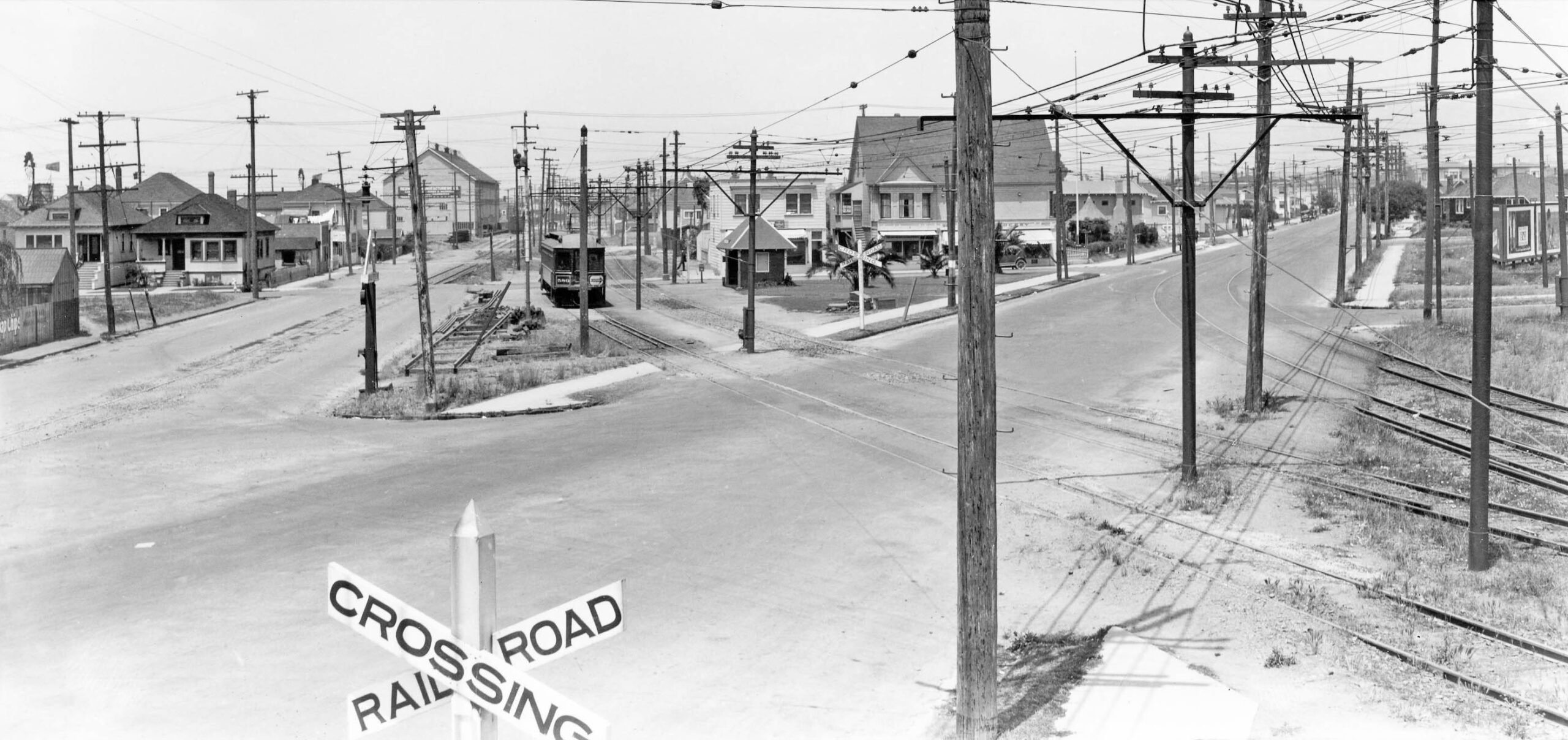
Inching further north, this Key 500 series passenger motor sits on the Northbrae line at the 54th Street shelter in this north view taken from Key Tower 4 ca. 1923. The two tracks of the Key Shattuck line appear on the right or east on Adeline St., and the single mainline track of the Santa Fe is on the left on Lowell St. The presence of grocery stores along 54th St. behind the shelter can be appreciated, these buildings preserved in 2023 as apartments. Unlike the Santa Fe, the Key line did not offer freight service for businesses on the east side.
L293-60-Sappers Collection, Courtesy BAERA, Western Railway Museum Archives, 67985ks, (Image 12 of 35)
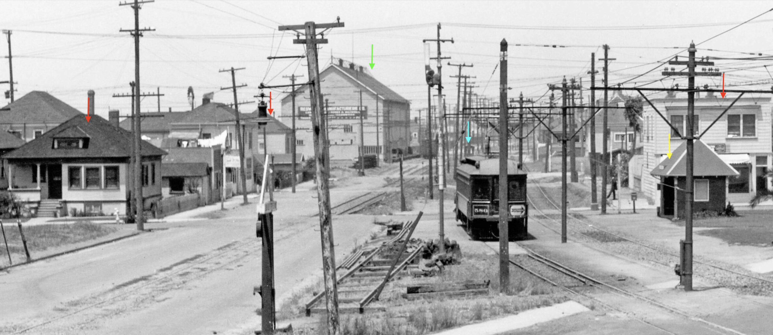
This detail from the previous north view taken from Key Tower 4 ca. 1923 shows three buildings still present in 2023, red arrows. The REMCO building on Aileen St. is marked by the green arrow, the shelter for the Key Aileen St. stop by the turquoise arrow, and the Key 54th St. shelter, yellow arrow. Note the presence of the Santa Fe siding alongside REMCO, a common feature for businesses on the west side of the street, but absent on the east side.
L293-65-Sappers Collection, Courtesy BAERA, Western Railway Museum Archives, 67985ks, (Image 13 of 35)
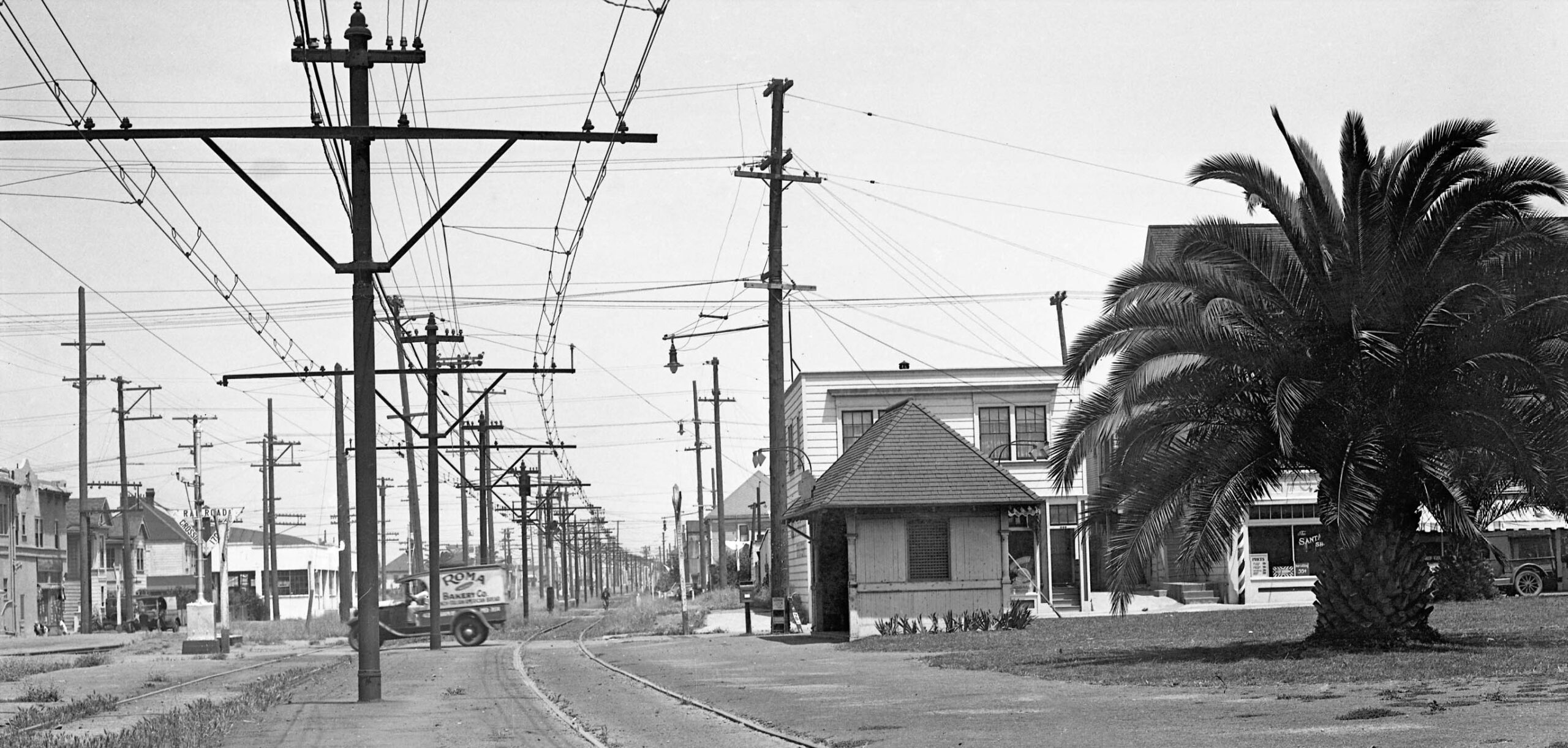
A similar north view from 1934, the buildings along the west side of Lowell St. on either side of 55th St. starting at the left edge of the image are still standing in 2023. The industrial building just to the left of the Roma truck at the northwest corner with 56th was occupied by Vacu-Dry Co.-The Calvac Co., a fruit and vegetable dehydration plant that has been modified to a larger structure that remains in 2023.
L293-70-Key Official Photo, Sappers Coll., Courtesy BAERA, Western Railway Museum Archives, 171253ks, (Image 14 of 35)
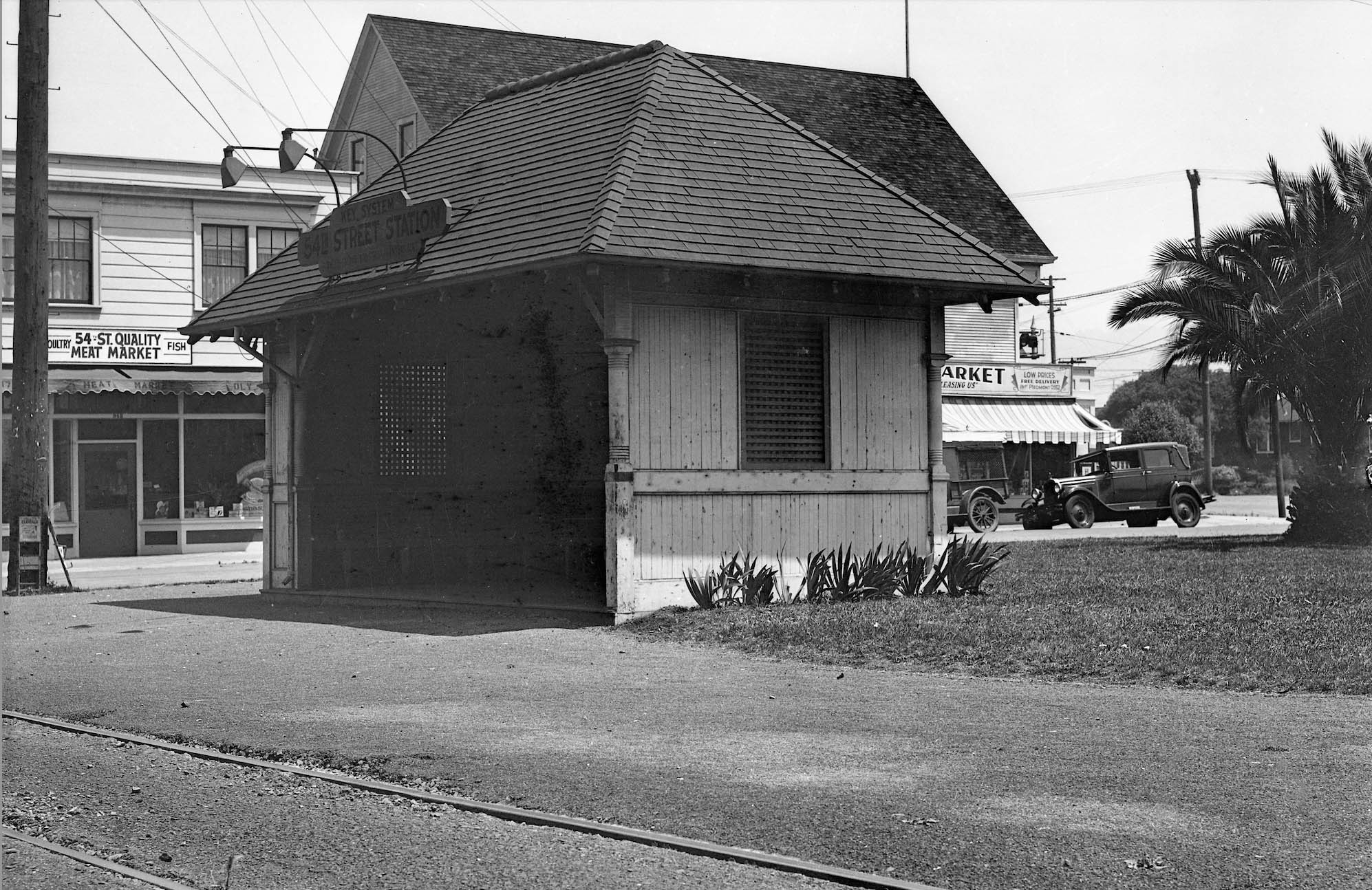
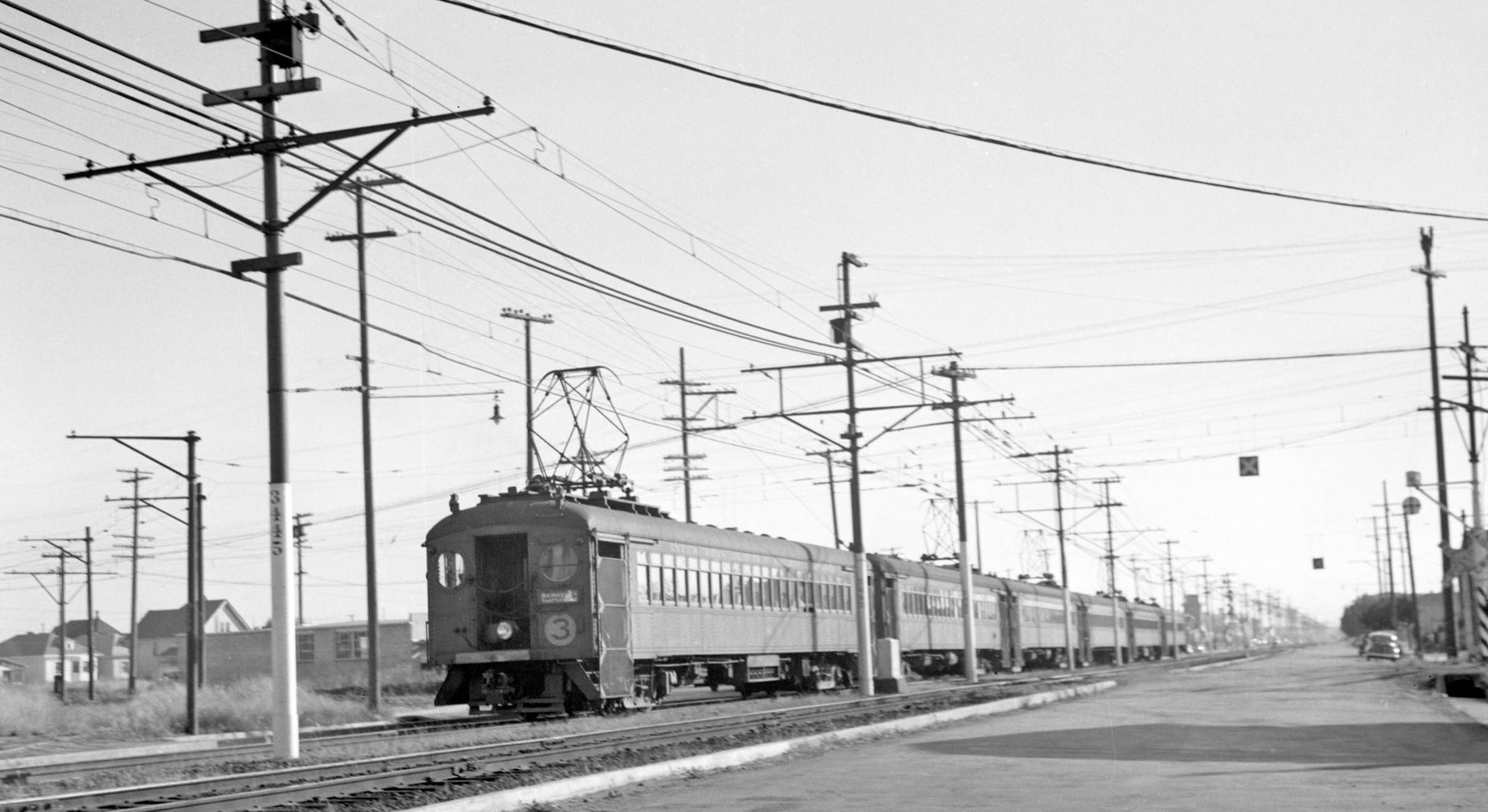
A northeast view of the Key shelter at 54th St. from 1934 also serves to show more details of the grocery stores lining 54th St. With the coming of the Bay Bridge, the SP California line was abandoned on Mar. 26, 1933 to reduce operating costs for SP and Key interurbans providing similar service. As a result, by 1934, the Berkeley terminus for Key trains along Lowell St. was changed to Colusa and Monterey Aves. using SP trackage.
L293-75-Key Official Photo, Sappers Coll., Courtesy BAERA, Western Railway Museum Archives, 171254ks, (Image 15 of 35)
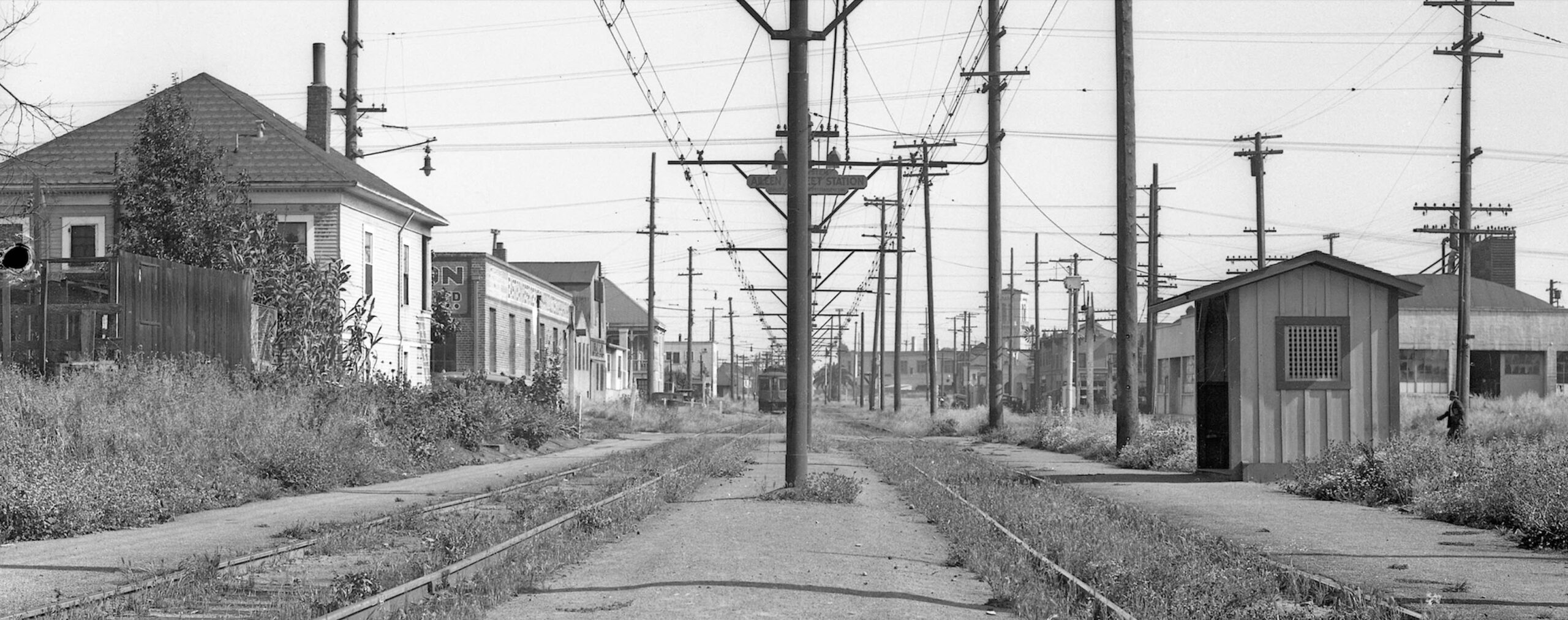
This south view from 1934 of the Aileen St. shelter was taken a year or so before the Northbrae line was renamed the H line. East Bay Refrigeration Products Corporation, Ltd. occupied the east side between 56th and Aileen Sts. across from the Vacu-Dry plant, the latter partially hidden by the shelter in this view. Aileen St. is not present in the 1903 Sanborn map. Within five years or so, 58th St, would be renamed 57th St, and the original 57th St. would be renamed Aileen St.
L293-80-Key Official Photo, Sappers Coll., Courtesy BAERA, Western Railway Museum Archives, 171255ks, (Image 16 of 35)
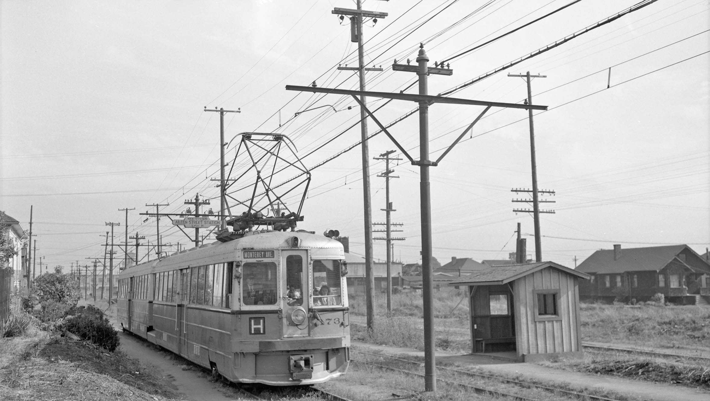
This southwest view of KS 173 at the Aileen St. stop shelter was taken on July 24, 1941, two days prior to abandonment of the H line. The lot on the west between Aileen St. and half way down the block toward 56th St. is empty, but would be filled by 1950 and combined with the Vacu-Dry Co. building.
L293-85-Richard Jenevein Photo, Courtesy BAERA, Western Railway Museum Archives, 12651ks, (Image 17 of 35)
Next. a north view toward 57th St. from the Aileen stop of a north-bound H line train in July of 1941 is presented. The house along the right edge, nos. 945-947 57th St., and the one to the right of the train, no. 944, are still present in 2023, but the one-story wood structure alongside nos. 945-947 is an empty lot.
L293-90-Addison Laflin Photo, Courtesy BAERA, Western Railway Museum Archives, 105827ks, (Image 18 of 35)
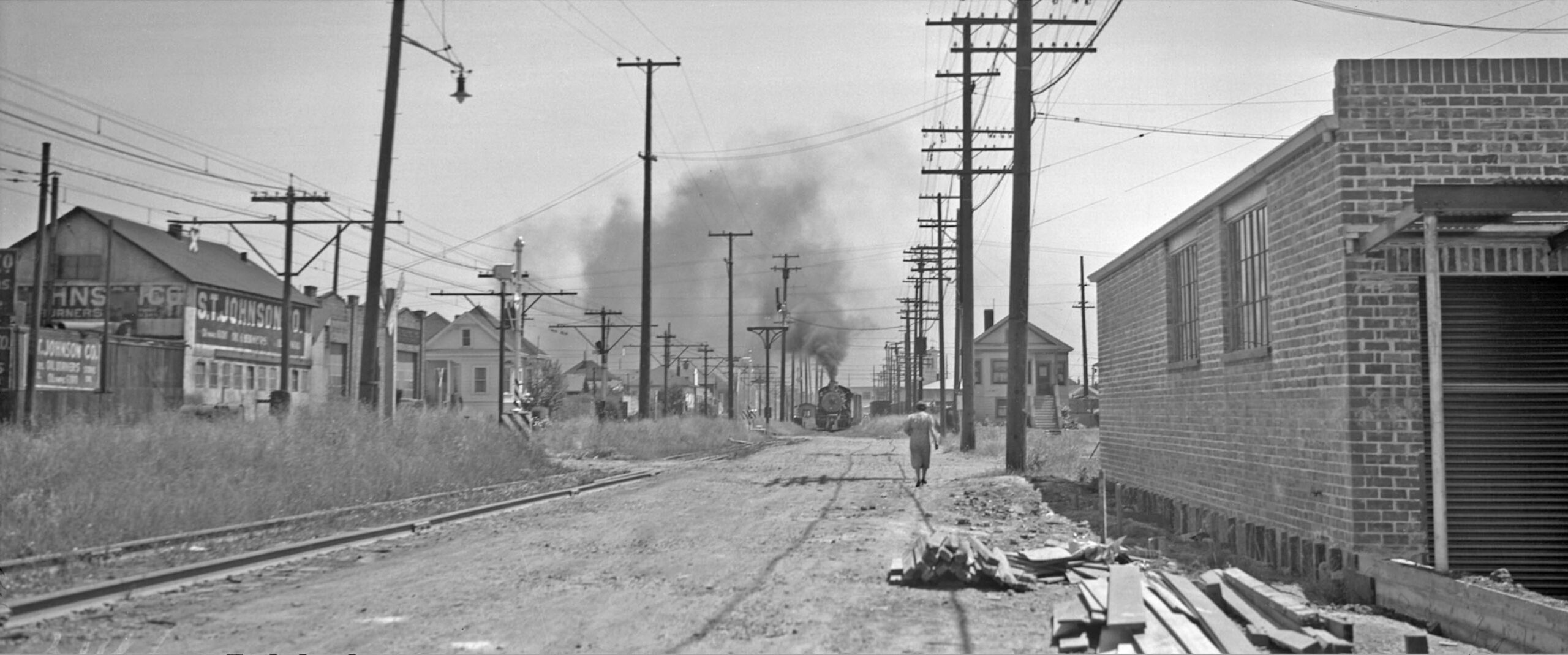
A south view of an oncoming Santa Fe freight had to have been taken at Grace Ave., as the two houses flanking the tracks on either side still occupy the corners with Arlington Ave. The house on the southwest corner, no. 951, is present in the 1903 Sanborn map. This ca. 1941 image also shows S.T. Johnson, manufacturer of oil burners and parts since 1903, occupying this space at least up until 1967, having expanded one block north by at least 1953.
L293-95-Ralph Demoro Photo, Courtesy John Harder, (Image 19 of 35)
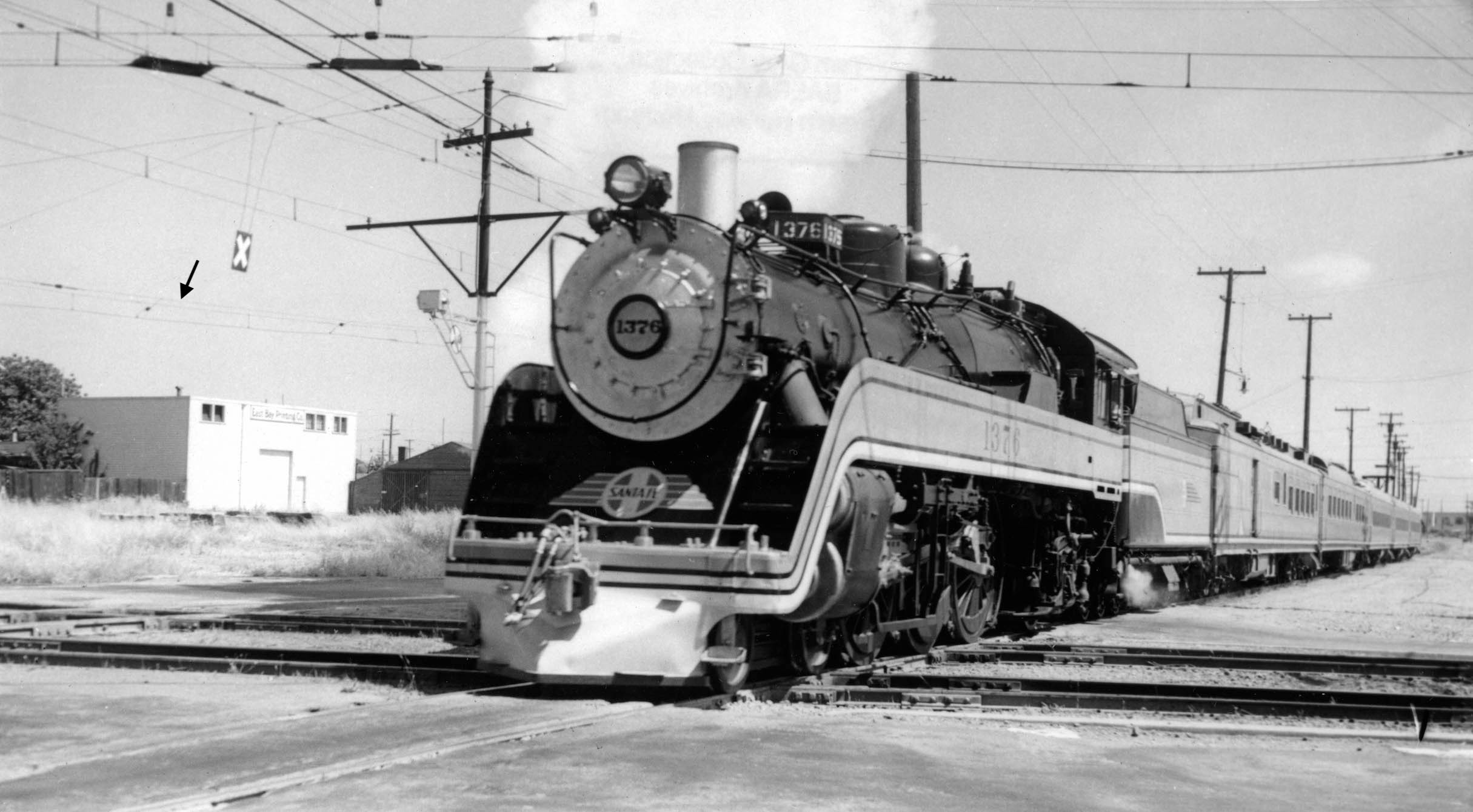
This southeast view shows the Santa Fe 4-6-2 steam locomotive 1376 “Valley Flyer” crossing the SP electrics mainline on Stanford Ave. at Lowell St. The train ran between Bakersfield and Oakland from 1939-1940 during the Golden Gate International Exposition on Treasure Island. It was the Santa Fe’s first attempt at streamlining older steam power. Note the unobstructed view of the East Bay Printing Co., and the extra set of catenary wires, black arrow, to be discussed shortly.
L293-100-Robert Hanft Collection, Courtesy BAERA, Western Railway Museum Archives, 68292atsf, (Image 20 of 35)
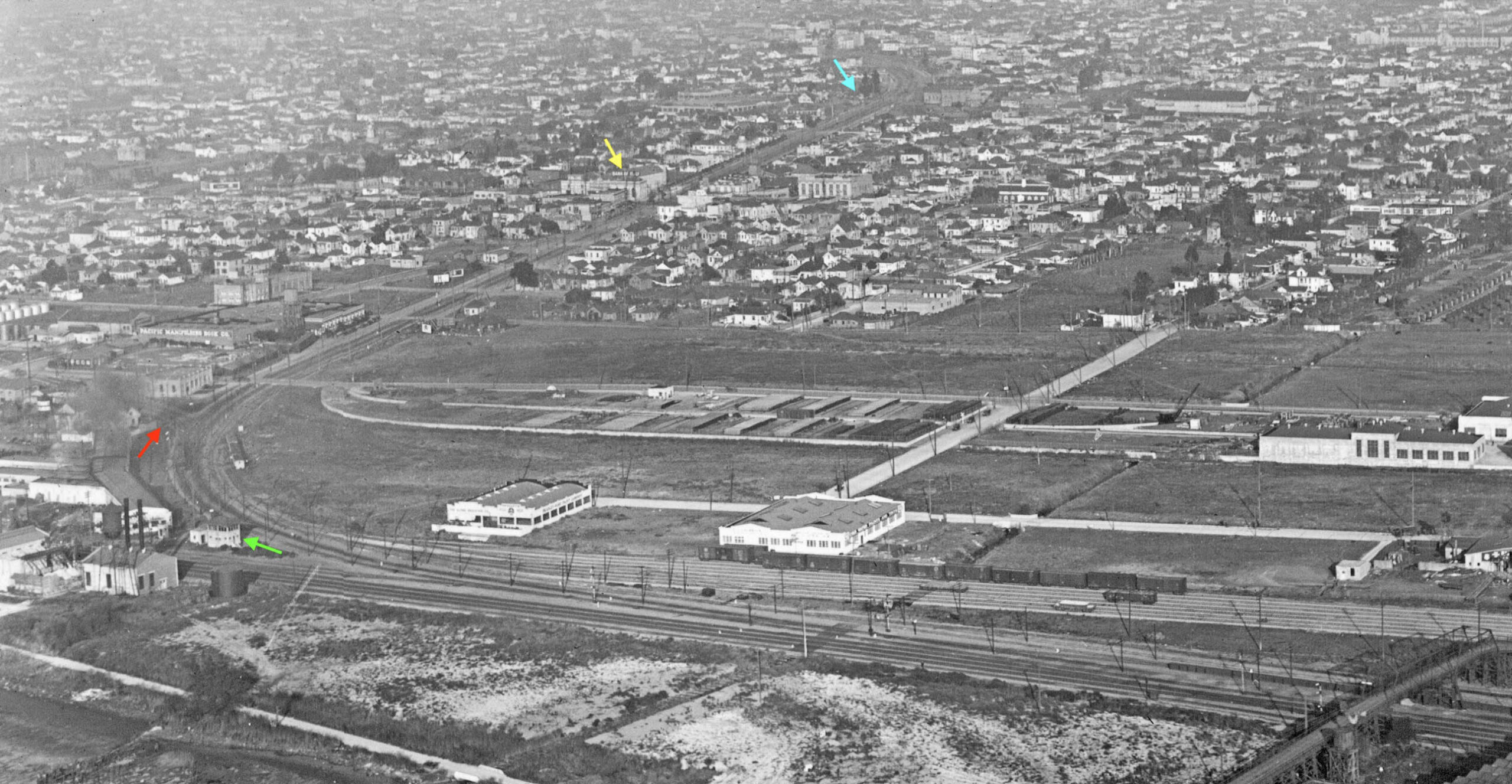
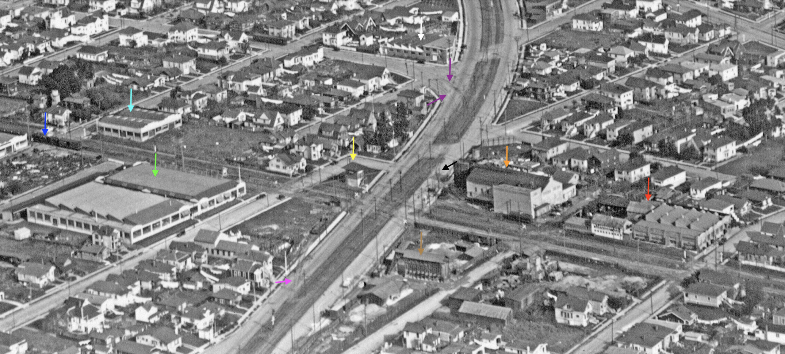
The review so far brings all the transit lines to the Lowell St.-Stanford Ave, crossing. This northeast view of the crossing was taken sometime ca. 1924-1925 as explained in -45, the latter image overlapping this one by the presence of the Redwood Manufacturers Co., Sash, Doors and Mill Work at 950 Aileen St, seen in this image in the lower right corner. A detail follows.
L293-105-George Russell Photo, Courtesy the California State Lands Commission, SLC_644_NoDate_23, (Image 21 of 35)
An annotated detail of the previous aerial view ca. 1924-1925 with arrows as follows: S.T. Johnson, red; National Ice and Cold Storage Co., orange; Golden Gate Tower, yellow; Unnamed building materials company, brown; Cyclone Fence-Standard Fence, Iron and Wire Works, green; Herman Goelitz Candy Co., turquoise; SP Steam locomotive, blue; double-track SP California St. line, purple; The Ferro-Enameling Co., white. Two SP freight spurs are indicated by the black and magenta arrows, the former alongside the National Ice and Cold Storage Co., and the latter supplying a cleared out lot, possibly a team track for the area.
L293-110-George Russell Photo, Courtesy the California State Lands Commission, SLC_644_NoDate_23, Detail, (Image 22 of 35)
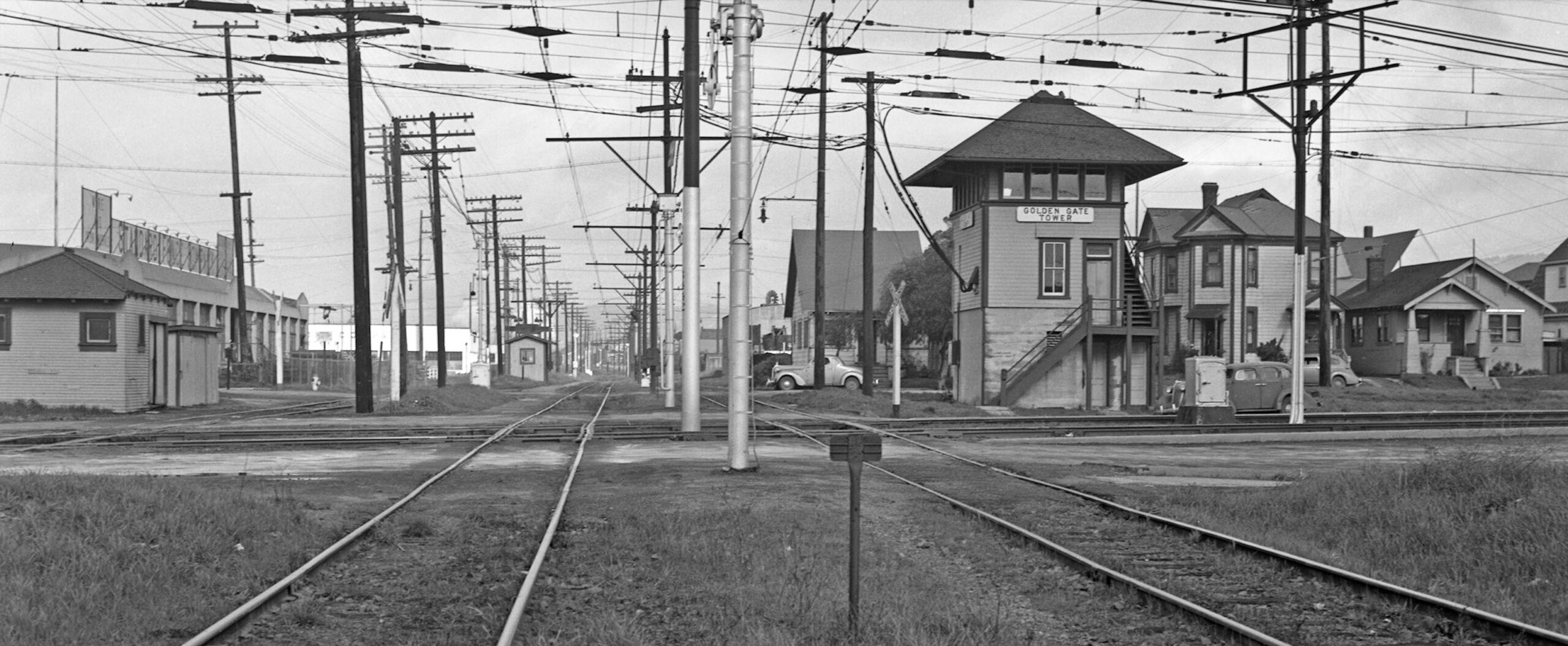
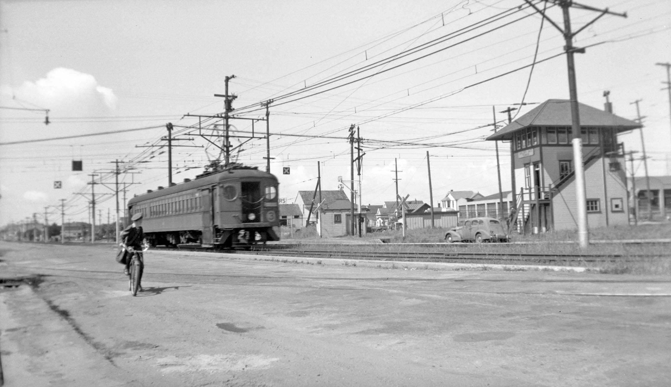
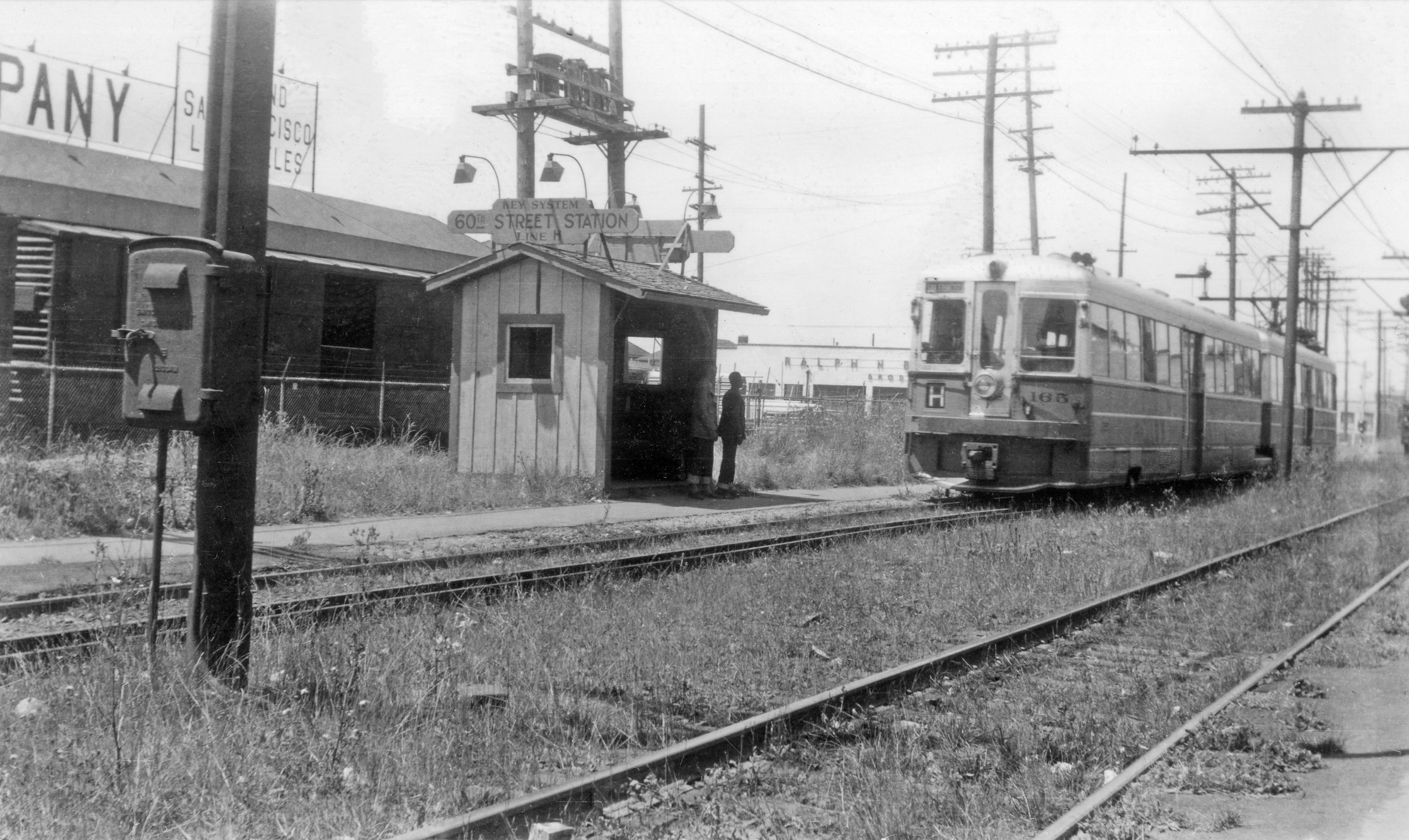
A north view taken south of the crossing between the H line tracks on Jan. 23, 1941 shows, starting left to right, or west to east, a Santa Fe shed, Cyclone Fence-Standard Fence, Iron and Wire Works, the Key 60th St. station shelter, and the Golden Gate Tower. The white building in the background to the left of the shelter is part of the Ralph N. Brodie Co. meter factory. The houses behind the tower are nos. 950, 944 and 942 60th St., all still around in 2023. Only no. 944 was present in the 1903 Sanborn map.
L293-115-Key System Photo, Courtesy John Harder, (Image 23 of 35)
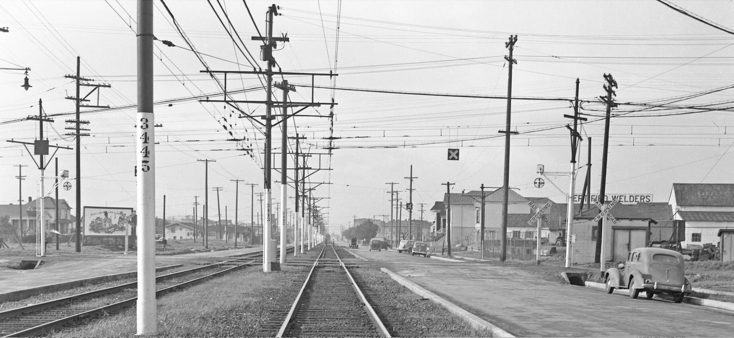
The overhead “x” indicating a railroad crossing to auto traffic in the foreground marks another view of the Lowell St. crossing on Jan 23, 1941, taken east of it from the west-bound SP track and viewed to the west. The second overhead “x” in the background is for the freight spur sans overhead wire marked by the magenta arrow in image L293-110. The numbers on the SP catenary poles also allow for locating of this image.
L293-120-Key System Photo, Courtesy John Harder, (Image 24 of 35)
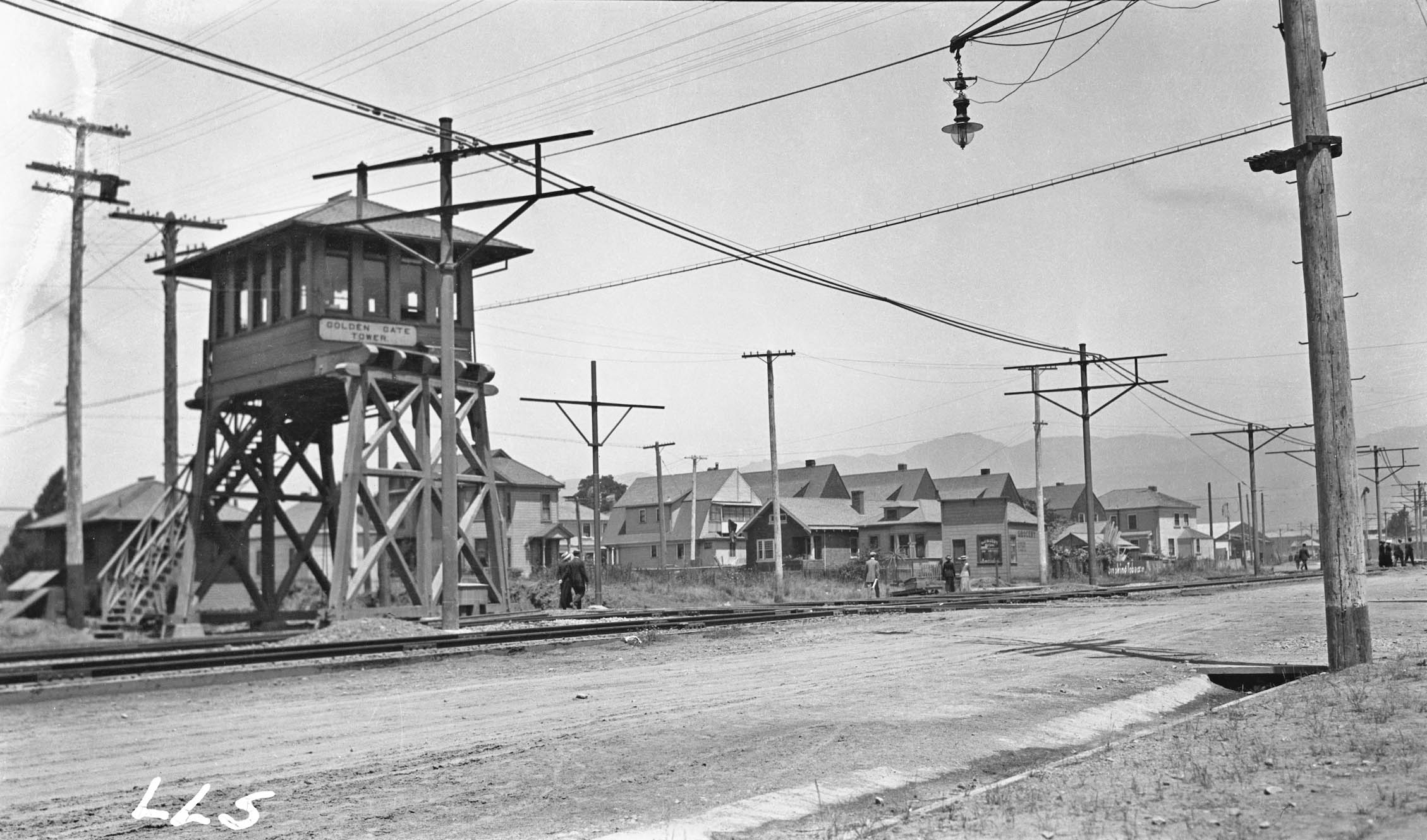
This northeast view from Aug. 5, 1911 shows the original Golden Gate Tower erected by the Santa Fe. The catenary poles had been erected for the Key Northbrae line, slated to start running in December of that year. At this point, the tower monitored activity, but it did not possess the ability to control the interlocking signals guiding rail traffic. Note the presence of no. 944 60th St. behind the tower, and on the disjointed half of 60th st. in the background, four examples of 1890’s High-Peaked Colonial Revival architecture, all still intact in 2023.
L293-125-Key System Photo, Louis L. Stein Collection, Courtesy BAERA, Western Railway Museum Archives, 29456ier, (Image 25 of 35)
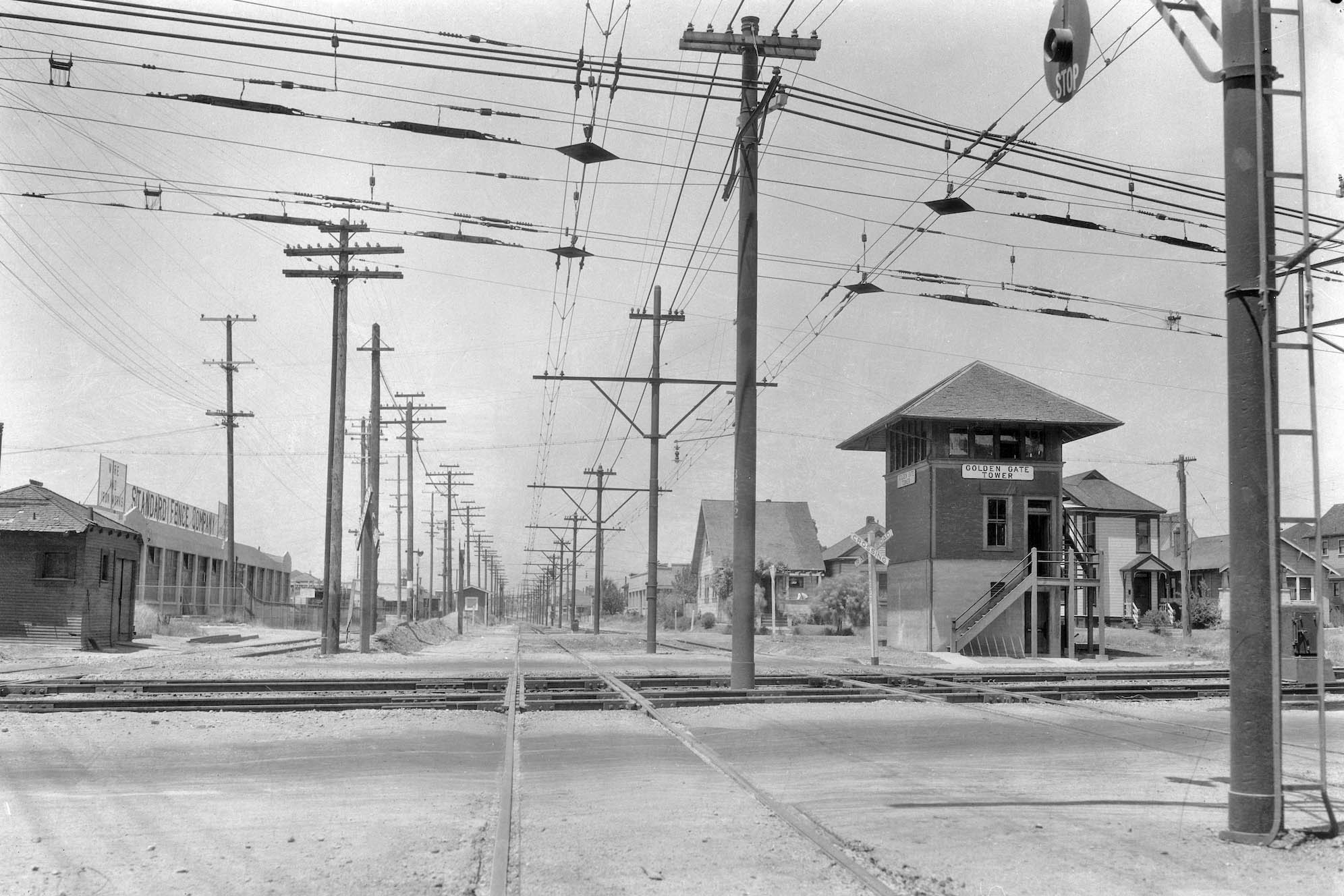
Page one of the Jan. 23, 1915 Oakland Tribune reported that the State Railroad Commission ordered the tower to be replaced with a first-class interlocking tower. The Key, having the greatest stake here in terms of rail traffic versus the Santa Fe, was to bear the greater part of the expense, a problem since they were in dire financial straits. The Key and Santa Fe were also required to place automatic bells or flagman at the crossing. This north view from 1921 shows the tower before the top part was painted. The building to the far left in this image appears to be more of a shelter for passengers or a flagman.
L293-130-Sappers Collection, Courtesy BAERA, Western Railway Museum Archives, 25357sp, (Image 26 of 35)
This northeast view of a passing an I.E.R. Shattuck express train on July 16, 1941 captures the overhead “x” for the Lowell St. crossing on both sides, and, in addition, a second one in the background to the right or south of the train. This spur track was marked by a black arrow in L293-110 ca. 1924-1925 serving National Ice and Cold Storage Co. That structure was razed by 1931 based on an aerial view, but the catenary wire shown in L293-100 corresponds to that track.
L293-135-Richard Jenevein Photo, Courtesy BAERA, Western Railway Museum Archives, 13268ier, (Image 27 of 35)
This southwest view of an oncoming I.E.R. Shattuck Ave. local was taken on July 16, 1940. It shows the two “x” crossing signs as previously discussed north of the tracks, but also that the track coming in from the south, to the left of the train, is lined by catenary poles. There is no other known example of a freight spur or siding having overhead wire for the SP in the East Bay. The track appears overgrown, and actual wire between the poles is not evident.
L293-140-Addison Laflin Photo, Courtesy BAERA, Western Railway Museum Archives, 70122ier, (Image 28 of 35)
Another view, this one to the northwest from Apr. 7, 1941, shows an I.E.R. Shattuck Ave. local and a biker who has just passed over the spur of interest. Note again that there is no evidence of catenary wire over the track. No images could be found showing a connection of this track to the Key H line, a problem to consider since the railways used different voltages. More research needed on this finding.
L293-145-Gresham Beauchamp Photo, Kyhn Coll., Courtesy BAERA, Western Railway Museum Archives, 76220ier, (Image 29 of 35)
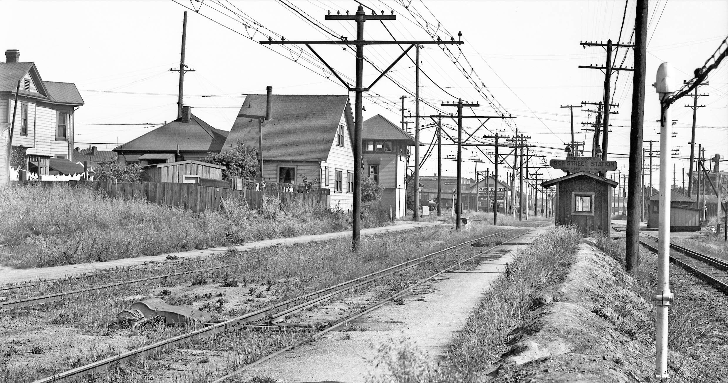
Once north of the the tower, H line trains stopped at a small shelter at 60th St. as shown in this south view from 1934. As previously noted, the house to the immediate left or east of the right-of-way, no. 950 60th St., is still present in 2023.
L293-150-Key Official Photo, Sappers Collection, Courtesy BAERA, Western Railway Museum Archives, 171256ks, (Image 30 of 35)
This northwest view shows Key 165 line approaching the 60th St. stop where two passengers wait at the shelter in July 1941. In the distance is Ralph N. Brodie Co.-Universal Meter Co. at no. 950 61st St. Started in 1928, Brodie invented the BiRotor Meter and Control Valve. Behind the shelter is Cyclone Fence-Standard Fence, at no. 950 60th St., present since at least 1925. The boxcar is on the Santa Fe siding from the north. By 1941, the fence outfits had been acquired by the US Steel subsidiary American Steel and Wire, but remained at this location.
L293-155-Peter Kyhn Collection, Attributed to Robert Burrows, Courtesy BAERA, Western Railway Museum Archives, 175220ks, (Image 31 of 35)
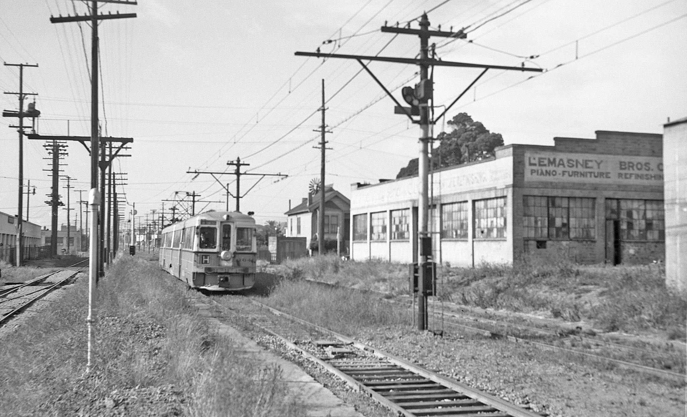
Key unit 164 is seen heading to San Francisco after crossing 61st St. in 1941. To the right is Lemasney Bros. Co. furniture refinishers, who shared the building at no. 947 61st St. with Herman Goelitz Candy Co. at no. 943. The latter was there since the early 1920s and would later gain fame as the producer of Jelly Belly jelly beans. Across 61st St is no. 946, a Victorian house that is present in the 1903 Sanborn map. Both buildings are present in 2003. The Santa Fe siding track to the left or west of the Key served the Cyclone Fence-Standard Fence.
L293-160-Addison Laflin Photo, Courtesy BAERA, Western Railway Museum Archives, 50262ks, (Image 32 of 35)
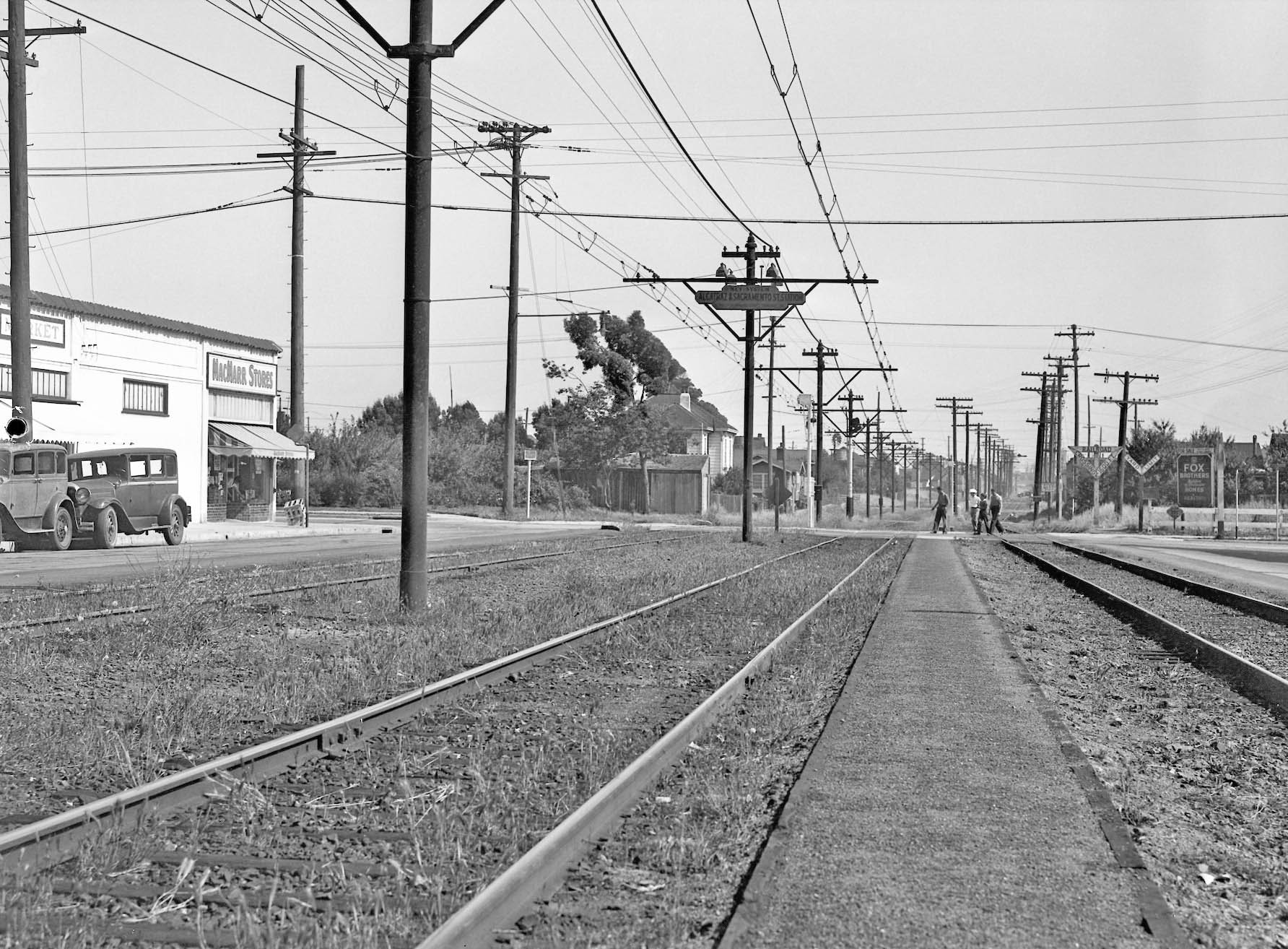
This south view from 1934 was taken just north of Alcatraz Ave. in Berkeley. The street alongside the private right-of-way of the two H line tracks and single Santa Fe track is now Sacramento St. Note the MacMarr store on the northeast intersection. A detail follows.
L293-165-Key Official Photo, Sappers Collection, Courtesy BAERA, Western Railway Museum Archives, 171257ks, (Image 33 of 35)
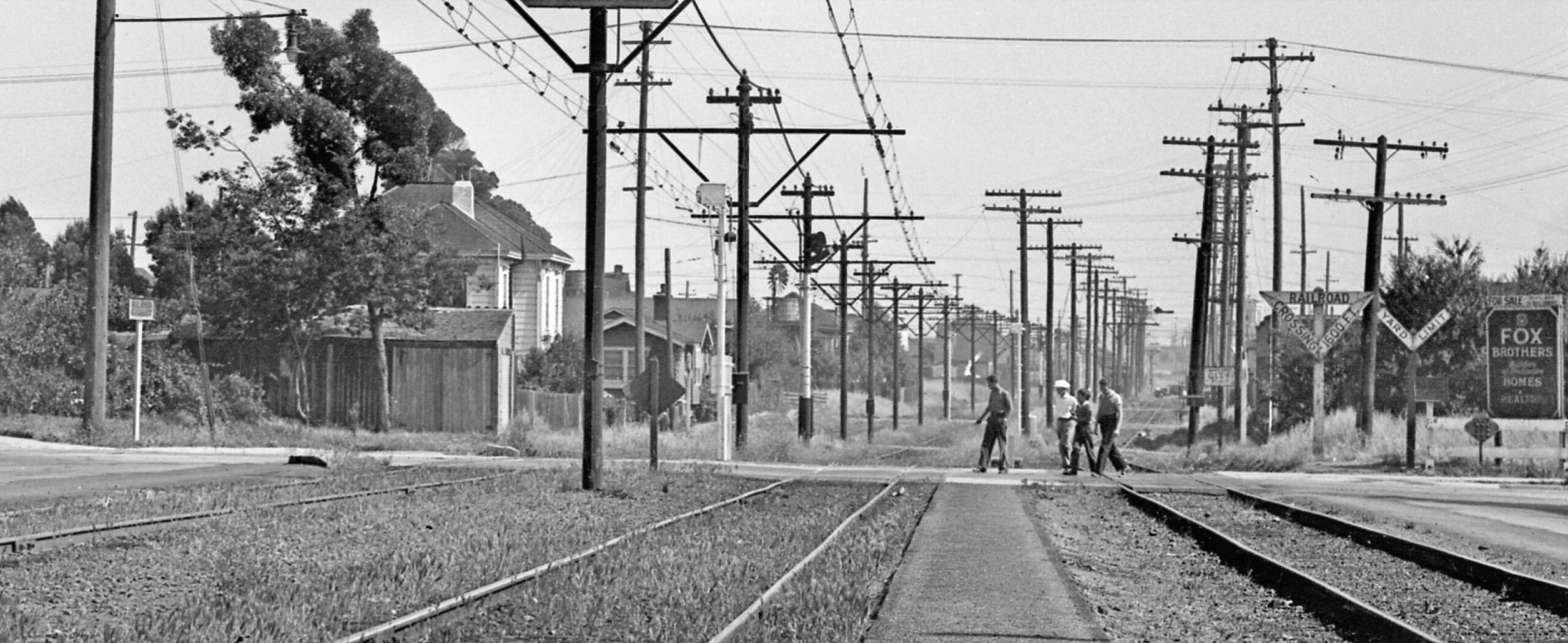
This detail from the south view from 1934 shows that the railroad tracks filled the entire width of Lowell St., and the creation of an automobile-navigable Sacramento St. required widening the road north of Alcatraz Ave. Note the residential nature of the both sides of Lowell St., a situation that would not change until the 1950s.
L293-170-Key Official Photo, Sappers Collection, Courtesy BAERA, Western Railway Museum Archives, 171257ks, Detail, (Image 34 of 35)
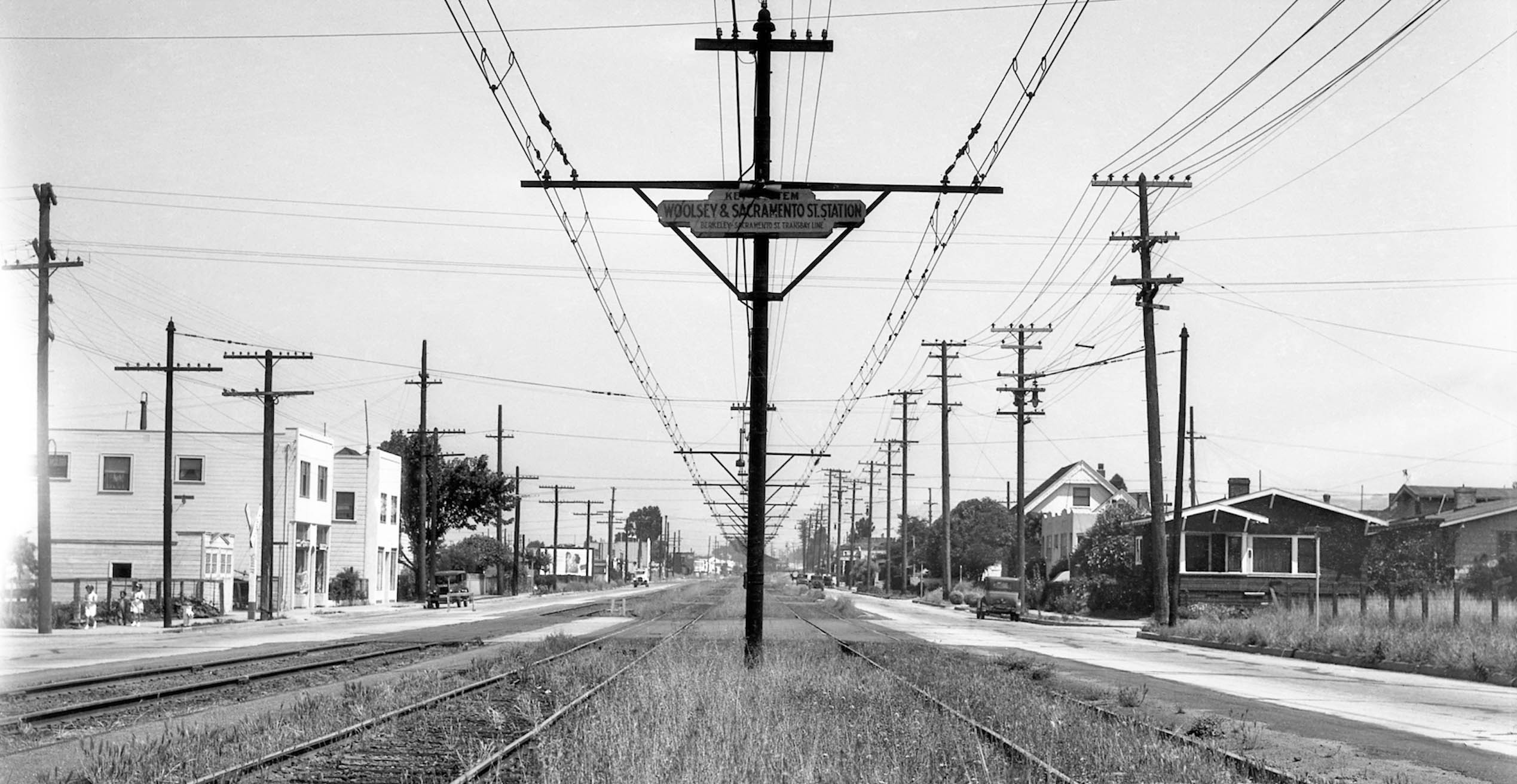
A final north view taken from the H line Woolsey St. station stop in 1934 is shown here. The corner house to the right, or east, is still in place in 2023, as are the two white buildings on the west side. The transformation of the Lowell St.-Sacramento St. between 1941-1965 is slated for next time. Appreciation to John Harder and Ron Hook for discussions and images, and to Betty Marvin for the 1953 aerial view.
.
L293-175-Key Official Photo, Sappers Collection, Courtesy BAERA, Western Railway Museum Archives, 171258ks, (Image 35 of 35)