Melrose Moments in the 20th Century – IER and Bridge Railway
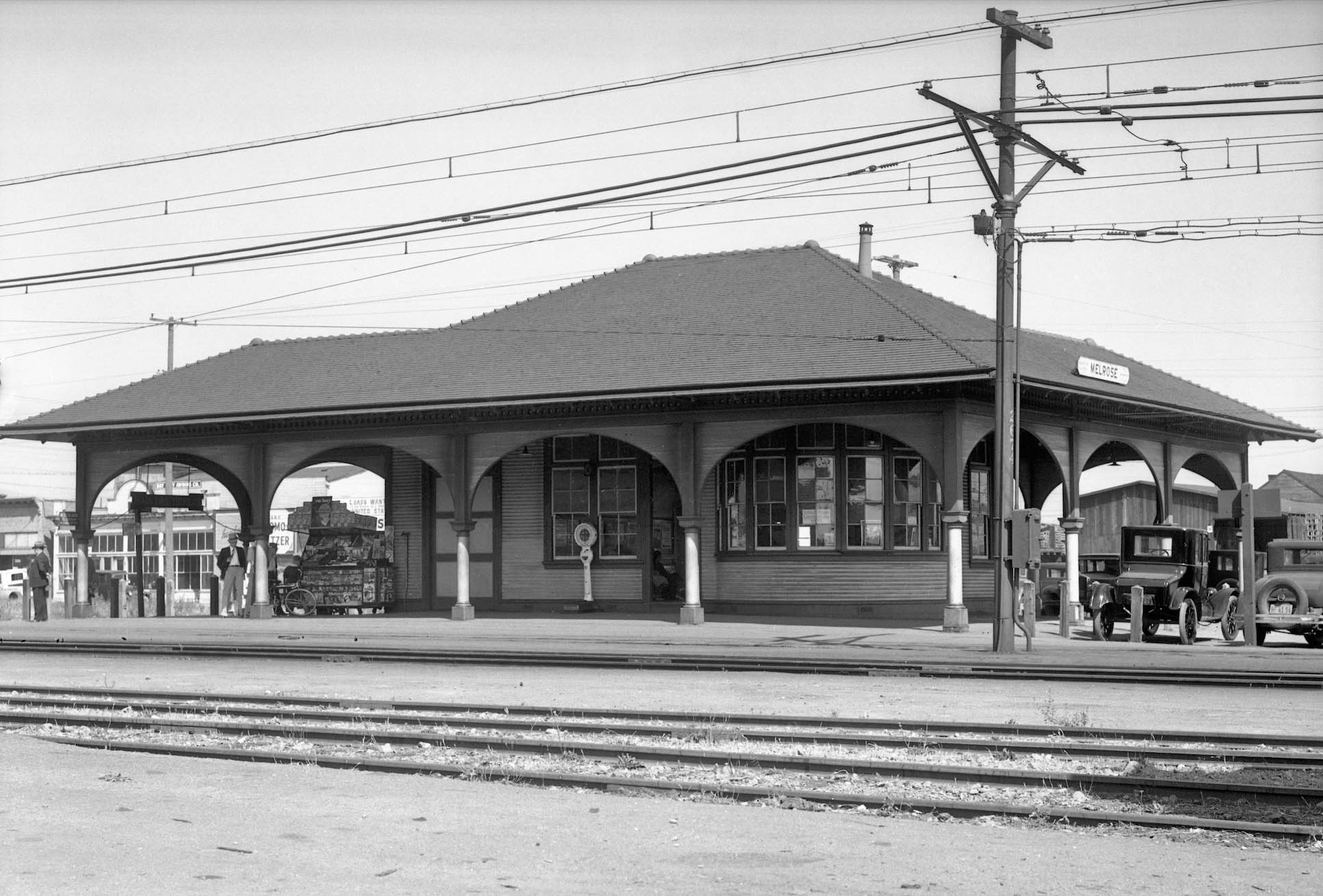
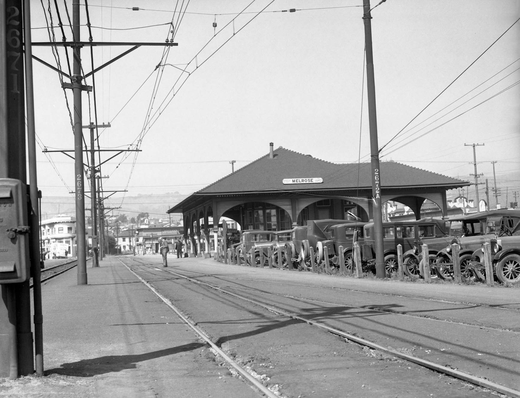
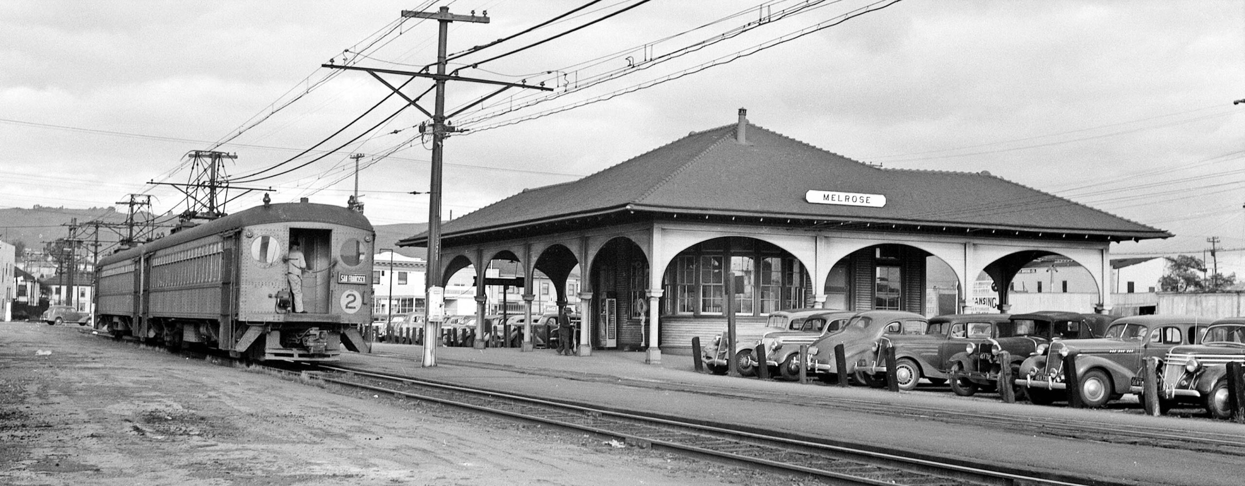
All appears quiet at the Melrose depot in 1934 in this east view. According to Robert Ford in “Red Trains in the East Bay”, all is not well with the Southern Pacific’s, SP’s, electric lines. As a collective, the electric venture had lost money from the onset, and the 1930s saw a year-by-year decrease in ridership from the steady numbers of the 1920s. Consider that by 1916, the electrics brought in 1.8 million dollars versus an operating cost of 2.3 million dollars. That deficit did not include debt payments for building the system.
L297-05-SP Official Photo, Courtesy BAERA, Western Railway Museum Archives, 170959oa&b, (Image 1 of 28)

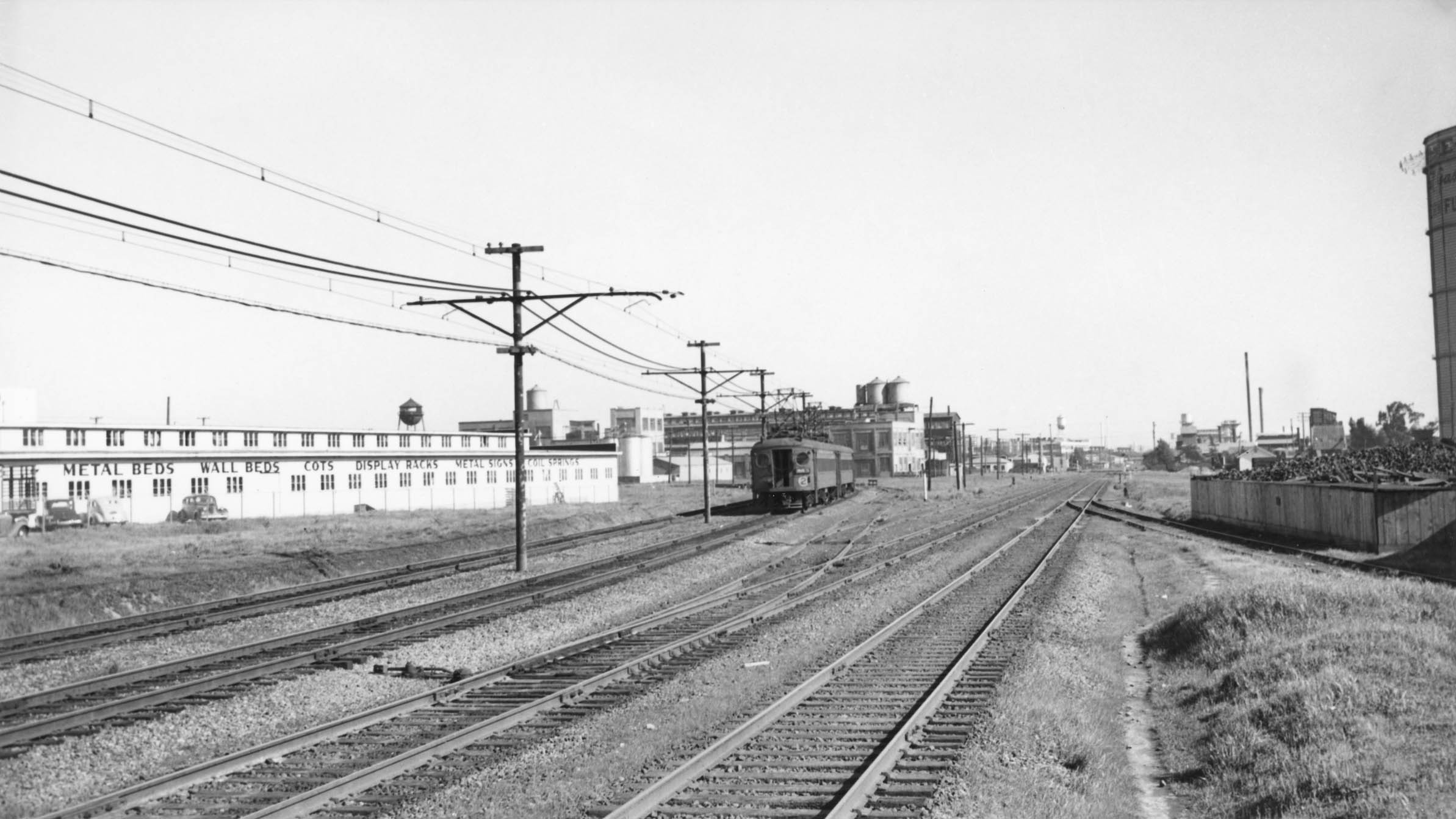
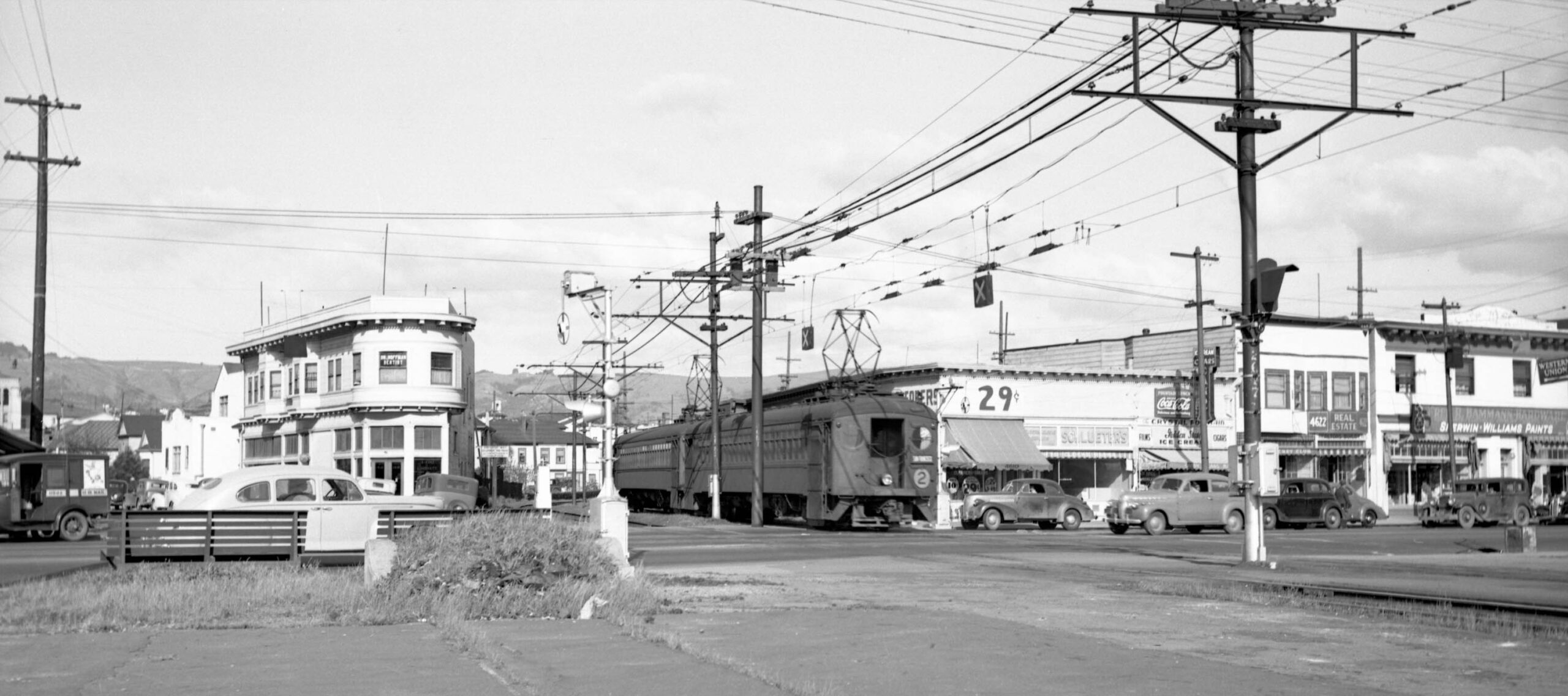
Competition from the Key System, Key, and high labor costs also added to the system’s woes. On the subject of the Key, the higher labor costs and the double the voltage requirement of the SP versus the Key had prevented earlier attempts at a merger. Upkeep was another issue, the track bed looks past its prime in this northeast view from 1934 at Melrose. The SP had been looking for a buyer of the system almost from the onset, but there were no takers.
L297-10-SP Official Photo, Courtesy BAERA, Western Railway Museum Archives, 170960oa&b, (Image 2 of 28)
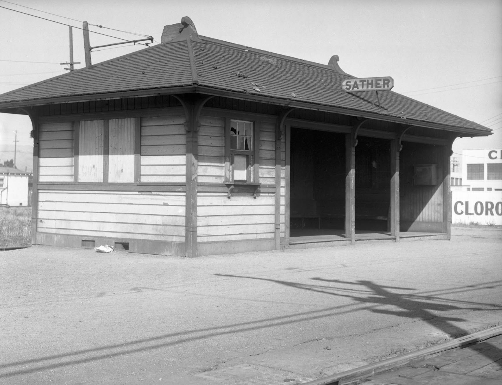
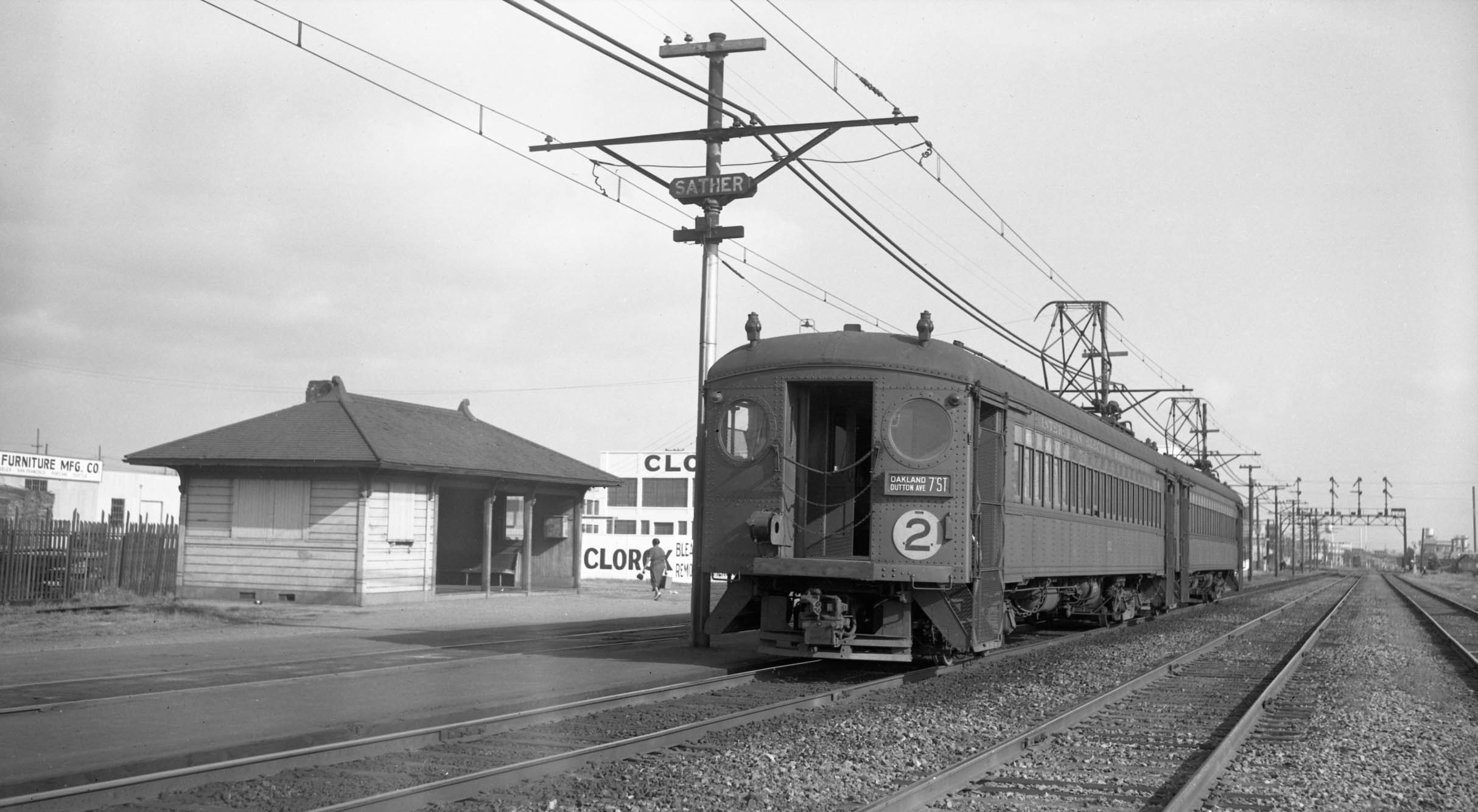
Further neglect is evident in this northeast view of the shelter at Sather from 1934. Unable to keep raising fares, both the SP and Key increased the waiting time between arrivals at a stop, or headway, on Sunday, holidays and after 7 PM on weekdays in early 1932 to reduce costs.
L297-15-SP Official Photo, Courtesy BAERA, Western Railway Museum Archives, 170962oa&b, (Image 3 of 28)
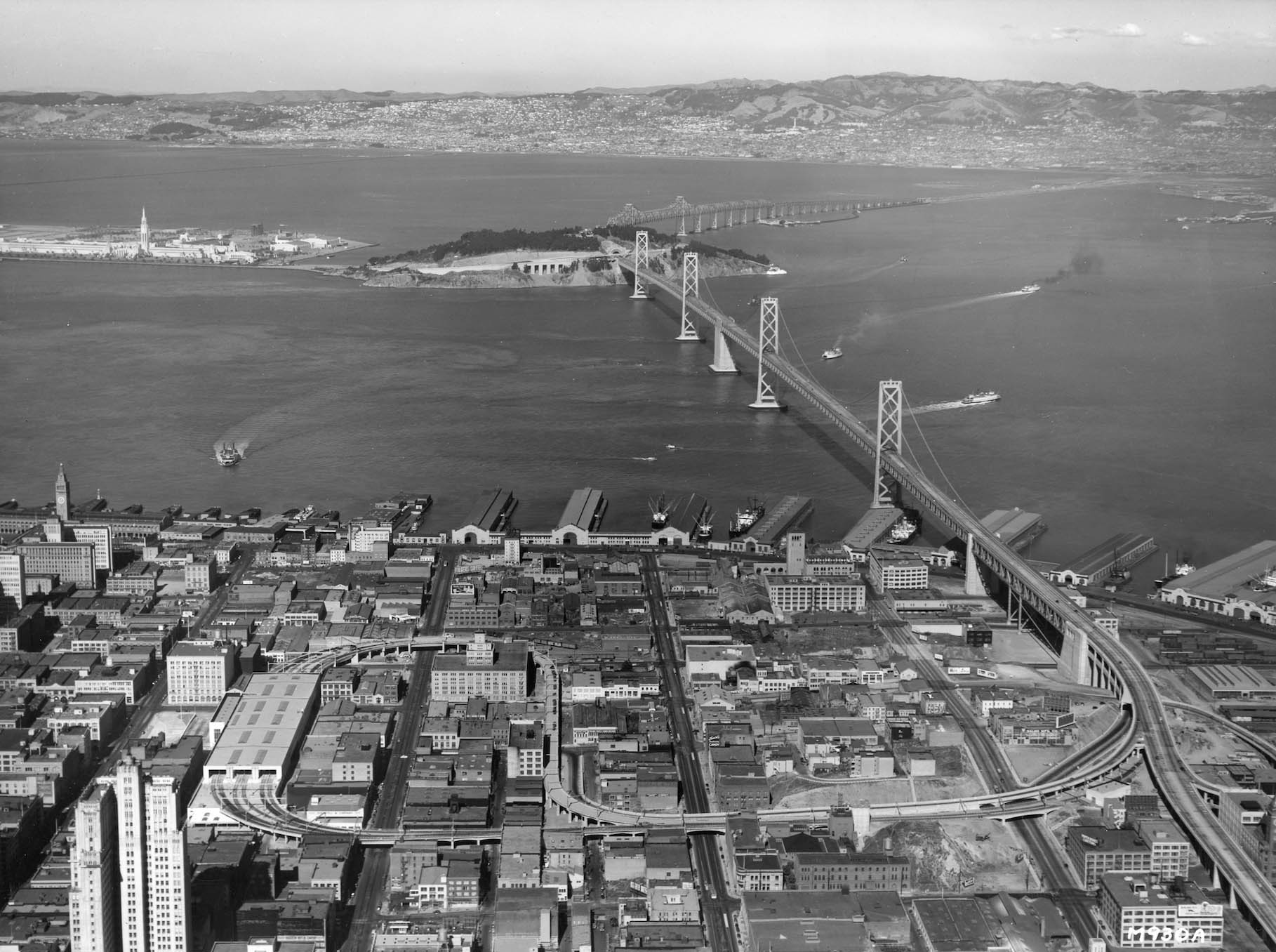
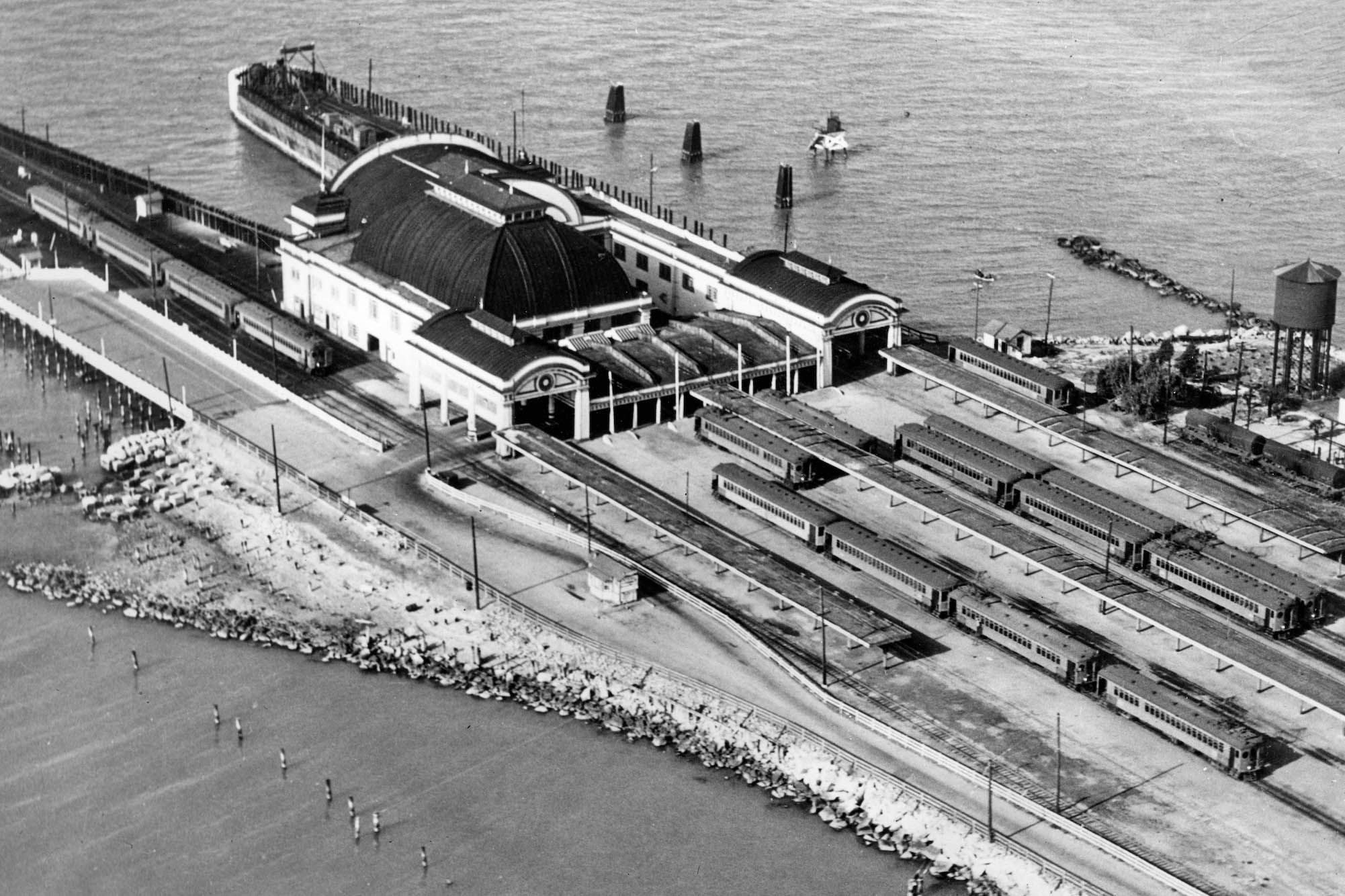
The next factor was the construction of the Bridge Railway during the 1930s, the electric railway link from the East Bay over the Bay Bridge to the San Francisco Transbay Terminal. This link would have a finite capacity, providing the SP and Key with an opportunity to cut lines to eliminate competition to produce a “Composite Equivalent.” This west view from late 1938 shows the terminal in its final phase of track construction for its opening on Jan. 15, 1939.
L297-20-Courtesy John Harder, (Image 4 of 28)
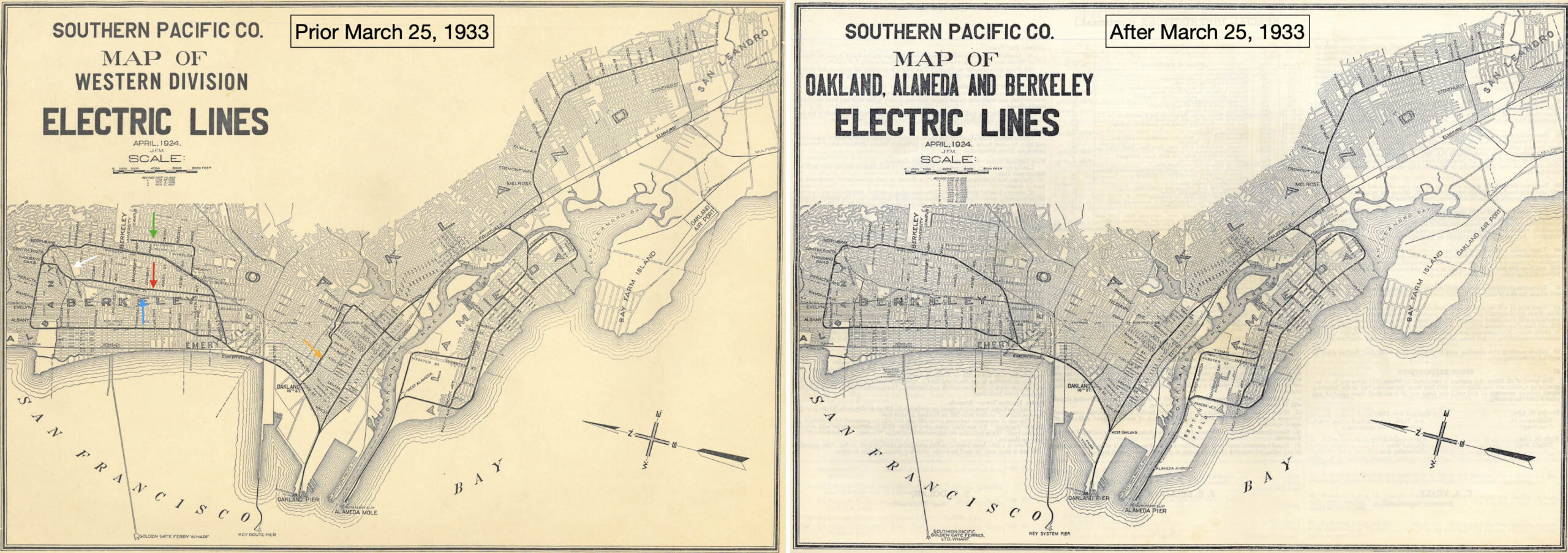
The SP and Key requested the elimination of duplicate lines to the Railroad Commission of California, RCC, in early 1933. Formation of a “Composite Equivalent” had its origins from opponents to requests by the SP and Key to the RCC for fare increases in 1918. That plan differed in that the Webster St. and Harrison St. bridges were still in place to allow additional flow between Alameda and Oakland in addition to the Fruitvale Bridge. Ref: http://cdnc.ucr.edu
L297-25-Courtesy of the California Digital Newspaper Collection, Center for Bibliographic Studies and Research, University of California, Riverside, (Image 5 of 28)
After Mar. 25, 1933, the SP Ellsworth St. Line, green arrow, California St. Line, red arrow, and 18th St. line, orange arrow, would be eliminated, while the Key would have its Shattuck line, turquoise arrow, cut back to Alcatraz Ave., and its Sacramento St. line would be rerouted onto the eastern end of the abandoned SP California Line, and lose its Hopkins St. segment, white arrow.
L297-30-Courtesy BAERA, Western Railway Museum Archives, 51930, l, 13650, r, (Image 6 of 28)
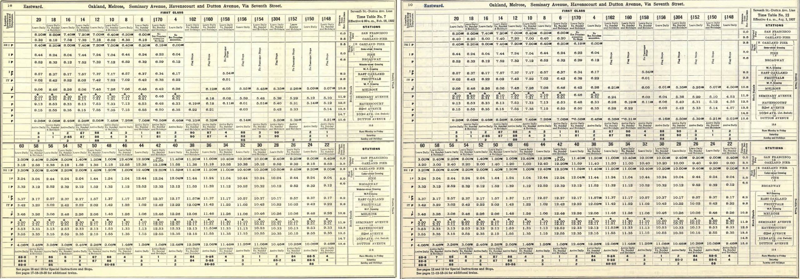
The SP 7th St. Line had no competition from the Key, and the non-competitive directive led to no diminution in service beyond that imposed in early 1932. That is supported by comparing timetables utilizing the Oakland Pier from before, left, or after, right, 1933. Although showing only the first page to conserve space, the 1932, left, and 1937 right, timetables are the same save for a few minor time variations.
L297-35-Courtesy BAERA, Western Railway Museum Archives, 51930, l, 13650, r, (Image 7 of 28)
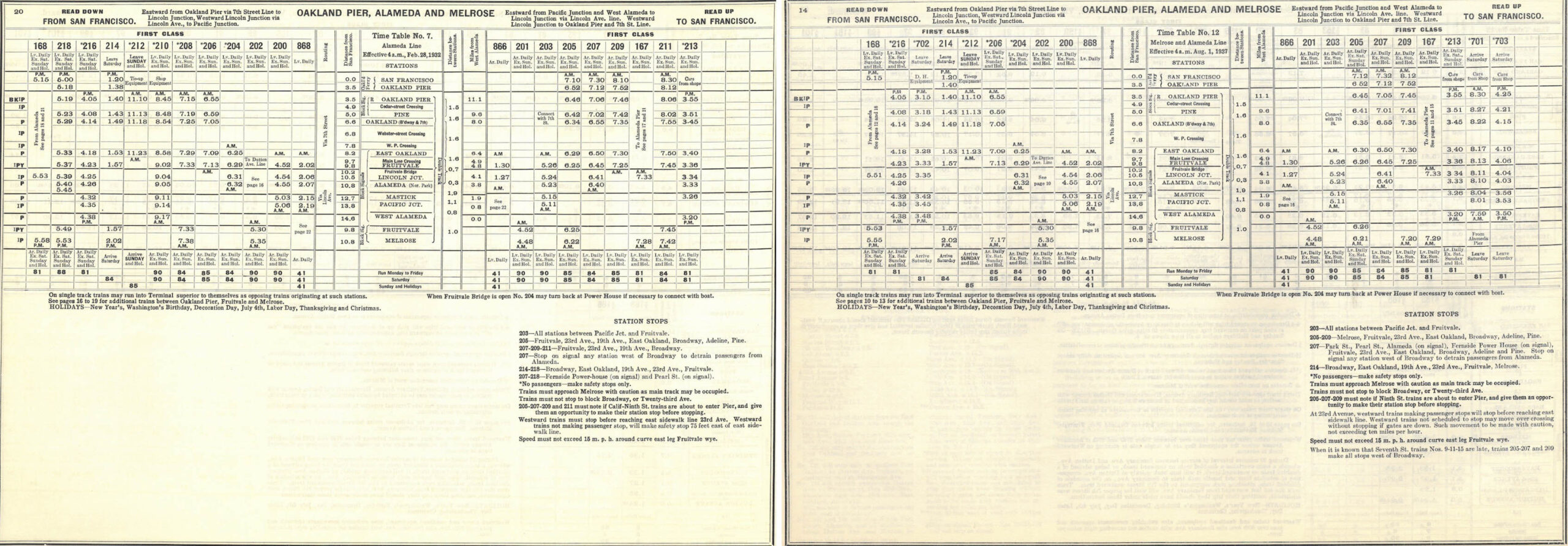
The few 7th St. Line rush-hour trains through Melrose to the Alameda Pier were reduced by only one less train from San Francisco in the morning, and some very minor time changes using the same comparison from 1932, left, and 1937, right, this time showing the full daily schedule.
L297-40-Courtesy BAERA, Western Railway Museum Archives, 51930, l, 13650, r, (Image 8 of 28)
Next, on Nov. 16, 1934, the Key and SP had asked the RCC to abandon its ferry lines. This would include closing the Alameda Pier and the track leading to it, and the Key Pier. The SP would continue to operate ferries to the Oakland Pier to accommodate passengers using its steam-powered Western Division lines. Harre Demoro noted in “The Key Route” that the Key lost the most as it had newer ferries and only one pier.
L297-45-George Russell Photo, Courtesy the California State Lands Commission, API 650_5_BOX 92, (Image 9 of 28)
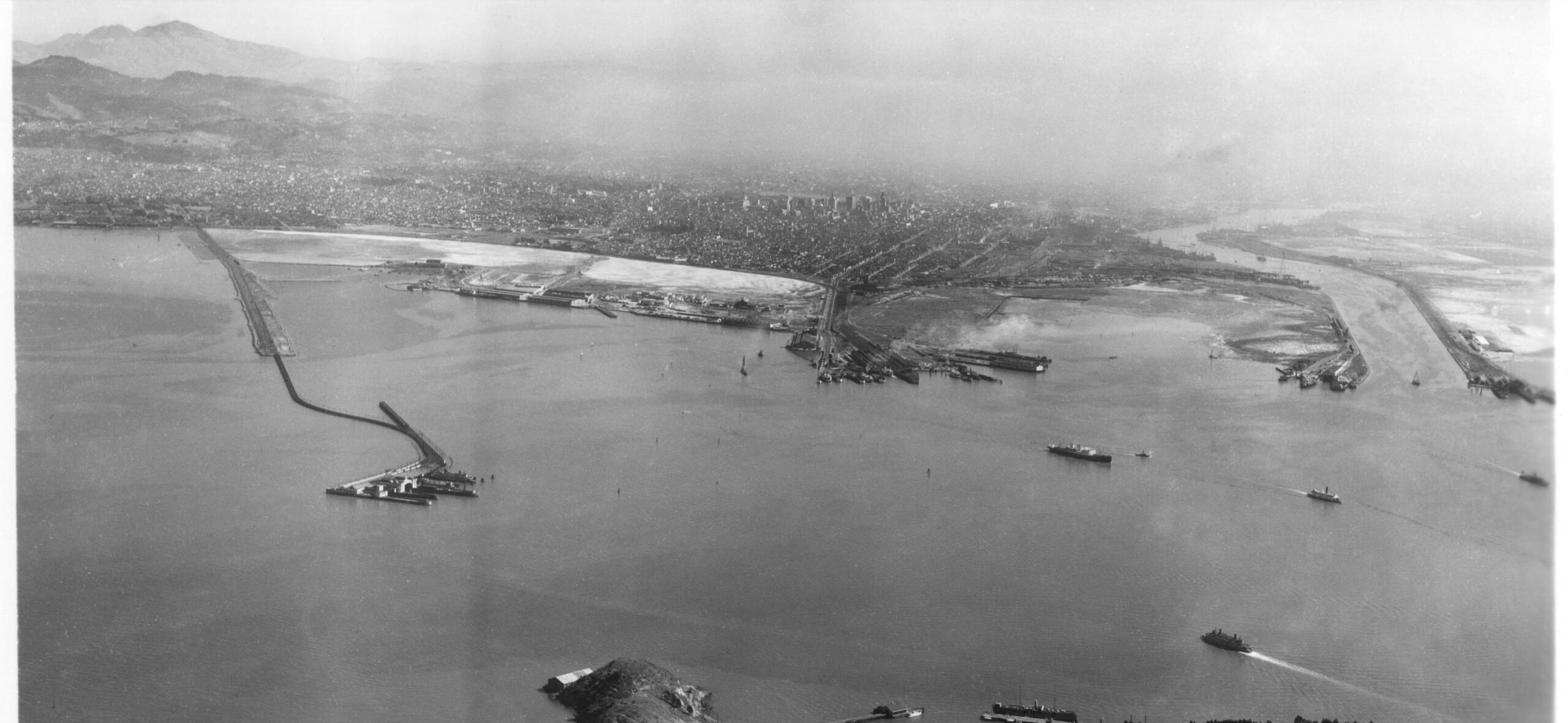
The loss of the SP’s Alameda Pier, seen here in a north view form 1936, would impair the SP’s monopoly on the island. By 1934, the bridges extending Webster St. or Harrison St. from downtown Oakland were gone. This would leave only one route for the SP in and out of Alameda, via the Fruitvale Bridge. With no pier, this would increase the SF-West Alameda commute time from 25 to 53 minutes, but reduce the time to West Alameda by 5 minutes.
L297-50-Courtesy BAERA, Western Railway Museum Archives, Sappers Collection, 23430SPOAB, (Image 10 of 28)
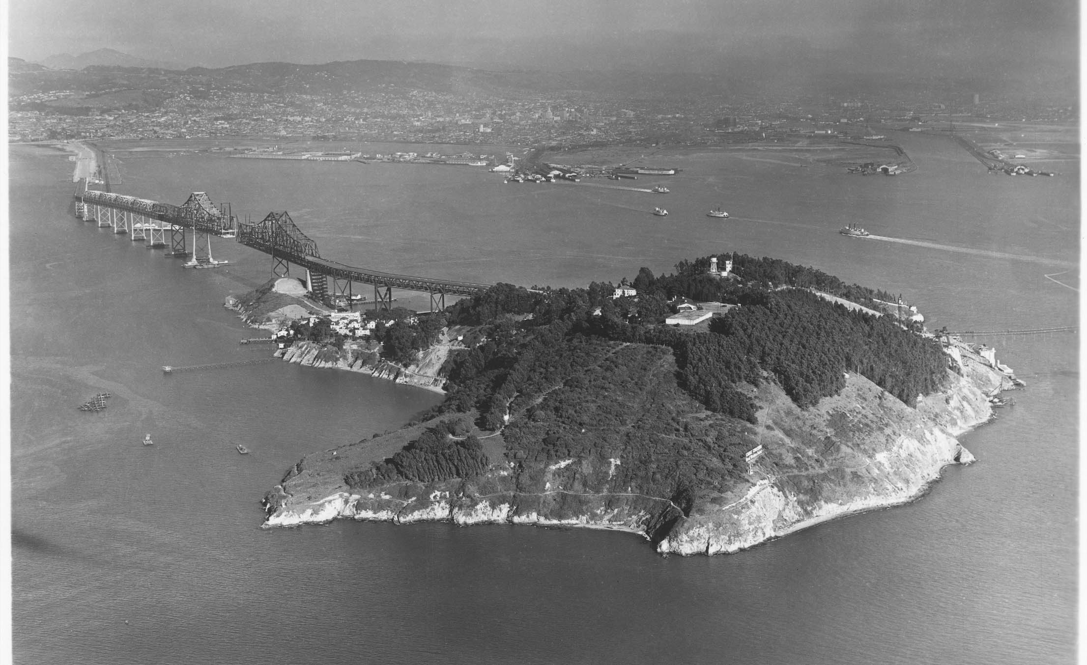
Construction of the Bay Bridge began on July 9, 1933 without any agreements with the three railways that would use it. The east view shown here is undated. The SP formed the Interurban Electric Railway Co, IER, as a wholly-owned subsidiary of the SP on Nov. 14, 1934 to assume operation of the electric lines over the bridge. Ford notes that the new company was capitalized at 200k dollars. This eliminated the electric trains from the rest of SP business.
L297-55-George Russell Photo, Courtesy the California State Lands Commission, SLC_517.21, (Image 11 of 28)
Individual agreements between the California Toll Authority and the IER, Key and Sacramento Northern Railway, SN, were completed by Mar. 6, 1936. Construction of the Bridge Railway began on Nov. 29, 1937, preceded only by excavation for the Transbay Terminal on July, 29 1937. John Signor in “SP”s Western Division” points out that the agreement delay was the major reason pushing out electric train traffic on the bridge to Jan. 15, 1939.
L297-60-Courtesy BAERA, Western Railway Museum Archives, 13650, l 51969, r,, (Image 12 of 28)
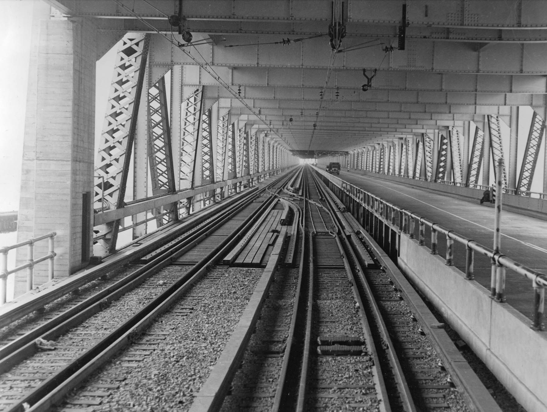
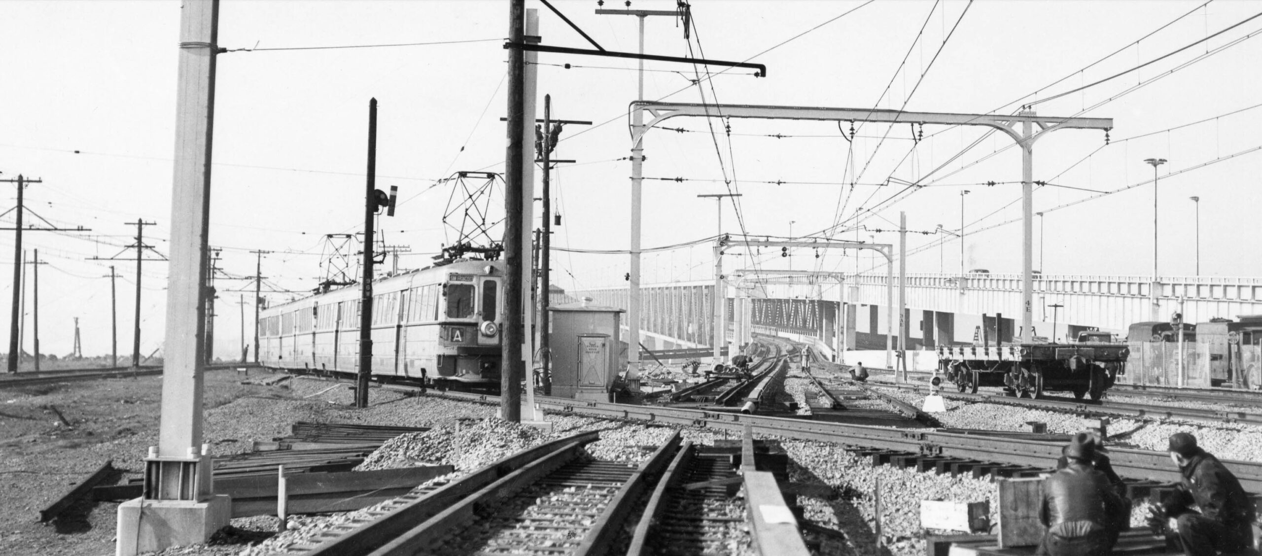
A question that is not addressed in any writings on this subject is why it took so long to get the agreements in place. The SN was merely a lessee of the Key, would have a low volume of trains, and could employ either the 600V that the Key required, or the 1200V the IER required. This ca. 1939 southwest view on the bridge shows the overhead wire for the SP and SN, and the third rail for the Key.
L297-65-California Toll Bridge Authority Photo, Courtesy BAERA, Western Railway Museum Archives, 205191ks, (Image 13 of 28)
Demoro notes the State required some Key fill closer to the Bay, and some of their yard in Emeryville for vehicular traffic. The transition from the Key Pier to the new bridge was a trivial shift of two short segments of track as seen in this southwest view ca. 1938 of an A train still using the pier. The entire system’s right-of-way for both Key and SN was essentially unaffected by the new route. The train in this image is about to cross the new SP tracks.
L297-70-Robert Hannah Collection, Courtesy BAERA, Western Railway Museum Archives, 176224ks, (Image 14 of 28)
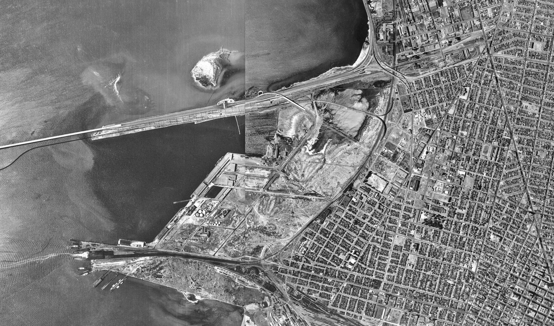
Both Signor and Demoro write that the SP informed the Authority it could no longer proceed with the Bridge Railway plan on Nov. 19, 1934. Signor attributes the delay related to SP’s labor unions’ concerns about job losses. Whatever time delay this caused, the plan to add a significant amount of additional track and a bifurcated flyover structure to the IER right-of-way was not formulated without any sense of urgency. The annotated aerial from 1939 addresses the changes.
L297-75-Courtesy of UC Santa Barbara Library Geospatial Collection, c-5750_290-4, l, c-5750_289-102, r, (Image 15 of 28)
A blank copy of the 1939 aerial is supplied here for further inspection.
L297-77-Courtesy of UC Santa Barbara Library Geospatial Collection, c-5750_290-4, l, c-5750_289-102, r, (Image 16 of 28)
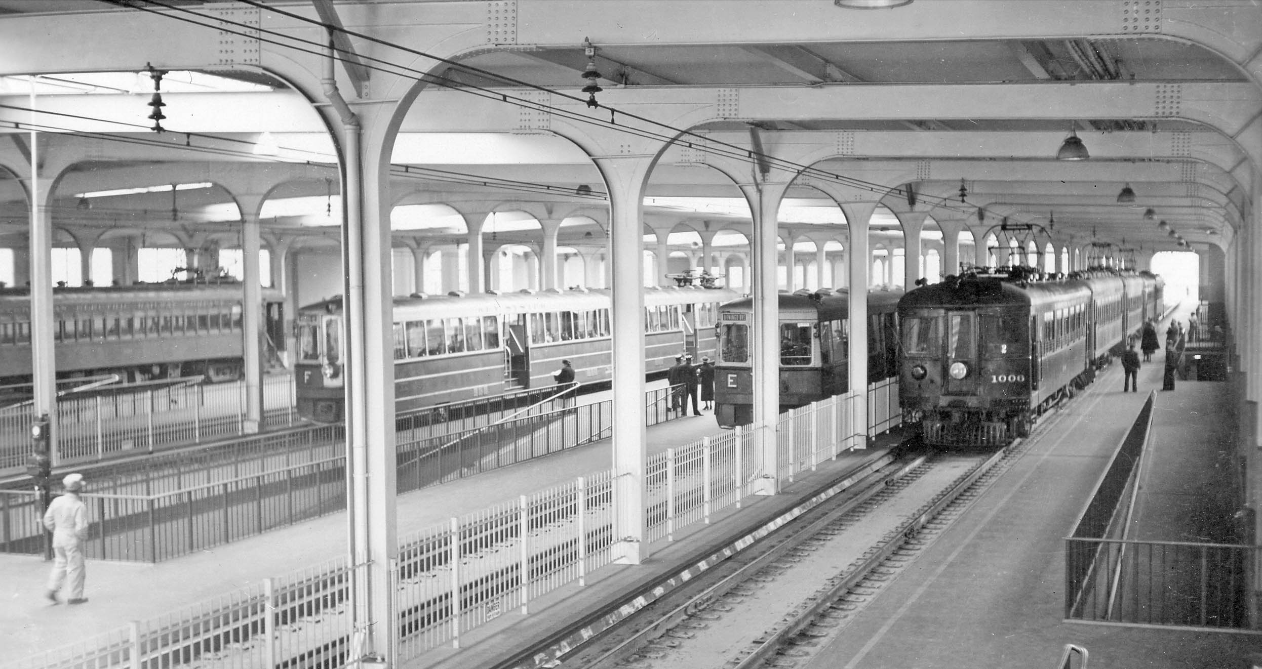
The new system was opened on Jan. 15, 1939. This north view ca. 1940 shows the train order east to west, right to left. Fencing separates SN 1006 and four trailers on track 6 from track 5 occupied by a Key E Line train and track 4 with a F line train. A fence also isolates the IER, occupying only one of its three tracks, track 2. One can only speculate on how the 26 month difference between bridge completion and railway completion got commuters comfortable using a bus or their own car to cross the bridge.
L297-80-Harold Hill Photo, Courtesy BAERA, Western Railway Museum Archives, 173193key, (Image 17 of 28)
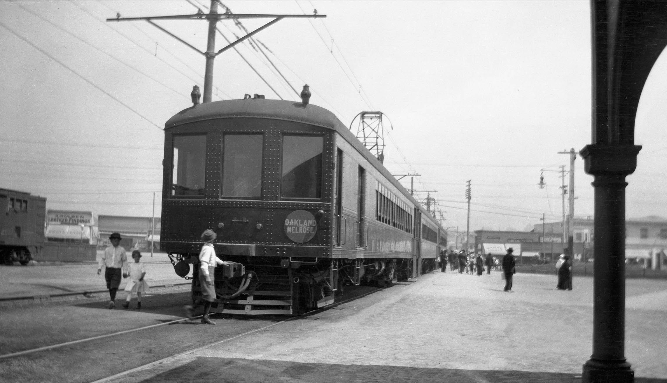
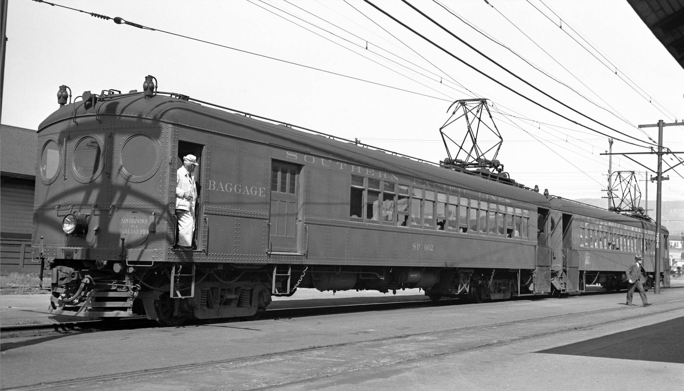
This northeast view ca. 1912 begins a review of trains at the Melrose station. SP cars were steel and designed to carry lots of passengers; very long cars, wide platforms, and packed with ratan walkover seats, coach cars carrying up to 116 passengers. The large windows provided excellent visibility. Delivered with a dark olive green exterior, the SP eventually painted the cars cherry red to increase their visibility in bad weather over the ensuing years.
L297-85-C. O. Clark Photo, Thickens Collection, Courtesy BAERA, Western Railway Museum Archives, 63299sp, (Image 18 of 28)
Very shortly into operation, the large windows were demonstrated not to be safe in the event of a collision, so the SP began replacing these windows used by the motormen with round porthole windows, and less so on trailer cars. According to Ford, the next set of new cars ordered from Pullman in 1912 all had the round window design. Pictured here in a north view at Melrose Station on Mar. 10, 1936 are baggage combo 602 and combo 627.
L297-90-Charles Savage Photo, Courtesy BAERA, Western Railway Museum Archives, 10736 SPOAB, (Image 19 of 28)
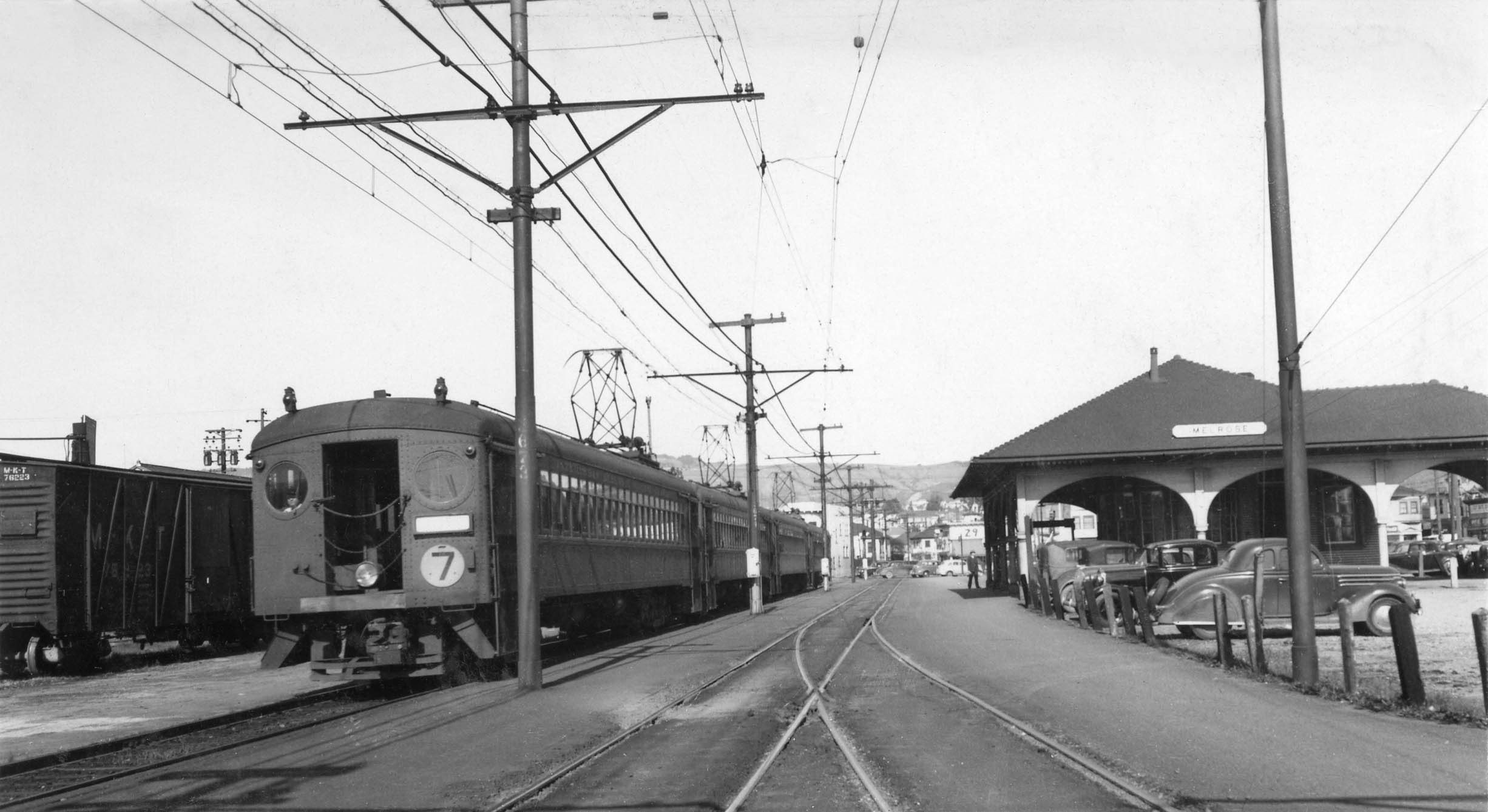
The last version of car appearances signaled the creation of the IER. Shown here in a northeast view from 1940, the lead car now has a number 2 afixed to it, designating it as the 7th St. Local. The IER took over operations of the system on Dec. 1, 1938. Ford notes they would pay the SP 50k dollars a year for renting the system.
L297-95-Waldemar Sievers Photo, Courtesy John Harder, (Image 20 of 28)
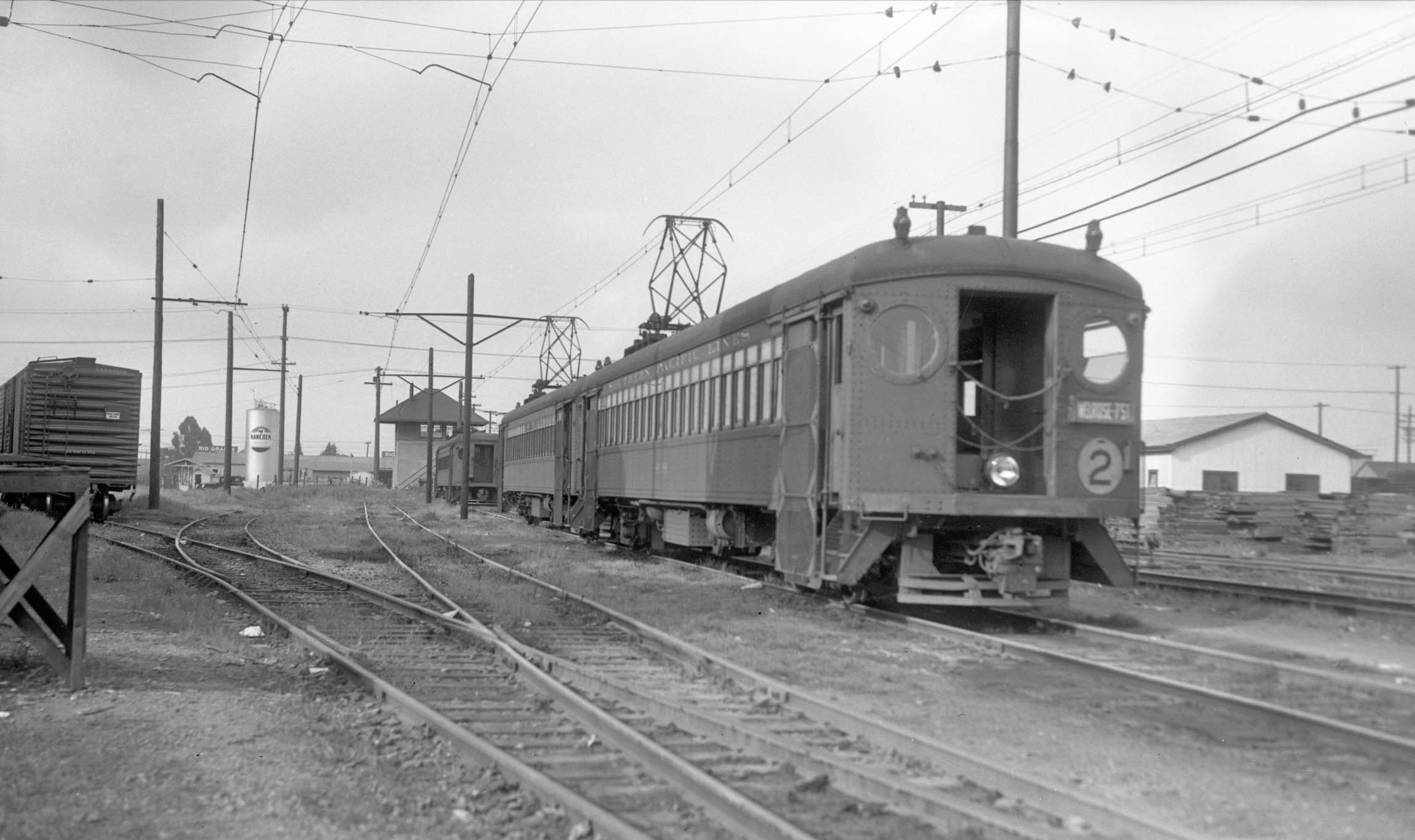
This final segment will follow IER trains from the north through the Melrose area and provide some additional history. A two-car 7th St. Local sits at the Sather shelter ca. 1940. Ford presents tabulated data to show how the 7th St. line outperformed the rest of the system. In 1919, the line accounted for one-third of the total SP passenger traffic in the East Bay against the other 10 lines combined, and brought in 40 percent of the total revenue.
L297-100-Vic DuBrutz Photo Courtesy BAERA, Western Railway Museum Archives, 81900ier, (Image 21 of 28)
A 7th St. Local curves off the SP mainline at 45th Ave. bound for Melrose, southeast view ca. 1941. Unlike the Key’s rebranding their product for the Bridge Railway by repackaging the innards of old cars and creating colorful articulated units, the IER made little effort to change or enhance their image.
L297-105-Courtesy BAERA, Western Railway Museum Archives, 85537ier., (Image 22 of 28)
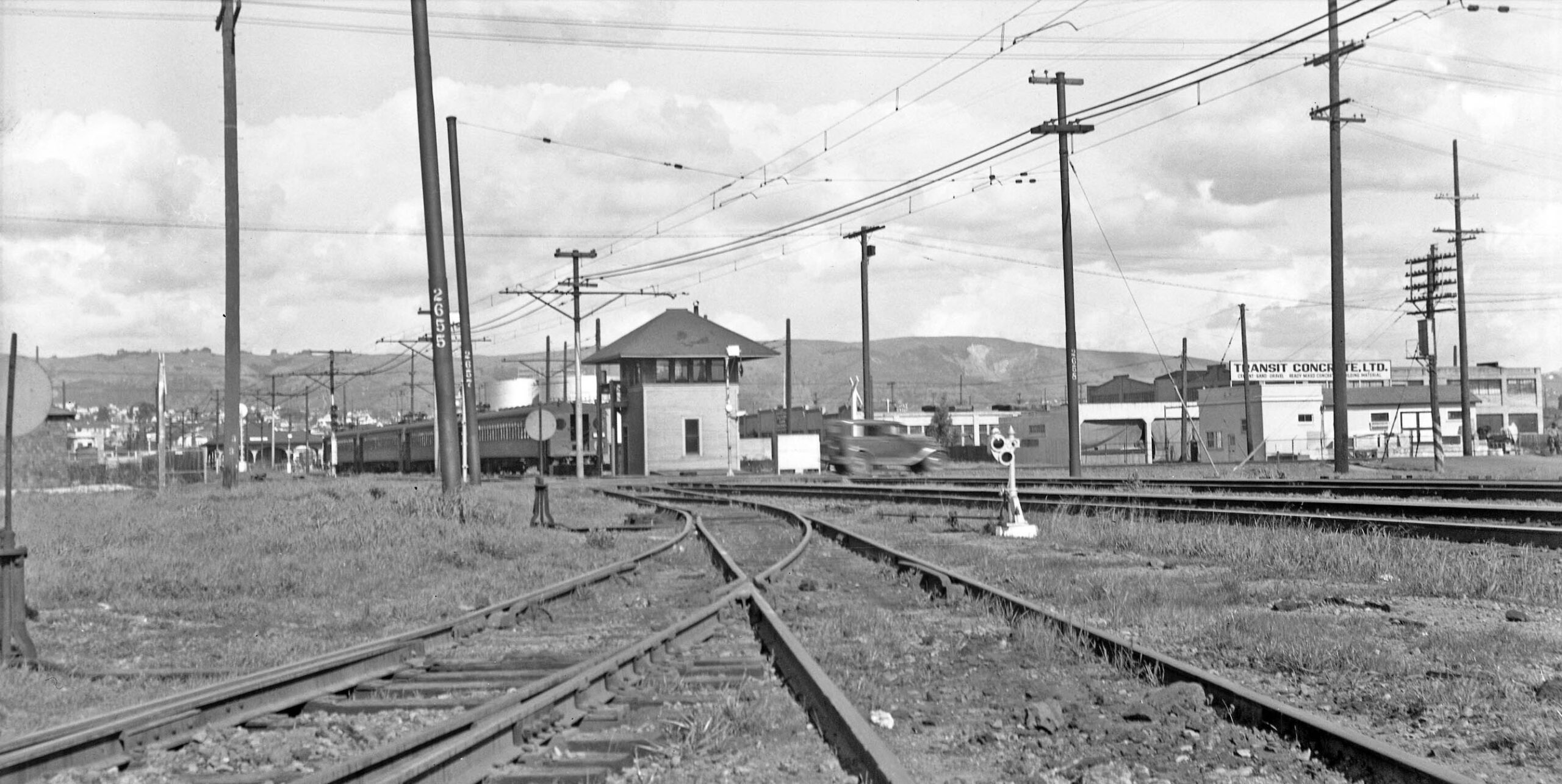
The image is a northeast view from freight spurs of the approach to the Melrose Tower, the small SP yard, and Melrose Station in 1939. In 1919, over 29 million rides were tabulated for the SP electrics, but by 1940 it was 9.6 million based on data displayed by Ford.
L297-110-Ralph Demoro, Courtesy John Harder, (Image 23 of 28)
A southwest view from 1940 shows the small SP yard wedged between the Melrose Tower and Station. The SP and Key were allowed by the RCC to reduce off-peak service on Feb. 26, 1940. Seventh St. and Shattuck trains now operated every 30 minutes, except on Sunday and holidays when it was every 45 minutes. Headways on the 9th St. Line and the two Alameda Lines were reset even longer.
L297-115-Addison Laflin Photo Courtesy BAERA, Western Railway Museum Archives, 67903ier, (Image 24 of 28)
A relatively rare image of a 7th St. Express train alongside the Melrose depot is seen here. On the same day service was cut back, the IER approached the RCC to abandon all rail service. The IER bridge endeavor would last barely over 13 months. The IER had a loss of 1M dollars in 1939 versus 200k dollars for the Key with comparable fares and ridership. Ford attributed the difference to using 3 verses 2 men on trains due to the IER workers belonging to a railroad union, the Key workers to a street railway union.
L297-120-Courtesy BAERA, Western Railway Museum Archives, 215199ier, (Image 25 of 28)
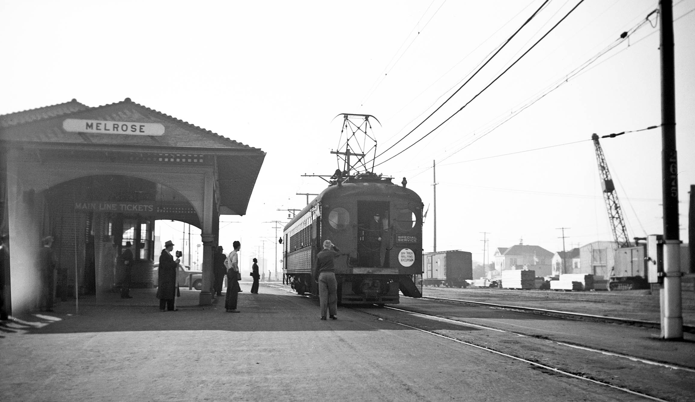
On a lighter note, the IER did support excursions, this southwest view at Melrose on Dec. 8, 1940. Ford displayed data of passenger service on Apr. 24, 1940 showing that the passenger traffic on the IER 7th St. Line and combined Adeline St. traffic by the IER and Key were on the order of three times larger than any of the other interurban lines of either company.
L297-125-Addison Laflin Photo Courtesy BAERA, Western Railway Museum Archives, 70191ier, (Image 26 of 28)
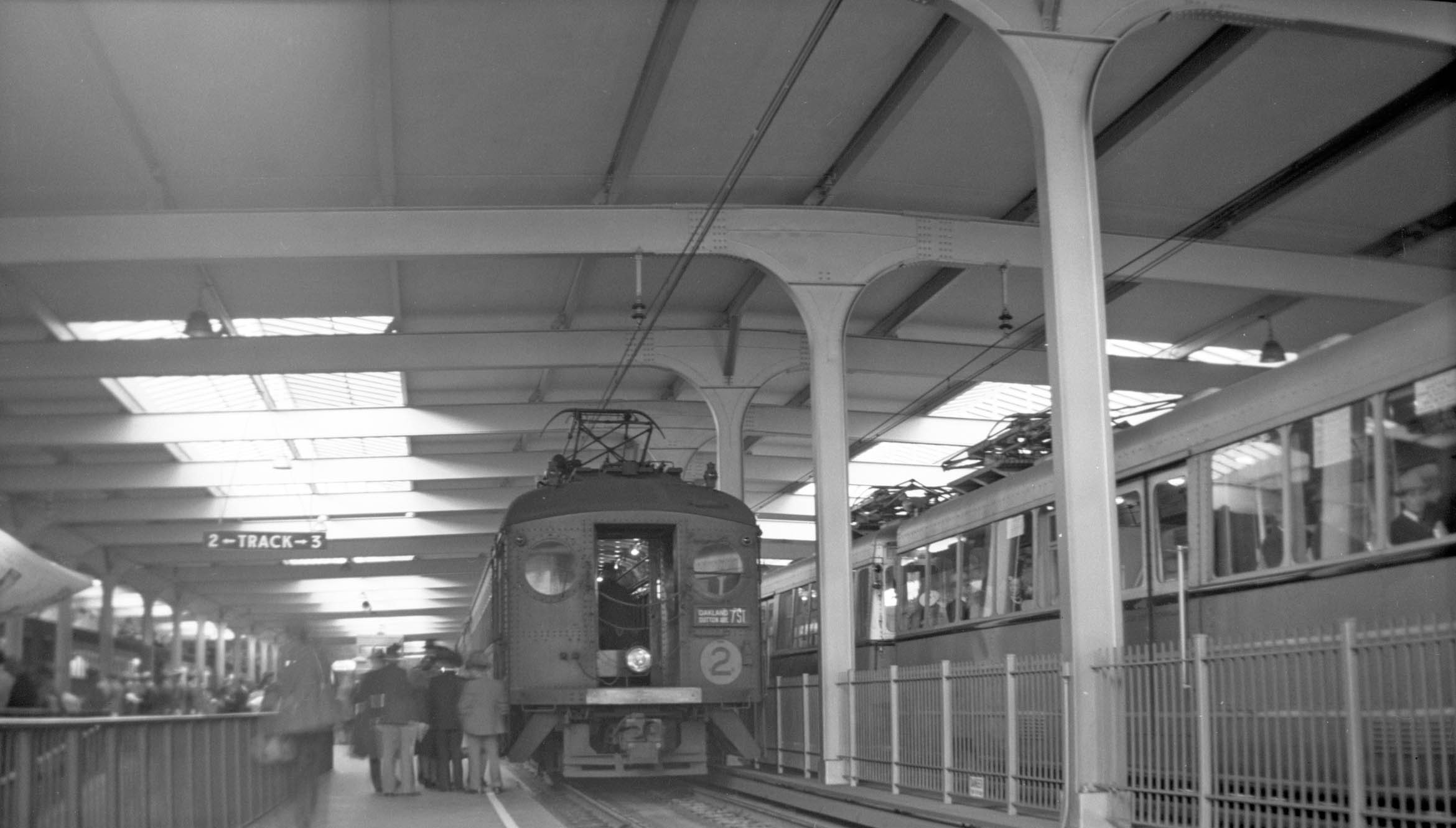
Richard Jenevein was at the Transbay Terminal on Mar. 21, 1941 to photograph 7th St. Line trains on the last day of operation. North view. Photographic documentation of a comparable special moment at Melrose could not be found. The Key would be willing to jump in and cover the areas abandoned by the IER. This will be discussed next time.
L297-130-Richard Jenevein Photo, Courtesy BAERA, Western Railway Museum Archives, 13279ier, (Image 27 of 28)
So far the focus has been on the south side of E. 14th St., now International Blvd. This northeast view from 1940 of a 7th St. Local brings the discussion of the next update to the north side of the street, and the special moments that occurred in the 1940s. Thanks to John Harder for images from his collection.
L297-135-Addison Laflin Photo Courtesy BAERA, Western Railway Museum Archives, 67908ier, (Image 28 of 28)