Missing from Chabot Canyon – Consumed by the Fire and Final Accounting
An east view of Chabot Canyon from 1975 commences a study of two homes built after 1935 on the south side of Chabot Rd. that were removed for Highway 24, and the homes on the northern flank east of Roble Rd. that were lost in the 1991 fire.
L205-05-Copyright California Department of Transportation, C5492-11 , (Image 1 of 30)

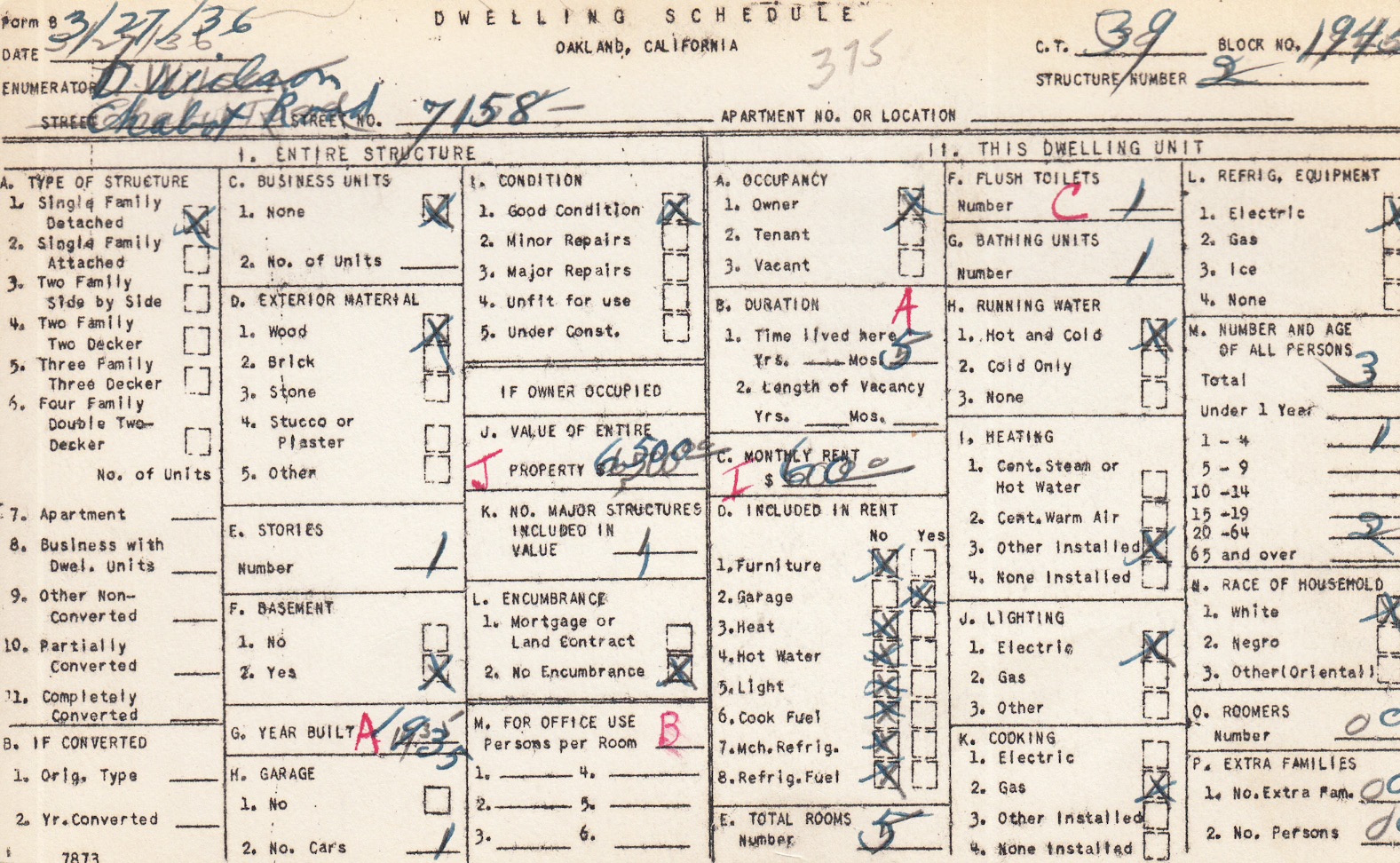
First for the two homes on the south side of Chabot Rd. that were not seen on the 1935 composite used previously. No. 7158 was built in 1936 for which this WPA card had previously been shown.
L205-10-Courtesy Oakland Cultural Heritage Survey, Oakland City Planning Department , (Image 2 of 30)
A panoramic south view of the home at no. 7158 Chabot Rd. from 1960 that was on a slope from the road.
L205-15-Copyright California Department of Transportation, Binder 5525 , (Image 3 of 30)
Next, a north-oriented map from Nov. 1958 showing the position of the home relative to its neighbors.
L205-20-Copyright California Department of Transportation, Binder 5525 , (Image 4 of 30)
A detail of the north-oriented map from Nov. 1958 shows the home was directly east of the Blosser home at no. 7130.
L205-25-Copyright California Department of Transportation, Binder 5525 , (Image 5 of 30)
Shown here are the parcel appraisal and valuation for condemnation of no. 7158. The paper street referred to is Laurel Rd. or Laurel Creek Rd., the name depending on the year of the map. See “Missing from Chabot Canyon - 1953 Update” for maps.
L205-30-Copyright California Department of Transportation, Binder 5525 , (Image 6 of 30)
The second home was at no. 7332 Chabot Rd. Construction was begun by the owner in 1954, and it was still under construction as condemnation proceedings took hold. Shown here is a south view from 1958 of the north-facing side of the home. Note the fence across the abandoned Sacramento Northern.
L205-35-Copyright California Department of Transportation, Binder 5450 , (Image 7 of 30)
This map from Nov. 1958 shows it was at the east end of the south side of the canyon.
L205-40-Copyright California Department of Transportation, Binder 5450 , (Image 8 of 30)
A detail of the map from Nov. 1958.
L205-45-Copyright California Department of Transportation, Binder 5450 , (Image 9 of 30)
Four views of the exterior of no. 7332; A, a south view of the north side across Chabot Rd.; B, the northwest side seen from a southeast view across Chabot Rd.; C, west end from an east view; and, D, a northeast view of the south-facing side of the home.
L205-50-Copyright California Department of Transportation, Binder 5450 , (Image 10 of 30)
The appraisal and valuation of no. 7332 Chabot Rd. is presented here.
L205-55-Copyright California Department of Transportation, Binder 5450 , (Image 11 of 30)
Other construction details of no. 7332 including images of ongoing work and its valuation are presented above.
L205-60-Copyright California Department of Transportation, Binder 5450 , (Image 12 of 30)
On to Marie Way, where none of the homes were lost to Highway 24-BART construction, but all were consumed in the fire of 1991. First, a north view of no. 5929, a home built around 1939 at the end of the cul-de-sac, shown here in 1959.
L205-65-Copyright California Department of Transportation, Binder 5436 , (Image 13 of 30)
This record of the sale of the home in 1957 is the only record that remains of the original home, since rebuilt post 1991.
L205-70-Copyright California Department of Transportation, Binder 5929 , (Image 14 of 30)
The same is true for no. 5910, a 10 year old home when photographed in this north view in 1962.
L205-75-Copyright California Department of Transportation, Binder 5668 , (Image 15 of 30)
A northwest view of no. 5910.
L205-80-Copyright California Department of Transportation, Binder 5668 , (Image 16 of 30)
A record of the sale of no. 5910 used as a comparison for evaluating properties to be condemned in the area for Highway 24 construction.
L205-85-Copyright California Department of Transportation, Binder 5668, (Image 17 of 30)
The final home, no. 7325 Chabot Rd., was newly constructed and situated at the end of the north side of Chabot Rd. when photographed in this northwest view in 1960.
L205-90-Copyright California Department of Transportation, Binder 5612 , (Image 18 of 30)
A record of the sale of no. 7325 Chabot Rd. in 1960 is all that remains after this home was lost in 1991.
L205-95-Copyright California Department of Transportation, Binder 5612, (Image 19 of 30)
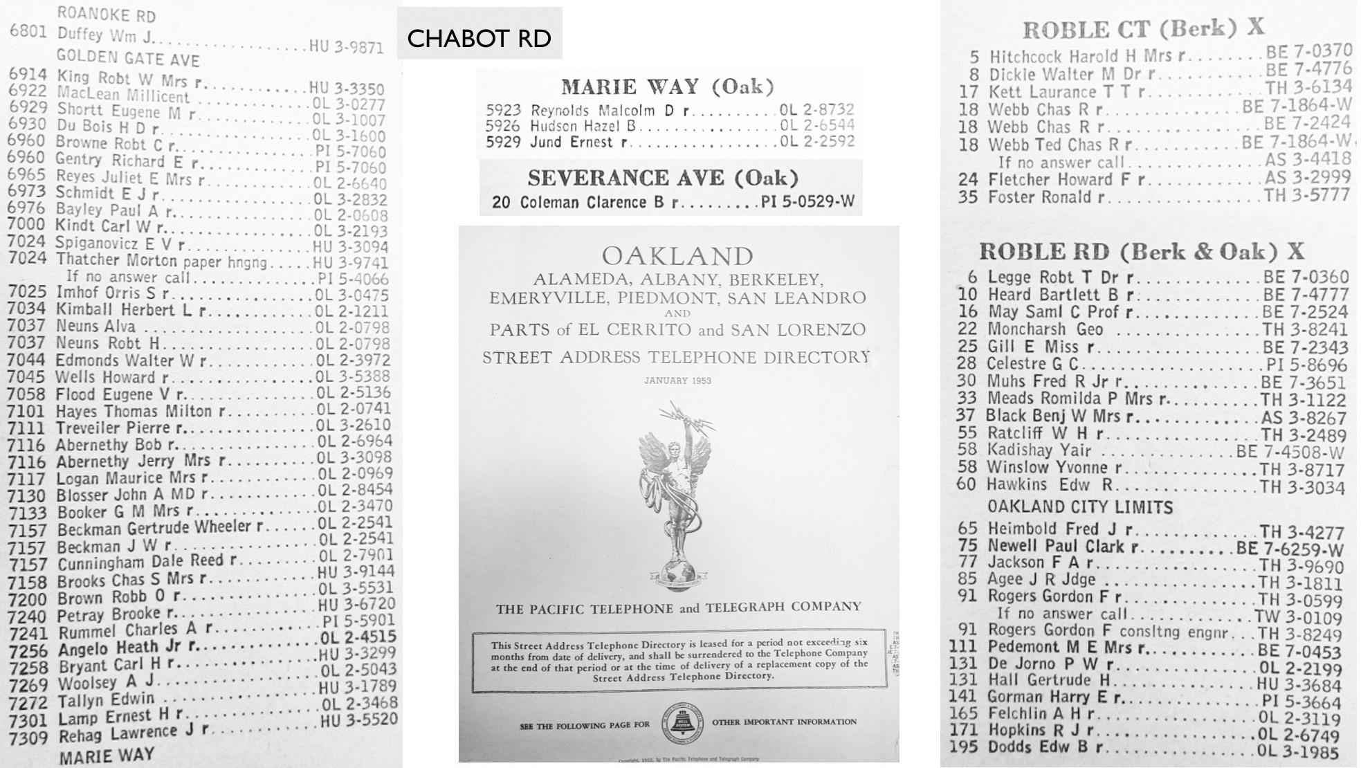
This concludes all the individual records obtained from the homes that existed in Chabot Canyon up until the fire of 1991. It is still incomplete for homes east of Roble Rd. Starting with these listings from the 1953 telephone reverse directory, an accounting of the homes will be summarized using maps and photos.
L205-100-Courtesy Oakland History Room, Oakland Public Library, (Image 20 of 30)
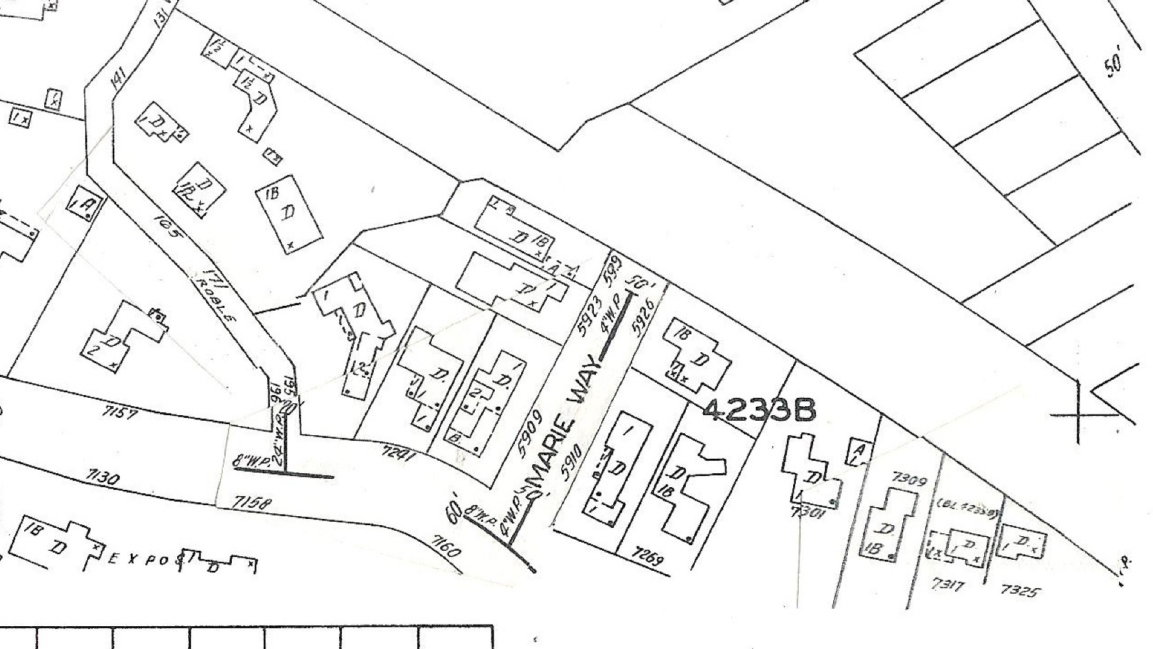
The east end of Chabot Canyon from the updated 1951 Sanborn map is shown. For whatever reason, homes along the south side of Chabot Rd. east of no. 7160 are not included.
L205-105-Courtesy Oakland Cultural Heritage Survey, Oakland City Planning Department , (Image 21 of 30)
The information gathered so far is summarized on this northwest view from April 8, 1953. Tourquoise labels indicate that 1936 WPA cards have been presented, black borders indicate that additional information from CALTRANS has already been presented. The rest are from homes post-1936 for which no information has been presented.
L205-110-Copyright California Department of Transportation, 3301-19, Detail, (Image 22 of 30)
Summary from April 8, 1953, from a northeast view. Building permits derived from the 1991 city firelogs for Roble Rd. are as follows: no. 77, bp B33842, 9-26-1950; no. 79, bp B38165, 1950; no. 85, 1950; no. 91, bp B 32294, 6-16-1950; no. 111, bp B22042, 1948; no. 131, bp B11824, 7-8-1946; no. 141, bp B24535, 6-7-1948; no. 165, bp B21535, 1948; no. 171, bp B30579, 1950; and no. 195, listed as built before 1940 based on a remodel.
L205-115-Copyright California Department of Transportation, 3301-18, Detail , (Image 23 of 30)
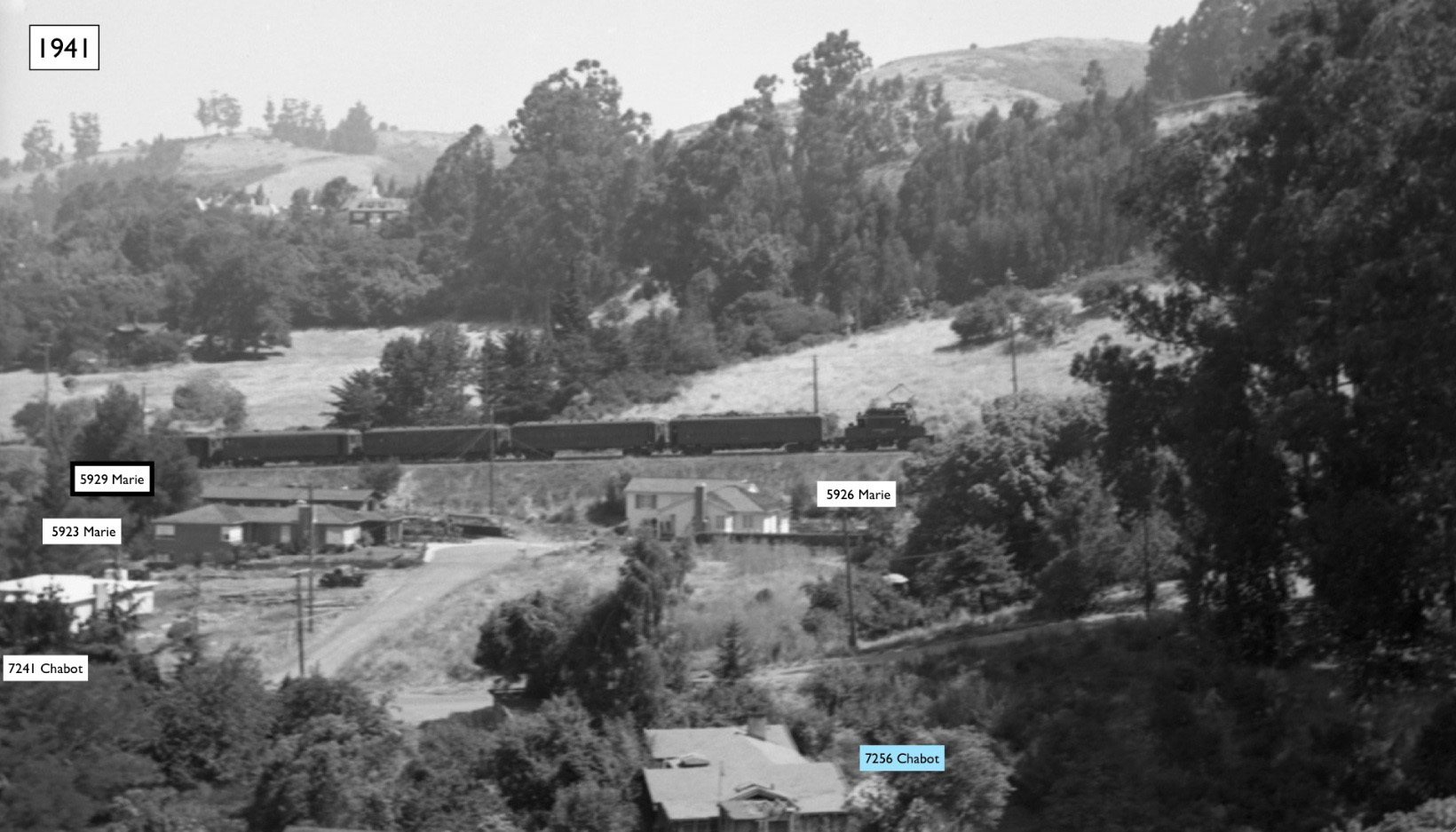
Now to account for addition of homes after 1935. This north view of the return of SN cars to Chico from July 1, 1941 is consistent with the 1991 city firelogs for Marie Way: no. 5923, bp A80526, 9-13-1939, Chamberlin and Reynolds, architects; no. 5926, bp A79020, 6-19-1939, HC Pfrang, builder; and no. 5929, bp A79499, 7-19-1939. No. 7241 Chabot Rd. had bp A89586, 3-7-1941, Harry Bruno, architect.
L205-120-David Merrill Photo, Courtesy BAERA, Western Railway Museum Archives, 43970sn, (Image 24 of 30)
Recall that no. 195 Roble Rd. was listed as built before 1940 based on remodel, and this is consistent with this image.
L205-125-Courtesy BAERA, Western Railway Museum Archives, 77083sn, (Image 25 of 30)
Two decades later, a detail from an east view of Chabot Canyon from Aug. 19, 1963 showing a cleared-out south side of Chabot Rd. The soon-to-be-razed Maybeck-designed no. 7240 Chabot Rd., and the Yelland-designed no. 7130 Chabot Rd. are all that remain on the south side of the street. No. 7269 Chabot Rd. had bp 36413, from 1950. No. 7317 Chabot Rd. was built in 1958.
L205-130-Copyright California Department of Transportation, 9973-2 Detail, (Image 26 of 30)
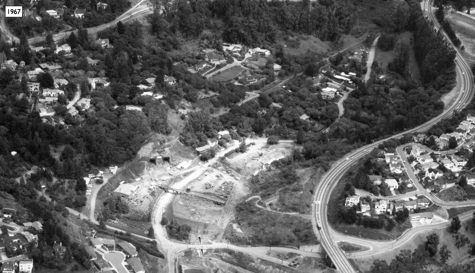
BART construction ravaged the west end of the canyon as depicted in this east view from April 24, 1967. Highway 24 construction has progressed to the east and west at this juncture, and Chabot Canyon was saved for last.
L205-135-Ed Brady-Aerospace Photo 11323, Courtesy BAERA, Western Railway Museum Archives, 151537BART, (Image 27 of 30)
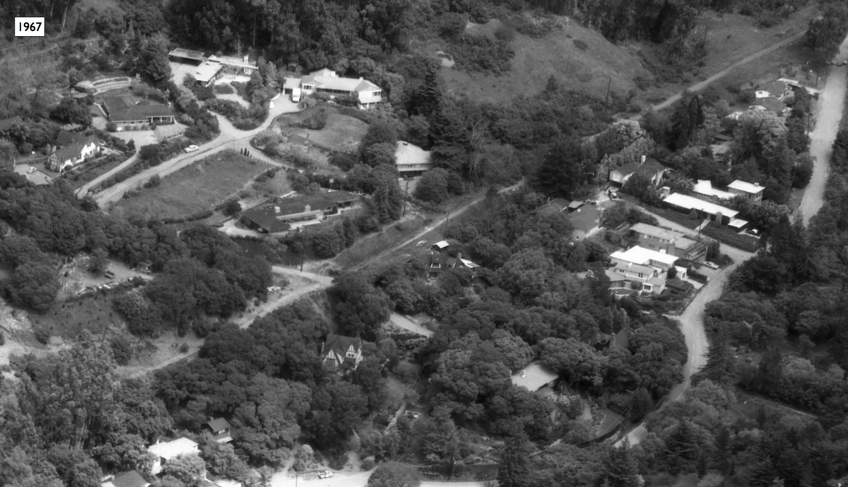
A further detail showing the east end of Chabot Canyon. The fire of 1991 would claim all but two of the structures shown. An east view from April 24, 1967.
L205-140-Ed Brady-Aerospace Photo 11323, Courtesy BAERA, Western Railway Museum Archives, 151537BART, (Image 28 of 30)
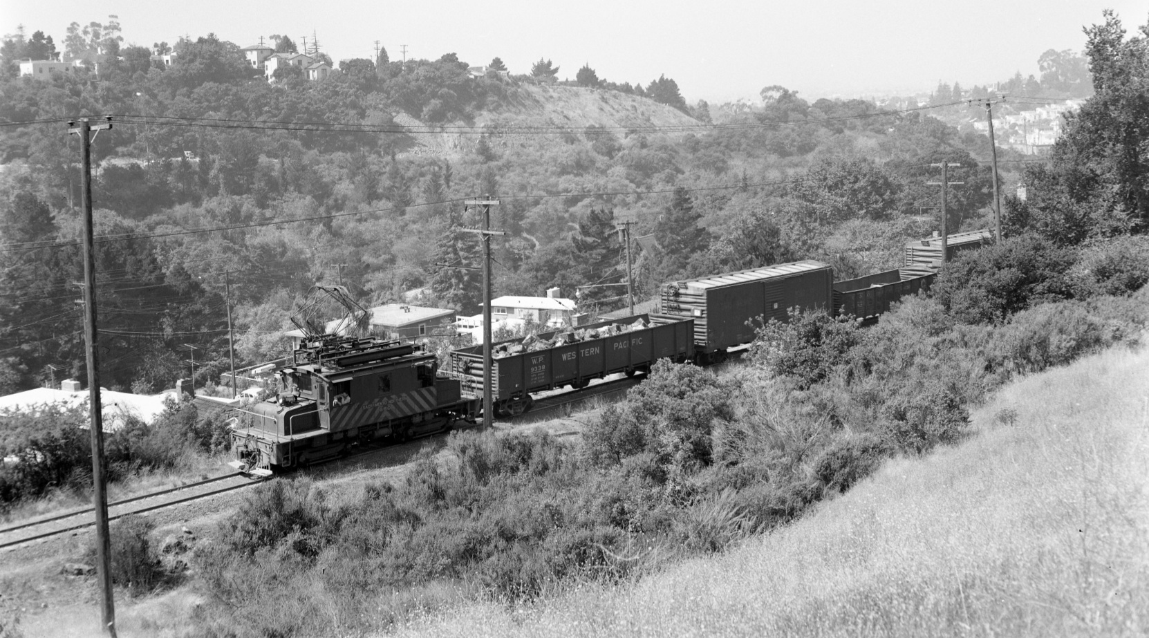
Just one decade earlier, SN 660 climbs the grade at Heimbold passing by Marie Way on Aug, 27, 1956 in this west view. All the homes may be identified by the material presented so far.
L205-145-Fred Matthews Photo, Anonymous Donor, (Image 29 of 30)
To come full-cycle on the multi-part reconstruction of Chabot Canyon, an Oakland, Antioch, and Eastern freight passes the north side of Chabot Rd.-Marie Way circa 1920 with the Roble Rd. crossbuck at the grade crossing in the distance. West view. Thanks to Betty Marvin and Gail Lombardi for the 1991 Oakland City firelogs.
L205-150-Eston Cheney Photo R-256, Courtesy BAERA, Western Railway Museum Archives, 28990sn, (Image 30 of 30)