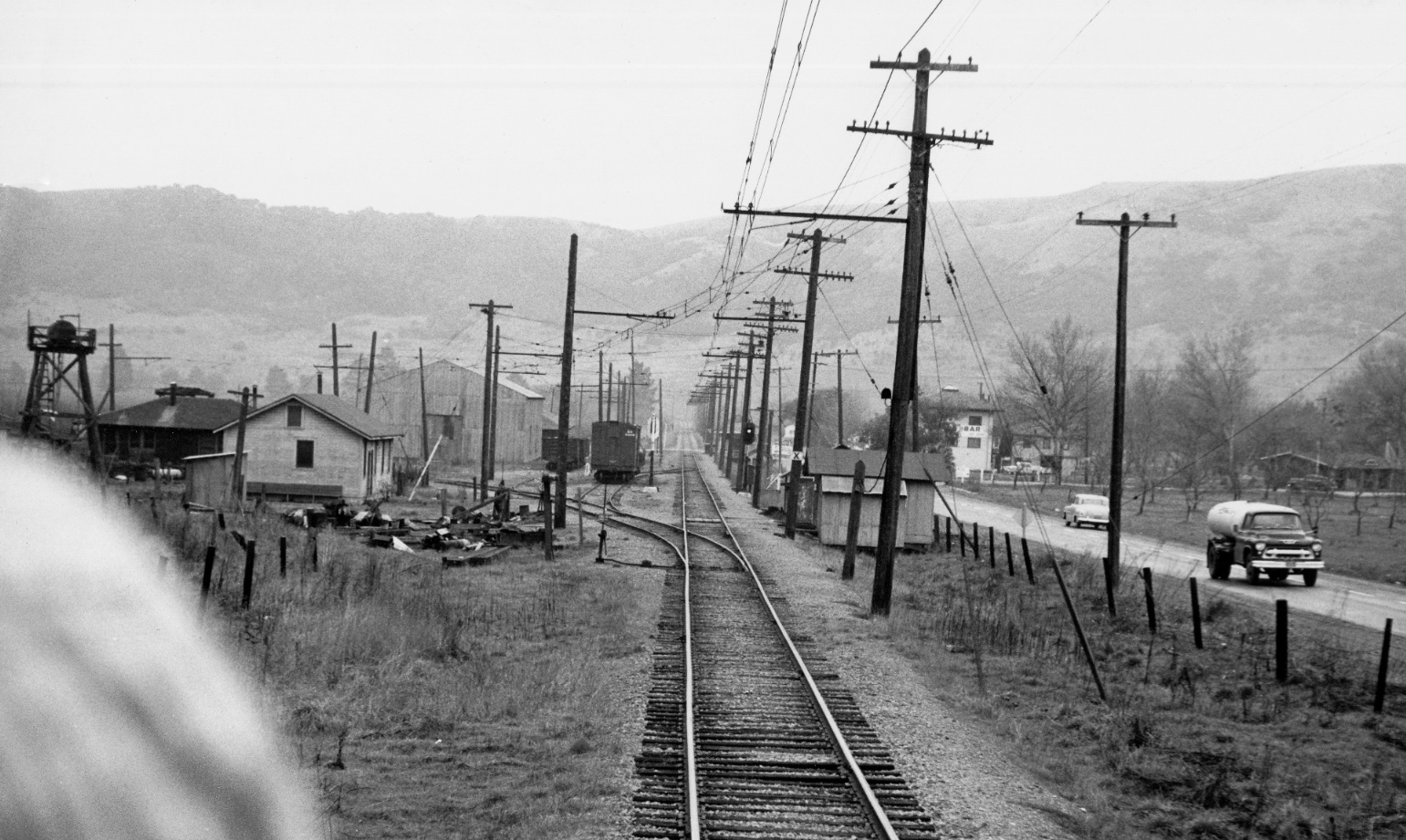
Moraga
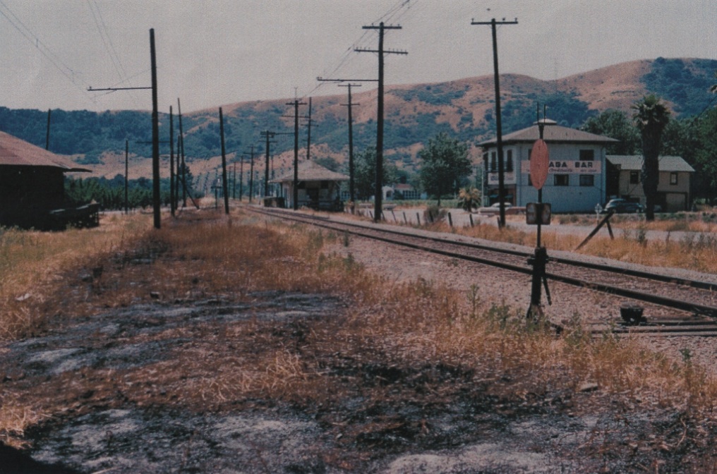
Important structures from the 1910s for central Moraga from this 1956 west view include, background to foreground: Moraga School, earlier Willow Spring School, now Willow Springs Church; SN passenger depot; the Moraga Bar, earlier Moraga Hotel or "Barn", now Canyon Construction; and, the SN freight depot, left.
G5-From the collection of the Moraga Historical Society, Moraga, CA, (Image 1 of 16)

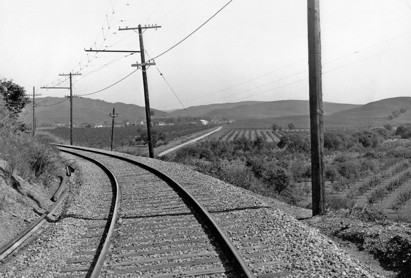
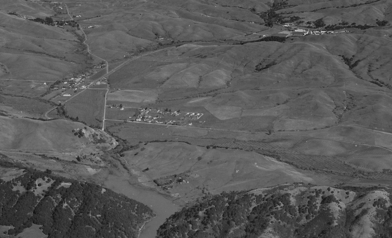
Before reaching downtown from Redwood Canyon, you needed to pass through Valle Vista and its pear orchards, here just leaving this area with Canyon Road in view as seen in this undated north view.
G10-Sappers Collection, Courtesy BAERA, Western Railway Museum Archives, 51837sn, (Image 2 of 16)
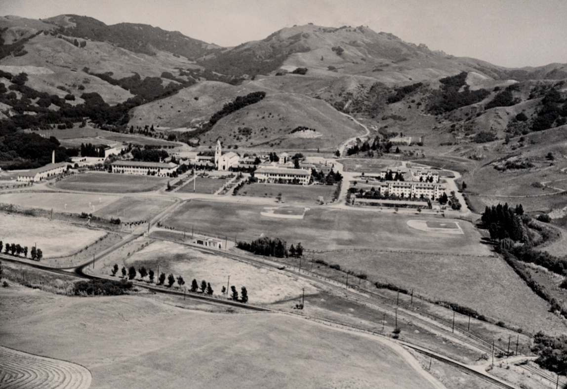
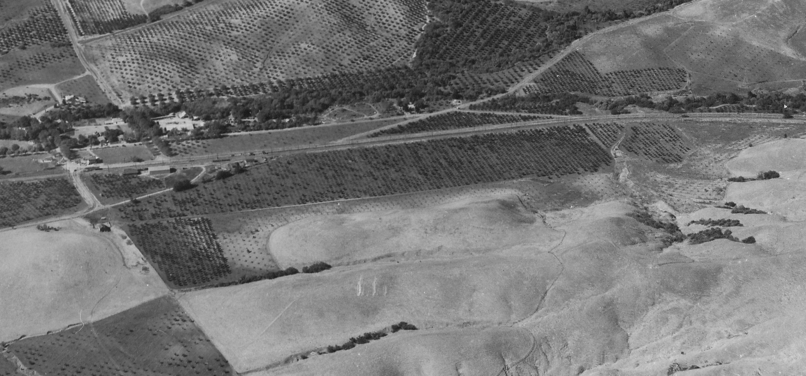
A second landmark to the northeast is Saint Mary's College, seen in this southeast image from circa 1950. The College moved to this spot from Oakland in 1928. Note the SN station and right-of-way ... more on this later.
G15-A Harris and Associates Photo, from the collections of the Saint Marys College of California Arc, (Image 3 of 16)
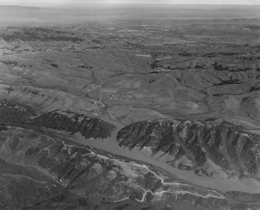
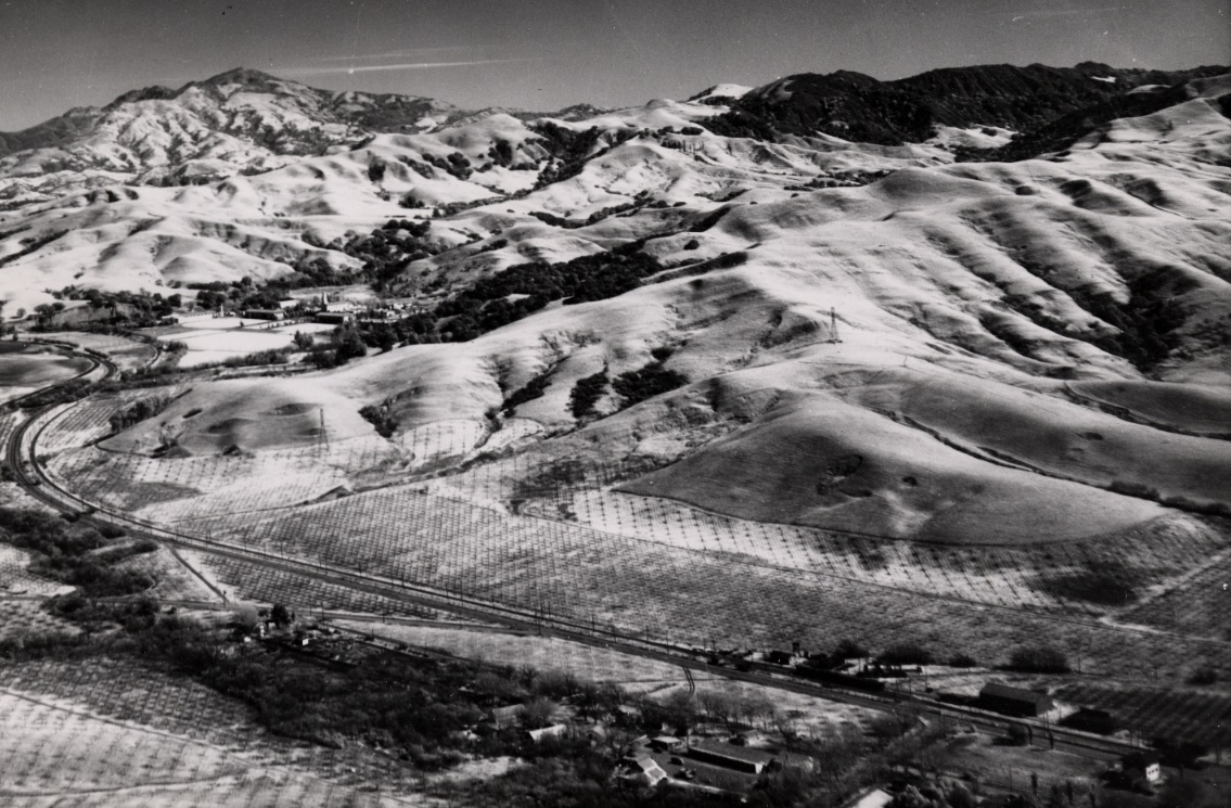
This north view from 1950 above Upper San Leandro Reservoir with Valle Vista, Moraga, the Rheem and Burton Valleys, and central Lafayette and Walnut Creek. The reservoir was completed in 1928 by the East Bay Municipal Utility District.
G20-RL Copeland Photo, from the collection of the Moraga Historical Society, Moraga, CA, 12, (Image 4 of 16)
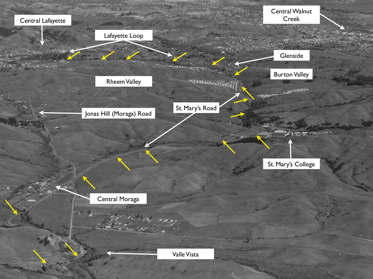
Annotated G20 focusing on key landmarks and yellow arrows delineate the SN right-of-way.
G21-RL Copeland Photo, from the collection of the Moraga Historical Society, Moraga, CA, 12, (Image 5 of 16)
Detail of the north view from 1950 of G20 reveals Moraga Creek path to the reservoir, and the intimate relationship between the reservoir with Valle Vista and Moraga.
G25-RL Copeland Photo, from the collection of the Moraga Historical Society, Moraga, CA, 12, (Image 6 of 16)
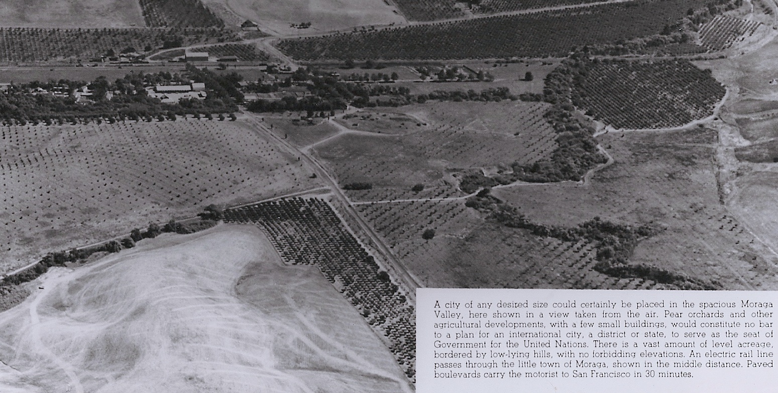
This east view of central Moraga from 1946 is accompanied by a publicity blurb .. go to the next image for a better read ...
G30-From the collection of the Moraga Historical Society, Moraga, CA, (Image 7 of 16)
Detail of G30 and the accompanying boast is testimony to the secondary importance of rail service to the auto, this now 5 years after abandonment of passenger service by the SN.
G35-From the collection of the Moraga Historical Society, Moraga, CA, (Image 8 of 16)
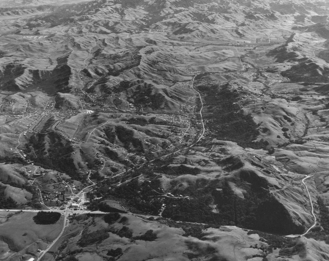
This northeast view from Oct. 21, 1953 shows Moraga and its neighbor, Orinda, flanked by Gudde Ridge to the West, out to the Orinda Crossroads.
G40-RL Copeland Photo, from the collection of the Moraga Historical Society, Moraga, CA, 20, (Image 9 of 16)
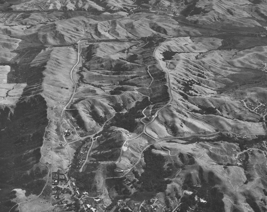
A closer image of G40 and the sweeping curve of the SN after Valle Vista and into central Moraga. Today, the curve is buried under or along the west flank of Augusta Drive, and not the Lafayette-Moraga Regional Trail. Northeast view from Oct. 21, 1953.
G45-RL Copeland Photo, from the collection of the Moraga Historical Society, Moraga, CA, 20, (Image 10 of 16)
This circa 1952 southwest view documents the straight path the SN followed from just prior to its crossing of School Street all the way through central Moraga.
G50-Reginald McGovern Photo, Courtesy Reginald McGovern, (Image 11 of 16)
Detail of G40 shows the 1950s configuration of Moraga's major roads. From the station, the SN rimmed the east side of St. Mary's Road, but today this would be right through Moraga Shopping Center. Moraga Road and Canyon Road were later lengthened to meet at Moraga Way, top left. Northeast view from Oct. 21, 1953.
G55-RL Copeland Photo, from the collection of the Moraga Historical Society, Moraga, CA, 20, (Image 12 of 16)
This northeast circa 1950s view with Mount Diablo captures the SN path from central Moraga to St. Mary’s College along St. Mary’s Road. The SN was not on the west, side of the road below St. Mary’s College, inferred today by the position of the Lafayette-Moraga Regional Trail.
G60-From the collections of the Saint Marys College of California Archives, (Image 13 of 16)
A southeast view of Moraga and Orinda from the Orinda Crossroads on Jan. 22, 1953 captures the major route, Moraga Highway, or "Way", with the Glorietta Blvd takeoff, and Rheem Blvd and Donald Drive cutting through the Rheem Valley to St. Mary's College, background, center.
G70-RL Copeland Photo, from the collection of the Moraga Historical Society, Moraga, CA, 18, (Image 14 of 16)
On year later, Oct. 23, 1954, this southeast view shows Rheem Boulevard to the left and Donald Drive to the right heading back across Jonas Hill Road, now Moraga Road, toward St. Mary's College in the background, center.
G65-RL Copeland Photo, from the collection of the Moraga Historical Society, Moraga, CA, 14, (Image 15 of 16)
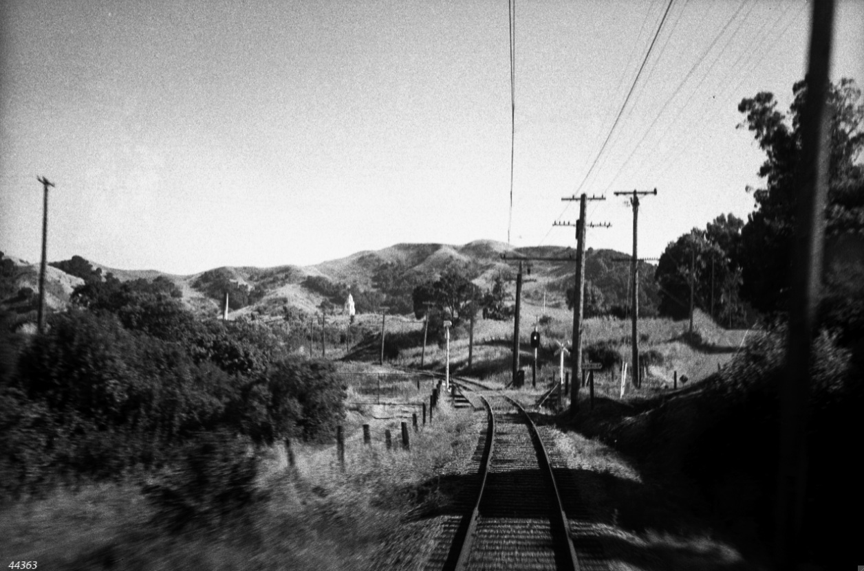
St. Mary's College, south view, from the grade crossing north of the college at St. Mary's Road between Rheem Boulevard and Bollinger Canyon Road. The right-of-way and current Lafayette-Moraga Regional Trail become coincident here through to Olympic Boulevard in Lafayette. More later ....
G75-David Merrill Photo, Courtesy BAERA, Western Railway Museum Archives, 44363sn, (Image 16 of 16)