More of Miles
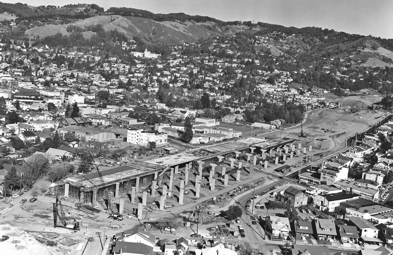
A northeast view from April 11, 1968 shows the construction of the Shafter-Grove Freeway in full swing.
L100-05-Copyright California Department of Transportation, 14629-5 Detail, (Image 1 of 15)

A northeast view from January 1968 dominated by College Avenue with Forest St. running along the bottom of the image shows that BART construction was also progressing simultaneously.
L100-10-BART Photo, Courtesy John Harder, (Image 2 of 15)
To get a sense of the changes being made as a result of this construction, this northeast image from Apr. 11, 1968 will be evaluated.
L100-15-Copyright California Department of Transportation 14629-2 , (Image 3 of 15)
Shown are major changes between 1935 and 1968 from a northeast view. While Keith Ave,. black line, has had its northern row of houses removed, Shafter Ave., yellow line, has lost its entire south side and homes on the north side from Presley Way, green oval, to Chabot Ct., red oval, to the east. Pryal St., orange line, has been eliminated in favor extending Presley Way, green line, to Keith Ave. Full ref left: HJW Geospatial Inc, Pacific Aerial Surveys, Oakland CA.
L100-20- Courtesy East Bay Regional Park Dist. and Copyright Calif. Dept. of Transportation, (Image 4 of 15)
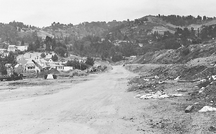
Only a few months earlier in construction, June 21, 1967, this northeast view shows the original footprint of remains of Shafter Ave. below College Ave., orange arrow, and approaching Patton St., purple arrow.
L100-25-Copyright California Department of Transportation 13947-3 Detail, (Image 5 of 15)
A southwest view complementary to L100-25 taken on the same day, June 21, 1967, also shows the last remains of the original Shafter Ave. footprint.
L100-30-Copyright California Department of Transportation 13947-2 Detail, (Image 6 of 15)
Many forget that although Miles Ave. was lengthened by renaming the former section of Shafter east of College Ave., it did lose some homes on its south flank between College Ave. and Forest St., and it was truncated between Forest St. and Hudson St. as seen in the lower left section of this northeast image from Apr. 11, 1968.
L100-35-Copyright California Department of Transportation 14629-2 Detail, (Image 7 of 15)
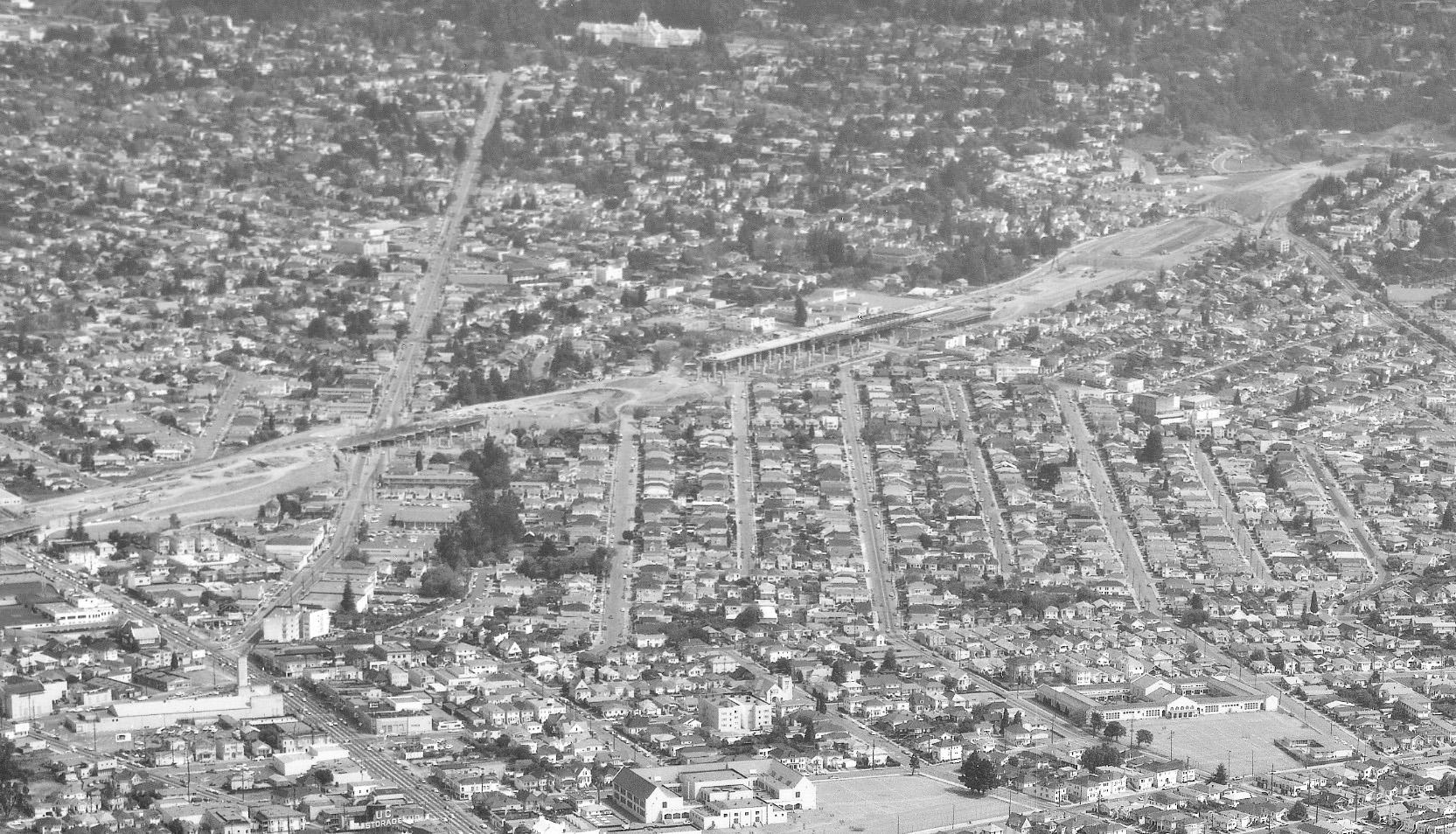
A close-up northeast view of the College Ave.-Freeway-BART intersection from Apr. 11, 1968.
L100-40-Copyright California Department of Transportation 14629-2 Detail, (Image 8 of 15)
A close-up northeast view of the new Miles Ave. above the level of Claremont Middle School from Apr. 11, 1968. The illusion that SN rail is visible on the south side of the street at the bottom, center of the image is just an illusion as their removal was established in the update, “More Than Just Taking Out the Rails on Shafter.”
L100-45-Copyright California Department of Transportation 14629-2 Detail, (Image 9 of 15)
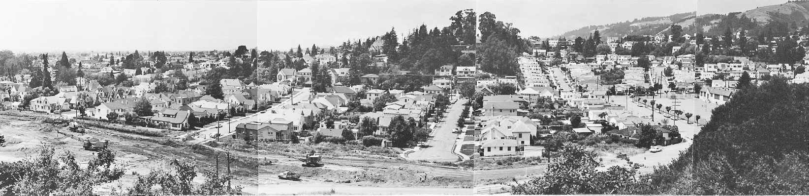
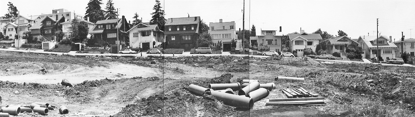
An undated northwest panorama of the construction zone shows the new face of the new Miles Ave. from Patton St. to Ross St., right to left across the image.
L100-50-Courtesy Oakland Cultural Heritage Survey, Oakland City Planning Department, 34 , (Image 10 of 15)
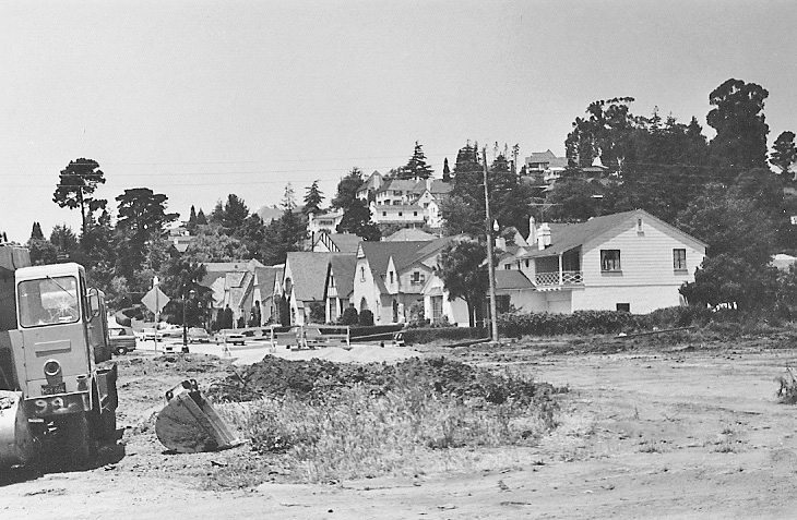
The Chabot Ct. cul-de-sac lost the three homes enveloping its south end as a result of the freeway construction, here in this undated northwest view.
L100-55-Courtesy Oakland Cultural Heritage Survey, Oakland City Planning Department, 27 , (Image 11 of 15)
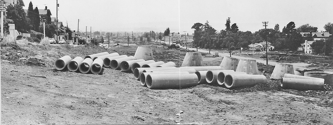
The construction of the freeway cost Ross St. five homes on both sides of the street to accommodate the new exit lanes. Undated, north view.
L100-60-Courtesy Oakland Cultural Heritage Survey, Oakland City Planning Department, 23 , (Image 12 of 15)
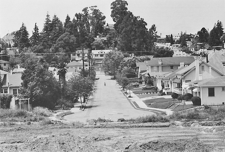
A northeast undated view up the reconfigured street with homes on the east side Chabot Ct. in view.
L100-65-Courtesy Oakland Cultural Heritage Survey, Oakland City Planning Department, 26 , (Image 13 of 15)
An undated southeast panorama of the now fully exposed south flank of Keith Ave.
L100-70-Courtesy Oakland Cultural Heritage Survey, Oakland City Planning Department, 22 , (Image 14 of 15)
An undated southwest view down the middle of the construction zone. Still to come, the changes in Chabot Canyon during freeway construction.
L100-75-Courtesy Oakland Cultural Heritage Survey, Oakland City Planning Department, 28, (Image 15 of 15)