More Questions Than Answers in Colusa During the SN Diesel Era
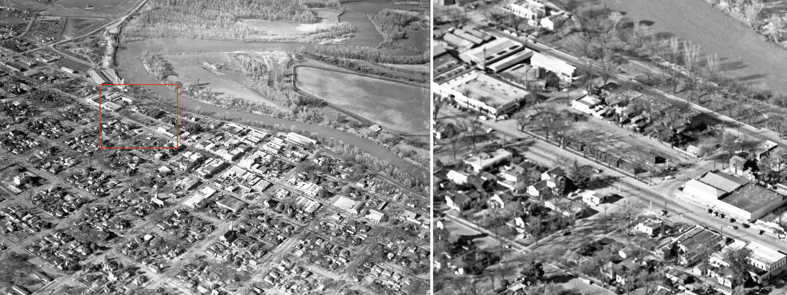
The last update covered Colusa when the Sacramento Northern, SN, electric trains supplied the city with passenger and freight service from June 13, 1913 until Oct. 31, 1940. Electric freights continued until the end of Dec. 1946, after which diesel engines would handle freight movements through the 1950s. The aerial view shown here from 1953 is of Colusa coming in from the southwest, left. The detail on the right from the warehouse section of town shows the SN corral loop, left margin, and freight warehouse, right margin.
L339-05-Courtesy Special Collections, UC Davis Library, Eastman Studios Photo B-8:B-8031, (Image 1 of 41)

In contrast, flying over the town in 1953 coming in from the southeast, left, provided a view of the SN freight yard, seen on the right. The string of boxcars along the Market St. side of the yard, and the single boxcar at the east end document active freight activity at this time. Aside from Dudley Thickens image of a freight in Colusa in 1937, no other ground images of any freight cars were found. As will be presented shortly, the details surrounding the decline of SN freight service in Colusa raises more questions than provides answers.
L339-10-Courtesy Special Collections, UC Davis Library, Eastman Studios Photo B-8:B-8032, (Image 2 of 41)
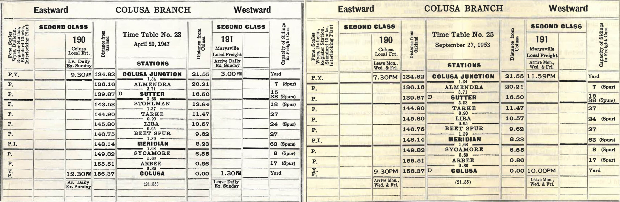
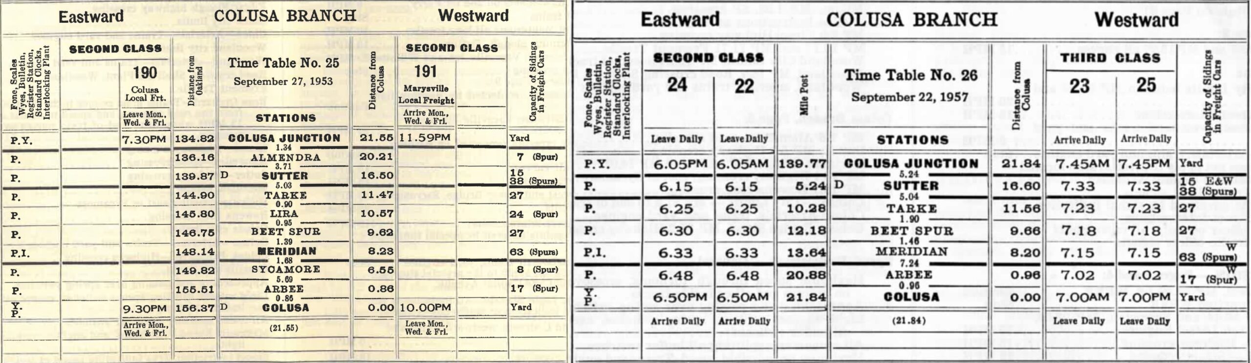
Comparing the employee timetable from Apr. 20, 1947, left, to Sept. 27, 1953, right, service to Colusa was down from six to three days a week, and from one hour total time to one half hour. These timetables, however, do not actually provide the actual amount of carloads of freight to and from Colusa, and the actual amount of time spent by the train crews.
L339-15-Courtesy BAERA, Western Railway Museum Archives, 13480, l, 99421, r, (Image 3 of 41)
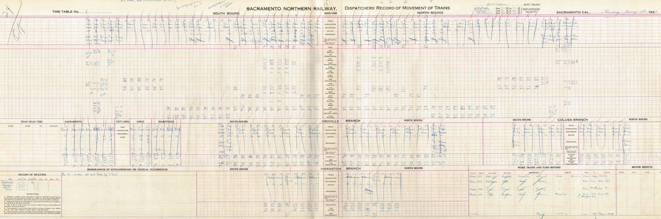
The principal way to document the winding down of daily freight activity to Colusa would be to review Dispatchers’ Record Movements of Trains, the example shown here for the North End mainline between Sacramento and Chico and the associated branch lines from Jan. 24, 1929. The Western Railway Museum in Suisun City has a large collection of these records, but none after 1950. More work needed here to find records from 1950 until abandonment to quantitatively assess of the decline in freight service to Colusa in the 1950s.
L339-16-Courtesy BAERA, Western Railway Museum Archives, 11621sn, (Image 4 of 41)
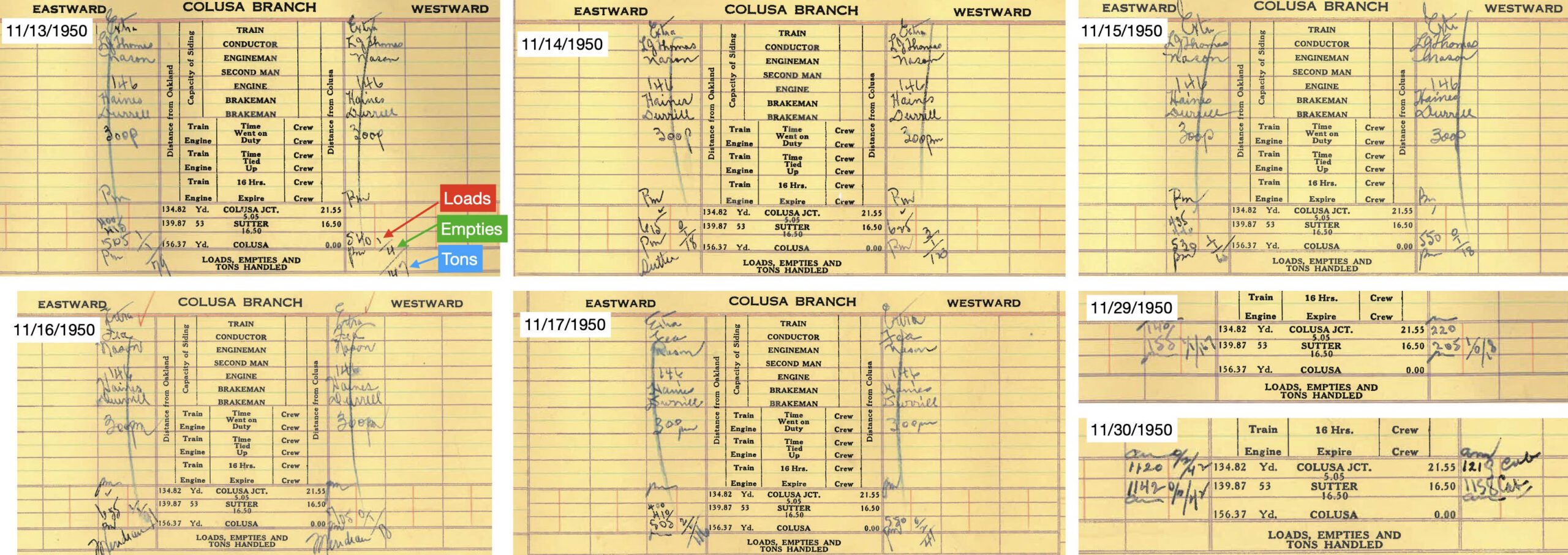
A preliminary look at the latest records from Nov. 1950 as shown here reveals the variability in freight service even in a time of year of low agricultural output. Freight for the five-day pre-Thanksgiving week of Nov. 13, 1950 is contrasted with the post-Thanksgiving week Thursday and Friday, the 29th and 30th. The volume of traffic was overall very low at Colusa with quick turnaround times of the crews for the full week of the 13th. However, no freights went beyond Sutter on the 29th and 30th, this variation not captured in the employee timetable.
L339-17-Courtesy BAERA, Western Railway Museum Archives, 11719sn, (Image 5 of 41)
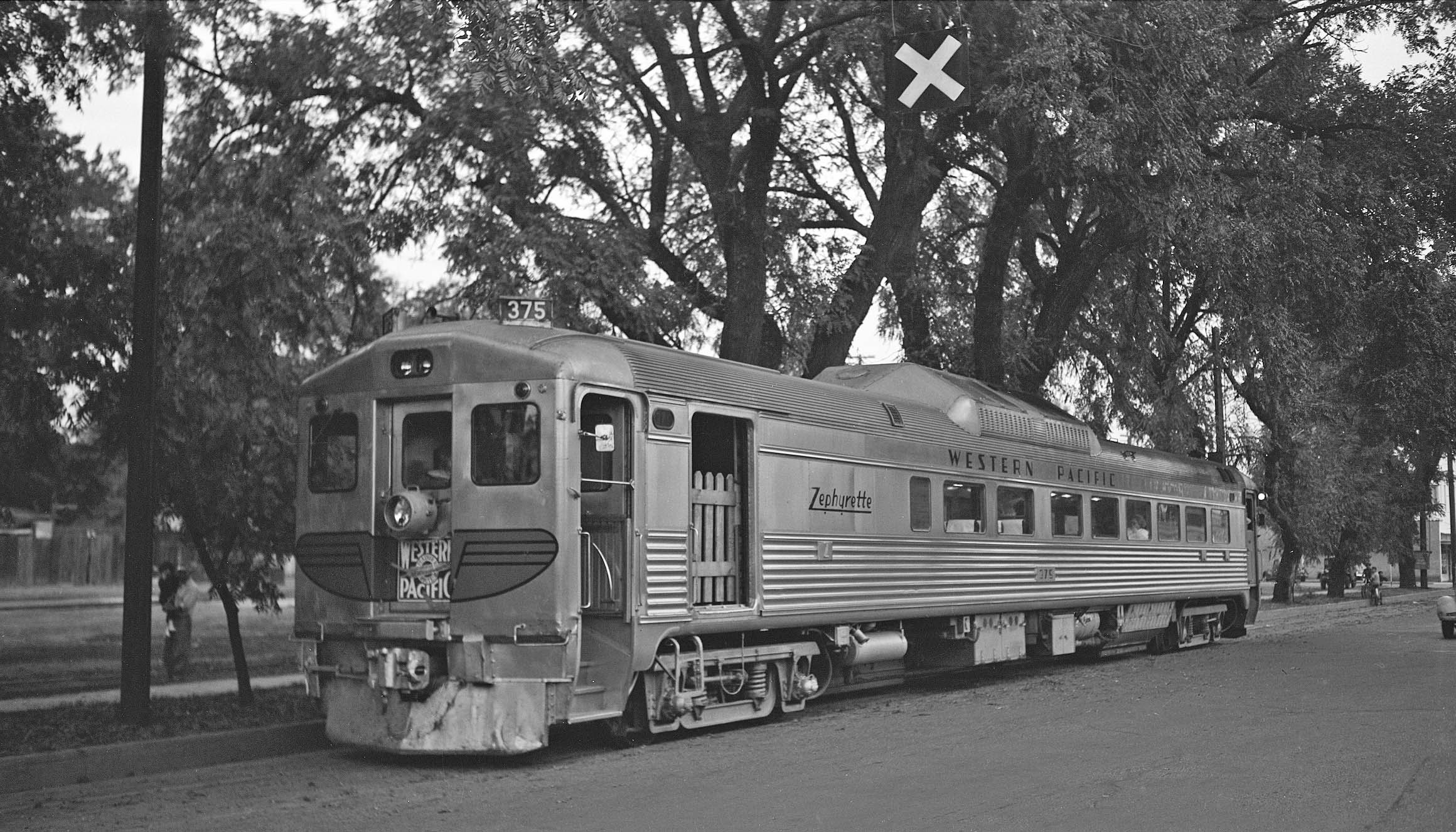
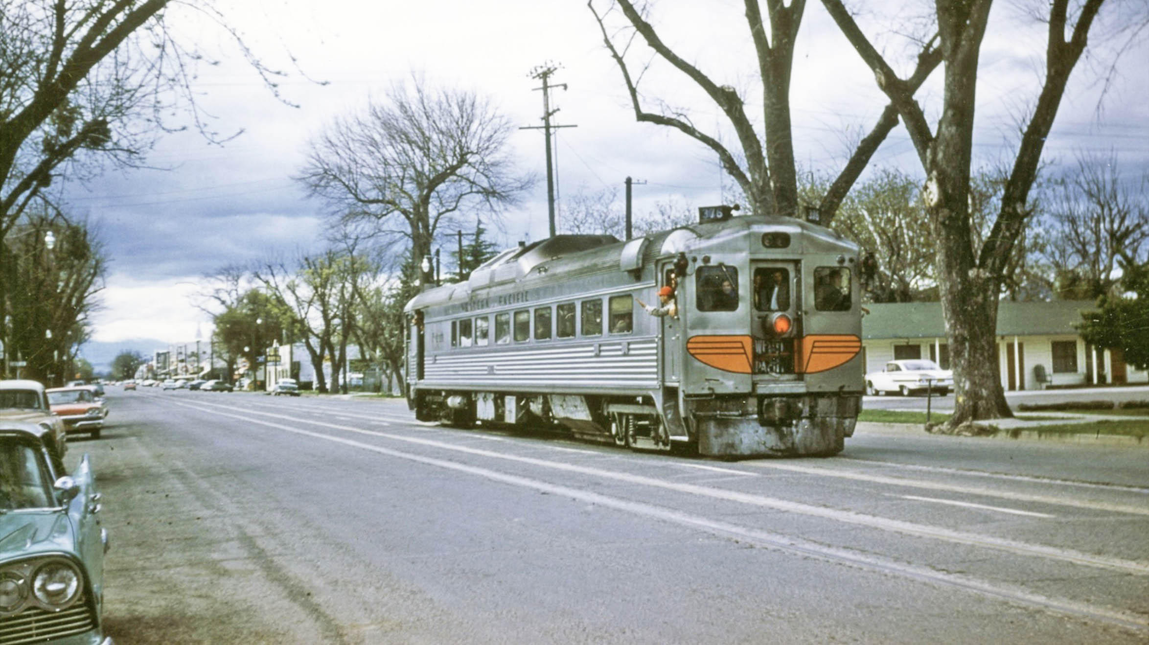
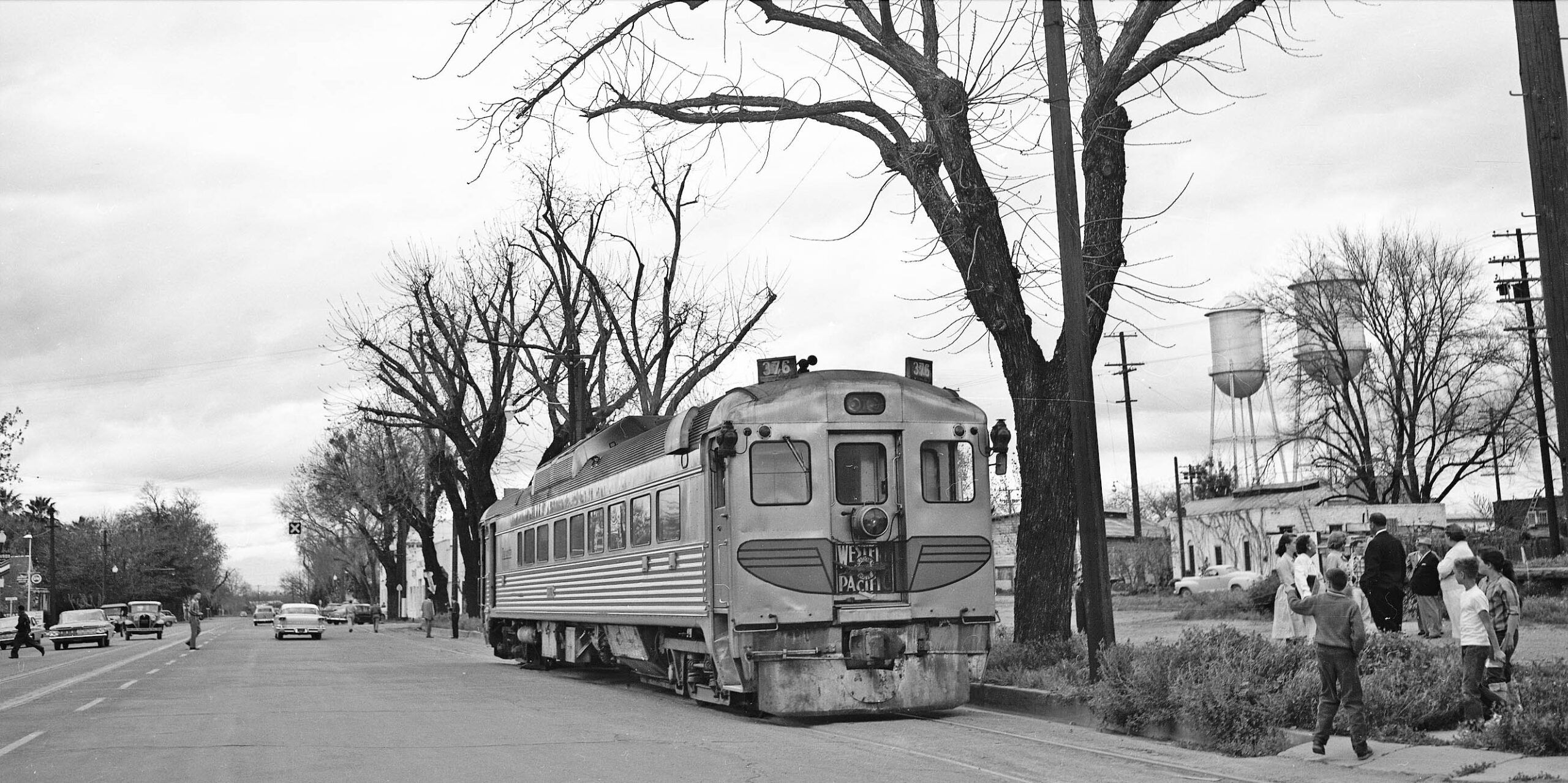
Ahead again to 1953 as it was the year a passenger train returned to Colusa on Oct. 31, left. This was a very ambitious excursion, arriving while the sun was setting in Colusa, probably accounting for why so few pictures were taken. On the right, Western Pacific Rail Diesel Car, WP RDC, car no. 375, “RDC”, takes a rest along the SN yard on Market St. between 7th and 8th Sts, east view.
L339-20-Addison Laflin Photo, Courtesy BAERA, Western Railway Museum Archives, 98787sn, (Image 6 of 41)
Another view of RDC at the same location looking more toward the northeast. Oct. 31 was a Saturday, and the yard appears empty of boxcars with no service scheduled on weekends.
L339-25-Arthur Lloyd Photo, Courtesy BAERA, Western Railway Museum Archives, 119551sn, (Image 7 of 41)
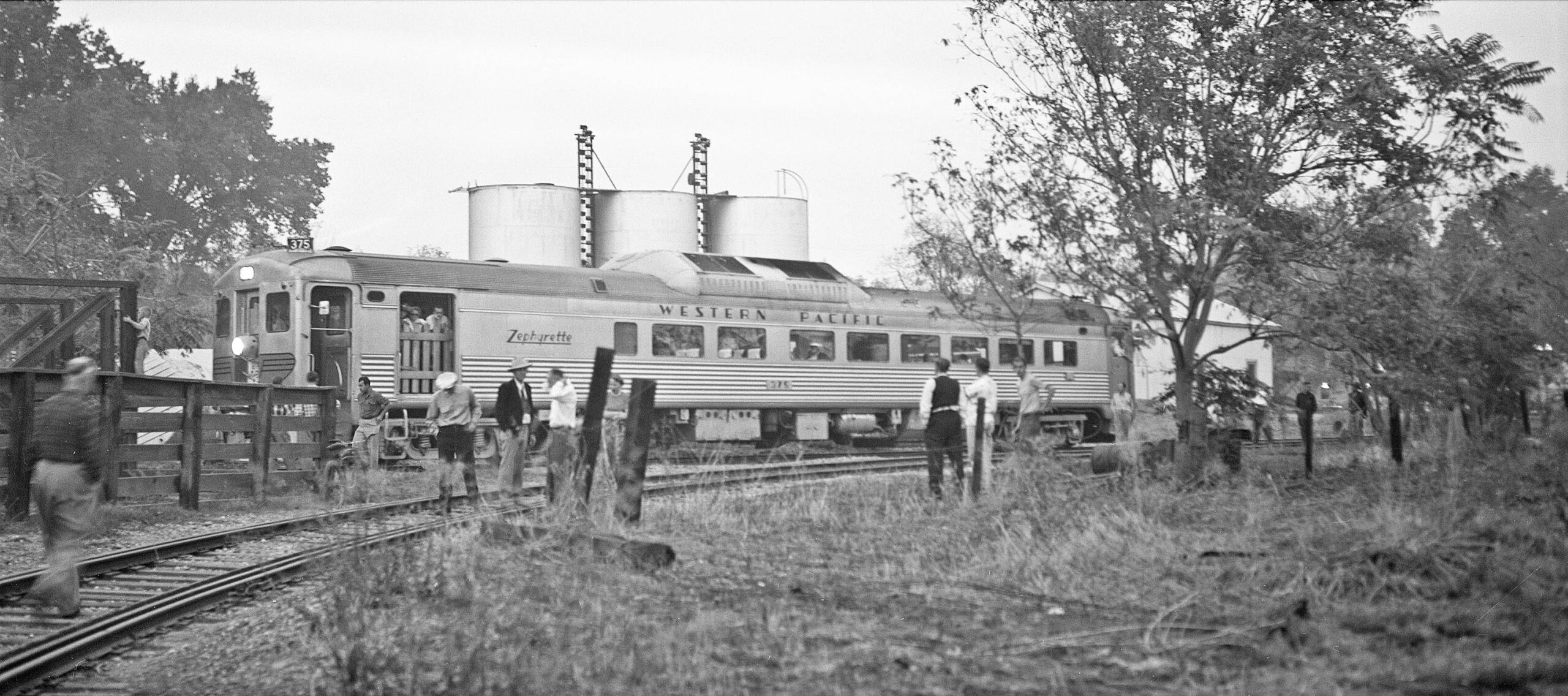
This is a north view at the corral, determined by the position of the three tanks of Union Oil behind the RDC. The RDC is on a spur and not on the loop track, the little boy holding onto a railing where livestock were likely loaded onto the freights. There is no documentation that RDC made its way around the loop, the large door of the baggage section always to the west in the few images found. The gauntlet track arrangement seen in the corral loop track, left border, that is tracks that run parallel on a single track bed that are interlaced, might have allowed the 85 ft. length of the RDC to pass through the constrained space.
L339-30-Addison Laflin Photo, Courtesy BAERA, Western Railway Museum Archives, 98786sn, (Image 8 of 41)
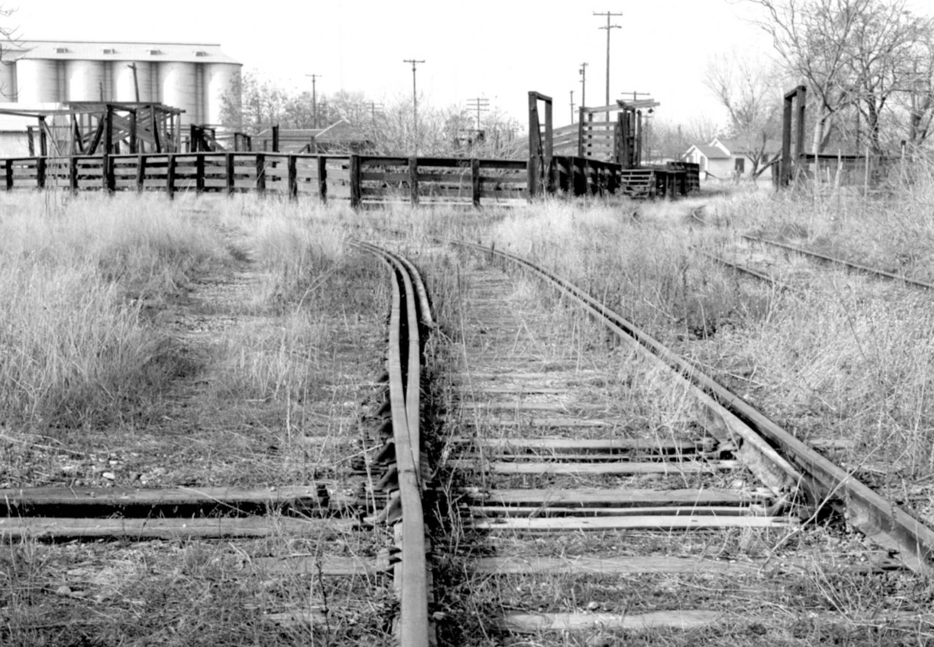
Now facing west in an undated view, someone documented the beginning of the gauntlet track arrangement of the loop, as well as the short spur and the adjacent livestock loading area. The large tanks to the west seen in the distance are absent in the 1937 aerial, but will be seen in a 1957 version shown later in this presentation. The unanswered question is whether this spur track also provided freights access to 14th St. For a treatise on gauntlet tracks, click here.
L339-32-Courtesy BAERA, Western Railway Museum Archives, 258938sn, (Image 9 of 41)
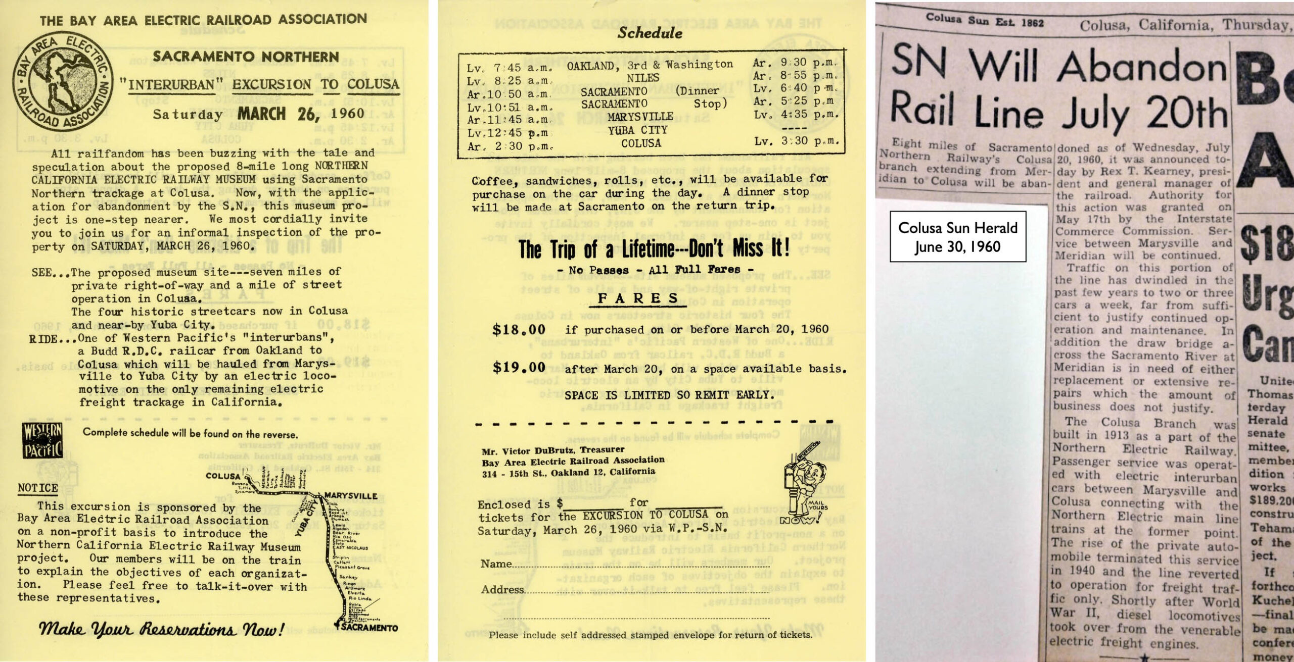
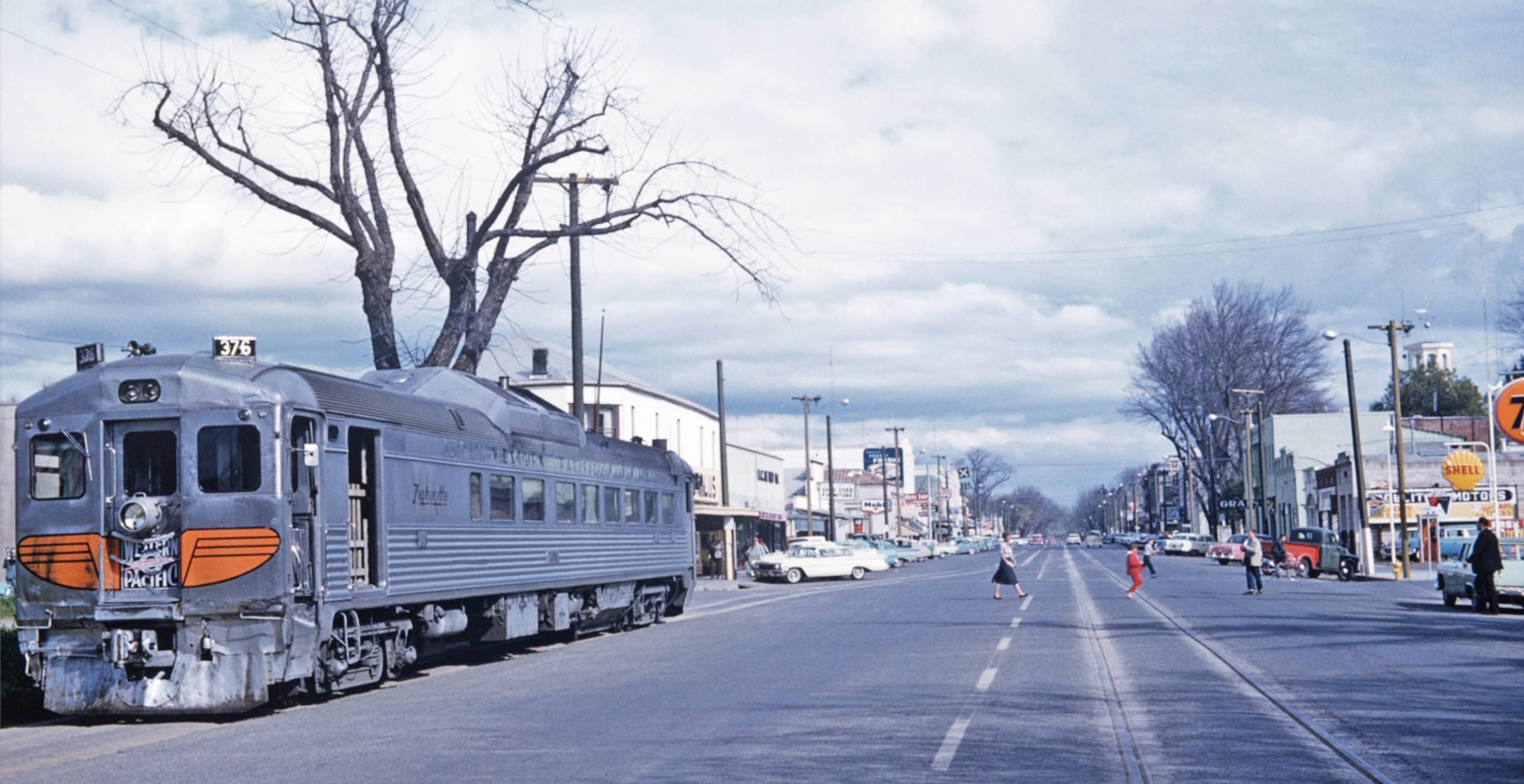
There would be one more excursion to Colusa using WP RDC no. 376 on Mar. 26, 1960. For this one, there was a motivating factor, that is, the Bay Area Electric Railroad Association, BAERA, members were looking for a place to create a museum, the Northern California Electric Railway Museum, NCERM. As the Colusa line west of Meridian was about to be abandoned, some members considered Colusa a possible place for the museum. On the right, the SN abandonment was complete three months later, the lack of business in concert with the State wanting to replace the Meridian Bridge to the east as the two key factors.
L339-35-Courtesy BAERA, Western Railway Museum Archives, l, Courtesy Colusa Free Library, r, (Image 10 of 41)
This east aerial view from 2025 is a reminder that the easternmost section of SN track into Colusa that was double-tracked, the former location indicated by the broken red line, has remained agricultural. As it was a hundred years earlier, the trees to the right or south of the right-of-way are within the city limits of Colusa, while the abandoned railbed and trees to the left or north are outside the city limits. The basis for this odd city limits was not uncovered.
L339-40-Courtesy Google Maps, (Image 11 of 41)
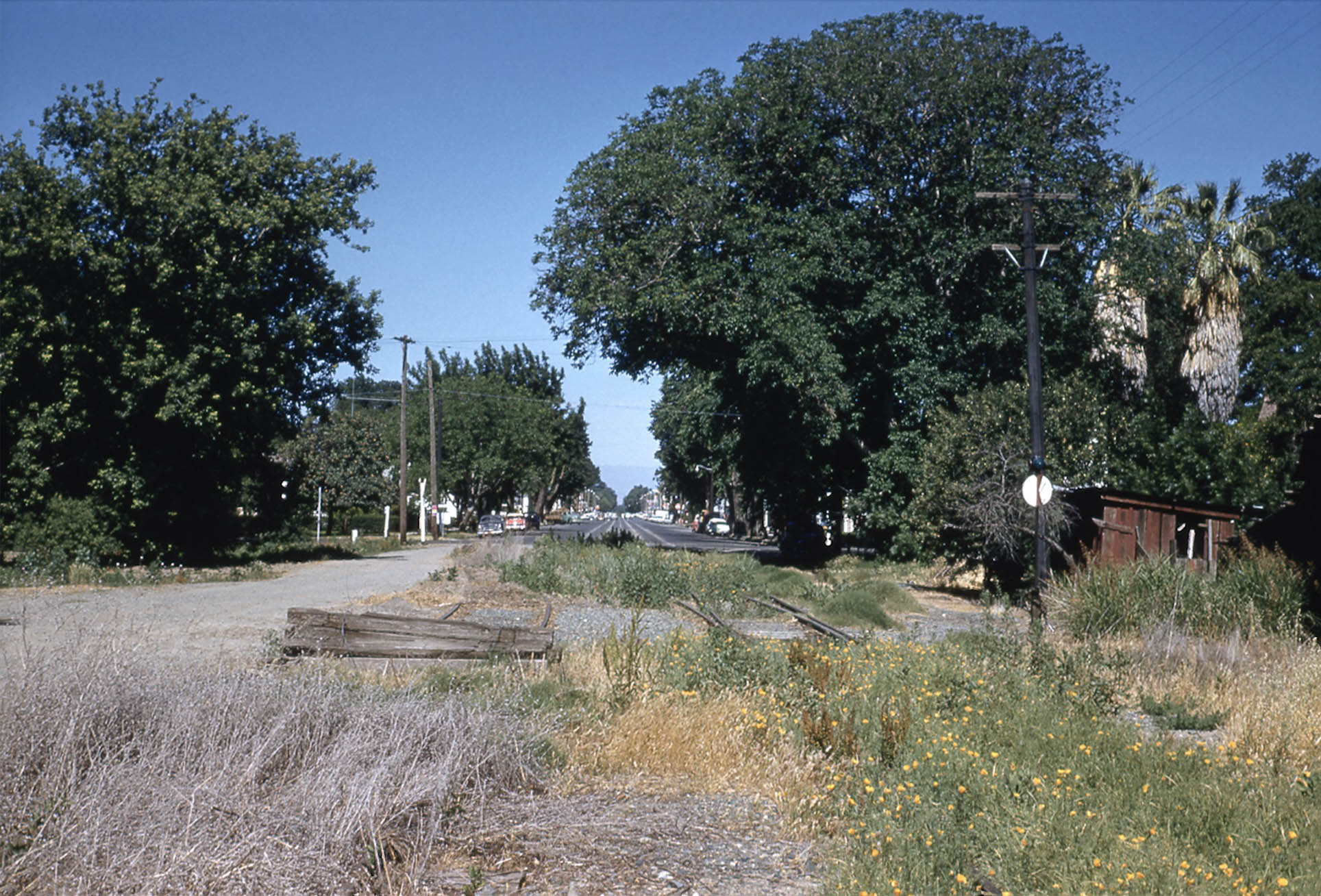
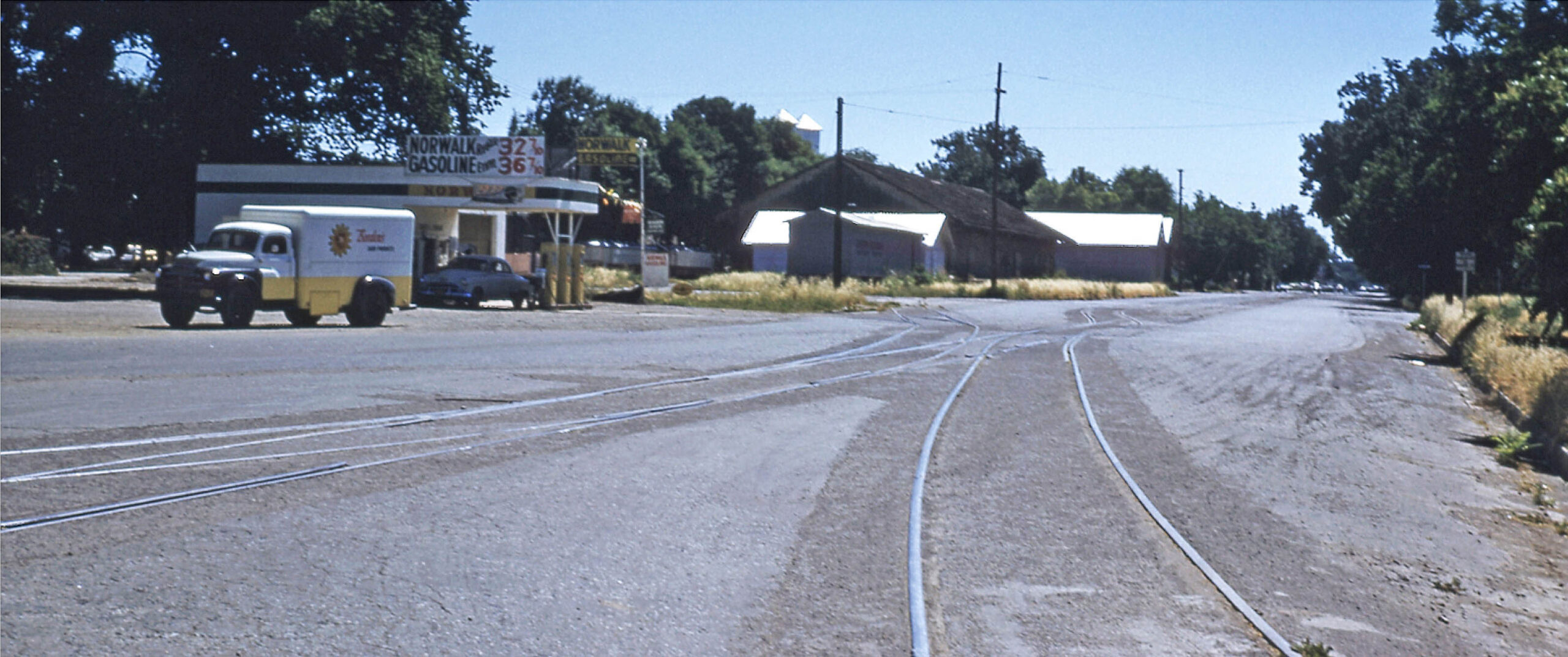
The condition of the SN right-of-way on May 21, 1959 at the rural-urban junction is shown in this west view. The last known train to have passed this section would have been the one delivering two streetcars for the planned NCERM on Apr. 10, 1959. Of course, the excursion train would have to pass here almost one year later as shown next.
L339-45-Ernest Haase Photo, Courtesy BAERA, Western Railway Museum Archives, 210173sn, (Image 12 of 41)
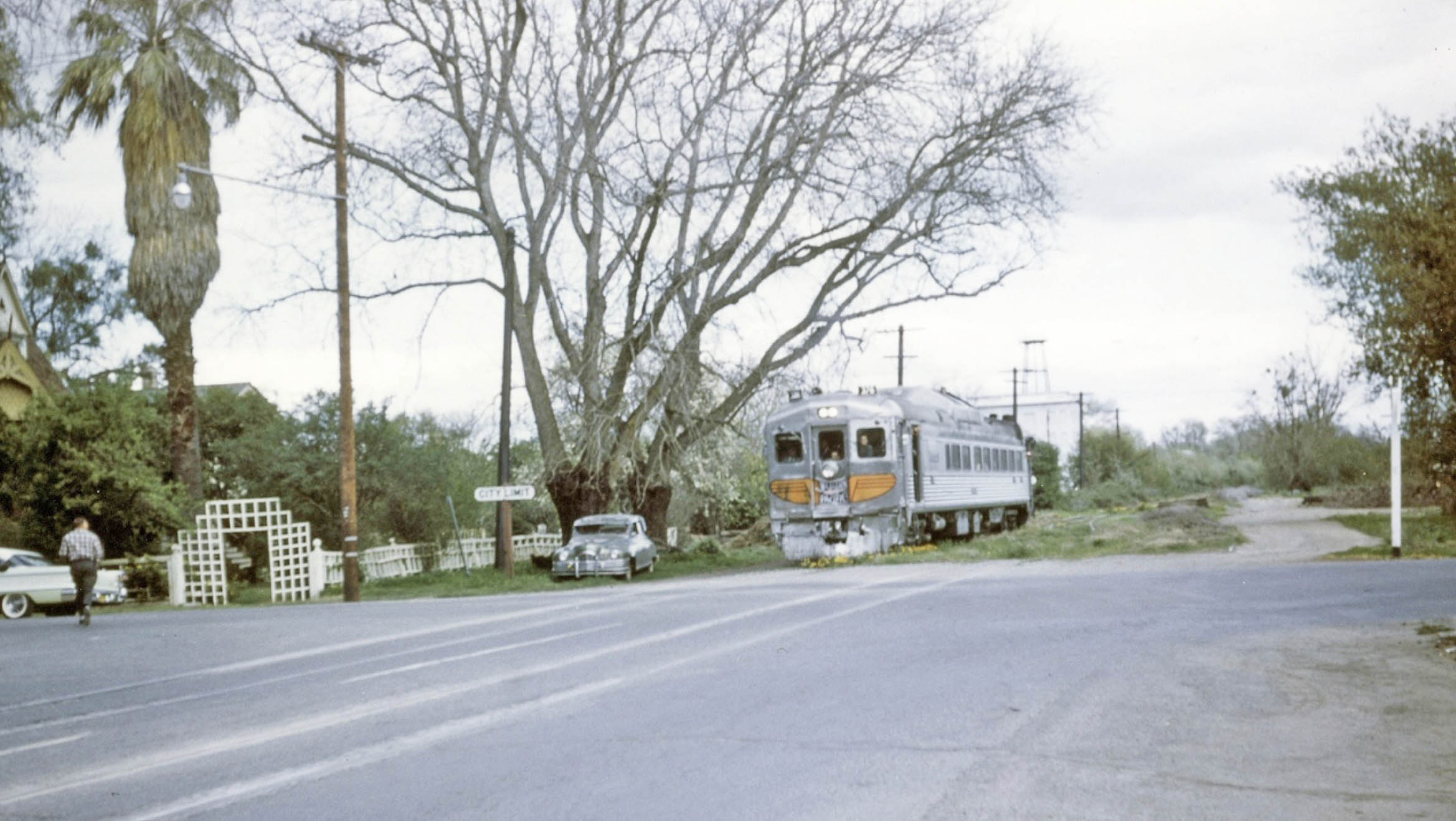
Based on the last image, it is not surprising that the RDC used the northern most track to enter Colusa on Mar. 26, 1960, east view. As with RDC 375 in 1953, the extra opening seen just to the east or right of the door which allowed entry to the baggage compartment marks the front of the train should it be determined that the train turned around using the corral loop.
L339-50-Jack Shekell Photo and Collection, Courtesy BAERA, Western Railway Museum Archives, 132203sn, (Image 13 of 41)
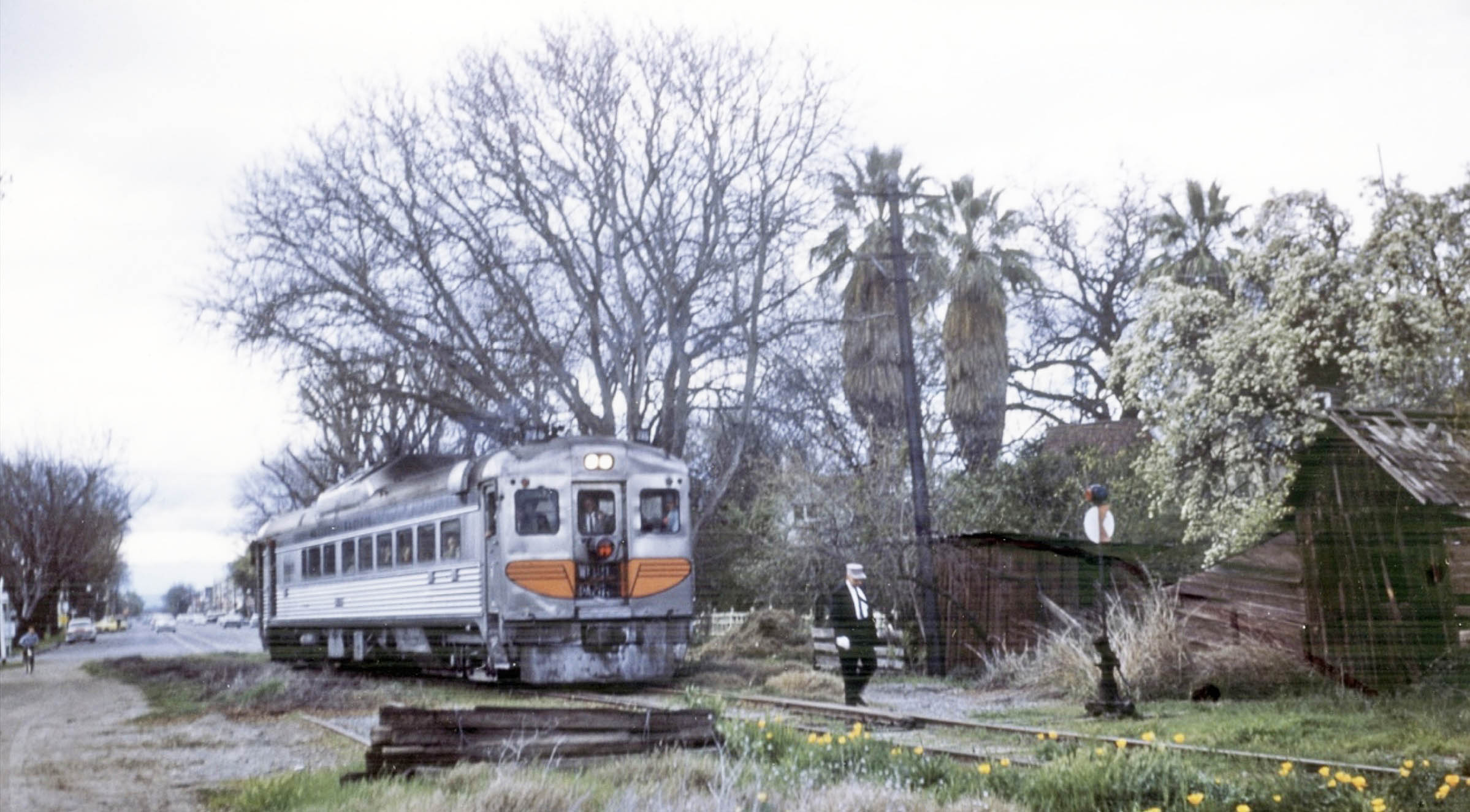
This west image is when the excursion was leaving Colusa, but placed here to keep the scenery ordered in sequence up to the SN yard. Here the conductor leaves the train to flip the switch to get the RDC onto the northernmost track, west view. The baggage compartment door is open, and is still at the same side of the train as when it entered. This means this car did not use the corral loop to turn around. The 1958-1960 Bay Area Review, the official record of BAERA activities, provided a possible reason in that in Apr. 1959, two short pieces of rail used to get the museum-related streetcars on the track “came from near the balloon track.”
L339-55-Jack Shekell Photo and Collection, Courtesy BAERA, Western Railway Museum Archives, 132201sn, (Image 14 of 41)
The RDC is at 1st St. in this west view. In 2025, the motel building seen just to the right of the train is the Colusa Motel.
L339-60-Jack Shekell Photo and Collection, Courtesy BAERA, Western Railway Museum Archives, 132202sn, (Image 15 of 41)
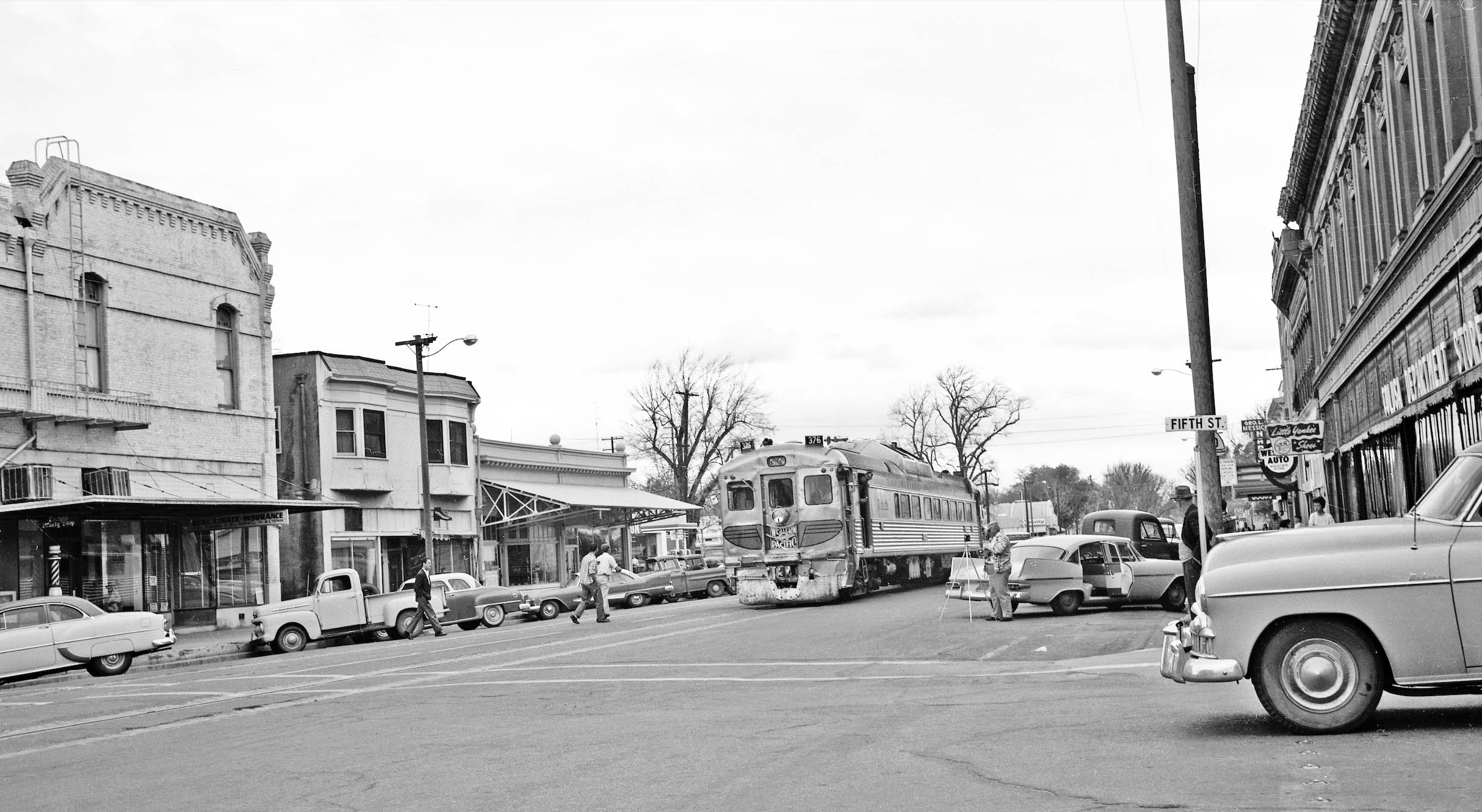
Now stopped just east of 5th St., the train is seen between the International Order of Odd Fellows, IOOF, on the left margin, and the Colusa Dept. Store in the O’Rourke Building on the right margin.
L339-65-Addison Laflin Photo, Courtesy BAERA, Western Railway Museum Archives, 172965sn, (Image 16 of 41)
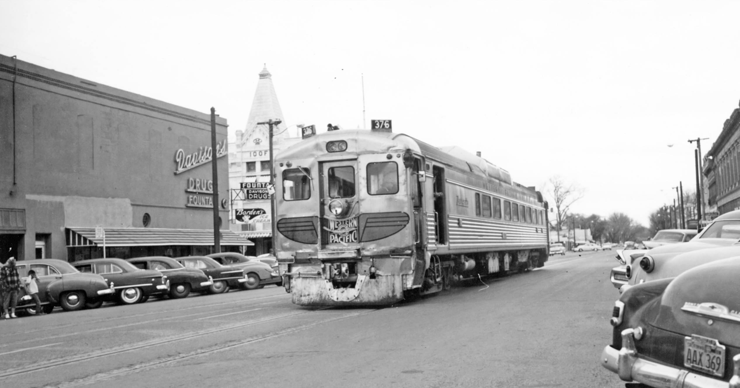
Now west of Fifth St., the buildings on the north side such as Davison’s Drug and Fountain and the IOOF are clearly documented.
L339-70-Courtesy BAERA, Western Railway Museum Archives, 232696sn, (Image 17 of 41)
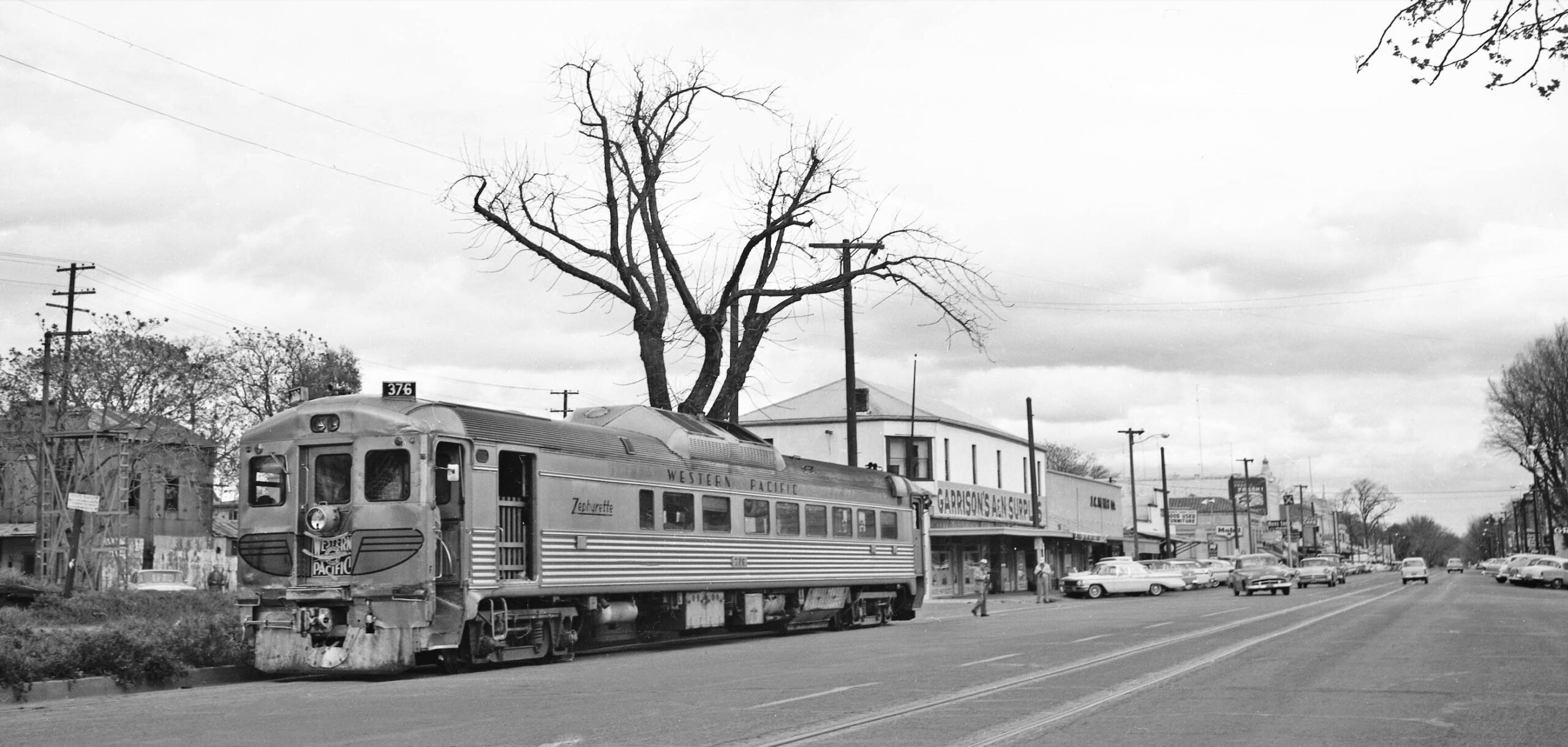
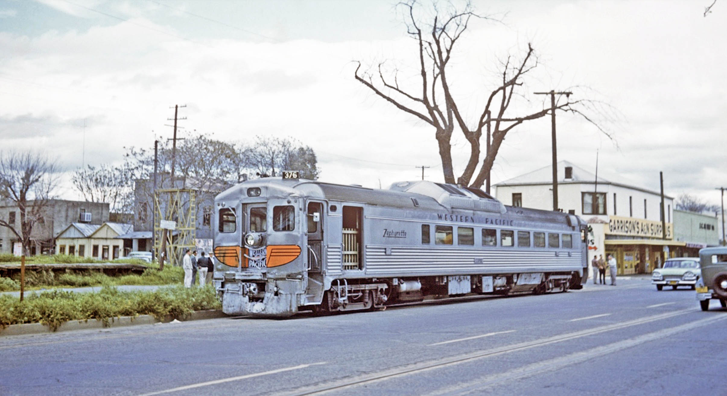
This east view provides a panoramic view of Market St. as the RDC sits alongside the SN yard between 7th and 8th Sts.
L339-75-Victor DuBrutz, Courtesy BAERA, Western Railway Museum Archives, 84541wp, (Image 18 of 41)
The building to the east of the RDC and 7th St. is now Garrison’s Army & Navy Surplus store. The part closest to 7th St. was where the SN ticket-freight office and waiting room had been, its absence based on the signage across the lower part of the ground floor indicating that the space is now inhabited by Garrison’s.
L339-80-Addison Laflin Photo, Courtesy BAERA, Western Railway Museum Archives, 172963sn, (Image 19 of 41)
The yard to the left of the RDC car looks empty in this northeast view, but not just because it is a Saturday and their is no freight service on the weekends anymore. Rather, the area around the freight ramp and platform appears overgrown.
L339-85-Arthur Lloyd Photo, Courtesy BAERA, Western Railway Museum Archives, 130186wp, (Image 20 of 41)
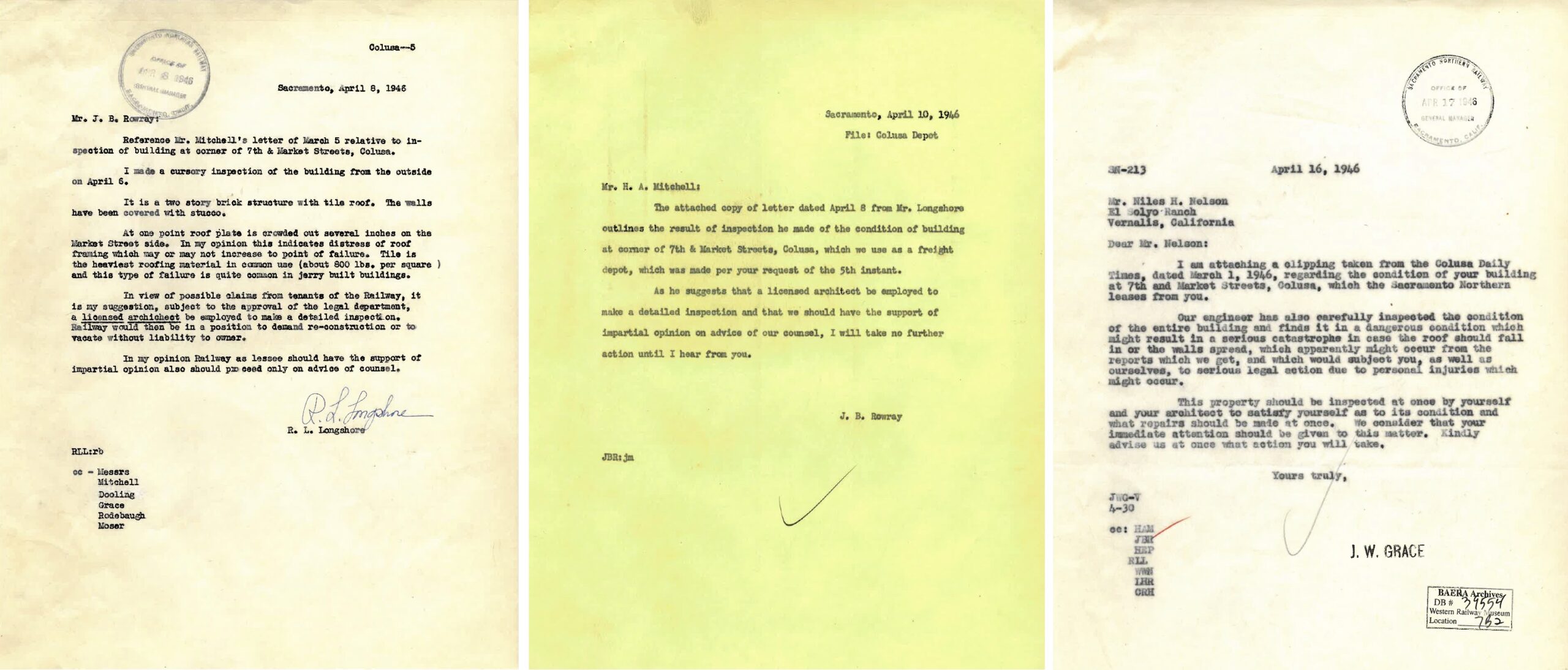
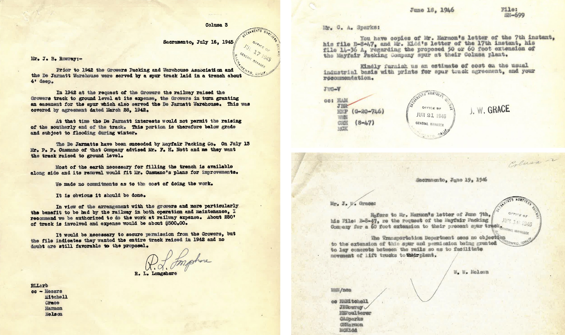
As documented in the last update, the SN had planned to create their own ticket-freight office within the confines of their adjacent yard in 1922, but that never happened. The memos shown here reveal significant structural degradation to the infrastructure of the building they were leasing. As the outside of the building remains unchanged in the previous two images from what was there in 1940, repairs to the structure were probably undertaken after these memos changed hands.
L339-87-Courtesy BAERA, Western Railway Museum Archives, 39554sn, (Image 21 of 41)
The complementary west view to those shown previously shows the RDC car alongside the empty yard. No images were found west of this, and the RDC car was not turned around for the return trip.
L339-90-Addison Laflin Photo, Courtesy BAERA, Western Railway Museum Archives,172964sn, (Image 22 of 41)
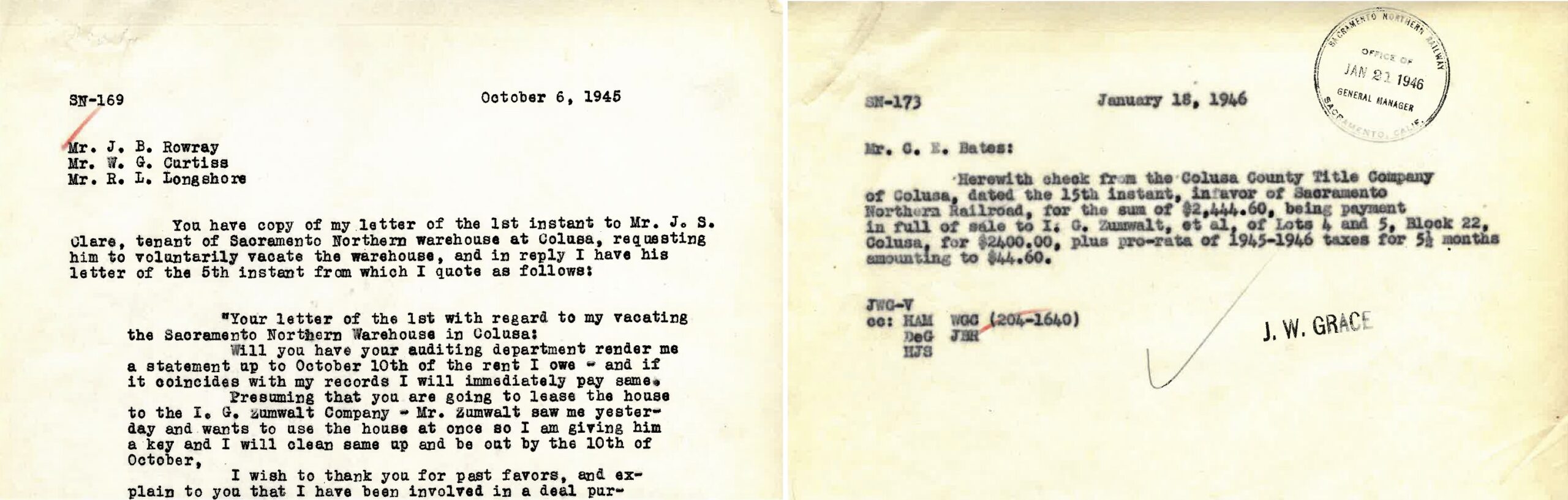
Next, some background on freight customers. In the documents shown, J. S Clare was in the seed business based on newspaper searches, and occupied the SN warehouse at Market St. and 11th St. Ivy George “I. V.” Zumwalt was an attorney, a Colusa District Attorney and publisher of the Colusa Daily Times. He was founder and president of the Colusa Implement Company, a machinery dealer whose retail outlet was shown in the last update at Market St. and 9th-10th Sts. A lifelong resident of Colusa CA, he had large land holdings in Colusa County. Based on these documents, Zumwalt ultimately bought the SN warehouse outright.
L339-91-Courtesy BAERA, Western Railway Museum Archives, 39553sn, (Image 23 of 41)
The last update featured the SN spur track to California Prune and Apricot Growers and the W. D. De Jarnett Dehydrater and Packing Plant on the western border of Colusa on 14th St., just outside the city limits. Mayfair Packing was also featured as leasing a warehouse at the northwest corner of Market St. and 12th St. in 1921. A San Jose-based dried fruit packer, these documents indicate the business was taking over the Jarnett facility asking for the SN to extend the SN spur to the south along 14th St.
L339-92-Courtesy BAERA, Western Railway Museum Archives, 39555sn, (Image 24 of 41)
WP Circular 167-E ca. 1957 supplies the names of active freight customers, left, and the availability of team tracks and ramps and platforms, center. A freight platform was just documented in the SN yard, and the location(s) of team tracks will be addressed shortly. Tania Cervantes and Resa Lyn of the Colusa County Free Library used phone directories to come up with addresses for these businesses, appreciating that a company might only supply a home office, not a warehouse. One error made by the WP was to list Union Ice, as it was Union Oil that made fuel oil. Note “Rosenburg Whse” under Zumwalt listing, to be explained later.
L339-95-Courtesy Bruce Eldridge, l and c, Courtesy Colusa Free Library, r, (Image 25 of 41)
Without having access to dispatcher information past 1950, it is hard to know when freight service functionally ended. These employee timetables show that from 1953 to 1957, freight movements increased to everyday with less destinations, but not necessarily to Colusa, where the time from arrival to departure had been cut to 30 minutes. The previous panel did not list the capacity of the Rosenberg Bros. & Co. spur at Arbee, but here it lists 17 cars.
L339-97-Courtesy BAERA, Western Railway Museum Archives, l, Courtesy wx4.org, r, (Image 26 of 41)
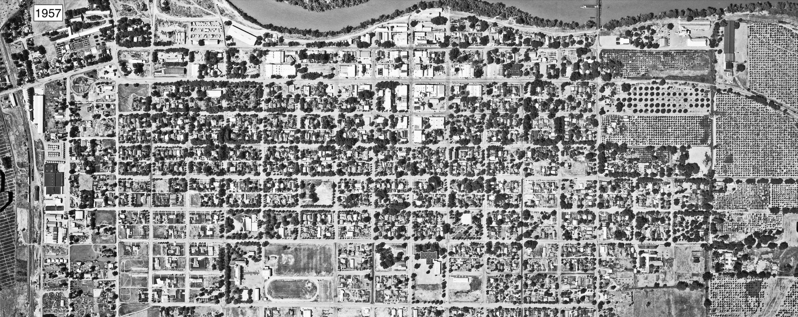
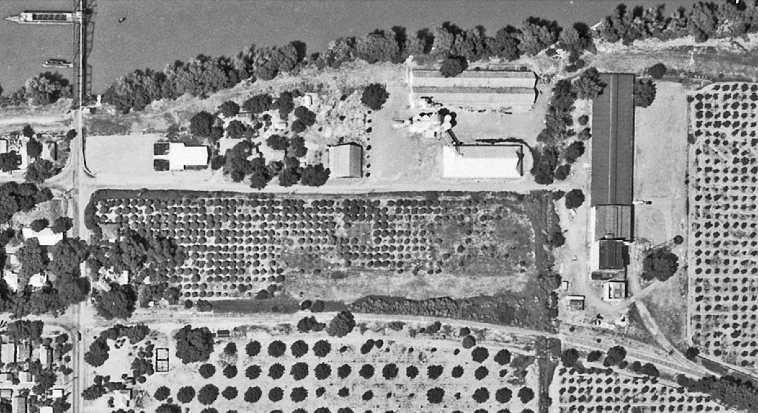
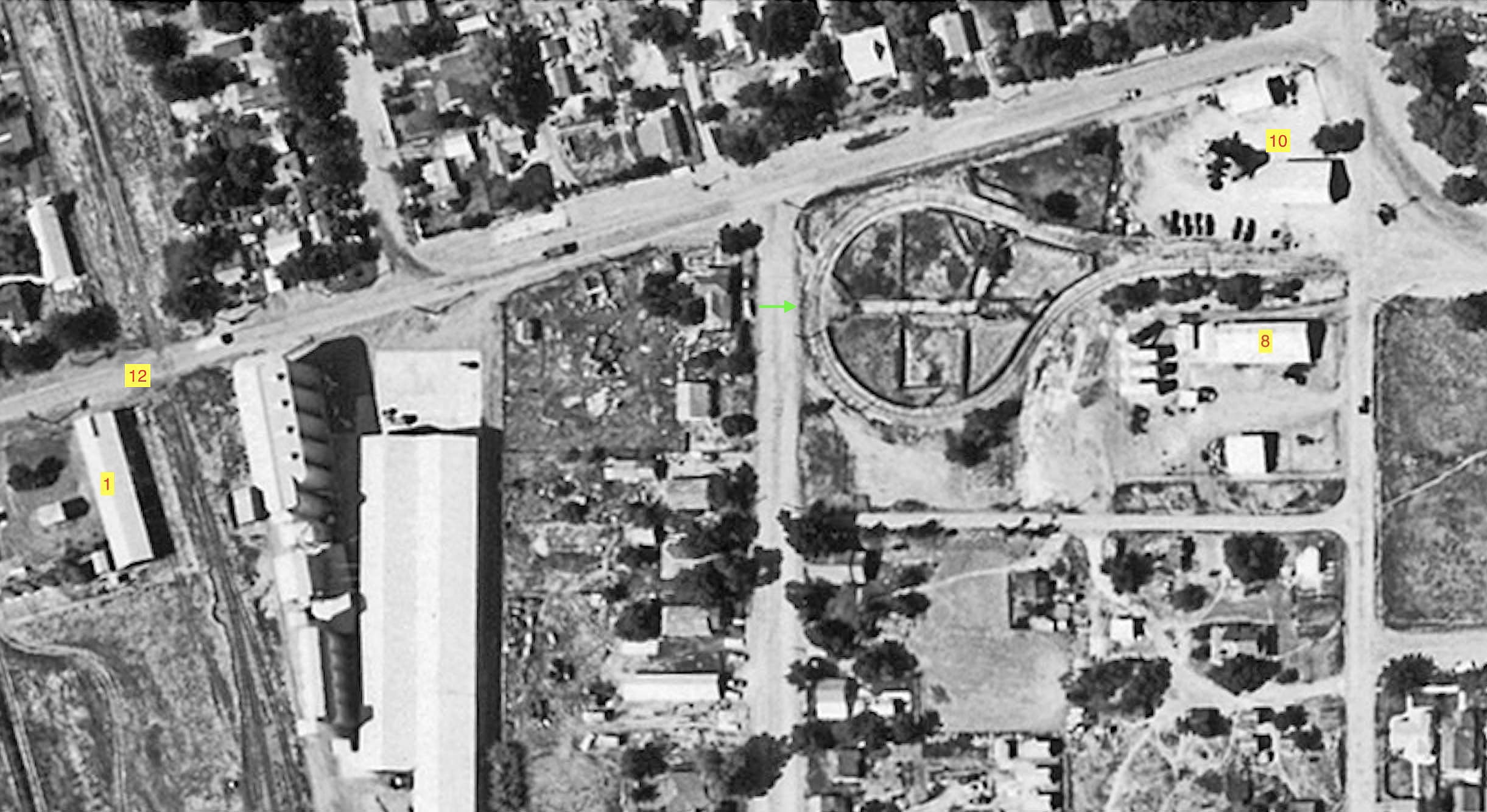
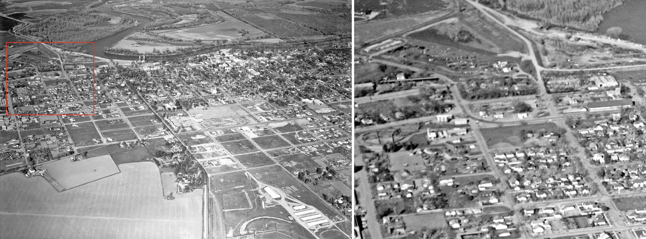
Staying in 1957, this aerial from May 29, 1957, a Wednesday, will begin the process to chronicle the end off SN freight service in Colusa. At this low magnification, there doesn’t appear to be any major changes to the SN track layout, but a few additions and no major reductions to buildings adjacent the tracks and spurs have been made since 1937. However, the warehouse area along the SP right-of-way that was partially serviced by a SN spur, seen running along the left margin, has shown significant growth. More about this later.
L339-100-cas-1957_colusa, Courtesy of UC Santa Barbara Library Geospatial Collection, (Image 27 of 41)
Next details from the May 29, 1957 aerial starting at the eastern border of Colusa. What had been identified as the Rosenberg Bros. warehouse in 1930 in the previous update still shows a spur coming off the mainline east of the city border. The facility shown here was not within the city limits of Colusa, the area historically was called Arbee as listed in the WP Circular list. Note the double-track entry into Colusa. As will be explained shortly, Rosenberg Bros. would be gone by 1959 at the latest, and possibly as early as 1955 as listed in the directory.
L339-105-cas-1957_colusa, Courtesy of UC Santa Barbara Library Geospatial Collection, (Image 28 of 41)
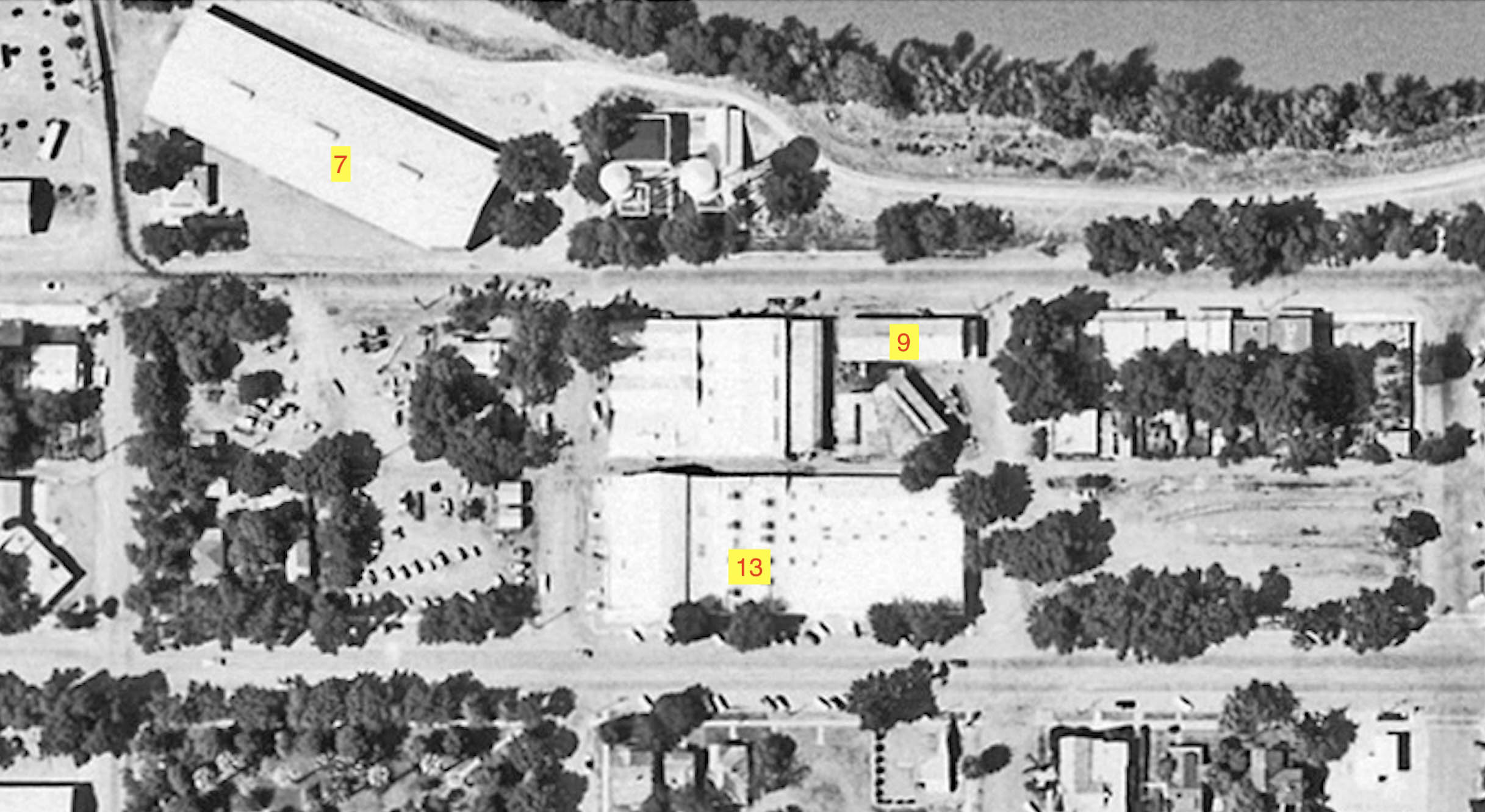
Shifting west to the area between 7th St., right border, and 11th St. left border, no freight cars are evident in the yard between 7th and 8th Sts. Marked as no. 7, River Warehouse, and no. 9, lumber company W. C. Stokes, were listed in the WP Circular as using the team track. This must mean at the SN yard, but it cannot be verified. The no. 850 Market St. address is the Zumwalt Farm Equipment building, no. 13, explained in the last update as their retail store for selling Caterpillar and John Deere equipment. The WP Circular lists a spur for “Equipment” with a capacity of three freight cars. If these are not in the SN yard, it is not clear where that spur would have been.
L339-110-cas-1957_colusa, Courtesy of UC Santa Barbara Library Geospatial Collection, (Image 29 of 41)
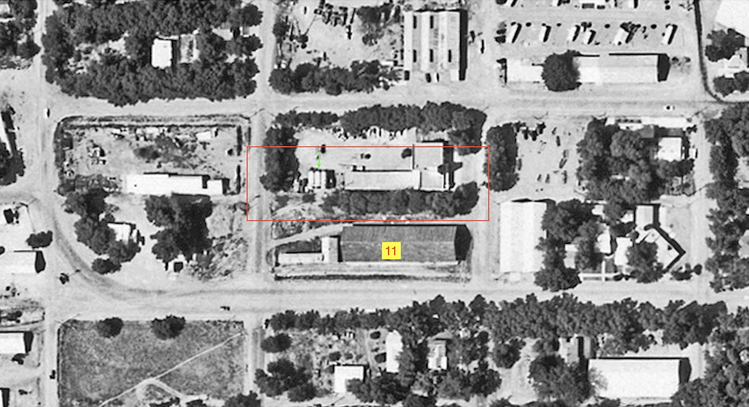
Further west, the SN freight tracks coming from the west on the left and bottom border and the switch allowing them to interchange freight just west of 12th St. are shown on May 21, 1959. The track veering to the left or north supplied the whole square block between 12th and 11th Sts., including what was the large SN warehouse along Market St., the large dark brown building, purchased by Zumwalt in 1946. The place looks forlorn, but notice just to the right of the service station in the background are two rail cars whose presence will be explained soon.
L339-115-Ernest Haase Photo, Courtesy BAERA, Western Railway Museum Archives 210176sn, (Image 30 of 41)
This detail from the aerial from 1957 includes the section just described, but also extends to the adjacent area from 10th St., right border to 13th St., left border. There are no freight cars seen, and the list from the WP Circular indicates only the Zumwalt warehouse, no. 11. seen in the previous image. The two rails car present in the background were along the spur enclosed by the red rectangle, parked just to the east or right of the three large tanks, green arrow.
L339-120-cas-1957_colusa, Courtesy of UC Santa Barbara Library Geospatial Collection, (Image 31 of 41)
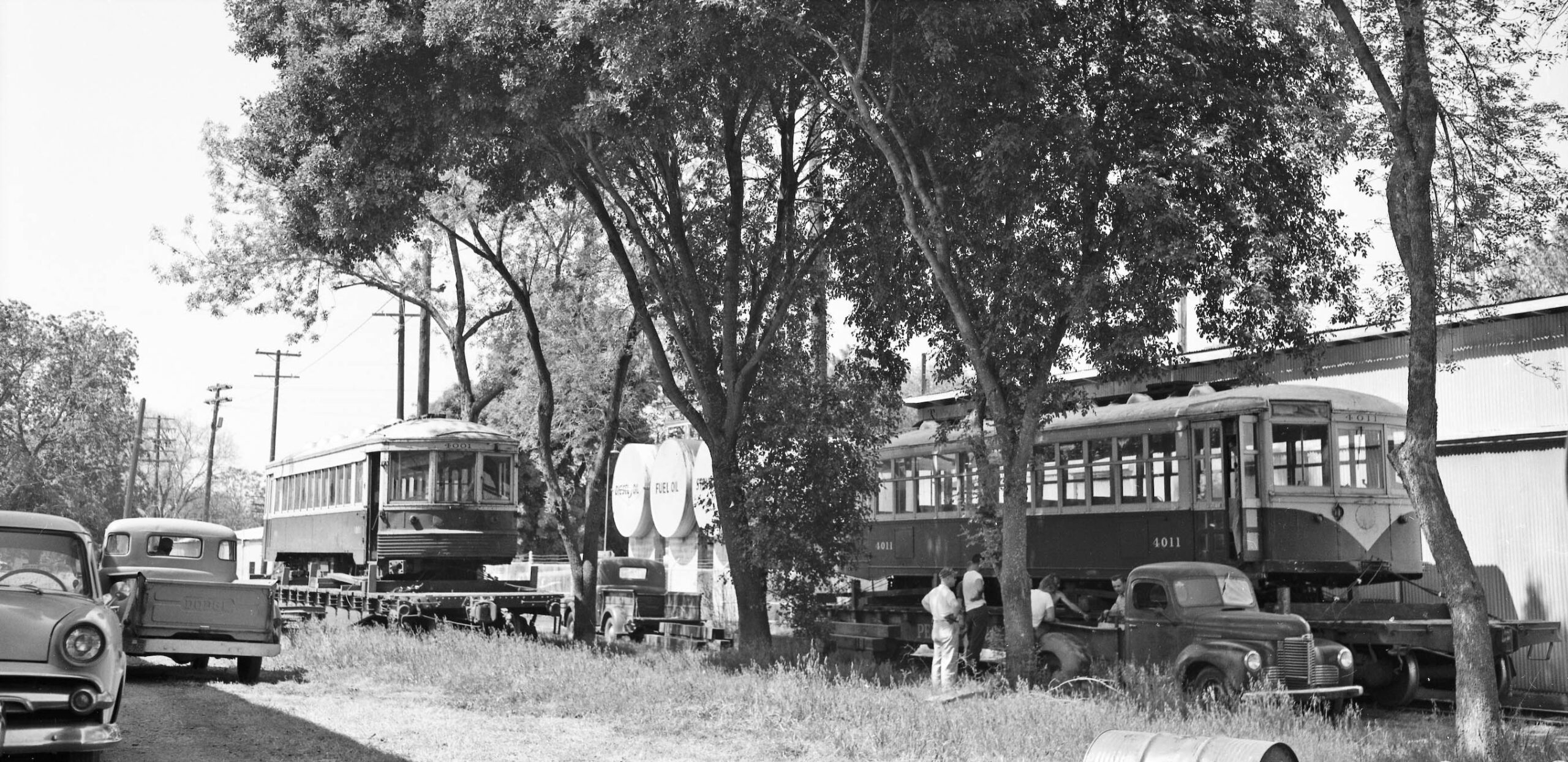
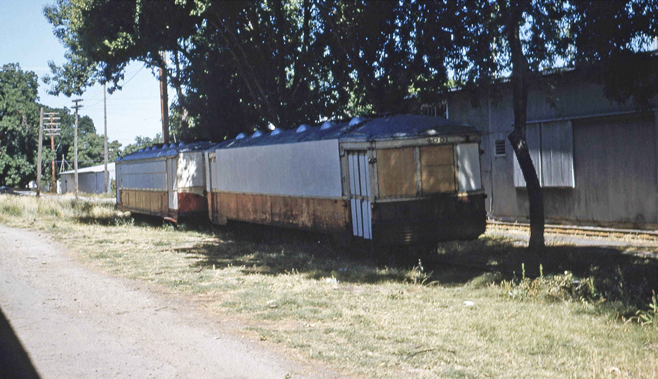
The scene is a northeast view from Apr. 11, 1959, and the members of the NCERM are positioning Portland Traction 4001, left, and 4011, right, to unload. The tanks holding oils and the building match what was outlined in the previous panel. Excerpts from the Bay Area Review 1958-1960 tell the story. On Feb. 16, 1959, the City Council of Colusa unanimously approved the NCERM to operate streetcars on the city streets on Saturdays, Sundays and holidays during the summer subject to an agreement between the city and museum to be negotiated. About 20 electric railway cars from several sources had been offered to start the museum at this point.
L339-125-Addison Laflin Photo, Courtesy BAERA, Western Railway Museum Archives, 202663sn, (Image 32 of 41)
On Mar. 4, 1959, BAERA members elected the officers of the NCERM. The delivery of cars to Colusa began on Apr. 6, 1959 in Portland, with Portland Traction Co., PTC, 4001, ex-Indiana RR 202, loaded on by its own power using a ground cable to Rock Island flatcar 90342, and car 4011, former Key car 987 that had been lent to PTC by BAERA, on Pennsylvania RR flatcar 469782. Car 4001 served as payment to BAERA for the loan of the Key car. They were transported by the Spokane, Portland & Seattle Railway, the Great Northern Railway, and WP to Marysville. No images showing this transfer en route were found. Northeast view, also Apr. 11, 1959.
L339-130-Addison Laflin Photo, Courtesy BAERA, Western Railway Museum Archives, 202659sn, (Image 33 of 41)
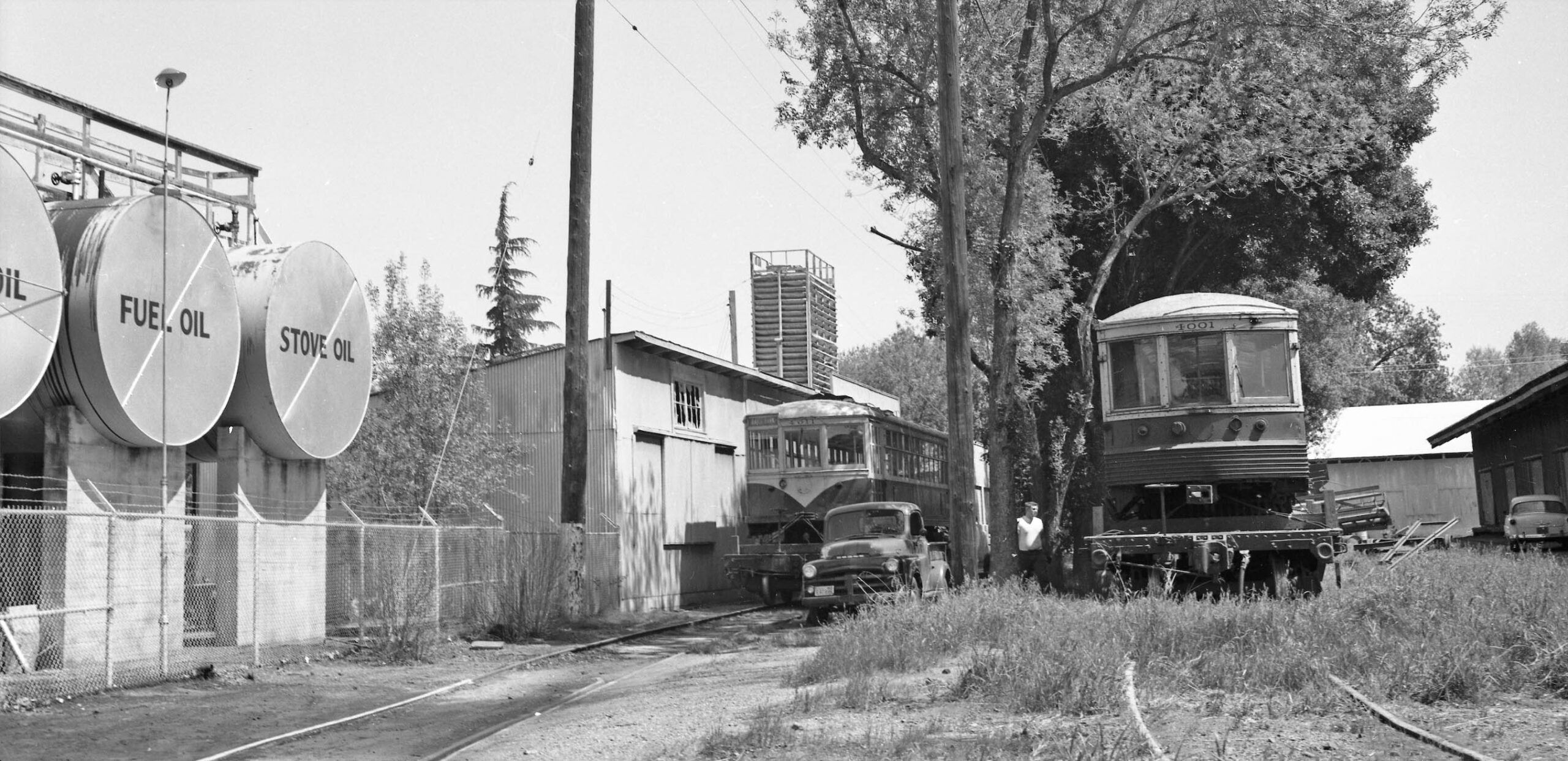
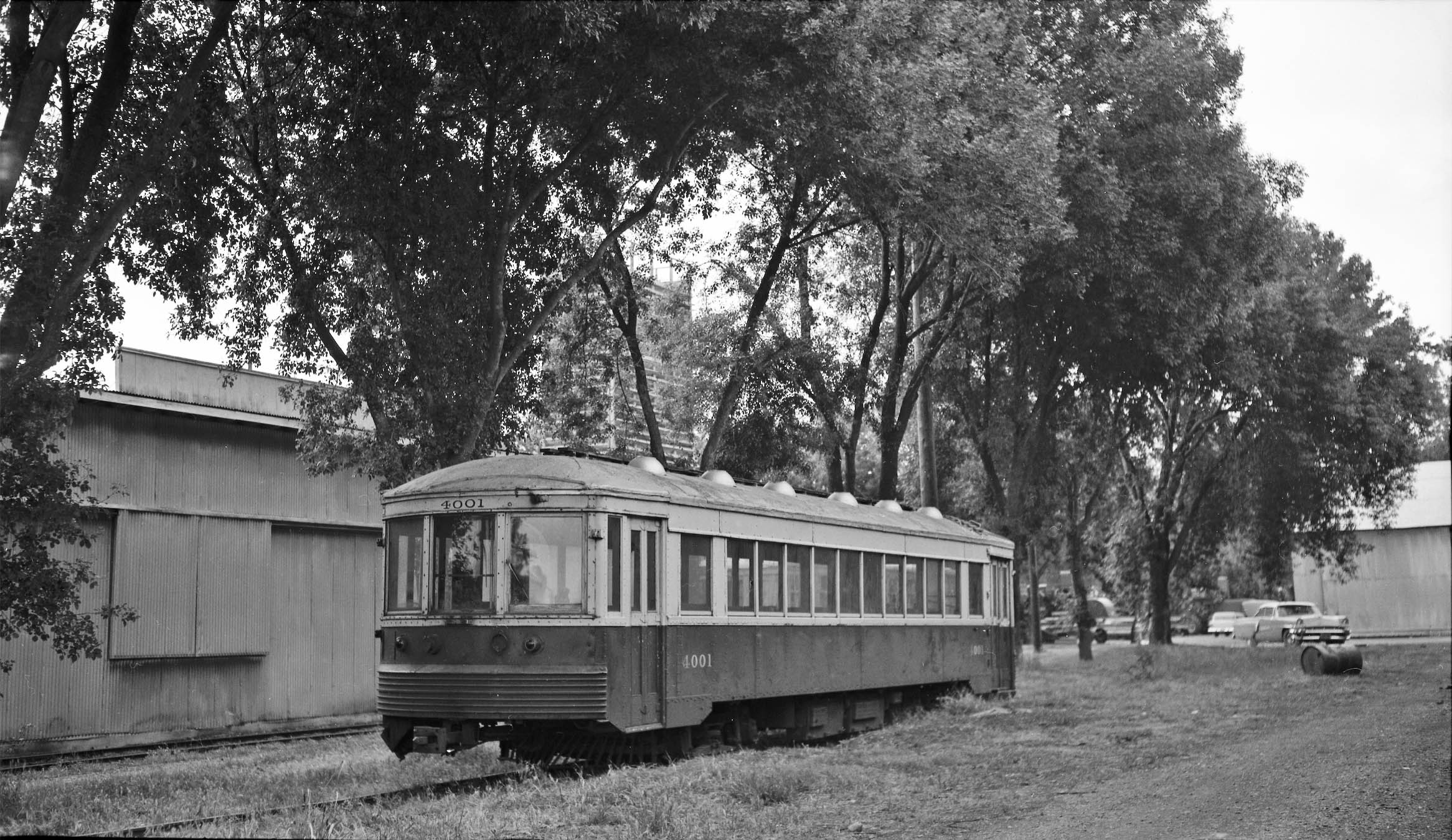
On Fri. Apr. 10, 1959, a diesel engine hauled the two loaded flatcars on SN track into Colusa, “the only train of the week”, also noted to be “spotted on the SN team tracks at Market St. and 11th …” No image of the diesel moving the flatcars here was found. They were taken off the flat cars the next day with great ingenuity, and as it was recorded, “now on the [SN] team tracks.” This may explain why the WP Circular had no company addresses between 11th-12th Sts., because these were considered team track. It is either that or the warehouses in this area weren’t using the SN. Northwest view of PTC 4001, Apr. 25, 1959. PTC 4011 is hidden behind 4001 …
L339-135-Addison Laflin Photo, Courtesy BAERA, Western Railway Museum Archives, 202656sn, (Image 34 of 41)
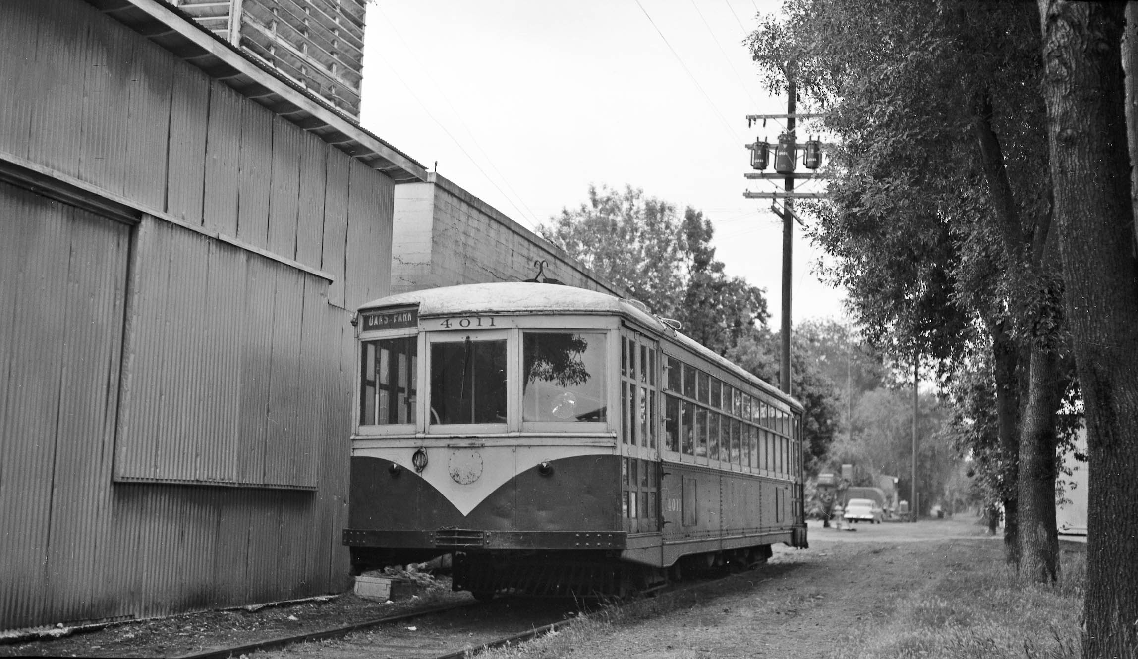
On July 20, 1960, the SN abandoned its Colusa Branch west of Meridian. The two street cars were moved “from the team track they now occupy to the spur at the old rice mill at Arbee … owned by I. G. Zumwalt Co. which uses the old rice mill building to store mud used in connection with oil well drilling.” This would explain the 1955 telephone listing the misspelled “Rosenburg Whse” shown earlier. However, the NCERM was “unable to post the $80k bond required as a guarantee that it would relieve the SN of repaving operations in connection with the abandonment of the rails on Colusa’s Market St.” Northwest view of PTC 4011, Apr. 25, 1959.
L339-140-Addison Laflin Photo, Courtesy BAERA, Western Railway Museum Archives, 202657sn, (Image 35 of 41)
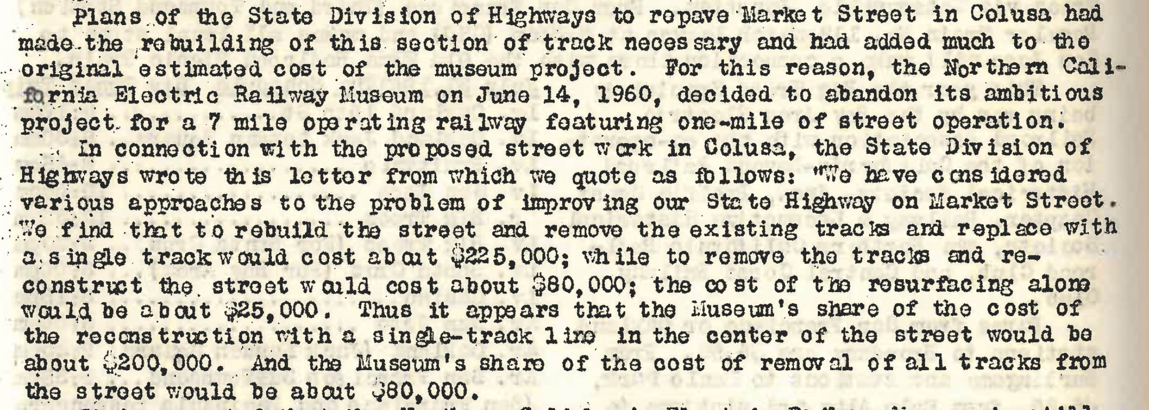
Market St. had been part of the State highway system prior to the construction of the Colusa Branch. The State Division of Highways had planned to repave it once the SN abandoned, and made the rebuilding of this section of track necessary, adding to the original estimated cost of the museum project. Although the letter from the State to the NCERM was not found, the Bay Area Review did provide a transcript of its contents, shown here, outlining the financial analysis of the work to be done after the SN abandonment.
L339-145-Bay Area Review 1958-1960, Courtesy BAERA, Western Railway Museum Archives, (Image 36 of 41)
The financial shortfall convinced the NCERM to abandon its ambitious project on June 14, 1960 for the 7 mile operating railway featuring one mile of street operation. The NCERM was still seeking about 1 mile of the abandoned track just east of Colusa, but that idea lost steam when the land at Rio Vista Junction became available for purchase as a museum site later in 1960. This west view from May 21,1959 is the latest image found of the two streetcars in Colusa, both in the process of rehabilitation and protection from vandalism.
L339-150-Ernest Haase Photo, Courtesy BAERA, Western Railway Museum Archives, 210174sn, (Image 37 of 41)
Moving further west to the corral area in 1957, the position of Associated Oil, no. 1, versus that for the Zumwalt drier facility at “SP & Lurie”, no. 12, have not been determined, but both were serviced exclusively by the SP right-of-way. Standard Oil, no. 8, and Union Oil, no. 10, had been SN customers from at least 1921. The best takeoff location for the spur to allow freight cars down 14th St., green arrow, is still from the west side or 3 o’clock. A track diagram of the post-abandonment dismantling plan for the SN track and facilities in Jeff Asay’s book “The Iron Feather”, Lockridge Press, 2018, page 461 shows that track left the loop at the west end.
L339-155-cas-1957_colusa, Courtesy of UC Santa Barbara Library Geospatial Collection, (Image 38 of 41)
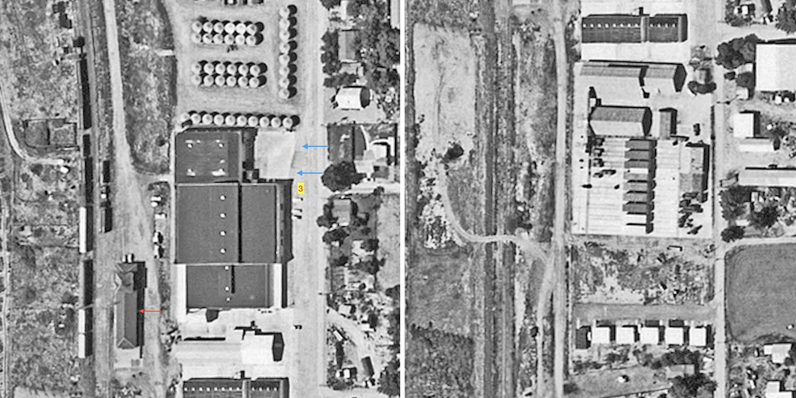
The spur to 14th St. that had shown five freights a piece for SN and SP at California Prune and Apricot Growers, no. 3, in the 1937 aerial from the previous update had five total listed here in the WP Circular ca. 1957. The image on the left showing that facility in 1957 still has the outlines of the SN spur, blue arrows, but there are no freights here at this time for the SN or SP. Contrast this to the cars lined to the west or left of the SP depot, red arrow. Further south at the dehydrator plant, there are no freights as well.
L339-160-cas-1957_colusa, Courtesy of UC Santa Barbara Library Geospatial Collection, (Image 39 of 41)
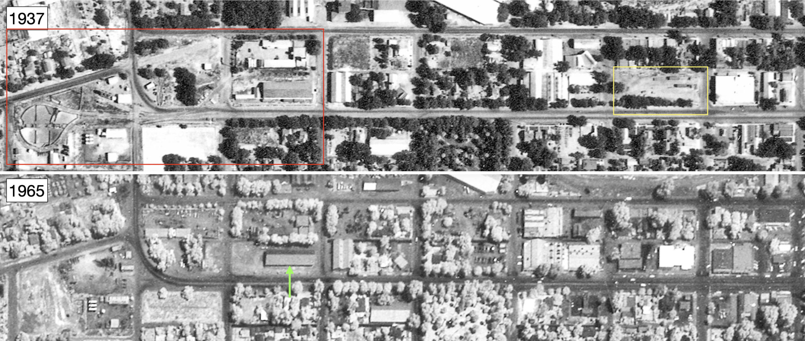
Once the SN abandoned and the talk of starting the NCERM ended, removal of any trace of the former SN operations was almost complete by 1965 as shown in the aerial below versus that from 1937. The green arrow points to one surviving landmark, the former SN warehouse, in place by 1921. Jeff Asay provides in his book a very concise summary and figure explaining the rail removal and salvage operation in Colusa that began in Oct. 1960.
L339-165-USDA Aerials, AAY-24-77, Courtesy Map Collection, Shields Library, University of California, Davis, ABC-100-90, G4363 C5A4 1937 U6, Detail top, G4363 C5A4 1965 H4, Detail bottom, (Image 40 of 41)
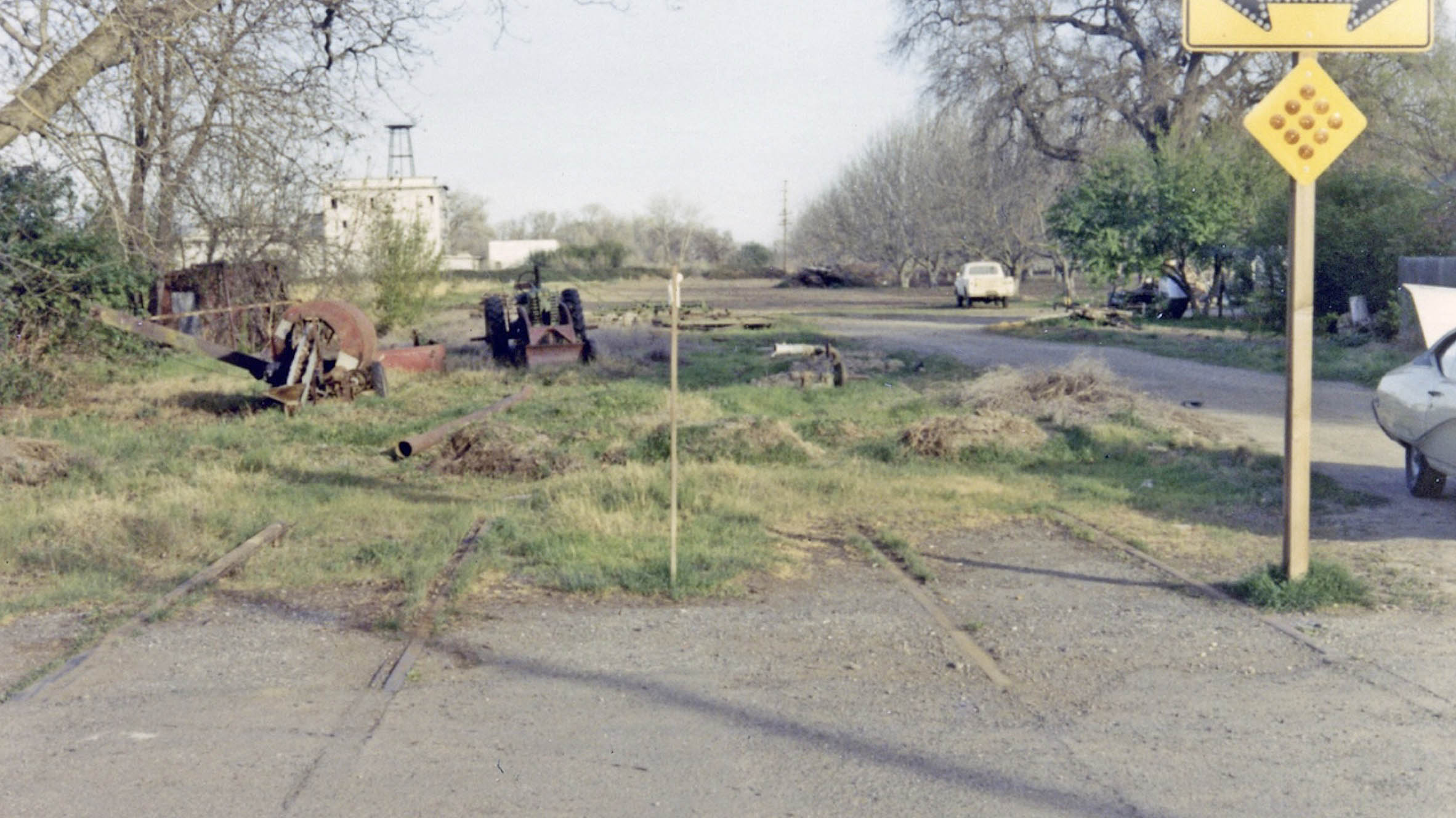
Jack Shekell returned to Colusa on Mar. 11, 1972, possibly looking for any remains of the SN. Only one picture from that trip was found, this east view at the border of asphalt and agriculture, urban and rural. Acknowledgement and appreciation to Resa Lyn and Tania Cervantes for their search for addresses of SN customers, and to Resa for digging out the newspaper clipping about the SN abandonment. Next time, the Meridian Bridge and Schindler’s Legacy.
L339-170-Jack Shekell Photo and Collection, Courtesy BAERA, Western Railway Museum Archives, 132200sn, (Image 41 of 41)