Newell Avenue Back Through Time – Panoramic to Willow
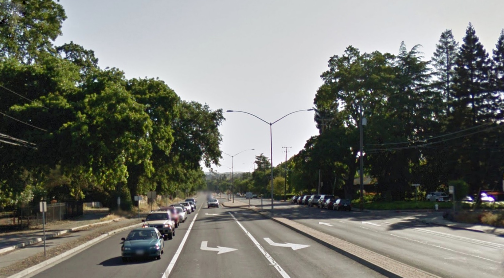
Viewed northeast from its intersection with Boulevard Way and Tice Vally Boulevard, tree-lined Olympic Boulevard is the major thoroughfare through Saranap. The first cross street sign to the right denotes Panoramic Way.
L53-05-Courtesy Google, (Image 1 of 12)

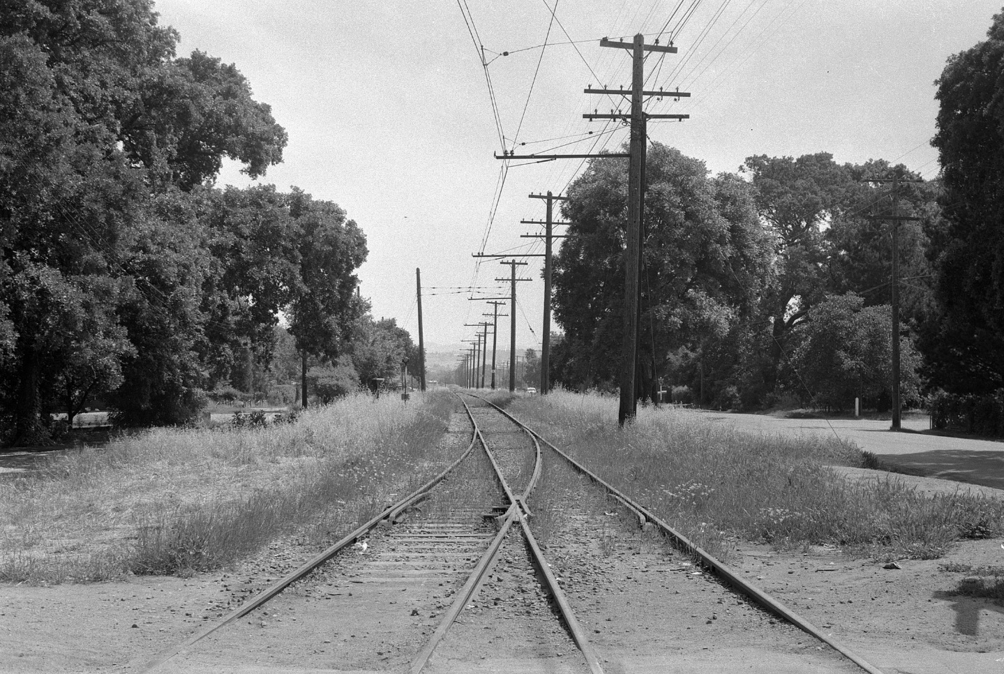
Going back in time to Nov. 5, 1963, the same northeast view shows unpaved Olympic Boulevard, with a pile of dirt running the length of the road just to the right, or south, of the median of the road.
L53-10-Courtesy Planning and Engineering Divisions, City of Walnut Creek, (Image 2 of 12)
Now to 1957, interpreting the changes in L53-10 becomes obvious from this northeast view. The paved street to the south and parallel to the tracks is Newell Avenue. Once this section of SN was abandoned on Aug. 10, 1958, it took many years until Olympic Boulevard was created.
L53-15-John Harder Photo, Courtesy John Harder, (Image 3 of 12)
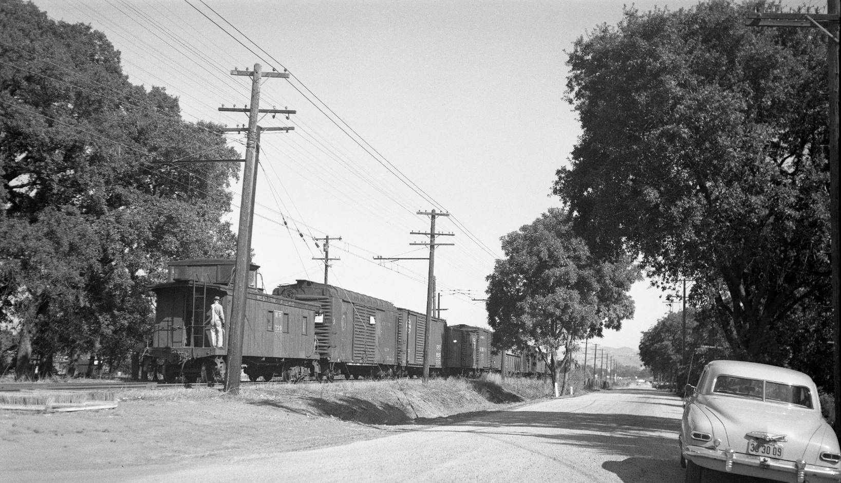
Another northeast view with WP caboose 739 at the rear of the freight, this time from 1950. The sign for Panoramic Way is different, visible above the roof of the driver side of the car. Now to trace the evolution of Newell Avenue.
L53-20-Dudley Thickens Photo, Courtesy BAERA, Western Railway Museum Archives, 63800sn, (Image 4 of 12)
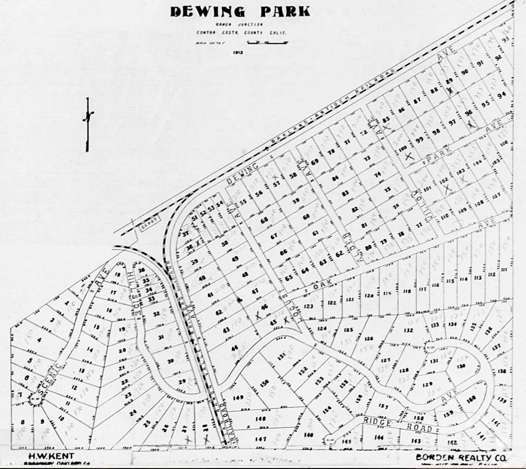
The roads shown in this 1913 map of Ramon Junction were the only ones in close proximity to the railroad mainline to Walnut Creek and the Danville branch in what is today Saranap. By 1940, Newell Road appears in County records, but the date for this name switch has not been determined.
L53-25-LL Stein Collection, Courtesy BAERA, Western Railway Museum Archives, 63588sn, (Image 5 of 12)
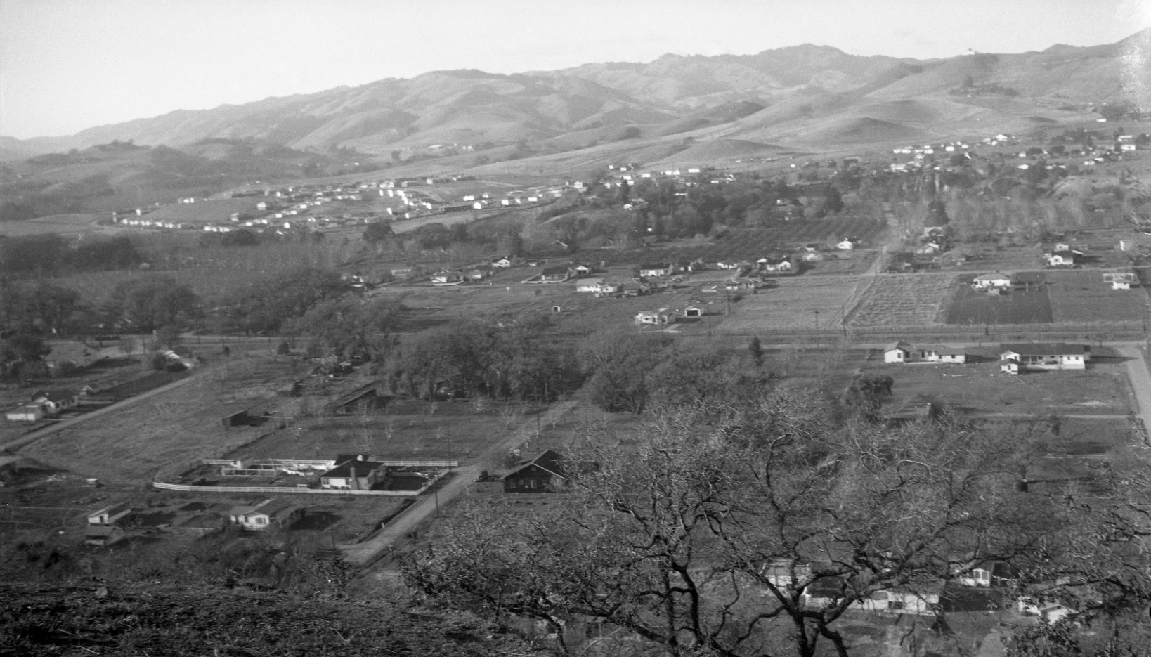
Dudley Thickens took this northwest panorama on Feb 2, 1947 on the ridge above Alder and Willow Avenues, far right to left, respectively. It captures the post-WWII growth spurt already evident to the northwest at Sun Valley Estates, and north of the tracks in Dewing Park extension.
L53-30-Dudley Thickens Photo, Courtesy BAERA, Western Railway Museum Archives, 63822sn, (Image 6 of 12)
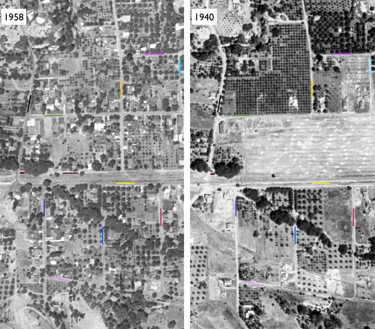
Before and after rapid population growth, 1940 and 1958, respectively, the aerials show Newell Ave. and the SN, yellow line, separating Dewing Park extension with Boulevard Ave. (Way), black; Whyte Park Ave, green; Center St., orange; Rose St., violet; Lily St., turquoise; and Cottage Ln., brown, from Dewing Park proper with Panoramic Way, purple; Alder Ave (St.)., blue; Willow Ave., red; and Sequoia Ave., pink.
L53-35-Courtesy Contra Costa County Historical Society, 13560, right, 13562, left, (Image 7 of 12)
A two-car SN passenger train near Alder speeds past the open field on its way to Walnut Creek, May, 1941 in this northwest view. Relative to L53-35, Panoramic would be south, or left of the track, across from the big trees to the north, or right of the track. Note the mail boxes, the white square on the fifth pole from the right, and the emergence of supports at the base of the catenary poles.
L53-40-Dudley Thickens Photo, Courtesy BAERA, Western Railway Museum Archives, 63811sn, (Image 8 of 12)
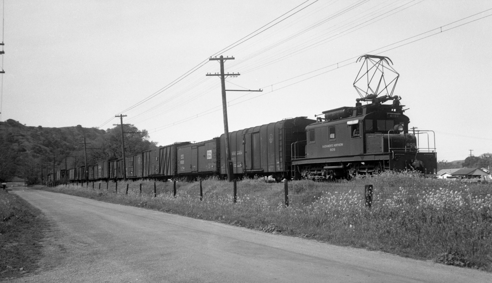
Now to Mar.-Apr. of 1947, motor SN 605 in this northwest view is further west relative to L53-40, and the white square on the pole looks like mile marker 26. Note the appearance of houses to the north in the previous open space in L53-40. No homes as yet at the curve to the west down Newell, at left.
L53-45-Dudley Thickens Photo, Courtesy BAERA, Western Railway Museum Archives, 63805sn, (Image 9 of 12)
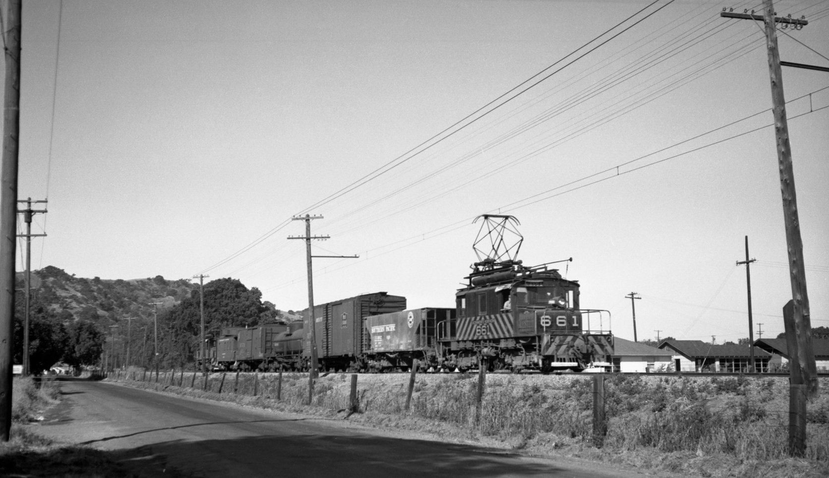
Progressing forward in time to Sept. 1949, SN 661 has inched a few feet east relative to SN 605 in L53-45. More homes have extended closer to the right-of-way from the north, or right, and new homes have now appeared at the curve down Newell on its south flank, or left.
L53-50-Dudley Thickens Photo, Courtesy BAERA, Western Railway Museum Archives, 63809sn, (Image 10 of 12)
This undated northwest view from the first half of the 1950s shows SN 670 at a point the furthest east relative to the previous images. A broken white line now divides Newell, and more homes have been added.
L53-55-Dudley Thickens Photo, Courtesy BAERA, Western Railway Museum Archives, 57125sn , (Image 11 of 12)
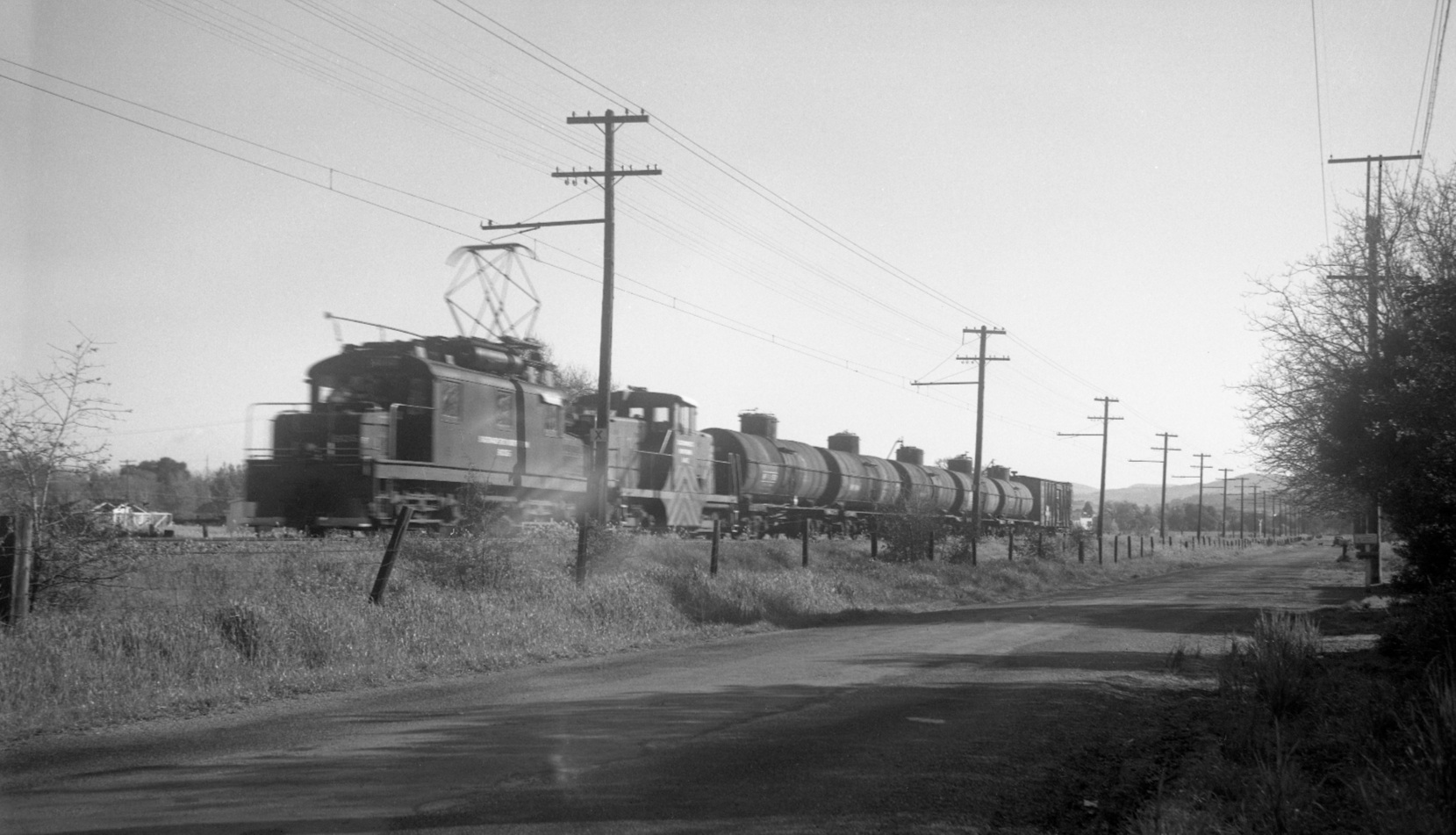
This northeast view from Mar.-Apr. of 1947 of motor SN 606, diesel SN 145 and oil tankers provides a view toward the next landmark, the Bridge Road grade crossing, seen in the distance as marked by the grade-crossing sign.
L53-60-Dudley Thickens Photo, Courtesy BAERA, Western Railway Museum Archives, 63802sn, (Image 12 of 12)