Not in Pleasant Hill
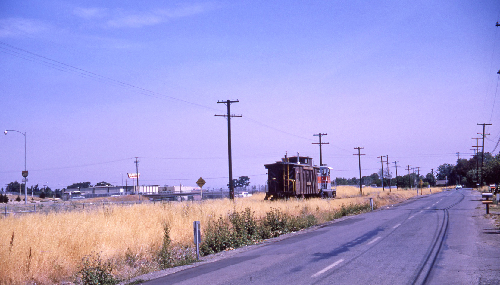
This southwest view shows SN 603 and 604 approaching the grade crossing at Geary Rd. circa 1950, today Treat Blvd., the site of the former Pleasant Hill SN shelter a decade earlier. Highway District 4 would obtain the land to the west by eminent domain around 1956 for the future I-680, assessing the three-story tank house on the land at only 100 dollars. Now for the details about this area.
L101-02-Dave Gumz Photo, Courtesy BAERA, Western Railway Museum Archives, 91514sn, (Image 1 of 23)

The Lucky Supermarket seen in this northwest image that resided at 2900 N. Main St. at Geary Rd., the site of present Walgreens, allows accurate positioning of one of the last SN freight movements along Jones Rd. north of the Contra Costa Canal on June 3, 1964.
L101-05-Victor B Dubrutz Photo, Courtesy BAERA, Western Railway Museum Archives, 71842sn, (Image 2 of 23)
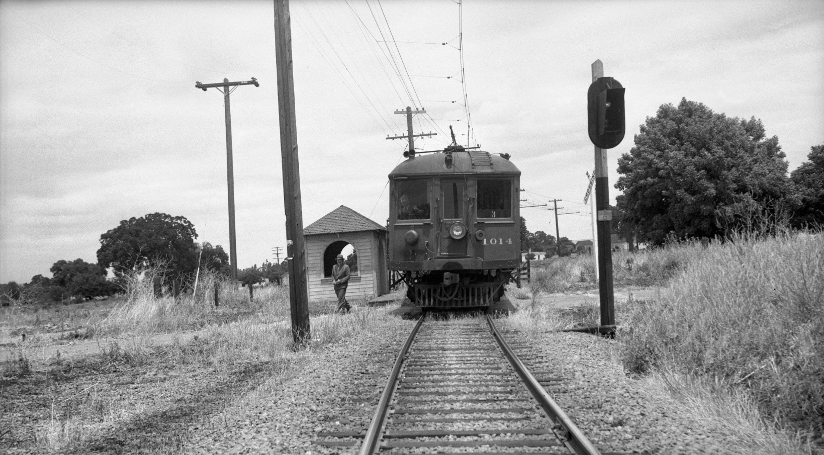
One week prior to the cessation of passenger service, Dudley Thickens took this north image on June 22, 1941 along with many others with SN 1014 posing at SN shelters. The unmarked shelter was labelled by Thickens as Pleasant Hill.
L101-10-Dudley Thickens Photo, Courtesy BAERA, Western Railway Museum Archives, 79021sn, (Image 3 of 23)
The red arrow on the 1940 northerly aligned aerial marks the position of the SN Pleasant Hill shelter at the Geary Rd. grade crossing, today on the portion of this road renamed as Treat Blvd. The broken yellow line on the 1968 northerly aligned aerial marks the original position of the SN right-of-way that remained relative to that of the BART test track to the southeast.
L101-15-Courtesy Contra Costa Historical Society, 13565, (Image 4 of 23)
This northeast view aerial from Feb. 13, 1958 shows the area between the Contra Costa Canal, noted by the break between the road directions of I-680, and the curve of the SN past the original Geary Rd. grade crossing.
L101-20-Copyright California Department of Transportation, 5845-10 Detail , (Image 5 of 23)
A repeat of L101-20, this time a color version northeast view aerial from April 15, 1957.
L101-25-Copyright California Department of Transportation, C198-2 Detail, (Image 6 of 23)
Now a direct north view zeroing in on the SN grade crossing at Geary Rd, Mar. 10, 1957.
L101-30-Copyright California Department of Transportation, 5397-3 , (Image 7 of 23)
It is not known when the SN shelter at Geary Rd. was removed. North view, Mar. 10, 1957.
L101-35-Copyright California Department of Transportation, 5397-3 Detail, (Image 8 of 23)
Three years later, Jan. 1, 1960, the same crossing at Geary Rd., northeast view.
L101-40-Copyright California Department of Transportation, 7240-2 Detail, (Image 9 of 23)
This northeast view of the BART test track, Mar. 3, 1969, also shows the abandoned SN right-of-way to the north. Folklore has it that the sight of sparks at night flying off the catenary as SN trains negotiated this curve was the origin of the term “Sparkle” to denote the area to the east. More on Sparkle next time.
L101-45-Copyright California Department of Transportation, 15606-28 Detail, (Image 10 of 23)
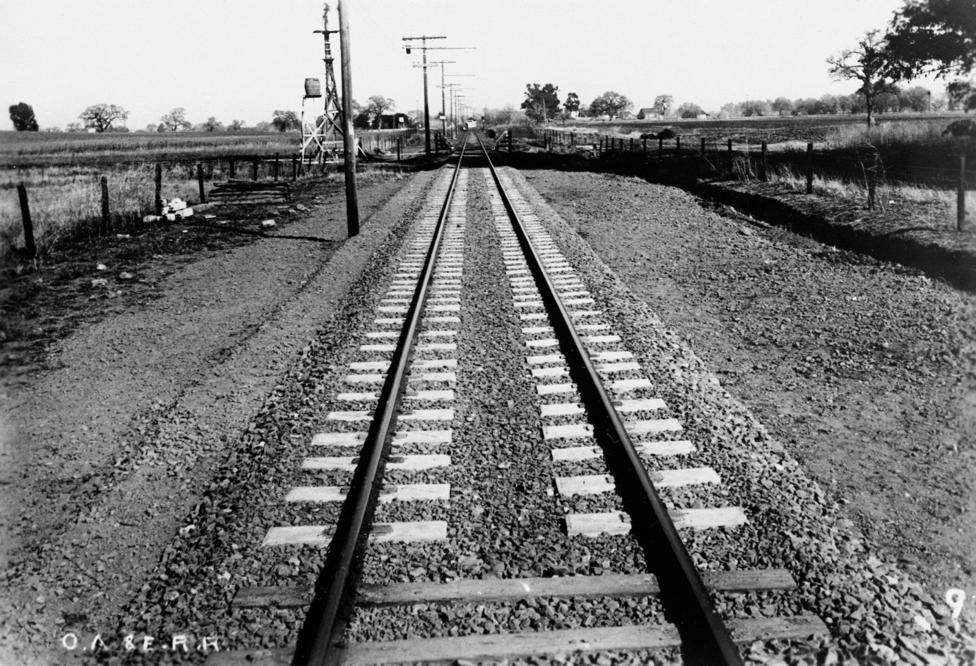
Next, a series of north views to provide an appreciation of the area during the passenger era. First, a north view of a section of previously unappreciated and still unaccounted for concrete ties on the ROW, Jan. 1918. More next.
L101-50-Moreau Collection, Courtesy BAERA, Western Railway Museum Archives, 82402sn, (Image 11 of 23)
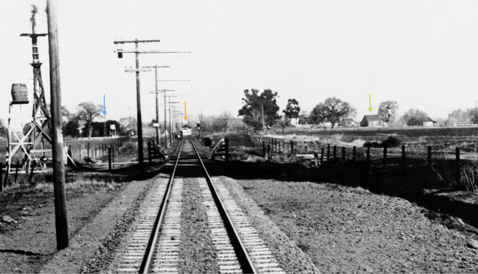
A detail from L101-50 shows a windmill, blue arrow, a shelter, orange arrow, and some small structures, green arrow, as the right-of-way takes a sharp bend to the east. North view, Jan. 1918.
L101-55-Moreau Collection, Courtesy BAERA, Western Railway Museum Archives, 82402sn, (Image 12 of 23)
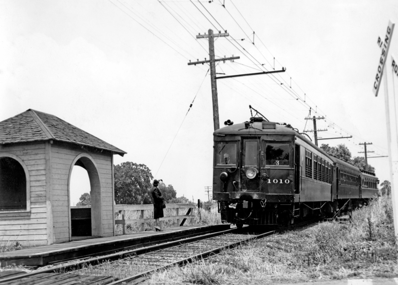
A passenger waits to catch a SN 1010 three-car train heading west at the unlabelled SN Pleasant Hill shelter, north view, 1938. Note the tree and the utility pole way in the background seen between the train and the shelter.
L101-60-Louis L Stein Collection, Courtesy BAERA, Western Railway Museum Archives, 79827sn, (Image 13 of 23)
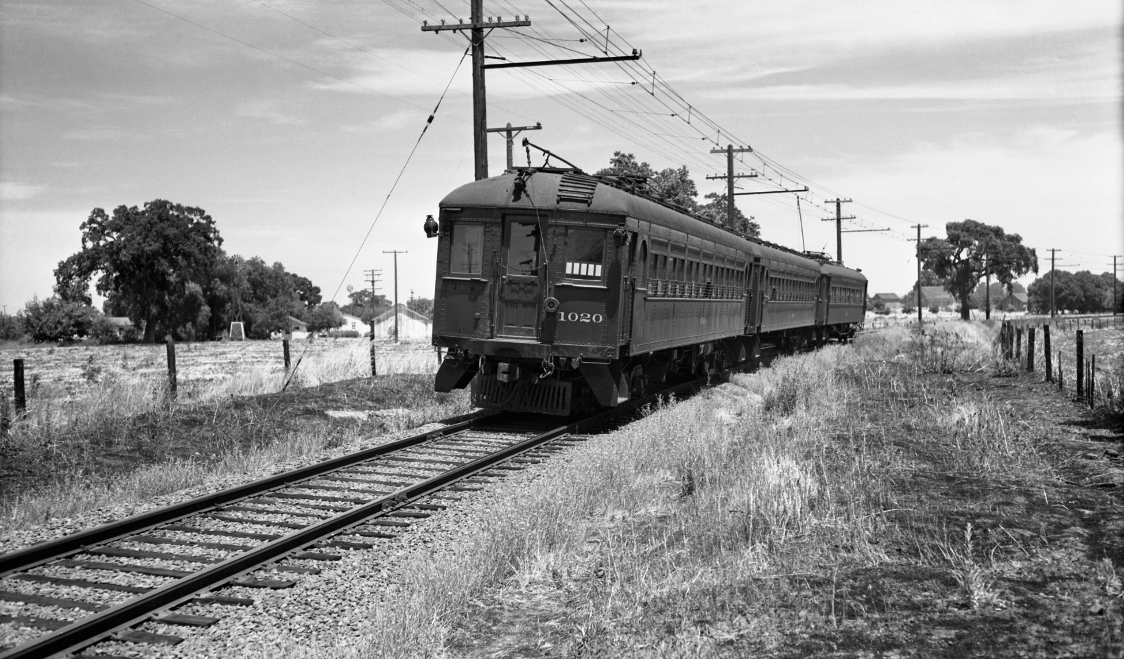
Now the key north view that ties the previous images together, taken just north of the shelter of an approaching three-car train led by SN 1020 in 1940. No wonder Pleasant Hill was sometimes referred to as the “City of Windmills".
L101-65-Charles Savage Photo, Courtesy BAERA, Western Railway Museum Archives, 10009sn, (Image 14 of 23)
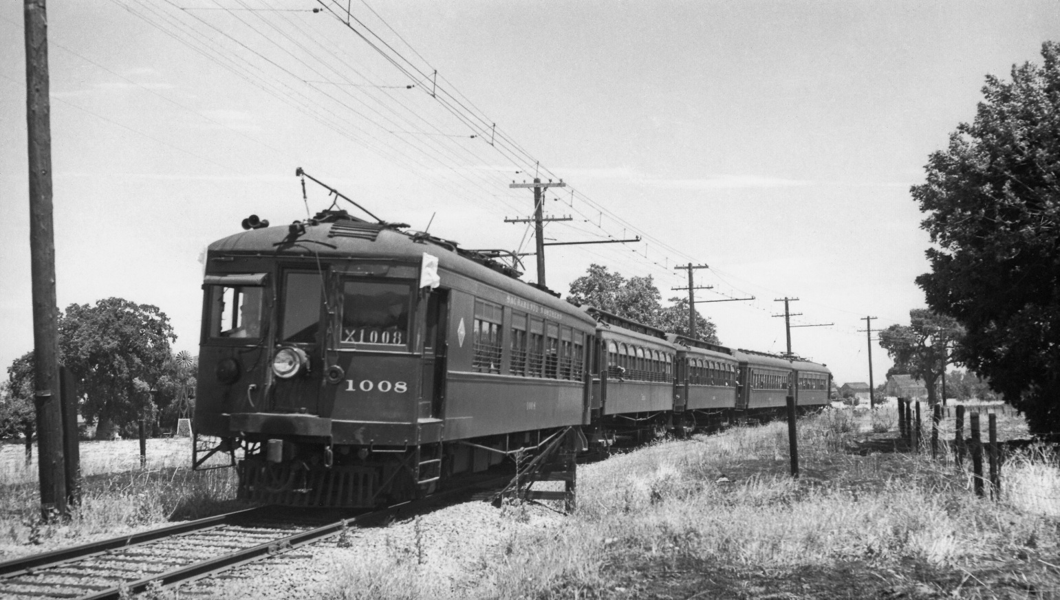
Just in case you want more evidence for the location, a north view of SN 1008 and a four-car train on July 14, 1940.
L101-70-Wilbur C Whittaker Photo, Courtesy Arnold Menke and Walt Vielbaum, (Image 15 of 23)
To complement the north views shown so far, a series of views to the south starting with this one over the I-680 Oak Park Blvd. exit, from Mar. 10, 1957.
L101-75-Copyright California Department of Transportation, 5397-2 Detail, (Image 16 of 23)
Another south view over the Oak Park Blvd. exit, this time in color taken on Apr. 15, 1957.
L101-80-Copyright California Department of Transportation, C198-1 Detail , (Image 17 of 23)
The Geary Rd. grade crossing seen in this south view from Mar. 10, 1957.
L101-85-Copyright California Department of Transportation, 5397-2 Detail , (Image 18 of 23)
Now ahead to a panoramic southwest view with the BART test track from Mar. 3, 1969. The EBMUD trail, under which the main water aqueducts are buried, can be seen entering Walnut Creek on the right side of the image.
L101-90-Copyright California Department of Transportation, 15606-20 Detail, (Image 19 of 23)
A view more toward the southeast, also from Mar. 3, 1969.
L101-95-Copyright California Department of Transportation, 15606-19 , (Image 20 of 23)
This southwest view of the area again highlights the outline of the former SN right-of-way to the north of the BART test track, also from Mar. 3, 1969.
L101-100-Copyright California Department of Transportation, 15606-20 Detail , (Image 21 of 23)
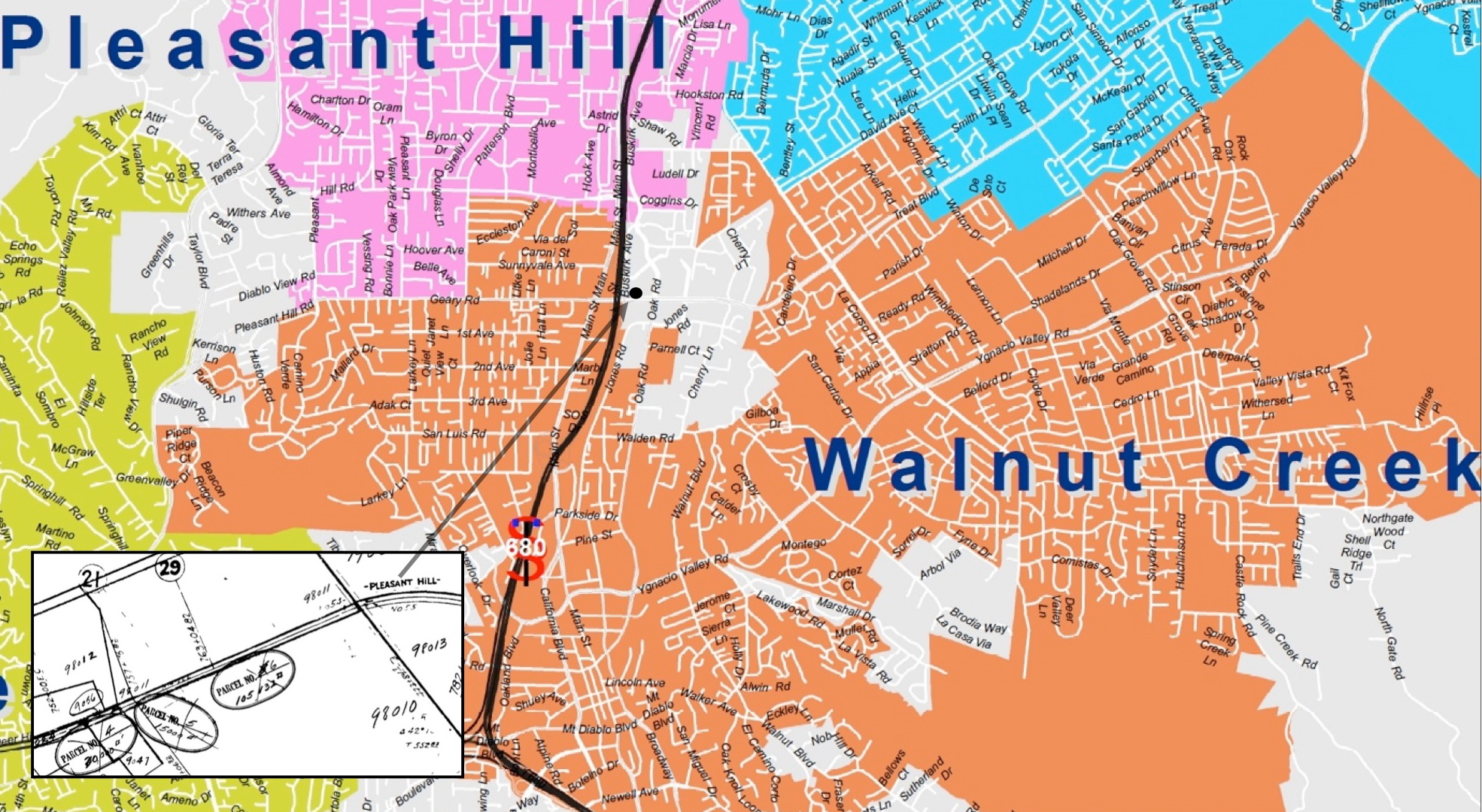
Although the insert from the California Board of Equalization confirms the name of the SN shelter as “Pleasant Hill”, the SN right-of-way never actually entered Pleasant Hill, even by today’s map. Although served by a Walnut Creek postal address, the area remains unincorporated. Insert Ref: California State Railroad Museum, CS07003M, and California Board of Equalization, 862-7-3C
L101-105-Courtesy Contra Costa County Public Works , (Image 22 of 23)
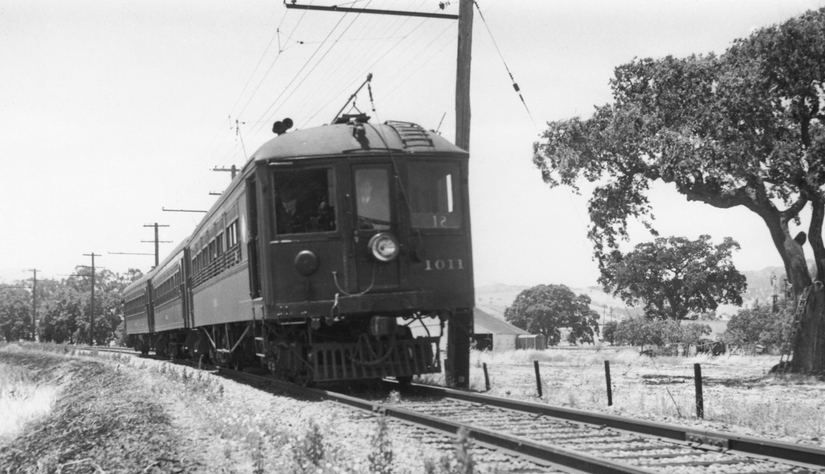
SN 1011 as part of a three-car train heads east on Jul. 14, 1940 in this west view. The structures in the background to the right of the train confirm that the train has just passed the SN Pleasant Hill shelter as it proceeds to the next Walnut Creek destination to be presented.
L101-110-Wilbur C Whittaker Photo, Courtesy Arnold Menke and Garth Groff, (Image 23 of 23)