Orchards of Lafayette’s Burton Valley – Moraga Border to the Station
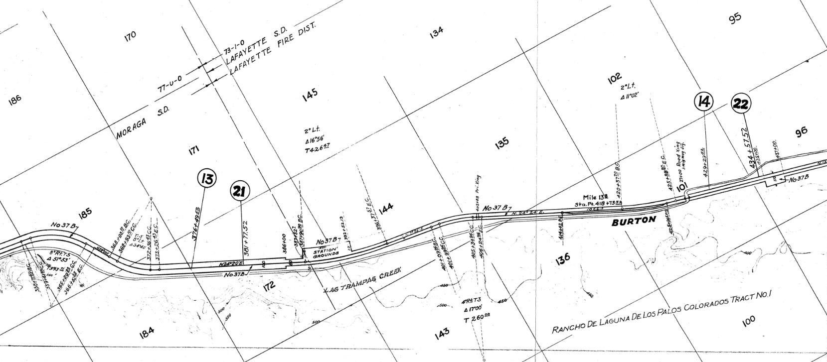
The Burton Valley in Lafayette extends northeast from the Moraga border, a quarter mile past the SN exit from St. Mary's College. The SN's path followed Las Trampas Creek and St. Mary's Road, today the Lafayette-Moraga Trail. This 1941 map also reveals its history as part of the Moraga land grant.
L12-05-Courtesy California Board of Equalization, 862 7 2A , (Image 1 of 26)

Starting at the grade crossing at St. Mary’s Rd., the initial path of the SN can be followed in this 1962 post-SN abandonment west view. If this image is not easily placed, review the Moraga Landmark, “Mystery Crossing - Where did Roger Take the Picture?”.
L12-10-Herrington-Olson Photo A-2895, From the collection of the Moraga Historical Society, Moraga, (Image 2 of 26)
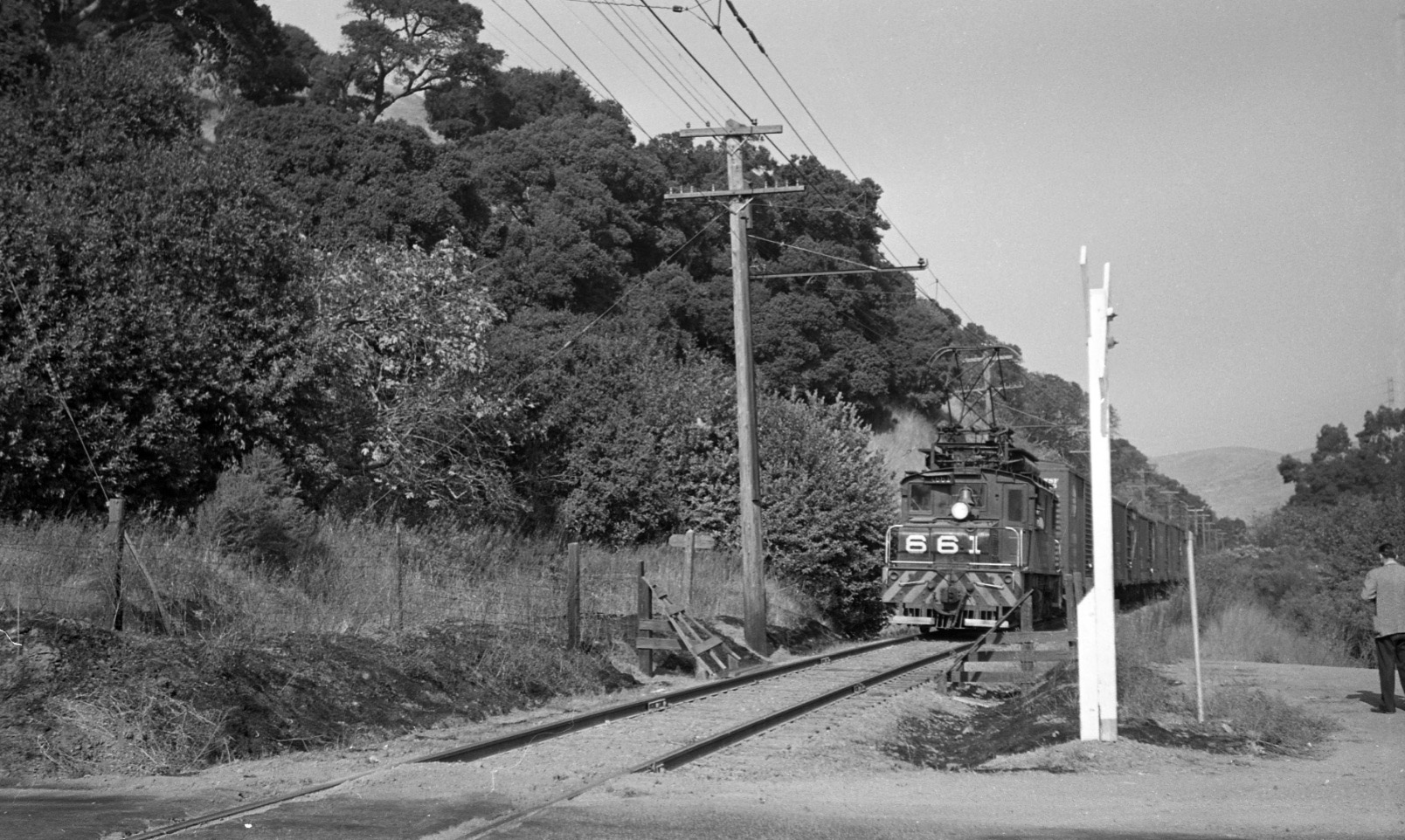
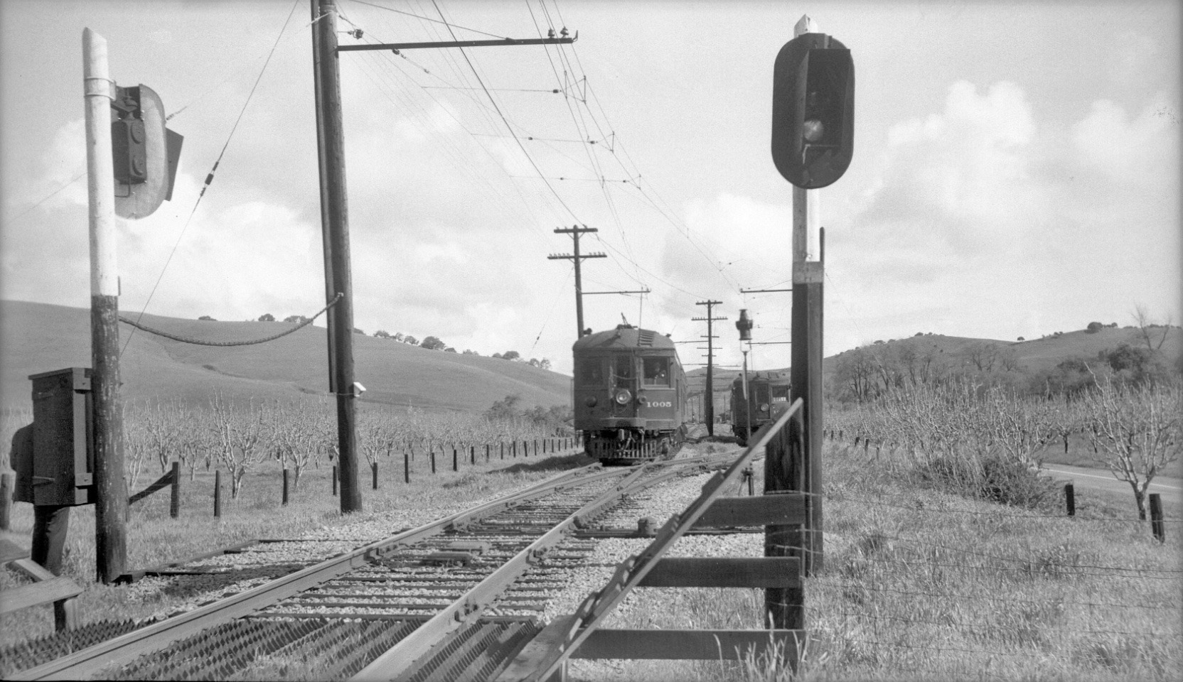
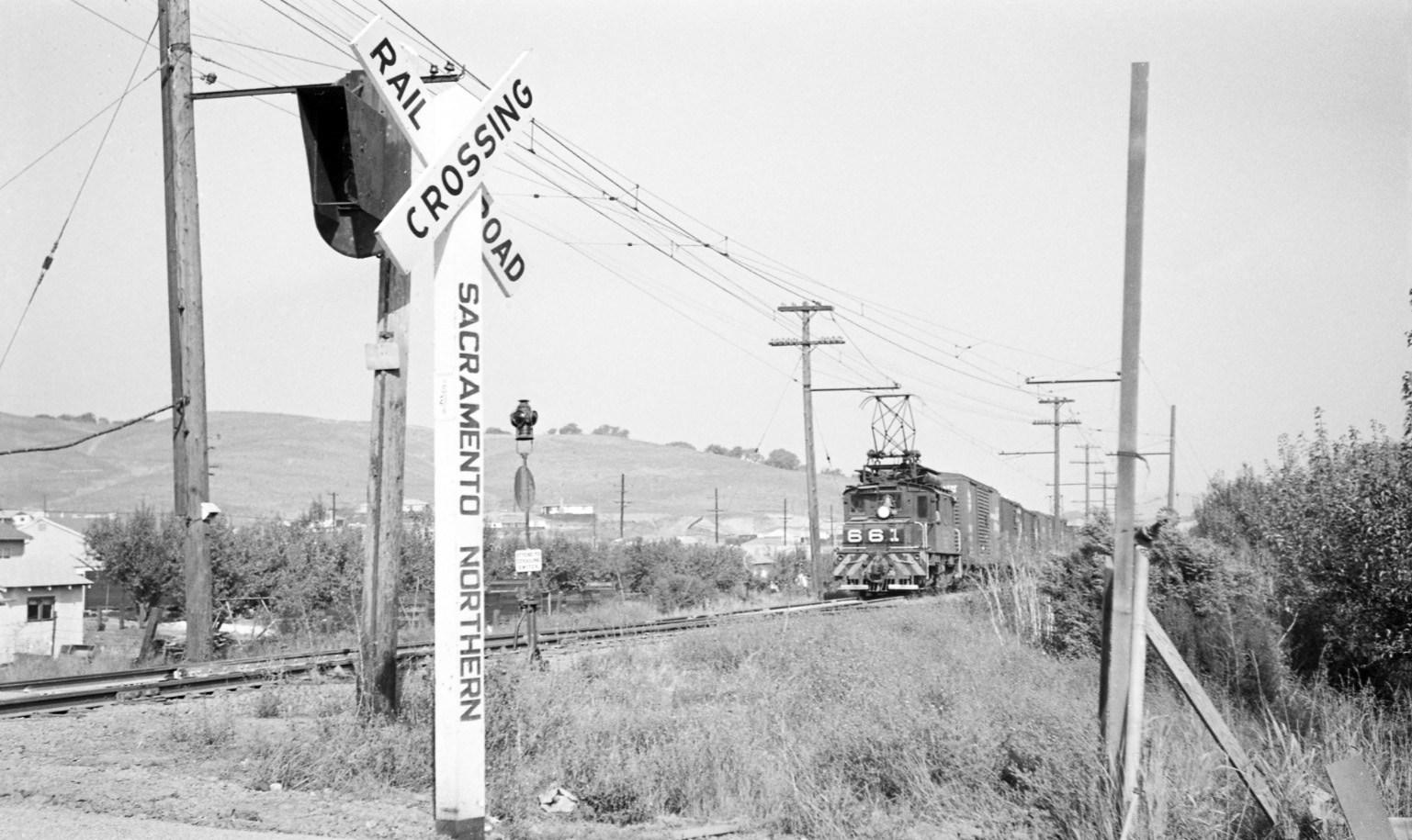
Best to start with this north image, circa 1950, of the north portion of the grade crossing and the right-of-way with Oakland-bound SN 661 having just exited Lafayette. Note the transmission tower along the right edge, still at the same location today, that will align images that follow.
L12-15-Norman Smith Photo, Courtesy BAERA, Western Railway Museum Archives, 55599.3sn, (Image 3 of 26)
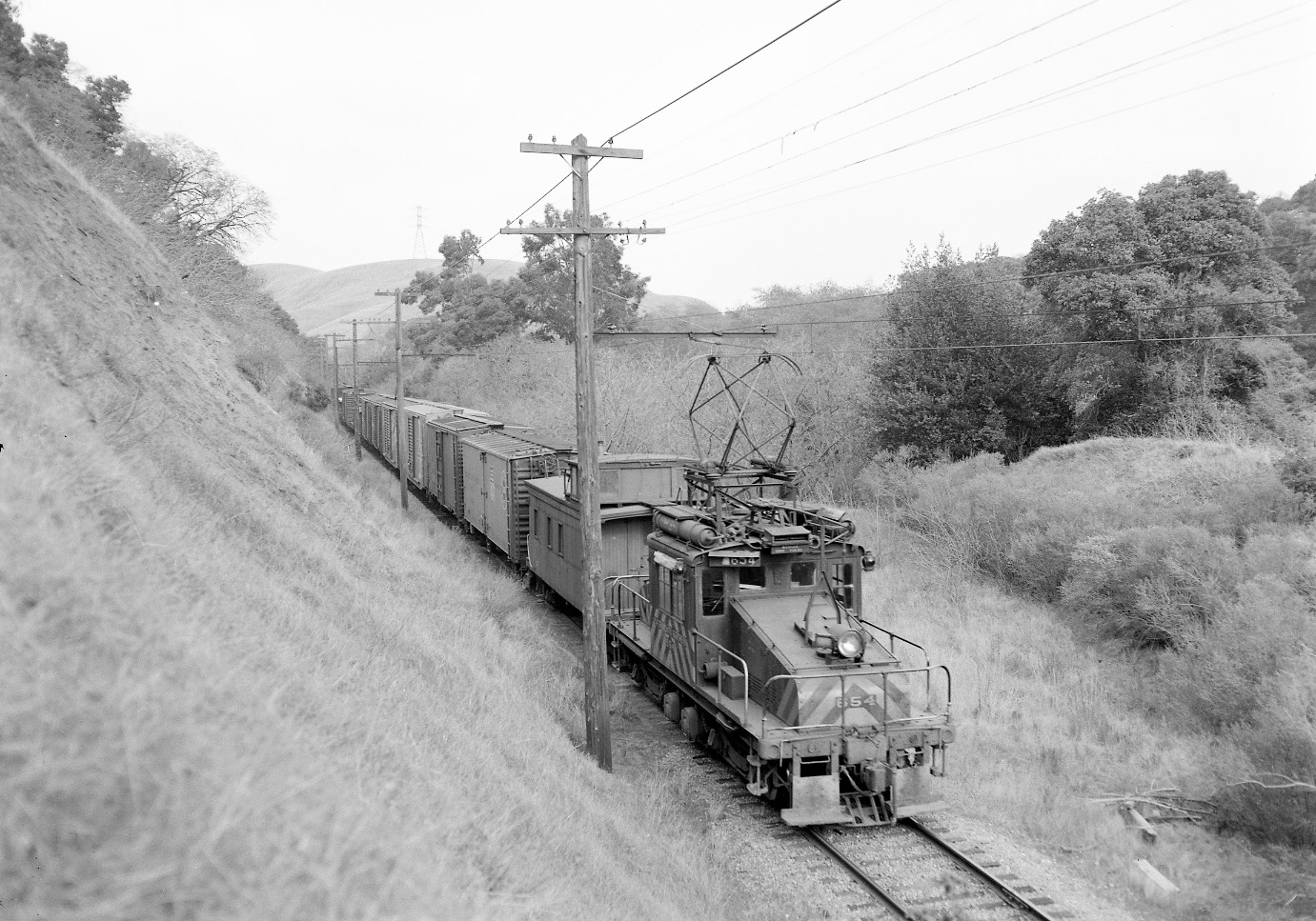
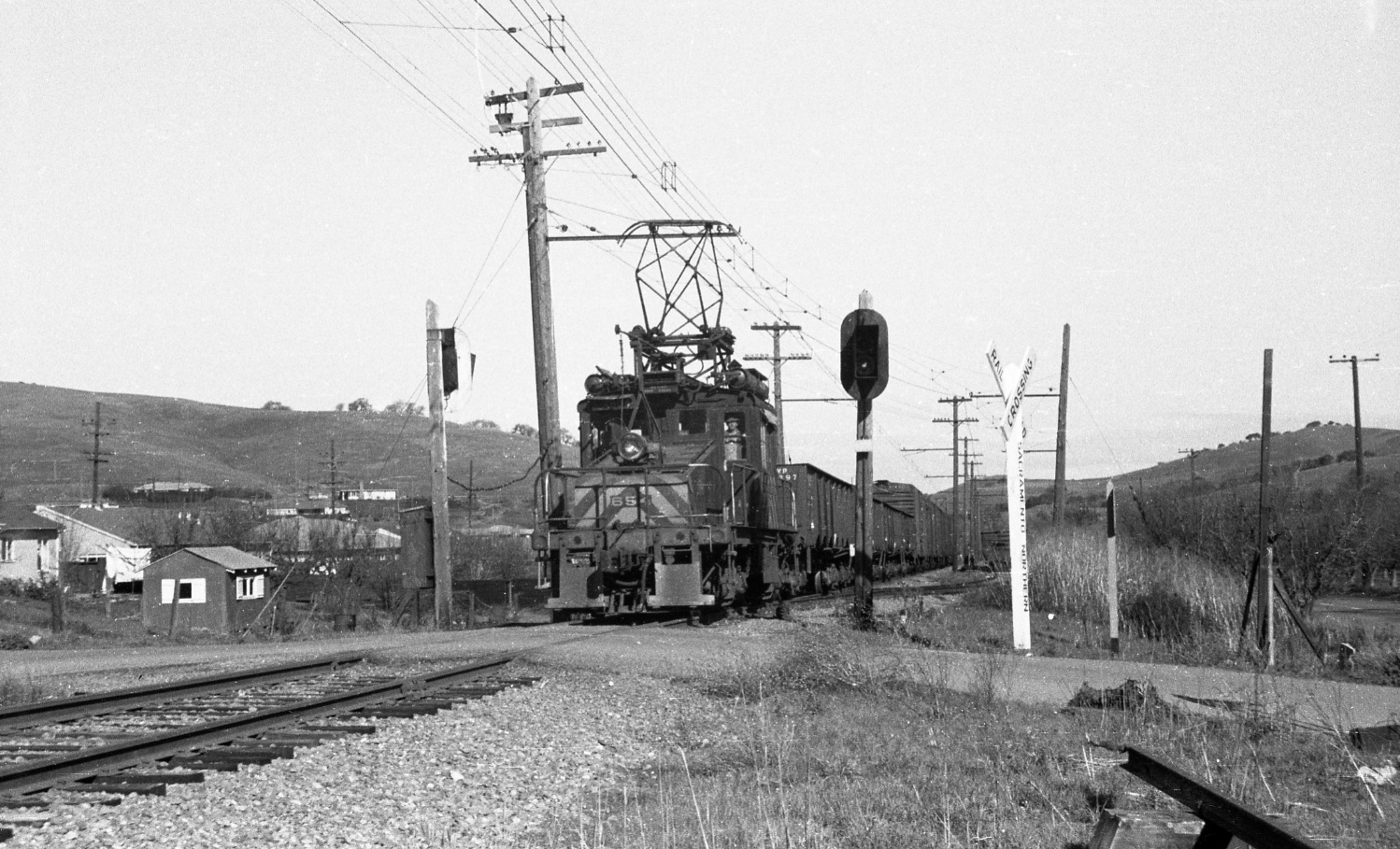
Further north, SN 654 on rear of SN 652-led train heading to the Burton Valley. Note the transmission tower. North view, Feb. 1, 1957.
L12-20-New Fred Matthews Photo, Anonymous Donor , (Image 4 of 26)
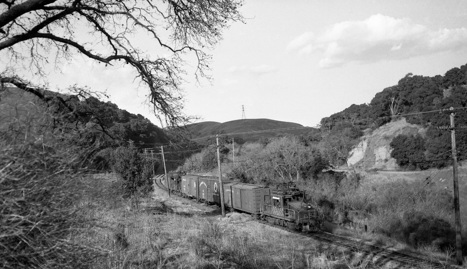
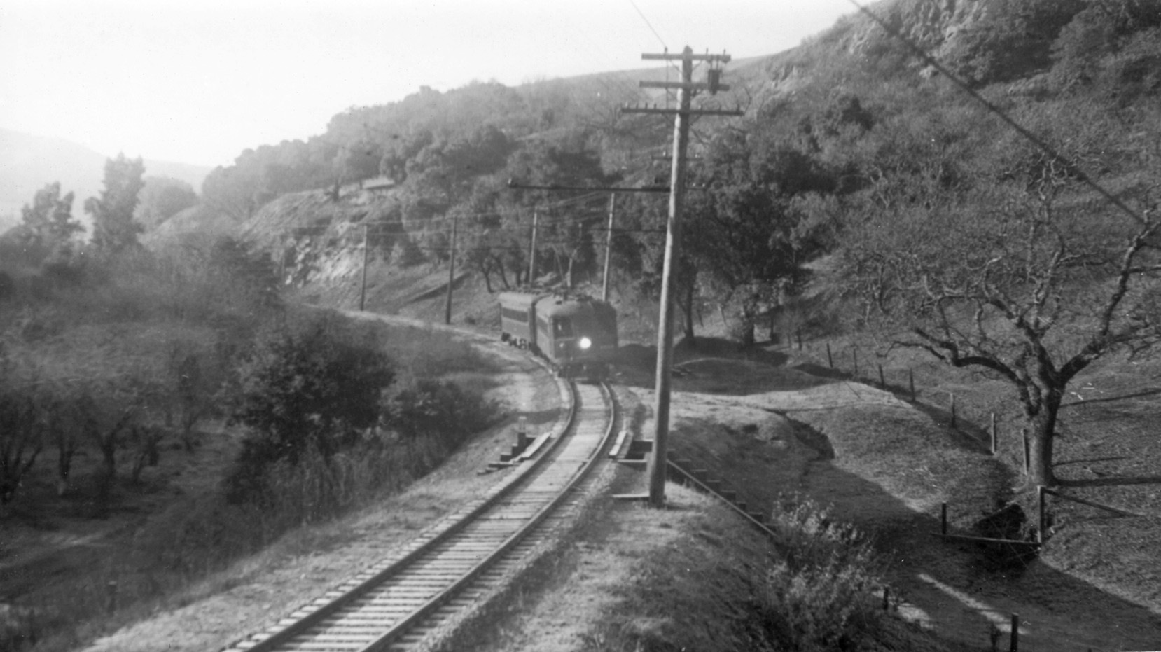
The transmission tower rules out a Feather River or Rocky Mountains panorama, but this north view of SN 652 with freight gliding along Las Trampas Creek and St. Mary’s Rd. speaks to the scenic beauty of the SN path, north view, Feb., 1957. If you can’t spot the short trestle behind the train, read on ...
L12-25-Dudley Thickens Photo, Courtesy BAERA, Western Railway Museum Archives 75628sn, (Image 5 of 26)
Wilbur Whittaker may have been the only one to detail the trestle, here in a south view, June 17, 1940. This trestle was situated between mile 20 and mile 21, but the mileage marker cannot be sufficiently resolved to indicate which one was applied here.
L12-30- Wilbur Whittaker Photo, Courtesy Arnold Menke and Garth Groff, (Image 6 of 26)
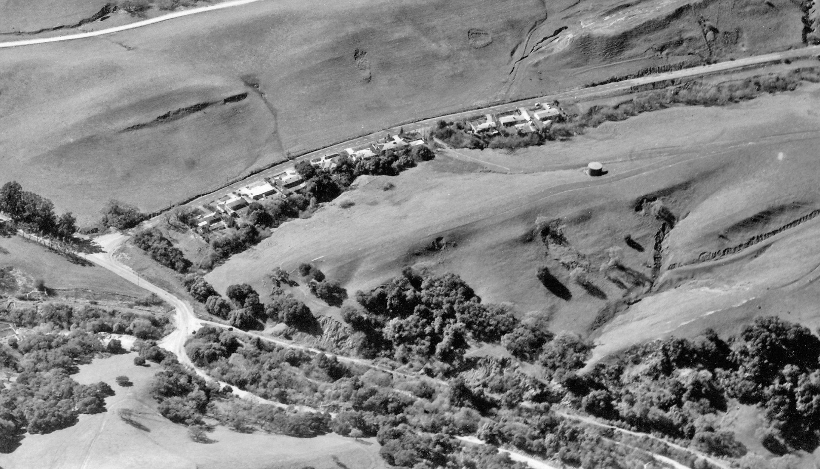
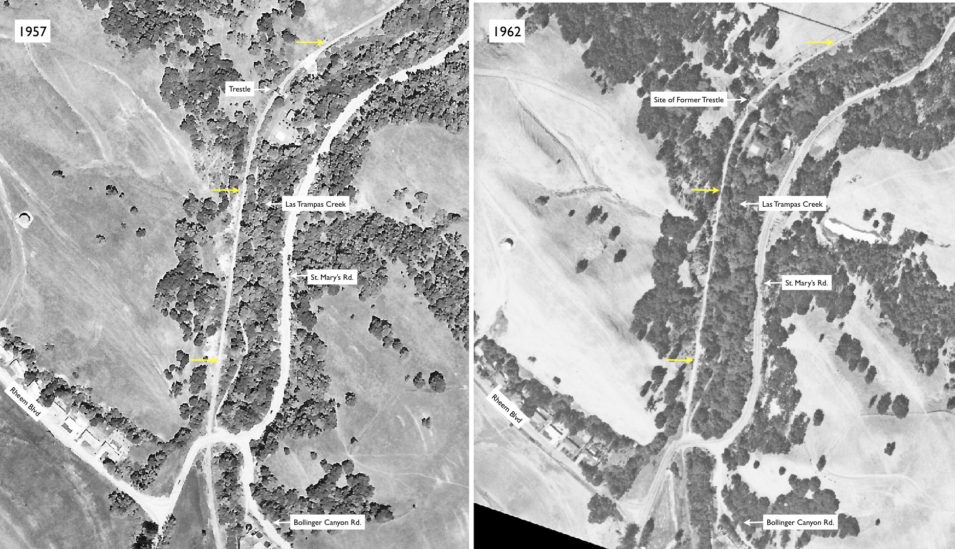
A summary of how much ground has been covered so far comparing May 4, 1957, left, to Aug. 14, 1962, right. Although the 1957 aerial was taken after right-of-way abandonment, the trestle was still in place. Ref: Left, Courtesy CCC Public Works, AV 253 15 25, HJW, 1-12000, May 4, 1957; Right, Courtesy Earth Sciences and Map Library, University of California, Berkeley, CC-255-A-2-(2-5)_0002, August 14, 1962.
L12-35 HJW Geospatial Inc, Pacific Aerial Surveys, Oakland CA and USDA AAA Western Division , (Image 7 of 26)
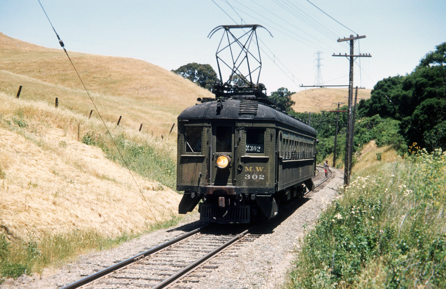
The site of the transmission tower is welcome relief for placing images containing few landmarks. This image is north of the trestle, and based on this curve to the west, MW 302 would be placed today on the Lafayette-Moraga Trail, just south of Cattle Chute Rd. North view, May 31, 1951. Special thanks to Art Peterson.
L12-40-G Krambles Photo, Krambles-Peterson Archive, (Image 8 of 26)
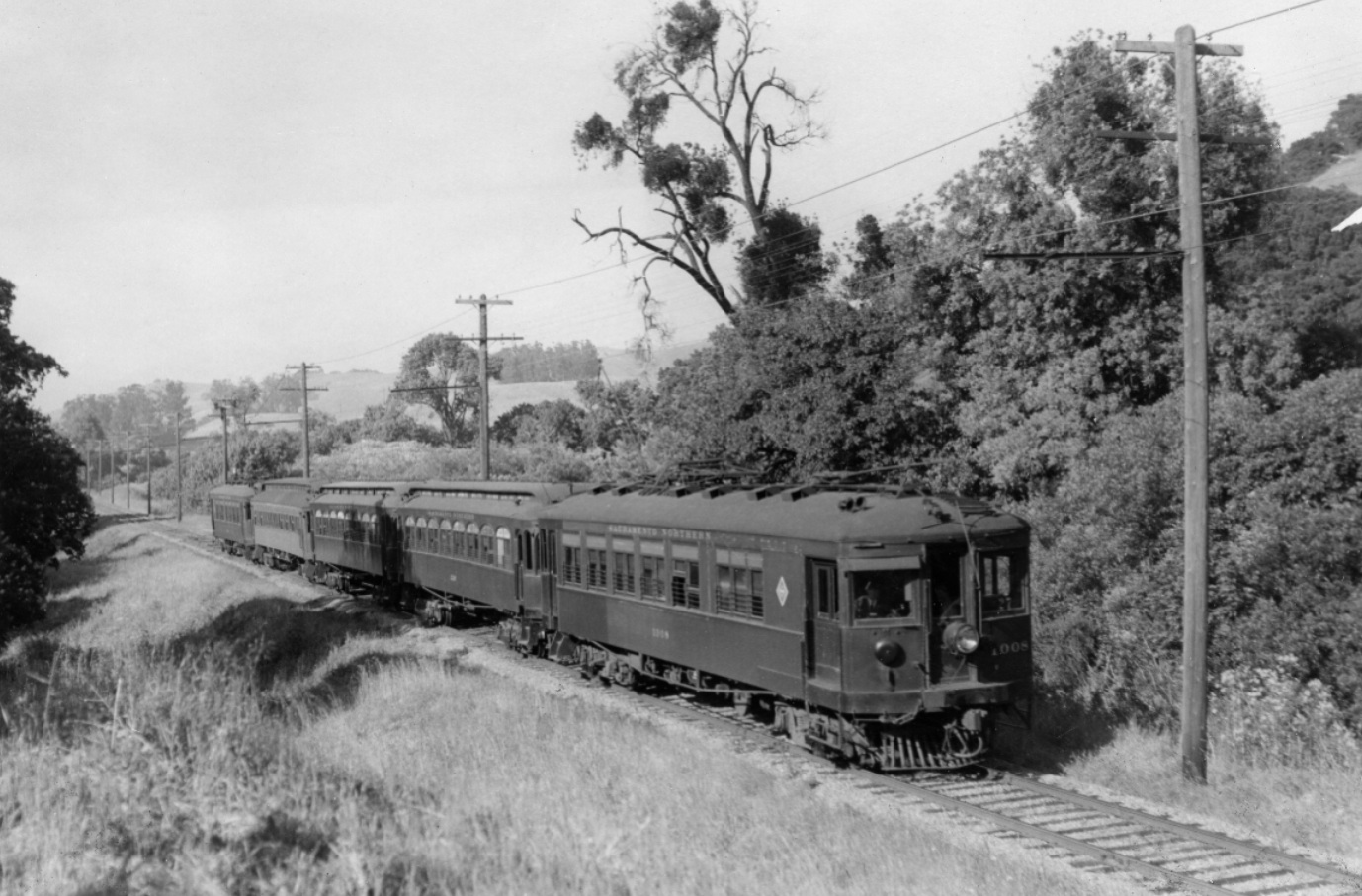
It was approximately eight-tenths of a mile of largely inaccessible SN right-of-way from the grade crossing until St. Mary’s Road crossed the creek, today at Lafayette Community Park. Trees from the creek obscuring the adjacent hills and a distinctive stand of trees in the distance mark this image of a five-cat train led by SN 1008. Northeast view, May 23, 1940.
L12-45-Arthur Alter Photo, Courtesy BAERA, Western Railway Museum Archives, 52963sn , (Image 9 of 26)
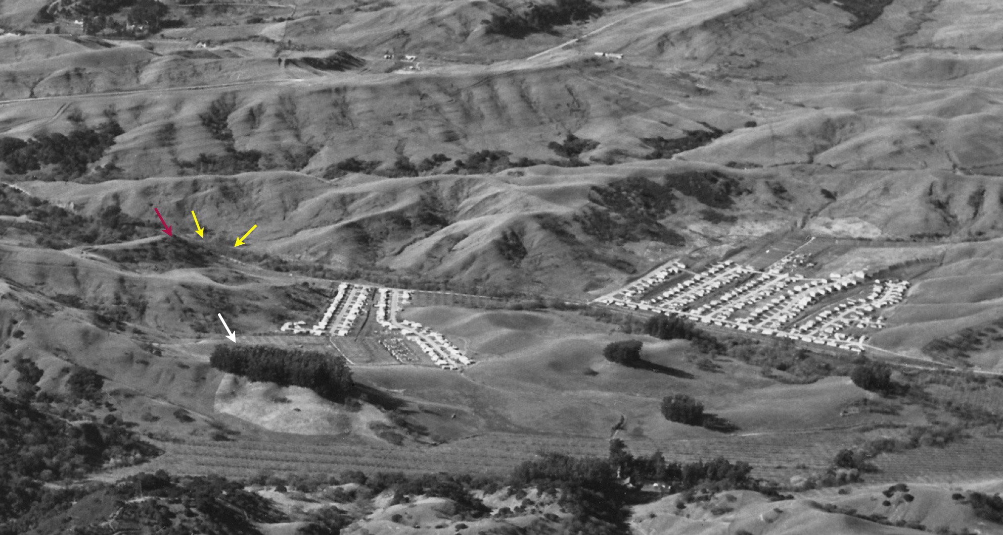
The location of the train in the previous image, L12-45, is marked in this annotated west view from Jan. 22, 1953 with the yellow arrow. The adjacent hill is marked by the red arrow, and the distinctive stand of trees by the white one. The housing boom was in progress as will be highlighted next ...
L12-50-RL Copeland Photo, from the collection of the Moraga Historical Society, Moraga, CA, Detail11, (Image 10 of 26)
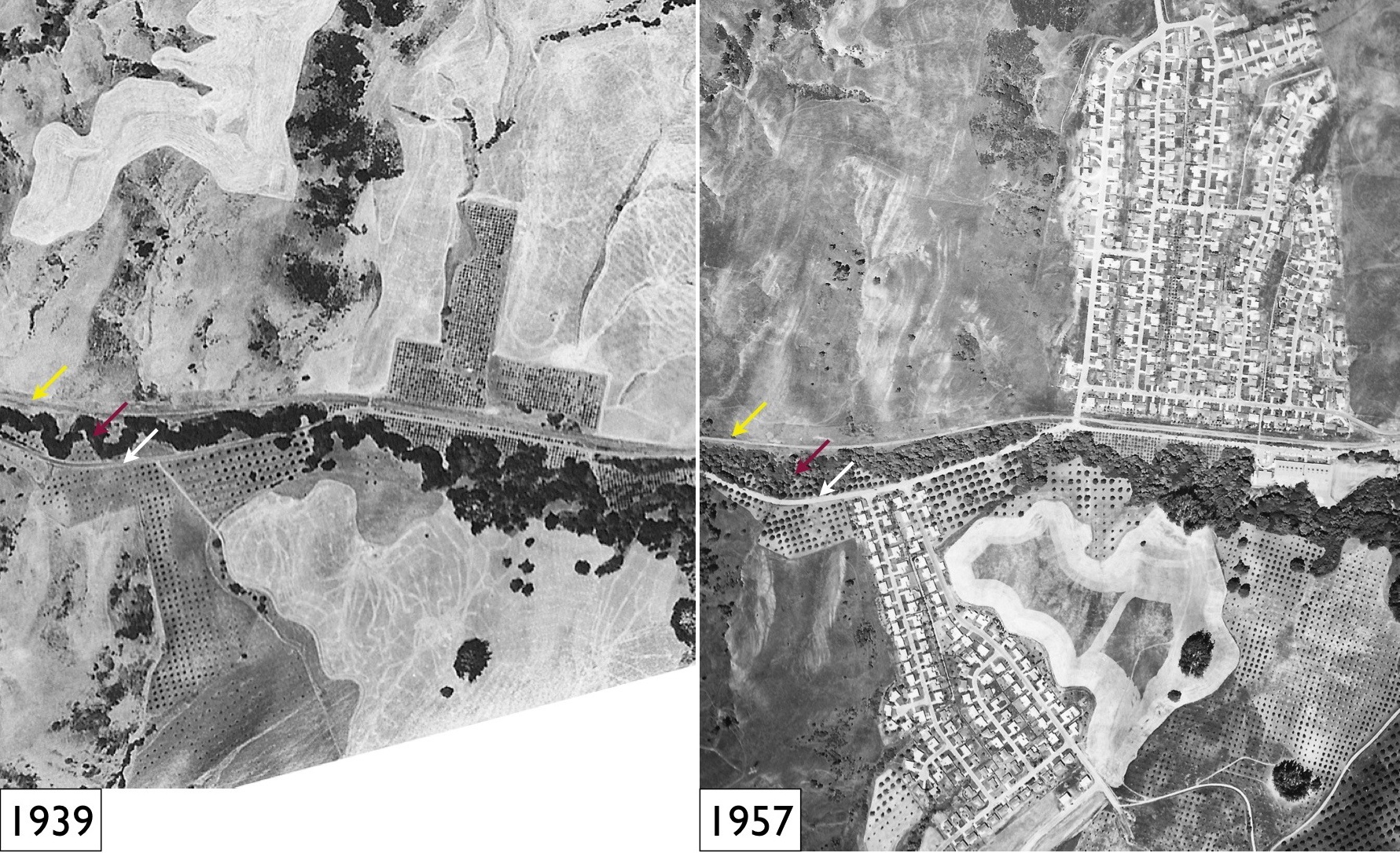
SN passenger service and the Broadway Tunnel had no immediate impact in converting the region's orchards to housing. The housing boom began in the early 1950s. St. Mary's Road, white arrow, crossed Las Trampas Creek, red arrow, and converged with the SN, yellow arrow. Images courtesy of East Bay Municipal Utility District, left, and Contra Costa County Public Works, right.
L12-55-USDA AAA Western Division and HJW Geospatial Inc, Pacific Aerial Surveys, Oakland CA, (Image 11 of 26)
With the crossing of the creek by the road behind it, along the left edge, or south, this southwest image shows an excursion train led by SN 653, a WP open car, and Salt Lake and Utah parlor car 751 approaching the South Lucille Lane grade crossing in mid-1956.
L12-60-Dudley Thickens Photo, Courtesy BAERA, Western Railway Museum Archives, 56639sn, (Image 12 of 26)
In July 1950, the same photographer, Dudley Thickens, showed in this northeast view that no road or grade crossing existed prior to the construction of the housing development. To the north, the SN became a two-track straight-away, bordered by orchards as St. Mary’s Road approached from the east. Northeast view, Jul. 1950.
L12-65-Dudley Thickens Photo, Courtesy BAERA, Western Railway Museum Archives, 53743sn, (Image 13 of 26)
Ten years earlier, March 31, 1940, the same northeast view highlighting the utility of the extra track as SN 1005 passes the train to the east.
L12-70-Arthur Lloyd Photo, Courtesy Arthur Lloyd, (Image 14 of 26)
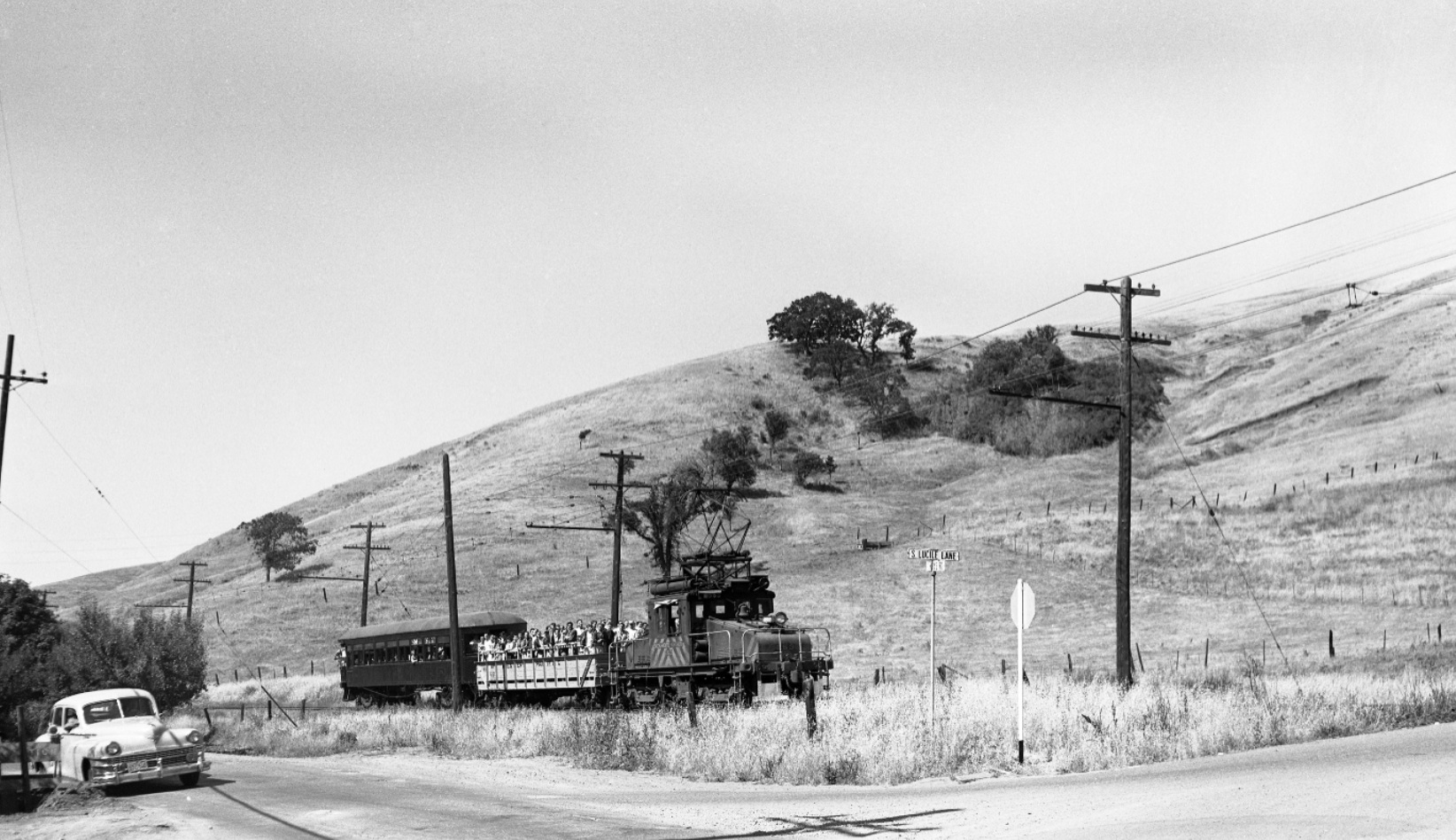
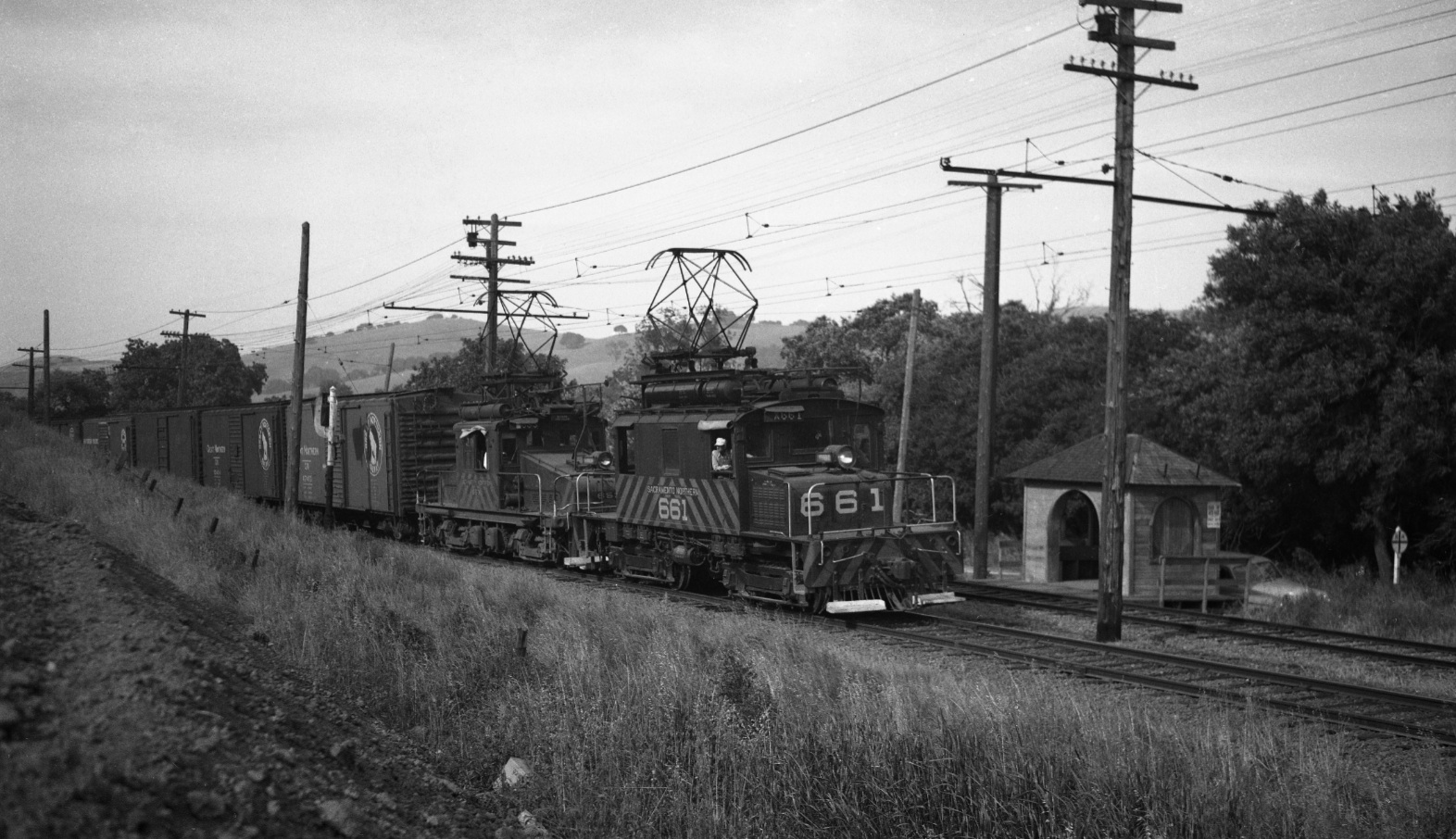
With housing replacing the orchard on the west side of the valley, a grade crossing at South Lucile Lane was constructed to permit access to the southern border of the development. The position of the poles and catenary wires allow lining up to scenes prior to the insertion of the grade crossing. Northeast view with SN 661, circa 1952.
L12-75-Norman Smith Photo, Courtesy BAERA, Western Railway Museum Archives, 55, (Image 15 of 26)
Another view of the same section only now with the actual grade crossing in view as SN 654 approaches. This image was dated based on an image of the photographer's car with 1956 license plates on the same roll of 35 mm negatives. Northeast view.
L12-80-Dave Gumz Photo, Courtesy BAERA, Western Railway Museum Archives, 55847sn, (Image 16 of 26)
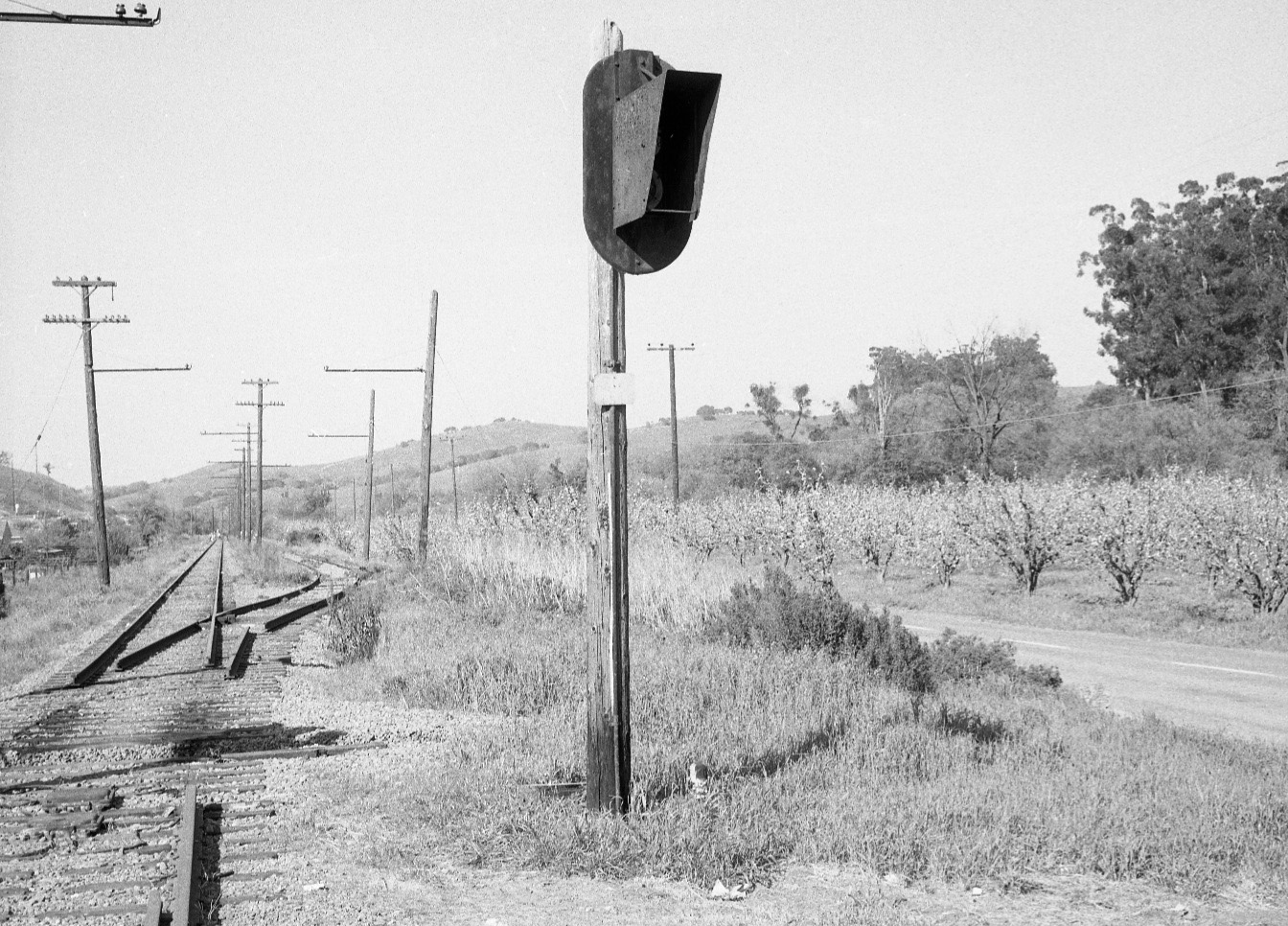
Once abandoned in 1957, the track south of the Lafayette shelter into Oakland remained in place for several months save for this switch track to the north of the grade crossing. The destination for the switch has not been discovered as yet. Northeast view.
L12-85-EK Muller Photo, Courtesy BAERA, Western Railway Museum Archives, 81416sn, (Image 17 of 26)
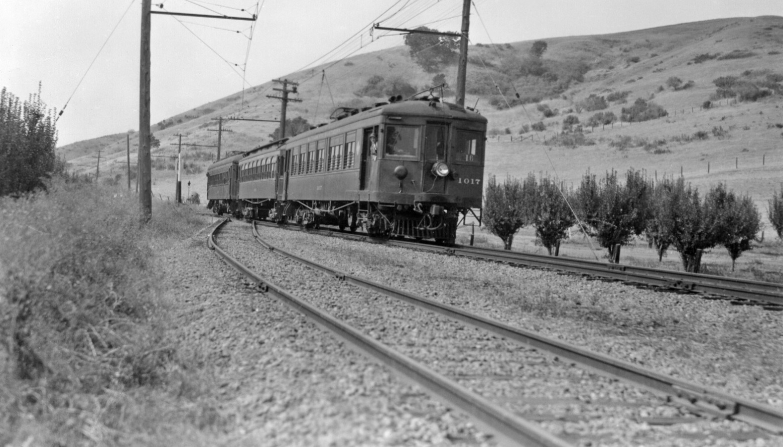
Turning our view the other way, to the southwest, the flattening of the surrounding hills can be appreciated as 3-car train 16 led by SN 1017 enters the double-track section, circa 1940.
L12-90-Paul Smith Photo, Courtesy BAERA, Western Railway Museum, 53880sn, (Image 18 of 26)
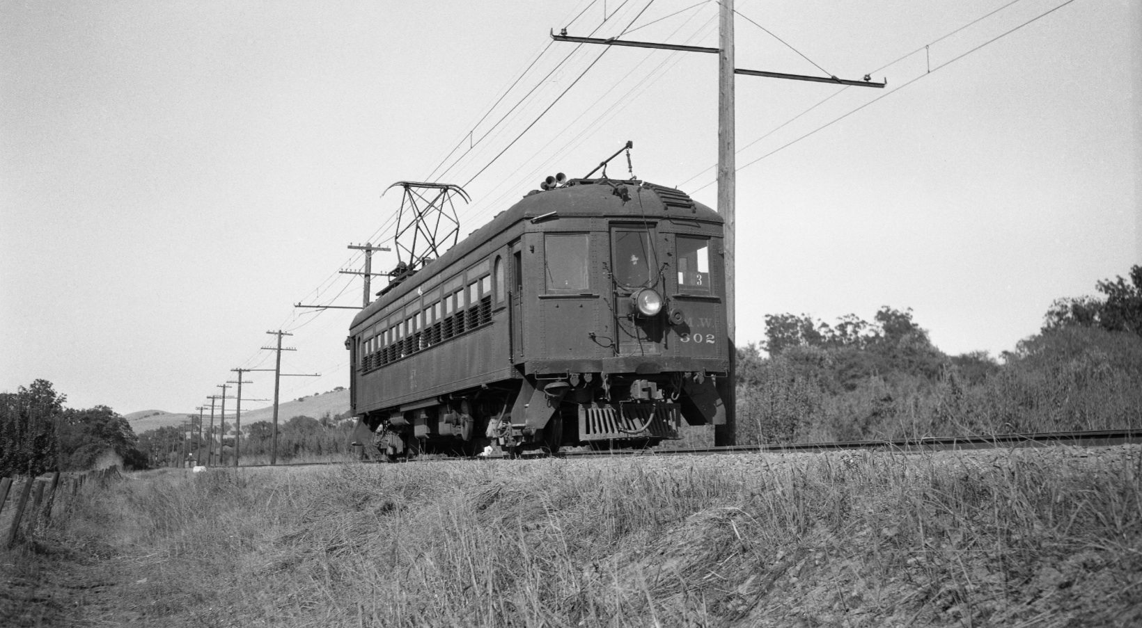
Very distinctive of this section, a single central pole held both sets of catenary wires as seen in this northeast image of SN 302 circa 1948. In the distance the little shelter that survived into the 1950s can be seen on the east side of the right-of-way.
L12-95-Tom Gray Photo, Courtesy Tom Gray , (Image 19 of 26)
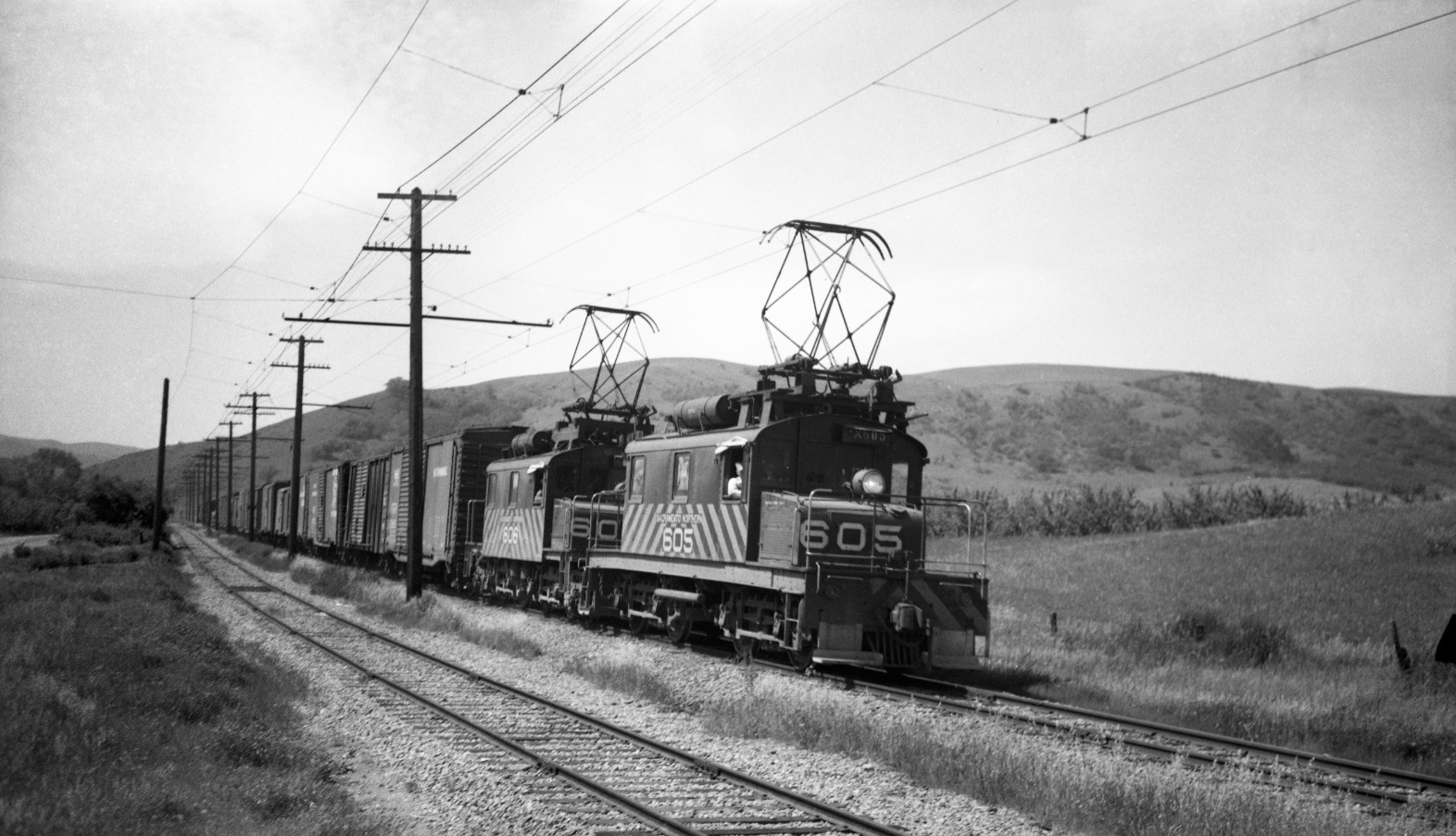
Now to a southwest view, SN 605 and 606 have progressed further northeast along the large orchard to the west, circa 1950. Note St. Mary's Road, just visible at the edge in the left middle portion of the image.
L12-100-Tom Gray Photo, Courtesy Tom Gray , (Image 20 of 26)
For completeness, very few photos managed to capture the freight shed that was south of the shelter as this southwest view from Apr. 1948 did. A color image of the shed may be seen on Dan Levy's excellent OB&E WEB site at http://www.oberail.org/photo/227/11/m.
L12-105-Tom Buckingham Photo, Courtesy BAERA, Western Railway Museum Archive, 54019sn , (Image 21 of 26)
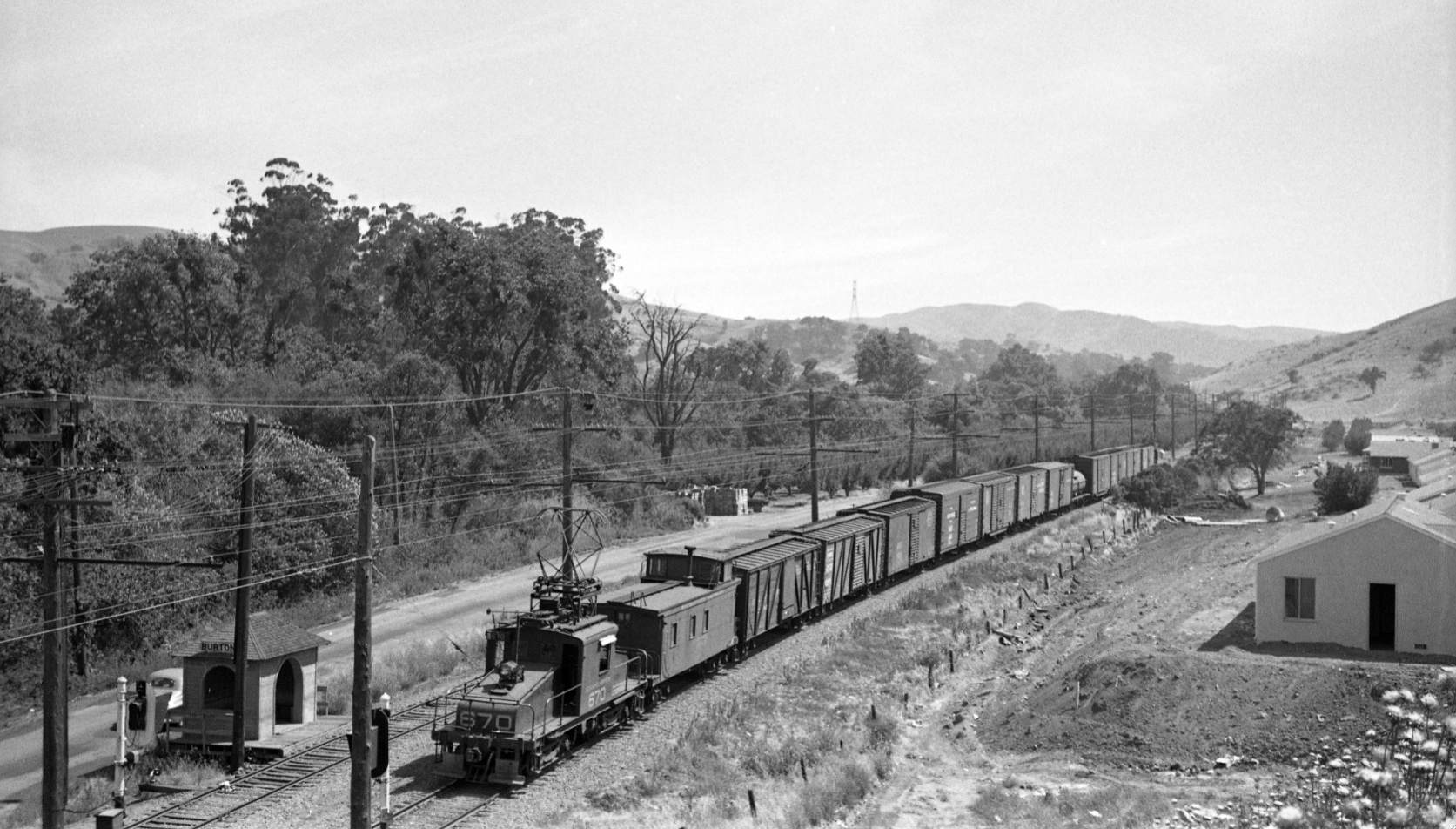
This south view catching SN 670 circa 1952 at the tail end of this freight shows the first row of houses that bordered Florence Dr., the latter out of the picture to the west. The freight shed is gone, but a pile of material to be loaded or previously unloaded from a train is seen.
L12-110-Norman Smith Photo, Courtesy BAERA, Western Railway Museum Archives, 52971sn, (Image 22 of 26)
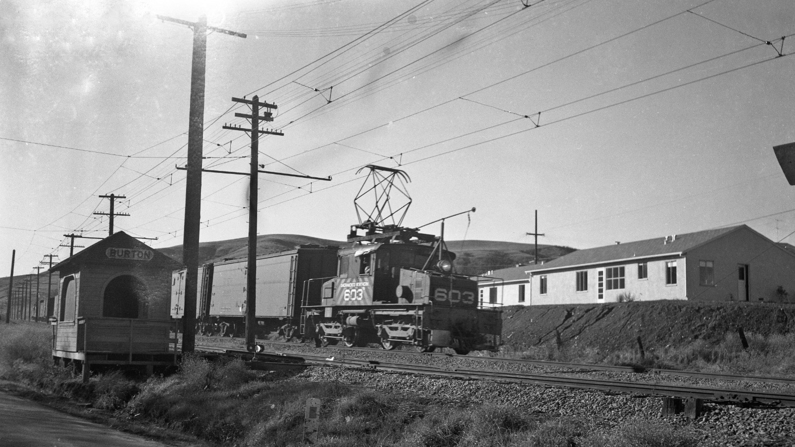
A similar documentation of the beginning of the housing boom, this time seen with a southwest view in this undated image of a SN 603-led freight as it passes the passenger shelter. Why the shelter survived on the active freight line after passenger service ended is not known, but the loss of the shed signaled the overtaking of the orchards by housing.
L12-115-Tom Gray Photo, Courtesy Tom Gray, (Image 23 of 26)
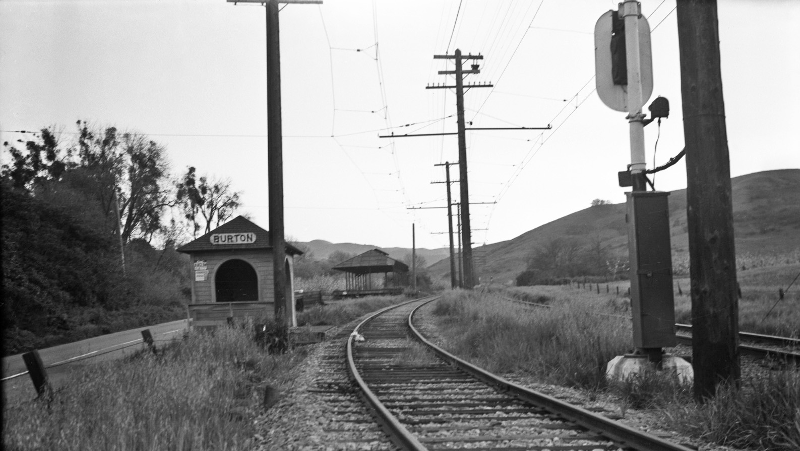
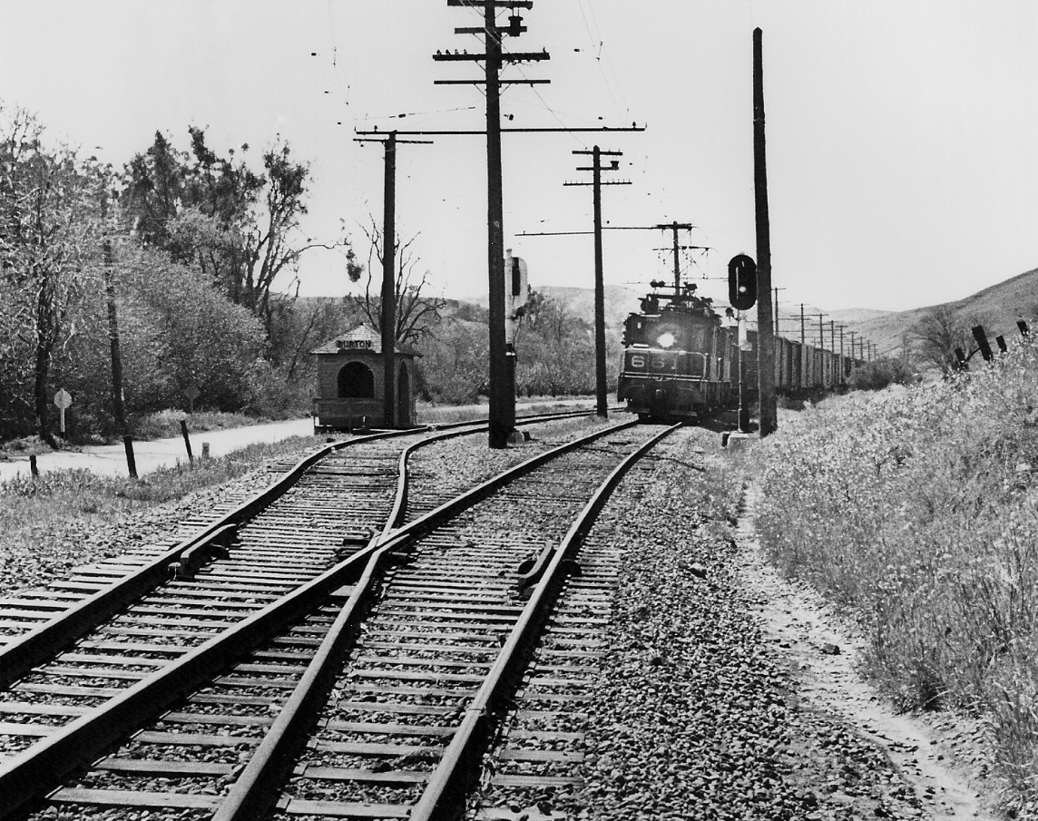
SN 661 has finally reached the shelter and the end of the double-track section in this south view from 1951. The shelter’s presence during the housing boom in the 1950s this region was ironic in that the area was almost completely unpopulated when passenger service ended in 1941.
L12-120-Reginald McGovern Photo, Courtesy Reginald McGovern, (Image 24 of 26)
As a SN 661 and 653-led freight heads toward Moraga circa 1950, we will turn our attention next time further to the northeast to another favorite Lafayette landmark and photographic opportunity of the Burton Valley.
L12-125-Tom Gray Photo, Courtesy Tom Gray, (Image 25 of 26)
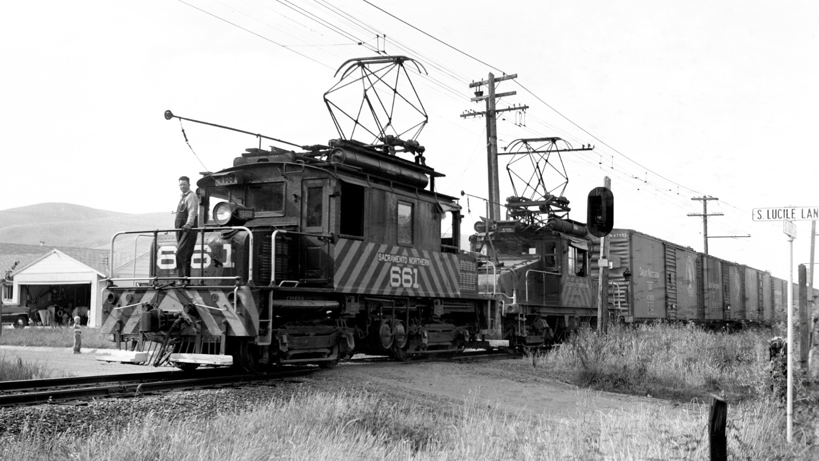
SN 661 at the S. Lucile Lane grade crossing, southeast view, circa 1950.
L12-130-Robert P. Townley Photo, Courtesy Robert P. Townley, (Image 26 of 26)