Reconstructing Meinert’s Double Track

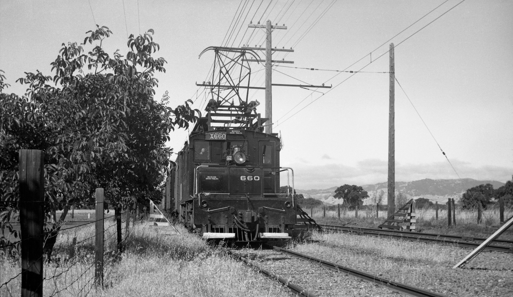
Eventually the single track leaving Bancroft station became a double-track section as the railway proceeded east along Minert Rd., the latter seen to the left of the train in this southwest view of SN 660 from July, 1940.
L103-05-Sappers Collection, Courtesy BAERA, Western Railway Museum Archives, 81315sn, (Image 1 of 15)

A comparison of three aerials and map notes the position of the west end of the double track by the black arrow. In the 1968 aerial, the arrow is for comparison only as BART is all double track here; note the footbridge over BART. Full Ref.: USDA AAA Western Division, BUU 280-64 from Jul 25, 1939; Full Ref. USDA AAA Western Division, 3-169, GS-VBZJ, 1968; 1958 aerial courtesy CCC Planning Department; Full Ref for Map: Courtesy California Board of Equalization, 862-7-4F
L103-10-Courtesy Contra Costa County Historical Society and California Board of Equalization, (Image 2 of 15)

A northeast view from the footbridge of the BART test track and David Ave., July 29, 1968. Unlike the SN, BART employs a continuous two-track configuration.
L103-15-Ted Wurm Photo, Courtesy BAERA, Western Railway Museum Archives, 85331BARTD, (Image 3 of 15)

Three years earlier, Mar. 1965, the BART test track is near completion in this northeast view taken further to the west relative to L103-15.
L103-20-Louis L Stein Photo, Courtesy BAERA, Western Railway Museum Archives,, 85626BARTD , (Image 4 of 15)

Taking a few steps to the east of the big tree in L103-20, John Harder took this northeast view of the BART test track in late 1964.
L103-25-John Harder Photo, Courtesy John Harder, (Image 5 of 15)

A definitive image of the switch track initiating the double-track section from the west end could not be found, but its origin is implied by the added catenary poles to the east of the block signal in this northeast image of SN 661 with freight at the Lee Lane grade crossing, circa 1952.
L103-30-Railroad Negative Exchange, Courtesy Charles Smiley, (Image 6 of 15)

This northeast image of MW 302 and SN 654 documented a BAERA excursion from July 12, 1954. The slight curve in the track indicates the west end of the double track is very close.
L103-35-Victor DuBrutz Photo, Courtesy BAERA, Western Railway Museum Archives, 80183sn, (Image 7 of 15)

SN 660 switches to the southern-most track in this northeast view circa 1940. The water tower and agricultural-related storehouses mark the east side of Oak Grove Rd. The continuation of the southern-most track to the east will be explained by the next image.
L103-40-Paul Smith Photo, Courtesy BAERA, Western Railway Museum Archives, 104259sn, (Image 8 of 15)

This northeast view of SN 652 late in Feb. 1957, documents that the southern-most track continued to the east of the switch served as the take-off of the Walwood branch of the railway. More on that topic later.
L103-45-EK Muller Photo, Courtesy BAERA, Western Railway Museum Archives, 77502sn, (Image 9 of 15)

A summary of the key portions of the double-track section using the 1958 aerial and the Board of Equalization map. The black arrow indicates the west end of the double-track section seen in L103-30, the red arrow the switch track seen in L103-40, and the blue and yellow arrows the continuation of the southern-most track as the Walwood branch take-off seen in L103-45. The green arrow may be pointing to a single car on the Walwood take-off.
L103-50-Courtesy Contra Costa County Historical Society and California Board of Equalization, (Image 10 of 15)

The railway produced this document dated Nov. 25, 1945 confirming the alignment of track as summarized above. The black arrow indicates the west end of the double-rack section seen in L103-30, the red arrow the switch track seen in L103-40, and the blue and and yellow arrows the continuation of the southern-most track as the Walwood branch take-off seen in L103-45.
L103-55-Courtesy BAERA, Western Railway Museum Archives, 36395sn, (Image 11 of 15)

Given what has been presented, SN 1005 and SLU 751 are seen switching to the southern-most track in this northeast view of the last BAERA-sponsored south end excursion south of Lafayette, Jan. 13, 1957.
L103-60-Richard Kampa Photo, Courtesy BAERA, Western Railway Museum Archives, 58308sn, (Image 12 of 15)

A southeast view of a derailed Pacific Fruit Exchange refrigerator car blocking passenger-car service in June 1939 is visited by SN 604 and, at the edge of the image, SN 603, in surroundings that could only be the Meinert double-track section.
L105-65-Ted Wurm Collection, Courtesy BAERA, Western Railway Museum Archives, 85641sn, (Image 13 of 15)

SN 661 along Minert Road, north view, circa 1950.
L103-70-Robert P. Townley Photo, Courtesy Robert P. Townley, (Image 14 of 15)

SN 670 along Minert Road, northeast view circa 1950.
L103-75-Robert P. Townley Photo, Courtesy Robert P. Townley, (Image 15 of 15)