Reliez, Raliez or Reliz?

In the Jan. 2011 Lafayette Historical Society News, Vol 38, #1, member Ray Peters asked “So, What’s A Reliez, Anyway?” in an entertaining account of uncovering at least 15 names related to a landslide in the area, or as in Spanish, “Reliz”. And what of this west image circa 1940, a shelter with “Raliez” and no roads in site?
L73-05-Charles Savage Photo, Courtesy Tom Gray, (Image 1 of 15)

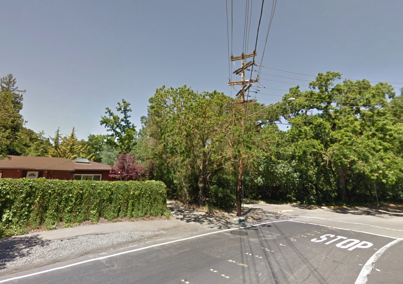
Reliez Station Rd. provides direct access to Olympic Blvd., here showing the intersection, north view. The intersection is unusual in that Olympic Blvd., a major thoroughfare, starts abruptly here as an extension of the Lafayette-Moraga Trail.
L73-10-Courtesy Google, (Image 2 of 15)
This north view capturing the winter sun of late 1956 illuminating SN 654 and caboose 1622 on the SN right-of-way leaves no doubt as to where Olympic Blvd. and the Lafayette-Moraga Trail derived their existence, one or two decades, respectively, from this date.
L73-15-Fred H Matthews Photo, Courtesy Anonymous Donor, (Image 3 of 15)
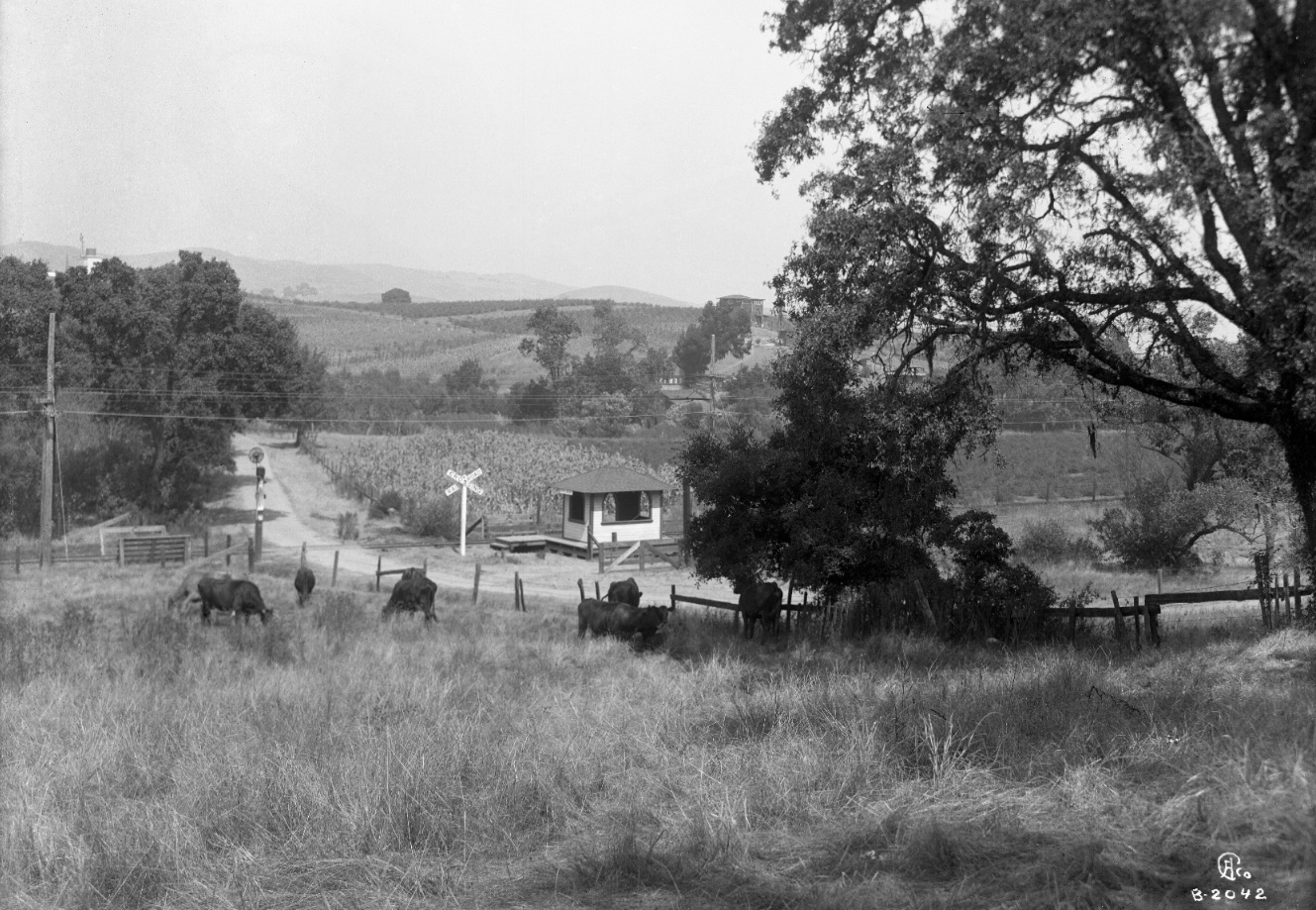
Going back in time further, the intersection had sported a much larger shelter in the 1910s relative to that shown circa 1940 in L73-05. This area was a favorite rural setting for Eston Cheney and other photographers in the Oakland, Antioch and Eastern era, particularly in the depiction of livestock.
L73-20-Eston S Cheney Photo B-2042, Courtesy BAERA, Western Railway Museum Archives, 24180sn, (Image 4 of 15)
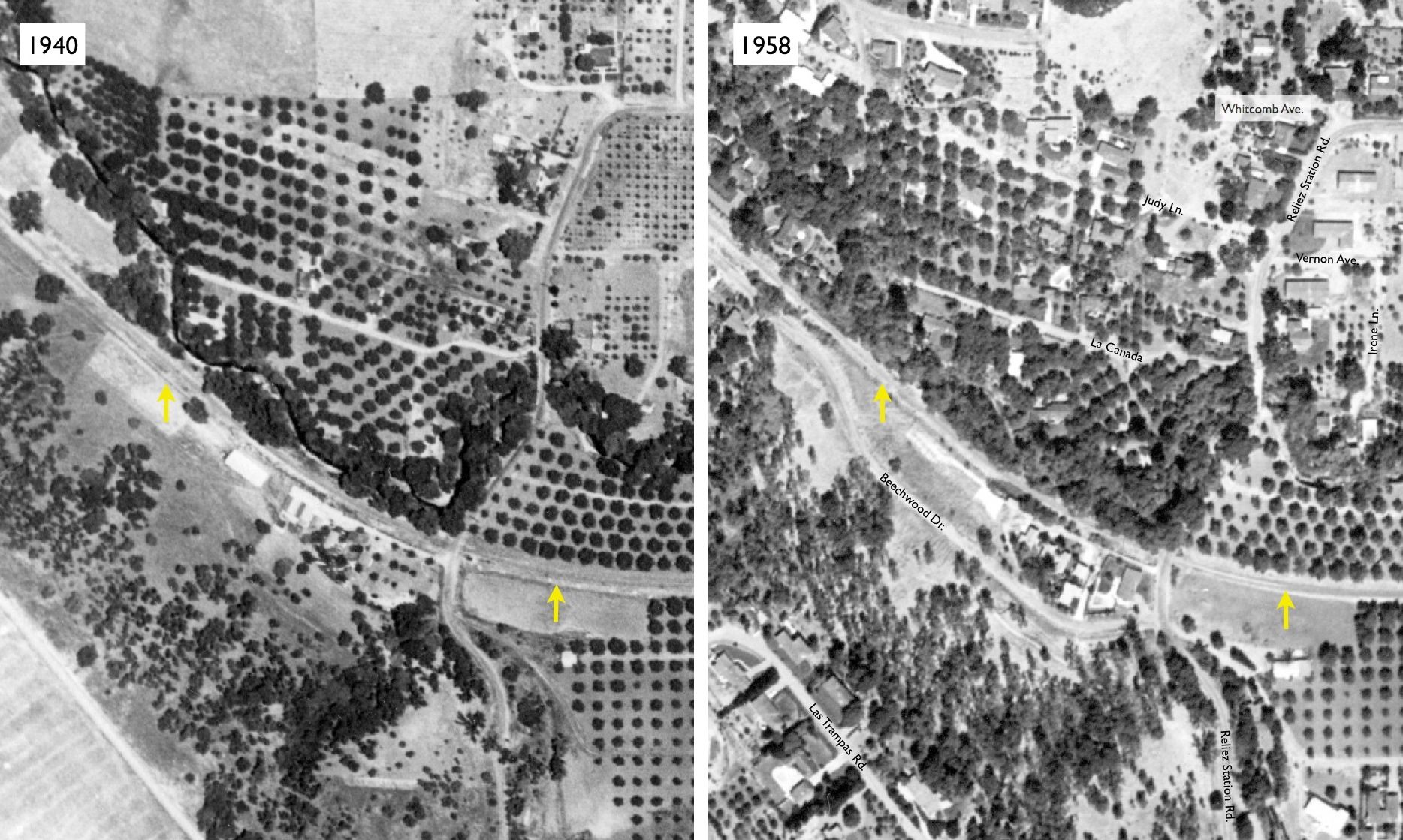
A comparative 1940 versus 1958 view of the northeast end of the Lafayette Loop east of Hawthorne Ln. to east of the Reliez Station Rd. grade crossing. The prominence of Las Trampas Creek, the orchards and Snake Hill remained relatively unchanged during this period of growth around the SN right-of-way, yellow arrow.
L73-25-Courtesy Contra Costa County Historical Society, 13560 and 13563 Details, (Image 5 of 15)
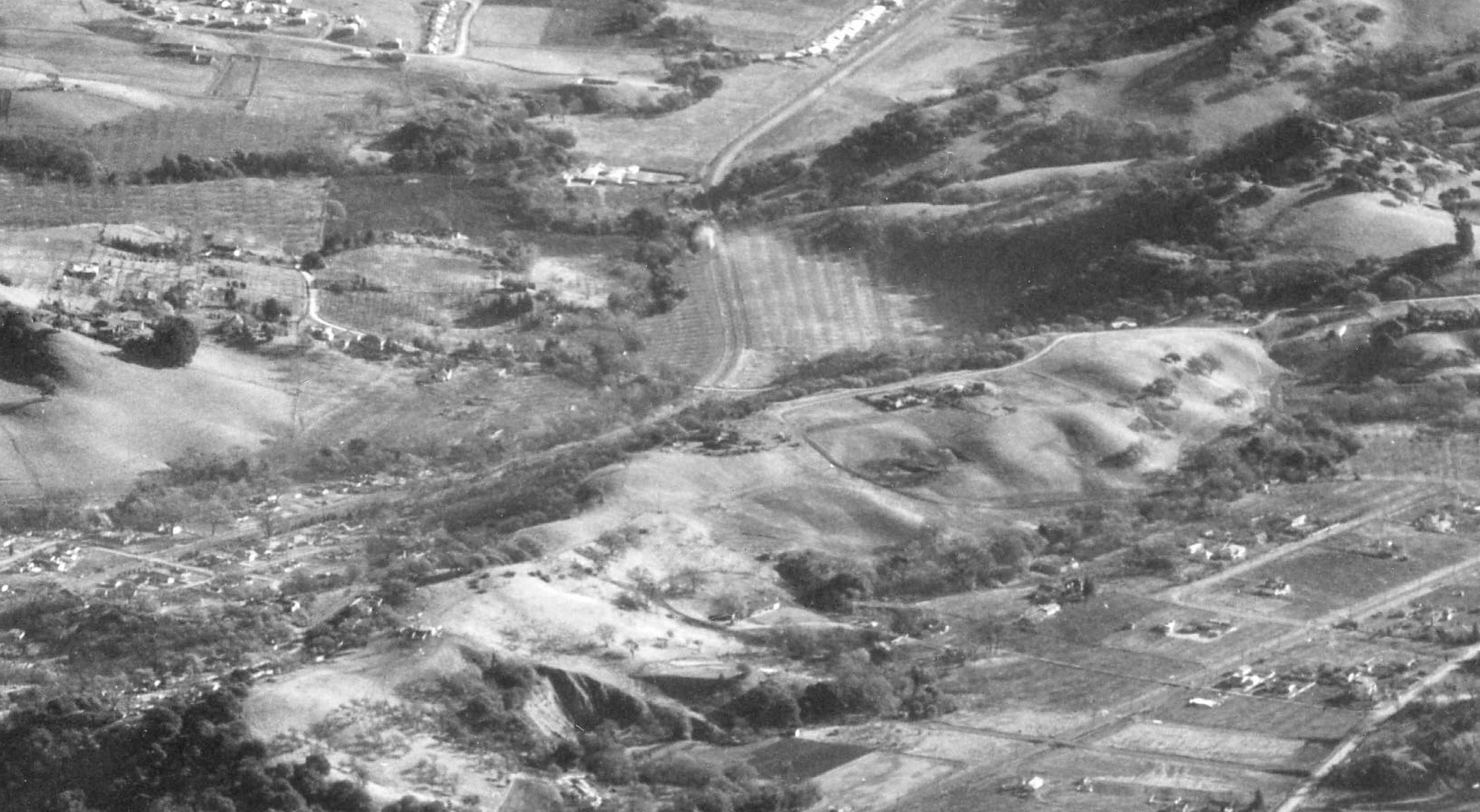
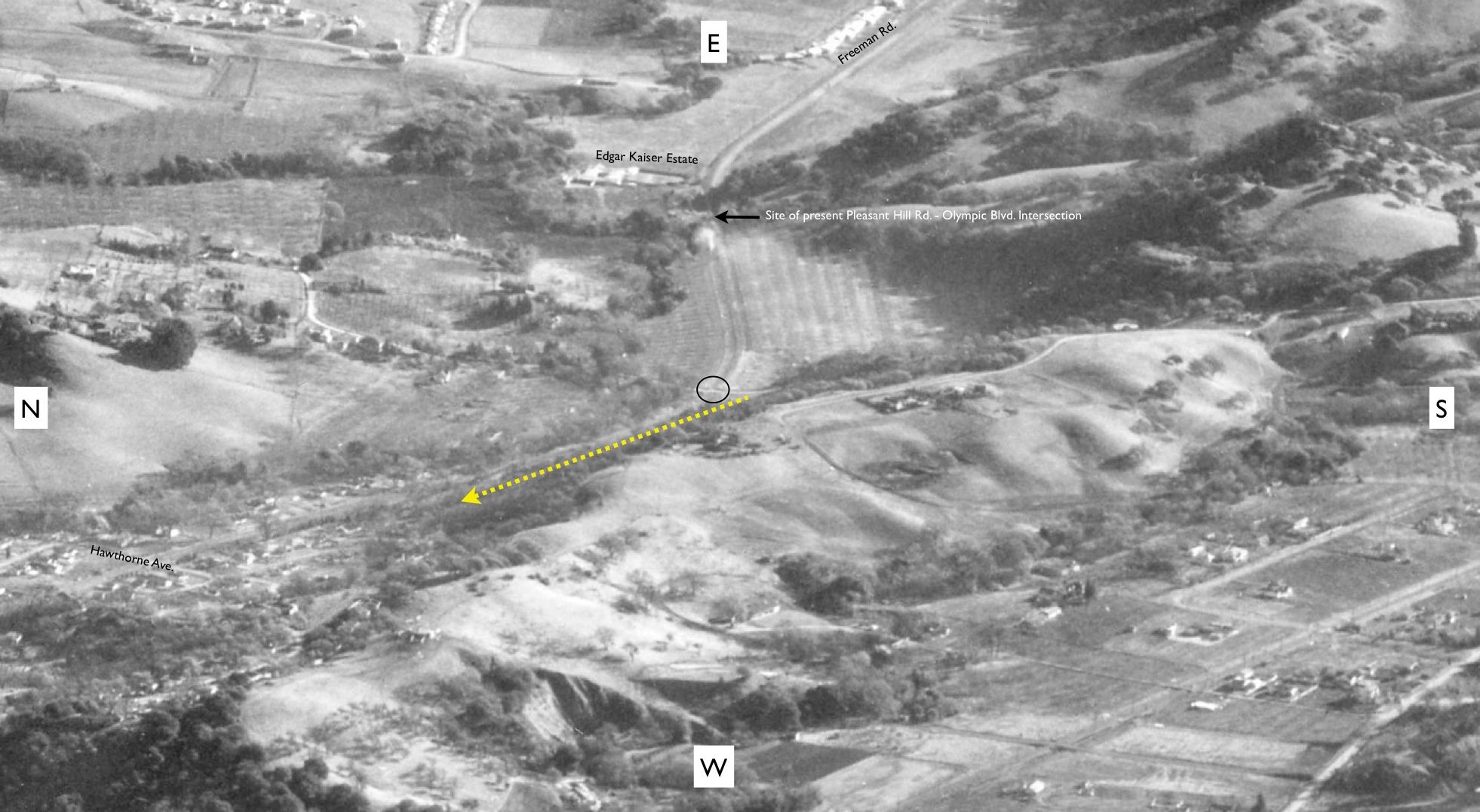
The SN-Reliez Station Rd. intersection sits in the center of this east view aerial from Dec. 31, 1946. The next image is an annotated version.
L73-30-RL Copeland Photo, Courtesy Contra Costa County Historical Society, 7348 Detail, (Image 6 of 15)
Annotated version of L73-30, the SN-Reliez Station Rd. intersection is marked by the circle in this east view aerial from Dec. 31, 1946. The remainder of this review will focus with one exception on north to west views of the last section of the Lafayette Loop outlined by the yellow arrow. Very few quality images beyond 1930 of this section have been identified.
L73-31-RL Copeland Photo, Courtesy Contra Costa County Historical Society, 7348 Detail, (Image 7 of 15)
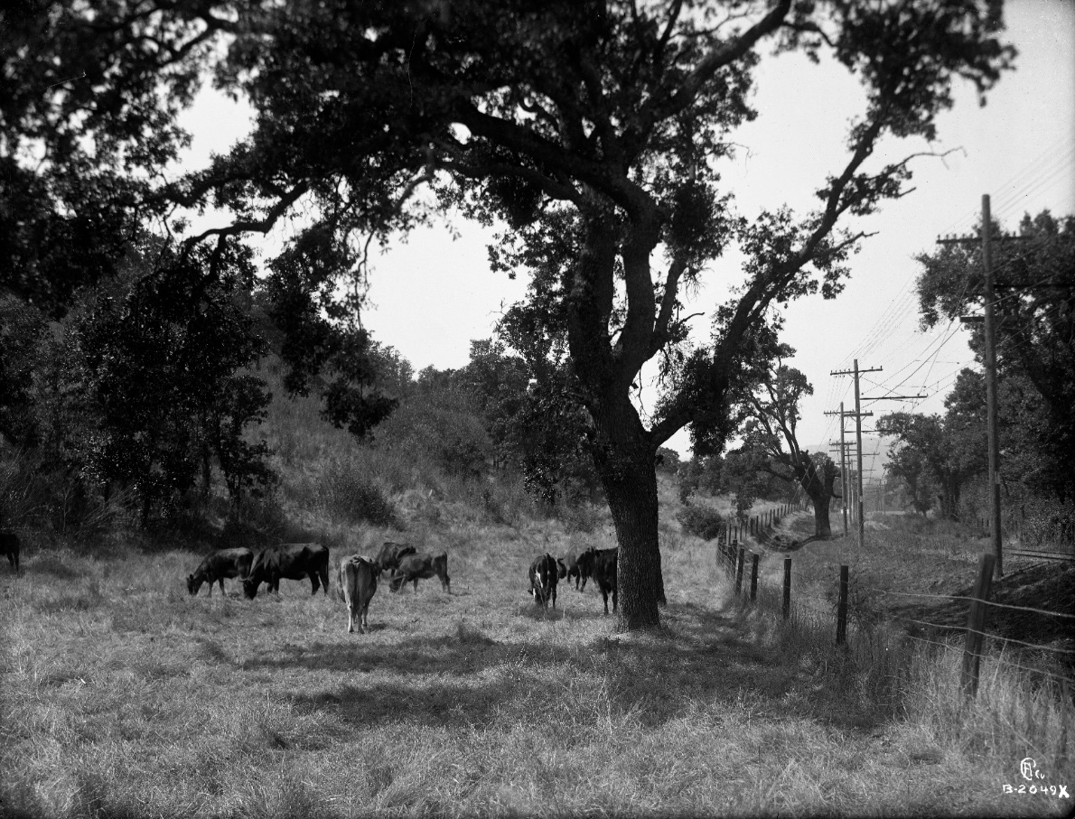
Eston Cheney produced several images from this area in the 1910s, such as this northwest view, typically showing a far off train or empty SN right-of way, cows, crops, a fence, and maybe an identifying hill.
L73-35-Eston S Cheney Photo B-2949X , Courtesy BAERA, Western Railway Museum Archives, 24816sn, (Image 8 of 15)
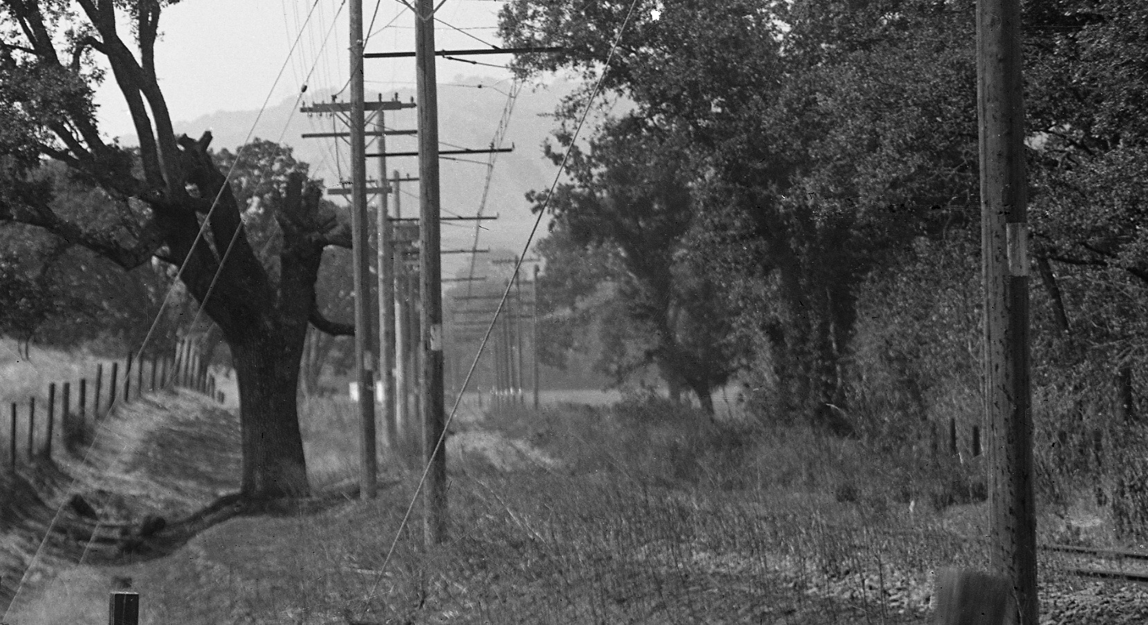
This detail from L73-35 northwest view from the 1910s also documents in the background the switch of position of the catenary poles from the north to the south side of the track as the curve to the Reliez Station Rd. grade crossing is approached.
L73-40-Eston S Cheney Photo B-2949X , Courtesy BAERA, Western Railway Museum Archives, 24186sn Detai, (Image 9 of 15)
This one southeast view also by Cheney is unusual as being the only image produced west of the grade crossing back to the curve looking southeast.
L73-45-Eston S Cheney Photo B-2038, Courtesy Lafayette Historical Society 01344, (Image 10 of 15)
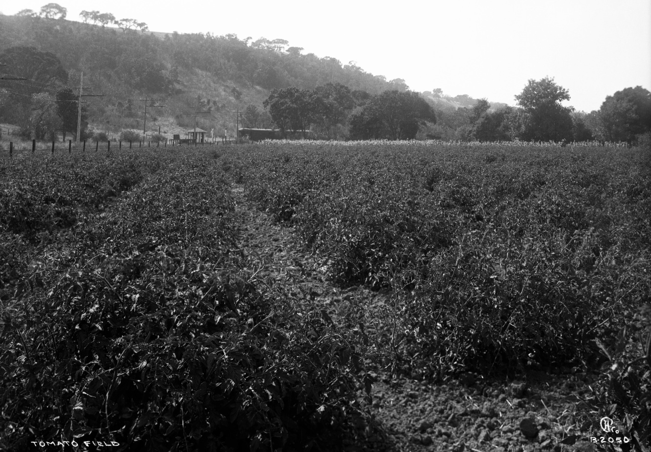
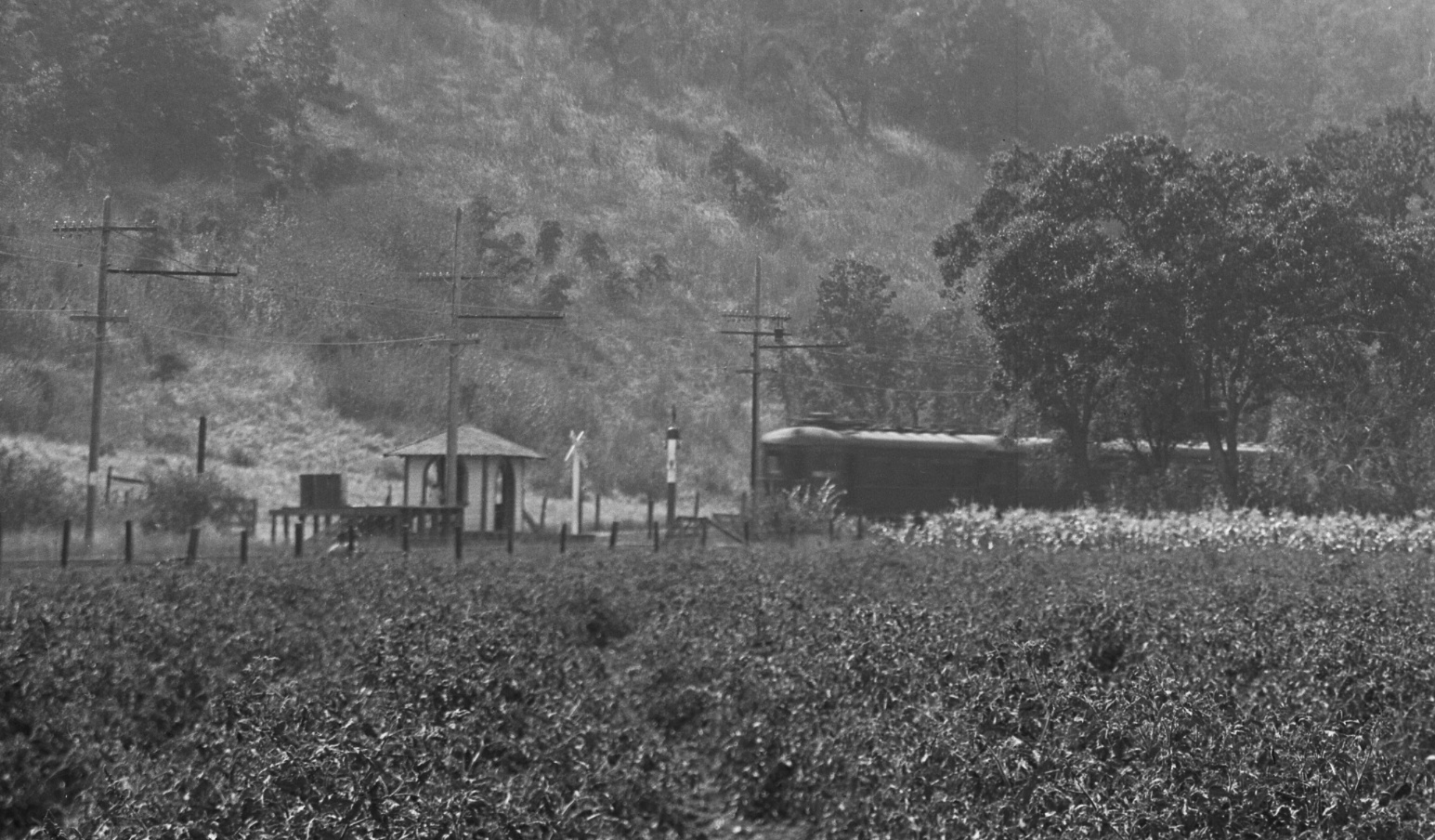
Moving to the intersection, Cheney’s “Tomato Field”, a west view with Snake Hill in the background from the 1910s speaks for itself. See the next image for an enlargement of the east-bound train approaching the shelter.
L73-50-Eston S Cheney Photo B-2050, Courtesy BAERA, Western Railway Museum Archives, 24187sn, (Image 11 of 15)
Detail from L73-50, west view from the 1910s capturing the shelter, wigwag, crossbuck, and freight platform. Evidence for the sense of history and artistry of Eston Cheney.
L73-55-Eston S Cheney Photo B-2050, Courtesy BAERA, Western Railway Museum Archives, 24187sn Detail, (Image 12 of 15)
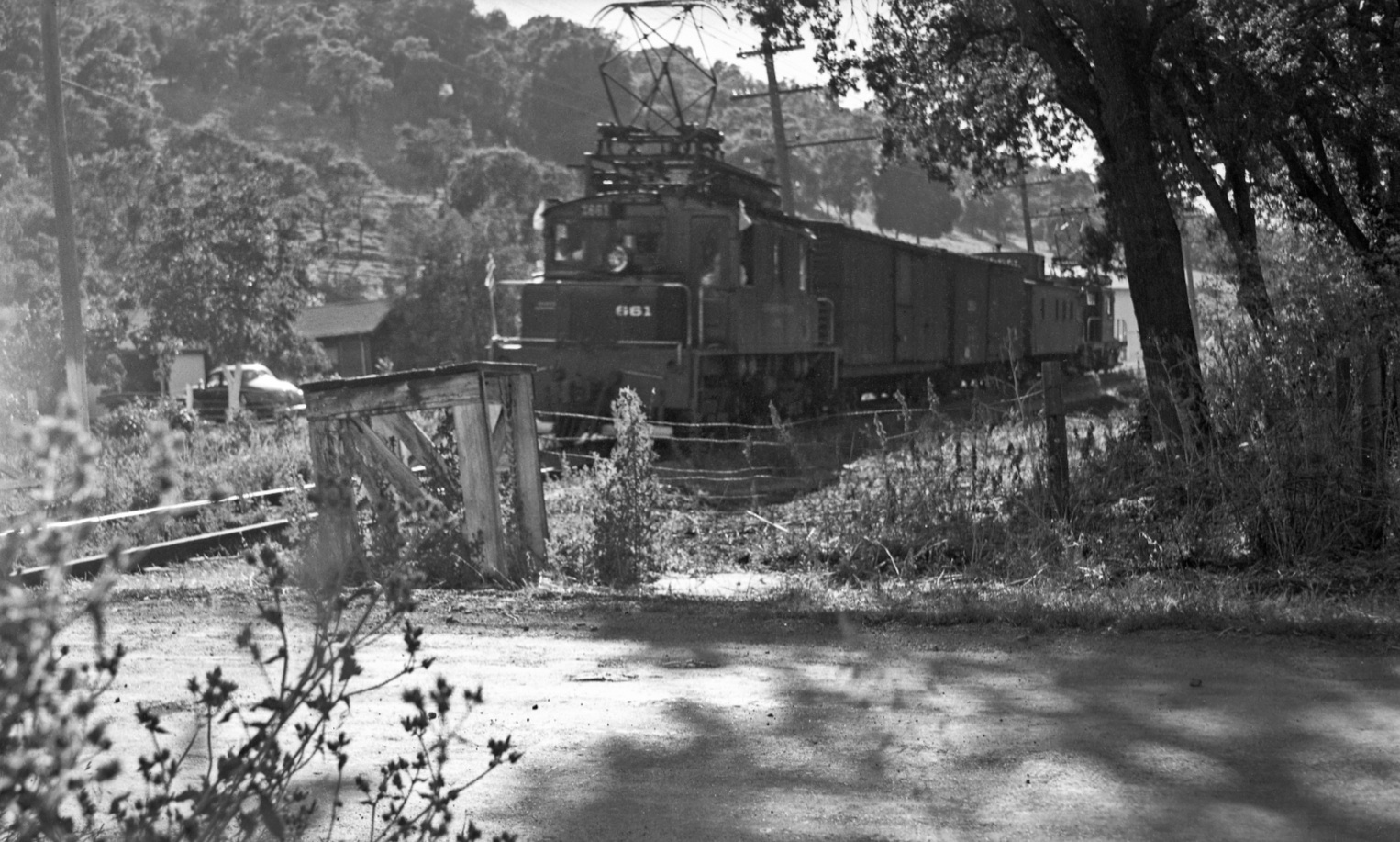
SN 661 approaches the Reliez Station Rd grade crossing pulling a short freight with an additional motor in the rear in this west view, circa 1940. Note the presence of a home and car close to the area.
L73-60-Paul Smith Photo, Courtesy BAERA, Western Railway Museum Archives, 70092sn, (Image 13 of 15)
The end of regularly scheduled passenger service was followed by a return of cars to Chico with SN 661 doing the honors, Jul. 1, 1941, west view. The SN identified this spot as “Raliez”, but the basis for their choice of spelling remains obscure, possibly made on a phonetic basis or an obscure map. But, what’s a Reliez, anyway!
L73-65-Richard Jenevein Photo, Courtesy BAERA, Western Railway Museum Archives, 13191sn , (Image 14 of 15)
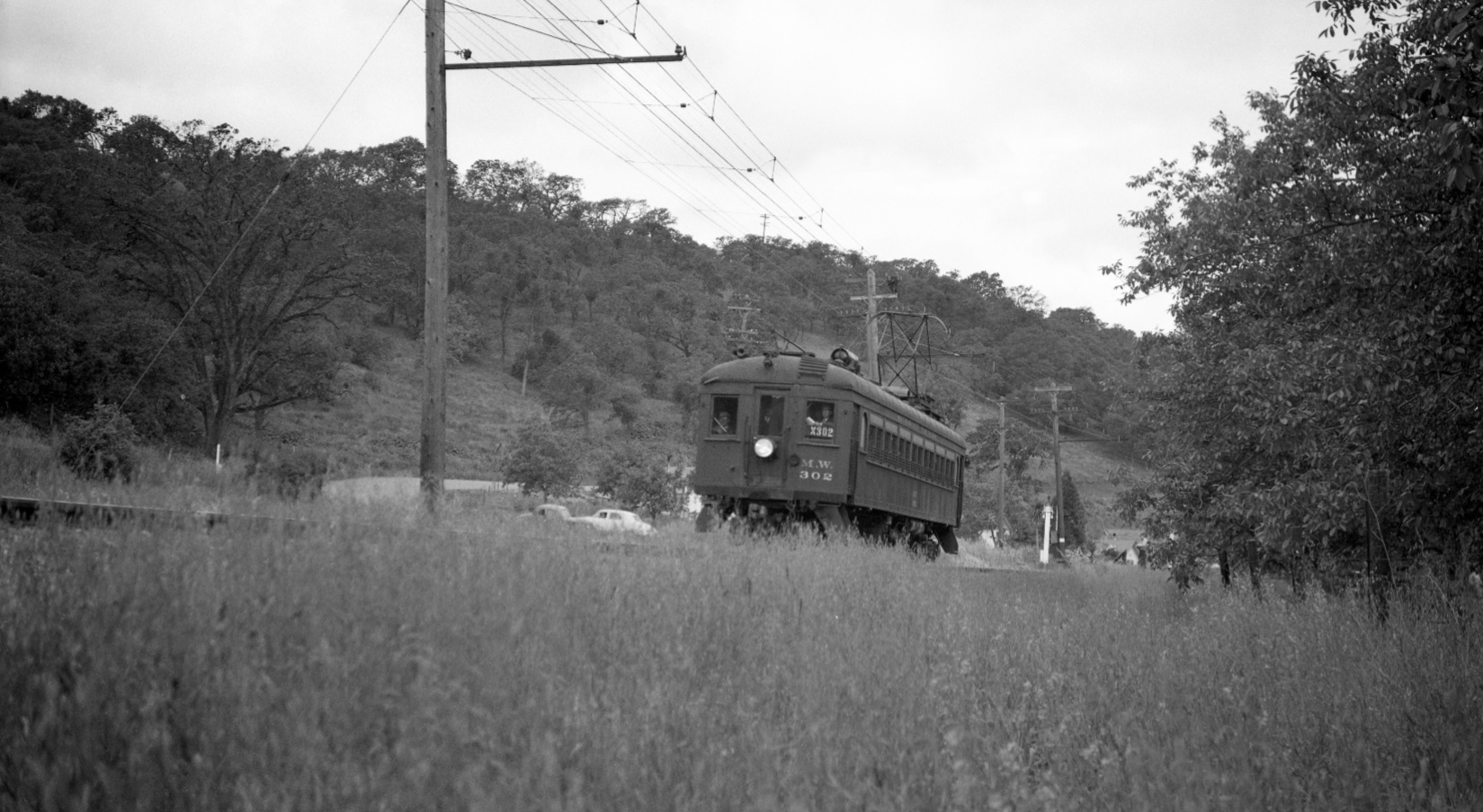
Rail fans got their chance to ride in a SN passenger motor again beginning in the late 1940s. Here, a west view of MW 302 with the grade crossing wigwag signal and Beechwood Dr. in the background during a Sep. 18, 1949 Northern California Railroad Club Excursion. West views of the grade crossing from the 1950s are still wanting.
L73-70-Vernon Sappers Collection, Courtesy BAERA, Western Railway Museum Archives, 70088sn, (Image 15 of 15)