Remaking Ohmer Hill
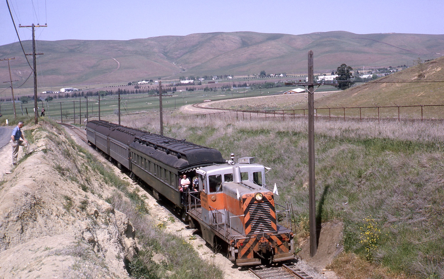
SN 143 and passenger cars sit atop Ohmer Hill in this south view during the End-of-an-Era excursion from Apr. 12, 1964. Ohmer Hill was a favorite spot for photographers, but exactly where was this place?
L148-01-Courtesy Charles Smiley, (Image 1 of 34)

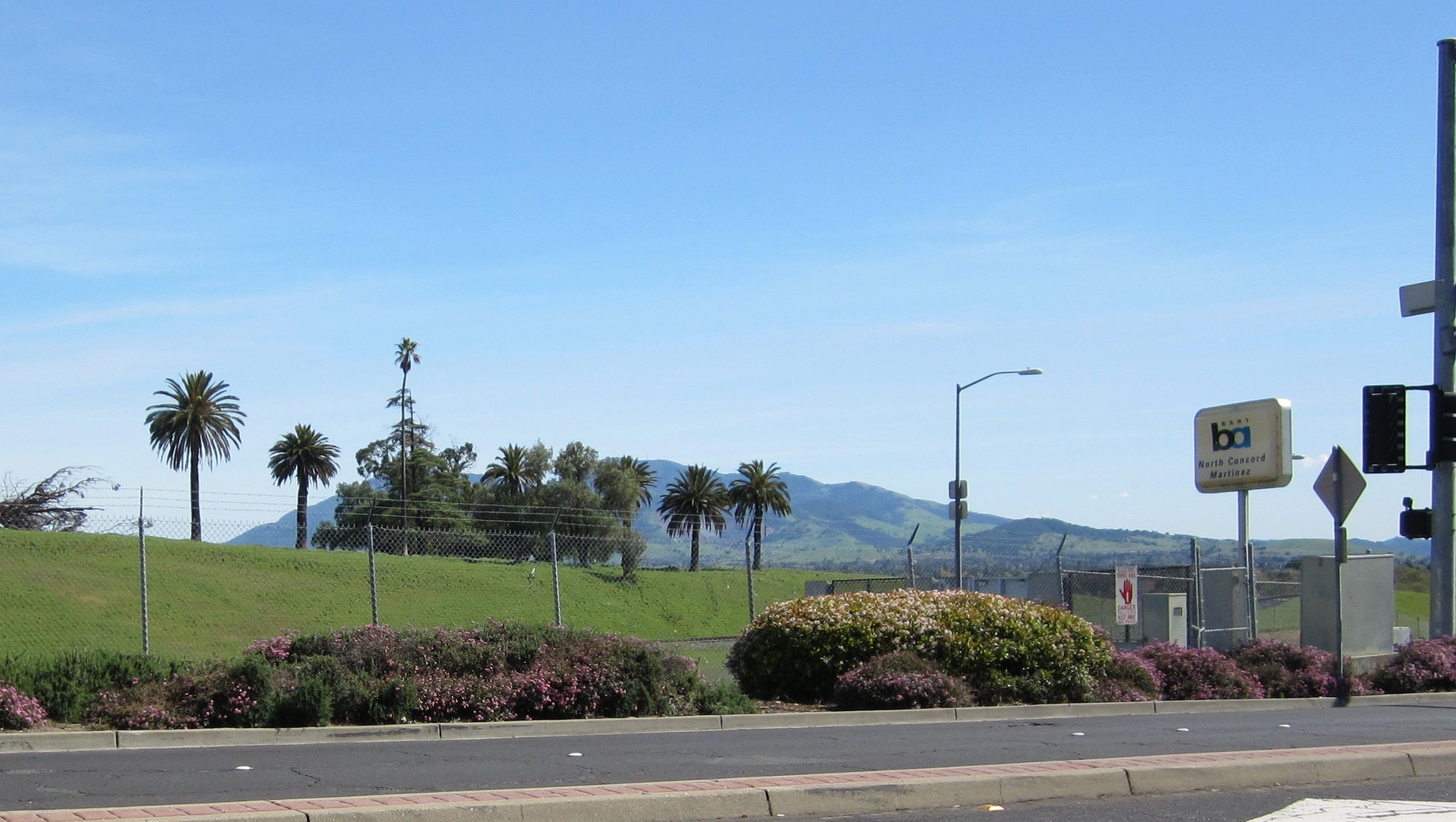
If you have ever been to the BART North Concord-Martinez station along the Port Chicago Highway and admired those palms on the ex-inland area of the Concord Naval Weapons Station, you have been to Ohmer Hill. Of course, it never looked like this while the moniker Ohmer was in vogue for this portion of North Concord.
L148-05-Stuart Swiedler Photo, (Image 2 of 34)
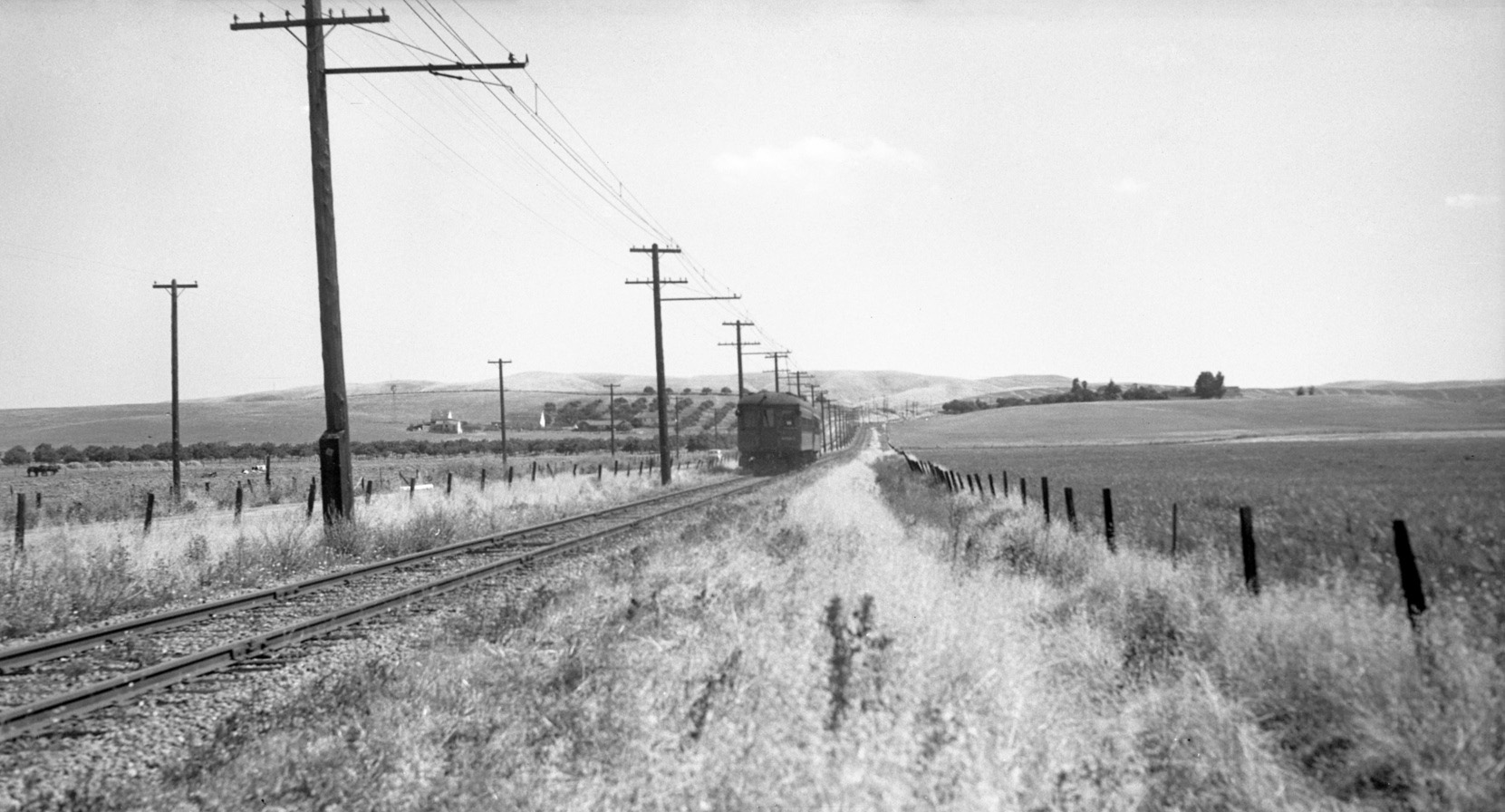
To get to Ohmer Hill from central Concord in 1940, you would have boarded this two-car train at the Adeline SN station at the Olivera Ranch in Concord and headed north. What is today called the Port Chicago Highway is to the left or west of the track. North view.
L148-10-Vernon Sappers Collection, Courtesy BAERA, Western Railway Museum Archives, 106461sn , (Image 3 of 34)
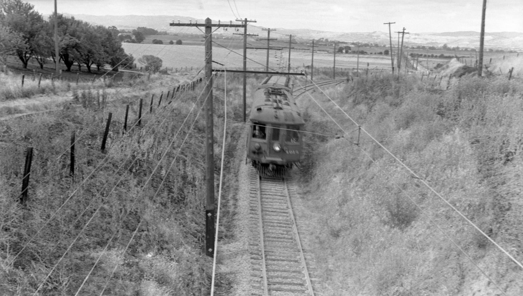
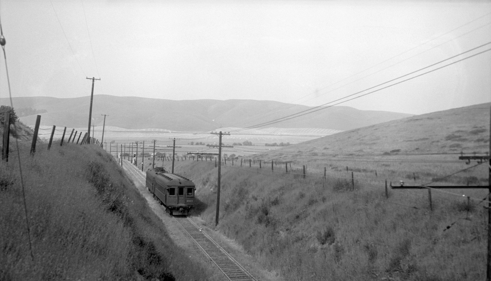
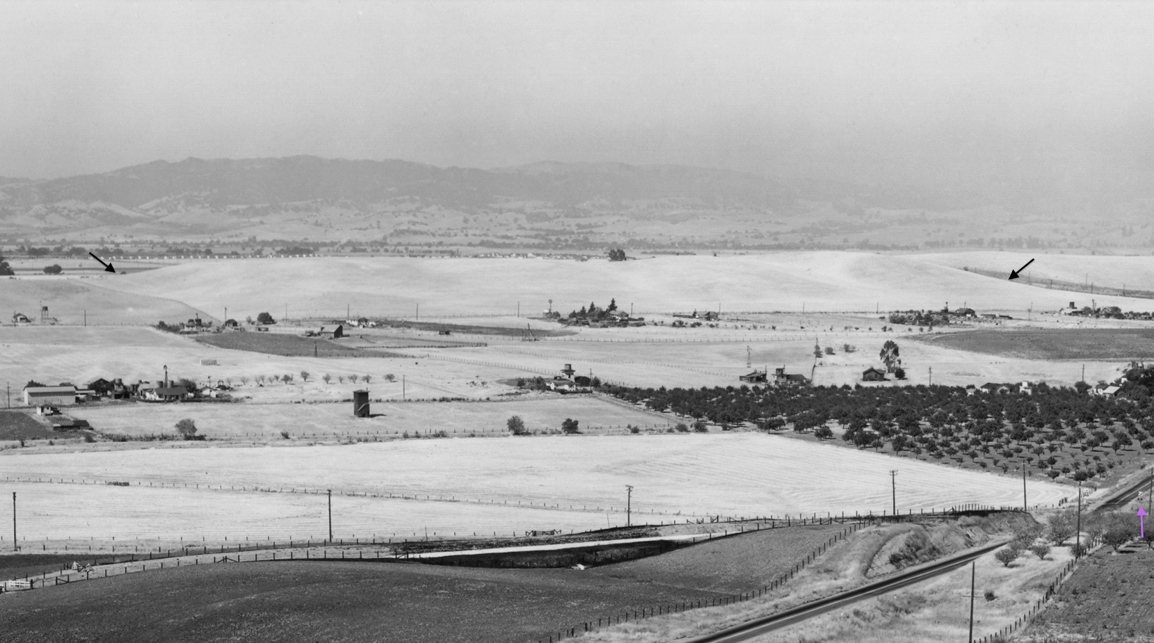
Your train, here train 12 with SN 1014 and SN 1023, would have climbed the south end of Ohmer Hill as seen in this south view from July 22, 1941. The paved road is still to the west or right of the track, but not visible here. The unpaved road to the east or left served the farm on that flank. Archivist Harry Aitkin remarked that nobody showed this was a hill better than Louis Bradas, Jr.’s images. One more to come later ...
L148-15-Louis Bradas, Jr. Photo, Courtesy BAERA, Western Railway Museum Archives, 68180sn, (Image 4 of 34)
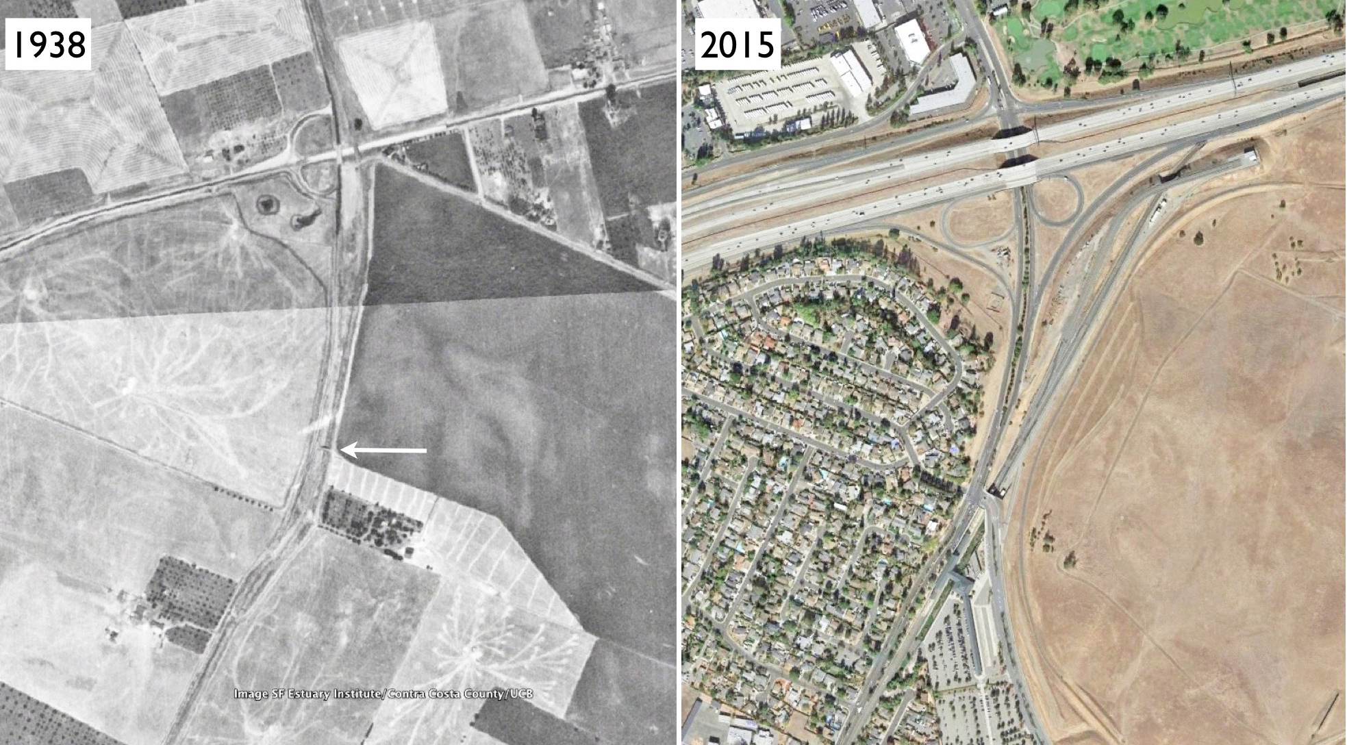
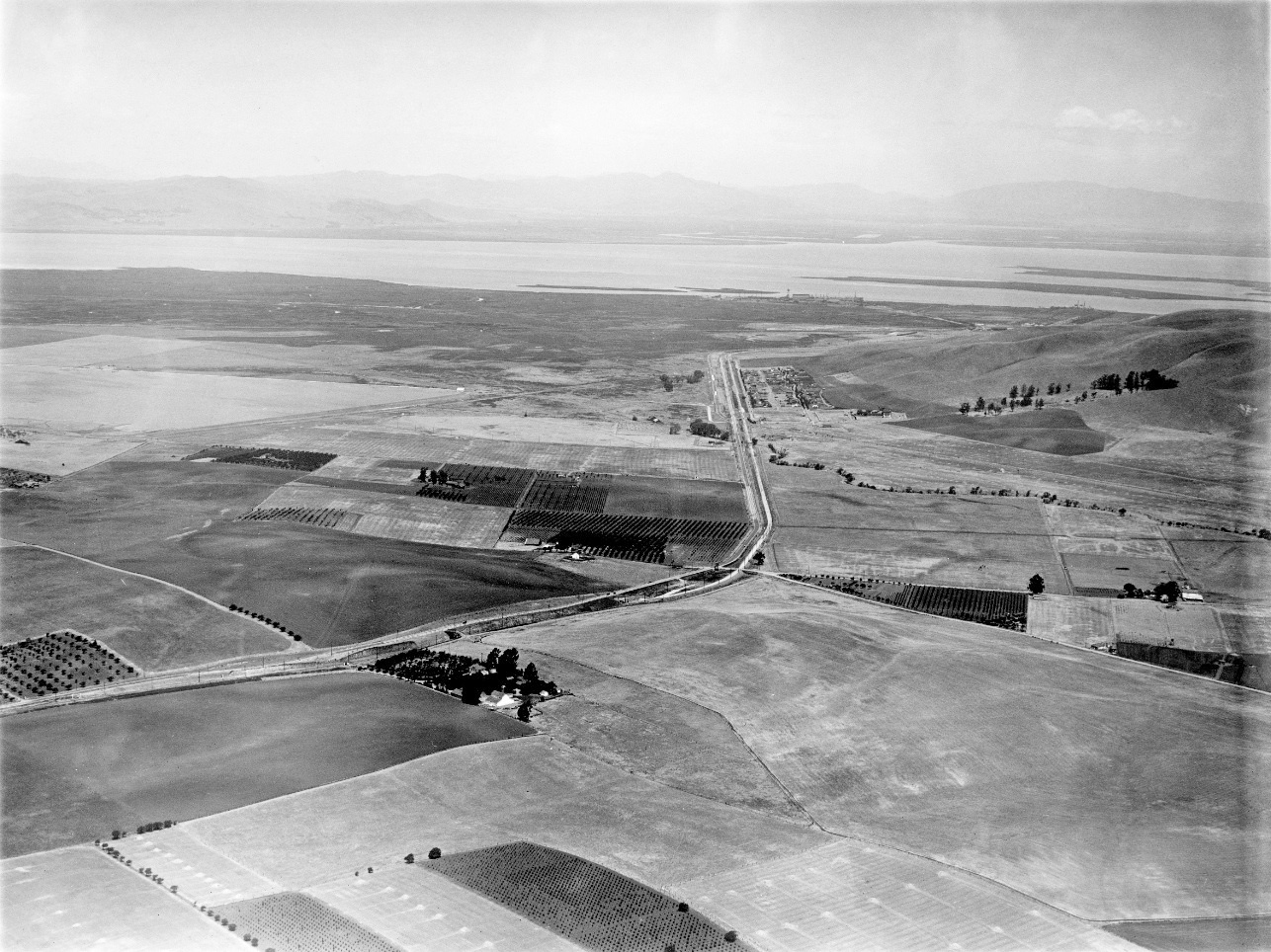
The image in L148-15 was possible because of a bridge over the railway that connected the road now called the Port Chicago Highway to the farming area on the east flank of the railway. The arrow in the 1938 aerial points to that bridge, an important landmark for the upcoming images.
L148-20-Courtesy Google Earth, (Image 5 of 34)
With no formal stop designated, your train would have continued down the north slope to stop just down the road at the formal Ohmer shelter. Northeast view, circa 1940. Appreciate that at this time the railway was surrounded by open grassland used for cattle grazing, but the construction of the Inland Concord Naval Weapons Station was soon to come.
L148-25-Sappers Collection, Courtesy BAERA, Western Railway Museum Archives, 106463sn, (Image 6 of 34)
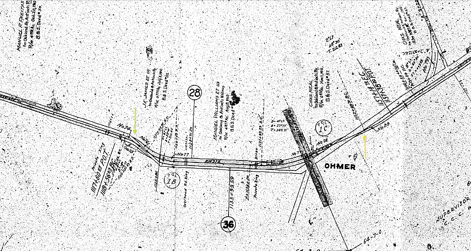
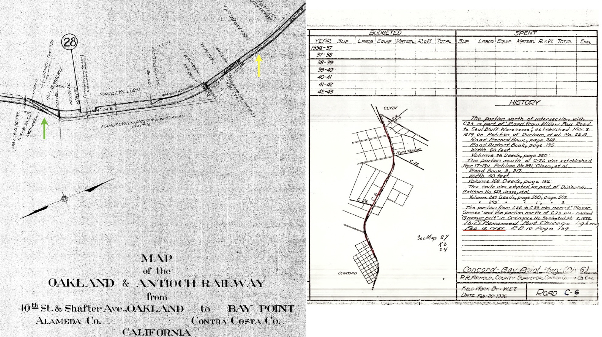
Ahead in time past 1940, there are no mysteries about this area, but this 1920s Board of Equalization map highlights a railway road crossing south of the hill, green arrow, and back again to the north, yellow arrow. A detail of the crossing in the hill area is next.
L148-30-Courtesy California Board of Equalization 862-7-5B, (Image 7 of 34)
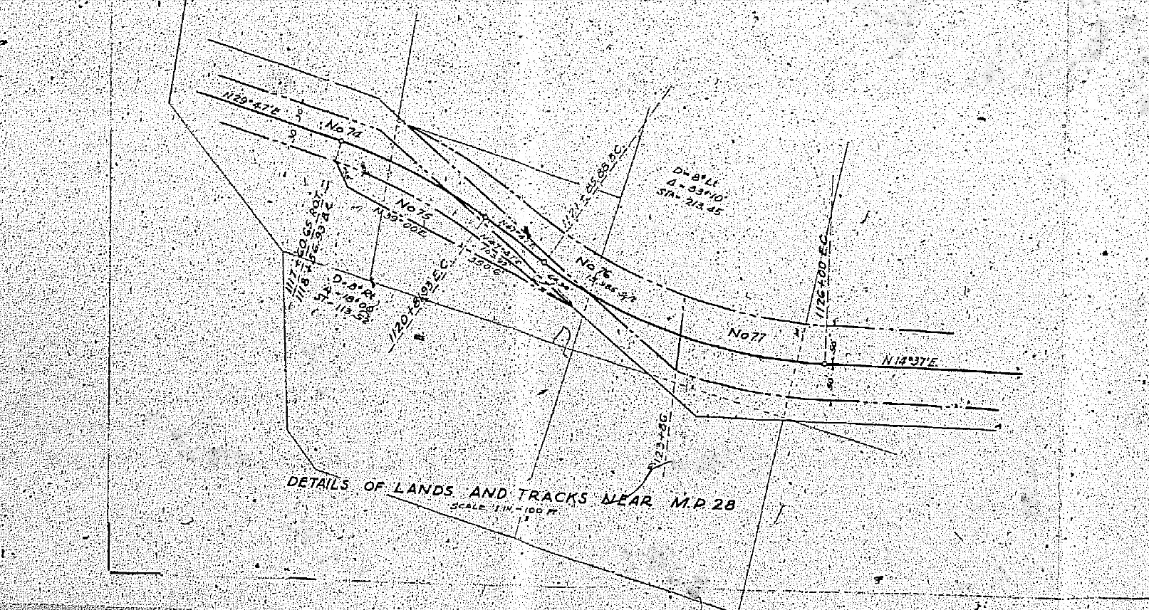
Detail from L148-30 showing apparent crossing of the road with tracks at Ohmer Hill.
L148-35-Courtesy California Board of Equalization 862-7-5B, Detail , (Image 8 of 34)
Records from Contra Costa County Public Works support the findings regarding the position of the road versus the track. Note in the written document that the road was not designated as the Port Chicago Highway until 1951 and had been referred to prior to that by several names, but in the county as C-6.
L148-40-Courtesy Contra Costa County Public Works , (Image 9 of 34)
George Russell’s north aerial circa 1929 shows a continuous road to the west of the tracks. Ref: API 563_5_BOX 59
L148-45-George Russell Photo, Courtesy California State Lands Commission, (Image 10 of 34)
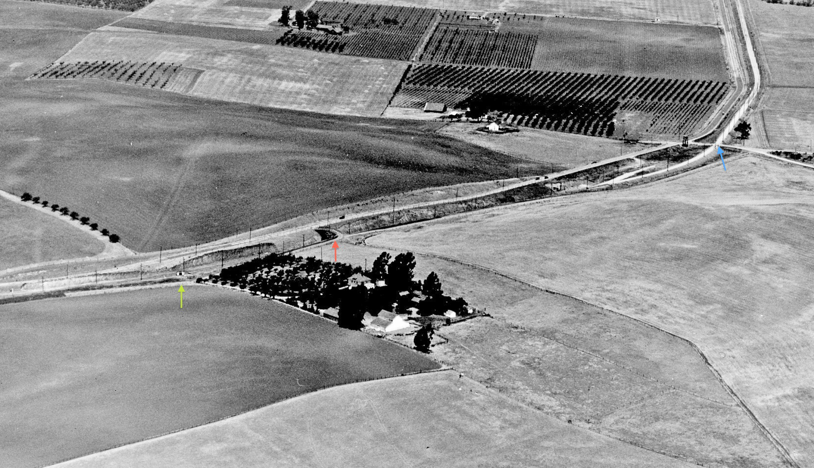
A detail from L148-45, north aerial circa 1929, shows a road bridge over the railway, red arrow. The green arrow points to what looks like the Ohmer shelter, which in circa 1940 images was shifted toward the Arnold Industrial Highway crossing, blue arrow, the latter to be modified in the mid-1930s and to be reported on in the next update.
L148-50-George Russell Photo, Courtesy California State Lands Commission, Detail, (Image 11 of 34)
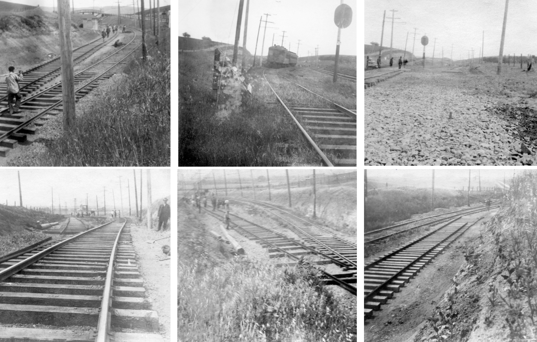
Based on these six images, extensive work had taken place to move the rails to the west. These images are not dated nor is there any documentation explaining what was done and why. Whether this relates to any road realignment is still to be determined. Ref. nos., left to right, top to bottom: 108315sn; 108317sn; 110757sn; 110755sn; 110759sn; 108329sn.
L148-55-Courtesy BAERA, Western Railway Museum Archives, (Image 12 of 34)
Now ahead to 1944, a rare west view at the backside or eastern-facing front of Ohmer Hill prior to the Navy’s claim on the land for the new weapons depot. See the annotated image next. Ref: RG 181 1944 N1-13NT1-32Serial38436 083144
L148-60-US Navy Photo, Courtesy the National Archives of San Francisco, (Image 13 of 34)
An annotated version of L148-60, a west view of Ohmer Hill from 1944, shows the north and south slopes of the hill marked by the black arrows. The crossbuck and grade crossing signals indicated by the purple arrow are for the Bay Point and Clayton Railroad at the Arnold Industrial Highway or Highway 4.
L148-61-US Navy Photo, Courtesy the National Archives of San Francisco, (Image 14 of 34)
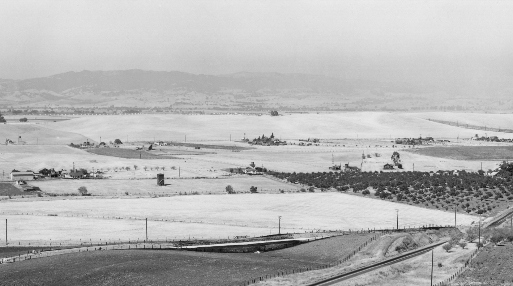
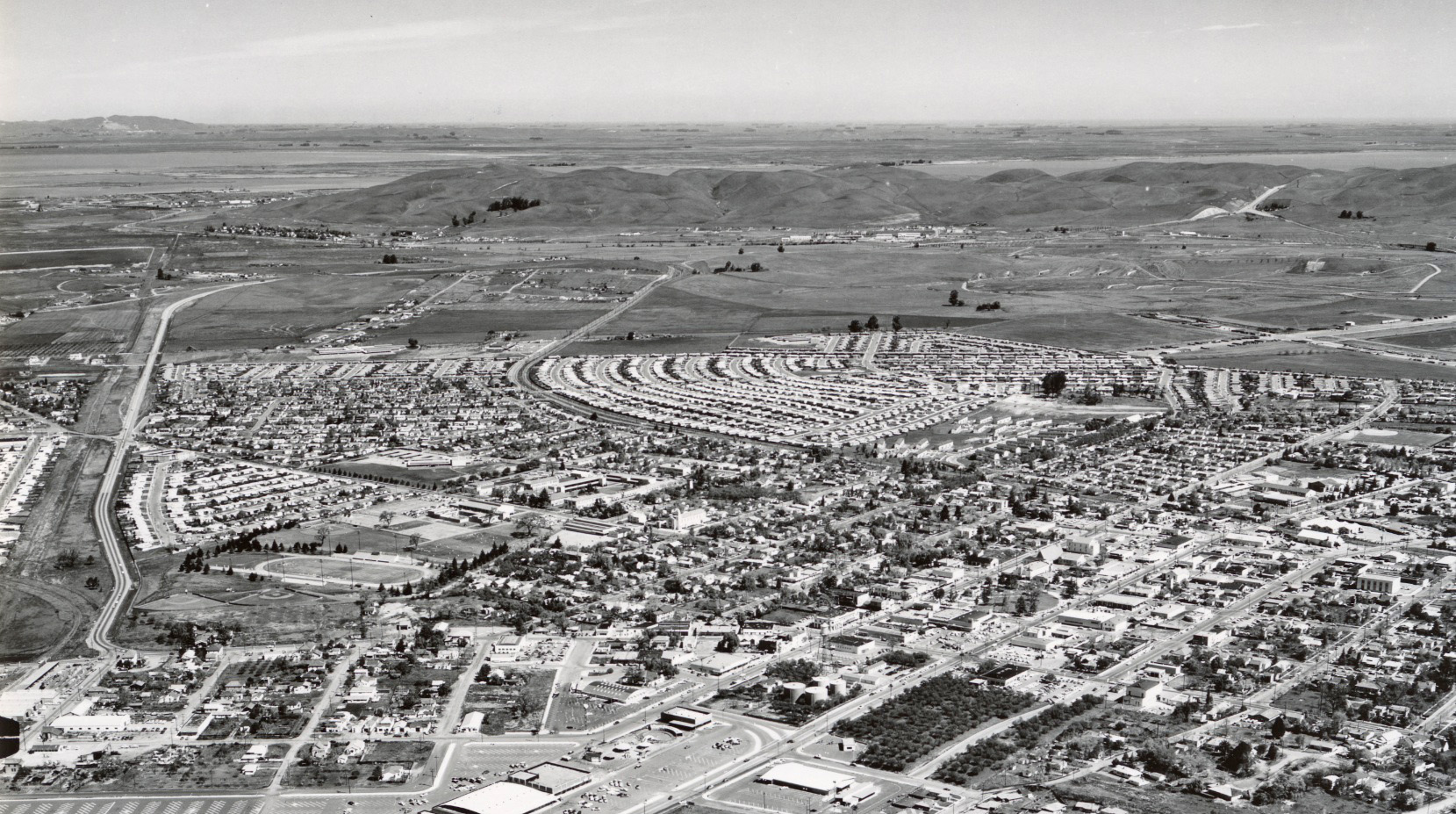
The Navy’s construction of the inland weapons station occurred during the electric freight-only operation of the SN at Ohmer Hill. Here presented is a north view of the area circa 1956 from the level of the Park and Shop Shopping Center, seen along the lower margin of the image. A detail follows. Ref: brk00017183_24a
L148-65-Clyde Sunderland Photo, Courtesy of The Bancroft Library, University of California, Berkeley, (Image 15 of 34)
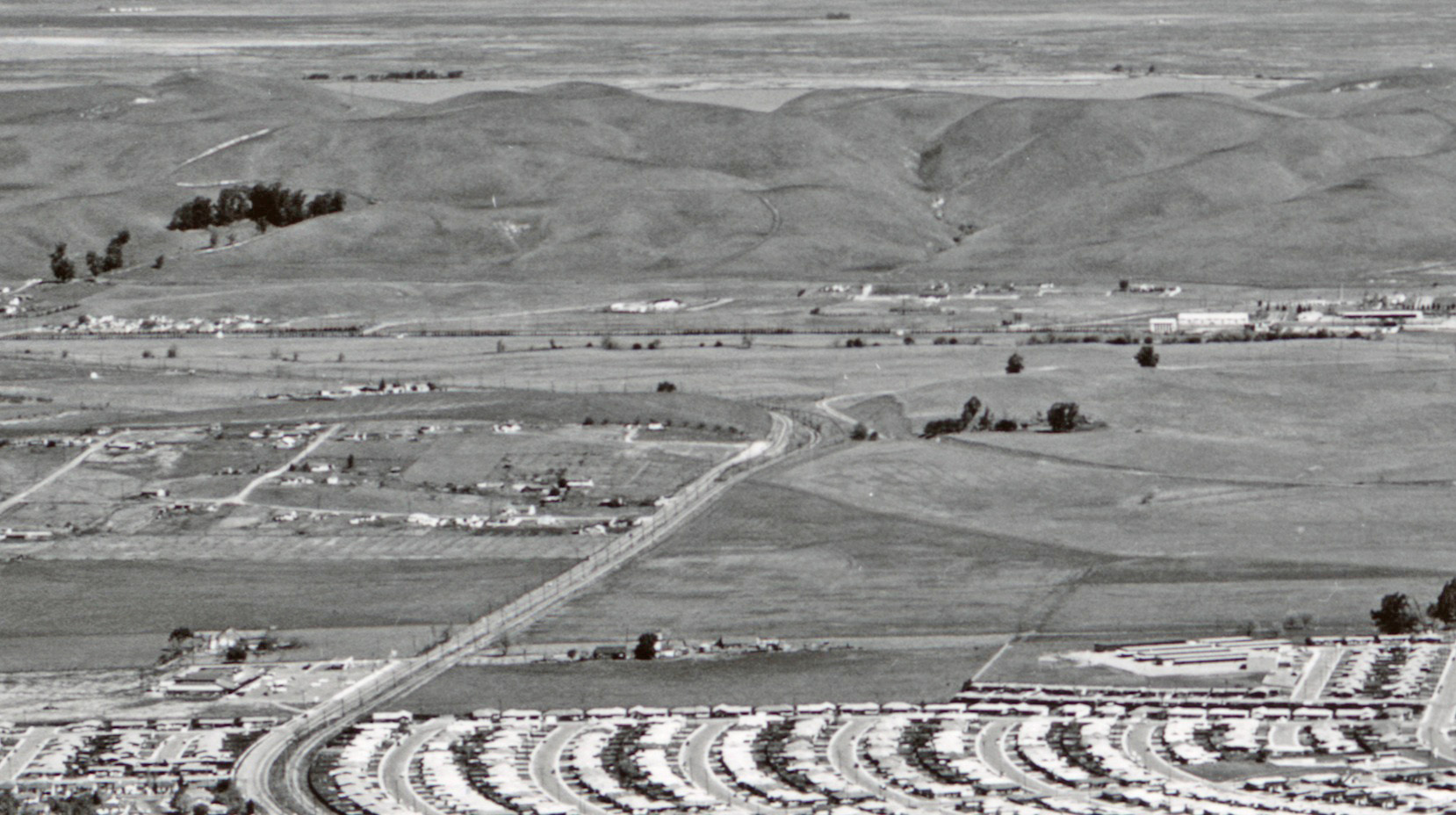
Ohmer Hill takes center stage in this north view of north Concord circa 1956. Open space still rules north of the Olivera Ranch at Olivera Rd. The bridge over the railway is gone. Ref: brk00017183_24a
L148-70-Clyde Sunderland Photo, Courtesy of The Bancroft Library, University of California, Berkeley, (Image 16 of 34)
A similar north view of north Concord and beyond, but the date is Mar. 3, 1969 and the SN is now served by its diesel fleet. A detail follows.
L148-75-Copyright California Department of Transportation, 15606-37, Detail, (Image 17 of 34)
Ohmer Hill again takes center stage in this north view of north Concord, Mar. 3, 1969. Any indication of the Olivera Ranch has been eclipsed by housing moving further north from the previous image of the 1950s.
L148-80-Copyright California Department of Transportation, 15606-37, Detail, (Image 18 of 34)
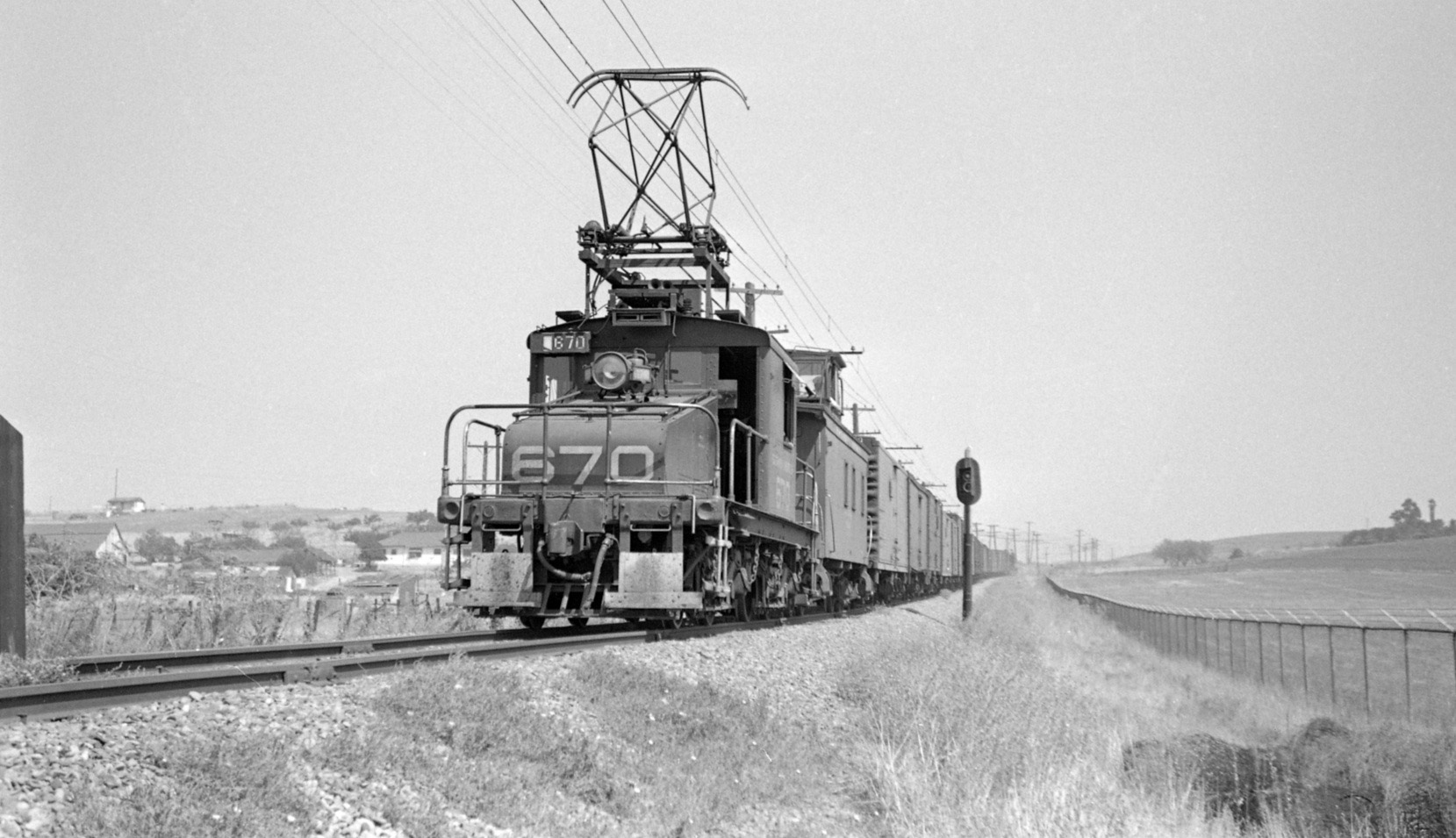
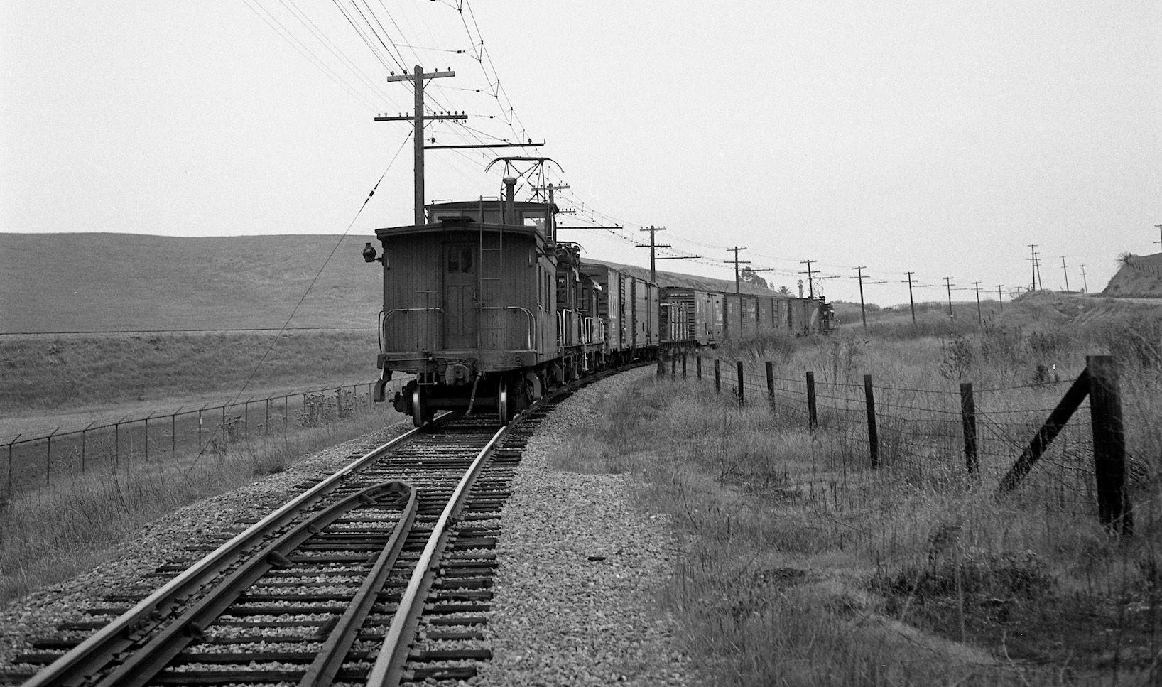
In parallel with previous views of passenger era trains traversing the hill, freights circa 1950 will be featured starting with this north view of SN 670 pushing from behind after passing Olivera Rd. and entering open space.
L148-85-Norman Smith Photo, Courtesy BAERA, Western Railway Museum Archives, 55878.5sn , (Image 19 of 34)
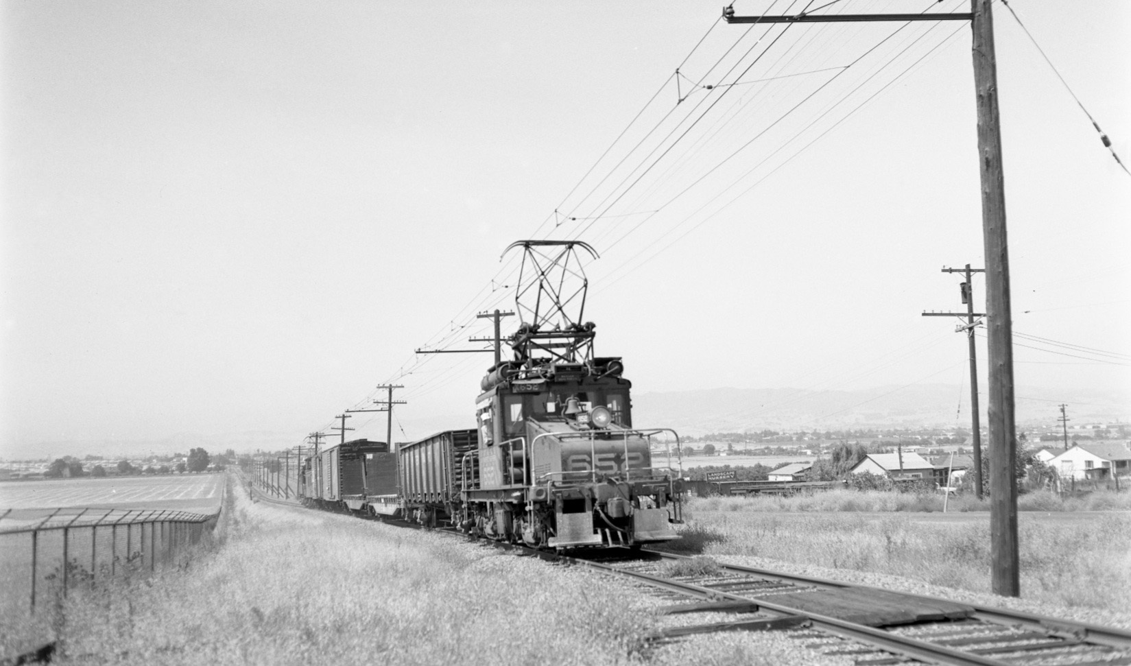
SN 652 and freight head north climbing Ohmer hill north of central Concord in July 1956, south view.
L148-90-Fred Matthews Photo, Courtesy Anonymous Donor , (Image 20 of 34)
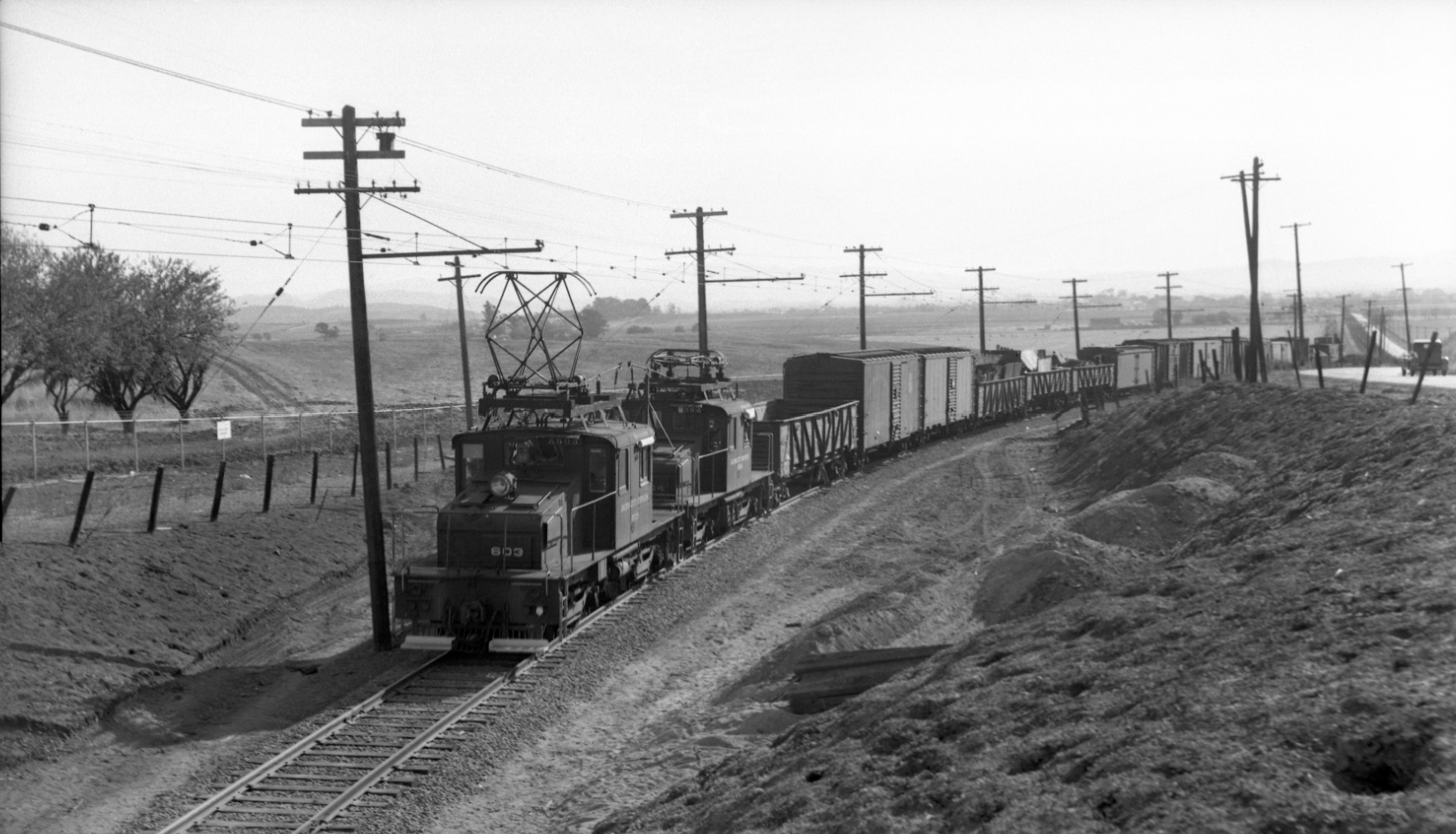
The Navy’s takeover of the land to the east of Ohmer by eminent domain probably led to the demise of the bridge over the railway, not documented but supported by Louis Bradas, Jr.’s south view from Sept. 1946 of twins SN 603 and SN 604 lugging a load up the south slope of Ohmer Hill. The angle and height from which this image was taken differs from that from the passenger era, L148-15.
L148-95-Louis Bradas, Jr. Photo, Courtesy BAERA, Western Railway Museum Archives, 68181sn , (Image 21 of 34)
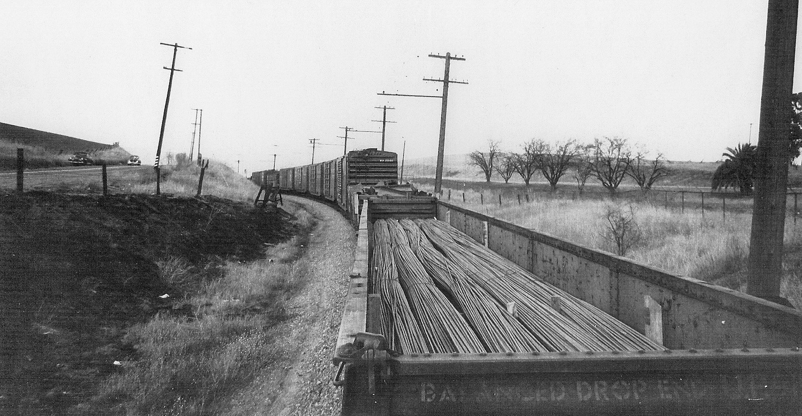
Reginald McGovern road the rails in the early 1950s and captured this view on a perch just behind a gondola filled with steel cable. Note the Port Chicago Highway to the left, and the landmark trees to the right.
L148-100-Reginald McGovern Photo, Courtesy Reginald McGovern, (Image 22 of 34)
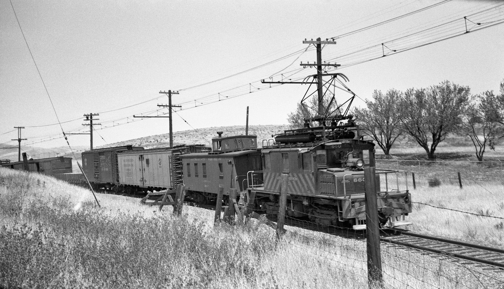
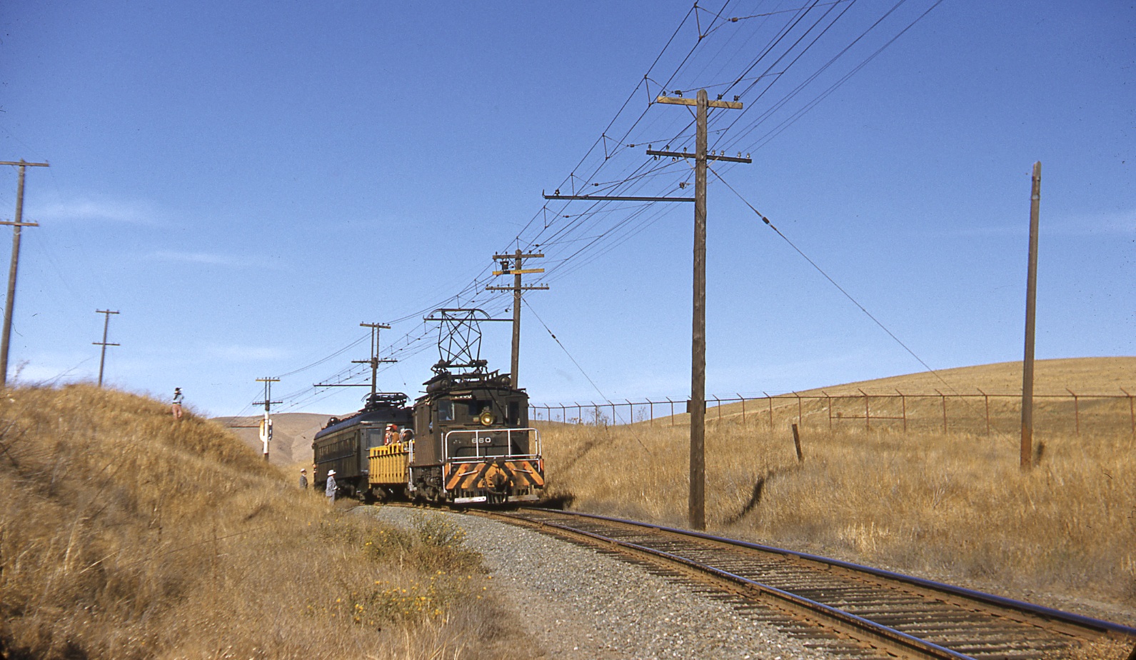
By pushing from the rear, SN 660 has aided the freight’s climb of the hill in this northeast view from 1952.
L148-105-Tom Buckingham Photo, Courtesy BAERA, Western Railway Museum Archives, 54307sn, (Image 23 of 34)
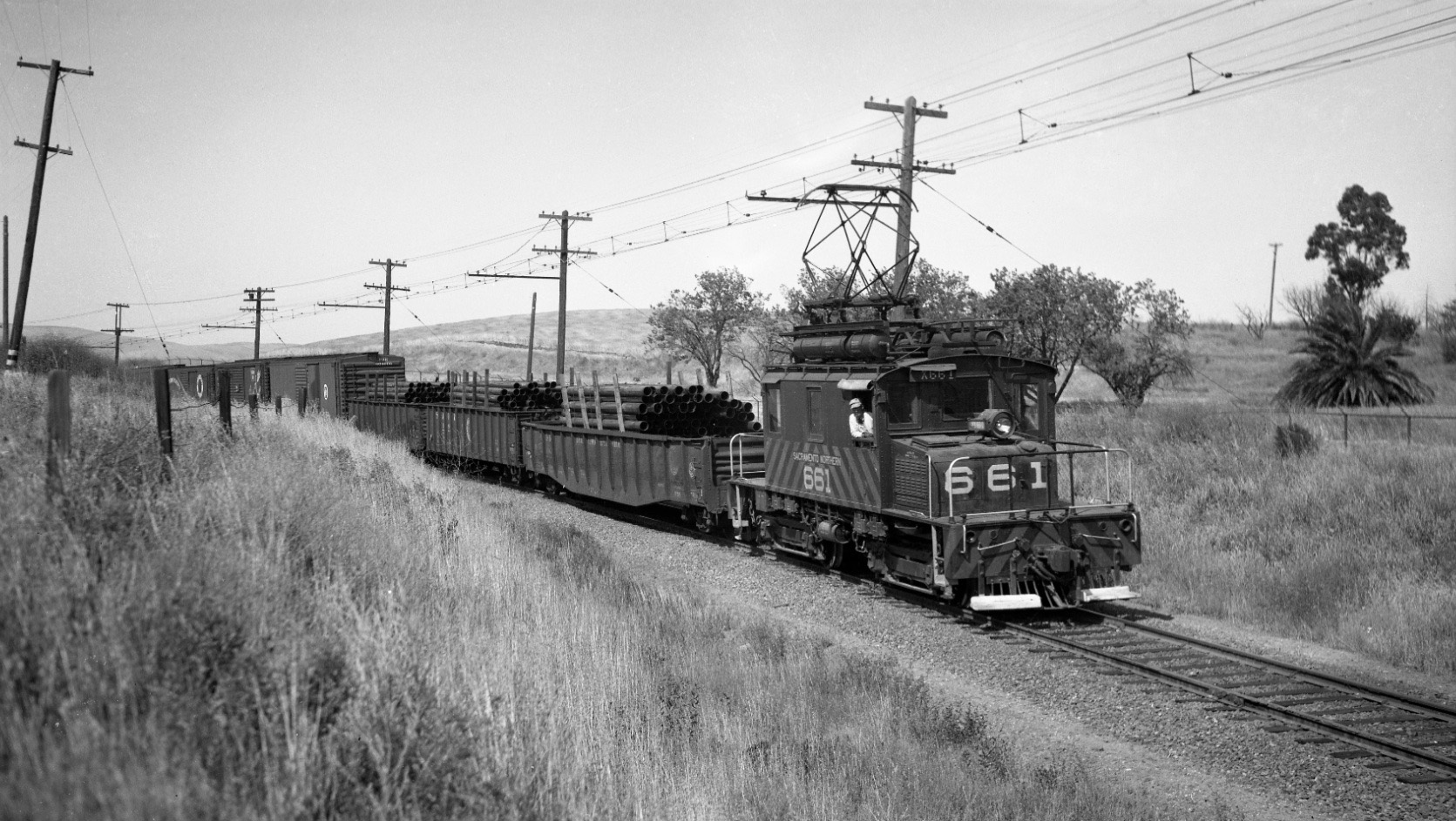
So as not to misrepresent the traffic flow on the SN, freights heading to Oakland were also a favorite of 1950s photographers, here the motorman of an SN 661-led freight with tubes poses for Tom Gray’s lens in a northeast view.
L148-110-Tom Gray Photo, Courtesy Tom Gray, (Image 24 of 34)
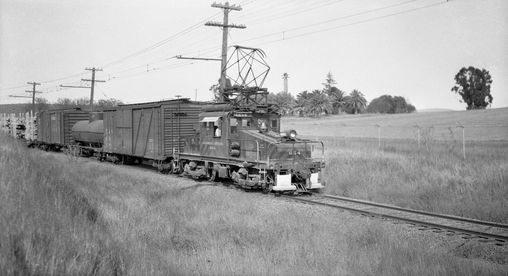
Catching a freight in front of those palm trees as in this circa 1950 northeast image of SN 654 provides a lasting link to the present day North Concord-Martinez BART station.
L148-115-Tom Gray Photo, Courtesy Tom Gray, (Image 25 of 34)
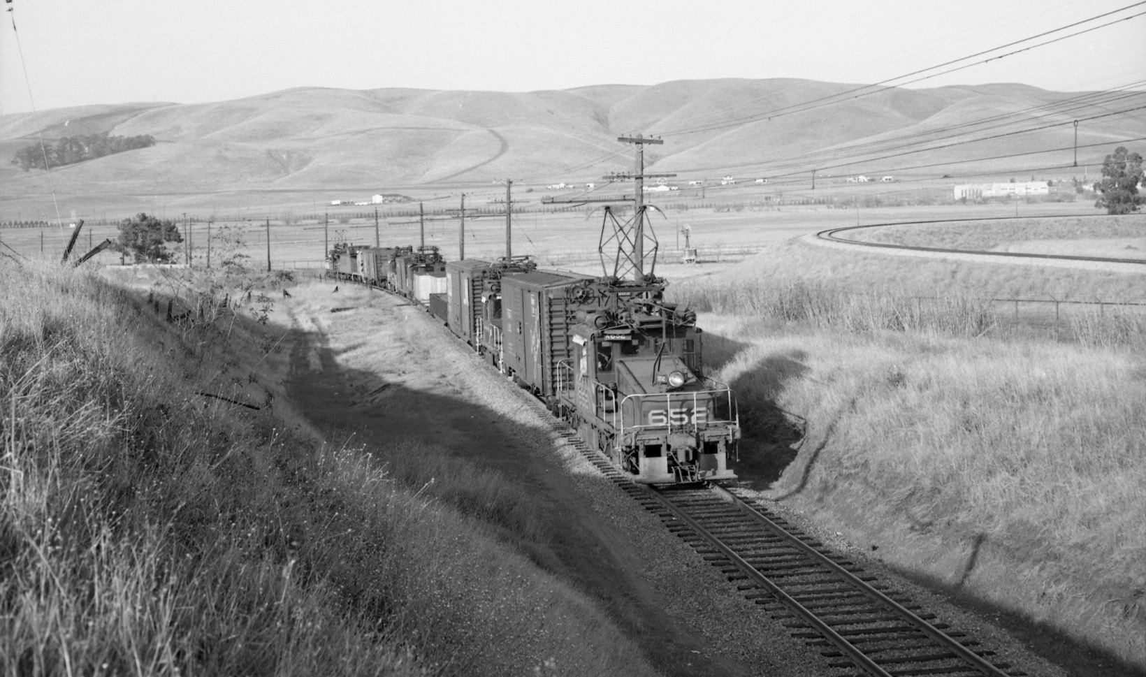
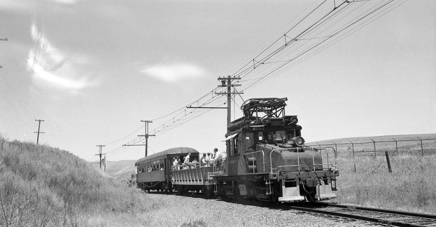
This northeast view of the north slope of the hill shows a freight consisting of five SN motors; SN 652 in the lead, SN 653 in the rear, and dead engines SN 650, SN 660 and SN 651 interspersed and off to be salvaged. EK Muller followed this last west-bound freight to Oakland through the East Bay on Feb. 27, 1957. The adjacent tracks of the Naval Weapons Station railroad are seen to the right.
L148-120-EK Muller Photo, Courtesy BAERA, Western Railway Museum Archives, 45020sn, (Image 26 of 34)
Just two days earlier, Feb. 25, 1957, EK Muller followed another freight from Port Chicago with SN 652 also in the lead, SN 653 in the rear, and SN 430 as a dead engine through the East Bay. Southwest view of the north slope of Ohmer Hill.
L148-125-EK Muller Photo, Courtesy BAERA, Western Railway Museum Archives 79014sn, (Image 27 of 34)
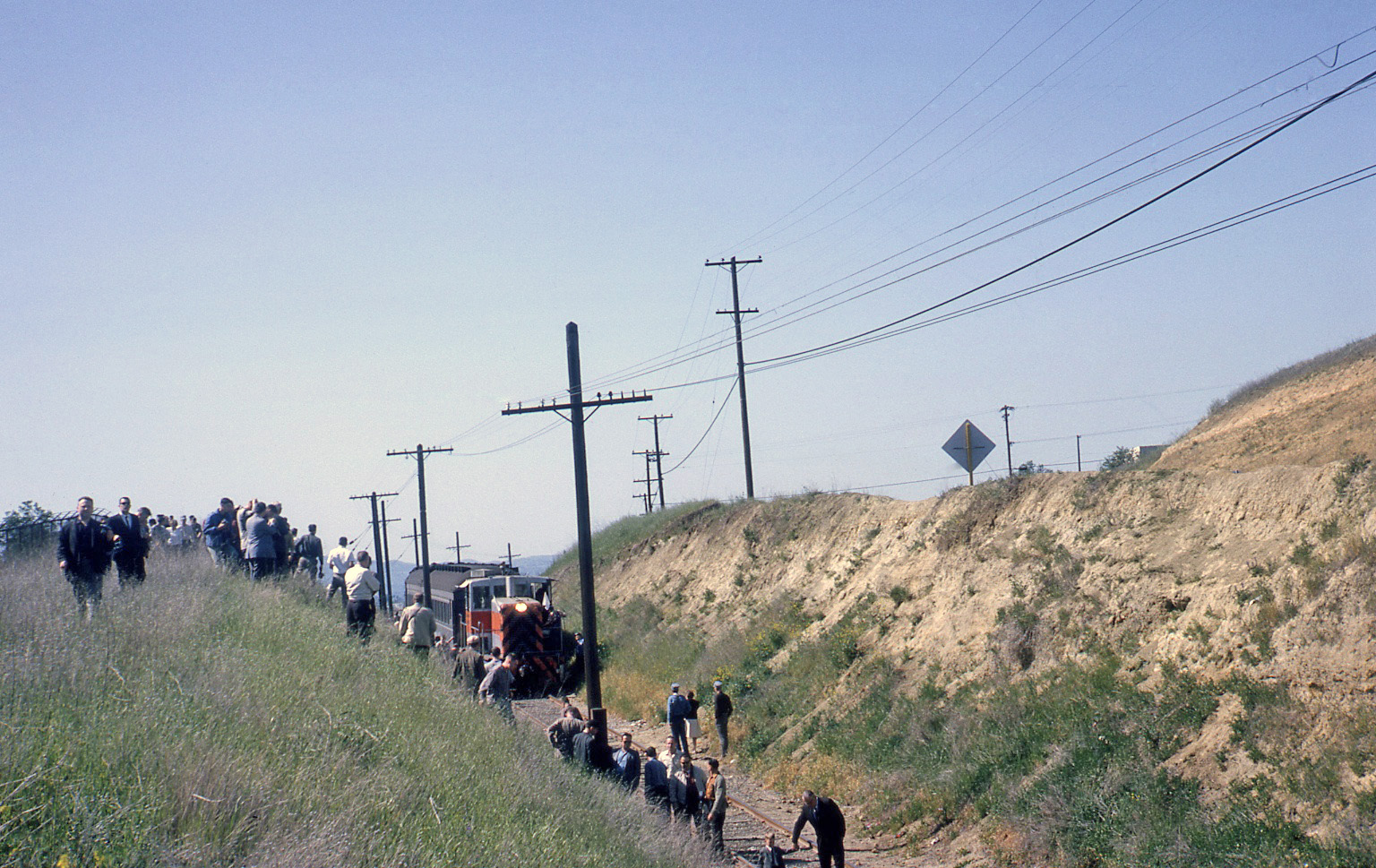
To complete this review, Ohmer Hill was also a favorite place for taking images of excursion trips. Here, SN 143 leads the second End-of-an-Era excursion on Apr. 12, 1964 up the south slope of Ohmer Hill, south view. The roof tops of homes seen in the background represent those added north of Olivera Rd., narrowing the date of their construction prior to the aerial from 1969, L148-80.
L148-130-Tony Perles Photo, Courtesy BAERA, Western Railway Museum Archives, 85029sn, (Image 28 of 34)
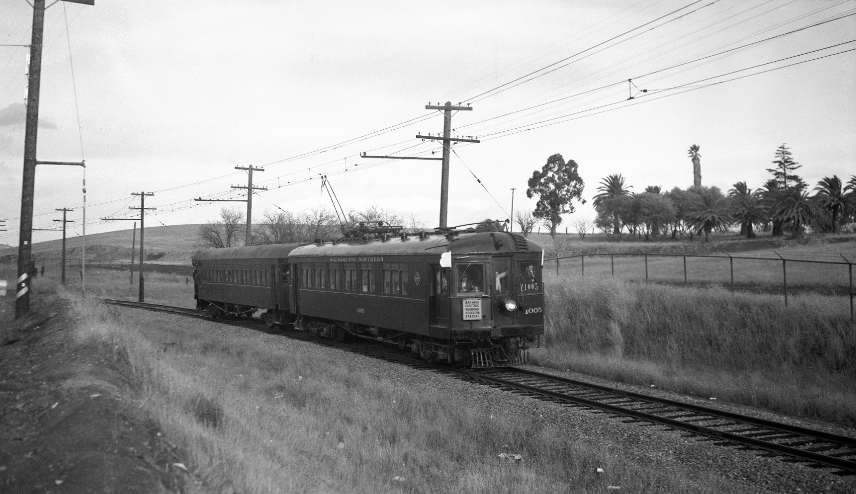
By now you should realize that this image could only have been taken at one place on earth, sometime between the summer of 1956 and Jan. 1957. Northeast view of SN 1005 and Salt Lake and Utah 751 during a BAERA-sponsored excursion.
L148-135-Tom Gray Photo, Courtesy Tom Gray, (Image 29 of 34)
The fire that disabled MW 302’s motor had happened earlier on the day of Oct. 24, 1954, but SN 660 came to the rescue for this NORCAL excursion, here in a northeast view with the WP observation car.
L148-140-Courtesy Charles Smiley, (Image 30 of 34)
Almost a repeat of the last image, but now it is SN 653, the WP observation car and Salt Lake and Utah 751 during a mid-summer excursion in 1956, northeast view.
L148-145-Arthur Lloyd Photo, Courtesy Arthur Lloyd, (Image 31 of 34)
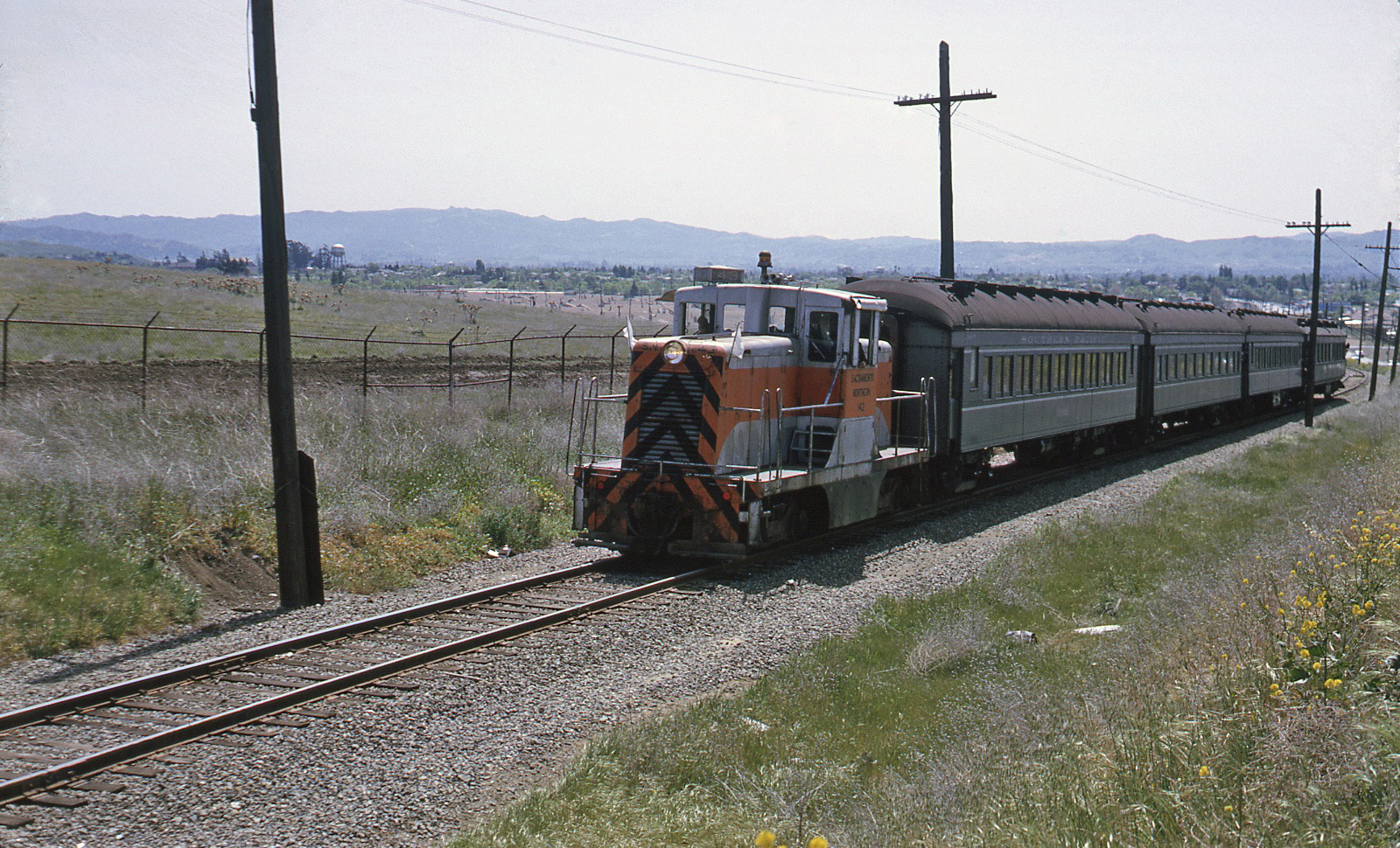
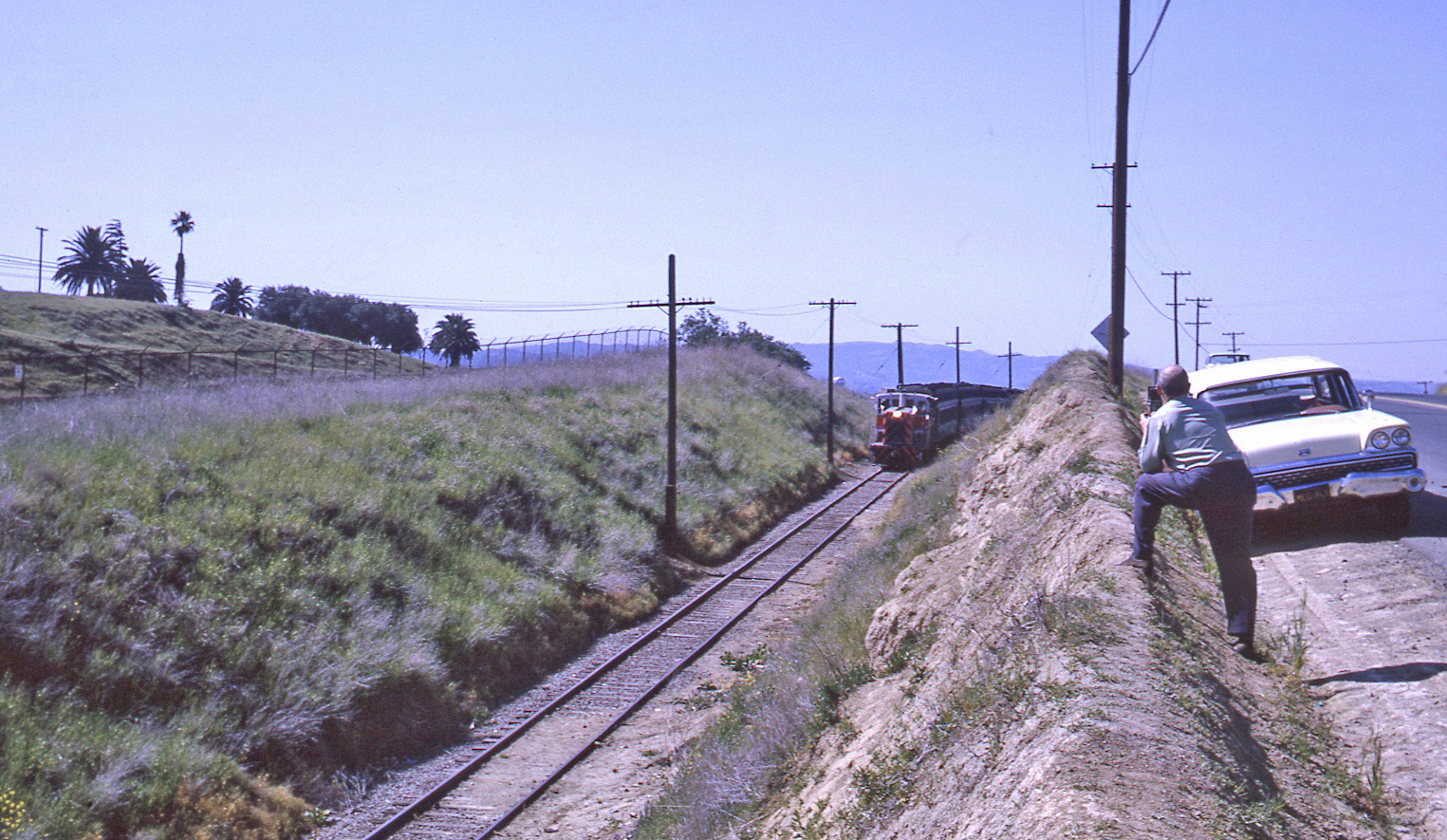
Now to the north slope of Ohmer Hill with a track of the Inland Concord Naval Weapons Station in full view, Apr. 12, 1964. SN 143 leads a return trip to Walnut Creek, northeast view.
L148-150-Courtesy Charles Smiley, (Image 32 of 34)
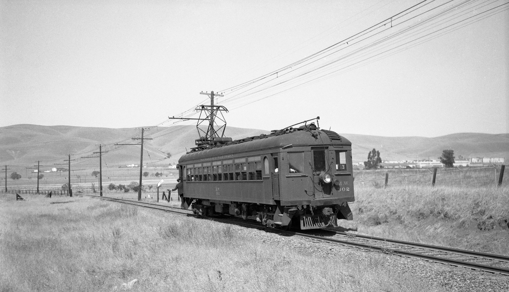
Excursions from the 1940s deserve at least one image, and this one from the BAERA-sponsored Sept. 12, 1948 trip shows MW 302 at the base of the north slope of Ohmer Hill.
L148-155-Tom Gray Photo, Courtesy Tom Gray, (Image 33 of 34)
Time to head down to the final resting place of the Ohmer shelter and the crossing of the Arnold Industrial Parkway. No longer possible by BART, SN 143 is ready to head that way, this southeast view with those signature palm trees from Apr. 12, 1964. Special thanks to Renee Hutchins and CCC Public Works for supplying information in a pinch.
L148-160-Louis L Stein Photo, Courtesy BAERA, Western Railway Museum Archives 110187sn, (Image 34 of 34)