Rockridge
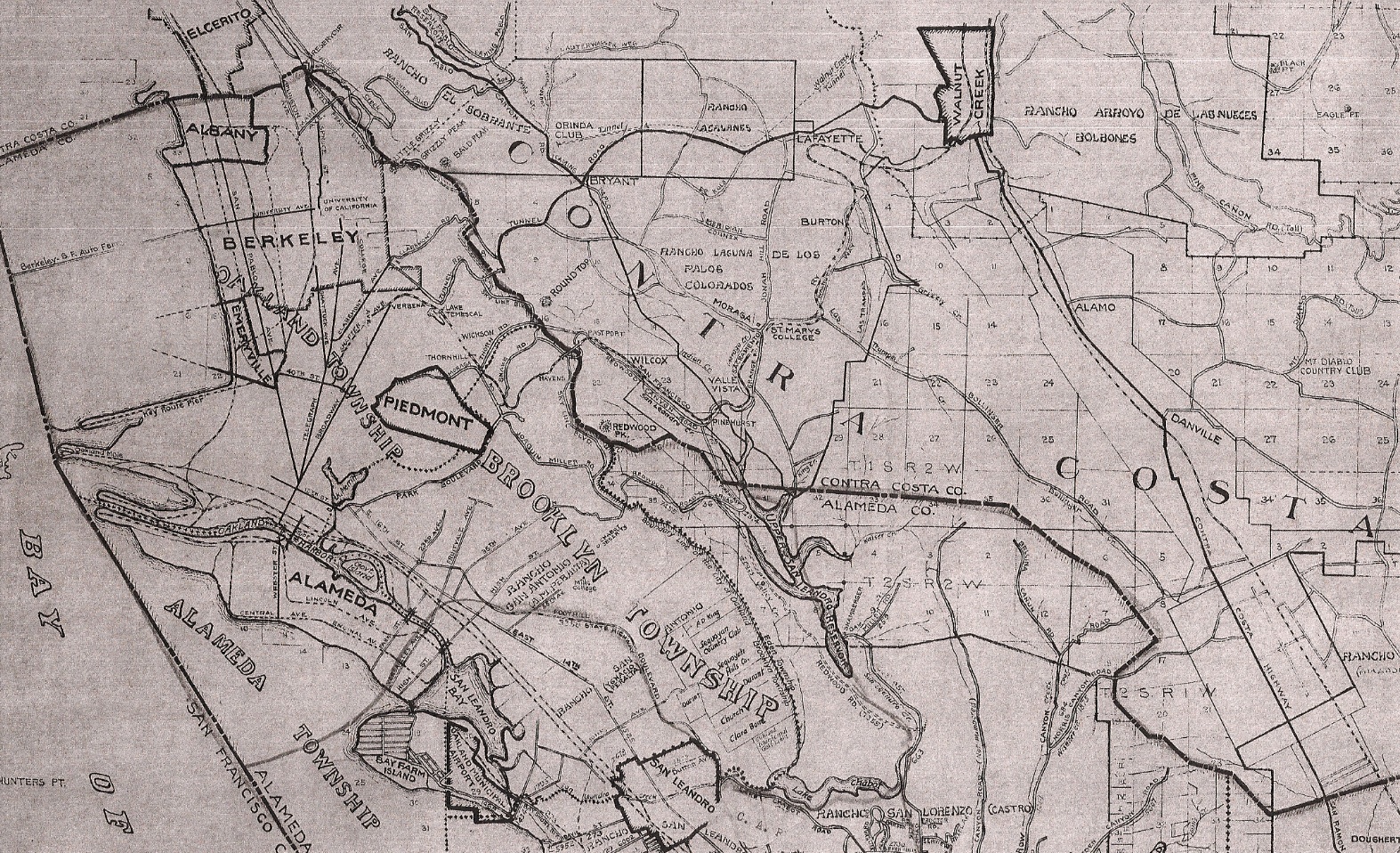
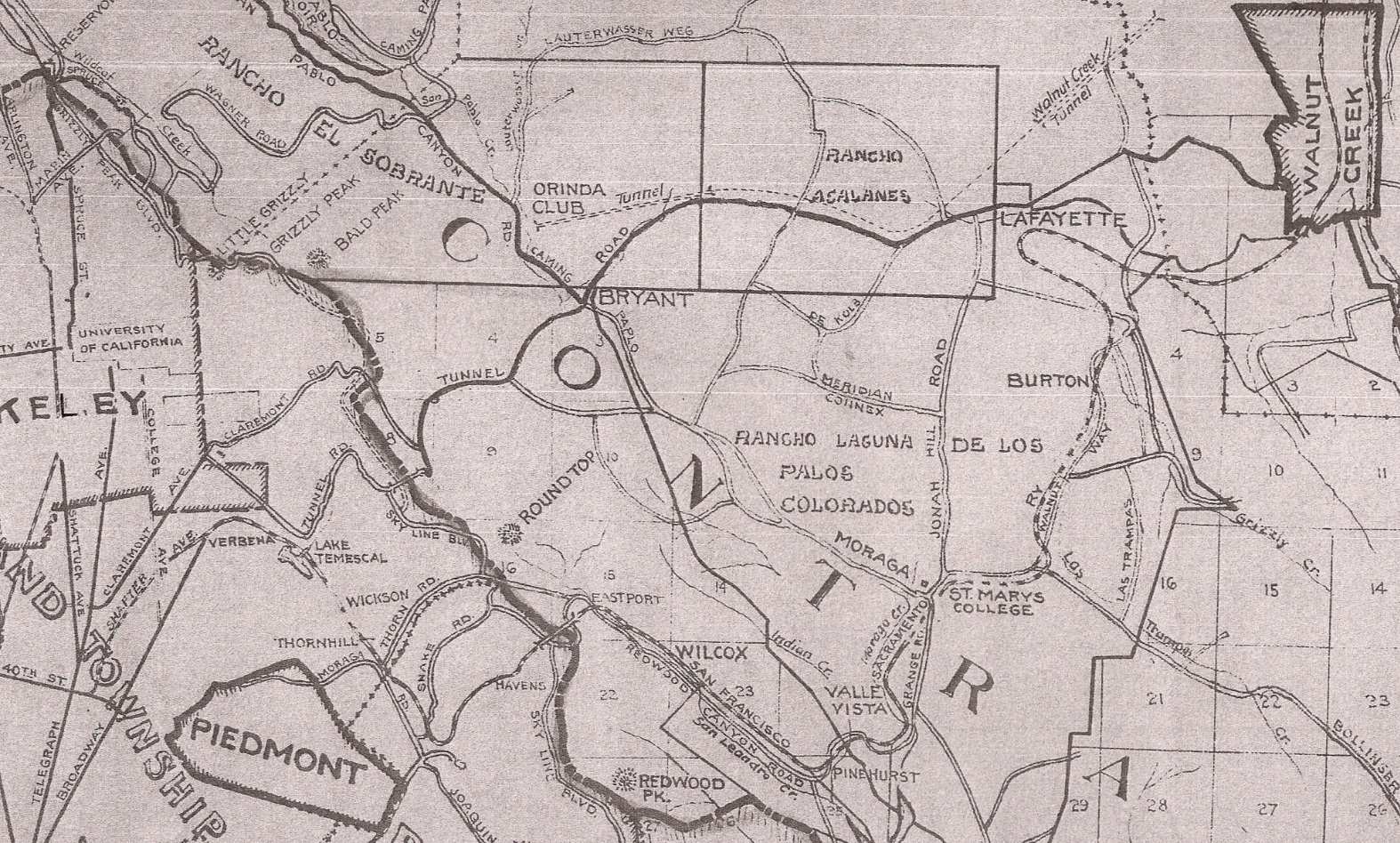
This portion of a 1933 Highways of Alameda County California map by George A. Posey, County Surveyor, provides an overview of key landmarks in the northwest section of the East Bay. Ref. G4363.A3P2 1933 .A5
A1-Courtesy Earth Sciences and Map Library, University of California, Berkeley, (Image 1 of 17)

Detail of map A1 from 1933 outlines the ~18.5 mile journey from North Oakland to Walnut Creek following the Sacramento Northern Railway or SN. The SN is labelled the San Francisco-Sacramento Railroad, a former name in use between 1920-1928. Ref. G4363.A3P2 1933 .A5
A2-Courtesy Earth Sciences and Map Library, University of California, Berkeley, Detail., (Image 2 of 17)
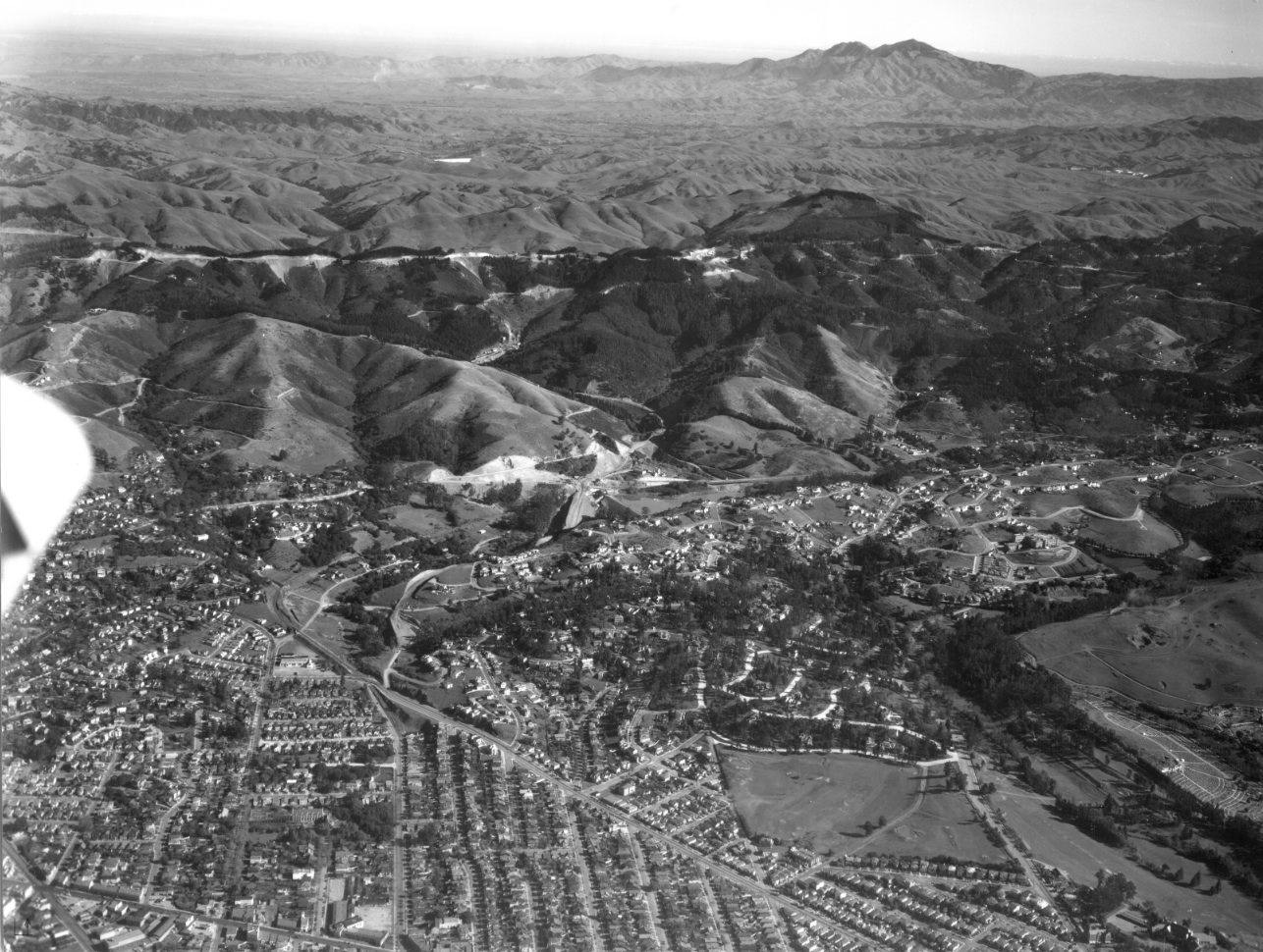
The route is largely captured in this 1935 east view of the construction of the Broadway Low Level Tunnel, now Caldecott tunnel. An annotated version follows. Also courtesy Fred Booker; EBRPD Ref. USNPS-7-B
A5-HJW Geospatial Inc, Pacific Aerial Surveys, Oakland CA, Courtesy East Bay Regional Park District, (Image 4 of 17)
Key landmarks from A5 are identified, the yellow arrows marking the SN up to the hills south of Broadway Terrace. The red arrow marks the Chabot Rd. trestle. Also courtesy Fred Booker; EBRPD Ref. USNPS-7-B
A6-HJW Geospatial Inc, Pacific Aerial Surveys, Oakland CA, Courtesy East Bay Regional Park Distric, (Image 6 of 17)
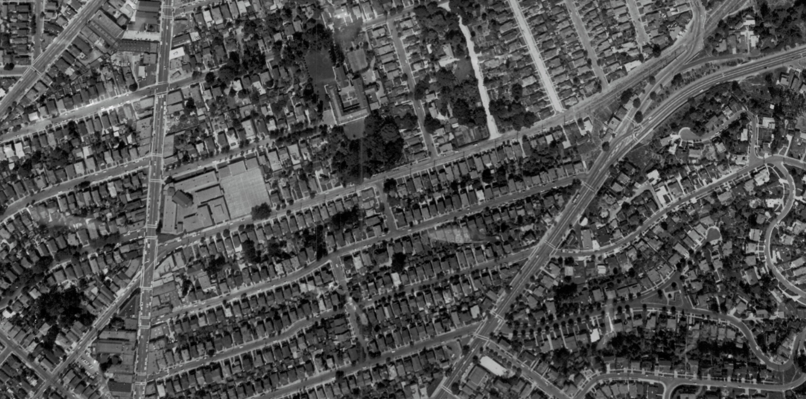
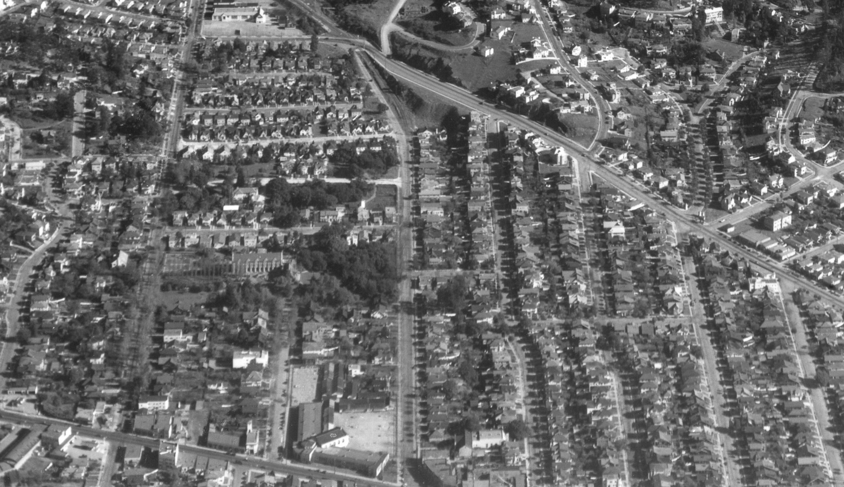
Shafter Ave., east-west orientation, from Forest St., lower left, past College Ave. to Patton St., upper right. Note Claremont Middle School and St. Albert's College along the north side of Shafter. The SN track and catenary poles are along the south portion of Shafter. Broadway enters on the lower border, cutting diagonally toward Patton. Ref. G4364_B5_A4_1956_R6_no.116-2.
A10-RM Towill Photo, Courtesy Earth Sciences and Map Library, University of California, Berkeley, (Image 7 of 17)
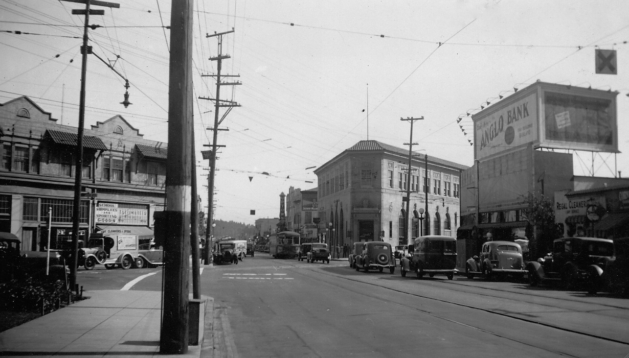
This 1930s south view taken from Claremont Middle School of the College and Shafter Aves. intersection shows the triangular landmark building, the Bank of America, and further south, the Uptown Theater facade, site of the present Market Hall and repositioned Shafter Ave. southwest corner. As will be examined in future presentations, BART and Highway 24 will eliminate all of the buildings to the north of the theater.
A15-Courtesy Bay Area Electric Railway Association, Western Railway Museum Archives, 51709sn, (Image 8 of 17)
Detail from A5, east from College Ave. in 1935. Shafter Ave. runs to the south or right of Claremont Middle School, seen along the bottom margin, and just falls short of Chabot Elementary School, visible along the top margin. Also courtesy Fred Booker; EBRPD Ref. USNPS-7-B
A20-HJW Geospatial Inc, Pacific Aerial Surveys, Oakland CA, Courtesy East Bay Regional Park District, (Image 9 of 17)
This northwest view from Shafter Ave., lower left, to Woolsey St., upper right, can be dated to mid-1957 to Apr., 1958 as the SN tracks have been removed and filled, and a Key System E line train is captured at the intersection of College and Claremont Aves. More on BART, Highway 24 and reconfigured Shafter later ...
A25-Courtesy Western Dominican Province Archives, (Image 10 of 17)
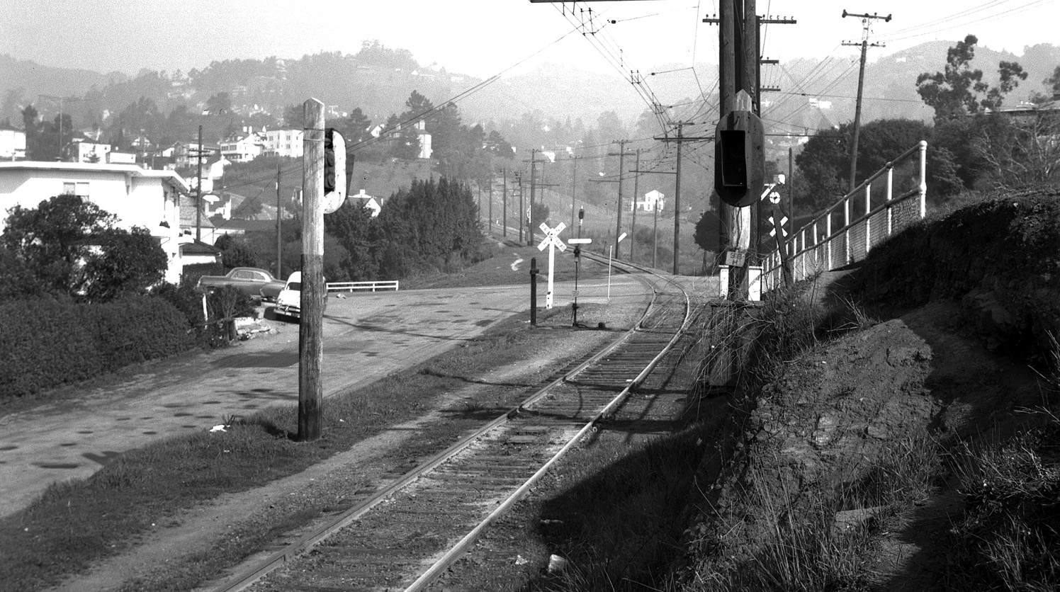
The SN tracks left concrete for grass at Ross St., east view of Shafter Ave. from Jan. 28, 1954. The Patton St. grade crossing is ahead. More on house architecture later ...
A31-John Harder Photo, Courtesy John Harder, (Image 11 of 17)
This 1954 east view from Shafter Ave. shows the Patton St. crossing and the right-of-way along the south edge of Chabot Elementary School.
A35-John Harder Photo, Courtesy John Harder, (Image 12 of 17)
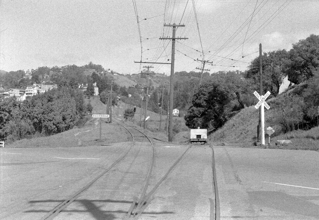
A closer look at the Patton St. grade crossing and Rockridge flag stop just after railway abandonment on March, 1957 in this northeast view reveals the SN spur that was to be used for a rail yard that was short lived.
A40-John Harder Photo, Courtesy John Harder, (Image 13 of 17)
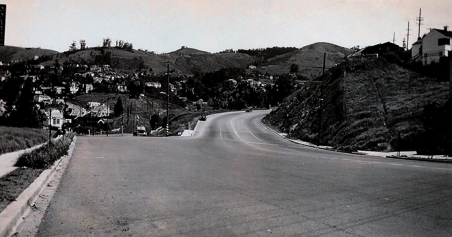
Broadway's importance grew when it was redirected to the new tunnel in 1937 creating the MacArthur Blvd.-Broadway route through Oakland to Contra Costa County. Northeast view from Keith Avenue circa 1938. More about changes at this intersection later ...
A45-Courtesy Oakland History Room, Oakland Public Library, 170, (Image 14 of 17)
An overhead north-oriented view of Chabot Elementary School in 1956, with Patton St. to Chabot Rd., west to east, left to right. Note the trestle over Chabot Rd. at the top right. Ref. G4364_B5_A4_1956_R6_no.116-2.
A50-RM Towill Photo, Courtesy Earth Sciences and Map Library, University of California, Berkeley, (Image 15 of 17)
A visual recap in the form of a northeast view from Apr. 8, 1953 of details that will be further examined in the future.
A55-Copyright California Department of Transportation, 3301-15,Detail, (Image 16 of 17)
A complementary visual recap in the form of a southwest view from Apr. 8, 1953 of details that will be further examined in the future.
A60-Copyright California Department of Transportation, 3300-40, Detail, (Image 17 of 17)