Saranap
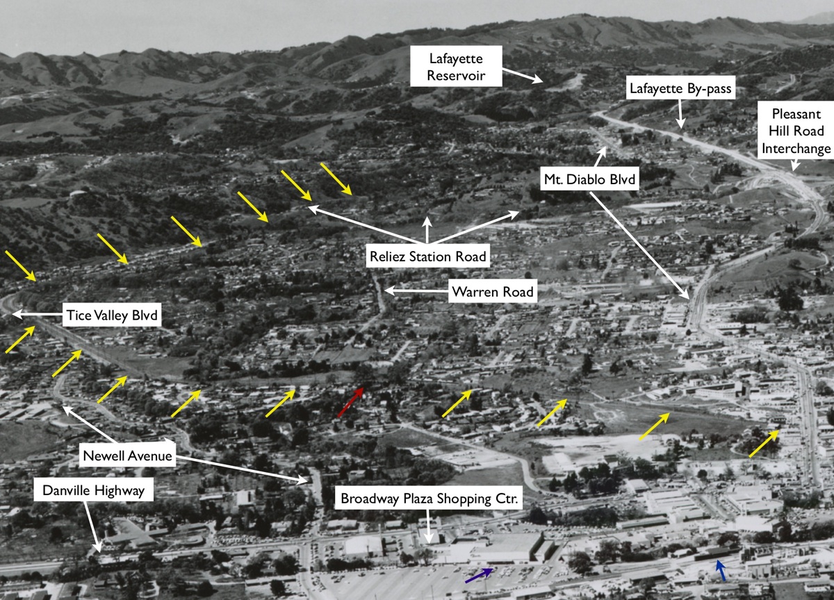
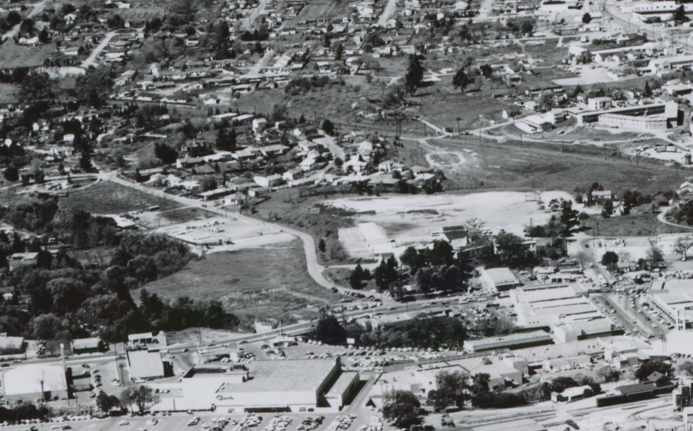
West view, circa 1955-6, of Walnut Creek, Saranap and Lafayette. The SN forms a "V" within Saranap, left. Mt. Diablo Blvd., the incomplete Lafayette bypass and Pleasant Hill Road interchange are in the upper right. Detail Ref. #48, BANC PIC 1993.004, CC-C19-84.
I5-Clyde Sunderland Photo, Courtesy of The Bancroft Library, University of California, Berkeley, (Image 1 of 14)

Annotated version of I5. SN is marked in yellow with the Las Trampas Creek bridge in red. Capwell's Department Store is shown by the purple arrow, and the Southern Pacific Depot is marked by the blue arrow.
I6-Clyde Sunderland Photo, Courtesy of The Bancroft Library, University of California, (Image 2 of 14)
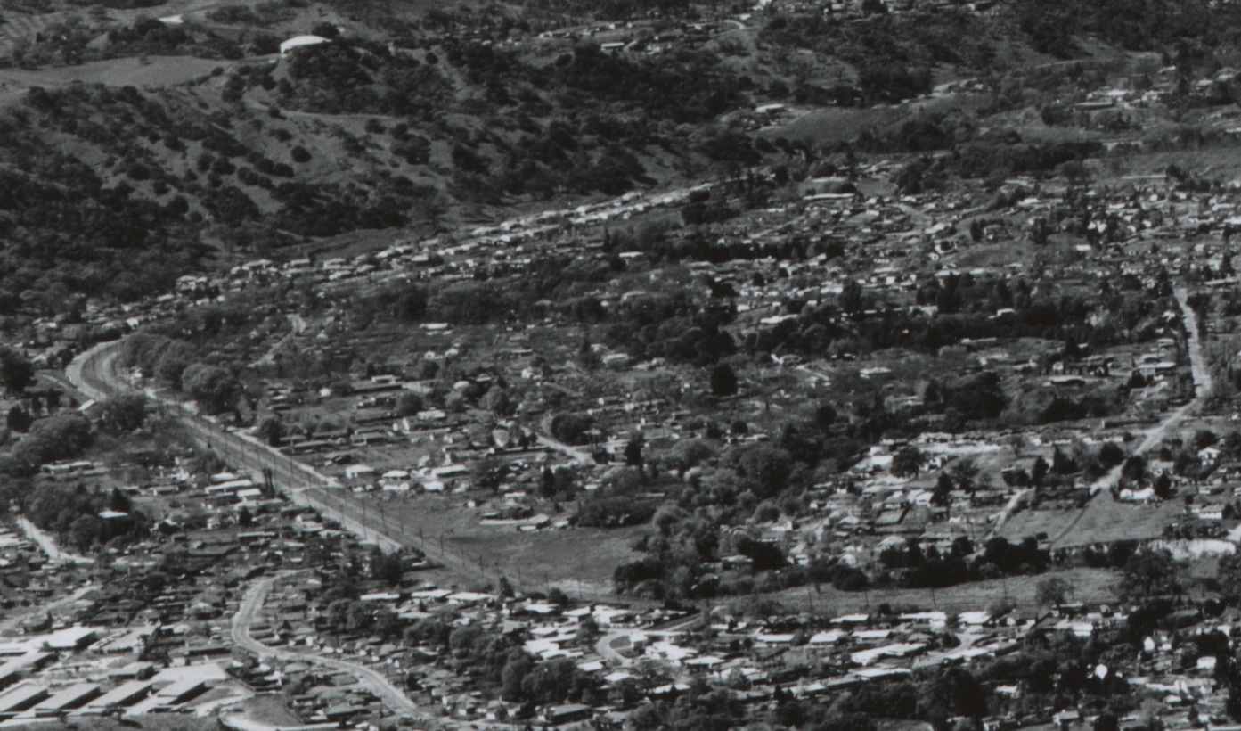
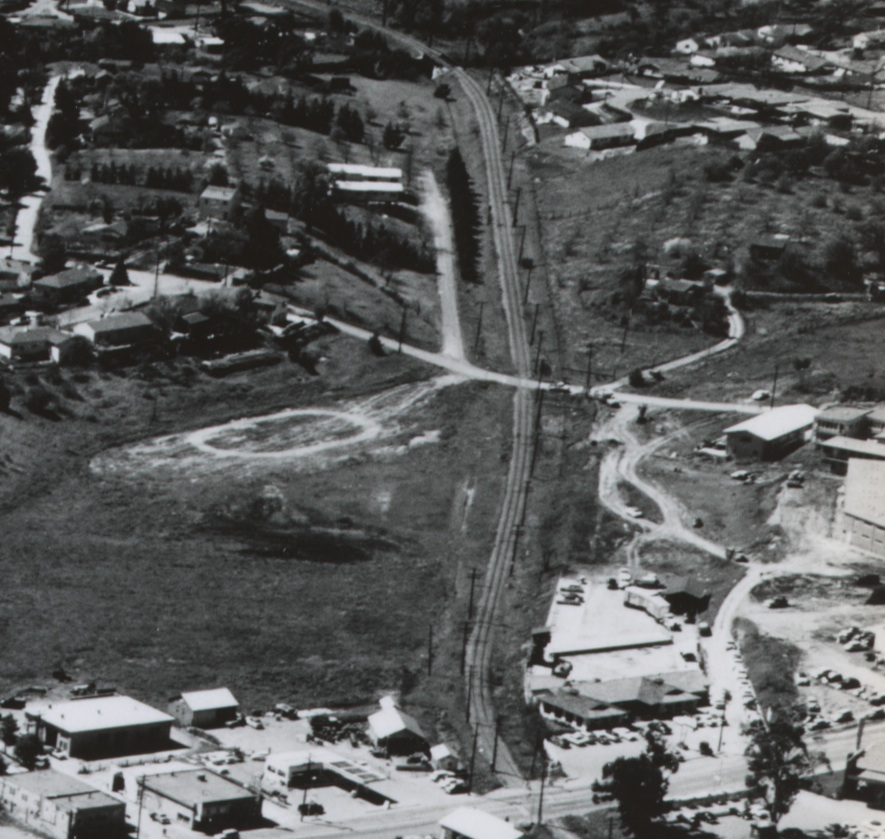
Detail from I5, west view, the SN right-of way, today Olympic Blvd., loops from Pleasant Hill Road to the crossing of Las Trampas Creek. Tice Valley Blvd. enters from the left, just past the sweeping curve. Detail Ref. #48, BANC PIC 1993.004, CC-C19-84.
I10-Clyde Sunderland Photo, Courtesy of The Bancroft Library, University of California, Berkeley, (Image 3 of 14)
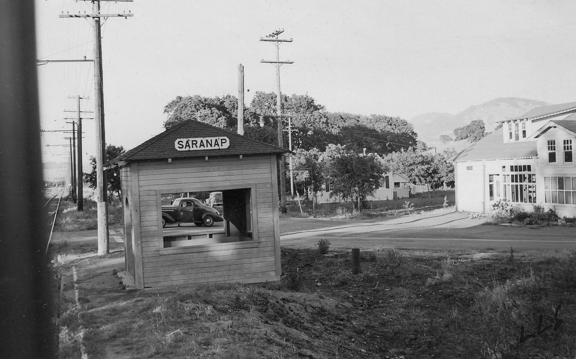
The SN Saranap station, here in an east view during the last days of passenger service in 1941. Tice Valley Blvd. entering from the right, met the right-of-way, today at Olympic Blvd.
I15-Louis Stein Photo, Courtesy BAERA, Western Railway Museum Archives, 51856sn, (Image 4 of 14)
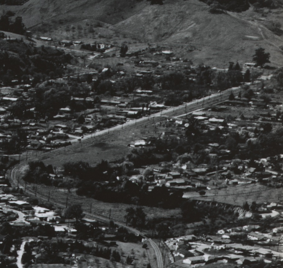
From Tice Valley Blvd., coming in from the upper left to right, the SN was a straightaway until the hard curve along Magnolia Way to Las Trampas Creek. Southwest view, circa 1955-56. Detail Ref. #41, BANC PIC 1993.004, CC-C19-91.
I20-Clyde Sunderland Photo, Courtesy of The Bancroft Library, University of California, Berkeley, (Image 5 of 14)
This southwest view of the same SN segment from Newell Avenue to the bridge crossing Las Trampas Creek a few years earlier, Apr. 9, 1953.
I25-Copyright California Department of Transportation, Detail 3299-3 , (Image 6 of 14)
Another view of Saranap from the air, Mar. 3, 1952, provides a northeast orientation of several landmarks of Saranap including, bottom edge, right to left, Newell Ave., the SN, Las Trampas Creek, and Mt. Diablo Blvd.
I30-Copyright California Department of Transportation, Detail 2481-2, (Image 7 of 14)
This detail of I30 from March 3, 1952 outlines a northeast-oriented view of the SN’s route from Newell Ave. to Las Trampas Creek, the fourth and last creek crossing by the SN since following the creek at St. Mary’s College.
I35-Copyright California Department of Transportation, Detail 2481-2, (Image 8 of 14)
Northeast aerial view from Mar. 3, 1952, from Las Trampas Creek bridge into Walnut Creek to Alpine Road. By the end of the decade, Highway 680 would run across this segment and over Olympic Boulevard.
I40-Copyright California Department of Transportation, Detail 2481-2, (Image 9 of 14)
Another overview of the SN route, southwest view, Apr. 9, 1953, flanked by Newell Avenue on the left, and Mount Diablo Blvd. to the right of the right-of-way.
I45-Copyright California Department of Transportation, Detail 3299-3 , (Image 10 of 14)
Detail of I45 from Apr. 9, 1953 of the SN route between Las Trampas Creek and Alpine Road, southwest view.
I50-Copyright California Department of Transportation, Detail 3299-3, (Image 11 of 14)
West view, circa 1955-56 between Las Trampas Creek to just past Alpine Road. Note the SP station, lower right corner, the Capwell store in foreground, but no trace of I-680 construction. Detail Ref. #48, BANC PIC 1993.004, CC-C19-84.
I55-Clyde Sunderland Photo, Courtesy of The Bancroft Library, University of California, Berkeley, (Image 12 of 14)
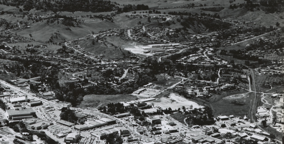
Southwest approach of SN from Las Trampas Creek to Mt. Diablo Blvd. circa 1955-56. Detail Ref. #41, BANC PIC 1993.004, CC-C19-91.
I60-Clyde Sunderland Photo, Courtesy of The Bancroft Library, University of California, Berkeley , (Image 13 of 14)
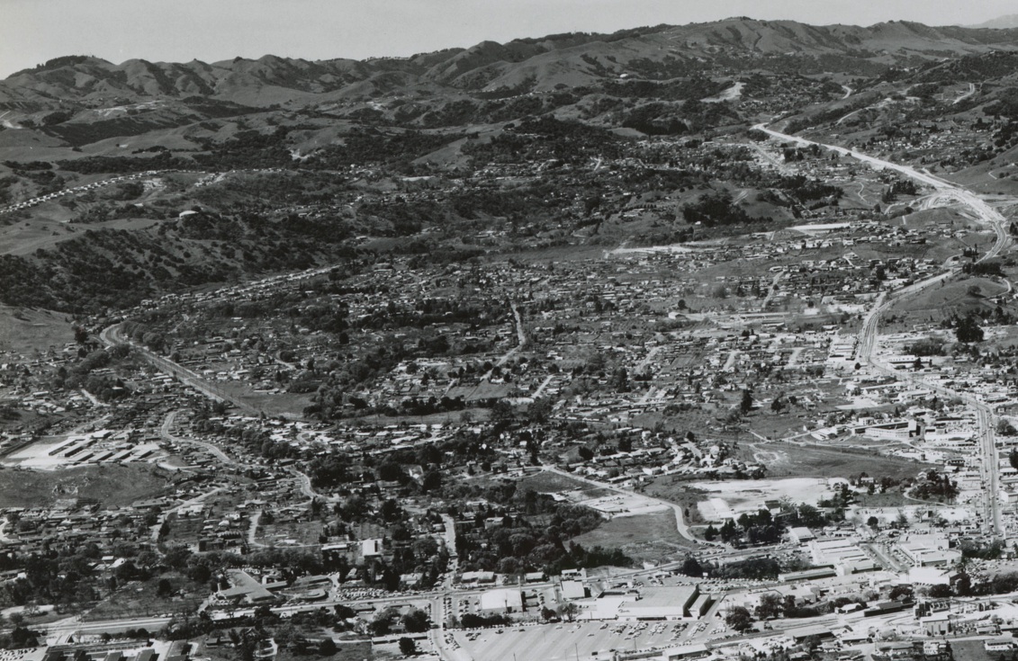
A southwest panorama of Saranap circa 1955-56 showing more of the south portion and its relation to the Danville Highway and Walnut Creek relative to I5. Detail Ref. #41, BANC PIC 1993.004, CC-C19-91.
I65-Clyde Sunderland Photo, Courtesy of The Bancroft Library, University of California, Berkeley, (Image 14 of 14)