Schindler’s Legacy and the Tale of Two Meridian Bridges
After a tour of Colusa, a full appreciation of the Sacramento Northern Railway, SN, Colusa Branch would not be complete without a quick visit to Meridian, turquoise arrow. It was here that the Northern Electric Railway, NE, formed a partnership with Colusa and Sutter Counties to build a bridge over the Sacramento River ca. 1912 that would contain a single train track along with roadways in either direction.
L340-02-David Rumsey Map Collection, David Rumsey Map Center, Stanford Libraries, top, Google Maps, Bottom, (Image 1 of 40)

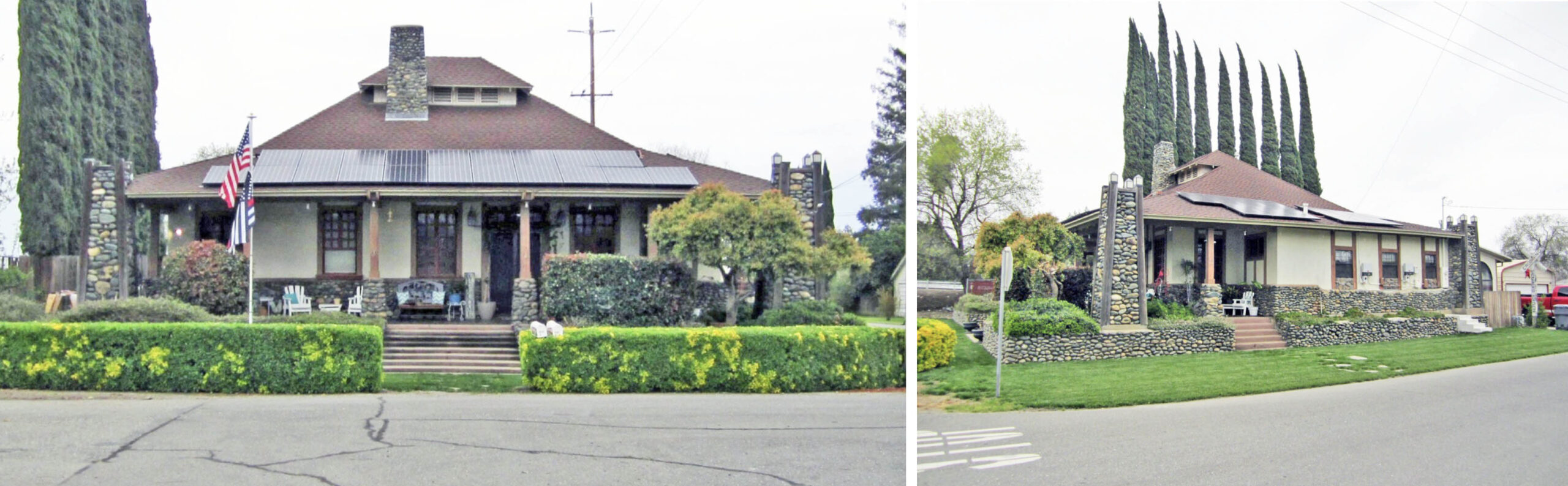
In terms of NE or SN artifacts, Meridian offers a unique gem seen here in 2017 on an east view, left, and northeast view, right, the only remaining intact Craftsman-style station depot built by the NE attributed to its general manager A. D. Schindler, who used a design based on the Pacific Electric Railway’s Glendale, CA station to build four north of Sacramento. All that remains elsewhere are two pillars of the Thermalito Station at 12th St. and Feather Ave. in that town. For images of the other three stations during their heyday, for Live Oak, click here, for East Nicolaus, click here, and for Thermalito, click here.
L340-05-Stuart Swiedler Photos, (Image 2 of 40)
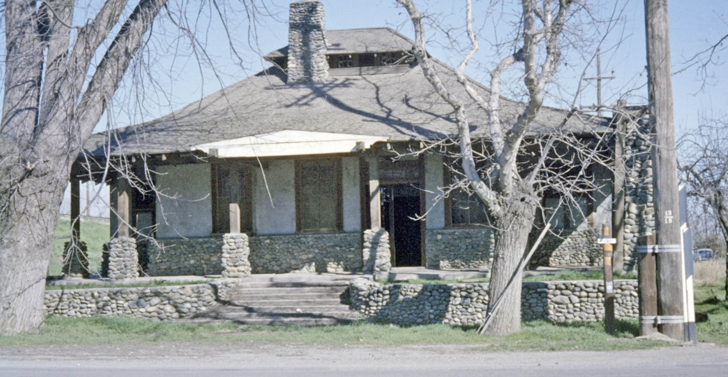
Dudley Westler most likely took this east view of the depot during the 1960 excursion through the town. Now for more Meridian history based on “History of Sutter County, California”, Thompson and West, Oakland, CA, 1879. Lewis O’Neill was the first recorded settler in 1852, but John F. Fouts who came to town in 1857 started the ferry in 1860 and one commercial business.
L340-10-Dudley Westler Photo, Courtesy BAERA, Western Railway Museum, 129085sn, (Image 3 of 40)
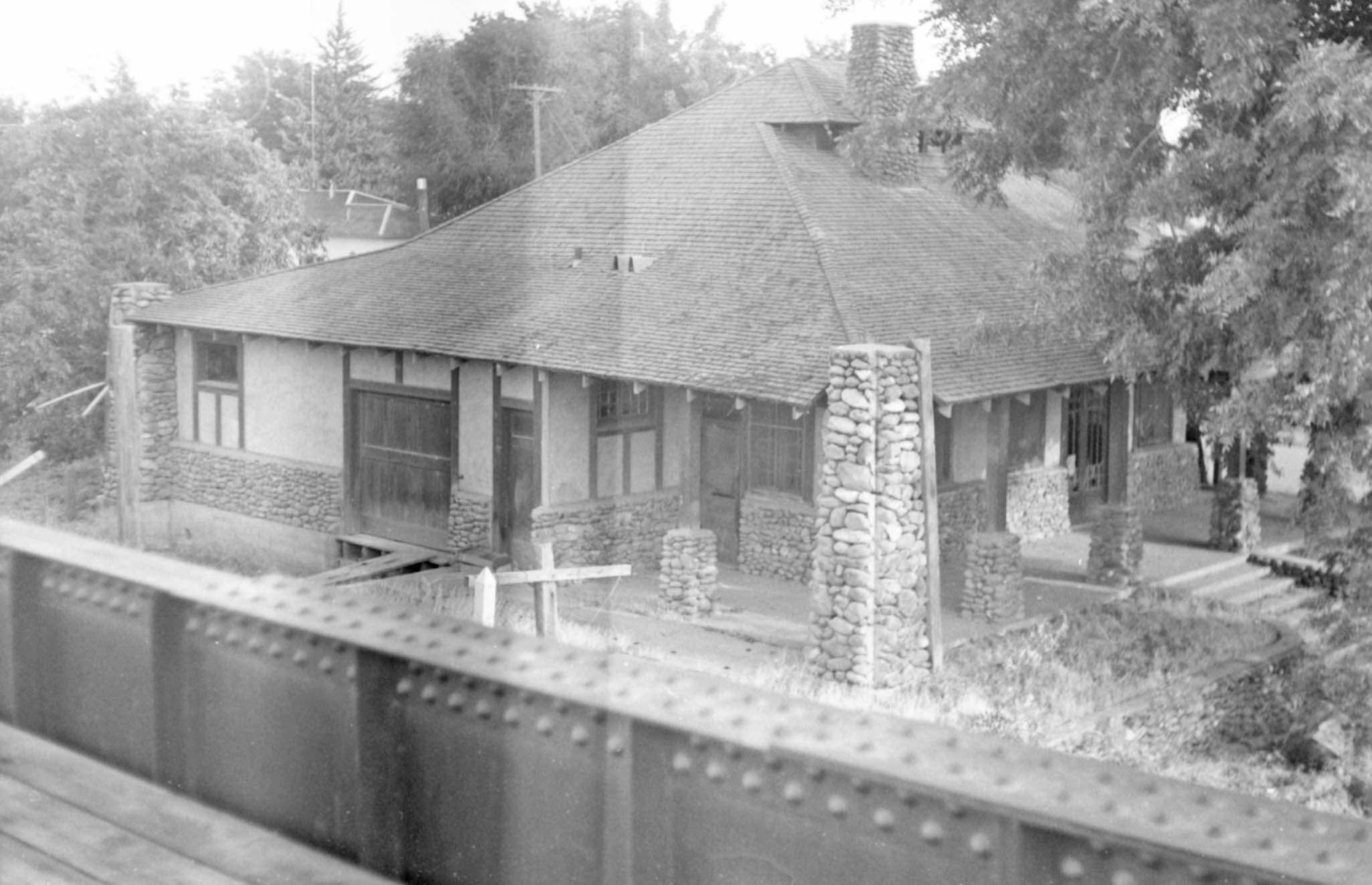
The Holmes Bros. took this southeast photo of the depot from the Third St. railway overpass on Sept. 20, 1959. For the NE, having a depot at a lower level relative to the track was unusual. More history, Fouts became postmaster for a post office built near the ferry in 1860. Although the post office was originally called Keokuk, it was a name already given to another place in CA. Meridian was chosen “because the office was only one-fourth of a mile west of the Mt. Diablo Meridian, U.S. survey.”
L340-15-Holmes Bros.Photo, Courtesy BAERA, Western Railway Museum, 99310sn, (Image 4 of 40)
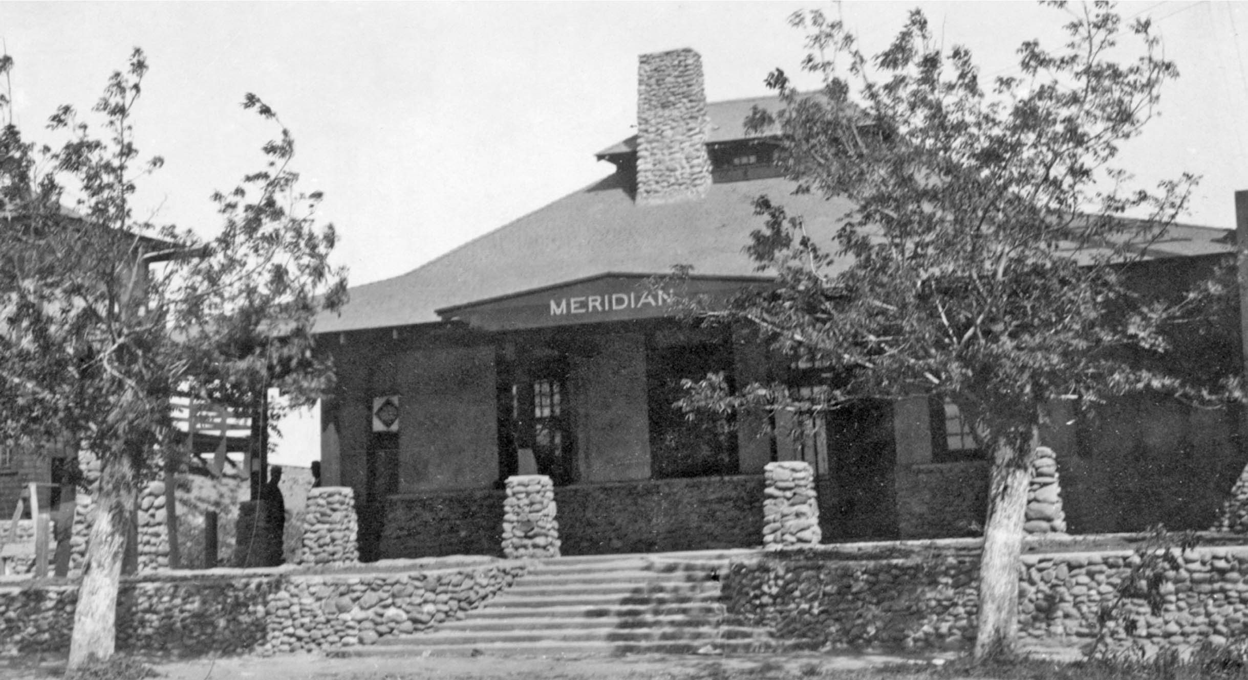
This ca. 1940 east view of the depot shows the stairway and elevator on the left edge that was intended to bring passengers and freight to a track-level platform. More features of that structure coming up. More history, a flood during 1867-1868 caused a downsizing of the town, but by 1876 the town had been laid out in lots, and had a large warehouse that allowed shipping of grain along the river, and a school.
L340-20-Robert L. Stein Collection, Courtesy BAERA, Western Railway Museum, 103396sn, (Image 5 of 40)
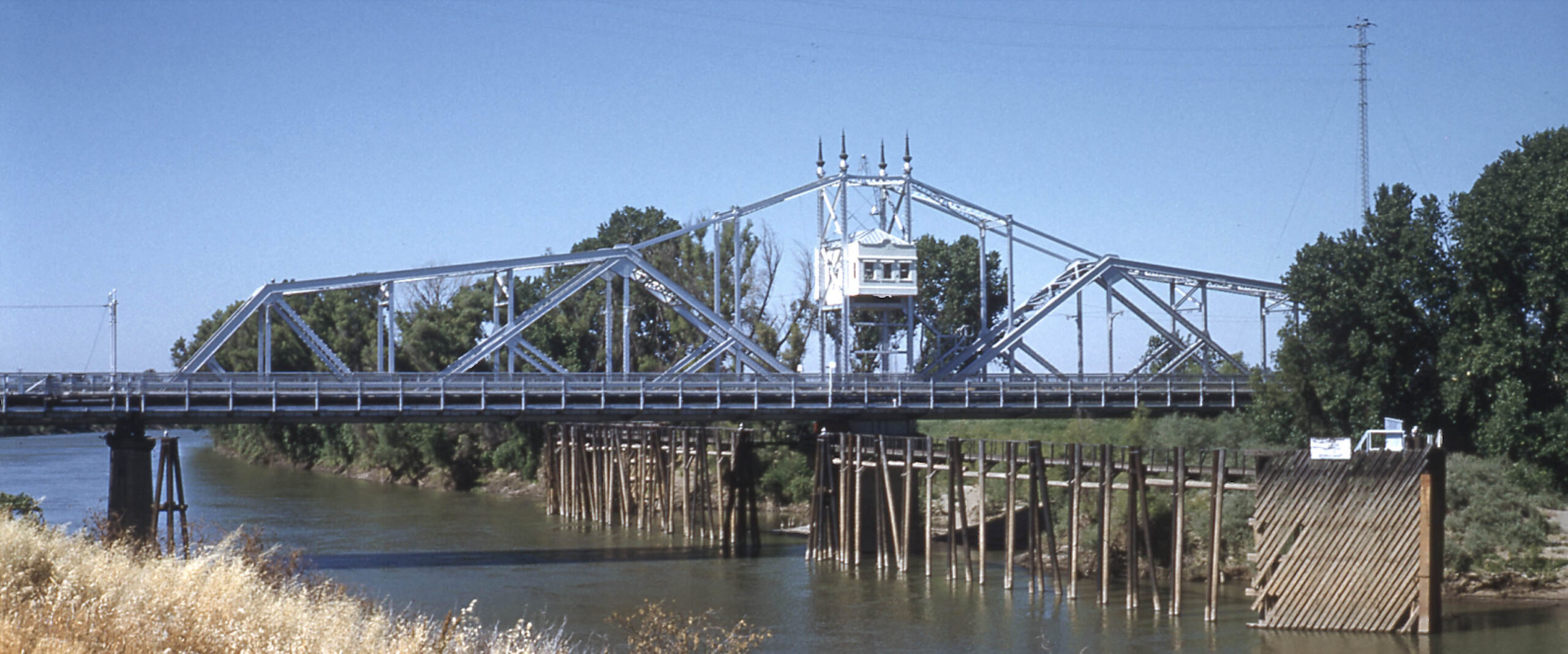
This southeast view from the Colusa side of the Sacramento River is of the Merdian Bridge on July 6, 1980. This is the bridge in place in 2025, but not the one that carried the SN Colusa Local across the river.
L340-25-Copyright California Department of Transportation, C7387-1, (Image 6 of 40)
A northwest view of the swing bridge open on Oct. 21, 1986, left, is accompanied by the brochure that announced the opening of the new bridge on Apr. 21, 1977, right, along with pertinent history that will bring this update back in time to the construction of the initial bridge.
L340-30-Copyright California Department of Transportation, C11866-10, (Image 7 of 40)
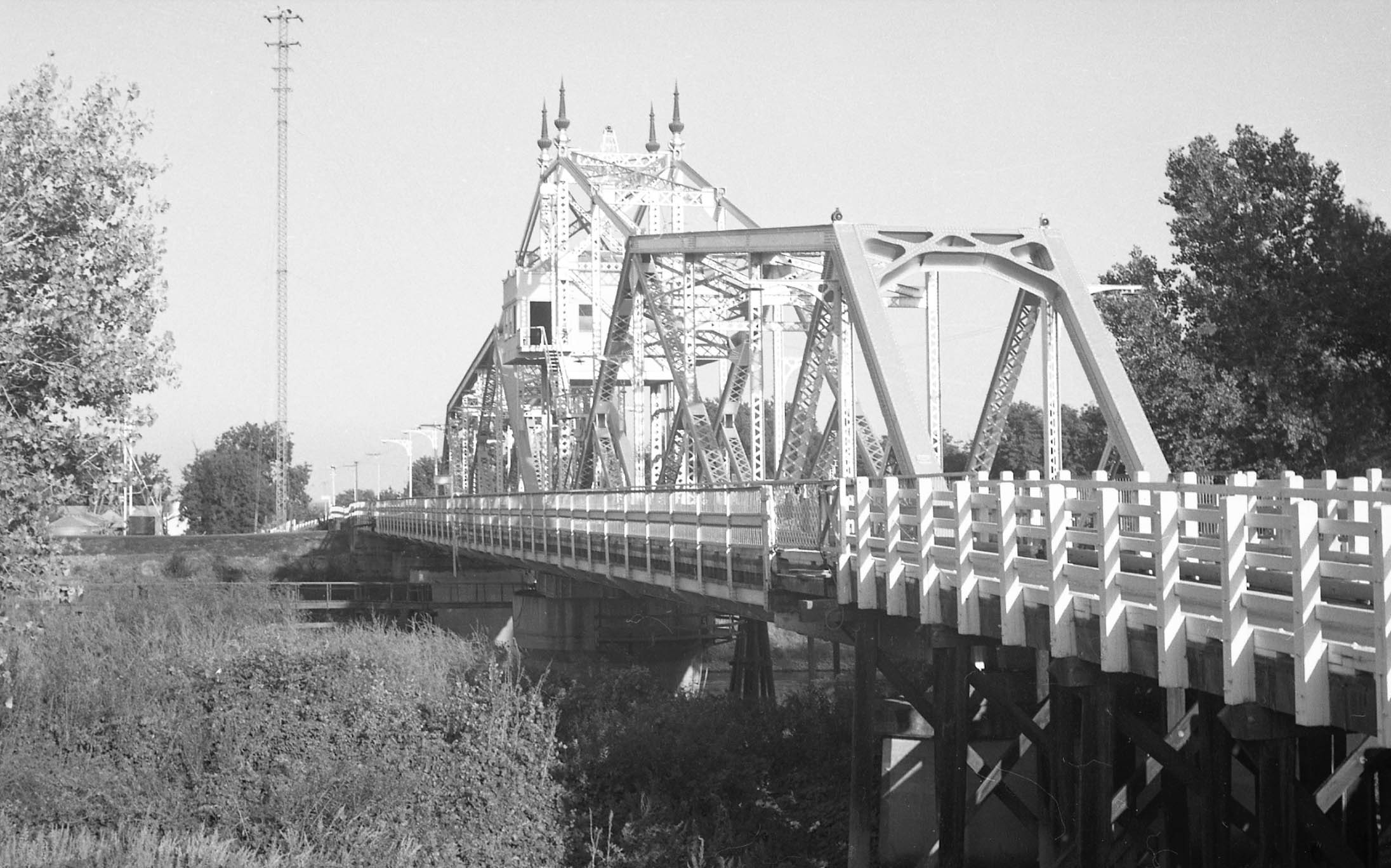
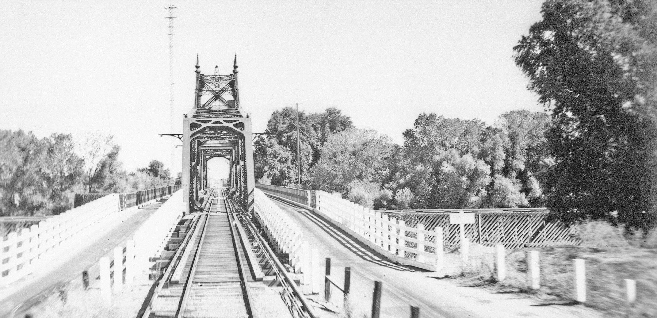
To introduce the first bridge, shown here is an east view taken on Sept. 20, 1959. The electrical tower on the Sutter County side of the bridge at its northeast corner is a useful marker for differentiating the direction in which images of the bridge were taken.
L340-35-Holmes Bros. Photo, Jim Holmes Collection, 163138sn, (Image 8 of 40)
Be aware that an additional tower was also placed on the Colusa County side, but further away from the southwest corner of the bridge as seen in this southwest view from May 21, 1959. Another directional clue was the position of the walkway to access the turning mechanism of the structure, closer to the Colusa County shoreline of the river as seen here. Not a single image of this bridge swung open could be found.
L340-40-Ernest Haase Photo, Courtesy BAERA, Western Railway Museum, 210181sn, (Image 9 of 40)
Good luck finding an image of a NE or SN train on the bridge, this southwest undated view from the NE era the only one found. Appreciation to the Sutter County Museum for providing this image.
L340-45-Courtesy Sutter County Museum, 998.008.031, (Image 10 of 40)
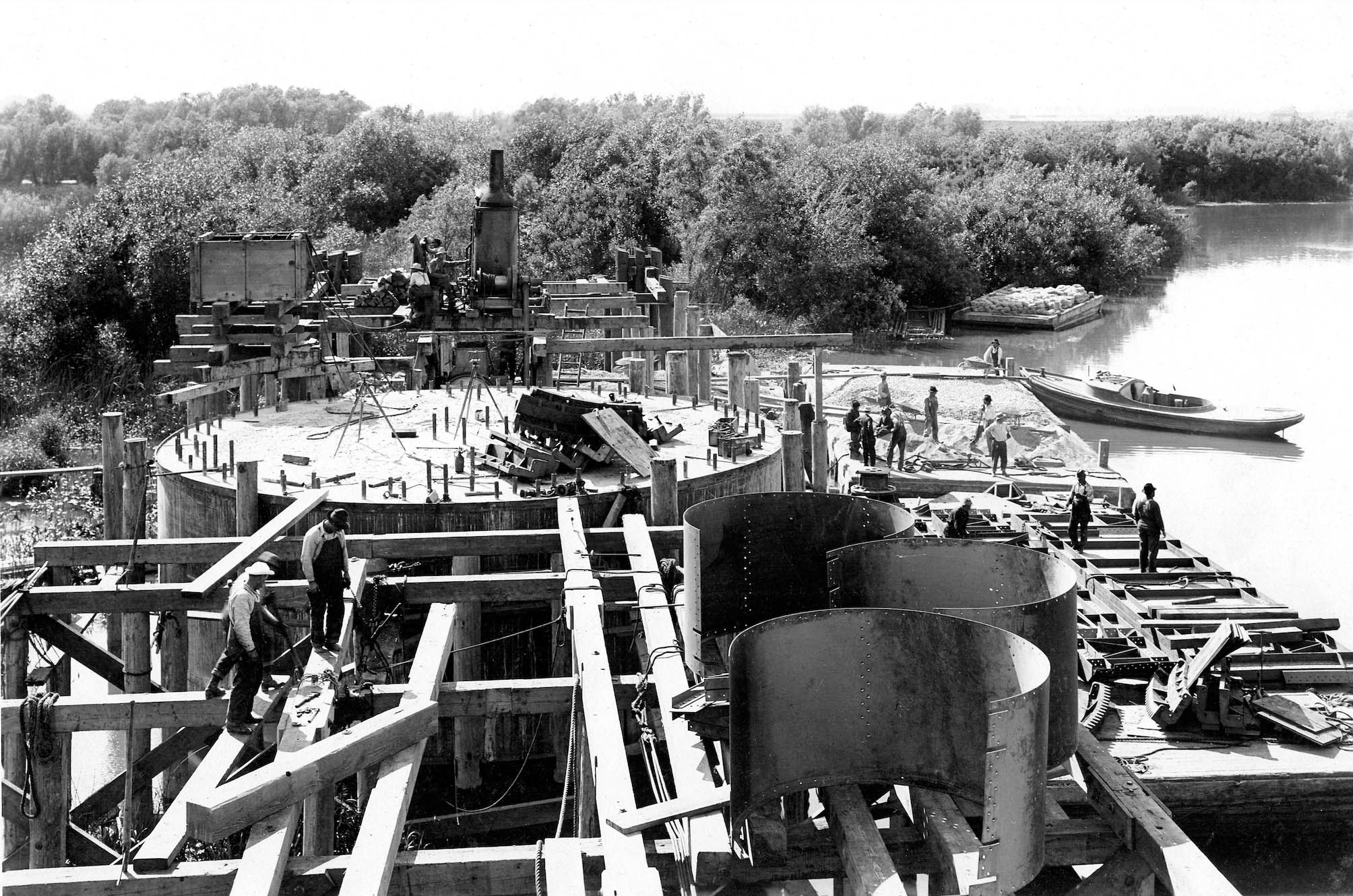
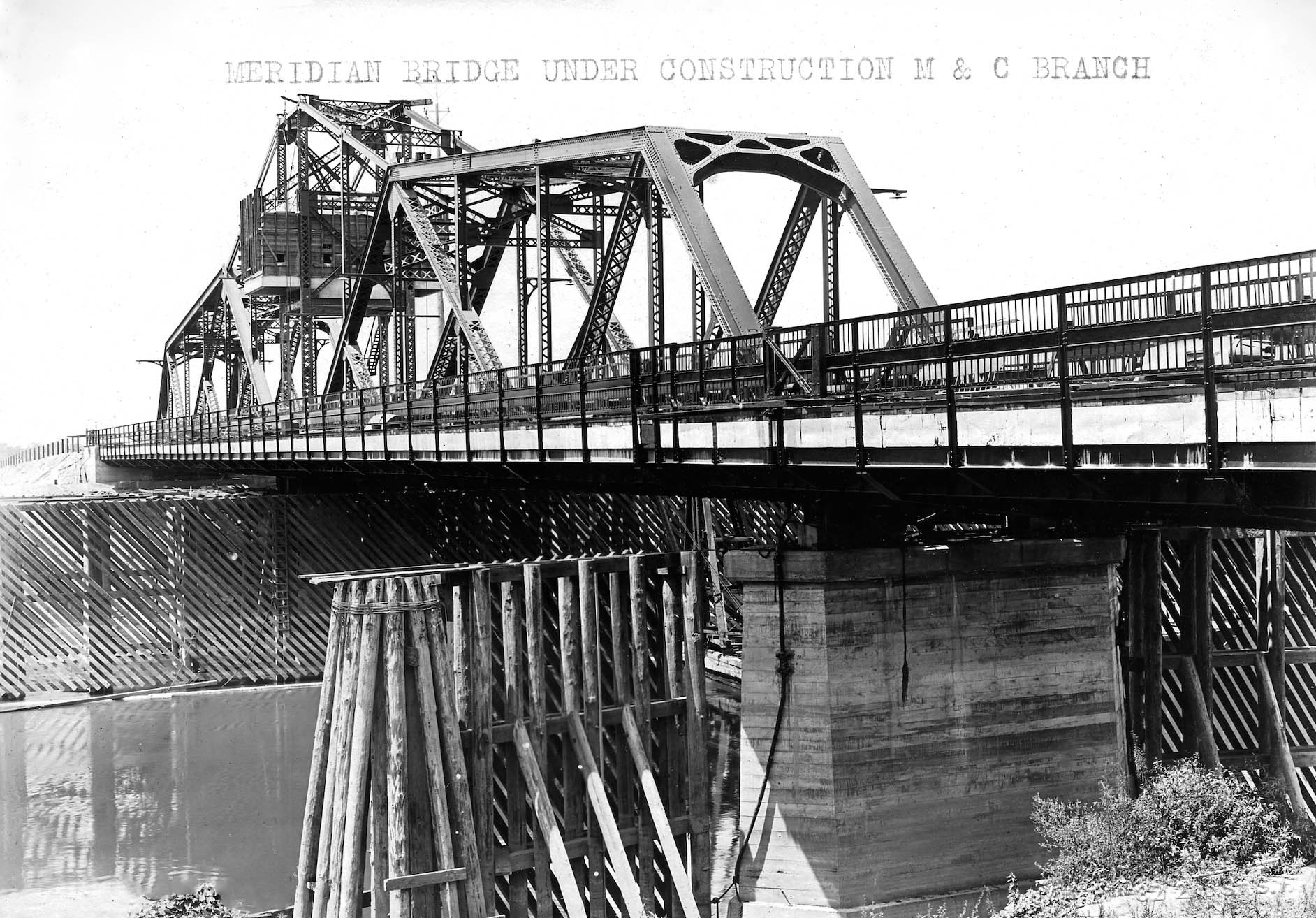
Next, a few images chronicling the building of the bridge. It is assumed that this is a west view of the swing mechanism taken from the Meridian side of the bridge on June 7, 1911, that is, two years and two days prior to the opening of the branch line.
L340-50-Courtesy BAERA, Western Railway Museum, 260060sn, (Image 11 of 40)
This northwest view of the nearly competed bridge shows that the silver color seen in the earlier views from the late 1950s was not added until after the passenger era ended.
L340-55-American Photo Co. Photo, R. L. Stein Collection, Courtesy BAERA, Western Railway Museum, 260059sn, (Image 12 of 40)
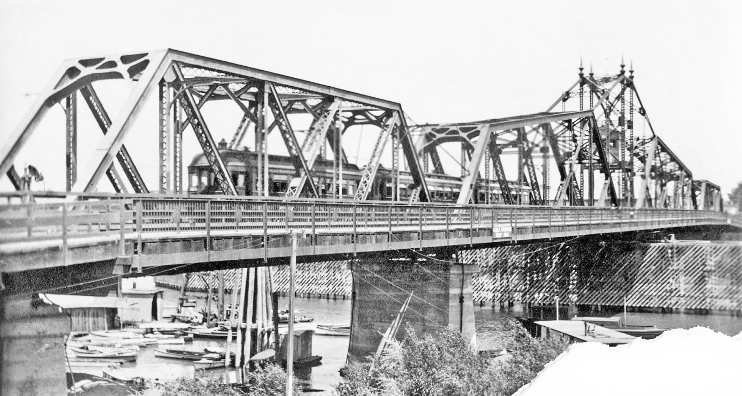
This east view ca. 1936 shows the single track and exposed third rail running down the center of the bridge. Railroad historian and author Jeff Asay provides the details to explain about the pipes running along the third rail. They were part of the manual interlocking system that prevented trains from going out on the bridge when the span was open, very common on railroads in the early part of the 1900s up to the 1970s or 80s. The pipes were attached via cranks and pulleys to large levers in the bridge control tower, two sets of pipes for each approach. These levers and a locking lever for the bridge mechanism would have been installed in a "locking bed", a flat device with rods and dogs (little steel pieces.)
L340-60-Kidder-Vielbaum Collection, Courtesy BAERA, Western Railway Museum, 132861sn, (Image 13 of 40)
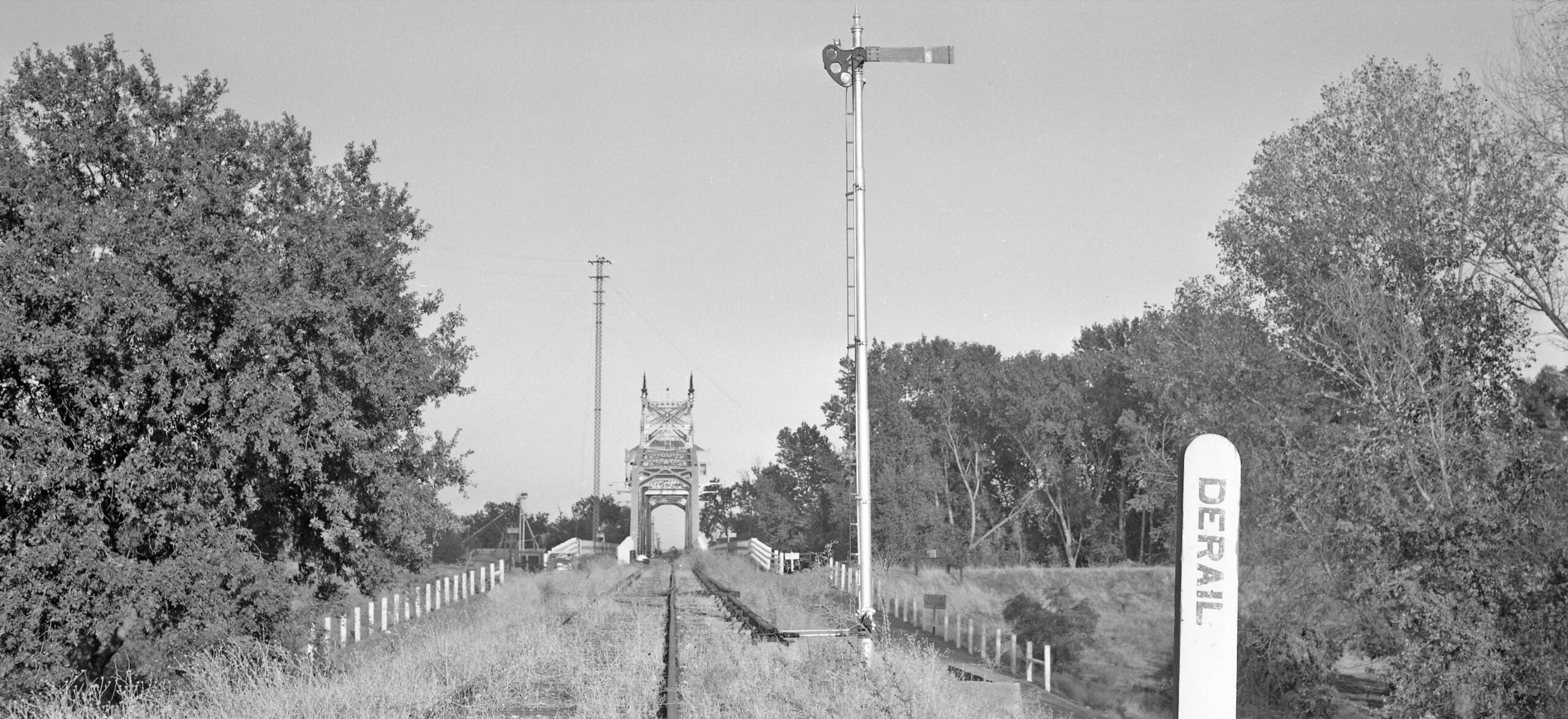
This east view was taken from the Colusa County side on Sept. 19, 1959. Jeff continues his explanation from the previous legend. The rods and dogs were arranged so that the bridge mechanism could not be activated unless and until the levers controlling the semaphores and the derails as seen here on each approach were in the proper position. In other words, if the derails were closed and the semaphores were down (proceed), the bridge mechanism could not be unlocked and activated.
L340-65-Sappers Collection, Courtesy BAERA, Western Railway Museum, 136904sn, (Image 14 of 40)
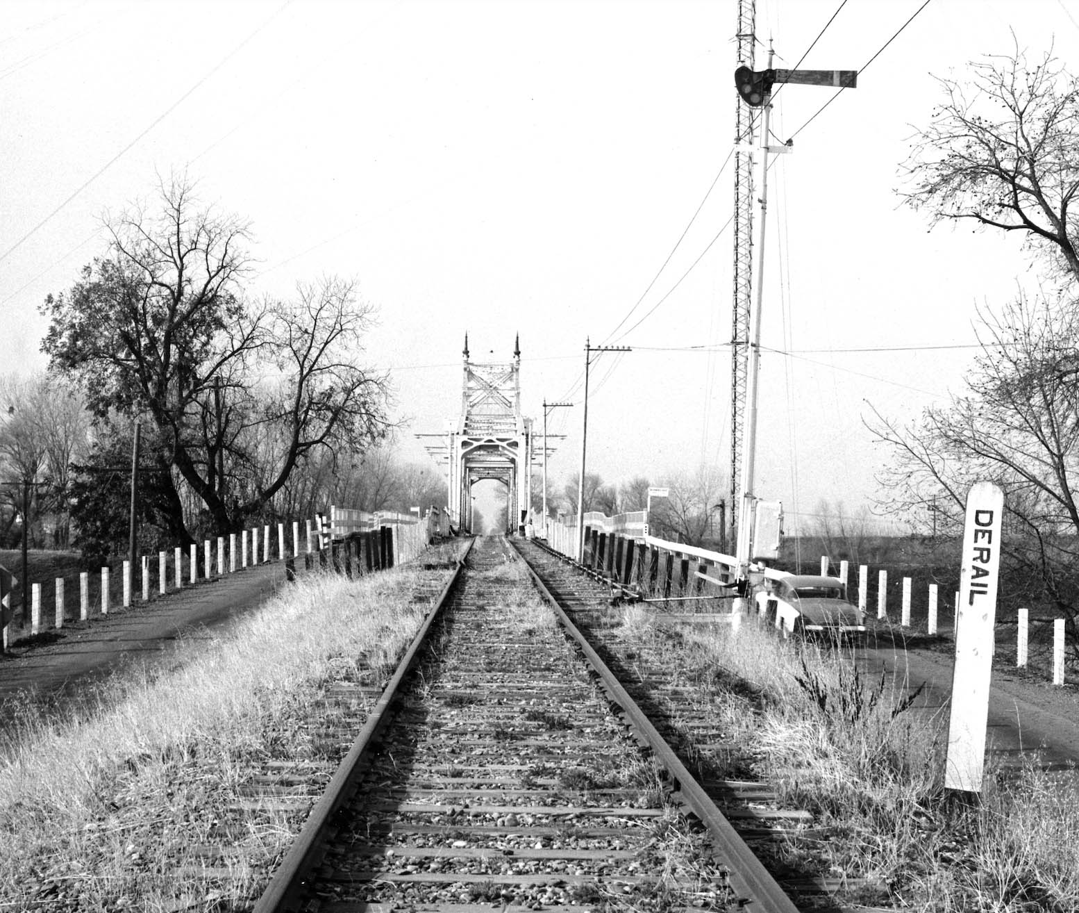
Same arrangement on the east side as seen in this west view from ca. 1960. Jeff concludes his explanation. Similarly, if the bridge was open, the levers operating the derails and semaphores were mechanically locked and could not physically be moved to the proceed position. I have to assume that the bridge unlocking lever would have been connected to a relay supplying power to the bridge controller. When the bridge lever was locked the relay was open and no power would go to the controller running the bridge motor. All the levers in the locking frame in the control room were moved by muscle power, “armstrong levers”, and no electric current was applied to the levers or the pipes. Two illustrated references, click here, or click here.
L340-70-Courtesy BAERA, Western Railway Museum, 260062sn, (Image 15 of 40)
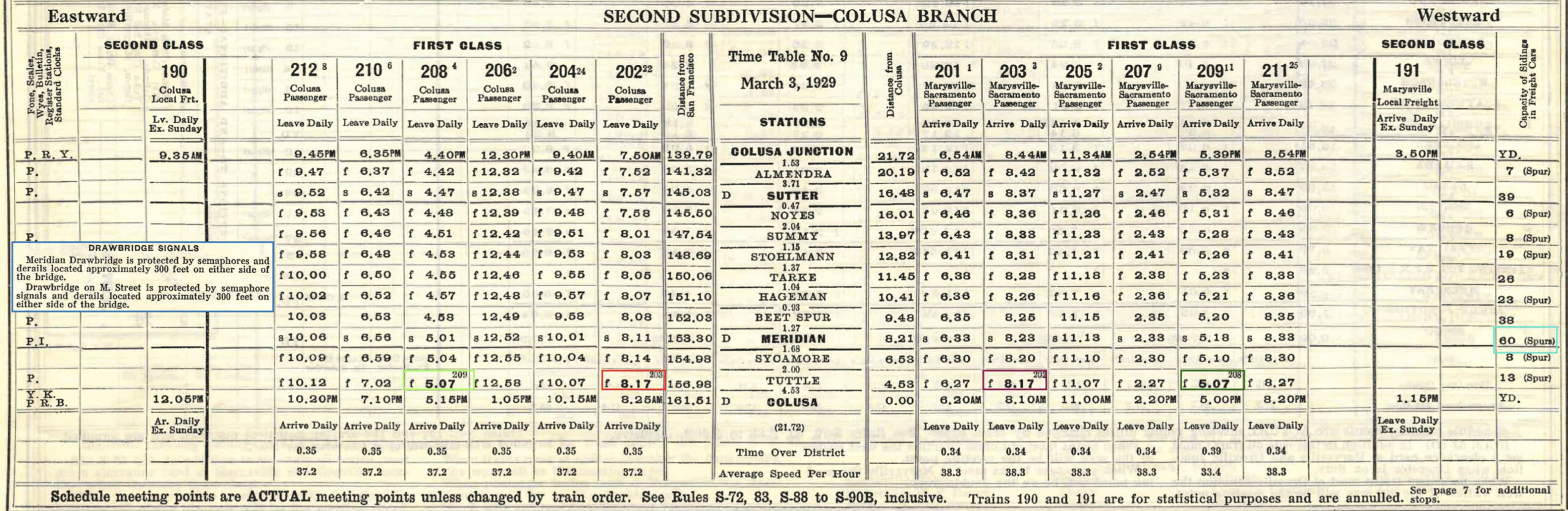
The no. 9 SN employee timetable from Mar. 3, 1929 provides some useful practical information. Trains running in different directions only passed twice a day, and that occurred at Tuttle as marked, avoiding a head-on collision on the bridge. By 1939, with passenger train numbers reduced, there was no longer a case where two trains passed. Second, as for freights, there were plenty of spots at Meridian for a freight to move out of the way, turquoise box. The text in the blue box is why trains would be prevented on the bridge if it was opened or in the process of opening, a situation similar to that in Sacramento as written.
L340-72-Courtesy BAERA, Western Railway Museum, 13460sn, (Image 16 of 40)
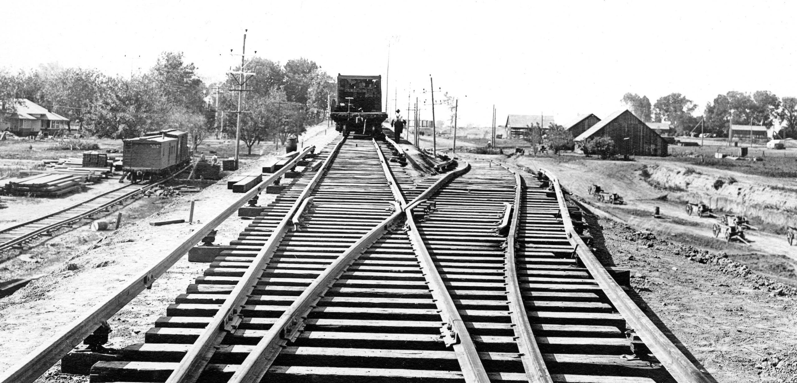
The images that follow are west views taken in Meridian showing the area adjacent to the branch line ca. 1913. This west view shows the spur arrangement on either side of the mainline as well as a few residences and buildings.
L340-75-American Photo Co. Photo, Sappers Collection, Courtesy BAERA, Western Railway Museum 260066sn, (Image 17 of 40)
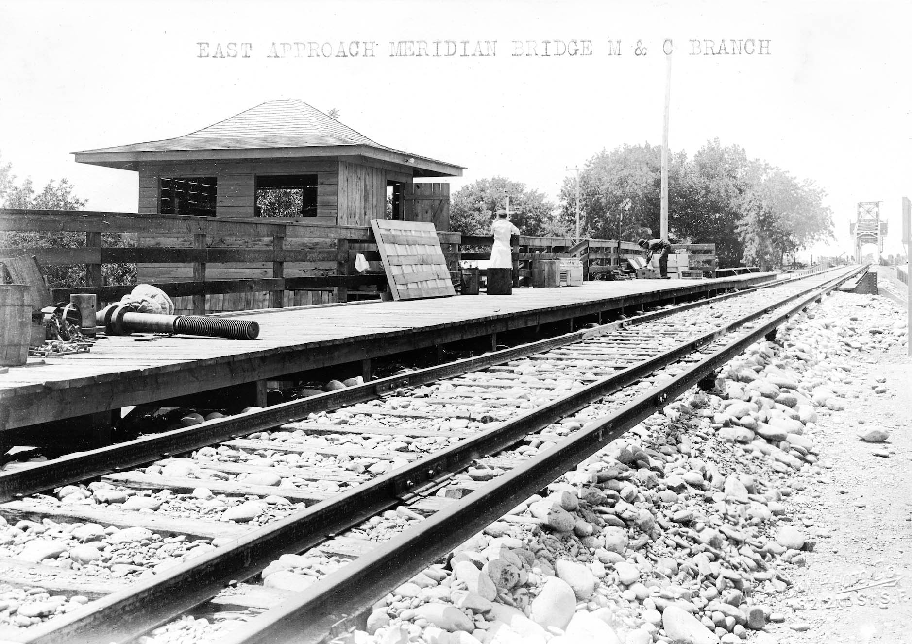
This west view shows the track-level building that would house the elevator. As will be explained shortly, there are no images of any passengers in this structure. The steel overpass of Third St. present beyond that structure will be shown in detail next…
L340-80-American Photo Co. Photo, Courtesy BAERA, Western Railway Museum, 260065sn, (Image 18 of 40)
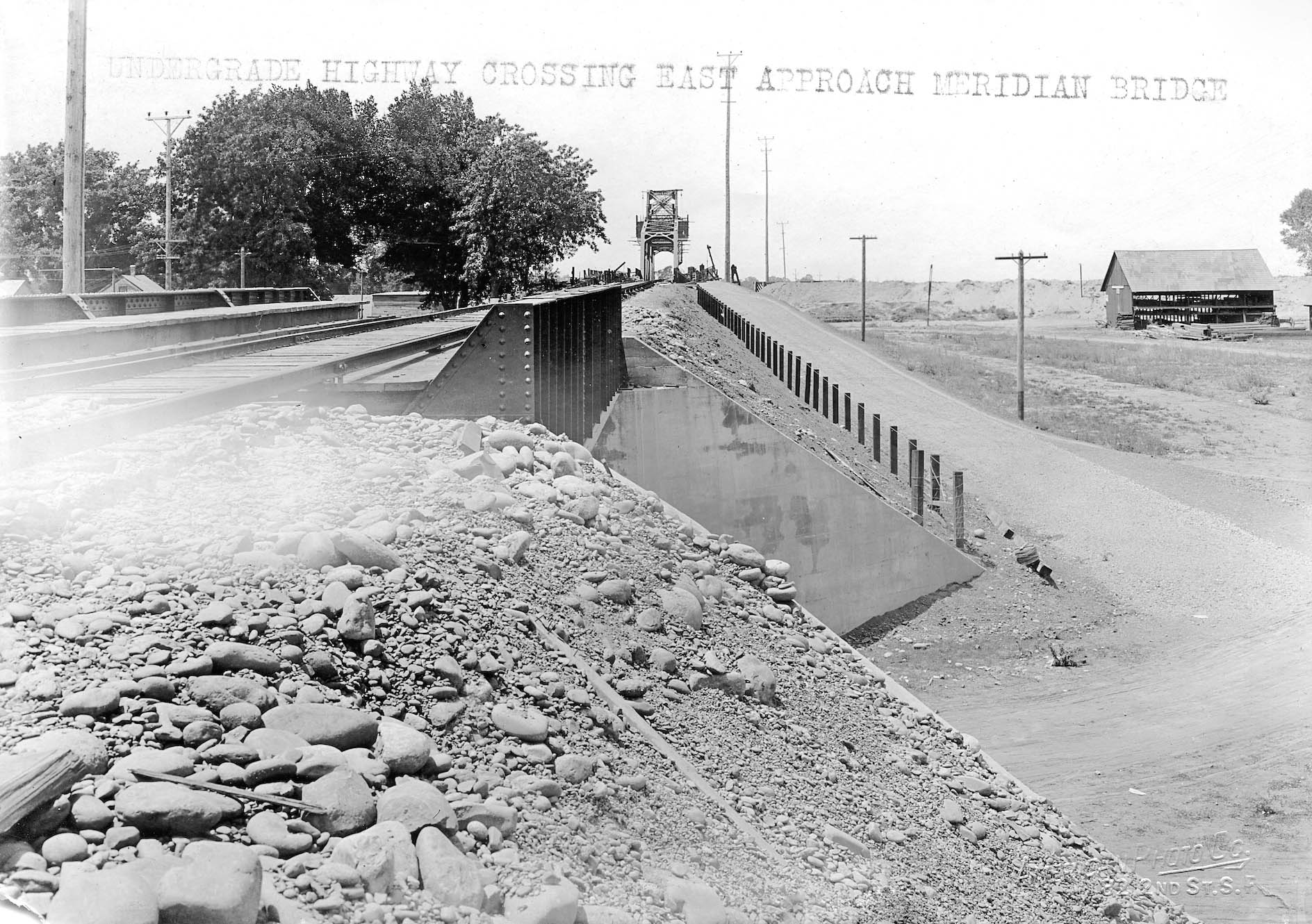
A closer look at the Third St. overpass is seen in this west view.
L340-85-American Photo Co. Photo, R.L. Stein Collection, Courtesy BAERA, Western Railway Museum, 260058sn, (Image 19 of 40)
Leave it to Howard Wolfe to take this unique west view from a train in 1940 of the tower containing the elevator. Note how Schindler’s rock pylon Craftsman design also graced this structure. The broken windows in the tower indicate poor upkeep of the structure. As shown next, disrepair inflicted the structure years before this scene was documented.
L340-90-Howard Wolfe Photo, Courtesy BAERA, Western Railway Museum, 246464sn, (Image 20 of 40)
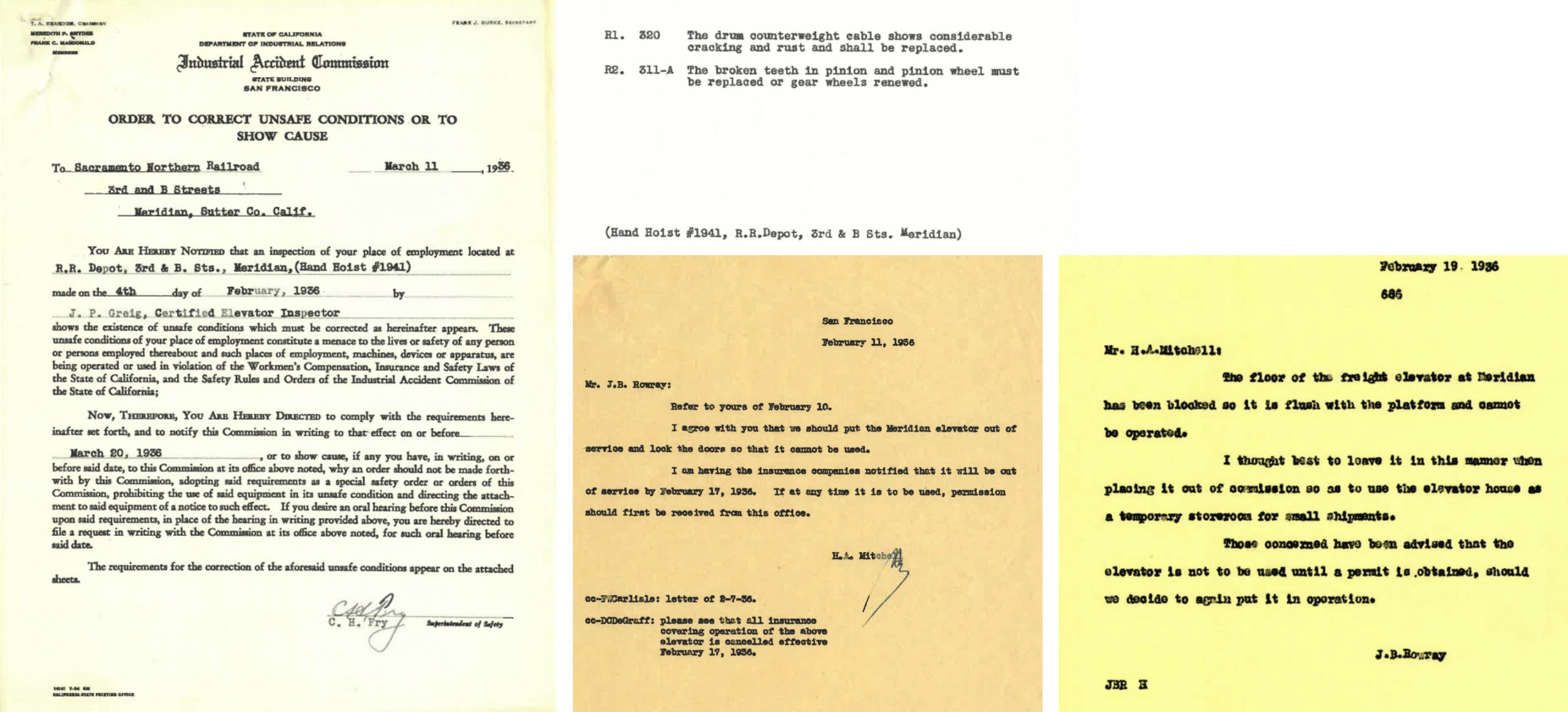
These documents describe the poor condition of the elevator in 1936. It was put out of commission in Feb. 1936. No documentation could be found if the elevator mechanism was ever repaired and returned to use.
L340-95-Courtesy BAERA, Western Railway Museum, 39573sn, (Image 21 of 40)
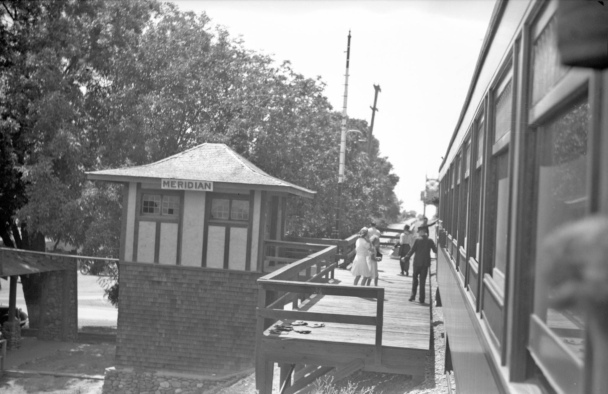
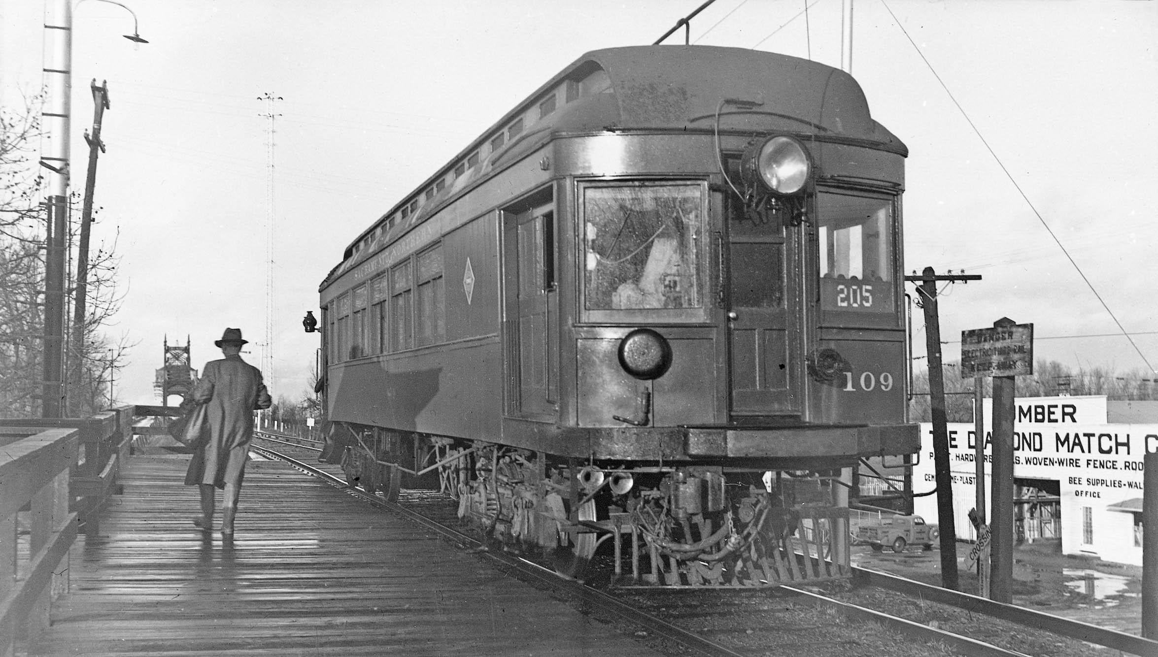
This rare east undated view of SN 109 at the passenger platform shows that the train has helped rid the right-of-way of vegetation. The open-air stairway to the right or west of the tower is nicely documented. The clutter seen through the elevator tower windows suggests it was used as a storage unit. From ground to wire, the electrical connections are obvious to see on the pole to the left of the train, and note the box on the pole. It appears to have buttons or switches, and the motorman already should have their sights on the semaphore and derail.
L340-100-Silleman Bros. Photo, Courtesy BAERA, Western Railway Museum, 138457sn, (Image 22 of 40)
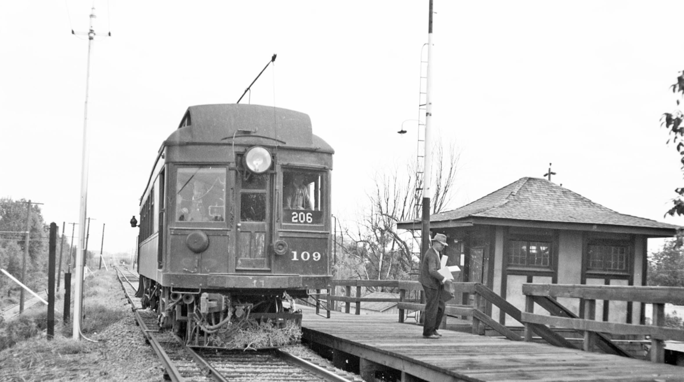
This west view taken on Jan. 2, 1940 on the passenger platform shows the two wires heading past the semaphore as shown previously.
L340-105-George Henderson Photo, Wurm Collection, Courtesy BAERA, Western Railway Museum240510sn, (Image 23 of 40)
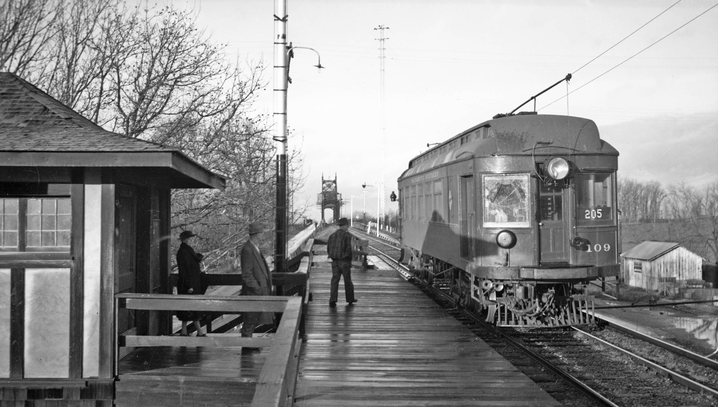
Ted Wurm was with George Henderson at Meridian and took his own west view that also captured the Diamond Match outlet on the north flank of the railway berm. This provides a good segway to explore the customers serviced by the SN at Meridian.
L340-110-Ted Wurm Photo, Tom Gray Collection, Courtesy BAERA, Western Railway Museum, 161800sn, (Image 24 of 40)
This diagram from 1921 shows the spur to the south or below the mainline sending off one track servicing a stock corral, and a second to the freight elevator. On the north side, the spur serviced Standard Oil Co., and a second track split off and continued across Third St. to the west. The insert from the WP Circular no. 167- ca. 1957 lists Standard Oil as the only remaining freight customer in Meridian, although the absence of listing the capacity for freight cars has sometimes meant the spur may no longer have been active.
L340-115-Courtesy BAERA, Western Railway Museum, 39569, Insert Courtesy Bruce Eldridge, (Image 25 of 40)
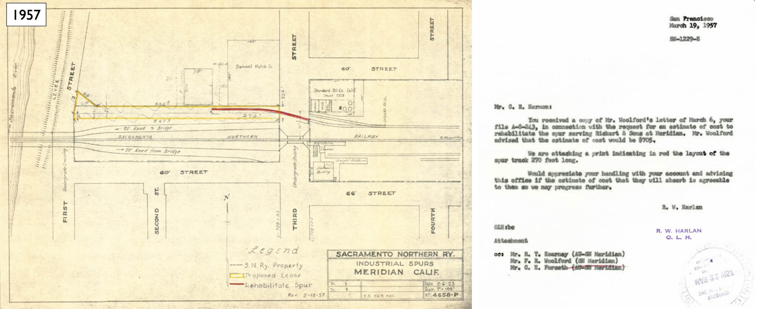
The western potion of the spur on the north side of the mainline and west of Third St. was for the Diamond Match Co., signed on with the SN since Feb. 5, 1923 according to railway documents. The map updated to 1957 has a red line added indicating the spur needed rehabilitation. Note that this figure includes a SN property line that does not include the property occupied by Diamond Match, and the letter mentions a new company to be discussed next.
L340-120-Courtesy BAERA, Western Railway Museum, 39563sn, (Image 26 of 40)
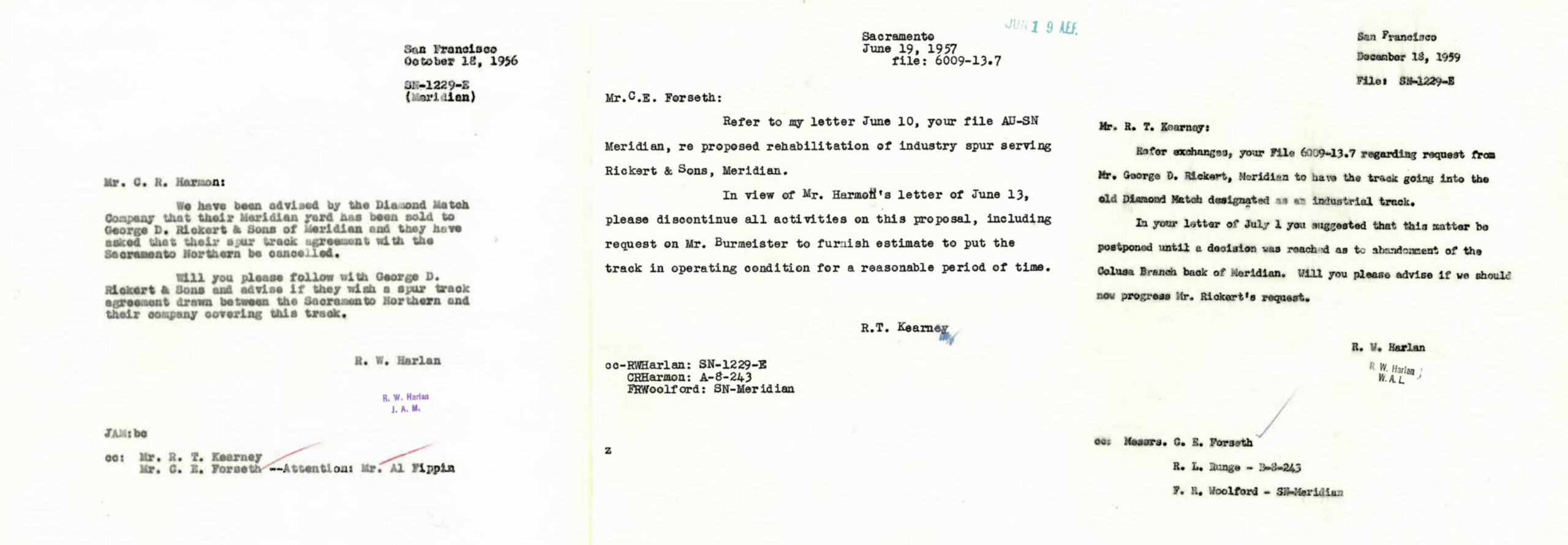
Diamond Match sold their property to George D. Rickerts & Sons in 1956, left. Their animal feed milling business had a projected productivity of less than one freight car per week, so they did not want the spur, and the SN complied, center. By the end of 1959, right, Rickerts requested activation of the spur, but SN President Rex Kearney was in no hurry to respond as abandonment plans were being considered.
L340-125-Courtesy BAERA, Western Railway Museum, 39563sn, (Image 27 of 40)
Following the Rickerts storyline, the next document found in this series was from Apr. 1963, after they had been out of business for about a year and had sold all their milling equipment to a new concern, Meridian Milling Co., left. As late as mid-1963, the letter on the right to Kearney suggests a lease was being considered, but no lease was ever found as freight service to Meridian was abandoned in 1964.
L340-130-Courtesy BAERA, Western Railway Museum, 39562sn, (Image 28 of 40)
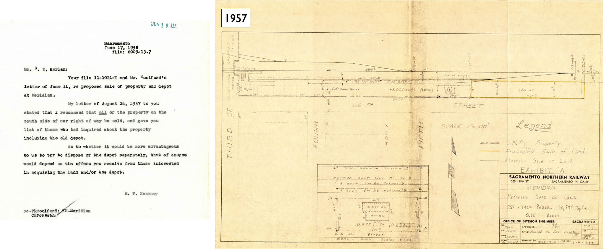
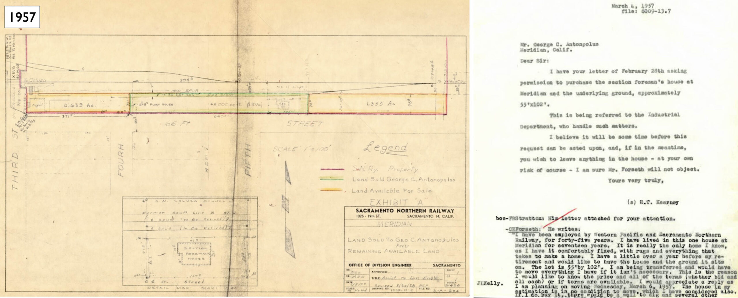
As for the property to the south of the branch line, the letter shown here, left, documents that Kearney wanted to sell off all of that property, including the SN depot as early as 1957. There is no evidence that there was any active business for the spurs on that side of the track at that date. The first structure to go was the section foreman house, right.
L340-135-Courtesy BAERA, Western Railway Museum, 39569sn, (Image 29 of 40)
That building and the land around it was sold to George Antonpolus by 1957, left. Jeff Asay’s book “The Iron Feather”, Lockridge Press, 2018, page 460 provides a reference that documents the Meridian depot and adjacent land was sold to a C. N. Jones in 1959 for $12,500. Eventually it all got sold, the dates not known. The letter on the right from Kearny to Antonpolus also includes an appeal from the section foreman who had lived in the house for seventeen years to obtain then house.
L340-140-Courtesy BAERA, Western Railway Museum, 39566sn, l, 39569,r, (Image 30 of 40)
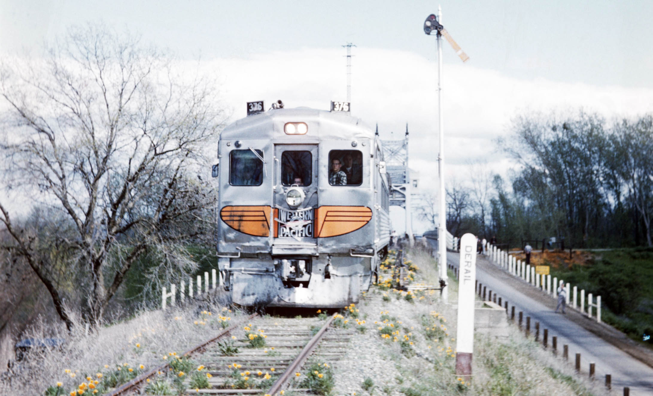
It is not known for sure when the the last train crossed the Meridian Bridge, but this east view of Western Pacific Rail Diesel Car, WP RDC no. 376, on the Mar. 26, 1960 Bay Area Railroad Association excursion must have been one of the last.
L340-145-Arthur Lloyd Photo, Courtesy BAERA, Western Railway Museum, 130185wp, (Image 31 of 40)
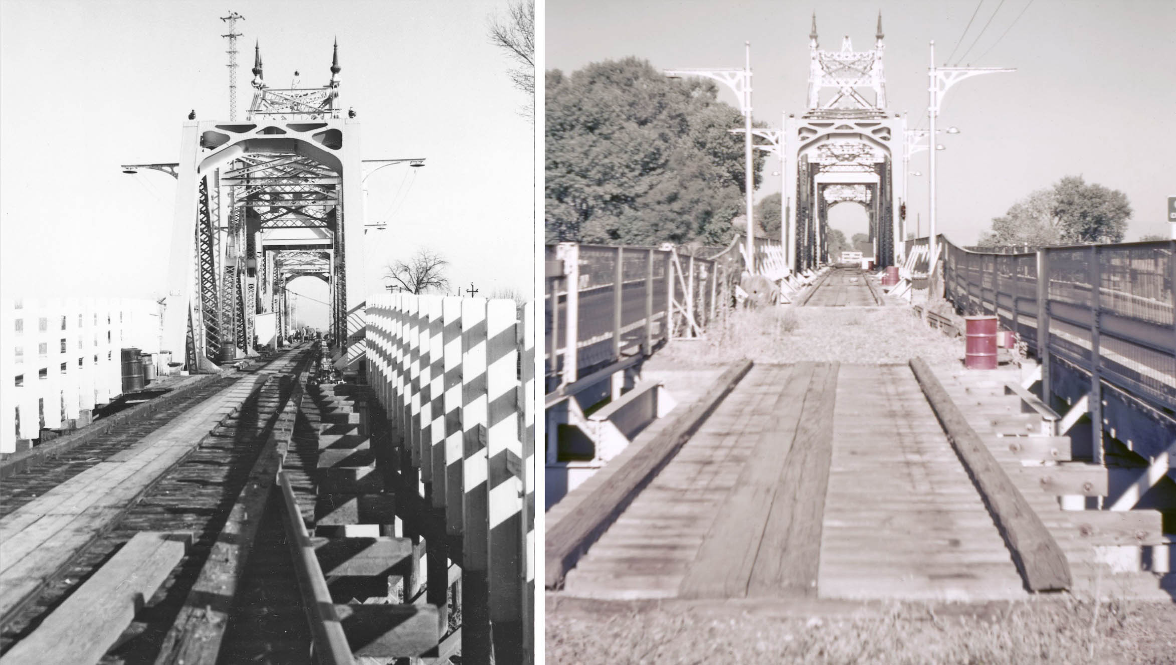
Removal of the rail on the Meridian Bridge and approaches commenced in the early 1960s, with an east view from 1964 on the left, and an undated west view on the right.
L340-150-Courtesy BAERA, Western Railway Museum, 182173sn, l, 210182, r, (Image 32 of 40)
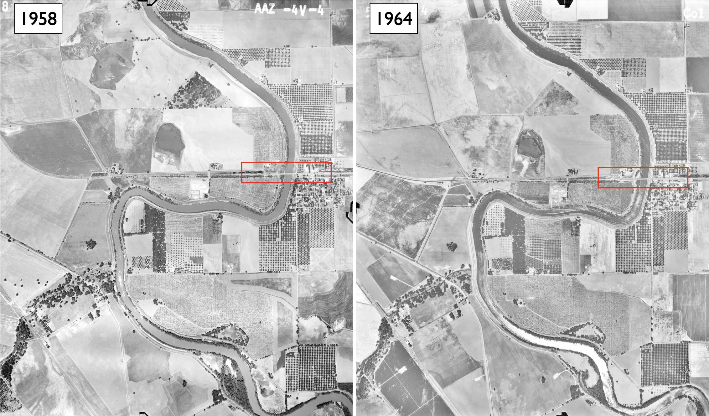
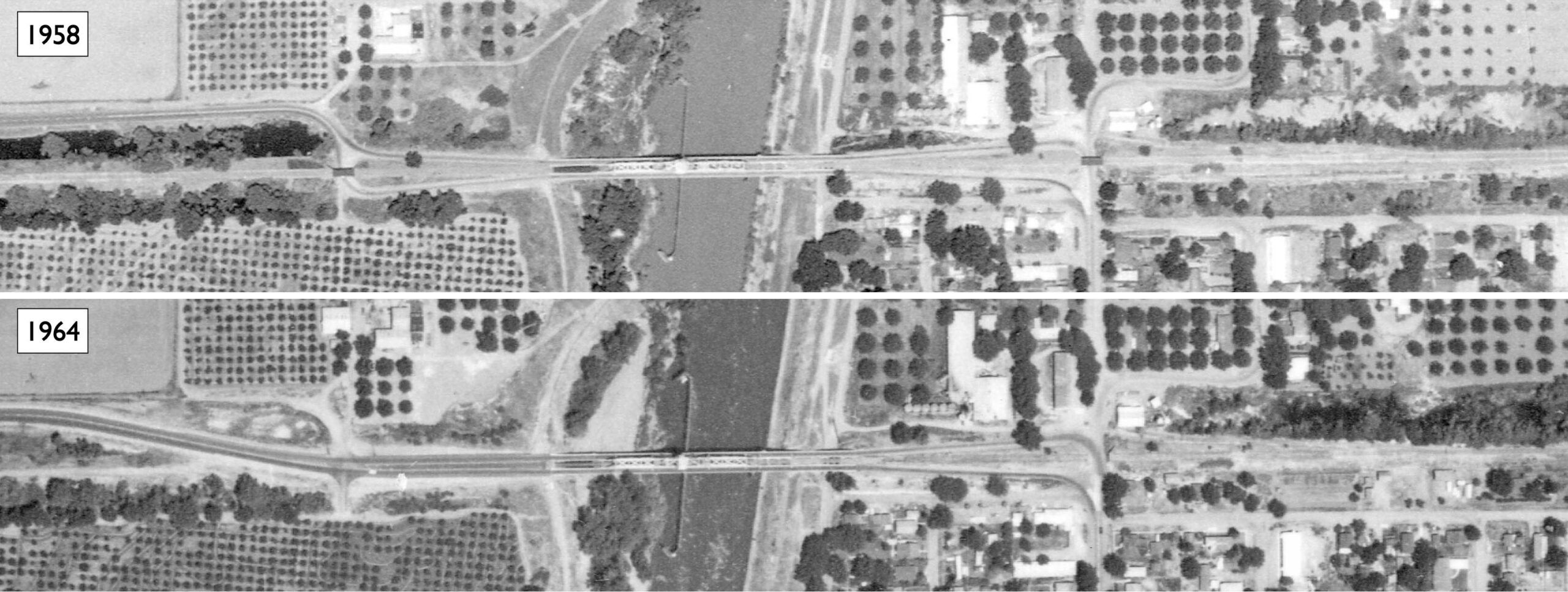
To conclude this update, a series of aerial views will be presented to follow the dismantling of the SN Meridian area. Here are shown aerial views from 1958, left, and May 31, 1964, right, and the area to be compared boxed in red in the next frame. Ref: G4363.S9A4 1958. U6, left: G4363.S9A4 1964. S8, right
L340-155-USDA Aerials, AAZ-4V-4, l, Col 1-114, r, Courtesy Map Collection, Shields Library, University of California, Davis, (Image 33 of 40)
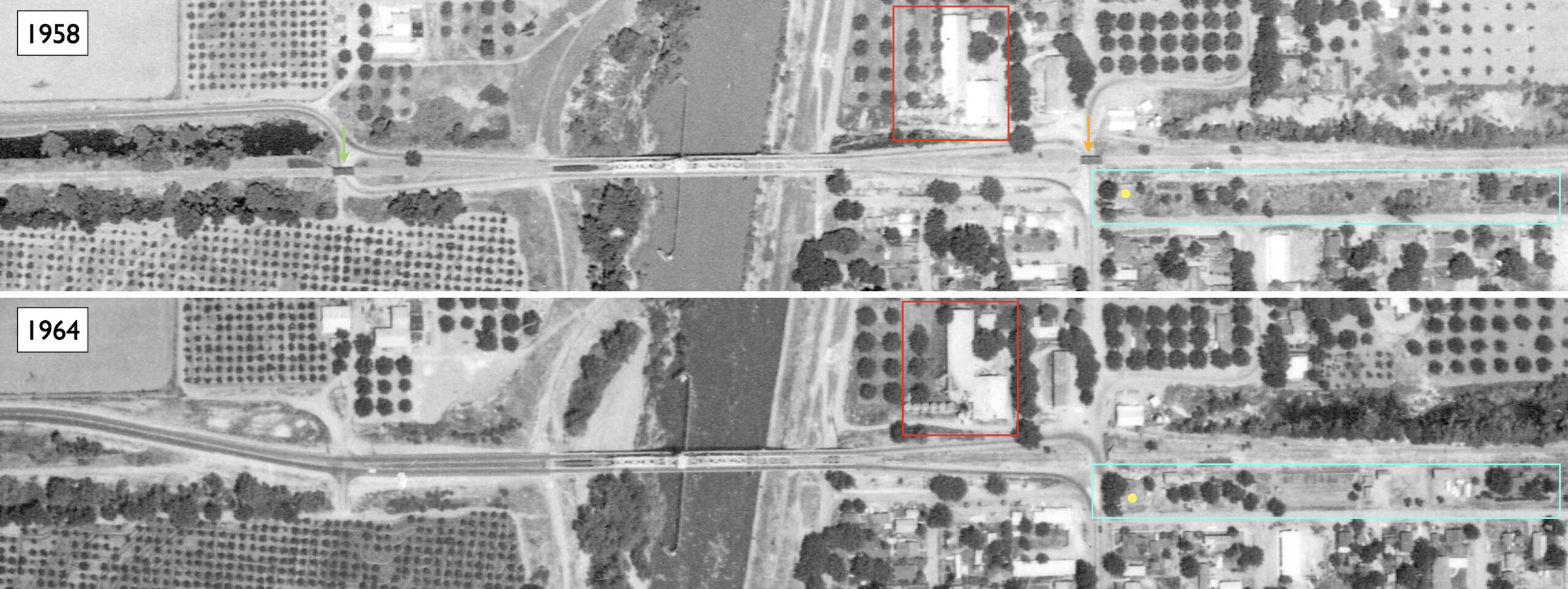
The areas boxed in red in the previous aerials are shown here. The next frame is an annotated version … Ref: G4363.S9A4 1958. U6, top: G4363.S9A4 1964. S8, bottom
L340-160-USDA Aerials, AAZ-4V-4, top, Col 1-114, bottom, Courtesy Map Collection, Shields Library, University of California, Davis, (Image 34 of 40)
The annotated version of the previous frame shows the overpass over Third St. in Meridian, orange arrow, and the one on the Colusa County side, green arrow, present in 1958, are gone by May 31, 1964. Removal of the Third St. overpass is west of the takeoff of the spur tracks, so this would have had no impact on freight traffic at this time. The area boxed in turquoise with the Meridian depot marked with yellow shows more structures along the SN right-of-way in 1964, so the buyers of the SN property were at work. The business boxed in red with the line up of tanks present in both aerials is most likely Meridian Milling or their structures.
L340-165-USDA Aerials, AAZ-4V-4, top, Col 1-114, bottom, Courtesy Map Collection, Shields Library, University of California, Davis, (Image 35 of 40)
A northwest view of the Meridian Bridge from the Meridian side from 1969 is shown here.
L340-170-Copyright California Department of Transportation, 16270, (Image 36 of 40)
On to Nov. 24, 1970, a west view from the Sutter County side, left, the turquoise arrow showing the abandoned SN right-of-way sans track, and an east view from the Colusa County side of Meridian, right. The area boxed in red is shown in detail next.
L340-175-Copyright California Department of Transportation, 16441-1, l, 16441-3, r, (Image 37 of 40)
The overpass supports for the Third St. are still present, red arrow, but Highway 20 has still not replaced the abandoned right-of-way through Merdian. The number of buildings east of the depot, yellow arrow, along the abandoned right of way has intensified relative to 1964. All that remains of the Standard Oil structures are their footprints, orange arrow. The Diamond Match main building is still present, green arrow, but that lot sits empty in 2025. The unidentified building, likely Meridian Milling, marked with the blue arrow is still present in 2025.
L340-180-Copyright California Department of Transportation, 16441-3, (Image 38 of 40)
The Meridian Bridge in a southeast view from Feb. 15, 1972.
L340-185-Copyright California Department of Transportation, 17590-3, (Image 39 of 40)
As this east view shows, the SN abandoned right-of-way served a purpose long after the trains were gone, allowing for a place to put a sign for requests to open the bridge. Appreciation to the Sutter County Museum for the use of their photo, and to Jeff Asay for his review of the presentation and his detailed description of the interlocking mechanism used by the bridge.
L340-190-Copyright California Department of Transportation, 17590-2, (Image 40 of 40)