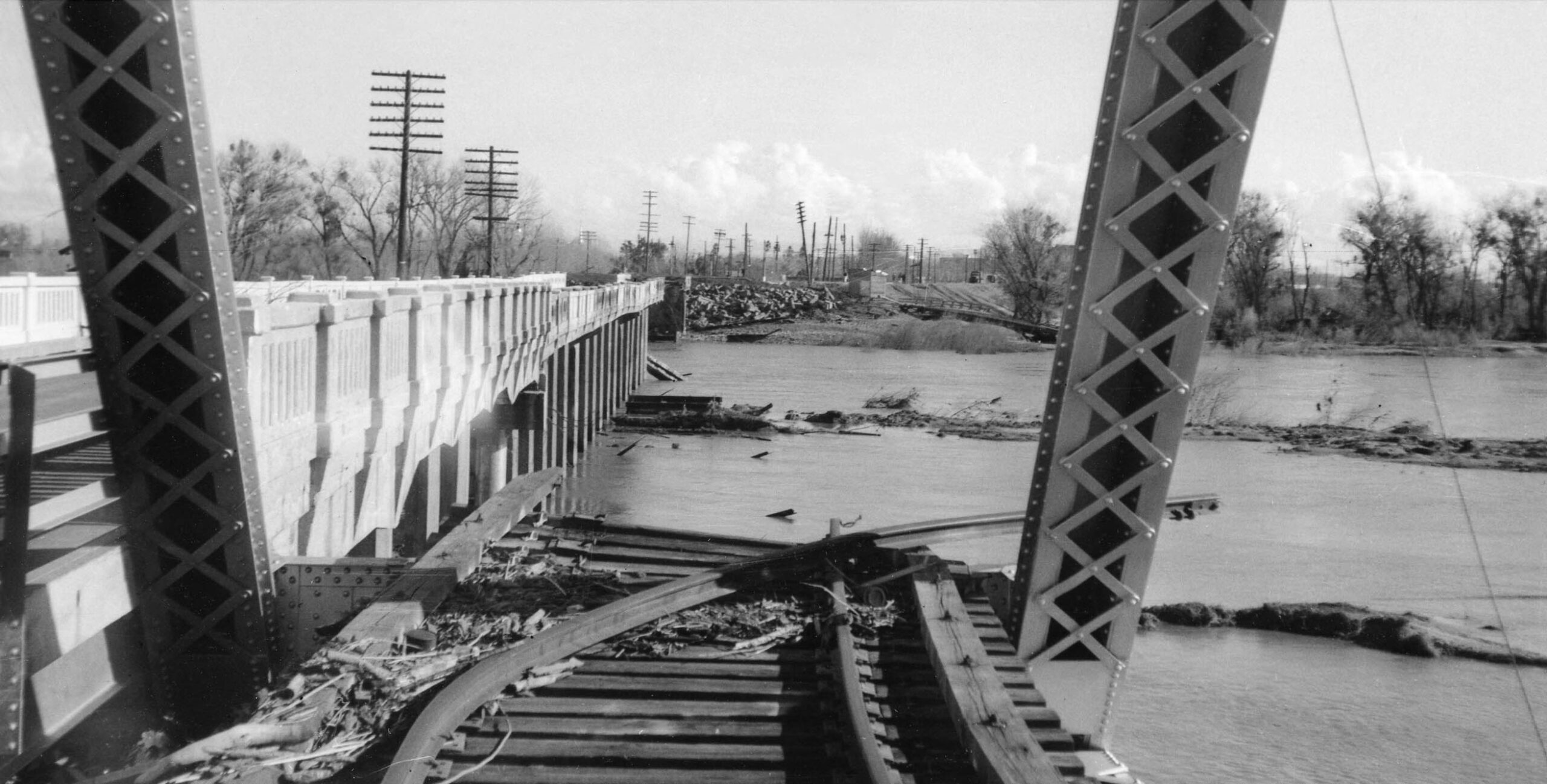
Season’s Greetings From Alicia
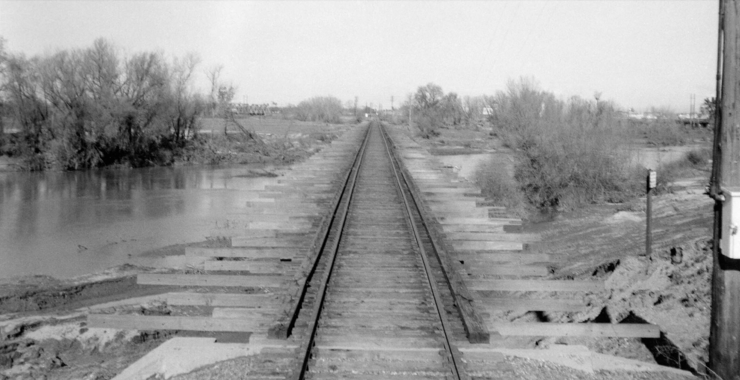
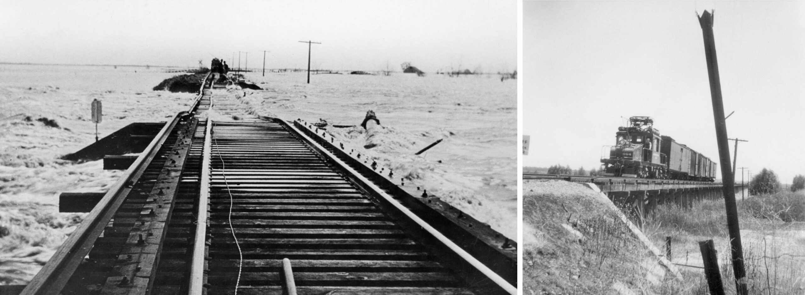
This north view was taken circa Jan. 1, 1956, at the southern end of the large Sacramento Northern Railway, SN, trestle located in an area called South Yuba in 2024. The pooled water was the remains of a massive flood that had inundated the area on Christmas Eve. This image may appear to indicate a calm after the storm, but in fact some serious damaged had occurred here that would put in motion the end of rail service on SN tracks directly south of Marysville.
L313-05-Courtesy BAERA, Western Railway Museum Archives, 225589sn, (Image 1 of 32)

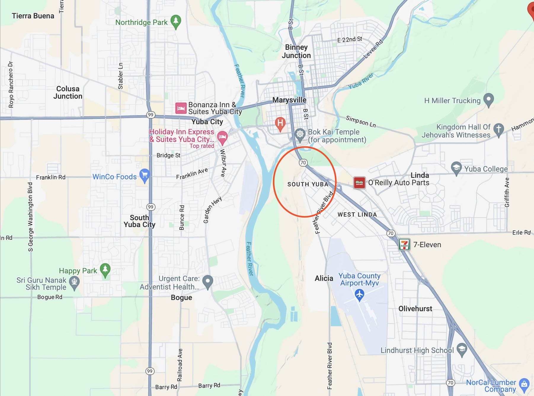
The rarely photographed trestle has not received any significant examination in the written literature. Based on the scribbled notations on the backs of railfan photos and negative envelopes, it has been called the Alicia Trestle, named for the unincorporated neighborhood in the southern portion of West Linda that is 1.5 miles to the south, seen in this map from 2024. This name is as good as any other to begin this review.
L313-10-Courtesy Google Maps, (Image 2 of 32)
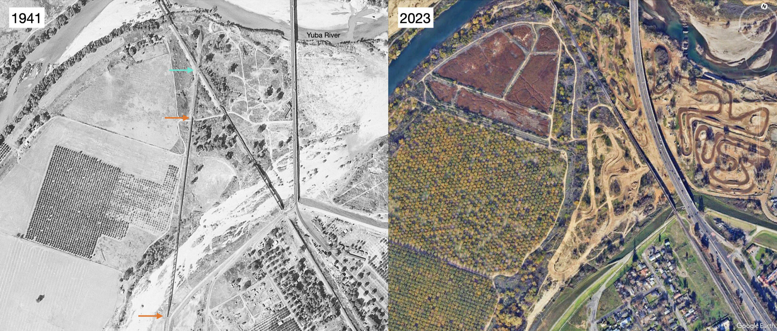
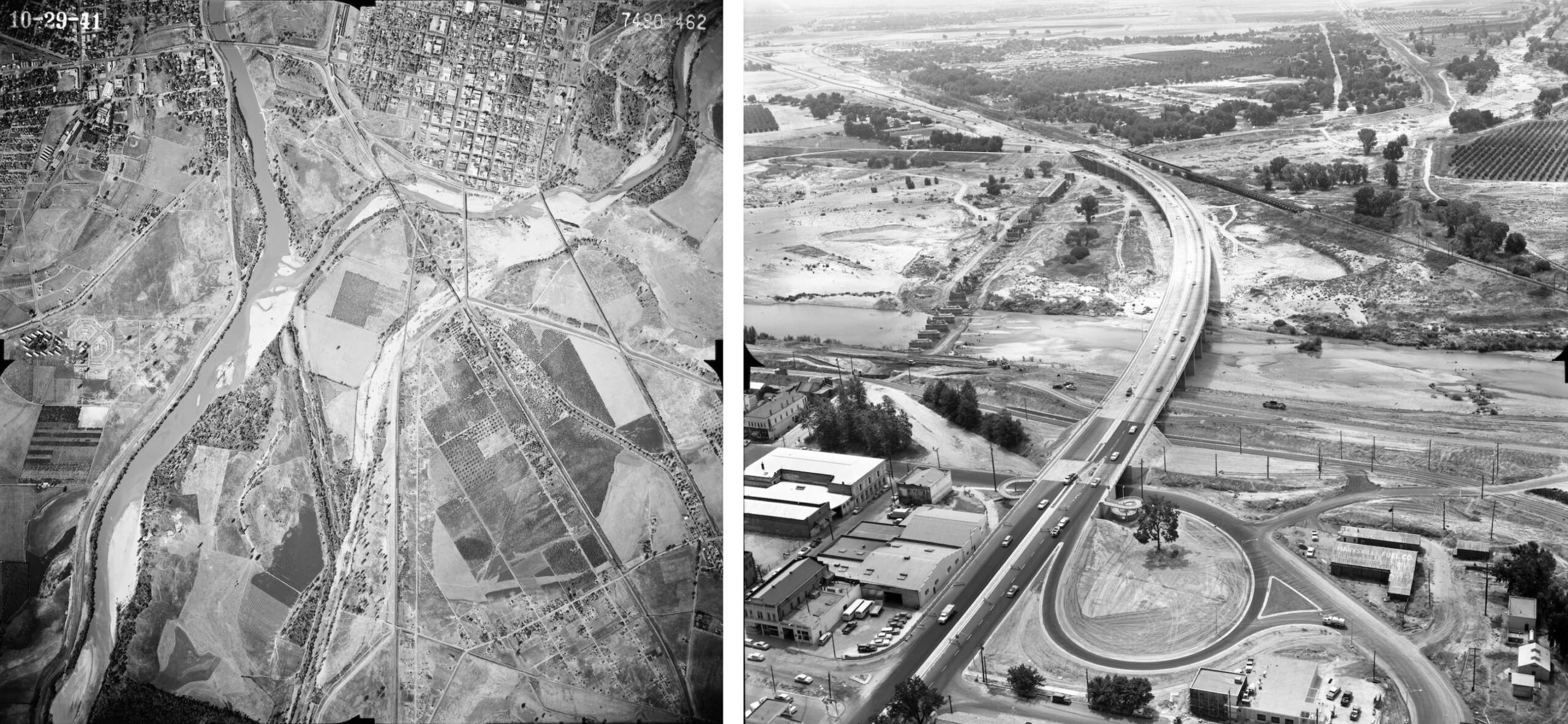
The north-oriented aerial from 1941 on the left shows the southern and northern ends of this trestle as indicated by the orange arrows. The turquoise arrow shows where the SN joined the Western Pacific, WP, mainline just south of the bridge they shared spanning the Yuba River south of Marysville. The comparison with the same area in 2023 is provided on the right.
L313-15-c-7490_462, Courtesy of UCSB Library Geospatial Collection, l, Courtesy Google Earth, r, (Image 3 of 32)
This north view from Jan. 14. 1953 shows where the north end of the SN trestle ended at the levee berm, orange arrow, just short of the merge with the WP mainline, the latter occupied in this image by a WP freight. That levee has been part of Reclamation Area no. 784 since 1908.
L313-20-Copyright California Department of Transportation, 2876-4, Detail, (Image 4 of 32)
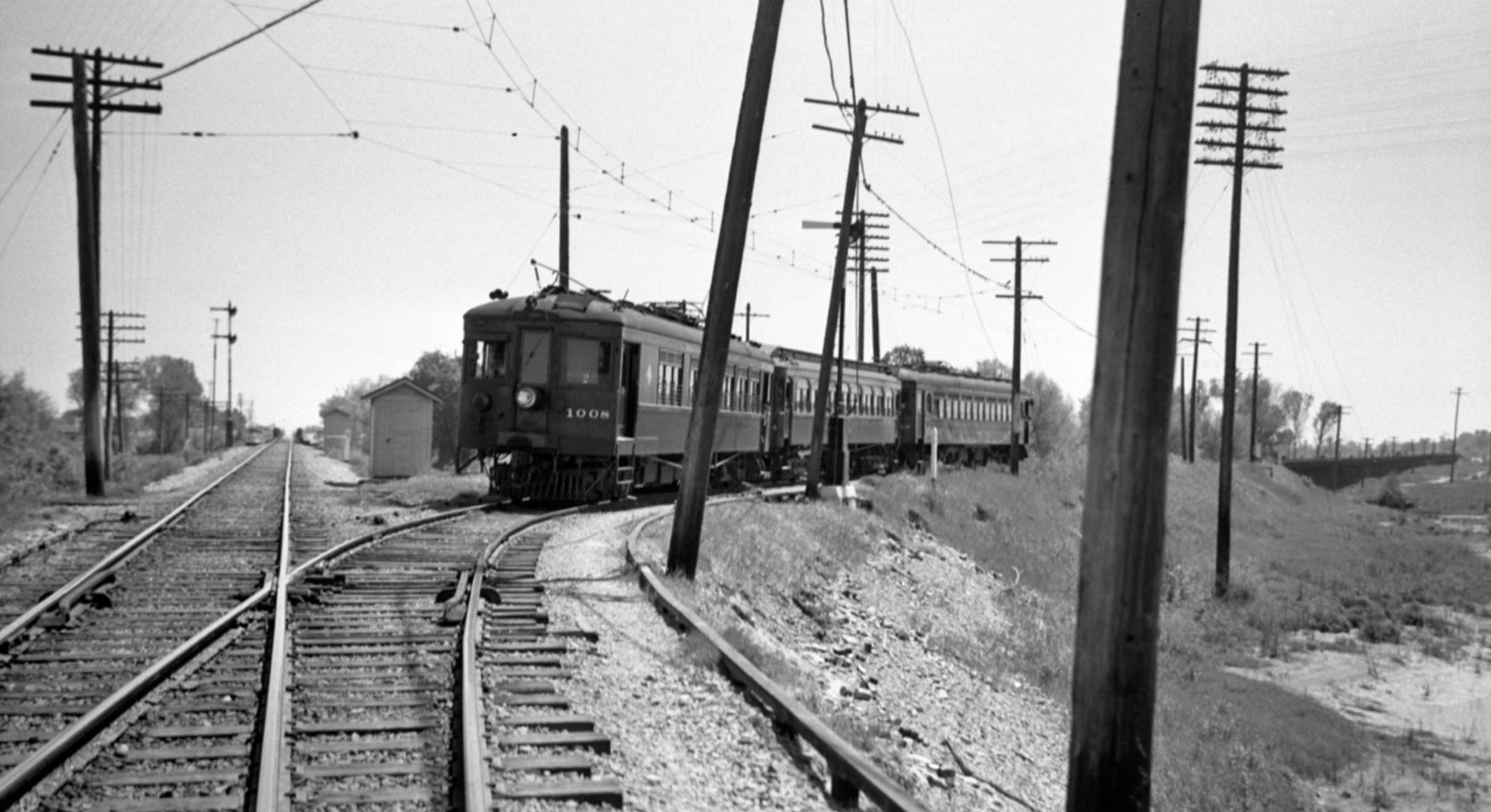
Arriving at the merge with the WP mainline on Apr. 21, 1940, SN 1008 and two trailers await the signal to proceed. The long trestle is seen along the right border of the image in this southwest view.
L313-25-Dudley Thickens Photo, Courtesy BAERA, Western Railway Museum Archives, 60140sn, (Image 5 of 32)
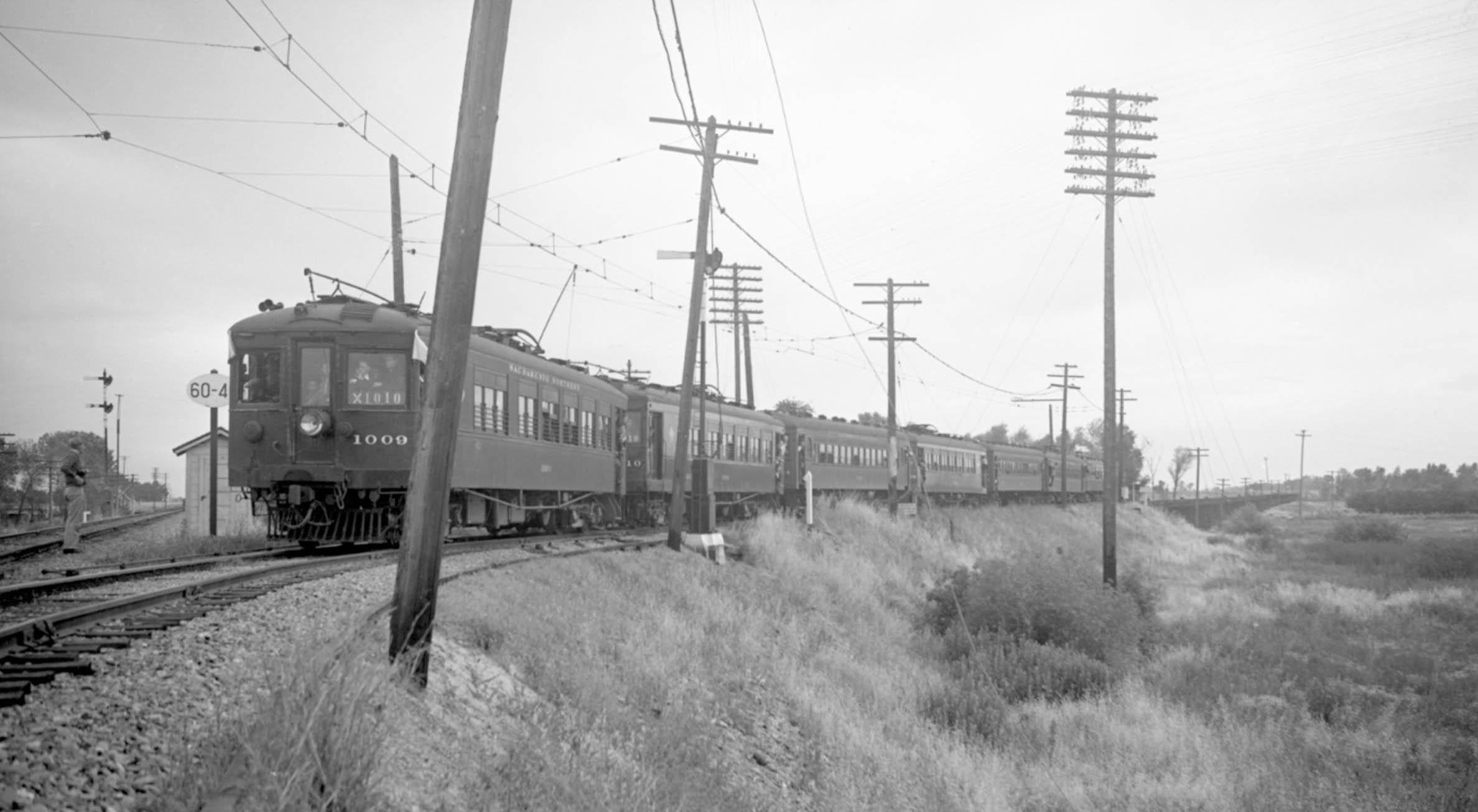
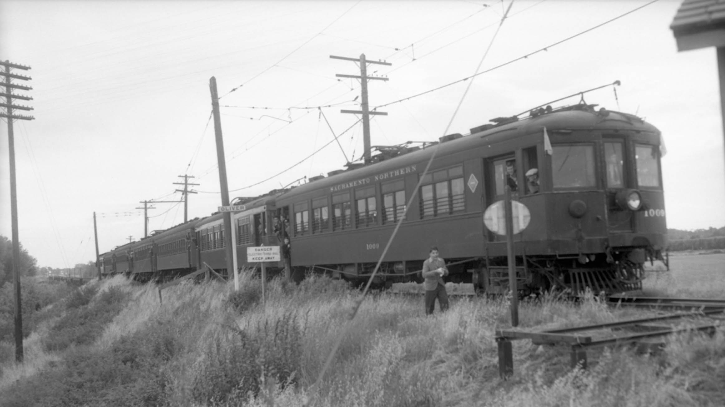
Dudley Thickens was back a year later, May 25, 1941, to get another set of images at the railroad merge and the trestle during the Farewell Excursion to Chico led at this point by SN 1009.
L313-30-Dudley Thickens Photo, Courtesy BAERA, Western Railway Museum Archives, 60284sn, (Image 6 of 32)
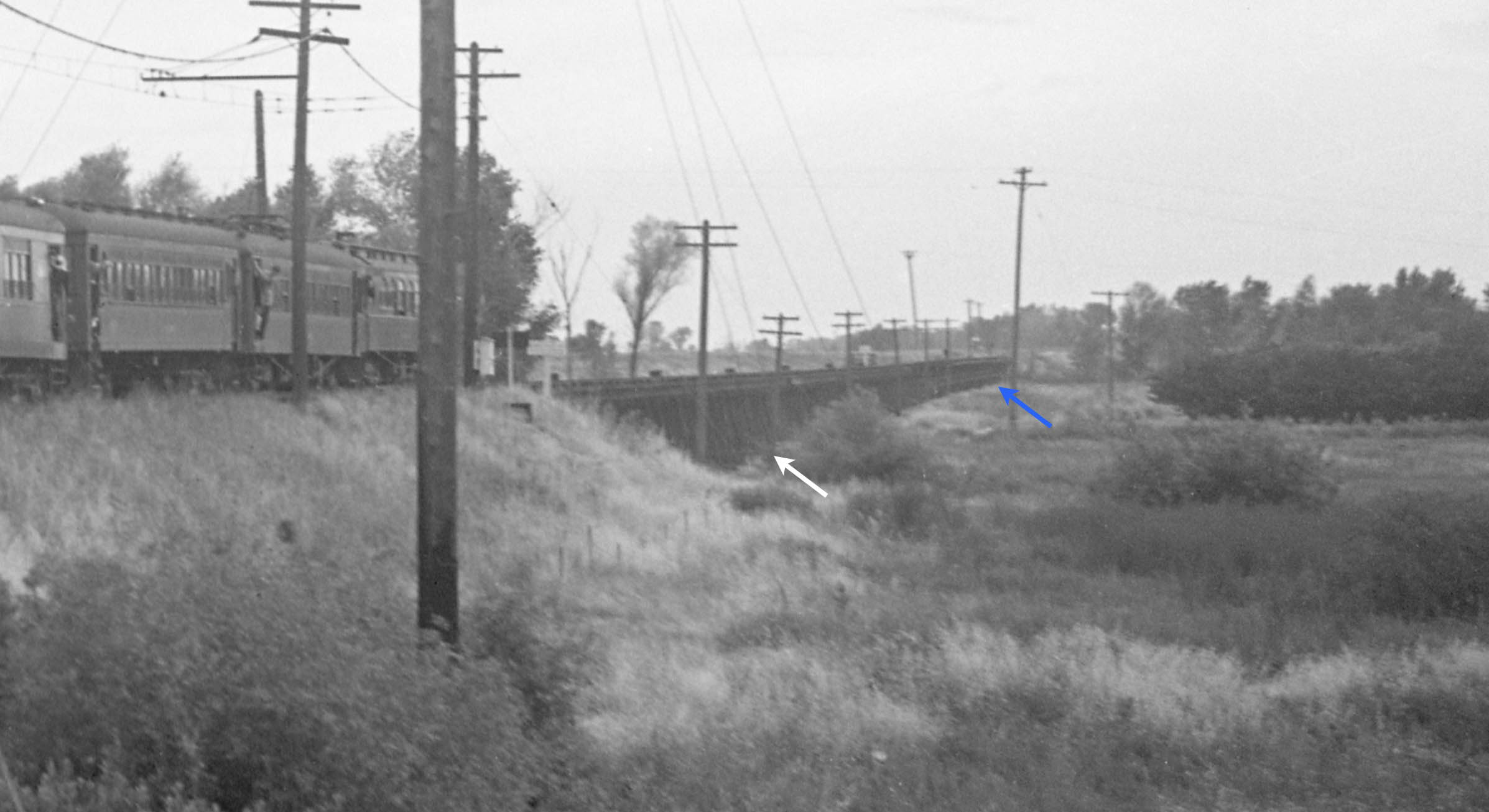
This detail from the previous southeast view from May 25, 1941, distinguishes the northern section of the trestle composed solely of wood, white arrow, versus the southern portion with its reinforced steel girders, blue arrow. The interpretation here is that the portion reinforced by steel was expected to handle the majority of the flow of water when the Yuba River flooded its banks.
L313-35-Dudley Thickens Photo, Courtesy BAERA, Western Railway Museum Archives, 60284sn, (Image 7 of 32)
More of a south view here of the Farewell Excursion train, May 25, 1941, to show the east side of the trestle, and the nominal name given to the railroad merge area, Oliver. Railfan Vernon Sappers is seen walking along the train.
L313-40-Addison Laflin Photo, Courtesy BAERA, Western Railway Museum Archives, 80041sn, (Image 8 of 32)
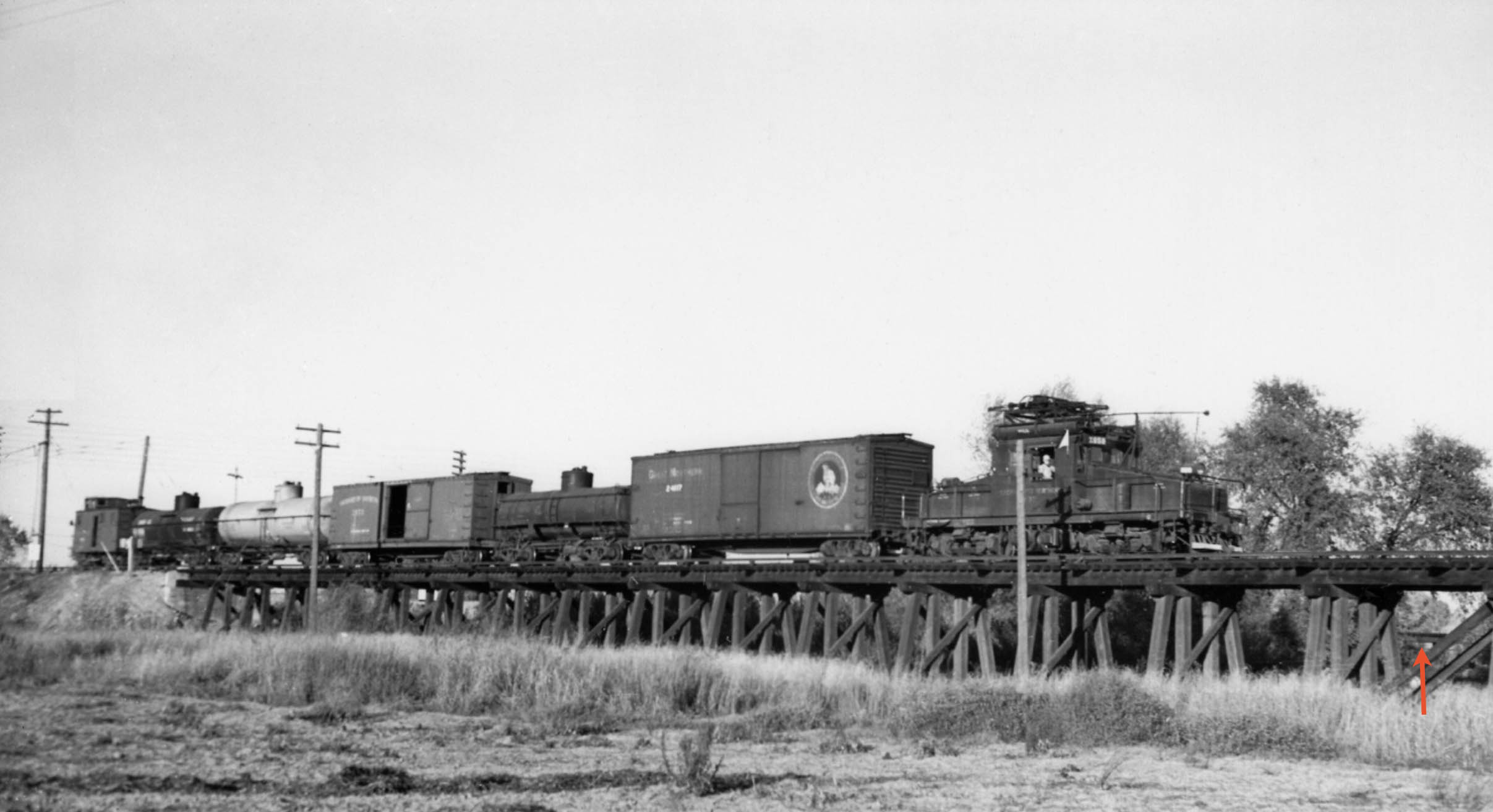
Only one identifiable photo taken from within the reclamation district flood plain was found, Will Whittaker’s southeast view of a SN 651 freight entering the north end of the trestle on Nov. 25, 1938. In addition to the rarity of capturing a freight at this spot during the day, the image verifies the location by including pieces of the converging WP trestle in the background, the red arrow showing one prominent example.
L313-45-Wilbur C. Whittaker Photo, Courtesyy Garth Groff and Arnold Menke, (Image 9 of 32)
Next, to the massive Christmas flood of 1955, two aerials taken on Dec. 24th. Both panels document how Marysville’s levees protected the entire city, and how the levee-deficient Yuba City was under water, east view on the left, west view on the right. The 5th St. Feather River roadway was severed, and the trestle connecting the SN truss bridge to Marysville was swept away.
L313-50-Courtesy California Department of Transportation, 4724-14, l, 4724-12, r, (Image 10 of 32)
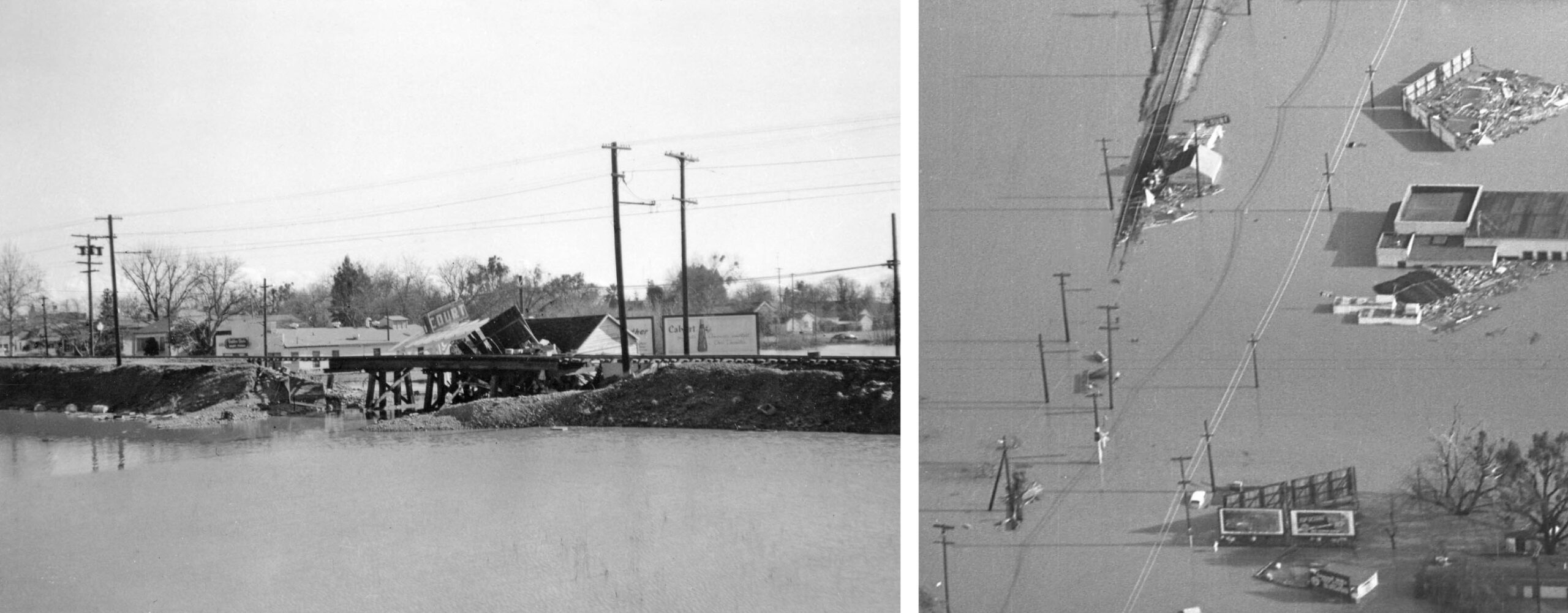
The only significant flood damage within Marysville occurred at the 5th St. roadway and train approach to the bridge, this east view taken from the SN bridge during the aforementioned time period.
L313-55-Courtesy BAERA, Western Railway Museum Archives, 225597sn, (Image 11 of 32)
This southwest view shows the landing spot on the east shore for a large portion of the washed away trestle connecting the SN truss bridge to Marysville.
L313-60-Courtesy BAERA, Western Railway Museum Archives, 225593sn, (Image 12 of 32)
The only major damage to the submerged SN track in Yuba City from the flood was at the “Blue Goose Underpass” as locals called it, but more formally the Gilsizer Creek overpass. The left panel is a ground view toward the southeast, the right panel is an east view of the damaged trestle taken from the aerial on the left in L313-50. Att: Courtesy BAERA, Western Railway Museum Archives, 225596sn, l; Copyright California Department of Transportation, 4724-14, r
L313-65-Multiple Attributions, (Image 13 of 32)
The east view on the left shows the damage caused by the flood to the approach taken by SN freights to the bridge, formerly the place where the freight and street car-interurban tracks merged. The right aerial showing the same area was taken from the the aerial on the left in L313-50. Att: Courtesy BAERA, Western Railway Museum Archives, 225592sn, l; Copyright California Department of Transportation, 4724-14, r
L313-70-Multiple Attributions, (Image 14 of 32)
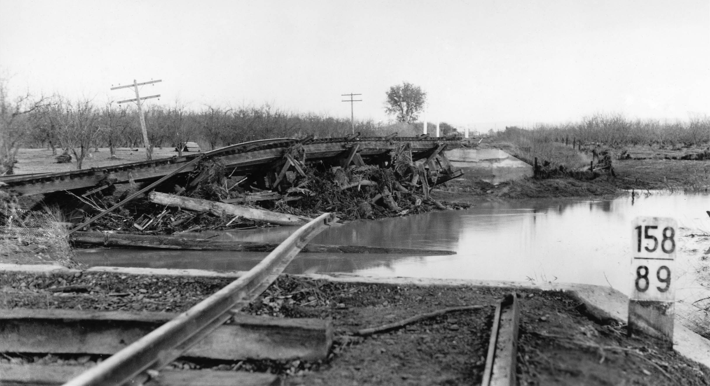
Flood damage had also occurred to the SN and its precursors in 1907, 1928, and 1937. Damage from the 1937 flood to the SN was documented in photos as far north as Chico, as covered in another update, and between Richland, milepost 158.28, and Haselbusch, mile 161.89. The view here is damage to the trestle at milepost 158.89, between East Biggs milepost 159.78 and Richland, milepost 158.28. Aside from the failure to repair the trestle in Oroville, all of the mainline damage was repaired.
L313-75-Courtesy BAERA, Western Railway Museum Archives, 224637sn, (Image 15 of 32)
The image from a print on the left was annotated on the back indicating this was a scene at the Alicia Trestle in 1928. If this be the case, this damage was repaired as well. In an attempt to verify that this image was taken at the trestle of interest, the utility pole pattern was matched versus the images shown previously in this presentation. Those shown so far had similar poles with an extra set of lines running along the top. The pole type in the undated image on the right of SN 654 and freight matches on the trestle matches well with the 1928 flood scene.
L313-80-Courtesy BAERA, Western Railway Museum Archives, 224667sn, l, 168432sn, r, (Image 16 of 32)
Next, two southeast aerial views taken on Dec. 24, 1955 toward the Alicia Trestle and Yuba River train and roadway crossings to examine the extent of damage to structures.
L313-85-Copyright California Department of Transportation, 4724-11, l, 4724-15, r, (Image 17 of 32)
This detail from the previous left aerial from Dec. 24, 1955 shows from top to bottom that the Southern Pacific, SP, trestle, Highway 70, and WP crossings are grossly intact, but that the north end of the Alicia Trestle has been severed, red arrow, eliminating the structure from this point north or to the left to the levee.
L313-90-Copyright California Department of Transportation, 4724-11, Detail, (Image 18 of 32)
To confirm, an additional view more to the south shows that the north end of the Alicia Trestle has been severed to the north or left of the red arrow.
L313-95-Copyright California Department of Transportation, 4724-15, Detail, (Image 19 of 32)
For completeness sake, a more easterly view showing that the three main river crossings that set foot on Marysville were grossly intact.
L313-100-Copyright California Department of Transportation, 4724-15, Detail, (Image 20 of 32)
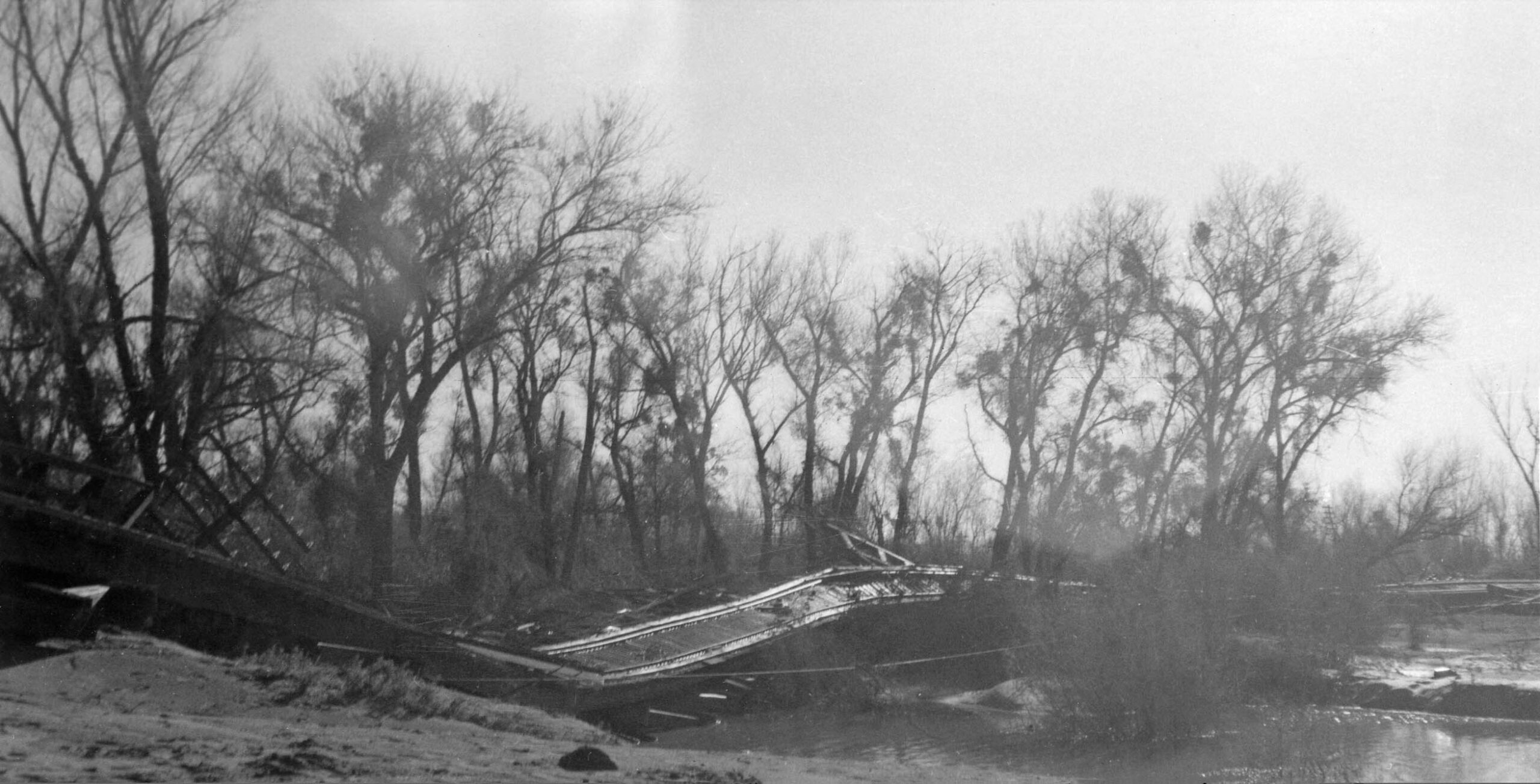
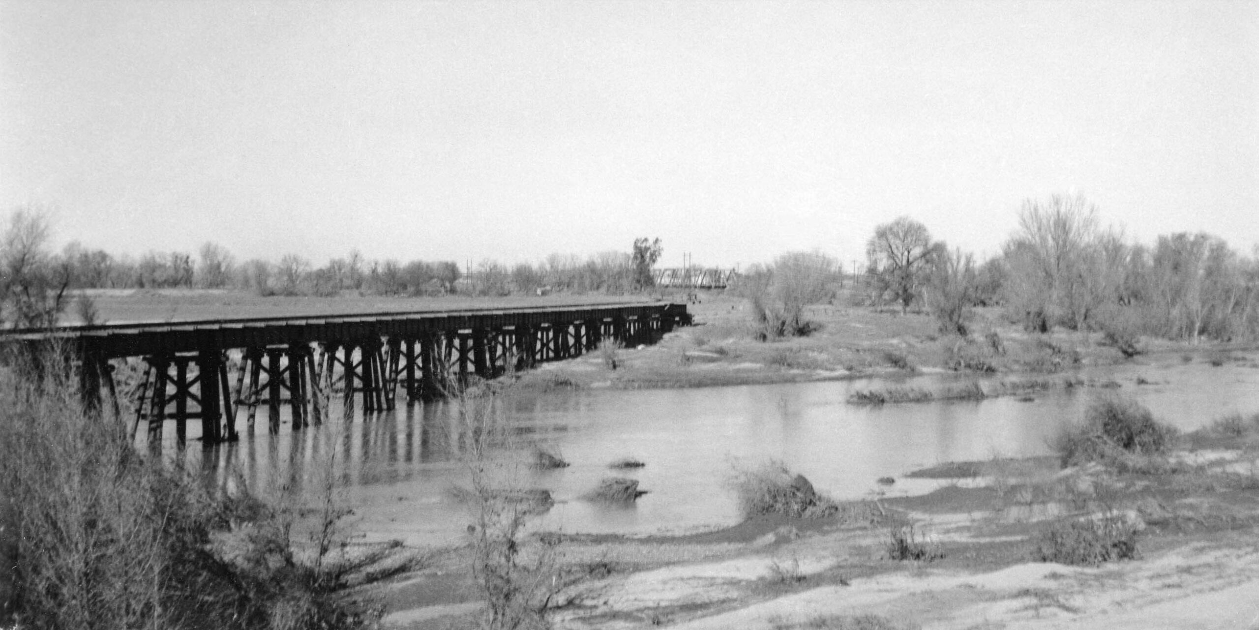
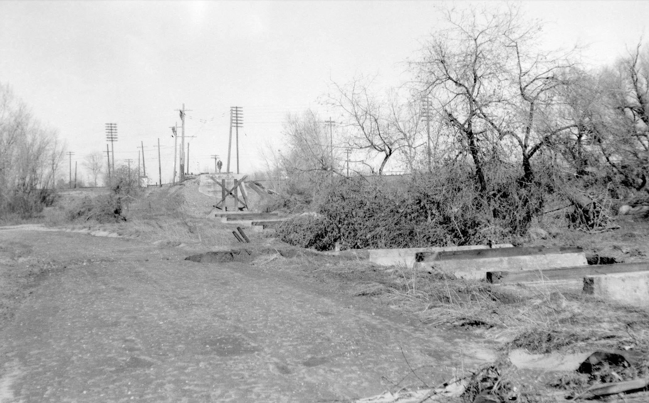
To provide more insight into the destruction of the Alicia Trestle, a few ground images are provided after the flood waters had subsided. This north view shows the girder-reinforced southern end of the trestle remained intact. The WP truss bridge to Marysville that the SN also used is seen in the distance.
L313-105-Courtesy BAERA, Western Railway Museum Archives, 222585sn, (Image 21 of 32)
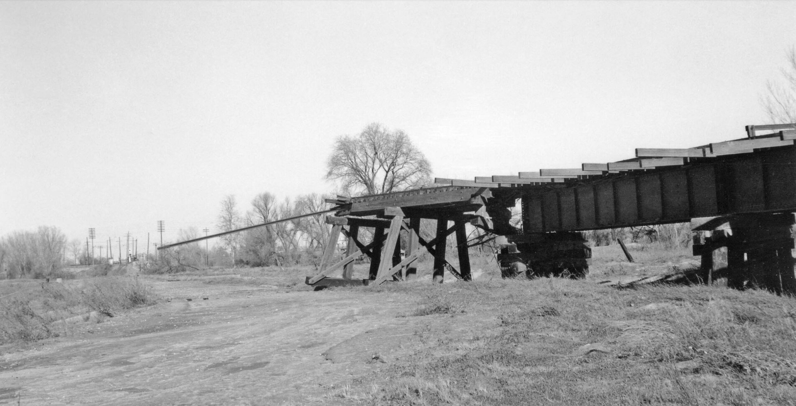
This northeast view shows that the trestle was ripped from its supports just past the section reinforced by the steel girders.
L313-110-Courtesy BAERA, Western Railway Museum Archives, 225586sn, (Image 22 of 32)
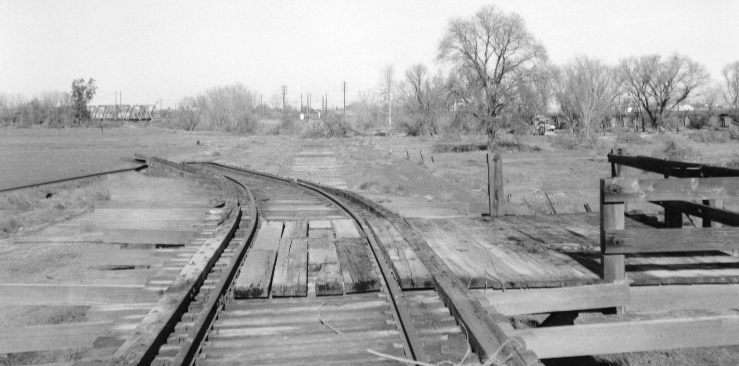
A north view from atop the trestle shows that the concrete footings for the missing portion remained.
L313-115-Courtesy BAERA, Western Railway Museum Archives, 225591sn, (Image 23 of 32)
Another northeast view, this time taken toward the abutment with the levee where the observer is standing.
L313-120-Courtesy BAERA, Western Railway Museum Archives, 225590sn, (Image 24 of 32)
Next, ahead to Mar. 7, 1958, two aerial views toward the southwest, left, and south, right, will be explored in more detail. The Highway 70 bridge seen here survived the flood, but it was decided that an improvement in auto traffic flow was needed, so a bridge twice the width that emptied onto E. St. was in the works. This would also eliminate the SN-WP grade crossing for its Yuba River freight spur, now viewed as a hazard as it was crossed by all the vehicles crossing the bridge to access D St.
L313-125-Copyright California Department of Transportation, 5886-1, l, 5886-2, (Image 25 of 32)
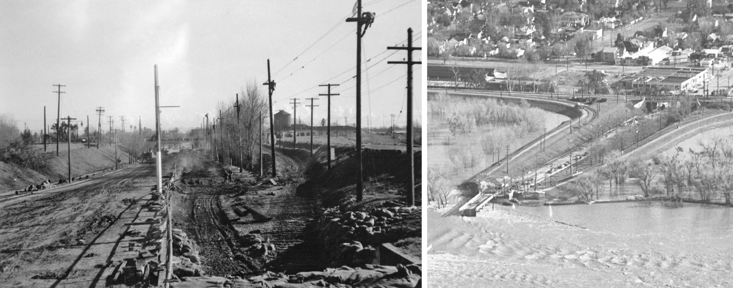
The first southwest view detail from Mar. 7, 1958 shows that the SN Alicia Trestle and any sign of track south of the takeoff point from the levee are absent. Note the largely excavated sand pits on either side of Highway 70. Recall that Yuba River Sand Co. sat on the north bank of the river, a WP customer serviced by SN freight motors at the time this image was taken.
L313-130-Copyright California Department of Transportation, 5886-1, Detail, (Image 26 of 32)
The more southerly detail from Mar. 7, 1958 shows the spot where the Alicia Trestle had its beginnings from the levee on the southern end, yellow arrow, and the northern end, turquoise arrow. Note that to the south, the SN track supported by the levee toward Alicia is absent as well based on a corporate decision and not flood damage. This will be addressed in the next update. By this time, the SN crossing over the Feather River and all other damages due to the 1955 flood had been repaired, the bridge having been reopened on Sept. 6, 1956.
L313-135-Copyright California Department of Transportation, 5886-2, Detail, (Image 27 of 32)
Unfinished business from this location has to do with the original Northern Electric, NE, line that went across the WP mainline and had its own bridge into Marysville until 1925. Of note are whether there were any remnants of the original NE Bridge or the spur north of the crossing to a sandpit down by the river that Bill Meeker and Jeff Asay ascertained to have lasted until 1932. A detail from the previous image shows a large sand pit and stone remnants on the banks of the river, orange arrows. Which ones are of significance?
L313-140-Copyright California Department of Transportation , 5886-2, Detail, (Image 28 of 32)
Two more aerials to address the above questions, the left panel from 1941 oriented to the north, and the right panel from 1960 with a south view. The one on the right shows the new Highway 70 bridge over the Yuba River to E St. that provided an overpass over the SN-WP right spur. It replaced the former bridge that connected to D St., the remains of which are present. This eliminated the hazardous SN-WP grade crossing. Att: c-7490_462, Courtesy of UCSB Library Geospatial Collection, l, Copyright California Department of Transportation, 7609-2, r
L313-145-Multiple Attrbutions, (Image 29 of 32)
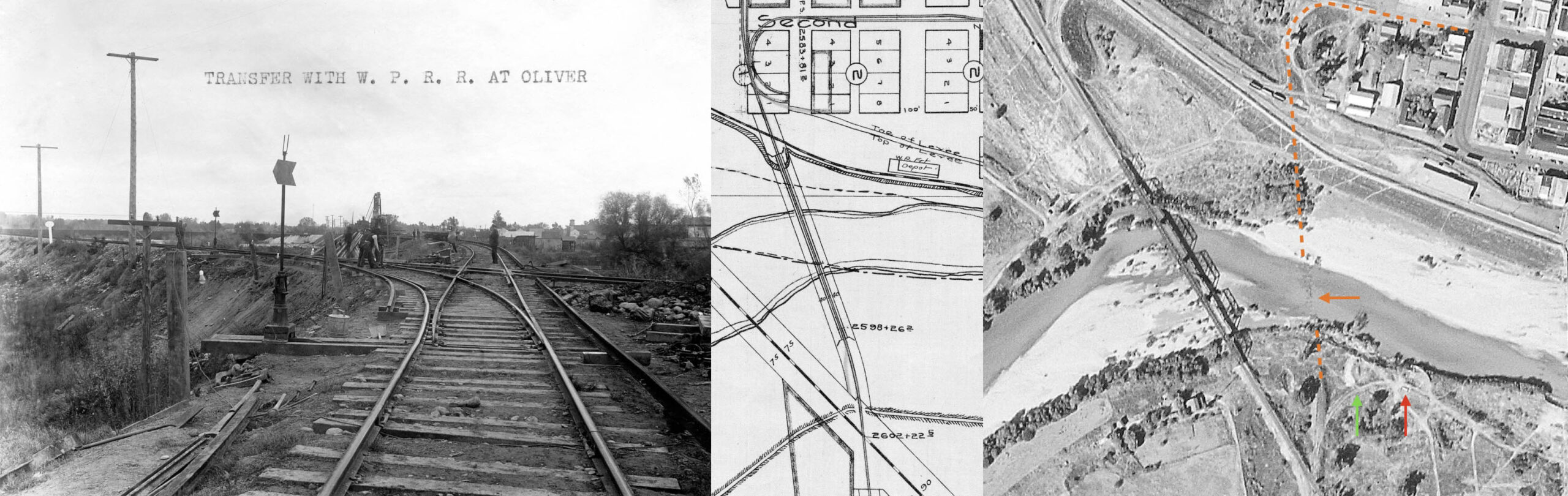
The image of the SN-WP crossing from 1909, left, a map of the crossing and Yuba River SN bridge in 1909, center, and the 1941 map, right, reveal that the mainline of the NE, broken orange line, can be drawn using the remnants of the bridge in the river, orange arrow, to match what is shown in the 1909 map. The outline the path for the spur, green arrow, and possibly a small structure, red arrow, can also be appreciated. Att: Courtesy BAERA, Western Railway Museum, 224631sn, l, 64585, c; c-7490_462, Courtesy of UCSB Library Geospatial Collection, r
L313-150-Multiple Attrbutions, (Image 30 of 32)
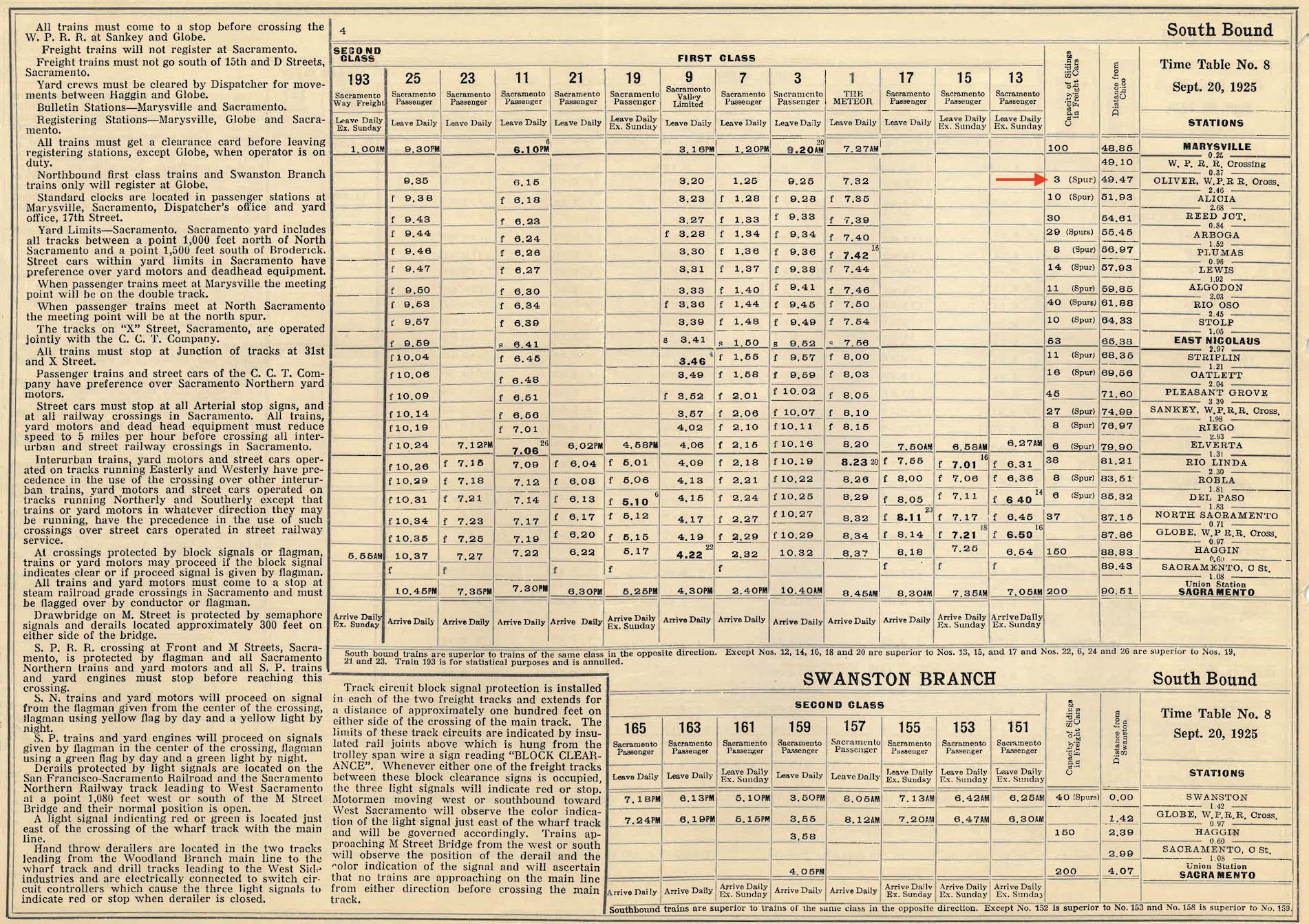
Regarding the sandpit, Sacramento Northern time table no. 8 from Sept 20, 1925 indicates it had a capacity of 3 freight cars, red arrow.
L313-155-Courtesy BAERA, Western Railway Museum Archives, 13454sn, (Image 31 of 32)
The detail from the aerial from 1960, left, provides a south view of the river when the water level was low, revealing the NE bridge remnants, in detail on the right. Appreciation to Bill Meeker and Jeff Asay for supplying unpublished research about the sand pit spur. Next time, what actions, if any, were taken by the WP to compensate for the loss of the Alicia Trestle and the track along the levee to Alicia.
L313-160-Copyright California Department of Transportation, 7609-2, (Image 32 of 32)