Shafter Avenue Architecture III- East Intersection with College
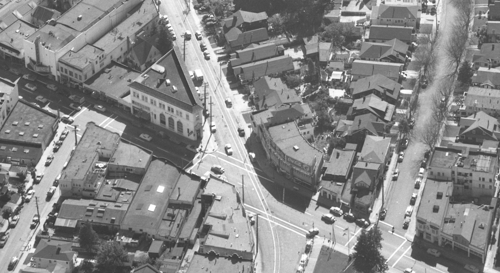
This west-oriented aerial from Apr. 8, 1953 shows the SN rails curving to the east as they compete crossing College Ave. at the lower edge, center. From this angle, only the rear of the buildings between Keith and Shafter Aves. may be appreciated.
L11-02-Copyright California Department of Transportation, 3301-16, Detail, (Image 1 of 20)

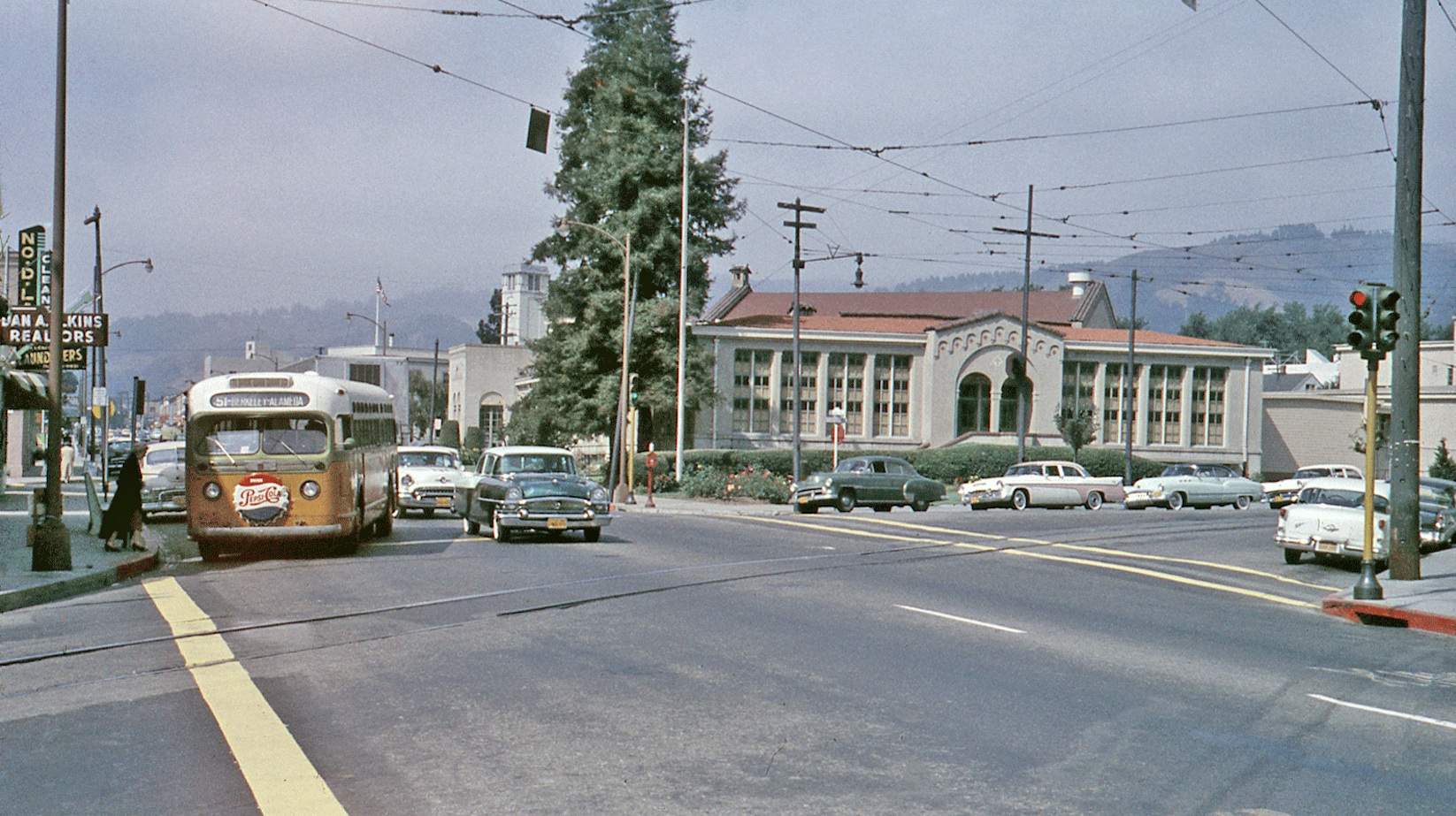
On the ground on Aug. 30, 1956, this north view from Shafter Ave. up College Ave. reveals the major component on the northeast intersection, Claremont Middle School. The 51 bus heading to Alameda is stopping on the west side, between Shafter and Miles Aves. All the buildings on this block were razed in the mid-1960s for Highway 24 and BART.
L11-05-Key-System Photo, Courtesy John Harder, (Image 2 of 20)
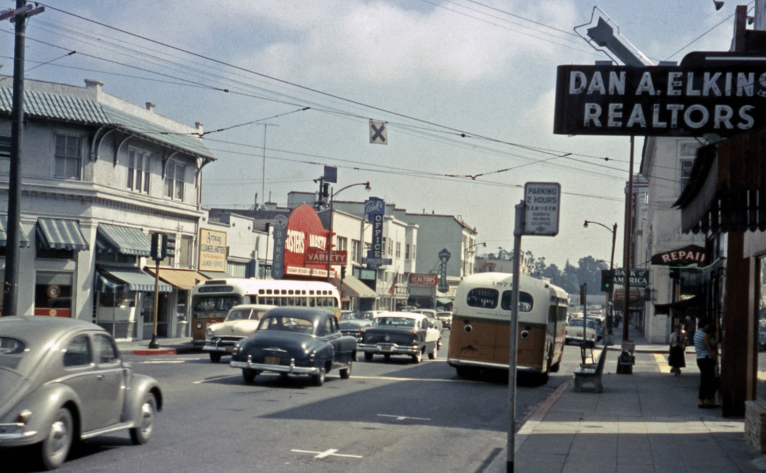
From this south view, also from Aug. 30, 1956, the east side of College Ave. between Shafter Ave. and Keith Ave. is highlighted. This block was also cleared, the Chimes Market marquee in the distance the first structure to survive, today as Cactus Taqueria. Everything seen along the right edge or west side of College Ave. up to and including the Chimes Theater was razed as well.
L11-10-Key-System Photo, Courtesy John Harder , (Image 3 of 20)
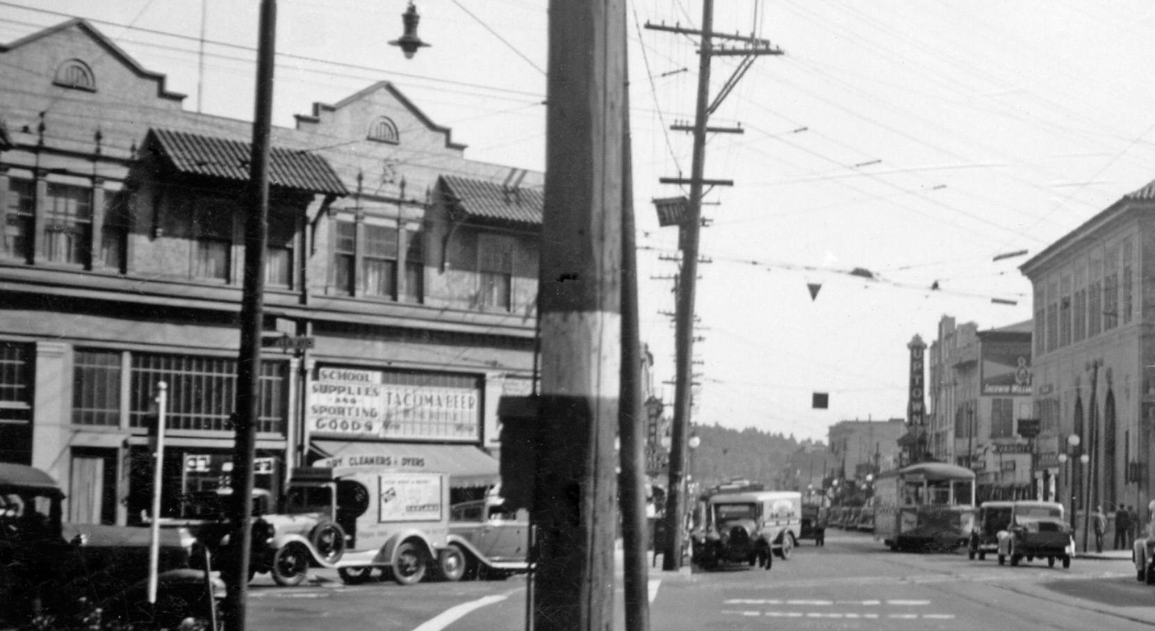
A similar view, this time the 1930s, a south view down College Avenue highlights the southeast corner of the Shafter Ave. with College Ave. This scene approximates the northern border of the westbound lanes of the present highway.
L11-15-Courtesy BAERA, Western Railway Museum Archive, 51709sn, Detail , (Image 4 of 20)
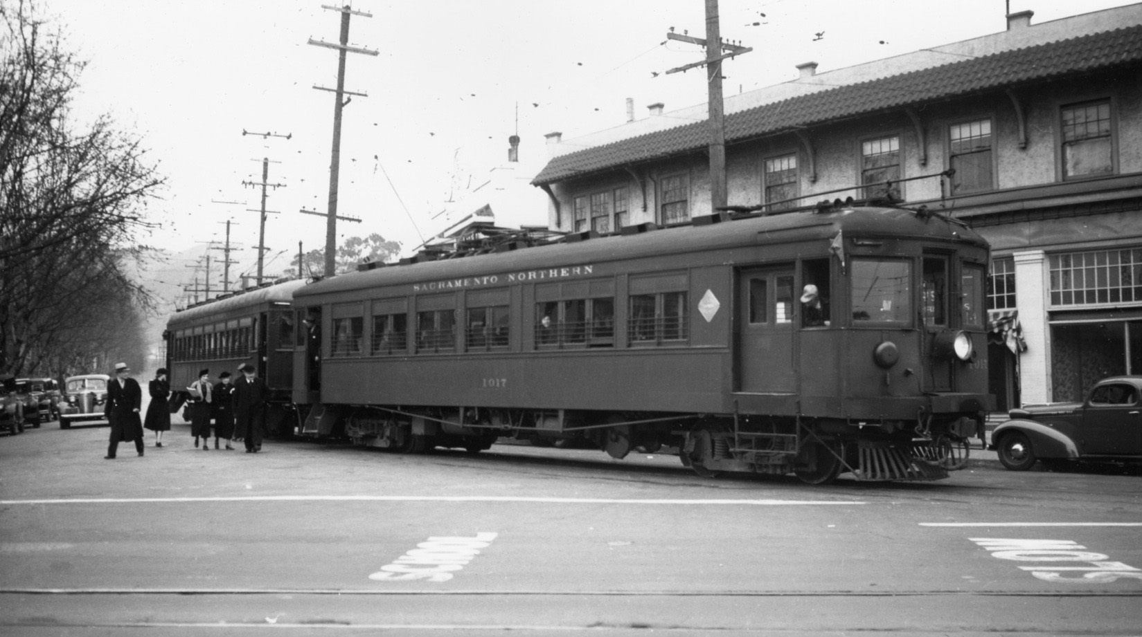
As passengers depart from a two-car train led by SN 1017, this northeast view from Jan. 30, 1938 provides the architectural features of the facade away from the southeast corner prior to WWII.
L11-20-Wilbur C. Whittaker Photo, Courtesy Arnold Menke and Garth Groff , (Image 5 of 20)
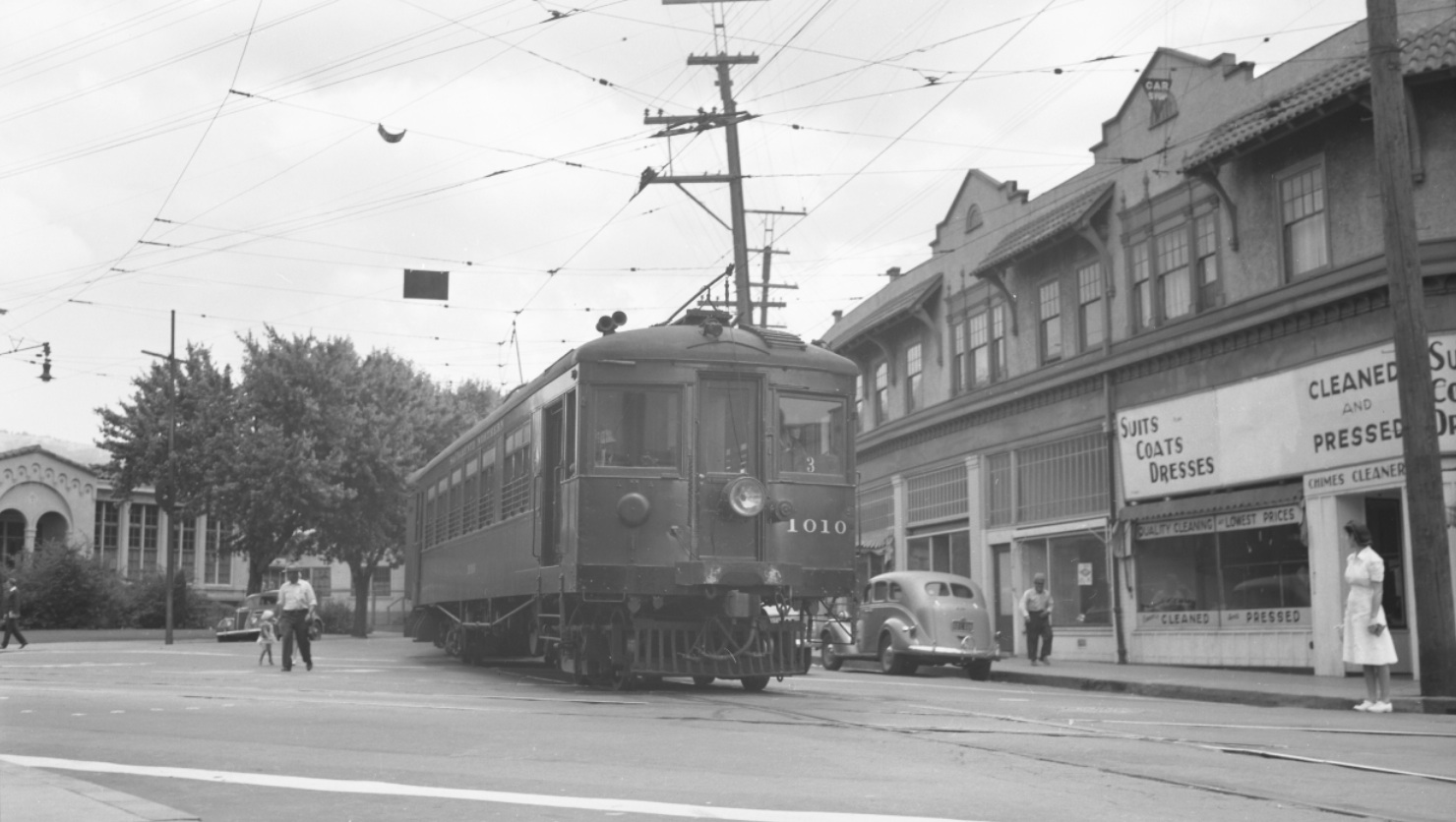
More toward the intersection, further details of the facade, the empty storefronts and the Chimes Cleaners at the corner. Northeast view with SN 1010, June 26, 1941.
L11-25-Richard Jenevein Photo, Courtesy BAERA, Western Railway Museum Archive 13129sn , (Image 6 of 20)
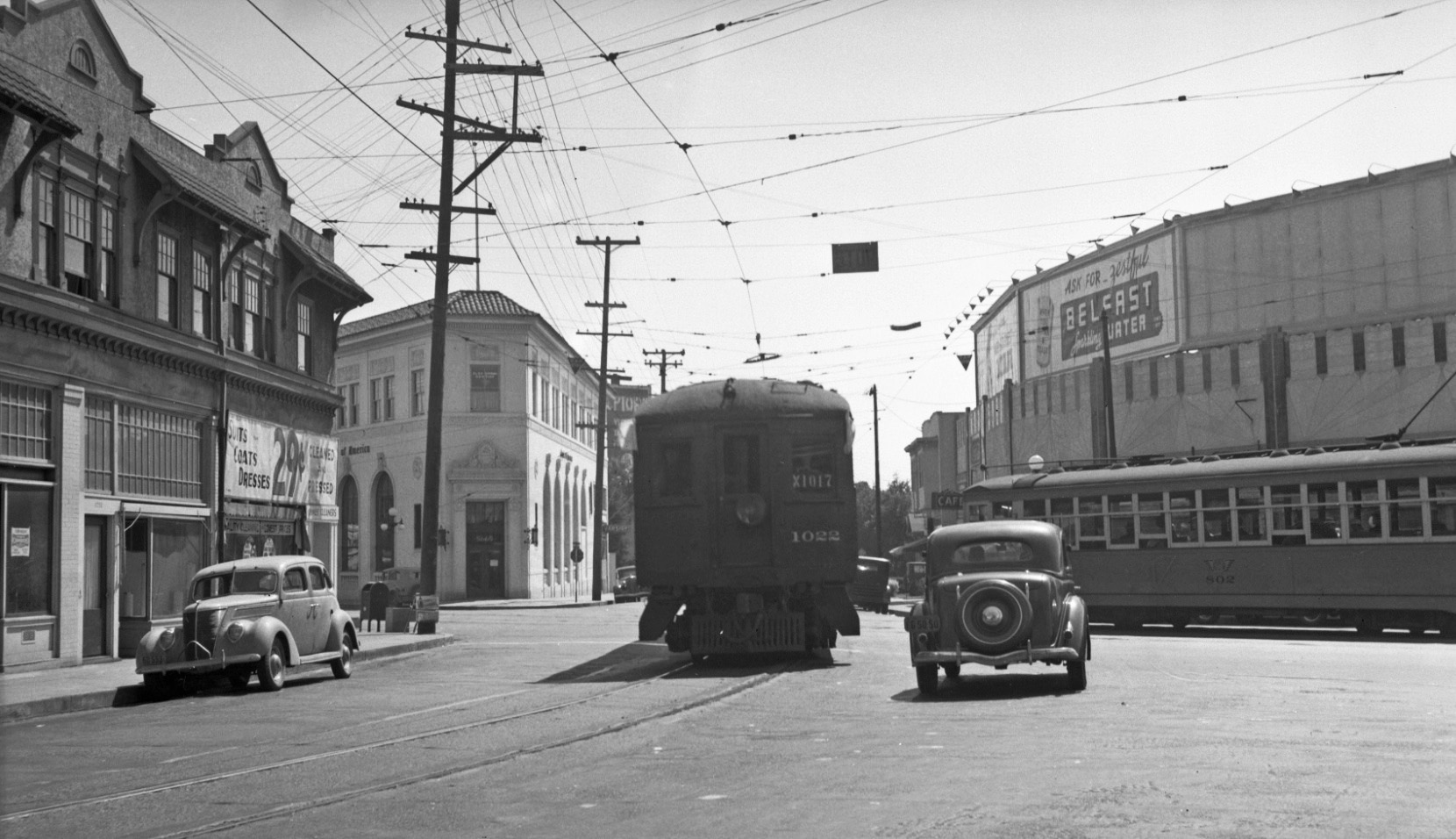
A better view of the end of the corner from a southwest perspective. Key streetcar 6-line car 802 waits for the interurban with SN 1022 and SN 1017 to clear College Ave. Southwest view, Aug. 3, 1940.
L11-30-George Henderson Photo, Wurm Coll., Courtesy BAERA, W. Railway Museum Arch., 33419sn, (Image 7 of 20)
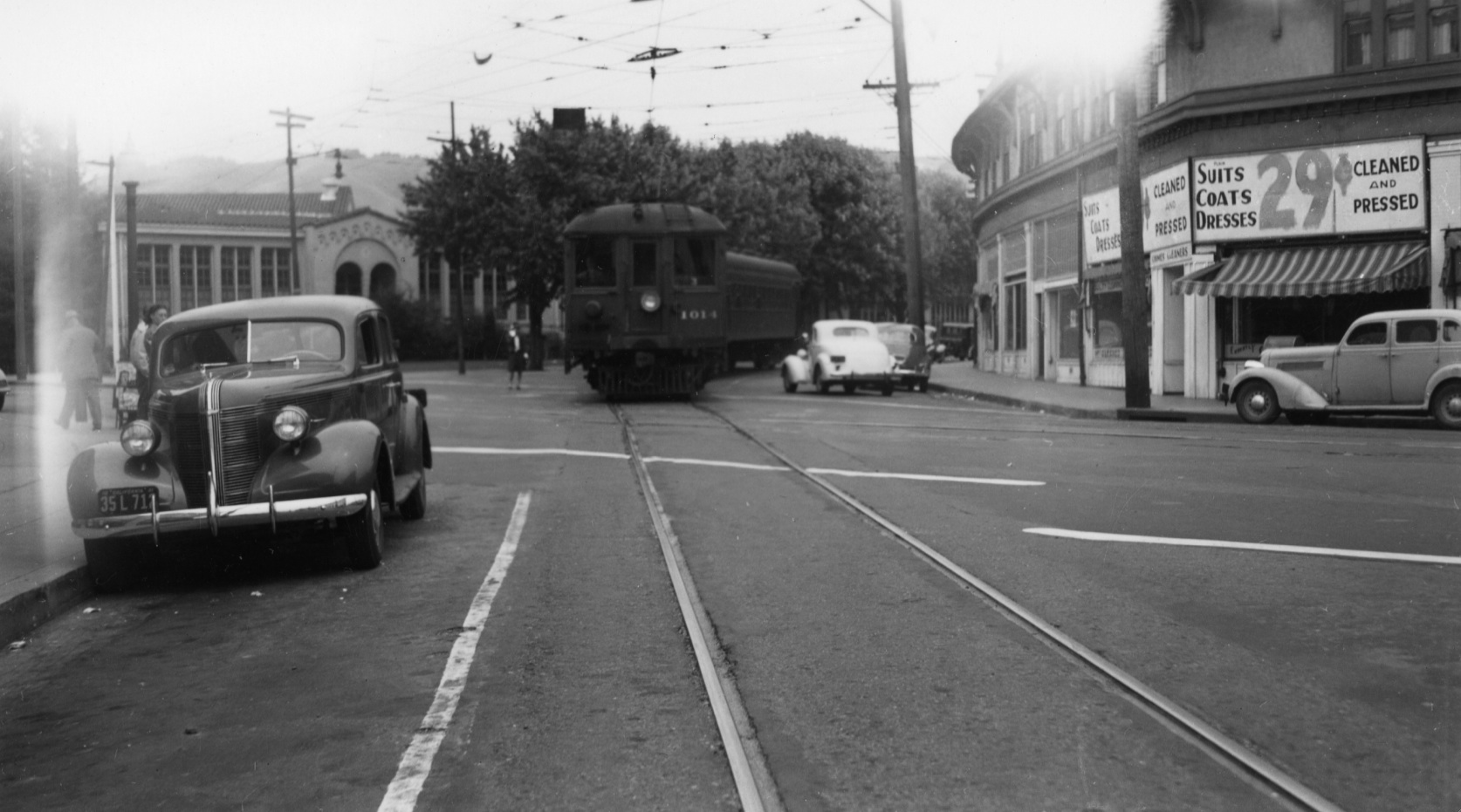
Finally at the southeast corner, and the price for cleaning a shirt is right! Northeast view, circa 1940, with SN 1014 leading a two-car train.
L11-35-Paul Smith Photo, Courtesy BAERA, Western Railway Museum Archive, 53219sn , (Image 8 of 20)
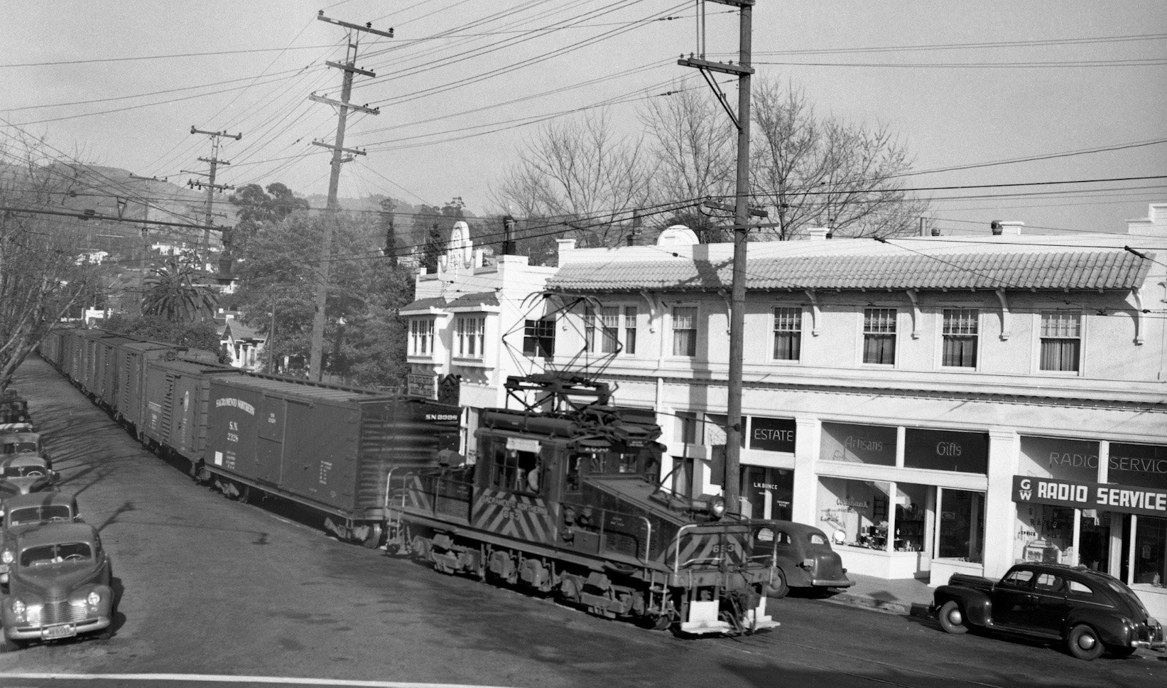
Ahead to 1950, this east view of SN 653 and freight was probably taken from a building on the west side of College Ave. No other images of the furthest east commercial storefront could be found, and in this image only “Rock Ridge” can be made out from the sign.
L11-40-Don Olsen Photo, Moreau Coll., W. Railway Museum Arch., 93162sn, (Image 9 of 20)
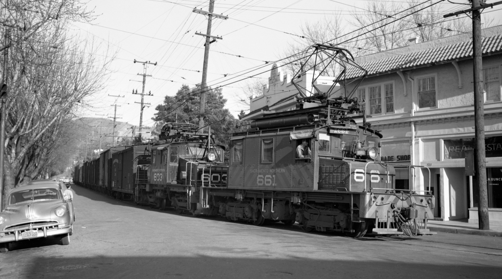
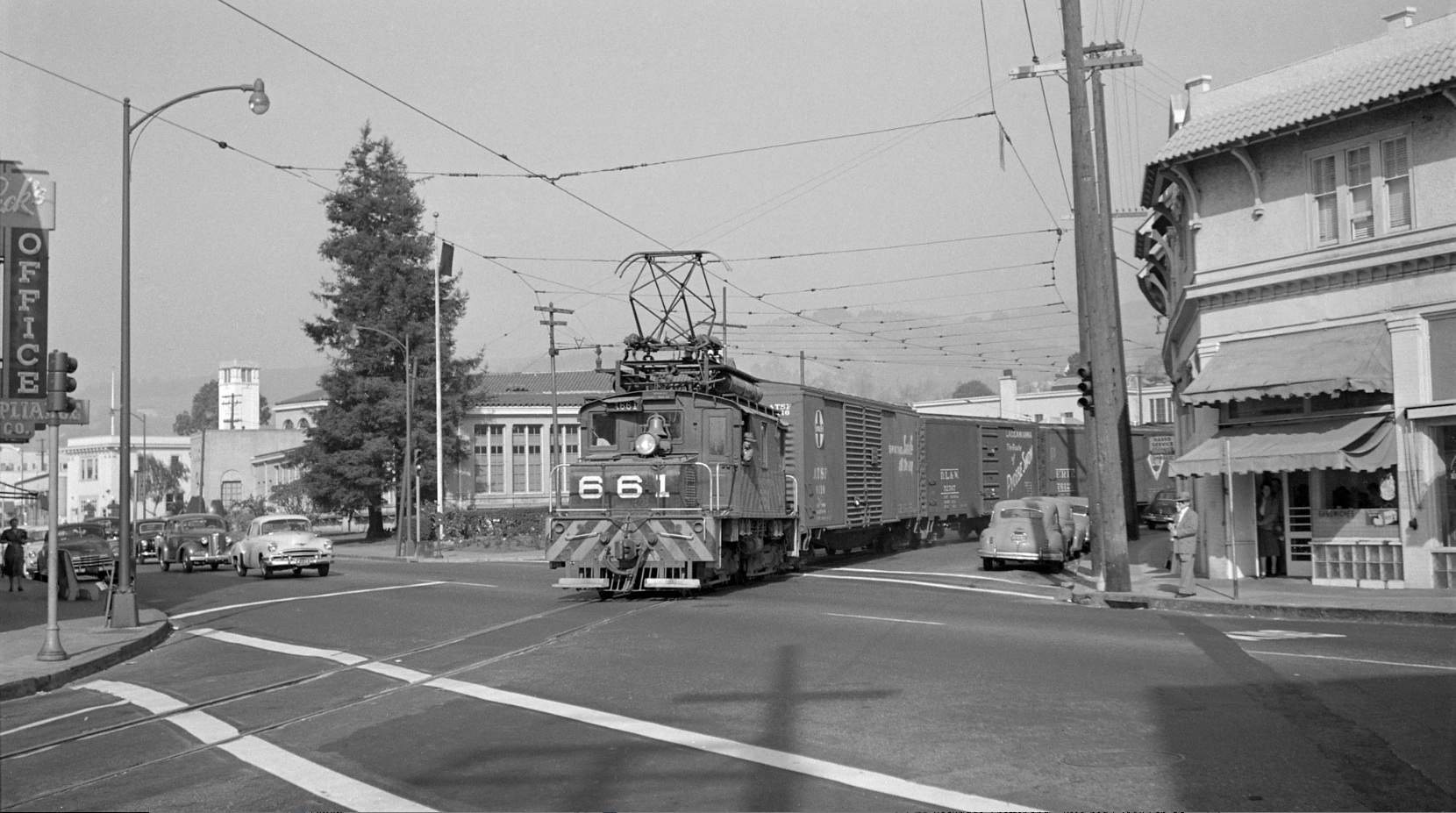
Back on the ground, this east view circa 1950 captures part of the sign on the east edge of the larger building, “Shade Shop” as SN 661 and SN 603 roll by.
L11-45-Walt Vielbaum Photo, Courtesy BAERA, Western Railway Museum Archives, 133091sn, (Image 10 of 20)
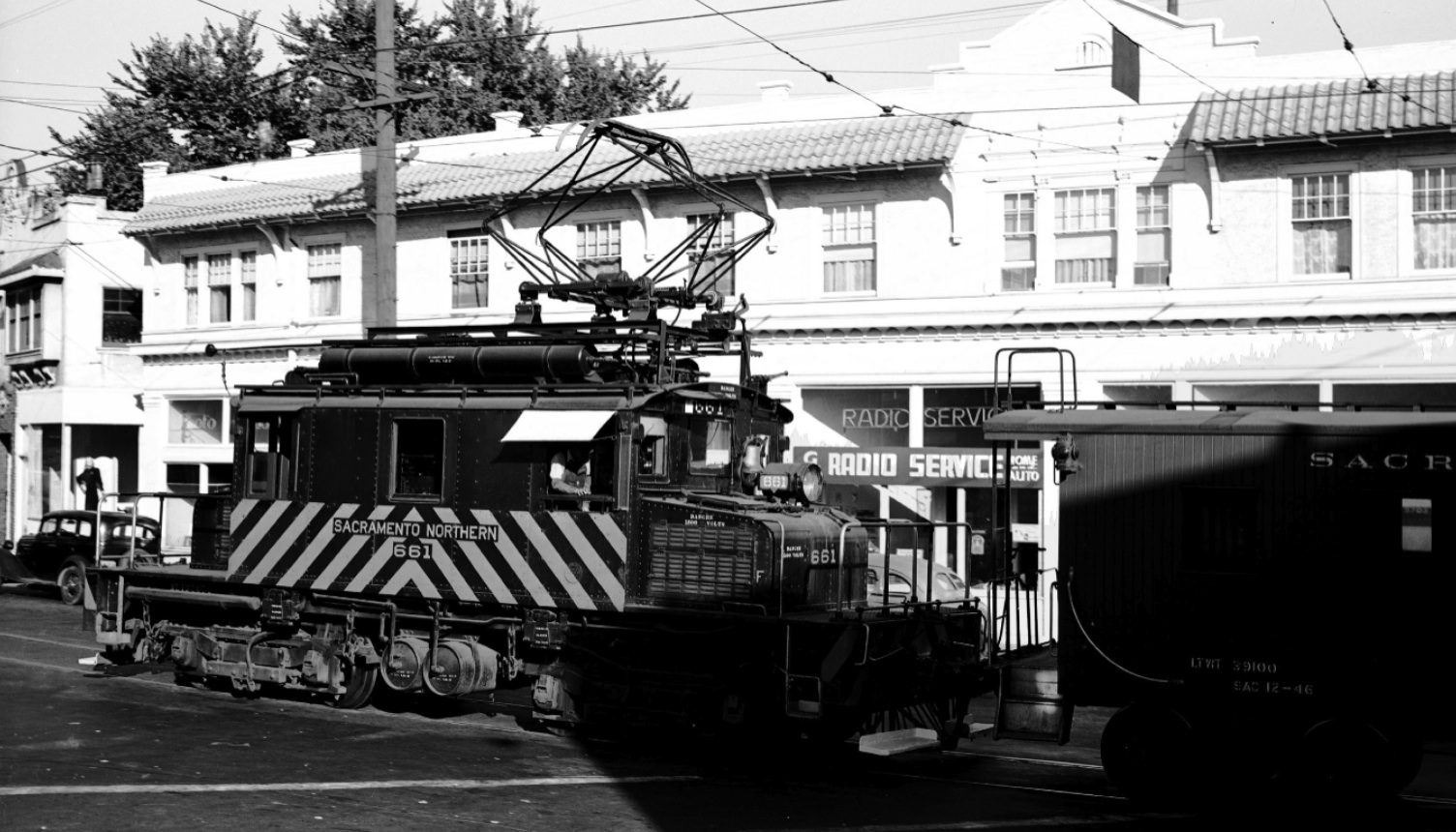
This east view from 1948 shows SN 661’s new strips. Better luck looking at the storefronts by waiting for the rear motor to pass. A dress shop occupying the west storefront of the eastern-most detached structure, the Photo Shop, and the Radio Services are featured.
L11-50-Wiliiam T. Larkins Photo, Courtesy William T. Larkins , (Image 11 of 20)
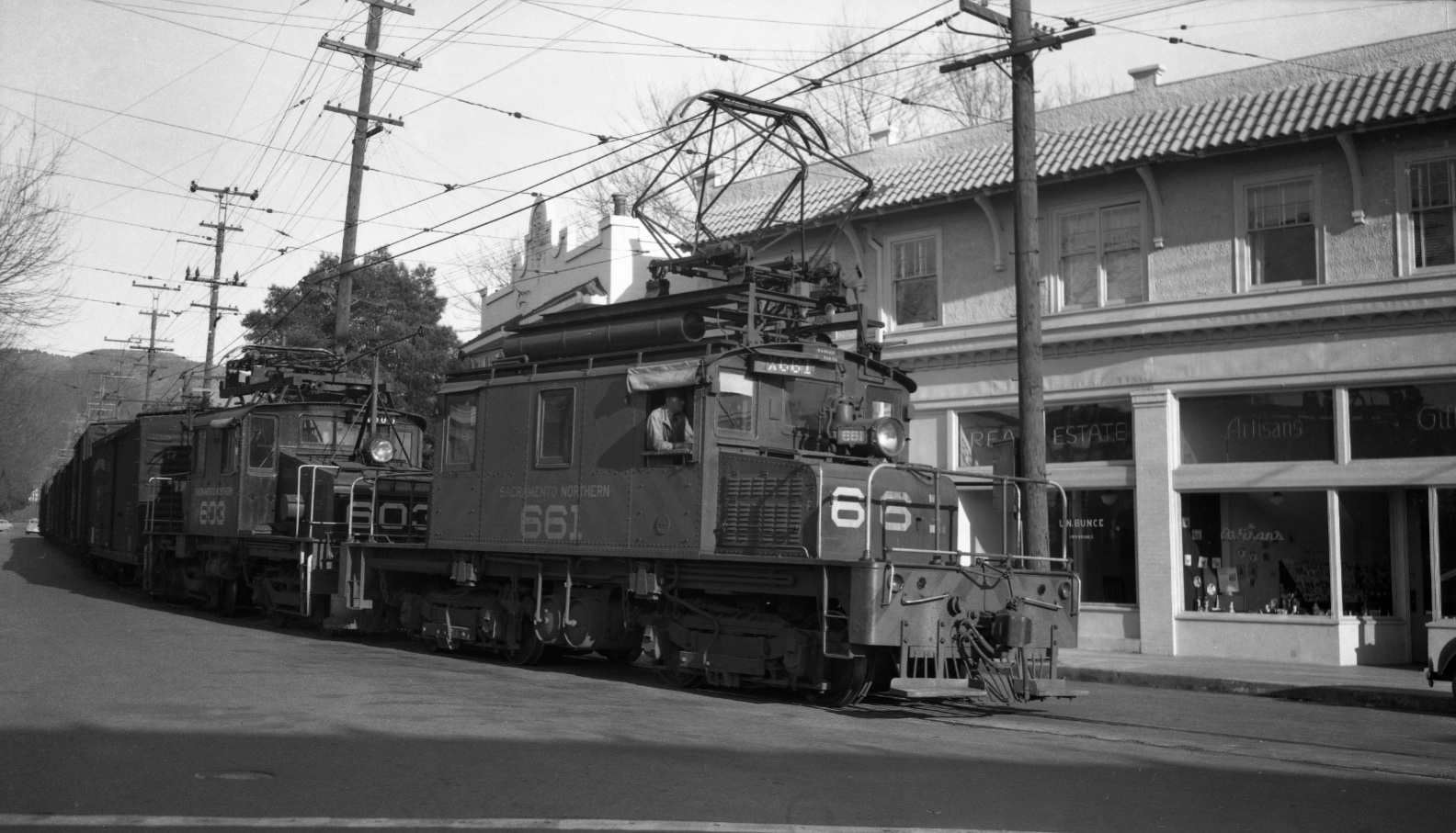
Ahead to Feb. 2, 1950, L.N. Bunce Insurance and Real Estate and the Artisans Gift Shop fill in the storefronts obstructed in the previous images. The window to the right of the telephone pole has been modified as has the exterior of SN 661 with its enlarged numerals, joined here with SN 603.
L11-55-Tom Gray Photo, Courtesy Tom Gray , (Image 12 of 20)
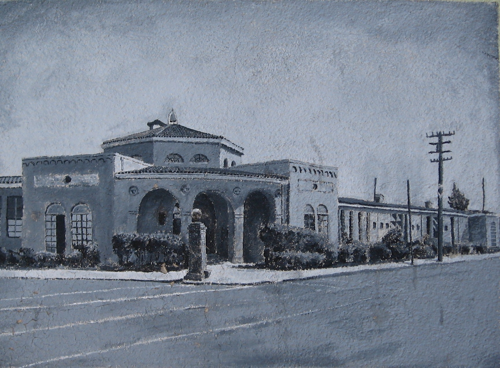
Claremont Middle School opened in 1913, initially serving both elementary and middle school functions. The painting along College Ave. shows the former main entrance on Birch Ct. The gate barely visible in the painting has just been restored close to its original location.
L11-65-Stuart Swiedler Photo, (Image 13 of 20)
N 661 brings us past Radio Services to the corner in this northeast view from Nov. 1952. The unmarked business is selling sandwiches, no longer the Chimes Cleaners from a decade before. Once the train has passed, the crosswalk will lead to the northeast corner and Claremont Middle School.
L11-60-Norman Smith Photo, Courtesy BAERA, Western Railway Museum Archives, 161833sn, (Image 14 of 20)
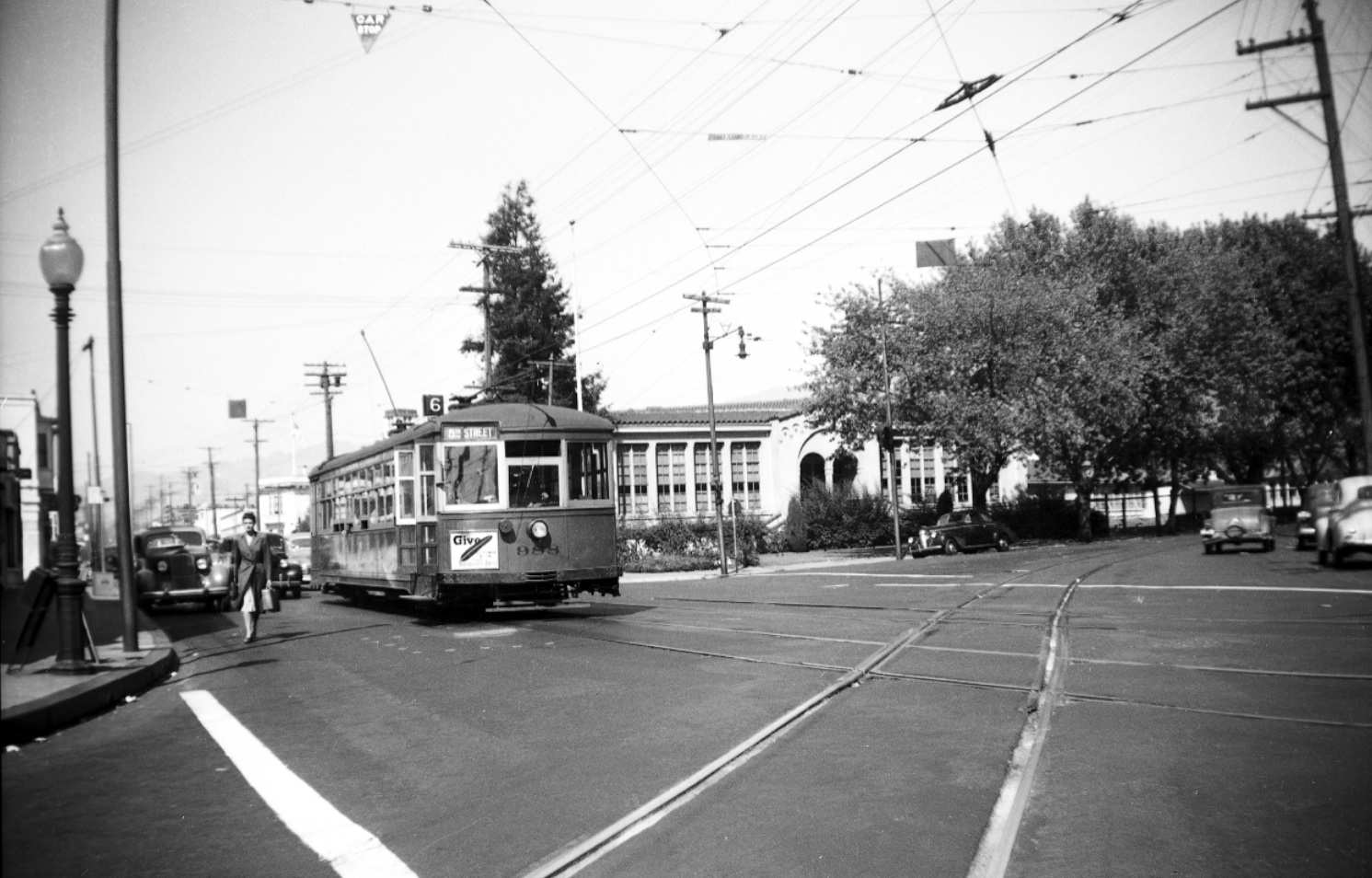
A north view up College Ave. circa 1940 with Key System streetcar 988 shows the Shafter Ave. side of the Claremont Middle School campus. The large numbers of trees along the school on Shafter will turn out to be a very important marker for dating images from this area.
L11-70-Courtesy BAERA, Western Railway Museum Archive, 52964key , (Image 15 of 20)
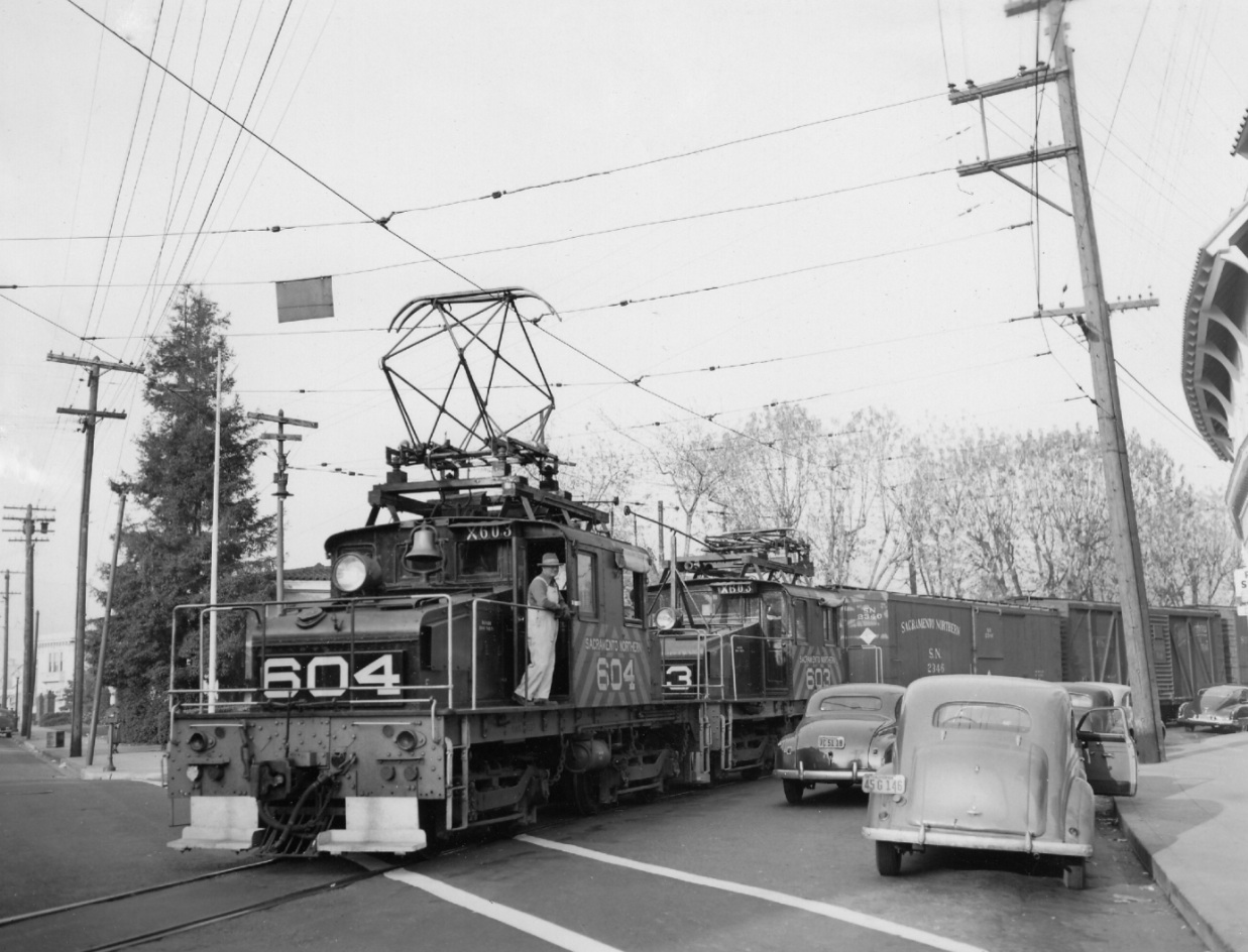
Another north view up College Avenue Nov. 19, 1949 with SN 604 and 603. The trees along the school are still present, this time without leaves.
L11-75-Alvon J. Thoman Photo, Courtesy BAERA, Western Railway Museum Archive, 7263sn, (Image 16 of 20)
Northeast view, again from July 8, 1956. Note the change to the appearance and ownership of the real estate office versus L11-55, as well as Chimes TV replacing Artisans Gifts. The large trees along the school have been replaced, estimates from other images suggest sometime after Apr. 1950. Eddie Hansen takes a break from conducting duties.
L11-80-Arthur Lloyd Photo, Courtesy Arthur Lloyd, (Image 17 of 20)
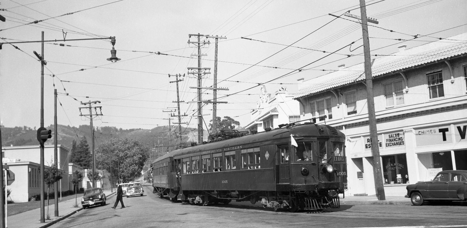
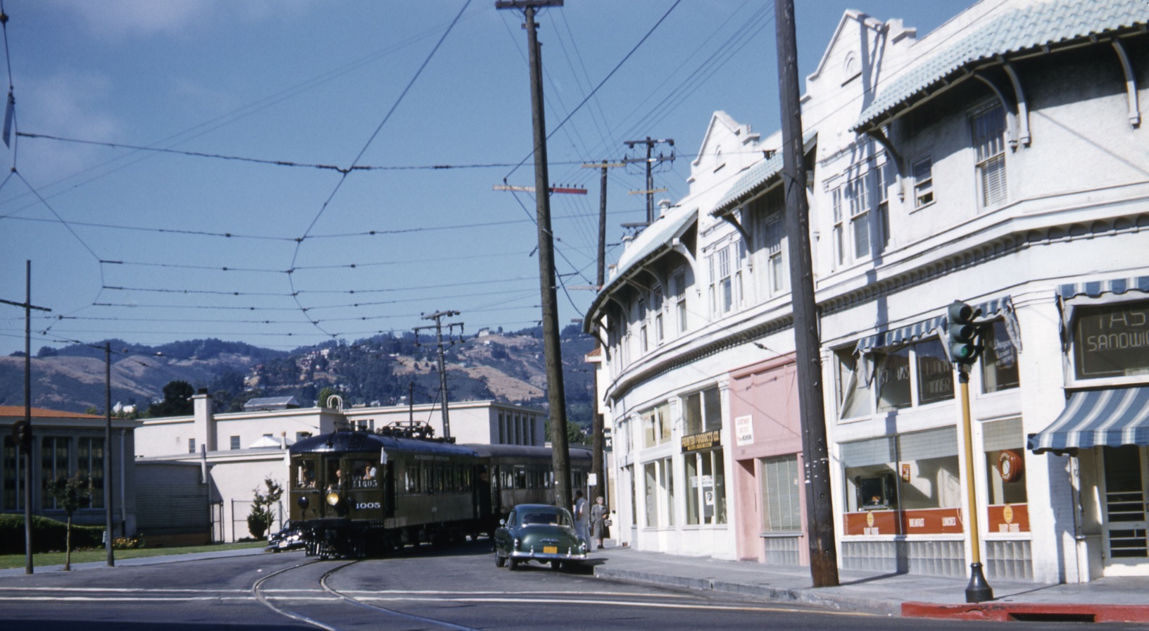
This northeast view from the same July 8, 1956 excursion with SN 1005 and Salt Lake and Utah Parlor car 751 is a continuation up the block to the west relative to the previous image. It is comforting to see that tasty sandwiches are still being provided at the corner store.
L11-85-Dave Gumz Photo, Courtesy BAERA, Western Railway Museum Archive, 55124sn , (Image 18 of 20)
This northeast view shows how the curve taken by then Shafter Ave. on the southeast side of the intersection with College is now used to turn off Miles Ave. into the BART station area. The remaining link at this location to a bygone era.
L11-90-Stuart Swiedler Photo, (Image 19 of 20)
SN 661 is captured returning passenger cars to Chico in this west view from July 1, 1941. Its path will be followed in future explorations of Shafter Ave. heading east of College Ave.
L11-95-Courtesy BAERA, Western Railway Museum Archive, 50137sn Re-enter, (Image 20 of 20)