Shepherd Canyon

This undated west view of the landmark SN Snake Road trestle is today a walk way that provides an essential link in the Shepherd Canyon Trail.
E5-Courtesy Bay Area Electric Railroad Association, Western Railway Museum Archives, 25462sn, (Image 1 of 16)

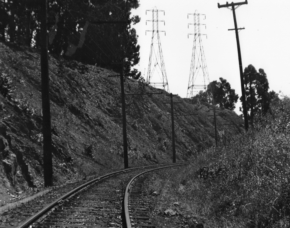
For the SN to proceed into Shepherd Canyon, a cut had to be produced out of the canyon wall as seen in this undated west view. It became known as Melin Cut, although no one is quite sure who Melin was ...
E10-Courtesy Bay Area Electric Railroad Association, Western Railway Museum Archives, 52062sn, (Image 2 of 16)
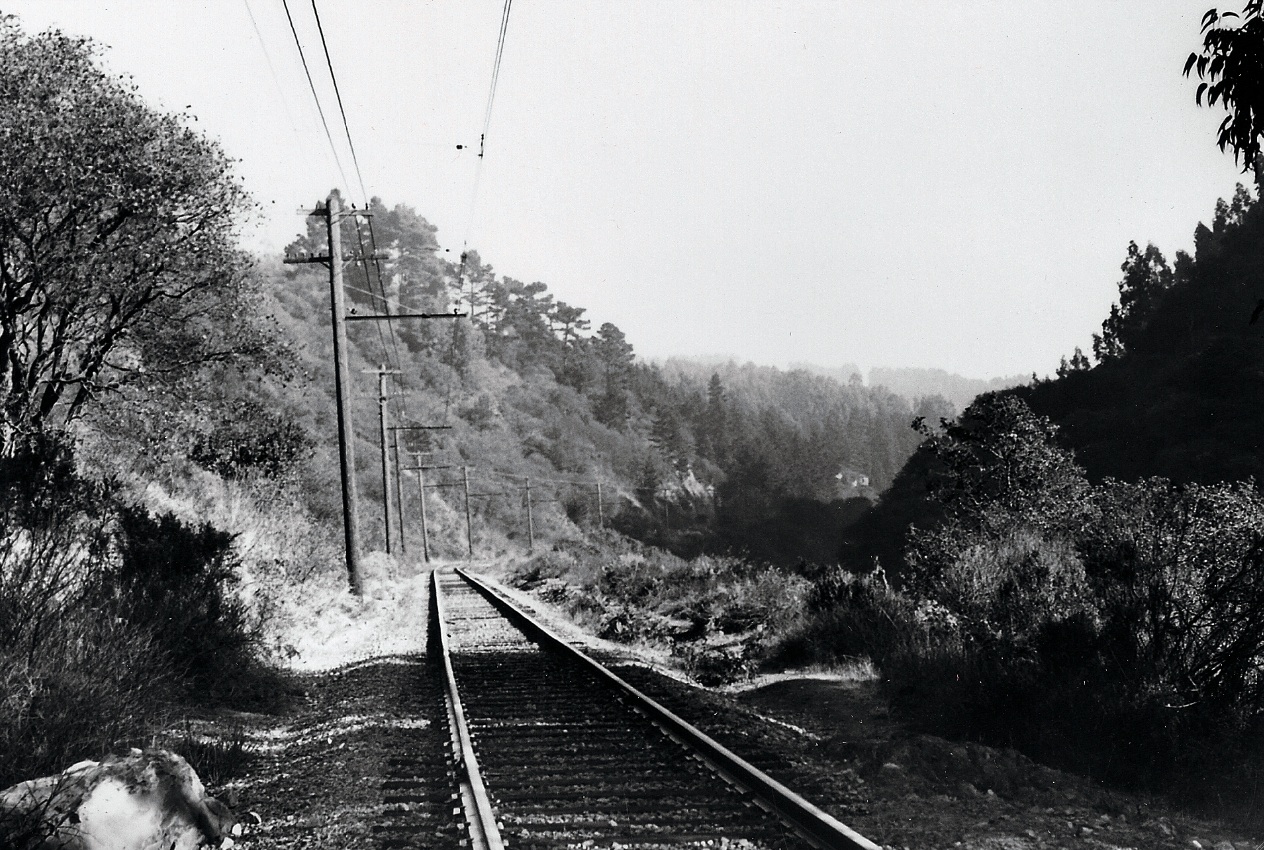
Once beyond the cut, the SN right-of-way curved to a direct east direction. Undated photo, northeast view.
E14-Grahame Hardy Collection, Courtesy the California State Railroad Museum, CSRM 33364, (Image 3 of 16)
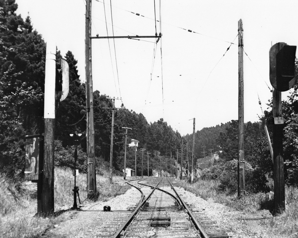
The SN had a single stop in the canyon at Paso Robles called Havens, seen in the distance in this undated east view. The station was not built by Frank C. Havens, the San Francisco lawyer and East Bay real estate developer at the turn of the 20th century, the identity of the builder to be revealed in a Landmark.
E15-Courtesy Bay Area Electric Railroad Association, Western Railway Museum Archives, 25462sn, (Image 4 of 16)
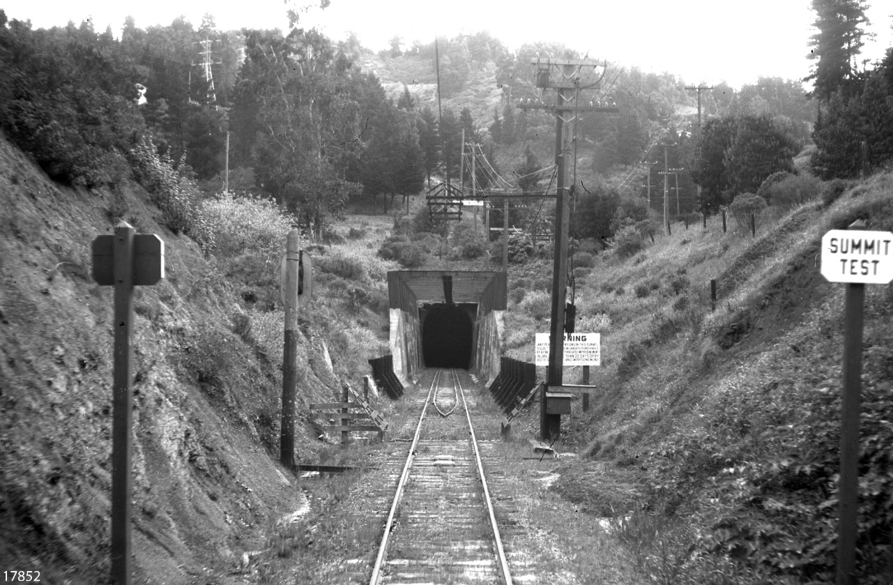
Positioned down Shepherd Canyon was the SN west portal, here from a circa 1940 photo highlighting the structural support needed to prevent the collapse of the surrounding walls.
E20-Courtesy Bay Area Electric Railroad Association, Western Railway Museum Archives, 17852sn, (Image 5 of 16)
The idea of a freeway connecting Alameda and Contra Costa Counties via Park Blvd. and Shepherd Canyon Road persisted from the 1940s until the plan was voted down in 1972. Here is a east view of refurbished Park Boulevard’s approach to Mountain Boulevard on Sept. 23, 1953.
E25-Public Works Photo, Oakland Cultural Heritage Survey, Oakland City Planning Department , (Image 6 of 16)
This east view shows the western edge of Shepherd Canyon from Apr. 22, 1960, three years after the abandonment of the SN. Note Snake Road, Melin Cut, the Park Blvd. interchange of Unit Two, and Montera Middle and Joaquin Miller Elementary Schools at the right.
E30-Copyright California Department of Transportation, 7453-12, (Image 7 of 16)
This close-up of Snake Road from E30, east view, Apr. 22, 1960, tells you why it is called by that name. The old trestle is gone and it will be more than a decade before a footbridge is put in its place to complete the Shepherd Canyon Trail.
E35-Copyright California Department of Transportation, Detail 7453-12, (Image 8 of 16)
This close up of Melin Cut also from E30, east view, Apr. 22, 1960, shows the electrical power transmission towers still distinctive of that area.
E40-Copyright California Department of Transportation, Detail 7453-12, (Image 9 of 16)
Another image of Melin Cut down to Paso Robles Drive further down the canyon, east view, Apr. 22, 1960.
E45-Copyright California Department of Transportation, 7453-1, (Image 10 of 16)
This west view of Shepherd Canyon, Apr. 22, 1960, shows the hairpin turn of Sherwood Drive to the south in the foreground, and Paso Robles Drive descending from the north of Shepherd Canyon Road.
E50-Copyright California Department of Transportation, 7453-11, (Image 11 of 16)
Detail from E50, west view of Shepherd Canyon, Apr. 22, 1960, shows a bright reflection from the ground marking the site of the since removed Havens Station of the SN.
E55-Copyright California Department of Transportation, Detail 7453-11, (Image 12 of 16)
From the previous image, the view is now turned 180 degrees to the east on Apr. 22, 1960, where the Shepherd Canyon Road climbed the wall of the canyon to reach the ridge.
E60-Copyright California Department of Transportation, 7453-10, (Image 13 of 16)
Detail of E60, east view, Apr. 22, 1960, shows the junction of Shepherd Canyon road with Saroni Drive, and just west of this is the west portal, now a tomb of the forgotten railroad, almost completely buried in silt just three years after railroad abandonment.
E65-Copyright California Department of Transportation, Detail 7453-10 , (Image 14 of 16)
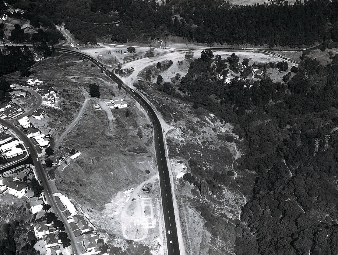
This west view of Skyline Drive and points west also captures the junction with Pinehurst Road, the latter beginning its descent into Redwood Canyon to the left edge of the image on Apr. 22, 1960.
E70-Copyright California Department of Transportation, 7453-7, (Image 15 of 16)
Detail of E70 shows another angle of the Shepherd Canyon Road and Saroni Drive Intersection, with the approach to the tunnel of the SN right-of-way in clear view to the west in Apr. 22, 1960.
E75-Copyright California Department of Transportation, Detail 7453-7 , (Image 16 of 16)