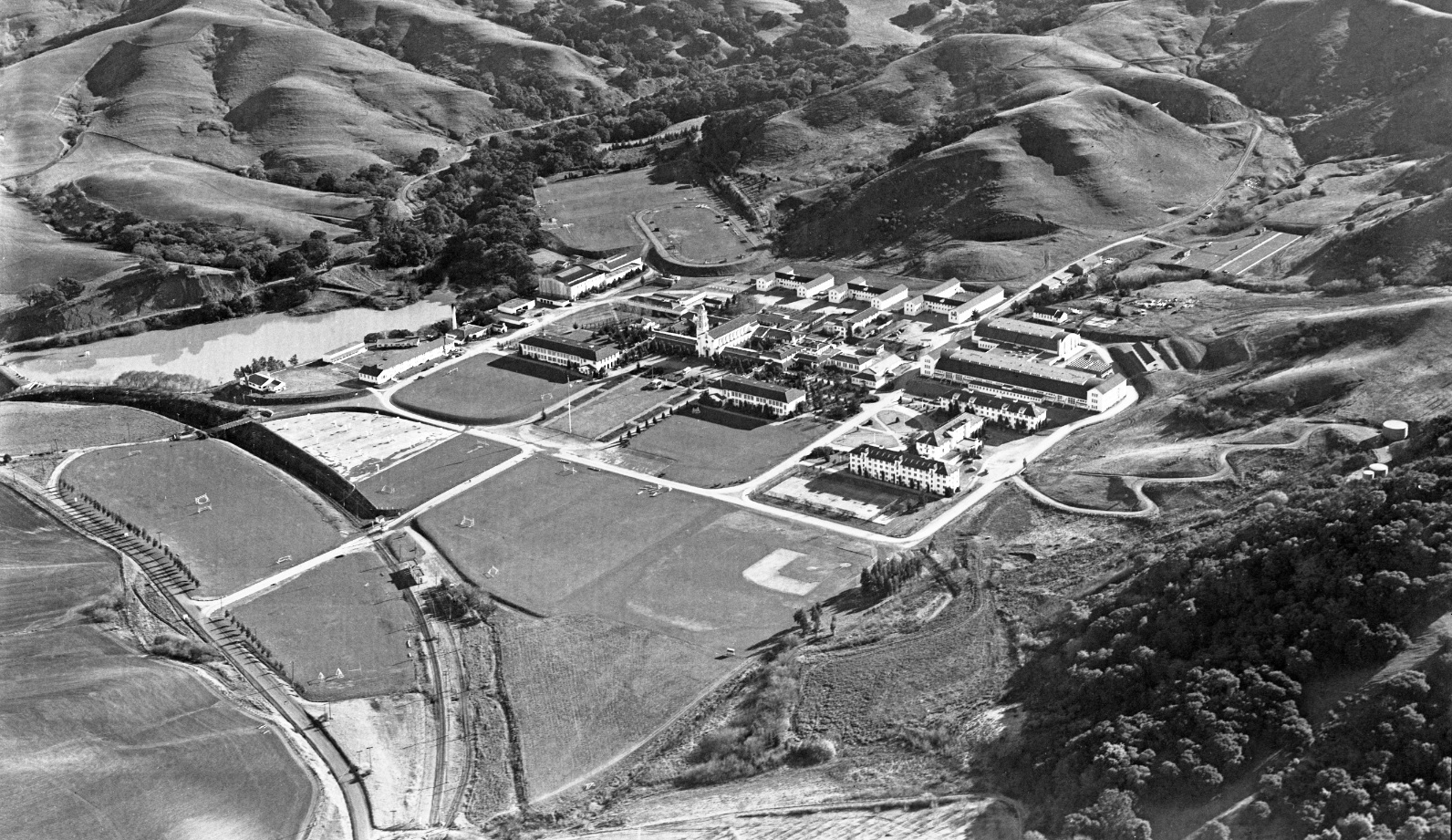
St. Mary’s College – By the Deep Blue Sea

Elimination of SN passenger service in 1941 and increased car traffic from the influx of naval cadets in 1942 signaled the end for the wooden bridge serving as the college entrance over the right-of-way. This east view aerial circa 1945 shows the new entrance and temporary structure still over the old one.
L61-05-Vernon Sappers Collection, Courtesy BAERA, Western Railway Museum Archives, 67024sn, (Image 1 of 18)

Detail of L61-05 and the view of the temporary bridge. Correspondences between Harry Mitchell of the SN and the college on Sept 20, 1945 indicated the SN would dismantle the original wooden bridge (West. Rail. Mus. Arch.) Why the SN accepted this responsibility and why a temporary structure was put in place are not known.
L61-10-Vernon Sappers Collection, Courtesy BAERA, Western Railway Museum Archives, 67024sn, Detail, (Image 2 of 18)

This north aerial view from 1945 complements the previous view of the campus. See a detail of the closed bridge next. According to old timetables, the OA&E stopped at “Country Club”, and the San Francisco-Sacramento stopped at “Cashion”, corresponding to the St. Mary’s College stop established in 1928. The presence of the wooden bridge prior to 1928 is not known.
L61-15-Sappers Collection, Courtesy BAERA, Western Railway Museum Archives, 216441sn, (Image 3 of 18)

L61-16-Sappers Collection, Courtesy BAERA, Western Railway Museum Archives, 216441sn, detail, (Image 18 of 18)

Lake La Salle was created by constructing an earthen dam in the path of Las Trampas Creek in 1928. In 1942, EBMUD extended its supply to meet the demands of the US Navy. Undated image from freight era, northwest view.
L61-20-Number 110, from the Collection of the Moraga Historical Society, Moraga, CA, (Image 5 of 18)

Removal of the wooden bridge resulted in SN images being taken from the rim of the cut, typically from the west side. The initial BAERA excursion from Sept 12, 1948 offered many opportunities for east views of MW 302 as it passed through the cut.
L61-25-Tom Gray Photo, Courtesy Tom Gray, (Image 6 of 18)

Although a long list of railfan photographers participating in the Nor-Cal-sponsored excursion of Sept. 18, 1949 captured MW 302 in the cut east of the station at St. Mary’s College, Bob Townley also included the location of the mile 20 marker in this northeast view.
L61-30-Robert P. Townley Photo, Courtesy BAERA, Western Railway Museum Archives, 199145sn , (Image 7 of 18)

It was more likely that during this time one would catch the site of a freight in the cut as in this image of SN 654, circa 1950, east view.
L61-40-Tom Gray Photo, Courtesy Tom Gray, (Image 8 of 18)

Art Alter took this dramatic north view from the bridge overpass when it was in use on July 6, 1941, of the rear of a SN freight with SN 661in the lead and SN 651 as helper.
L61-42-Art Alter Photo, Moreau Coll., Courtesy BAERA, Western Railway Museum Archives, 82319sn, (Image 9 of 18)

SN 1014 sits as part of a three-car train northwest of the cut in 1941 on its way out of the campus to the grade crossing at St. Mary’s Road. Southeast view.
L61-45-Addison Laflin Photo, Courtesy BAERA, Western Railway Museum Archives, 50650sn , (Image 10 of 18)

A little closer to the St. Mary’s Road grade crossing to the northwest, MW 302 and SLU 751 circa 1950 pose for excursion participants, southeast view.
L61-50-Tom Gray Photo, Courtesy Tom Gray , (Image 11 of 18)

With the trees as reference, turning to the north provides a view of a four-car train led by SN 1005 on June 6, 1939. The previous aerial images establish that the trees were planted along St. Mary’s Road, the path of which, indicated by the utility poles, descended to meet the tracks at the grade crossing.
L61-55-Wilbur C Whittaker Photo, Courtesy Tom Gray, (Image 12 of 18)

A final topic concerns the college’s waste water treatment facility running along Bollinger Canyon Road, white arrows. The Contra Costa County Sanitary District took over this responsibility by 1962. SN right-of-way, yellow arrows. Refs: L, RL Copeland Photo; R Herrington-Olsen Photo A-2895.
L61-60-From the collections of the St Marys College of CA Archives and Moraga Historical Society, (Image 13 of 18)

Three photos taken during the May 31, 1951 unspecified tour with MW 302 capture several elements of the water treatment facility starting with this east view. Note Bollinger Canyon Rd. in the upper left quadrant.
L61-65-B.L. Stone Photo, Courtesy, Krambles-Peterson Archive, (Image 14 of 18)

Next, a west view from May 31, 1951 with MW 302 in the same location.
L61-70-H.M. Stange Photo, Courtesy Krambles-Peterson Archive, (Image 15 of 18)

The third view taken at the SN-St. Mary’s Rd. grade crossing with MW 302 approaching from May 31, 1951 in an east view shows the smoke stack from the college power plant and hints of the treatment facility.
L61-75-George Krambles Photo, Courtesy Krambles-Peterson Archive, (Image 16 of 18)

A last glimpse of the water treatment facility from a SN photo opportunity is seen in this south view from Jan. 1957 here with SN 653 and freight rounding the curve north of the college heading for the grade crossing at St. Mary’s Rd. Appreciation to Art Peterson for the images he contributed to in this presentation.
L61-80-Fred Matthews Photo, Courtesy Anonymous Donor , (Image 17 of 18)