Stan’s Brick House and the North Main Street Crossing

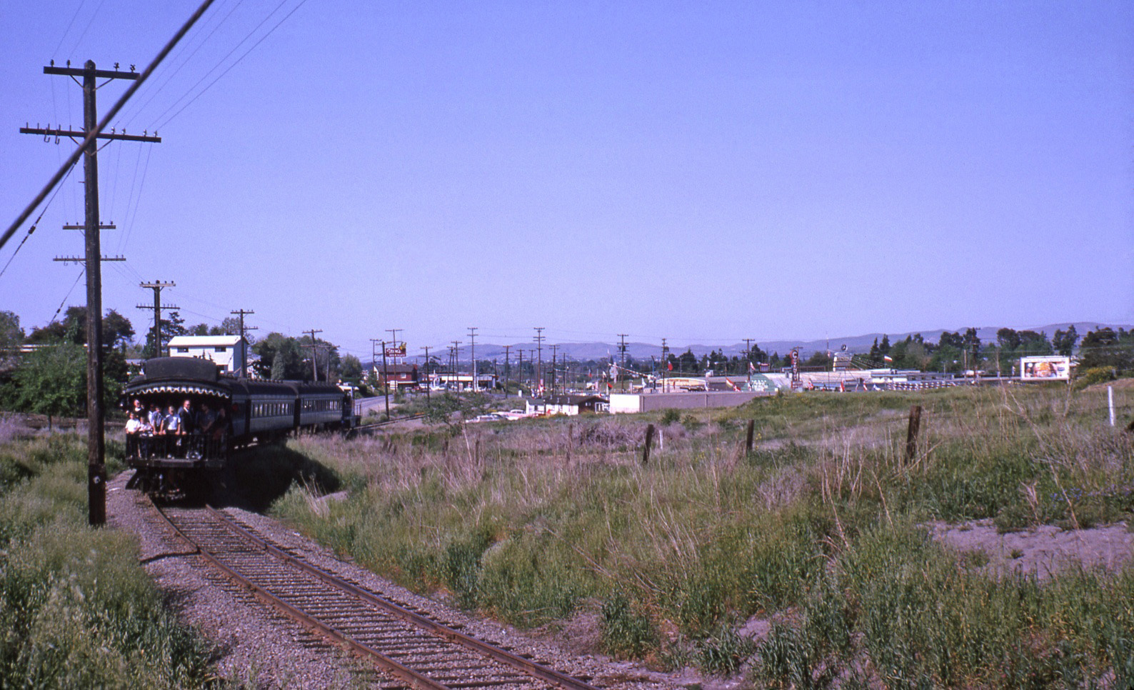
Its the “End-of-an-Era” for the SN, Apr. 12, 1964, in this north view of a final excursion of the SN’s south end as SN 143 leads its four cars to the North Main St. grade crossing.
L78-01-Ted Wurm Photo, Courtesy BAERA, Western Railway Museum Archives, 79850sn, (Image 1 of 16)

Stan’s Brickhouse, however, would endure, at least as the last identifiable building directly adjacent to the right-of-way held over from the SN era.
L78-05-Victor B Dubrutz Photo, Courtesy BAERA, Western Railway Museum Archives, 71841sn, (Image 2 of 16)

A south view comparison at the Main St.-N. California Blvd. intersection between 2011 and 2013 differs by the loss of the building at 2211 N. Main St, Le Virage Restaurant. It was gutted by a fire on Aug. 25, 2012 and soon razed when it failed to qualify as a National Register or California Register of Historic Places.
L78-10-Courtesy Google and Stuart Swiedler Photo, (Image 3 of 16)

A southwest view at the northeast corner of the N. Main St.-N. California Blvd. intersection in 2011 on the east side of the BART structure reveals Le Virage and surrounding structures all associated with the mid-1980s in the so-called Golden Triangle of Walnut Creek.
L78-15-Courtesy Google Maps, (Image 4 of 16)

Now to the same southwest view circa 1952, the only known image of an SN train passing Stan’s Brickhouse during the electric era is revealed. The 35 mm negative was taken by Norman Smith, an excellent photographer of the railway circa 1950 unknown to surviving BAERA members from that era.
L78-20-Norman Smith Photo, Courtesy BAERA, Western Railway Museum Archives, 71847.5sn, (Image 5 of 16)

The building was erected in 1924, and not much is known about its function until 1936 when Bill Correira opened Bill’s Cocktail Room where it was listed as “Brick House-Junction, Oakland Boulevard and Martinez Highway”. Later that year, it was advertised as Bill’s Brick House, N. Main St. and Oakland Blvd. at Sacramento Northern crossing. North view, circa 1930s.
L78-25-Courtesy Walnut Creek Historical Society, (Image 6 of 16)

In the 1946-47 timeframe, Stanley and Clara Parsens or Parsons purchased the property and Stan’s Brick House, “Famous for Fine Food”, started appearing in ads in 1947. The Parsens operated the restaurant until sometime in the 1960s, and by 1971 it had become Le Virage. Northwest view showing ad on building, circa 1930s.
L78-30-Courtesy Walnut Creek Historical Society, (Image 7 of 16)

Comparing 1940, left, to 1968, right, in these northerly oriented aerials shows the Brick House was increased in size over the decades, red arrows. The original SN tracks are marked by the yellow arrows, establishing that from this point, BART’s overhead structure was built to the east in this section.
L78-35-Courtesy Contra Costa County Historical Society and Planning Department, City of Walnut Creek, (Image 8 of 16)

A summary of additions made to the structure over time is presented from the assessment report submitted by William Self Associates, Inc. to determine its status as an historically important structure.
L78-40-Courtesy Planning Department, City of Walnut Creek , (Image 9 of 16)

A detailed overhead image from Feb. 7, 1952 attesting to the reputation of the Brick House as a prime destination for the locals and those traveling the Martinez to Danville corridor.
L78-45-Copyright California Department of Transportation, 2477-23 Detail, (Image 10 of 16)

A north view from Feb. 13, 1958 prior to addition of the red color to the exterior.
L78-50-Copyright California Department of Transportation, 5845-9 Detail, (Image 11 of 16)

A south view from Jan 14, 1960.
L78-55-Copyright California Department of Transportation, 7240-3 Detail , (Image 12 of 16)

SN 143 and its excursion-associated passenger cars pause at the south side of the intersection at the Apr. 12, 1964 “End of an Era” celebration, handing the SN right-of-way over to BART.
L78-65-Courtesy BAERA, Western Railway Museum Archives, 71858sn, (Image 13 of 16)

Then SN 143 starts up again to cross the intersection, Apr. 12, 1964, southview.
L78-65-Ted Wurm Photo, Courtesy BAERA, Western Railway Museum Archives, 79848sn, (Image 14 of 16)

The same scenario, this time at the north side of the intersection on the return trip to the Walnut Creek depot. The area to the east of the right-of-way was still open country. Northeast view, Apr. 12, 1964.
L78-70-Drew Jacksich Photo, Courtesy Drew Jacksich, (Image 15 of 16)

Now rotated slightly more to the north, also Apr. 12, 1964, the mile 28 marker signifies that N. Main St. has been crossed, onward to the Walden flag stop.
L78-75-Courtesy BAERA, Western Railway Museum Archives, 71859sn, (Image 16 of 16)