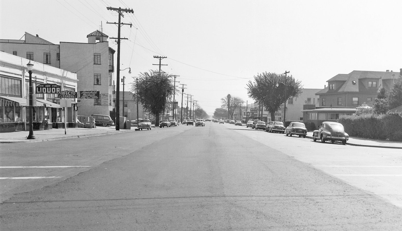
Temescal 1948
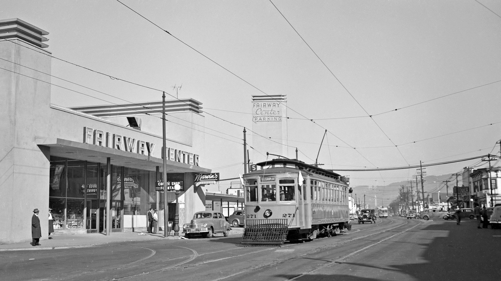
This transition moment in the Temescal neighborhood occurred in 1948. The precise day is even known, and all the clues are in this north view of Key 271.
L157-05-Leon Bonney Photo, Courtesy John Harder, (Image 1 of 27)

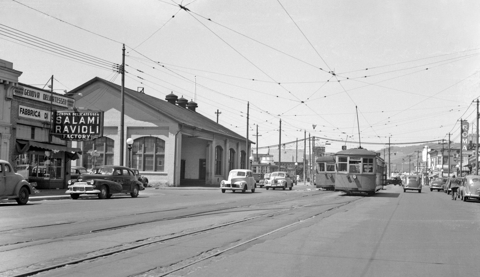
Just two years earlier in 1946, a north view toward 51st. on Telegraph Ave. would have highlighted the Key 5 or Telegraph line, the Western Car House, WCH or “barn”, and Genova Deli. With no line out the door of the latter, this was probably not a football game day.
L157-10-Waldemar Sievers Photo, Courtesy John Harder, (Image 2 of 27)
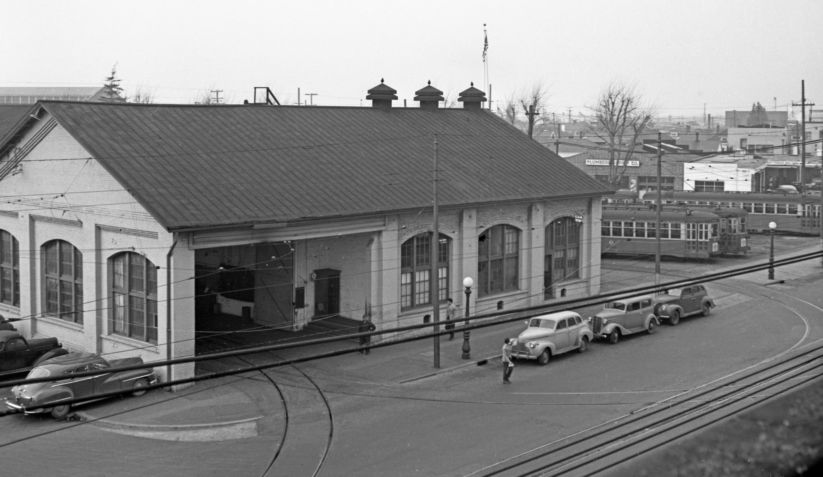
According to Sappers “Key System Streetcars”, structures related to public transport at this site date back to the 1870s, built above Temescal Creek to use the water to cool its power-plant. This 1898 structure no longer needed the plant after Pacific Gas and Electric built Station D on 51st. in 1904. Northwest view, Feb. 2, 1947.
L157-15-Robert L Stein Photo, Courtesy BAERA, Western Railway Museum Archives, 51863ks, (Image 3 of 27)
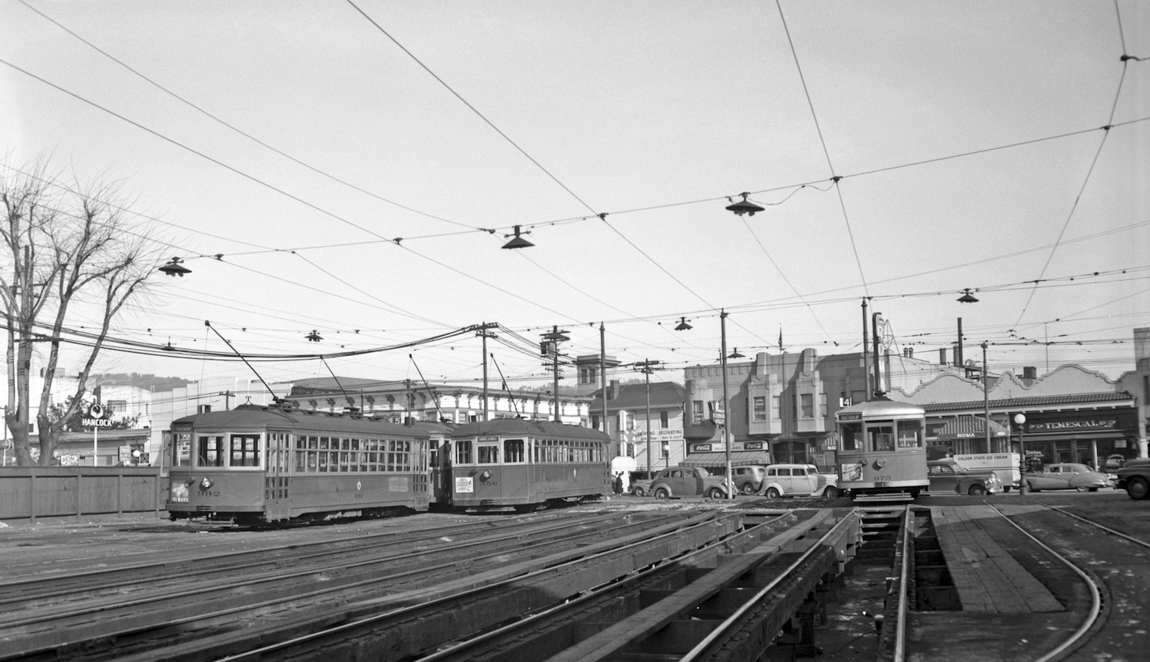
An east view towards Telegraph Ave shows the car storage yard. Nine car lines used the WCH; no. 4 Shattuck Ave., no. 5 Telegraph Ave., no. 6 College Ave., the L Alcatraz (later the K), the Ashby line, the 24 Dwight Way line, the D Euclid, the N Arlington, and Park Ave. line to Emeryville. Car 973 roof color hints at a later 1946, early 1947 date.
L157-20-Waldemar Sievers Photo, Courtesy John Harder, (Image 4 of 27)
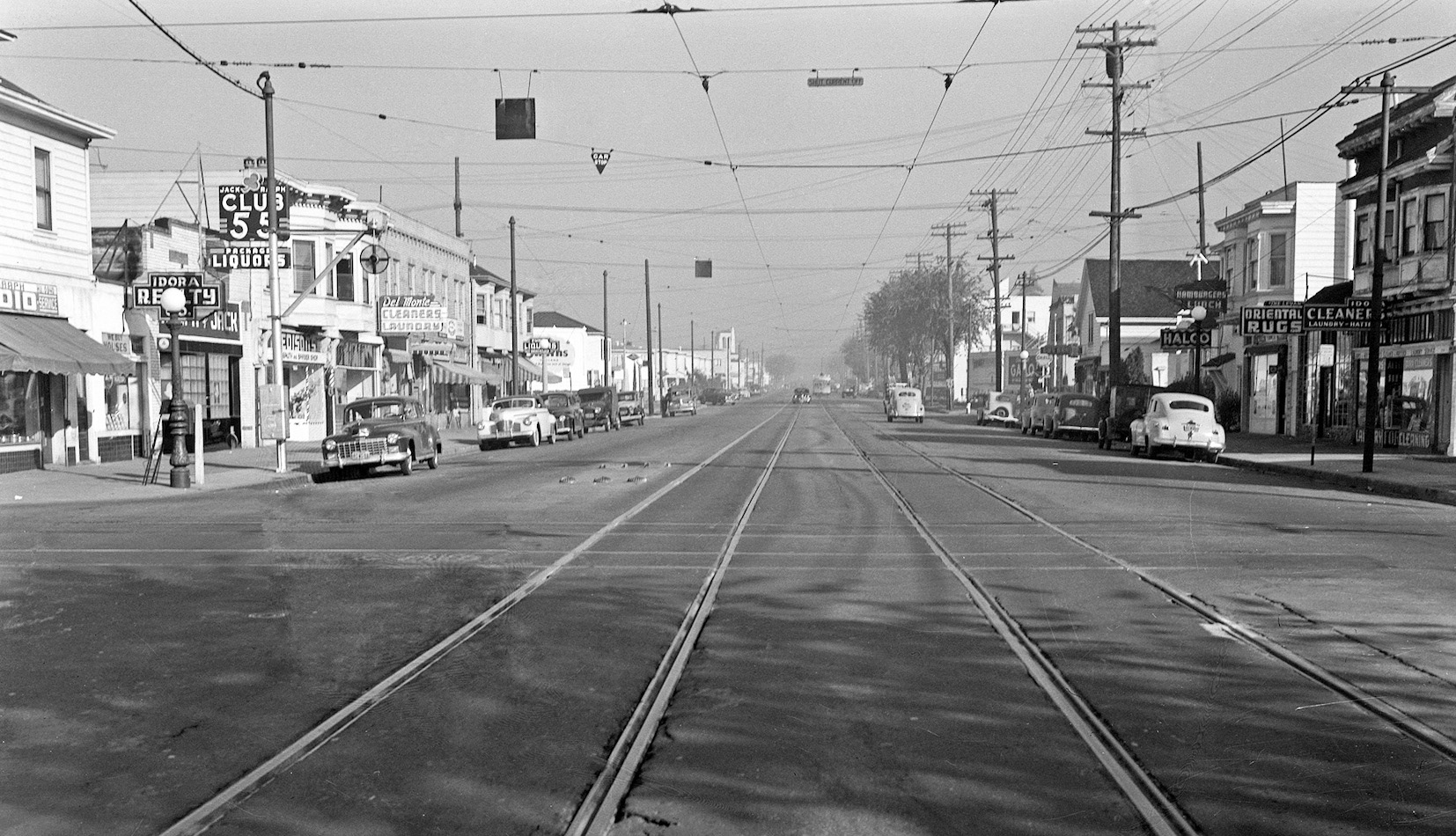
To set the stage for the moment in time, the clock is turned back to a south view just north of 40th St. where the Key C line crossed the road, revealing Key 956 as a no. 4 line car heading for Shattuck Ave. toward Berkeley. It must be 1944 as the marquee on the Senator Theater advertises for Cary Grant in “Arsenic and Old Lace”.
L157-25-Key System Photo, Courtesy John Harder, (Image 5 of 27)
Further north to 55th St. where the Key E line crossed the road shows a Key streetcar in the distance to the north with the National City Lines paint scheme indicative of 1947-48. All of these building met their end with the construction of the overpass of Highway 24.
L157-30-Key System Photo, Courtesy John Harder , (Image 6 of 27)
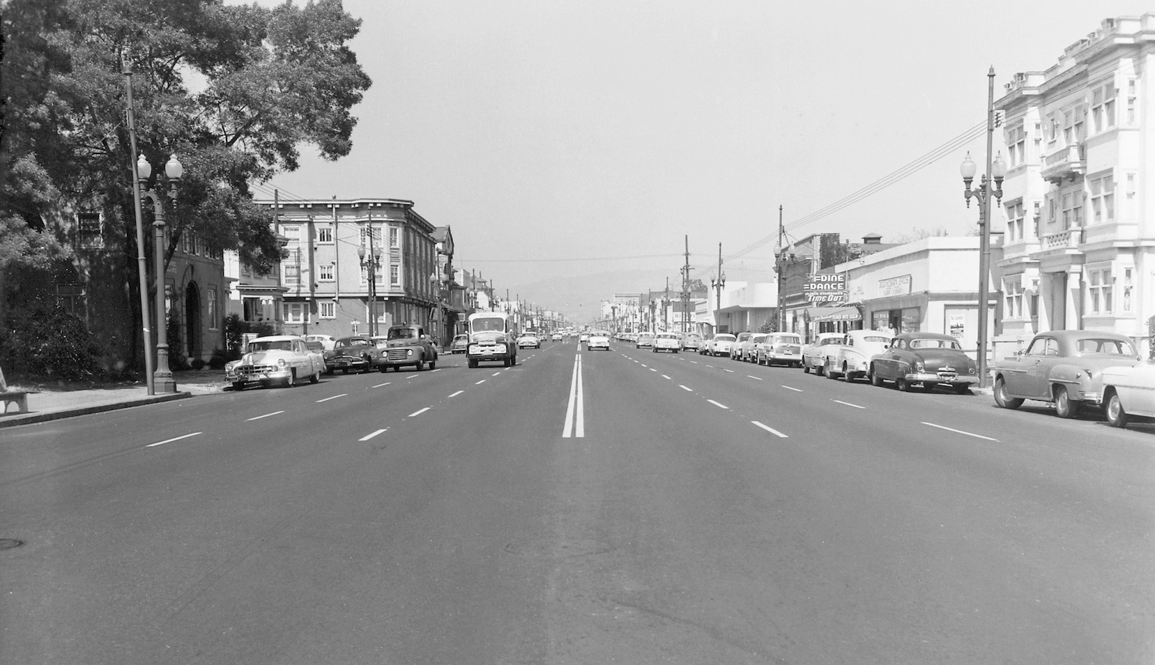
Now ahead to Sept. 20, 1955, a series of images post-streetcar starting with this north view of Telegraph and 33rd. The streetcar tracks are gone and the surface looks freshly applied. The buildings along the west or left side of the image remain today, but on the east side only the brick work on the building with the “Dine Dance” sign and the intact structure to the north, nos. 3242-3246, remain today.
L157-35-Frank Johnson Photo, Public Works, Oakland Cultural Heritage Survey, Oak. City Plan. Dept., (Image 7 of 27)
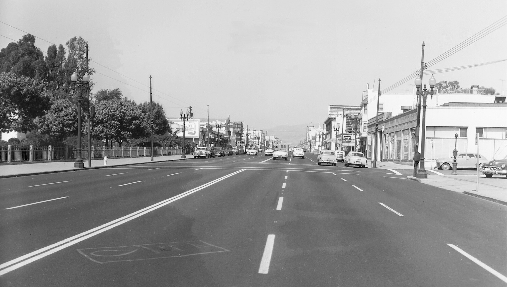
Continuing north on Telegraph to just south of 36th St, Sept. 20, 1955, the left or west side of the street is unrecognizable, while the attractive brick-work on the east side has been painted over. Behind the photographer today is the Highway 580 overpass, only in the planning stages when this image was taken.
L157-40-Frank Johnson Photo, Public Works, Oakland Cultural Heritage Survey, Oak. City Plan. Dept., (Image 8 of 27)
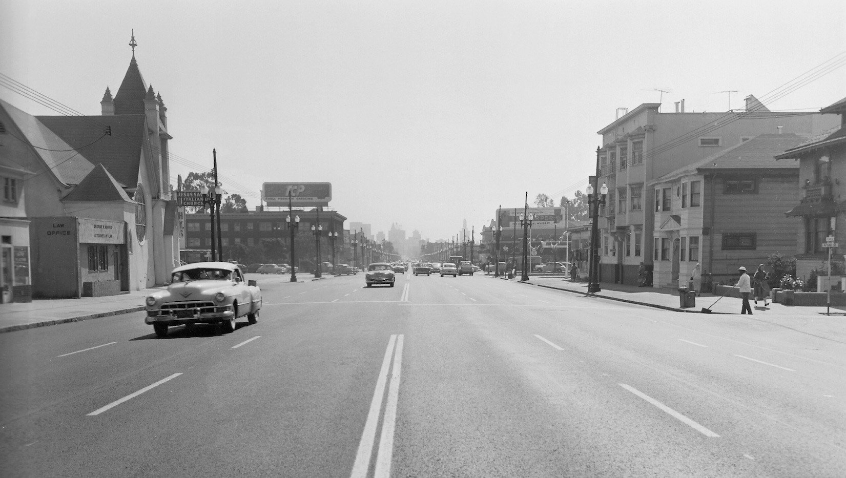
Reaching further north past MacArthur Blvd. and into Temescal proper, the view south on Sept, 20, 1955 shows a familiar church once popular with local Italians whose sign now reads “Pentecostal” and buildings across the street that still stand. The structure on the southeast corner of MacArthur is gone, but the “L” from Lucky Florist with an overhead billboard has not changed on the southwest corner.
L157-45-Frank Johnson Photo, Public Works, Oakland Cultural Heritage Survey, Oak. City Plan. Dept., (Image 9 of 27)
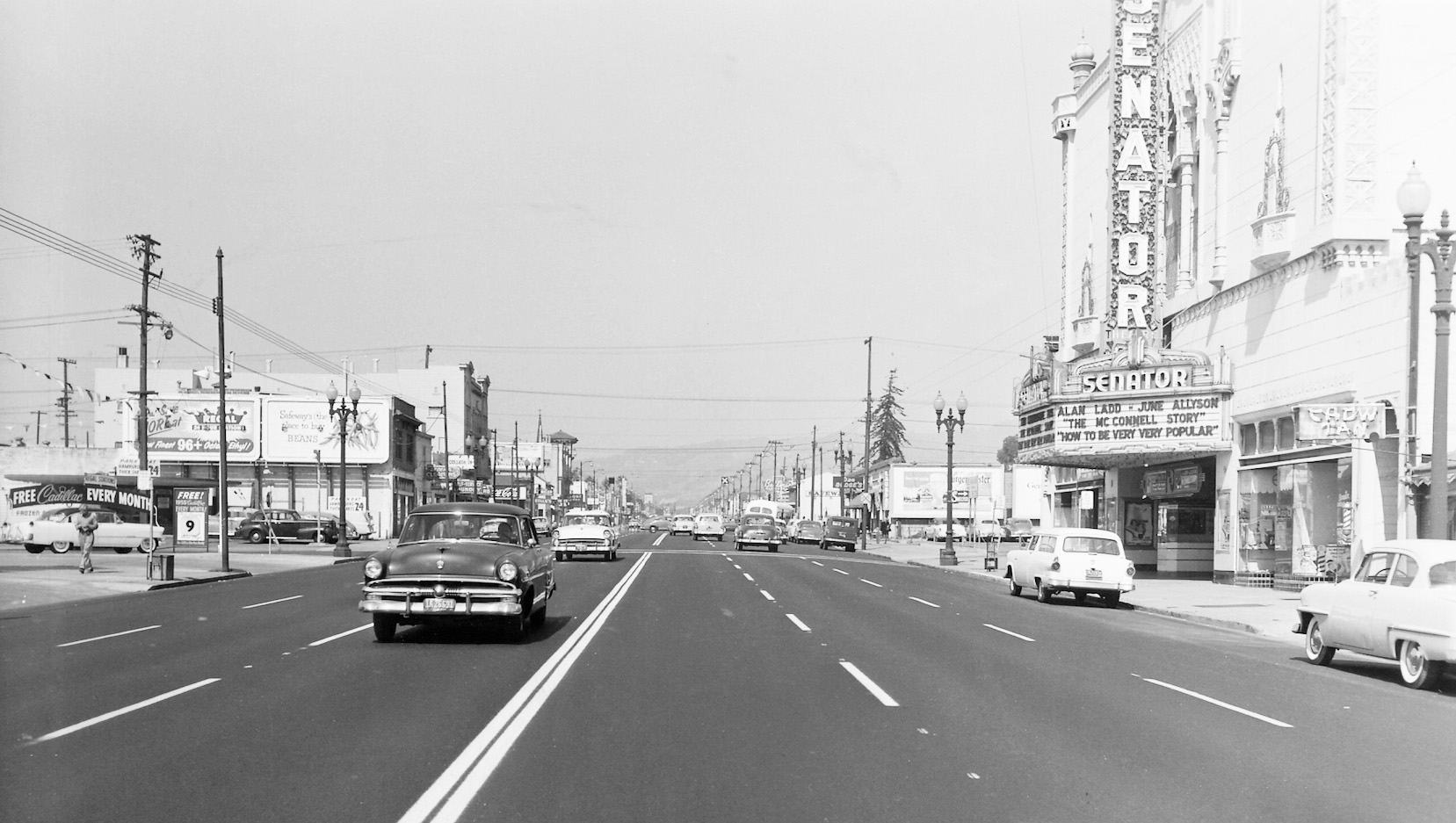
Next to Telegraph and 39th, the north view from Sept. 20, 1955 reveals the Senator Theater. Built in 1925, it parted ways circa 1962 for the Beebe Memorial Cathedral. The large apartment with first story commercial space still stands across the street at the southwest corner of 40th St.
L157-50-Frank Johnson Photo, Public Works, Oakland Cultural Heritage Survey, Oak. City Plan. Dept., (Image 10 of 27)
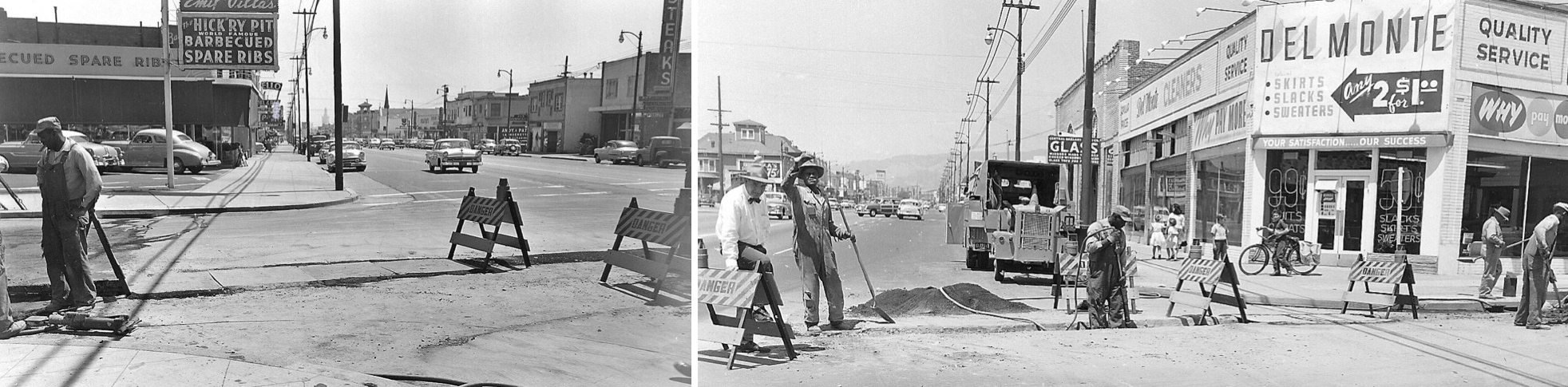
South, left, and north, right, views of repair work at 44th and Telegraph, July 6, 1955. Del Monte is now Baby World, but the facade of the building has been changed, while the small shopping center that Emil Villas once occupied is now a popular spot for shops owned by Korean-Americans.
L157-55-Charles Brown Photos, Public Works, Oakland Cultural Heritage Survey, Oak. City Plan. Dept., (Image 11 of 27)
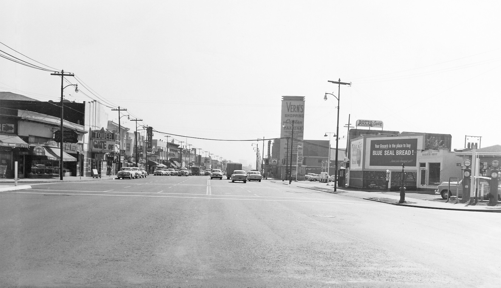
After crossing 51st St. and reaching the Claremont Ave.-52nd St. intersection beside the Temescal branch of the Oakland Library, this south views shows two long-gone fixtures of the neighborhood, the Tower Theater and Vern’s Shopping Center. The building housing the movie theater, originally the “Claremont” and later the “Pussycat”, was razed in 1998. Temescal Creek runs right beneath this property.
L157-60-Frank Johnson Photo, Public Works, Oakland Cultural Heritage Survey, Oak. City Plan. Dept., (Image 12 of 27)
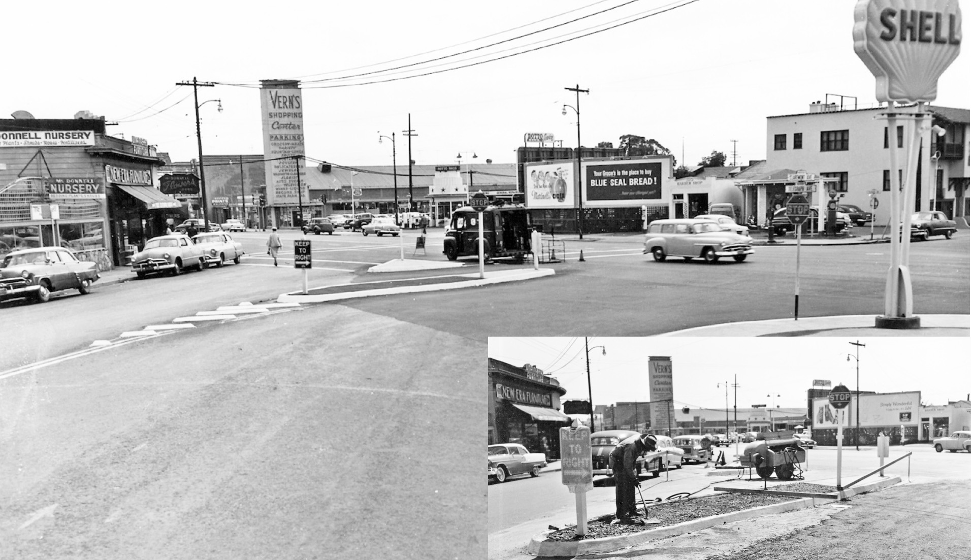
A southwest view of the revised Claremont Ave.-Telegraph Ave. intersection from Sept. 18, 1955, and an insert showing its construction in progress from Aug. 18, 1955, also highlights local stores. Vern’s Shopping Center appeared in the 1952 Oakland Directory and was a mainstay of the neighborhood until 1985.
L157-65-Frank Johnson Photos, Public Works, Oakland Cultural Heritage Survey, Oak. City Plan. Dept., (Image 13 of 27)
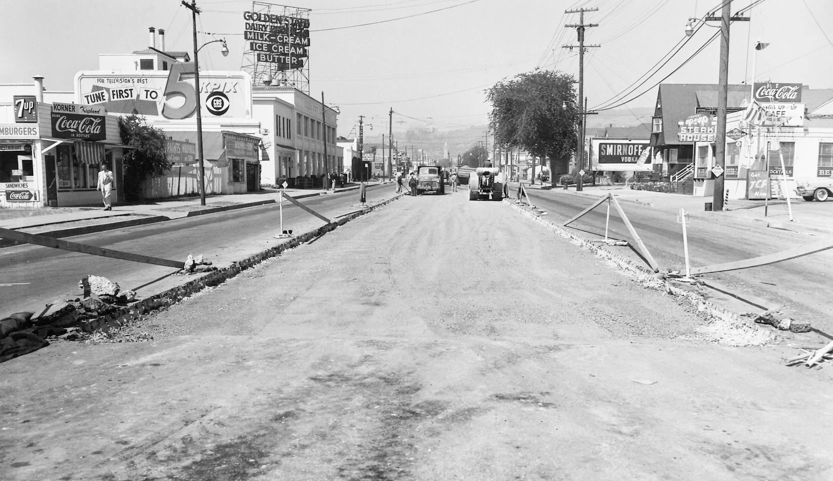
Aug. 18, 1955 also produced the last evidence for the removal of Key System track from Telegraph Ave., here in a north view from 52nd St. featuring Golden State Dairy Products at 5307 Telegraph Ave. Taken just north of the Temescal branch of the Oakland Public Library, this view is totally unrecognizable in 2017.
L157-70-Frank Johnson Photo, Public Works, Oakland Cultural Heritage Survey, Oak. City Plan. Dept., (Image 14 of 27)
This last section of rails was still in place in the Bushrod neighborhood on Aug. 18, 1955, a north view at 57th St. The west side buildings, left, at the corner of 57th remain, albeit slightly modified. The east side of the street has been completely changed, although Betty Marvin noted the corner house, right edge, was moved to 827 Delaware St. in Berkeley circa 1990. Memorial Tabernacle Church at 5801 Racine St. is prominent in the background.
L157-75-Frank Johnson Photo, Public Works, Oakland Cultural Heritage Survey, Oak. City Plan. Dept., (Image 15 of 27)
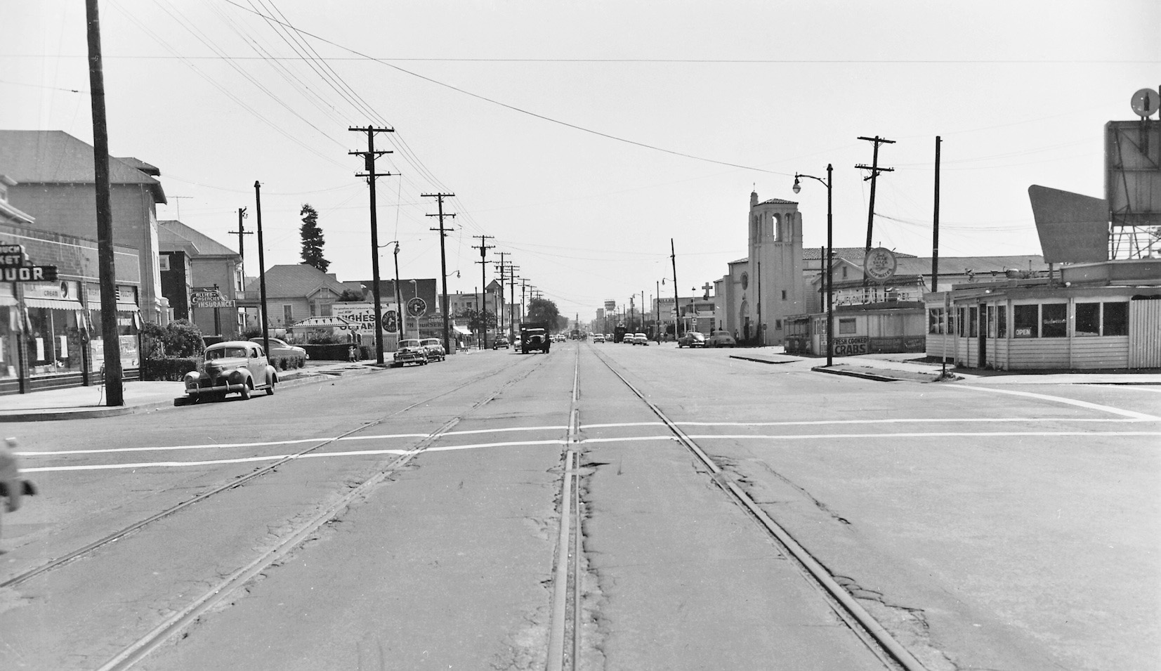
The next three south views from Telegraph Ave. and 59th St. document the before to after transition of the road bed. First, Aug. 18, 1955, featuring a fairly intact east or left side of the avenue, including the market-liquor sign. The west side, right, up to the church has been completely replaced.
L157-80-Frank Johnson Photo, Public Works, Oakland Cultural Heritage Survey, Oak. City Plan. Dept., (Image 16 of 27)
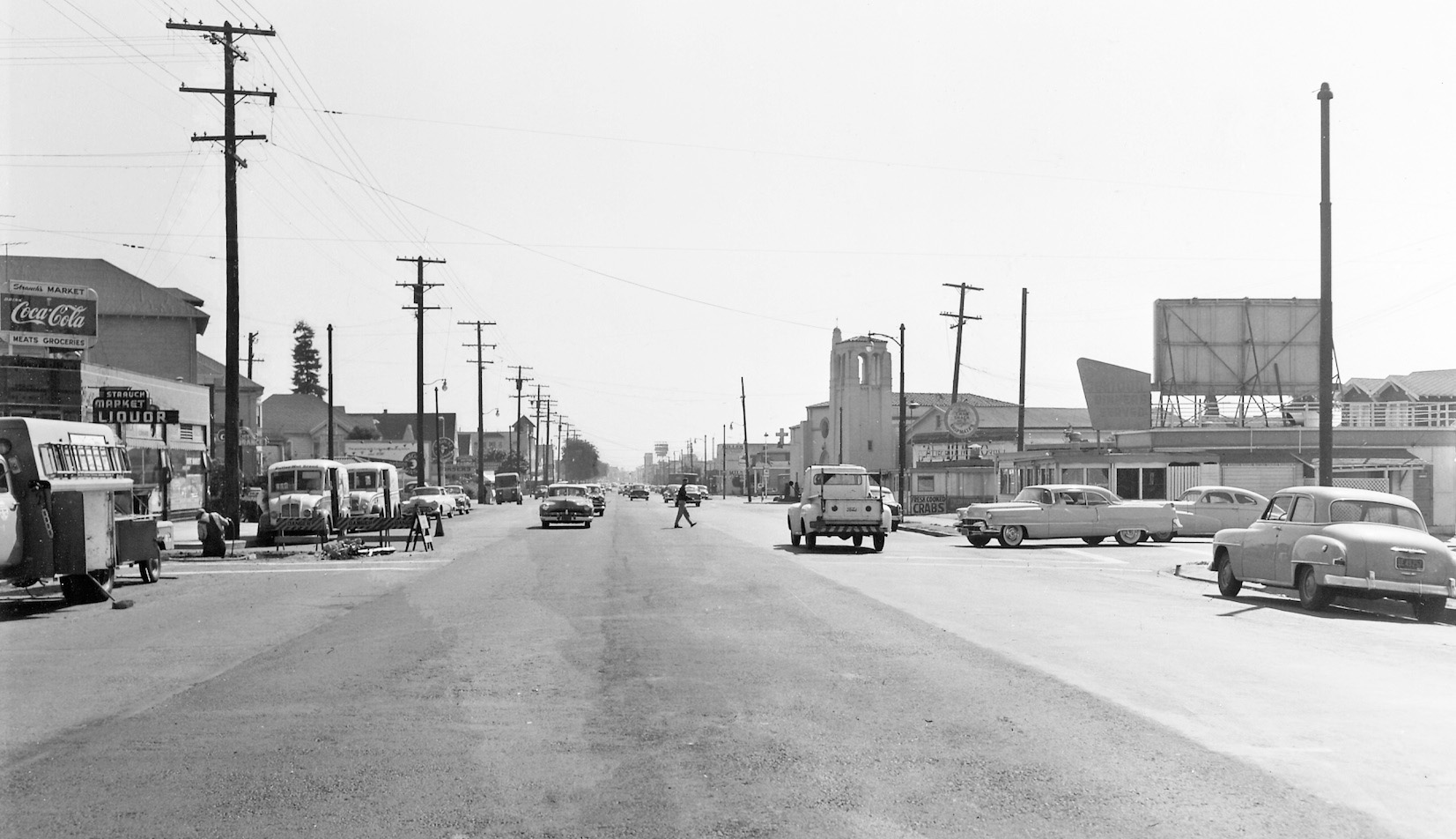
Second, the same south view at Telegraph Ave. and 59th St. now showing the replaced street surface on Sept. 19, 1955.
L157-85-Frank Johnson Photo, Public Works, Oakland Cultural Heritage Survey, Oak. City Plan. Dept., (Image 17 of 27)
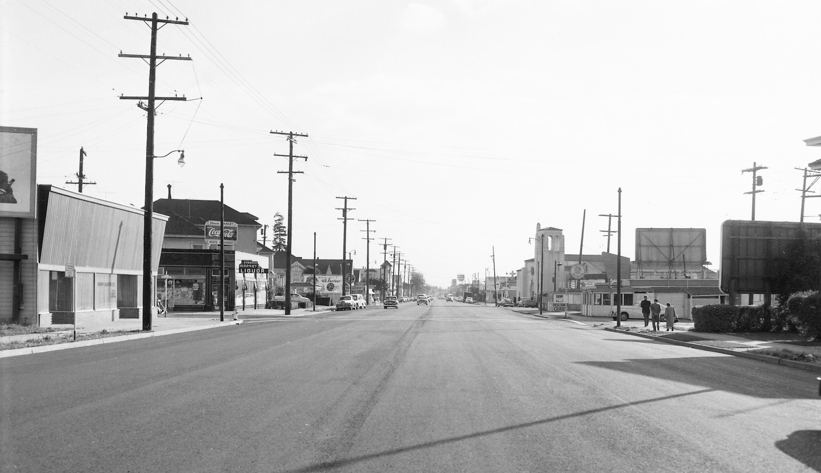
Third and final, this south view from Nov. 15, 1955 from Telegraph Ave. and 59th St. shows the finishing touches to the street markings have been applied. The building to the east or left at the northeast corner of the intersection still exits as the Washhouse.
L157-90-Frank Johnson Photo, Public Works, Oakland Cultural Heritage Survey, Oak. City Plan. Dept., (Image 18 of 27)
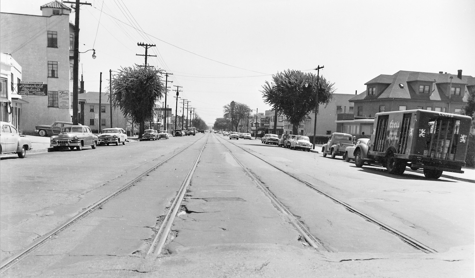
The final segment of track ended just at the Berkeley border, a south view down Telegraph Ave. at Woolsey, Aug. 18, 1955. Through to 66th St., much of the buildings remain, albeit some dramatically remodeled, such as the home to the west or right, and some more subtle, such as the removal of the marquee for the White Horse Inn.
L157-95-Frank Johnson Photo, Public Works, Oakland Cultural Heritage Survey, Oak. City Plan. Dept., (Image 19 of 27)
Backing up a few steps to the north, this south view down Telegraph Ave. at Woolsey shows the last sign of the existence of the Key 5-line is now history, Sept. 19, 1955. And if you happened to notice, those two trees are long gone as well.
L157-100-Frank Johnson Photo, Public Works, Oakland Cultural Heritage Survey, Oak. City Plan. Dept., (Image 20 of 27)
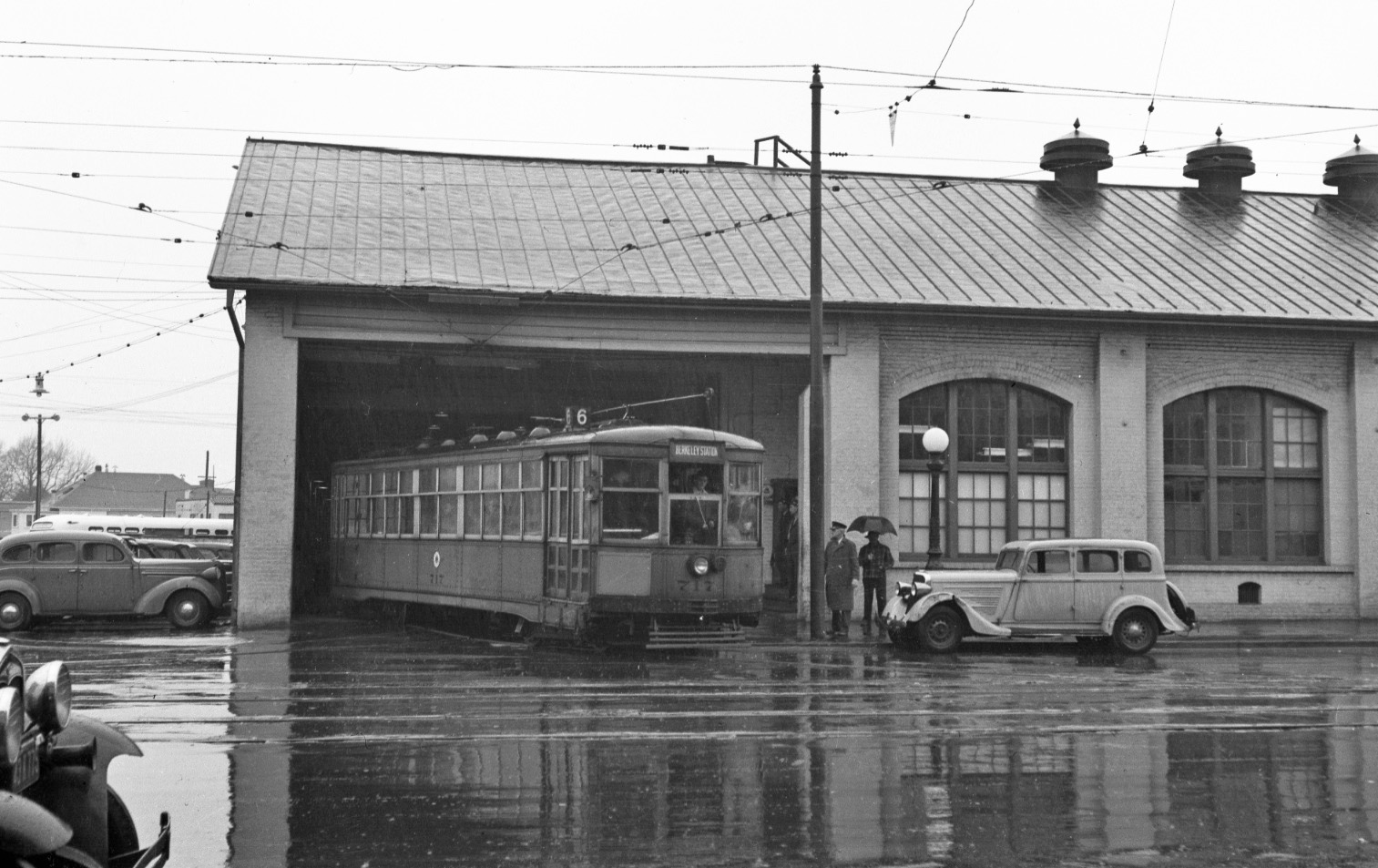
Now for important date information starting with this west view of the Key WCH with Key 717 as a 6-line car entering Telegraph Ave. The date is Feb. 7, 1947, significant in that the WCH was closed for good on Feb. 8, 1947. It is also likely that this scene was staged for the cameras since 6-line College Ave. streetcar service had been discontinued on Sept 30, 1946.
L157-105- RL Stein Photo, Courtesy BAERA, Western Railway Museum Archives, 51869ks, (Image 21 of 27)
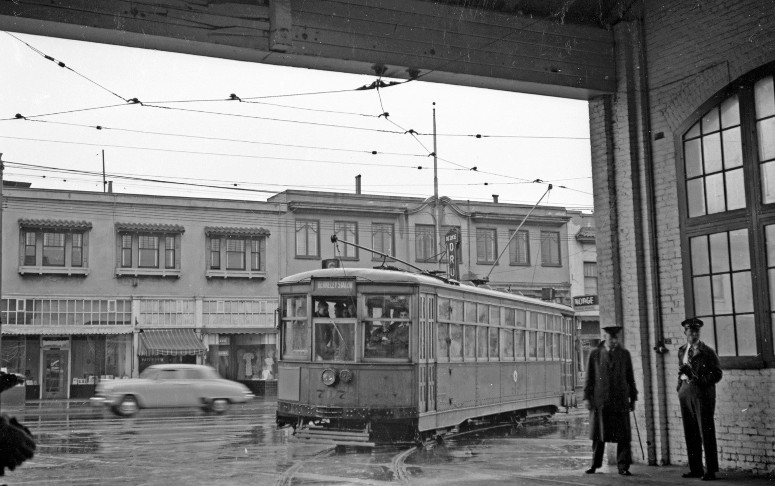
An east view of Key 717 returning to the WCH, northwest view, Feb. 7, 1947.
L157-110-RL Stein Photo, Courtesy BAERA, Western Railway Museum Archives, 51870ks, (Image 22 of 27)
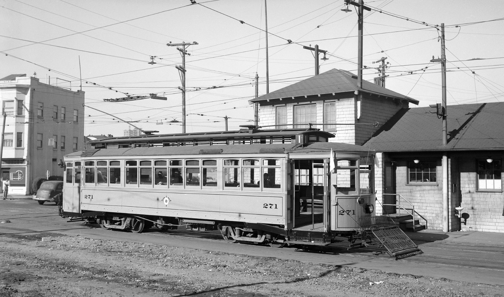
Next to the Central Car House by the central office near 2nd Ave. and East 16th, Key 271 in a north view is ready to head east bearing white flags to indicate a BAERA excursion on the morning of Nov. 21, 1948.
L157-115-Leon Bonney Photo, Courtesy John Harder, (Image 23 of 27)
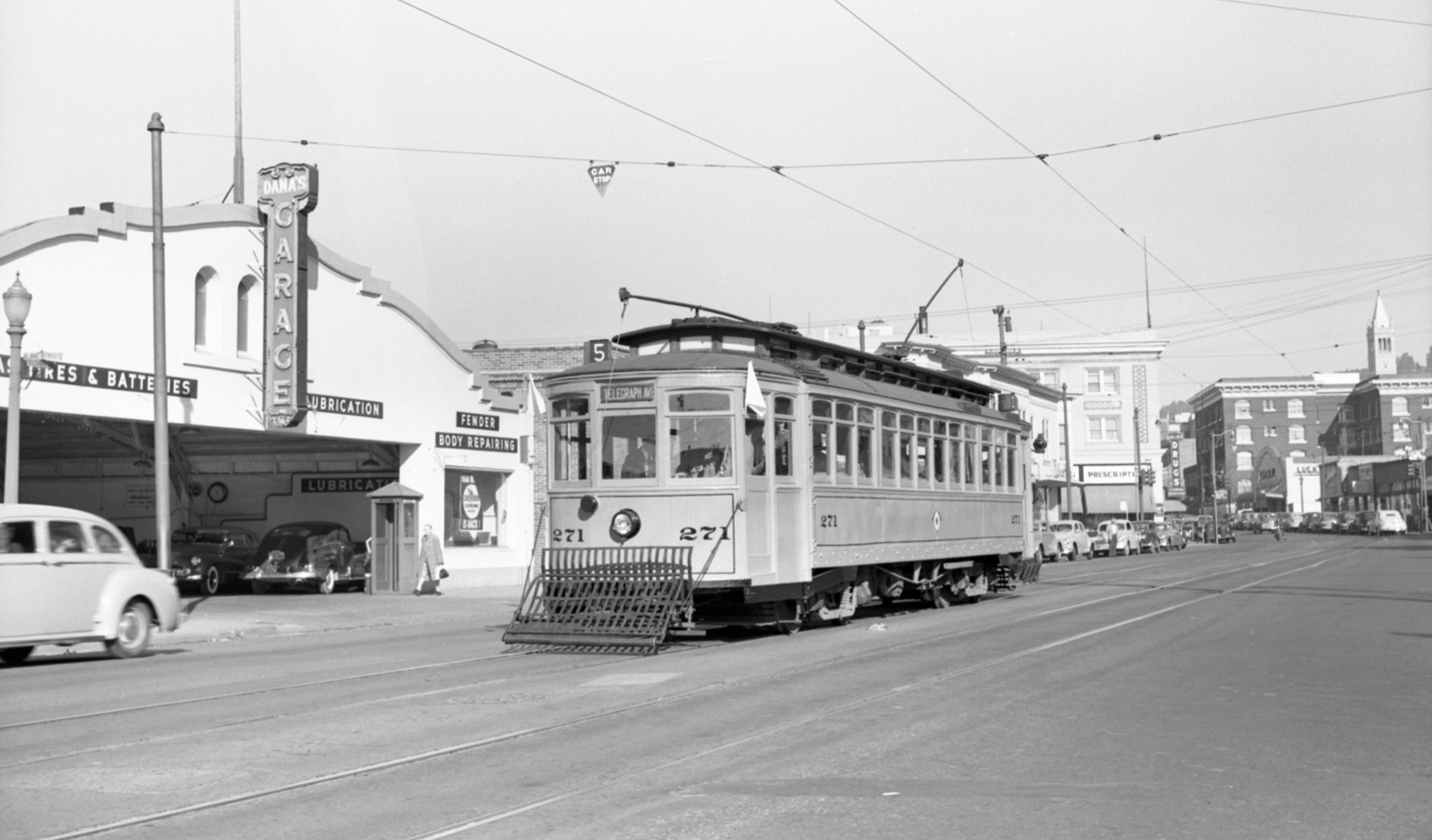
Later that day, Nov. 21, 1948, KS 271, dressed as a 5-line car, is inbound on Telegraph Ave. passing Dana’s Garage approaching Parker St., northwest view.
L157-120-Fred Matthews Photo, Moreau Coll., Courtesy BAERA, W. Railway Museum Archives, 91980ks, (Image 24 of 27)
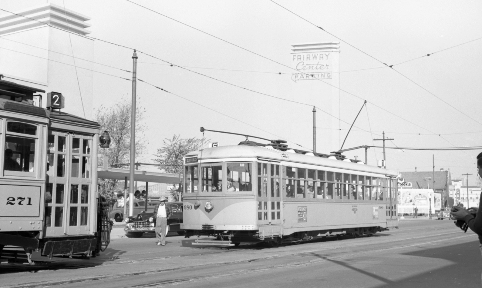
Now back to the image used to introduce this transition moment in time, Key 271 has reached the Fairway Center on Nov. 21, 1948. This store was the first to occupy the ex-WCH shed, showing up as 4530 Telegraph in the Oakland Directories in 1949 and 1950, and gone in 1951, replaced by Vern’s Shopping Center in 1952.
L157-125-Leon Bonney Photo, Courtesy John Harder, (Image 25 of 27)
This northwest image confirms that the streetcar in the background of L157-125 was Key 980, the regular service on the 5-line on Nov. 21, 1948, painted in the National City Lines paint scheme. This is consistent with this event taking lace prior to discontinuation of the streetcar system on Nov. 28, 1948.
L157-130-Fred Matthews Photo, Moreau Coll., Courtesy BAERA, W. Railway Museum Archives, 91982ks, (Image 26 of 27)
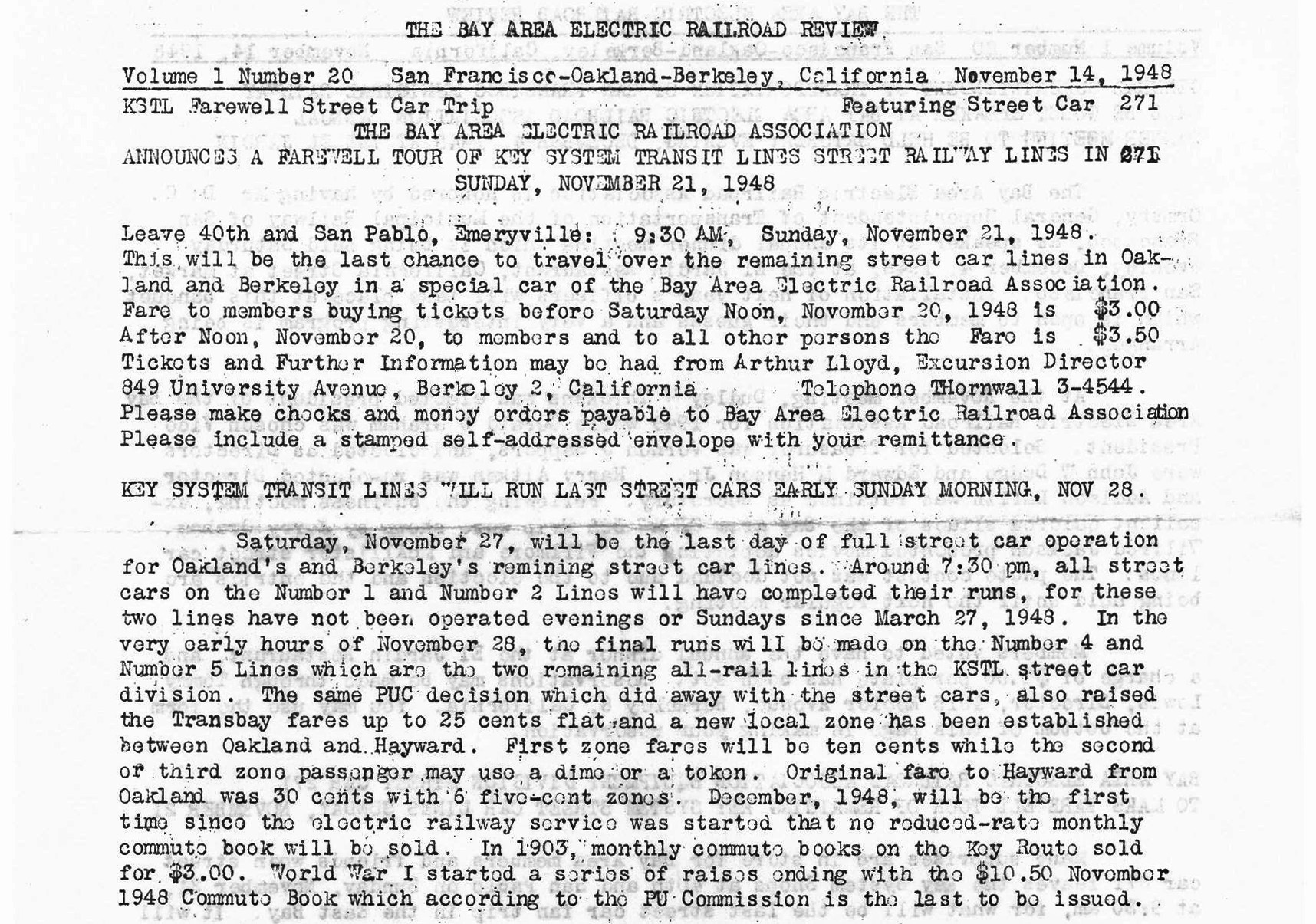
As indicated in the Bay Area Electric Railroad Association Review, this excursion had been planned out well in advance. Much appreciation to Betty Marvin and Gail Lombardi of the Oakland Cultural Heritage Survey for the public works images, and John Harder for providing the impetus and images for the subject covered.
L157-135-BAERA Review, Courtesy BAERA, Western Railway Museum Archives, (Image 27 of 27)